Displaying items by tag: Mountain
Adventure to Jones Mountain from American Basin
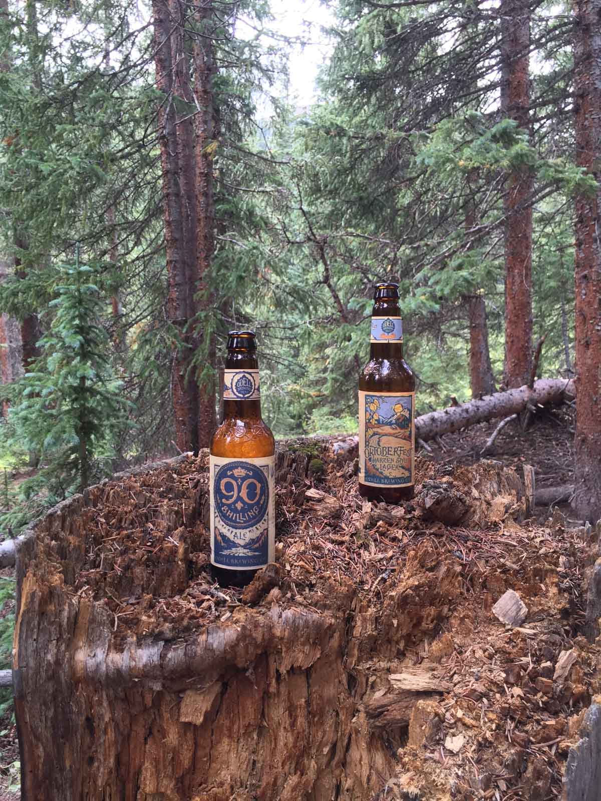
After an amazing day of rigorous hiking which culminated in a successful summit of Half Peak by Sarah Musick and I, we slept at our fantastic campsite in the picturesque valley below Cuba Gulch, near Lake City, Colorado. Instead of taking the longer, more scenic (and steeper) route to Jones Mountain via Cataract Gulch near our campsite, Sarah and I opted to drive over to American Basin and approach Jones Mountain from that side. Usually, climbers looking to summit Jones Mountain approach it from Silverton; however, because Sarah and I were already on the Lake City side of Engineer Pass and were driving a Suburu Forester, we decided to take an alternative route. I had researched our route ahead of time by consulting the out-of-print and quite handy 13er guidebook by Gerry Roach. Upon arrival at the American Basin trailhead for Handies, Sarah and I set-up camp and she decided to quickly hike up Handies since she had never done it before. I decided to stay behind and rest my legs. My ankle was still quite sore from my basketball injury two months prior and my legs were feeling pretty heavy yet from our climb up Half Peak. I spent the afternoon napping by my camera while taking a time-lapse video of wildflowers in American Basin. Upon Sarah's return from Handies we celebrated by opening up some Odell Myrcenary, one of my favorite Imperial IPAs. Good stuff.
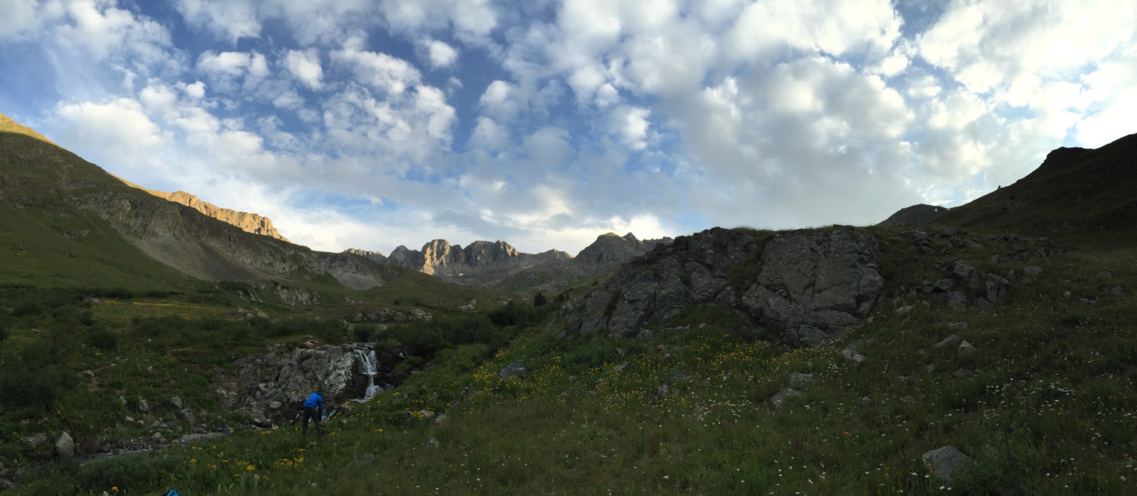
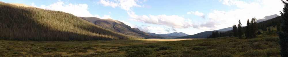
After enjoying our beverages, I convinced Sarah to hike up American Basin with me for some photography. The clouds were setting up nicely for sunset and I found a sweet little waterfall which made a nice combination with American Peak in the background. Sarah shot a quick panorama of me setting up a shot in the basin with her phone which depicts the scene quite well I think.
And here's the shot I was setting up to take...

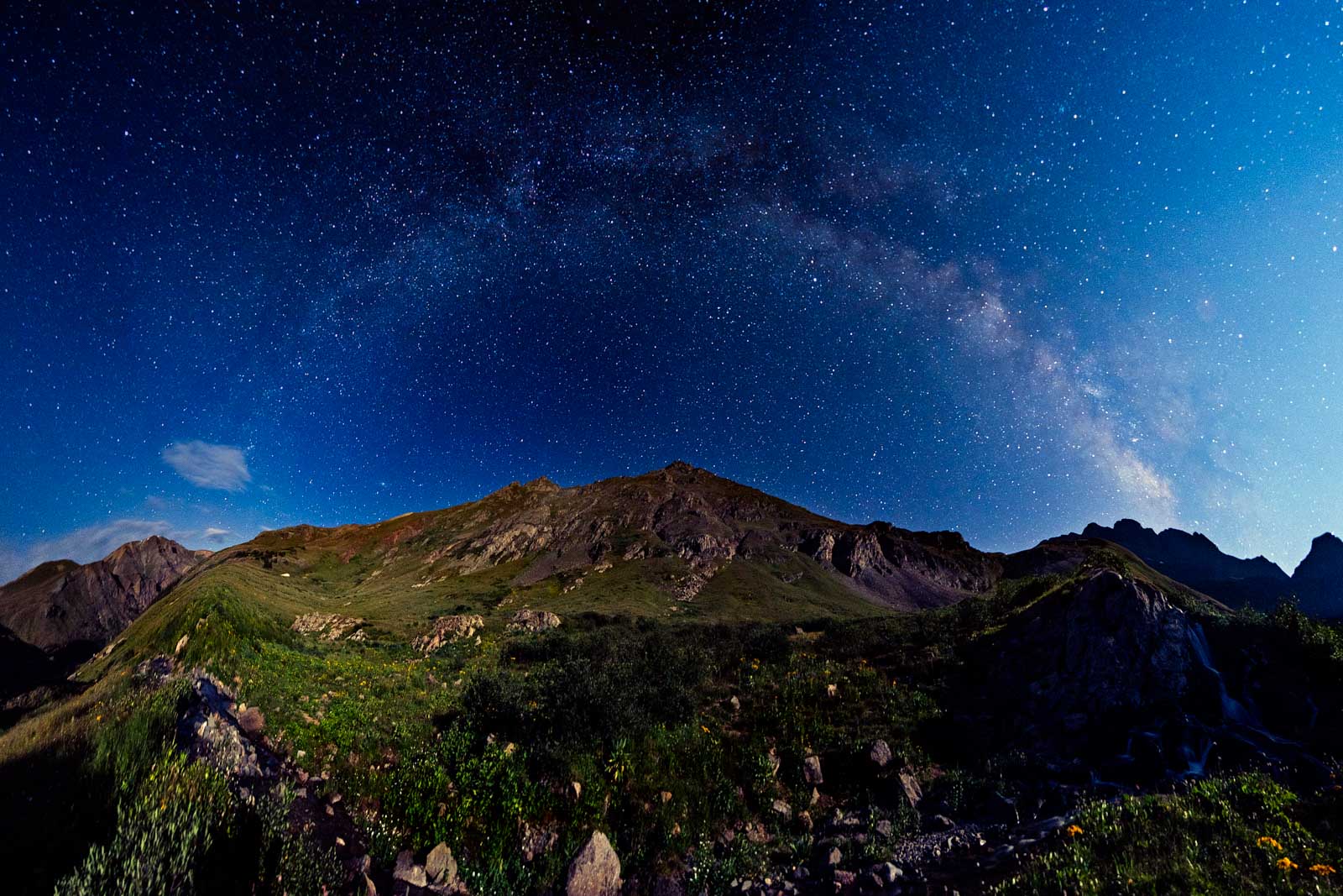
I also decided to hang out past sunset and well into the night in order to get some night photos. I always wanted to get a Milky Way selfie and I thought this spot would be perfect for that shot.

I also set-up for a Milky Way panorama from this spot, relying on the faint light of the moon to light up the hillside.
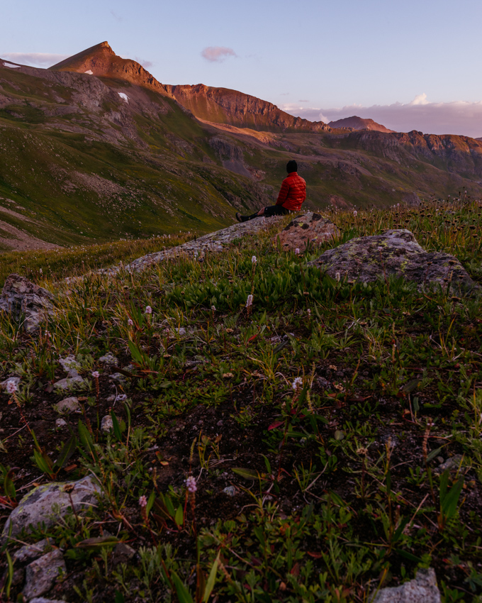
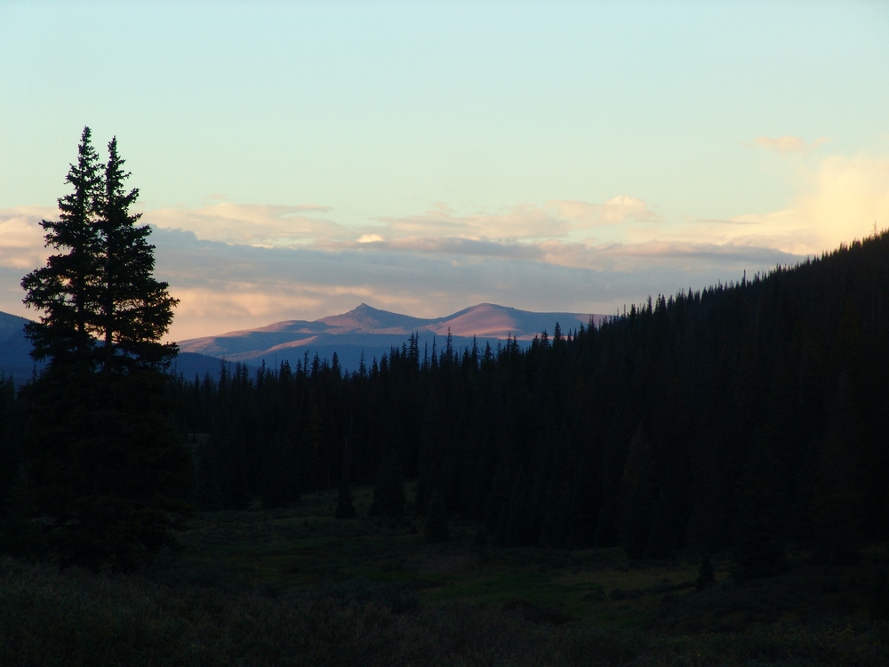
After freezing my hind quarters off, I decided to head back to camp and hit the sleeping bag for some sleep. Knowing the weather would be great, we decided we would start early enough to get some photographs of the basin at sunrise, but not so early that we would be hiking in the dark. Our route took us up the main Handies Peak trail and then off-route for most of the rest of the day. After hiking about 1/4 of the way up Handies, we split off the trail and started our leisurely stroll up the fragile tundra and wildflowers below American Peak. As the sun began to rise, American Peak began to light up with sweet alpenglow.

The view of UN 13,535 behind us wasn't so bad either...
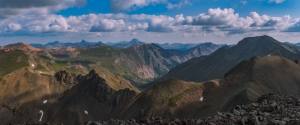
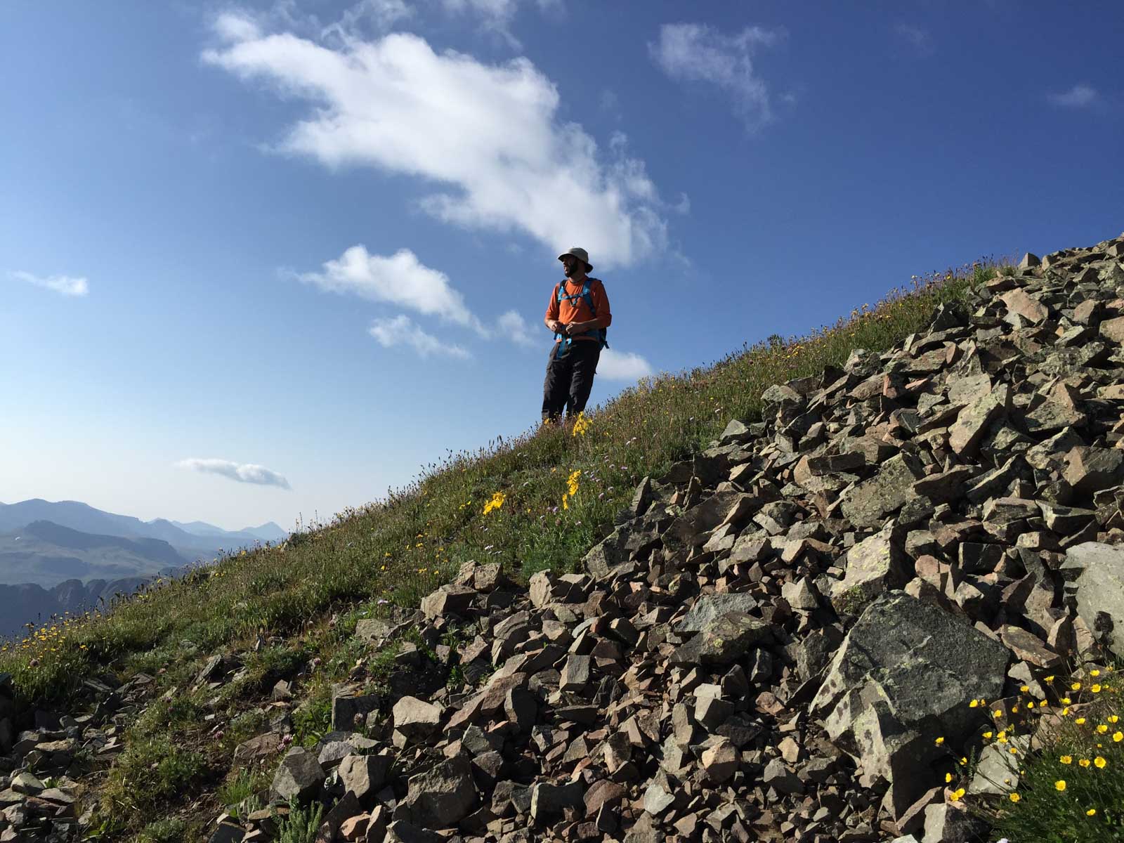
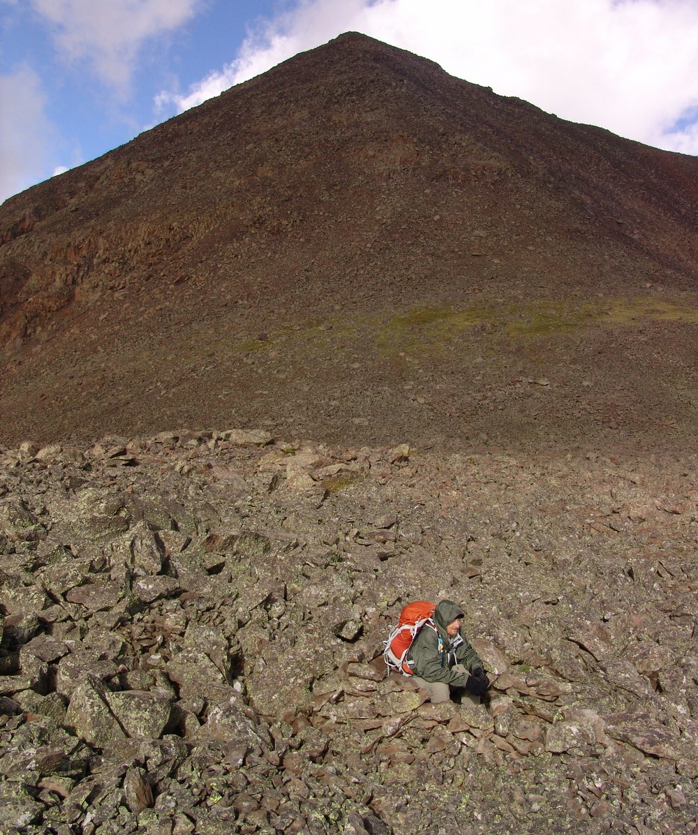
After enjoying the awesome sunrise, we began to head up the un-trailed section to the west saddle of American Peak. Our target was the lighter colored rocks as seen below. We planned to just bushwhack our way up the side of the mountain.
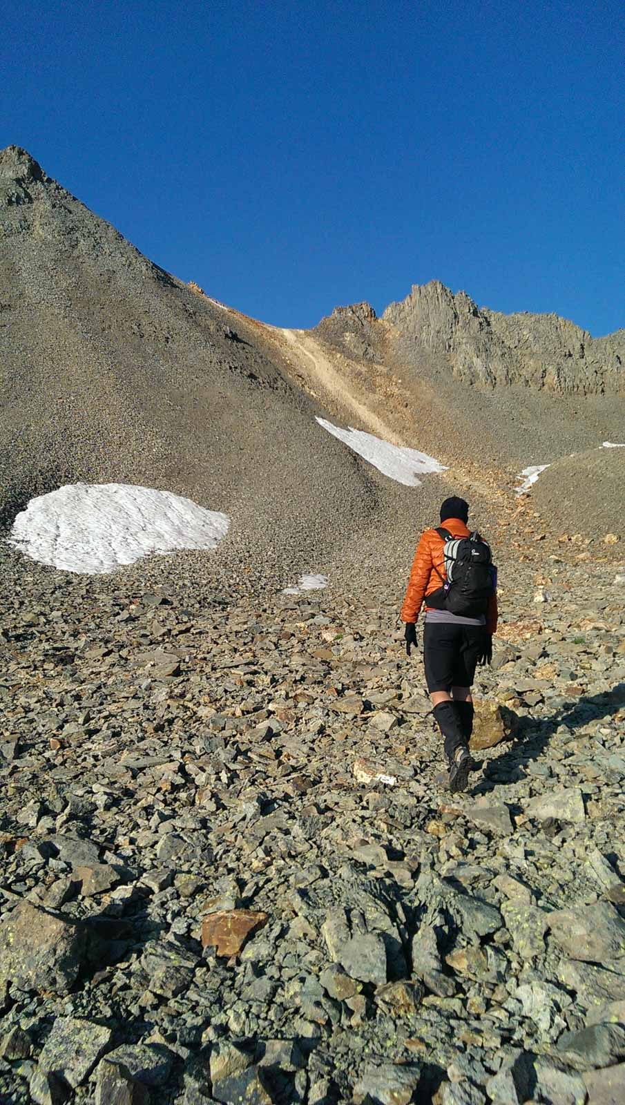
The climb was not too bad - the hardest section was the loose scree and dirt just below the saddle.
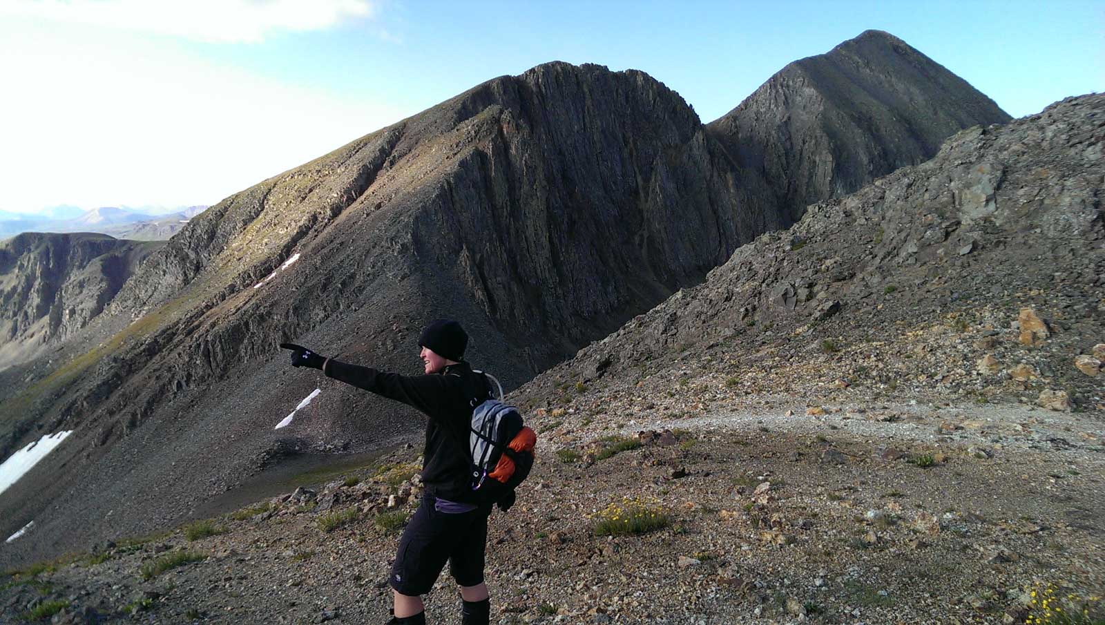
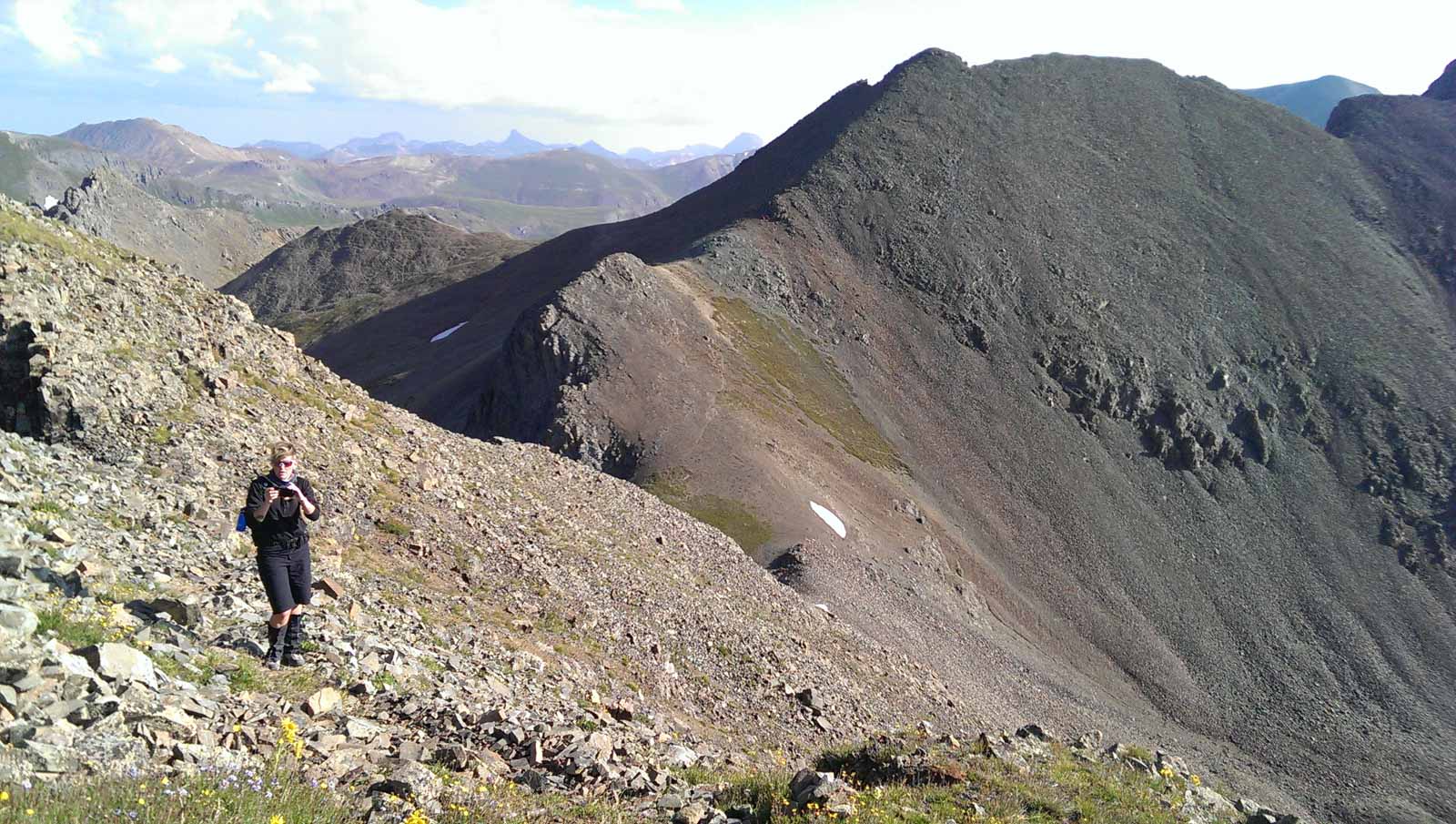
We were quite excited to reach the saddle and get our first glimpses of Jones Mountain.
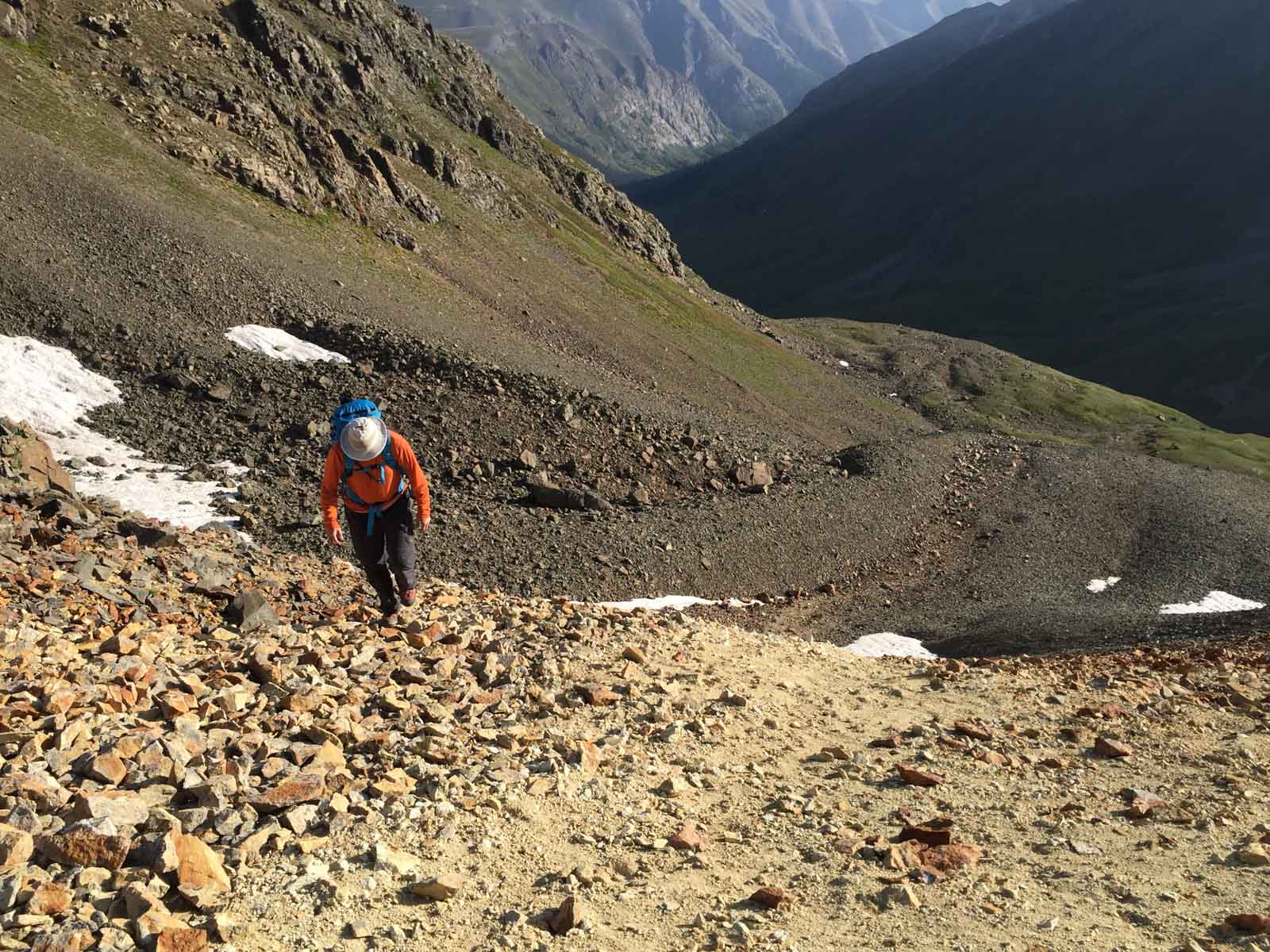
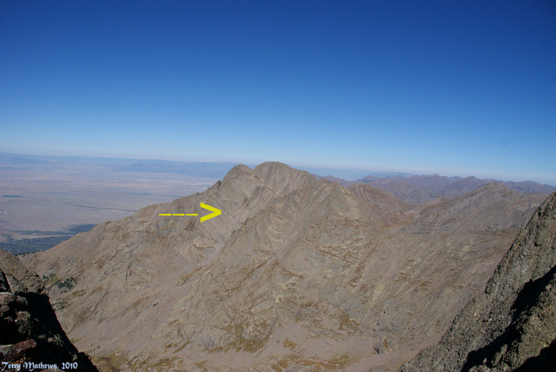
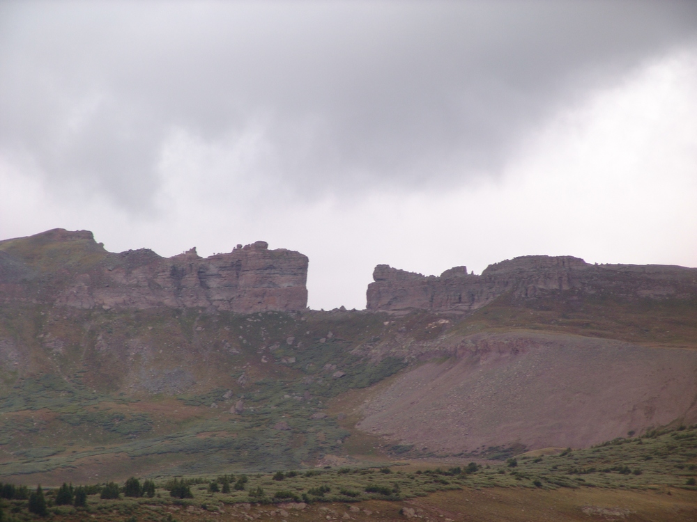
Our route took us up a very faint trail to the ridge between American Peak (left) and Jones Mountain (right). The hiking was pretty easy going.
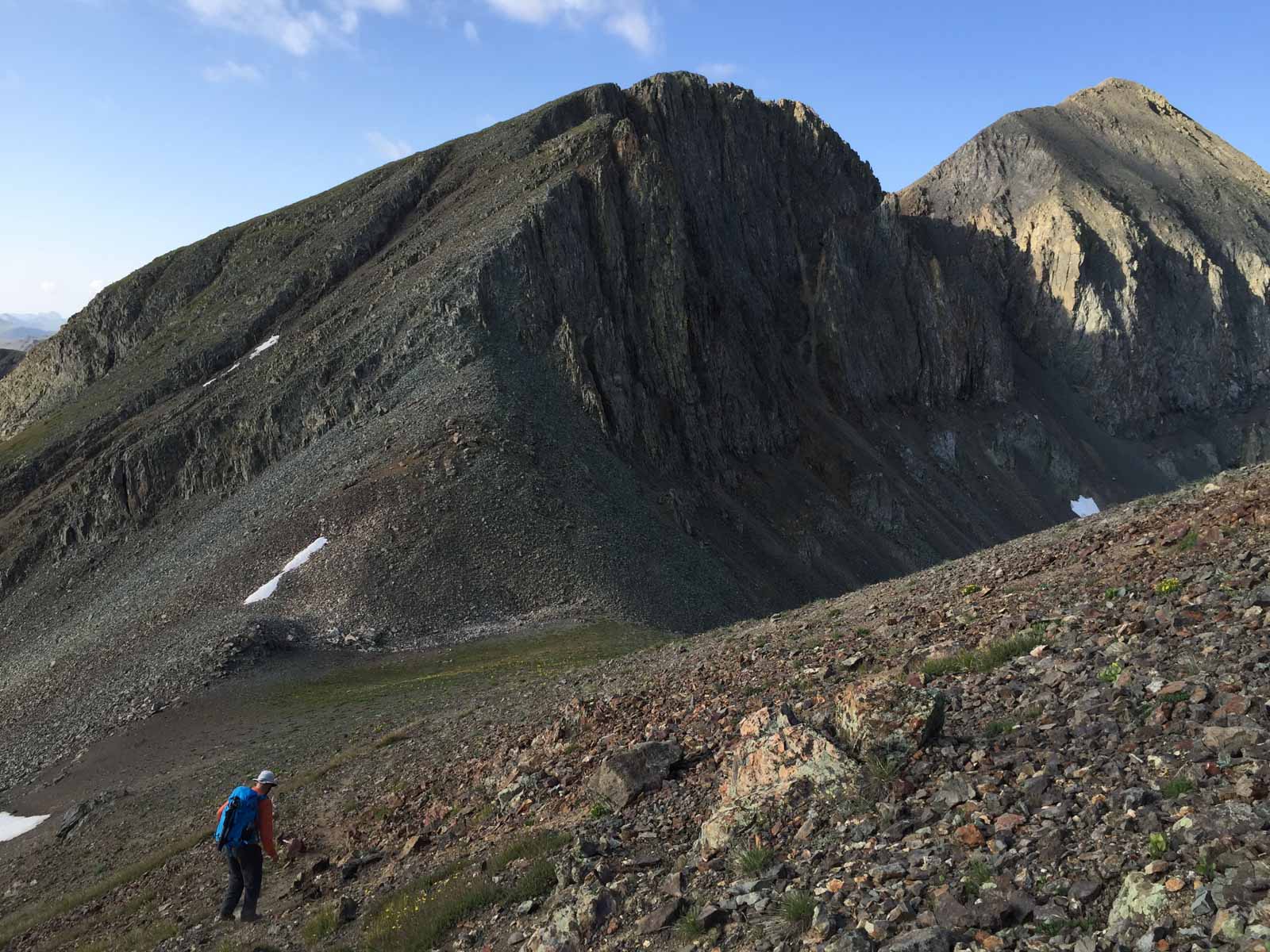
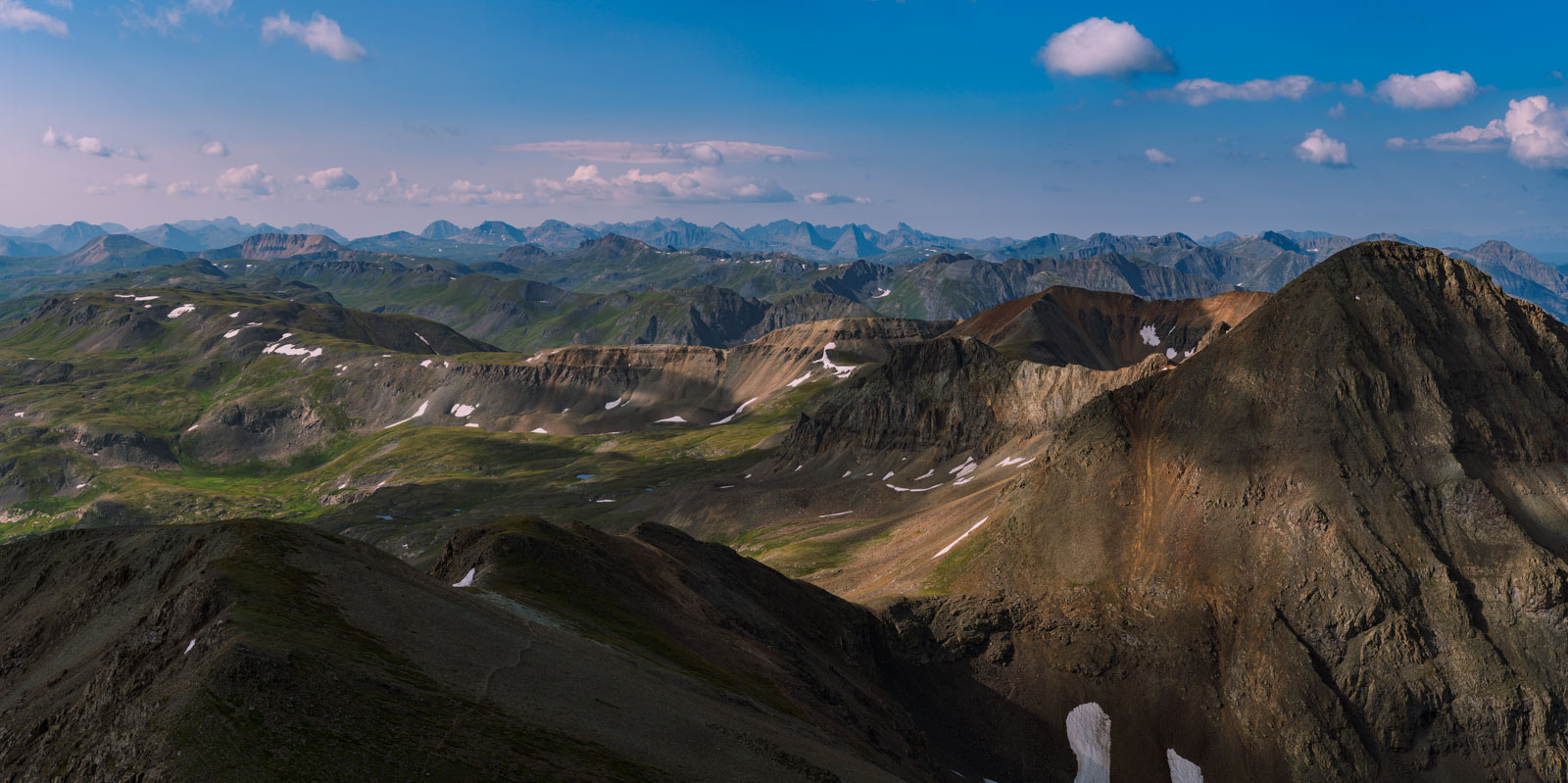
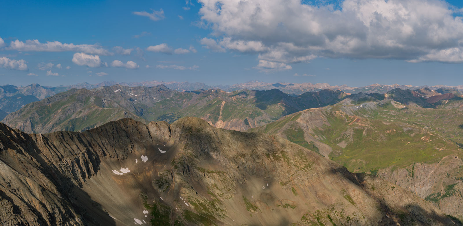
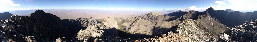
Once we were between Jones and American the views opened up a bit and we could see just how rugged Jones looked from this vantage. The summit of Jones is seen at the far right.
We headed down (and then up again)...
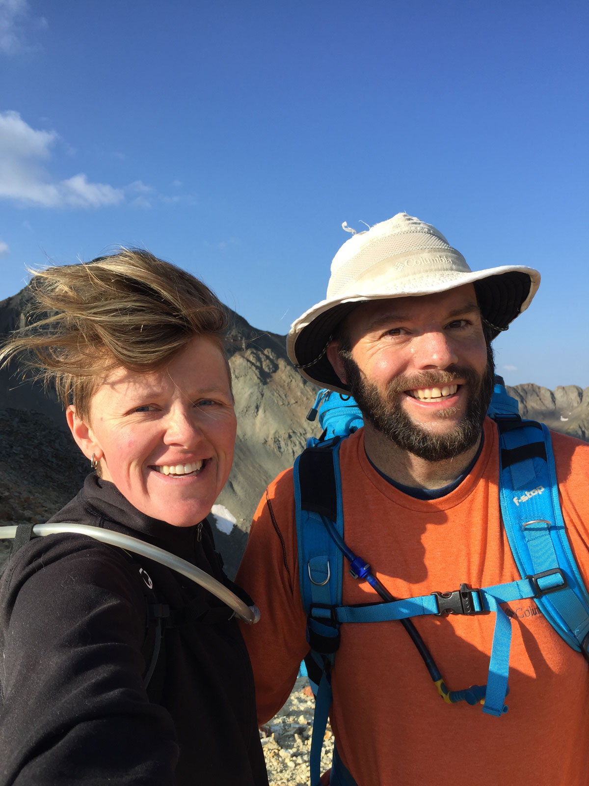
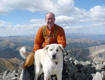
Upon reaching the summit of Jones Mountain, we ran into another hiker and his dog. My mind was blown when I realized that the other hiker was Mike Megorden, a friend of mine from high school! We played on the high school football team together. Pretty small world!
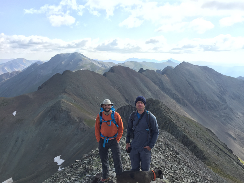
Sarah and I celebrated our 16th summit together with views of the Grenadiers and Needles behind us. What an amazing view. Oh, how I had missed this part of Colorado!
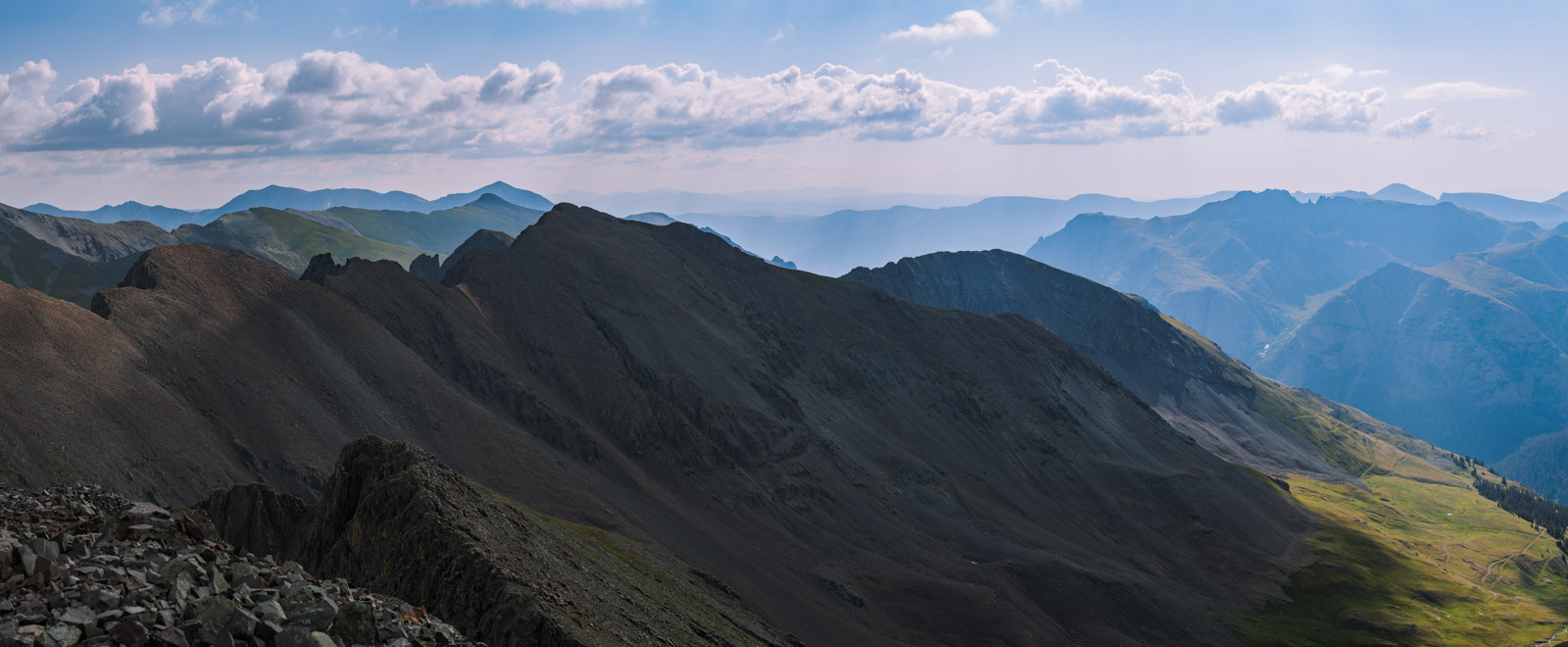
I set-up my tripod and shot some panoramas using my telephoto lens. The air was still a bit hazy, which added some interesting tones to the photos. Looking south.
Looking south-east.
Looking east. You can see the rugged ridgeline of American Peak.
Looking north east - featuring Uncompahgre and Wetterhorn.

Looking north.
Looking north-west.
Zoomed in on Uncompahgre and Wetterhorn. I think this one would look pretty nice printed large.

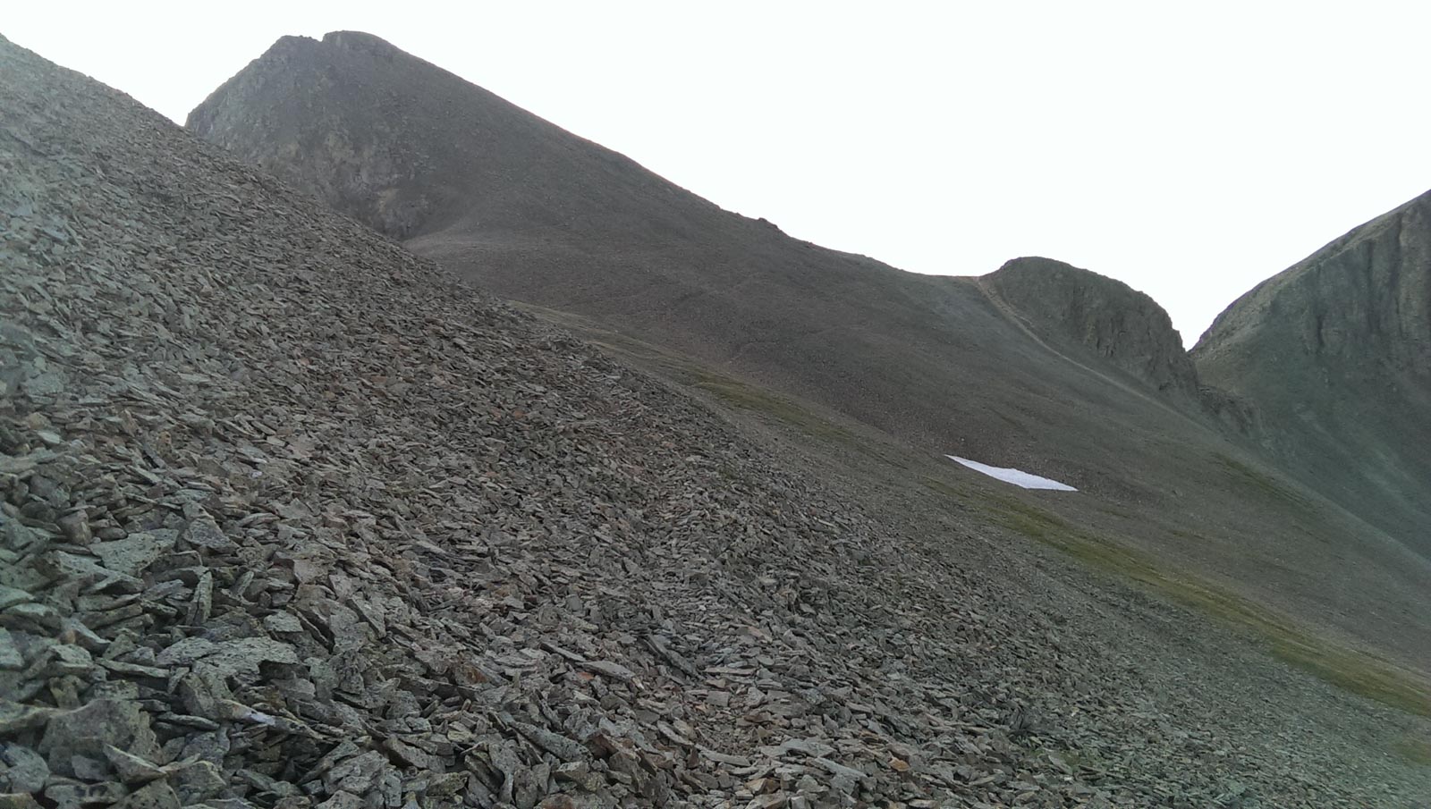
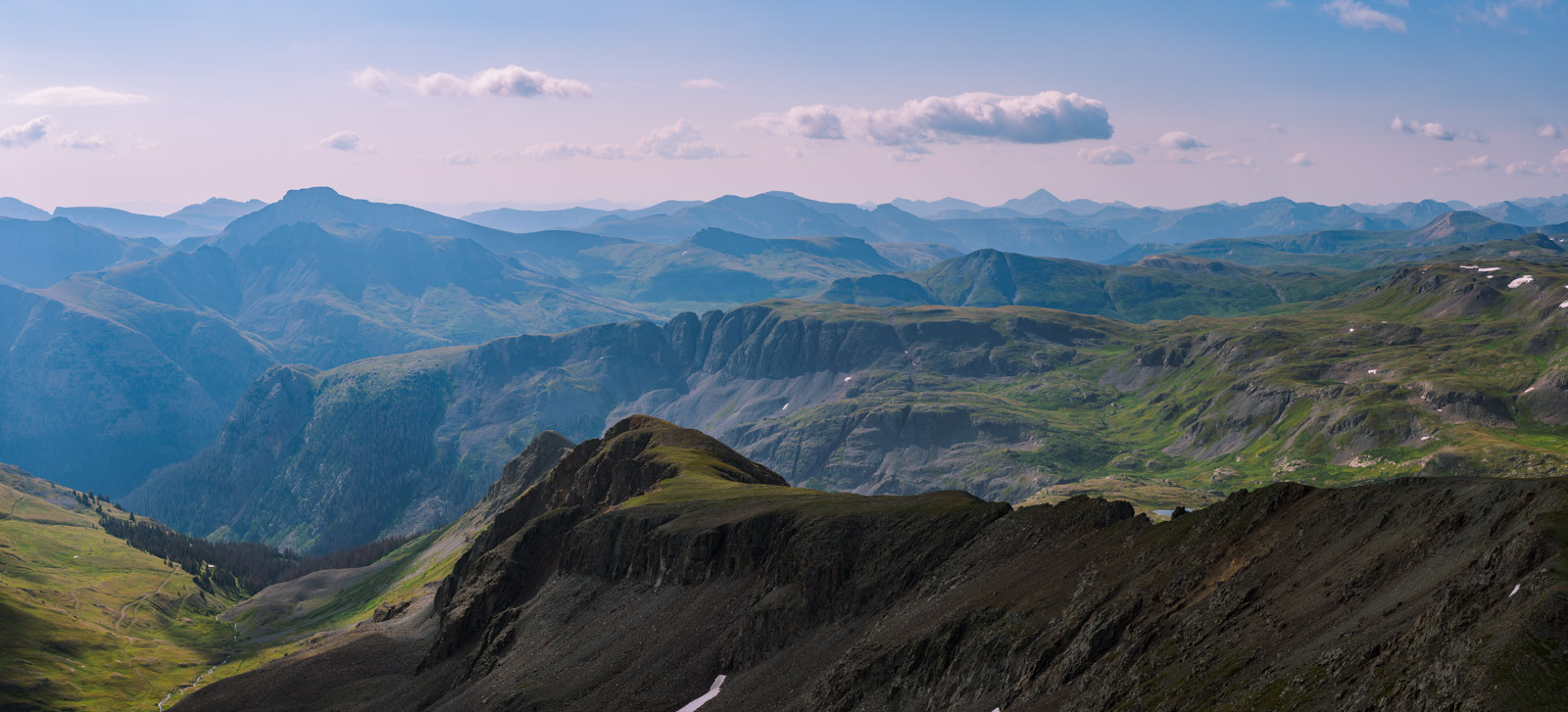
After enjoying the views we decided to head back down. We were contemplating American Peak and would need to make a decision when we hit the American - Jones ridge. The weather was looking 50/50.
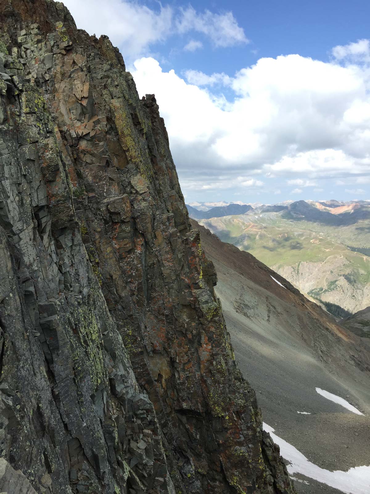
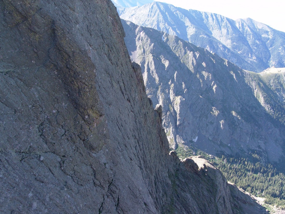
A glimpse sideways at Jones' north face reveals how rugged it really is.
I was pretty amazed at how great the flowers still looked for this time of year. Here's a shot of some alpine sunflowers with Jones in the background.

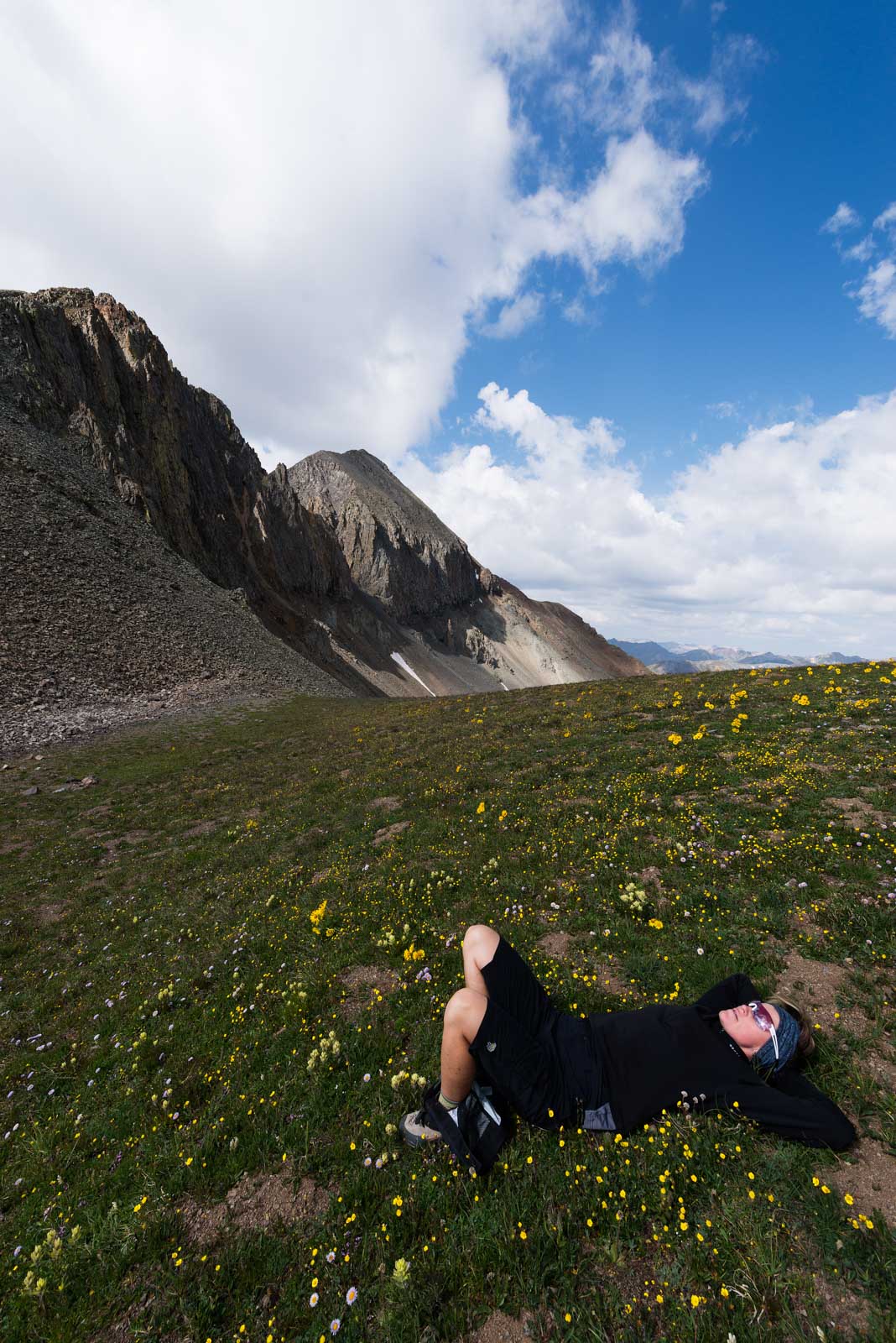
Sarah and I rested at the ridge and decided not to take on American Peak - the weather was starting to look a bit questionable; however, the tundra was quite inviting for nap-time.
Sarah and I took our time heading back, enjoying the great scenery on the way.
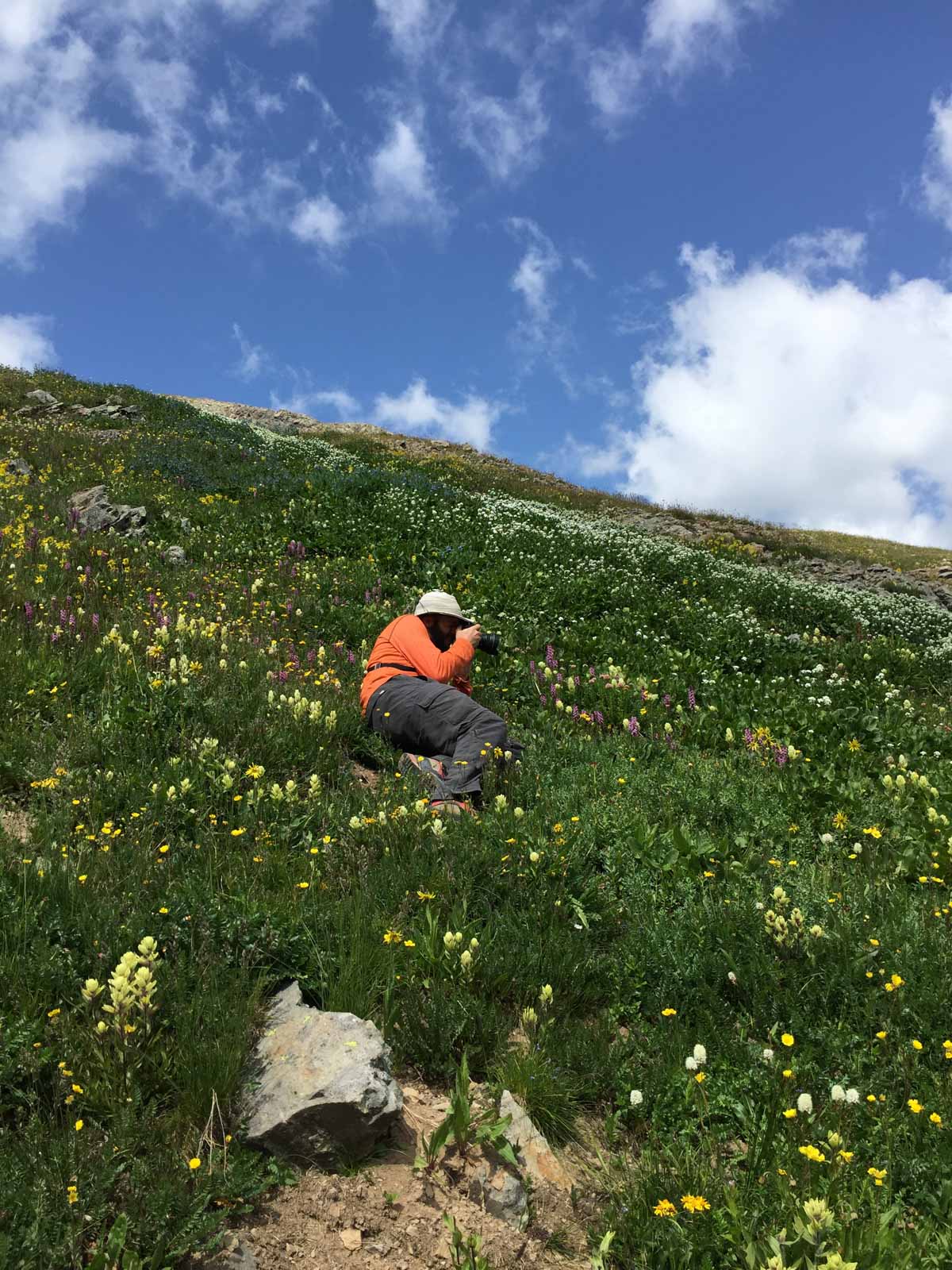
Back on the American Basin side, we ran into a huge field of wildflowers which I had to stop and take photos of. I really want to go back and get this same shot at sunset or sunrise someday. Here's a shot Sarah took of me composing my photo.
And the crown jewel shot of the day - a mix of awesome wildflowers with the shoulder of Handies Peak in the background at the right. American Basin truly is one of the best spots in Colorado.

Sarah and I got back to our campsite and packed up. We decided to drive back to Lake City and up Nellie Creek for our next adventure: Uncompahgre Peak. I had done Uncompahgre back in 2000 with my dad, but was excited to see if I could get some photos at sunrise from the top. We cracked open some more tasty Odell brews and prepared for our next adventure...
I hope you enjoyed following along for this adventure up Jones Mountain. Next up: Colorado 14er Uncompahgre.
2010 Colorado Mountaineering Deaths - A Review and Remembrance
An in-depth review and analysis of every Colorado mountaineering death from 2010.
TABLE OF CONTENTS
- Introduction
- Heidi Kloos – Baldy Peak (Ice Climb) - 3/30/2010
- Kevin Hayne - Little Bear Peak - Hourglass route - 6/15/2010
- Jeffrey R. Rosinski - Longs Peak - Keyhole Route - 7/15/2010
- Robert Doyle - Mount Cutler - 7/25/2010
- Peter Topp - El Diente Peak - 7/26/2010
- Duane and Linda Buhrmester - Crestone Needle - Ellingwood Arete route - 7/27/2010
- Spencer James Nelson - Maroon Bells - Bells Traverse - Bell Cord Couloir - 8/14/2010
- Benjamin Russell Hebb - Longs Peak - Diamond - Dunn-Westbay route - Broadway ledge - 8/27/2010
- Don Thurman - Kit Carson Mountain - 9/18/2010
- John Regan - Longs Peak - Keyhole route - 9/25/2010
- John Merrill - El Diente Peak - 9/26/2010
- James Nelson - Mount of the Holy Cross - 10/3/2010
- James Patrick - Taylor Peak and Powell Peak - Rocky Mountain National Park - 10/16/2010
- Chris Pruchnic - Thatchtop Mountain - 11/20/2010
- Summary / Data / Charts / Common Themes
2010 marked one of the deadliest years in Colorado history for mountaineers -15 deaths. While no entity keeps official records of mountaineering deaths in Colorado, the American Alpine Club publishes its annual Accidents in North American Mountaineering (ANAM) book, which highlights every known accident and death in North America as well as providing meaningful statistics, broken down by State and type of accident. The scope and purpose of that book is for mountaineers to read about accidents and to learn from them. Through analyzing what went wrong in each situation, ANAM gives experienced and beginning mountaineers the opportunity to learn from other climbers' mistakes. From inadequate protection, clothing, or equipment to inexperience, errors in judgment, and exceeding abilities, the mistakes recorded in the book are invaluable safety lessons for all climbers.
With that being said, I wanted to focus more on Colorado Mountaineering specifically, and provide my own respectful opinion on each death, as well as a remembrance for each victim. I am also hopeful that this website may serve as a historical reference for Colorado Mountaineering Accidents - at least 2010 and forward. I have tried to follow reasonable guidelines in analyzing each death. If you have information or data that contradicts or adds further clarity to one of the accidents described below, please feel free to This email address is being protected from spambots. You need JavaScript enabled to view it..
My personal philosophy is that each mistake, accident or unfortunate event has a valuable lesson attached to it. I also believe that even simple coincidences or freak accidents, where no fault can be laid upon the mountaineer, can be analyzed or studied. Perhaps in reading about one of these such accidents, other climbers may decide to avoid that mountain or take extra precautions when attempting to climb it. I am hopeful that if I were to perish from a mountaineering accident that others will study my actions to discover any possible errors I may have made that contributed to my demise, and share those errors with others for educational purposes. Additionally, most of us that climb mountains do so with the knowledge that it is dangerous and that accidents can and will occur. The only thing we can do to mitigate that risk is to educate ourselves, learn from others, and prepare as much as possible. My hope is that this work is a small means to that end.
In researching this topic, when possible, I have made attempts to contact family and friends of the deceased in order to obtain permission for photographs, etc.
Lastly, I want to leave the reader with a few quotes before I begin, in the hopes that they may impress upon the reader the true intent of this body of work:
- “Learn all you can from the mistakes of others. You won't have time to make them all yourself.” - Alfred Sheinwold
- “Mountains are not fair or unfair - they are just dangerous.” - Reinhold Messner
- “The mountains will always be there, the trick is to make sure you are too.” - Hervey Voge
1. Heidi Kloos – Baldy Peak (Ice Climb) - 3/30/2010
 |
|
Photo courtesy of The American Alpine Club by Drew Ludwig |
Heidi Kloos was a 41-year-old Ridgway resident and well-known mountain guide. She was found buried under 10 feet of snow after she was caught by an avalanche near Baldy Peak, just east of Ridgway, CO.
Heidi was one of only a few female alpine guides certified by the American Mountain Guides Association. She had guided extensively around the world, and therefore one could assume that she was well trained and educated on proper avalanche precautions.
According to the Colorado Avalanche Information Center (CAIC), a website dedicated to providing avalanche infomation and education, Kloos was alone when she headed out to do a remote ice climb. After friends reported her missing, members of the Ouray Mountain Rescue Team were dispatched to the area.
Searchers found tracks leading into a large avalanche debris field measuring 150 by 80 meters. They also found Heidi's backpack and climbing gear, including an avalanche beacon, just outside the avalanche debris area at the base of a cliff wall.
According to CAIC, searchers presume that Kloos dropped her gear before heading up to assess the climb and en route was caught low in the path of the avalanche. Kloos' body was found with probes, buried 10 feet below the surface.
In 2008, she received the Denali National Park Service's Denali Pro Award for her efforts in assisting the National Park with a difficult rescue there in 2007.
Additionally, Kloos led guided trips in Antarctica and Argentina - she was clearly a well-trained and accomplished mountaineer.
For the official CAIC report of the incident, click HERE.
Analysis:
Because of her extensive experience and accomplishments, Heidi was clearly quite capable of climbing nearly any route she would have encountered. Some highly experienced mountaineers tend to take higher risks than less experienced mountaineers, due to their confidence and also because of the inherent rewards for success when risks are overcome. In some instances, the more experienced one becomes, the greater the challenge required to stimulate that sense of excitement and pursuit of reward. It is therefore reasonable to theorize that Heidi may have taken some unnecessary risks that led to the accident that killed her.
First, Heidi could have greatly benefited from having at least one other person with her for the trip into an avalanche prone area and the climb. Not only is this a common safety precaution for ice climbing, but it is also a common safety precaution for all back-country activity where avalanche danger is high. Travel into areas with high avalanche danger should always be with groups that are staggered (to avoid everyone from being buried at once). Everyone in the group should also be equipped with all of the proper avalanche safety equipment, including beacons, probes and shovels.
Due to her high skill level, it is reasonable to assume that Heidi had successfully soloed many similar ice climbs before without incident. Previous mountaineering success is a frequently correlated with higher risk taking - a cause that stems from psychological pitfalls.
Since Heidi was carrying an avalanche beacon, it is also reasonable to assume that she knew of the avalanche risks. Unfortunately, an avalanche beacon is of little use if no one is with you with probes and a shovel to rescue you. Lastly, Heidi had made the trip to this area prior to the accident, without incident, which may have caused her to believe it was safe to return to the area for climbing. It is unknown if snow conditions had changed between her visits to the area.
My deepest condolences and sympathy go out to Heidi's family and friends. Heidi's passing is a tremendous loss to the climbing world. A memorial scholarship fund was established through Mountain Trip for the Telluride Adaptive Sports Program. Donations in memory of Heidi Kloos may be made to TASP (contact Mountain Trip, 866-886-8747 or 970-369-1153), as well as to Ouray Mountain Rescue (970-318-8872).
2. Kevin Hayne - Little Bear Peak - Hourglass route - 6/15/2010
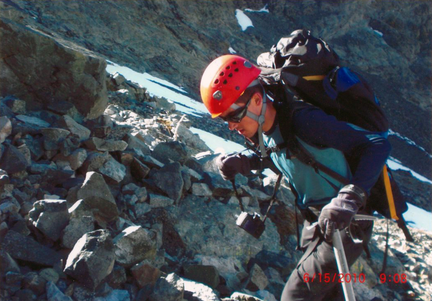
Photo courtsey of Lynn Hayne, taken on Kevin's way up Little Bear the day of the accident.
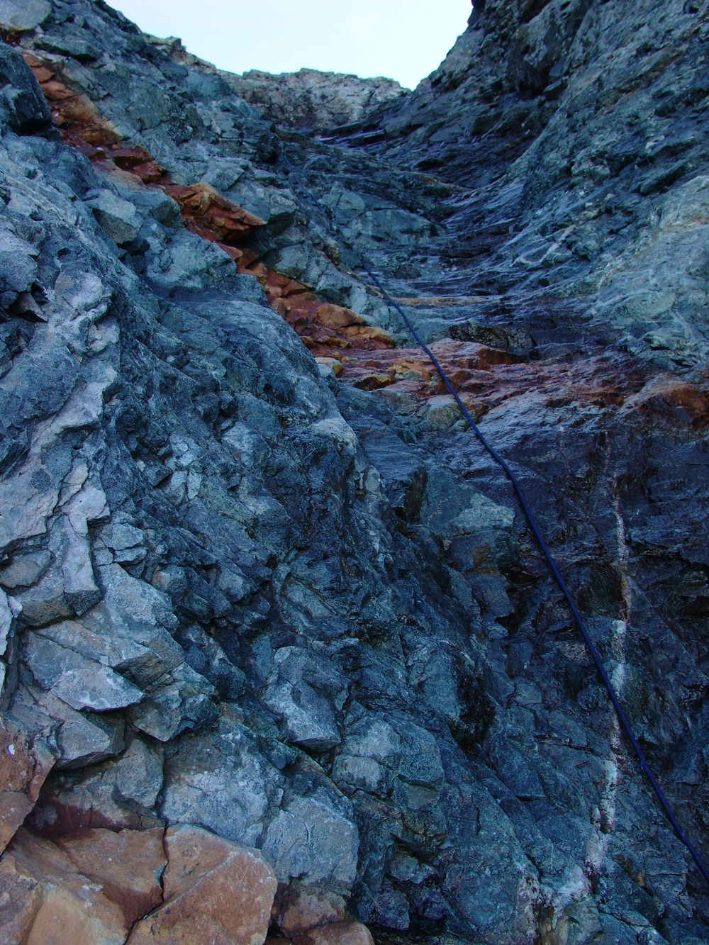
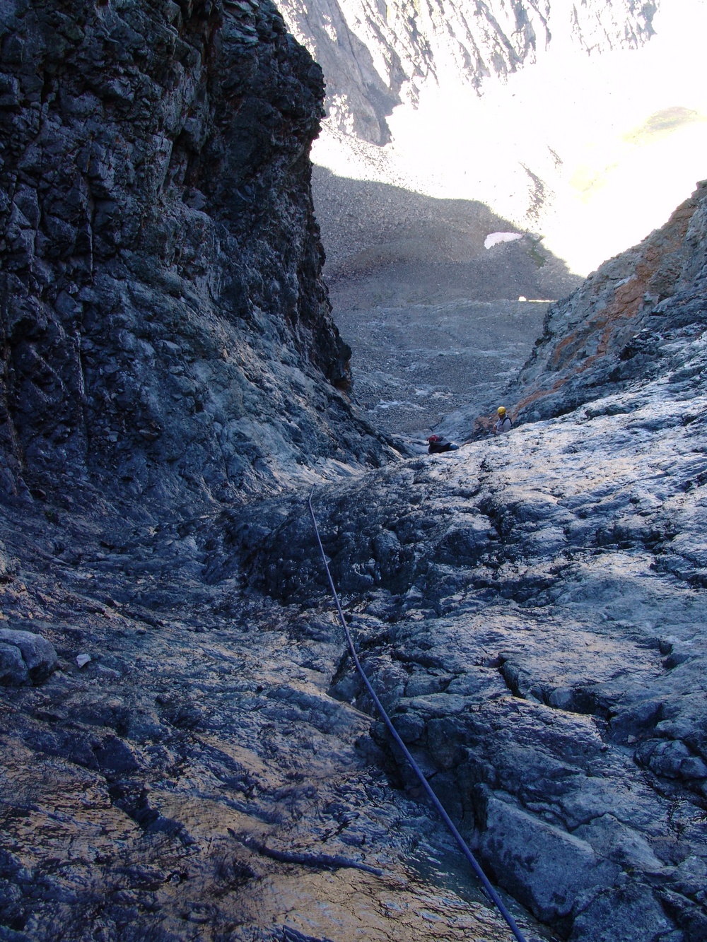
Kevin Hayne, an 18-year-old from Highlands Ranch, CO, died while attempting to climb the standard route of Little Bear Peak, known as the Hourglass. The Hourglass is a 4th class scramble - a very narrow gap between two towering cliffs comprised of very loose rock. Having climbed Little Bear's Hourglass myself, I can attest to the gritty and dangerous nature of this section of the mountain, and can personally say it was one of the more challenging mountaineering adventures I've been on. Here are three photos of the Hourglass, looking up and looking down, which demonstrate the sheer steepness of this section. In the first photo, you can see the loose rock just above me - this is where I believe Kevin fell from.
Kevin was accompanied by his friend, Travis Winder. The two reached the Hourglass and found it covered with a thin coating of ice. They decided to pass the Hourglass on its left, climbing across the broken cliffs as seen above. Just after they started climbing, Kevin slipped and fell down the rocky terrain. Travis posted a detailed account of those events on 14ers.com: "Today me and Kevin8020 were hiking the hourglass just shy of the summit of Little Bear Peak. The hourglass was completely iced over and was impassable, we decided to take a ledge on the left side of The Hourglass and decided to wait and see if the sun would help melt anything out. 30 seconds after this decision was made, Kevin's hand/foothold (I could not see all of him) broke loose and he fell several hundred yards down the mountain. When I got to him he was breathing heavily and both his arms looked broken, both of our spot trackers malfunctioned at a terrible time. I waited 30 minutes by chance that the distress signal did go out, tried to comfort Kevin, and after no response from either Kevin or SAR, I made the hardest decision of my life and had to hike out, leaving my partner behind."
By the time the Search and Rescue (SAR) team reached Kevin, he had already passed away.
Kevin was a very religious and spiritual person, as well as the class valedictorian of his senior high school class at Lutheran High School in Parker. At the time of Kevin's death, he had climbed 35 of Colorado's Fourteeners, making him a fairly accomplished mountaineer by most standards. Several 14ers.com members who had previously climbed with Kevin had nothing but good things to say about him as a person, and it is obvious that he will be greatly missed by family and friends.
Analysis:
Little Bear Peak is one of the most dangerous mountains in Colorado, as evidenced by an incomplete historical timeline of accidents on that mountain provided by John Kirk. The Hourglass is generally climbed in the spring, when there is ample snow, using an ice axe and crampons to aid climbing, or in the later summer months, when the Hourglass is empty of snow and ice. Usually the biggest danger in the Hourglass is rockfall from above, often dislodged by other climbers. In Kevin's case, much of the snow had melted on Little Bear, causing running water to coat the Hourglass, which freezes at night, leaving a thin coat of ice on all of the rock. Even with adequate equipment and experience, thin ice accompanied by loose rock makes for quite dangerous climbing conditions. Mountains like Little Bear present dangerous challenges, even in the best of conditions. The lives of accomplished and experienced mountaineers, making no mistakes whatsoever, have been claimed by Little Bear before. With that being said, it would seem that Kevin and his climbing partner, Travis, possibly made minor errors in judgement that precipitated Kevin's death.
When reading this analysis I want to caution readers from reacting. Kevin's possible errors in judgement were quite minor, and depending on the circumstances, possibly not the worst decisions that could have been made at that time.
Choosing to climb Little Bear during the early part of June makes for a difficult and challenging climb, given the route's reputation and the challenges it presents when it is not completly full or devoid of snow. These challenges have been well-documented on 14ers.com, where Kevin frequently researched the mountains he climbed. According to 14ers.com, the Hourglass route of Little Bear is, "probably the most difficult standard 14er route." His partner, Travis, indicated that Kevin generally conducted meticulous research before climbing a mountain. 14ers.com has over 100 trip reports for Little Bear, many of them outlining the dangers that can be found on that mountain. So, going into this climb, Kevin certainly knew of the risks and dangers that could be present.
Compounding these findings is the fact that Kevin found himself in a similarly precarious situation just a year prior, where he was rescued by helicopter on the Maroon Bells, another set of very dangerous mountains. That trip report can be found HERE. During that climb, Kevin was traversing to the second peak when adverse weather conditions moved in and deposited snow on the mountain. In those accounts, Kevin stated, "Looking back, it was clear that with only a few exceptions, we made the right decisions. For one, despite the fact that my personal weather forecast/prediction said I was safe and NOAA said we were safe until afternoon, weather is unpredictable - I shouldn't have taken the chance of heading for North Maroon even though we were ahead of schedule. Second, I shouldn't have set foot on the snow to begin with."
Kevin's own analysis of those events was very mature, and it seemed that he learned a great deal from his experience on the Maroon Bells. Kevin should have learned a valuable mountaineering lesson - knowing when to turn-around and go back down. This is what makes Kevin's tragedy on Little Bear so baffling. The very lesson he learned on the Maroon Bells very well may have saved his life, or caused him to not pursue such a difficult mountain like Little Bear without more experience or better conditions.
It seems that both Kevin and Travis made the right analysis at first - in finding the Hourglass covered in ice, they decided it would not be safe to continue. Unfortunately, instead of climbing back down to a safe location, they chose to climb up onto looser terrain to wait for the ice to melt. It is easy to see how many other people could make the same decision - especially since the Hourglass is quite steep and not easy to down-climb. The idea of down-climbing was probably not as appealing as waiting on a loose ledge.
Lastly, Kevin relied on the use of a SPOT beacon during his rescue on the Maroon Bells, a device that can be used to transmit an emergency rescue message via satellite to Search and Rescue teams. The SPOT beacon requires a clean line-of-sight with the sky from all directions, something the Hourglass does not provide. The use of such equipment potentially lulls climbers into a false sense of security, giving them the idea that if they were injured, a rescue would not be difficult to obtain.
In conclusion:
- Kevin made a very good initial assessment to not continue up the Hourglass due to ice being present; however, he chose to wait on unstable terrain without adequate protection (rope, harness, anchor).
- Climbing the Hourglass in similar conditions should only be attempted with adequate protection and knowledge of its use.
- Climbing the Hourglass is recommended only when snow is completely absent or when snow completely fills the gully.
- Caution should be taken when employing the use of equipment such as a SPOT beacon. They are not adequate protection from injury and should not be used in lieu of adequate training and preparation.
- Some mountains are just plain dangerous. We will never truly know if Kevin could have done much differently to avoid his death, other than not climbing to begin with. Clearly, I don't want to advocate that no one should ever climb mountains; however, before attempting mountains like Little Bear, one should have a keen sense of their personal limitations, and trust their instincts if something does not feel safe.
A memorial fund has been created in honor of Kevin. Details of that fund can be found HERE.
3. Jeffrey R. Rosinski - Longs Peak - Keyhole Route - 7/15/2010
Jeff was a 29-year-old man from Middletown, Rhode Island and the associate pastor of the Kings Grant Fellowship Church in Portsmouth, RI. Rosinski was also a clinician at Rhode Island Hospital. Jeff was also married and was the father of two young children: a 2½ year-old boy and an eight-month-old girl. Jeff's body was found by another climber, Corbin Mabon, at 3 AM the following day, along a section of the route known as "the Trough." Based on where Jeff's body was found, it is not entirely known how he came to die; however, it would seem that he was hiking late at night (possibly in the dark), and went off-route and fell up to 300 feet from above. The terrain above the Trough is quite steep, and venturing off-route into that part of the mountain would almost certainly lead to trouble for almost anyone. If you look at the next photo of the Keyhole on Longs Peak, you can see steep cliffs to the left of the Keyhole - the rock terrain above the Trough is quite similar to those cliffs.
This particular incident was quite interesting to me, personally, because I climbed Longs Peak the day after Jeff's body was found, and saw some of the forensic evidence that still remained on the trail. According to Mabon, the winds on Longs that morning were fierce, which could have caused Jeff' to want to get off the summit quickly.
Analysis
Not much is known about the circumstances surrounding Jeff's death, or the events leading up to his fall. What I have been able to learn, through correspondence with Jeff's father-in-law, Jim Treat, is that Jeff was not an especially experienced mountaineer. He had been training on Mount Washington in New Hampshire in preparation for attempting to climb Longs Peak.Mount Washington is a respectable mountain by most's standards; however, at 6,288 ft in elevation, it is not fair to compare it to Longs Peak, which has an elevation of 14,255 ft. Additionally, the conditions and technical requirements of the two mountains are completely different. Additionally, Longs Peak is a very long and strenuous climb. It is very easy for beginner hikers to become tired, not only from the elevation that is gained, but also from the length of the hike. Due to the lack of information surrounding Jeff's death, I can only speculate that he went off-route and fell. While the Keyhole route is littered with "bulls-eyes" that show hikers where to go, it is still easy to get off-route if you are not experienced in route-finding or with Longs itself.
In conclusion:
- Longs Peak is a difficult mountain - unless you are in peak physical condition and have experience in Colorado mountaineering, it is advised that you not climb Longs Peak.
- Unfortunately, because Longs Peak is inside of a National Park, where thousands of people visit each year, it is all too often climbed by people lacking adequate experience, preparation, gear, or physical condition. Based on descriptions of Jeff, it would seem that he could have fallen into at least two of those categories.
- It seems that Jeff went off-route, even with the presence of the bulls-eye markers that show people where to go. It is important to research your route before you attempt a climb such as Longs Peak. Without a good route description or map and navigation skills, it can be quite easy to get lost or disoriented, especially if you get a late start or encounter difficult weather conditions.
4. Robert Doyle - Mount Cutler - 7/25/2010
Robert was a 19-year-old man from Colorado Springs, CO. He was killed in a fall on the southeast rock face of Mount Cutler, near Colorado Springs. Doyle was a 2009 graduate of Cheyenne Mountain High School in Colorado Springs and an avid outdoorsman. Not much is known of Robert's mountaineering experience; however, he was not aware that a trail existed up Mount Cutler, and attempted to climb a loose section of the mountain. According to Christian Crookham, the group Robert was with reached the top of Mount Cutler, but worried it would be dangerous to go down the way they came up. Crookham took the trail, while Robert and another friend took the more risky descent. According to The Gazette, the two were climbing down a rock when Robert decided to jump down to the next ledge, slipped, and fell into the canyon below.
Analysis
Not much is known about Robert's mountaineering ability or the footwear he was wearing the day he fell. What is known is that Robert climbed a relatively dangerous route on a fairly easy mountain that has an established route on it. This information paints a picture of someone that was probably just out to have fun on a sunny July afternoon, not knowing that he could get into a dangerous situation on a seemingly easy mountain. Even the easiest mountains present dangers if they are not taken seriously or if one strays off-route without the proper gear, equipment, or training. It would seem that Robert was not adequately prepared for what he encountered and placed himself in a dangerous situation. This is especially troubling considering that a much easier route existed and that others in his group heeded caution. Unfortunately, this situation is not uncommon and is described in more detail in the psychology section of my mountaineering safety article. My analysis is that Robert was the victim of psychological pitfalls.
In conclusion:
- Robert climbed a mountain without knowing anything about it beforehand. This is highly discouraged unless your equipment and experience are adequate to adjust for situations you may find yourself in.
- Robert descended a dangerous route, despite he and his group recognizing that it was not a safe route to take.
- It is possible that Robert may have viewed himself as being invincible, ignoring dangerous warnings and proceeded on a dangerous route carelessly.
Robert seems to have been a well-liked young man with a real passion for the outdoors. My condolences go out to his family and friends.
5. Peter Topp - El Diente Peak - 7/26/2010
|
|
|
Photo courtesy of Doug Hatfield, taken the day of the accident |
Peter Topp was a 59-year-old retired colonel and experienced mountaineer who perished on the jagged ridge between El Diente Peak and Mount Wilson, located in the rugged San Juan Range in southwest Colorado. According to Peter's 14ers.com profile, he had climbed 47 fourteeners, an indication that he had adequate experience for a climb such as El Diente.
According to the Colorado Springs Gazette, a party of five climbers were traversing the 1.5 mile ridge between the two mountains when the accident occurred. This particular ridge is well-known as being quite dangerous, loose, and difficult to navigate (author's note: at the time of this article's writing I have not yet completed this traverse). After leaving El Diente's summit, the group of five worked their way along the ridge towards Mount Wilson. They reached a notch on the ridge and were climbing up a steep gully to the next ridge point when a climber above dislodged some loose rock, which cascaded down, hitting three of the climbers below, including Peter. Peter was wearing a helmet, which is an excellent precaution for climbs such as this; however, the rockfall hit Peter in the head and torso, knocking him unconcious and eventually killing him. It is not known if Peter's group caused the rockfall or if another group ahead of them triggered the rocks to fall.
Analysis
El Diente Peak, and most of the mountains located in the San Juan Range for that matter, are full of loose and dangerous rock. It is well-known that the ridge between El Diente Peak and Mount Wilson is a strenuous and dangerous route that presents challenging route-finding obstacles. Not much can be said regarding precautions that Peter or his group did or did not take. He was wearing a helmet and following the correct route. For all intents and purposes, Peter did everything right. If there was anything that could be taken away from this accident, it would be some safety precautions when hiking in groups up steep sections of rock:
- Climb one at a time while the rest of the group is sheltered from rockfall, or climb along parallel paths so that if rocks were to fall they would not hit anyone.
- Pay attention to your surroundings at all times - be vigilant about who is above and below you, and take extra precautions to prevent rocks from falling.
- If rocks do fall, make sure you notify others by yelling, "ROCK!"
- Get up earlier to beat crowds - if you're ahead of the rest of the climbers, you don't need to worry about rockfall above you (but you should still be cautious about knocking rocks down on people below you).
It would seem pretty clear that Peter's death was one of those "freak accidents" that sometimes "just happen" on mountains. Unfortunately, you can't control the behavior of others that climb above or below you, so there will always be risk of rockfall unless your group sticks to a very clear plan of avoidance. When I climbed Mount Lindsey's 4th class ridge in 2008, my climbing partner and I were very concientious about rockfall danger, and made sure that we took turns ascending and descending steep sections, constantly communicating about our location and when it was safe to for the other person to continue. Even using such precaution, there will always be risk of rockfall that is not avoidable.
Peter was obviously a well-respected family-man and generally great person, as evidenced by the out-pour of grief after his death. His death was a real loss to the Colorado mountaineering community. I can only say that I am hopeful that when it is time for me to die that I am doing something I love when it happens - just like Peter.
6 & 7. Duane and Linda Buhrmester - Crestone Needle - Ellingwood Arete route - 7/27/2010
Photo courtesy of Michael Buhrmester - Vestal and Arrow Peak
Duane and Linda Buhrmester, 57 years old and 56 years old, respectively, were washed to their deaths during a very violent storm on Crestone Needle. The couple resided in Plano, Texas, where Duane was the associate dean of the School of Behavioral and Brain Sciences (BBS) and a professor of psychological sciences at UT Dallas. Linda Buhrmester ran an in-home childcare company. Both were quite accomplished climbers and mountaineers with the adequate training, expertise and equipment to tackle a difficult route such as Ellingwood Arete.
 Custer County Coroner Art Nordyke provided his analysis to thedenverchannel.com:
The Buhrmasters were ascending a near-vertical cliff when they were blasted by a torrential downpour, Nordyke said. They fell about 500 feet and then were carried about 300 feet farther by a mudslide that buried their bodies. "It was very violent," he said. "It looks like a huge amount of water came down that washed them off the mountain." "The mudslide buried them. We're just lucky we found them," Nordyke said.
It is not known if they were roped up and using anchors when the accident occurred; however, they did have climbing rope with them. It is also highly probable that even if they were roped up and using anchors that the severe storm could have taken them off of the mountain anyways.
Not much else is known about the accident that led to their deaths; however, through the gathering of evidence and through knowledge about his parent's behavior patterns, Michael Buhrmester provided some insightful thoughts about the timeline of his parent's death on a message board thread on 14ers.com:
Mom and dad walked in from the trailhead to Upper Colony Lake on Monday the 26th in the mid afternoon. They camped there for the night. They would have gotten up well before dawn, knowing that weather could be an issue (they had actually gone into last labor day to climb Ellingwood but there was so much rain they never attempted the summit climb). We found only one eaten dinner in their tent and several more days worth of food, suggesting they attempted the summit climb on Tuesday the 27th. They likely saw that the weather was changing for the worse at some point on the Ellingwood route (unsure when, but it is fairly certain they did not summit because they would have descended the standard route, but that's not where they were found, they had also not eaten their packed lunch, which we normally do on the summit). Upon seeing the weather changing, they would have tried to get down as safely and quickly as possible. Its likely they rappeled or down-climbed to the gully/chute to the north? (right of the route if you're looking at the regular face pictures of the route) where it probably looked safest and most direct to the camp. At some point during their descent, there may have been a major rock/mud fall hitting them and carrying them perhaps several hundred feet. I believe this is what happened because mom and dad weren't roped together when found (mom had a mountaineer's coil over her shoulder and had both ends of the rope, suggesting they had used the rope earlier and had it at the ready should they need it again). If they were in that chute with much scree, they knew that it would have been safest for them to not be tied together because of the potential for the rope to get caught on loose rock and cause rockfall. Both were also wearing their boots when found, and had their rock shoes in their packs, suggesting that they had not taken a fall on a technical pitch where they would have been wearing their rock shoes. I suspect they got pretty high up the arete in their rock shoes, bailed, switched to boots as they probably didn't want to twist an ankle in their rock shoes on any loose scree, then encountered a rock slide. Based on where they were found and the likely weather issues, we think this is what happened.
Analysis
Based on the thoughtful analysis provided by Michael above, it is difficult to speculate if anything could have been done differently by Duane and Linda to prevent their deaths. Severe weather is always a risk when climbing mountains in Colorado; even on the clearest of days with the best forecast, lightning and rain and move in quickly to unsuspecting climbers. This risk is amplified when climbing because of the limited range of visibility and the fact that the mountain can obscure incoming storms from view. As Michael suggests, Duane and Linda both knew of these risks and most likely began their climb as early as possible to avoid storms. The storm that killed them has been described by many locals as a freakish "100-year" event. The mudslides in the area were significant, and the aftermath can still be seen in the drainage beneath Crestone Needle, with mud and rock being deposited where none previously existed.
This accident can be categorized under the "freak accident" category. Based on an article written by Duane's former employer, UT Dallas, Duane and Linda were clearly outstanding individuals that cared deeply about those in their community. They will be missed by families and friends alike, no doubt.
Those wishing to make an acknowledgement of the Buhrmesters may send a donation to:
Buhrmester Student Development Fund
The University of Texas at Dallas
Office of Development and Alumni Relations
800 W. Campbell Road
Richardson, TX 75080
8. Spencer James Nelson - Maroon Bells - Bells Traverse - Bell Cord Couloir - 8/14/2010
Photo courtsey of Sara Hjertman
Spencer James Nelson was a 20-year-old college student from Winter Park, CO. He was a graduate of Middle Park High School and an avid outdoor enthusiast, including skiing and mountaineering. According to Skihidailynews.com:
At age 7, Spencer began racing with the Winter Park Competition Center and eventually made the ski team at the University of Colorado in Boulder. Only four months before the start of pre-season training, Spencer encountered a major setback when he was severely injured in a dirt bike accident. He broke his back and ruptured his spleen, among other things. Yet, he recovered from those injuries in time for the season and went on to become one of the team's top skiers — as a walk-on freshman.
His coach remarked to the family this week that given his dirt bike injuries, Spencer likely had one of the best seasons in history for a freshman and established himself as one of the best giant slalom racers on the team. His seventh place finish at the Rocky Mountain Intercollegiate Ski Association Championships helped the Buffs qualify a full 12-member team for the NCAA Championships.
Nelson finished his freshman season with nine Top 20 performances and finished 21st in the giant slalom and 23rd in the slalom at NCAAs, helping the team to a second-place finish.
He received the Lucie Hanusova Memorial Award, which is given to those who overcome adversity and challenges with smiles and enthusiasm.
After the season, he was honored by Colorado Ski Country USA in its Double Diamond Awards as male all-star athlete of the year.
Spencer, like many Colorado mountaineers, was determined to climb all of the state's 14ers and had already ascended 17 of them at the time of his death. The Maroon Bells, where Spencer died, is home of some of the most treacherous, loose rock of any mountains in Colorado.
Spencer summited the first of the two mountains with his group of 8, which included his father, Peter Nelson, and Mike Cronin, who is a member of the Grand County Search and Rescue team. While traversing what is known as one of Colorado's "Four Great Traverses," between North Maroon Peak and Maroon Peak, a rock was dislodged from above, which struck Spencer, knocking him 600 feet down the Bell Cord Couloir. Spencer was wearing a climbing helmet at the time of the incident. It was believed that a member of Spencer's climbing party knocked the rock loose that knocked him down.
Analysis
Based on the information that is available at the time of this report, it seems fairly clear that Spencer's death could not be attributed to anything he did or did not do, rather, similar to Peter Topp's accident above, Spencer was a victim of pure coincidence and accidental rock fall triggered by another person. It is not known if Spencer had adequate training or experience to be attempting the Bell's Traverse; however, at least one member of his party, his father, seemed to have the necessary training and equipment for the technical climb.
The Maroon Bells are some of the most deadly mountains in Colorado. It is not known how many people have perished on them over the years; however, a sign clearly warns hikers at the trailhead:
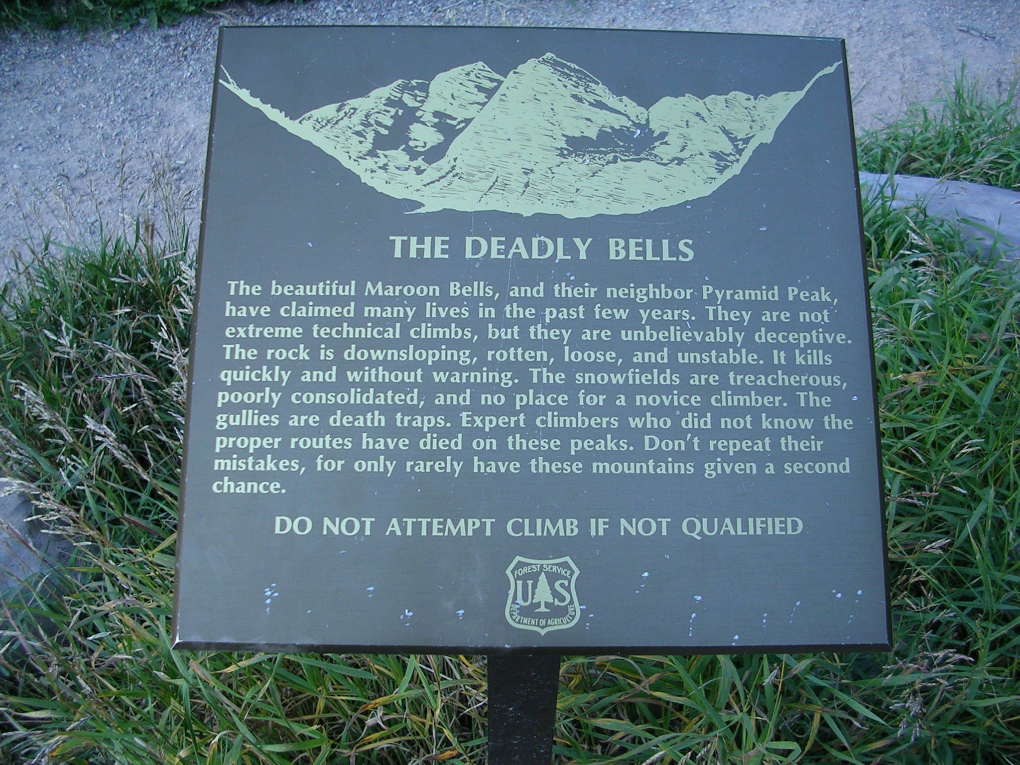
It would seem that Spencer's death could have been avoided if his group practiced safety precautions that should be employed when climbing in groups on steep terrain. This information is copied from Peter Topp's analysis above, but I believe it is worth repeating due to the value of the information:
- Climb one at a time while the rest of the group is sheltered from rockfall, or climb along parallel paths so that if rocks were to fall they would not hit anyone.
- Pay attention to your surroundings at all times - be vigilant about who is above and below you, and take extra precautions to prevent rocks from falling.
- If rocks do fall, make sure you notify others by yelling, "ROCK!"
- Get up earlier to beat crowds - if you're ahead of the rest of the climbers, you don't need to worry about rockfall above you (but you should still be cautious about knocking rocks down on people below you).
Failure to follow these precautions is something I've been seeing a lot lately, especially on popular 14ers. When I climbed Capitol Peak last year, I was down-climbing towards the knife edge when a group of three climbers, without helmets, came right below me and proceeded to climb up towards me, oblivious to the fact that I was above them on very loose terrain. I even warned them that I was on loose rock and that they should wait for me to continue, but they ignored my plea of caution. On Longs Peak last year, I witnessed the same thing, just after the "Narrows" section just after passing over to the "Trough." Several climbers, oblivious to the fact that many people were below them, carelessly knocked rocks down on people below, some large enough to cause significant injury or death.
It cannot be stressed enough that climbers be vigilant of the terrain they are on. Unfortunately, due to the growing popularity of the sport of climbing 14ers in Colorado, the number of people on any given mountain can be very high, making it almost impossible to mitigate the risk of rockfall caused by others. It is therefore the responsibility of each and every climber to practice sound safety precautions. In the example of my encounter on Capitol Peak, I stopped climbing until the three other climbers reached a safe distance away from any possible rockfall beneath me.
It is obvious that Spencer was a special person and well-liked by many. This is evidenced by a quote from a Facebook group created in his memory: "This is a toast to the life of a boy who had such a big heart. Today we lost someone who had so much determination and will power to be the best he could be. Someone with a world of friends and no enemies." My condolences go out to his family and friends.
9. Benjamin Russell Hebb - Longs Peak - Diamond - Dunn-Westbay route - Broadway ledge - 8/27/2010
|
|
| Photo courtesy of Jason Kaplan |
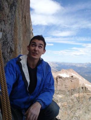
Benjamin was a 26-year-old from Broomfield, CO. He was set to graduate from the University of Colorado at Boulder in December with a degree in chemical engineering and had previously earned a degree in physics. He also worked as a research assistant at Gill Lab at CU - Boulder. Benjaimin was an expert rock climber, having spent most weekends climbing. At the time of his death, he was wearing a helmet and had all of the appropriate rock climbing gear and equipment with him for a successful ascent. Benjamin was solo-aiding the route, which involves fixing the rope to an anchor and connecting yourself to the free end with either knots or one of the various modern devices designed for roped soloing. Then the pitch is led as a standard aid pitch would be led. According to Rocky Mountain Park officials that witnessed his fall, he was unroped at the time - a common situation for experienced climbers in that location. Benjamin fell approximately 800 feet down a chimney.
Longs Peak's "Diamond" - Photo by Matt Payne
Analysis
While Benjamin was climbing solo, which is generally considered more dangerous than climbing with a partner, it was most likely not a contributing factor to his death. The section of the route he fell from is often not protected because of the comparatively easy terrain it is on. With that being said, it would seem prudent to protect that section of the route if high winds are present or if your climbing abilities are not honed (Benjamin was a very experienced climber). Placing protection on this section of the route might be more feasible if a partner is with you; however, since I have not been on the route personally, I cannot attest to that. It would seem that Benjamin fell on one of the "easier" sections of the route, while unprotected - a relatively common event for expert climbers. The easier sections of any given route are often free-soloed due to the speed by which a route can be accomplished. Obviously, even on easier sections of a route, the most experienced of climbers can still have an accidental fall, just as in the case of Benjamin Hebb. In conclusion:
- When possible, climb with others - climbing solo is generally less safe than with other people.
- When free-soloing an easy section of a route, extra caution should be employed to avoid a fall.
It is not known if Benjamin could have done anything to prevent his death, except to use protection on an easy section (which is generally not something most climbers do). This accident merely accentuates the fact that even the best climbers can still fall to their death on easy routes or easier sections of a route (which is probably one of the reasons why people climb to begin with - the rush of climbing is a powerful experience).
10. Don Thurman - Kit Carson Mountain - 9/18/2010
Don Thurman - photo courtesy of Don's hiking partner.
Don Thurman was a 63-year-old man from Parker, CO. Don perished on Kit Carson Mountain near what is commonly referred to as the "Kit Carson Avenue," a small cut-out in the mountain that allows climbers to gain access to the summit. It is not known what exactly happened to cause Don's death; however, his climbing partner strongly believes that Don fell on steep terrain after the two of them became separated after mis-calculating their exit into the Kit Carson Avenue upon descent. According to his 14ers.com profile, he had previously climbed 51 of Colorado's 14ers. Don went by the name of PeakCowboy on 14ers.com and was known by that community as one of the nicest and most pleasant individuals on the site, as evidenced by some of these comments about him:
- "I was deeply saddened to hear of Don's passing. I only had the honor of climbing with Don once, but it was one of the most memorable climbs I have had."
- "Don Thurman possessed a powerful drive and desire to experience the outdoors. He was an accomplished outdoors-man, and was always ready for the next challenge. I had the great pleasure of making Don's acquaintance via 14ers.com."
- "He's a great guy, very experienced, knowledgeable, and fun to talk with. I had never done a bear bag before and he showed me how to do it correctly."
- "He was a great companion and a careful climber. Each outing [with him] is a cherished memory."
Analysis
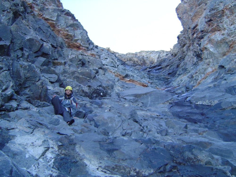
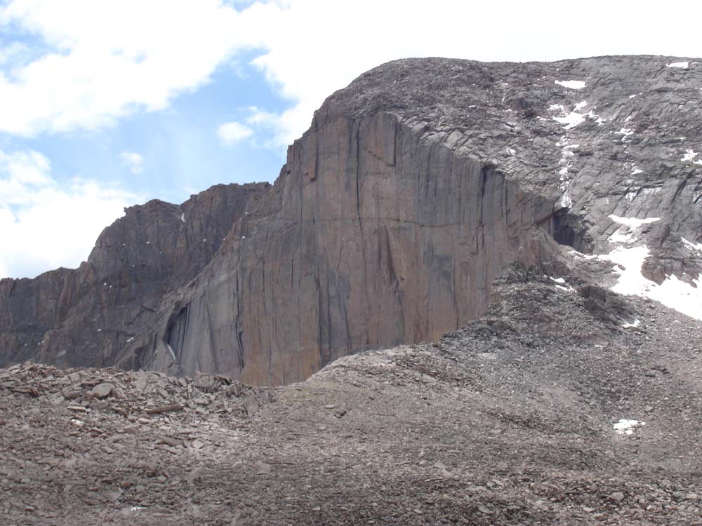
Don was clearly an experienced and accomplished mountaineer - he had been climbing mountains for several decades. His skill level was certainly high enough to tackle Kit Carson's relatively difficult terrain. Although Don had an undisclosed medical condition, it is not believed that it was a contributing factor in his death. Both he and his climbing partner were wearing helmets at the time of the accident. It would appear that what happened in this case was that Don and his climbing partner "missed" the exit to the Kit Carson Avenue while descending from Kit Carson's summit. When the Avenue is "missed" in this fashion, climbers descend too far into much steeper, looser terrain which requires careful climbing and route-finding to escape. This is a relatively common mistake on Kit Carson - in fact, my climbing partner, Terry Mathews, made the same mistake when we climbed it together in 2009. Fortunately, he was able to reverse course and ascend out via the Avenue properly. The Kit Carson Avenue can be seen in the below photographs. The first, a view of the Kit Carson Avenue as seen from Crestone Peak - photo courtesy of Terry Mathews. You can see that the terrain below the Avenue is quite steep.
To get a sense of just how steep and dangerous the terrain becomes once one misses the Avenue, take a look at the next photograph that I took in 2009:
Based on what is known about Don's death, it is not certain that he could have done much differently to avoid his death. He was wearing the proper equipment, he had the necessary skills and experience, and he was hiking with a competent partner. If anything could be learned from his accident, it would be:
- When climbing, one should take careful notice of their surroundings, making special mental notes of geographical features when changing directions or climbing up from another feature.
- By taking these mental notes, you will help remember where you need to go upon descent to prevent finding yourself off-route in much more dangerous terrain.
- By reading other's trip reports one can read about different pitfalls and things to look out for on a given mountain. This is not the first time I've heard of someone "missing" the Kit Carson Avenue, and I am certain it won't be the last.
- If you are planning on climbing Kit Carson, make sure you pay attention when you are leaving the Avenue to finish the climb. Look for unique rocks, cairns, or other unique features to clue you upon your descent.
11. John Regan - Longs Peak - Keyhole route - 9/25/2010
John Regan, a 57-year-old from Wichita, Kansas, died after falling about 300 feet from "The Ledges" on the Keyhole Route of Longs Peak. In response to this fatality, Rocky Mountain National Park changed the rating of the route to technical. The fall happened on the where two metal bars protrude from the rocks on the trail. See below:
Not much is known about John or the accident other than the fact that he slipped off of the mountain on a narrow section.
Analysis
John's accident was one of many on Longs Peak in 2010. Not much is known about John or his climbing capabilities, mountaineering experience or equipment. John's death reads quite similar as Jeffrey Rosinski's - an inexperienced climber who underestimated the mountain's difficulty. That is most likely the number one issue with Longs Peak, in general. Due to being in a National Park, Longs attracts thousands of visitors per year, many of which have little to no experience with climbing mountains. It is also possible that the section of the route that John fell from was iced-over and slippery.
In conclusion:
- Do not attempt Longs Peak unless you are an experienced mountaineer in excellent physical condition or unless you are with an experienced individual.
- Take extra caution on "The Ledges" section - it is slippery even on the driest of days due to the rock being worn down by years of boot traffic. Mountaineering boots such as the La Sportiva Trango or ascent shoes, not tennis shoes, should be employed to climb mountains such as Longs Peak. Excellent footwear is vital for grip, support, warmth and protection.
12. John Merrill - El Diente Peak - 9/26/2010
John Merrill was a 30-year-old climber from Cortez, CO. John was crushed by rockfall in nearly the same location as Peter Topp, exactly two months later. He was hiking alone with his dog, Oof. El Diente Peak would have been his fifteenth 14er. John was survived by his pregnant wife. John's dog, Oof, was rescued by a Search and Rescue operation the following day. The dog is now being cared for by Kacey Long, according to Watchnewspapers.com.
In searching for information about John Merrill, I stumbled upon his best friend's blog, which portrays John as being a lover of the outdoors and of elevated summits. In this blog, his friend, Tom Alphin writes about John:
"John has always been obsessed with reaching high places professionally and personally. I have always found the biggest reward for reaching high places were the clear views around me, but I think for John, part of the reward was the ability to see himself more clearly."
Analysis
Since John was by himself when he died, not much is known about what caused his death other than the evidence left behind by the rock fall that he died from. All signs point to this being a freak accident, almost identical in nature to the circumstances surrounding Peter Topp's death. It is not known if John was wearing a helmet or if he died instantly from his wounds. It is also not known if John's dog, Oof, played any role in the rockfall. What is known is that John's mountaineering experience was likely limited, based solely on the number of summits he had completed. The only mistake John likely made was climbing such a difficult mountain by himself without prior experience on similarly difficult terrain. In conclusion:
- Generally speaking, it is not a good idea to climb mountains by yourself unless you have significant mountaineering experience and / or a SPOT beacon.
- Climb within your abilities. There's no shame in turning around if a mountain presents challenges that you do not feel comfortable with.
- Test your footholds and handholds before placing a significant amount of your weight on them. This is especially vital in rugged terrain like the San Juan Mountains or Elk Mountains of Colorado.
- Climbing mountains with dogs is a personal decision. On more difficult terrain found on mountains like El Diente Peak, it is generally not a good idea to bring a dog with you since dogs tend not to be careful about rockfall, etc.
- Read above examples on how to climb safely on steep terrain to avoid rock-fall.
13. James Nelson - Mount of the Holy Cross - 10/3/2010
James Nelson is a 31-year-old man from Chicago, IL. No one has seen him since he went missing on October 3rd, 2010 when he set out for a five-day, 25 mile hike in the Holy Cross Wilderness Area. At the time of this article, James is presumed to be deceased; however, his body has yet to be found. Several attemps have been made to locate James to no avail. The circumstances leading up to, and following his dissappearance are murky, convoluded and controversial, as evidenced by the discussion on 14ers.com. Some speculate that James attempted Mount of the Holy Cross and fell - James had shared his proposed route with some friends before leaving Chicago and in those plans was a tentative scheduled climb of Mount of the Holy Cross. Others believe he became lost, similar to the case of Michelle Vanek, who famously went missing in the Holy Cross Wilderness Area in 2005. Some people speculate that he was killed and consumed by a mountain lion, despite a lack of evidence available to support that theory. It is also quite possible that James, being alone, became injured - perhaps a twisted ankle or knee ligament tear - and was far enough off the beaten path that no one could find him to rescue him. Clearly, not much is known about what happened to Mr. Nelson, and we probably will never know. What we do know is that he was somewhat experienced in backpacking, having led several trips with his Chicago Backpackers Meetup Group since 2006. Also, James was well-equipped with the proper gear and supplies for a long backpack trip.
Update: 5/27/2012: It would seem that the remains of James was finally found in the Holy Cross Wilderness Area: http://www.denverpost.com/commented/ci_20720181?source=commented-
Analysis
Embarking on a 5-day, 25 mile backpacking trip in a wilderness area notorious for lost hikers is a challenging undertaking for almost anyone. It is not known if James had the necessary fitness level or experience to accomplish such a feat. One of the last people to see James stated that he "covered the same ground it took James 45 minutes to cover in 10 minutes." This would seem to indicate that James was having trouble carrying his heavy pack at high elevation. A logical possibility is that James became exhausted from Acute Mountain Sickness at some point (read more about the impacts of AMS HERE). This could have led to any number of fatal mistakes, including straying off-route, falling down dangerous terrain, or other physical disabilities that could have impacted his ability to complete the hike safely. With that being said, it is also entirely possible that James was in great shape and that some other tragic event took place to explain for his disappearance.
Unfortunately, James' case presents us with several opportunities to learn some key lessons about wilderness travel:
- Make sure you are in good enough shape to accomplish the goal at hand - climbing mountains and backpacking are very physically demanding activities.
- Know the area you are traveling into before leaving home. While James had a GPS with him, he was traveling into a very wild part of the backcountry. Without first-hand knowledge of the area, James took some risks by traveling there by himself.
- If possible, hike with others - this ensures that if you are injured that someone can get help to rescue you.
14. James Patrick - Taylor Peak and Powell Peak - Rocky Mountain National Park - 10/16/2010
James Patrick was a 54-year-old licensed master plumber from Littleton, CO. He fell 1,000 feet down Taylor Glacier on steep terrain. During his fall, he pulled down his group's climbing rope, which stranded the other two climbers that were with him whom were later rescued. I have not been able to find many other details about James or the accident which caused him to perish. Apparently, his accident occurred during a sponsored trip from the Colorado Mountain Club, so many of the details of the accident are kept secret for legal reasons.
Analysis
Unfortunately, not much else is known about the accident. Based on the research I've done, it would seem that the cause of the accident was technically-related, meaning, either some piece of climbing equipment failed, or James made a mistake with his climbing equipment (knot / protection placement / etc).
15. Chris Pruchnic - Thatchtop Mountain - 11/20/2010
Photo courtesy of Kiefer Thomas
Chris Pruchnic was a 42-year-old man from Denver, CO and the former chair of the Front Range Section of the American Alpine Club. Chris was a very experienced mountaineer and ice climber. Chris was attempting an ice climbing route known as "All Mixed Up," located 1,200 feet above Mills Lake in Rocky Mountain National Park. Chris was climbing with one other person at the time, who was not injured. The route is very steep with loose ice and talus. It is one of the most famous ice climbing routes in Colorado. Chris was one of the most well-respected climbers in the Denver area, as evidenced by comments left by other climbers and people that knew him:
- "Even though I knew only a few morsels of his life, I will remember his kindness, his refreshing perspective on life and living it to the fullest, that went hand in hand with his passion for the outdoors from the deepest depths to the highest heights."
- "You'll be greatly missed as a climbing partner, a mentor, and most of all a great friend."
- "He had an infectious love of the outdoors and truly loved to give back. He will be greatly missed, in many ways in the climbing community."
Analysis
Not much is known about the details of the accident that caused Chris to fall to his death. It could have been ice conditions, gear malfunction, technical oversight - or a combination of all three. The route that Chris fell from is highly technical and quite difficult, even for experienced mountaineers. The very nature of ice climbing includes risks that are generally accepted as part of the sport. Placement of protection is generally difficult, and even more so on routes such as All Mixed Up. It is quite possible that Chris placed an ice screw or other form of protection, fell, and the protection failed. This is actually fairly common in ice climbing because of the way in which the protection is placed into the ice. According to an article on ezinearticles.com by Phil Lyall:
"Putting a piece of protection into ice is not easy. Most commonly you are looking at putting in an ice screw, which is very similar to a normal screw but larger: about the size of a plastic tent peg. There are no pre-bored holes in ice, so one must first chip a small area of ice away for purchase: a depression that allows the screw to bite. If you are lucky the screw does bite and then you are able to begin boring into the ice. No screw drivers, no vises, no warm basement workshops, and no hands because you are still clinging by ice axes to the approximately perpendicular face of waterfall ice. Houdini would have appreciated the act. Placing a screw is difficult. Placing a screw in the throes of worrying about a fear-fall, is next to impossible."
In conclusion:
- Ice climbing is dangerous, even for experienced mountaineers. Take extra caution when engaging in this sport.
- Route conditions can negatively impact your ability to safely complete a climb. Before starting a climb, evaluate the conditions of the route and make a sound decision on whether or not to continue.
- Check your equipment before starting a climb - make sure your rope is in good condition. Stewart Green from about.com provides good advice on how to do this.

Summary / Data / Charts / Common Themes
2010 marked one of the deadliest mountaineering years in history for Colorado. As an avid hiker and mountain climber, I could not help but take special notice of each death, as each incident personally impacted me due to the fact that these people died doing something that I do almost every weekend. Witnessing the impact of these deaths on the hiking community at large, and reading the misinformed reactions of non-participants of the sport inspired me to research each death and try to formulate explanations for the lay person, the expert and everyone in between. I realize that this is a quite controversial undertaking, and also know that there will be critics. To reiterate from my introduction, I believe that this is an acceptable risk for me to take if even one person reads this article and learns something from it.
Many have speculated that the up-tick in deaths is caused by an increase in climbers and new hikers to the sport of hiking and climbing mountains in Colorado. I have a different set of explanations that I'd like the reader to consider:
- The digital era has made it even easier for people to access information, whether that be news or information about the sport in general. As media outlets continue to saturate the market with news of events via print, websites and social media, the public's awareness of deaths and accidents will increase.
- So too will the public's access to information on how to climb mountains - in fact - many people believe that sites like this one and 14ers.com have only made things worse by encouraging people to climb when they are probably not physically or mentally capable of it.
- In reviewing the statistical tables of mountaineering deaths in North America, I've discovered, at least on a surface-level, that there is not a meaningful or significant increase in the number of accidents over the past 50 years. This would seem to debunk the theory that because more people are climbing mountains, more people are dying.
- The increase in 2010 is therefore most likely only a fluke.
The below charts were created using data from the ANAM statistical tables. Chart 1 shows Colorado Mountaineering Deaths from 1961-2006. While ANAM captures all death types (avalanches, rock climbing, etc) and does not drill down to show Colorado-specific data for mountain climbing, it is still good data to analyze. As you can see, the trend has remained relatively static over the past 50 years, with only a slight increase in the past decade. ANAM has not released 2007-2010 data at the time this article was written.
Chart 1:
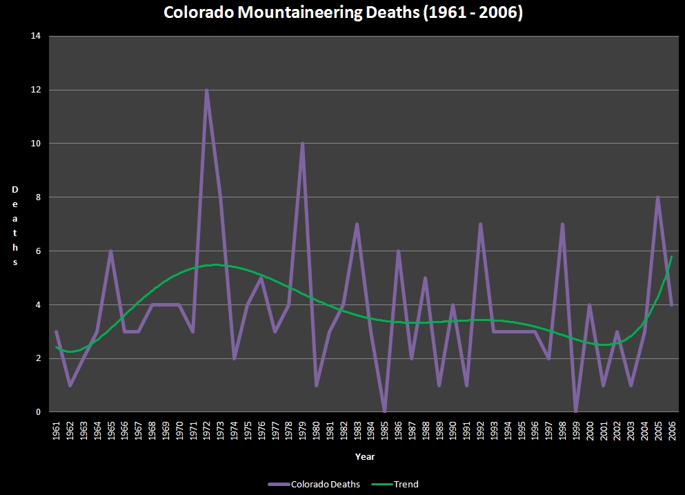
Chart 2 illustrates Colorado mountaineering deaths as a % of USA mountaineering deaths. This data is useful because it shows that Colorado is not an outlier for mountaineering deaths.
Chart 2:
Again we see that the trend is that deaths have been relatively static with only a slight up-tick in recent years.
There were some common themes of the deaths this year:
- Highly experienced mountaineers perished on difficult mountains or routes. This is not surprising if one considers that as one becomes more experienced, they will pursue more difficult mountains or climbs. Compound this with a steady increase in self-confidence, which may deter a climber from taking precautions they normally would, and there is increased potential for risk and subsequent death.
- Inexperienced mountaineers perished trying to climb mountains that probably exceeded their ability, expertise or equipment.
- 6 out of 15 (40%) deaths were individuals over the age of 50.
- 3 out of 15 (20%) deaths were individuals 20 years or younger.
- Longs Peak was the most deadly mountain, followed by El Diente Peak and Crestone Needle. All three mountains require "Class 3" climbing or harder.
- The quest to summit all of the 14ers seems to drive people to attempt mountains that are either beyond their skill level or during poor conditions.
- Some of the victims were almost finished with their quest to summit all the 14ers. The increasing use of these lists to establish mountaineering goals (of which I am guilty of as well) may not be practical for all climbers, especially when their final climbs are considered to be highly dangerous (Thanks to Curt Kennedy for pointing this out to me).
- Longs Peak is dangerous. Tourists, beginners and inexperienced climbers beware!
If you are considering climbing mountains in Colorado and found the contents of this article overwhelming, consider joining the Colorado Mountain Club and taking their Basic Mountaineering class. At the very least, please take the time to read the contents of my mountaineering safety article. Be safe out there!
Rio Grande Pyramid - The Lonely Centennial
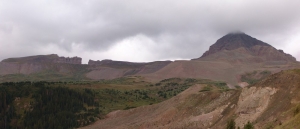
 Rio Grande Pyramid has long been on my "to-do list" for the Centennials (the highest 100 mountains in Colorado). Isolated by over 10 miles from its neighbors in the San Juan Mountains, Rio Grande Pyramid sticks out like a sore thumb by itself to the east of the Needle and Grenadier subranges. I viewed Rio Grande Pyramid from many angles this year, including a great view from Handies, and another wonderful perspective from Vestal and Arrow Peaks.
 Needless to say, I have been eyeing Rio Grande Pyramid a lot this year, and I have known since January that I would be climbing it with my dad at the end of August. Since Rio Grande Pyramid is very isolated, it requires a fairly lengthy backpacking excursion and some planning. My dad (Old Climber on this site) has wanted Rio Grande Pyramid for many, many years, so he jumped all over the chance to attempt to tackle this beast.
The plan was to leave from Colorado Springs after work around 5 or 6 PM on Friday, set-up a quick camp near Rio Grande Reservior, back-pack to Weminuche Pass on Saturday, set-up camp there, climb Rio Grande Pyramid on Sunday, and backpack out on Monday. With the weather forecast for the area being up to 70% chance of precipitation for pretty much the whole weekend, Ray and I were prepared for a wet trip, but hopeful that the weather would cooperate for a summit attempt. Just in case, I packed a book, The Things They Carried by Tim O'Brien, per the recommendation of my wife.
To start off, here are some meaningful statistics for this adventure:
Peak summited:
Rio Grande Pyramid: 13,821 ft. (ranked 97th in Colorado)
Total elevation gain: 4,674 ft.
Total distance hiked: 19.26 miles
Total time hiking: Approx. 14 hours
Total photos taken: 350
Total distance driven: 540 miles
Trip duration: 3 days
The drive to Rio Grande Reservior was uneventful, and finding a place to camp was surprisingly easy. We were aiming for the Thirtymile National Forest Campground, but we balked at the $16 fee, so instead we decided to camp 400 yards away, for free, in a large field by the Rio Grande River. This proved to be a great campsite. We woke up around 7:30 AM, packed up, ate breakfast, and drove to the campground, where the parking lot for the Weminuche Trail is at. At about 8:30 AM, Ray and I were packed and ready to hike, and began our 3-day journey into the remote Weminuche Wilderness Area.

A topographical map of our trip, click to enlarge.
The hike in is a relatively easy backpack, with the exception of mile number 2. The first mile is spent traveling along Rio Grande Reservior along a gentle trail, and then the trail picks up elevation quickly in mile 2 as it climbs and rounds the corner to the south west. After the 2nd mile, the rest of the hike in is very mild, with excellent views of the wide-open and very photogenic Weminuche Creek basin.

The Weminuche Creek.
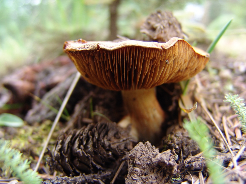
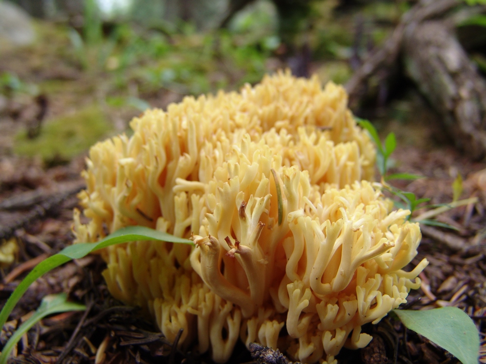
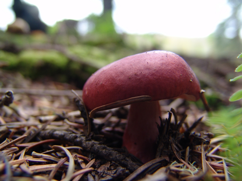
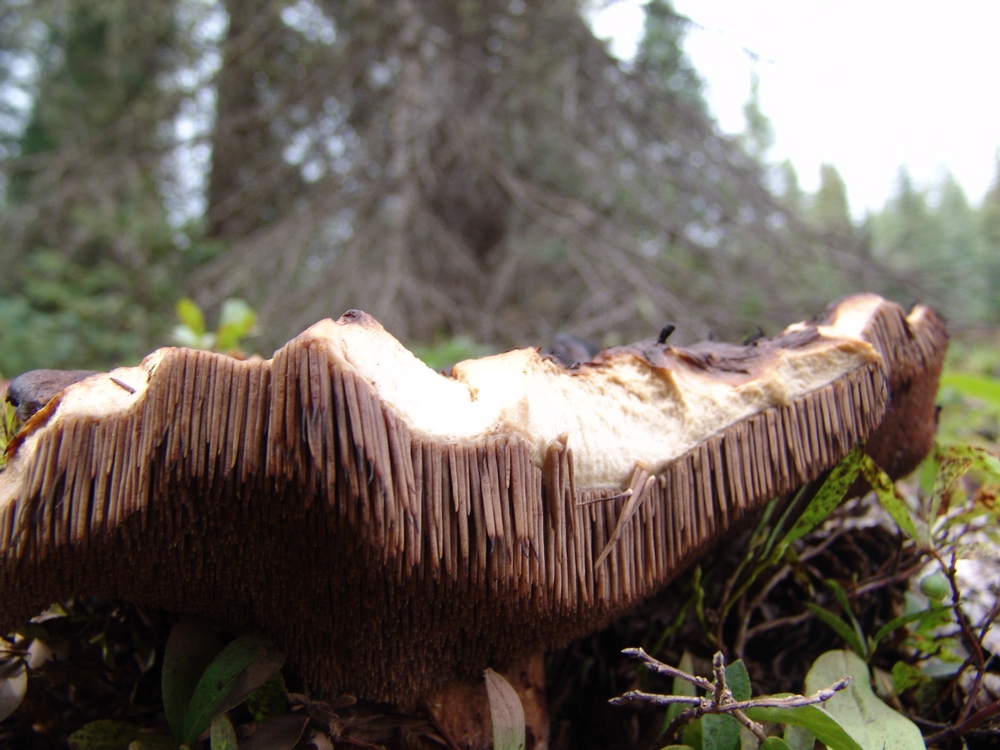
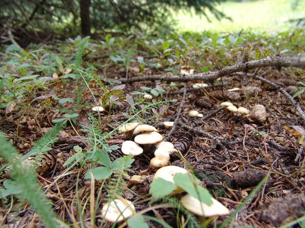
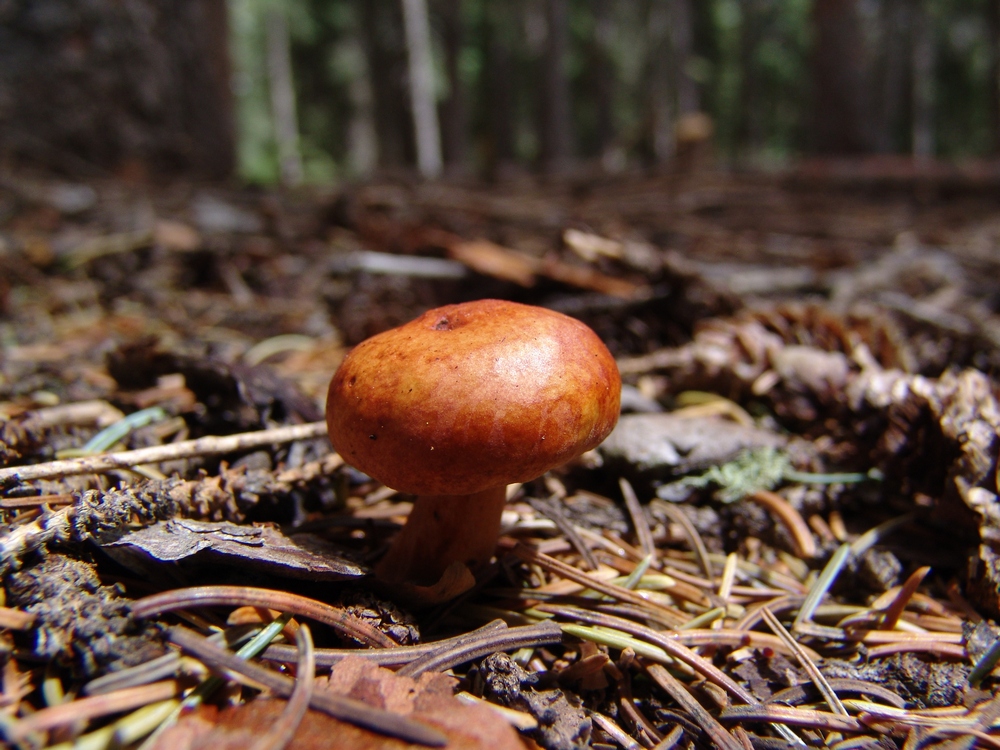
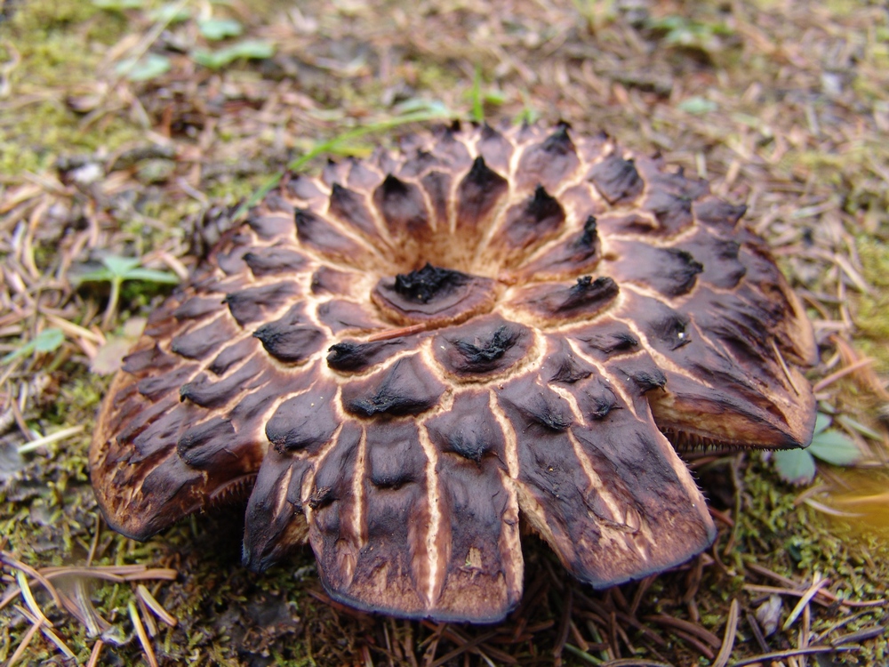
For our campsite, we were aiming for an area near Weminuche Pass. On the way up, both Ray and I were marvelled by the variety of mushroom that were growing along the trail, certainly evidence that this was been a very wet summer. Little did we know, the mushrooms would be one of the highlights of our trip (for those wondering, we did not ingest any of them).
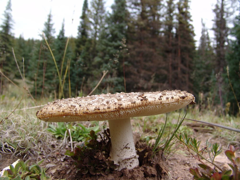
A Fly Agaric mushroom along the trail leading towards Weminuche Pass.
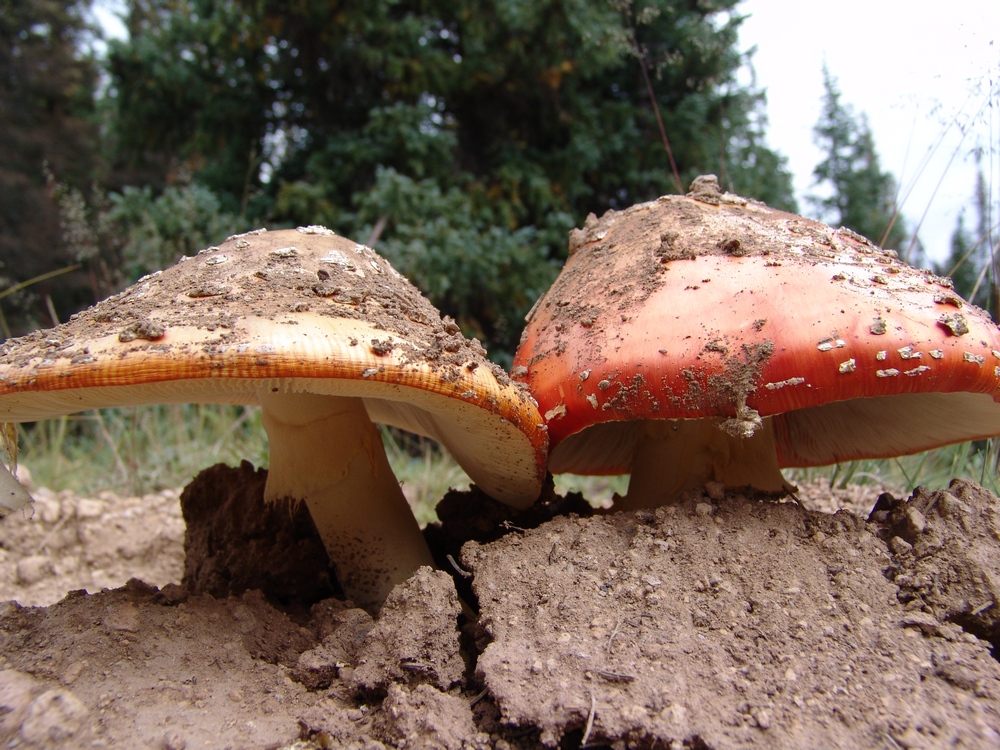
Two Fly Agarics emerge from the hard soil.
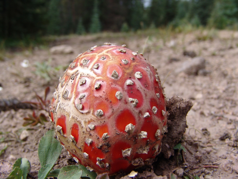
A Fly Agaric poking through the dirt.
We finally found Weminuche Pass, which was easy to spot by the two almost useless signs sticking up out of some cairns on each side of the trail. Heed my warning now, the sign on the right is for "Sky Line Trail," which is the route to Rio Grande Pyramid. The sign is poorly marked and at the time pointed in the wrong direction. We've since fixed the sign, so hopefully you'll see it better than we did. We camped directly east (left) of these signs along a small but gorgeous creek that flowed down from the Continental Divide. The area was a very large and impacted campsite, with plenty of great spots for a tent a a nice fire-ring.

The creek near our campsite.
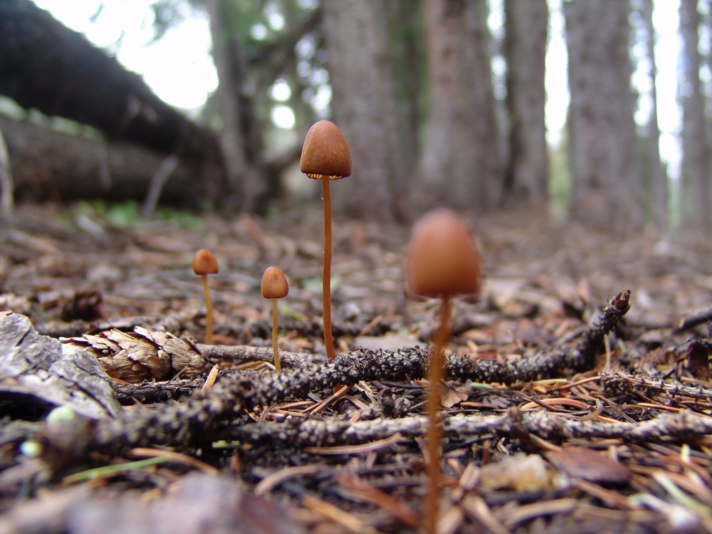
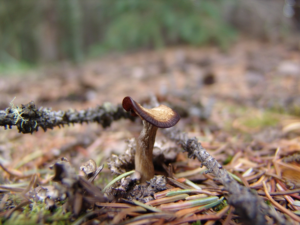
After setting up camp, I decided to go for a walk around the area, and see what kind of mushrooms I could find. Since I know almost nothing about mushroom identification, this was more of an opportunity for me to practice taking macro shots with my camera. I do think that mushrooms make for excellent subjects for photography, and I suspect/hope that some mushroom lovers out there may appreciate this trip report. I've submitted these photos to MushroomExpert.com (which is a very cool site) and hope to find out soon if we can name any of them. If you don't care for photos of mushrooms, you can skip that section by clicking here.
A little brown mushroom (or LBM for short, as Ray would say).
Some funky yellow mushrooms - we saw a lot of these under the pine trees.
Another "LBM."
A nasty looking 'shroom - I think it has seen better days...
Three "LBM's" emerge from the mossy ground floor of the forest.
I wonder... did these mushrooms seal the fate of this poor animal?

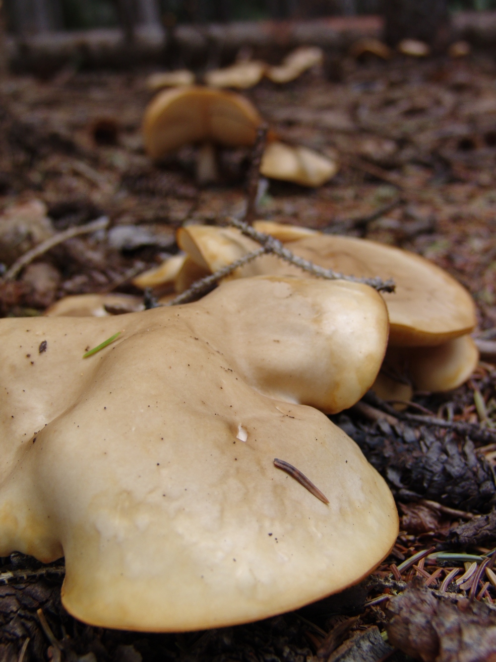
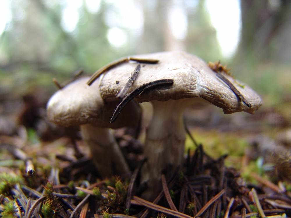
A King Bolete mushroom near our campsite. It turns out that these are quite edible.

Another view of the King Bolete.

A ring of mushrooms near our campsite.
More LBM's.
A LBM emerges from the pine needle floor.
Little white mushrooms were everywhere...
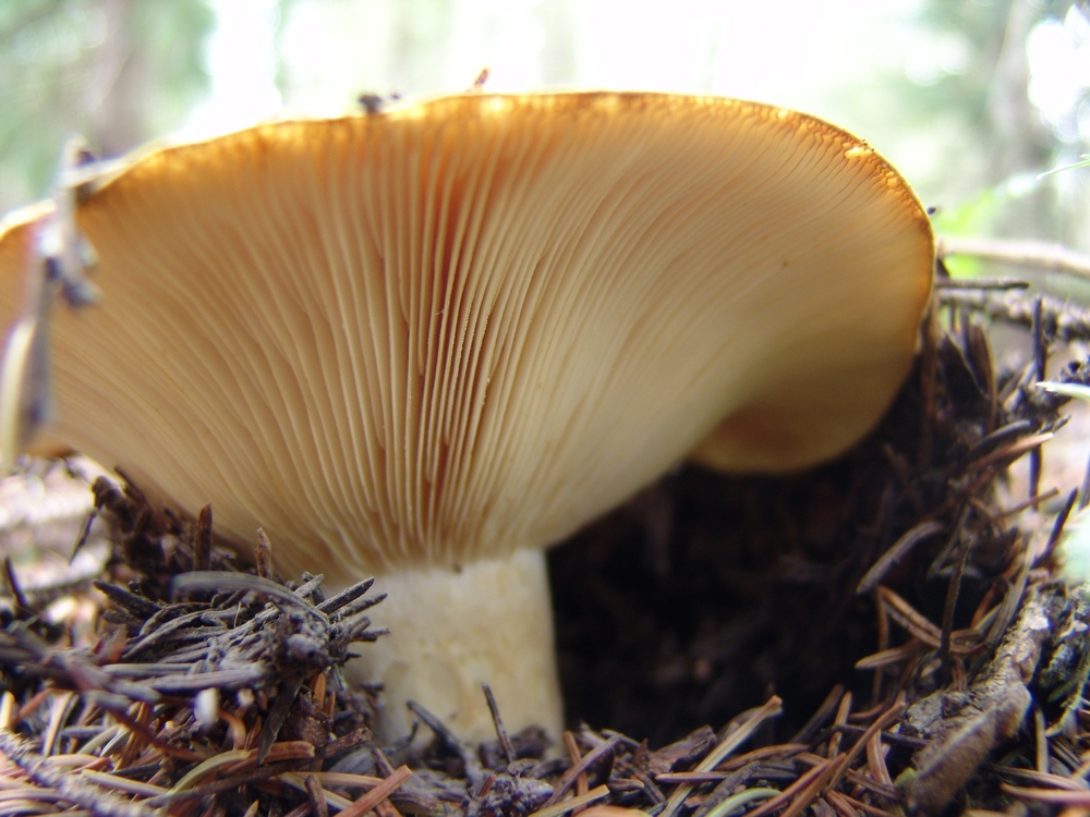
The "gills" of this mushroom made for an interesting subject for a macro shot.
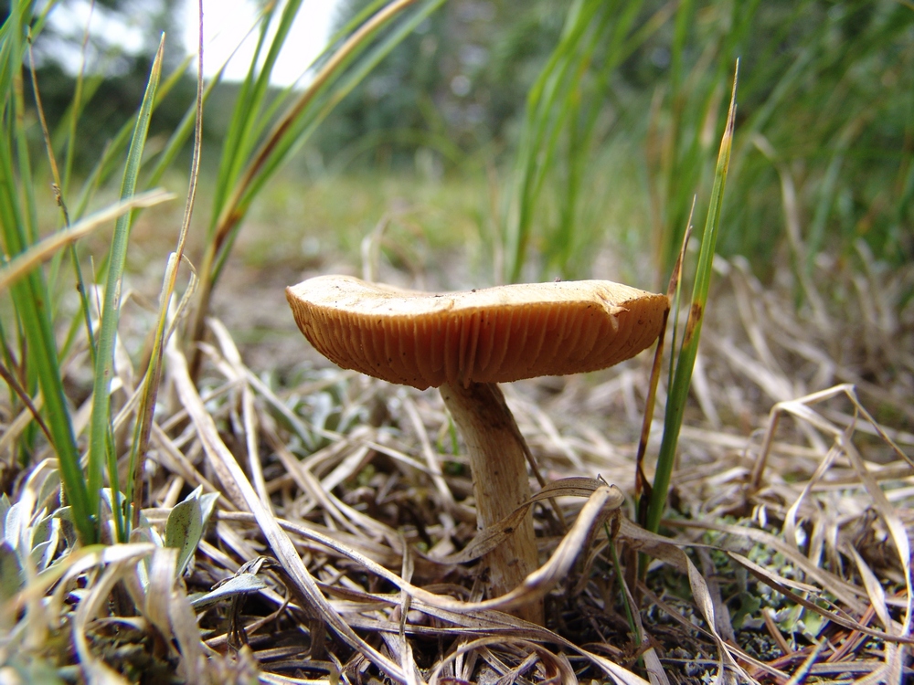
Another LBM rises from the grass.
These mushrooms looked like blobs slithering across the forest floor.
Yet another LBM!
These tiny mushrooms were growing in a very obscure location. I don't have a clue how I spotted them. Pure luck. They were about an inch tall.
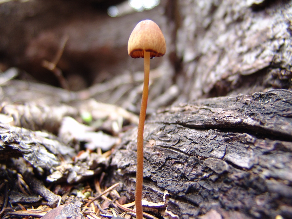
Another tiny little mushroom.

A perfect Fly Agaris specimin near our campiste. Doesn't it look like something out of Super Mario Brothers?

Mario emerges!
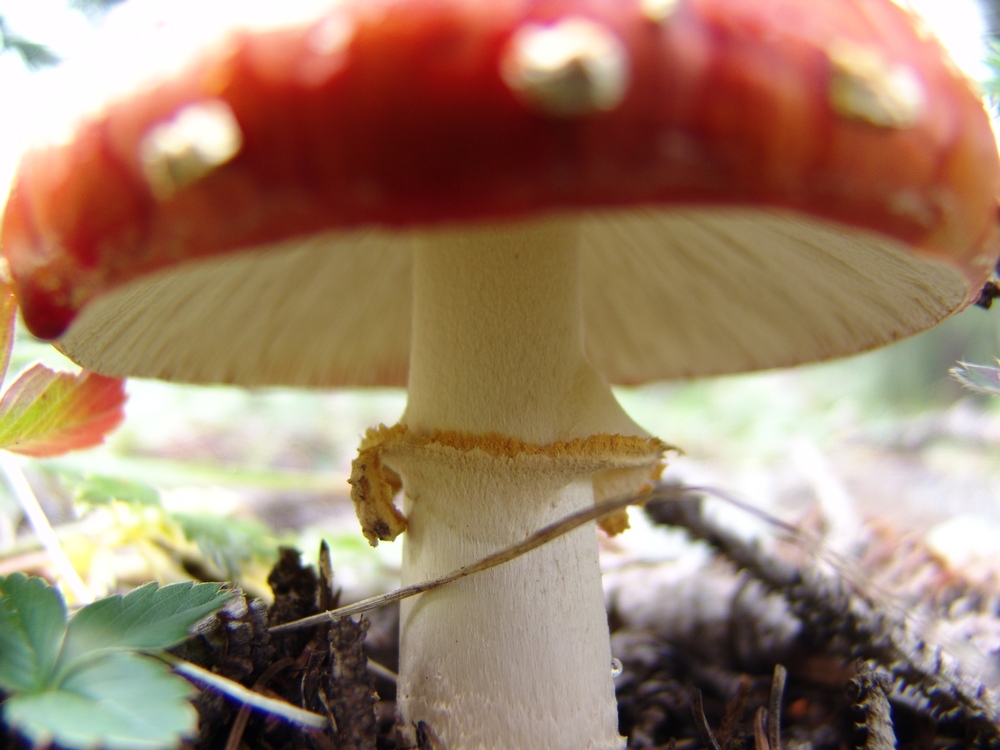
A view of the underside of the Fly Agaric.
This mushroom looks like it maybe got a little too much sun. Sunscreen is important in the mountains.

More crispy 'shrooms.
This little mushroom looks like she put on a little too much lipstick...
A white mushroom.
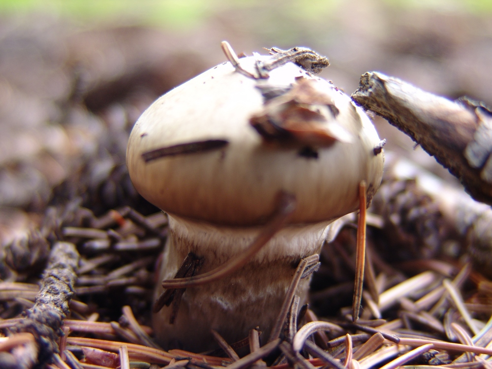
A small button cap mushroom.
After photographing the mushrooms, I took a nap. Sleeping next to the creek was great, and I recuperated from my exhausting search for the perfect mushroom. Ray and I cooked up some mashed potatoes and gravy with StoveTop dressing and chicken breast (we know how to cook when we backpack), and then after dinner I decided to go on another adventure up the valley to see if I could watch the sunset.
A view of the upper Weminuche Creek basin, just past Weminuche Pass.
To the east (left), I saw a small meadow at the base of the hillside pictured above. In that meadow, I saw a deer grazing, so I decided to see if I could stalk the deer and get a good photo of it. I think the deer was aware of my presense for pretty much my entire walk, which about 400 yards total across the basin. As I got closer to the meadow, I found myself looking down upon an awesome series of pristine beaver ponds.
A hidden beaver pond and meadow. The deer can barely be seen in the upper meadow.
Another beaver pond.
The beaver ponds were full of duck and fish, and it was fun watching the ducks swim around with their little families of chicks.
I even took some video of the ducks. If you listen really closely you can hear coyotes howling in the woods nearby.
In the distance I could make out what I believed to be Pole Creek Mountain in the late sun's light.
Pole Creek Mountain.
After being spooked at the beaver ponds by continuous coyote howling, I decided to return to camp. We crashed fairly early and set our alarm for 5 AM. The alarm went off and it was really cold outside. We got ready quickly and were on the trail by 6 AM. This is where we made our first mistake. Instead of following the "Sky Line Trail," we followed the Weminuche Trail further south until I realized we were doing something wrong. We backtracked to the Sky Line Trail (which does NOT follow where it shows on the USGS topo map, as seen by my TOPO map of our route) and began the steep upclimb along the Continental Divide. This trail is well established and somewhat steep. The weather was very foggy and winter-like for us, but there was no precipitation, so we continued up. The trail splits at one point, trying to avoid some deadfall; however, we found the best thing to do is to stay on the trail and go over the dead trees. This prevents you from losing a lot of elevation. Eventually, the trail brings you around the bend and Rio Grande Pyramid and The Window come into view.

The Window and Rio Grande Pyramid.
The Window is a very impressive geologic formation along the south ridge of Rio Grande Pyramid, and it does not disappoint. It was truly striking.
The Window.
The trail flattens out here in the upper basin and eventually brings you to a junction at the base of Rio Grande Pyramid. We took the junction to the right and climbed up a steep trail to the lower plaform of Rio Grande Pyramid. From here, we chose to follow the platform south and then up the gradual southeast slope.
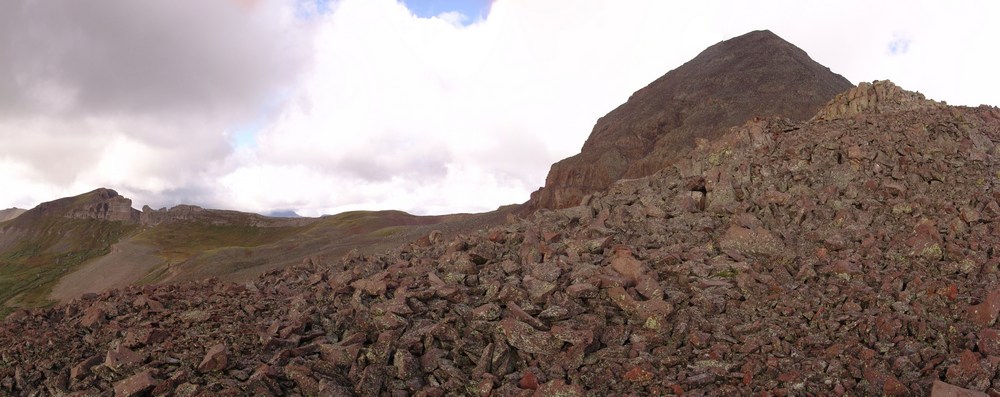
Nearing the summit of Rio Grande Pyramid.
The view back from where we came near UN 12,808 was pretty awesome, with the greens and yellows of the huge basins showing their true colors.
UN 12,808 towers over the valley below.
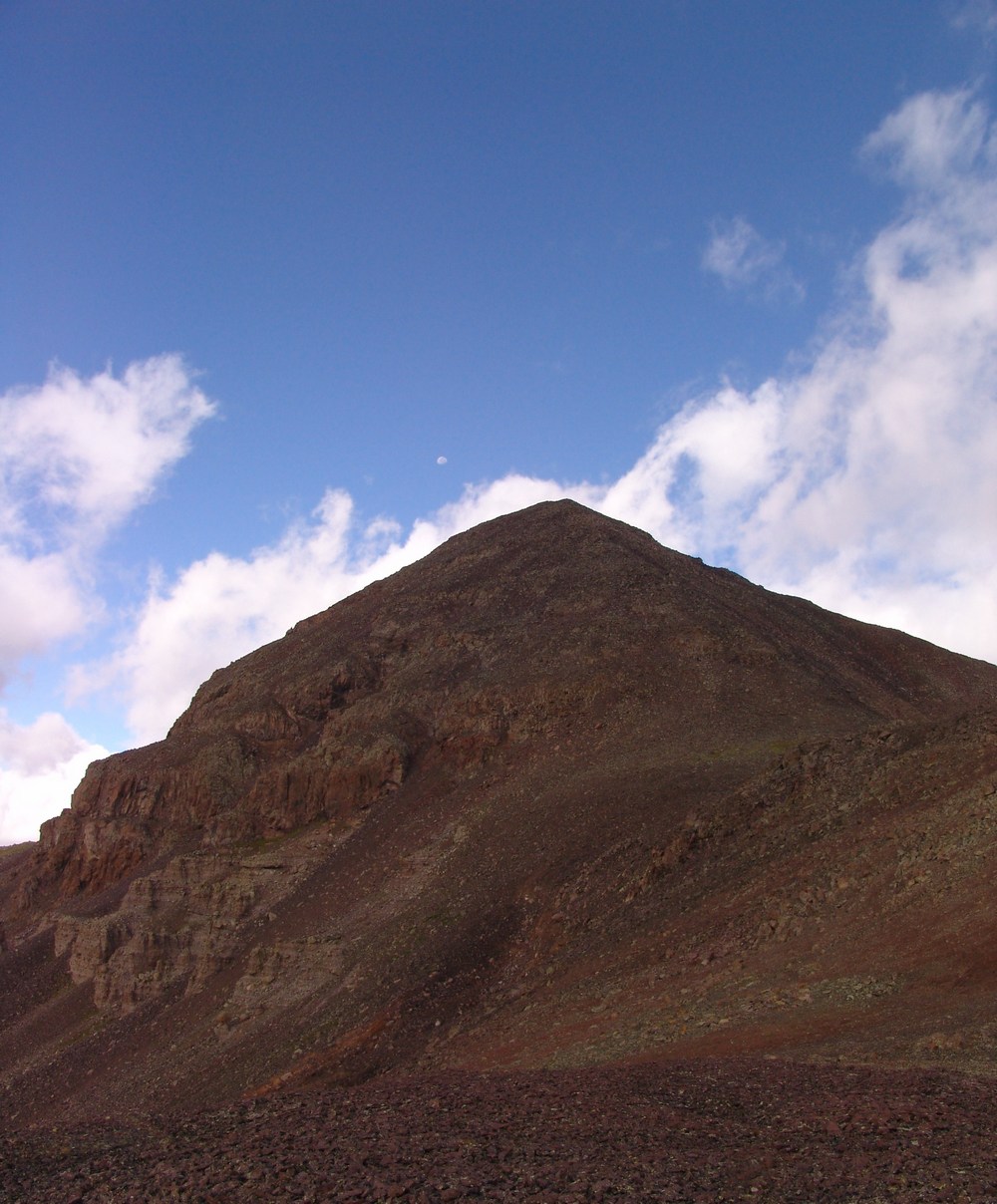
The Moon sets over Rio Grande Pyramid.
I was very intrigued by the volcanic nature of the rock on Rio Grande Pyramid. It was very much like lava rock in many regards, and made for quite easy travel compared to the "dinner plates" in the Elk Mountains or the famously loose rock found elsewhere in the San Juan Mountains.
Ray takes shelter in a ring of rocks we found.
From here, it was smooth sailing to the summit. While steep, Rio Grande's final summit block is nothing to be worried about. It is relatively short, and there are even class 3 variations for those seeking out a more challenging ascent. As I crested the summit, I was worried that there would be complete cloud cover in the area and that my view of Vestal Peak and Arrow Peak would be obscured. When I first viewed those two mountains at the top, I was ecstatic. While the weather did indeed obscure much of my view of the Needle Range, the Grenadiers were in plain view.
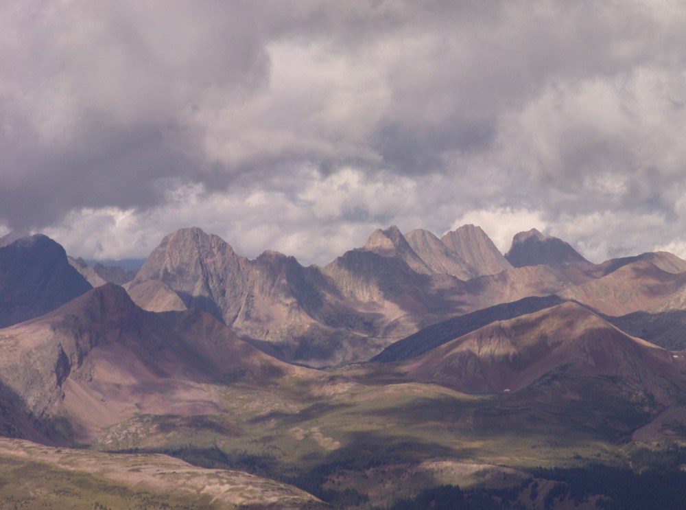
The Grenadier Range.
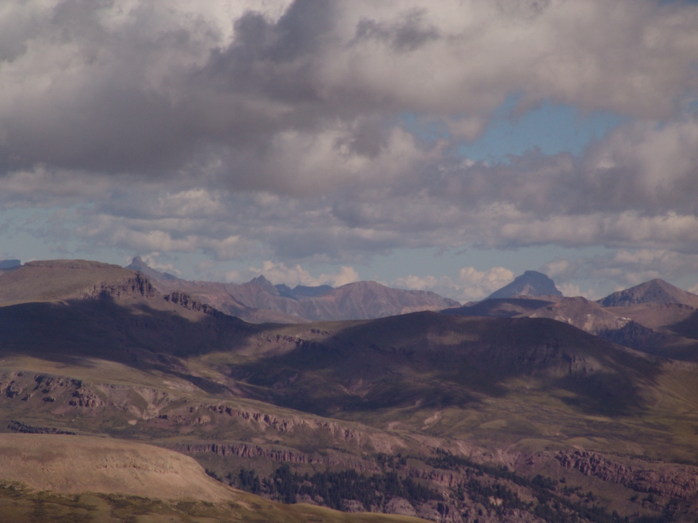
Wetterhorn and Uncompahgre to the north.
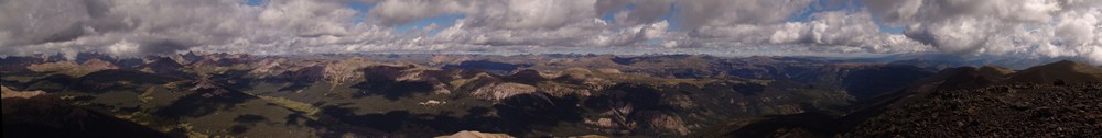
A 2800 pano from the summit of Rio Grande Pyramid.
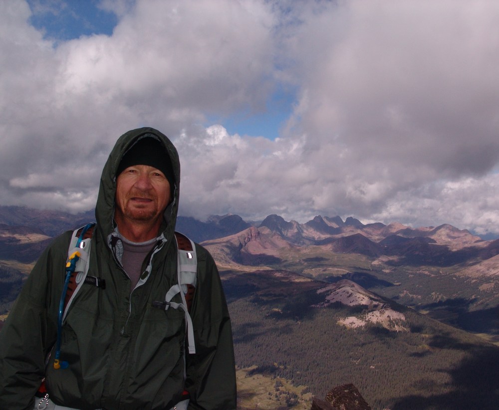
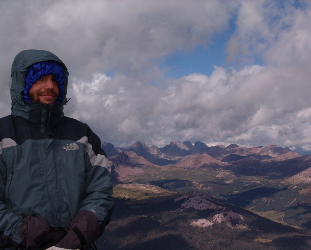
Ray Payne on the summit of Rio Grande Pyramid Matt Payne on the summit of Rio Grande Pyramid
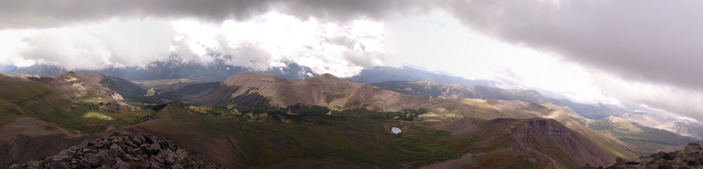
A view east and south. The clouds loomed over us all day long.
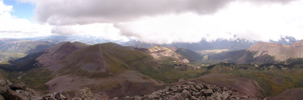
A pano looking east. "Fool's Pyramid" or UN 13,278 left of center.
Since it was really windy and cold on the summit, Ray and I opted to head back down a few yards to eat a snack and refuel for the climb back down and hike back to camp. It began to lightly snow, so we headed on down. The weather began to clear for us on our descent, and better views of Rio Grande Pyramid were had from below.

A super-high resolution pano of Rio Grande Pyramid.

Ray rests on the trail in this wide view pano of Rio Grande Pyramid and the surrounding ridges and valley.
As we hiked down, I was constantly drawn to the deep green and yellow colors of the meadows below.
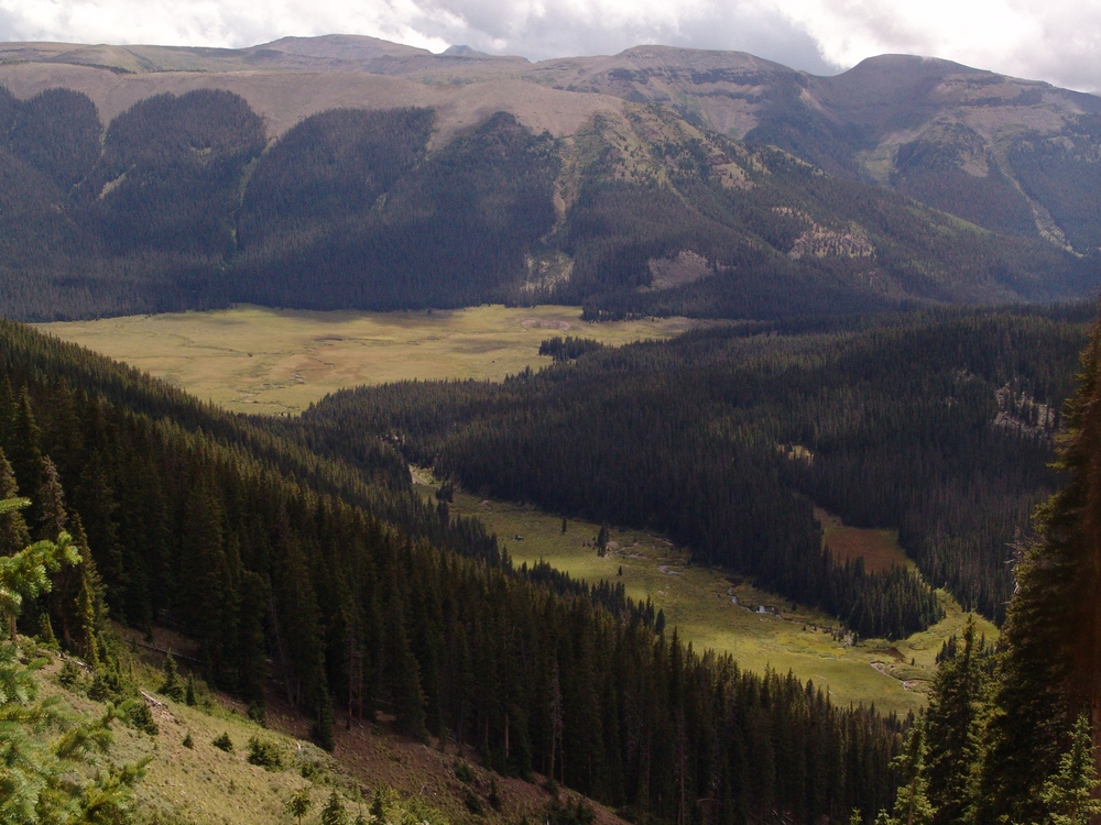
On the way back down, Ray and I took our time looking for mushroom, and we found plenty to take photos of. The mushrooms were honestly one of the highlights of this trip, because both Ray and I are fascinated by mushrooms.
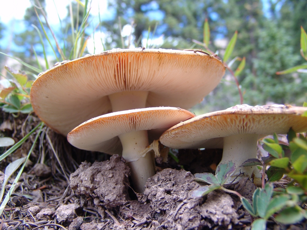
A trio of Fly Agarics.
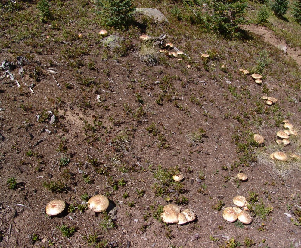
A circle of Agarics.
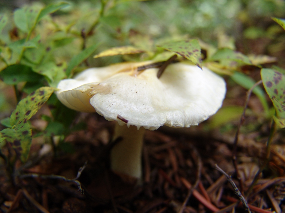
A tiny white mushroom.
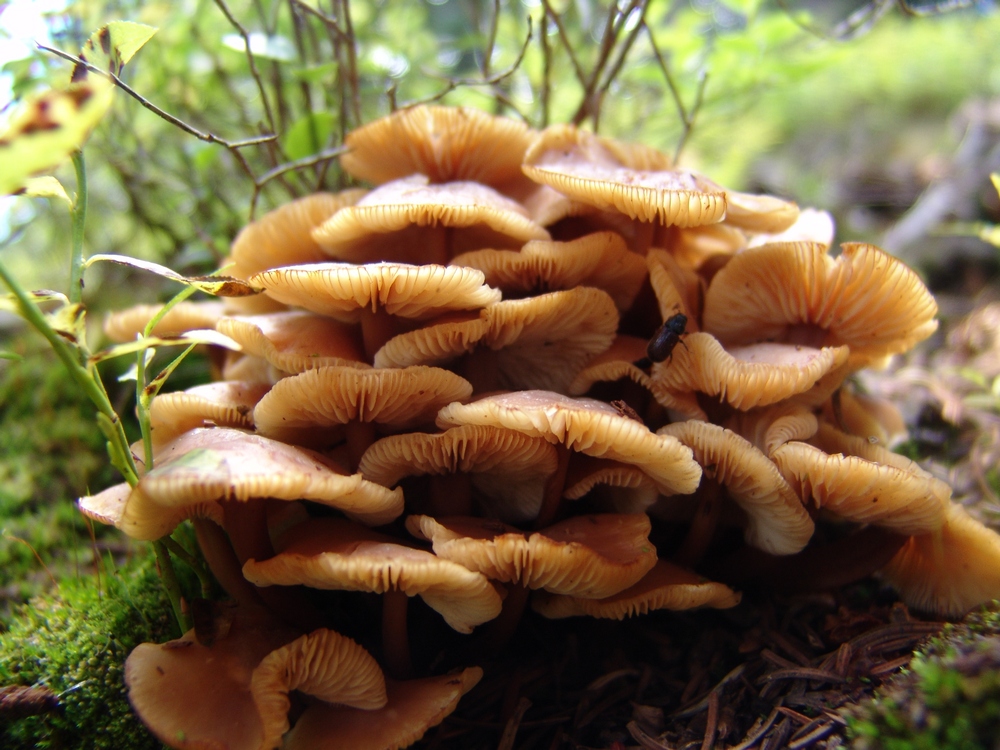
An odd cluster of gooey looking mushrooms.
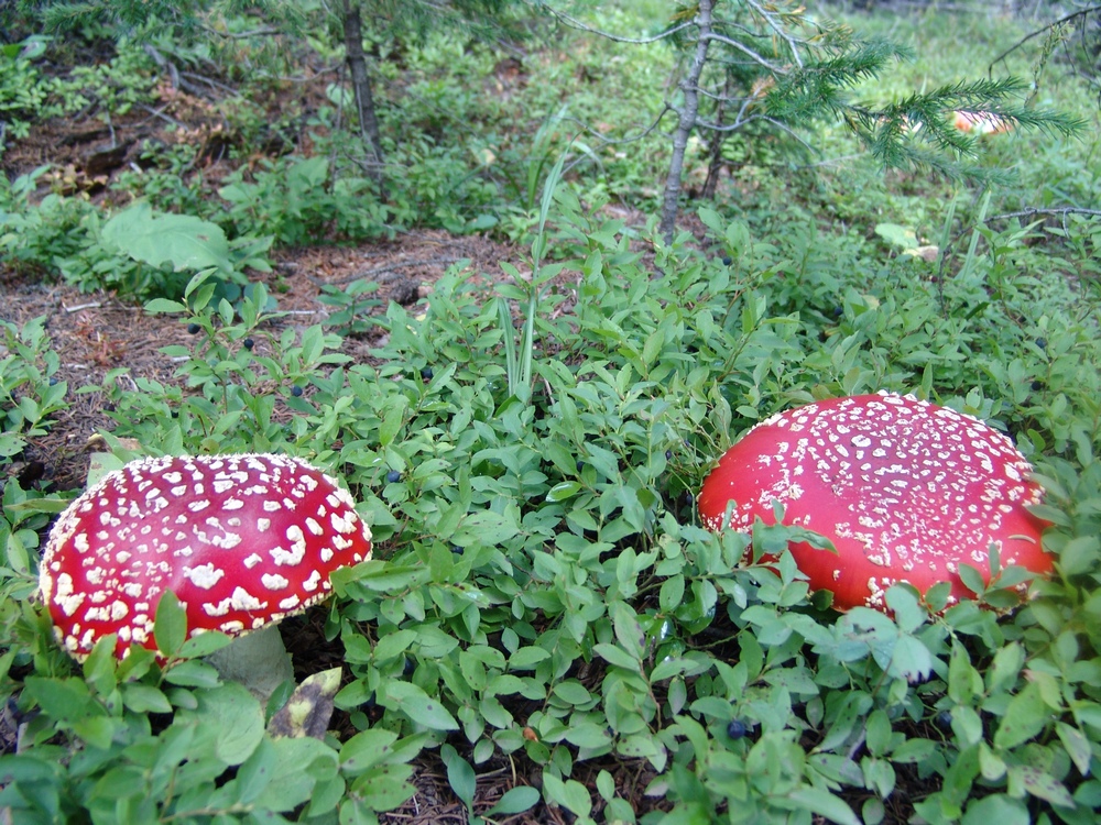
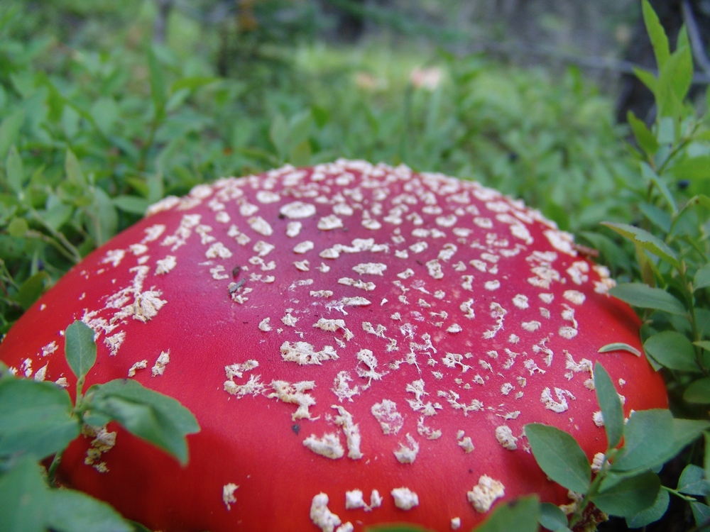
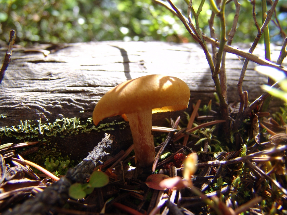
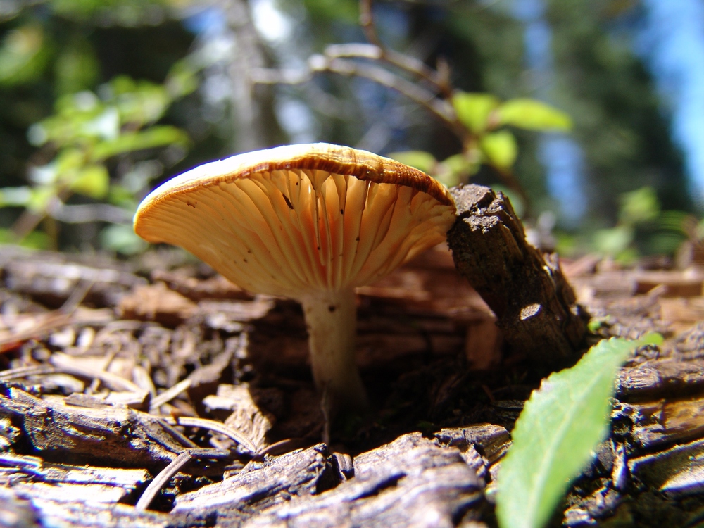
This one looks like a UFO.
This one grew around the grass...
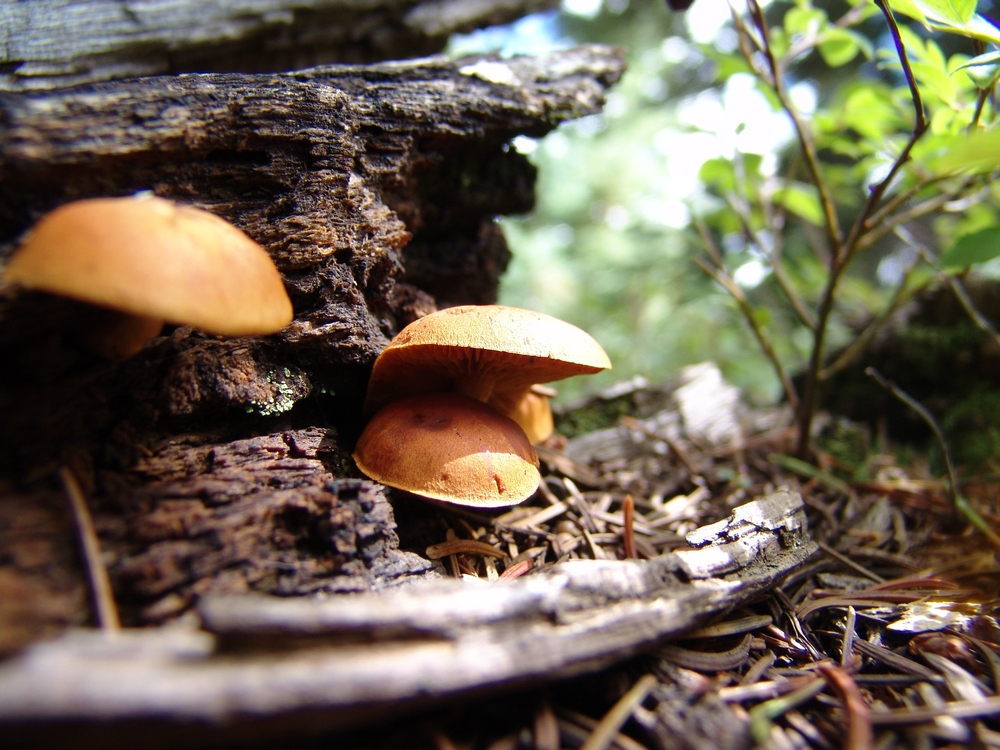
This one had it's own wooden house.

Covered in moss. Or - the Dagobah Mushroom.
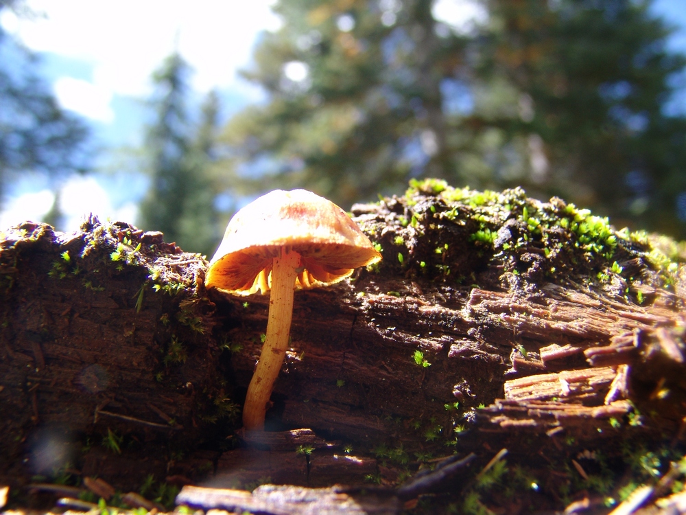
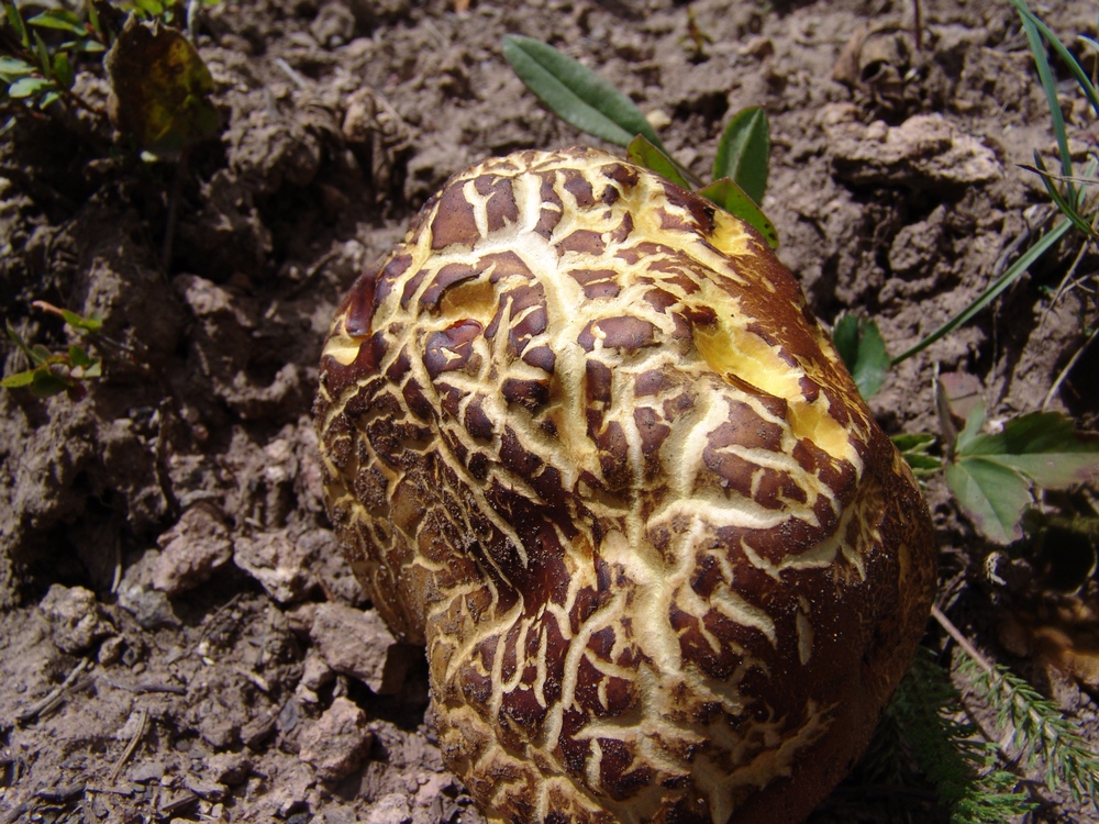
This one caught our eye...
Once back at camp, I decided to get a few more shots of our close-by creek. I think these came out quite well!
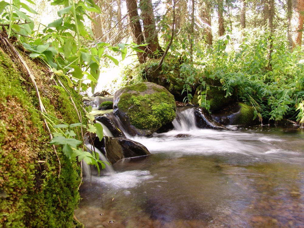
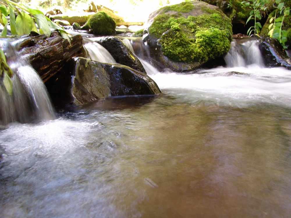
Ray and I cooked up dinner - a fitting meal of tortellini, salmon, alfredo sauce, and 4 kinds of dried mushrooms. A meal fit for kings.
Huron Peak and Browns Peak - a Sawatch Throwdown!
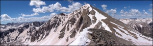
Interesting statistics:
Start time: 5:30 AM
Summit time (Huron): 9 AM
Summit time (Browns): 11 AM
Finish time: 1:20 PM
Mileage up: 3.6
Mileage down: 4.2
Total mileage: 7.8
Huron Peak Elevation: 14,003 ft.
Browns Peak Elevation: 13,523 ft.
Total elevation gain: 3,900 ft.
Total photos taken: 219
GPS map of our route (ascent in red, descent in blue):

This trip report begins with an interesting back story. I had a new member join my site in May from South Dakota. This member eventually messaged me on Facebook and asked if he could join me on some of my climbs this year. After learning about my plans to attempt Huron that very weekend, he decided to join me. Mike Vetter drove all the way down from Sioux Falls, South Dakota on Saturday, June 5th to climb with me. Mike is the CEO of DataSync - a successful start-up software company. Our route to reach the trail-head was very simple: we drove west on Highway 24 to Buena Vista and turned left on Chaffee County Road 390 heading west. After driving about 14 miles on a dirt road, we turned left at the old mining town of Winfield and continued west another 2 miles to our campsite near the trail-head. We left my house at about 6:30 PM and reached our campsite near the Huron trail-head at approximately 10 PM.
On the way to Buena Vista, we were able to get some great views of the sun setting over the Northern Sangre de Cristo Mountain range:
We set-up our tents in the dark and set our alarms for 4 AM and hit the sack. A few cars drove past during the night, presumably looking for camp spots. Fortunately, the vehicles did not disturb my sleep too badly and I was able to get some quality rest. The alarm sounded at 4 AM and I hurried to get dressed and tear down my tent. As we were getting camp taken down, a skiier passed us, informing us that he was going to ski down Ice Mountain. I'm pretty sure this person was "benners" from 14ers.com. We were able to quickly break down our campsite and cook some oatmeal for breakfast before debarking for Huron's trail-head at 5:30 AM.
Mike and I were able to make quick work up to the trail-head and soon there-after, the sun broke through to light up the tips of the surrounding peaks in Silver Basin, including Virginia Peak and Granite Mountain:

Silver Basin illuminates a small lake

A closer look at the sunrise

Virginia Peak (right of center)
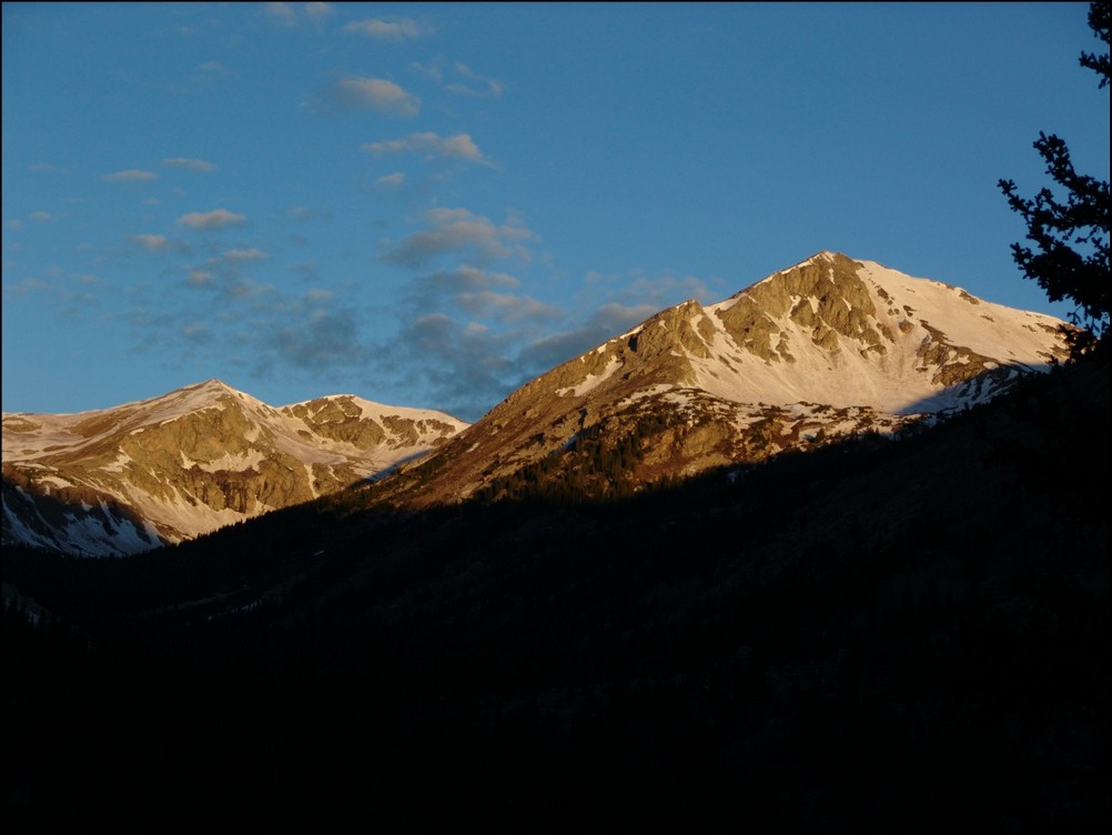
Virginia Peak
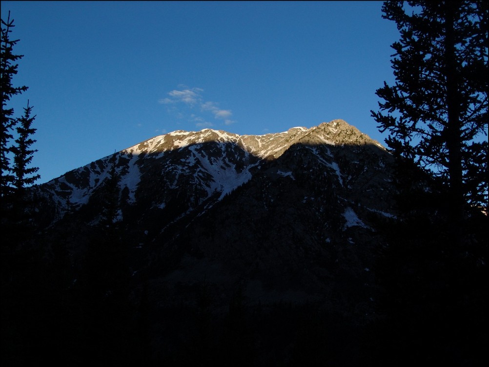
Sunrise hitting Granite Mountain

Sunrise hits Granite Mountain and Virginia Peak
Mike and I were energized by the great views of the valley across from us and made excellent time up the steep trail. Mike kept up with me as we blazed the trail. He did amazing considering he lives at 1,442 ft. and was not acclimated to the high elevation of Colorado yet.
<p
Mike Vetter proves he's got what it takes to climb mountains in Colorado
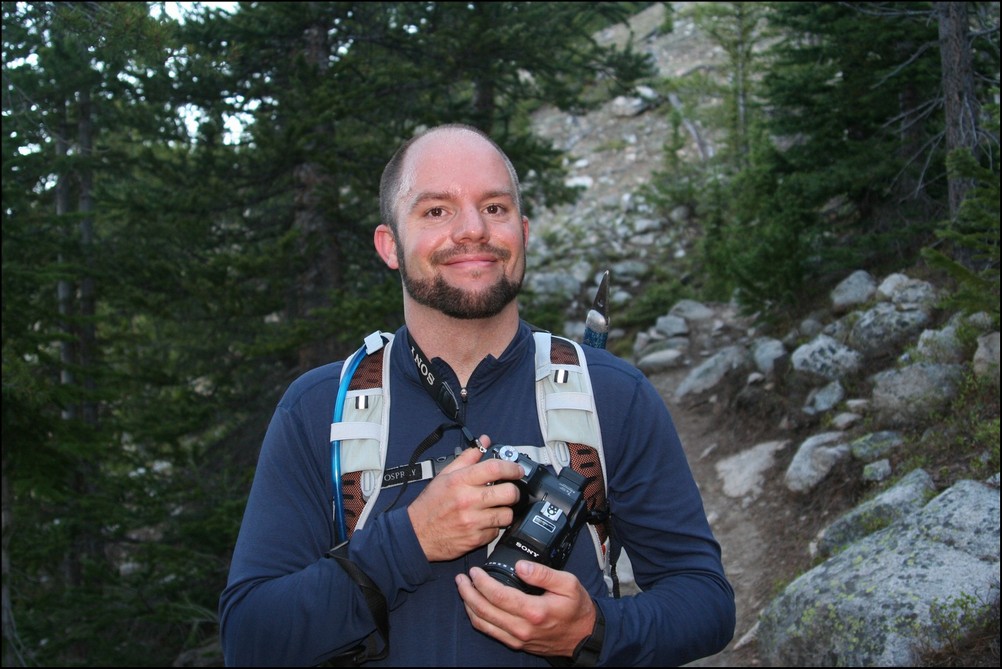
Matt Payne (author) hiking up Huron
An hour and 15 minutes after we started hiking from our camp, the first view of the Three Apostles came into view. The Three Apostles are a group of 13ers located up the valley from Huron, and contain two of the highest 100 in Colorado, Ice Mountain (13,951 ft.) and North Apostle (13,860 ft.). West Apostle is also respectable at 13,568 ft.

The Three Apostles come into view for the first time
Soon thereafter, one of our objectives for the day came into view as well: Huron. Huron appeared above us like a giant pyramid, as if it were guarding some ancient treasure within its rocky shell.

Huron Peak comes into view for the first time

The moon sits over Huron Peak
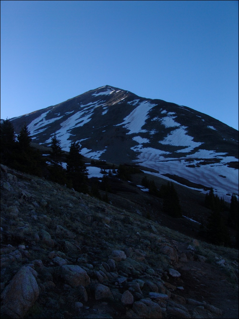
Huron Peak in the early light

Huron, the Three Apostles, and Granite Mountain greet the rising sun
Now that we could see the beginnings of the amazing views, Mike became more and more awestruck by the Colorado Rockies. It was a real pleasure hiking with someone that shared the same level of appreciation for Colorado's awesome peaks. Mike and I exchanged photos of each other.
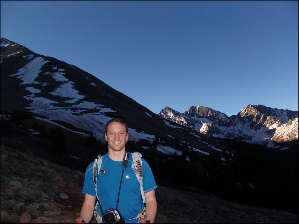
Mike Vetter looking excited in front of the Three Apostles
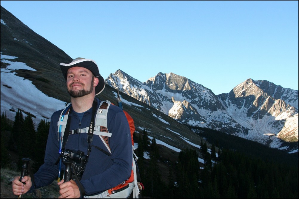
Matt Payne with the Three Apostles in the background
As we gained more elevation, views across the valley were getting even better. I noticed a long waterfall snaking down the side of Granite Mountain and decided that I wanted to try to capture a zoomed-in view of that waterfall. I took about 10 photos of the side of the mountain at 200mm and combined them into this photo:

Snow forms a waterfall down the side of Granite Mountain
I also wanted to get a zoomed in shot of the Three Apostles using the same method. Here are the results (click on the photo to see the super-hi-res version):

The Three Apostles in high detail
We continued to climb past treeline and up to Huron's base. I took some opportunities to take multiple photos of the views and stitched some photos together for a panoramic view.

Looking South and West, Huron casts a shadow over Granite Mountain
We quickly made our way up into the basin below Huron and were greeted by a giant snowfield. Normally, I welcome the sight of snow; however, the snow we encountered was very soft, with marshy streams and pools of water beneath. It was very much like crossing a field filled with 7-11 Slushies.
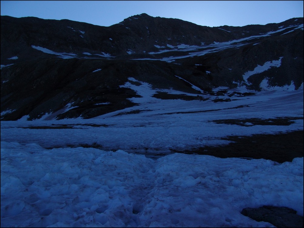
We made it through the slush and continued up the basin beneath Huron. The terrain was solid and only mildly wet from snowmelt. At this point, the sun had crested Browns Peak and began to heat the surrounding area.
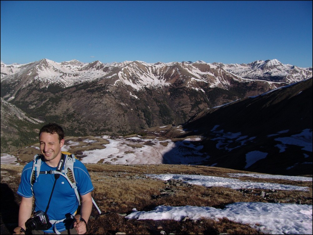
Mike Vetter squinting into the sun on our approach of Huron
We continued to climb up towards Huron, following the trail through and around large snow fields. At this point, it was clear that snowshoes or other assistive devices would be fairly useless and I was glad I brought neither. As we gained elevation, the views of Browns Peak as well as the Elk Mountains began to get better and better.
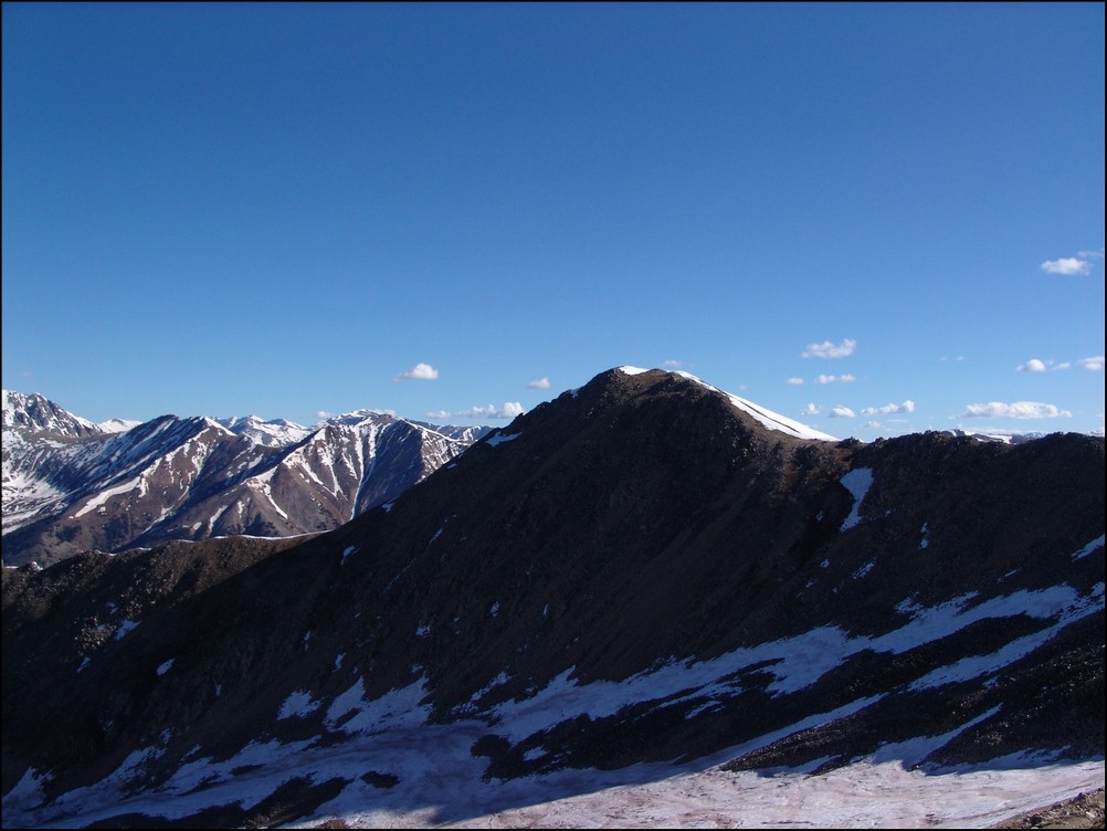
Browns Peak sits to the North of Huron Peak
We made really great time up Huron, despite its relative steepness and other aforementioned challenges (did I mention Mike lives 13,000 ft. lower than Huron). Huron's summit block loomed over us, making us feel pretty small compared to this giant choss pile. The trail up this section of Huron was clearly maintained and the efforts of Colorado Fourteeners Initative to improve the trail were apparent.
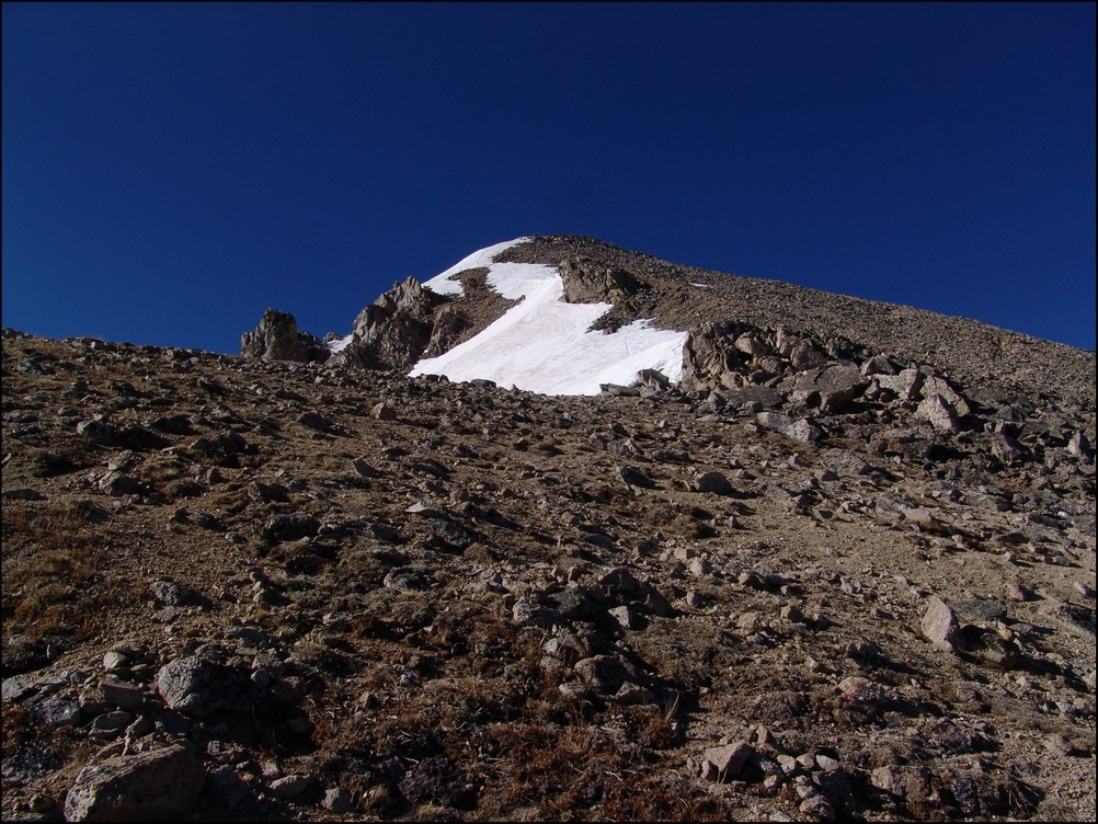
Huron Peak's summit block
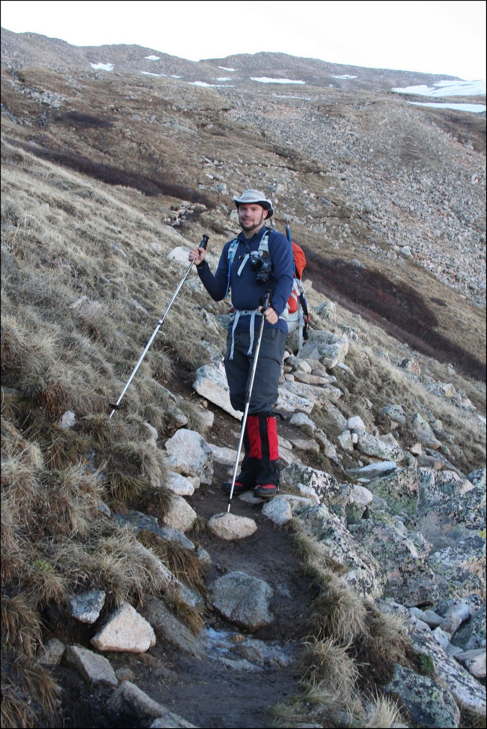
Matt Payne (author) hiking up Huron's Peak
We finally reached the ridge between Browns Peak and Huron Peak and were warmly welcomed by a giant cornice sitting at the top of the ridge.
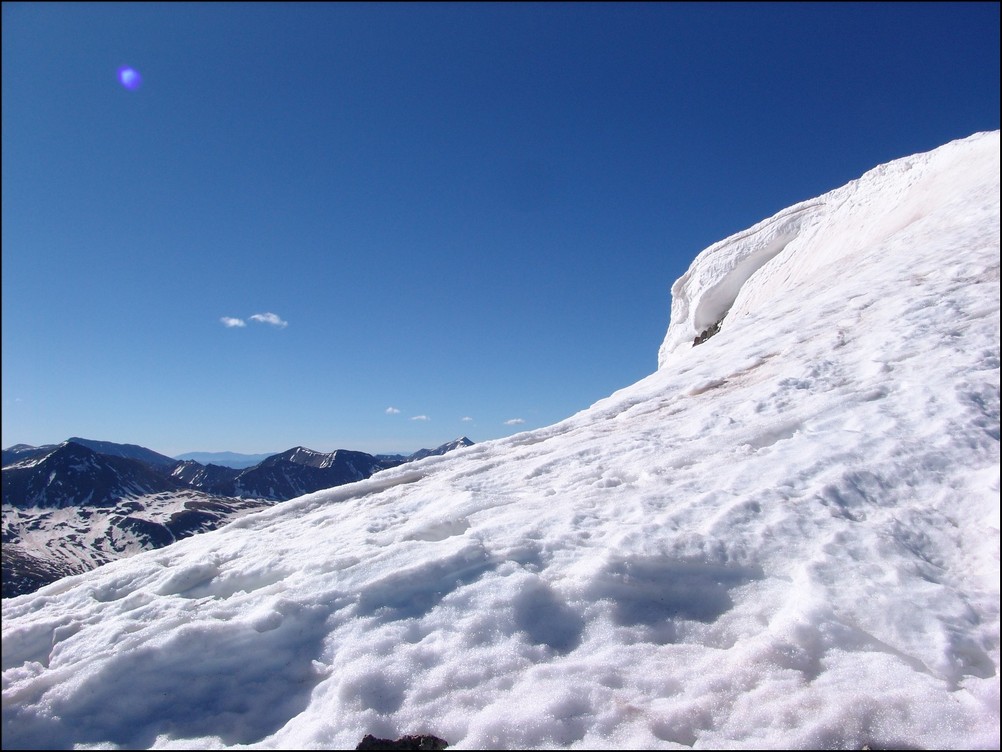
A giant cornice on Huron's ridge
The final push to the top of Huron took exactly 10 more minutes. The views from Huron Peak were absolutely outstanding. Being somewhat more isolated than most of the other 14'ers in the Sawatch Range, Huron Peak offers excellent views of the rest of the Sawatch Range and the Elk Mountains as well. Mike and I were the first to summit that day, and spent an hour on top celebrating, eating, and taking large amounts of photographs.
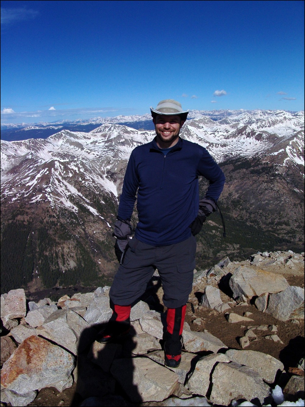
Hero shot of Matt Payne on top of Huron Peak
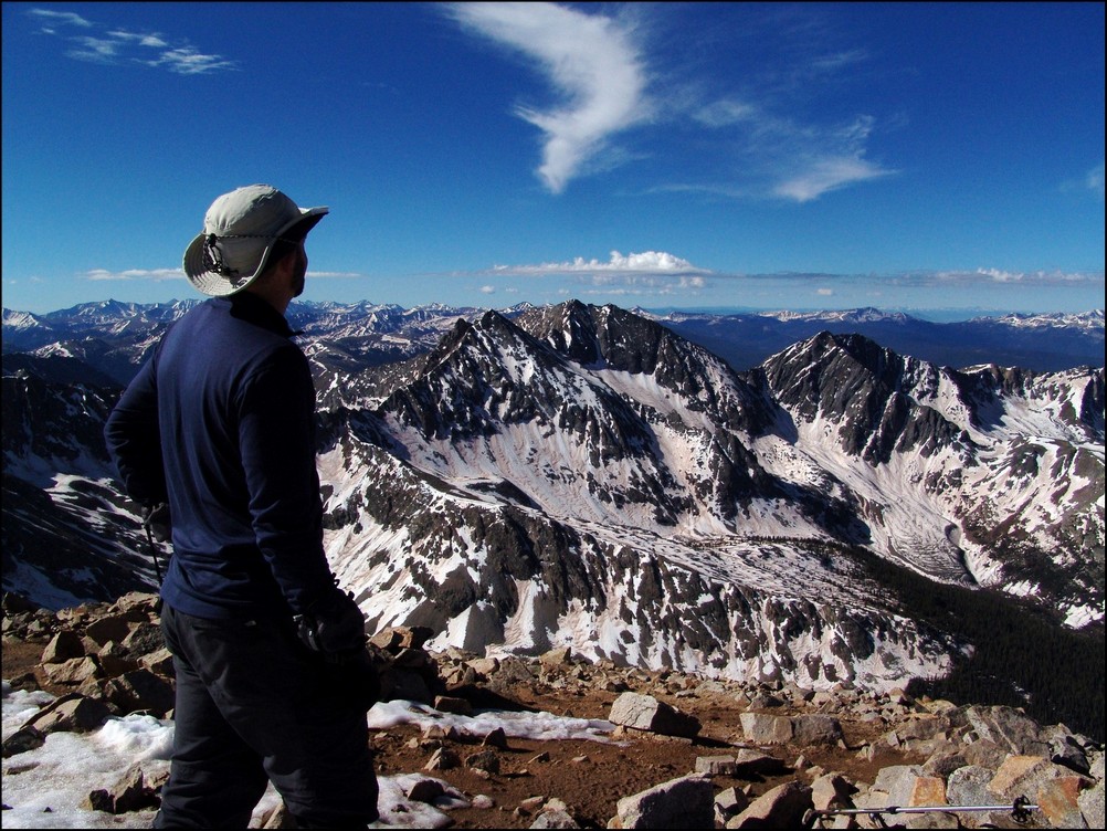
Matt Payne gazes South towards the Three Apostles

360 Degree View from the top of Huron Peak (click for full resolution version)
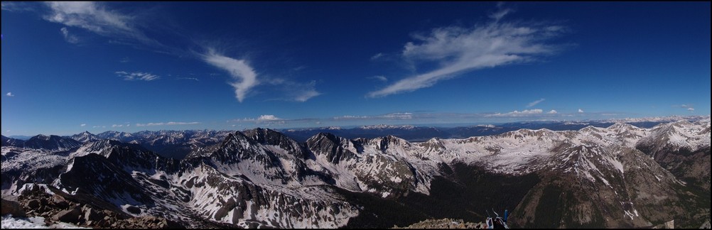
A 180 Degree View from North to South from Hurons Peak. The Three Apostles at center.
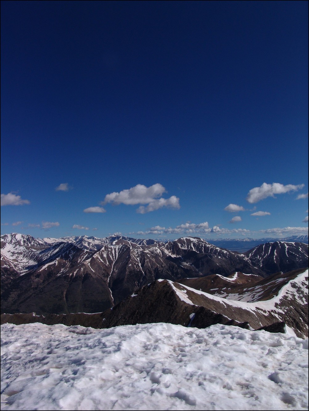
Mount Hope (the flat topped mountain) rests right of center. La Plata Peak rests far left.
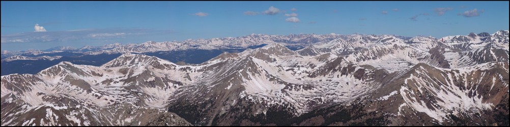
The Elk Mountains loom in the distance, covered in snow.This photo is zoomed in at 200mm. Pyramid Peak, Maroon Peak, Snowmass Mountain, and Capitol Peak can all be seen from this vantage. Click on the image for the super hi-resoltution version.
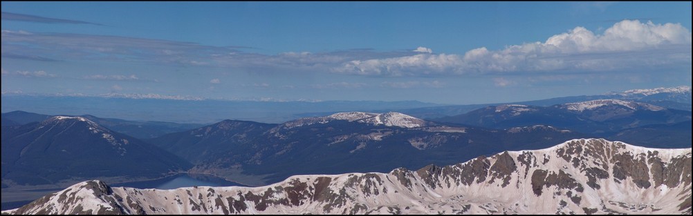
Taylor Reservoir can be seen in the distance, reflecting the surrounding mountains (click for full resolution version)
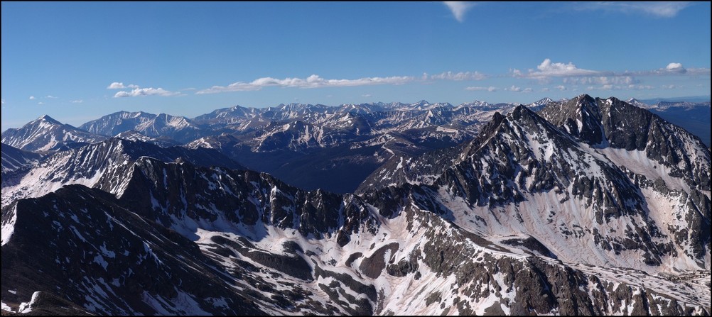
A closer look at the Sawatch Mountains south of Huron. Mount Antero, Mount Shavano, and Tabeguache Peak are all recognizable.
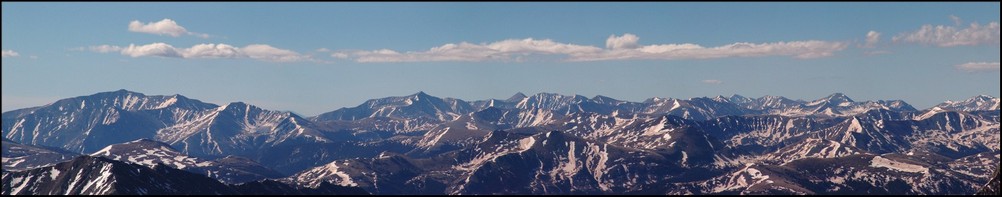
A zoomed in view of the Southern Sawatch mountains
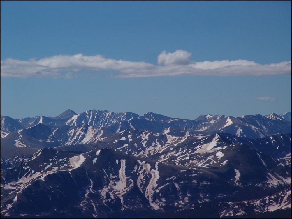
Shavano and Tabeguache (high pointed peak and flat snowed peak respectively)
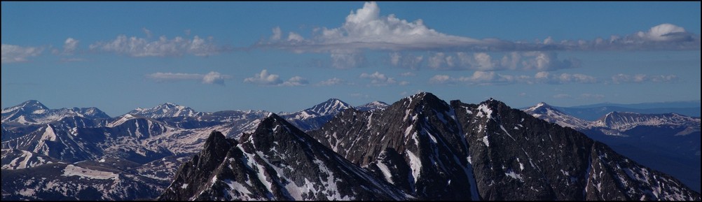
North Apostle and Ice Mountain zoomed in. If you click on the image you can see the full resolution version (and the climber atop North Apostle. I've confirmed that this climber is "Mad Mike" from 14ers.com
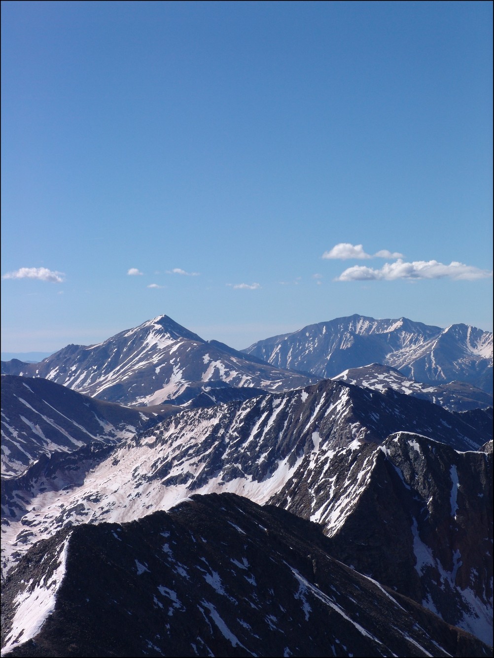
Mount Yale and Mount Princeton seen in the distance
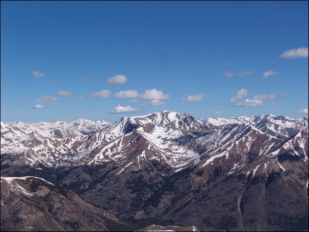
La Plata Peak seen to the North of Huron across the valley
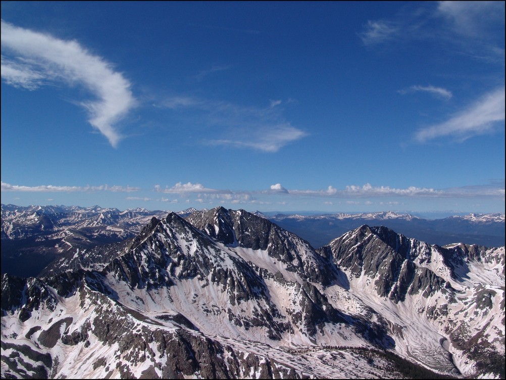
A great view of the Three Apostles from Huron
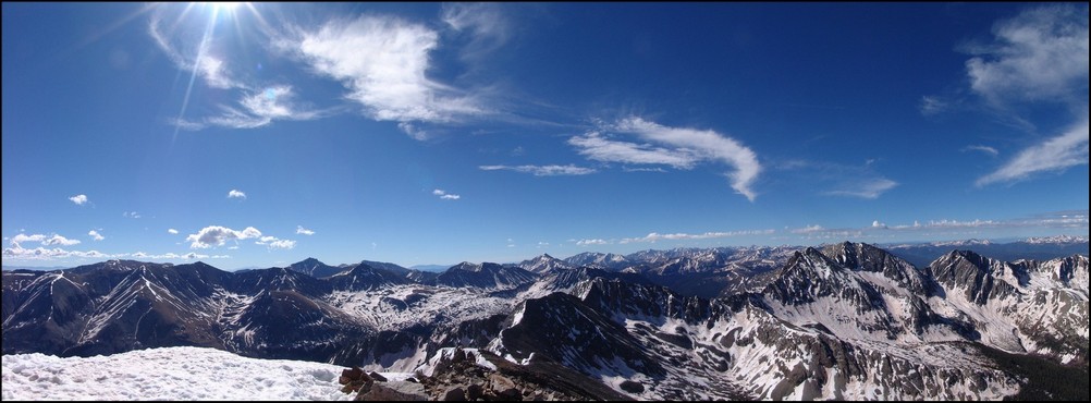
A 90 degree view looking Northeast, North, and Northwest from Huron
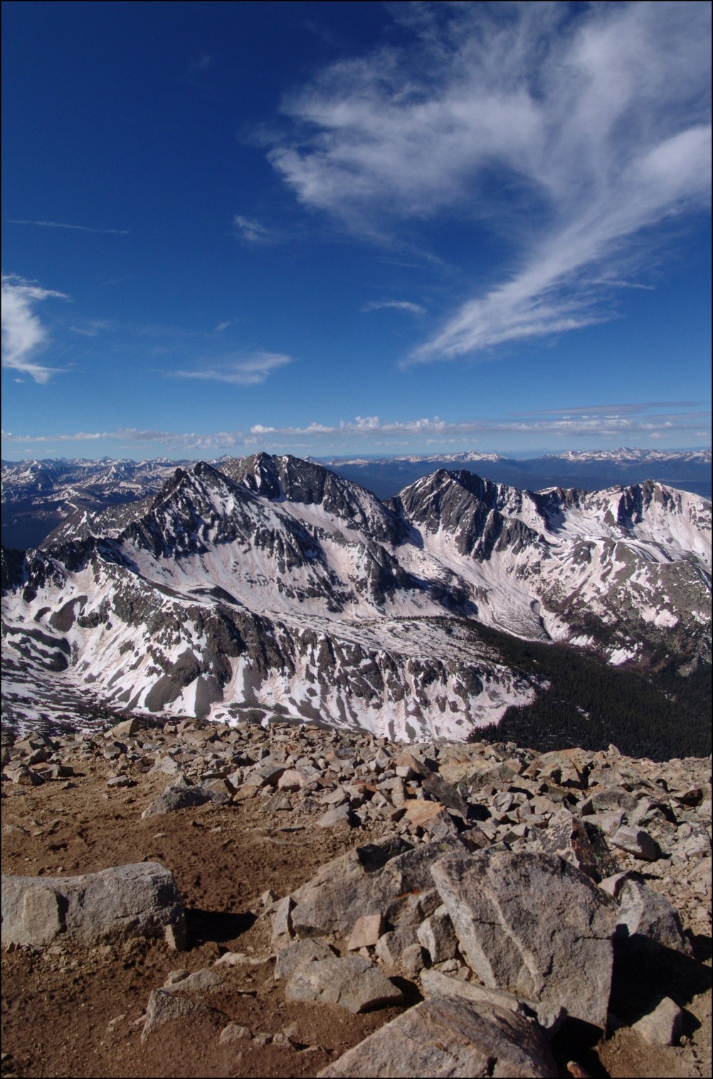
A vertically-oriented panoramic view of the Three Apostles
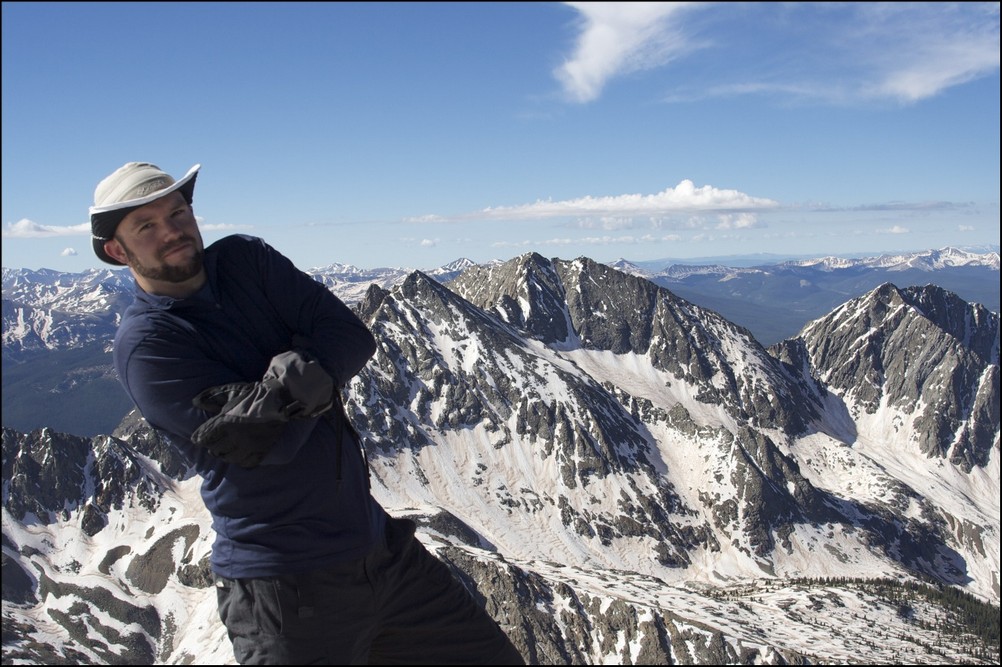
Matt Payne leaning to allow for a better view of the Three Apostles
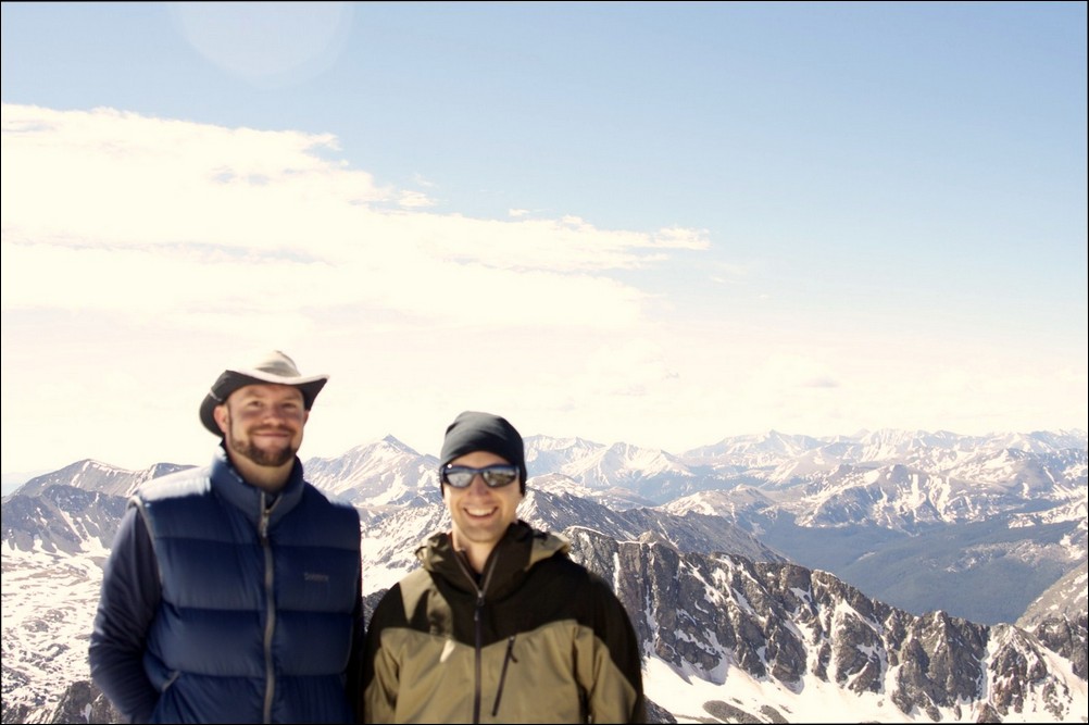
Matt Payne and Mike Vetter on top of Huron Peak
At this point we decided that after an hour of being on the summit we should head down to the ridge and make an attempt on Browns. Once down-climbing to the ridge, we were able to get a view of what we just climbed, decorated with a fair amount of snow still.
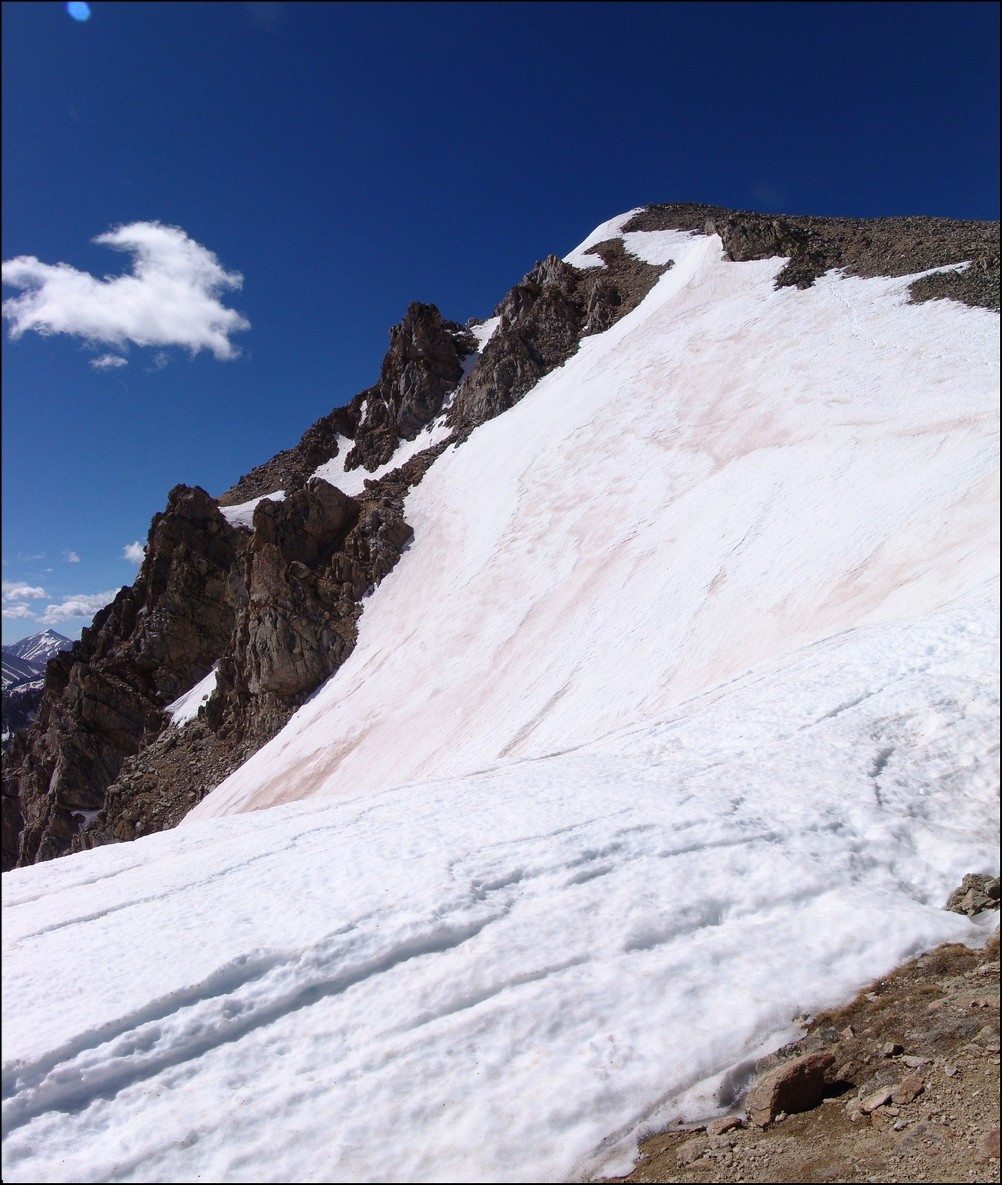
Still a lot of snow on Huron's eastern face
We took a look at our route - a straight ridge scramble to PT 13,518 and then to Browns.
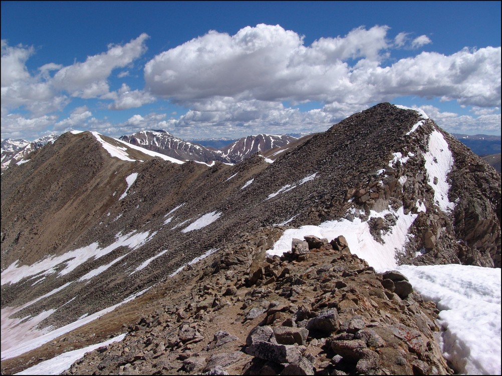
PT 13,518 and Browns were a straight shot from Huron's ridge. Mount Hope seen in the background.
We quickly scrambled up PT 13,518 without any problems and looked back at Huron. The further away we got from Huron, the more we could appreciate just how steep it was.
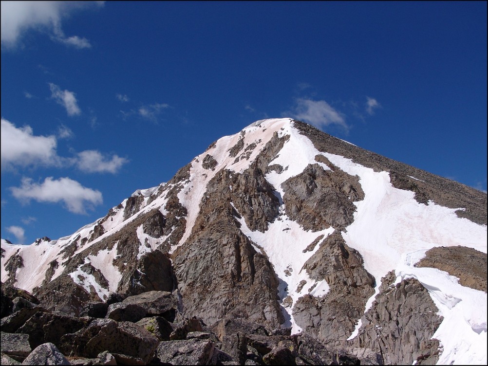
Huron rises high above PT 13,518 to the Northwest
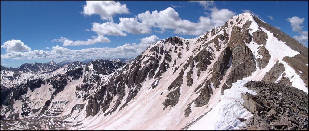
A zoomed in view of Huron from PT 13,518

A wider view of Huron and the surrounding terrain
After reaching PT 13,518, we took a look over to our next and final objective: Browns Peak.
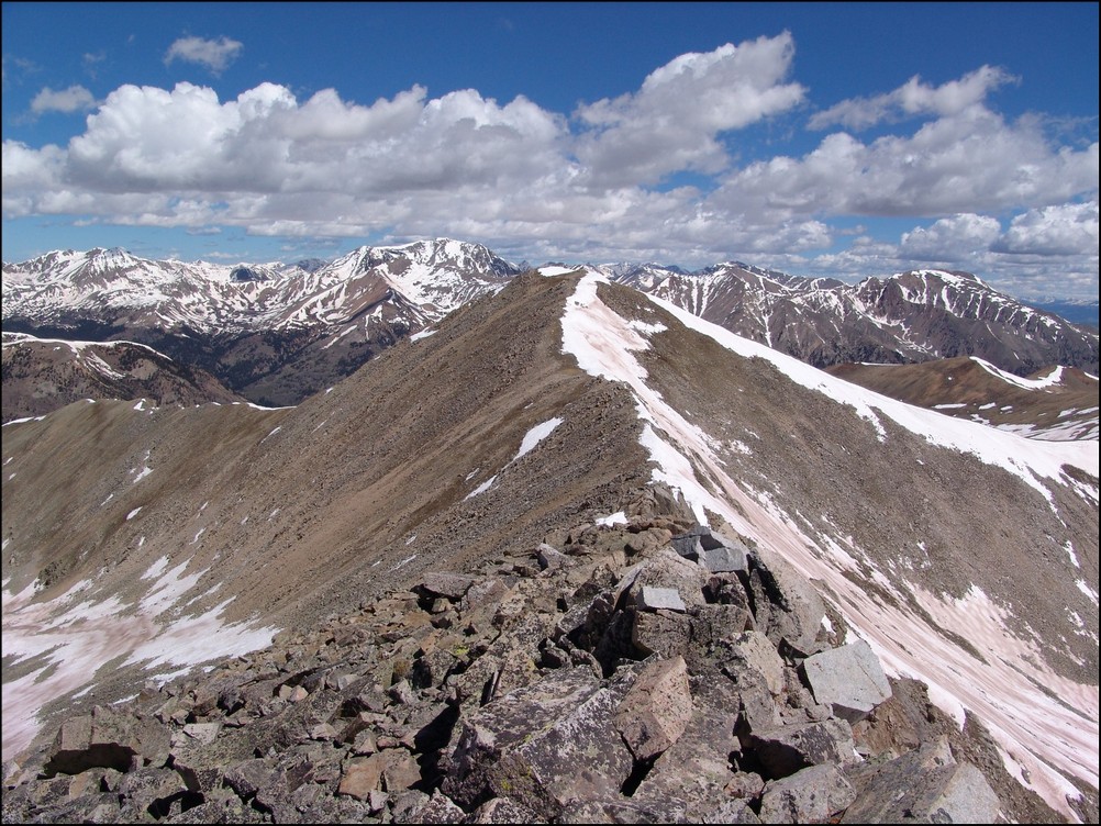
Browns Peak looked fairly easy with La Plata Peak behind it
On the way over to Browns, we were able to get a really awesome view of a nasty cornice, which looked more like a frozen tidal wave.
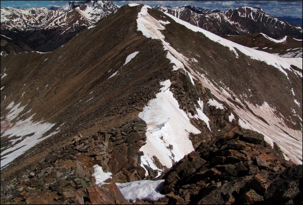
A huge cornice sitting in the saddle between PT 13,518 and Browns
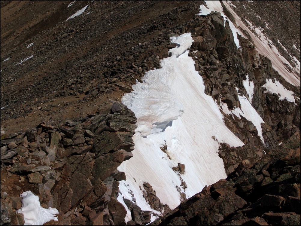
A closer view of the cornice
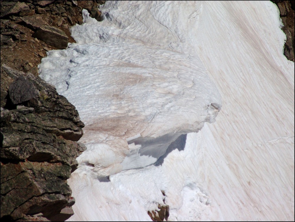
A super-zoomed in view of the cornice
After a bit of mild scrambling, Mike and I reached the summit of Browns in quick order. The clouds were looking to get worse and worse, so we decided that after Browns that we would go ahead and head back down to the trail below us, making our own route down off of Browns and connecting with the Huron trail.
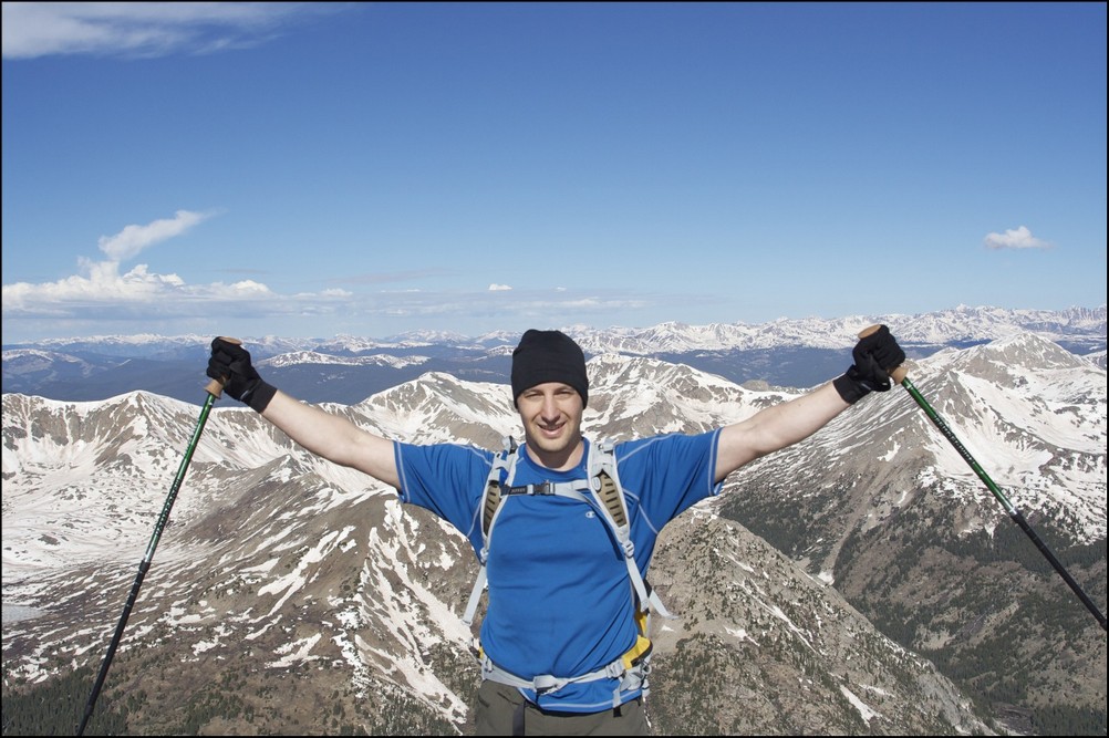
Mike Vetter celebrating on the summit of Browns
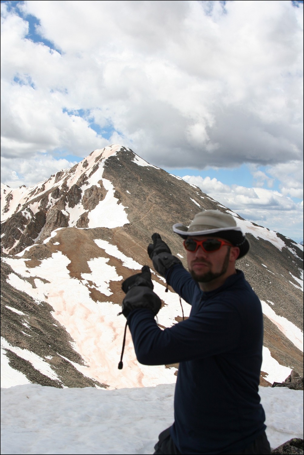
Matt Payne points back to Huron from Browns
We dropped off the north face of Browns just a few hundred feet and went straight down a scree gully. The dirt was quite loose but manageable. Soon after reaching the basin for Huron again, we were greeted by another large snow-field, which presented some pretty awful post-holing up to our wastes. Fortunately, my boots and gaiters kept my feet completely dry!
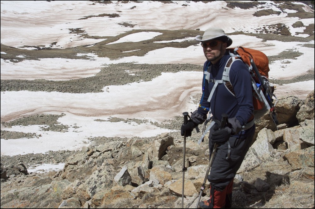
Matt Payne descending from Browns
After reaching the trail again, we headed back down the way we came and crossed the insane snow-field at the base of Huron. After a days worth of sunlight, the snow-field was quite soft and presented us with some unique and 'wet' hiking challenges.
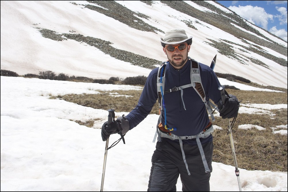
Matt Payne crossing the slushy on Huron
Once we reached the bottom of the snow-field, the way down was pretty quick to treeline and below to the trailhead and eventually my vehicle.
All-in-all, this was an amazing trip filled with great views. And I must say, I could not have hiked with a better guy. Thanks for driving down and climbing with me Mike!
To complete the trip report, here are three HDR photos I combined. I am new to HDR but I do like how it can enhance the light.
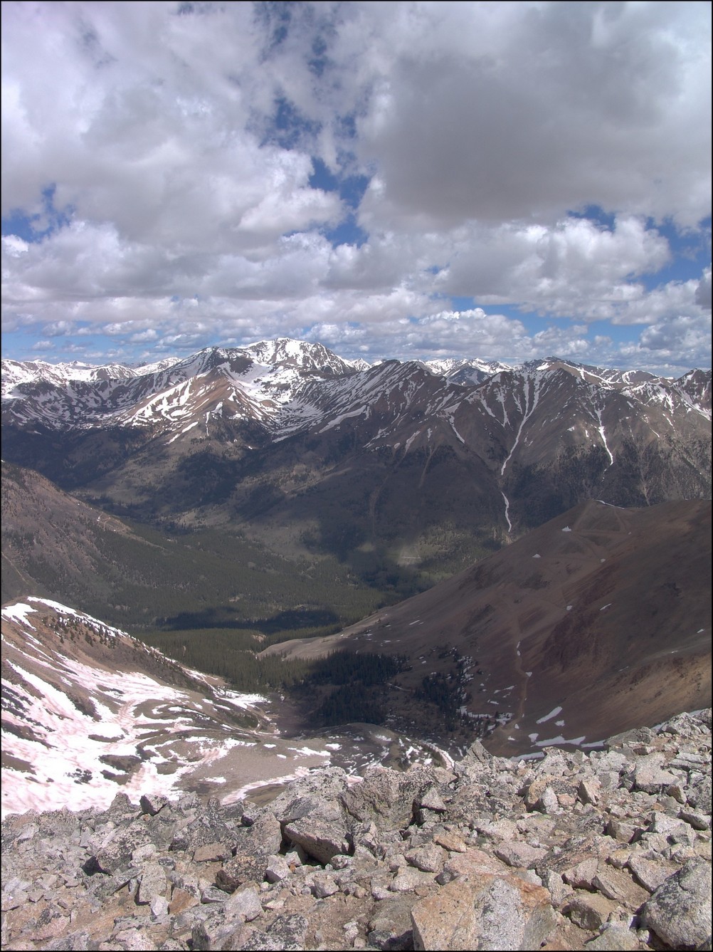
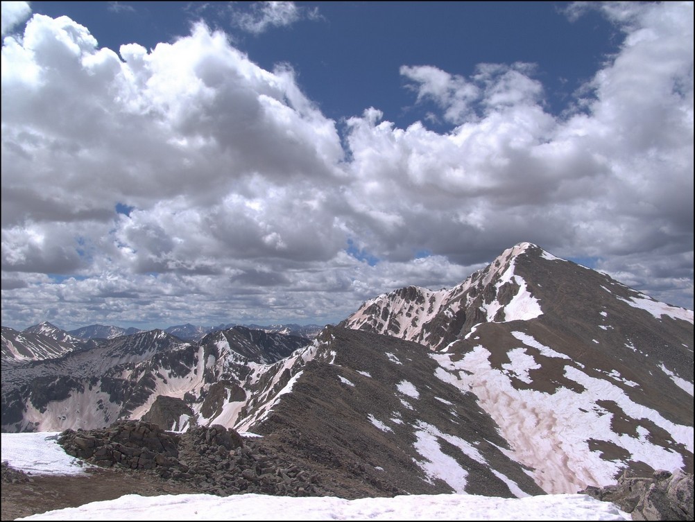
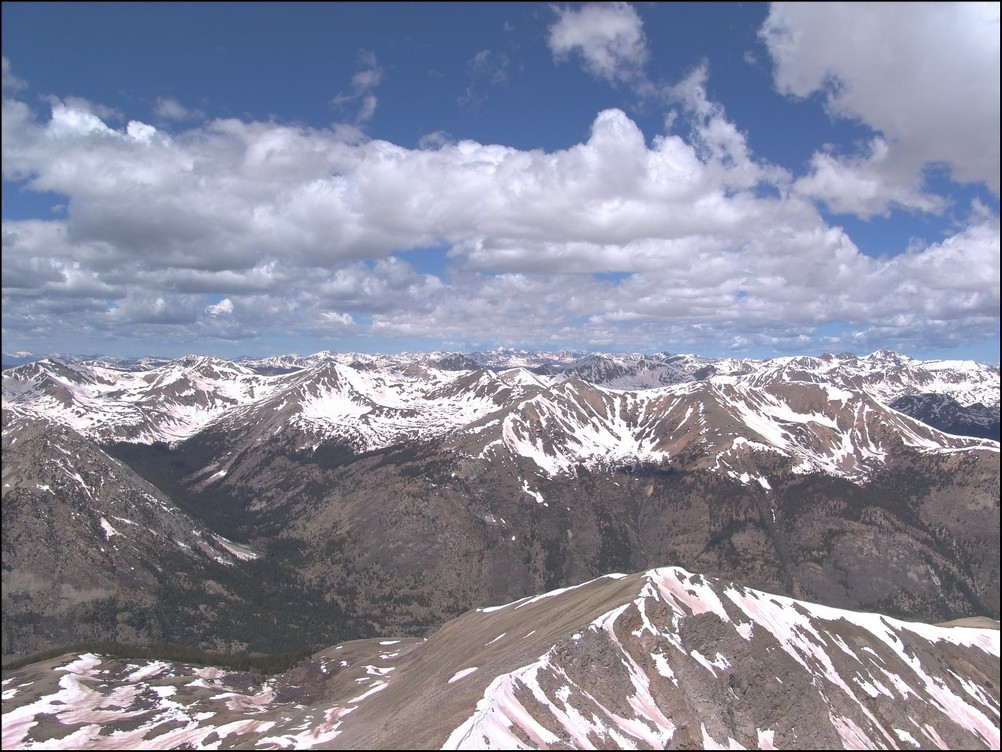
Until next time, enjoy Colorado's summits!