Displaying items by tag: Thunder Pyramid
Completing the Centennials - ending a decade-long goal on Thunder Pyramid
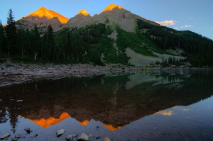
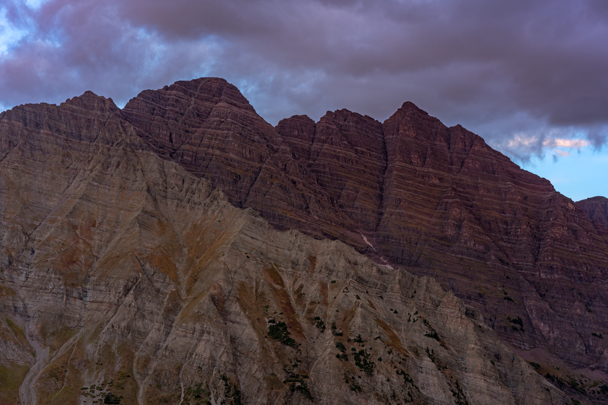
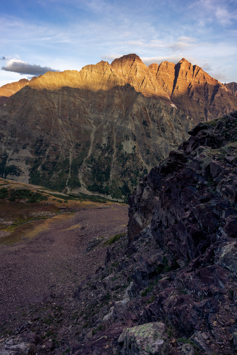
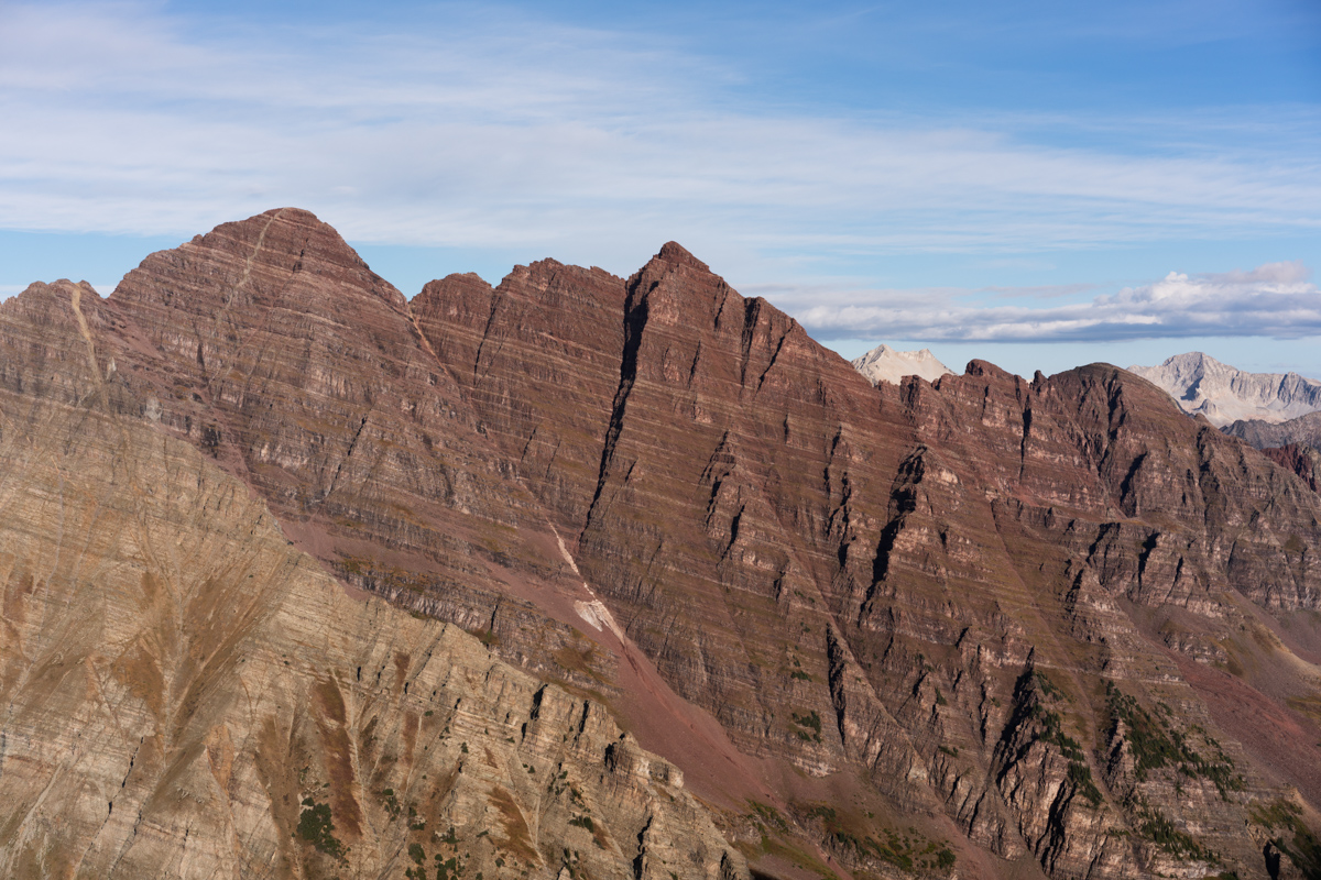
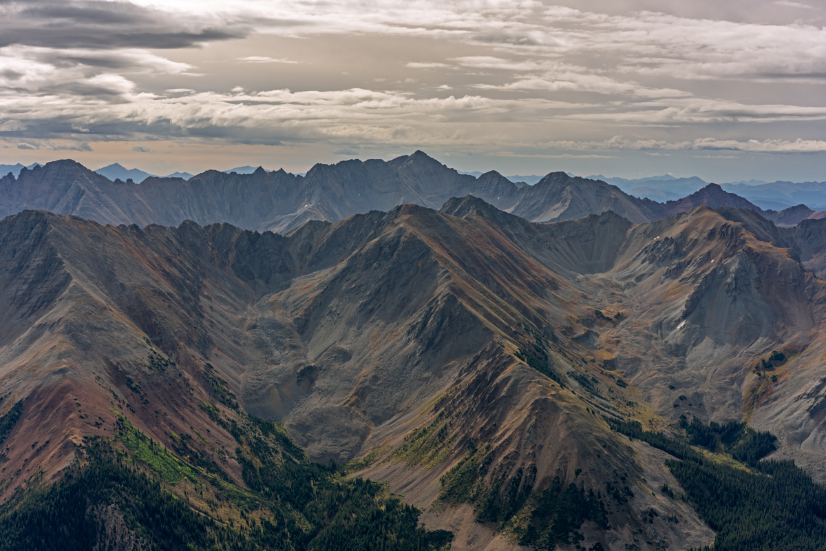
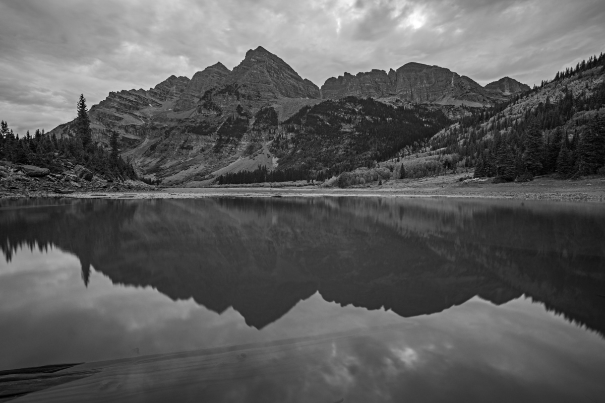
 Pyramid Peak and Thunder Pyramid as seen from Maroon Peak in 2012
At the start of 2018, I told myself that this would be the year that I would complete the Centennials (the highest 100 mountains in Colorado). For no great reason, I wanted to finish my goal before I turned 40 (I'm 39). It was a somewhat lofty goal considering I had lost my job in January, started a new job in February, and was not in the best physical shape of my life. I started this goal officially in 2009 and game out of the gates in a hurry. I had a headstart, having started climbing peaks when I was 4-years-old (1982). I had completed 22 / 100 by the end of 1998 when I was in college, but took a very long hiatus after that. I only completed 5 more peaks from 1998 to 2008. That means that between 2009 and the end of 2018, I completed 73 of the highest 100 mountains. That feels substantial. In January 2009, I built this website and began documenting my journey. This trip report may be boring in some ways so bear with me. It is my way of reflecting back on this journey and reminiscing on a goal completed. The following summaries don't include repeat peaks or other peaks not in the highest 100 that were climbed those years.
- In 2009, I completed 20 summits on the list.
- In 2010, I completed 12 summits on the list.
- In 2011, I completed 14 summits on the list.
- In 2012, I completed 5 summits on the list and finished the 14ers.
- In 2013, I completed 5 more summits and then moved to Oregon.
- In 2014, I completed 1 more summit (how sad).
- In 2015, I completed 2 more summits (still very sad), but moved back to Colorado at the end of the year.
- In 2016, I completed 3 more summits.
- In 2017, I completed 3 more summits.
- Finally, in 2018, I completed 8 more summits and my goal. My average per year that I was actively seeking the goal was 7.3 - not bad!
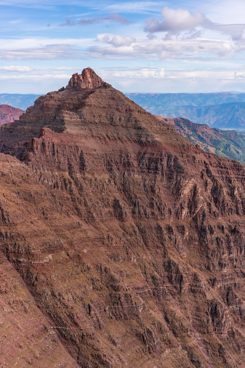
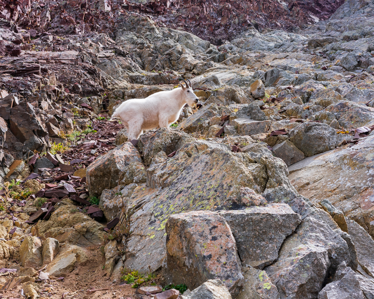
A mountain goat gazes upon Pyramid and Thunder Pyramid from the summit of Maroon Peak
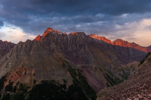
Regarding the subject at hand: I have been dreading Thunder Pyramid ever since gazing upon it in 2012 from the summit of Maroon Peak. The vantage from that position makes Thunder Pyramid unclimbable, the White Gully leading to the summit a straight-up nightmare. I had heard horror stories (all greatly exaggerated) of the looseness of the rock on Thunder Pyramid and many very exceptional climbers, including David Morano and Steve Gladbach, have perished on her slopes. The mountain was ultra-hyped in my mind and I was completely prepared for anything I found due to that hype. Anxiety is a powerful driver for some of us and I'm no exception.
As always, you can see and download my full route and GPS tracks over on the incredible app, Gaia GPS, which I use on my iPhone to plan, track, and follow my routes on these trips. It is absolutely invaluable and worth every cent. I personally love that you have full access to all USGS topo maps and National Geographic Trails Illustrated maps as well. You can use the app while in airplane mode and even save maps for offline use. To get a nice discount on the application, follow this link and you'll also support my efforts to keep this site running.
For this trip, I decided to pack quite a lot of camera gear (by the way, these are affiliate links and using them helps me pay for this site and to bring you better content):
- Sony A7R2 Camera
- Laowa 15mm f/2 lensaowa 15mm f/2 lens
- Zeiss Loxia 21mm f/2.8 lens
- Sony 55mm f/1.8 lens
- Sony 70-300 FE telephoto lens
- Feisol Tournament 3442 tripod
As usual, I used the beta from Gerry Roach's High Thirteener Guidebook. I was still using the 1st edition of the book; however, his new edition is available on Amazon after many years of waiting - rejoice! Also, huge shout-out to my good friend Kane Englebert who called me to give me some excellent tips on climbing this peak safely - thanks man!

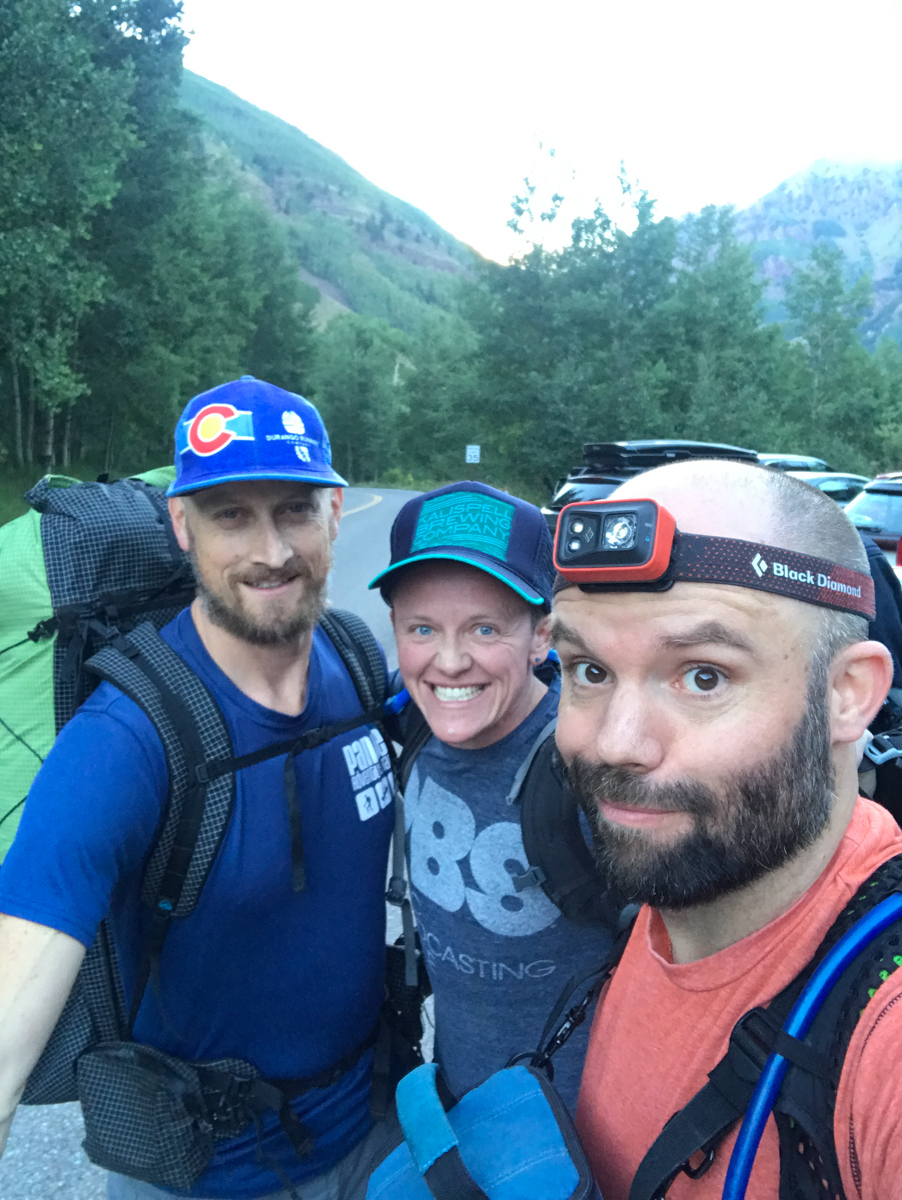
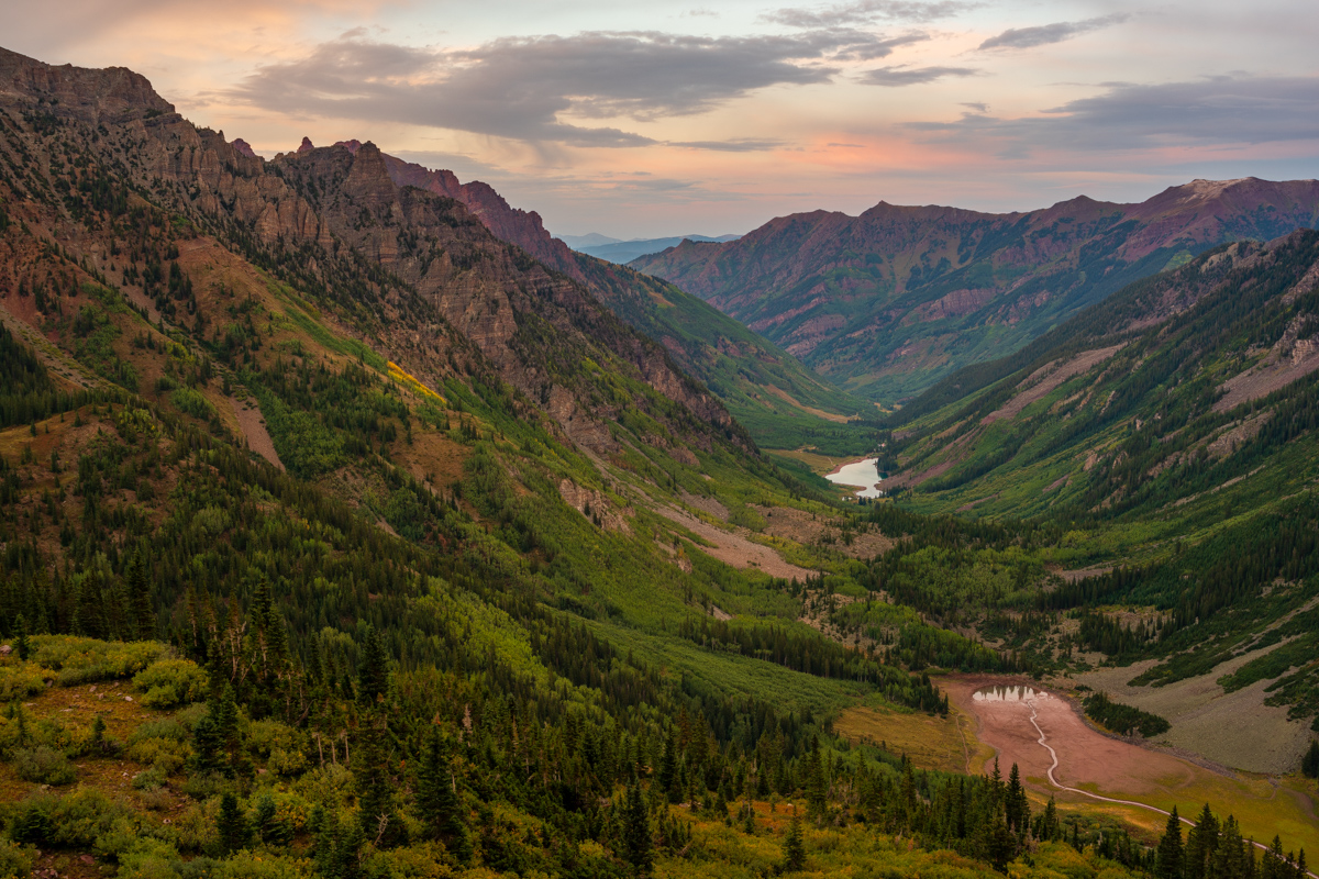
I decided to invite my two best friends for this final climb: Silas Musick, who has joined me on 16 of the highest 100 peaks; and, my friend Todd Myers. Since Todd was training for the Imogene Mountain Run in a week, he opted to just join us for the backpacking and stay in camp during the climb. The plan was for Todd and I to meet Silas in Aspen and then drive to the Maroon Bells parking lot together. Todd and I left Durango at noon on Friday. We met Silas at 6 PM in Aspen and we were all at the trailhead and ready to hike at 7:30 PM. We were planning to backpack to Crater Lake, set-up camp, and then get up really early for our attempt on Thunder Pyramid. Silas also had North Maroon on his radar and so we knew we would be in the area for a few days. The three amigos began our trip up from the lake in high spirits.
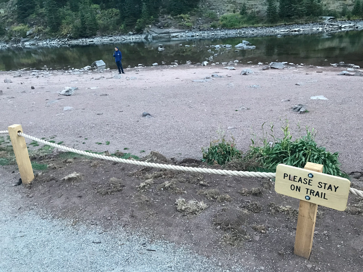
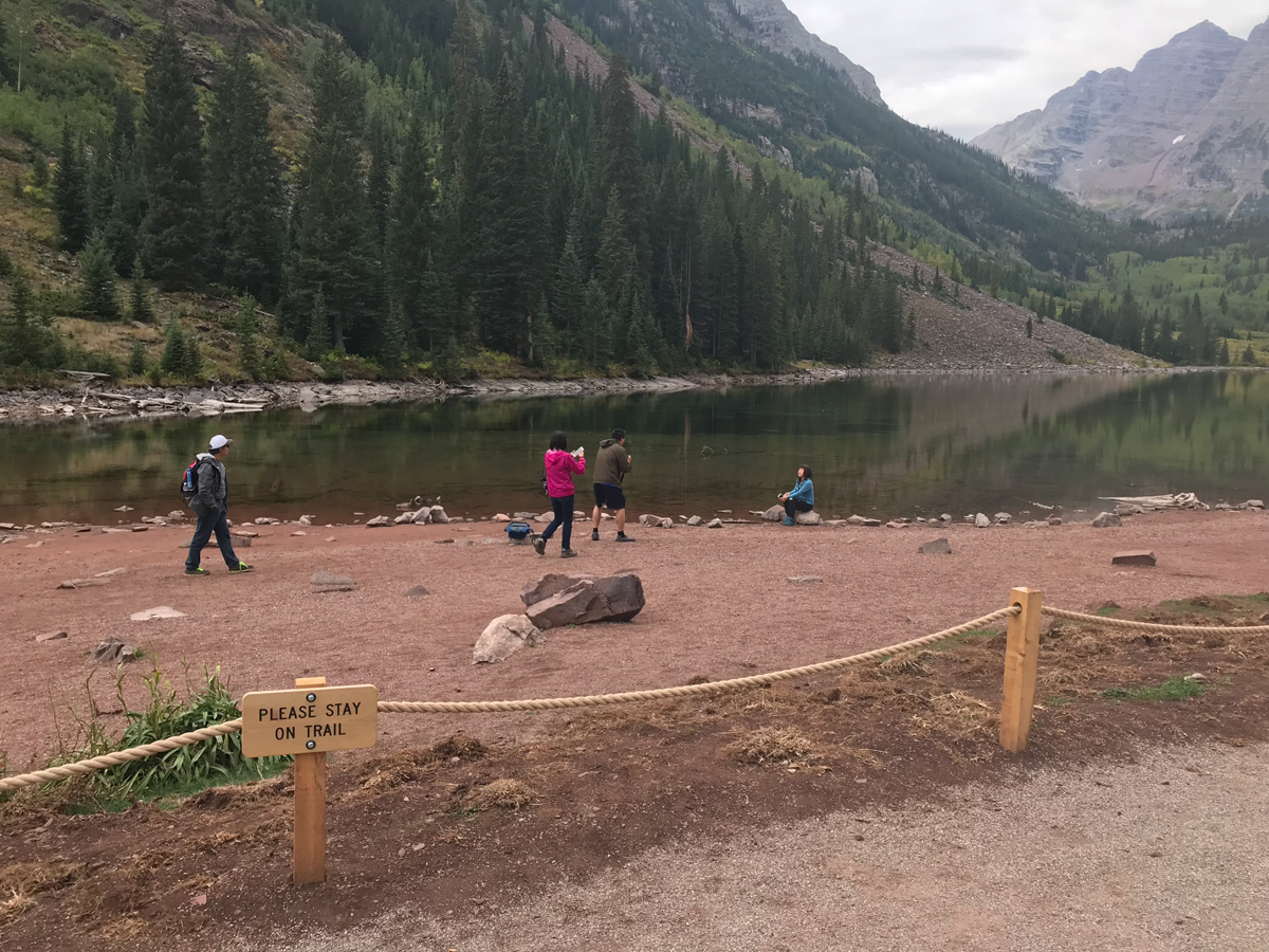
I was surprised to find that Maroon Lake had a rope surrounding it - which will not bode well for those looking to photograph it during autumn colors. Already, we found lots of people that simply disregarded the signage to stay on the trail, despite a sign being visible on the rope every 20 feet or so. Seriously, how hard is it for us as humans to simply obey rules? Do folks feel like they are above them? Anything for Instagram? What's going on here? You may not agree with the rope, but if you're going to enjoy public lands, you need to follow the rules. While they may sometimes be poorly implemented, we should still follow them. For more on the Forest Service's decision to rope it off, see this link.
We arrived pretty late at our campsite and set-up in the dark. There was an abandoned tent at our site - one of those cheap Walmart tents. I sure don't envy the job of the Forest Service to keep these places looking halfway decent. The total disregard of Leave No Trace principles is quite astounding. OK, off my soap box! Silas and I set our alarms for 3:45 AM and hit the sack.
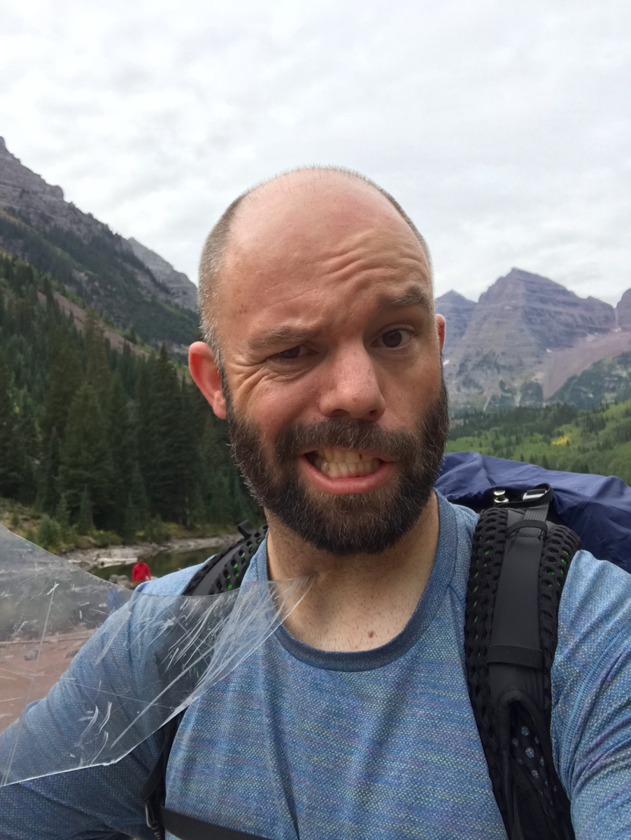
We woke up at 3:45 and left camp at 4:00 AM. The forecast for the day was not great; however, it was also looking like the best weather window for the weekend. We anticipated early storms and lots of clouds in our future and wanted as early of a start as possible. While this meant hiking up the first section of Thunder in the dark, we felt it was a good choice.
After hiking about 10 minutes, a young man by the name of Austin stopped us on his way down from above asking if we had cell phone reception. We of course did not and explained that you would have to go all the way into town to get cell reception. He explained that his father, Brad, had altitude sickness and asked him to go down to get help. We explained that the most important thing was for his dad to get down and for someone to help him do that. We urged him to go back up and get him. He reluctantly agreed and hiked with us to the Thunder Pyramid turn off. We wished him luck, made sure he had food and water, and went our separate ways. More on that story later!
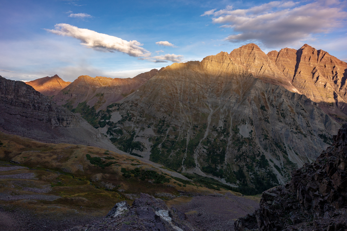
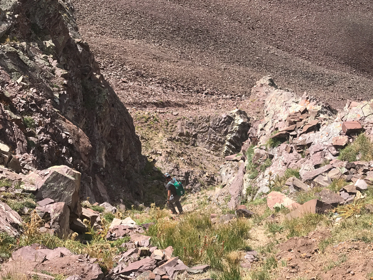
We had a tough time finding / following the trail from the cairned turn-off for Thunder Pyramid. We ended up bushwhacking up steep forested garbage until we reached the first cliff band. We followed that cliff band to our left to a weakness and followed that weakness up to another cliff band. This pattern continued until we found ourselves above treeline looking back on the Maroon Bells before sunrise.
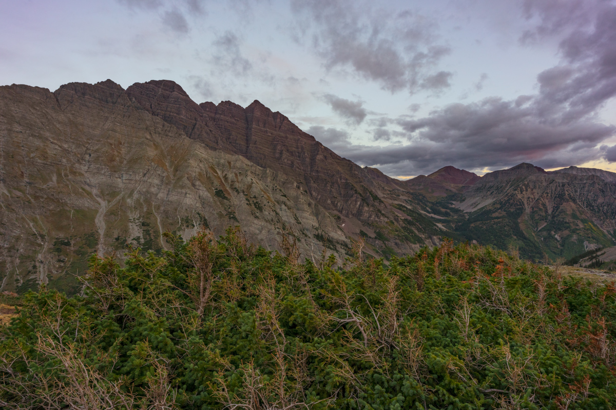
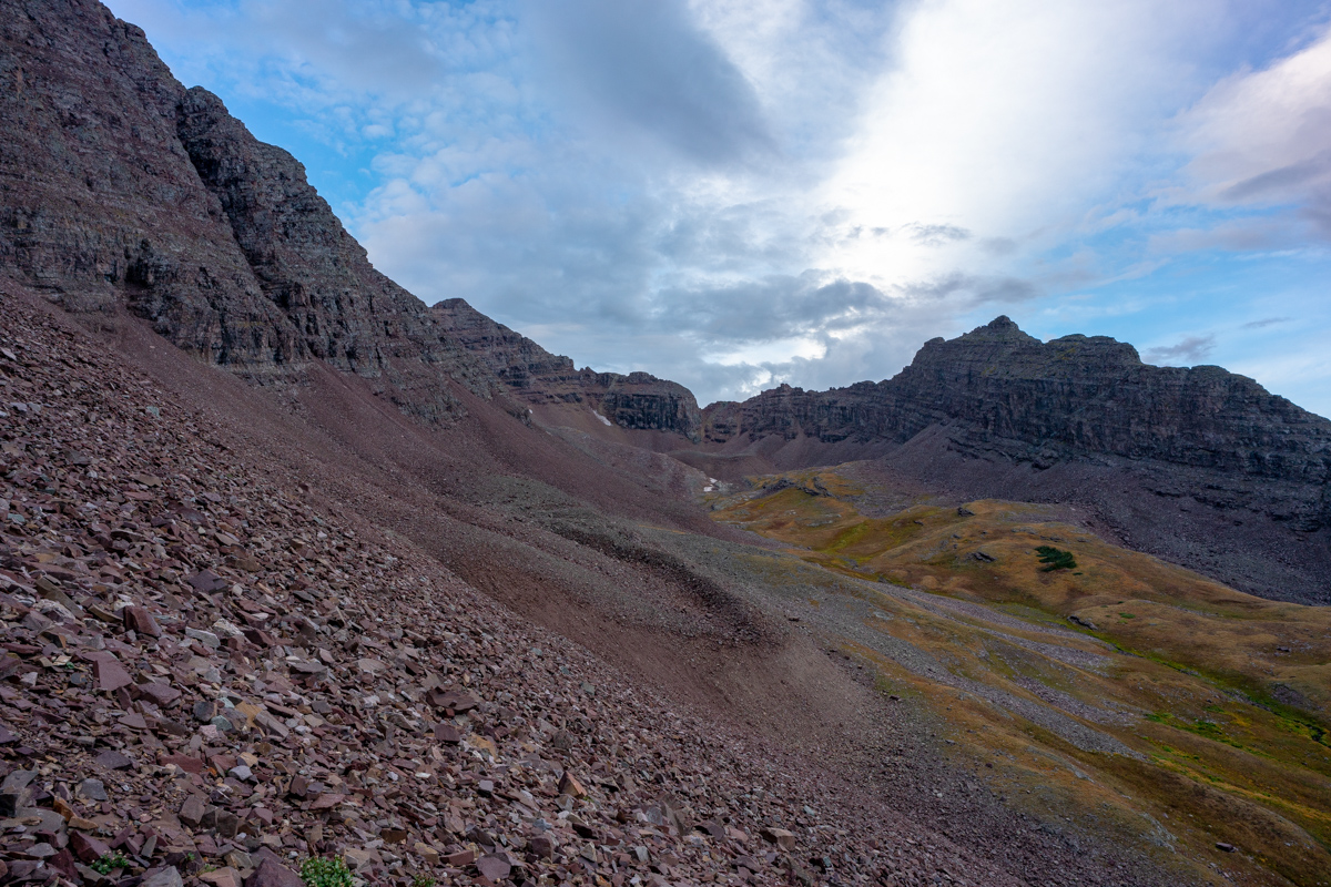
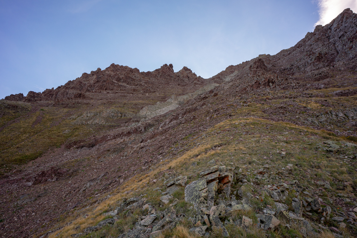
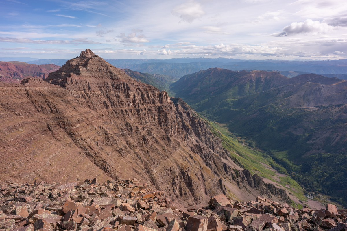
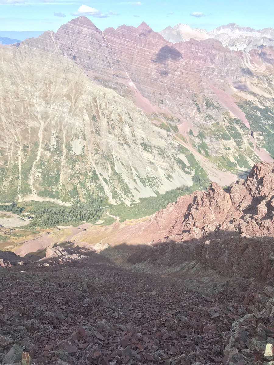
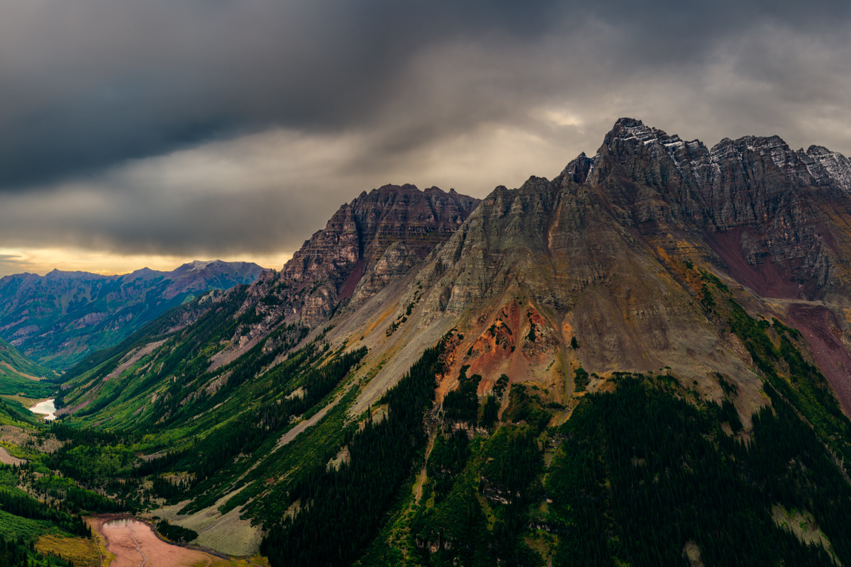
The sight of Thunder Pyramid above us was certainly sobering. Clouds were already forming to the north and we felt like the hardest parts were still yet to come. We knew the next step was to identify a steep gully of talus and follow it more or less to the base of the famous white gully. We decided on the gully to the left of the really large one filled with junky talus.
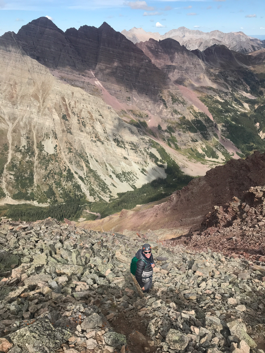
The talus was not too terrible or awful, but it was certainly made of the same garbage Elk Mountains stuff we had grown distateful of on Maroon and Pyramid in previous climbs. I personally found it quite inviting compared to my experience on Cathedral Peak!
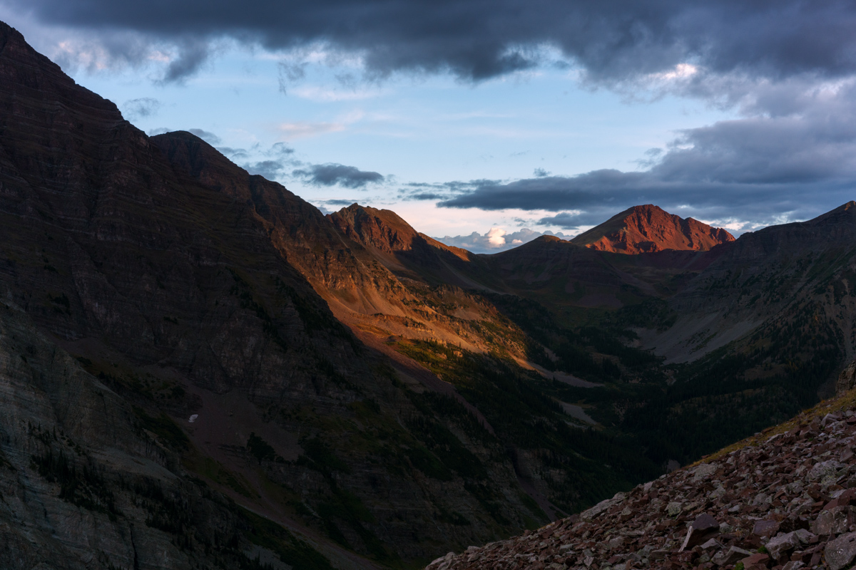
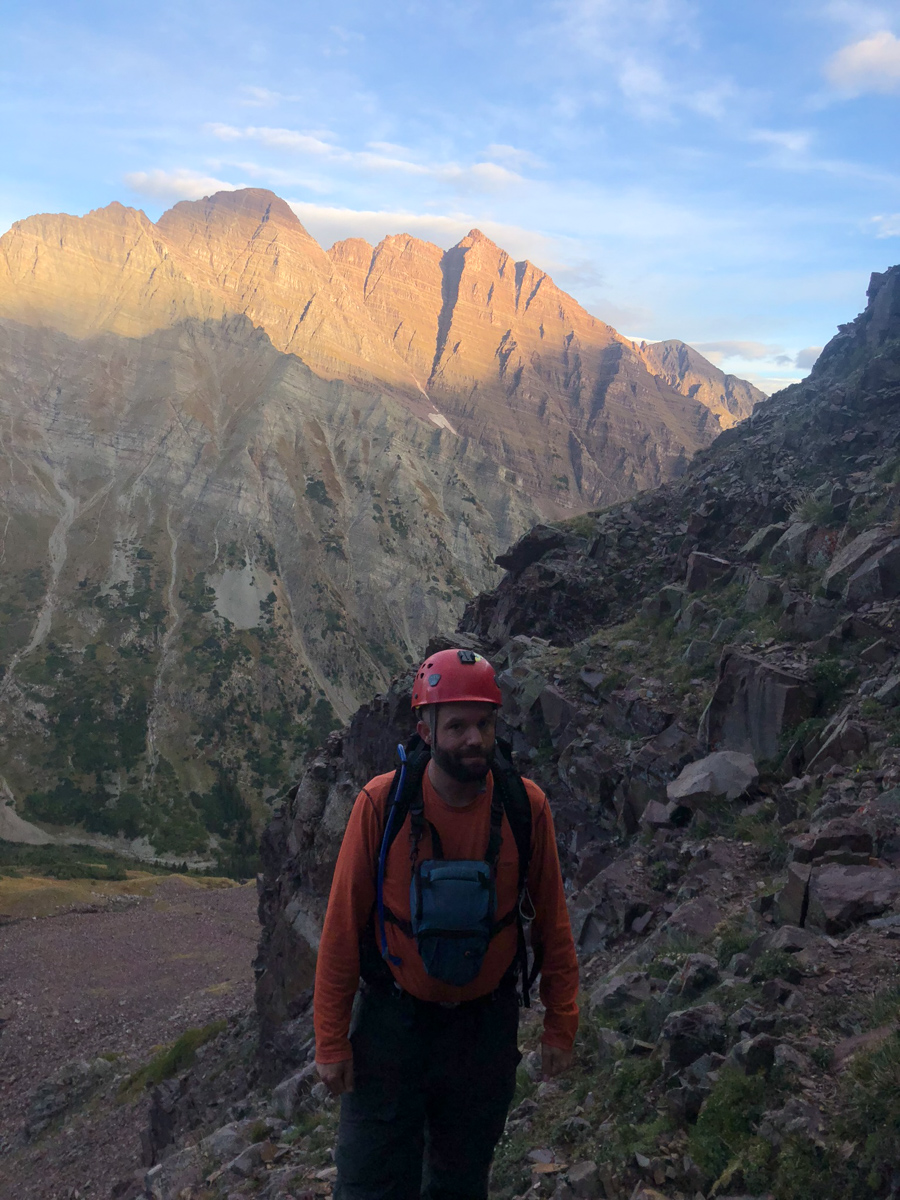
As we ascended the gully, the light over on Buckskin Benchmark to the northwest was looking quite fine!
And naturally my gaze was constantly drawn by the Maroon Bells. What a magnificent pair of peaks to be able to stare at throughout the day.
Silas was armed with cell phone and Spot GPS, and I was armed with my Sony A7R2 and my cell phone equipped with Gaia GPS. Technology has really come a long way in a short amount of time since I started documenting these climbs!
As we climbed up into the gully, the views above Len Shoemaker Ridge were getting really nice. I don't love climbing on the rocks in the Elks, but damn they make for great scenery!
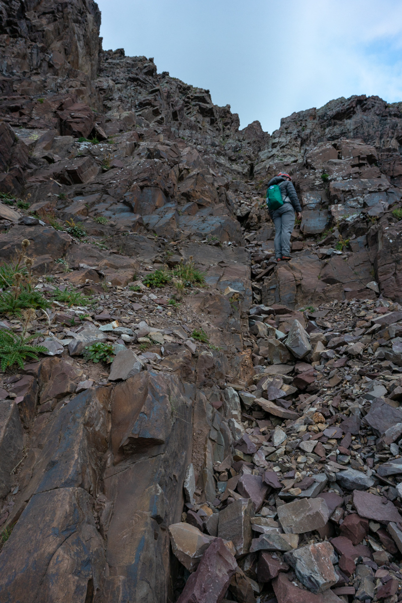
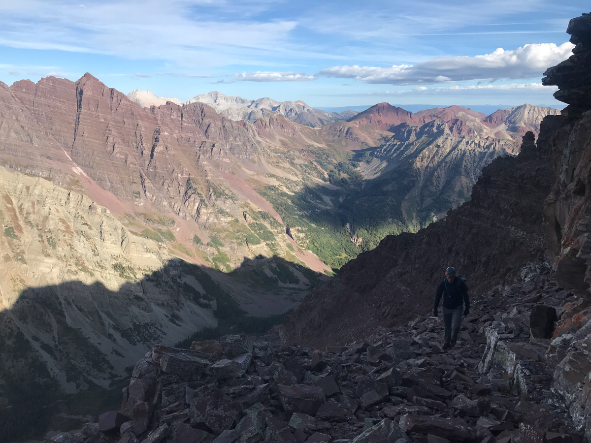
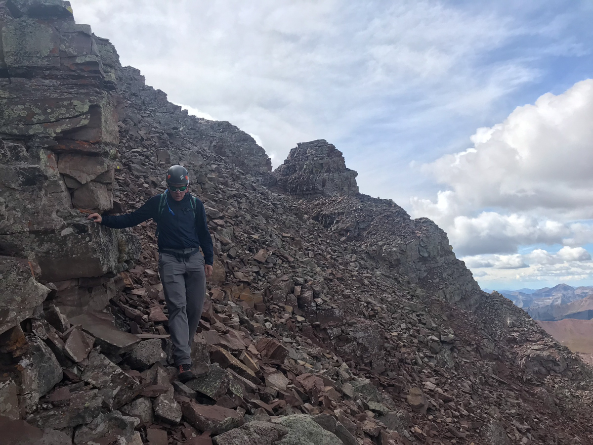
Below you can see another good view of the gully we chose to climb up, which I felt was very solid class 3 climbing all the way up until we turned off to the left.
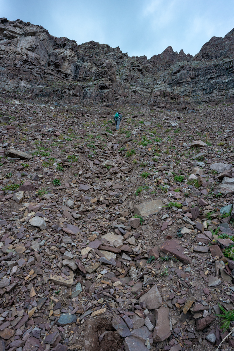
More views of the class three climbing...
And finally the sun hits the Bells and makes me a happy dude.
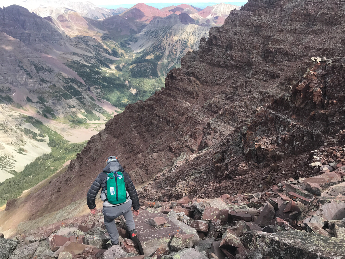
I took advantage of the great views of the Bells to showcase the terrain down below us in the gully. I think this photo does a good job of showing you the complexity of the rock in this section.
I also found myself quite enamored by Bellview Mountain, which is seen left (south) of the Bells in the photo below. I really would like to climb that one someday. I bet its an incredible vantage of the Bells; aptly named indeed.
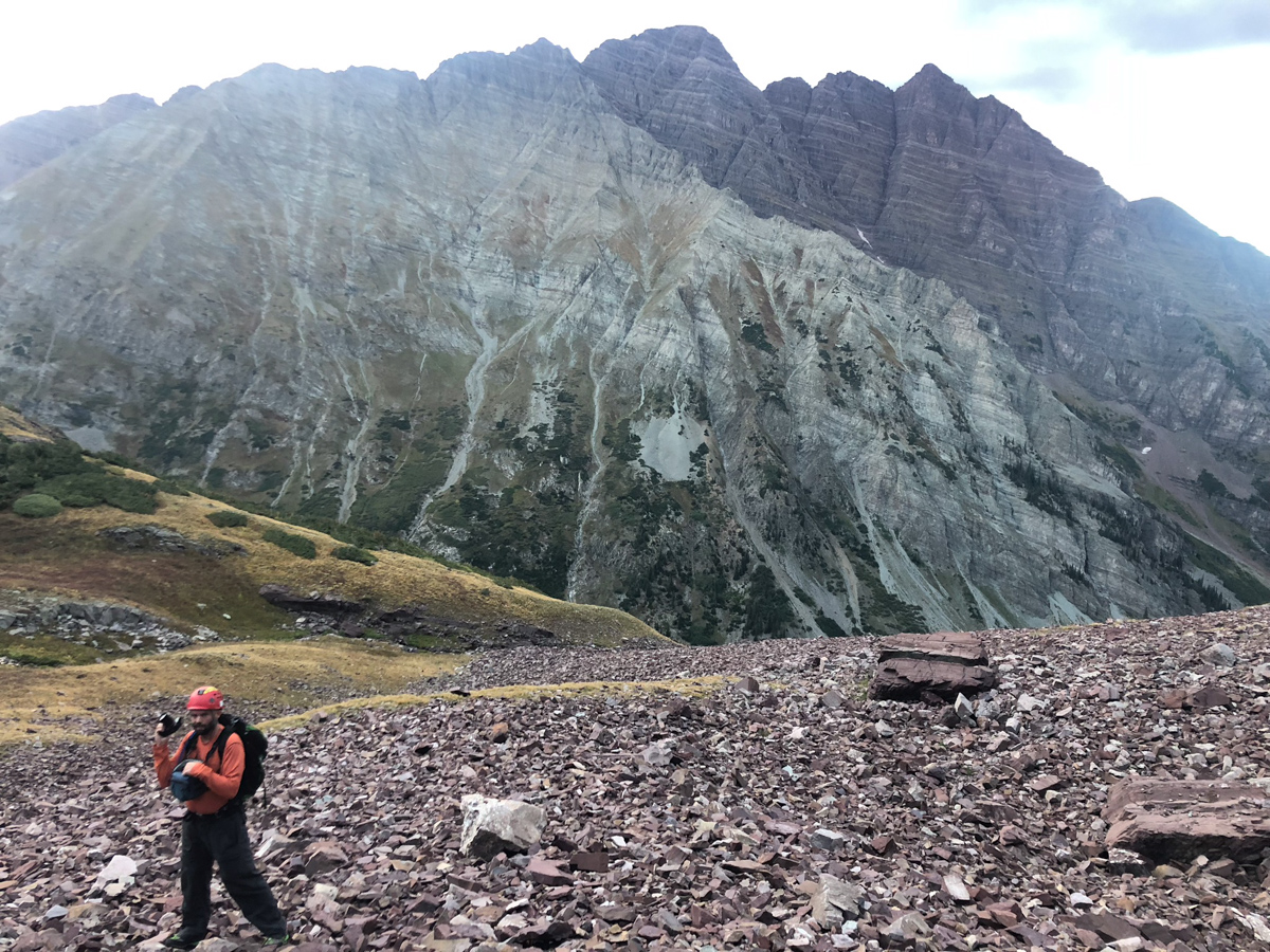
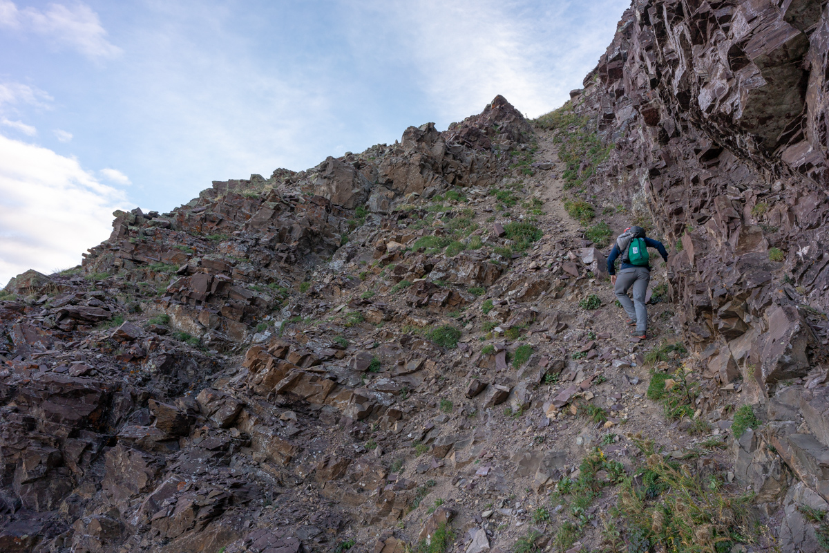
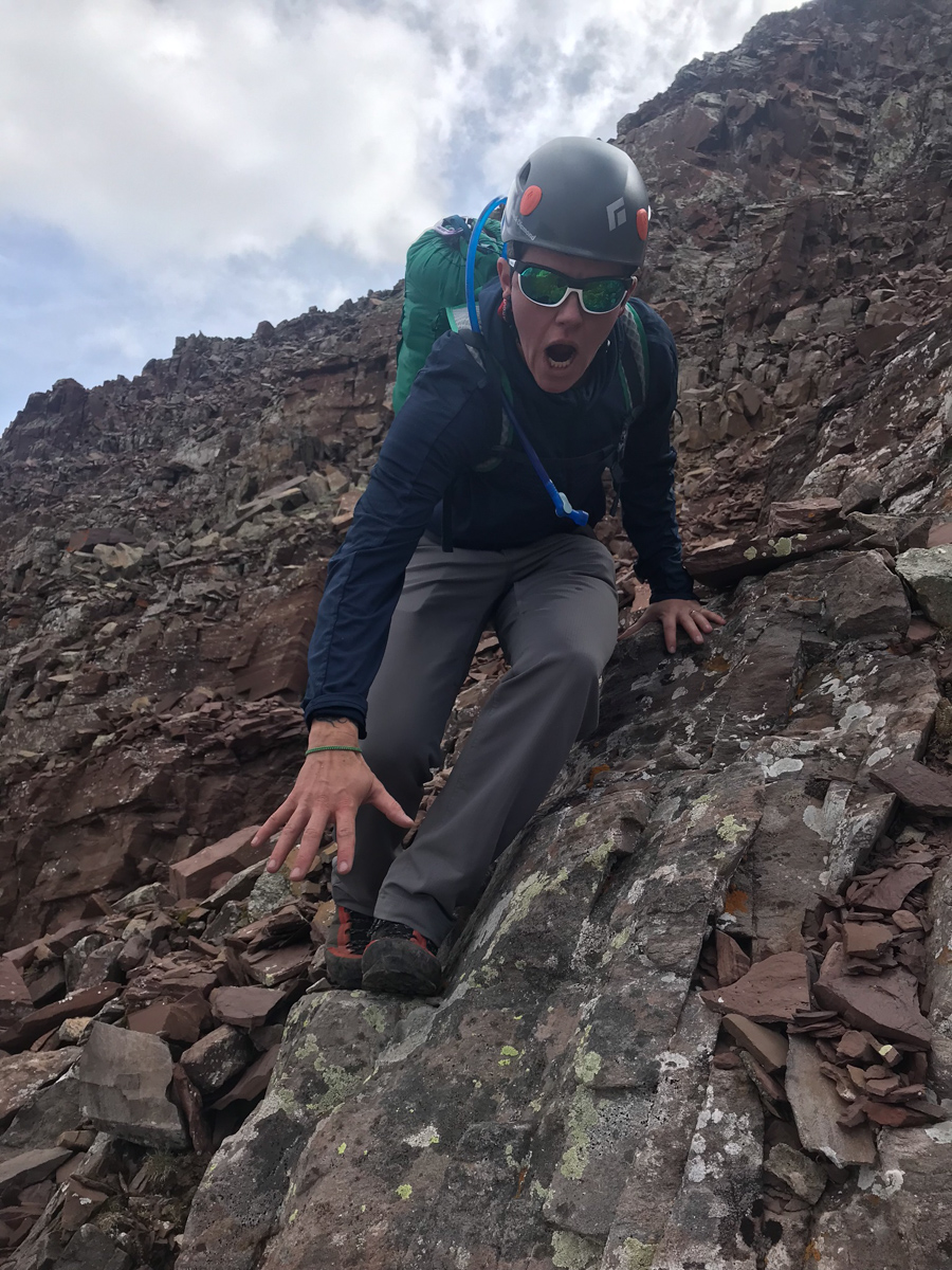
Once we reached the top of this gully, we saw a noticable trail heading left up a very steep dirt and rock slope below the next cliff band. We decided to take it. I knew it would probably lead to the base of the white gully. The trail is what I describe as a "climber's trail," aka - not very solid, very loose, and very steep!
After reaching the top of this section, our view of the Bells really opened up and I could not have been more happy with it.
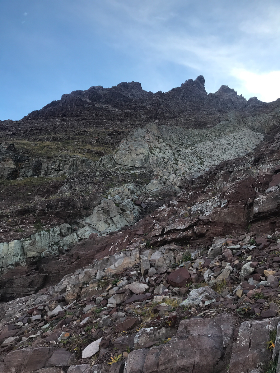
Indeed, the famous white gully came into full view and revealed our future. I was excited to reach this section finally. There was a decent trail all the way up to the base of the gully from here.
As predicted, the white gully was much less daunting up close than from afar. Many of climbers warned me of the loose nature of the rock in the white gully and I was prepared for anything.
It was at this point that I decided to film the rest of the journey to the top with my GoPro Hero 4. I created a 30 minute video which is in hyperlapse format with pauses at key moments. I'm not a professional video editor nor do I have the time to edit this to give it full justice, but I figure it serves as a nice beta for folks wanting to know more about the white gully, the final segment, etc. Also, its fun for me to look back on later in life.
About halfway up the white gully, we began to get great views of all the 14ers in the area. The below shot really intrigued me. It includes Maroon, North Maroon, Snowmass, and Capitol all in one frame. Nice! By the way, I did not find the white gully to be loose at all! We chose to stay high on the left side in the white stuff and it was very solid. Once exiting the gully to the right, things get much dicier.
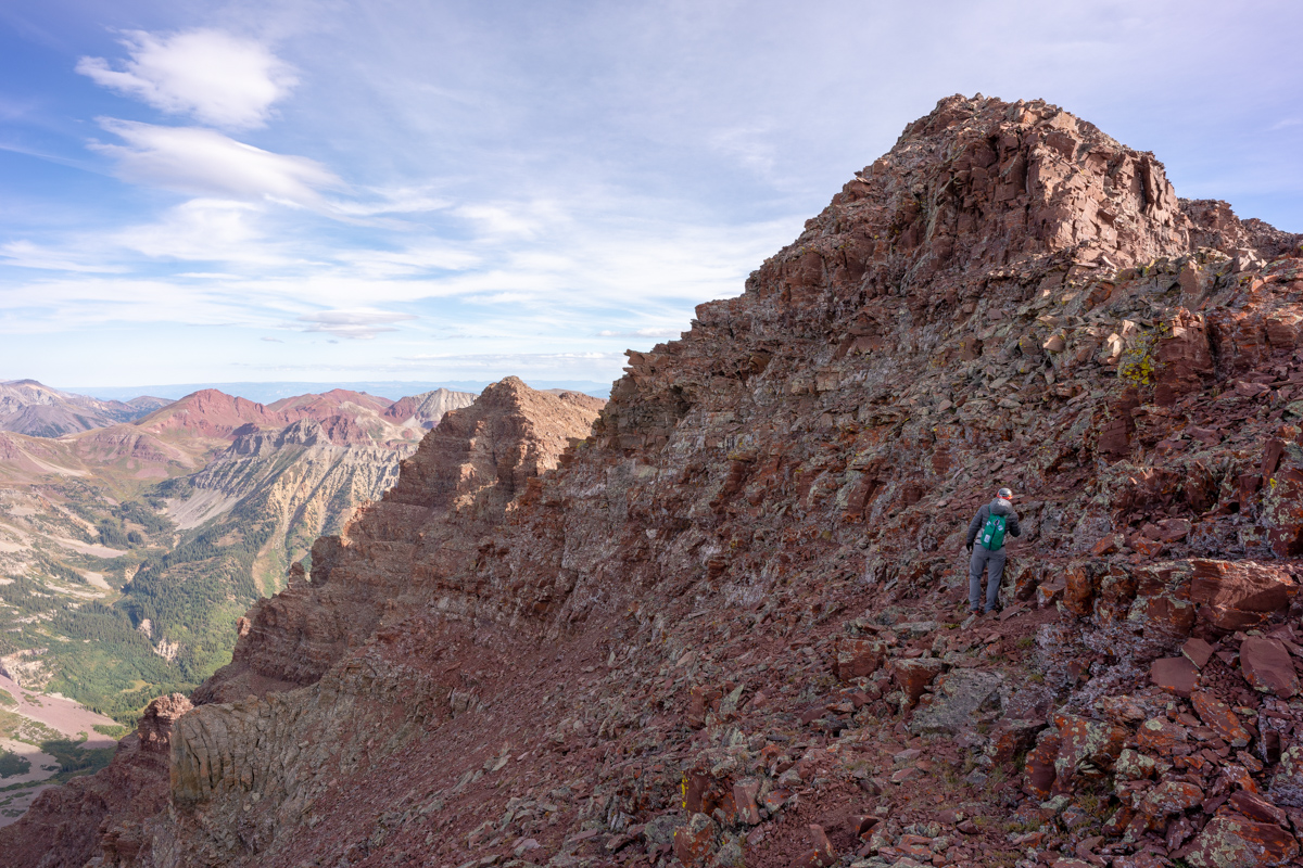
We exited at 13,400 ft. just as Roach suggests. There's a pretty obvious spot to exit below some cliff bands. We had to pick our way through some very nasty rock and maybe strayed a bit too far right into the next gully when we should have stayed high on the "ridge" here, but nothing was obvious at this point. We just went a couple feet at a time, making sure to stay close to each other and stay very mindful about potential rockfall above and below. It is more a mental exercise than a physical one from this point forward.
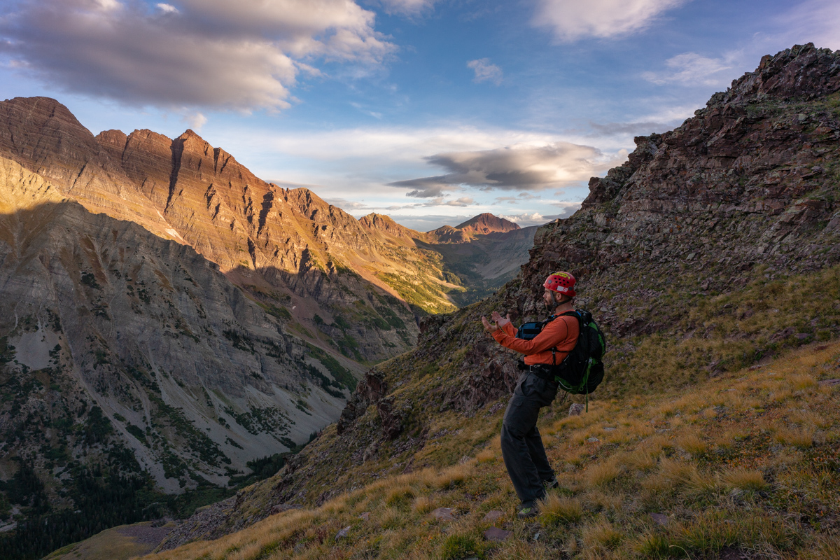
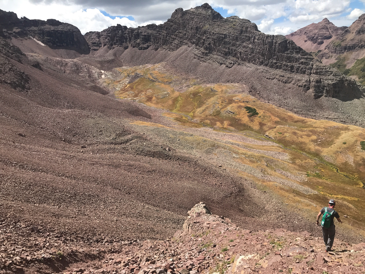
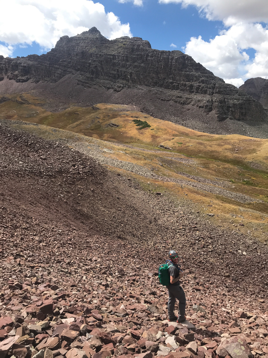
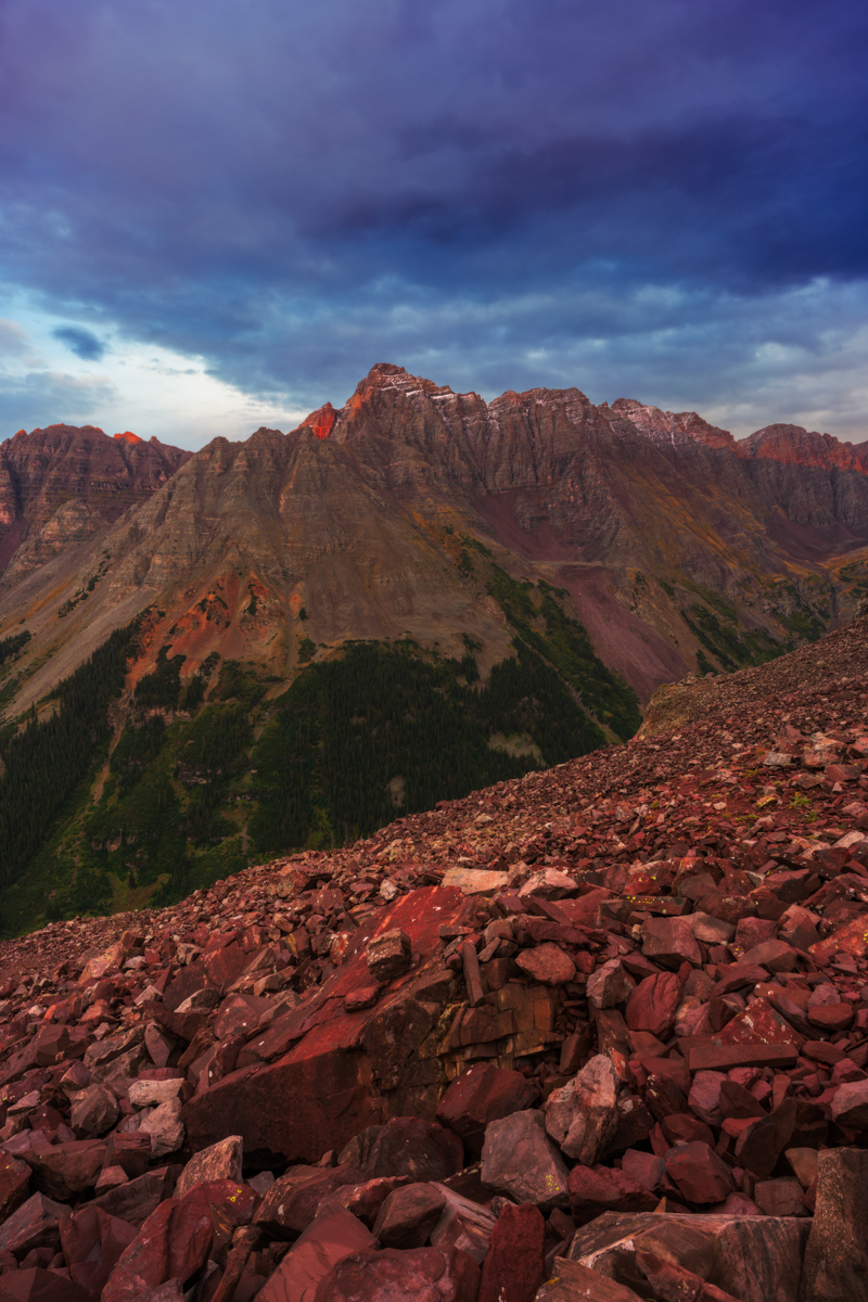
Just below the saddle between Thunder Pyramid and Lightning Pyramid, we found it best to cut under more cliff bands and stay high on lighter colored rock as pictured above.
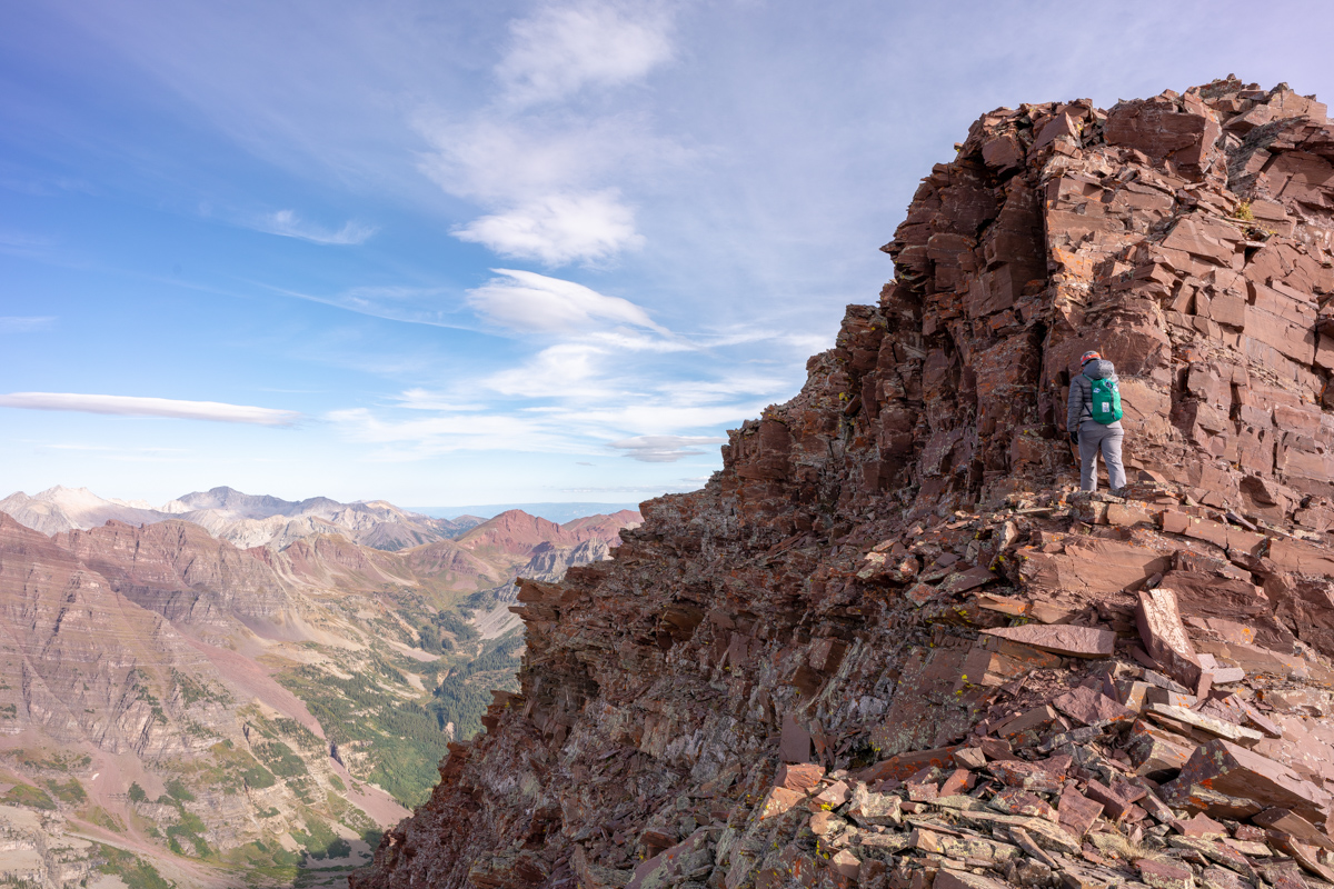
Once we reached the saddle, it was very clear where to go next and we were feeling very excited to be so close to the top!
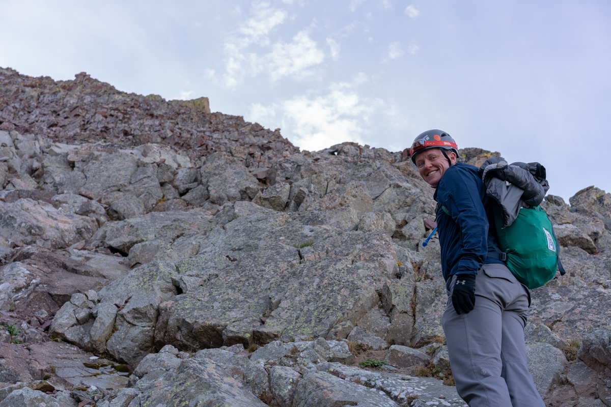
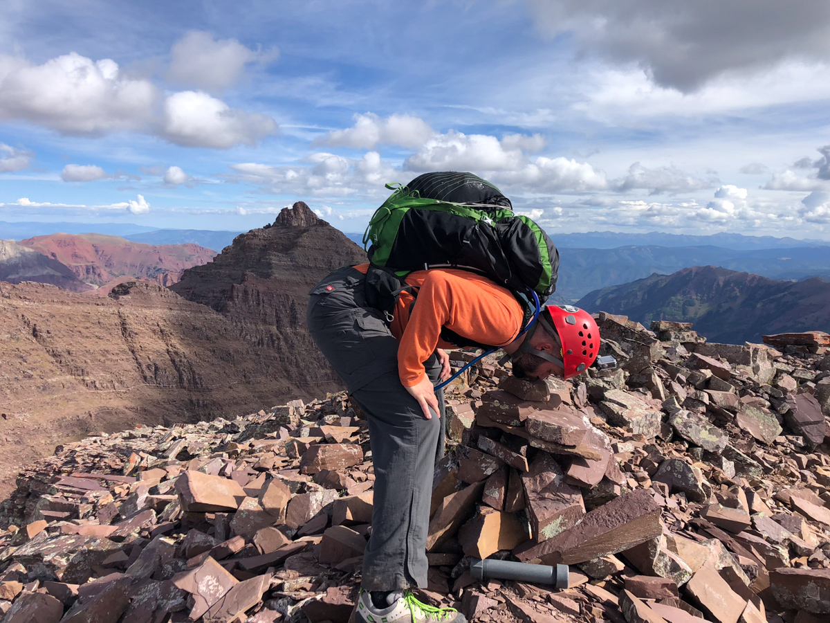
I let Silas go first as I wanted him to film me ascending the final section.
They very last section, which you can see on the earlier YouTube video, was pretty simple to find the solution too, but it did require some easy class 3 chimney climbing. A real joy, to be honest. We just had to be ultra careful about the loose rock above the chimney, as it was ubiquitous and precarious. Below is Silas' film of me arriving at the summit. What a crazy feeling it was.
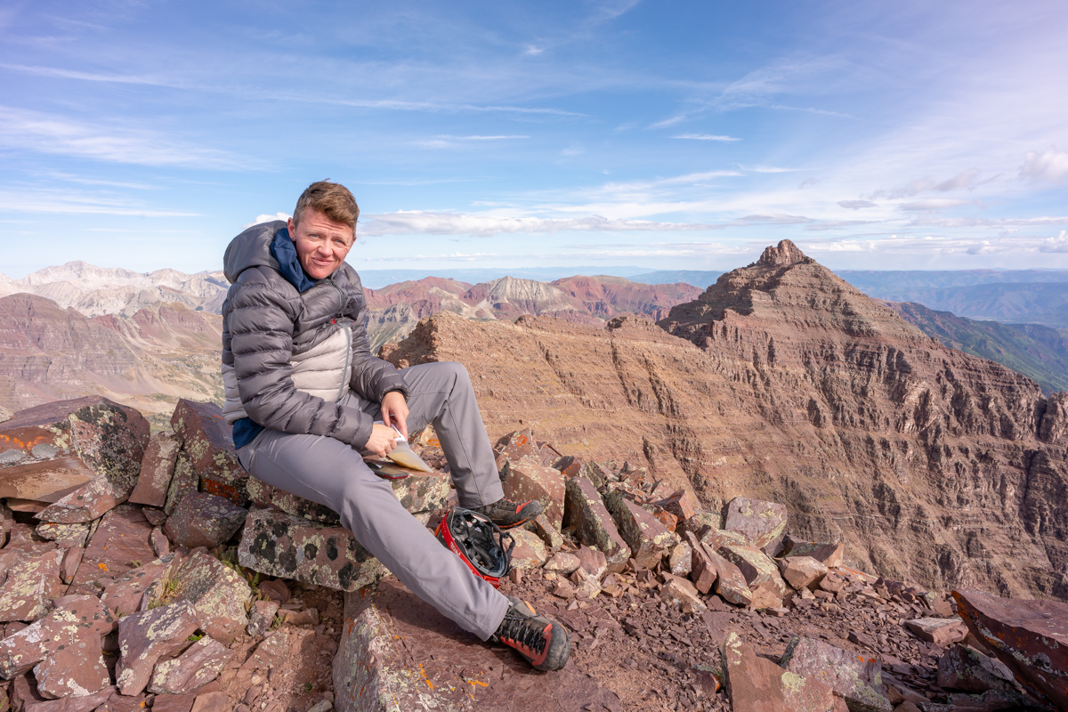
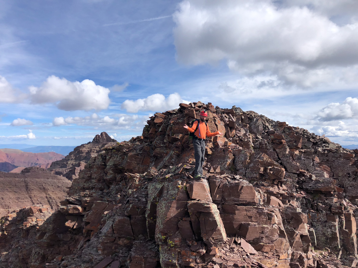
Nerd move! Number 100!
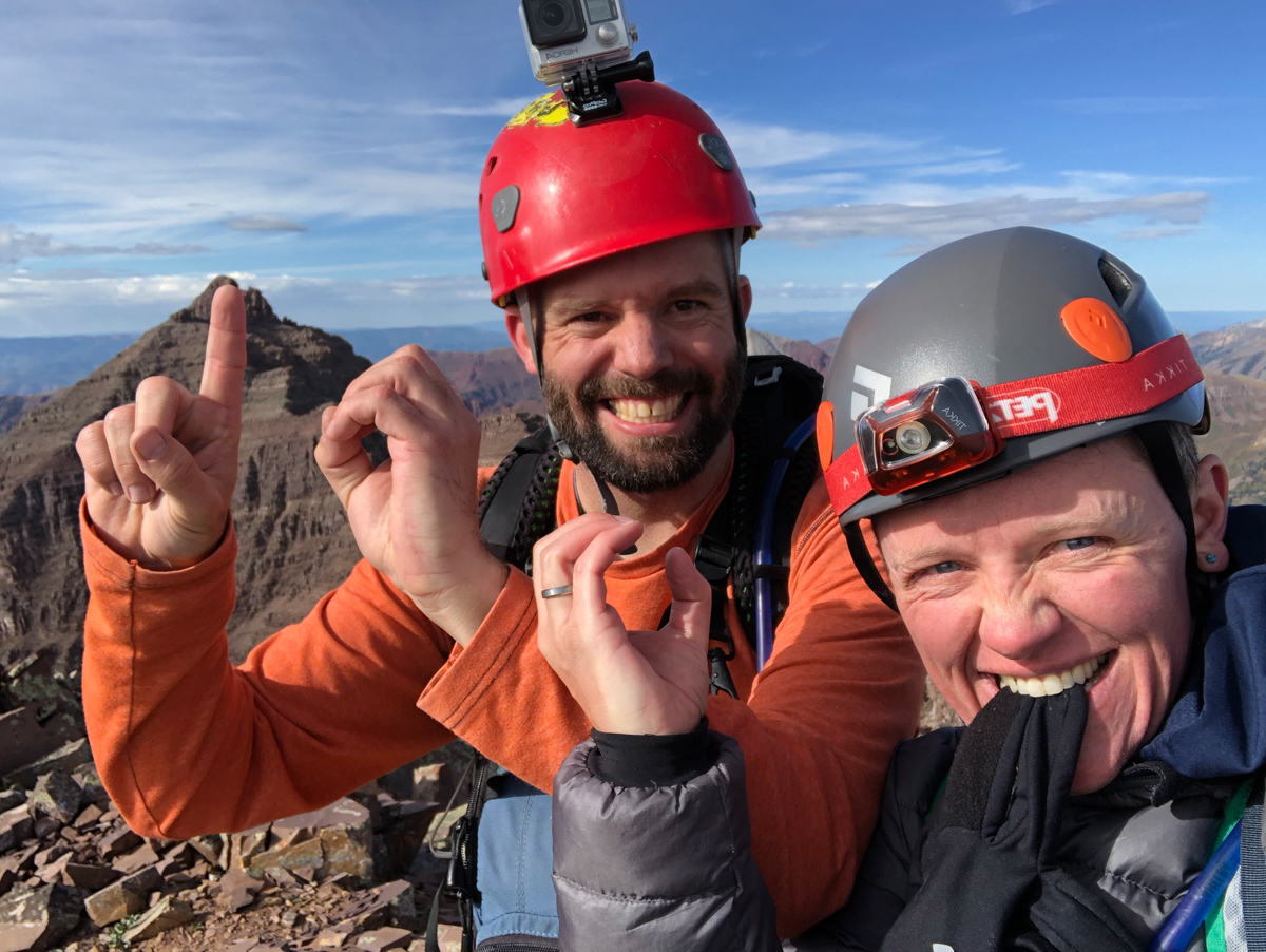
Upon arrival, the first order of business was for Silas to surprise me with a letter written by my mom and dad for Silas to read upon us reaching the summit. It was so incredibly heart-felt and I teared up big time. The video of me reading it is below. Thanks mom and dad!
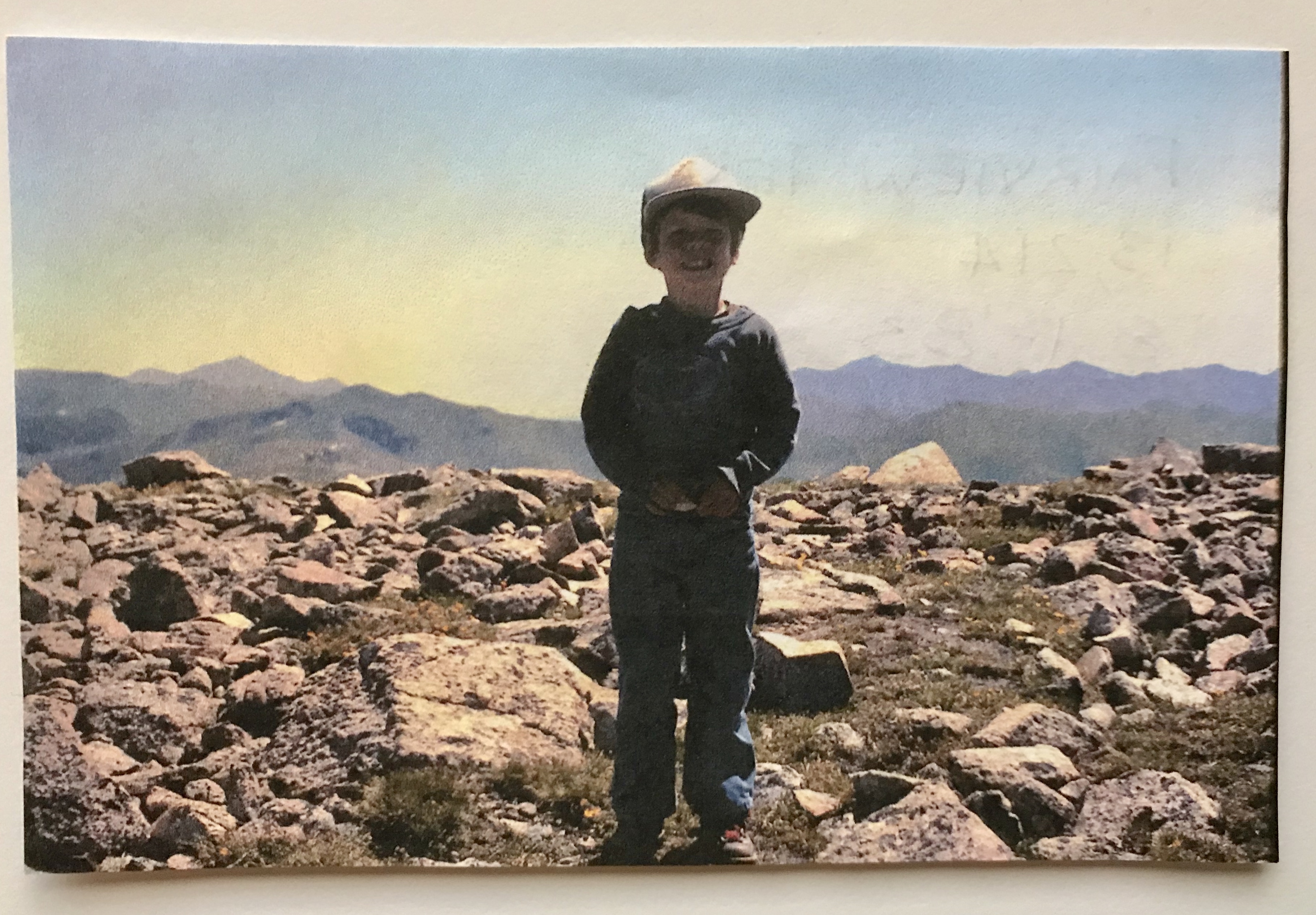
And of course, here's the photo they sent with it - me standing on my first 13er - Fairview Peak at age 4. Good stuff!
It was so great celebrating this one on top with Silas, who I think was more elated than me!
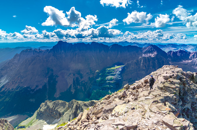
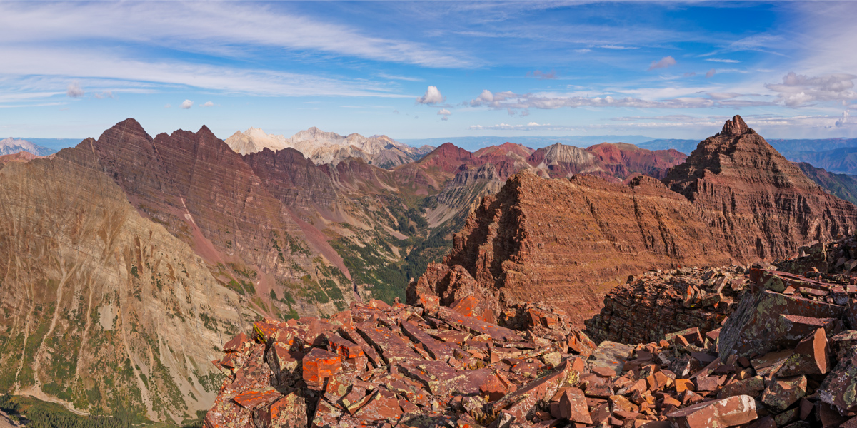
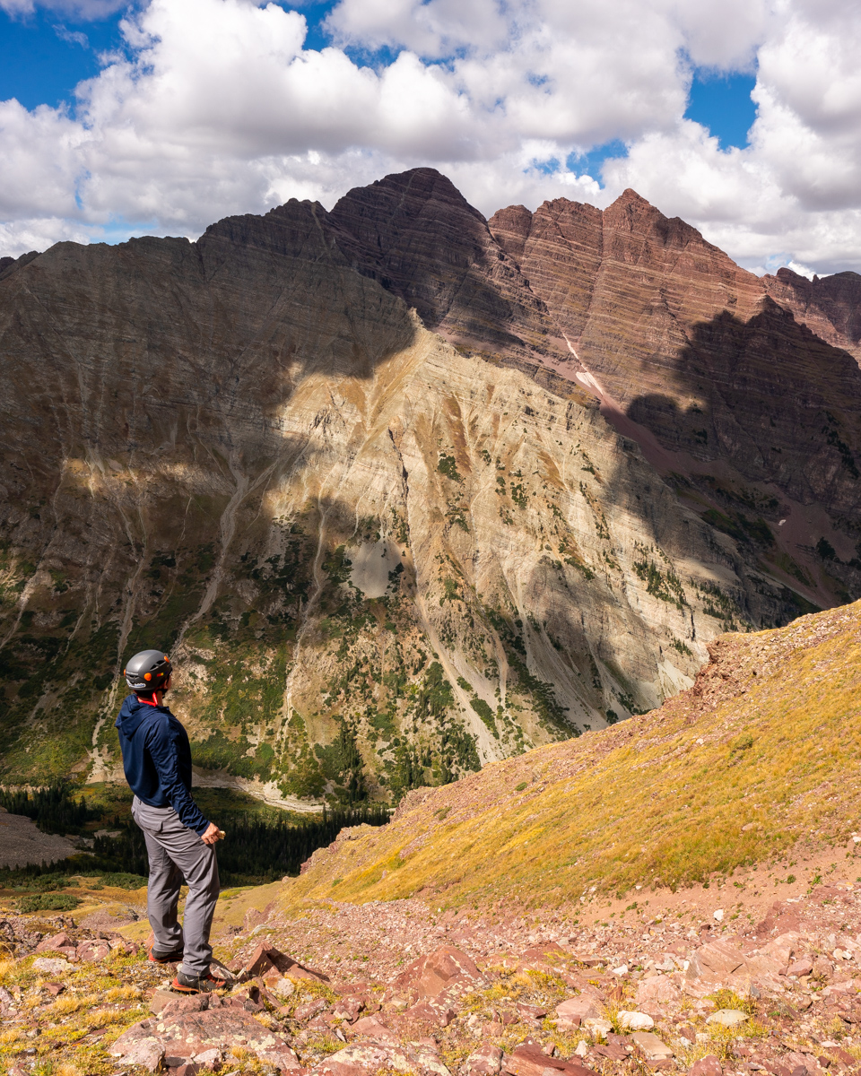
It was also really cool to have a view of Pyramid from here, which I finished the 14ers on in 2012.
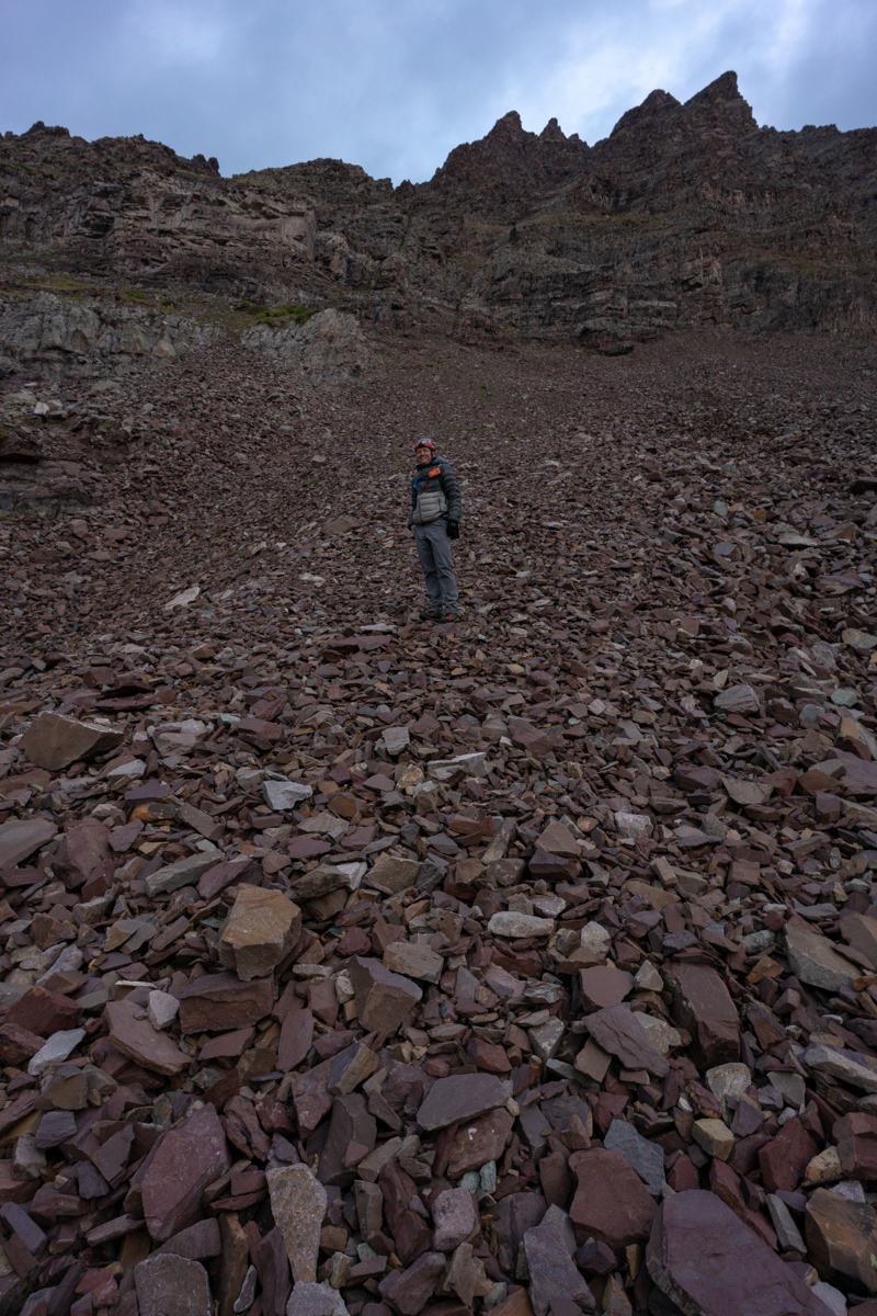
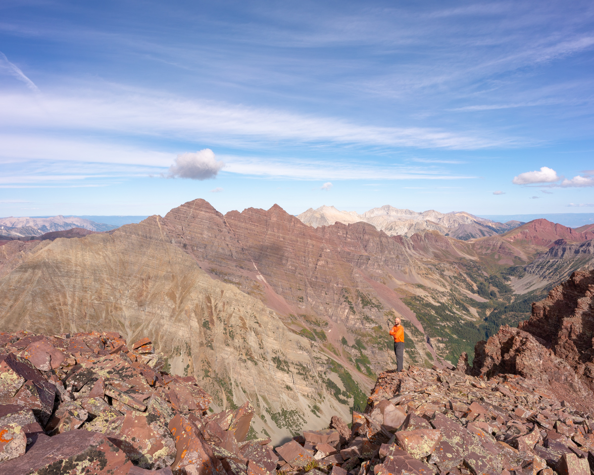
The scale of these mountains is so hard to describe in photos; however, I think adding me to the frame helps.
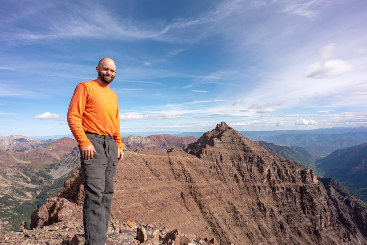
I had a special surprise for Silas too. I brough my 100summits.com T-shirt with me and a sharpee so he could check off the last box for Thunder Pyramid. What a great feeling!
I wonder why they call these the Pyramids?
Silas caught me in the act of composing a photo while there. I really wanted something to show off the gnarly rocks in the foreground while including all of the great peaks of the area, so I had to get really low!
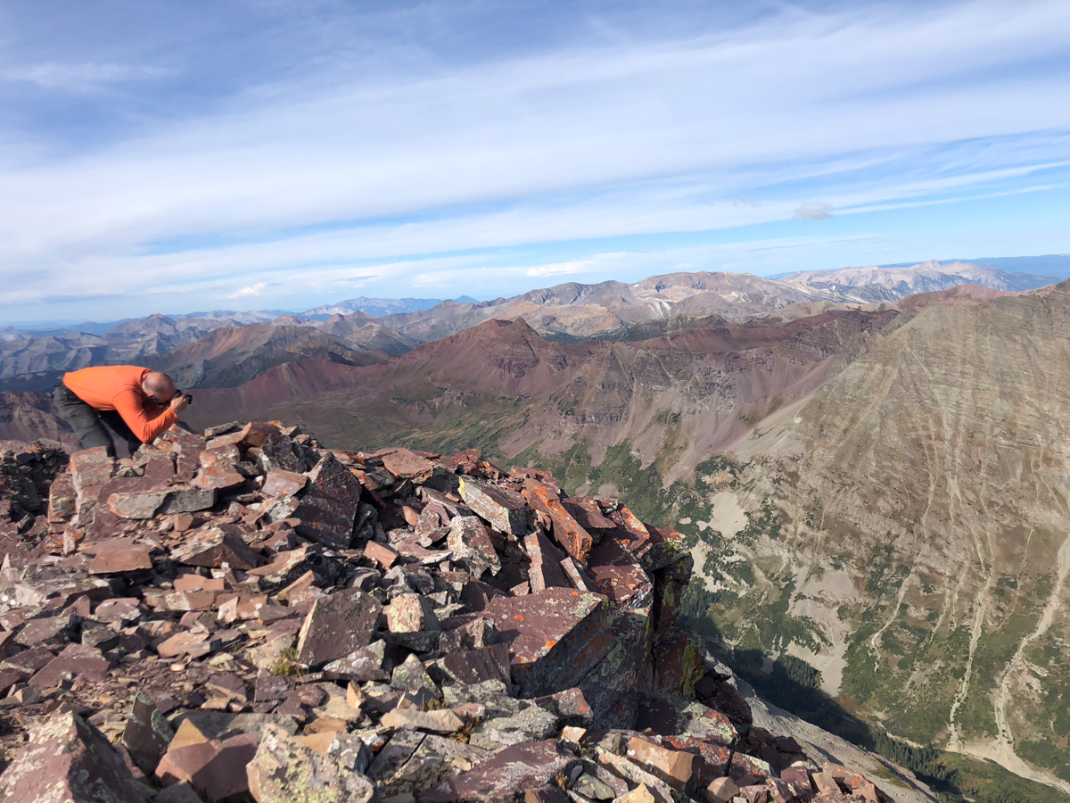
And the result:
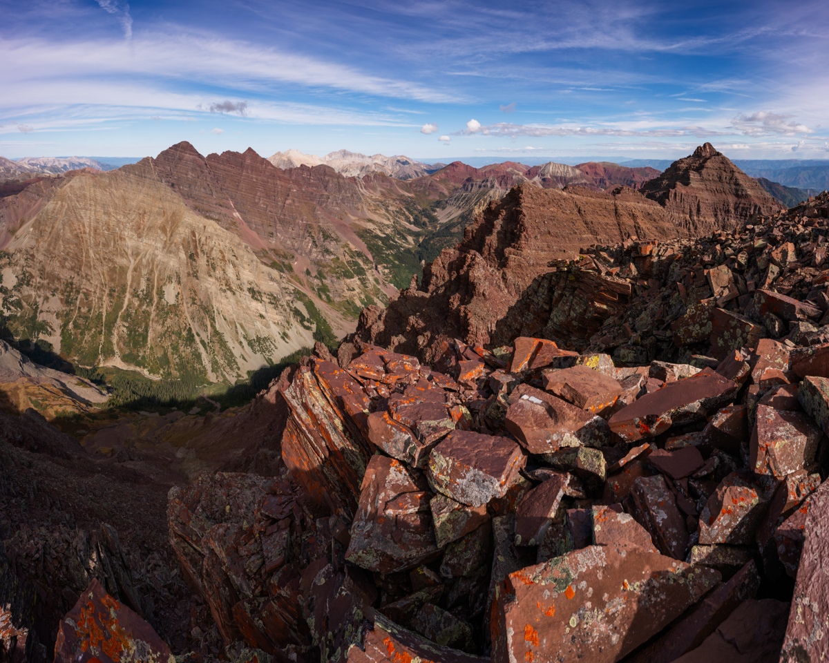
Another angle:
I felt like I needed a shot of Castle and Condundrum too, even though the light to the east was quite harsh. I think they still look quite formidable from here though. It was crazy to think just a couple weeks ago I was on Cathedral at sunrise looking this direction.
We also noticed a pair of hikers on top of Pyramid. This photo really shows off the scale of that peak well.
I decided to sign the summit register and have Silas video it for posterity.
I also felt compelled to kiss the top of the mountian for some reason before departing. It was fun Thunder Pyramid - thanks for the ride!
The journey down began and I was still on cloud 9 but knew we needed to be extra safe on the descent. There were sections near the summit that had decent exposure and made Silas quesy to look back at me on the edges. I was like, "what's the big deal?" :-)
Upon reaching the saddle the view down was sobering. It looked incredibly nasty. Fun.
We made our way down carefully, picking mostly the same route as before, except we stayed a bit higher towards the top of the ridge instead of going south into the gully.
The rock here is especially loose and nasty. Great care should be taken to navigate down. I got some fun action shots of Silas in the act.
Don't fall!
Here is a good view of the spot we chose to turn off from the White Gully, only in reverse.
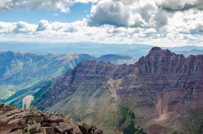
Upon reaching the white gully, we were equally excited and dismayed by the appearance of a mountain goat below us. Despite our efforts, he kept climbing right up the gully towards us and eventually above us. We now not only had to contend with our own rock fall, but also the rock fall from the goat. Fortunately, he did not knock any rocks down on us!
Reaching the bottom of the white gully was a relief, and, we were pleasantly surprised at how well the weather had held up!
I absolutely love the next shot of Silas gazing at North Maroon (which he climbed the following day).
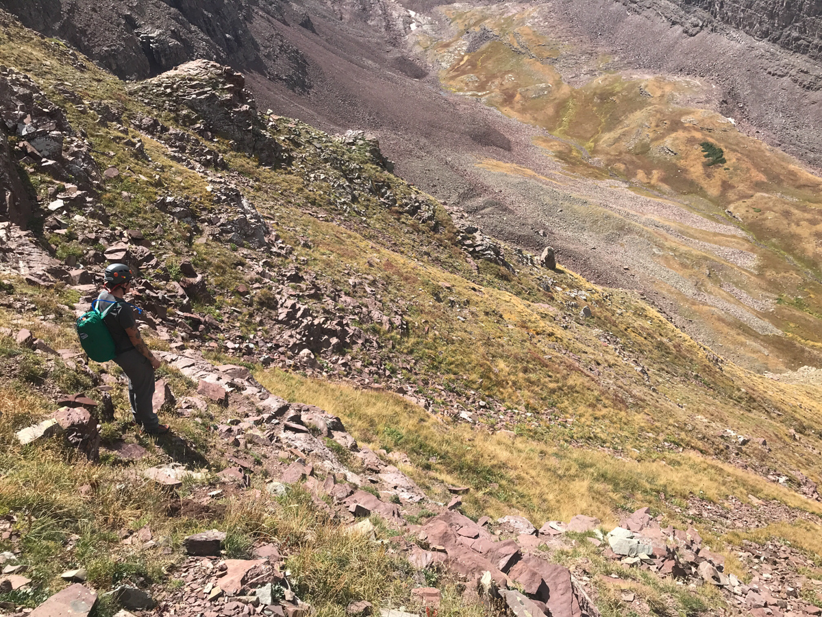
We made it to the turn off for the very first gully and found that dirt/rock section to really suck - here's a good view of Silas entering that section. It was super steep and very unpleasant.
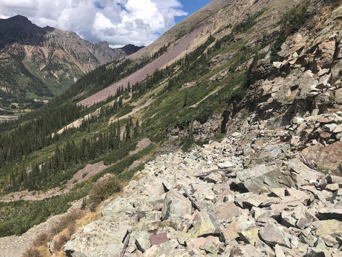
We opted to follow the far left gully to exit, which was much less steep but much more loose and filled with nasty talus. At least the view of Len Shoemaker ridge was good.
Every step in this gully was dangerous. It was a real ankle destroyer.
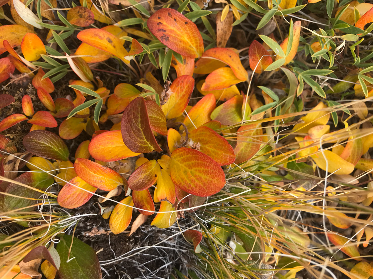
Upon reaching the flat surface below the talus field, we stopped to admire the foliage - the tundra had turned yellow and orange, reminding us that fall had arrived.
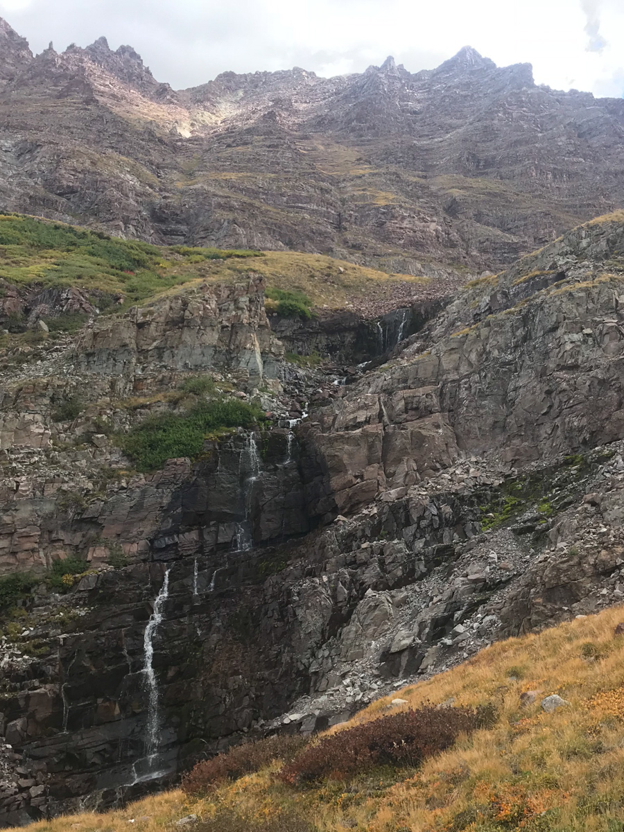
A look back up Thunder Pyramid below some waterfalls we found - a glorious sight indeed.
We picked our way down pretty much following our ascent route - here you can see one of the sections where we navigated below and above two cliff bands by following a nice rocky section.
At treeline we found some very large plastic peices that we think were from a downed helicopter. They appeared to be part of the cockpit and were about 2' by 2' in size. Silas carried them out. We reached the base of the peak without incident! Success! Upon reaching our campsite, we found a Ranger talking to an older gentleman who seemed a bit out of breath. I confirmed it was the father we had told the son to go back to get earlier in the morning. It had apparently taken them this long to get him down to our campite near Crater Lake. He thanked us for helping his son Austin, saying when Austin came back for him, he had fallen asleep. They eventually airlifed them both out from the lake, which quite the specticle to witness. I got some photos and video of the event.
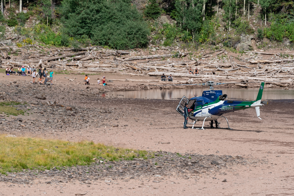
It was impressive seeing the pilots navigate the lake with the helicopter.
Once the drama stopped, I stopped to get some photos of the surrounding area with my telephoto lens. The light in the steep gullies below North Maroon was particularly mesmerizing.
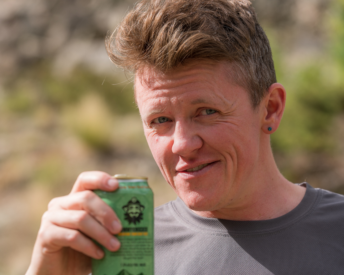
And of course we celebrated with camp beer!
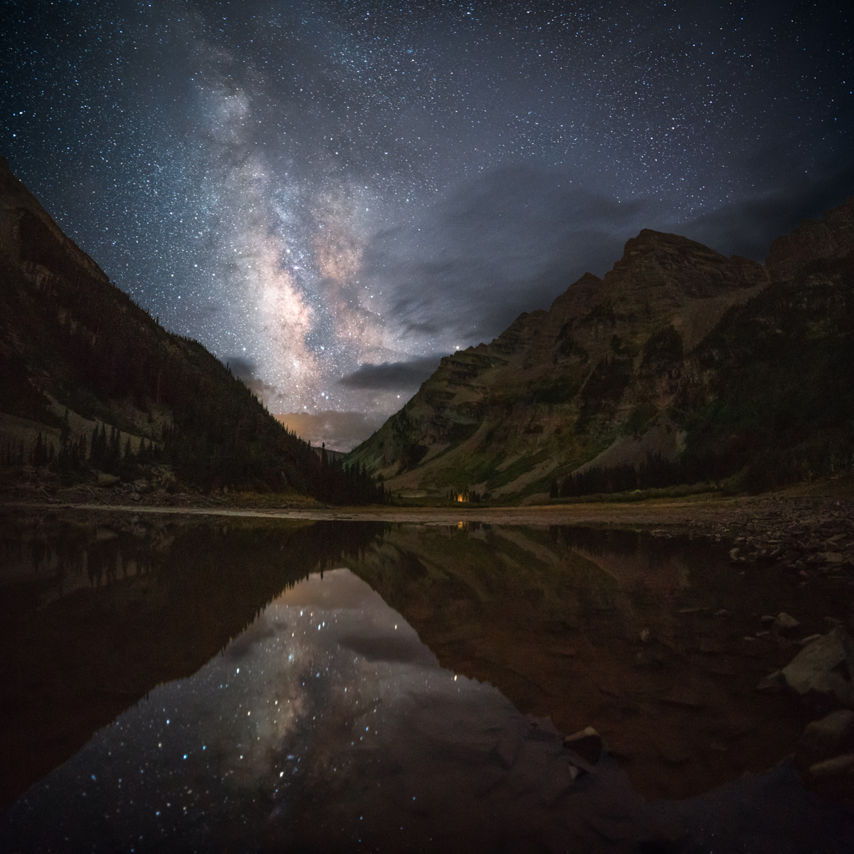
After telling Todd about the climb and settling in for the night at a new campsite, I decided to head down to Crater Lake for some night photos. Using my new 15mm wide angle lens, I was able to get the whole lake, both Bells, and the Sleeping Sexton in one photo. Nice.
I was particularly excited to re-create a photo I shot here several years ago with inferious camera equipment - the Milky Way in the valley gap between the Maroon Bells and Pyramid Peak. I think it was quite the success.
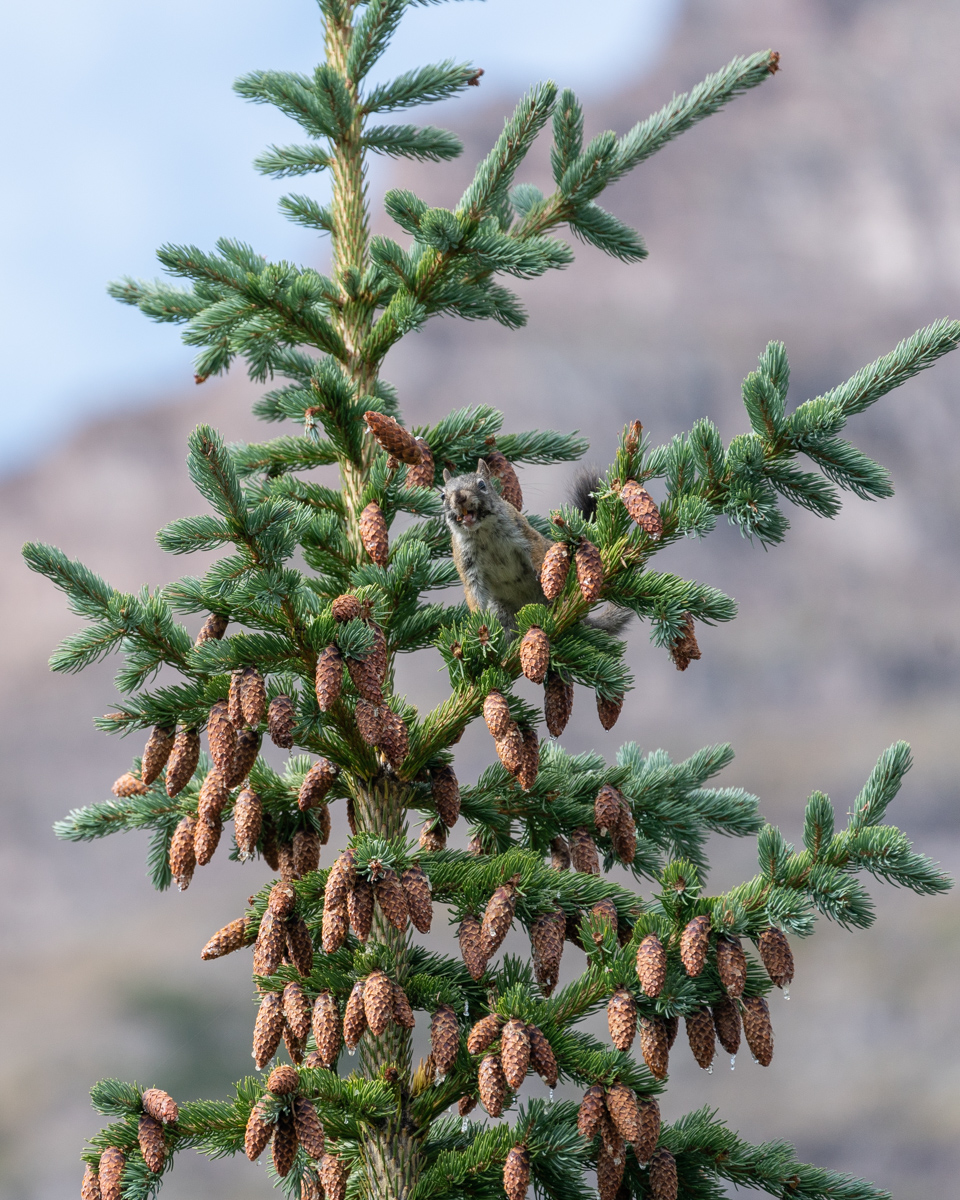
Day 3 - a rest day for me and a climb of North Maroon for Silas. I spent a great deal of the day putzing around with my camera and talking with my friend Todd. We were confronted by a Forest Service Ranger for camping in the wrong location. Apparently the correct site 6 was further back away from the trail than we realized. The sign we camped near said site 6 and was heavily impacted. He forced us to pack up and move to another spot. We were happy to comply. Note - the signage is pretty spotty and not very useful in general. Many camp sites have huge signs saying "restoration in progress, no camping," and others have no signage at all. It is wildly inconsistent and the marked sites are, well, not very well-marked. Noted. Since Silas was away on North Maroon, we had to figure out how to coordinate the move. We packed all of Silas' gear up into his pack and moved to site 8 (which was WAY better, by the way). We came back to site 6 and Silas had just arrived back from North Maroon. Perfect timing! I decided to get some photos of a squirrel that was throwing pine cones on the ground (which is hilarious to watch).
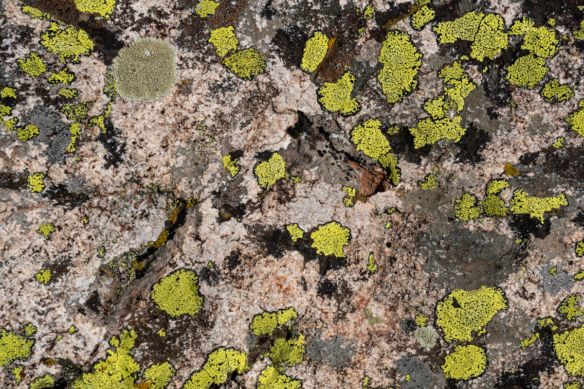
I also decided to get some abstract shots of a rock covered in moss... boring for some, probably, but interesting to me.
And of course, the setting moon was fun to photograph over the Sleeping Sexton.
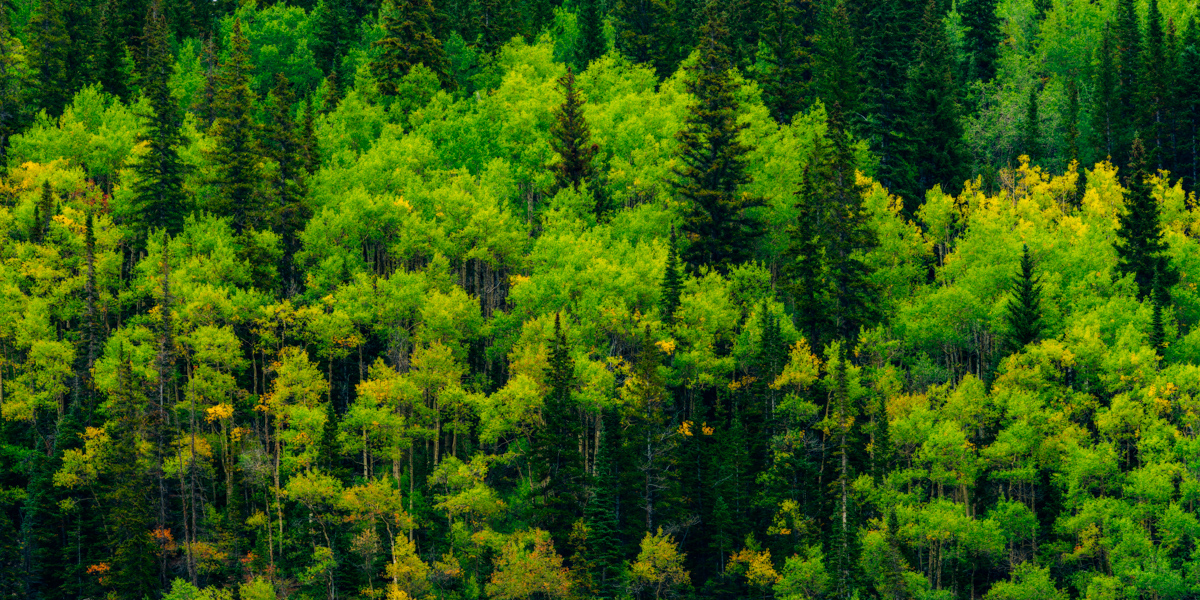
After we all napped in the rain at site 8, I set-off to photograph the area with my telephoto lens. The foliage was just starting to change color and I really enjoyed phtographing the area.
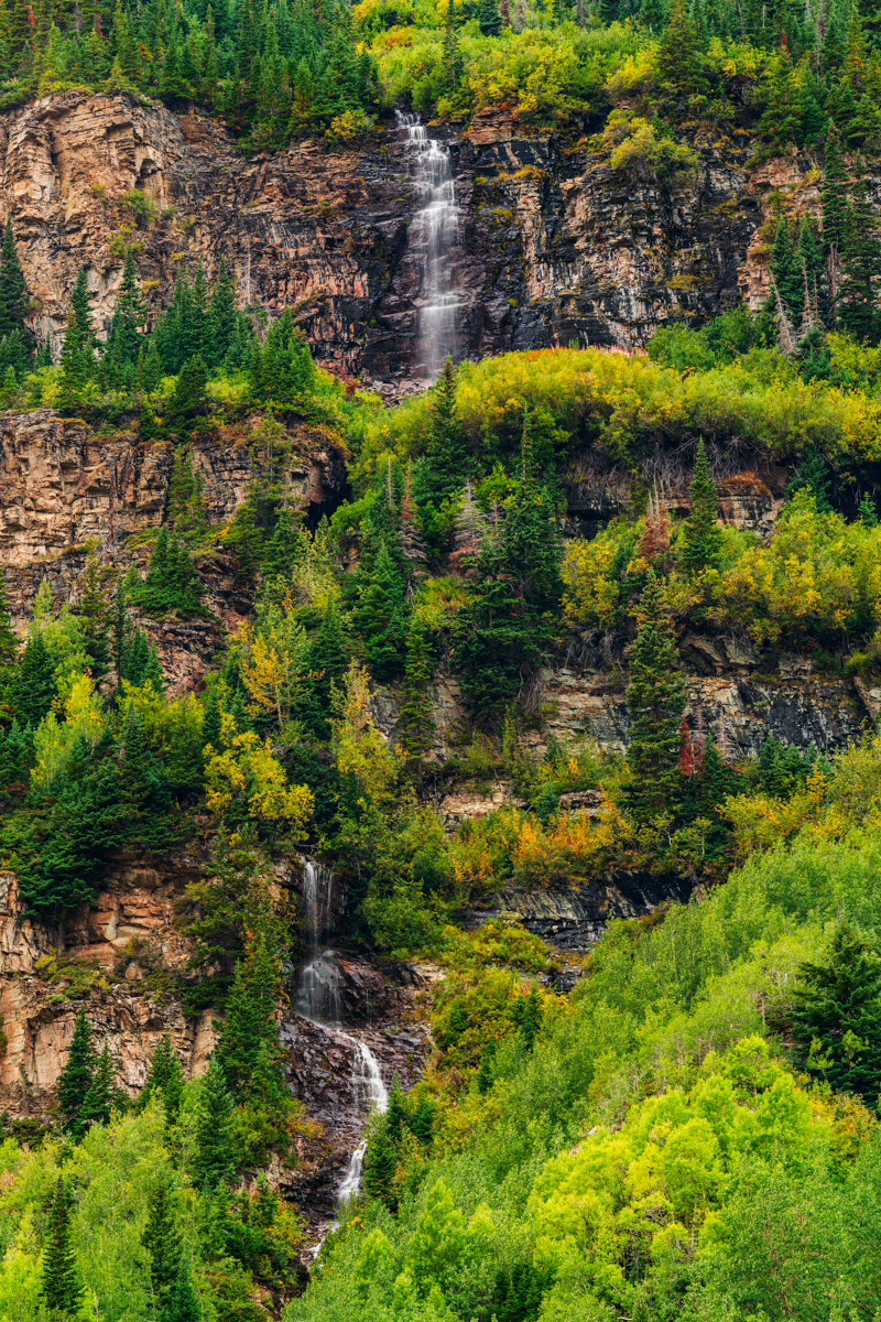
After the rain, there was a significant waterfall that appeared above us below North Maroon, and it was also fun to photograph.
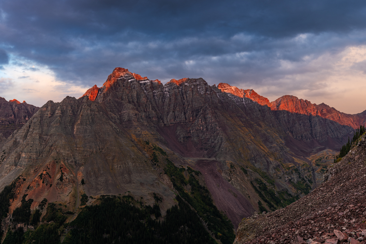
A very large weather system moved into the area around 4 PM and we were glad we were not climbing. I had a vision in my mind of snow being dropped onto Pyramid and Thunder Pyramid during the storm and thought there could be a possibility that the storm would break at sunset and produce some amazing results. I really wanted to commemorate the trip and experience with one last photograph of Pyramid and Thunder Pyramid in these conditions, so I sold Silas on the idea of hiking all the way back up North Maroon's slopes to get a good view of these two peaks at sunset. We hiked in the rain for a couple of hours up the trail for North Maroon, which was pretty miserable. Honestly, who does this?
When we arrived, I stopped at the very long boulder field below North Maroon, which was very wet and slippery. I noticed a climber at the other end of the boulder field who was moving incredibly slowly back down the mountain. He was maybe moving one rock per minute. He was obviously in pain. I later learned his name was Scott and he was from Woodland Park, CO. I yelled out to him.
Matt: "Hey man, are you OK!"
Scott: "Yep, just hurt my ankle and can't put any pressure on it."
Matt: "Do you need any water or Ibuprofen?"
Scott: "I'm good man."
Matt: "Well, I'll wait for you up here to make sure you get down OK."
Scott: "Thanks man, appreciate it."
Silas and I waited below the boulder field for another hour and he still had not come down. I decided to climb back up to the boulder field and found that he was really high above the trail. I went to him and helped him get down to safety, one step at a time. He was badly hurt. We gave him some ibuprofen and wrapped his ankle in an ace bandage and he went on his way down the mountain.
The clouds and light were quite dramatic and I was really holding out hope that the clouds would break for just a minute to light up the peaks with alpenglow.
Alas, my wish was granted! I was so elated! Silas caught the whole thing on video.
I really loved this scene. Not the best, compositionally, but damn, the light! Pyramid and Thunder Pyramid covered in snow with alpenglow, just as I had envisioned. Yes!
I am really proud of this image. I had the vision. I had the perseverence to try to get it. I was prepared. Execution was good too. Hallelujuah, this is what its all about for landscape photographers!
The light to the north was pretty great too! Looking down on Crater Lake and Maroon Lake was quite a treat.
After sunset, we left. On the way down, we ran into three hunters, a father and two sons who were hunting Mountain goats. They said they saw our injured hiker earlier and he was doing OK. Good! We returned to camp very late and ate a very late dinner and had beers. What a great trip! The next morning, we packed up and head out at 10 AM. Naturally, upon arriving at Maroon Lake, the shit-show of tourists not obeying the Forest Service signs was even worse. I loudly but politely asked several parties to not cross the rope and that they should read the sign. I bet the forest service hates this new system. I can't imagine policing it 24/7.
I think I looked pretty menacing with the plastic helicopter cockpit part we found...
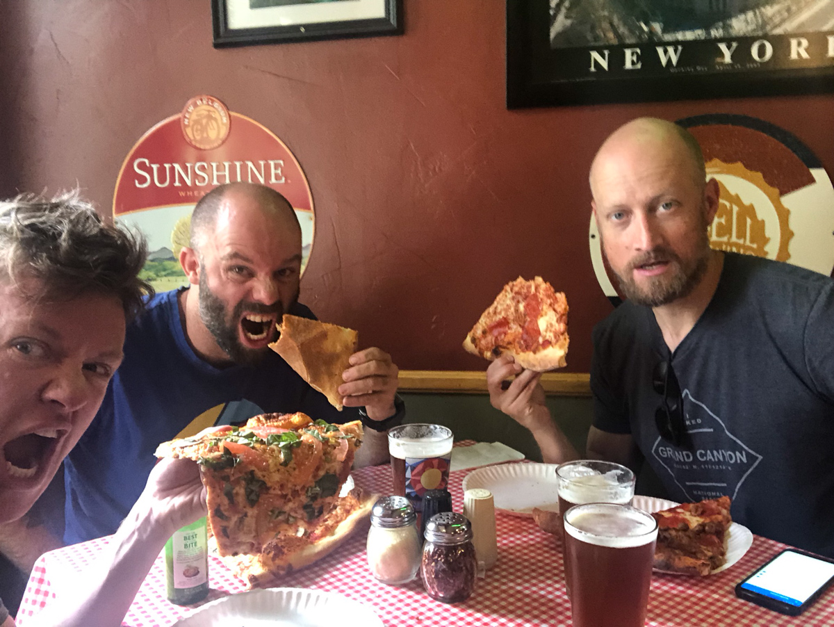
A successful trip deserves a trip for beer and pizza. We stopped at NY Pizza in Aspen for our celebration meal.
Wow, that concludes this report. My final Centennial!
A few thanks are in order -
Thanks to Silas Musick for being such an amazing climbing partner. We celebrated on 14 of those 100 summits together and I consider you my best friend - all because of our mutual passion for mountains and the outdoors. You're a beautiful human.
Thanks to Natalie Moran for taking me up Jagged, Dallas, and Teakettle. You're a fabulous climber and a great person.
Thanks to Terry Matthews (RIP) for accompanying me on my first class 3 climbs in 2008 when I got back into this pursuit. You are missed.
Thanks to Ethan Beute - our climbs on obscure 13ers kept me going - miss you man!
Thanks to Regina Primavera - you're a great friend and it has been fun catching summits with you since 2011.
And lastly, thanks to my parents for getting me going on this crazy journey 35 years ago. The photo Silas posted was actually my first 13er - Fairview Peak - I was 4 yrs old.
I created my little website in 2009 mostly to teach myself how to build one but also to document and share my journey with my friends and family. I know my dad regrets not having something similar to look back on. Hope it’s at least been somewhat useful to others as well.
Next up? I have no idea. I don't think it’s the bi-centennials.
I have some photography projects I want to tackle, including a book of photos of the Centennials...
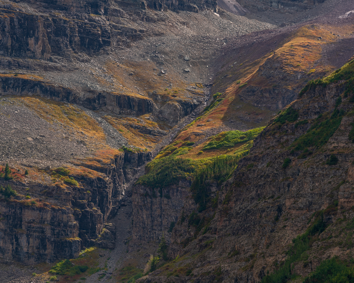
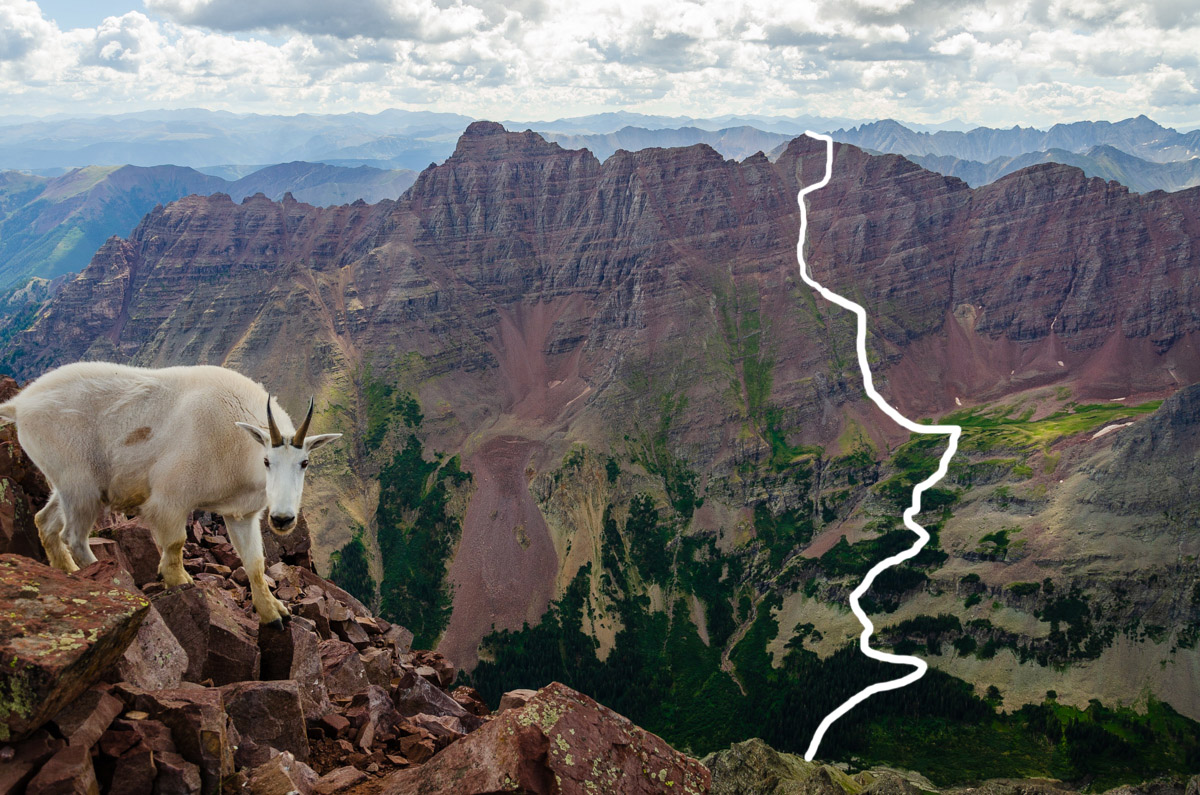
Here is a photo that might help folks see the general route we took:
And a link to the Gaia GPS track:
2013 Colorado Mountaineering Deaths - A Review