Displaying items by tag: Blanca Peak
California Peak - a Sangre de Cristo warm-up
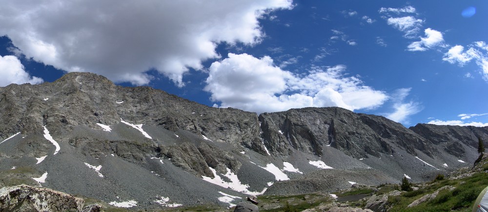
California Peak has long eluded me. Being one of the highest 100 mountains in Colorado (a Centennial), it has been in my sights for awhile. California Peak rises to 13,849 ft. and is ranked 84th highest in Colorado based on my list of the highest 100 mountains in Colorado. Over the past two years, I've set eyes on it numerous times, first from the summit of Lindsey, Iron Nipple and "Huerfano," and later from the summits of Ellingwood Point and Blanca Peak, all close neighbors of California Peak. I had hoped to climb it back in 2009 with my wife, but those plans were foiled by some hoodlums shooting guns at me and my family. I also wanted to climb it in 2010, but those plans were foiled by a seriously bad weather outlook that forced me to stay home. So, a few weeks ago, my long-time hiking partner, Ethan Beute and I made plans to climb California Peak. Our plans to climb it two weeks ago were completely thwarted by forecasted 100 MPH winds and again the following weekend due to snow. Alas, this weekend came and we pulled the trigger, with highs forecasted in the 40's for California Peak and wind gusts of up to 40 MPH. Not knowing how much snow was on the trail itself, we both packed our MSR Lightning Ascent snowshoes and a great deal of winter gear. We both also brought our Outdoor Research gaiters, expecting to encounter a fair depth of snow. I scoured the internet for trip reports for California Peak in April and found none, so we really had no idea how much snow would be on the trail or the road. I met Ethan at his house at 3:45 AM and we left for the beautiful yet dangerous Huerfano Valley. We were not sure what the road would be like, so we were very concerned with how far we could get his vehicle, given the last report stated the road had significant snow drifts fairly far from the trailhead. At 6 AM, we were able to make it to within about 2 miles from the trailhead just as the first views of Blanca Peak came into view.
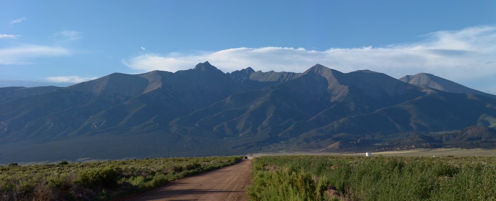
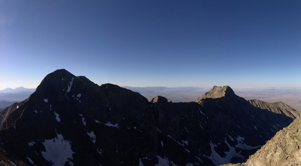
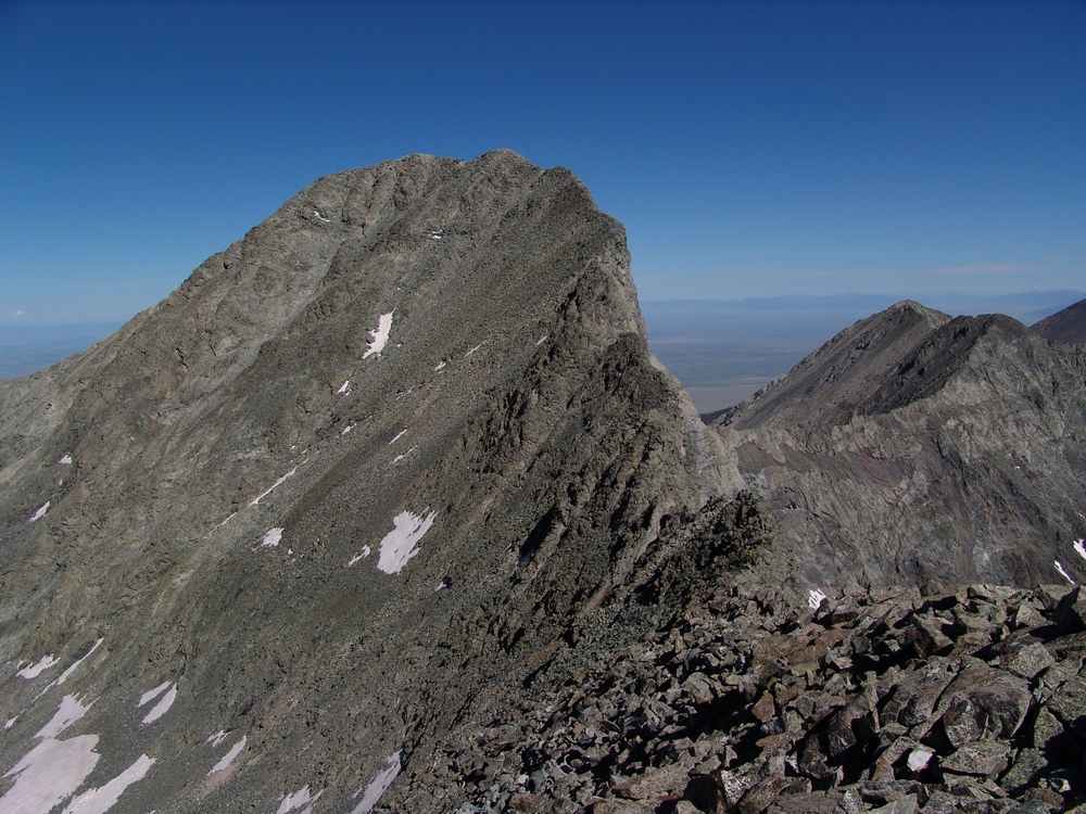
Ethan snapped a great photo of California Peak and Blanca Peak (right to left respectively):
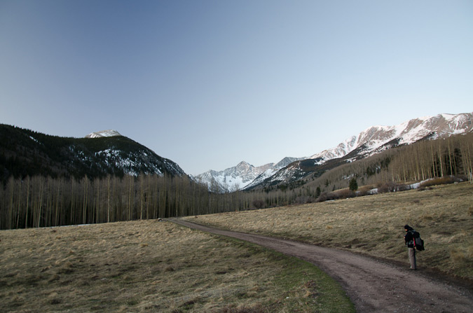
I was very pleased with this starting point and start time. I was also very pleased by the apparent lack of snow on the road and in the trees, as well as the relatively warm temperature. After evaluating the snow levels from afar, we opted to bring our snowshoes because we were unsure if we would need them or not, and since the MSR Lightning Ascents only weigh 3 pounds, it was a sacrifice we were both willing to make to ensure peace of mind. After properly securing our gear and donning our hiking boots, we were off to the races.
One thing you should know about both Ethan and I is that our first passion is hiking but a close second for both of us is photography. Last year, Ethan purchased a very nice Olympus camera on a deal that was too good to pass-up. I became increasingly jealous of the great images he'd been producing, so I set my sights on upgrading my old Sony DSC-F828 that I purchased in 2001. I was able to purchase a Nikon D7000 a couple of months ago and so I was really excited to finally put it to the test on a proper mountain ascent. Given our mutual love for photography, Ethan and I tend to take several breaks on our climbs to capture some photos along the way, and this trip was no different. In retrospect, I feel that I have a lot to learn about my new camera even though I felt really good about all of the settings after familiarizing myself with its features for the past couple of months. Many of my photos from this trip were blurry, under or over-exposed, and just plain not what I expected. I need a ton more practice!
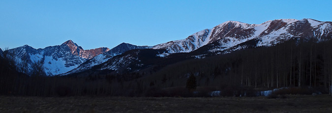
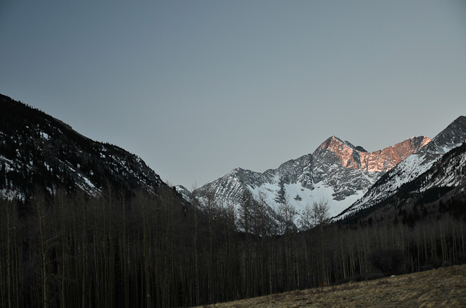
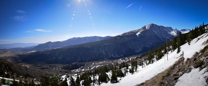
Right away after setting off on the trail, Ethan and I were greeted by the sunrise kissing the top of Blanca Peak, one of the most magnificent mountains in Colorado. The vantage of Blanca Peak from the Huerfano Valley is one to behold, and I can't produce a much higher recommendation for a scenic location.
The road was almost completely clear of snow, minus a few large drifts that were in the shadows of trees. A large dead aspen tree had fallen to block the road about 1/8 of a mile from where we parked, so we were glad we parked where we did. Someone's going to have some fun with a chainsaw to get that tree out of the way.
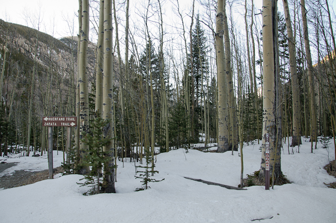
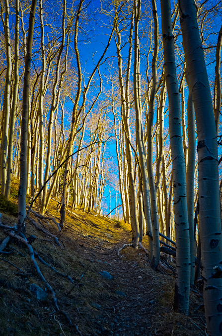
The standard route for California Peak takes you from the road up the Zapata Trail that weaves through the trees and intersects with a high meadow.
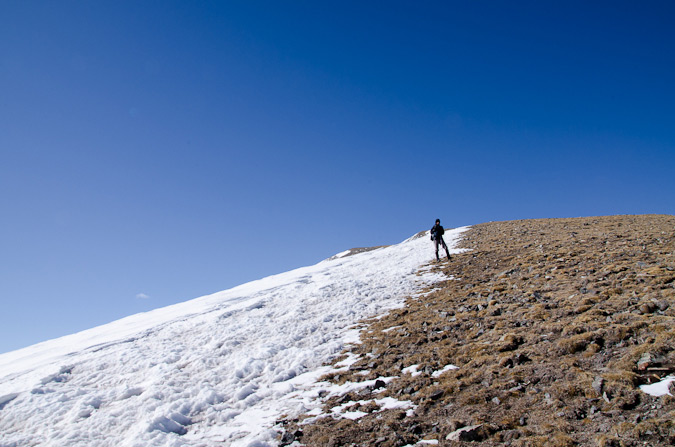
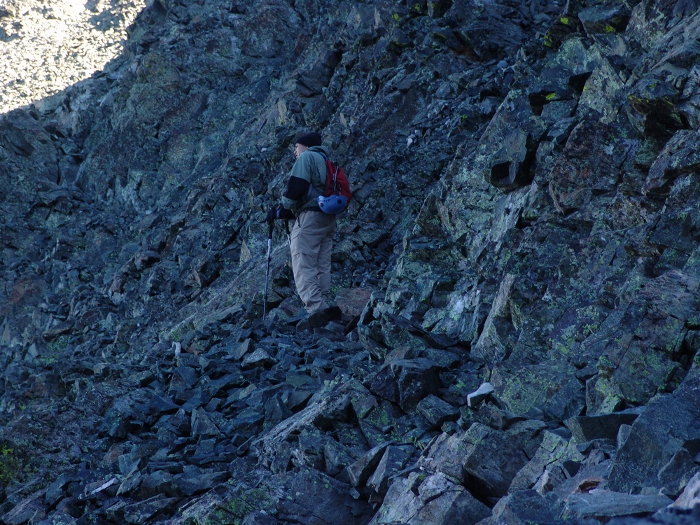
From there, the trail heads even higher on the eastern slopes of California Peak until dropping you onto a gentle ridge at 11,800 ft. From here, the idea is to follow the very long south ridge of California Peak all the way to the top, a ridge walk consisting of about 2,000 ft. in elevation gain over three miles. Our plan was to stick to the standard route as much as possible, taking detours when the trail was lost. As it turned out, the trail was quite visible for most of the hike, until we lost it just after the meadow. From here, we opted to head where we thought the trail went and then straight up a steep gully towards the ridge.
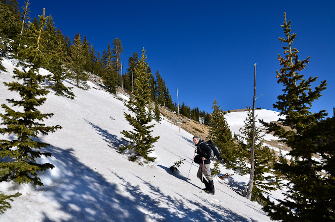
This gully ended up intersecting the actual trail eventually, and so we re-gained the trail and followed it to just below the ridge, where we trodded up a steep snow slop and over a small cornice to reach the ridge and the crazy wind that accompanied it.
Here is an outline of the route we took for California Peak (click for higher resolution):

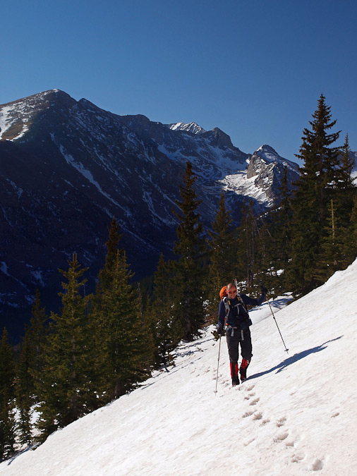
The trail offers some pretty nice views of the Huerfano Valley below, including a nice vantage of the Iron Nipple.
The wind on the ridge was pretty intense. It was not gusty, rather a constant ripping wind that had a biting chill to it. The wind was blowing across the ridge from the west, which explained the relatively little amount of snow on the ridge minus the drifted cornices on the very eastern edges of the ridge.
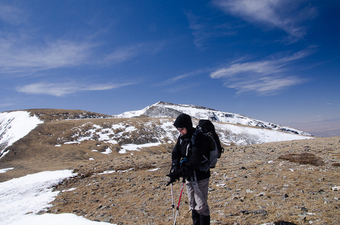
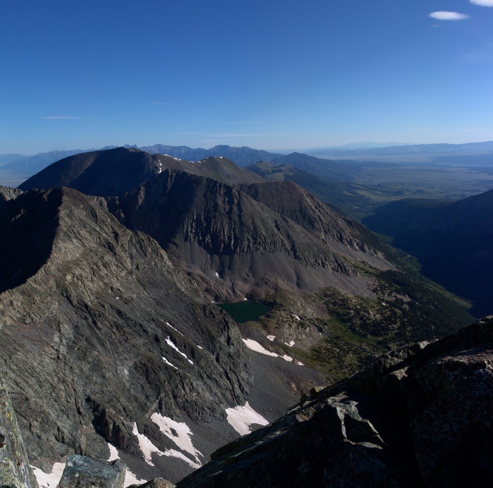
Ethan and I began hiking up the gentle ridge towards what we thought was the summit of Unnamed 13,476. Once we crested it, we realized it was merely one of several false summits leading up to California Peak. While these false summits were constantly demoralizing us, we were pleased and surprised by the breathtaking views of Crestone Peak, Crestone Needle, Mount Herard and the Great Sand Dunes National Park to the north.
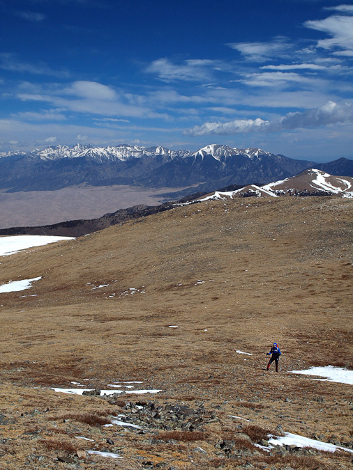
We reached the summit of another false summit and realized that California Peak was a long ways off yet. This ridge was quite a long approach indeed!
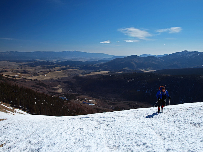
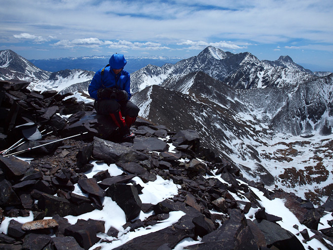
Once we reached the summit of Unnamed 13,476, we needed to stop because Ethan's hands had gone numb. This was surprising to both of us because he was wearing his brand new Marmot Windstopper gloves. Apparently they did not stop the mighty wind of the Sangre de Cristo Mountains. I went into my first aid kit and produced two Hand Warmer kits, one of which I had looted from a geocache find near Mount Shavano in 2009. The kits seemed to help Ethan, so we continued on up towards the next false summit.
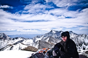
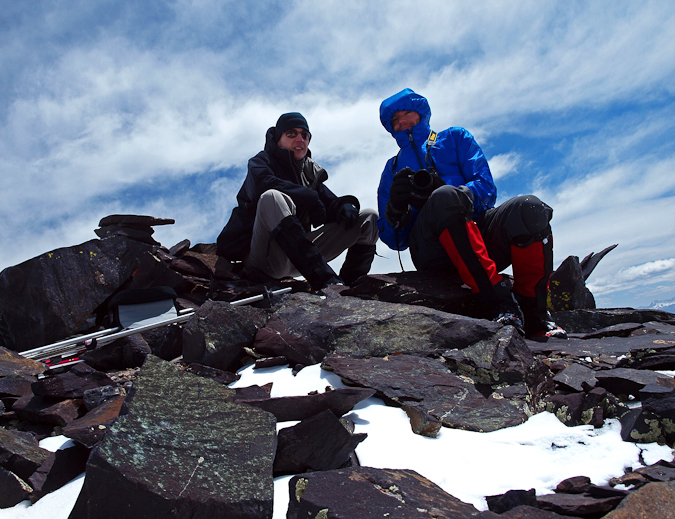
The summit block of California Peak was fairly steep, although nothing too crazy, and we were able to boulder hop our way through the shallow snow and to the summit by noon. Needless to say, the views of Blanca Peak, Ellingwood Point, Mount Lindsey, Iron Nipple and "Huerfano Peak" were outstanding.
It had appeared that no one else had signed the summit register since October, so it was cool being the first to sign it in 2011. We took several picutres and refueled for the descent. Despite the strong and chilly winds, the summit was great. It was awesome to be on my first top 100 mountain of 2011.

It was also really great to make the realization that I had just completed my 60th highest 100 summit of my life.
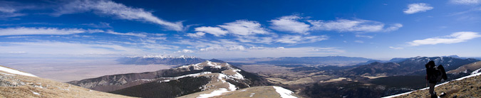
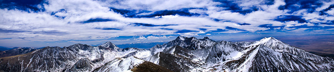
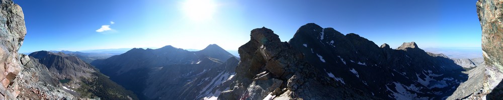
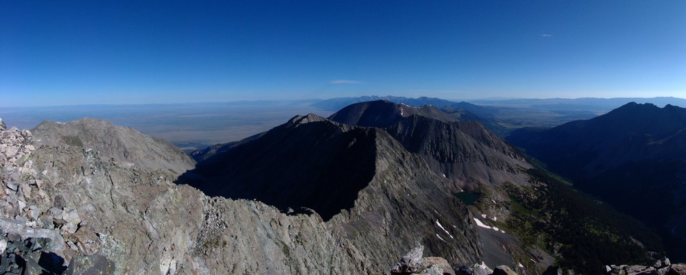
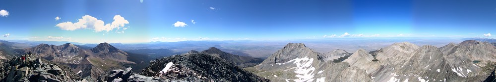
If all goes according to plan, by the end of 2011, I'll have only 15 of the highest 100 left to climb. My life-long dream is coming closer to completion. After soaking in the amazing views from the summit of California Peak, Ethan and I headed back down the ridge, but not before taking a 360 degree panoramic photo set:
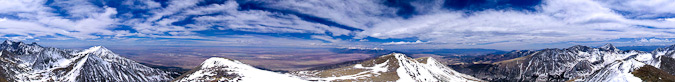
Click HERE to view an interactive version of this photo (SMALLER FILE - 1.8 MB).
Click HERE to view an interactive version of this photo (LARGER FILE - 27.1 MB).
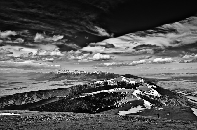
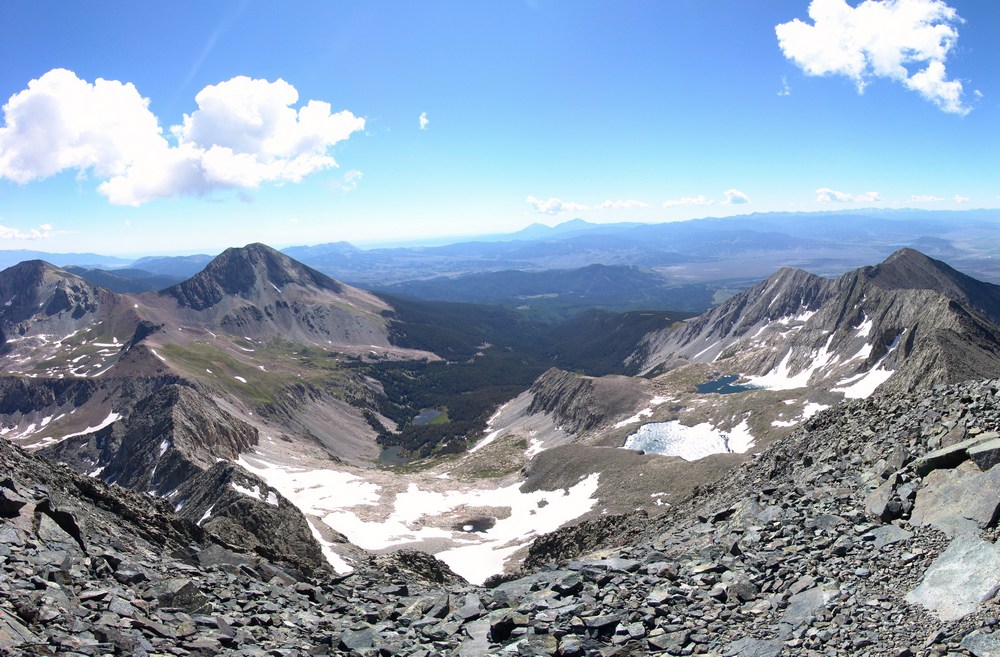
I was able to take two more sets of parting shots before we left the ridge, and I was quite pleased with the way in which they both turned out (one is the first photo in this trip report and the other is below).
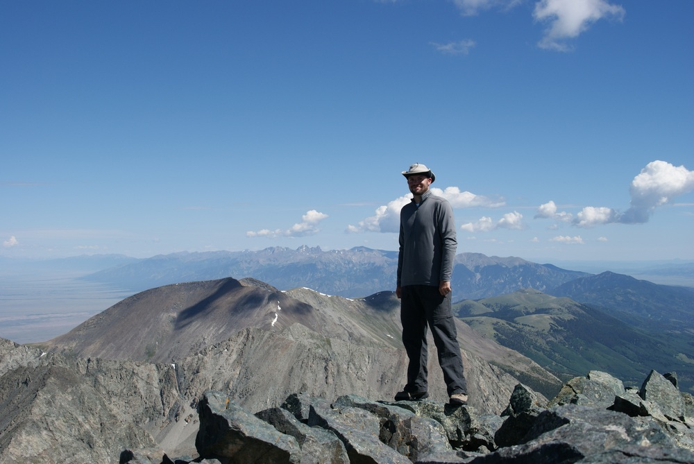
We found our trail in the snow without too much trouble and made quick time back to the road, and eventually, Ethan's car. Here is my favorite shot of Ethan's from the trip:
Here are some fun statistics from our hike:
Miles hiked: 11.5 round-trip
Total time: 10 hours
Total photos taken: 190 (far less than usual, despite having the new camera - shooting photos in the wind sucks)
I hope you enjoyed this adventure or that the information was useful for your planned hike of California Peak. As always, you can follow me on Twitter and Facebook. Please also remember, if you're planning on making any camera-related or outdoor-related purchases, use the links found HERE to support this site.
I look forward to your comments or questions regarding the hike or the methods used in any of the photos!
Blanca Peak and Ellingwood Point - Introduction to the Sangres
Blanca Peak has always mystified me. It is one of the most prominent mountains in Colorado - it towers over the San Luis Valley and the Great Sand Dunes National Park. It is easily one of the most impressive looking mountains in the State, from almost any angle. With that being said, it was quite exciting to finally get to climb it along with its neighbor, Ellingwood Point.
Here are some meaningful statistics from this adventure:
Blanca Peak - 14,345 ft. (ranked 4th highest in Colorado)
Ellingwood Point - 14,042 ft. (ranked 42nd highest in Colorado)
Total mileage: Approximately 10 miles
Elevation gain: 4,600 ft.
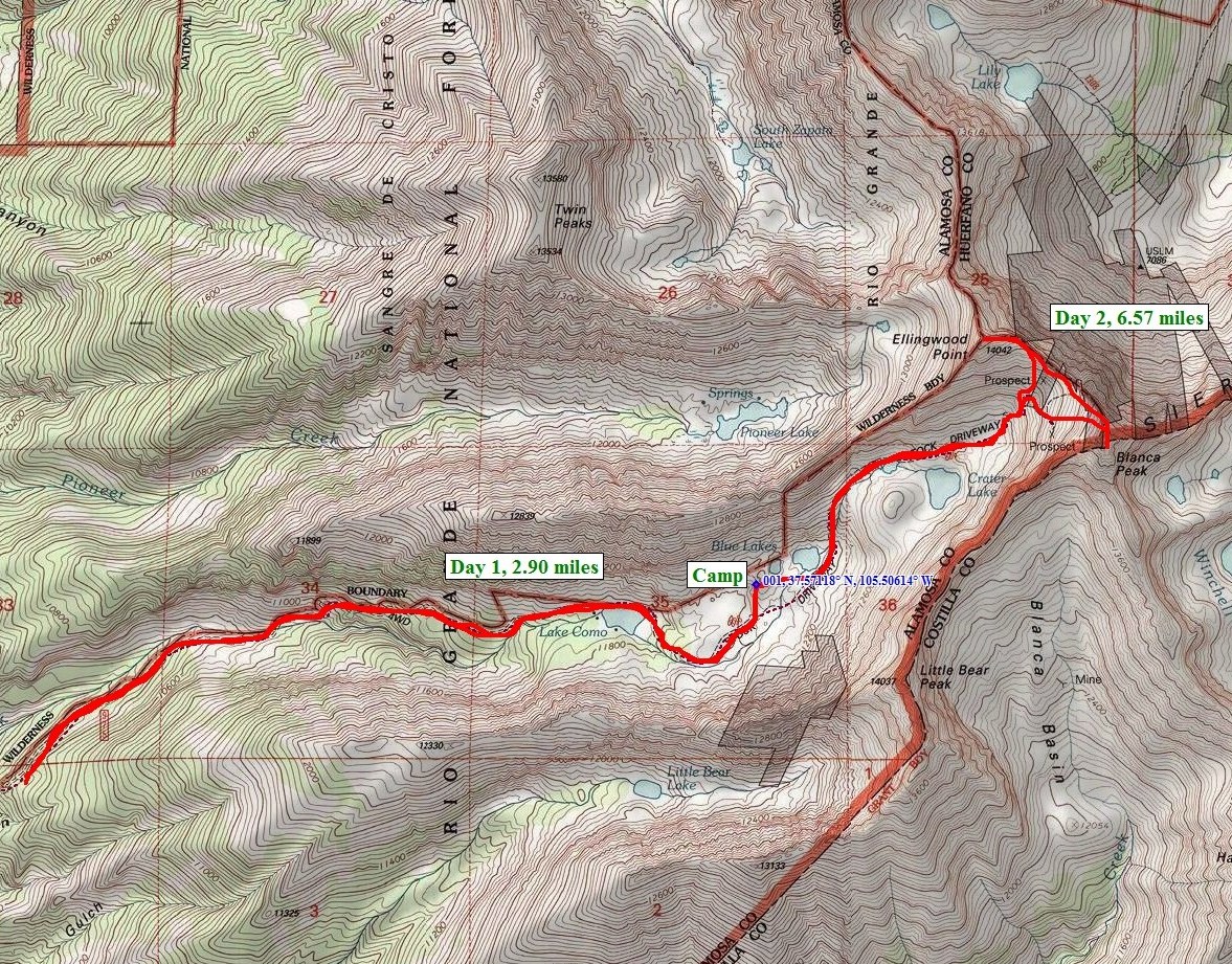
My friend Terry and I started our epic July climbs with a bang by heading down to the Sangres to tackle some of the most impressive mountains in the State. To accomplish this - we would need to backpack up a fairly long road to reach some high mountain lakes.
Terry picked me up at my house on Friday morning at about 7AM and we started the drive down to Walsenburg. Once we reached Walsenburg, we headed west over La Veta Pass and then through the towns of Fort Garland and Blanca. From Blanca, some pretty awesome views of the Blanca massif can be seen. Blanca is the highest one in the middle towards the back and Little Bear is the pointy one on the left.
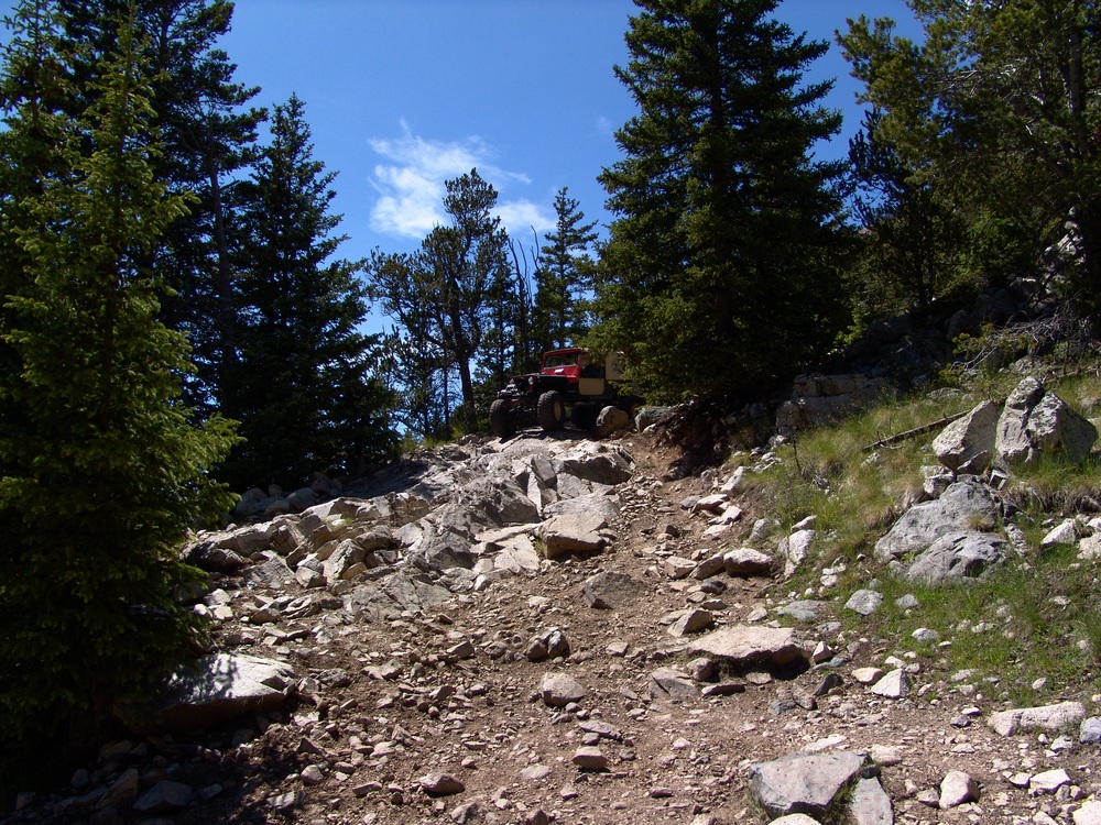
Next we headed north towards the Great Sand Dunes and turned up towards Lake Como. The Lake Como road is one of the premier 4-wheeling roads in the State, as evidenced by the three Rubicons at the start of the road. We started up the road in Terry's Blazer and encountered what I believe to be some of the most intense off-roading I've ever seen. Terry was a total champ! He was able to maneuver up the crazy road over some impressive and daunting obstacles and got us to a large camping area at about 10,000 ft. Turns out Terry damaged his engine mounts in the process. Here is a nice article on the road we were driving on.
In 2010, I went up the same road with my friend David, and there are more photos of that adventure in my Little Bear report.
The road is full of obstacles called "Jaws" which we stopped just short of. We got out of the vehicle and started our backpacking adventure. My pack weighed in at 55 lbs and Terry's weighed 40 lbs. I guess I carried heavier food!?
Here is the overall route we took up the valley and eventually up to the top of the peaks:
The hike took us up past the infamous "Jaws" obstacles and eventually we landed at Lake Como. We passed Lake Como and continued up the valley towards Little Bear Peak, Ellingwood Point, and Blanca Peak. We finally stopped above tree-line at 12,200 feet to set-up our camp-site. Here is a nice panoramic photo of the view from our campsite:
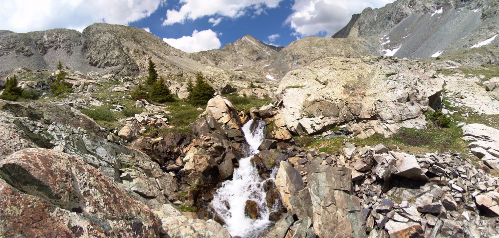
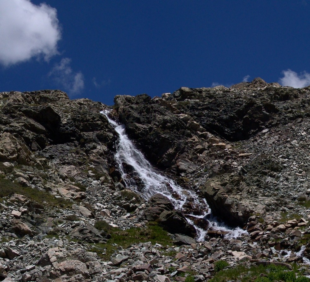
We were camped right next to a mini-waterfall that looked right up at Ellingwood Point. After we unpacked and got settled in, we decided to take a short hike further up the trail to one of the Blue Lakes. On the way there, I saw a small bird scurry past me. My first thought was, that bird can't fly! Then my second thought was, that's a baby bird! Sure enough, there were several small baby birds right in the area that were standing very still.
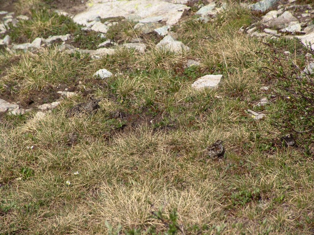
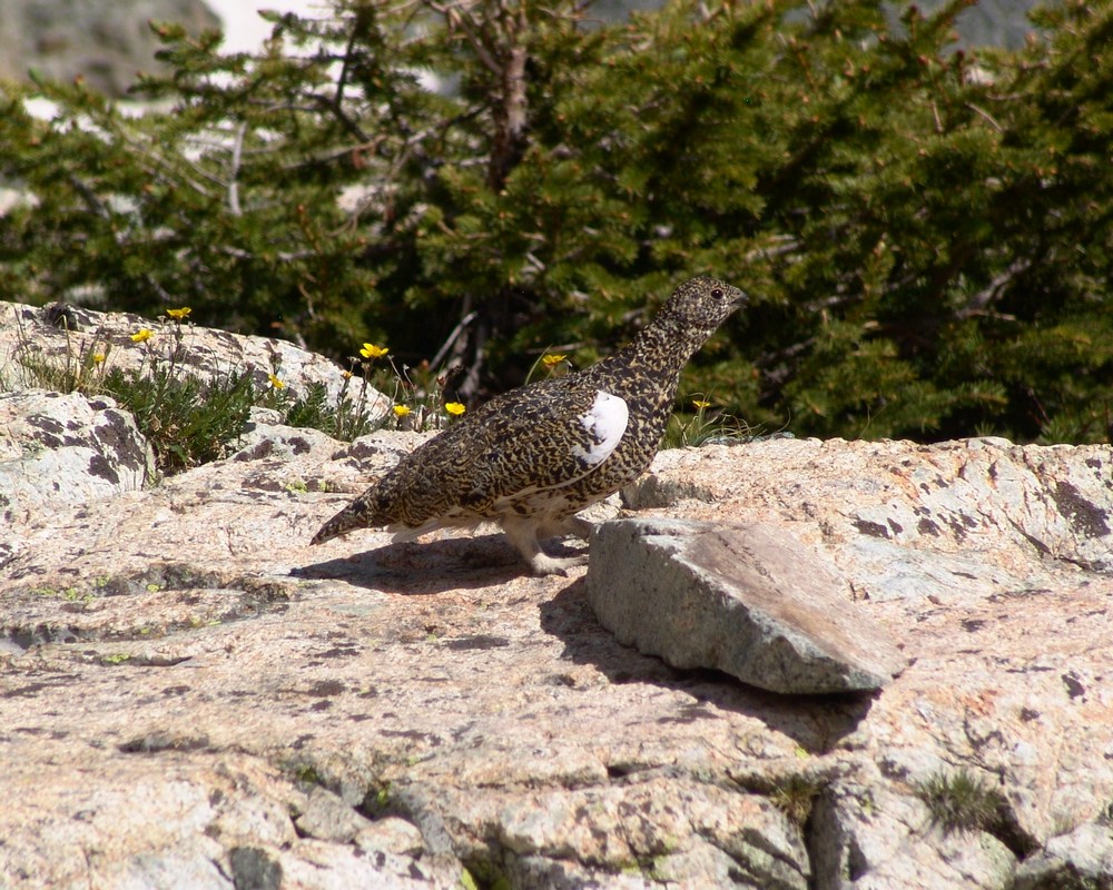
Then I spotted the mama bird - a full-grown Ptarmagin hiding in the brush:
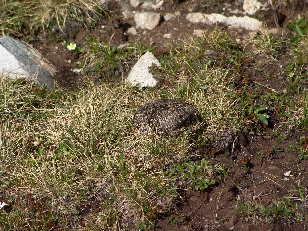
She got up and started running around me like a crazy lady (can't blame her - I was invading her space and she was protecting her chicks) and I took one more picture of her and continued up to the lake.
At the lake, we were able to get more awesome views of Ellingwood Point (left of center) and the waterfall at the base of the headwall for the Blanca / Ellingwood Point saddle.
From the lake you could see all the way up and down the valley, including nice views of Little Bear.
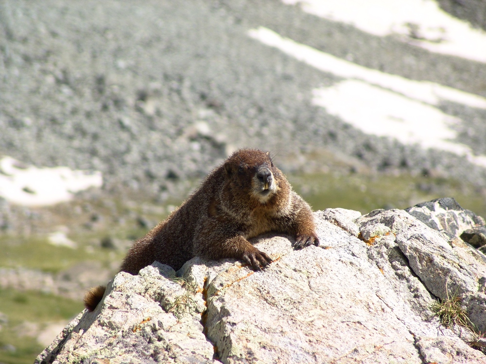
On the way back to our camp-site, we encountered a very friendly Marmot hanging out on a rock. This whole area was full of marmots and we were very careful to hang our food bags in a tree to prevent Marmots from eating our food.
When we returned to camp, we both set-off to prepare dinner. Terry boiled some water for his freeze-dried meal and I opened up a can of tomatoes, chicken, and green chilies. I got out my pre-chopped onion and sauteed everything together and made some yummy burritos. My pack may have weighed a lot, but I got to eat well, so it was worth it.
We saw that rain was on the way so we prepared our area for rain and got into Terry's tent. The rain was fairly heavy and lightning was off-and-on the rest of the evening. I was particularly uncomfortable being so high during a lightning storm, but we survived... We set the alarm for 4:30 AM and went to sleep.
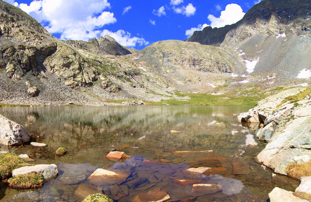
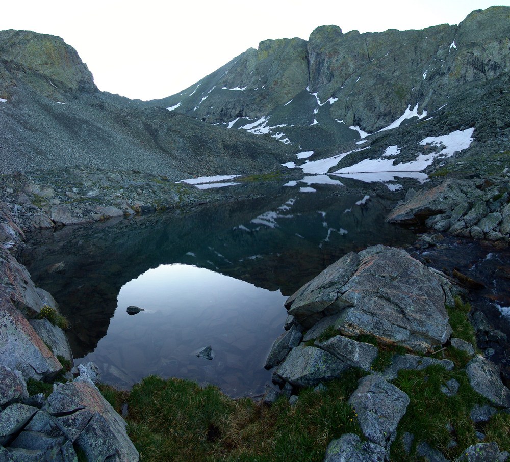
At about 1AM I woke up to the loud sound of rocks falling. I think a goat knocked down some rocks in the valley, which sounded like fireworks in the middle of the night. At 4:30 we both got up and prepared for the climb. I ate some breakfast bars and Terry boiled more water for another freeze-dried meal. In the process he melted some plastic on his stove on accident. Fortunately, it appeared that his stove was still functional. We started up the trail around 5:30 AM as the sun was just beginning to light up the valley. Shortly after we began, we reached one of the upper lakes. The lake was pretty cool because it was reflecting the light that had just started to shine on Little Bear - right of center.
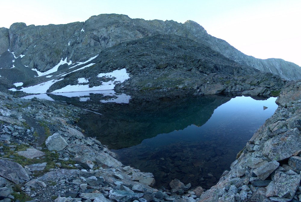
The lakes were really calm and provided some nice views.
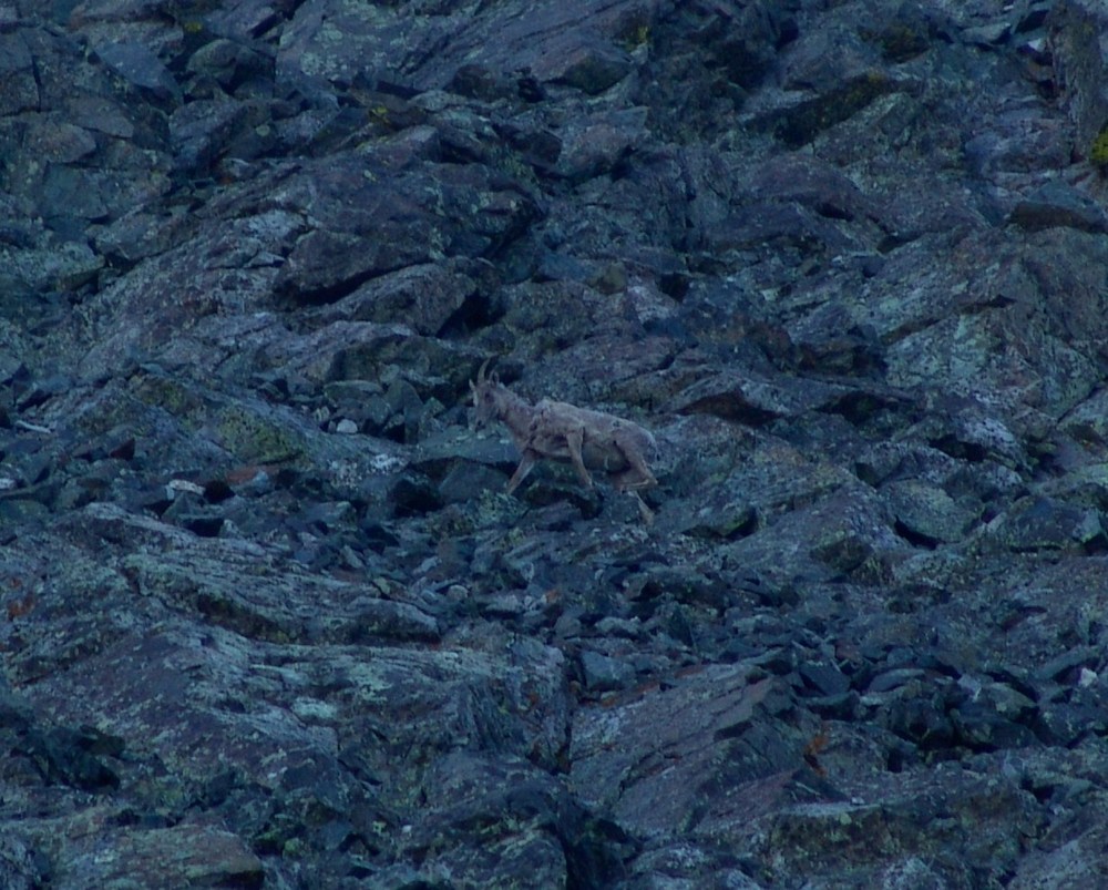
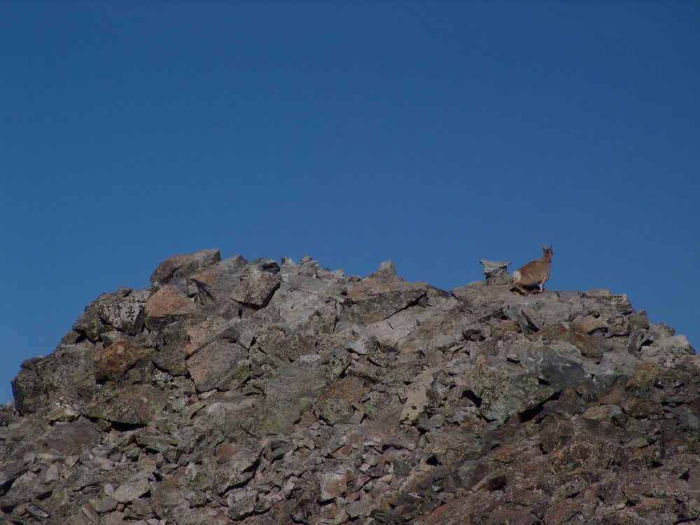
We continued up the trail and began the steel climb up snow fields and boulders. We followed cairns towards the saddle between Ellingwood Point and Blanca and heard the sound of rocks falling above us. A pair of Mountain Goats were doing the traverse from Blanca to Ellingwood above us!
Terry finally reached the trail connecting Blanca and Ellingwood just below the saddle and he led us up towards Ellingwood.
Finally we reached the saddle between Blanca and Ellingwood and were afforded the first very impressive views of the morning. We could begin to make out Crestone Needle (the pointy mountain peaking through left of center).
I also took a 300 degree pano from here, which turned out really nicely. On the right you can see the Lake Como valley from where we came from, and on the left you can see the Huerfano River valley and Mount Lindsey, which I climbed last weekend.
We continued up Ellingwood Point and kept looking back behind us in awe of the sheer size of Blanca Peak. It really is impressive. Here's some panos of Blanca and Little Bear, across the valley from us:
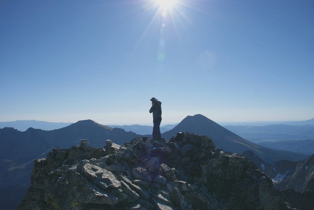
While I was taken by all of the views and therefore occupied by photo-taking, Terry was making great progress towards the top of Ellingwood. He couldn't see it, but unfortunately he was not the first to summit Ellingwood today. The goats were!
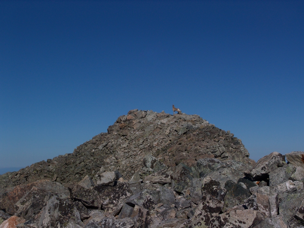
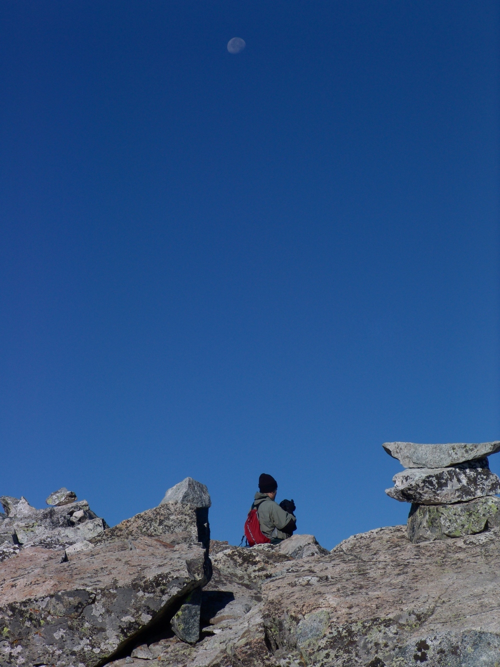
As Terry approached the summit, the goats left and Terry was afforded solitude once more on Ellingwood. Here's Terry with the moon above him as he took in the views from atop Ellingwood:
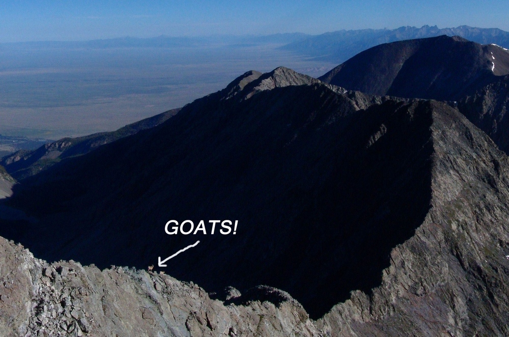
As I reached the false summit of Ellingwood, I looked to my right (north) and saw an impressive ridge connecting Ellingwood to California Peak. If you look closely at this pano, you can see something really cool...
... goats!
Here's a zoomed in view of the Goats! They were doing the traverse down the spiny ridge. It was really amazing seeing wildlife this high.
I finally reached the summit and Terry was already taking pictures. He took this one of me as I was also taking photos:
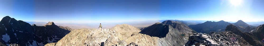
Here's a 360 pano from Ellingwood. Under the sun is Lindsey, and left of Terry is Little Bear and finally Blanca:
Terry and I stayed on top for about 20 minutes, watching groups of people summit Blanca and Little Bear across the valley. We refueled and began the traverse over to Blanca. This was a fairly sketchy route, perhaps because we stayed pretty high on the airy ridge. To our east was a sheer drop-off of at least 1,000 feet. The route required some careful footholds, ledge-walking, and even an icy couloir. Terry went down the icy couloir first, acting like Spiderman on the edge. I decided to around the ice and then right through it, using my hand to pick up ice and snow and throwing it out of my way. We started up Blanca and passed one gentleman coming over from Blanca. Looking back at Ellingwood, you can see the route we took, basically right down the ridge and up again towards Blanca.
The scramble up Blanca was fairly straightforward class 2+ climbing and I eventually reached the summit. Terry summited about 10 minutes later and we both began to take pictures like crazy. The weather was absolutely perfect - no wind. Terry took my summit shots, and then we both started walking around the summit block in search of great photos.
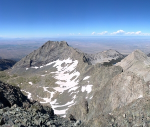
I took my normal 360 pano...
...and then took some higher detail panos of Lindsey Peak and the Winchell lakes to our Southeast.
Here's a zoomed in view of one of the Winchell lakes: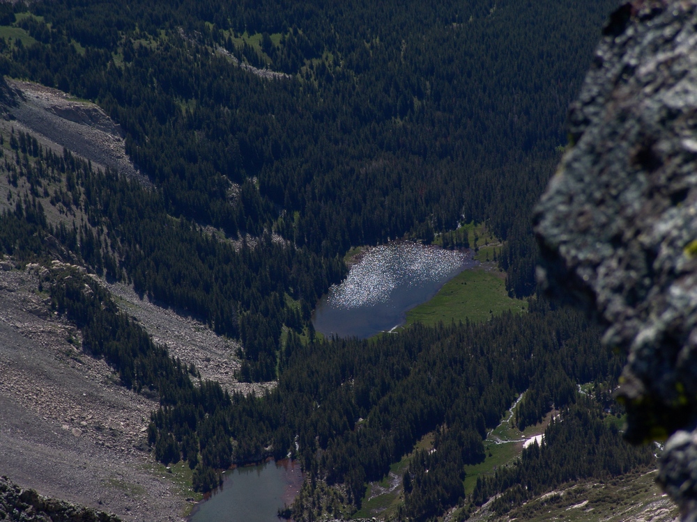
Then I took a very detailed set of photos of Little Bear and the traverse from Little Bear to Blanca - one of the hardest traverses in the State. You can also see Lake Como in the valley to the right of Little Bear.

After hanging out on the summit for awhile, we decided to head back down, which turned out to be fairly uneventful except for the awesome views. We eventually got back down to the waterfall, which I had to take a picture of!
When we got back to camp, we both decided it would make sense to just pack-out today, so we packed up our camp and headed back down towards Terry's vehicle. At Como Lake, we encounted a large group of 4-wheelers, one of which we followed down most of the trail to watch him go over the Jaws obstacles. His Willy's Jeep made the Jaws look more like baby teeth:
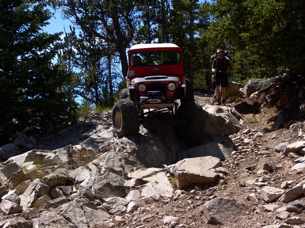
The hike back down to the car was fairly uneventful after seeing the Willys.
We then drove into Blanca to have some good food to prepare us for the drive home.
Sangre de Cristo Range
The Sangre de Cristo Range spans over 180 miles from Colorado into New Mexico and is known by many locals for its solid congolmerate rock and its steep relief, rising out of the San Luis Valley. The festive town of Crestone sits at the base on the western side of the range and serves as a gateway to many of the lesser-known summits in the area. Another famous aspect of this mountain range is the Great Sand Dunes National Park, which rests at the western base of this range and can be seen from many of the summits of this range.