Displaying items by tag: Pikes Peak
Exploring Almagre Mountain - Sunrise on Pikes Peak and the Waldo Canyon Fire
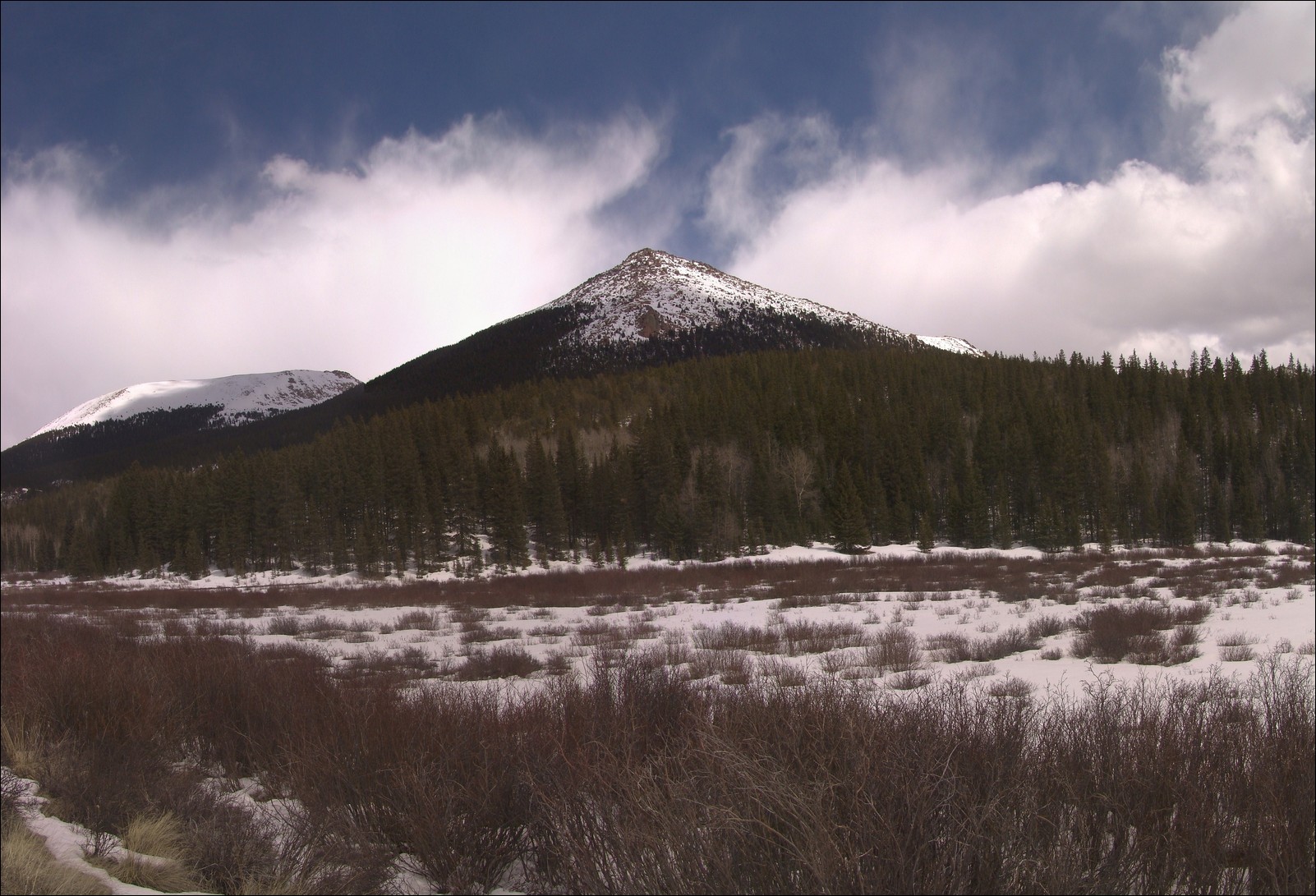
Originally, my friend Ethan and I had made plans to climb the Three Apostles - three great 13ers over near Leadville; however, the Waldo Canyon Fire started the weekend prior and by Tuesday had burned out of control - 346 homes were burned to the ground in Mountain Shadows and Highway 24 was closed. The main access to the mountains was Highway 24, so we were pretty much stuck on the Front Range. Additionally, the whole week had been an emotional rollercoaster for everyone - my parents evacuated their house and stayed with us for a couple of nights. Ethan covered the fire quite a bit with video and social media throughout the week (by the way, if you have a chance, you really should check out his incredible blog post about social media, traditional media and the Waldo Canyon Fire - a fabulous read). The Waldo Canyon Fire had presented Ethan and I another opportunity - to hike a closer-to-home peak with the hopes of getting a birds-eye-view of the fire's extent.
So - we set off early on Sunday morning to do just that - I picked Ethan up at 3:30 AM from his house and we head up Gold Camp Road to tackle Almagre Mountain - a 12,367 ft. gently-sloped peak just South of Pikes Peak. Indeed, most Colorado Springs residents will recognize Almagre as a very plain looking set of mountains above tree-line to the left (south) of Pikes Peak. I'd always wanted to climb Almagre, and Ethan had already done it twice, so it seemed a great fit for our objectives.
We opted for the western approach from near the gate that Colorado Springs Utilities (CSU) has erected to keep people out of the city's water supply, which seemed to us to be quite low. To reach this spot, we drove quite a ways up Gold Camp Road, about 2/3 of the way to Cripple Creek, and turned right on Forest Road 376 to the CSU dead-end.
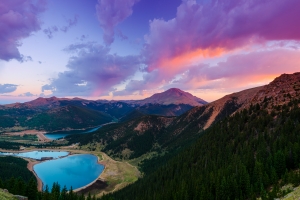
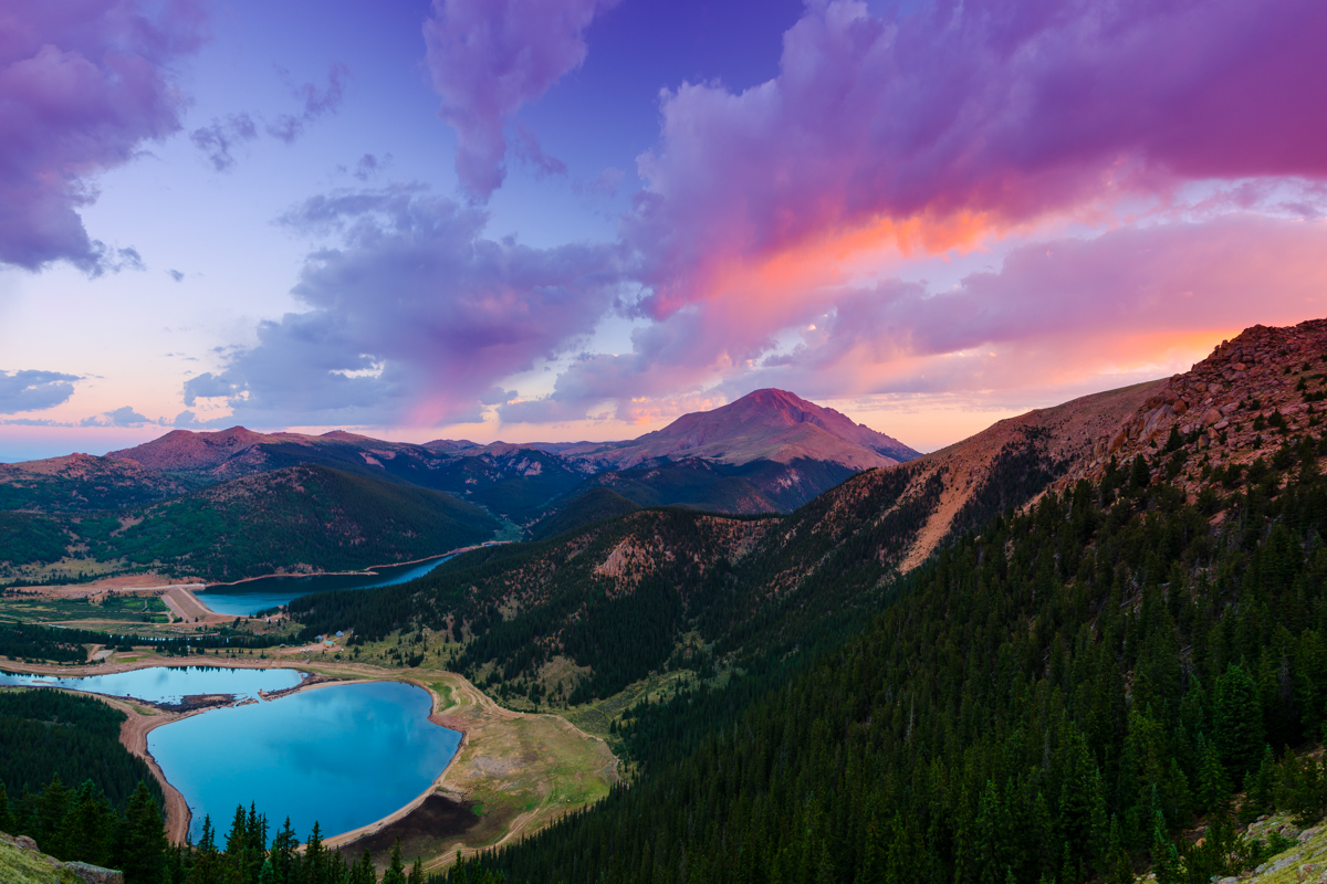
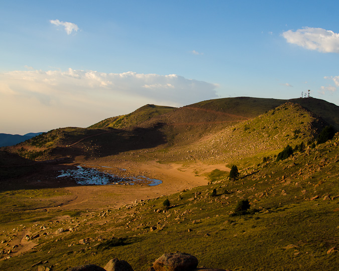
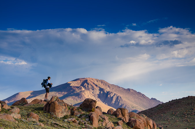
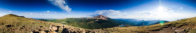
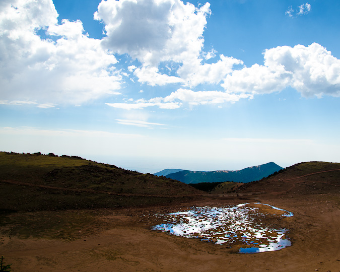
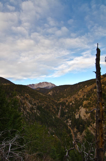
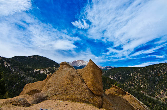
We arrived at the gate at approximately 4:15 AM and began in a wild rush up the steep 4WD road by foot towards McReynolds Reservoir. The air was quite cold this early and this high up, a stark contrast to the record-setting 100+ degree heat we had been experiencing in the scorched and dry urban setting of Colorado Springs. Eventually, the road leveled off and opened up into a large meadow, giving us a clue to begin to head west on a very faint trail, which crossed the CSU fence-line and connected to a more solid trail leading up towards Almagre Mountain. After a couple of miles of fairly steep climbing, we reached a great stopping point, giving us a wonderful vantage of Pikes Peak and the various reservoirs below - Mason Reservoir and McReynolds Reservoir - also known as the Seven Lakes area.
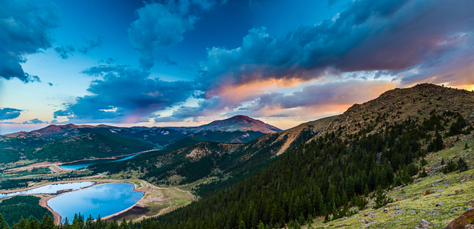
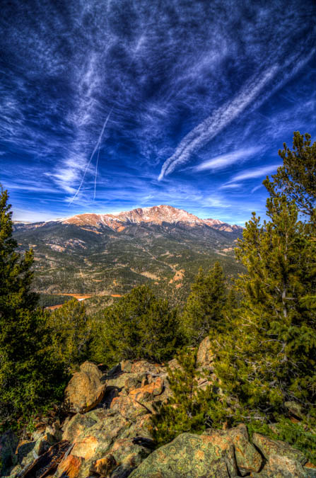
We stopped here to take in the great light hitting Pikes Peak, and I took advantage to take many photos from here as the sun continued to change the colors of the clouds and Pikes Peak.
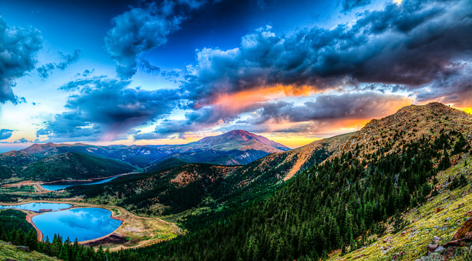
The lighting was fantastic, and it was such a rare view of Pikes Peak, I really loved it. This particular shot is also available on my photography website for sale.
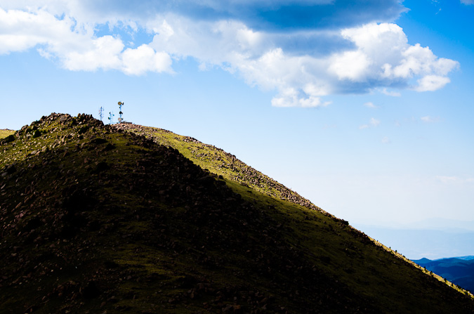
Eventually, Ethan and I packed up our tripods and continued up to the ridge for Almagre Mountain. Once on the ridge, we could see Stratton Reservoir, which looked more like Stratton pond. Additonally, we made lots of jokes about the "Weather Control Satellite" on top of Almagre Mountain South (which is really a microwave repeater). This was based on a very funny press conference earlier that week about the Waldo Canyon Fire where someone in the crowd actually seriously suggested that the government just use its weather control satellites to create rain to put out the fire. For more on the weather control satellite joke, check out this hilarious post.
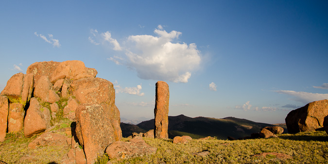
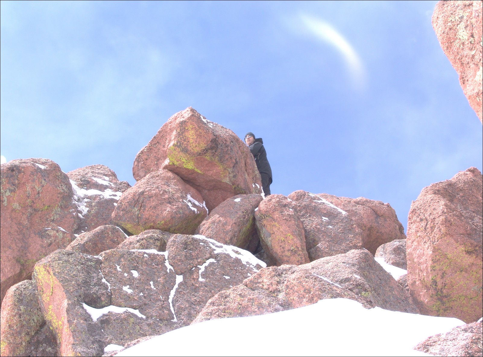
The terrain on the ridge was classic Pikes Peak granite - much of the same material found in the Lost Creek Wilderness Area.
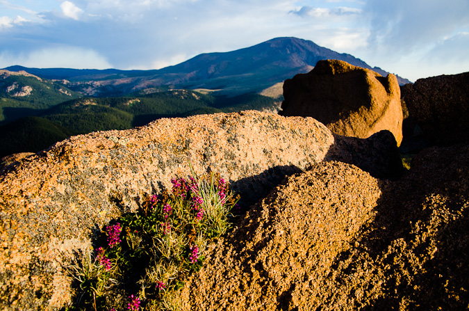
There were funky rock outcroppings all over the place. Nature sure does have a great sense of humor!
Ethan and I were both really loving the light and the color - somewhat tainted by the smoke from the huge fire that raged on to the north of us.
Ethan and I made several stops on the way up to take shots of the lakes and of Pikes Peak.
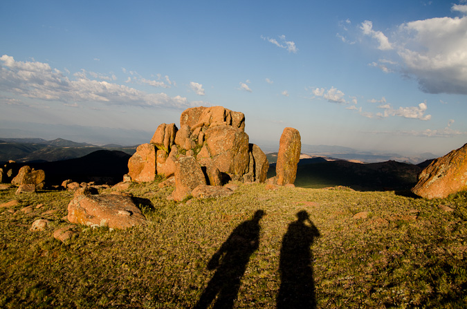
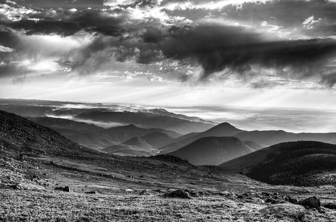
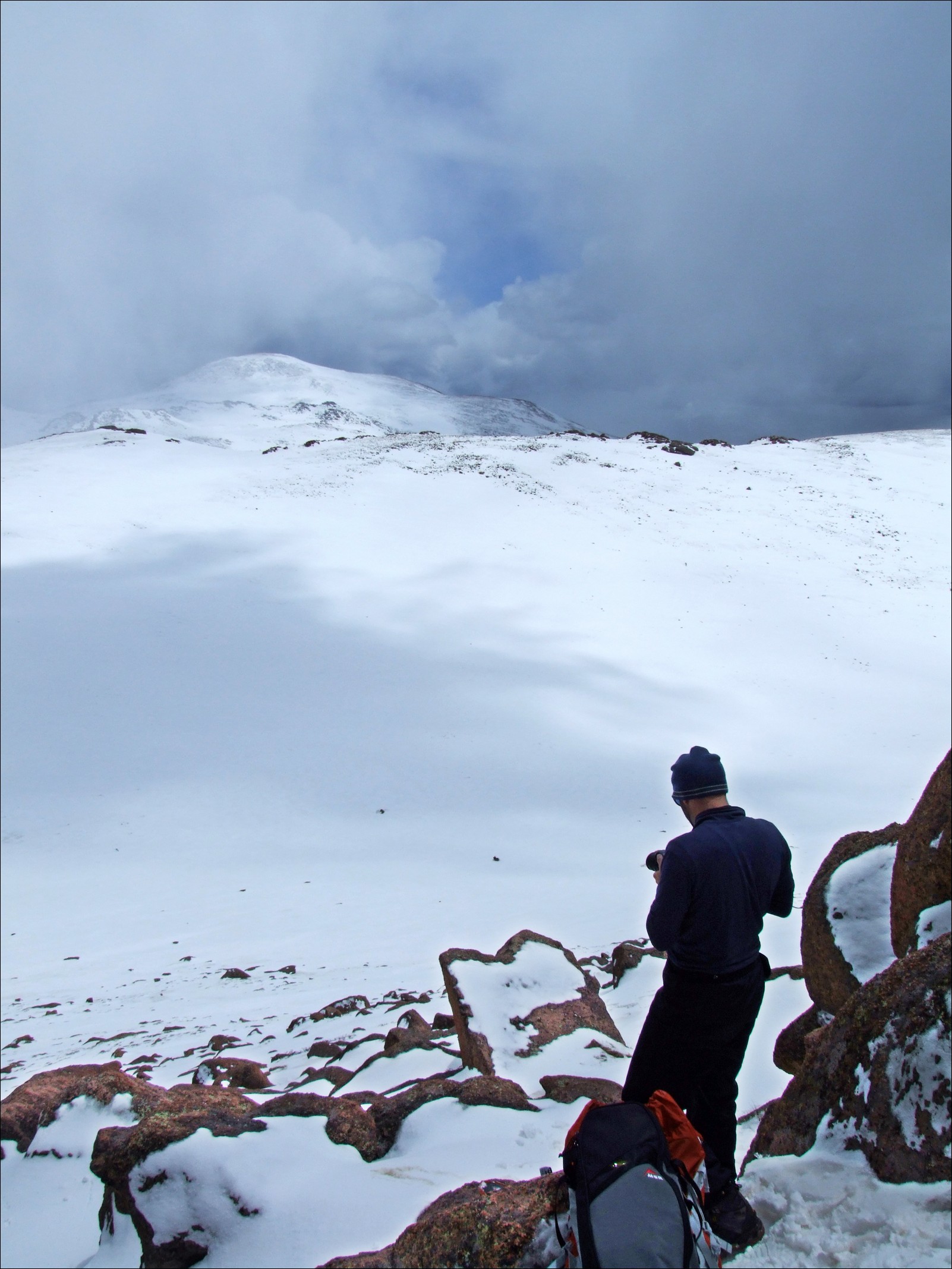
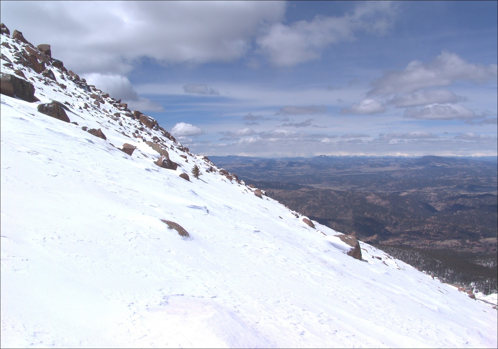
Before long, we had reached the summit without any problems. We had a great viewpoint of the fire burn area and the current burning zone. The smoke had settled into the valleys below us and made for quite the fantastic scene.
We both set-up tripods to take some time-lapse photos and video.
I was able to put together a 300 shot time-lapse video out of still images over a two-hour period from the summit. While it was pretty borning up there, I could not complain about the view.
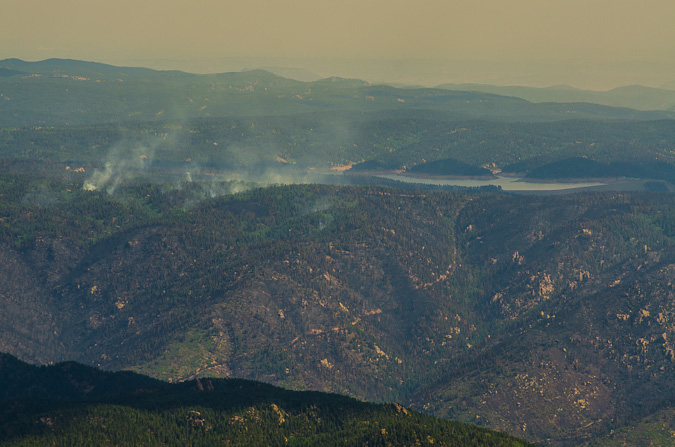
I was able to get some pretty great zoomed-in shots of Rampart Range Reservoir about Highway 24, where the fire was most active at this point. A zoomed in view shows quite a bit of destruction in that area, but as bad Ias I had thought would / could happen.
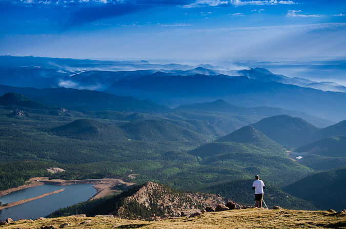
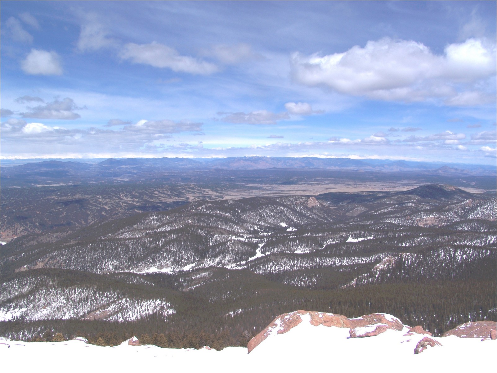
The 360 degree view was fantastic as well - with Pikes Peak anchoring the center of this peice.
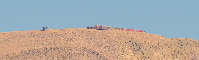
I was even able to get a super zoomed in view of the Pikea Peak summit, where I could make out people and the Cog Railway.
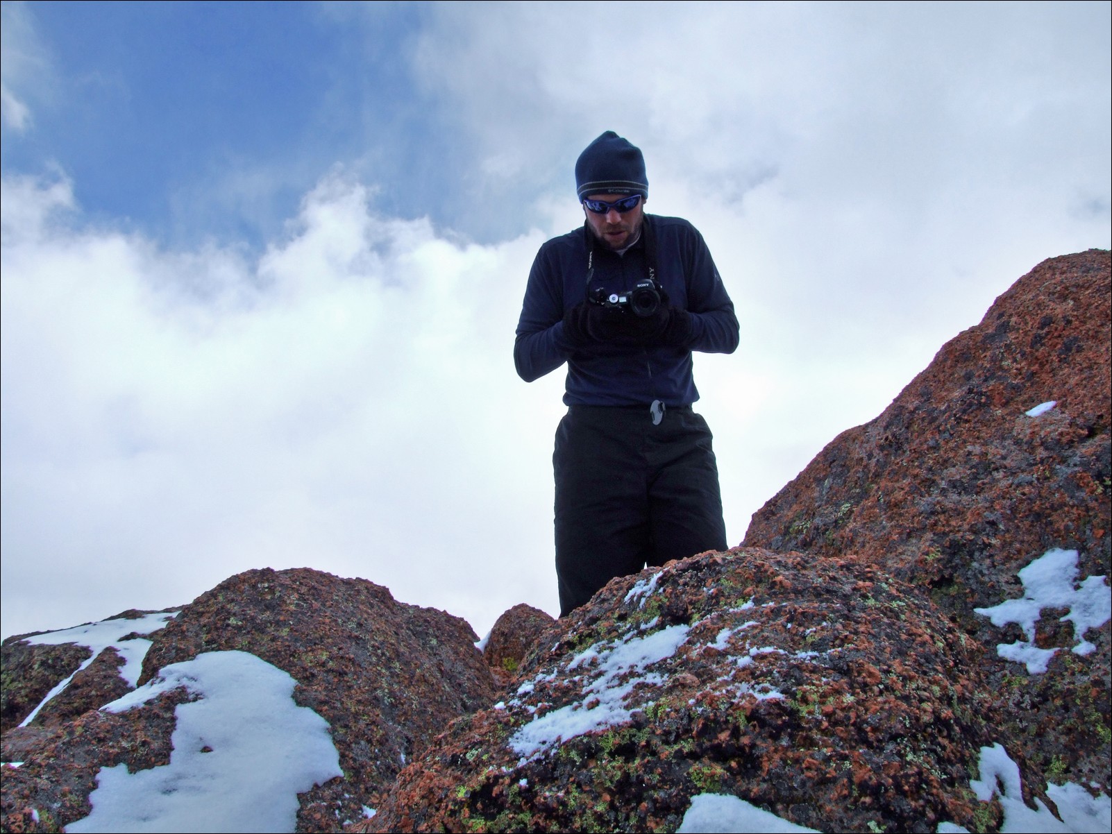
We both decided that after spending two hours on the summit that it was time to head-out. So we did just that. Right beforehand I was able to get a sweet shot of Ethan way up on the summit taking shots.

On the way back, I was able to get a better shot of Stratton Reservoir (with Mount Rosa in the background), now reduced to almost nothing.
And of course, our down-climb would not be complete without another shot of the Weather Control Satellite...
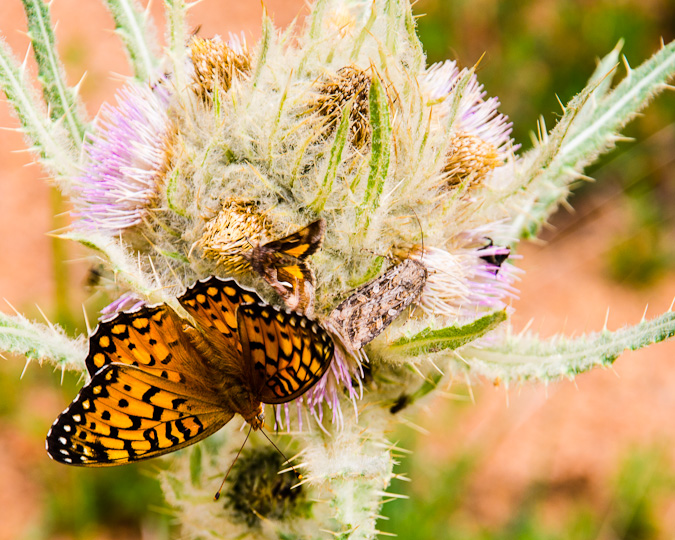
The hike back down to the car was quite uneventful. We noticed there were a lot of butterflys out and so we were able to follow one to this huge thistle plant, where countless other insects were hanging out, drinking nector from these hearty flowers.
All in all, I would rate Almagre Mountain as very easy - a mountain for all ages and skill levels. The rare views of Pikes Peak alone were worth the drive and hike for me.
{fcomment}
Adventures on Cameron Cone - Views of Pikes Peak and Beyond

This Spring has been quite dry and I've been feeling the itch to get out and get up a summit. I mulled the idea of heading up to do Lackawanna (a high 13er near Independence Pass); however, I knew my time was limited and that I would need to stay closer to home. So, I put out a feeler to my climbing partner Ethan Beute to see if he would be interested in doing something easy close to home. We both settled on Cameron Cone, the easily recognized point often seen in front of Pikes Peak in many photos of Pikes from Colorado Springs. I'd had my radar on Cameron Cone forever it had seemed, so it was a great choice in that regard. At the last minute, I also invited one of my other hiking partners, Sarah Musick, and plans were in motion to meet at Ethan's at 5 AM and hit the Cone. Since both Ethan and I are avid photographers, we opted for the early start in the hopes of getting some decent shots of sunrise from the trail somewhere.
Cameron Cone is named after a famous soldier and newspaper publisher, Robert Alexander Cameron. When originally dedicated, the summit was called Cameron's Cone. The Cone towers 10,707 feet above the city of Colorado Springs and is the fourth highest ranked summit in El Paso County and 1,935th highest in the State of Colorado. For a whole listing of summits in El Paso County, check out this link.
There are several routes to reach the summit of Cameron Cone; however, we chose one of the more rigorous routes to gain the summit. Instead of driving to Crystal Park, as some would suggest, we opted for the long route from Barr Trail. Here is a map of our route, feel free to click on it to see a slightly larger version. All in all the hike was 7.0 miles and 4,175 ft. of elevation gain - a nice work out for sure!

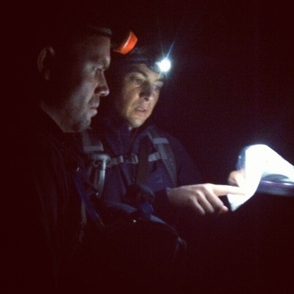
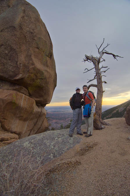
We decided to park on Ruxton Ave. in Manitou Springs and walk the road to where it ends. We then chose to cut left just after the chain link fence to the left of the Barr Trail and then walk the Cog Railway about a hundred feet. From there, we went straight up the hillside to the south until we reached the Englemann Trail. We found this guide to be very useful for the trip, as you can see from this photo of Ethan and I taken by Sarah.
We found the route to be fairly straight-forward once on the trail; however, we did lose the trail in one spot lower in the Englemann canyon. A simple up-climb and we were able to re-locate the trail. I would mention that I did bring my GPS with me and I had entered the coordinates from the Summitpost route description into my GPS as waypoints which proved useful.
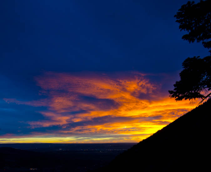
Before we knew it, the sun had begun to rise and we found a suitable place to stop. I set-up my new Gitzo carbon-fiber tripod and took a ton of shots with my Tokina 11-16 lens. I love this tripod! It was somewhat heavy, but well worth the haul. I was not terribly impressed with my sunrise photos, mostly because I think we were too low and some of the view was obscured by Eagle Mountain to the south and east. Nonetheless, here's a few of my shots.
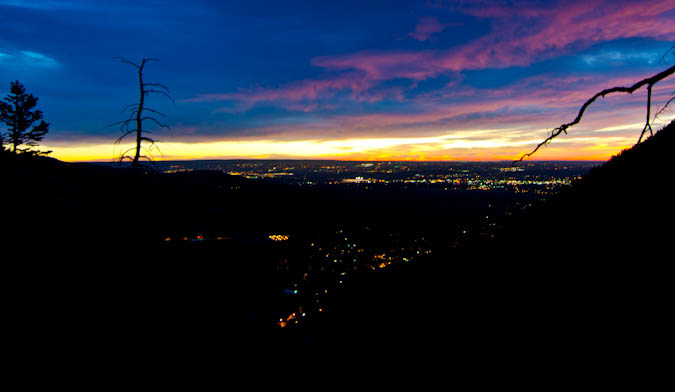
The city lights made for a very cool view.
I also had a little bit of fun doing a very short time-lapse video of sunrise using my intervalometer on my Nikon D7000.
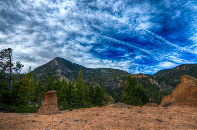
After stopping to take some shots of the sunrise, we continued on up the trail. The trail was fairly steep and kept our heart-rates going. Soon, the trail went around this huge rock feature and then dumped us out with a huge view of Pikes Peak and the Cog Railroad, which was pretty impressive.
The rock near the trail was very classic Pikes Peak Granite, with features very similar to those of outcroppings found in Lost Creek Wilderness Area. A truly fun playground, as Sarah was able to demonstrate.
Ethan and I both enjoyed the view of Pikes Peak from this location.
The terrain was like a playground of sorts, with all kind of really cool features.
We took a few more pictures and then we were on our way up to the next section of the trail.
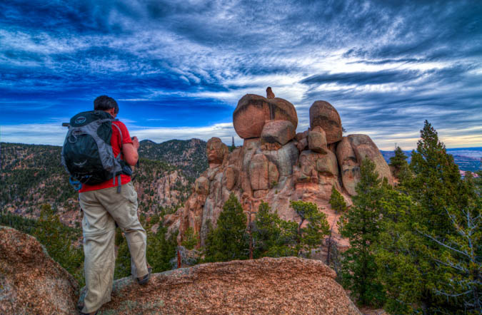
Soon, the trail opened-up again and dumped us out onto a very flat area which was the middle section of the hike. From here, we could see Cameron Cone finally - it seemed a lot futher away than I think we were anticipating. We could also see the Magog Ridge and Magog Rock. For the rest of the hike we all jokingly coined the phrase "Oh-my-Gog."
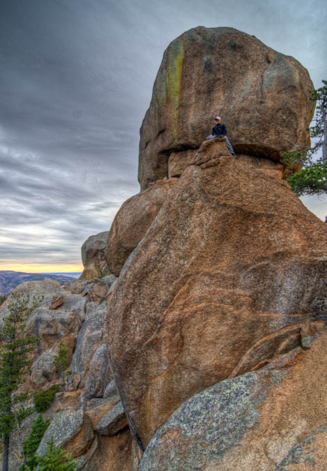
We went around the huge Magog Rock, which was one of the cooler features I'd seen. It had this smaller rock perched above it which made us all wonder how the heck something like that could even happen.
Ethan took many opportunities to take photos of it as well.
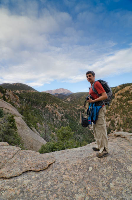
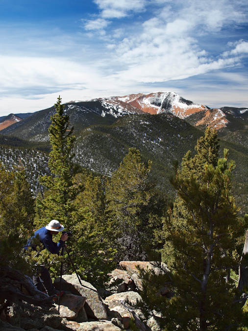
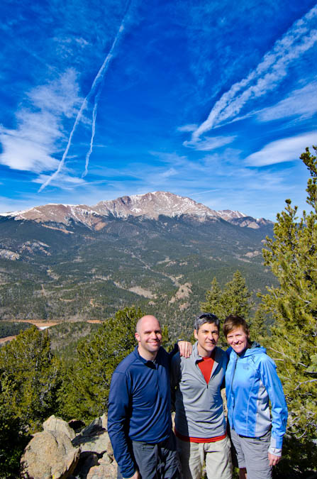
We followed a small road for a ways and then found the trail leading up to Cameron Cone, as advertised. Indeed, the trail was faint and sometimes hard to follow. We did find that there were small ribbons tied to trees at various intervals to help mark the way. We lost the trail a couple of times and found ourselves bushwacking through some steep and nasty terrain. Finally, we reached the ridge to the south of Cameron Cone and then ascended to the summit. It was pretty steep and I could understand if people turned back on this climb. It is much harder than it looks, for sure. Once we reached the top, we all enjoyed the view of Colorado Springs to the east and the unique view of Pikes Peak to the west. I busted out my tripod and set it up for some HDR work. Ethan caught me in the act, with Almagre in the background.
The sky was pretty cool for photography and some jet contrails added to the interest level.
One other nice advantage to bringing a tripod is that it makes for easy group photos.
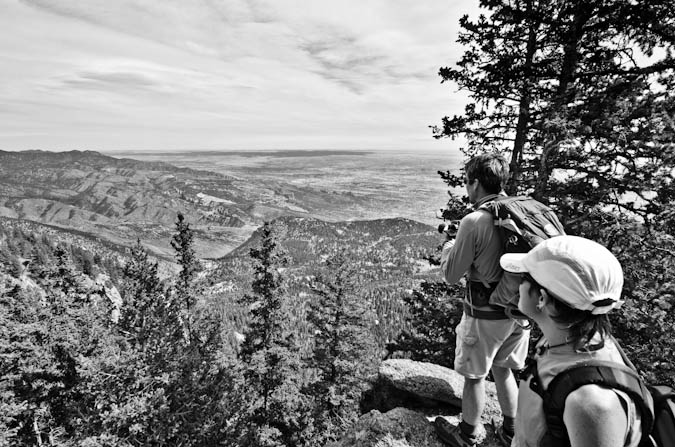
On the other side of the summit, the views of Colorado Springs, Waldo Canyon, Williams Canyon, Garden of the Gods and Colorado Springs were pretty impressive.
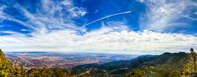
From here, I took a quick panoramic photo of the Colorado Springs area, looking northeast, east and southeast.
We spent about an hour on the summit and then head back down. The rest of the trip was pretty uneventful, albeit full of great conversation with some really great friends. I left with one parting shot of Pikes Peak.
Overall, Cameron Cone is a great hike! It is tougher than it looks and demands some respect when climbed from Barr Trail. Also, good route-finding skills are also required.
The views of Pikes Peak on this trip are totally worth the hike and are quite unique. You won't be disappointed if you choose this mountain that is off the beaten path.
{fcomment}
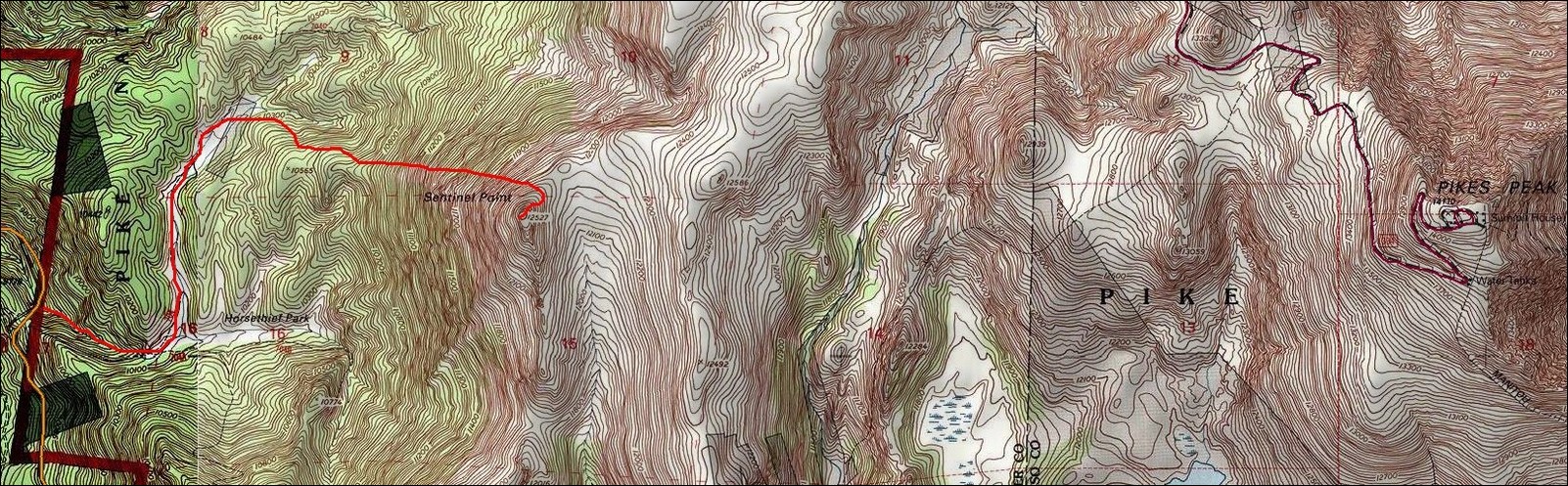
Sentinel Point - Pikes Peak's western guardian
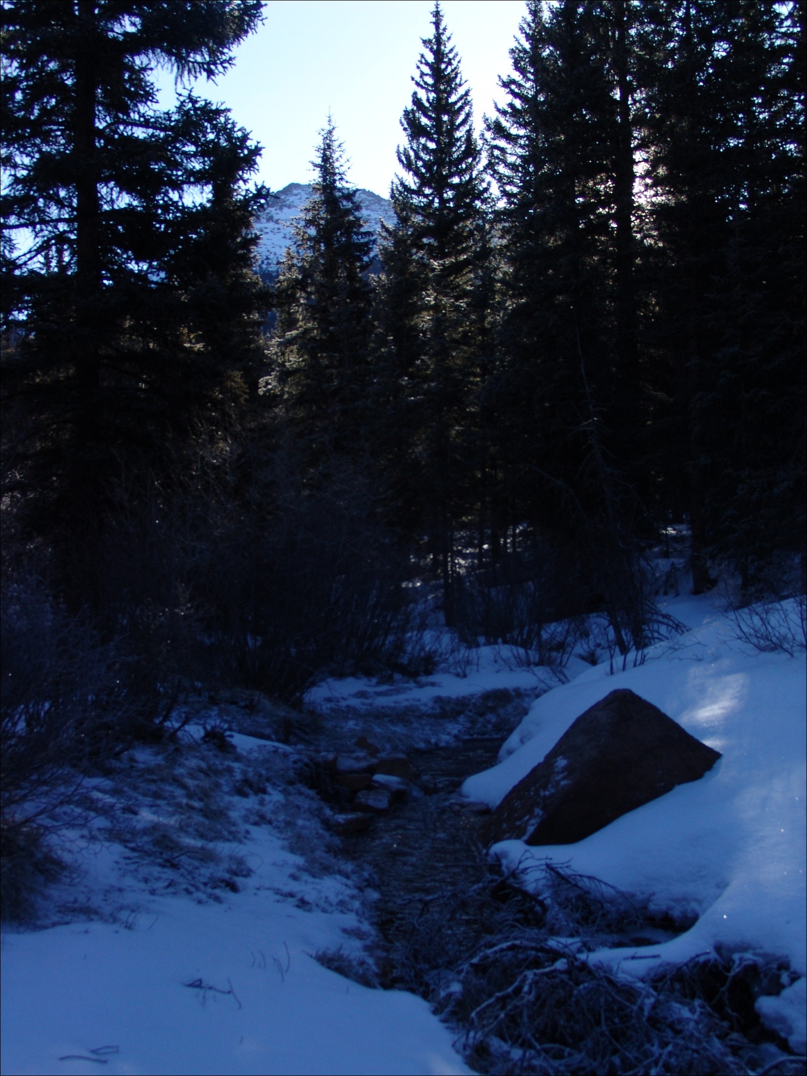
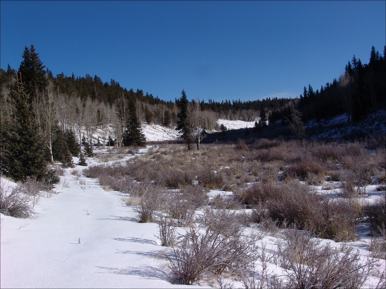
Sentinel Point is a fairly unknown mountain on the west side of Pikes Peak. One can access the mountain by driving to Divide on Highway 24 and heading South on Highway 67 just past the old tunnel. The "Horsethief Park" trailhead, which provides access to both Sentinel Point and Pancake Rocks can be found roughly halfway between Divide and Cripple Creek. Having just purchased new snowshoes, my friend Ethan decided that he wanted to test them out. We departed Colorado Springs around 6:30 AM and began hiking around 7:45 AM. The trail begins fairly easy and we did not put on our snowshoes until we crossed the creek onto trail 704C to head North into Horsethief Park.
After crossing the stream, the trail brought us right up into Horsethief Park and provided us with some great views of some frozen over beaver ponds.
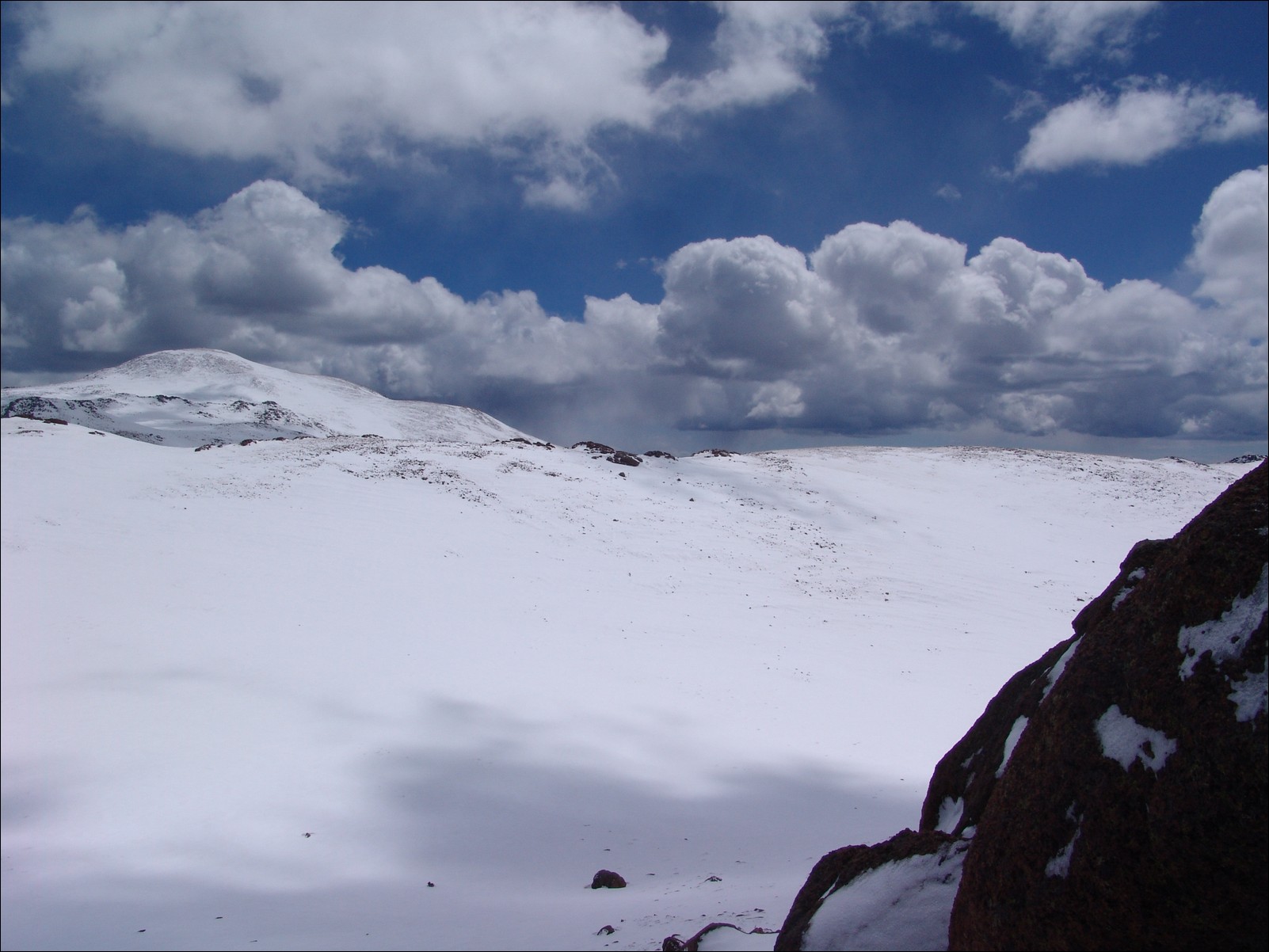
The views of Sentinel Point were great all day, and as we ventured up into Horsethief Park, the mountain seemed to keep an eye on our progress, measuring our worthiness.
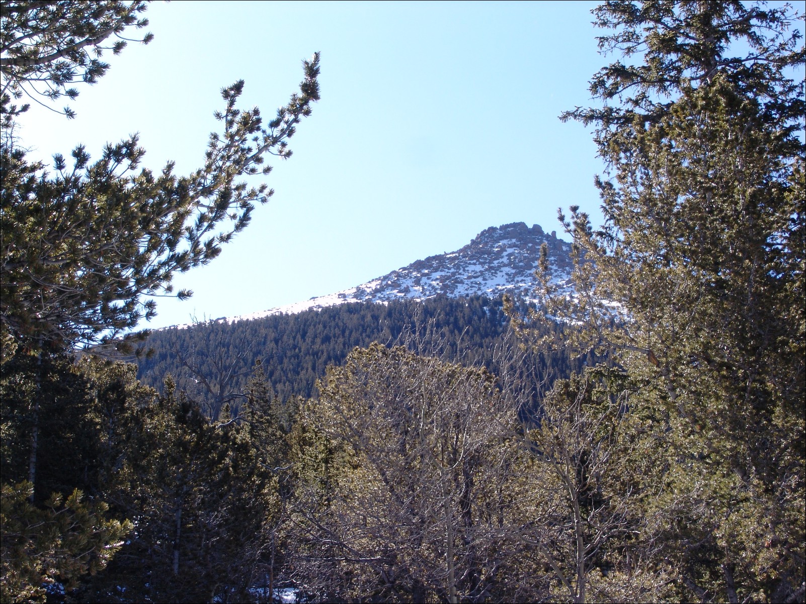
Sentinel Point was very close!
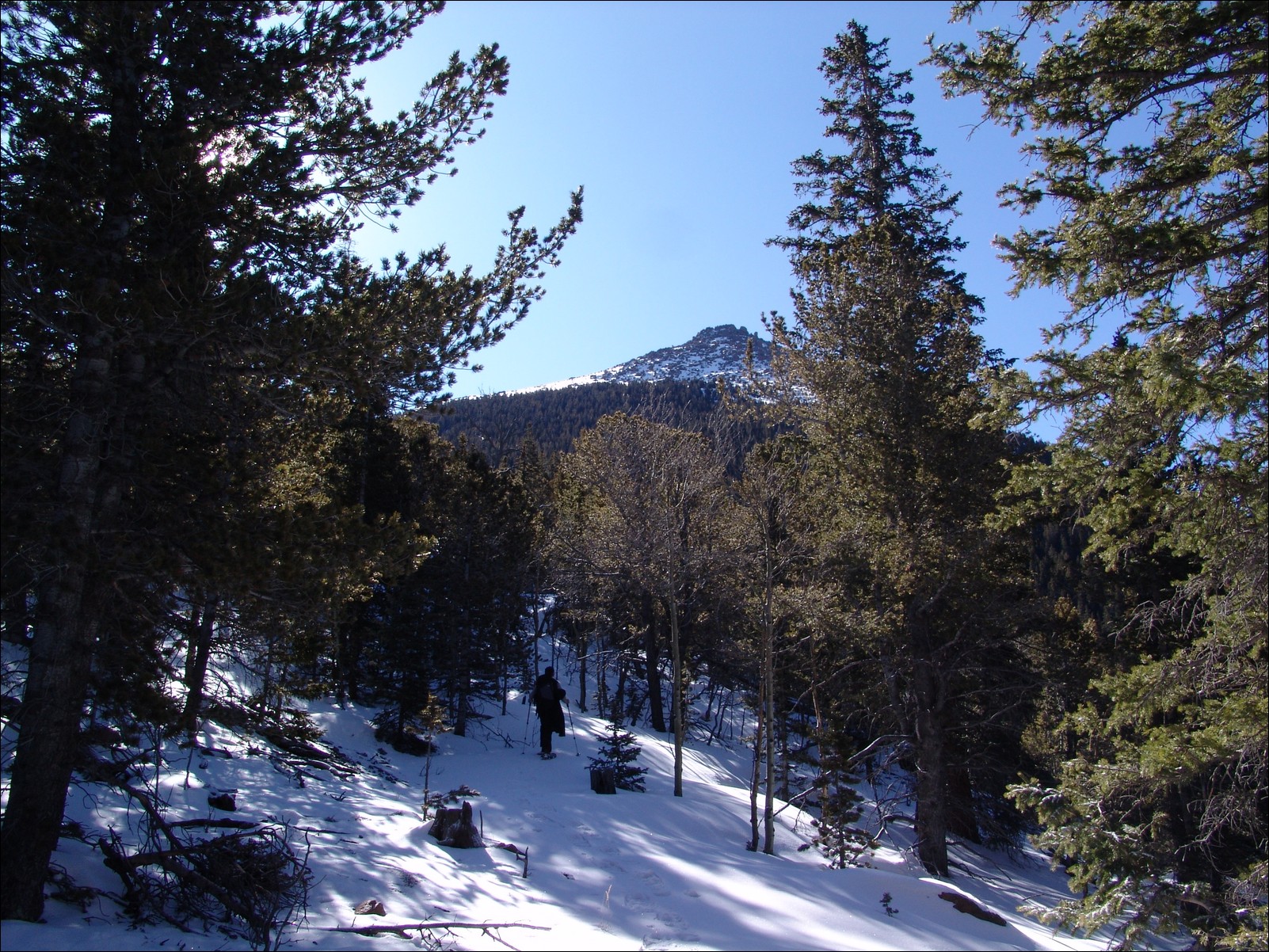
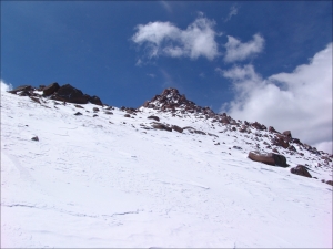
Once in Horsethief Park, the trail splits and we stayed to the right and began bushwhacking up the steep slope of Sentinel Point.
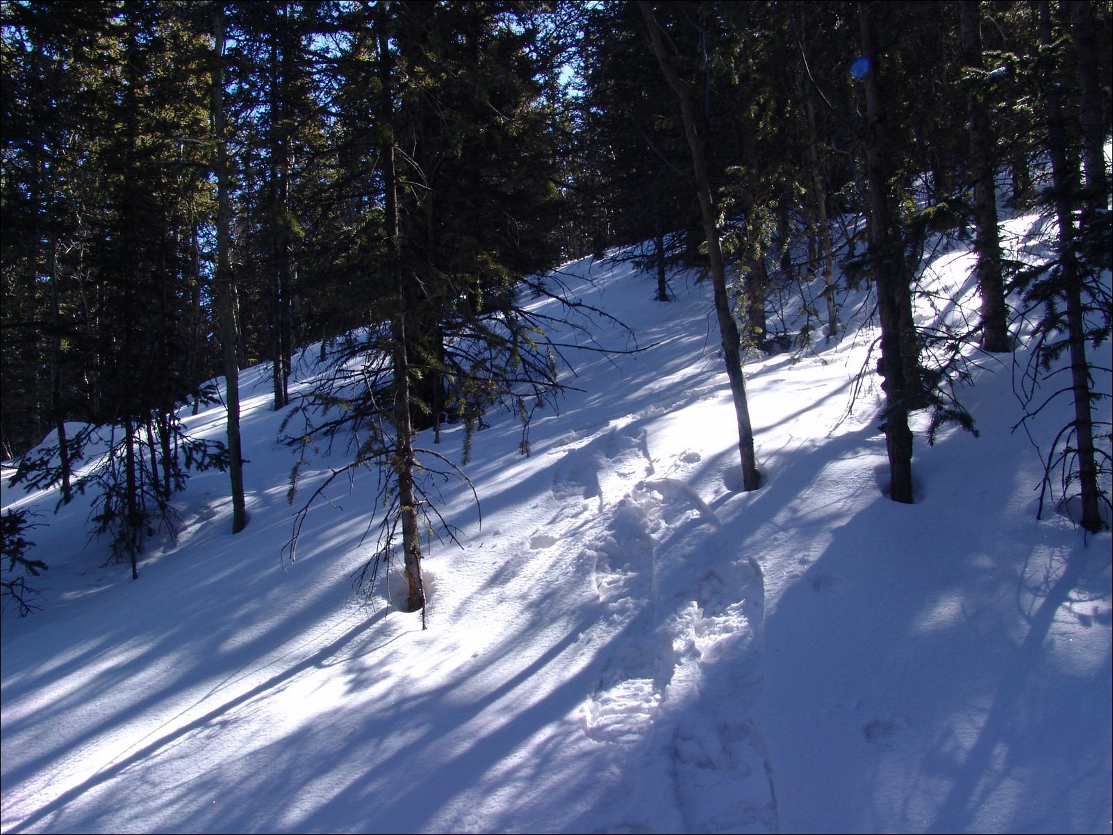
In retrospect, it would have been prudent to stay to the North side of the mountain; however, the very steep and powdery west slope of Sentinal proved to be a great test for our snowshoes and our endurance! Once at tree-line, the terrain leveled out and we were able to make our way to the ridge-line and up to Sentinal Point proper. The views on this hike were outstanding, including some very uncommon viewpoints of Pikes Peak and Almagre Mountain. 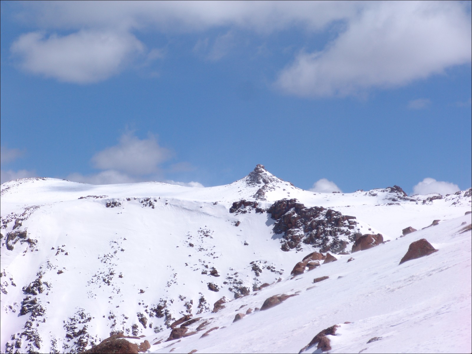
I highly recommend this as a quick day-hike all year round.
Front Range
The Front Range of Colorado is perhaps the most well-known mountain range in Colorado due to its proximity to three major metropolitan areas: Denver, Colorado Springs, and Ft. Collins. The Front Range is comprised of several sub-ranges, including Rampart Range, Kenosha Mountains, Platte River Mountains, Tarryall Mountains, Puma Hills, Vasquez Mountains, Laramie Mountains, Rocky Mountain National Park, Never Summer Mountains, Medicine Bow Mountains, Mummy Range, Williams Fork Mountains, and the Indian Peaks. Additionally, the Front Range covers roughly 7,000 square miles and spans more than 175 miles North-to-South, making it Colorado's longest mountain range.