Displaying items by tag: Sawatch Range
Climbing the Crown Jewel of Colorado's Sawatch Range - Ice Mountain & North Apostle
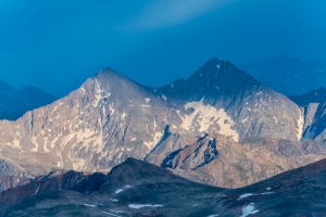
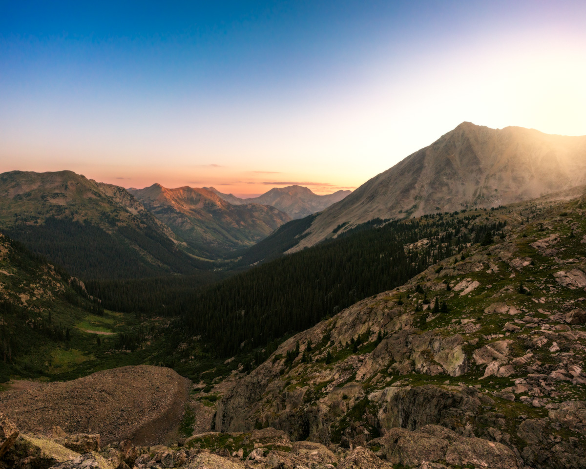
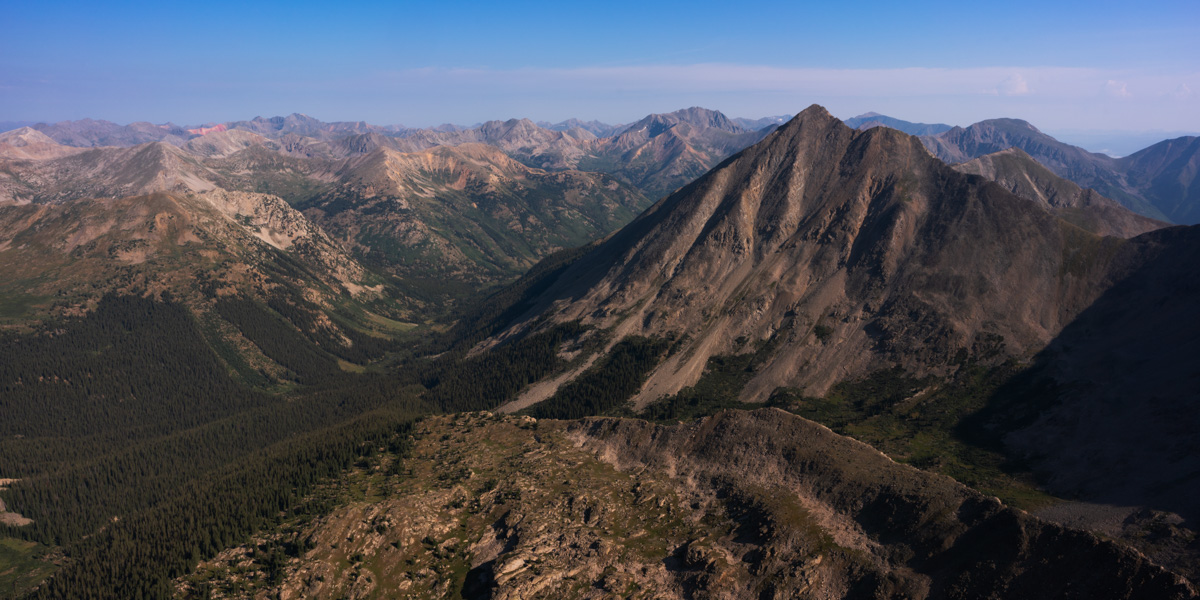
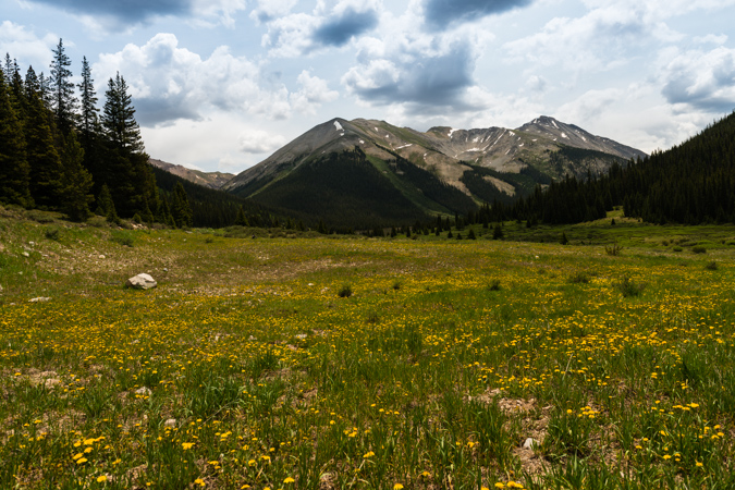
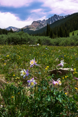
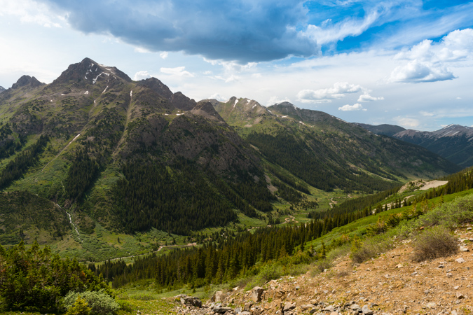
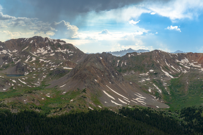
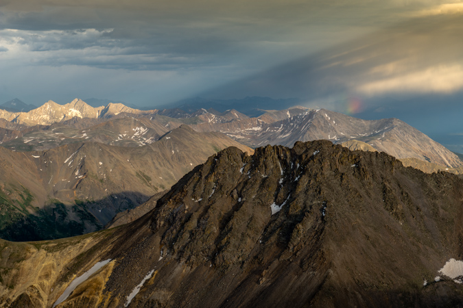
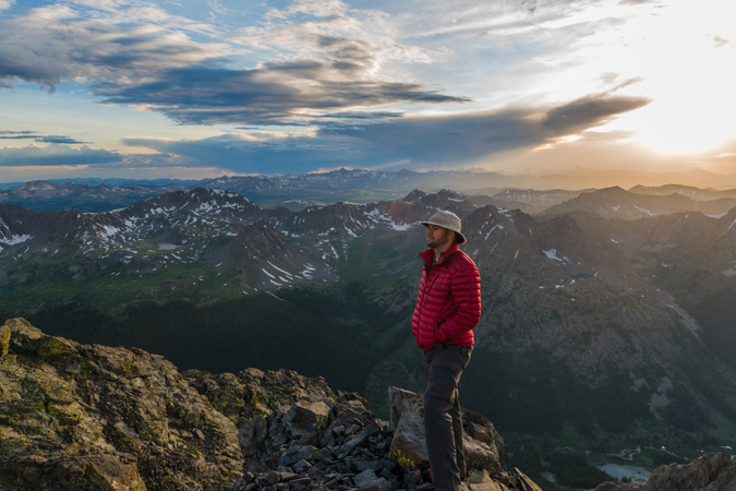
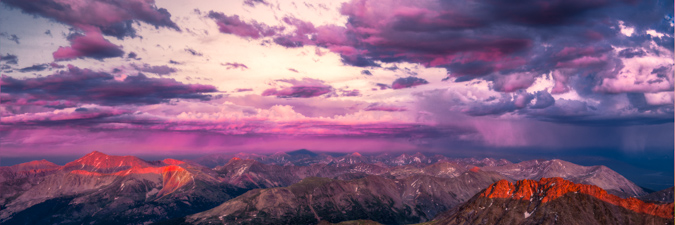
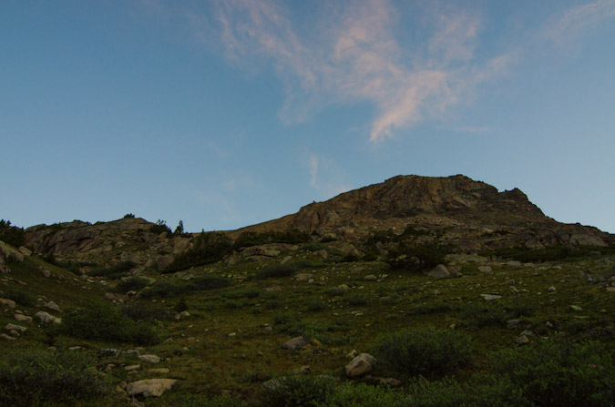
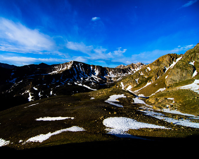
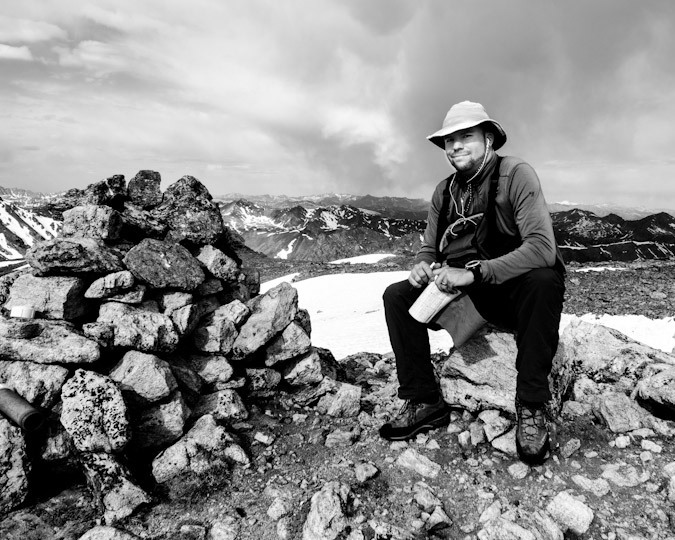
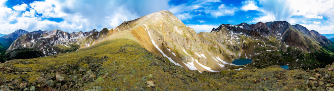
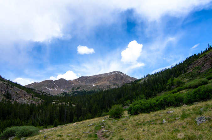
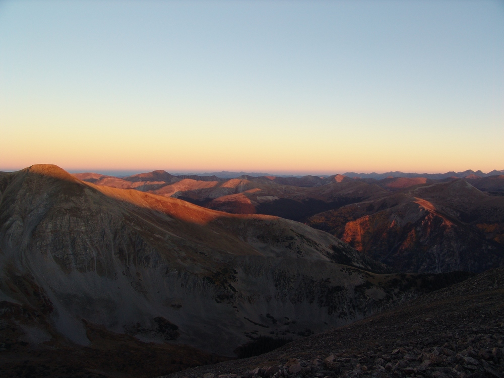
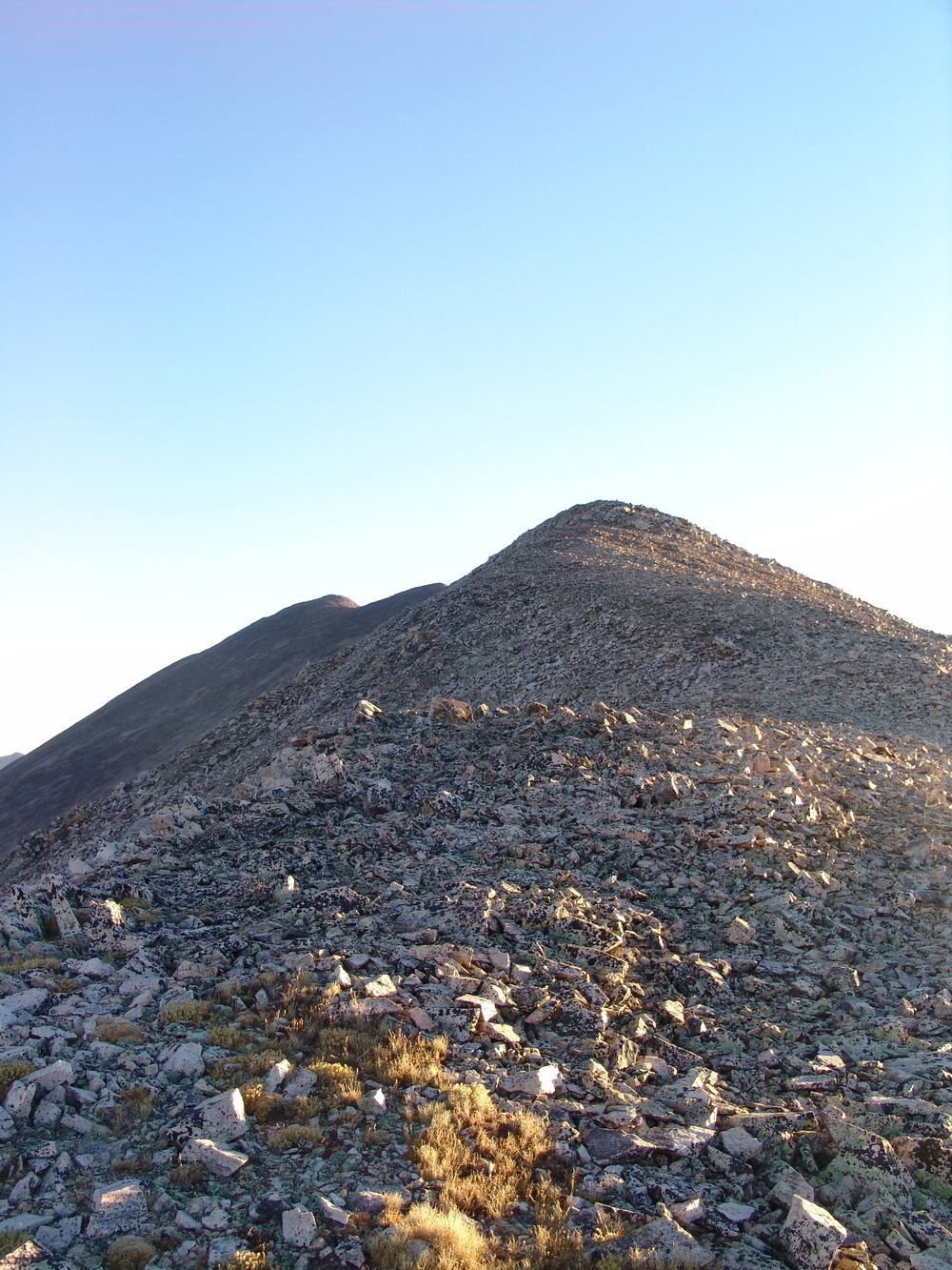
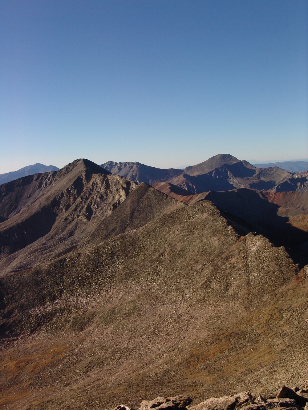
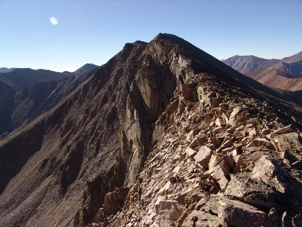
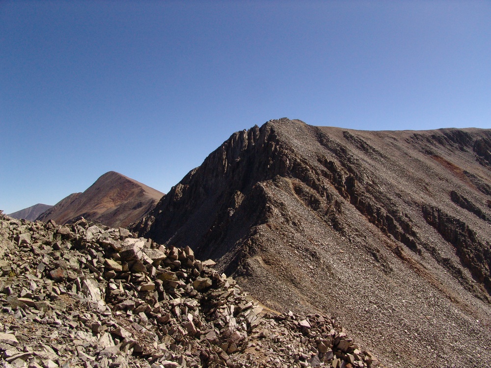
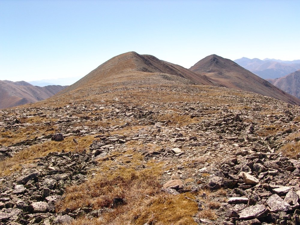
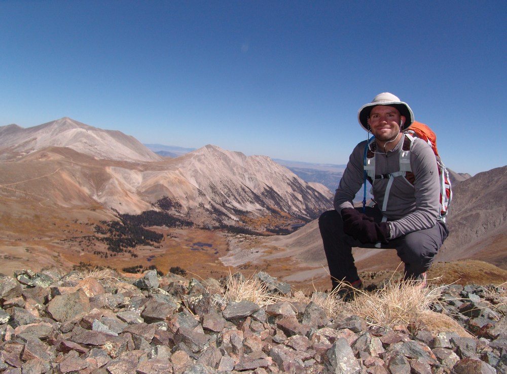
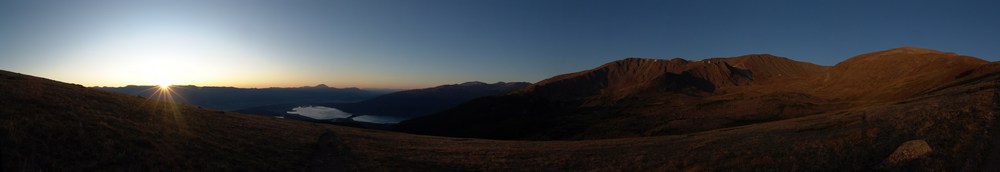
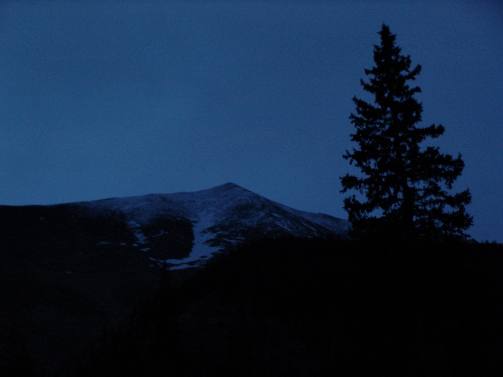
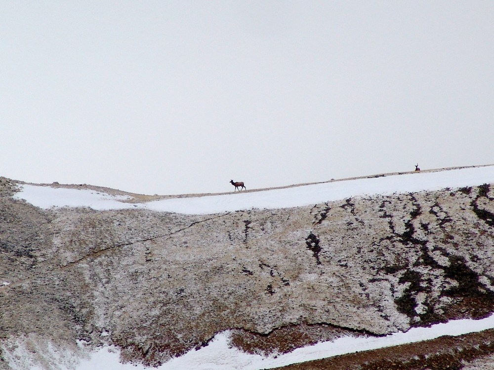
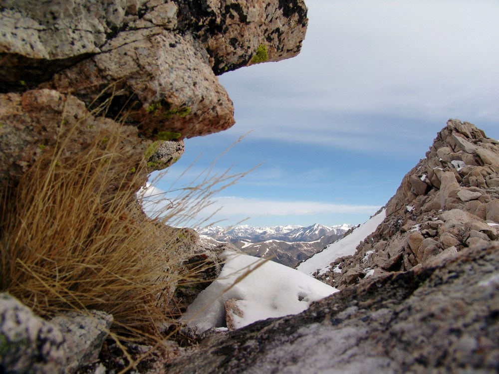
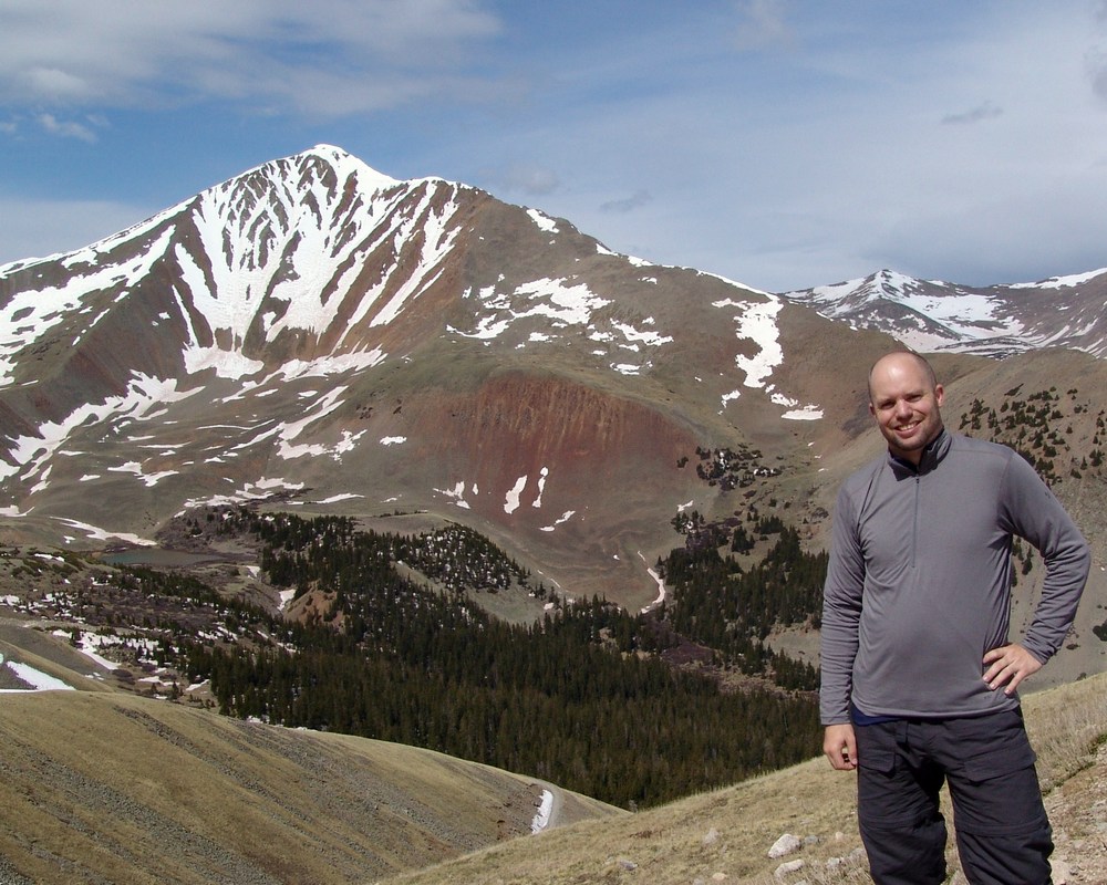
North Apostle and Ice Mountain as seen from Grizzly Peak in 2013.
2018 will be the year that I finish my lifetime goal of climbing the highest 100 mountains in Colorado. Or at least that is what I keep telling myself to stay motivated! Having climbed Dyer Mountain back in May, and Silverheels, Buckskin, and Stewart earlier in June, I found myself faced with only four mountains left to complete my goal: North Apostle, Ice Mountain, Cathedral, and Thunder Pyramid. Having Fridays off of work most of the time, I was faced with some options in terms of climbing - I could leave Friday from Durango, find a camp-site, climb on Saturday, and then drive home; or, I could do something stupid. I went with stupid. My friend Silas (featured in many trip reports here) was climbing Capitol Peak the same weekend and I really wanted to climb that again with him. I decided I would try to squeeze both climbs into one packed weekend, at the last second. So, I packed my car with both backpacking and car camping stuff and left my house in Durango after work on Thursday at 8:30 PM to drive to the trailhead for the Three Apostles. I ended up arriving at the trailhead at 1:00 AM and slept in my car until 3:45 AM, at which point I left the car and began my journey on almost no sleep. Huge mistake...
I've been eyeing the Three Apostles for years. I first admired their incredible stature when I was much younger on camping trips with my parents around Winfield. I remember one particular year going on a camping trip with my parents and my friend Jeremy where we hiked up into the upper basin and could see the Three Apostles - they looked intense! My next foray in seeing them up close and personal was in 2010 when I climbed Huron and Browns with my friend Mike Vetter - I recall being quite impressed with the peaks then as well. My latest encounter with them was watching the sunset from the summit of Grizzly Peak to the northwest of the Three Apostles and seeing a huge rainbow over Taylor Park. That was awesome! That particular trip, I hauled a huge telephoto lens up to the top with me and shot North Apostle and Ice Mountain at sunset. Good times!
As always, you can see and download my full route and GPS tracks over on the incredible app, Gaia GPS, which I use on my iPhone to plan, track, and follow my routes on these trips. It is absolutely invaluable and worth every cent. I personally love that you have full access to all USGS topo maps and National Geographic Trails Illustrated maps as well. You can use the app while in airplane mode and even save maps for offline use. To get a nice discount on the application, follow this link and you'll also support my efforts to keep this site running.
My full stats for this particular climb, which included summiting North Apostle (13,860 ft.) and Ice Mountain (13,961 ft.):
- Peaks climbed: 2
- Miles hiked: 10.8
- Time: 10 hours, 34 minutes
- 3,657 ft. elevation gain
For this trip, I decided to pack quite a lot of camera gear (by the way, these are affiliate links and using them helps me pay for this site and to bring you better content):
I found the trail going up to the Three Apostles to be very straight-forward. I followed the decent trail beta from Gerry Roach's High Thirteener Guidebook. I was still using the 1st edition of the book, which I'm told has some route errors for this mountain; however, his new edition is available on Amazon after many years of waiting - rejoice!

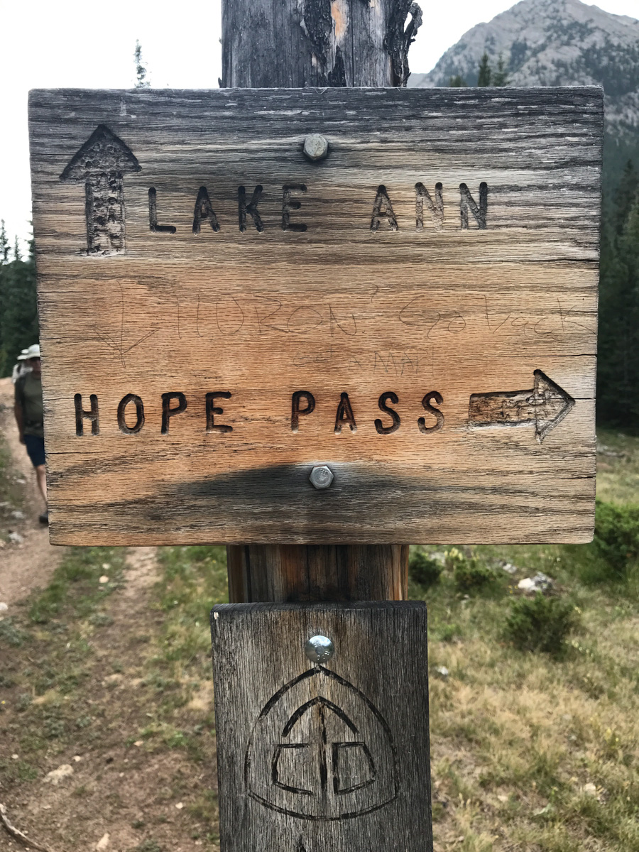
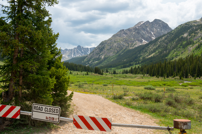
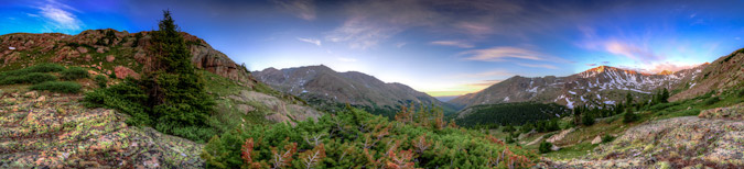
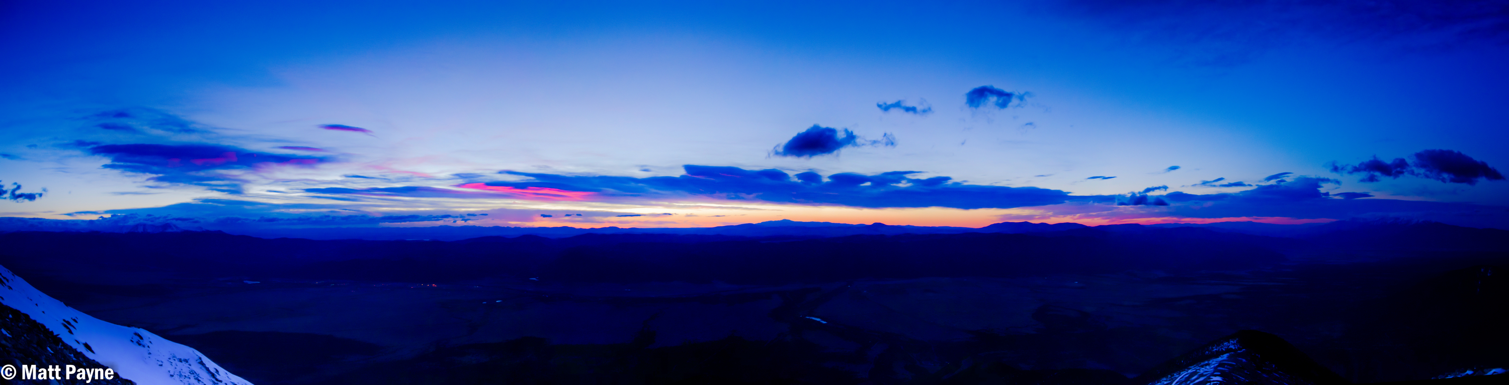
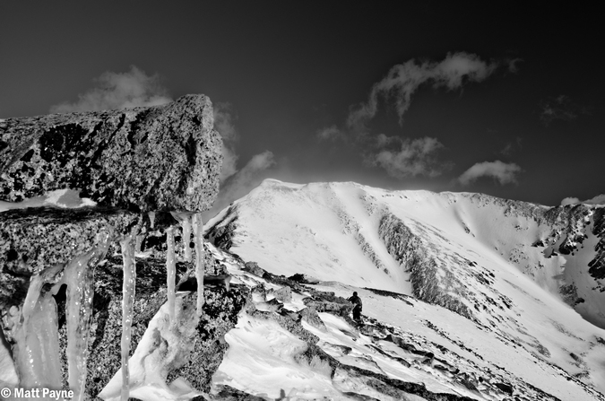
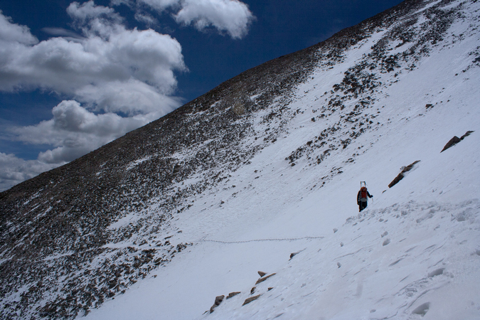
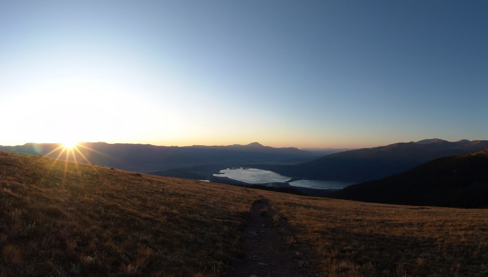
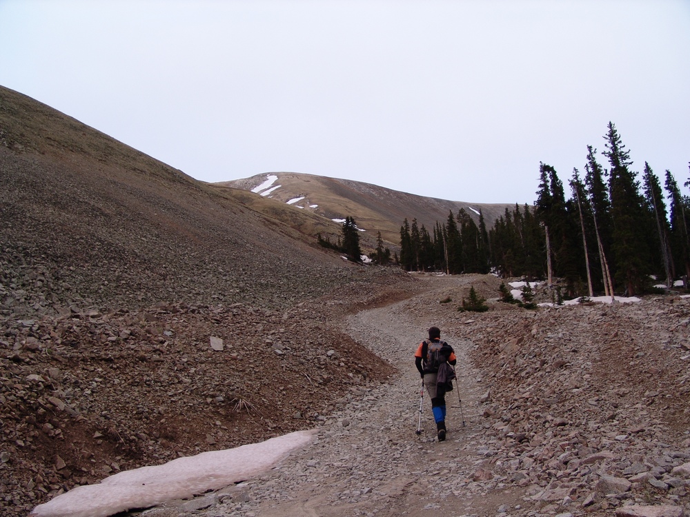
The trail follows the same trail as Huron for a while; however, there are several branches off of the trail to keep note of. Generally, you keep going straight. There are two signs before you are officially on the Trails Illustrated Apostles Trail 1445. I took a picture of one of them on the way down as seen below. I especially enjoyed seeing someone pencil in that if you were at this particular sign, and were climbing Huron, you had gone too far. That's how you know you're on the right trail for the Three Apostles. Having departed my vehicle at around 4 AM in the dark under a full moon, I had optimistically hoped to shoot sunrise from the summit of North Apostle (or nearby). Due to having almost no sleep, this proved impossible. Once I hit treeline, I found my pace slowed significantly.
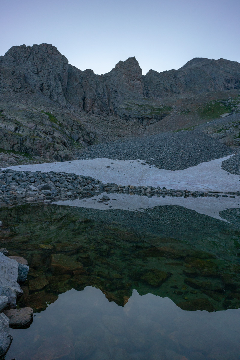
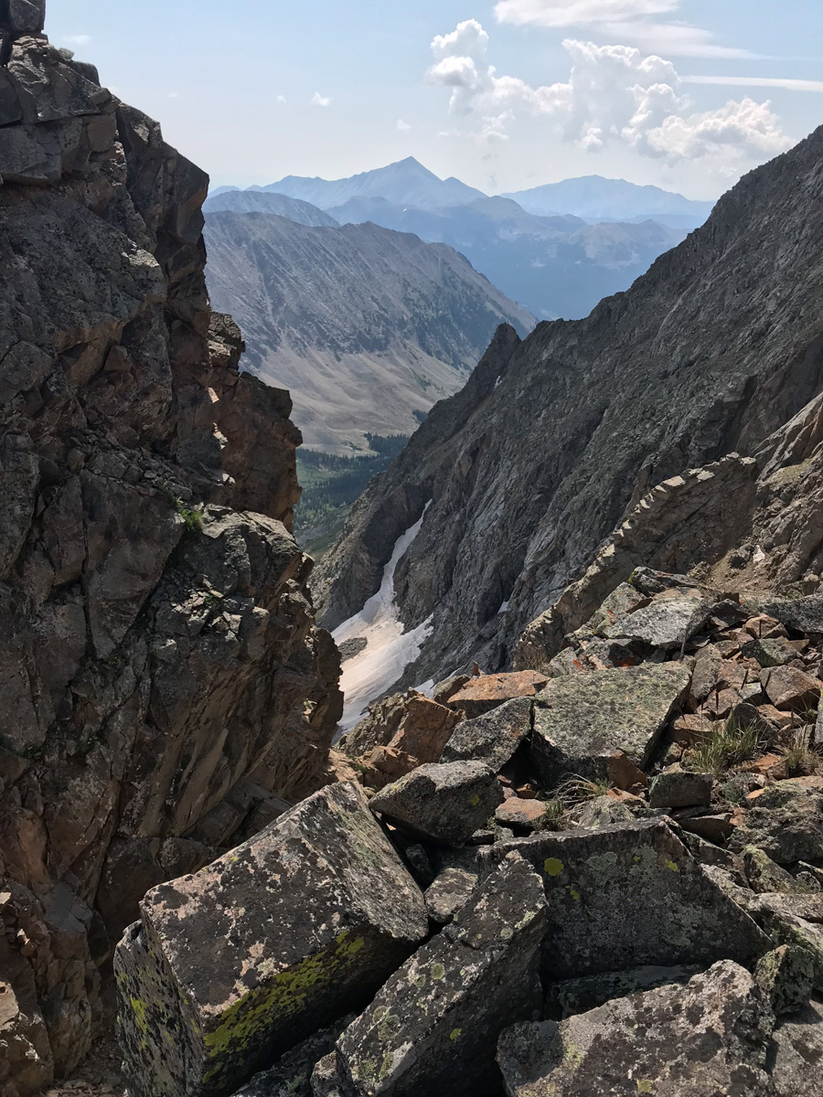
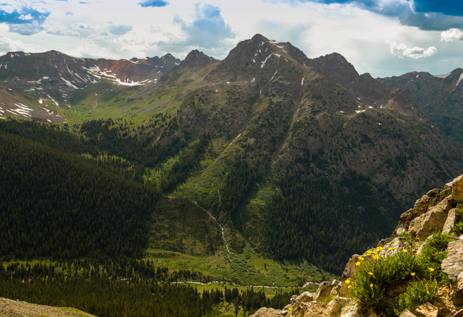
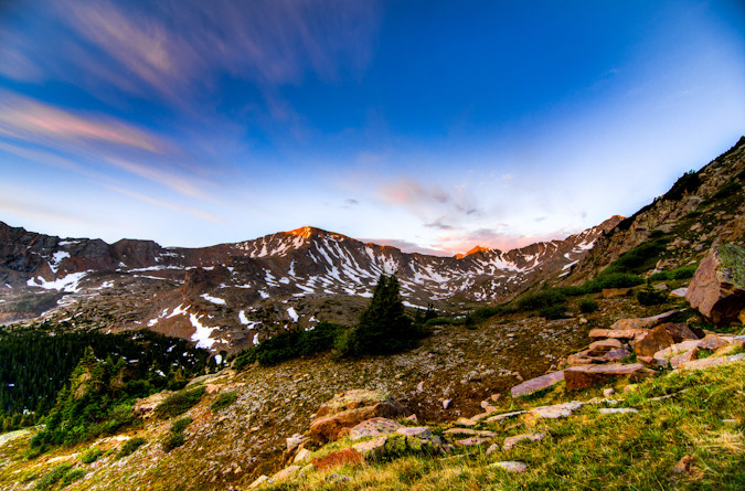
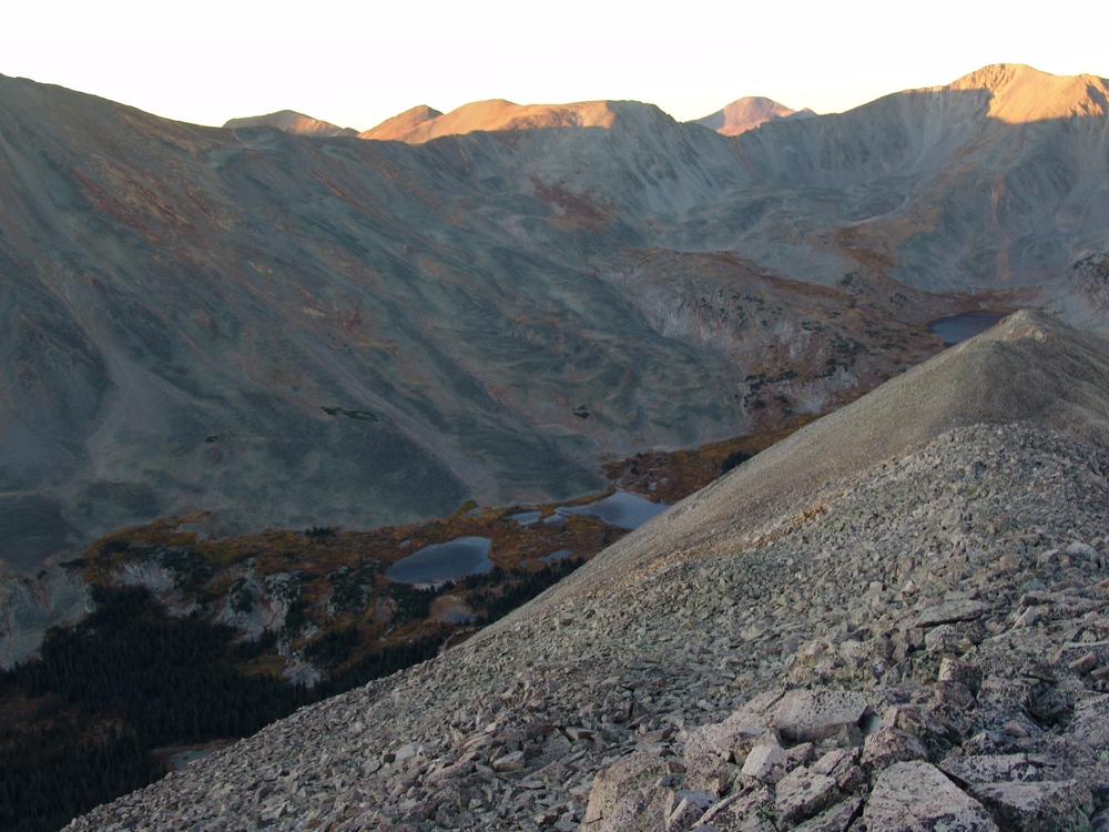
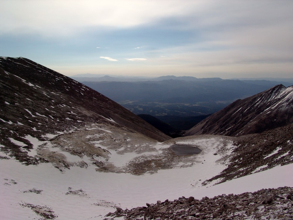
I reached treeline at about 5:30 AM and the scene really opened up above me. You could make out the Three Apostles easily. It was at this point I realized I was not going to be able to shoot sunrise from the top. Oh well, there were not any clouds anyways, so it would have been a boring image. Having followed the Roach route description as opposed to the 14ers.com route description, I was aiming for a high lake below West Apostle and Ice Mountain. I figured that would be a fantastic spot to get some sunrise shots as well. The trail petered out after treeline and so I was forced to bushwhack through some willows which were quite wet still. Huge mistake again. Have I ever said how much I hate willows? After reaching the end of the willows, I followed the weakness in the drainage east towards a huge cliff band below North Apostle. From the end of there, I followed a steep dirt and rock slope south towards the base of the lake described by Roach. On my Gaia track you can see my ascent as the most southerly part of the route as opposed to my descent which was a little north of the lake.
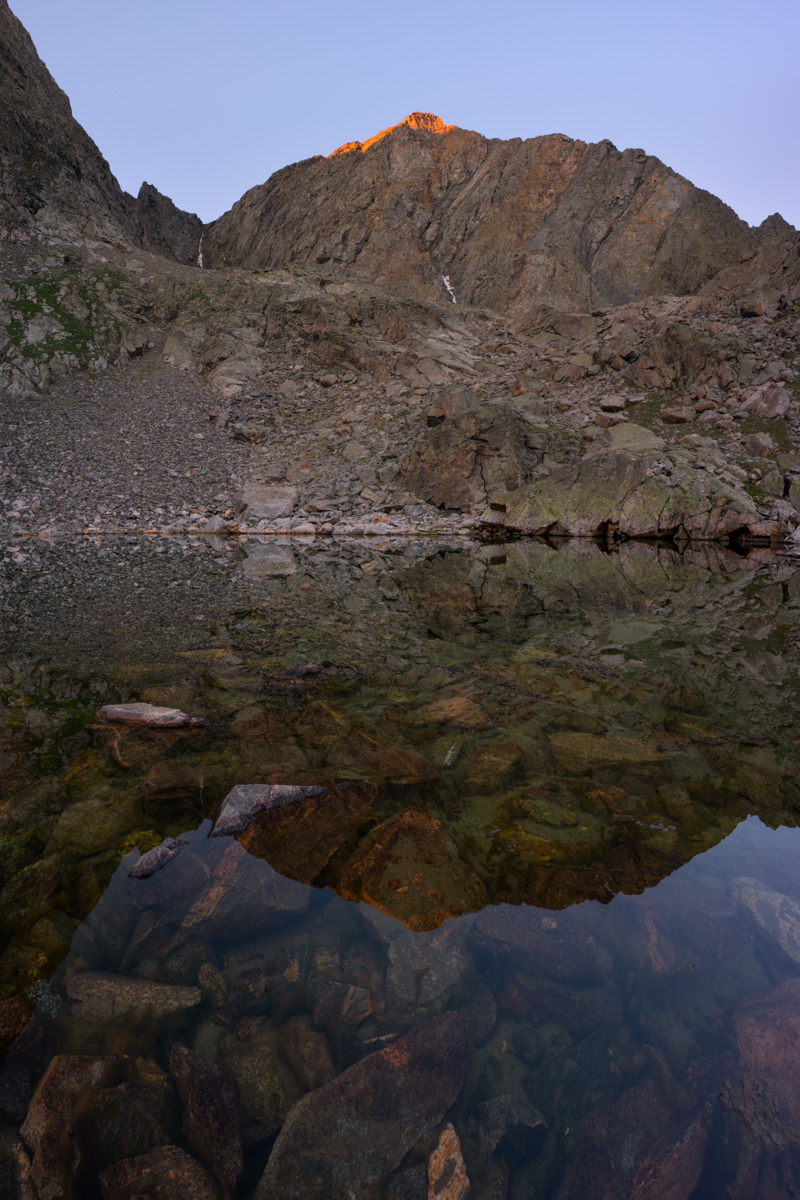
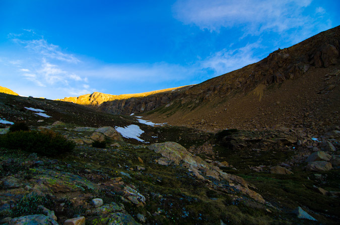
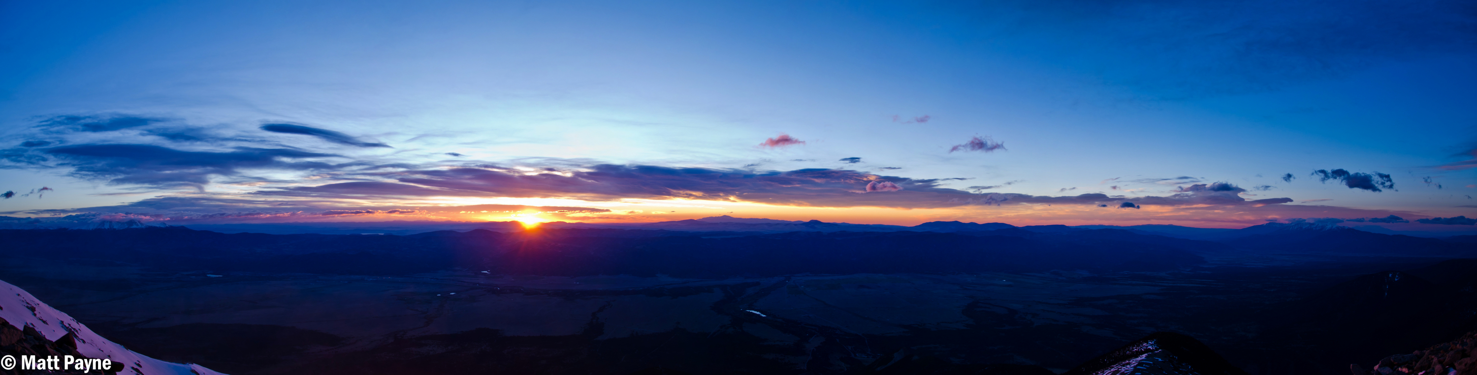
Above the dirt and rock slope, I found myself in a strange spot. There was a huge rocky and cliffy section between me and the lake. I could try to go around to the south or cut across the rock face for some fun scrambling. I chose the latter and it was fun. I would not recommend this section if it were wet; however, it was fun to navigate and climb on. It was easy class 3 / hard class 2. A good warm-up for Ice Mountain for sure! Having reached the lake, I looked for some spots to take shots at sunrise. There were not a ton of options or time, so I found myself looking north towards La Plata and Huron.
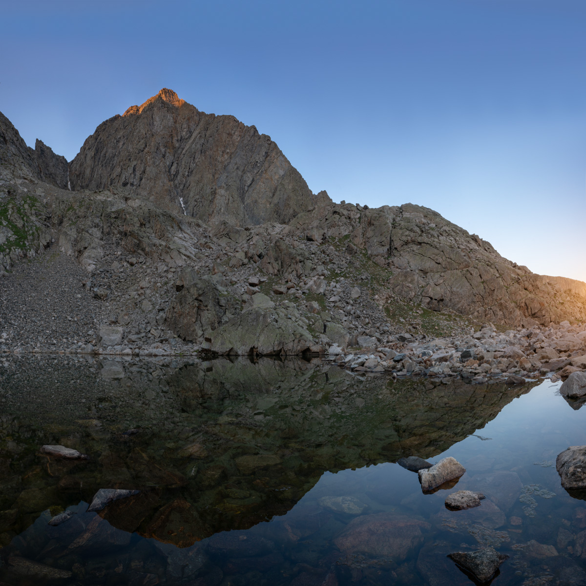
The early light kissed the tip of West Apostle above the small lake and made for a very fun scene to shoot with the Loxia 21 lens. I was wishing for a wider lens for sure, but nothing a two-row panorama stitch could not overcome. The waters were crystal clear and quite still.
I spent some time enjoying the lake and snacking to regain some strength. I was really feeling the fatigue from the lack of sleep and was hopeful that food and water would help.
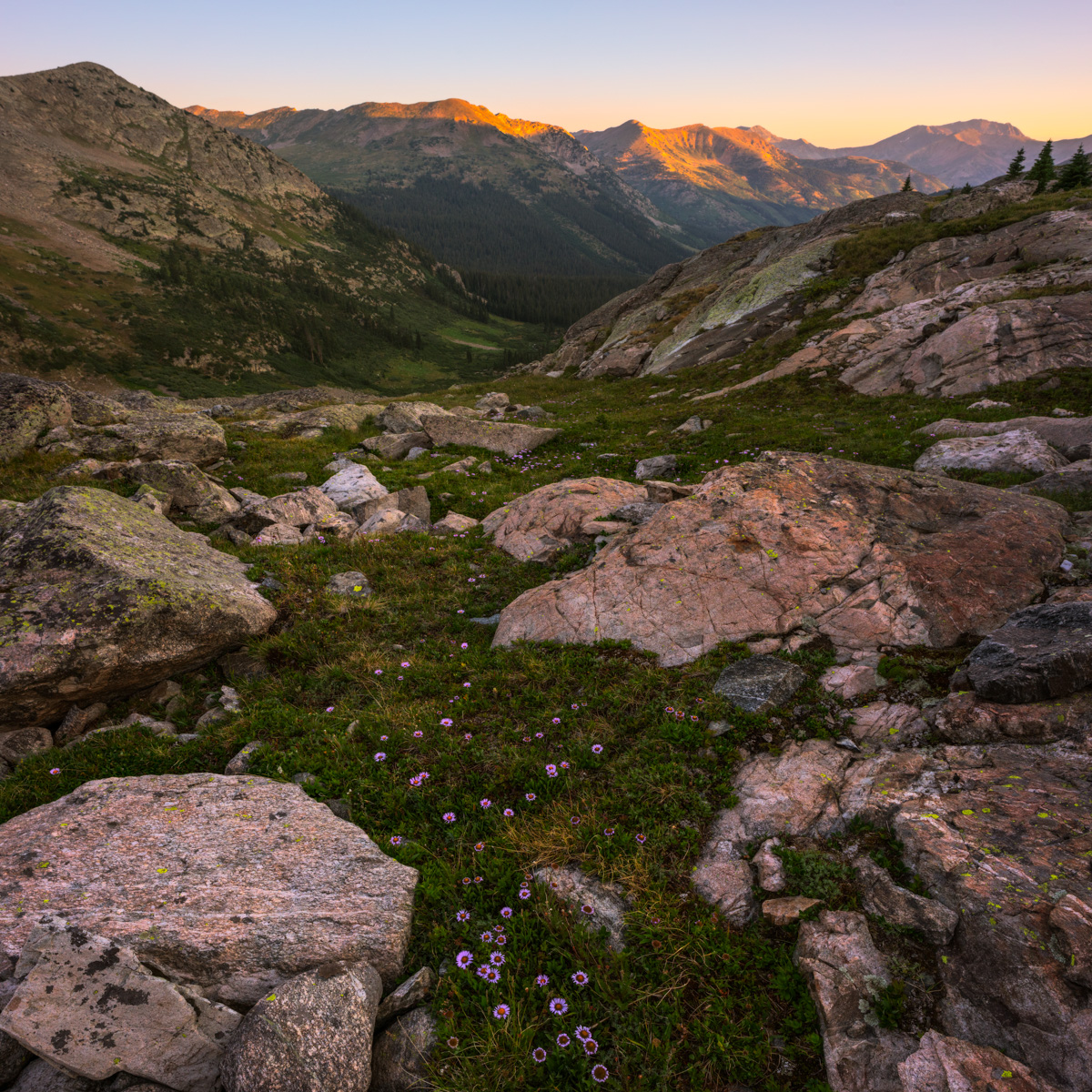
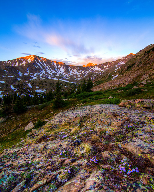
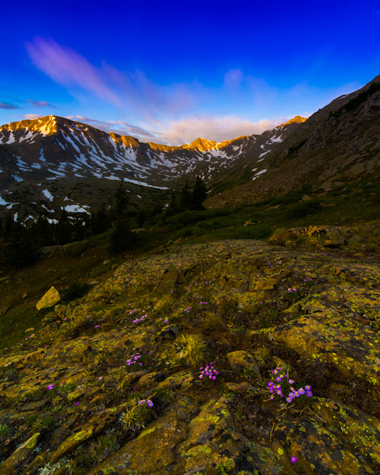
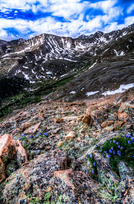
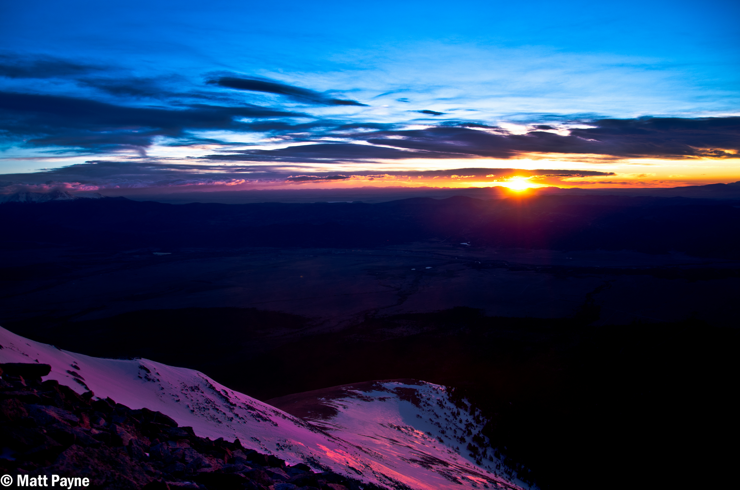
The light over on La Plata was pretty great too - accentuated by some pretty purple flowers on the ground between the huge boulders that were strewn about below the Three Apostles.
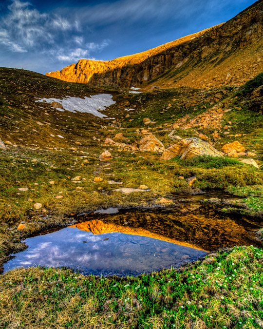
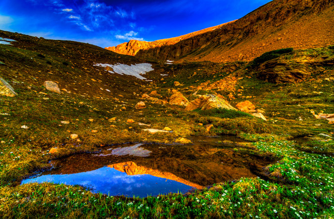
I wanted to take one final shot before leaving the lake and found a nice reflection of the lower sections of North Apostle, which were these awesome cliff bands and spires. Good stuff.
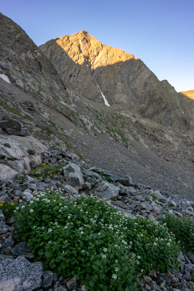
The path up from the lake seemed to be pretty straightforward. I just followed the grassy and rocky slope up near the creek coming down from snow-melt. The slope contoured up towards the base of North Apostle. It seemed that there were two ways to go - through a notch in some rocks next to the south wall of North Apostle or around the notch and around. I chose the notch.
West Apostle in early light
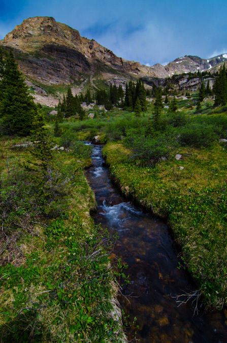
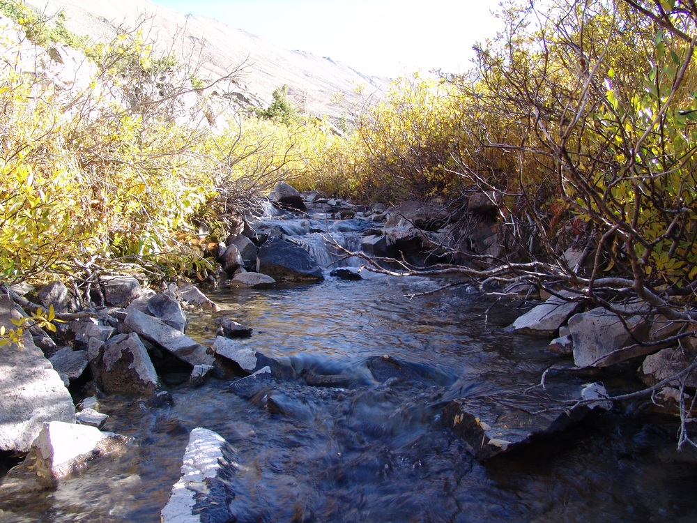
As I climbed up, I stopped to admire the running water under the boulder field. There's something about that experience that always brings a smile to my face. Sometimes the most simple things in nature are the most relaxing and impressive.
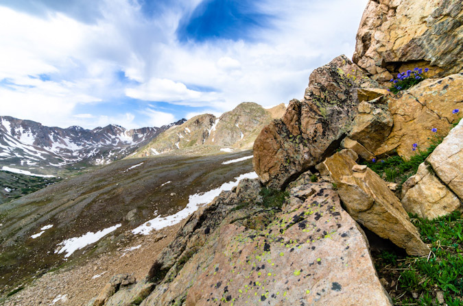
I continued up towards the notch below North Apostle and looked back to admire the early morning light that was shining on Harrison Flats to the west. The whole area just looks amazing from here.
As I climbed, there was a lot of rock fall happening on Ice Mountain, caused by mountain goats, likely disturbed by me and my huffing and puffing. I call them jerks in the video, but I'm joking. It should be noted that these goats could pose a huge safety concern for anyone doing the snow climb route of Ice Mountain, so beware!
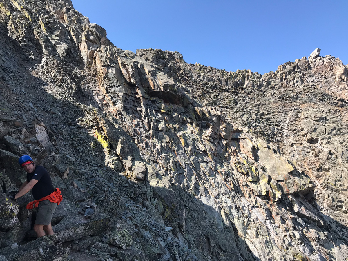
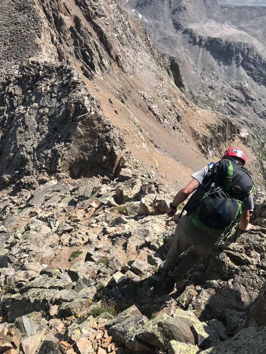
The rocks above the notch and below the North Apostle / Ice Mountain saddle were absolutely horrific. They were huge boulders, many of which were loose, on steep terrain. Special caution should be taken while climbing to the saddle.
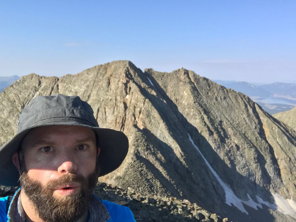
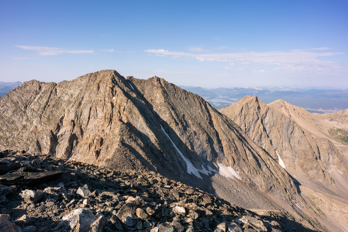
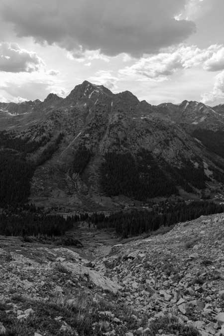
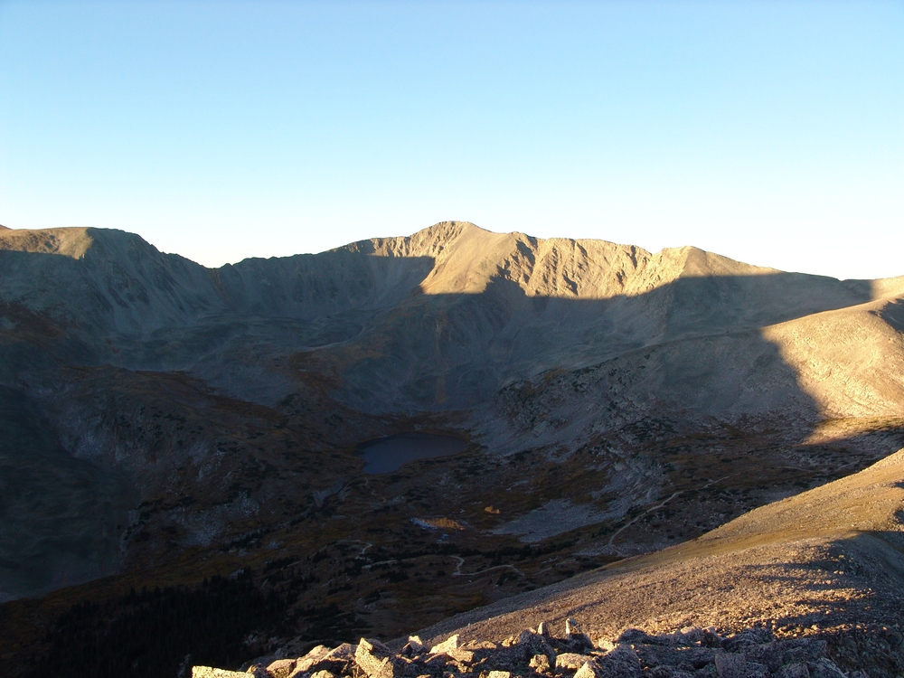
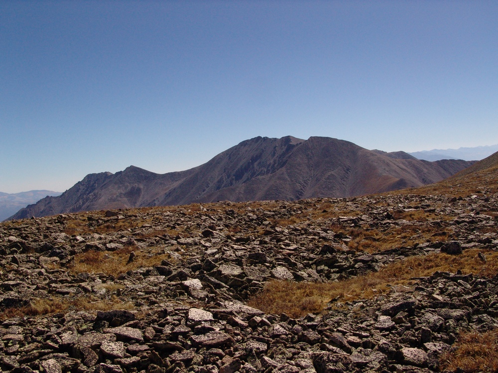
Upon reaching the saddle, a good view of Ice Mountain avails itself and caused me to take pause. It looked really gnarly from this vantage point. Paired with my exhaustion, this view was pretty demoralizing. I was not sure I was going to be able to finish Ice Mountain on this trip. I kept climbing up to North Apostle.
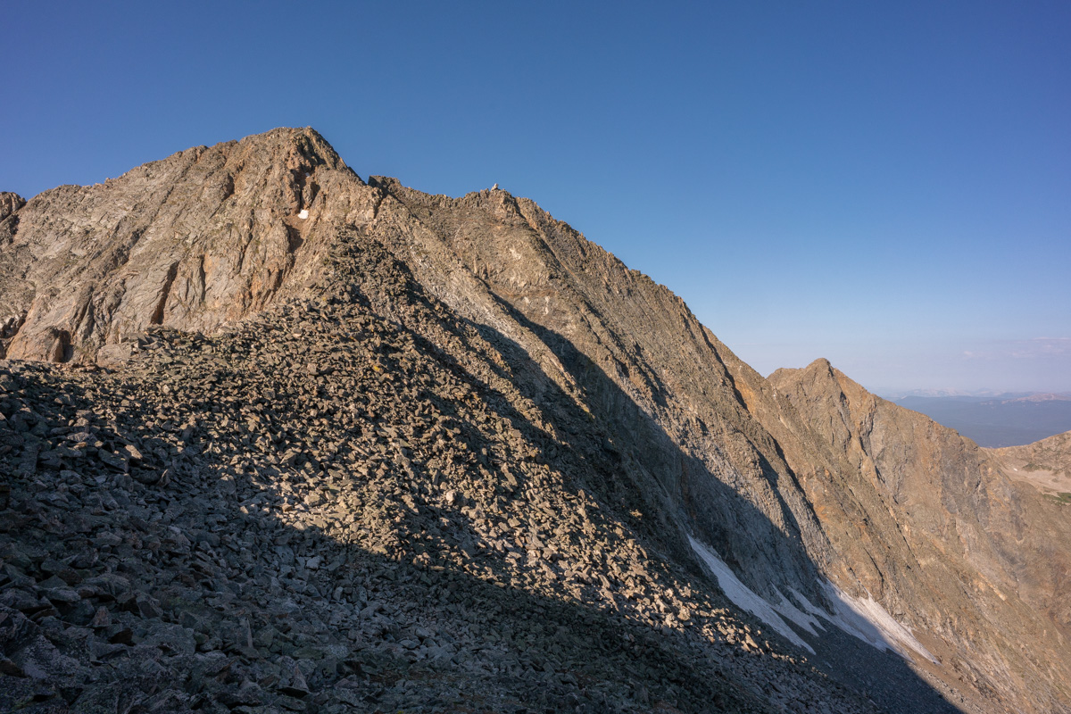
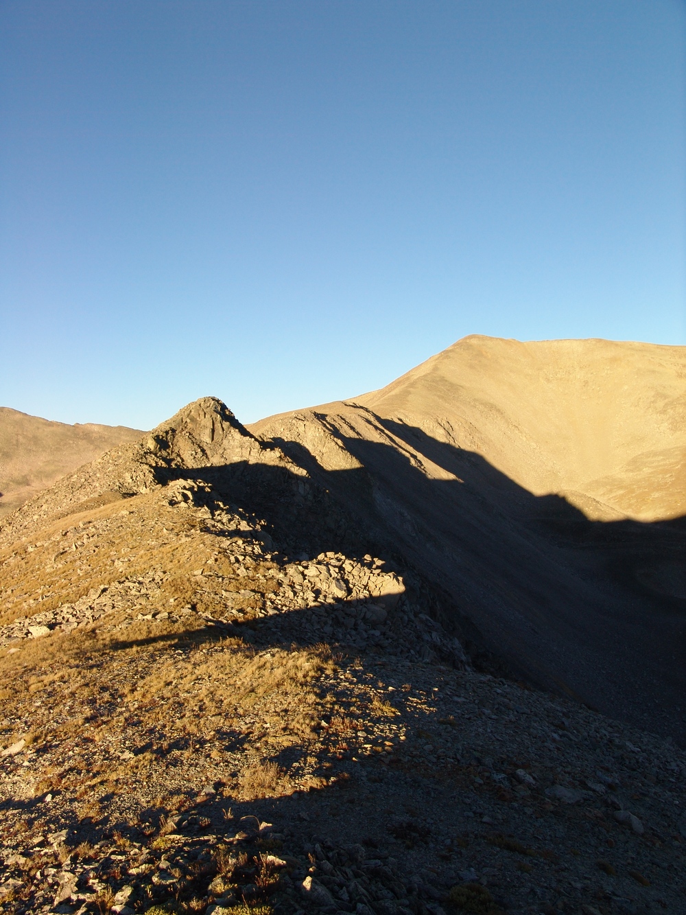
The route from the saddle to the top of North Apostle was quite simple and pretty fun, all things being equal. The east face of North Apostle was pretty intense to look down on. I would hate to take a fall here.
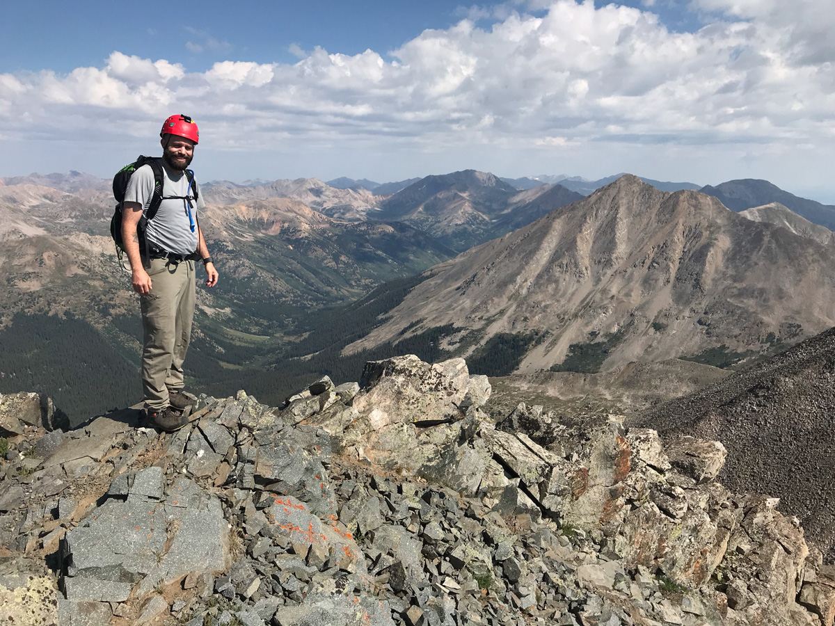
I reached the summit of North Apostle at 8:30 AM and was really tired. The views though - they were amazing. Huron was quite impressive from this vantage point.
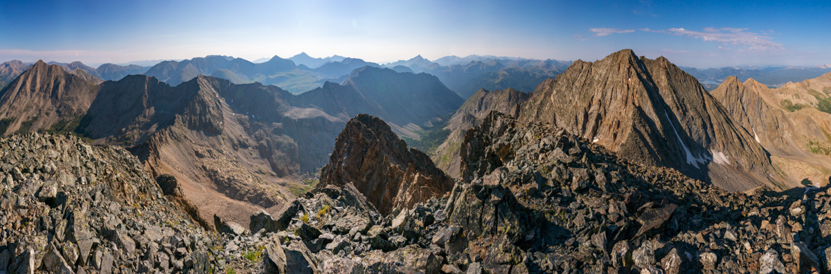
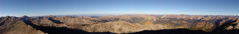
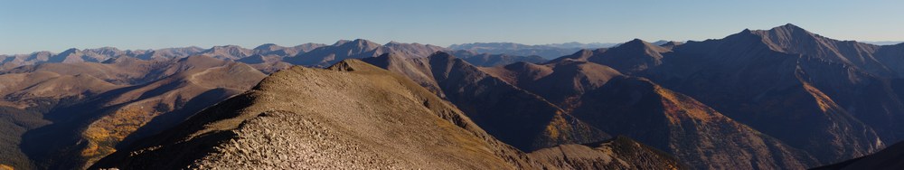
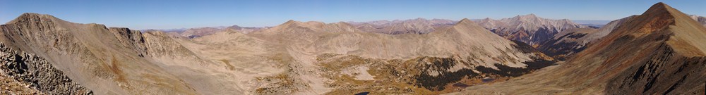
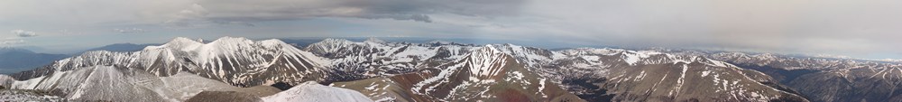
I let my friends and family know I was safe on top of North Apostle and took a panorama with my wide angle lens. Huron at far left, Ice Mountain at far right. Lots and lots of 14ers in between.
Huron and La Plata looked really fantastic from North Apostle, and I wanted to make sure I showcased Huron in at least one shot, with the huge valley below it.
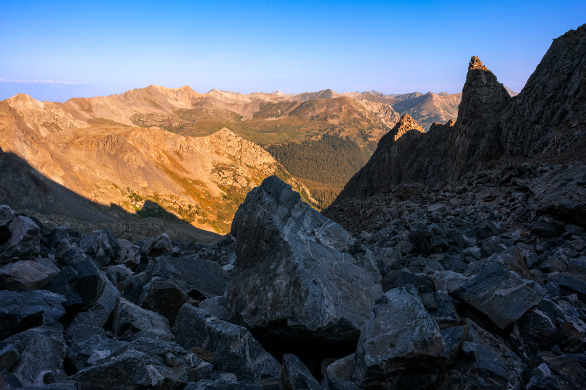
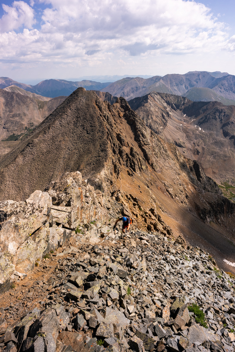
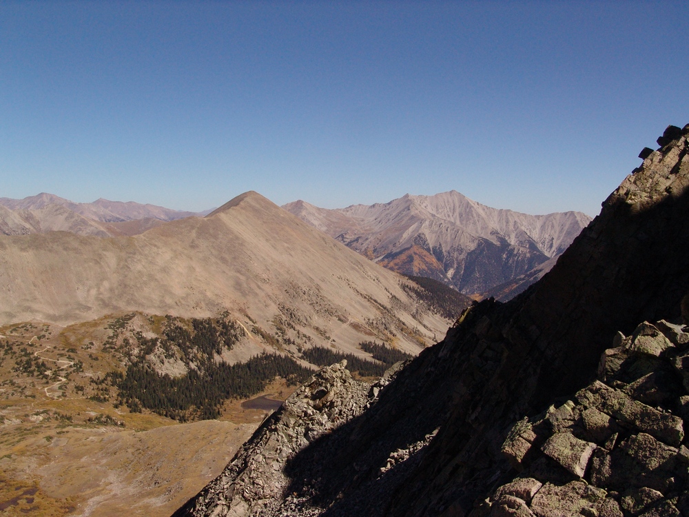
I head back down towards the saddle, eyeing Ice Mountain's impressive and dangerous stature the whole time. I was one part excited and one part nervous. The route looked really intense from this spot; however, mountains always look harder than they are...
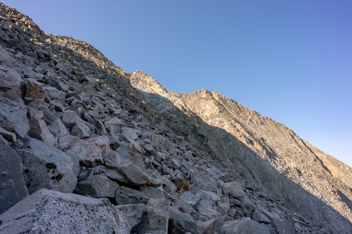
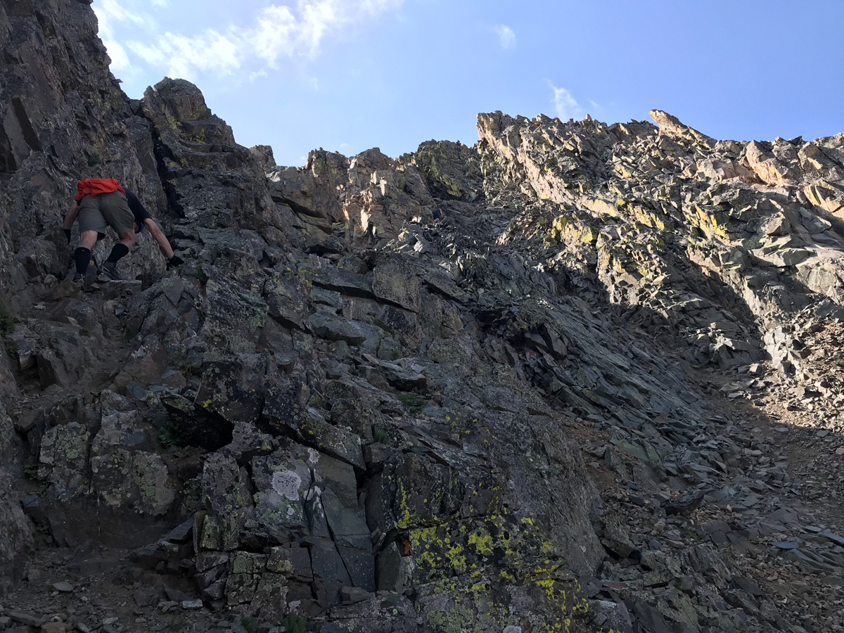
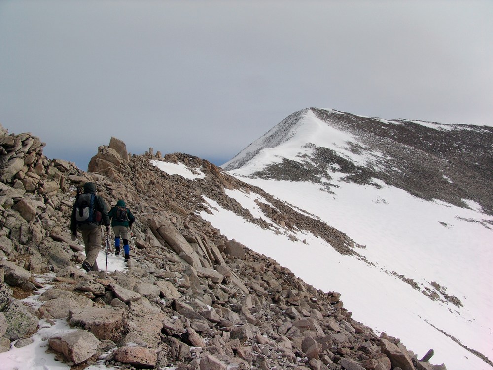
About halfway down the saddle, I ran into a gentleman named Dempsey Andrews from Denver. He asked if I was planning on doing Ice Mountain and I said that I was. He offered to allow me to join his group - himself and two other gentlemen that were waiting for him on the saddle - Kyle and Jerry. I was excited to run into a group that was also doing Ice Mountain and said I would join them, absolutely! Jerry planned on hanging out on the saddle so it was just Kyle, Dempsey, and I for the ascent of Ice Mountain. They were great climbing partners. Dempsey is an English as a Second Language teacher and Kyle is a financial advisor. Dempsey used to do high alpine rescue and so I felt like we were in good hands for the climb. Fortunately, Dempsey had downloaded the route description from 14ers.com which was very clear to follow compared to the one I found in the 1st edition of Gerry Roach's book. Dempsey lead us up, following cairns the whole way. It was surprisingly excellent rock and a ton of fun.
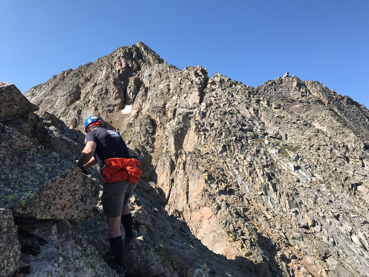
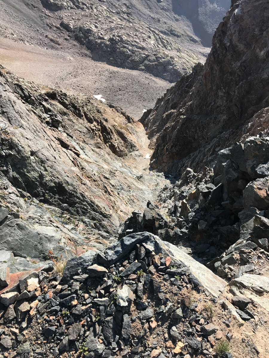
I found myself taking the rear most of the way up and as you can see above, care was needed to plot our route on loose rocks and boulders. We mostly followed the ridge and then found a nice set of gulleys to climb up towards the end.
The final section of the route before the summit was very difficult class 3 / easy class 4 and reminded me of the Wilsons in the San Juans. There were good foot and hand-holds to be found, but each needed to be tested for stability. We kept our distance between climbers and played it safe.
All in all I really enjoyed Ice Mountain's route here. It was pretty easy to follow and offered up numeous challenges that were fun to tackle.
Kyle ascends the final pitch of Ice Mountain
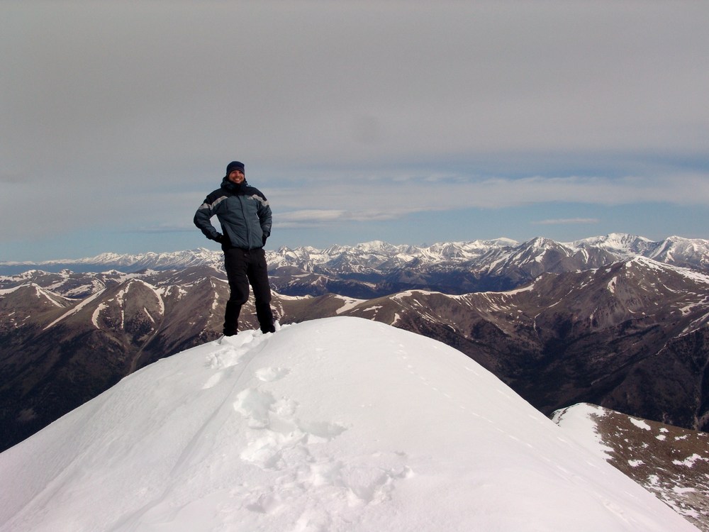
We reached the summit at 10:00 AM and enjoyed the views. It looked like the weather would hold up for us to get down safely, but we knew that the clouds appeared to be forming some of their awesome lightning jam.
I got a cool shot of Kyle on the very final section before the summit - what a mountain! We enjoyed the summit views, called loved ones, and head out. It was a short stay. The downclimb for the 1st section was facing in and quite slow.
As long as you take your time on the downclimb, it should not be too bad. It is very steep and loose though, so great care should be taken on each step.
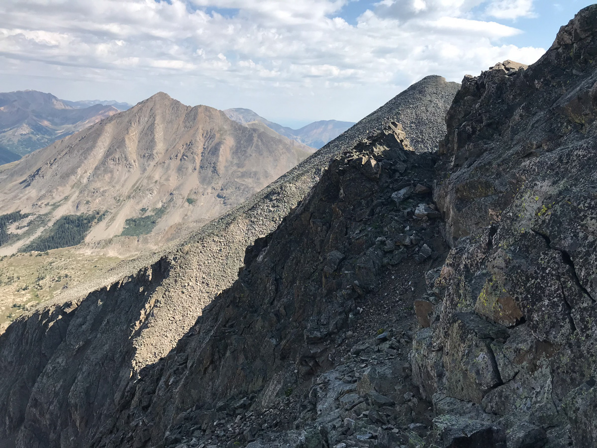
As you can see above, the terrain is nasty but really awesome to be in. These are the types of peaks I long for each year. Ice Mountain does not disappoint if you seek exposure and a challenge. We did encounter a small amount of rain above treeline on our way down and some lightning was starting to strike nearby; however, we were able to avoid the storm for the most part. We took a blend of my route up and their route up for our path down and I found it to be very solid - we stayed high and went into the trees southeast of the willows and avoided the willows altogether. Finding the trail again was easy with Gaia GPS and the hike out from here was completely uneventful.
Scaling Colorado's Highest 13er - Grizzly Peak at Sunset
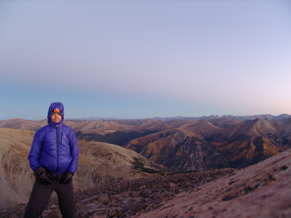
Climbing mountains in solo-mode is therapy for me. While I have often espoused a deep belief that climbing mountains solo is a safety concern, there are times when the benefits outweigh the risks. I'm not sure that this particlar climb qualifies; however, I must admit, this was a truly wonderful experience that I will never regret. I decided somewhat at the last minute to take Friday off of work and climb a 13er. Having only 20 or so Centennials left to complete my quest of the highest 100 in Colorado, I have been getting more motivated to tackle the mountains left.
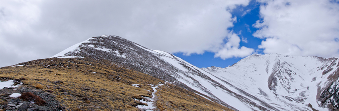
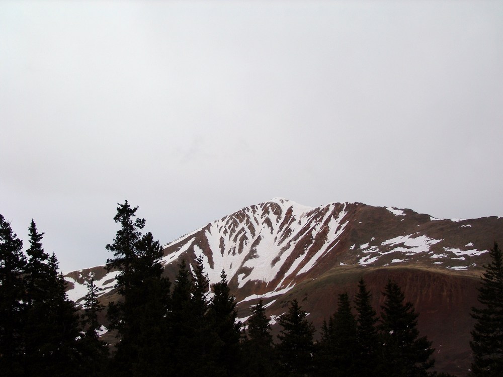
Grizzly Peak had always intrigued me. It is one of the few Centennials not visible from a paved road (I am fairly confident of this) and has a very remote status. Grizzly Peak is nestled deep in a valley just west of the summit of Independence Pass between Leadville and Aspen and is the most western Centennial in the Sawatch Range. There are tremendous views of the Elk Mountains from Grizzly Peak, including Pyramid Peak, the Maroon Bells, Snowmass Mountain and Capitol Peak. Grizzly Peak also carries with it the distinction of being the highest of 7 mountains in Colorado named Grizzly and the highest ranked 13er at 13,988 ft. (Sunlight Spire is higher, but is not ranked - for more on this issue see this article).
Since I would be climbing by myself, I knew I would have as much time as I needed to take photos and do some crazy photography projects from or near the summit. I chose the west route of Grizzly due to the very short length of the climb, which was very appealing for weather purposes. The plan was to drive the road to the base of the mountain Friday morning, climb the mountain, take photos of sunset from the top, and stay on the top as long as possible for a shot of the Milky Way and to do some star trails photography. According to Roach's 13er guidebook, the road is open all the way to the very base of the mountain, leaving only about 2 miles of hiking to the summit. When I reached Grizzly Reservoir, the road was closed at this point, which meant I had to add another 2 miles both ways to my hike. This was not a huge deal, but it certainly made me re-think my plan.
Being that I had nutty plans to do some extensive photography work from the summit, I packed quite heavily. I was carrying the following photography gear with me:
| Item | Weight (lbs) |
| Gitzo Carbon Fiber Tripod w/ Arca Swiss Ballhead | 6.4 |
| Nikon D800 DSLR w/ Arca Swiss Plate | 2.8 |
| Nikon 14-24 f/2.8 Lens | 2.0 |
| Nikon 24-70 f/2.8 Lens | 2.0 |
| Nikon 50mm f/1.4 D Lens | 0.5 |
| Nikon 300mm f/4 D Lens | 3.0 |
| 1.4x Teleconverter | 0.5 |
| Total | 17.2 |
I'm not especially proud of carrying all of this weight up a steep mountain, but I certainly don't regret doing it.
After I parked my Jeep near the Grizzly Reservoir campground, I head out with a pack full of camera gear and fresh legs at about 1 PM. This is not a very typical start time for me, and probably not highly recommended due to weather concerns, but I figured I would play it safe and keep an eye above for the hike in. For any photographers reading this, I decided to stick with the 24-70 f/2.8 as my walk-about lens, which worked out fairly well. The round-trip stats for this hike are 8 miles w/ 3,500 ft. of elevation gain.
The view from the road was fantastic. Lower, but very rugged 13ers adorned the valley and made for quite a nice sight on the hike in.
I certainly enjoyed the view but was keeping an eye on developing thunderstorms above.
I'm usually not a fan of hiking on a road, but I could not really complain with the view I had, plus I had the Nerdist podcast to keep me entertained.
On the hike in, I was able to find some Columbine flowers growing in a small open field, making for a fun photography experiment. One thing I have been wanting to try to do is a technique called focus stacking, which allows a photographer to capture a very sharp photograph that is really the combination of multiple photographs taken at various focal points. I tried that out on these columbine flowers, which worked pretty well considering the wind was blowing (which makes focus stacking almost impossible).
I was looking for a gully cut into the side of the mountain to my left (east), which would be my entrance point for the Grizzly Peak ascent. The mountain has no trail and is basically a steep slog up a very pretty, wild, but generally straight forward gully going up, up, up. Before reaching the gully, the rain started to come down a little, so I stopped to get a photo at this beaver pond before putting my camera away and heading up the gully.
While small rain was coming down, I decided to keep my camera bag packed in my main pack to make it easier and to give me some peace of mind. As such, I was unable to take any photographs with my camera until the rain totally left and I was about a quarter of the way up Grizzly via the gully. I stopped to snap a set of photos to be later stitched into a panorama, looking west across the valley towards Truro and several un-named 13ers.
A look up at the terrain revealed just the sloggy mess I was climbing up. It was quite steep and somewhat difficult to navigate through all of the small pine trees, willow trees and rocks. I just had to pick my way up and take frequent rest breaks (I was carrying a lot of weight, haha). The Nerdist podcast of Rick Moranis made the slog a lot less painful, although my laughter probably drove wildlife away.
As I continued up Grizzly, the storms seemed to subside, and I was feeling a lot more comfortable about the hike up and eventual stay on the summit. A look back down the gully showed the way up and I could now see the road I hiked up from the North (right).
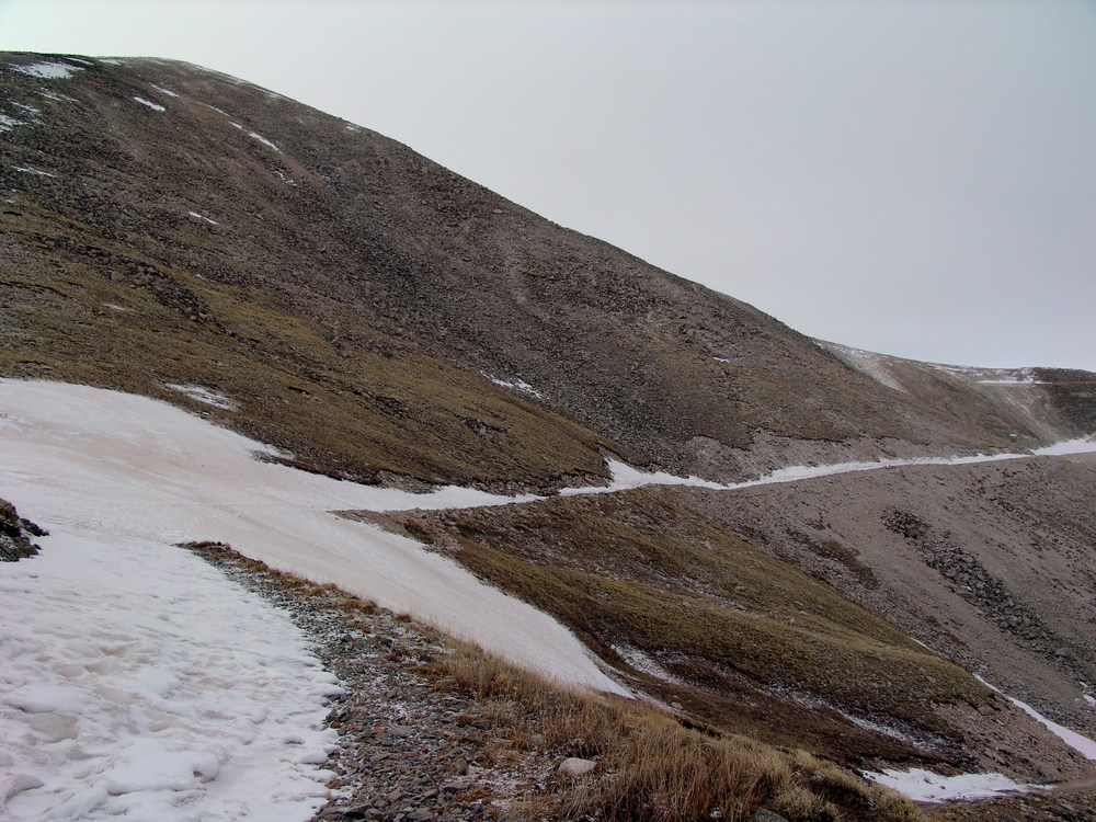
Once above treeline, the gully was pretty obvious in terms of where to go. It was mostly rock and dirt with wildflowers and boulders strewn about.
The views were pretty enjoyable in all directions. Despite some wind, I really could not complain.
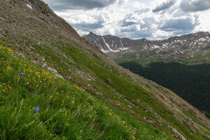
The 13ers to the west kept me looking back quite often, and the wildflowers were just too cool. They were all over the place, even above treeline, which is always awesome. I probably could have made it up the mountain in a lot less time, but I took the time to take some quality photos. This is another focus-stacked image making it so the very close flower in the foreground could be in focus as well as the distant peaks.
As I continued up, views of the Elk Mountains (specifically, Castle Peak) began to materialize above the horizon to the west beneath some virga coming from some small storm clouds.
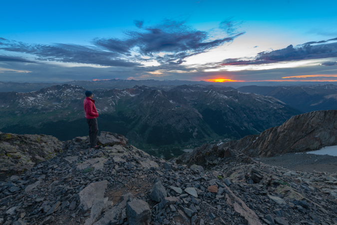
I was not worried about the weather yet - the clouds were pretty small and my new expansive views to the west indicated I should be in the clear for the remainder of the day. At this point, the climb became progressively more difficult for my weary legs. The weight of the photography equipment was really kicking my rear end and I had to take more and more breaks. The terrain was also much more difficult - not technically, but physically demanding. There were more boulder fields to contend with and the dreaded scree that takes you downhill one step for every two you take. As such, I decided to pack away my camera again so I could focus on the hike and make sure I did not fall. I finally was able to reach the saddle between Grizzly Peak and Garfield Peak as the light from the impending sunset was starting to generate some magic on the valleys below to the west and east. Seriously, if you've never done a sunset climb before, you need to - it is simply one of the most amazing experiences you can have in the high country.
While the weather to the west was looking fabulous, the weather to the south and east was starting to look kind of nasty. I was not too concerned yet, but was keeping watch. One benefit of carrying a 5 lb tripod up a mountain is that you can do self-portraits. Here's one looking south and east towards Garfield Peak and Taylor Park (not visible).
I also decided it might be fun to do a very large vertical panoramic showcasing the sky from the saddle, looking South-West-North. To the north (right) would be the summit of Grizzly Peak itself.
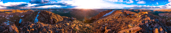
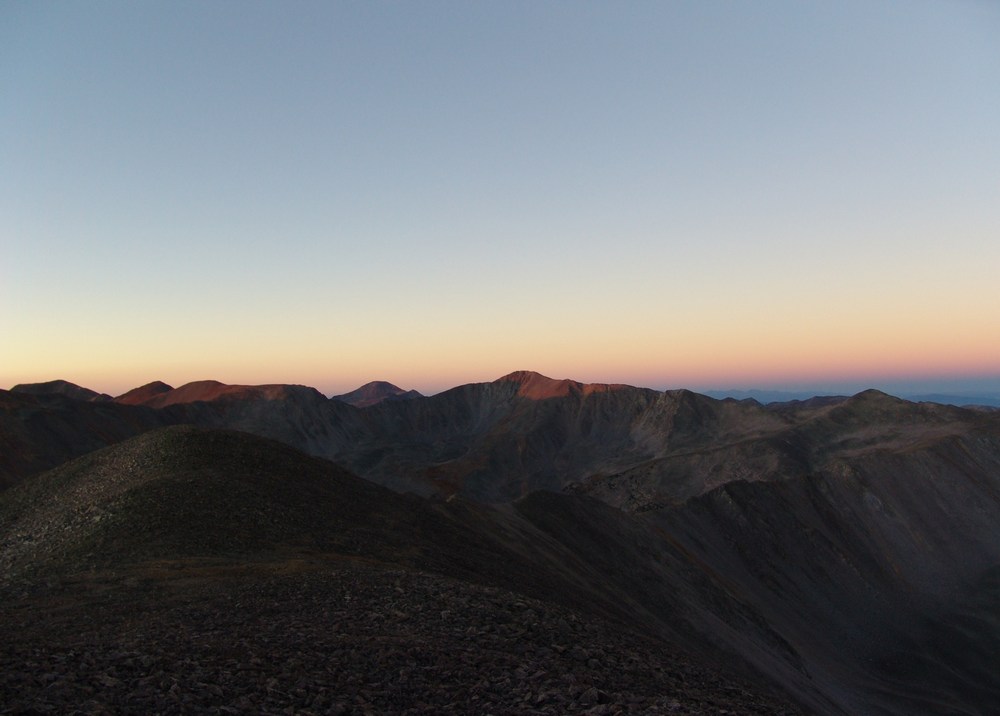
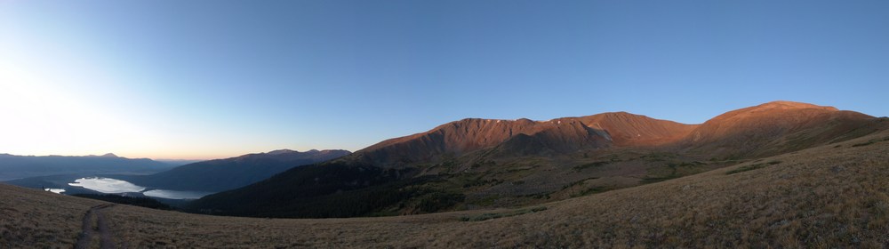
After about 20 more minutes of climbing, I was able to reach the summit of Grizzly Peak. I was greeted by an incredible view to the east and south, which included the Three Apostles and an amazing rainbow just shy of Taylor Park, where a huge thunderstorm was brewing.
It was pretty awesome to be on top of the Continental Divide before sunset. The views were great, and that sweet rainbow stuck around for quite a long time to the northeast. The light from the sun was hitting the clouds over Taylor Park and causing some interesting streaks to appear. I signed the summit register, which was last signed by a guy I had read a trip report of from the day before. He had made a tribute to Steve Gladbach, a very accomplished and famous Colorado mountaineer who had just perished on Thunder Pyramid. I decided to also sign the book as "For Steve." I think Steve's passing weighed on every mountaineer's mind heavily, including mine. I never did get a chance to meet Steve, but we exchanged several cordial and thought-provoking messages over on 14ers.com regarding my morbid articles I write about the mountaineering deaths each year. Steve wrote a very eloquent and thoughtful post about death over there a few years ago and it always stuck in my mind. I even remember responding to his post saying that "heaven forbid you die in the mountains..." and yet - he eventually did. Steve had conquered the goals I have set for myself and I had always looked up to him, not only as an accomplished mountaineer but as a very amazing person. There are countless stories of his selfless acts and I felt a solo climb a nice tribute to his life.
As I enjoyed the last few minutes of sunlight, I had to take advantage of my somewhat foolish decision to haul up my 300mm lens, which weighs 3 pounds on its own. I wanted to get some zoomed in shots of Ice Mountain, Pyramid Peak, the Maroon Bells and Snowmass Mountain using the 300 and a 1.4 Teleconverter, which gave me an effective focal length of 420mm.
Castle and Conundrum were looking freaking awesome, with some crazy sunset light surrounding it. Thanks to Michael Colson for the correction!
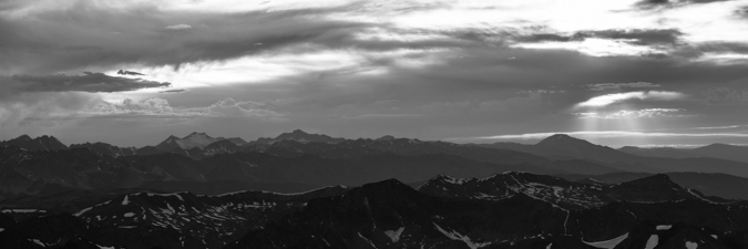
Snowmass Mountain was also looking wicked with the sunset light, giving the photo a very layered feel in black and white.
As the light continued to approach the magical photographic Golden Hour, I had some fun playing with different photos.
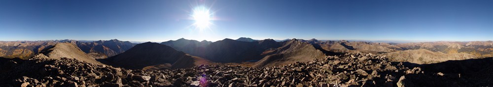
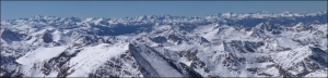
I also stitched together a massive 360 summit pano centered on the sun. This photo, being taken with the Nikon D800, is a massive file. If printed at native resolution (no loss of quality), it would span 30 feet wide. I'd love to see that. If I have time later, I'll work on an interactive 360 file so you can see this thing at a bigger resolution and zoom in.
The sun went behind some clouds but then created some nice god beams coming down near Mt. Sopris.
Then the sun reappeared and allowed me to snap off this photo which I think looks kind of like a Colorado flag.
A look back to the east revealed some magic also. The light was very soft and colorful, showcasing the grand scale of La Plata Peak (left), Colorado's 5th highest mountain.

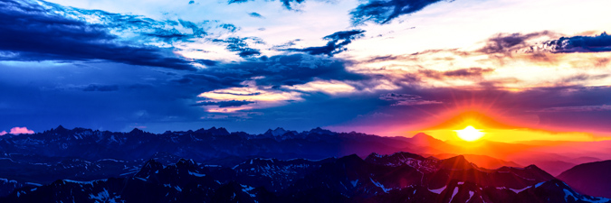
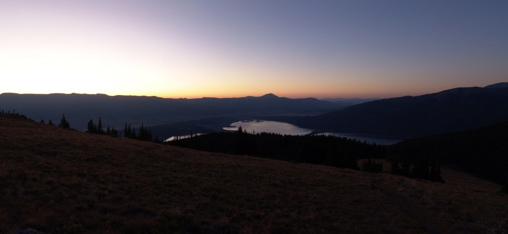
Sunset from the Continental Divide - an awesome experience. I took some artistic liberties on this next photo...
As the sun dipped below the horizon, and stood and watched the magic fade.
At this point, I had to make a decision. Watching the clouds to my east and south, I was getting a little nervous about the prospect of staying on top of the mountain to photograph the night sky. I was really motivated to do so, but I did not feel like it was a risk worth taking. While climbing down the mountain in the dark did not appeal to me, getting struck by lightning was even less appealing. I decided to pack up the gear and head down. The hike down was an adventure to say the least. It became quite dark very quickly, as there was no moon. I found myself in some sketchy spots where I had no recollection of that route from the hike in. I took my time and was very deliberate about each step. I was able to ride down a scree field a ways using some scree-skiing techniques and from there it was pretty much a boulder/snowfield/cliff/willow dodging fest. Downclimbing in the dark without a trail - not recommended - AT ALL. Hahahaha! It was certainly not the safest mountain climbing experience...
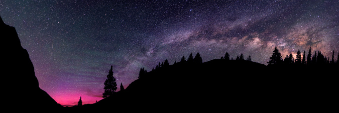
After reaching the road at 11 PM, I was rewarded with some insane views of the Milky Way. I set-up for some shots of the Milky Way and to my huge surprise, was able to also capture the Northern Lights! This next shot is a panoramic looking north-east-south. I just can't believe I got the Northern Lights - so awesome.
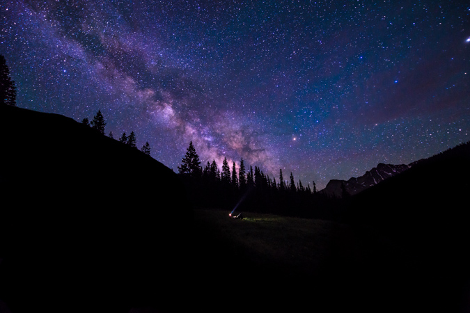
My final shot is me laying in the grass with my head-lamp, gazing into the night sky.
I slept under the stars at my Jeep back at the Reservoir after a long but enjoyable hike out in the dark and drove home to Colorado Springs early the next morning. What a great trip!
If you enjoyed my photos, please consider purchasing a print for your home or office. You can visit my gallery for a full showcase of my photography - if there are any photos from this trip you are specifically interested in, please do contact me.
Mount Oklahoma - A Centennial 13er that is more than just "OK"
Mount Oklahoma is often forgotten by many, including myself, for a variety of reasons. There's nothing very remarkable about the look or feel of Oklahoma or the route to climb it. As Gerry Roach explains in his guidebook for 13ers, Mount Oklahoma is dwarfed by its neighbor to the east, Mount Massive, which is the 2nd highest mountain in Colorado. Despite this fact, Mount Oklahoma is more than OK - it offers solitude, unique views of mountains in all directions, and a fresh perspective on the art of "peakbagging."
Mount Oklahoma is not a mighty mountain, nor is it meek - rather, it is fairly average in stature for the Northern Sawatch Range - rising 13,845 ft. in a valley full of giants. Indeed, Mt. Elbert (14,433 ft.), Colorado's highest mountain, towers over Oklahoma to the south and east. Other higher Centennial peaks also adorn the skies nearby, including French Mountain (13,940 ft.), Casco Peak (13,908 ft.) and of course the Mount Massive massif (14,421 ft.) right next door.
Knowing that Mount Oklahoma is a fairly straight-forward and relatively safe climb, lacking anything harder than class 2 and with one of the easier levels of access for a 13er, I opted to head-out to climb it solo. While this is something I generally discourage, I felt the risk was manageable, plus my wife knew where I was going to be. Indeed, it did turn out that I did not run into a single other soul during the whole hike until well on the way back to the Jeep on the Mount Massive leg of the trail. So there it was, I left my house in Colorado Springs at about 6:30 PM on Friday evening and found myself at the North Halfmoon Creek Trailhead at 9:15 PM. There was an abundance of people up in the valley camping. Despite campsites being quite ubiquitous in the valley, I was left with no other option but to park at the trailhead and find a flat and comfy campsite within the trees. I set-up my sleeping pad and sleeping bag only and went to sleep right away.
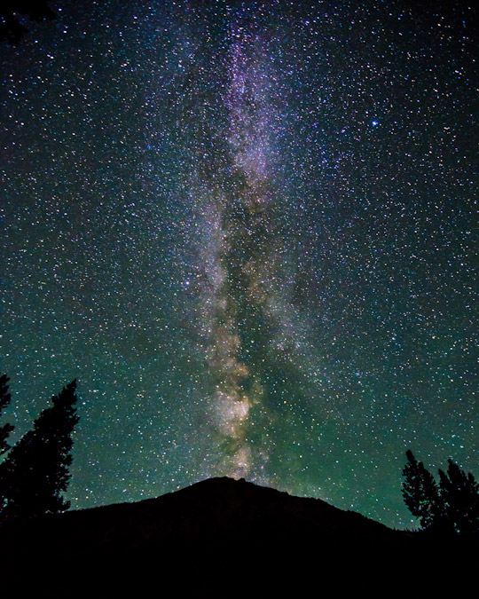
The alarm sounded promptly at 3:30 AM and I rose quickly to get a start for the day, as I knew my wife wanted me home relatively early so that we could go to my parent's house for a father's day dinner that night. The first thing I did was take a shot of the Milky Way above the trees and above the 13,221 ft. northern sub-peak of Mount Elbert.
Click on the photo to see a larger version or to purchase a print.
I had been on this trail once before in 2009, having been here in the cold month of October to climb Mount Massive. What I remembered of this trail was that it was very straight and easy to follow below tree-line before the turn-off for Mount Massive, so I was very confident that I could make my way in the darkness with the aid of a headlamp. Adorned with my Ipod and my favorite Celtic tunes, including Solas and Altan, I began my journey in the dark.
I also decided to bring my Gitzo tripod - which is basically an older, heavier version of THIS one, with an Arca Swiss monoball affixed so that I could get some sweet sunrise shots and summit shots along the way. While this adds a great deal of weight to my pack, the effort is worthwhile and increases the types of shots I can get significantly. I've fallen in love with this tripod and monoball combination since acquiring them both on the cheap a few months ago on Craigslist. They are hands-down the highest quality photography gear in the business. I highly recommend both for anyone looking to upgrade.
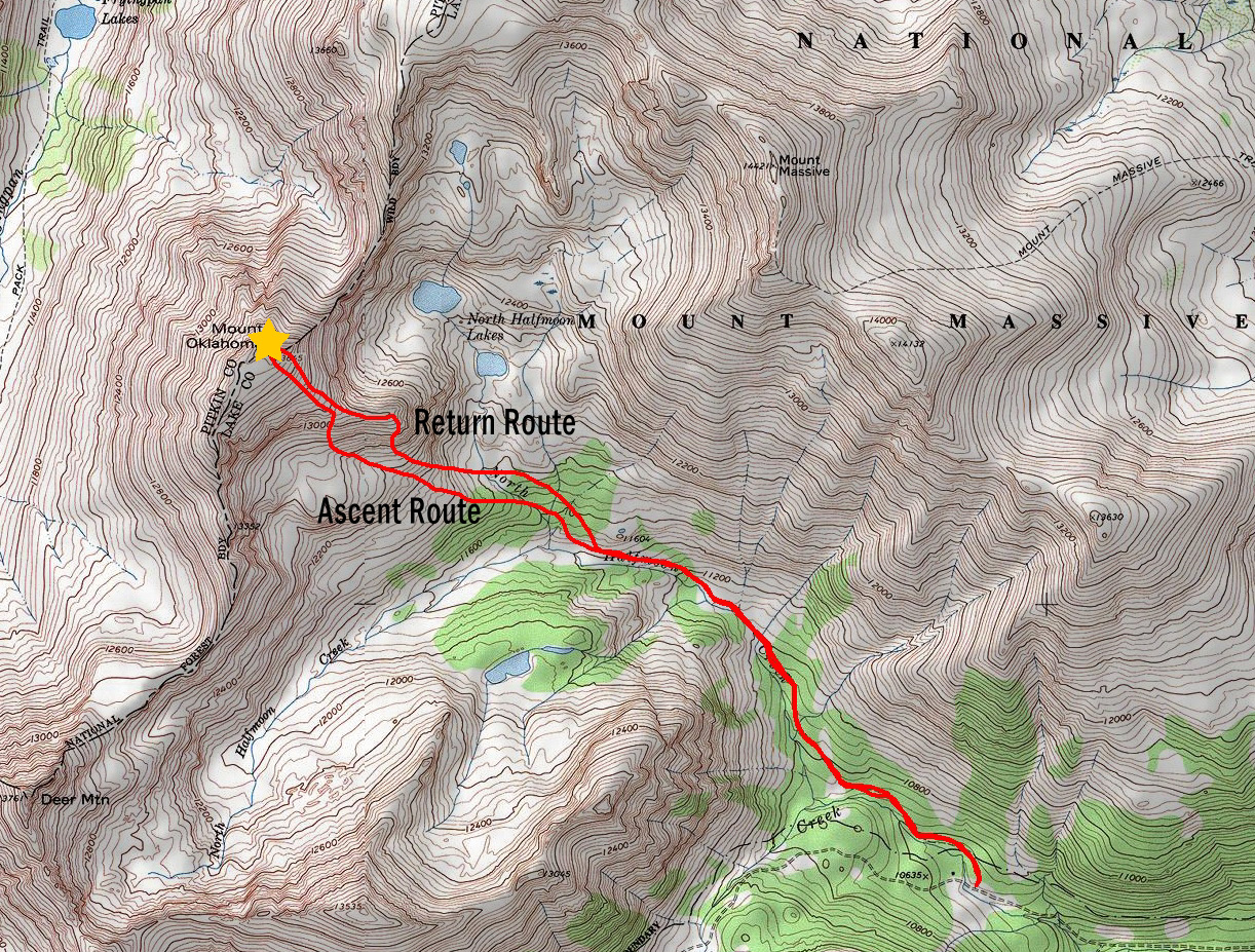
The plan was to follow the route as described by Roach, which is close to what actually happened - here is the map of my route - click on it to see a larger version.
I found the trail very easy to follow, even in the darkness, minus one section where the trail meets up with a very large rock formation and crosses it. I just kept my eye out for the trail and ensured I was on track at all times. The route description for Mount Oklahoma is pretty straight-forward according to Roach. After passing the Mount Massive trail junction, continue west-northwest until the trail begins to gain elevation and head north, at which point you are to leave the trail and continue west. That's just what I did, but it was somewhat sketchy in the dark - bushwhacking through trees and logs is a great time. I quickly reached the two large stream crossings described by Roach - they were quite fast streams on a steep incline - I was very careful to cross, finding dry-ish rocks in narrow passage-ways. At this point - I began up a steep hillside per Roach's description for going up a tree-filled ridge to the northwest. Before I knew it, I had reached treeline and could make out my surroundings.
I encountered a deer at this point, which quickly ran off into the trees below. I could also make out a series of waterfalls in the Halfmoon Lakes basin below Mount Massive to my right - this was quite impressive and I made a mental note to return to those lakes someday - they seem to hold quite a bit of promise. I also was revelling in the fact that I was hiking solo in the Mount Massive Wilderness Area, off-route, while listening to great tunes and taking pictures of fantastic vistas. I really do love Colorado! Mount Oklahoma was clear as day above me, and the route seemed quite obvious from this point - go up.
Before long, I found myself high above most of the trees just in time to witness the first light kiss the tops of Deer Mountain and UN 13,535 to the south and west. Moments like this made hauling the tripod up worth the effort.
I left my pack and wandered up a little way and found an area covered with really cool looking flowers. Turns out the flowers are known as Alpine Primrose - a really quite lovely looking purple and pink flower. I took quite a few shots from this spot and processed each a little differently.
Another version from the same vantage point...
I was even able to put together an 360 degree HDR panorama, which I've not tried in a few months. I was not overly impressed with the results of this one, but I'll share it anyways.
Having filled my soul with a dose of alpine sunrise, I was ready to continue on up the mountain. I followed what seemed to be a slight trail or drainage up the mountain and was aiming for an area to upclimb a grassy screefield.
At this point I stumbled upon a small pond at the base of a small snowfield below Mount Oklahoma. It made for a very interesting reflection in the water with the sun just hitting the tops of the southern ridge of Oklahoma.
I played with a few versions of this shot, and I think I liked the HDR horizontal version the best. I know HDR is a technique with many detractors; however, I like to play with it - it keeps me entertained and thinking.
At this point, I found the grassy screefield, and it was mighty steep. I was not sure if this was the right way to go, but it looked like the easiest way up to the ridge. I plowed ahead slowly, reaching the ridge after several long minutes of gruelling climbing up this nasty section. Once up, the views were splendid.
I continued to plow ahead slowly on the obvious route up Oklahoma to the north and west. As I climbed, the views improved dramatically.
It was at this point that I began to feel sick to my stomach just like I did back in 2009 when I climbed Harvard and Columbia. I was beginning to wonder if my lack of food intake or the water I was drinking were to blame. Perhaps I did not clean out my camelbak adequately? Perhaps I was eating too dense a food (Larabars) for my stomach to handle? Or, perhaps I was just suffering from a mild case of Acute Mountain Sickness? Who knows? All I knew was that I was moving far slower than I wanted to and making progress quite sluggishly. I worked my way slowly up the boulderfield until my eye was caught by some blooming flowers which happened to be quite near the summit. I took off my pack and prepared my tripod for some photos of some flowers. Also, I could finally make out the Elk Mountains to the west, including Snowmass, Maroon Bells, Cathedral and Castle - they were all quite impressive to be sure. I fixated on small field containing a variety of colorful wildflowers and took some shots.
After taking my fair share of photos in this patch of flowers, I decided to move upwards. It took about 4 more minutes from here to reach the summit, which was a relief given my stomach issues, which had actually subsided significantly since I stopped to photograph the flowers. On the summit, I noticed that clouds were hitting the Elks with some light showers and that those clouds were headed this way. I had no intention of getting stuck in a storm, so my lofty goal to traverse to North Massive was out of the question. I set-up my tripod and set the timer so I could get a few shots of myself signing the summit register for Centennial #76 - only 24 more mountains to go!
The register was quite intact and filled with many familiar names. I was happy to add mine to the list.
At this point I used the tripod to take some photos to later be used in my 360 degree summit panorama.
I also toyed with a black and white shot from here, framing Mount Massive on the left part of the shot.
After a quick phone call to the wife to let her know I made it safely, I took an assessment of the weather. The storms rolling in over the Elk Mountains to the west did not give me a good feeling, so I decided to pack-up and head down. I decided this time to see about the small ridge that rolls down to the east of Oklahoma. Instead of going back down the grassy talus, I went down the long ridge.
Once down, I found a great spot at the end of the ridge to take a sweet pano from - Mount Oklahoma at center with Mount Massive at right with a small storm over it.
At this point, I saw a ton of cairns leading down the mountain towards the cliffs Roach warned to avoid in his guidebook. I decided to take the challenge and see where the breadcrumbs could lead me. Sure enough, they led me down the mountain's steep slopes, but it was not a terrible route, albeit harder than my ascent route (loose rock, etc).
Small storms were hitting the areas peaks, and it started snowing a little bit, but nothing too scary.
On the way down the steep terrain, I ran into some really nice flowers in a very strange spot amongst the rocks. Nature never ceases to surprise me...
Once down the nasty part, I was back on the grassy ledges near treeline. I decided to angle my decent more northeasterly so I could hit the trail coming down from Halfmoon Lakes sooner. This turned into a pleasant bushwhack into the forest, where I stumbled upon a small stream leading down from the lakes.
I found the trail again with no issues and found myself flying down the trail at a rapid pace. I reached the turn-off for Mount Massive in short order and took one last look back at Mount Oklahoma.
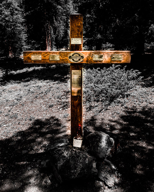
I was also pleased to see the large monument cross at the trailhead that was placed after the Blackhawk Helicopter crash in 2009 on Mount Massive.
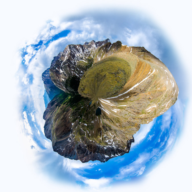
In closing, I highly recommend Mount Oklahoma as a hike that gets you away from the crowds on 14ers and still allows for wonderful views and a decent work-out. I am certainly not usually a fan of the Sawatch Range; however, the northern Sawatch Range really separates itself vis-a-vis grand views of the Elk Mountains and a seemingly more rugged feeling than the Southern Sawatch Range. I'll leave this trip report with a creative rendition of my 360 pano from the ridge - Planet Oklahoma. I wrote a tutorial on how to make these if anyone is interested.
{fcomment}
Sleepless on Mount Princeton - Sunrise in the Collegiate Peaks
Mount Princeton has been on my radar for a long time. As the most visually prominent (but only 8th most prominent, literally speaking) mountain in the Sawatch Range and Collegiate Peaks, it always has greeted me with warmth and nostalgia to the Arkansas River Valley and the quaint town of Buena Vista (yes, it is pronounced "Bewna," we know) during my travels into Colorado's mountains. Mount Princeton is the 18th highest mountain in Colorado, towering over the valley below at 14,197 feet in elevation. According to The Princeton Alumni Weekly, the first recorded ascent of Mount Princeton was on July 17, 1877, by William Libbey of Princeton University, hence the namesake. Sitting next to Mount Princeton is "Tigger Peak," an unranked mountain with 13,300 feet in elevation, which is often climbed in conjunction with Mount Princeton (which is what we did as well). The Princeton University history would also help explain the name of "Tigger Peak," since the mascot for Princeton University is the Tiger.
The plan to climb Mount Princeton was hatched earlier this month when I was chatting with a climbing friend of mine, Mike Vetter, about him coming to Colorado for his next climb. Mike actually found me through this website last year from his home in Sioux Falls, South Dakota, and joined me for my climb of Huron and Browns, and later, Capitol Peak. Mike found some seriously cheap plane tickets to Denver for the date we both had open, and he decided to pull the trigger. We both knew it would be a challenge, logistically, since he was flying into Denver and I lived in Colorado Springs, not to mention that his return flight departed the same day as our climb. Mike flew into Denver International Airport at 6 PM on Saturday evening and I picked him up from the terminal. We drove west on I-70 to C-470 and then caught US 285 towards Fairplay. After a quick meal in Conifer, we were ready for our adventure to begin.
We arrived in Johnson's Corner at around 10 PM and made our way to the Mount Princeton Road. We were happy to find the road completely clear to the Radio Towers on Mount Princeton Road, where we planned to camp for the night. We eagerly set-up camp in some hellacious wind and cold temperatures. Little did we realize (out of sheer stupidity mostly) that we were smack-dab on top of a giant hill, and consequently, the wind was outrageous. Not only did this make setting up tents quite difficult, it made sleep simply impossible. Due to the tight time constraints we were under due to Mike's departure flight, we knew we needed to start early if we were to make his flight on time. So, as a matter of necessity, we set our alarms for 2 AM and hoped for at least 3 hours of sleep. Unfortunately, neither of us were able to sleep one bit due to the insane wind.
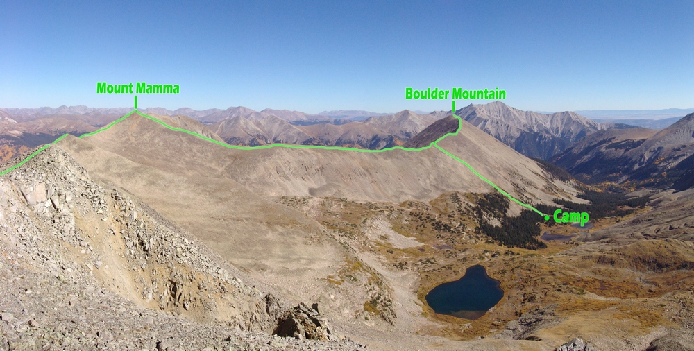
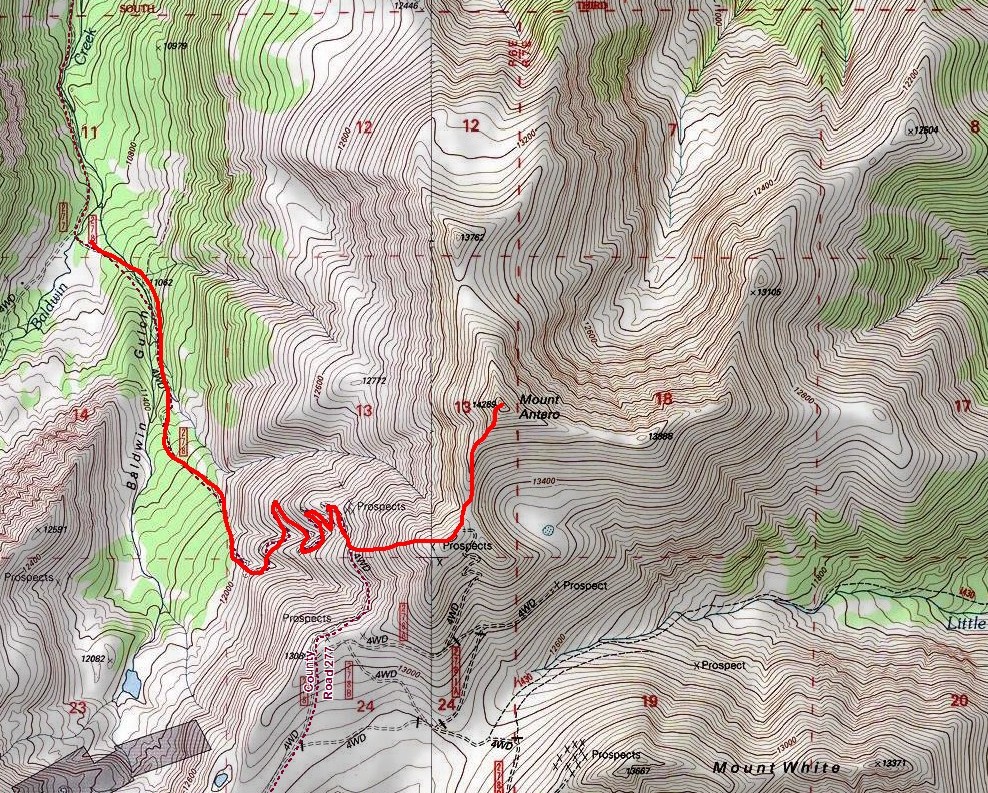
The experience of trying to sleep through huge wind gusts in a tent was surreal to say the least. Even though I did not sleep at all, the experience was very peaceful and restful, yet violent at the same time. Never before have I simultaneously experienced fear and happiness, it truly is difficult to explain what the experience was like. On top of getting zero hours of sleep, I managed to contract my son's cold, so I was feeling quite under the weather for this hike; nevertheless, we woke up at 2 AM, tore down our tents, secured our gear and began our hike at 2:45 AM. Here is a map of our route (click for larger version), which took us up the road and under "Tigger Peak," over "Tigger Peak," and up the ridge to Mount Princeton.
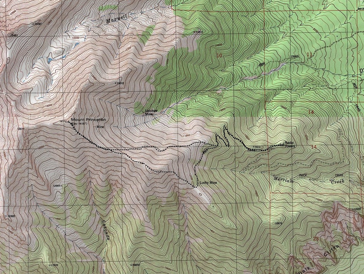
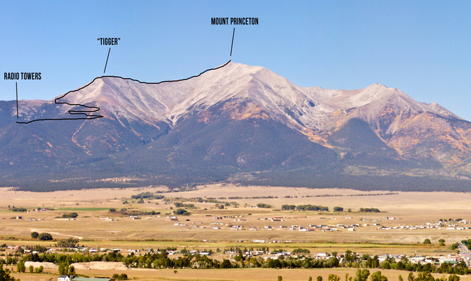
To get some perspective of our route, I decided to dig into my archives and illustrate the route, as seen from the Collegiate Peaks lookout, just east of Johnson's Corner. As you can see, the radio towers provides a good starting point and a clearly defined route all the way up the mountain.
The route seen above was made even more interesting by the record snowpack that Colorado has received this Spring, which many believe will cause flooding and massive avalanches. Indeed, as I returned home from this trip, I learned that someone died on a nearby 14er the day before due to an avalanche. Relative to our climb, the snow was a concern for both of us; however, we made sure to take our time and heed the utmost caution at all times. The snow appeared to be settled on Princeton for the most part, and we benefited from a very early start, which guaranteed snow that was not melting, and therefore, more stable. On the approach, just before heading up Tigger, we encountered several steep snowfields that were somewhat difficult to navigate because of how hard the snow was; crampons would have been a really nice thing to bring along, but instead we both had snowshoes with us (which were never deployed - story of my life).
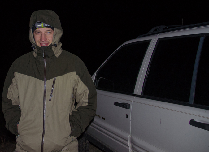
Early on in the hike, the effects of sleep deprivation and a strong and nasty head-cold were considerable and noticeable. I felt awful. Mike was gracious enough to capture the essence of that feeling in a photo, taken just a half mile into our hike. 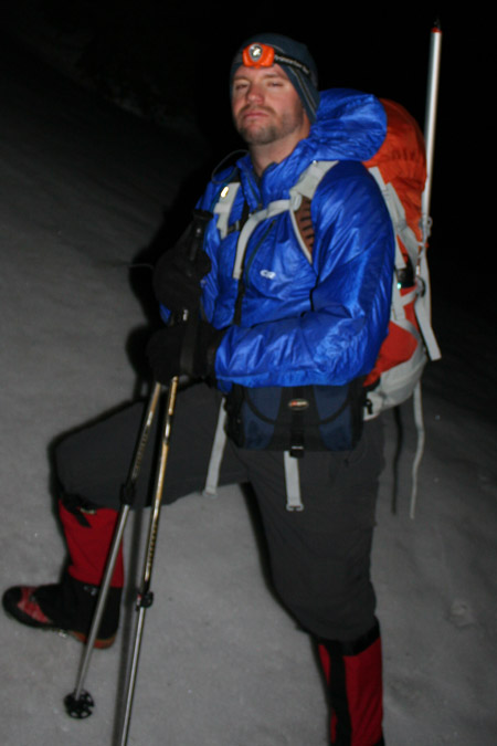
I think I actually felt worse than I looked, which says a lot based on how awful I look in this photo! On the flip side, Mike was looking chipper, as seen in this photo taken right as we left our campsite.
Despite feeling as if a large semi-truck had ran me over, I kept my head down and my spirits up. Once we reached the upper section of the trail beneath Tigger, I knew we needed to start heading up sooner rather than later. Despite the map in Roach's guide showing the hike following the trail to the top of the hill, we opted to leave the trail early and bushwhack straight up the ridgeline of Tigger. This proved to be a fairly good decision despite the absence of anything resembling a trail and the interesting route-finding required on the ice and snow strewn rocks that adorned the eastern face of Tigger. Most of the way up Tigger, we decided to stop and enjoy the sunrise, which was, by far, one of the most beautiful ones I have ever witnessed. Now, if you don't know me by now, you should know - I'm pretty obsessed with sunrises and sunsets, so that probably says something about the quality of this particular sunrise. The colors were fantastic. The presence of snow made it even more special, with the snow giving off a pinkish glow. We spent quite a bit of time watching this sunrise, and it was well worth it. I compiled several panoramic photos of the moment, including a couple single shots that I thought were pretty fabulous as well. Feel free to click on them for higher resolution versions (and full resolution prints are of course available for sale if anyone were interested).
The pre-sun sunrise color was intense, casting a deep red and pink hue on the clouds, with a cream-sickle orange glow around the silhouette of Pikes Peak.
The sunrise itself was great - of particular note, the clouds around the Buffalo Peaks were glowing, which was pretty marvelous!
Not sure what else to say about it - the sunrise was exceptional, and a dream for an amateur photographer!
Having indulged enough in the amazing sunrise, Mike and I were ready to keep on going since the wind was blowing pretty strongly, making it a very cold morning. We made our way to the top of the ridge of Tigger and were greeted with some of the strongest wind I've ever felt. The wind was easily gusting to 60 miles per hour or more, making it very difficult to hold your ground or take steps. Mike and I both later commented that this moment was very demoralizing for us both because we could not fathom continuing all the way up Princeton in these conditions. Nevertheless, we continued up and over Tigger, taking frequent breaks to catch our breath and regain our strength. The combination of the snow, wind, cold, lack of sleep and head-cold was forcing me to take much more frequent stops than I am generally accustomed.
It was a very pretty environment though, with views of the Southern Sawatch acting as further motivation to continue. Additionally, the ground was covered with thin ice and deep snow, littered with ice-cycles drooping from large boulders. It almost felt like another planet.
Mike and I soldiered on, with wind gusts and broken terrain slowing our climb. Mike was still in high spirits, and I had caught a second wind. Thank God.
We had a long ways to go yet, and it felt like an eternity just taking one step. Sleep deprivation does not mix well with mountaineering.
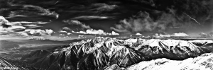
After about two hours, our traverse up to Princeton from Tigger was complete. It was a very exhausting haul up the deep snow. We were both wishing we left the snowshoes at home and packed crampons instead. Lesson learned. It was a great feeling, having completed my 43rd 14er and 61st mountain in the highest 100. Naturally, the views from the summit were breathtaking. It was a fairly clear day, and fortunately, the wind had magically subsided while we were on the summit, making our photography efforts that much easier. One of my favorite captures from the top was the view of Antero, Shavano, Tabeguache, Boulder Mountain, Cronin, Mount Mamma, Carbonate and Grizzly. Having spent numerous days hiking on those mountains last year, it was neat to see them from this vantage point. Here's the black and white version, feel free to click to see a higher resolution version.

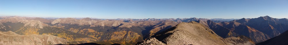
And of course the obligatory 360 panoramic shot... click for a larger version.
.JPG)
And if you're interested in an interactive version of the 360 view, take a look at these files, one is smaller in size (1.2 megs) and one is larger in size (16.7 megs).
CLICK HERE for small version (1.2 megs) of the interactive 360 panoramic.
CLICK HERE for large version (16.7 megs) of the interactive 360 panoramic.
Additionally, Mike was able to catch me in the act of shooting some photos and generous enough to share the photo with me.
And here's one of Mike enjoying the views from the summit.
Knowing that the sun was melting the snow, we decided not to spend too much time on top and head on down. On the way down, we were lucky enough to run into a few skiers, several of which were from 14ers.com, including LostSheep5 and EatinHardTack. They were able to confirm that the standard route trail was clear, so we opted to detour to the trail to avoid the ridge. I was excited about descending the snow to some degree, because I wanted to test out my new ice axe, which I purchased at REI recently. With ice axes in hand, we crossed the giant snowfield between Tigger and Princeton, which felt quite solid despite the warming temperatures and avalanche concerns in the back of our minds. I did slip a few times on the way down, and needed to use the axe for self-arrest. I was thankful that I had already experienced this before, because self-arresting came quite naturally.
We were able to wrap around Tigger, following the snow-filled trail and look back to see the skiers making their descent.
It was about at this point that the trail ended and we had to make a decision, not knowing where the most logical place to descend from since we did not come up this way. I did some scouting at the end of the ridge and much to my surprise, spotted the radio towers and my Jeep in a straight line down from us. We opted to bushwhack in that direction and quickly met back up with the trail, which we happily followed all the way back to the Jeep. Those radio towers never looked so good!
That concludes this trip report. If you would like to stay up-to-date on all of my articles, trip reports and other mountaineering related news, please feel free to follow 100summits on Twitter or Facebook! Also, if you're planning on doing any online shopping and if you enjoyed the content, please help keep the site going by using the links on this page to help fund the site.
Six 13ers in the Sawatch: Fall Colors Galore!
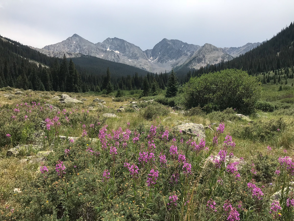
Earlier this year I had made plans to climb Mount Wilson, Wilson Peak, and El Diente with my dad; however, plans quickly changed through the summer as Ray painfully realized that he did not have the flexibility, strength, nor desire to conquer those mountains. We decided instead to take a camping trip with my son, Quinn, up to the southern Sawatch range and I would figure out alternative climbing options later.
Being that one of the best months to climb mountains in Colorado is September, I wanted to get in as much hiking time as possible to soak in the fall colors. I chose the far southern Sawatch range to begin my quest for great fall color photos and hoped to conquer my personal nemesis, Tabeguache Peak, as a bonus. Due to it's location, Tabeguache is generally climbed in conjunction with Mount Shavano - which I've already climbed twice in two years due to my quest for Tabegauche's summit. For this trip, I'd planned to hit Tabeguache from the north, while bagging Grizzly Mountain, Cyclone Mountain, and Carbonate Mountain; however, upon further inspection of the TOPO map for the area (St. Elmo Quadrangle), I discovered that there were several other 13ers right near where we were planning to camp, all of which were connected by long ridges, and that it would be a shame not to climb them while we were in the area. My plans quickly changed and I added Boulder Mountain and Mount Mamma to my itinerary.
Trip Statistics:
Summits reached:
Boulder Mountain: 13,528 ft. (ranked 236 in Colorado)
Mount Mamma: 13,646 ft.(ranked 173 in Colorado)
Grizzly Mountain: 13,708 ft. (ranked 142 in Colorado)
"Lo Carb": 13,591 ft. (unranked)
Cyclone Mountain: 13,596 ft. (ranked 192 in Colorado)
Carbonate Mountain: 13,663 ft. (ranked 165 in Colorado)
Total elevation gain: 4,883 ft.
Total prominence in feet: 2,723 ft.
Total distance hiked: 11.41 miles
Total time hiking: 10 hours, 30 minutes
Total photos taken: 592
Total wildlife sightings: 1 (Mountain Goat)

Collegiate Peaks - located in the Sawatch Range, including Mount Antero left of center, Mount Princeton at center and Mount Yale at far right.
On Saturday, September 18, 2010, my dad, my son, and I loaded into my Jeep Grand Cherokee and headed for Baldwin Gulch. To get there, we traveled to Highway 285 via Highway 24 and drove south from Buena Vista / Johnson's Corner to Chaffee County Road 162, heading west towards Mount Princeton & St. Elmo. After 12.5 miles, we took a left (south) on Chaffee County Road 277 (Mount Antero / Baldwin Gulch Road).

The aspen changing colors in Baldwin Gulch.
This is a 4WD road and put my Jeep to the test. In fact, when I purchased this Jeep earlier this year, I had this road in mind as a good barometer for how much clearance etc. I wanted to have. The road is fairly rough in spots, and I knew that after the road splits towards Baldwin Lake, it becomes even rougher. Sure enough, after passing the turn-off for County Road 278 at Baldwin Creek and staying right, the road became fairly crazy. If you don't have good clearance, this would be a great place to stop.
We found a great campsite roughly 4.3 miles up the road (1.7 miles from the Baldwin Creek turn-off) near a large boulder field near the smaller lakes below the main Baldwin Lake. We set-up camp and enjoyed the cool yet pleasant fall weather. Speaking of weather, the forecast for the weekend was ideal for hiking - no rain, no storms, no wind. I took a small hike around the area to enjoy the fall colors. I was very impressed by the golds, yellows, reds, and browns of the vegetation - it certainly made for quite the view, and complimented the diverse colors of the mined rock on the mountainsides.

Antero Peak is reflected with vibrant blue colors.

Cronin Peak and lower Baldwin Lake.

Cronin Peak and lower Baldwin Lake.
Baldwin Creek.
The moon was nearly full and much to my surprise, there were great views of the moon rising above Cronin Peak in the early evening.

Cronin Peak with the moon rising above it, reflected in the water.

Cronin Peak with the moon rising above it, reflected in the water (lighter this time).
After enjoying a large campfire and roasting marshmellows with my son, we all went to bed. I set my alarm for 4 AM so that I would have a full day for my planned epic hike:

The route map for Boulder Mountain, Mount Mamma, Grizzly Mountain, "Lo Carb," Cyclone Mountain and Carbonate Mountain.
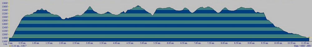
Elevation profile for Boulder Mountain, Mount Mamma, Grizzly Mountain, "Lo Carb," Cyclone Mountain and Carbonate Mountain.The first 1/2 mile was pure bushwhacking scree hell.
I left camp at 4:30 AM and bushwhacked straight up the side of the ridge of Boulder Mountain. I stumbled across an abandoned mine on the way up and found this part of the hike to be the worst part of the day. As you can see above, the first 1/2 mile of the hike was absolutely brutal - I gained 1,400 ft in the first 1/2 mile on loose scree, boulders and talus. It was the kind of rock where you took one step forward and then slid backwards half a step. It took me only an hour to reach the ridge, where I was greeted by strong, cold wind and pure darkness. The stars were amazing though, and the sun was just beginning to provide the first glimpse of light on the eastern horizon, left of Antero. Looking north, I could see the vague outlines of Boulder Mountain, which seemed to be pretty far away in the darkness. Through the cold wind, I pushed my way up the summit ridge of Boulder Mountain, and reached the summit at 6 AM, a mere 1.5 hours after I began my adventure. The summit had a very awesome looking cairn at the top, which provided nice contrast with the light of the rising sun.

If you've never experienced the sunrise from the top of a mountain before, it should be on your bucket list. This marks the third time I've been able to witness the sunrise from 13,000 ft+ and it never gets old. The sunrise provided excellent outlines of Mount Antero, Mount White, Tabeguache Peak, and Mount Shavano to my east. Additionally, as the sunrise continued to increase the amount of light, it became clear that there were incredible views of gold and red aspen across the valley along the ridgeline for Mount Princeton to the north. It was quite stunning to see all of the colors emerge from the darkness as the sun rose above the horizon.

The sunrise illuminates the sky, revealing Mount Princeton (left) and Mount Antero (right).

The sunrises behind Mount Antero.

The changing aspen are visible from the summit of Boulder Mountain.
Matt Payne on the summit of Boulder Mountain - it was really windy!

Aspen change colors on the slopes of Mount Princeton and it's neighbors.
After enjoying the sunrise, I started to head back down the ridge of Boulder Mountain to the south. As I traveled along the ridge, the sunrise lit up skyline to my right (west) across the slopes of Mount Mamma and to the north, illuminating groves of aspen trees. It was nothing short of spectacular.
Grizzly Mountain in the far distance...
Mount Mamma is lit up by alpenglow.

Aspen are further revealed by the rising sun across from Mount Mamma's north ridge.
As I approached the ridge between Mount Mamma and Boulder Mountain, the full length of my next summit revealed itself in quite an overwhelming way. The distance between the two peaks seemed quite vast; however, I was so entranced by the surrounding views that any doubts I had about going onwards were destroyed.

At center - Cronin Peak. In the far distance just right and behind Cronin were the final two mountains I would end up climbing - Cyclone and Carbonate. The ridge to Mount Mamma is quite long from Boulder Mountain.
The lower Baldwin Lakes were right below me on the saddle between Mamma and Boulder.
Baldwin Lake pools reflect parts of "Lo Carb" to the South from the saddle between Mount Mamma and Boulder Mountain.
About halfway across to Mamma, it still felt like I had a long way to go...
Mount Mamma was quite a long haul from Boulder Mountain...
At 7:30 AM I finally reached the summit of Mount Mamma, just three short hours from the start of my trip. My legs were feeling extra spicy!
Matt Payne on the summit of Mount Mamma - with insane aspen in the background.
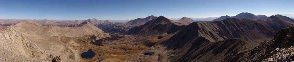
A panoramic landscape looking south to north from the summit of Mount Mamma.
Mount Princeton seen at far right among changing aspen, as seen from the summit of Mount Mamma.
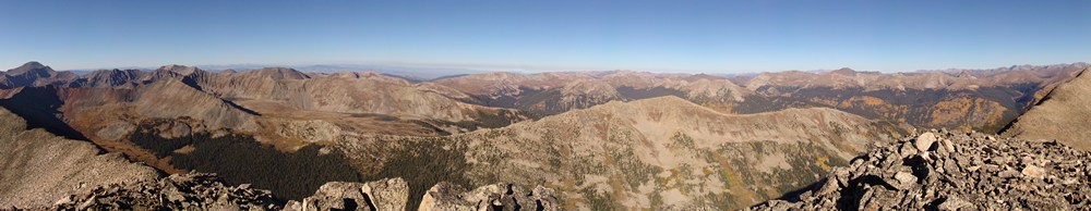
A 360 degree panoramic landscape from the summit of Mount Mamma.
Huge groves of aspen are seen to the north and west of Mount Mamma.

A zoomed-in panoramic landscape of aspen trees west and north of Mount Mamma.
A panoramic photo looking west from Mount Mamma.
After taking some time to rest on Mount Mamma, I peered over to my next objective: Grizzly Mountain. Grizzly Mountain would be the highest mountain for me to summit this day, and it was not easy.
The terrain on the ridge from Mount Mamma to Grizzly Mountain is steep and rugged, without a trail. The rocks were looser and slightly more dangerous on this section of the route, so I was careful to choose my foot placements.
After another hour of hiking, I reached the saddle between Mamma and Grizzly and took time to appreciate the sheer northern face of Grizzly that stood before me. At this point, the ridge became quite narrow, and it was quite fun having nothing but sheer drop to my left and incredible views of Grizzly Gulch to my right. Grizzly Gulch contains Grizzly Lake and some of the most photogenic and pristine looking wetlands I've seen.
Grizzly Mountain's north face is quite impressive.
Grizzly Gulch seen from the saddle of Grizzly Mountain and Mount Mamma.
As I approached the summit of Grizzly Mountain, I could really gain some perspective on the hike I had completed so far. It was certainly impressive seeing the distance I had traveled thus far:
Additionally, I was able to get a great view of the entire route for the day, from start to finish. I had traveled a great distance already, but could see that I had a long way to go yet...
A view of Baldwin Gulch, including Baldwin Lake, Boulder Mountain, Mount Mamma, Cronin Peak, Antero Peak, Mount White, Cyclone Peak and Carbonate Peak.
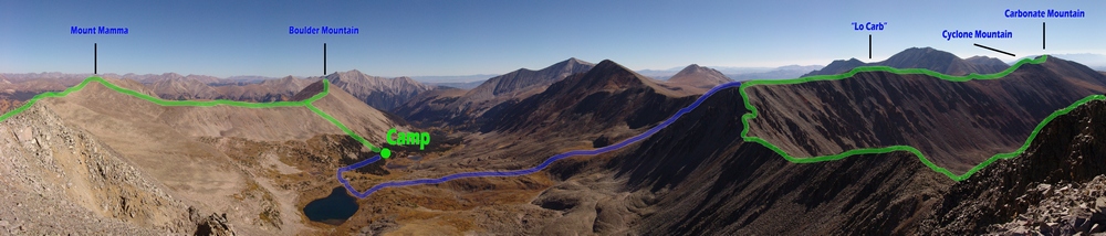
The entire route as seen from Grizzly Mountain.
I finally reached the summit of Grizzly Mountain at 10 AM and dove into my pack for some much needed food. The views from Grizzly were great, but I could see that I still had quite a lot of ground to cover if I were to complete my goals.
Matt Payne on the summit of Grizzly Mountain, with Cyclone Creek Basin in the background.
Cyclone Creek Basin, south of Grizzly Mountain. Taylor Mountain in the foreground with Mount Ouray in the distance.
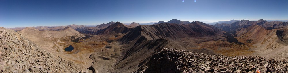
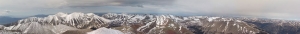
A 360 degree pano from the summit of Grizzly Mountain.
Knowing that I had a long day in front of me still, I departed Grizzly Mountain's summit promptly and made my way over towards saddle of "Lo Carb" and Grizzly. From afar, the terrain between Grizzly and "Lo Carb" seemed rather intimidating, and I was a little concerned with what I would find once I began climbing to the top of ridge at the end of the ridge-line.
Steeper terrain greeted me at the saddle between Grizzly Mountain and "Lo Carb."
The terrain indeed proved to be challenging, but quite fun. I would rate the tough section of this climb low Class 4 or high Class 3.

At this point, Boulder Mountain seemed like a completely different trip - it was so far away!
After reaching the false summit of "Lo Carb," which is basically the high point between Lo Carb and Cronin Peak, I was able to get a full grasp of the distance I had traveled. It continued to amaze me.
Grizzly Mountain (left), Mount Mamma (center), Boulder Mountain (right of center) and Cronin Peak (far right).
I began the long hike towards Lo Carb, Cyclone Mountain and Carbonate Mountain. Tabeguache was still a long way away, which pretty much sealed the deal for me - I would be coming back for Tab a 3rd time!
I don't know what came over me at this juncture of the trip, but I just remember being overcome with positive feelings and I remember saying to myself, "Man - THIS is so awesome!" I think the combination of solitude, great weather, awesome views, and the sustained time above 13,000 ft. had something to do with it.
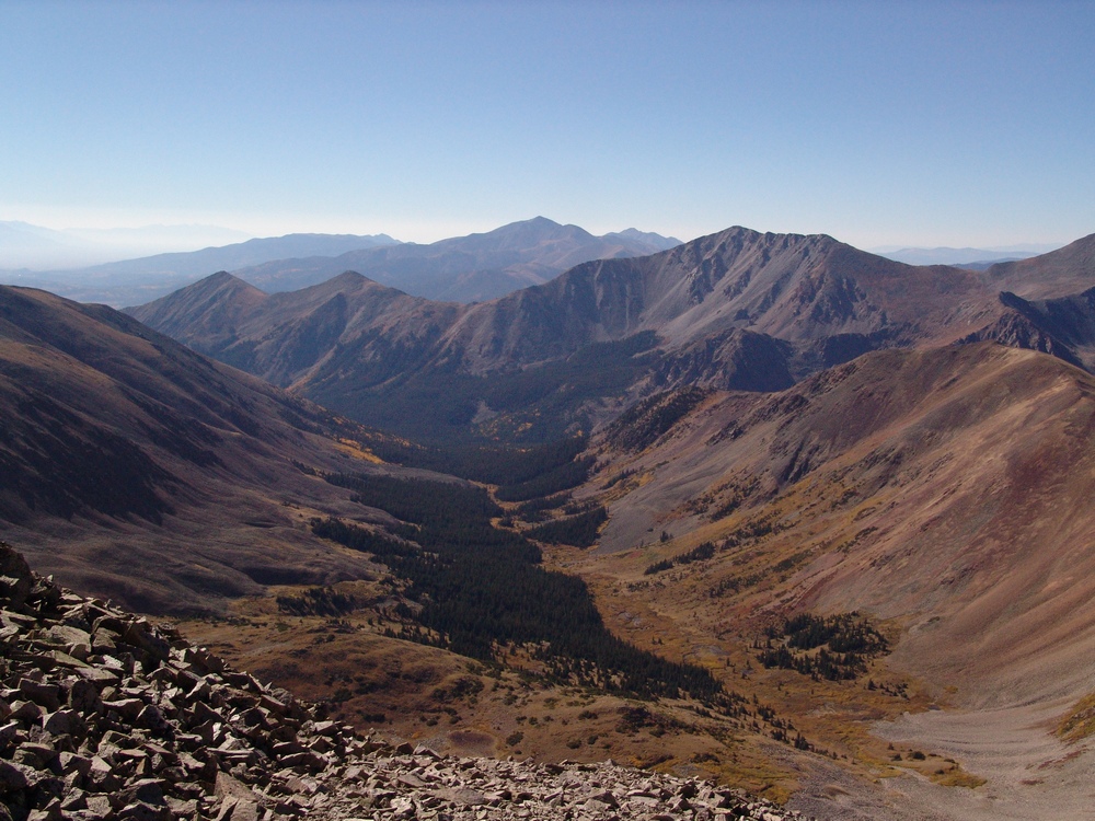
Cyclone and Carbonate are really gentle peaks nestled at the top of Brown's Creek Basin, which divides Mount Antero and Mount White from Tabeguache Peak.
Cyclone Mountain and Carbonate Mountain.
One detraction from the view was the large network of roads that connects Mount White and Mount Antero. As many know, these mountains are rather famous for gemstone mining, so a lot of people probably make a living from these roads' existence. With that being said, it seems like there are too many roads up there and it is an eyesore for sure.
Mount Princeton, Cronin Peak, Mount Antero, Mount White and Tabeguache Peak as seen from the saddle of "Lo Carb" and Cyclone Mountain.
Reaching the summit of Cyclone was somewhat of a treat because the summit register there had listings from all the way back to 1349. Of particular note, I saw an entry there from the famed Bob Martin, of Martin and Garratt - Colorado's High Thirteeners, which is one of my favorite mountain books. One more note about Bob Martin - he's probably climbed every mountain in Colorado over 10,000 ft., not an easy task to complete! In fact, at the date of this report, he's climbed 2,563 mountains in Colorado... as compared to my 91 (at the date of this report) and some people think I'm obsessed! :-) My take on it - impressive dedication!
Bob Martin sighting...
From the top of Cyclone, I was able to get a really nice zoom-in pano of Cyclone Gulch and the mountains across the valley. In case you're wondering what that means - I take several photos where I've zoomed-in as far as I can with my camera, and I've combined them. The result is that you are able to see a great deal of detail in the photo. Individual trees can be made out easily. Of course to see this, you need to see the full resolution version of the photo. Let me know if you'd like to!
Cyclone Gulch seen at high resolution. Carbonate Mountain at far left with Taylor Mountain and Mount Aetna in the valley over above the groves of changing aspen trees.
At this stage, my legs were definitely getting tired. I strolled on over to the summit of Carbonate Mountain, and after seeing the huge drop in elevation between Carbonate and Tabeguache, I made an official declaration that Tab would just have to wait for another day.
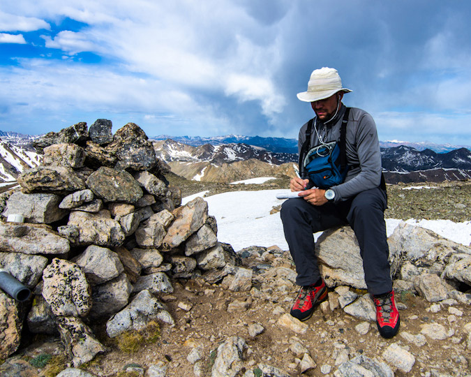
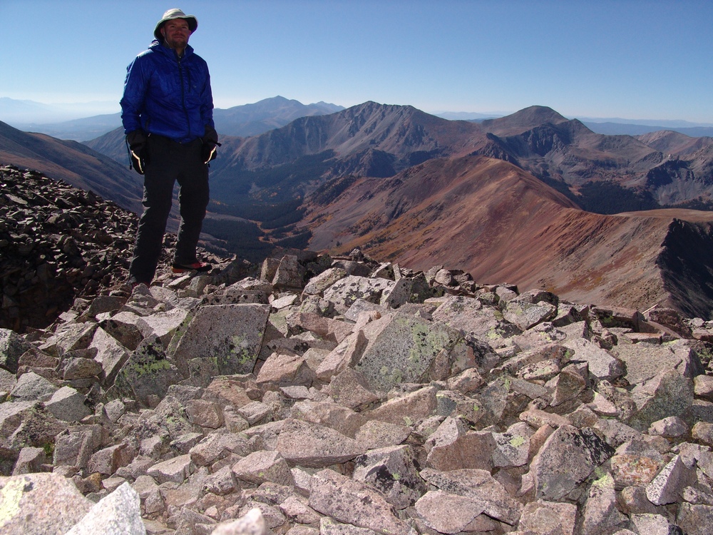
Matt Payne on the summit of Carbonate Mountain.
Taylor Mountain and Mount Aetna rise above a forest of colorful aspen tree and North Fork Reservoir.
While it was somewhat of a hazy day, I could still see aspen changing in every valley that I could see with the naked eye.
Having summited 6 mountains in one day, 5 of which being ranked 13ers, I felt that my day was a huge success and that I was ready to return to camp for some awesome burgers. I made my way back over Cyclone Mountain and Lo Carb, down to the saddle between Lo Carb and Cronin, and down to Baldwin Lake.
Baldwin Lake.
Once I reached our campsite, it was only 3 PM. Quinn was happy to see me, and many burgers were happily consumed!
"Welcome back dad!"
Mount Elbert - A Stroll Up Colorado's Highest

Mount Elbert – 14,433 ft. – ranked highest in Colorado, 2nd highest in the contiguous United States (highest is Mt. Whitney at 14,505 ft.)
I had originally planned on climbing Snowmass mountain with Terry this weekend, but my wife’s mother, Donna, asked me a few weeks ago if we could give a 14’er a shot. Donna has been reading my reports here for awhile and I think she was bitten by the 14’er bug. As she had never done a 14’er before, I did some research on the ‘easier’ 14’ers and figured that Elbert would be a good choice due to the gentle elevation gain and relatively high start. In retrospect, I probably should have chosen Sherman or Quandary.
We left Colorado Springs around 6 PM on Thursday 8/27/09 and arrived at the South Elbert Trailhead around 9 PM. We set-up camp and went to sleep. The alarm woke us up at 4 AM and we quickly got ready.
Hiking in the dark was no doubt an interesting and new experience for Donna. We started up the Colorado Trail and then up the South Elbert Trail. The start of this trail is pretty steep and took us by surprise. I did not anticipate the route to be this steep, but Donna took it in stride. As this was her very first climb, I gave her lots of time to rest and take-in water as needed. I stressed the importance of drinking lots of water to her and she definitely listened. We were able to reach tree-line before sunrise. I must admit, the view of Twin Lakes Reservoir was really impressive from this trail. Here’s a shot of Donna with Elbert behind her just before sunrise:
Donna kept our pace nice and steady and we were able to get sweet views of Elbert and the surrounding area as the sun hit the tops of the peaks. Here’s a pano looking east, south, and west:
The sunrise was really beautiful. Twin Lakes really was an awesome sight:
We continued up Elbert.
Here’s Donna with the Lakes behind her:
The trail was very clear. There seemed to be quite a bit of erosion and I would suggest that other hikers try to stick to one main trail so that the tundra can recover. We kept climbing and the views of the Lakes just got better and better. 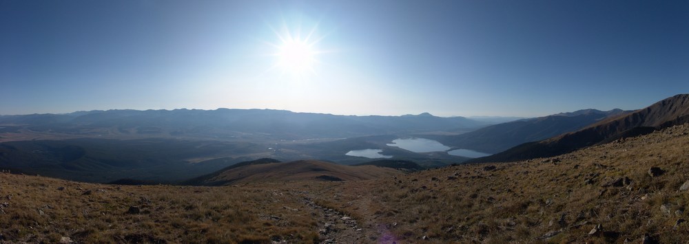
Elbert is like a giant pile of rocks. It has very little in terms of distinguishing features other than its a really big, pile of rocks.
Unfortunately, the higher we got, the more ill Donna became. I thought that acute mountain sickness(AMS or altitude sickness) might happen, but had hoped that she could fight through it. She finally stopped climbing at 13,750 feet, an impressive first outing! I was really rooting for her, but I totally hate the nausea that AMS gives you, so I totally understood why she would want to stop.
Donna told me to go ahead without her, so I climbed the rest of Elbert quickly. Donna’s decision to stop proved to be a good one, as there was quite a bit more mountain to hike up than I originally thought. It took me about 30 minutes more to get to the summit, where I was greeted by two Austrian gentlemen, one smoking a cigarette, and the other drinking a Bud Light. They kindly took my picture: 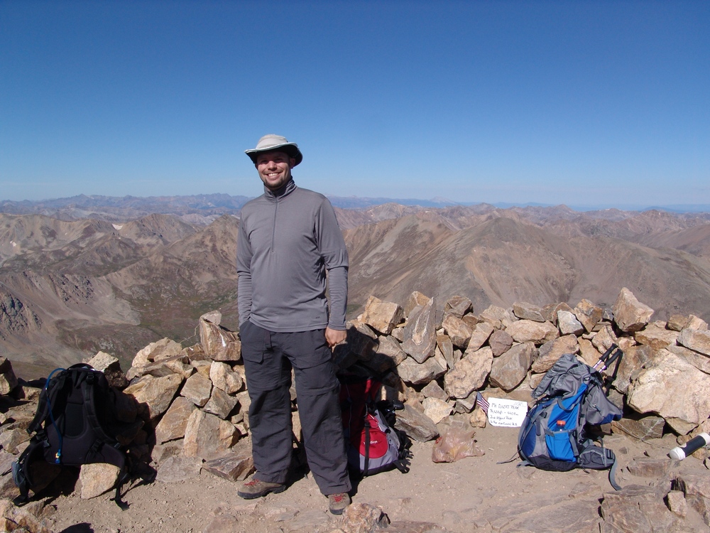 I was really excited to see the Maroon Bells in the distance, and took tons of pictures of them. They are very aesthetically pleasing to me, one of the coolest sets of mountains I have seen.
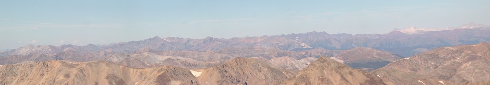
I took quite a few photos from the top but did not stick around very long because I wanted to get back down to Donna. Here’s some panoramic shots of the view from the top. This one is looking east and south:
And this one is looking east, south, and west:
And then looking north, west, and south:
I quickly hurried back down and found Donna down-climbing about a half-mile from where I had left her. We slowly went back down, which was very enjoyable – the colors were changing and the day was PERFECT – weather was awesome and the start of fall was in the air. Here’s some fun pictures I took of the early fall colors that were changing in the tundra on Elbert and the surrounding mountains: 
We made it back down to the Jeep successfully and I think Donna had a very good time on her first mountain climb. I really hope she tries again and is able to feel the great thrill that is the top of a high mountain in Colorado!
{fcomment}
Mount Antero - A Great 14er Season Starter
Mount Antero is one of the easiest mountains to identify as you are driving into Buena Vista from Colorado Springs. It is a very pointed peak to the South of Mount Princeton. Mount Antero towers above the Arkansas River Valley as one of the mighty 14ers in the Southern Sawatch.
Here are some fun statistics from this adventure:
Mountain climbed:
Mount Antero. 14,269 feet. 10th highest in Colorado
Elevation gain: 3,401 ft.
Total miles: 6.4 miles
My mission, and it was a fun mission indeed, was to reach the top of Mount Antero. Being out of shape and out of the climbing game for quite some time, I had exercised all Spring for this summer's adventures. This was an adventure indeed... Wind. Cold. Wildlife.
I drove from Colorado Springs on Friday night and made record time since the wife forced me to eat at home instead of on the way (thanks babe). I arrived at the turnoff for the Baldwin Lakes at around 8 PM and met up with Randy from 14ers.com there. We had met on 14ers.com and agreed to conquer Antero together. His cousin Daniel met us there and I decided to drive up the road where I would sleep for the night.If you've never been up the Baldwin Lakes road, its quite the adventure, especially if you're in a stock-equipped vehicle. My 2007 Jeep Grand Cherokee handled it like a champ, but not because I'm very good at driving off-road, that's for sure. The whole time I was driving up, I was white-knuckled and cringing for the inevitable scrape on the underside of my vehicle.
Fortunately it never came. On the way up the road I had two interesting moments. The first moment was when I was about half-way up and a big mammal was right in the road in front of me about 20 yards away. My vehicle startled it and it scurried off the road but I recognized it clearly - a porcupine. I had the wherewithal to not get out and investigate, but was glad I could see such a wild fella in the woods.The second interesting moment was at the stream crossing at the road intersection for Baldwin Gulch and Baldwin Lakes. I crossed the stream reluctantly, as this was something I had never done in my Jeep and I was not sure how deep the water was. I had read on 14ers.com that the stream was passable by a stock 4x4 truck, so I figured my Jeep would be OK. I was right, but I had trouble sleeping all night because all I could do was conjure up images of my Jeep being stuck in the water on the way down! Note, the water looked a heck of a lot deeper in the dark than in the daylight!

Baldwin Creek in early June - not for the faint of heart or stock-equipped vehicles...or, maybe, people afraid to get stuck, like me!
I set the alarm for 5 AM and tried to sleep in the car on a slight angle - always a fun endeavor. I woke up the next morning and shortly afterwards Randy and Daniel were at my car to start the hike. We started up the road and you could barely make out Antero in the darkness:
Its important to note that Antero has a well-developed 4x4 Jeep road going up the majority of the way up until about 13,800. This does not make it "easy" necessarily, but it certainly takes a lot of the mystery out of the hike. Randy blazed the trail ahead and set the pace for the morning:
The road switches back and forth up the side of Antero, as seen from my picture taken from the top of Mount Shavano just the week prior:
Its also important to note that there is some considerable mining interest on Antero. Apparently there have been some very nice and quite valuable aquamarine finds on this peak, including the largest aquamarine specimen ever found in North America, as evidenced by this article. As we climbed up, the sun began to rise and we were able to make out North Carbonate and Baldwin lake below it to our west. I climbed North Carbonate, now called Cronin Peak, on 9/1/1985 when I was just 6 years old. My memories from that climb are vivid, as we were pushed from the top by lightning. That made this climb even more nostalgic.
Additionally, as we gained elevation we could see down the Baldwin Gulch valley where we came from.
The road we were hiking on was full of snow drifts pretty much the whole way up, making a very formidible barrier for all of the miners that make this mountain their home during the summers. I'll come back to that later.
Antero loomed above us and was shrouded in shadow for much of our ascent. We spotted some elk on the road as we climbed, which was a very surprising but welcoming sight in the cold morning.
The elk stayed on the road for quite awhile as we approached and we came within 200 yards of them at one point.
Finally, we were able to get to the top of the first ridge that separates the Baldwin Gulch from Brown creek valley. Numerous jeep trails cross and intersect on this part of the mountain, which did deter somewhat from the spectacular views of Shavano and Tabeguache:
At this point we decided to take a "short-cut" up the ridge by doing some boulder-hopping, which is quite challenging with trekking poles, something I've not grown accustomed to yet.
Looking back from the ridge we were climbing you could see the large basin/ridge we had came from that leads to the upper Brown creek valley.
The northern Sawatch range broke out in the distance from the ridge we were climbing, and we could see that the weather was going to cooperate for us today.
The sun was finally cresting over the ridge at this point and was quite the contrast to the snow we were hiking on. The sunglasses were quickly dug out of my jacket and worn for much of the rest of the hike.Once we reached the top of the ridge we could see our final destination - the summit of Antero. Unfortunately, the wind at this point was maddening and brutally pounding our faces. We estimated that for the remainder of our climb, the wind on the ridge and the summit was about 50 MPH and gusts were up to 70 MPH. This, combined with 25 degree weather, made for a wind chill of about 5 degrees. My thin gloves were not cutting it at all, and my hands were punished. The North Face pants and jacket I was wearing were doing a superb job of keeping the rest of my body warm; however, and I was able to alternate keeping one hand in my pocket while using the other hand to hold both of my trekking poles.
We continued up the ridge, covered mostly with snow. The snow was hard enough to walk on and postholing was kept to a minimum, although, at one point, I did sink to about chest level in a snow drift.We continued up the ridge towards Antero, using the small rock formations as protection from the wind. The heavily fortified sections of rock were welcoming as the wind was beating them with a loud fury. I was really qutie impressed with the way in which the rock stopped the wind and created such amazing sound.
Here is a video I shot from the windy ridge:
Another great picture opportunity presented itself to me about halfway up the ridge, and I stopped to see if I couldn't capture it. My photography skills are not that good, but I think this picture came out pretty well.
Pictures from the rest of the climb did not happen because taking a picture in the wind and steep snow would have surely ended tragically for me. It was all I could do to keep my balance in the slippery, steep snow with the wind beating me down. At one point I lifted my hand up to my face and the wind caught my trekking pole and slammed it right into my face. The wind really was quite incredible. At one point I really felt as though I was on some epic climbing expedition.
I was able to summit a few seconds after a gentleman that had passed us right near the top. I took his picture and waited for Randy to arrive a few minutes later. Daniel took his time and was able to summit about 10 minutes after Randy.
A small lake near the summit of Antero.
Once Daniel was on top, I asked him to take a few shots of me, which gave me a chance to pose. Something about being on the top of a high mountain reminds of you of the corny scene from Titanic.
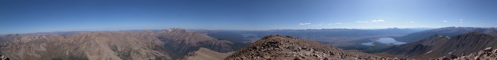
Poor Daniel had lugged a tripod to the top and never used it, but I took full advantage of it! I took a nice pano from the top, but unfortunately because of the wind, it was really hard to get it straight. The pano I ended up with was only partial, but still impressive nonetheless.
On the way back down I got one final shot of myself posing in front of Cronin. When we neared the stream crossing where my jeep was crossed, we encountered a gentleman that was shoveling the snow from the road. We theorized that he was an aquamarine miner based on his decor and by some of the things he said. It sounds like there's quite the mining operation on Antero in the summer.
We made amazing time back to the bottom and my Jeep made it across the stream easily - thankfully!
Mount Massive - A Frozen Wonderland
Some fun information about this great hike:
Mt. Massive - 14,421 ft. - 2nd highest in Colorado; third highest mountain in the contiguous U.S.
8 miles round-trip via Southwest slopes route
3,950 ft. elevation gain
More snow than I expected...
I thought that my climbing season had ended after being snowed on in mid-September on Grays and Torreys; however, I got the itch to climb again this weekend. Serendipitously, a fellow climber from Colorado Springs, Rob, posted on 14'ers.com that he was going to Mt. Massive on Saturday and that anyone from Colorado Springs was welcome to join him. I jumped all over the opportunity and we made plans to meet at 4:15 AM on the west-side of town to car pool. Rob had his friend Brad with him and we departed for Mt. Massive at around 4:30 AM.

Our route took us directly up the snowy south face of Massive.
On the way over we had good conversation, shared stories about our climbs and got to know each other. We arrived at the turn-off for Mt. Massive at 6:45 and met up with two other climbers from Denver. We reached the trail-head and began hiking at 7:40 AM. Right at the trail-head lies a memorial to the soldiers that died in a helicopter crash earlier this year on Mt. Massive. Here are some photos of the Memorial, notice a section of the helicopter is seen as well:

A memorial cross for the victims of the Blackhawk Helicopter crash on Mount Massive, 2009.

The forecast for the day was clear skies and a high of 60, and wow the weatherman did not disappoint! We swiftly hiked up the valley and reached the turn-off for Mt. Massive. Our view back down the valley was stunning:

The trail was covered in snow, making for a quite interesting hike. As we gained elevation, the trail became less and less apparent and eventually we just started hiking straight up towards Massive.
Looking back towards Elbert, you can see our footprints through the snow...

None of really expected to see so much snow, but it made for a very challenging hike. The snow was up to 3 ft. in depth in some spots, and it was quite slippery due to the 30-40 degree slopes were climbing on. We stopped several times to rest on the way up, and about halfway up I was able to take some shots, combined here into a smaller panoramic photo:

After approximately three hours, we were able to reach the saddle, which joined us with the standard route. By now I was pretty tired, partially due to the extra effort required by the snow, and partly due to the fact that I had not had much to eat. I made sure at this point to eat some snacks, and we headed back up. We found ourselves climbing up some pretty deep snow, as evidenced by this shot, looking up the ridge towards the summit, taken on our way back down:

After trudging through the snow, we were able to reach the summit at 12:40 PM, a full 5 hours after we started. The snow really took a lot out of us! I was just really glad I brought my gators and had tons of warm clothing... Here is my obligatory summit pose, with the Elk range behind me:
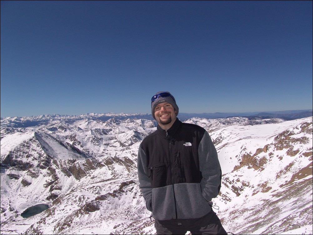
And of course my traditional 360 degree pano:

Before we left from the summit, I took some zoomed in shots of the Elk range, including the Maroon Bells. This stitched pano is one of my favorites from this 2009's shots:

We headed back down and had a good time rumbling down the snowy slopes. I took one last set of the valley, combined into a pano here:
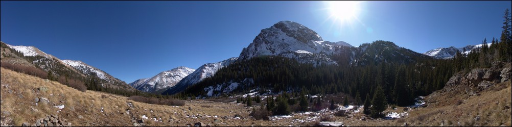
All in all, I would highly recommend this route for Mount Massive. Even in October, the route is solid, and I could see this being feasible even through November or later.
Missouri Mountain, Iowa Peak and Emerald Peak: The Sawatch Triple-Crown
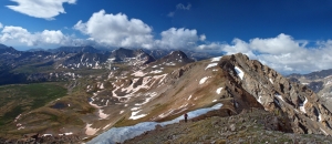
The Sawatch Range of Colorado is known for its long, gentle giants such as Mount Elbert, Mount Massive, etc. It would also seem that most visitors to this area of the state are solely interested in climbing only the 14ers, due to the popular sport it has become to summit all of the 14ers in Colorado. I must admit that I have been caught up in this craze myself; however, one of my favorite climbing past-times is to spend time tackling some of the lesser-known 13ers, and that is just what Ethan Buete and I did this past weekend.
To start off, here is a break-down of relevant numbers from the trip:
Missouri Mountain: 14,067 ft (ranked 36th in Colorado)
Iowa Peak: 13,831 ft (soft-ranked)
Emerald Peak: 13,904 ft (ranked 71st in Colorado)
Total elevation gain: 5,612 ft.
Total distance hiked: 13.44 miles
Total time hiking: 10 hours, 10 minutes
Total photos taken: 554
Total wildlife sightings: 2 (marmot and beaver)
Total distance driven: 124 miles
Trip duration: 27 hours
Ethan and left his house at 5:30 PM on Friday evening and stopped in Buena Vista at the Eddyline Brewery for dinner. The selection of food was superb - Eddyline supports local agriculture and the green movement - a definite bonus. I ordered the "Mount Princeton Calzone," which seemed quite fitting. After chowing down at the brewery, Ethan and I departed for Chafee County Road 390, just a few minutes North of Buena Vista, and headed up past Clear Creek Reservoir to find a camp-site next to a beaver pond along-side the road. Upon arrival, we were greeted by a friendly and noisy beaver as we began un-packing. We quickly set-up camp, set our alarm for 4 AM, and drifted into the always welcome pre-summit slumber.
We woke up at 4 AM and made some quick oatmeal and broke-down our campsite. Shortly afterwards, we departed for the Missouri Gulch trailhead and began hiking at 5:15 AM.
This particular trailhead provides access for several fourteen-thousand foot mountains, including Mount Belford, Mount Oxford and Missouri Mountain. We were hopeful that most other hikers would be aiming for the ever-popular Belford-Oxford combo and that we would be provided with some solitutude. Our goal was to climb the standard route of Missouri and then follow the ridge over to Iowa Peak and then Emerald Peak. We were not sure on our route quite yet, but figured we would have it solidified upon getting a full view of the area from each peak. Our eventual route took us up Missouri, over to Iowa, up Emerald, down into the Missouri Basin, and finally over Elkhead Pass back to the trailead.

A topographical map with our route shown in purple. We began and ended near Vicksburg at the Missouri Gulch trailhead.
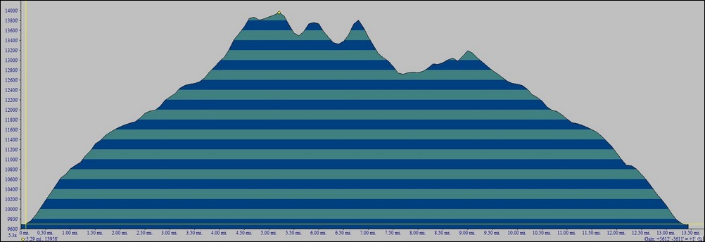
A vertical profile of our chosen route up Missouri, Iowa and Emerald.
The trail going up Missouri Gulch starts out very steep and does not relent until after treeline. Ethan and I made excellent progress up the trail and only stopped a few times before reaching treeline shortly before the sun began to rise.
The sun rises below over the Clear Creek valley.

Matt Payne hikes quickly up Missouri Gulch
Shortly after reaching treeline, some favorable campsites appear near some old mining cabins alongside the Missouri Gulch drainage. It is at this point that you can begin to see Mount Belford above and to the east. Ethan and I both stopped to take some pictures of Mount Belford and the surrounding area.

Matt Payne stops to take a few photos of the Missouri Gulch and Mount Belford.

Mount Belford is illuminated by sunlight near Missouri Gulch
After hiking a short was further up into the basin, our first views of our first objective for the day, Missouri Mountain, became available.
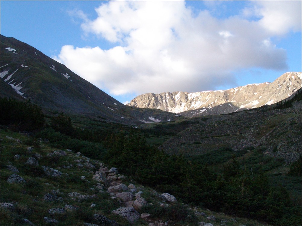
Missouri Mountain appears before us, basked in early sunlight.
At this point, we were closer to Mount Belford. Ethan explained to me that when he climbed it, he climbed up Elkhead Pass, where most other hikers chose to go straight up a muddy slope on the northwest slopes, making for a terrible climb. It appeared that others were attempting to do just that on this day as well.

Mount Belford with hikers on the northeast slope.

Climbers are seen going up the gentle northeast slope of Mount Belford.
As we climbed higher, Missouri became more and more impressive. The light also afforded somewhat better views of the mountain, and afforded us with some photo opportunities.
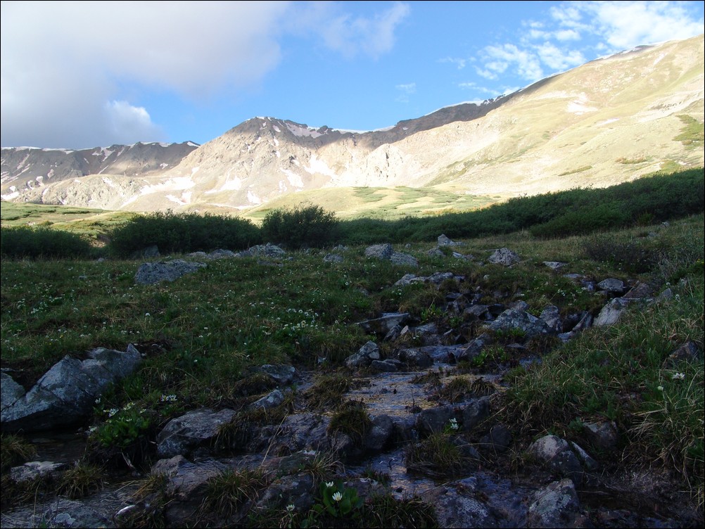
Missouri Mountain with a small water flow with alpine flowers
At this point, were were passed by a group of 4 hikers heading up Missouri. I hate to judge people that I don't know, but I could not help but wonder about this group. It was a friendly but fairly odd group, all wearing cotton sweat-shirts (cotton is often considered a very poor choice for any article of clothing worn during high-altitude hikes due to its inability to quickly dry). One gentleman was wearing flip-flops and playing music out of a small radio in his backpack. I was both perplexed and annoyed - I really don't want to hear your music when I'm hiking, and I won't feel pity if Search and Rescue are called because you obtained frostbite on your toes. We later learned it was his first 14er and he had switched into ascent shoes, which made me feel a little better.
Ethan and I continued up the trail and kept our eye on Missouri, hoping to catch a view of the trial heading up to the ridge.
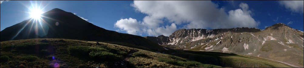
The sun rises over Mount Belford with Missouri to its immediate right.
The extra light from the sun also revealed to us that there were many types of wildflowers in bloom, much to our surprise. The basin was covered in whites, purples, yellows, and blues.
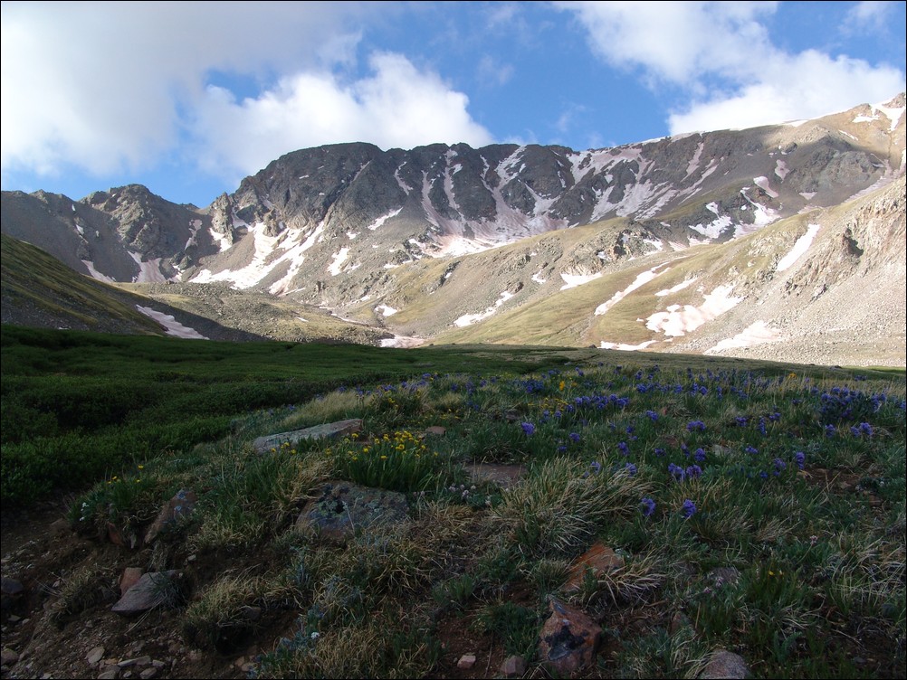
Wildflowers cover the Missouri Gulch basin in late June.
The trail heading up towards Missouri was in great condition, often weaving through thick tundra grasses and around willow bushes.
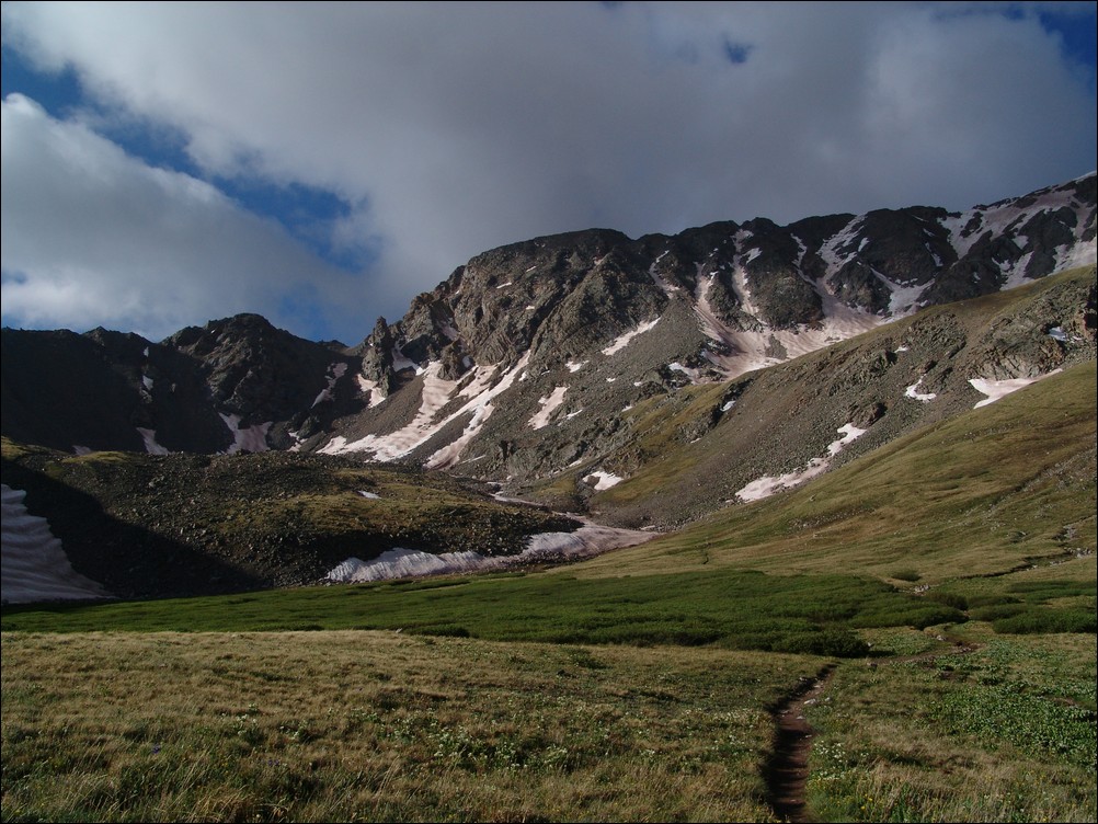
Shortly before reaching the base of Missouri Mountain, the trail hits an intersection. Heading left takes you up Elkhead Pass and heading right takes you up the standard trail for Missouri Mountain. Ethan and I refueled with nuts/fruit/powerbars and began our ascent up the relatively steep trail for Missouri.
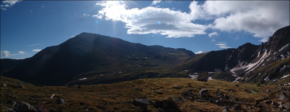
Elkhead Pass can be seen to the right of Mount Belford (left of center).
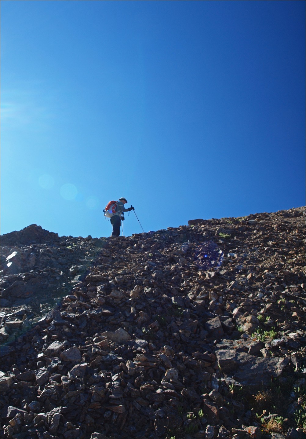
At this point, Ethan and I kicked it into high gear, heading up the rocky, but well-maintained trail up Missouri's long sweeping north ridge. The trail takes you up very quickly, and before we knew it, we were cresting the ridge.
After reaching the ridge, awesome views of Huron Peak, La Plata Peak, and the Three Apostles, including Ice Mountain and North Apostle were revealed.
This was particularly exicting for me since I had just been on top of Huron Peak just a few short weeks previous to this trip.
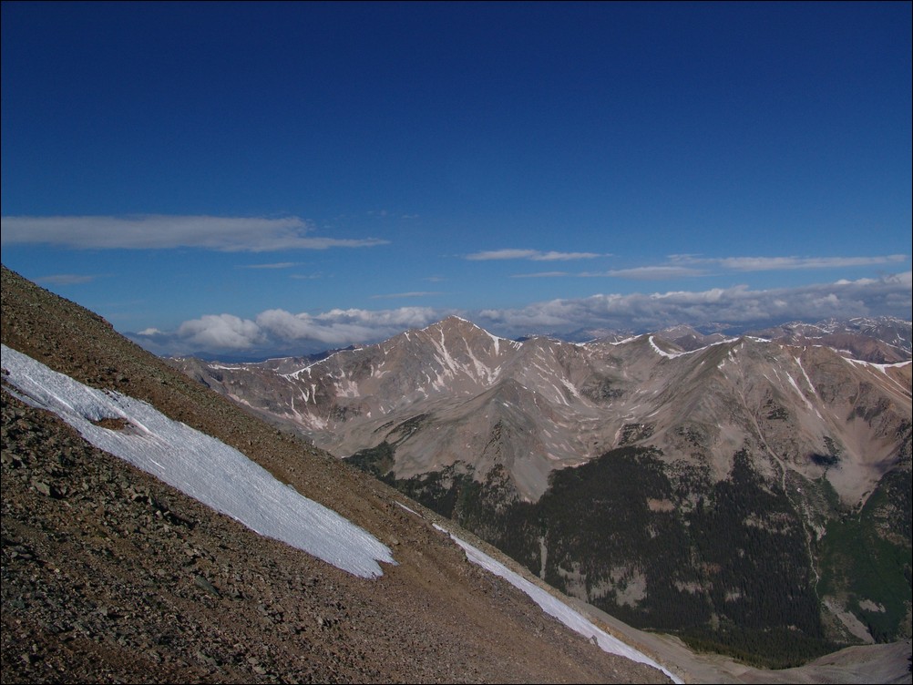
Huron Peak comes into view upon gaining the north ridge of Missouri Mountain.

Huron Peak - zoomed in

Ethan Buete looks over towards La Plata Peak (ranked 5th highest in Colorado).

Missouri's Ridge is revealed.
After taking a lot of photos, Ethan and I headed up and along the long ridge towards Missouri. The second and third objectives for the day finally appeared as well, with Emerald peaking over the top of Iowa.

Iowa Peak mostly obscures the view of Emerald Peak to the south of Missouri Mountain.

From the ridge of Missouri, views of Emerald Peak, Iowa Peak, the Three Apostles, Huron Peak, and La Plata Peak (among many others) can be seen in great detail (click to see the full resolution version).
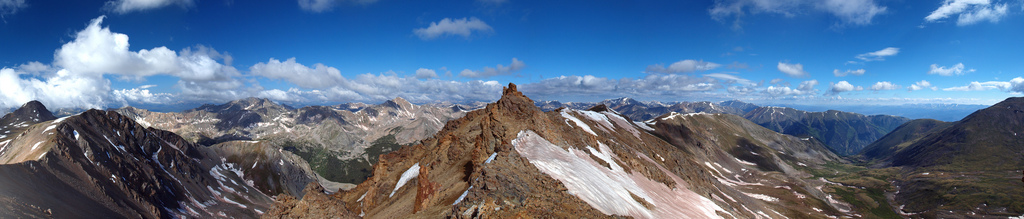
Ethan's photo of Missouri's Ridge with Emerald and Iowa in view (left) and Missouri's Ridge behind us (right)
The ridge to Missouri was nothing harder than class 2 the whole way, and was quite simple to navigate. I've read reports of people calling the ridge class 3, and I can assure you, it is not even close to class 3 unless you stay high at the jagged rocks (seen above). Those rocks are easily navigated around though...
After 3 hours of hiking, we reached the summit of Missouri Mountain at 9:15 AM. Naturally, the flip-flop guy had his music playing on top and he was enjoying a beer. Ethan and I exchanged summit photos, took some 360o panoramic shots, ate some food, and quickly departed, knowing our day had really just begun. Later in the day, I was able to capture a nice view of the route we took up Missouri from the Missouri Gulch.

The route up Missouri Mountain.
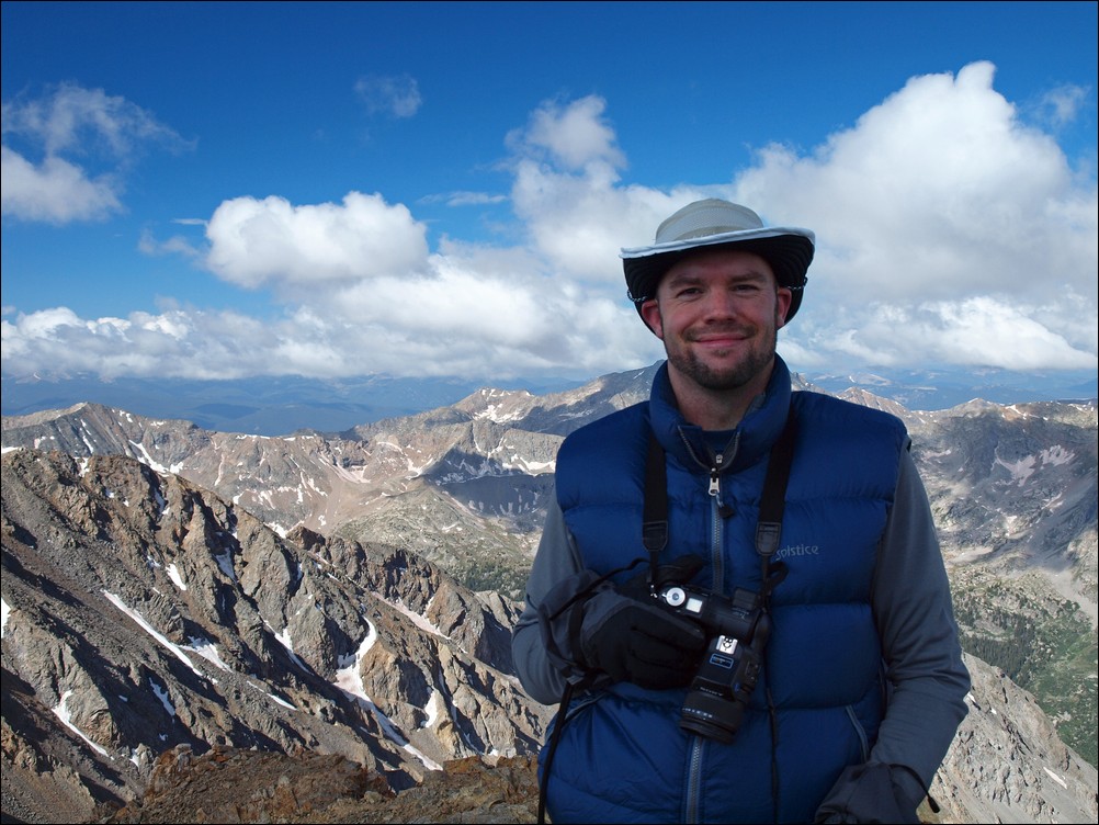
Matt Payne on the summit of Missouri Mountain, his 38th 14er climb (37 total 14ers).
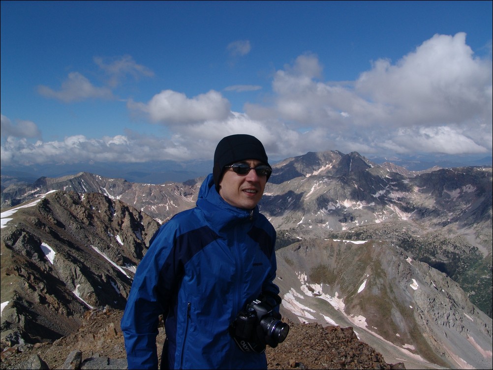
Ethan Beute on the summit of Missouri Mountain. Ethan was unsure of how many 14ers he has climbed, as he is not keeping track. 
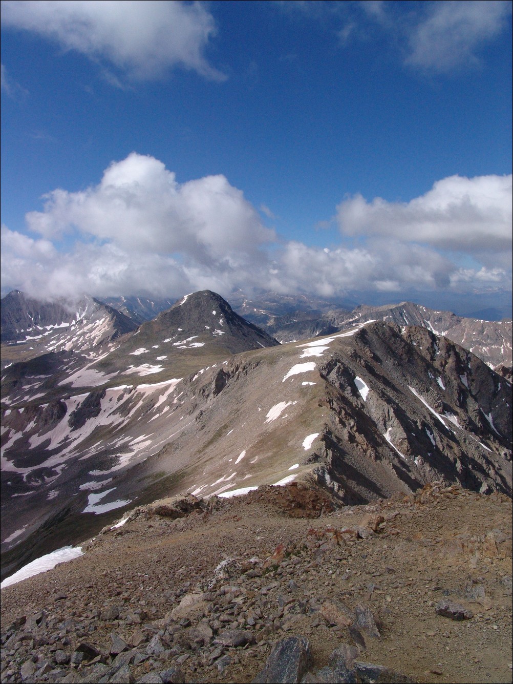
Iowa Peak (closest) and Emerald Peak (left and behind Iowa) drew our gaze.

Mount Harvard (left) rises high above the Missouri Basin (middle), with Emerald Peak and Iowa Peak sitting above pristine alpine lakes.
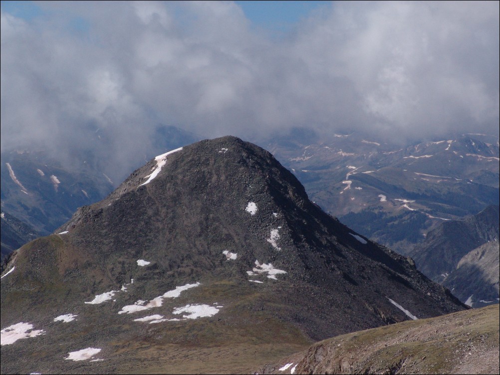
A zoomed in view of Emerald Peak from Missouri Mountain
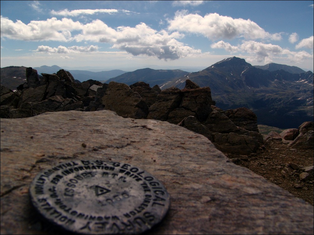
The USGS marker for Missouri Mountain with Mount Harvard in the background.
Ethan Buete captured this great macro shot of the Missouri Mountain USGS marker.
Ethan and I decided to pack up and head on over to Iowa Peak, leaving the summit of Missouri Mountain.

Matt Payne descends towards Iowa Peak - photo by Ethan Buete
The climb down to the ridge and up Iowa was fairly straight forward on a primitive trail.
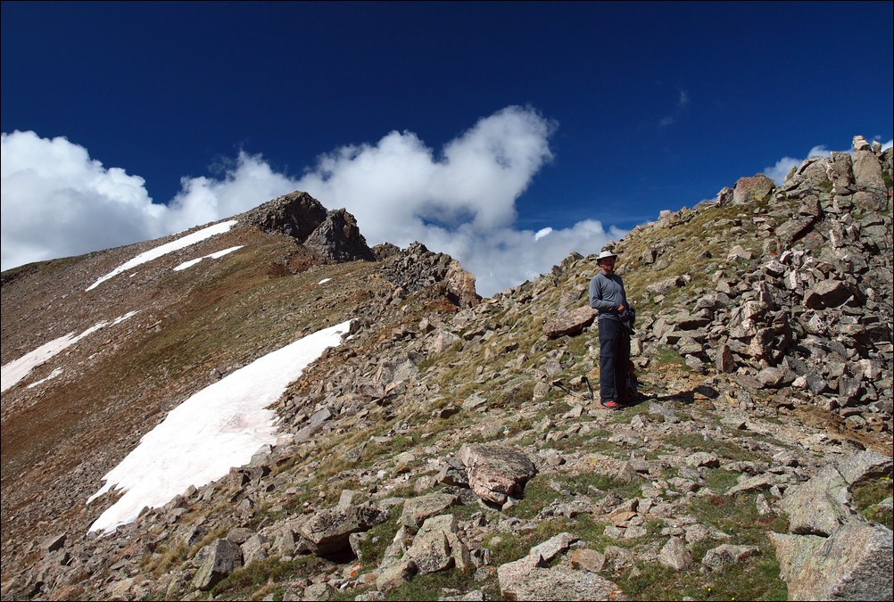
Matt Payne halfway up Iowa Peak.

A look back at Missouri Mountain from near the top of Iowa Peak.
It took us about 30 minutes to reach the top of Iowa Peak, where we stopped to take more photos and re-hydrate.
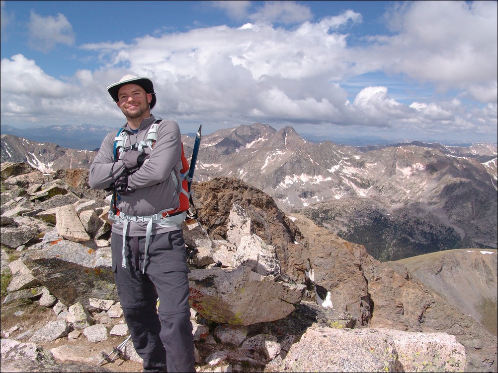
Matt Payne on top of Iowa Peak.

Ice Mountain and North Apostle sit above the valley just below Iowa Peak.

180o view from the summit of Iowa Peak. Looking left to right - Missouri Mountain, Buffalo Peaks (in far distance), Mount Harvard (center), Mount Yale, Emerald Peak (above near snow).

Huron Peak rises high above Clohesy Lake as seen from the summit of Iowa Peak.
After a few minutes on top of Iowa Peak, we made an assessment on the weather. The cloud patterns had not changed since leaving Missouri Mountain and we were fairly confident that the weather would hold long enough to summit Emerald and make it down. So, we headed on down to the saddle between Iowa and Emerald.

Emerald Peak and its grassy slopes.

Ethan made it down to the saddle first, and promptly began photographing the area. He was able to capture some amazing photos, including the next one - one of my favorites from the trip. I love the images Ethan produced from this trip. The colors are astounding. I believe that Ethan uses the Olympus E-30 DSLR with a circular polarizer. I wrote a quick follow-up article about the use of circular polarizers here.
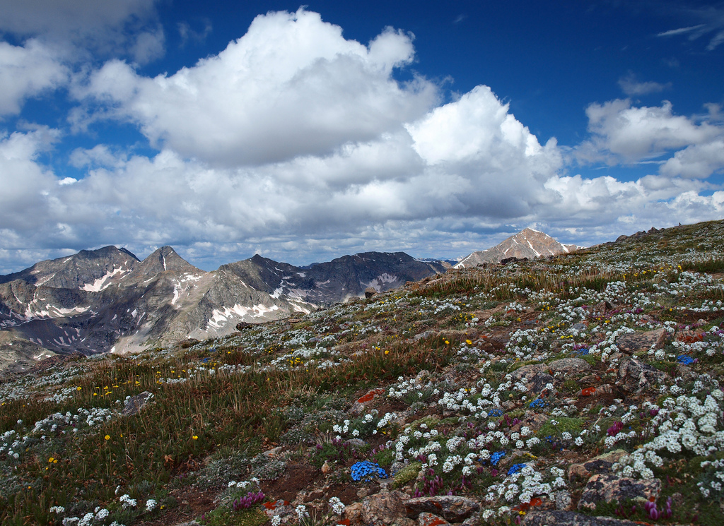
Wildflowers in bloom - photo by Ethan Buete.
After reaching the saddle, we began hiking up Emerald's steep face. It was a fairly straight-forward climb requiring a few breaks on the way up.
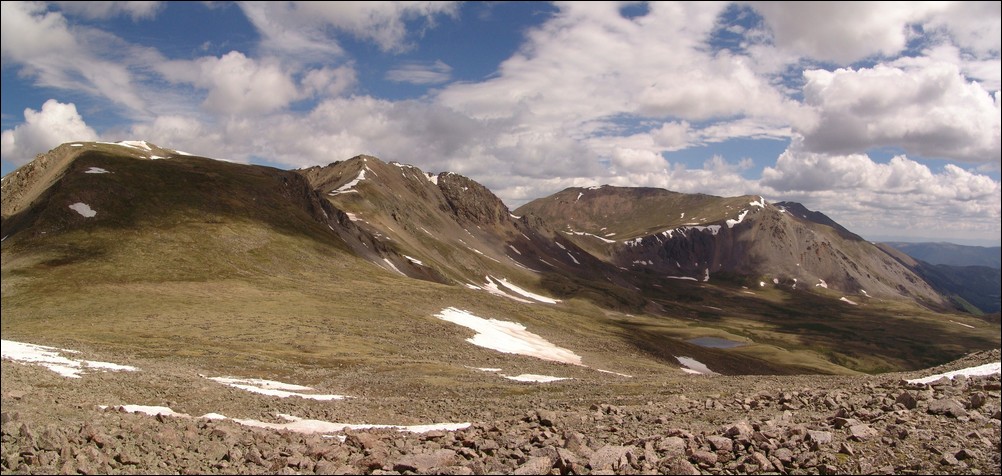
A look back at Iowa Peak and Missouri Peak from the base of Emerald Peak.
After reaching the summit of Emerald Peak at 10:30 AM, Ethan and I both agreed that the views from Emerald were the best of all three summits. Unabated views of Yale and Harvard and the surrounding basins made for a great resting spot. We probably spent about an hour on top, enjoying the views and taking photos while eating. I chowed down on some Reeses Peanut Butter Cups, which made for an even better experience 
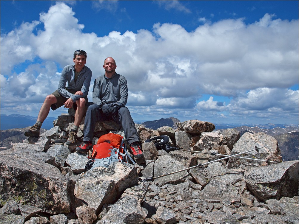
Matt and Ethan enjoy the views from Emerald Peak.
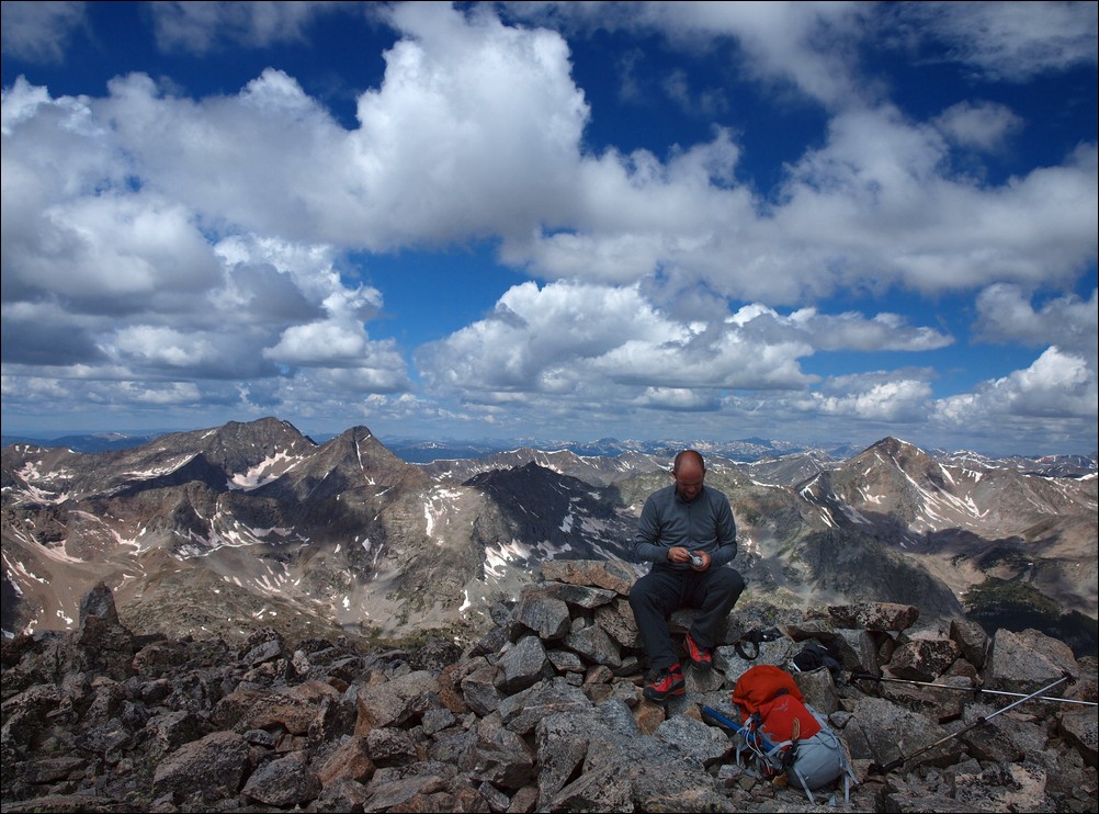
Matt Payne signs the summit register of Emerald Peak, one of the 100 highest mountains in Colorado.
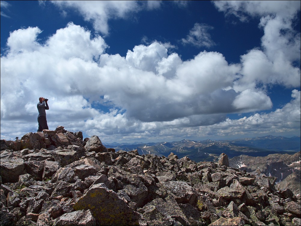
Matt Payne scouts for more Reeses Peanut Butter Cups.
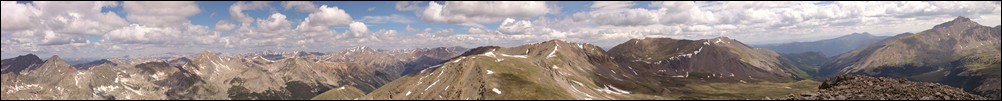
Views from Emerald Peak, west-to-east (left to right).
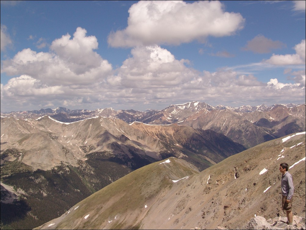
Ethan Buete gazes west from the summit of Emerald Peak, with La Plata Peak behind him.
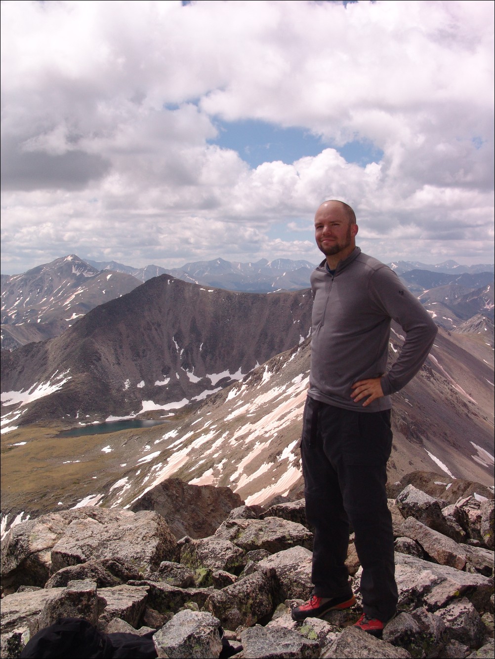
Matt Payne on the summit of Emerald Peak, with Mount Yale in the distance (far left).
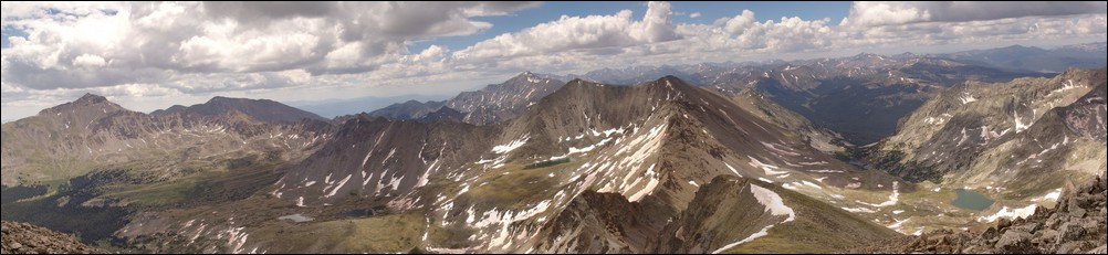
Views from Emerald Peak, looking east-to-north (left to right).
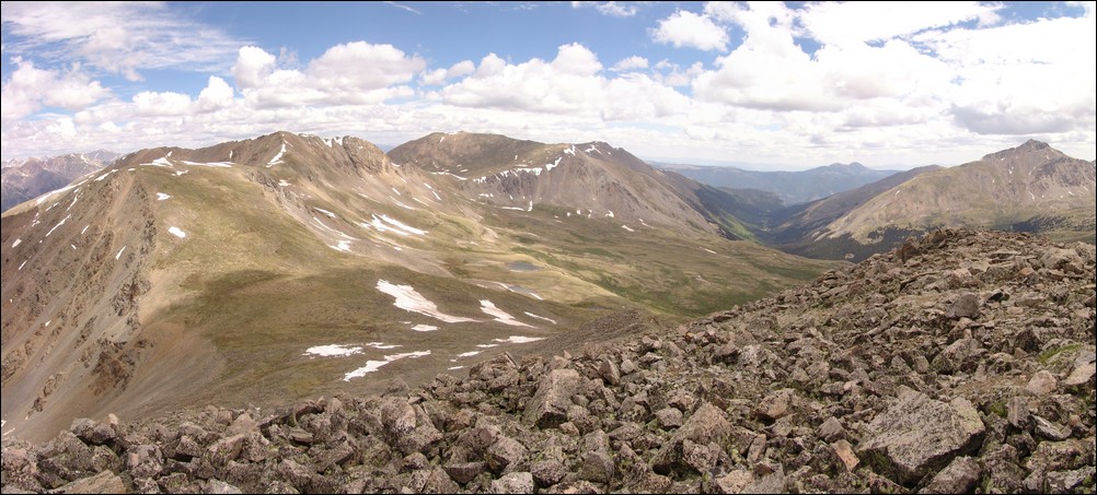
A view back at Iowa Peak and Missouri Mountain, with Mount Belford to it's right. Mount Harvard to the far right.
Ethan and I planned our route back to the trailhead from the summit. We decided that we would drop off of the east face of Emerald Peak and to the lakes below us. From there, we would aim for Elkhead Pass and head back down Missouri Gulch.
Matt Payne shooting some photos of flowers on Emerald Peak's east ridge.
And here is what I was photographing...
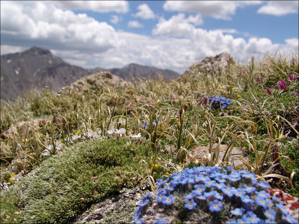
Wildflowers growing on Emerald Peak with Mount Harvard blurry in the distance.
We continued down the ridge from Emerald and through a small snow field. The snow was solid and we were able to walk right on the top of it. No need for the ice axe after-all!
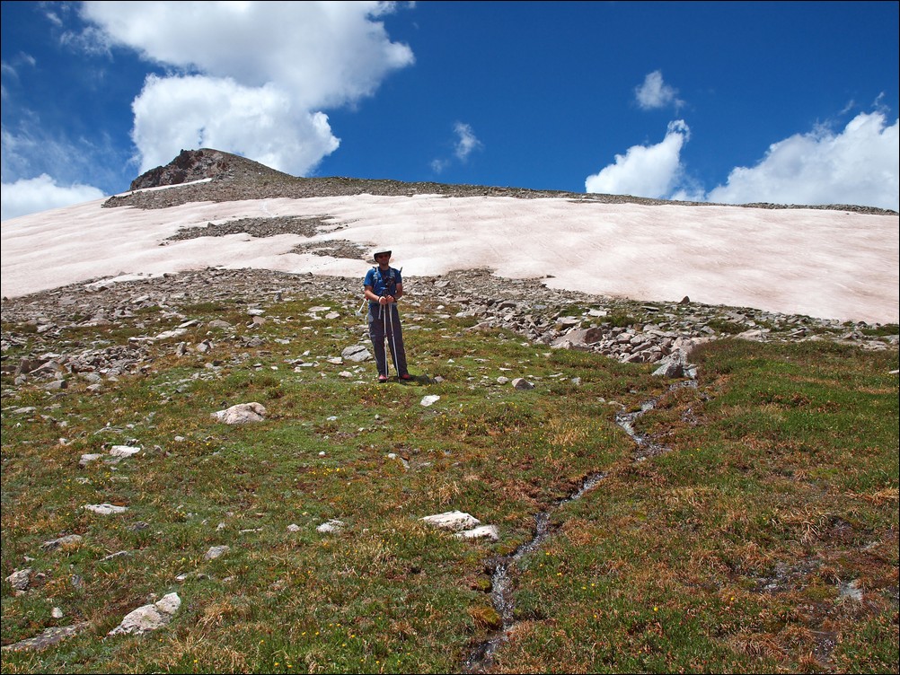
Still plenty of snow melt on Emerald Peak's east ridge in June.
At this point, the hike became incredible. The lower lakes came into better view, and the alpine surroundings continued to amaze both of us. One of the lakes in particular had an island of snow still sitting in it, making for a very bright blue hue around it. It was fascinating and gorgeous.
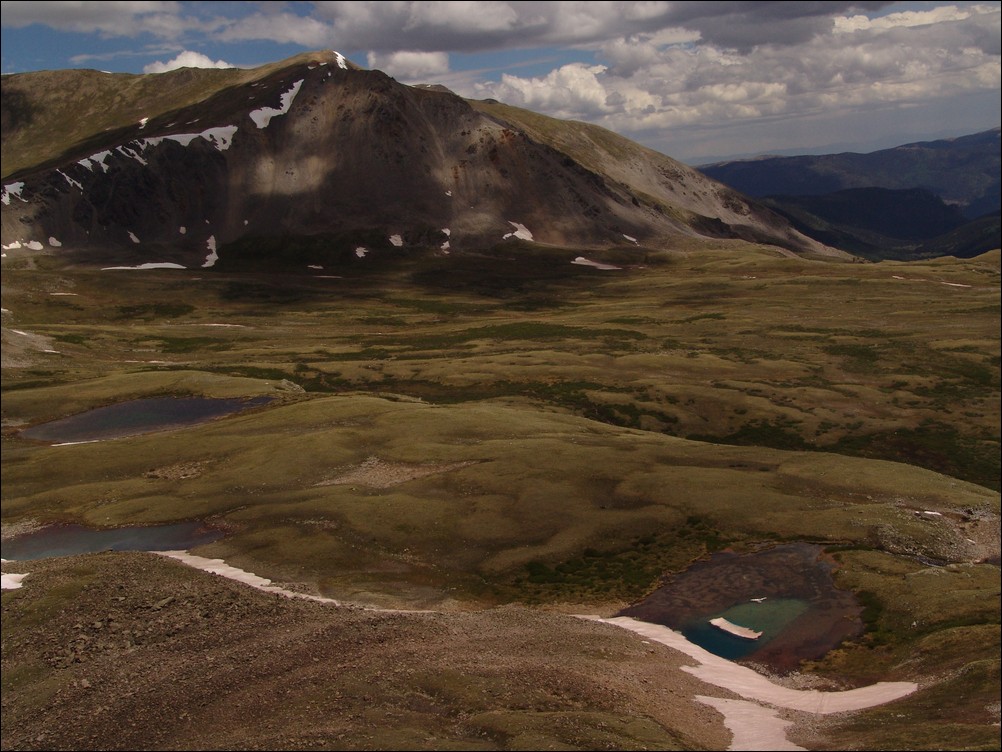
Lakes sit at the base of Emerald Peak.
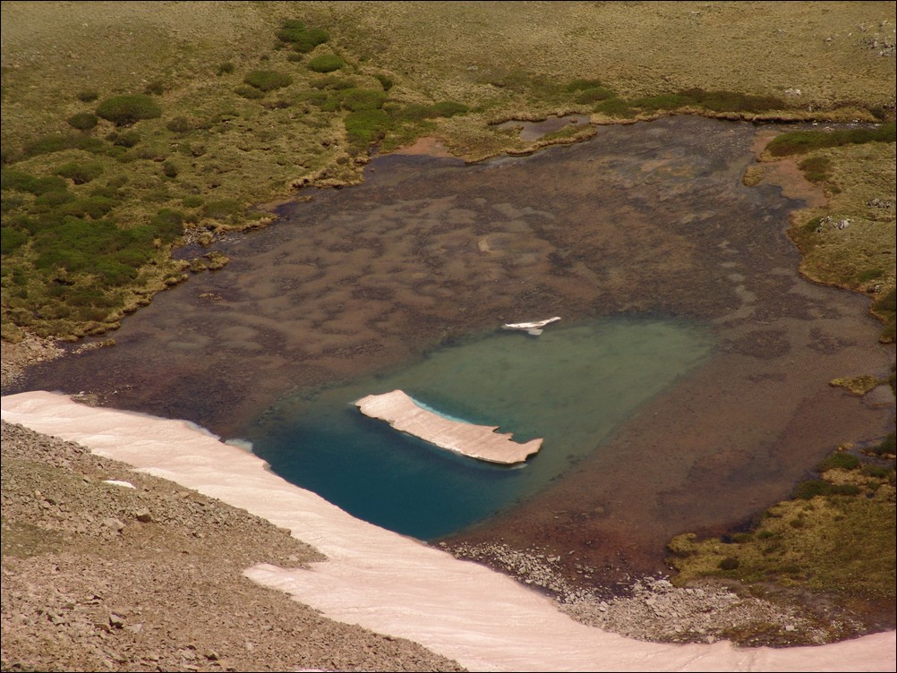
A zoomed in view of the odd and gorgeous blue lake.
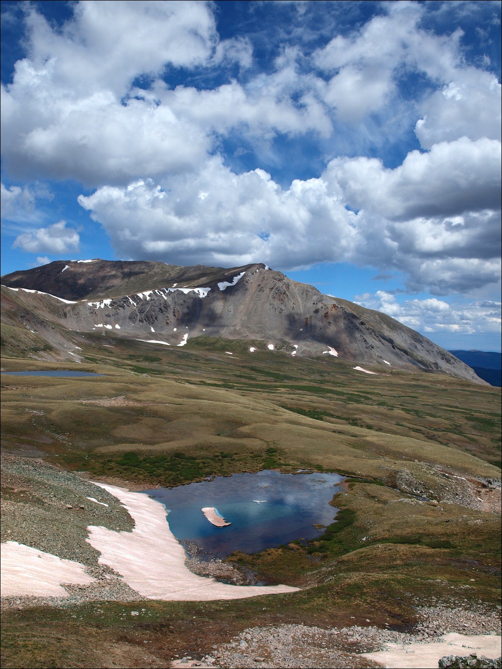
Ethan captures the blue slight better than I through the use of a circular polarizer.

Ethan Buete captured this great photo of some small lakes.
We were able to connect with an old game trail and head down to the lakes.
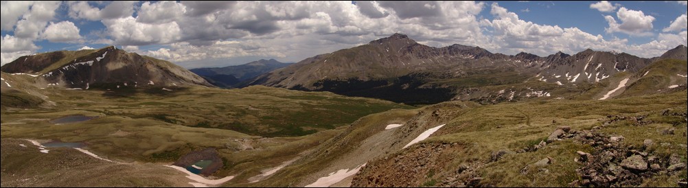
The Missouri Basin.
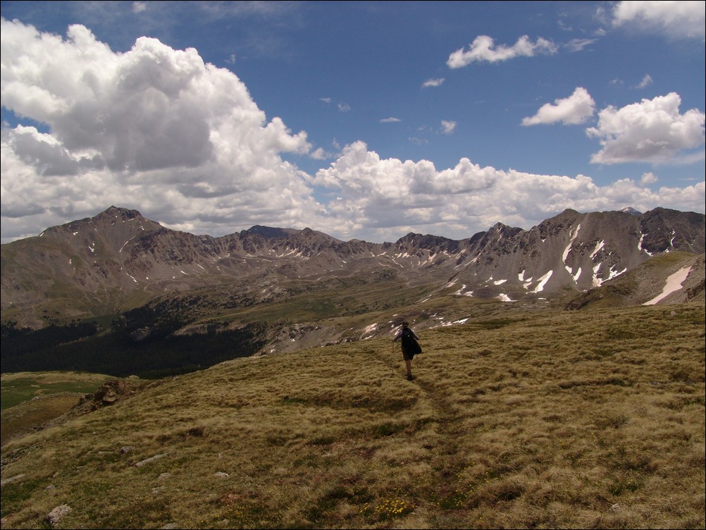
Ethan hikes towards Mount Harvard.
Ethan and I were continually impressed with the views of Mount Harvard from this area - a much more impressive view than you get when you actually climb it.
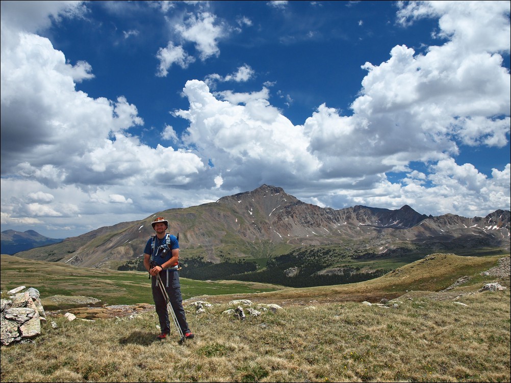
Mount Harvard towers above Matt Payne
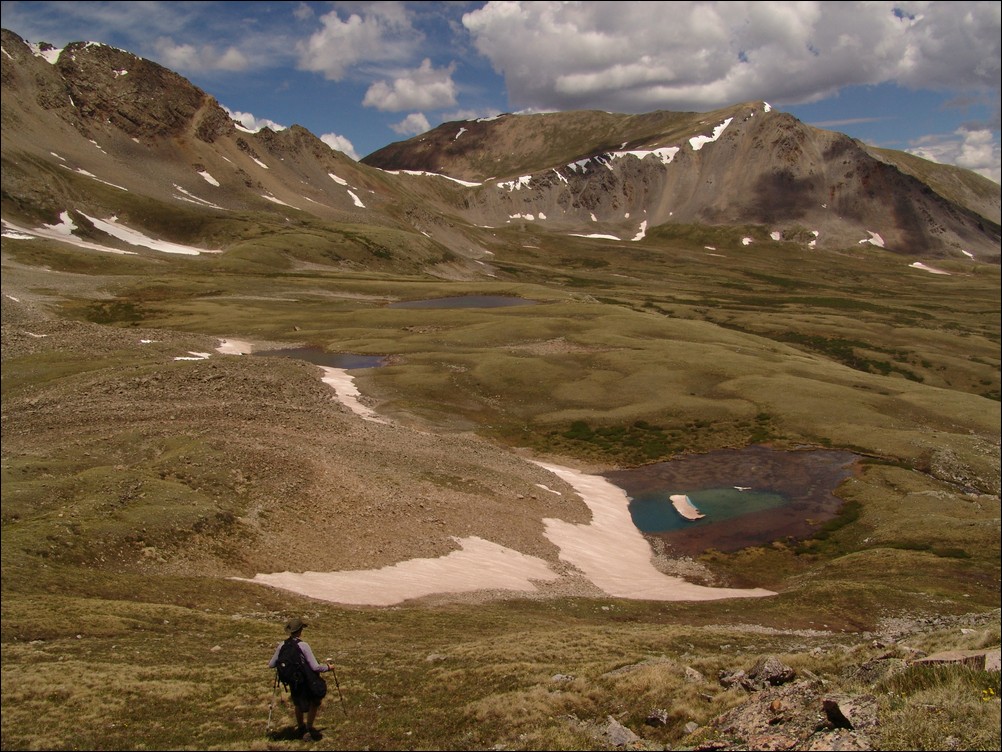
Ethan descends down into the basin towards the awesome blue lake.
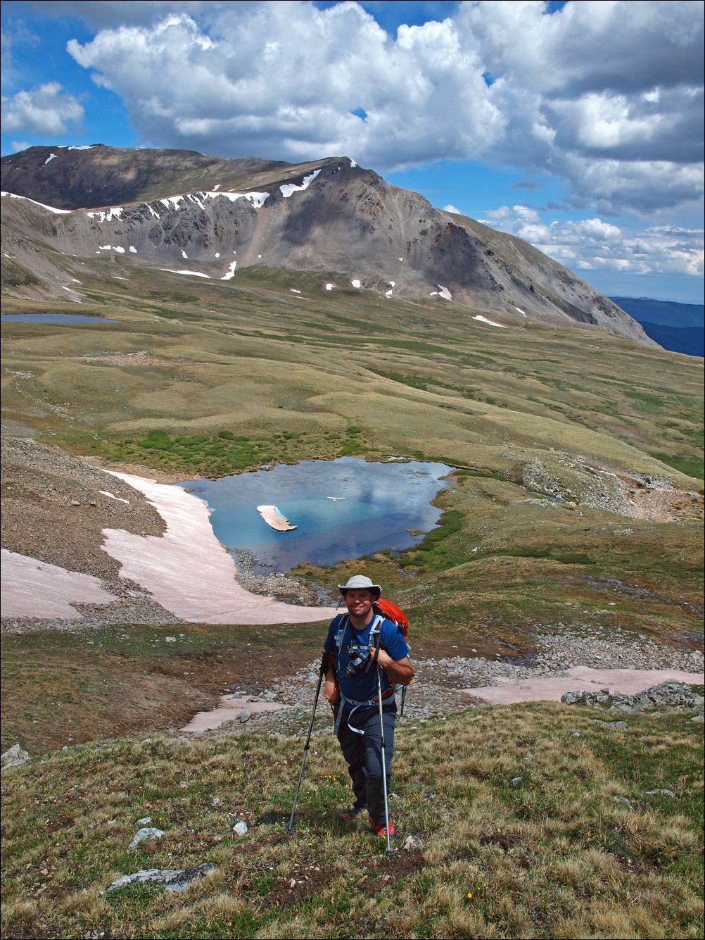
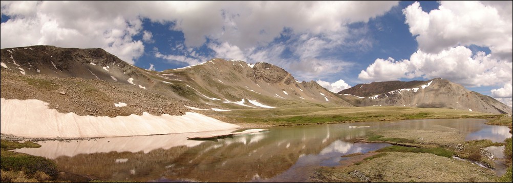
A panoramic photo of the first of three lakes found in the Missouri Basin, with Missouri Mountain at center.
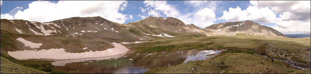
Ethan Buete checks out the snow melt coming out of the 1st of three lakes at the base of Emerald Peak.
We made our way across the long basin and found the 2nd of three lakes. This lake had some snow that had begun calving from the rock face, much like a glacier would.
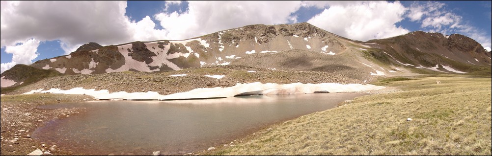
A glacier-like calving on the 2nd of 3 lakes below Emerald and Iowa Peaks.
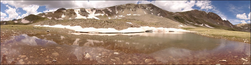
The water was quite still for this panoramic shot of a small lake below Missouri Mountain, Iowa Peak and Emerald Peak (right to left).
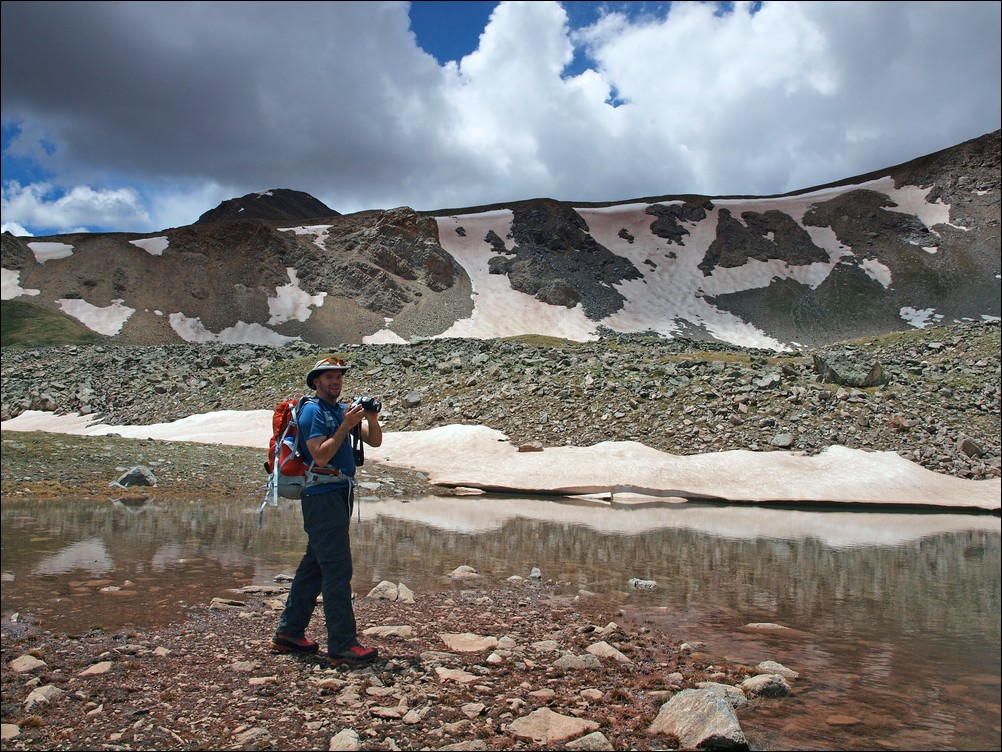
Ethan catches me in action at the 2nd of 3 lakes.
We headed on over to the 3rd lake, finding it to be the best of three due to its larger size and excellent views below Mount Harvard.
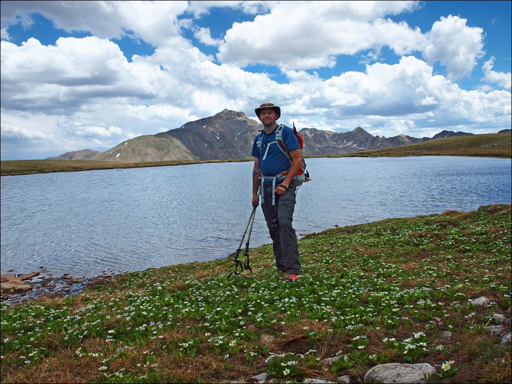
Matt Payne in front of a large apline lake and Mount Harvard.
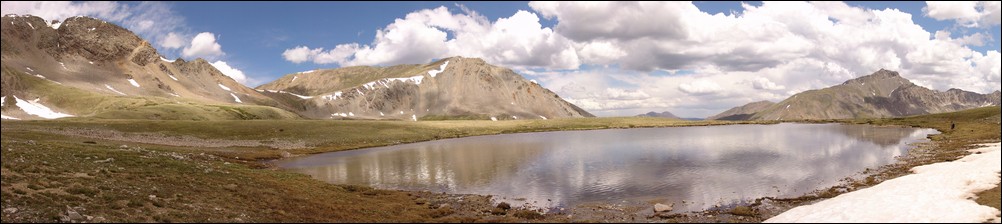
Ethan Buete next to a large lake with Mount Harvard in the background.
The sheer size of the Missouri Basin makes it a wonderful place to hike. With alpine vistas in every direction, it was tough for Ethan and I to leave. However, with weather looming on the horizon, we decided to head towards Elkhead Pass. Once reaching the end of the basin, looking back at Emerald left a great feeling in us. We had traveled a great distance today, and it was hard to believe just how far away Emerald looked already.

Matt Payne boogies on out of the Missouri Basin

A look back across the Missouri Basin. Mount Harvard sits as the basin's monarch to the far left with Emerald Peak and Iowa Peak resting at the far right.
After hiking more or less straight across the back-side of Missouri Mountain, we were able to connect back up with the trail leading up Elkhead Pass.
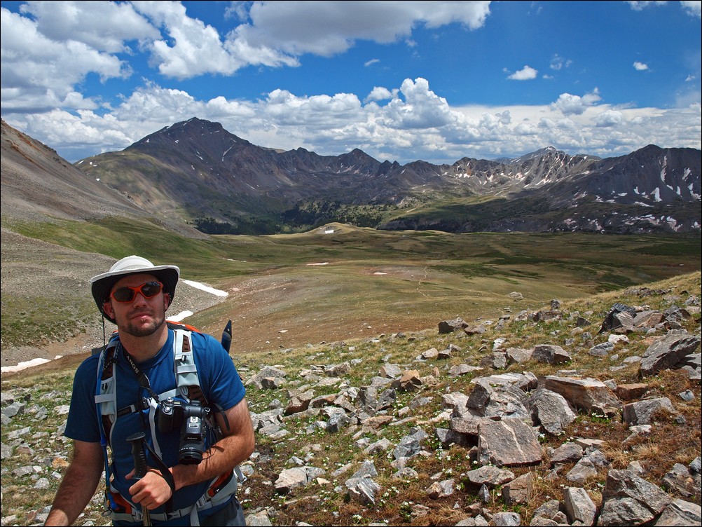
Matt Payne with Mount Harvard behind him.
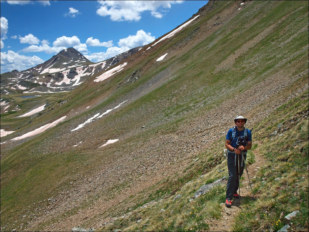
Matt Payne on the Elkhead Pass trail with Emerald Peak at far left.
Near the top of Elkhead Pass, I noticed a giant waterfall below Emerald Peak, so I took several fully zoomed in photos of the basin and waterfall and composed them into one giant zoomed in view of the basin.
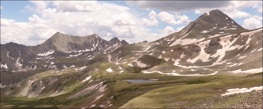
A super-zoomed in view of the Missouri Basin, with a giant waterfall flowing at far left. Emerald Peak sits above the basin at far right.Click on the photo to see the full resolution version.
A short while later, Ethan and I managed to reach the top of Elkhead Pass and see down into Missouri Gulch where the whole day began.
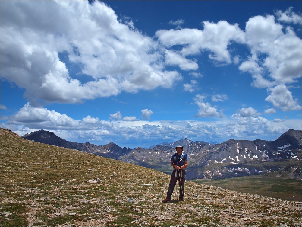
Matt Payne at the summit of Elkhead Pass.
It was nice to hike downhill again and see the valley in the middle of the day with more light. We were also lucky to see the entire route up Missouri from slightly below the pass, as well as views of Missouri's class 4 northeast face.

Missouri Mountain's class 4 northeast face (far left).

A zoomed in view of Missouri Mountain's class 4 northeast face.
Ethan poses in front of Missouri Mountain.
We headed on down the pass and noticed a large waterfall coming down Missouri as well.
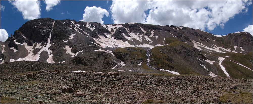
A large watefall flows down the face of Missouri Mountain's ridge.
After a short time, we reached the trail turn-off for going back up Missouri Mountain. We had made a full circle at 1:30 PM, a full six hours after we first encountered this split in the trail.

The trail forks - heading back up Missouri Mountain or down to the start of Missouri Gulch.
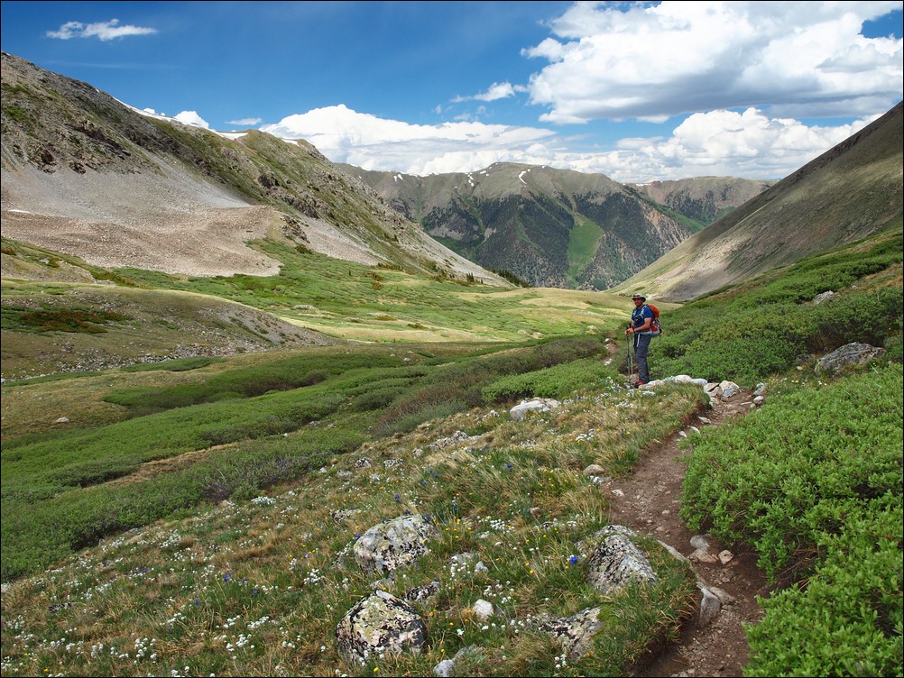
Matt Payne hikes down the Missouri Gulch trail.
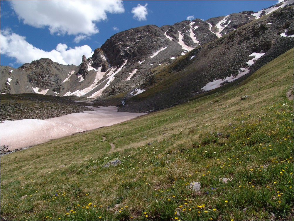
A look back at Missouri Mountain and the Elkhead Pass trail.
Ethan and I made excellent progress down the trail and made it back to a large stream crossing. Ethan took this time to train me on photographing water flows.

Water flows down Missouri Gulch.
Ethan and I made excellent time back down the trail and to the trailhead. We made a quick stop at a small gravesite in the Vicksburg cemetary. The grave marker reads: "Vicksburg Cemetary. William Huffman, Born 1884. Died of Pnemonia. One Month Old.Father was a miner and mother ran a boarding house in Vicksburg."
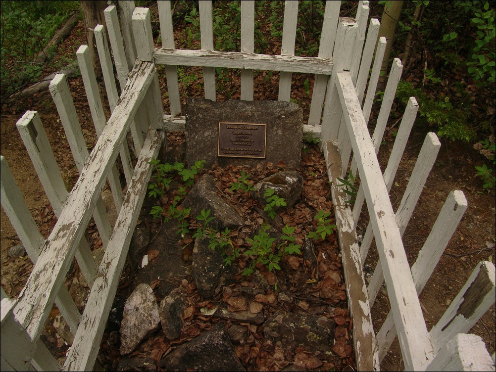
We crossed Clear Creek over the bridge and made it to Ethan's car. All in all a very successful and aesthetically pleasing trip.
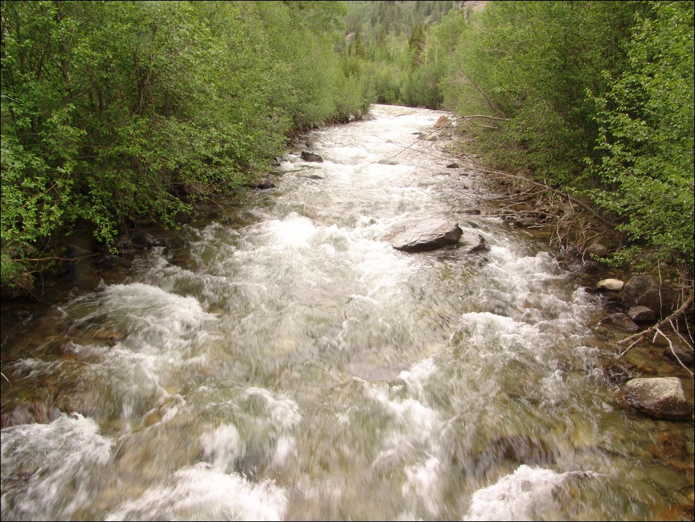
Clear Creek was still running fast near the end of June.
I hope you enjoyed this trip report. If you are interested in any of the photos, please contact me. If one of the photos belongs to Ethan Beute, I will forward your message to him.
Stay safe!
Sawatch Range
The Sawatch Range is by far one of the largest mountain ranges in Colorado, spanning over 100 miles from north to south. This range contains some of the highest mountains in the whole continent, including Mount Elbert, Mount Massive, Mount Harvard, Mount Princeton, and Mount Yale. The Sawatch Range is known for some of the best views in all of Colorado, due to the huge number of high elevation peaks there.