
San Luis Peak is a gentle giant, rising to 14,014 feet in the middle of the La Garita Wilderness Area, which means "The Lookout" in Spanish, according to Wilderness.net. The 50th highest ranked peak in Colorado, San Luis Peak is named after the valley it towers over, the San Luis Valley. According to Hayden's 1877 Atlas of Colorado, the valley itself was named by an early unknown Spanish explorer, the patron saint of whose village was San Luis.
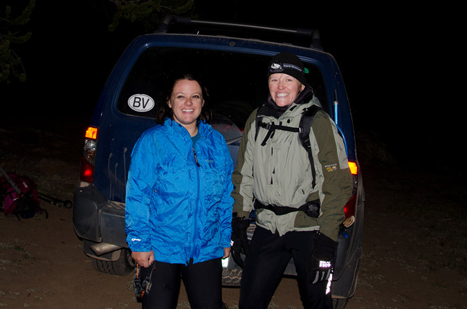
I've been wanting to climb San Luis for awhile now. Not a technical climb nor arduous hike, San Luis is generally considered one of the easier 14ers; however, due to its remote location, it is not climbed nearly as frequently as other 14ers. Indeed, the trail-head is located nearly 50 miles from any recognizable form of civilization. For this reason, I am quite thankful that I was able to get a ride with Regina Primavera (Yalegirl09 on 14ers.com), my friend and hiking partner. Regina and I planned out many of our hikes quite early this year and San Luis was to be the first mountain for us to tackle together. Additionally, another awesome person, Sarah Musick, found me through my website and a mutual friend, and asked if she could join us.
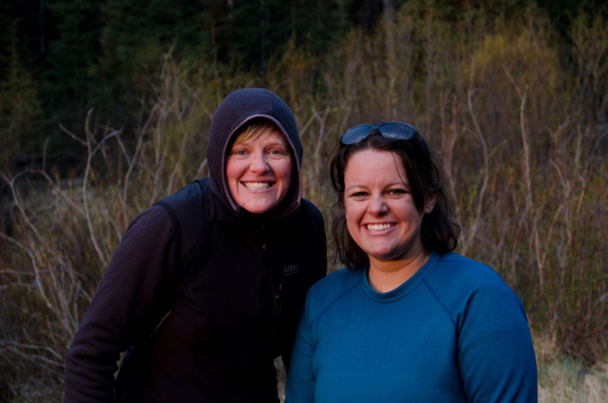
Regina and I picked up Sarah and departed for the San Luis trailhead on Friday evening, June 10th, 2011. Excellent conversation ensued and we were all quite acquainted with each other before we reached Salida, Colorado for dinner. We made a stop at Amica's Pizza and Microbrewery, which reminded us all of Il Vicino in Colorado Springs (and for good reason too, apparently Amica's used to be a Il Vicino and was later converted by the new owner). The food and beer were all quite fantastic. With spirits high, we continued on to the town of Saguache, Colorado (pronounced Saw-watch), refueled, and drove the beautiful yet never-ending road to the San Luis trail-head. A note about the road - it was somewhat confusing for us coming from the San Luis Valley. If you are coming from the San Luis Valley area, drive north on Colorado 114 to Dome Lakes, then turn left onto the "15-GG" road. Our mistake was that we did not drive all the way to the 15-GG road, but instead headed up the NN-14 road before reaching Dome Lakes. It still gets you there by going the way we did, but it is MUCH longer! For our trip, we opted to take the Stewart Creek trail.

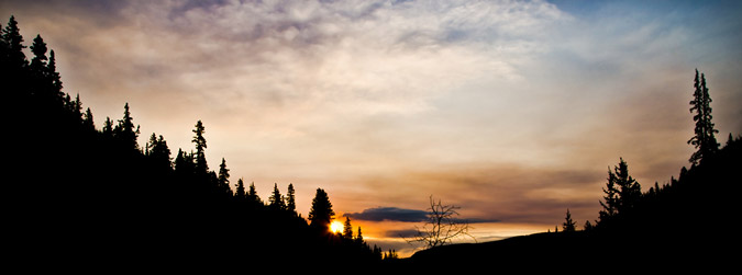
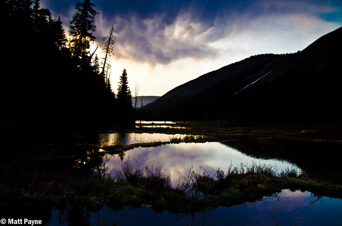
Upon reaching the trail-head parking lot, we set-up our camp site quickly with the aid of headlamps. The stars were pretty incredible since we were in the middle of nowhere, and I decided it would be a great time to try out some star trails photography.
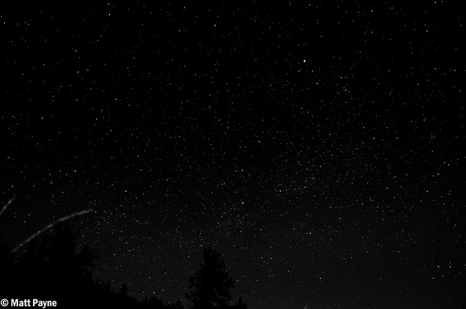
The stars were looking good... hopefully the star trails version would be just as good!
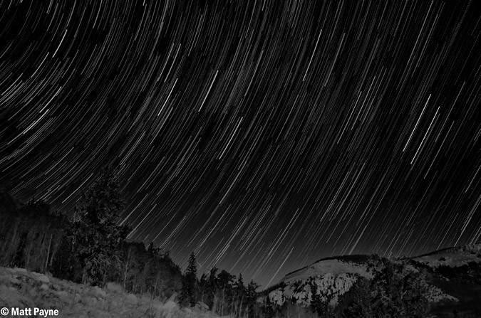
There are a couple techniques one can use to accomplish star trails in a photo. The basic method is to take one long exposure (over an hour), which captures the movement of all of the stars as trails across the photo. The drawback from this technique is that you have no room for error because of the long single exposure and, due to noise caused by heat and other factors in the camera, you need to turn on noise reduction in camera, which basically takes an equally long exposure with the shutter closed at the end of the shot and then reduces noise based on the comparison of the open and closed shutter shots. The second method, which I employed, is to take multiple shorter exposure shots (30 seconds to 4 minutes each) over a period of time, with little time between shots to ensure that no gaps exist in your trails (unless that is what you want), and then combine them later in a program like photoshop or startrails.exe. In order to get the below photo, I set-up my camera, a Nikon D7000, to take a photo every 45 seconds. The camera was set on manual focus, with the stars in focus, at aperture of 5.6; the shutter speed was set for 30 seconds because I forgot to bring my shutter release cable, otherwise I would have probably set my shutter speed at 2 minutes or so. I then imported the photos into Adobe Lightroom and adjusted the exposure and cleaned up any unwanted artifacts that streaked through the exposures (airplanes, satellites, etc). I copied the development settings of the photo I did the work on and applied it to the other 47 images for consistency purposes. Finally, I loaded all of the images into startrails.exe, which is a free program. Startrails combines all of the photos together into the one you see below. All-in-all, I was very pleased with the results.
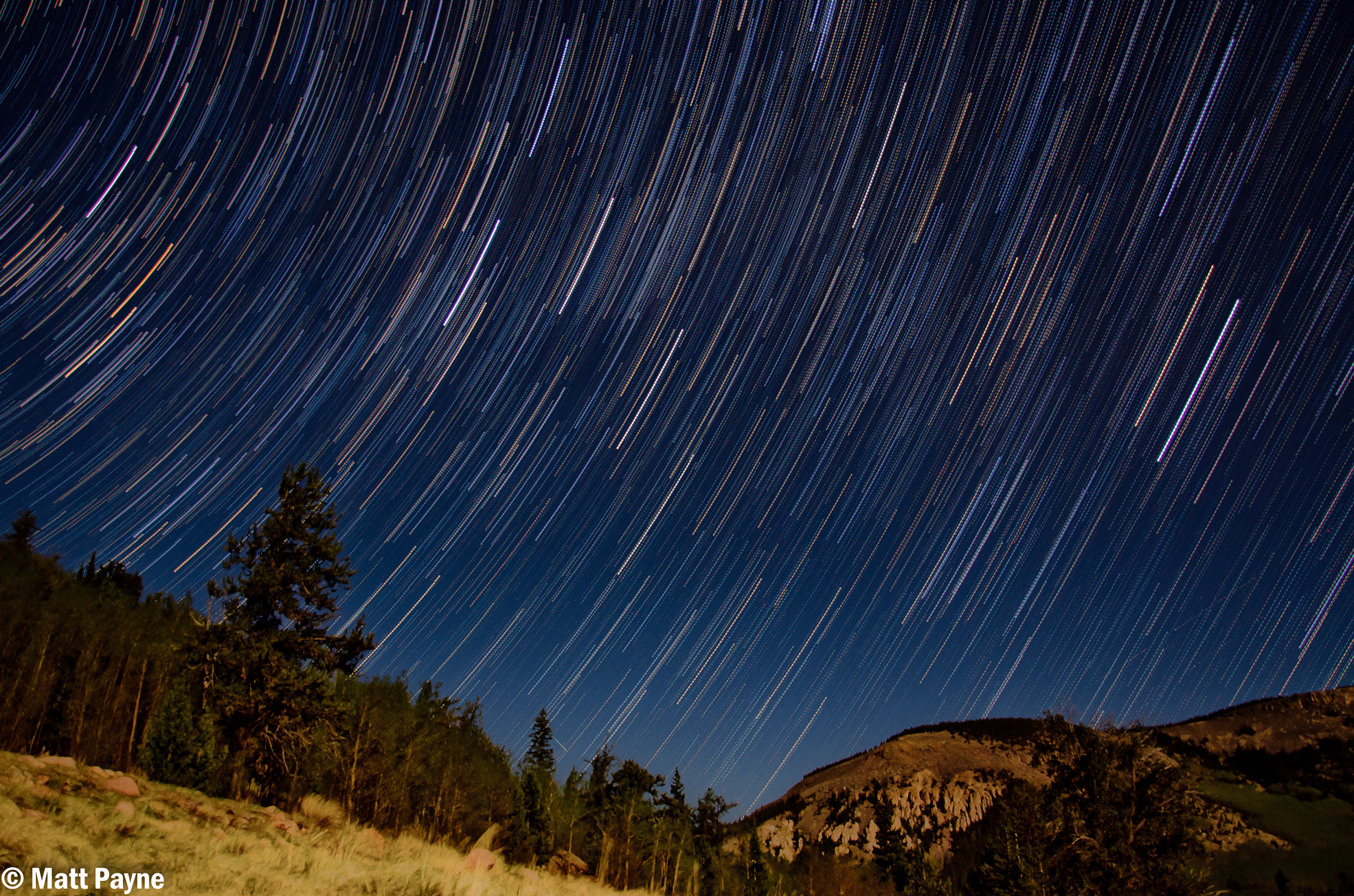
Additionally, I decided to add the photos together into a time-lapse video, showing the change in star position across the 35 minute time-span, as seen in this YouTube video:
After waiting in the cold for an hour with Regina while the camera captured the photos, we set our alarm for 4 AM and crashed in the tent. 4 AM came sooner than I liked, but I felt much more rested than I did on my last adventure up Princeton.
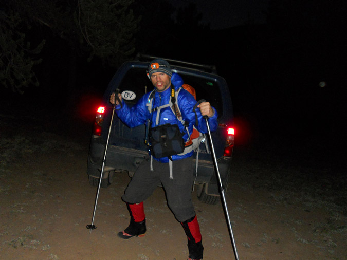
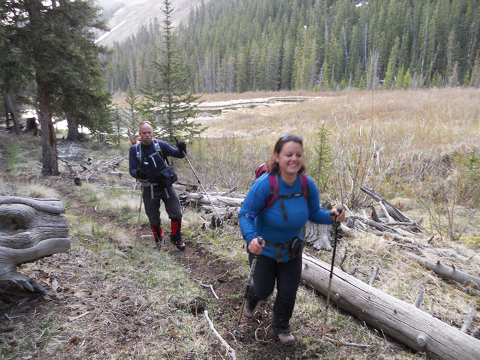
We packed up our tent and sleeping amenities, ate some quick trail food, and departed. Since none of us were really sure about the conditions of the mountain due to a real dearth of trip reports online for San Luis recently, Regina and I opted to pack our crampons, and we all had ice axes. Regina and Sarah were looking quite excited to begin the hike at 5 AM, despite Regina stating she felt sick.
Naturally, I had to look as excited as possible, despite the fact that I am not a morning person!
The trail heading up the Stewart Creek valley was gentle and steady. One thing that was remarkable was the beaver ponds, which were quite ubiquitous. We were even lucky enough to be greeted in the early morning by a couple of beavers, whom used their tails to loudly splash water, as if to say, "this is our house!" As we continued up the trail, we shortly glimpsed a very young moose that was grazing near one of the beaver ponds. Before we could capture any photos of it, it ran into the woods. Oh well!
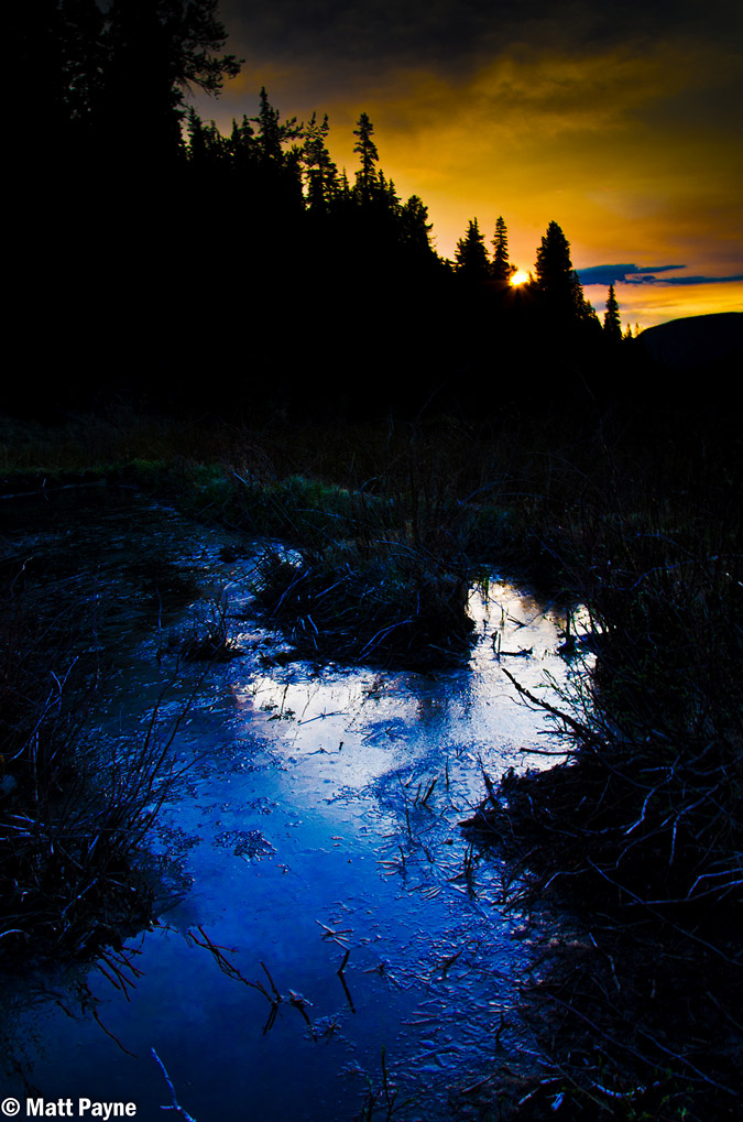
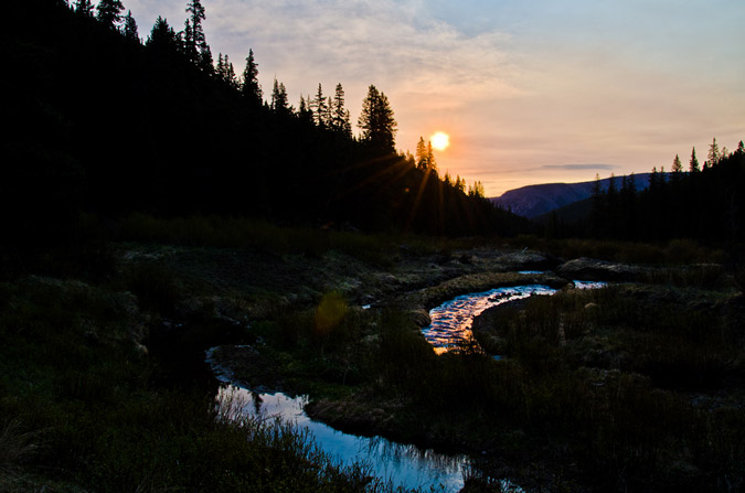
Before long, the sun began to rise and the inner nerd photographer in me began to get excited. The Golden Hour is easily one of the best times to take photos, and I quickly searched for some beaver ponds or other water features to balance out my compositions.
 |
 |
We stopped near a small pond and a crook in the stream and I set-up my camera.
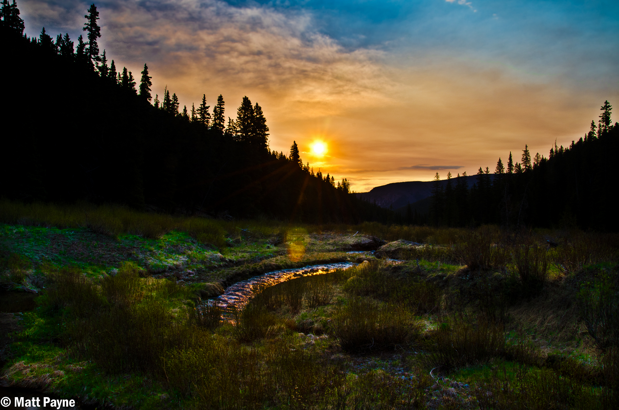
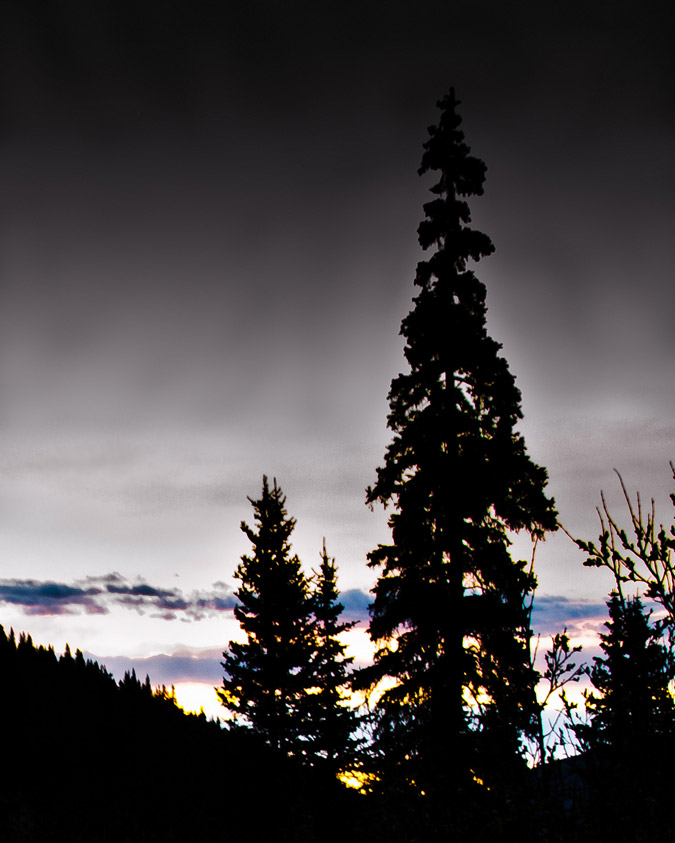
If you are not familiar with The Golden Hour, it is well defined by Wikipedia: "In photography, the golden hour is the first and last hour of sunlight during the day, when a specific photographic effect is achieved due to the quality of the light." Today was no exception. Due to the fires on the Colorado-New Mexico border and in Arizona, the sky and the clouds had a brownish-red hue to them, making for some interesting light effects.
I think I may have frustrated Regina and Sarah with the amount of time I spent shooting photos at this point, but I think the time was well worth it, personally. I have been trying to focus a little more on composition in my photographs lately, including thinking about the rule of thirds and incorporating lines into the photo in order to draw the viewer into the photo. I've also been using Lightroom to do most of my editing. Let me know what you think about my efforts!
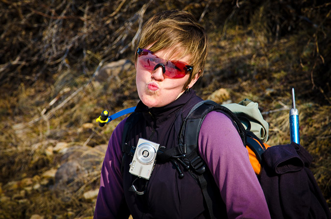
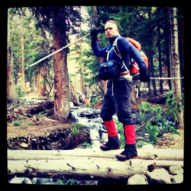
While I was playing in the woods with my camera, Regina decided it would be fun to take a picture of me, taking pictures.
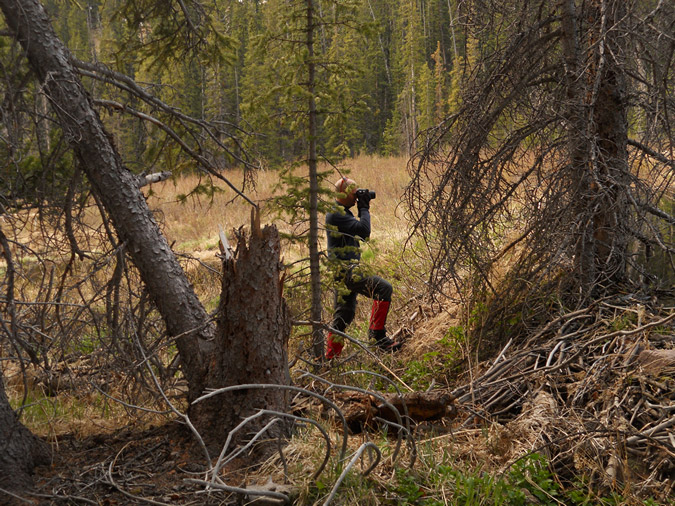
Something about me being rich and famous someday (yeah right)! Additionally, Regina and Sarah teamed-up and came up with the brilliant plan of putting Regina's crampons in my pack as punishment for the long wait I had caused (and more importantly, because Regina did not feel well).
On we continued up the trail, with Sarah playing videographer to our adventures.
Sarah and Regina made for great companions, it was amazing how well we all got along and how closely aligned our political, religious and philosophical views were.
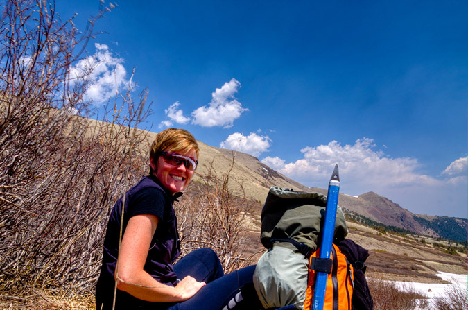
We rested for a little bit to eat and drink, and Sarah shared some amazing little snacks her friend made. Apparently, her friend is beta-testing these snacks to be sold to cyclists, hikers, climbers, triathalets, etc. I must say, they were delicious! They were little balls of goodness!
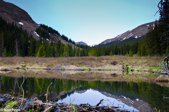
We spent a little time at a huge set of beaver ponds, admiring the clear water and great morning air.
Before we knew it, we were at treeline after a few simple creek crossings.
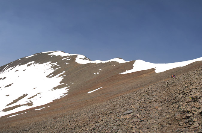
Once we hit treeline, the trail ran right into a huge snowfield that presumably went over where Stewart Creek is supposed to be.
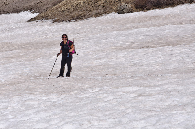
From here, the goal was to gain the saddle between Organ Mountain and San Luis. The trail was hit or miss through the snow, but never felt difficult. The snow was not a problem at all, and I think Regina was a little bummed that she didn't get to use her crampons.
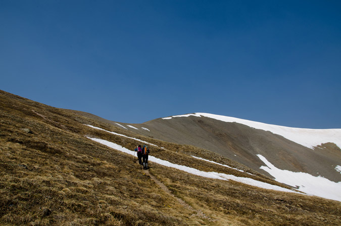
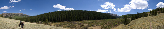
There was a group of 5 guys that were behind us pretty much the whole way up. In total we counted 15 people including ourselves the whole day. I was able to get a large pano from most of the way up to the saddle, which included the guys behind us.
We quickly gained the saddle and enjoyed views of both Organ Mountain and San Luis, which was pretty close!
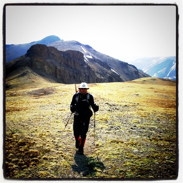
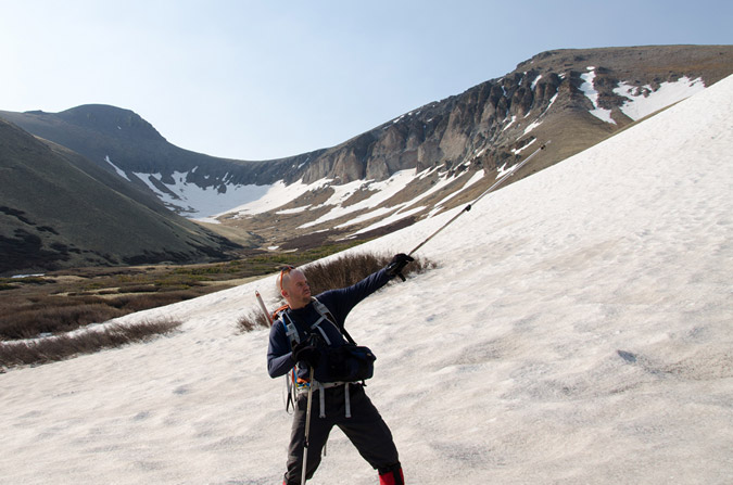
Organ Mountain behind Matt.
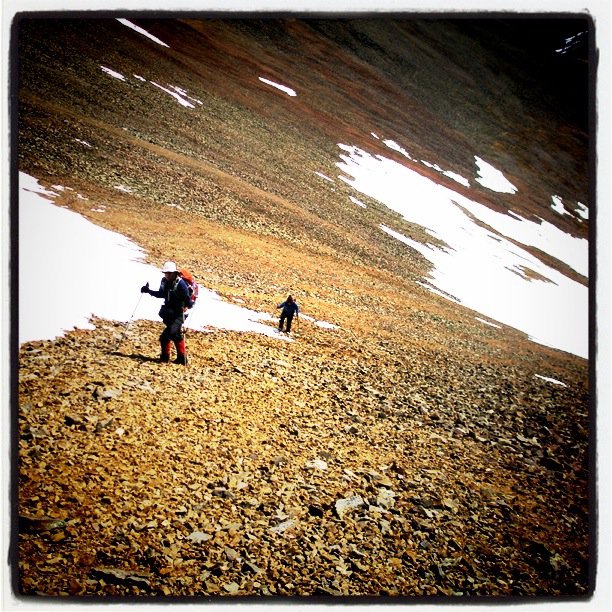
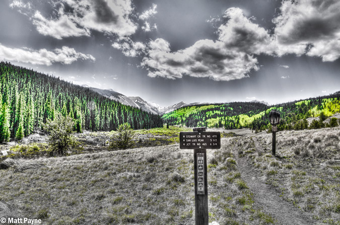
After the saddle, the trail leads you up towards a bump that Regina kept saying was Baldy Alto, but is in fact just a bump on the way up San Luis. The trail bypasses this bump to the left and then heads right up below San Luis' ridge.

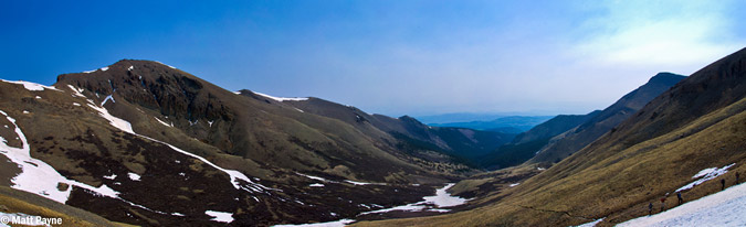
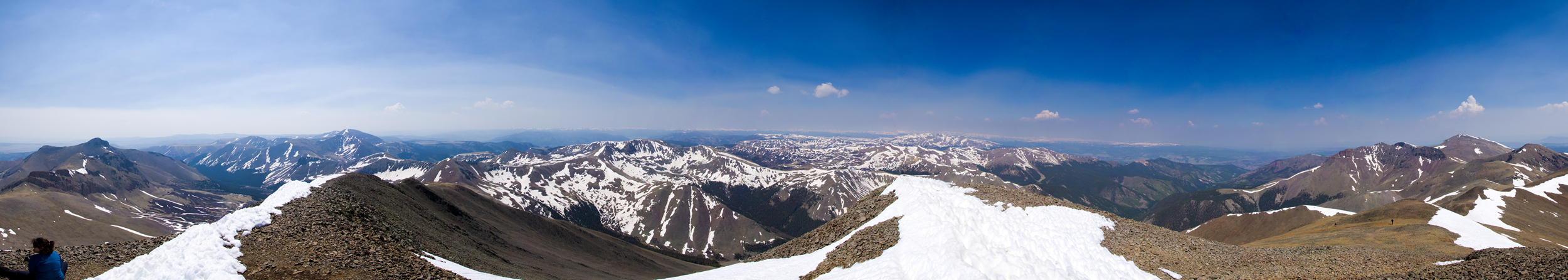
A 360 view from the ridge between Organ and San Luis. Click for a higher resolution version.
Organ Mountain was impressive. I had originally thought we might have time and energy to hit it as well, but with Regina not feeling well, I decided to just do San Luis Peak. Anyways, I really liked the imposing feel that Organ Mountain imparted upon me here, so I had fun editing this photo to really convey that feeling.
We opted to follow the trail and stay low instead of going up to the top of the ridge.
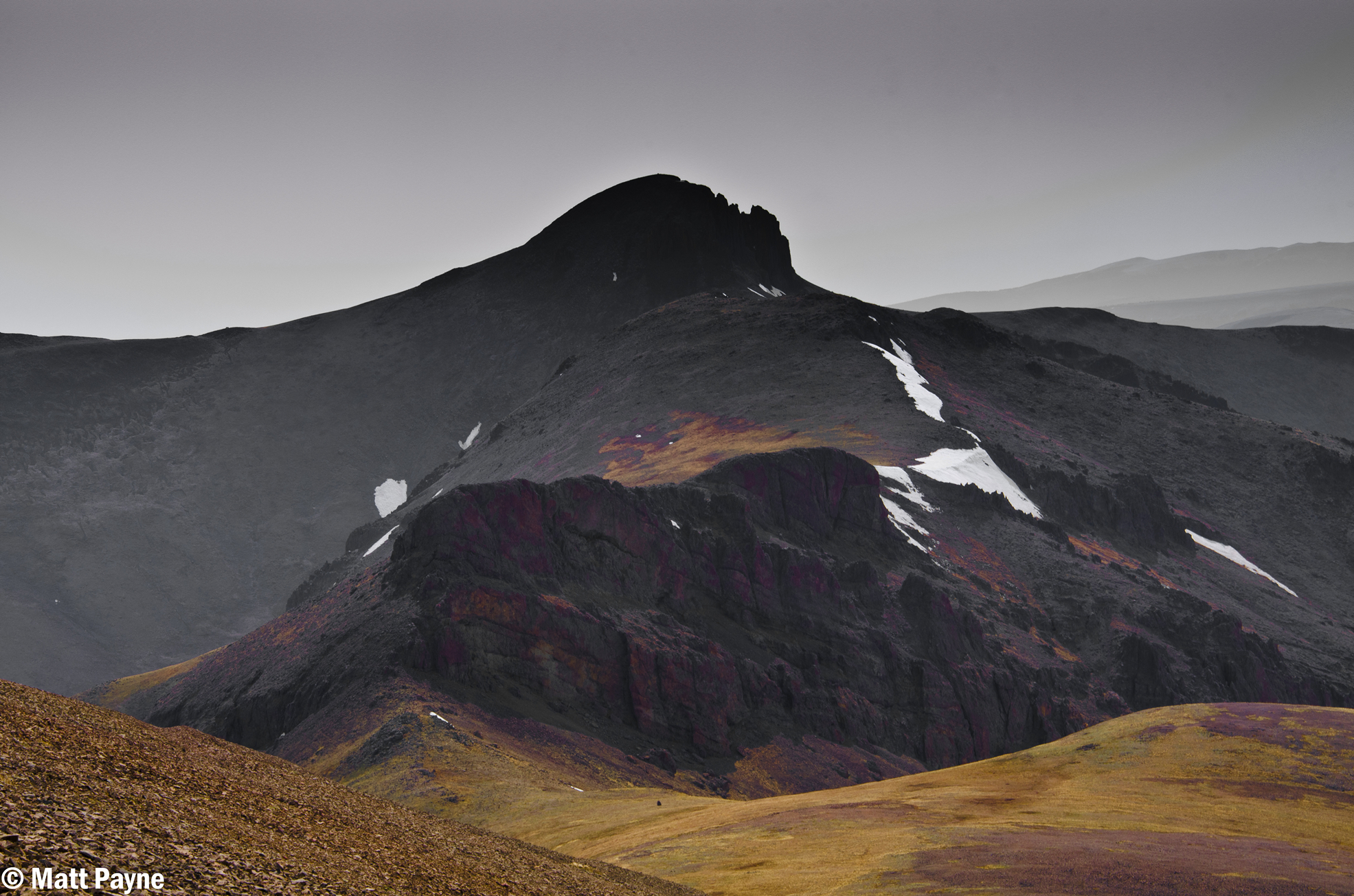
Subsequently, the trail led us into some nasty snowfields, which we had to downclimb to go around. We later lost the trail due to the snow and ended up going straight up some relatively unpleasant scree to the ridge.
We reached the summit at 10:45 AM, a modest 6 hours since we left the car. Surely if Regina wasn't sick and if I didn't own a camera we could have shaved a good 2 hours off the time!
The smoke was very evident from the top, by sight and smell. It really degraded the view and photography. Regardless, I was able to get some good shots from the top, including this near-360 view (click for higher resolution).
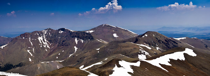
I was also contemplating knocking out Stewart Peak (center) and Baldy Alto (right of center), as seen below, but opted not to due to Regina not feeling well. I did not want to split the group up if someone was not feeling good.
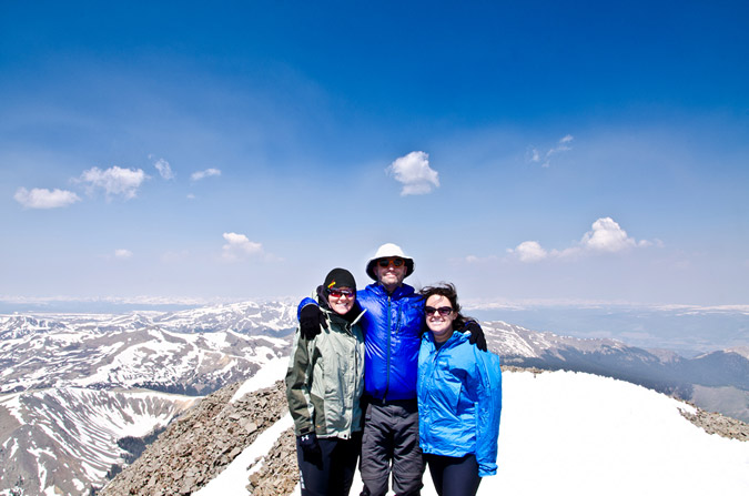
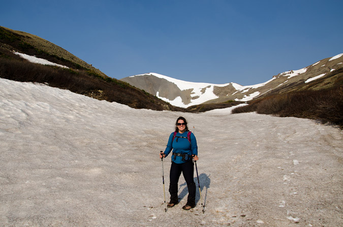
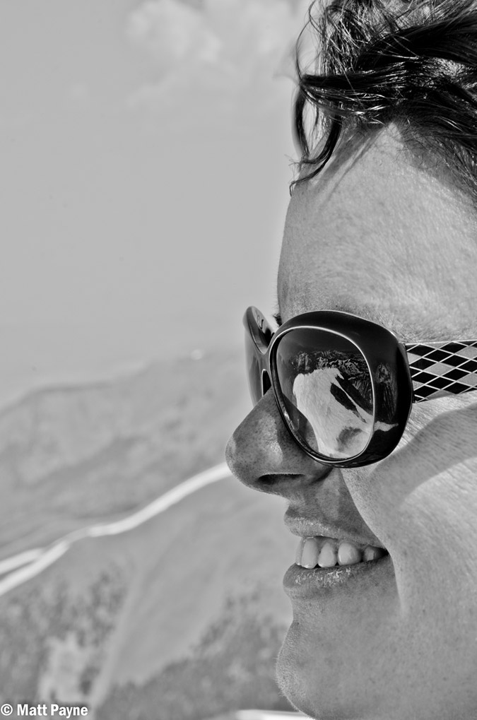 I had fun shooting this photo of Regina - the mountains to the west were reflected nicely in her sunglasses, plus she was quite a cooperative model! All in all, it felt great to climb my first mountain with both Regina and Sarah, and I think everyone was quite proud of their accomplishment!
After enjoying some cliff bars on top, we all decided to head back down. The hike down was quite easy, and before we knew it, we were all back at the first snowfield we had encountered before. Regina cracked some jokes about falling into the snow, which was hard enough to prevent post-holing, thankfully.
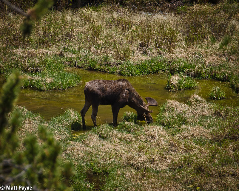
On the way back down, I caught something moving out of the corner of my eye. Much to my surprise, a huge moose was moving slowly through the beaver ponds below. That was probably the highlight of the trip!
The Stewart Creek valley is a very beautiful place. I am glad I need to return to do other climbs nearby!
We finally reached the trailhead again, and I took some fun bracketed photos to run through Photomatix. If only I had a tripod...
The total hike was 11 miles round-trip, including 3,500 feet in elevation gain. I would rate this hike as moderate to easy in comparison to other 14ers I've climbed.
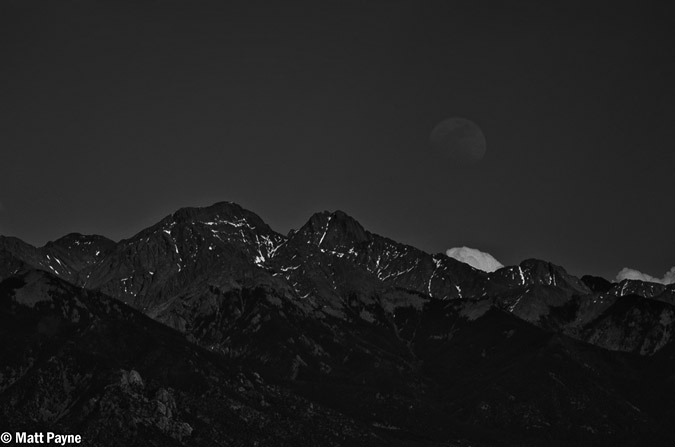
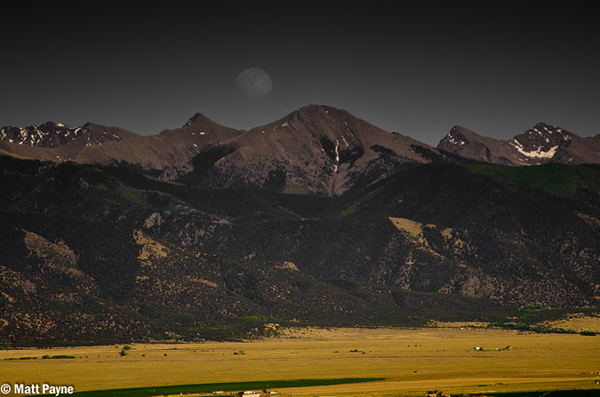
The drive home was fairly uneventful until I was able to discover the moon rising above the Sangre de Cristo Mountains, including Crestone Peak (right) and Kit Carson Mountain (center).
As soon as I returned home, I made sure to check-off another box on my 100summits t-shirt. Thirty-eight of the highest 100 to go and ten 14ers to go!
I look forward to more exciting hikes with Regina and hopefully Sarah too!
If you would like to stay up-to-date on all of my articles, photography musings, trip reports and other mountaineering related news, please feel free to follow 100summits on Twitter or Facebook! Also, if you're planning on doing any online shopping and if you enjoyed the content, please help keep the site going by using the links on this page to help fund the site.