Displaying items by tag: 14ers
Completing the Centennials - ending a decade-long goal on Thunder Pyramid
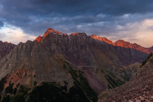
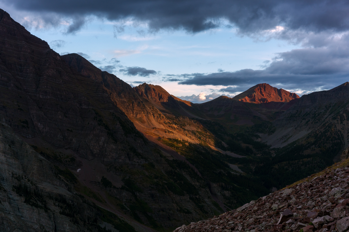
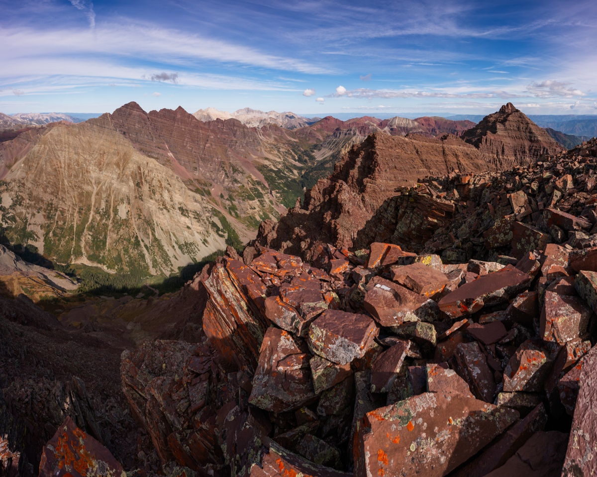
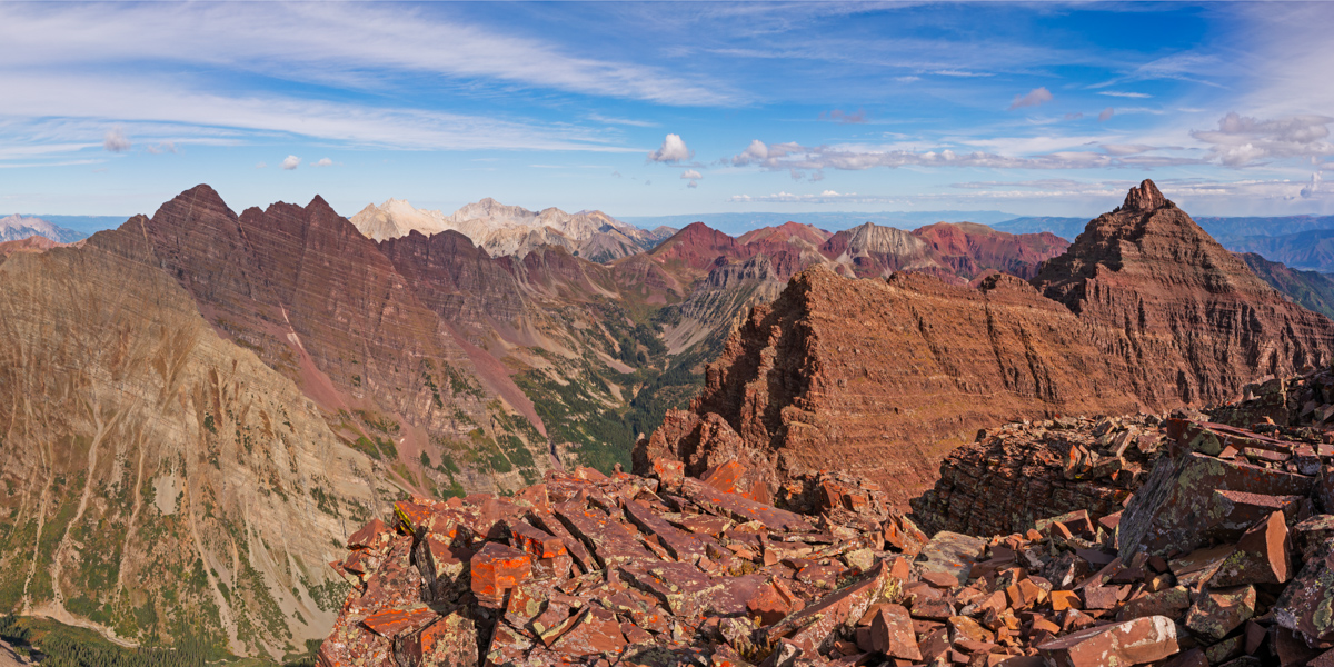
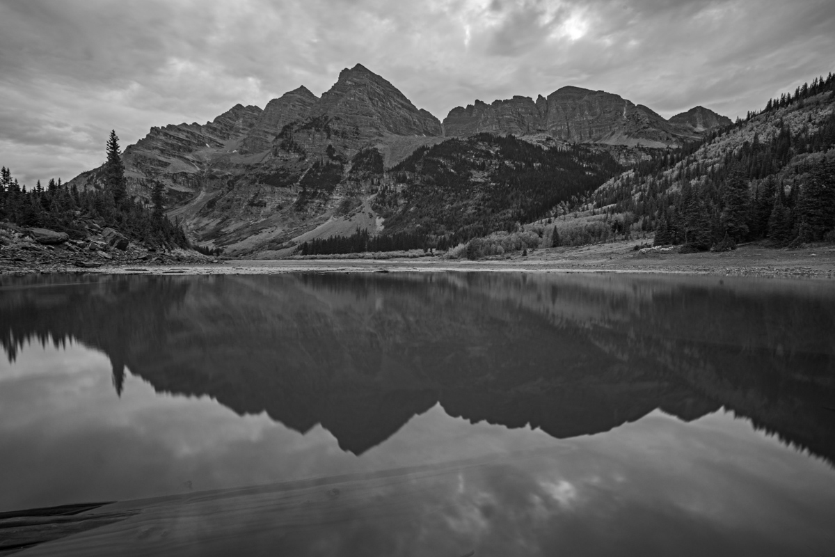
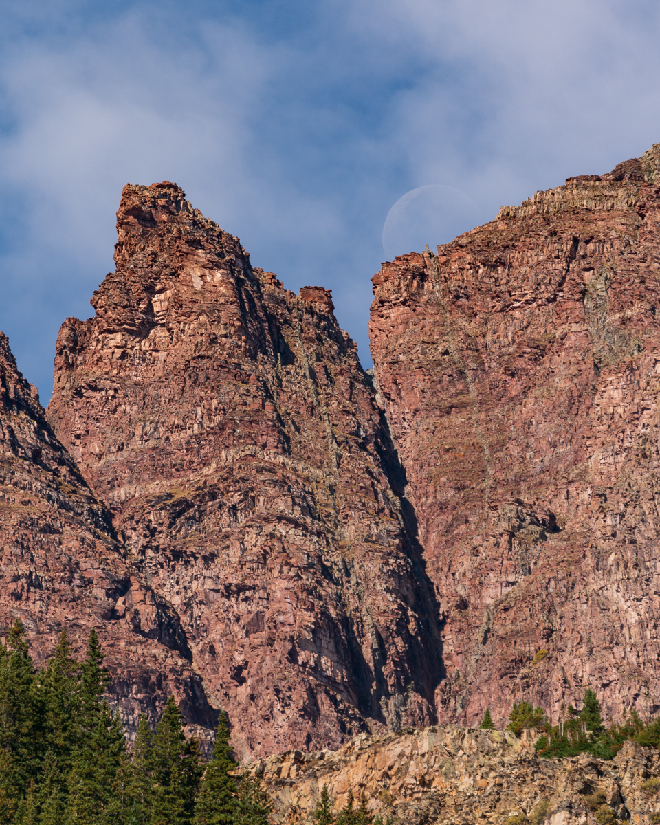
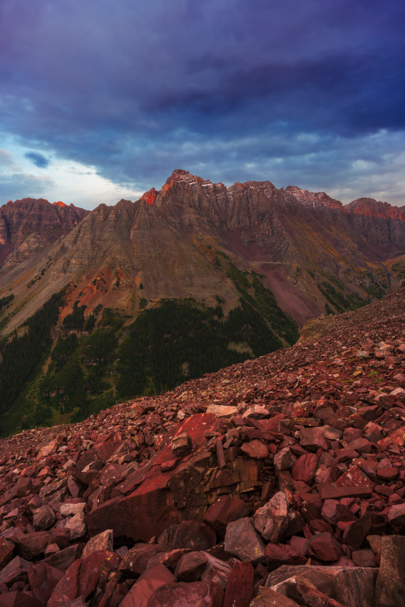
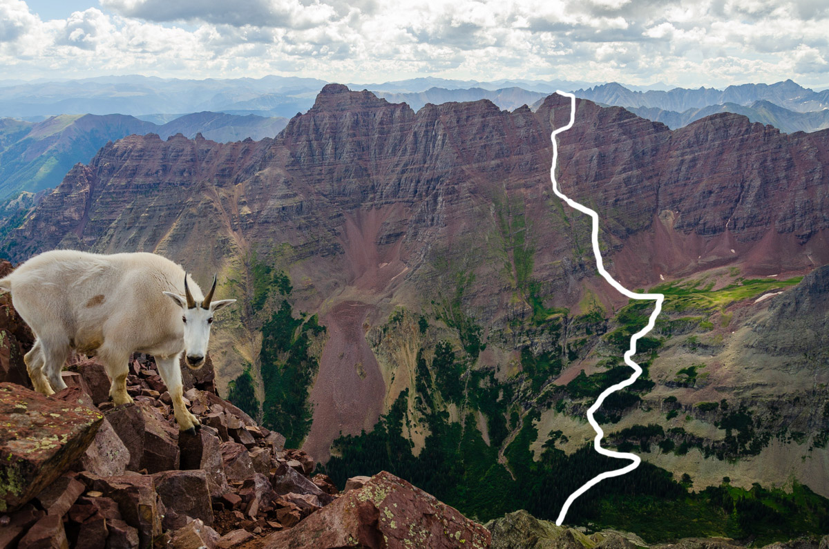
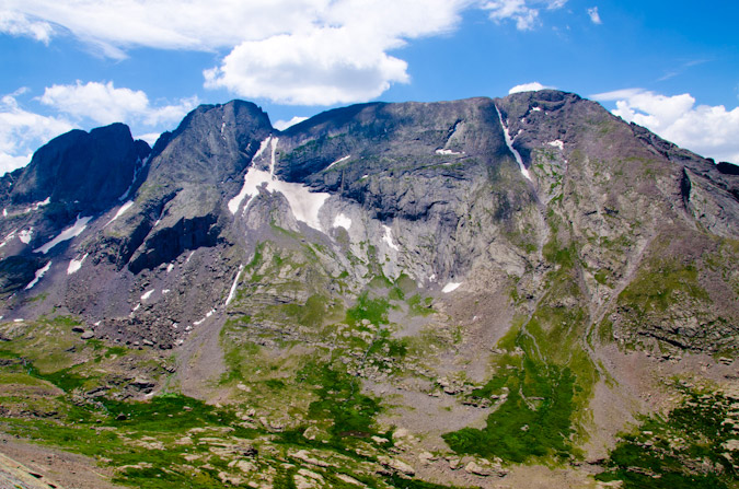
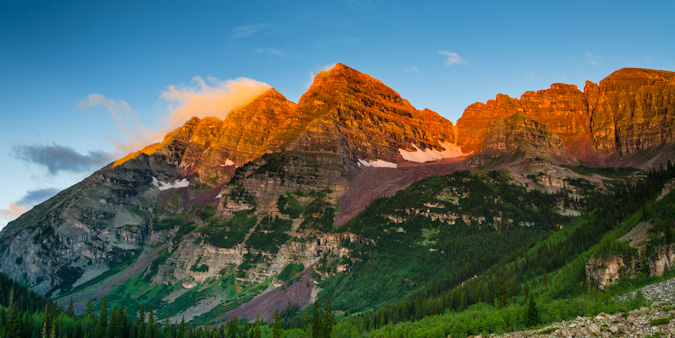
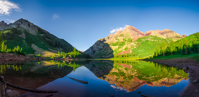
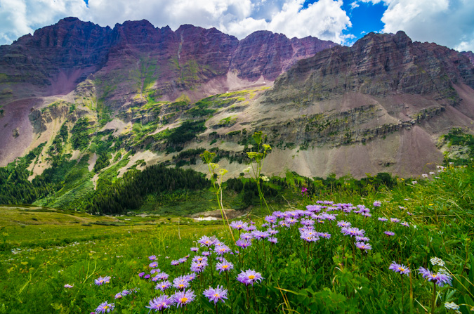
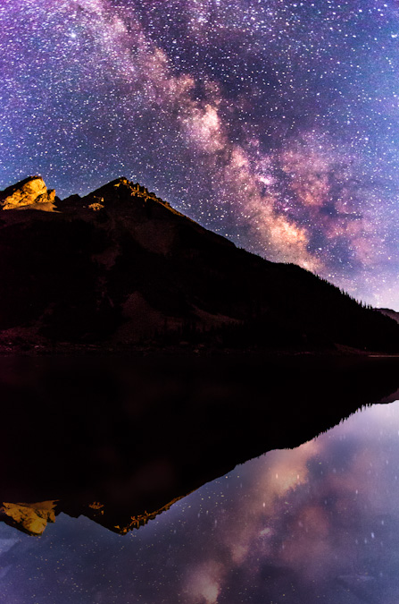
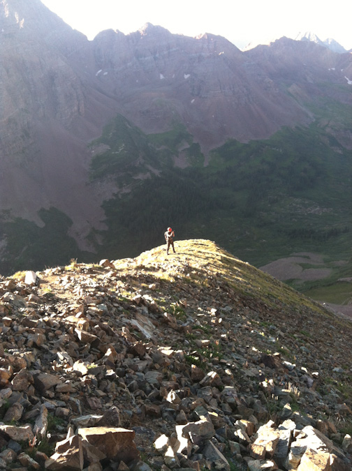
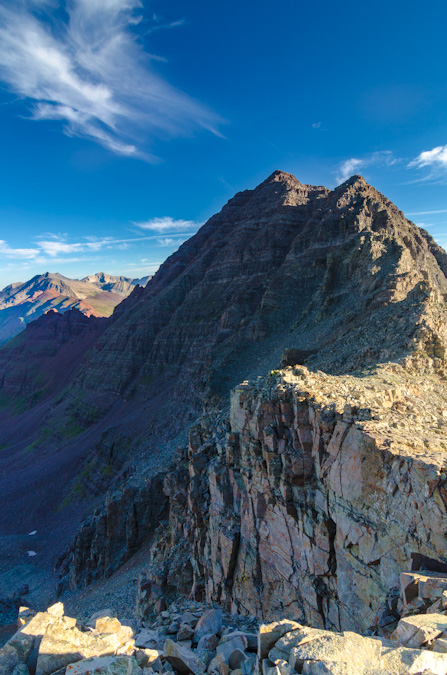
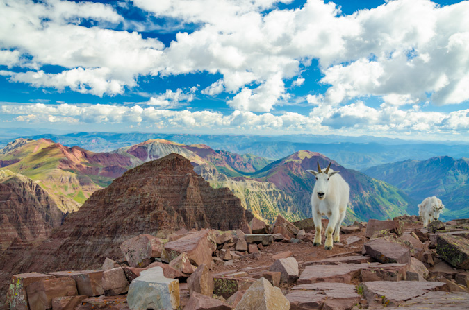
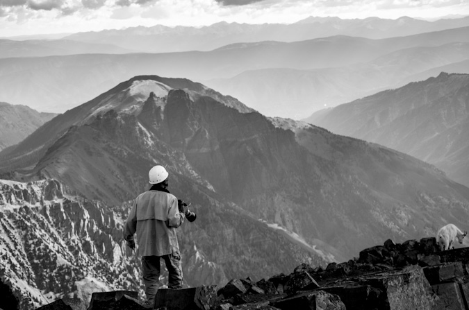
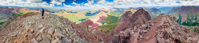
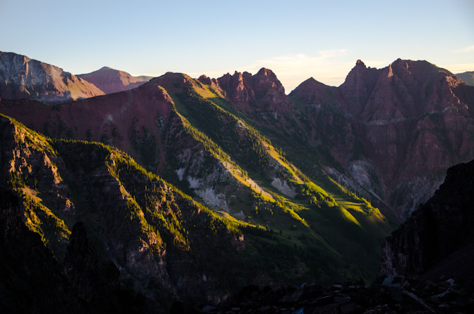
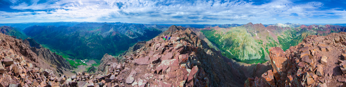
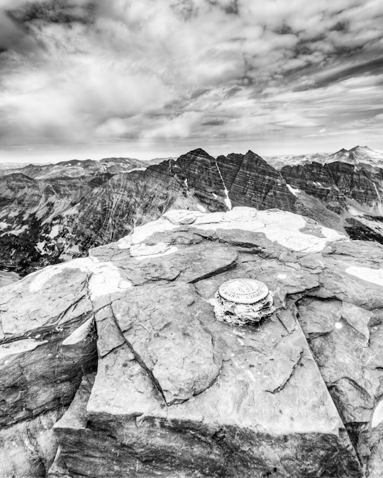
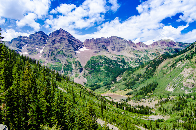
 Pyramid Peak and Thunder Pyramid as seen from Maroon Peak in 2012
At the start of 2018, I told myself that this would be the year that I would complete the Centennials (the highest 100 mountains in Colorado). For no great reason, I wanted to finish my goal before I turned 40 (I'm 39). It was a somewhat lofty goal considering I had lost my job in January, started a new job in February, and was not in the best physical shape of my life. I started this goal officially in 2009 and game out of the gates in a hurry. I had a headstart, having started climbing peaks when I was 4-years-old (1982). I had completed 22 / 100 by the end of 1998 when I was in college, but took a very long hiatus after that. I only completed 5 more peaks from 1998 to 2008. That means that between 2009 and the end of 2018, I completed 73 of the highest 100 mountains. That feels substantial. In January 2009, I built this website and began documenting my journey. This trip report may be boring in some ways so bear with me. It is my way of reflecting back on this journey and reminiscing on a goal completed. The following summaries don't include repeat peaks or other peaks not in the highest 100 that were climbed those years.
- In 2009, I completed 20 summits on the list.
- In 2010, I completed 12 summits on the list.
- In 2011, I completed 14 summits on the list.
- In 2012, I completed 5 summits on the list and finished the 14ers.
- In 2013, I completed 5 more summits and then moved to Oregon.
- In 2014, I completed 1 more summit (how sad).
- In 2015, I completed 2 more summits (still very sad), but moved back to Colorado at the end of the year.
- In 2016, I completed 3 more summits.
- In 2017, I completed 3 more summits.
- Finally, in 2018, I completed 8 more summits and my goal. My average per year that I was actively seeking the goal was 7.3 - not bad!
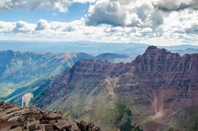
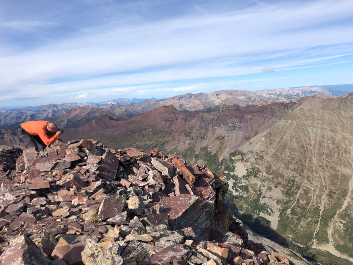
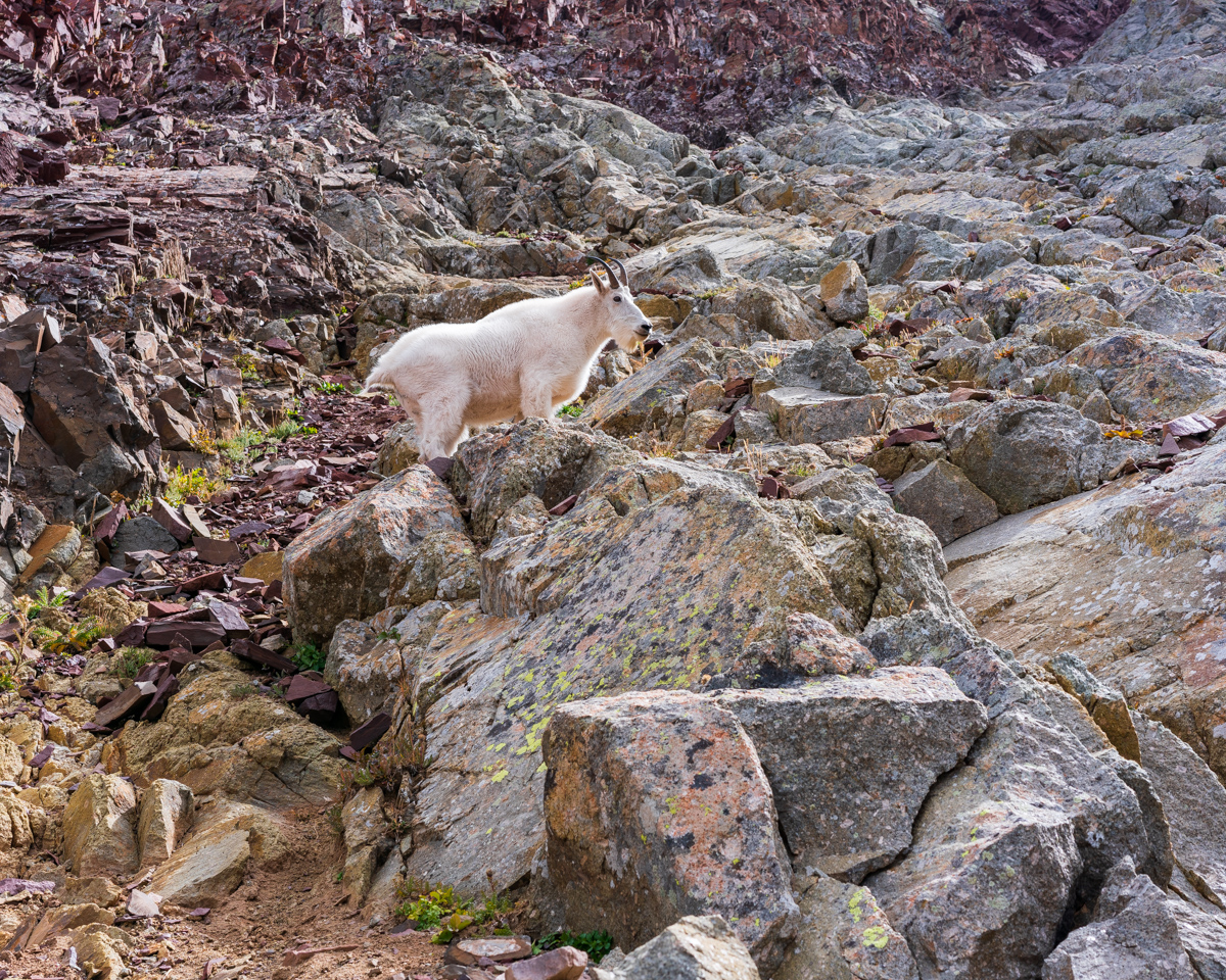
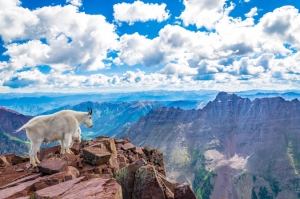
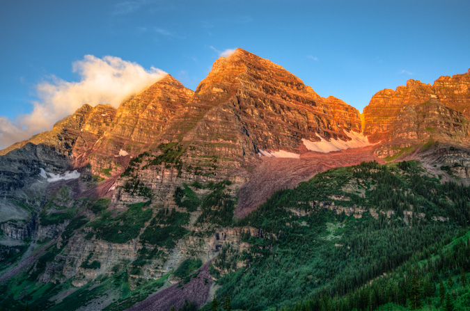
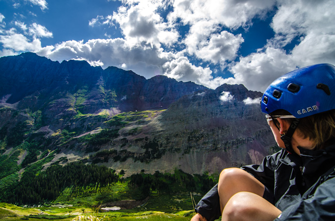
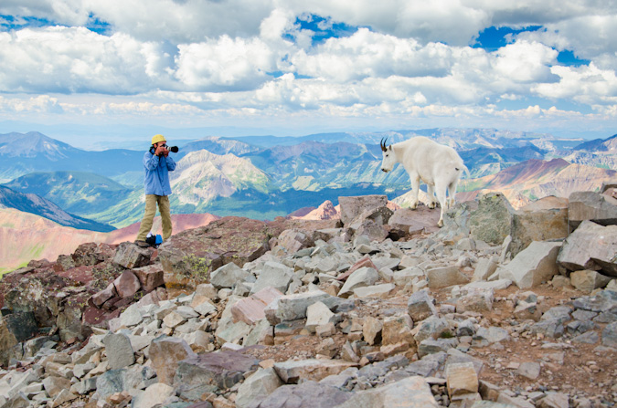
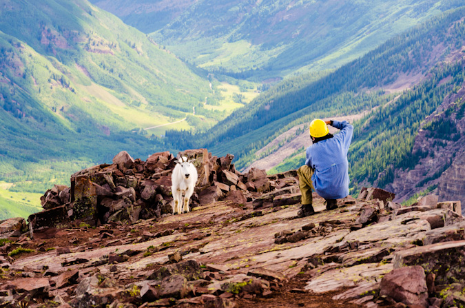
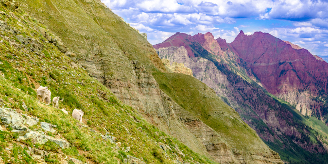
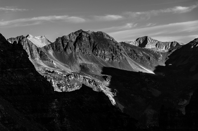
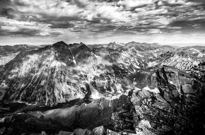
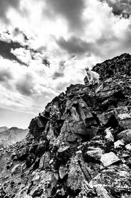
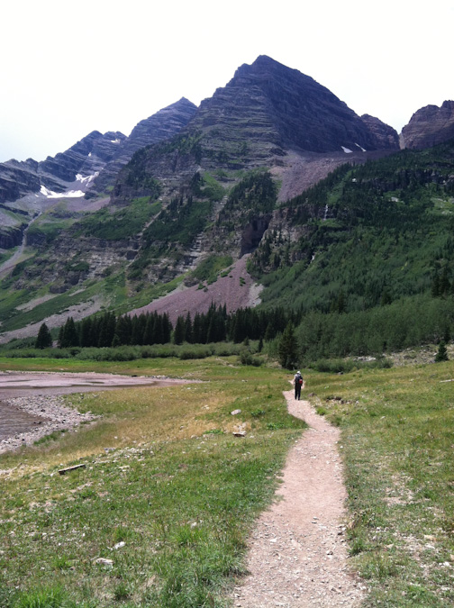
A mountain goat gazes upon Pyramid and Thunder Pyramid from the summit of Maroon Peak
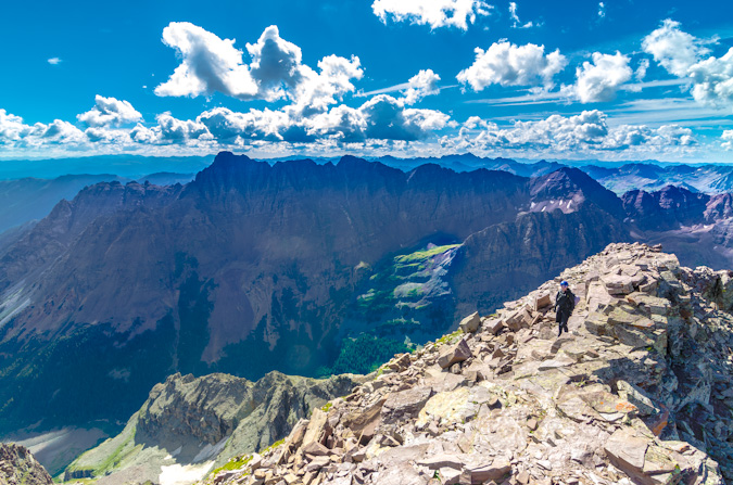
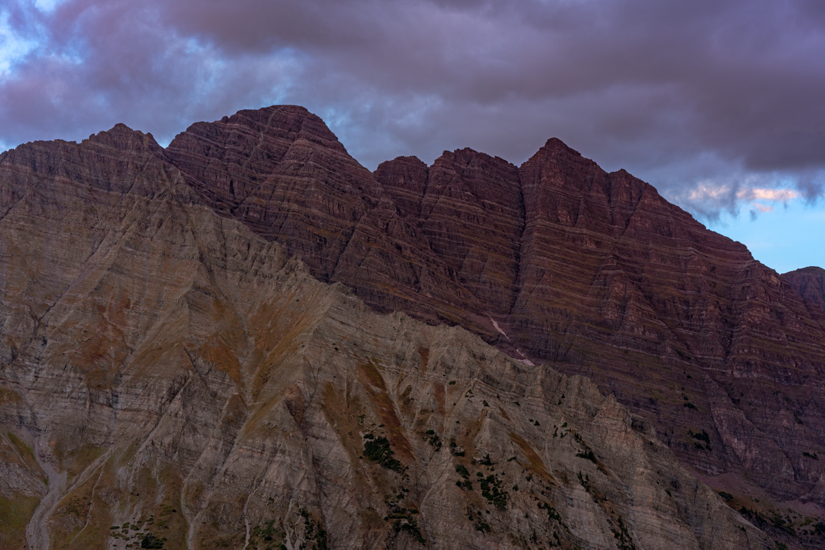
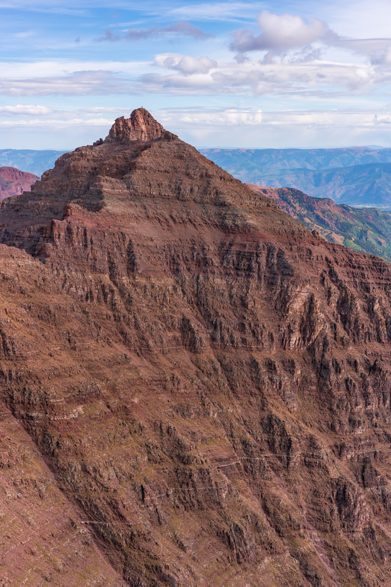
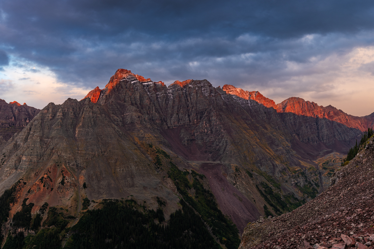
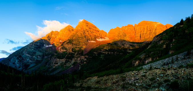
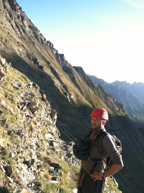
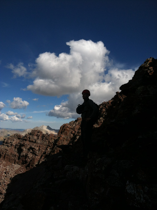
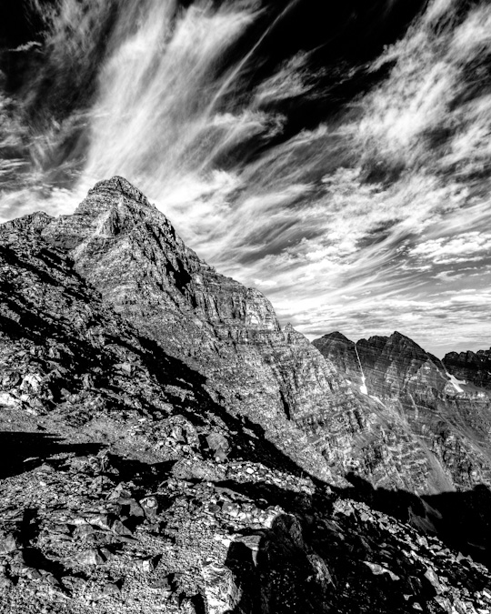
Regarding the subject at hand: I have been dreading Thunder Pyramid ever since gazing upon it in 2012 from the summit of Maroon Peak. The vantage from that position makes Thunder Pyramid unclimbable, the White Gully leading to the summit a straight-up nightmare. I had heard horror stories (all greatly exaggerated) of the looseness of the rock on Thunder Pyramid and many very exceptional climbers, including David Morano and Steve Gladbach, have perished on her slopes. The mountain was ultra-hyped in my mind and I was completely prepared for anything I found due to that hype. Anxiety is a powerful driver for some of us and I'm no exception.
As always, you can see and download my full route and GPS tracks over on the incredible app, Gaia GPS, which I use on my iPhone to plan, track, and follow my routes on these trips. It is absolutely invaluable and worth every cent. I personally love that you have full access to all USGS topo maps and National Geographic Trails Illustrated maps as well. You can use the app while in airplane mode and even save maps for offline use. To get a nice discount on the application, follow this link and you'll also support my efforts to keep this site running.
For this trip, I decided to pack quite a lot of camera gear (by the way, these are affiliate links and using them helps me pay for this site and to bring you better content):
- Sony A7R2 Camera
- Laowa 15mm f/2 lensaowa 15mm f/2 lens
- Zeiss Loxia 21mm f/2.8 lens
- Sony 55mm f/1.8 lens
- Sony 70-300 FE telephoto lens
- Feisol Tournament 3442 tripod
As usual, I used the beta from Gerry Roach's High Thirteener Guidebook. I was still using the 1st edition of the book; however, his new edition is available on Amazon after many years of waiting - rejoice! Also, huge shout-out to my good friend Kane Englebert who called me to give me some excellent tips on climbing this peak safely - thanks man!

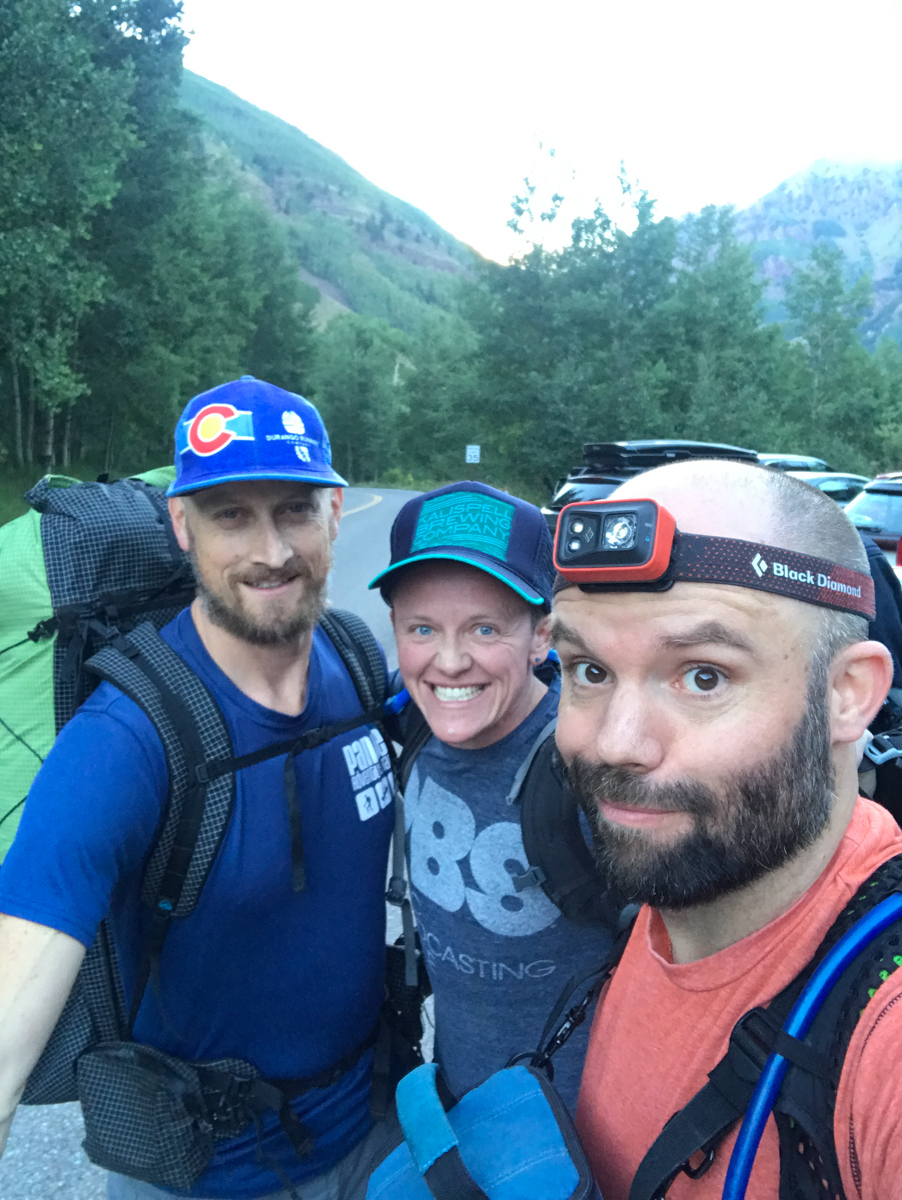
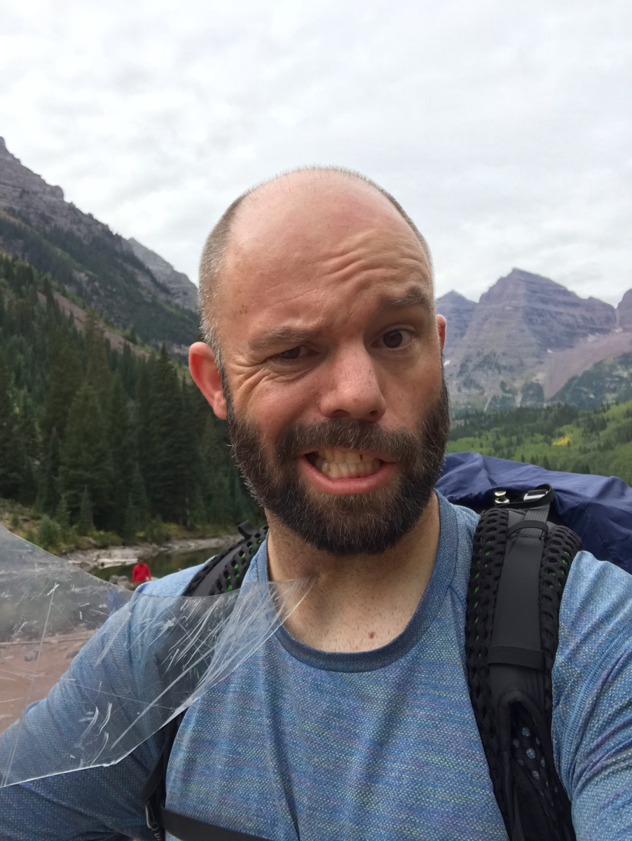
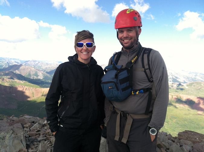
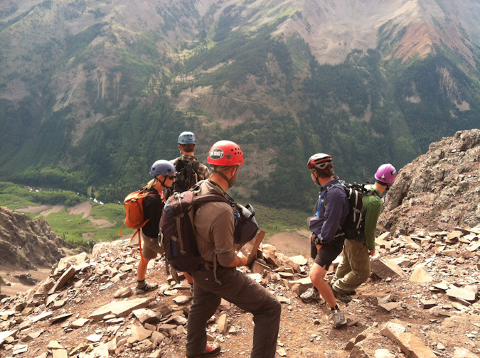
I decided to invite my two best friends for this final climb: Silas Musick, who has joined me on 16 of the highest 100 peaks; and, my friend Todd Myers. Since Todd was training for the Imogene Mountain Run in a week, he opted to just join us for the backpacking and stay in camp during the climb. The plan was for Todd and I to meet Silas in Aspen and then drive to the Maroon Bells parking lot together. Todd and I left Durango at noon on Friday. We met Silas at 6 PM in Aspen and we were all at the trailhead and ready to hike at 7:30 PM. We were planning to backpack to Crater Lake, set-up camp, and then get up really early for our attempt on Thunder Pyramid. Silas also had North Maroon on his radar and so we knew we would be in the area for a few days. The three amigos began our trip up from the lake in high spirits.
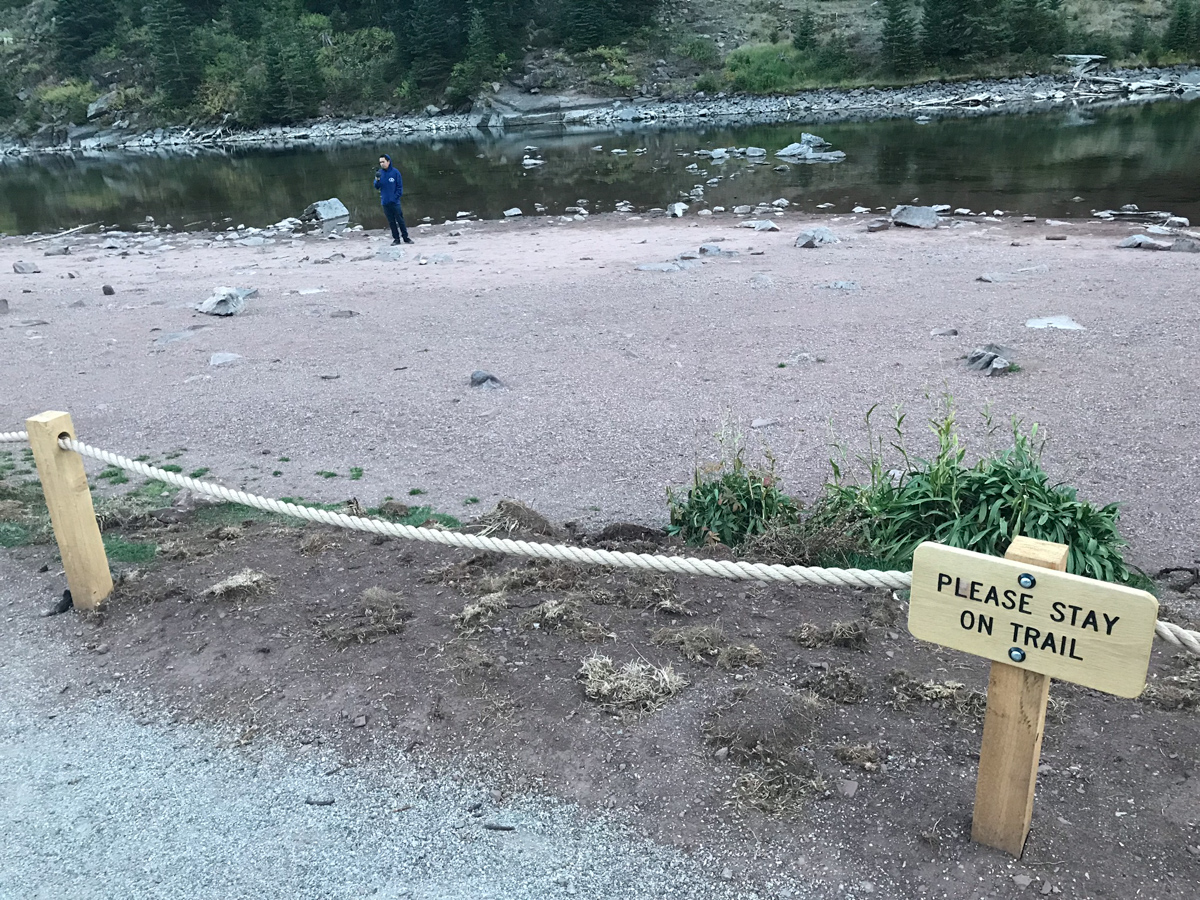
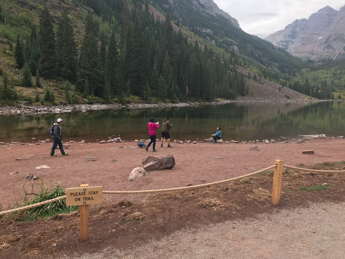
I was surprised to find that Maroon Lake had a rope surrounding it - which will not bode well for those looking to photograph it during autumn colors. Already, we found lots of people that simply disregarded the signage to stay on the trail, despite a sign being visible on the rope every 20 feet or so. Seriously, how hard is it for us as humans to simply obey rules? Do folks feel like they are above them? Anything for Instagram? What's going on here? You may not agree with the rope, but if you're going to enjoy public lands, you need to follow the rules. While they may sometimes be poorly implemented, we should still follow them. For more on the Forest Service's decision to rope it off, see this link.
We arrived pretty late at our campsite and set-up in the dark. There was an abandoned tent at our site - one of those cheap Walmart tents. I sure don't envy the job of the Forest Service to keep these places looking halfway decent. The total disregard of Leave No Trace principles is quite astounding. OK, off my soap box! Silas and I set our alarms for 3:45 AM and hit the sack.
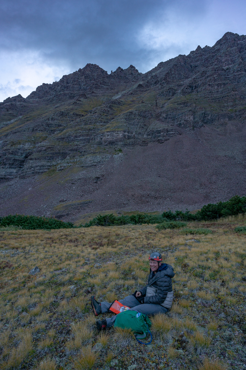
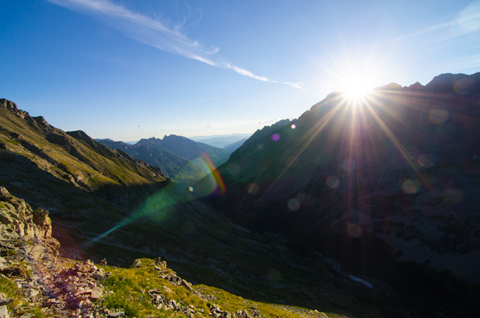
We woke up at 3:45 and left camp at 4:00 AM. The forecast for the day was not great; however, it was also looking like the best weather window for the weekend. We anticipated early storms and lots of clouds in our future and wanted as early of a start as possible. While this meant hiking up the first section of Thunder in the dark, we felt it was a good choice.
After hiking about 10 minutes, a young man by the name of Austin stopped us on his way down from above asking if we had cell phone reception. We of course did not and explained that you would have to go all the way into town to get cell reception. He explained that his father, Brad, had altitude sickness and asked him to go down to get help. We explained that the most important thing was for his dad to get down and for someone to help him do that. We urged him to go back up and get him. He reluctantly agreed and hiked with us to the Thunder Pyramid turn off. We wished him luck, made sure he had food and water, and went our separate ways. More on that story later!
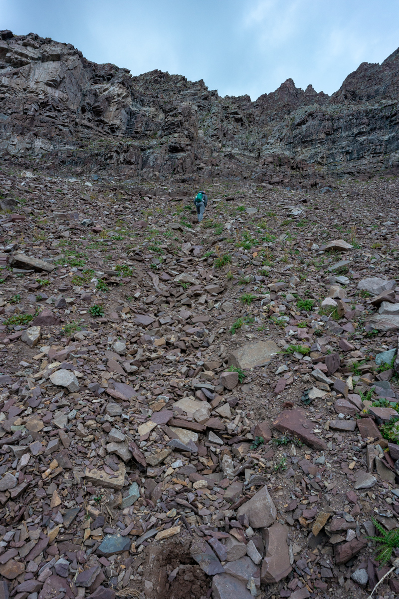
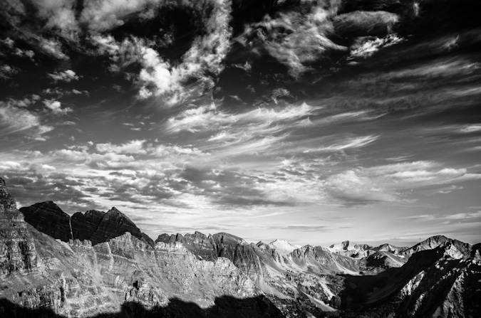
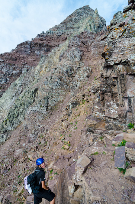
We had a tough time finding / following the trail from the cairned turn-off for Thunder Pyramid. We ended up bushwhacking up steep forested garbage until we reached the first cliff band. We followed that cliff band to our left to a weakness and followed that weakness up to another cliff band. This pattern continued until we found ourselves above treeline looking back on the Maroon Bells before sunrise.
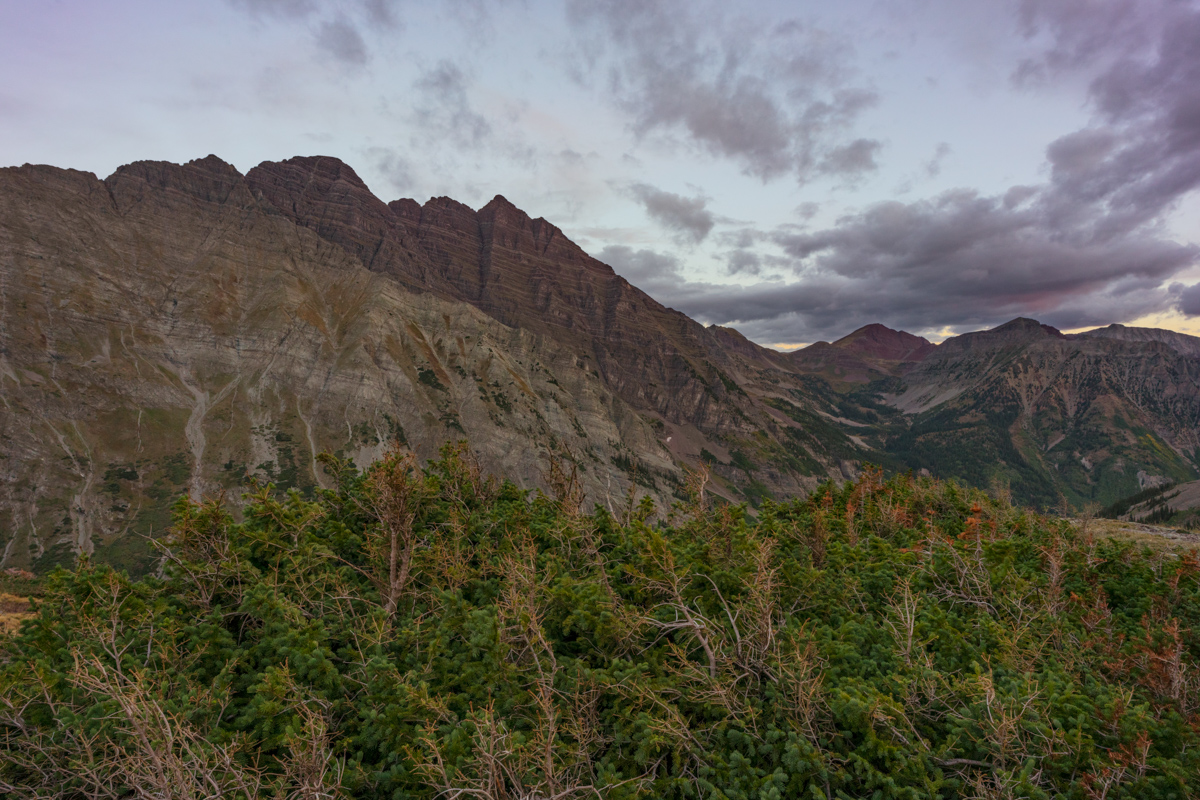
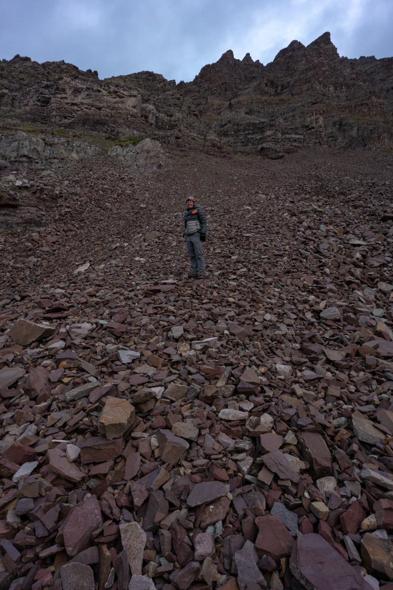
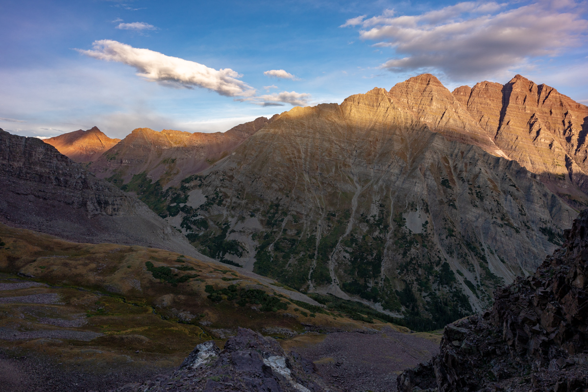
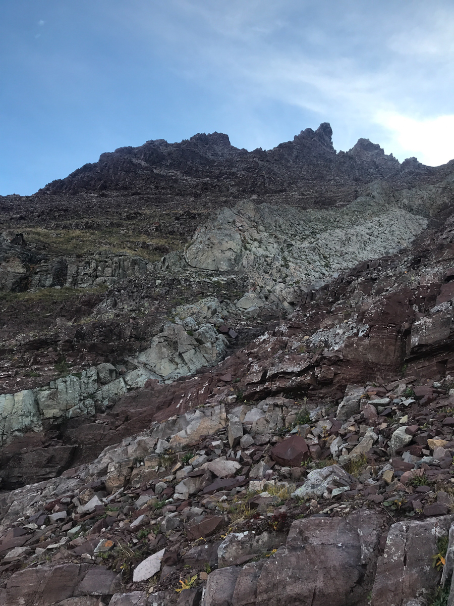
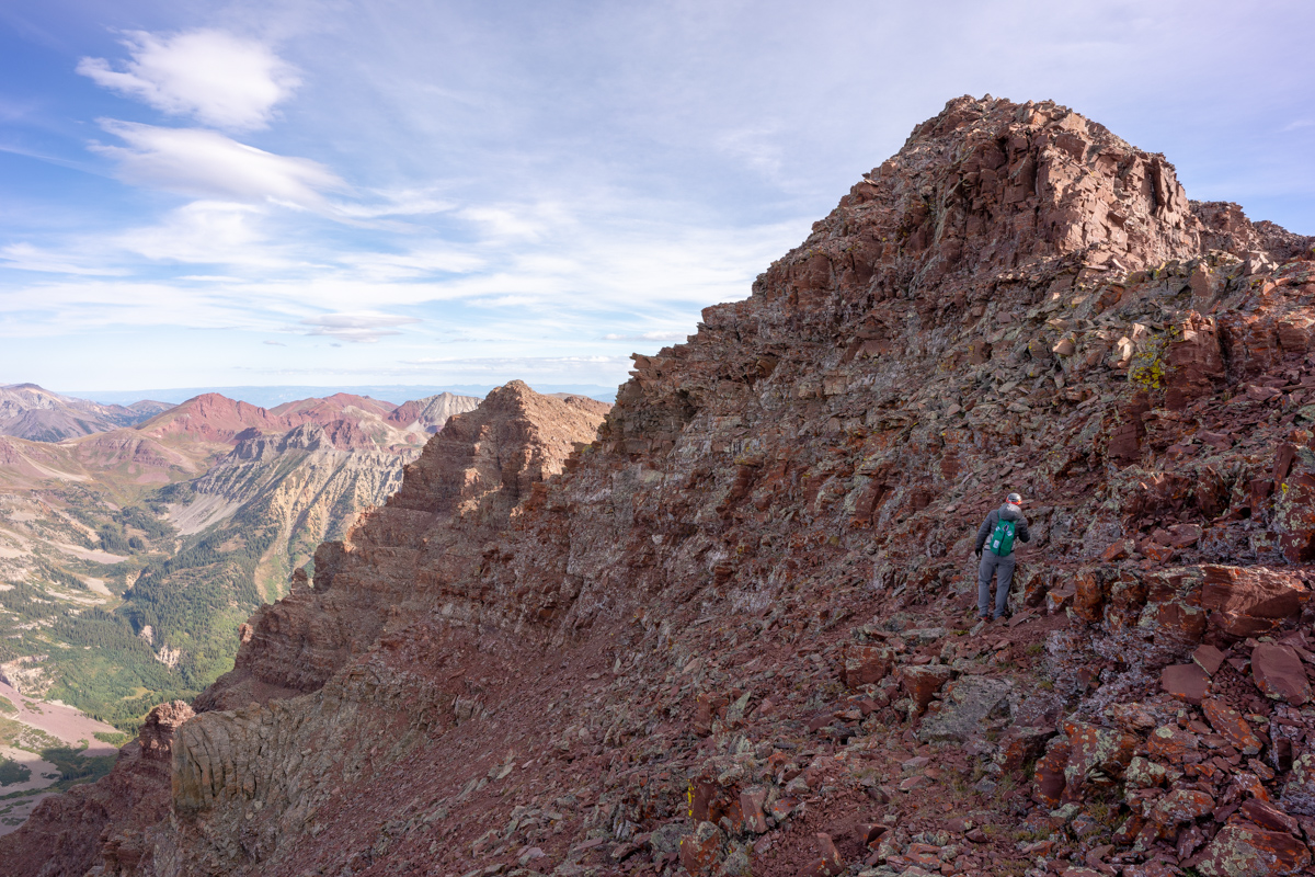
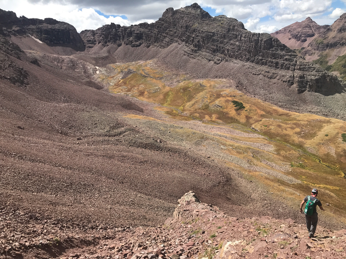
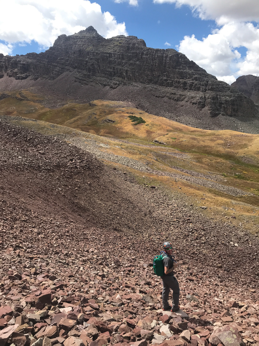
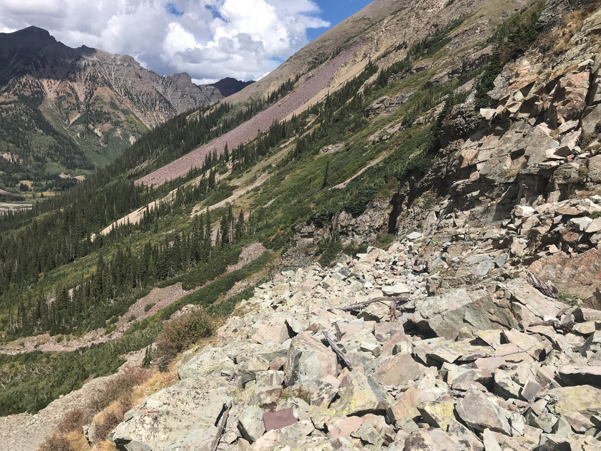
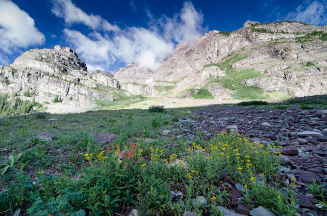
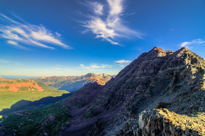
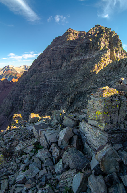
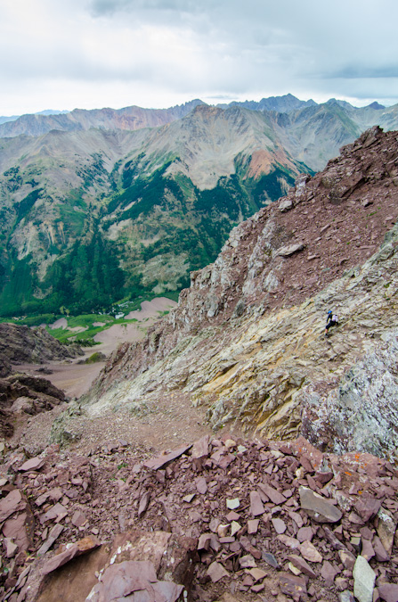
The sight of Thunder Pyramid above us was certainly sobering. Clouds were already forming to the north and we felt like the hardest parts were still yet to come. We knew the next step was to identify a steep gully of talus and follow it more or less to the base of the famous white gully. We decided on the gully to the left of the really large one filled with junky talus.
The talus was not too terrible or awful, but it was certainly made of the same garbage Elk Mountains stuff we had grown distateful of on Maroon and Pyramid in previous climbs. I personally found it quite inviting compared to my experience on Cathedral Peak!
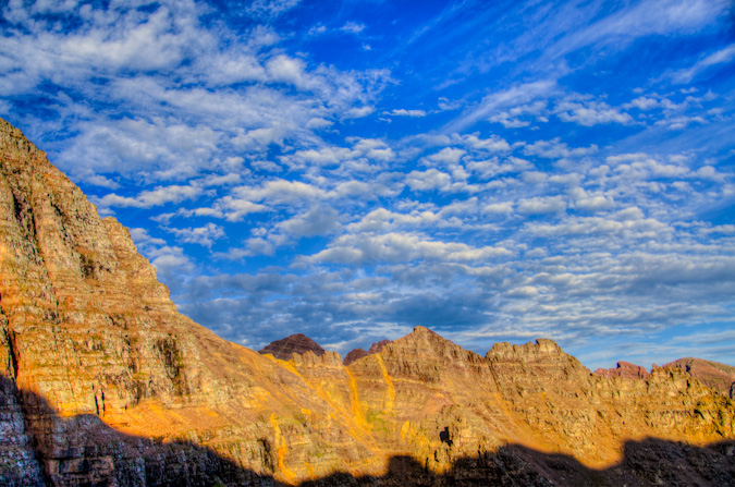
As we ascended the gully, the light over on Buckskin Benchmark to the northwest was looking quite fine!
And naturally my gaze was constantly drawn by the Maroon Bells. What a magnificent pair of peaks to be able to stare at throughout the day.
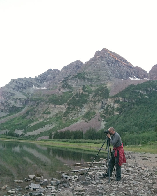
Silas was armed with cell phone and Spot GPS, and I was armed with my Sony A7R2 and my cell phone equipped with Gaia GPS. Technology has really come a long way in a short amount of time since I started documenting these climbs!
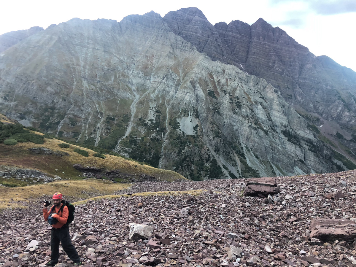
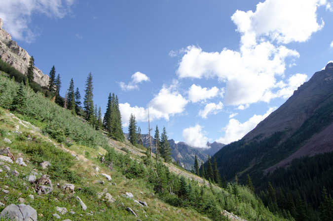
As we climbed up into the gully, the views above Len Shoemaker Ridge were getting really nice. I don't love climbing on the rocks in the Elks, but damn they make for great scenery!
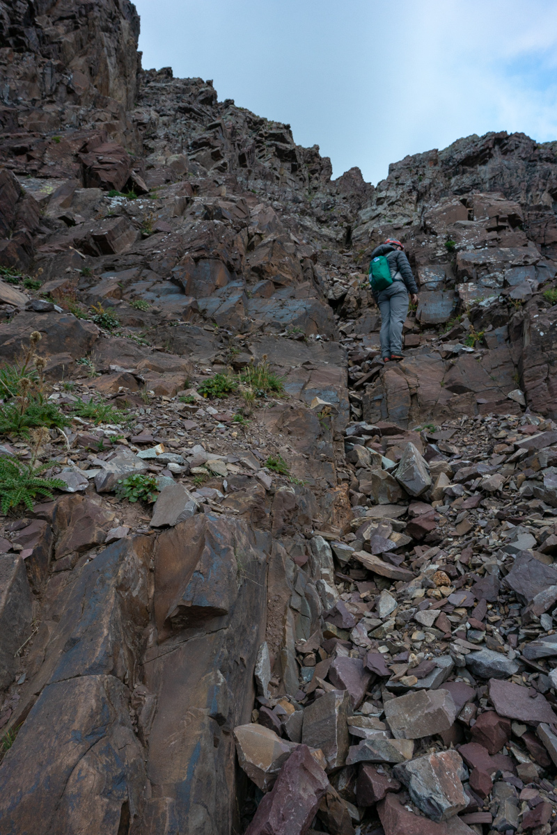
Below you can see another good view of the gully we chose to climb up, which I felt was very solid class 3 climbing all the way up until we turned off to the left.
More views of the class three climbing...
And finally the sun hits the Bells and makes me a happy dude.
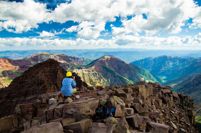
I took advantage of the great views of the Bells to showcase the terrain down below us in the gully. I think this photo does a good job of showing you the complexity of the rock in this section.
I also found myself quite enamored by Bellview Mountain, which is seen left (south) of the Bells in the photo below. I really would like to climb that one someday. I bet its an incredible vantage of the Bells; aptly named indeed.
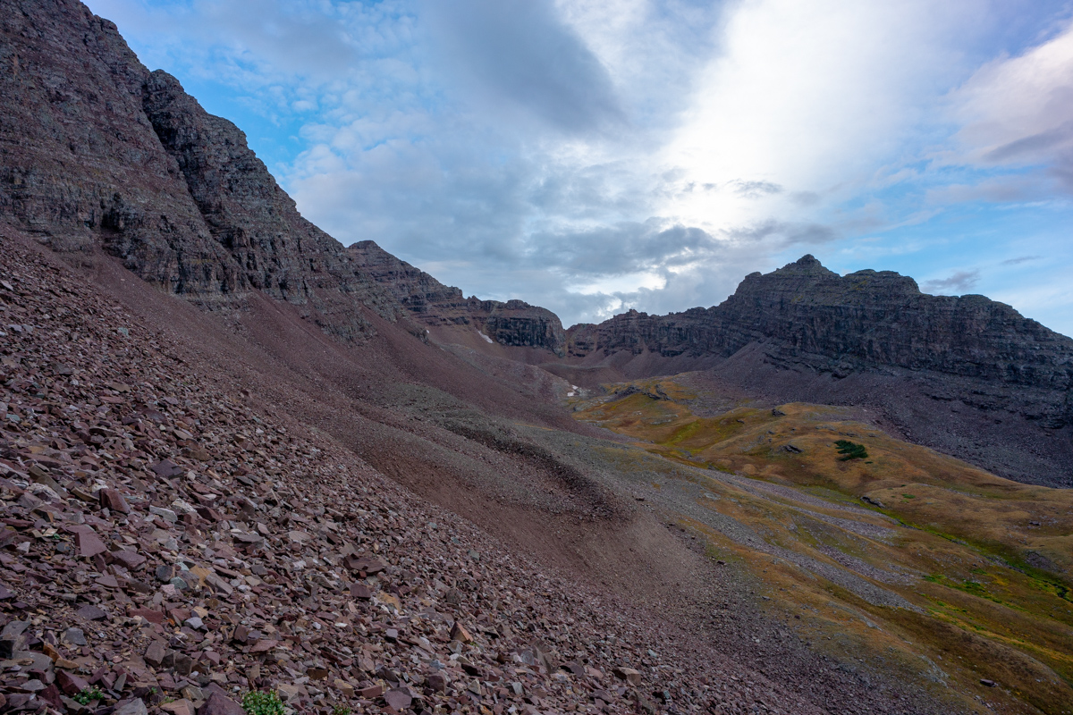
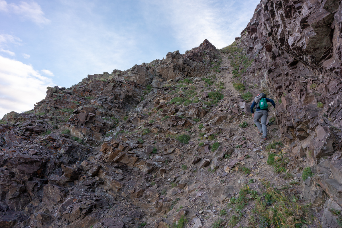
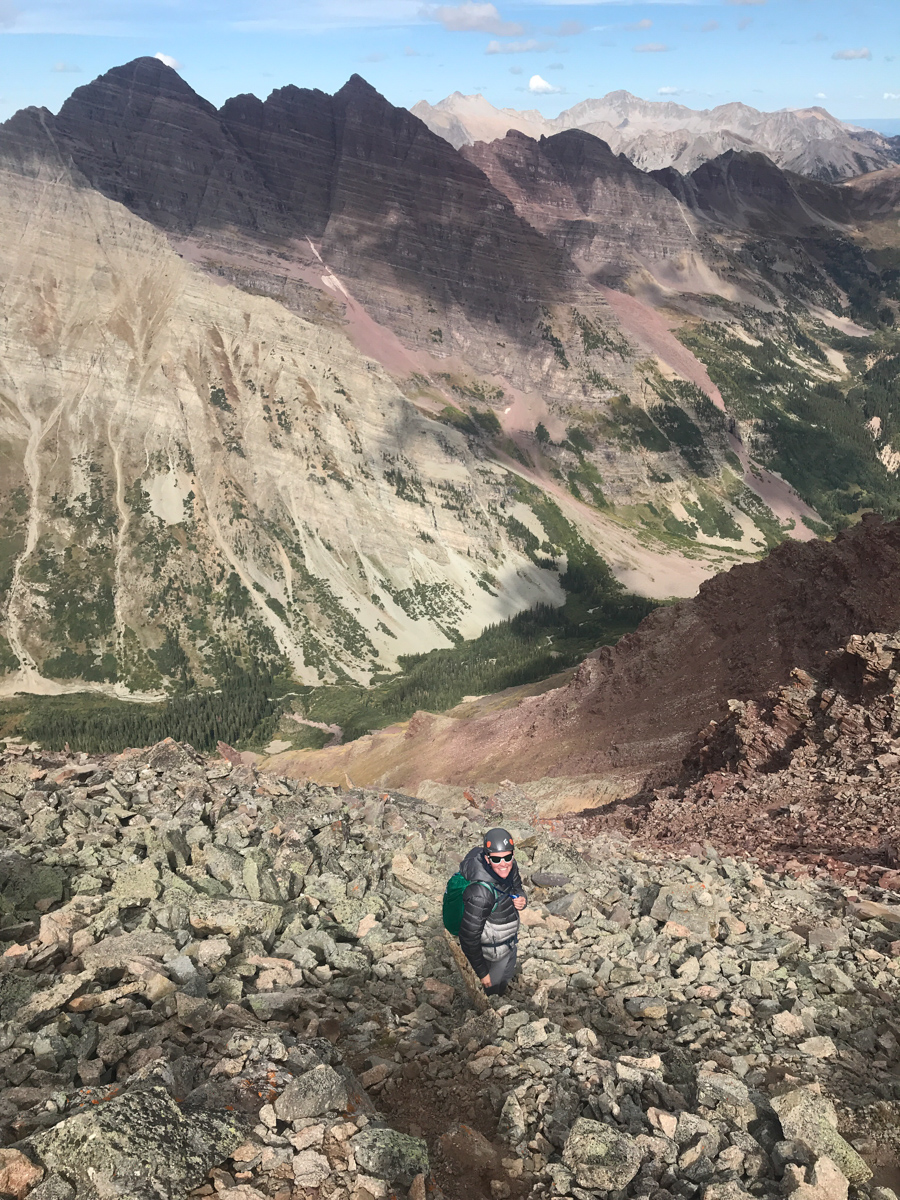
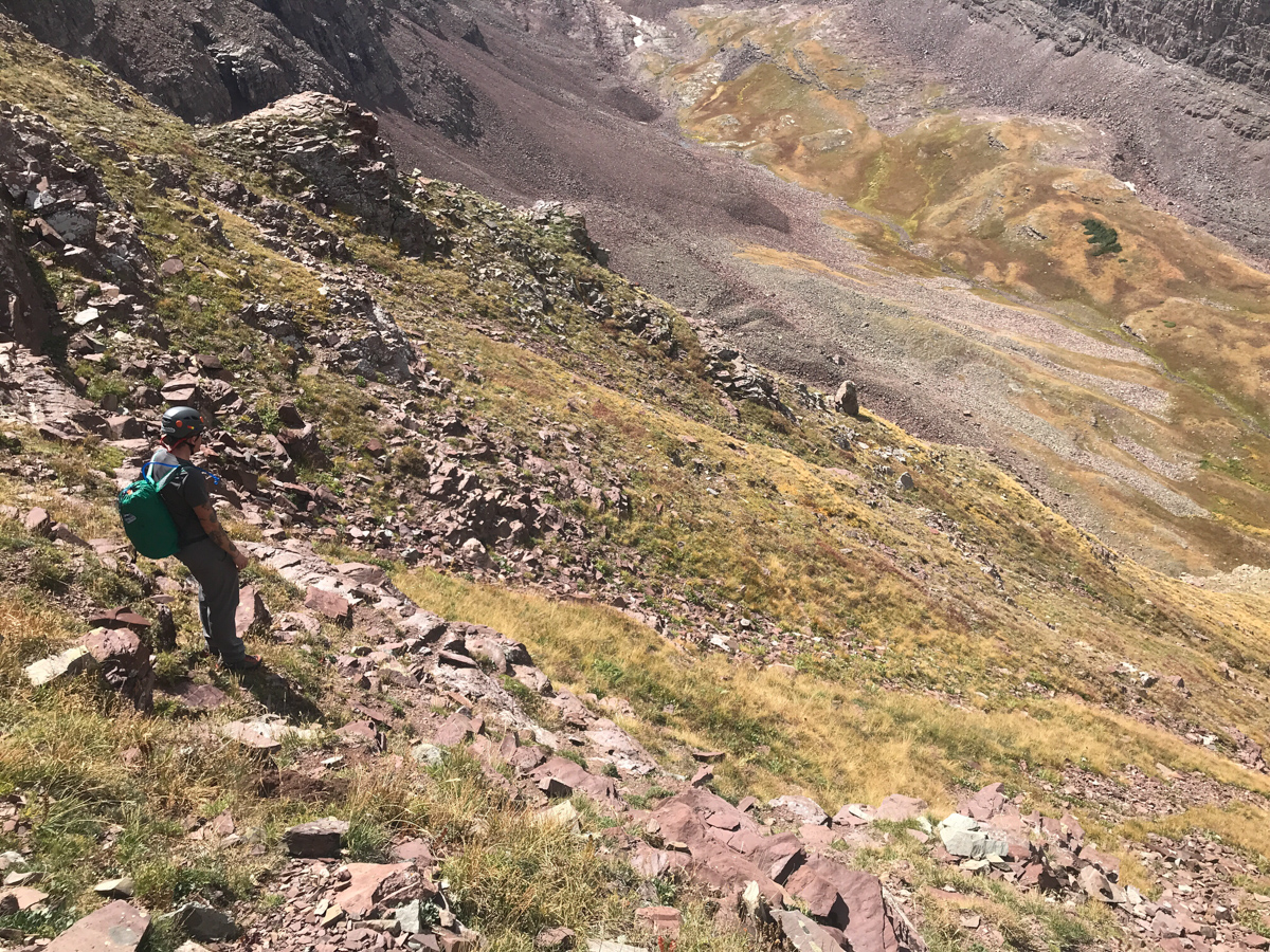
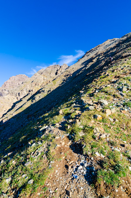
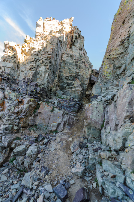
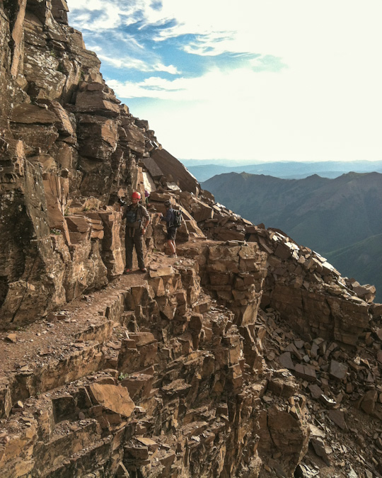
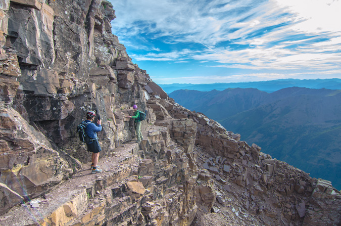
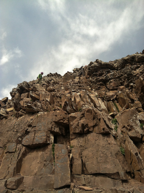
Once we reached the top of this gully, we saw a noticable trail heading left up a very steep dirt and rock slope below the next cliff band. We decided to take it. I knew it would probably lead to the base of the white gully. The trail is what I describe as a "climber's trail," aka - not very solid, very loose, and very steep!
After reaching the top of this section, our view of the Bells really opened up and I could not have been more happy with it.
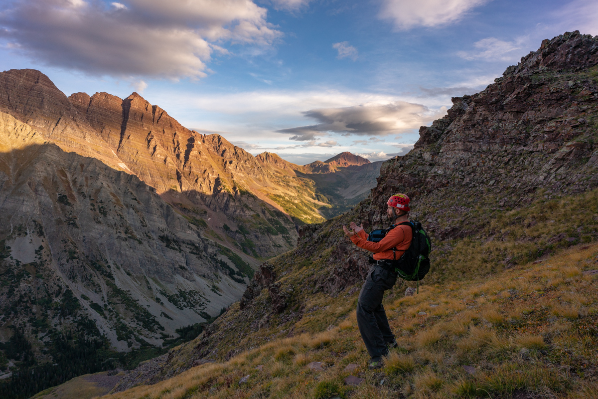
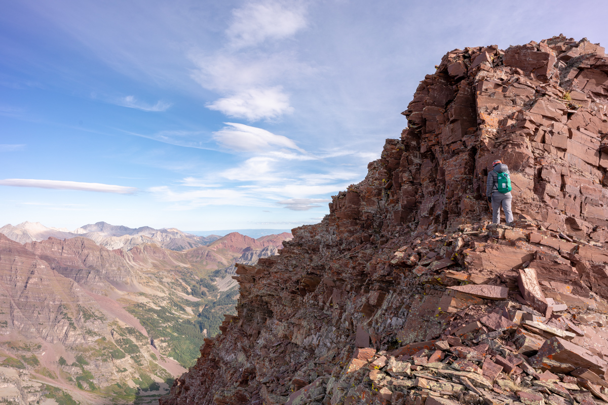
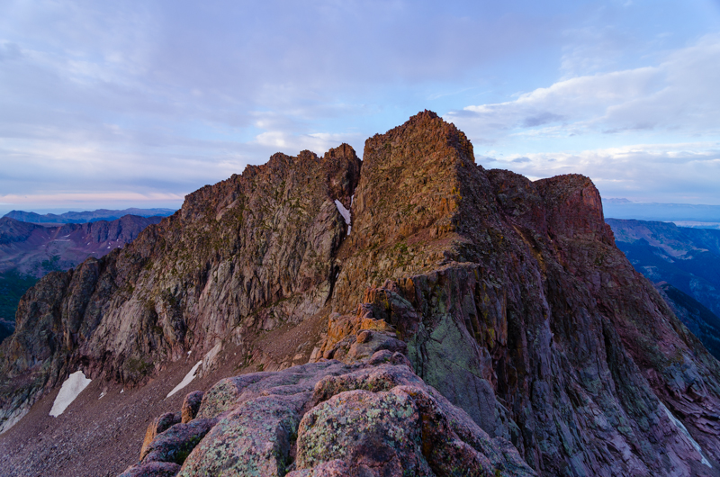
Indeed, the famous white gully came into full view and revealed our future. I was excited to reach this section finally. There was a decent trail all the way up to the base of the gully from here.
As predicted, the white gully was much less daunting up close than from afar. Many of climbers warned me of the loose nature of the rock in the white gully and I was prepared for anything.
It was at this point that I decided to film the rest of the journey to the top with my GoPro Hero 4. I created a 30 minute video which is in hyperlapse format with pauses at key moments. I'm not a professional video editor nor do I have the time to edit this to give it full justice, but I figure it serves as a nice beta for folks wanting to know more about the white gully, the final segment, etc. Also, its fun for me to look back on later in life.
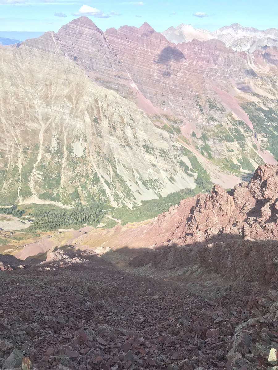
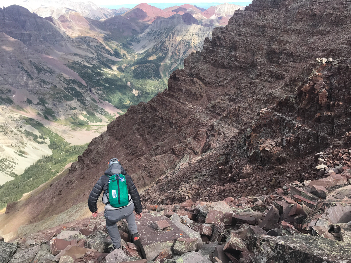
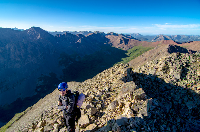
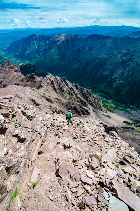
About halfway up the white gully, we began to get great views of all the 14ers in the area. The below shot really intrigued me. It includes Maroon, North Maroon, Snowmass, and Capitol all in one frame. Nice! By the way, I did not find the white gully to be loose at all! We chose to stay high on the left side in the white stuff and it was very solid. Once exiting the gully to the right, things get much dicier.
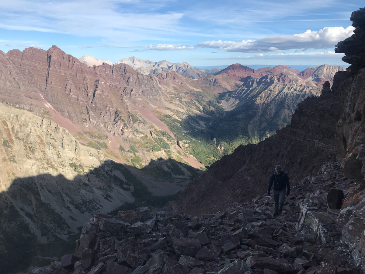
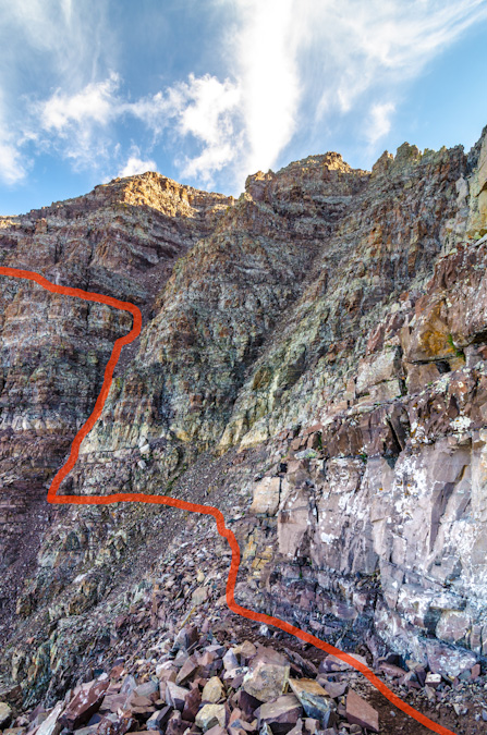
We exited at 13,400 ft. just as Roach suggests. There's a pretty obvious spot to exit below some cliff bands. We had to pick our way through some very nasty rock and maybe strayed a bit too far right into the next gully when we should have stayed high on the "ridge" here, but nothing was obvious at this point. We just went a couple feet at a time, making sure to stay close to each other and stay very mindful about potential rockfall above and below. It is more a mental exercise than a physical one from this point forward.
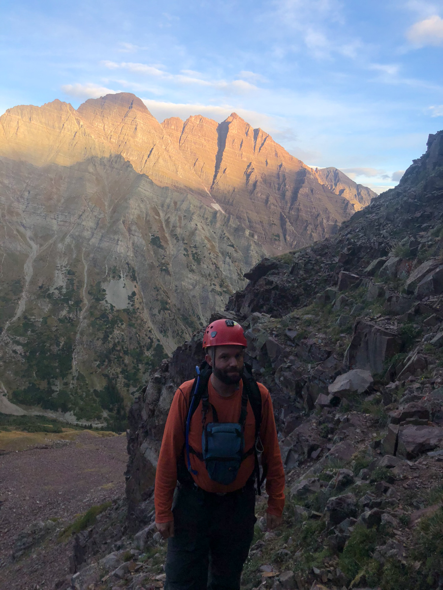
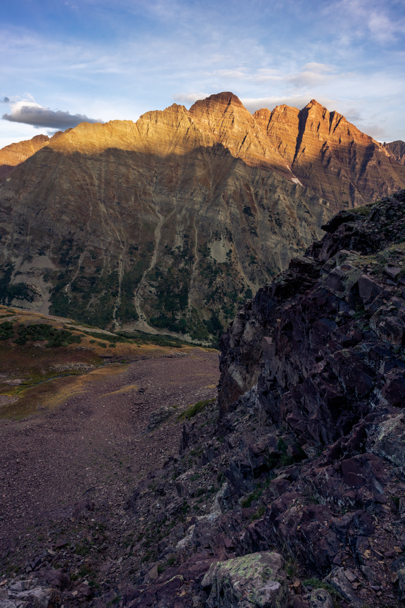
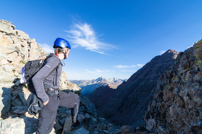
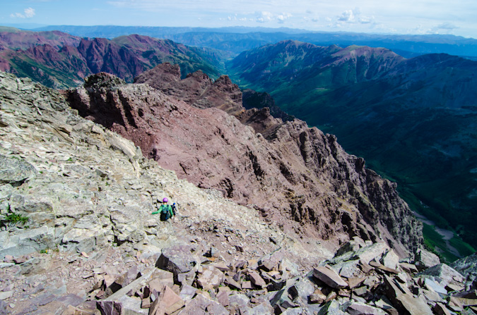
Just below the saddle between Thunder Pyramid and Lightning Pyramid, we found it best to cut under more cliff bands and stay high on lighter colored rock as pictured above.
Once we reached the saddle, it was very clear where to go next and we were feeling very excited to be so close to the top!
I let Silas go first as I wanted him to film me ascending the final section.
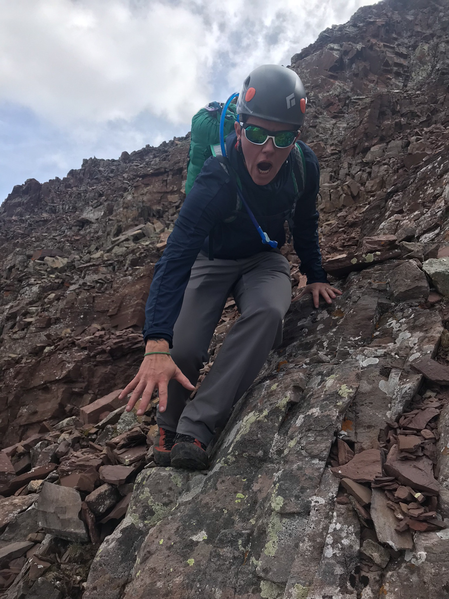
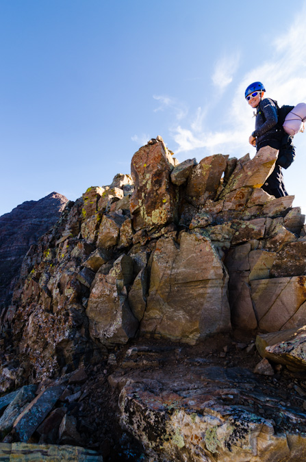
They very last section, which you can see on the earlier YouTube video, was pretty simple to find the solution too, but it did require some easy class 3 chimney climbing. A real joy, to be honest. We just had to be ultra careful about the loose rock above the chimney, as it was ubiquitous and precarious. Below is Silas' film of me arriving at the summit. What a crazy feeling it was.
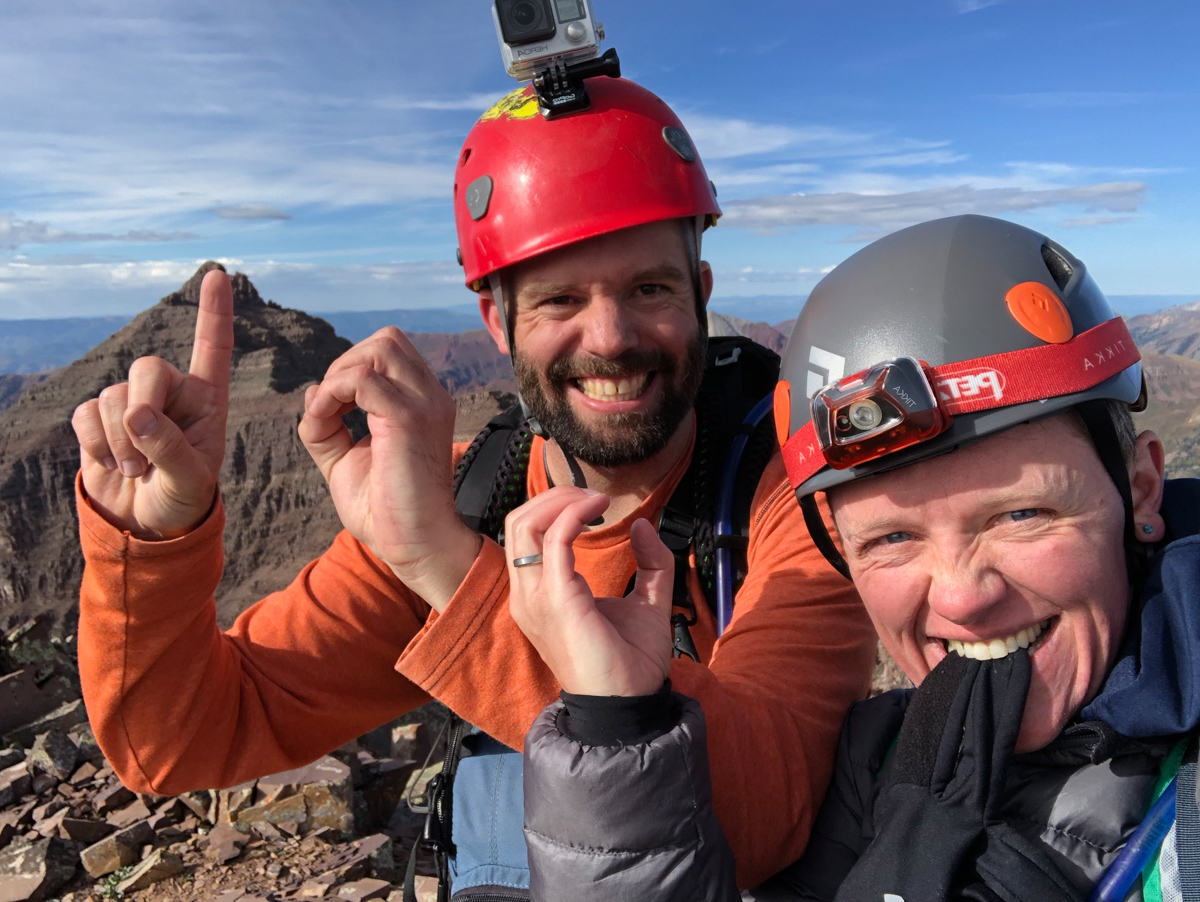
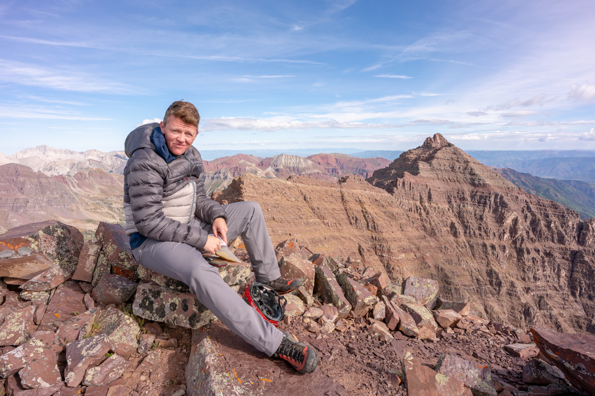
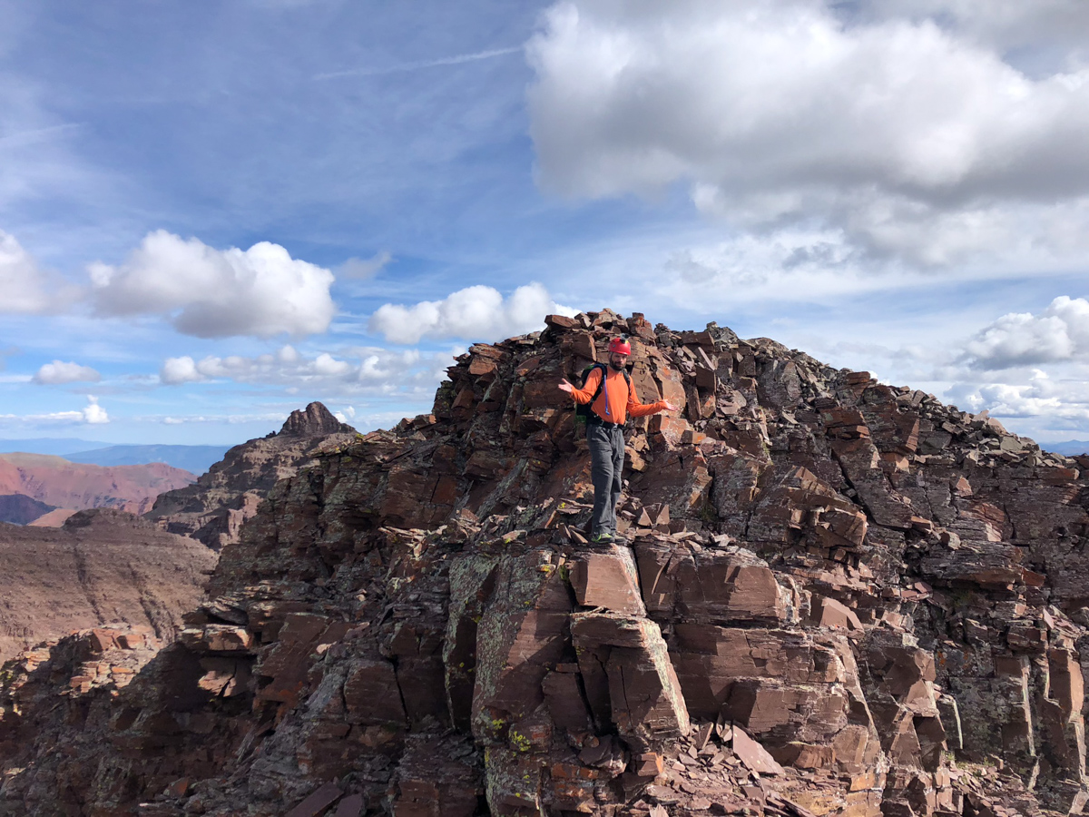
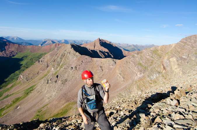
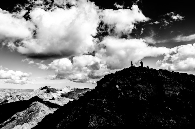
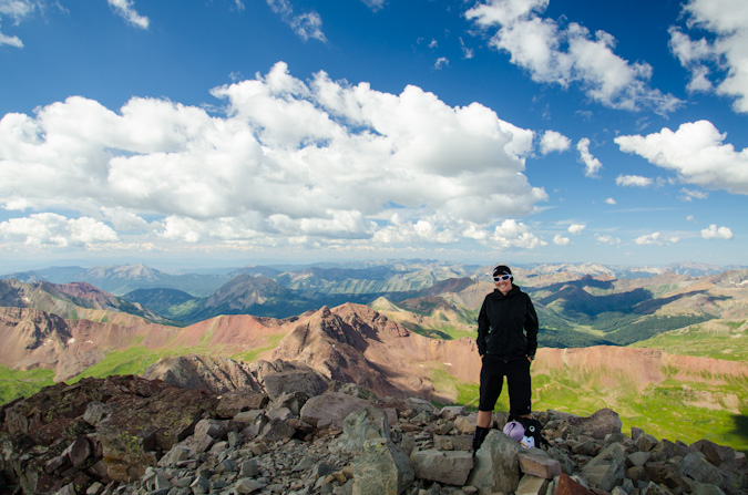
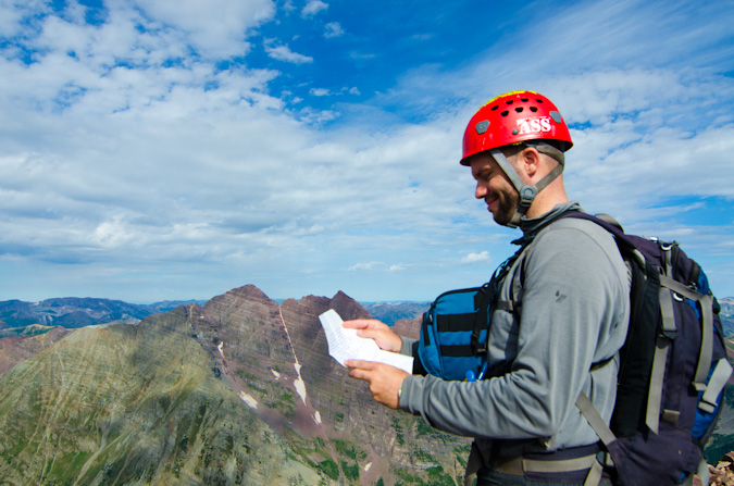
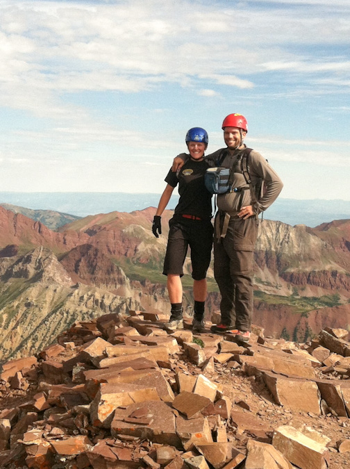
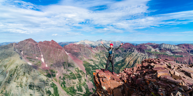
Nerd move! Number 100!
Upon arrival, the first order of business was for Silas to surprise me with a letter written by my mom and dad for Silas to read upon us reaching the summit. It was so incredibly heart-felt and I teared up big time. The video of me reading it is below. Thanks mom and dad!
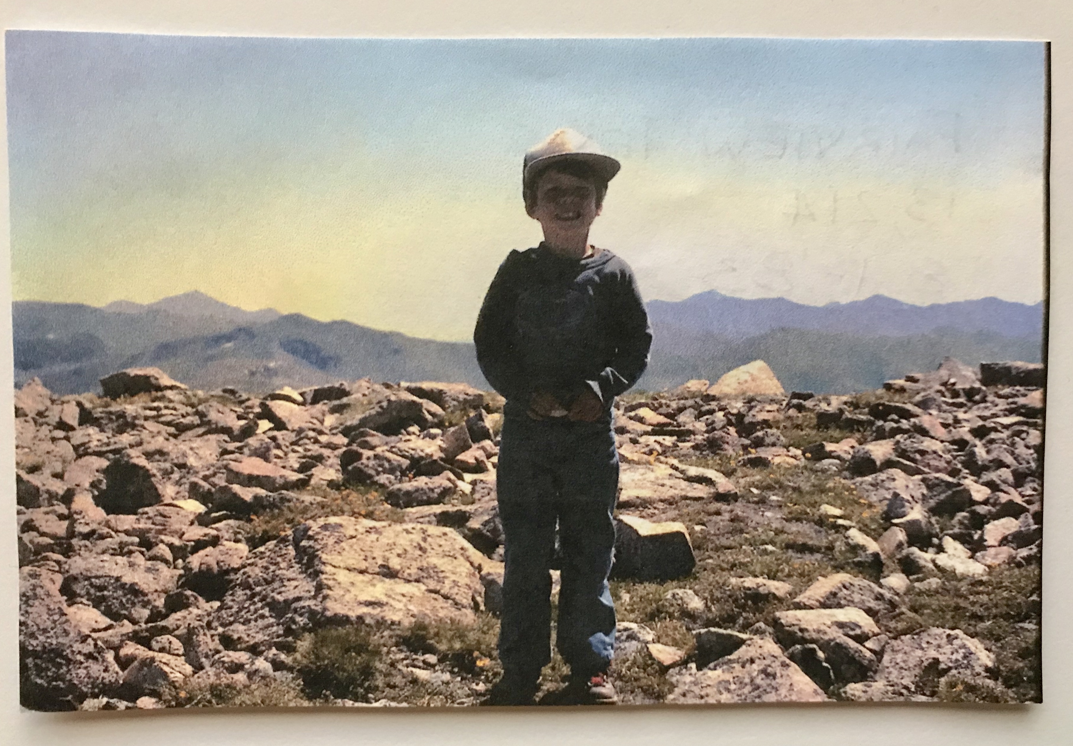
And of course, here's the photo they sent with it - me standing on my first 13er - Fairview Peak at age 4. Good stuff!
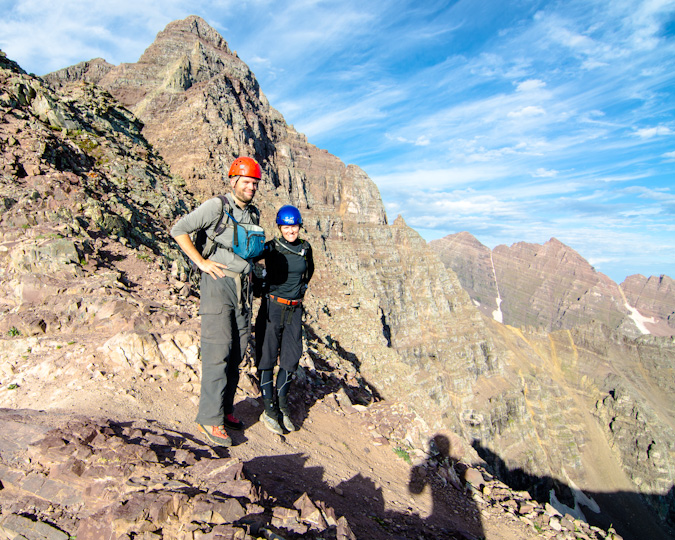
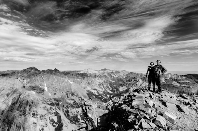
It was so great celebrating this one on top with Silas, who I think was more elated than me!
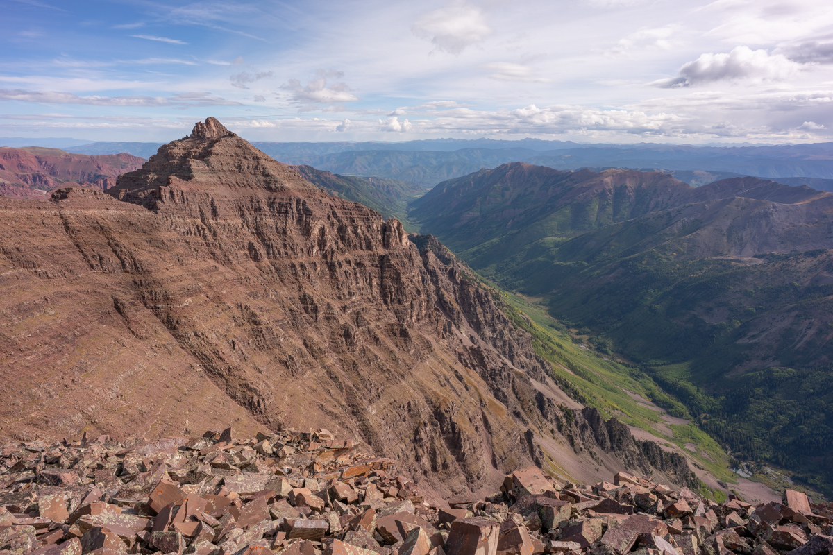
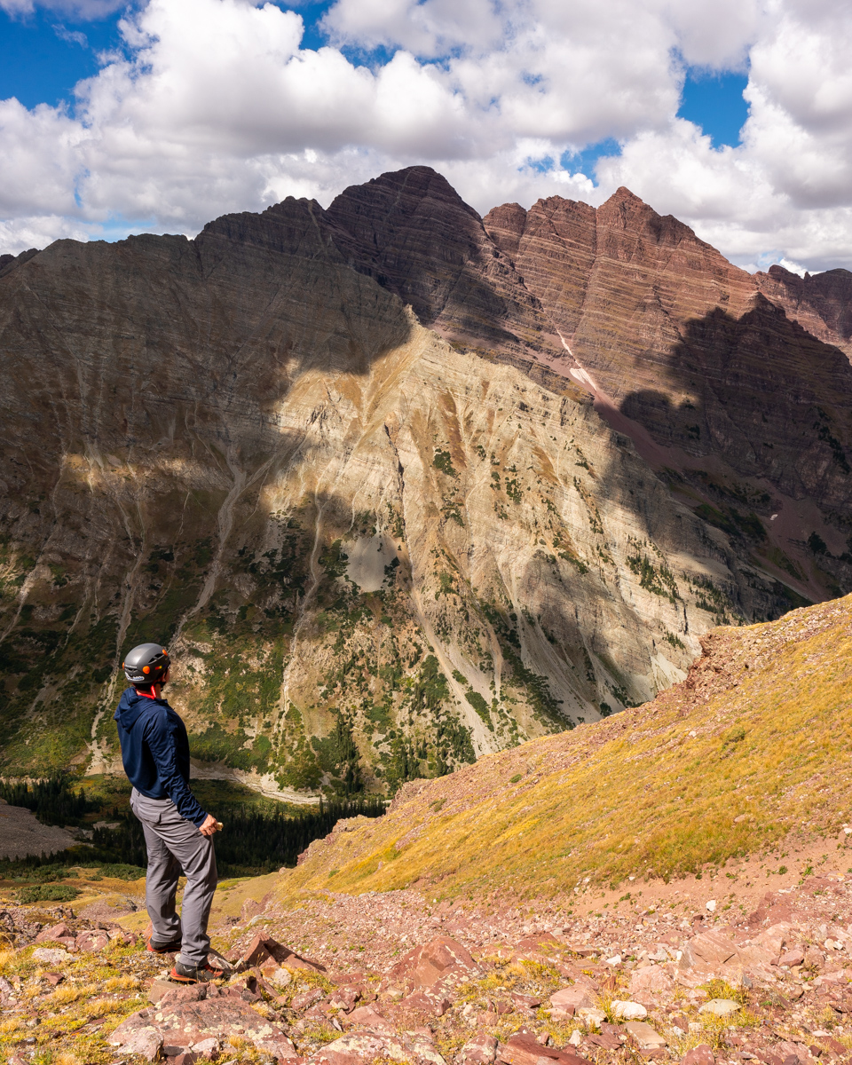
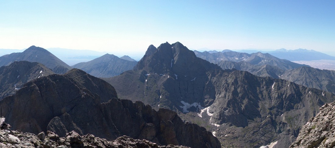
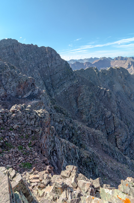
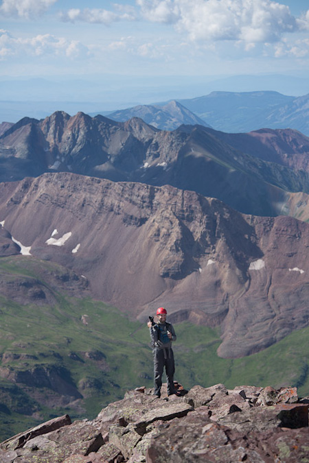
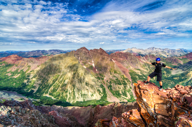
It was also really cool to have a view of Pyramid from here, which I finished the 14ers on in 2012.
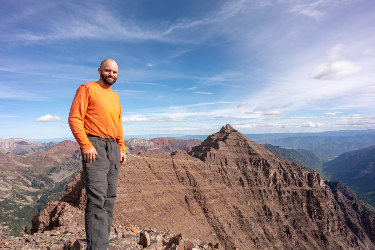
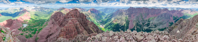
The scale of these mountains is so hard to describe in photos; however, I think adding me to the frame helps.
I had a special surprise for Silas too. I brough my 100summits.com T-shirt with me and a sharpee so he could check off the last box for Thunder Pyramid. What a great feeling!
I wonder why they call these the Pyramids?
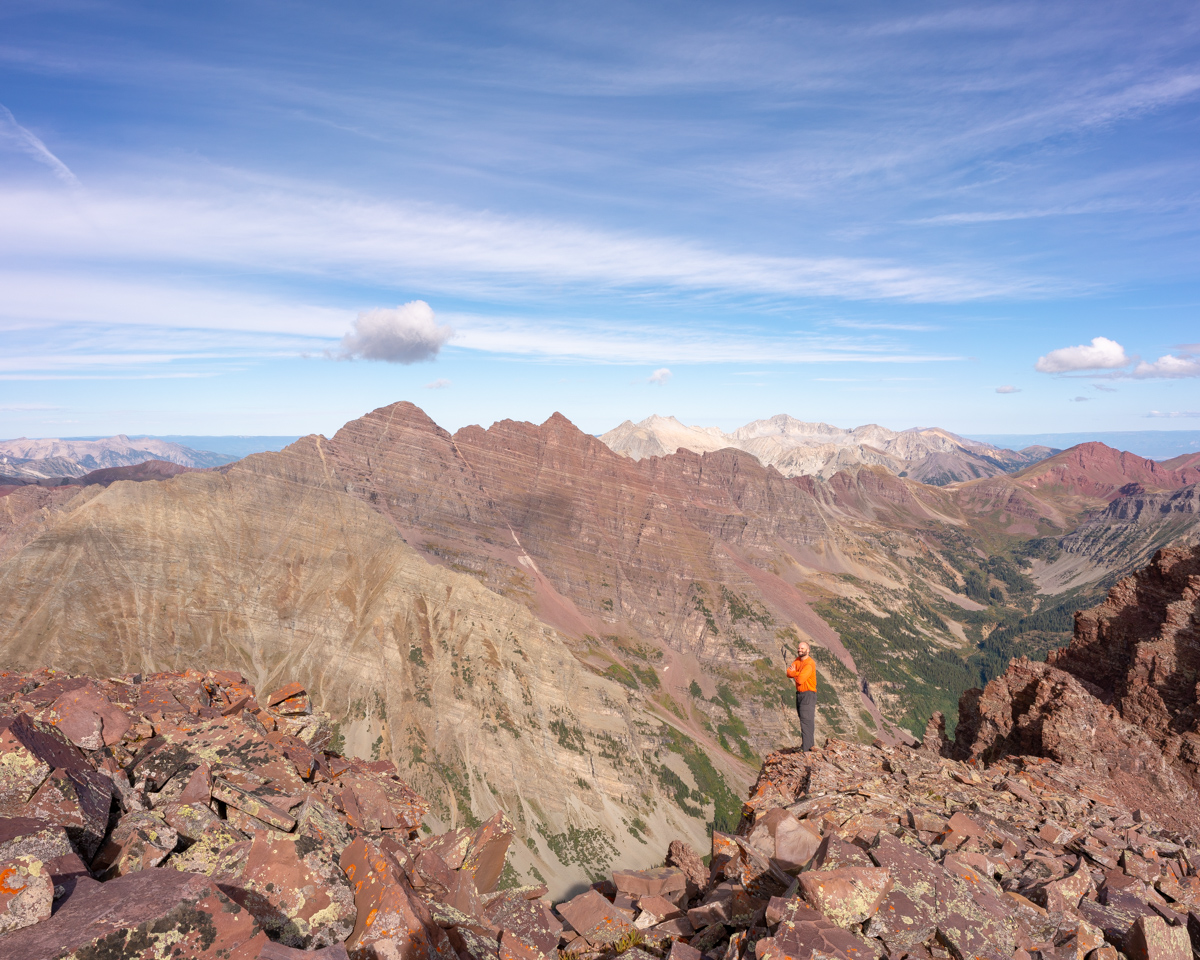
Silas caught me in the act of composing a photo while there. I really wanted something to show off the gnarly rocks in the foreground while including all of the great peaks of the area, so I had to get really low!
And the result:
Another angle:
I felt like I needed a shot of Castle and Condundrum too, even though the light to the east was quite harsh. I think they still look quite formidable from here though. It was crazy to think just a couple weeks ago I was on Cathedral at sunrise looking this direction.
We also noticed a pair of hikers on top of Pyramid. This photo really shows off the scale of that peak well.
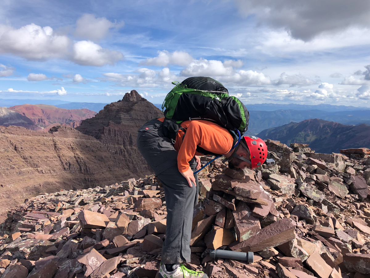
I decided to sign the summit register and have Silas video it for posterity.
I also felt compelled to kiss the top of the mountian for some reason before departing. It was fun Thunder Pyramid - thanks for the ride!
The journey down began and I was still on cloud 9 but knew we needed to be extra safe on the descent. There were sections near the summit that had decent exposure and made Silas quesy to look back at me on the edges. I was like, "what's the big deal?" :-)
Upon reaching the saddle the view down was sobering. It looked incredibly nasty. Fun.
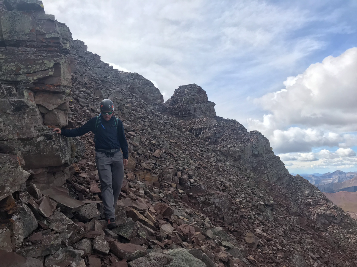
We made our way down carefully, picking mostly the same route as before, except we stayed a bit higher towards the top of the ridge instead of going south into the gully.
The rock here is especially loose and nasty. Great care should be taken to navigate down. I got some fun action shots of Silas in the act.
Don't fall!
Here is a good view of the spot we chose to turn off from the White Gully, only in reverse.
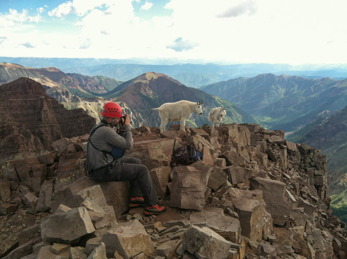
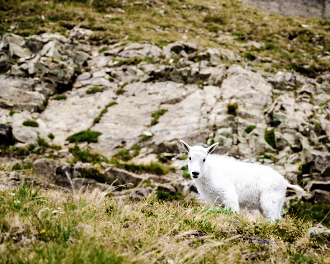
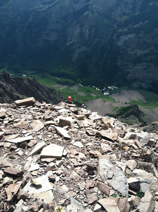
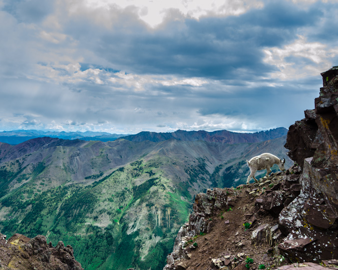
Upon reaching the white gully, we were equally excited and dismayed by the appearance of a mountain goat below us. Despite our efforts, he kept climbing right up the gully towards us and eventually above us. We now not only had to contend with our own rock fall, but also the rock fall from the goat. Fortunately, he did not knock any rocks down on us!
Reaching the bottom of the white gully was a relief, and, we were pleasantly surprised at how well the weather had held up!
I absolutely love the next shot of Silas gazing at North Maroon (which he climbed the following day).
We made it to the turn off for the very first gully and found that dirt/rock section to really suck - here's a good view of Silas entering that section. It was super steep and very unpleasant.
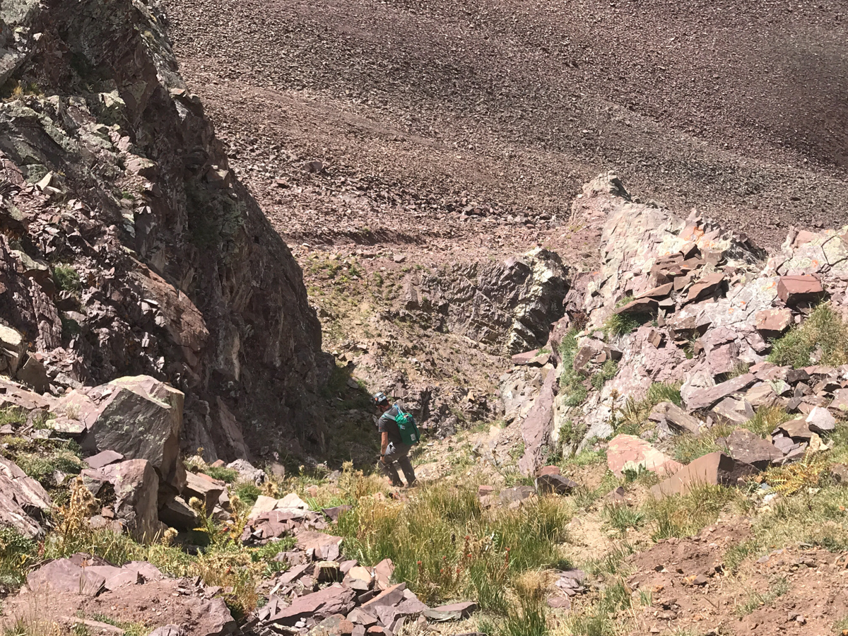
We opted to follow the far left gully to exit, which was much less steep but much more loose and filled with nasty talus. At least the view of Len Shoemaker ridge was good.
Every step in this gully was dangerous. It was a real ankle destroyer.
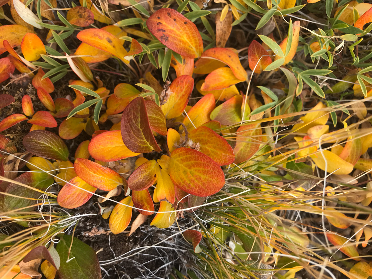
Upon reaching the flat surface below the talus field, we stopped to admire the foliage - the tundra had turned yellow and orange, reminding us that fall had arrived.
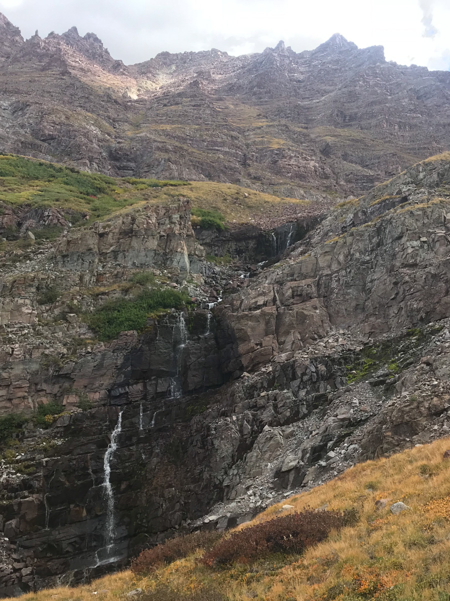
A look back up Thunder Pyramid below some waterfalls we found - a glorious sight indeed.
We picked our way down pretty much following our ascent route - here you can see one of the sections where we navigated below and above two cliff bands by following a nice rocky section.
At treeline we found some very large plastic peices that we think were from a downed helicopter. They appeared to be part of the cockpit and were about 2' by 2' in size. Silas carried them out. We reached the base of the peak without incident! Success! Upon reaching our campsite, we found a Ranger talking to an older gentleman who seemed a bit out of breath. I confirmed it was the father we had told the son to go back to get earlier in the morning. It had apparently taken them this long to get him down to our campite near Crater Lake. He thanked us for helping his son Austin, saying when Austin came back for him, he had fallen asleep. They eventually airlifed them both out from the lake, which quite the specticle to witness. I got some photos and video of the event.
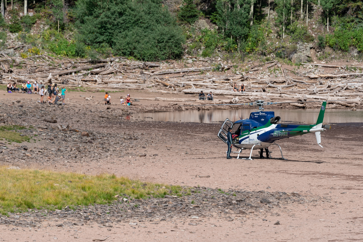
It was impressive seeing the pilots navigate the lake with the helicopter.
Once the drama stopped, I stopped to get some photos of the surrounding area with my telephoto lens. The light in the steep gullies below North Maroon was particularly mesmerizing.
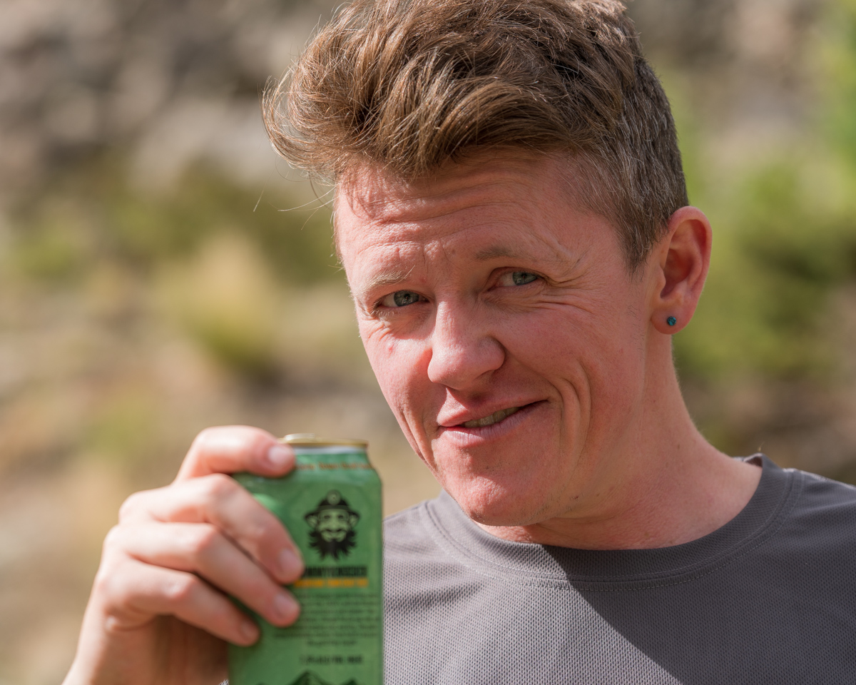
And of course we celebrated with camp beer!
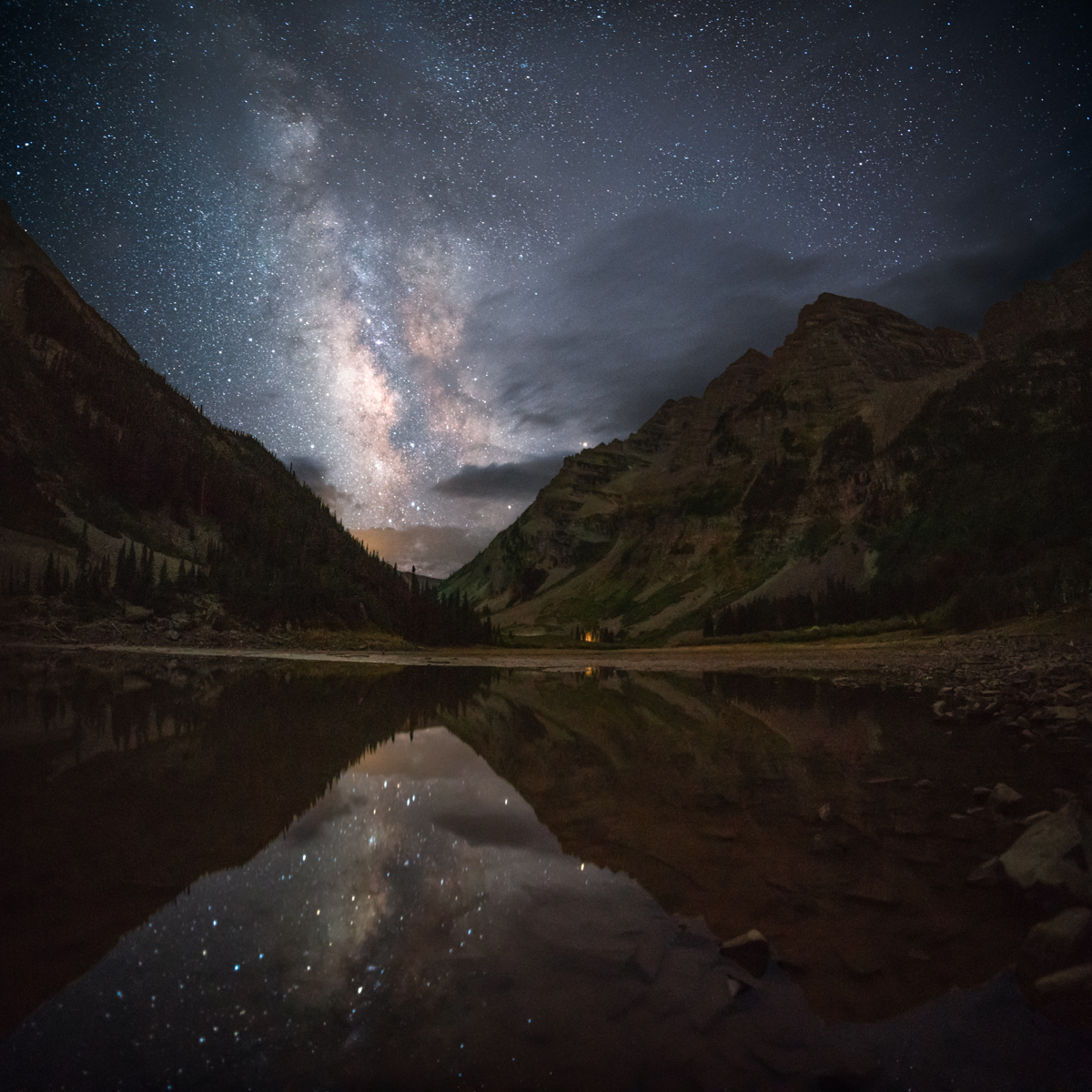
After telling Todd about the climb and settling in for the night at a new campsite, I decided to head down to Crater Lake for some night photos. Using my new 15mm wide angle lens, I was able to get the whole lake, both Bells, and the Sleeping Sexton in one photo. Nice.
I was particularly excited to re-create a photo I shot here several years ago with inferious camera equipment - the Milky Way in the valley gap between the Maroon Bells and Pyramid Peak. I think it was quite the success.
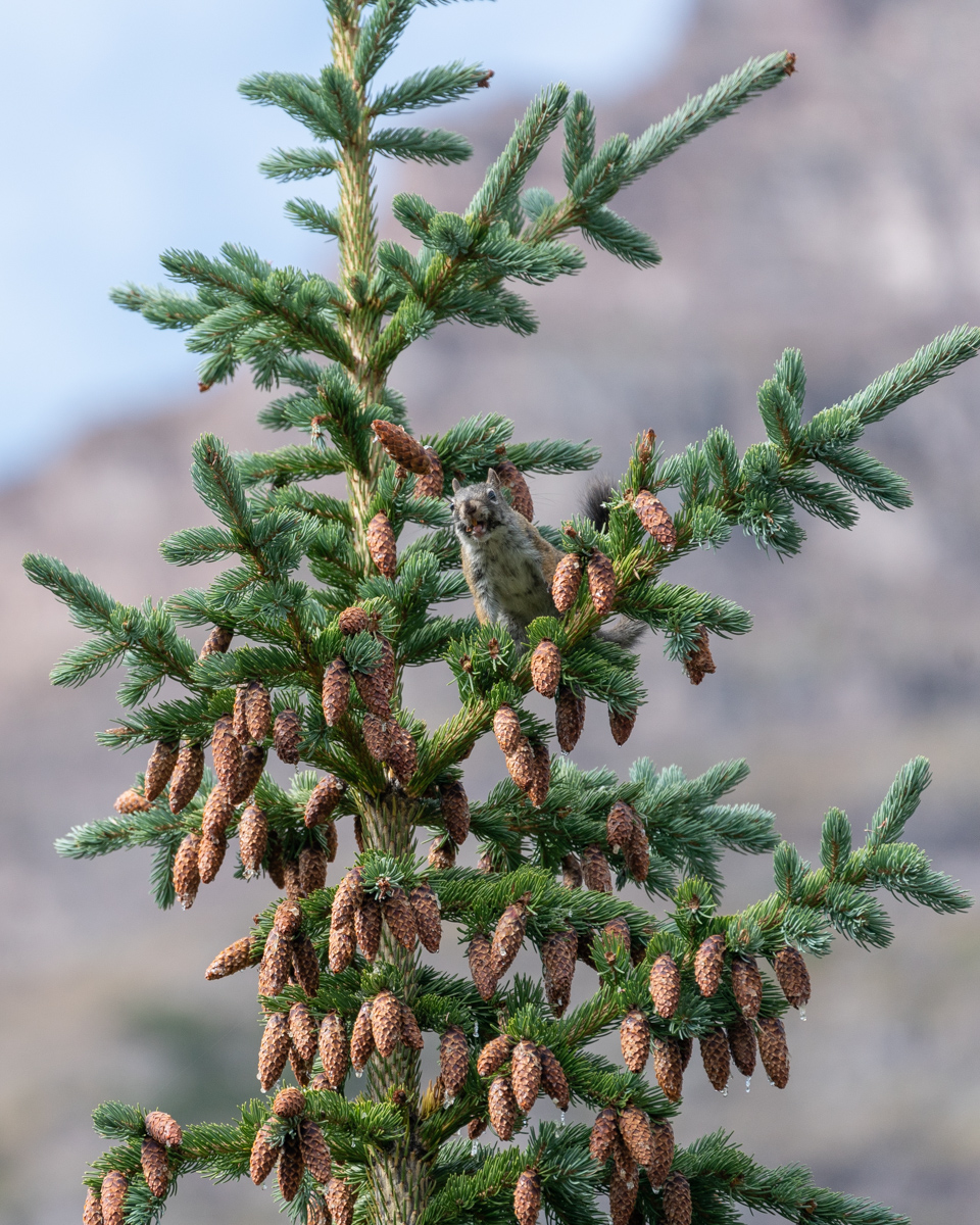
Day 3 - a rest day for me and a climb of North Maroon for Silas. I spent a great deal of the day putzing around with my camera and talking with my friend Todd. We were confronted by a Forest Service Ranger for camping in the wrong location. Apparently the correct site 6 was further back away from the trail than we realized. The sign we camped near said site 6 and was heavily impacted. He forced us to pack up and move to another spot. We were happy to comply. Note - the signage is pretty spotty and not very useful in general. Many camp sites have huge signs saying "restoration in progress, no camping," and others have no signage at all. It is wildly inconsistent and the marked sites are, well, not very well-marked. Noted. Since Silas was away on North Maroon, we had to figure out how to coordinate the move. We packed all of Silas' gear up into his pack and moved to site 8 (which was WAY better, by the way). We came back to site 6 and Silas had just arrived back from North Maroon. Perfect timing! I decided to get some photos of a squirrel that was throwing pine cones on the ground (which is hilarious to watch).
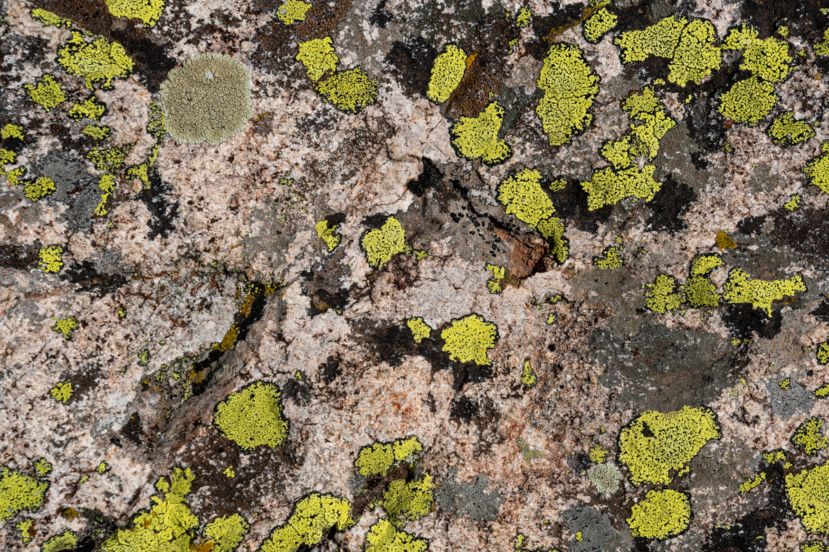
I also decided to get some abstract shots of a rock covered in moss... boring for some, probably, but interesting to me.
And of course, the setting moon was fun to photograph over the Sleeping Sexton.
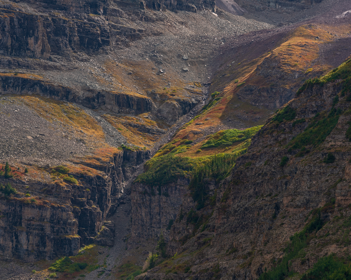
After we all napped in the rain at site 8, I set-off to photograph the area with my telephoto lens. The foliage was just starting to change color and I really enjoyed phtographing the area.
After the rain, there was a significant waterfall that appeared above us below North Maroon, and it was also fun to photograph.
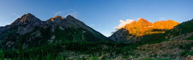
A very large weather system moved into the area around 4 PM and we were glad we were not climbing. I had a vision in my mind of snow being dropped onto Pyramid and Thunder Pyramid during the storm and thought there could be a possibility that the storm would break at sunset and produce some amazing results. I really wanted to commemorate the trip and experience with one last photograph of Pyramid and Thunder Pyramid in these conditions, so I sold Silas on the idea of hiking all the way back up North Maroon's slopes to get a good view of these two peaks at sunset. We hiked in the rain for a couple of hours up the trail for North Maroon, which was pretty miserable. Honestly, who does this?
When we arrived, I stopped at the very long boulder field below North Maroon, which was very wet and slippery. I noticed a climber at the other end of the boulder field who was moving incredibly slowly back down the mountain. He was maybe moving one rock per minute. He was obviously in pain. I later learned his name was Scott and he was from Woodland Park, CO. I yelled out to him.
Matt: "Hey man, are you OK!"
Scott: "Yep, just hurt my ankle and can't put any pressure on it."
Matt: "Do you need any water or Ibuprofen?"
Scott: "I'm good man."
Matt: "Well, I'll wait for you up here to make sure you get down OK."
Scott: "Thanks man, appreciate it."
Silas and I waited below the boulder field for another hour and he still had not come down. I decided to climb back up to the boulder field and found that he was really high above the trail. I went to him and helped him get down to safety, one step at a time. He was badly hurt. We gave him some ibuprofen and wrapped his ankle in an ace bandage and he went on his way down the mountain.
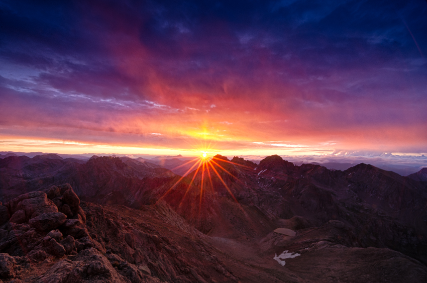
The clouds and light were quite dramatic and I was really holding out hope that the clouds would break for just a minute to light up the peaks with alpenglow.
Alas, my wish was granted! I was so elated! Silas caught the whole thing on video.
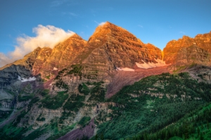
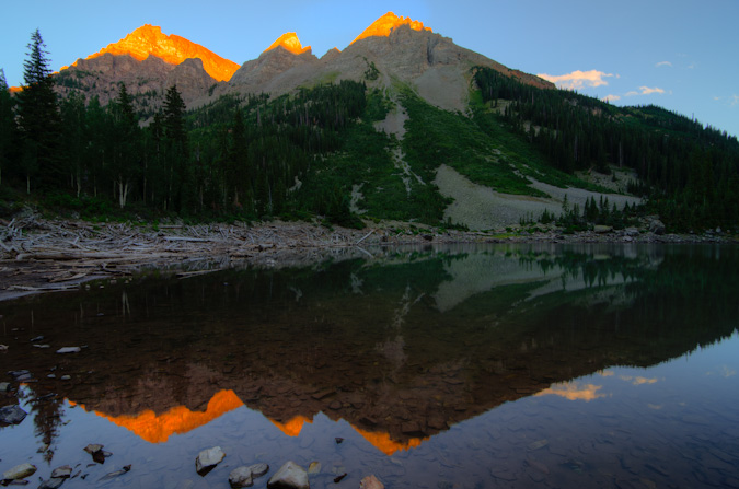
I really loved this scene. Not the best, compositionally, but damn, the light! Pyramid and Thunder Pyramid covered in snow with alpenglow, just as I had envisioned. Yes!
I am really proud of this image. I had the vision. I had the perseverence to try to get it. I was prepared. Execution was good too. Hallelujuah, this is what its all about for landscape photographers!
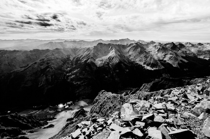
The light to the north was pretty great too! Looking down on Crater Lake and Maroon Lake was quite a treat.
After sunset, we left. On the way down, we ran into three hunters, a father and two sons who were hunting Mountain goats. They said they saw our injured hiker earlier and he was doing OK. Good! We returned to camp very late and ate a very late dinner and had beers. What a great trip! The next morning, we packed up and head out at 10 AM. Naturally, upon arriving at Maroon Lake, the shit-show of tourists not obeying the Forest Service signs was even worse. I loudly but politely asked several parties to not cross the rope and that they should read the sign. I bet the forest service hates this new system. I can't imagine policing it 24/7.
I think I looked pretty menacing with the plastic helicopter cockpit part we found...
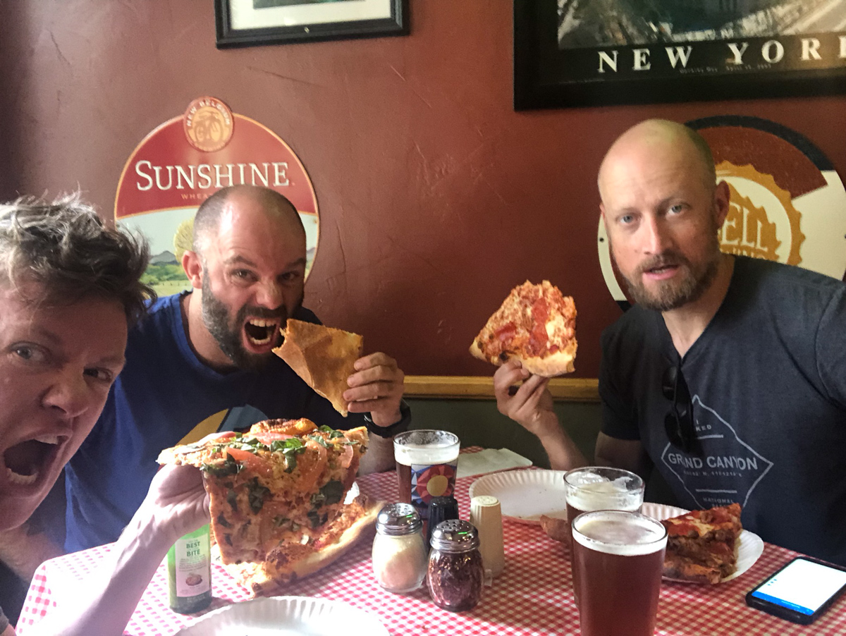
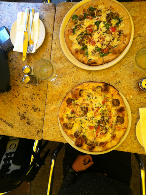
A successful trip deserves a trip for beer and pizza. We stopped at NY Pizza in Aspen for our celebration meal.
Wow, that concludes this report. My final Centennial!
A few thanks are in order -
Thanks to Silas Musick for being such an amazing climbing partner. We celebrated on 14 of those 100 summits together and I consider you my best friend - all because of our mutual passion for mountains and the outdoors. You're a beautiful human.
Thanks to Natalie Moran for taking me up Jagged, Dallas, and Teakettle. You're a fabulous climber and a great person.
Thanks to Terry Matthews (RIP) for accompanying me on my first class 3 climbs in 2008 when I got back into this pursuit. You are missed.
Thanks to Ethan Beute - our climbs on obscure 13ers kept me going - miss you man!
Thanks to Regina Primavera - you're a great friend and it has been fun catching summits with you since 2011.
And lastly, thanks to my parents for getting me going on this crazy journey 35 years ago. The photo Silas posted was actually my first 13er - Fairview Peak - I was 4 yrs old.
I created my little website in 2009 mostly to teach myself how to build one but also to document and share my journey with my friends and family. I know my dad regrets not having something similar to look back on. Hope it’s at least been somewhat useful to others as well.
Next up? I have no idea. I don't think it’s the bi-centennials.
I have some photography projects I want to tackle, including a book of photos of the Centennials...
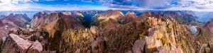
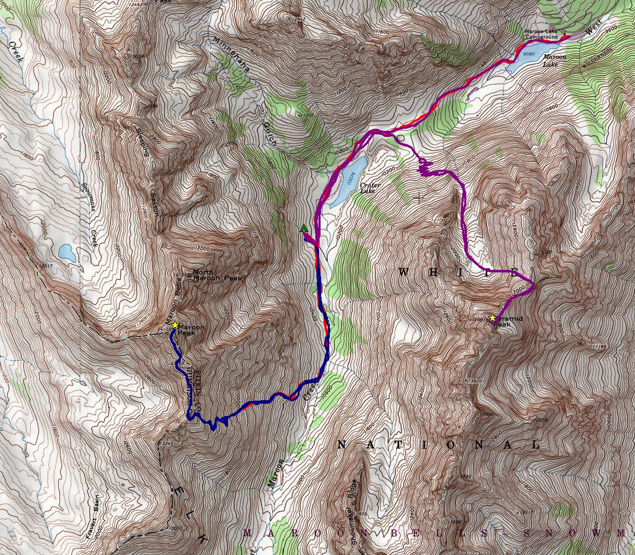
Here is a photo that might help folks see the general route we took:
And a link to the Gaia GPS track:
Colorado's 12 Hardest 14ers to Climb
Colorado's Fourteeners (14ers) are legendary. Each of the 53 ranked peaks offers unique challenges and rewards. They are the some of the most amazing mountains in the world and have been the number one object of adoration for hundreds of thousands of Coloradoans. Indeed, according to the Colorado Fourteeners Initiative (CFI), approximately half a million people attempt to climb a fourteener each year. Climbing 14ers is a dangerous activity; however, good planning, fitness, and awareness of the potential hazards will provide climbers with good opportunities to accomplish these monsterous peaks. Each year I'm usually asked one of two questions - which 14ers are the easiest; and, which 14ers are the hardest? I decided to lay out the hardest 14ers here for you in this article. Let me know how I did based on your own experience. Lastly, it might be a good idea to arm yourself with the most up-to-date information about mountaineering accidents in Colorado. Who knows, reading about these tragic events may just save your life. Additionally, I highly recommend obtaining GaiaGPS for your phone. It allows you to see your track and location on a USGS map overlay even in airplane mode. It has saved me so many times. You can purchase it here and help support the site.
While it may make sense to simply use the only existing data available regarding mountaineering accidents in Colorado to determine 14er difficulty, my experience has been that the difficulty of a peak is more than just cold, hard facts. Indeed, Longs Peak is not nearly as difficult as, say, Capitol Peak; however, it has far more accidents due to the sheer number of inexperienced and/or unaccomplished people attempting it each year. With that being said, I'm going to use a mixture of my personal experience and some subjective ratings to present my case to you. For these ratings it is assumed that the climber is approaching via the standard route in "normal" conditions. I've intentionally left out un-ranked 14ers such as North Maroon and El Diente - assume they can be bundled with Maroon Peak and Mount Wilson, respectively. Additionally, consideration of any traverses between 14ers was not considered for these ratings.
I will rate each mountain's difficulty ranking based on four equally weighted variables:
1. Sustained difficulty: this rating establishes the peak's sustained difficulty over the course of the entire climb
2. Most difficult section: this rating establishes the difficulty of the peak's most difficult section
3. Terrain: this rating establishes the difficulty of the peak's overall terrain, taking exposure and looseness of rock into account
4. Access: this rating establishes the difficulty to reach this peak or how long it takes to get to the top
Feel free to let me know if you disagree with my ratings!
#1. Capitol Peak
While Capitol Peak has only seen two deaths since 2010 compared to five on Longs Peak (as of August 2014), it is arguably the most difficult 14er in Colorado, as I attested in my 2010 trip report. As pictured above in the panoramic taken between Capitol Peak and K2 near the infamous Knife Edge, the terrain is rugged, exposed, loose and dangerous. Not only does Capitol Peak have some very difficult sections, it has, in my opinion, the highest sustained difficulty out of any of the 14ers. The climb up Capitol is relentless and requires mountainners to focus on the mountain's terrain for a very long period of time. There are very few breaks to be had and simple mistakes can and do prove to be fatal. Additionally, Capitol Peak requires a lot of time to accomplish and once you are past the knife edge, you are committed to at least two hours more of climbing. This makes the mountain especially mentally taxing as those are two hours straight of focused climbing on rugged terrain where you also have to keep a keen eye on the weather. Lastly, access to Capitol, while doable in a single day, usually requires an arduous backpacking trip to Capitol Lake and a very early start on a subsequent day. Let's see how Capitol Peak rates in the four domains:
| Sustained Difficulty: 10/10 | |
| Most difficult section: 9/10 | |
| Terrain: 10/10 | |
| Access: 9/10 | |
| Total: 38/40 |
#2. Mount Wilson
Mount Wilson is easily one of the most challenging 14ers in Colorado to climb - the standard route, while mostly straight-forward, has many difficult sections of very loose rock at the summit. The summit block itself has stopped many people in their tracks, just a few feet from the summit. The exposure there is intense and not for the feint of heart. Examples of this can be seen in my trip report from 2011. In addition to the tremendous exposure found on the summit block, Mount Wilson's approach from the Rock of Ages trailhead is fairly long and quite committing, with a lot of up-and-down climbing (unless approached from Kilpacker Basin or Navajo Basin). The difficult section of climbing found on the upper 1/3 of the route is difficult to negotiate and offers many challenges for climbers of all levels. The rock on Mount Wilson is extremely loose and many people have perished on the slopes between Mount Wilson and the un-ranked beast to the west - El Diente.
| Sustained Difficulty: 10/10 | |
| Most difficult section: 9/10 | |
| Terrain: 10/10 | |
| Access: 7/10 | |
| Total: 36/40 |
#3. Little Bear Peak

Out of all of the Fourteeners, Little Bear Peak is quite possibly my least favorite and least likely to be something I'd like to repeat. The approach is terrible - either a long slog on a rocky road in hot weather or an insane jeep ride over some of Colorado's toughest jeep obstacles (OK - those are kind of awesome). My ascent in 2010 was quite memorable, notably - the infamous "Hourglass" section just about scared me to death. Many people have perished in the Hourglass over the years, including one of the most memorable deaths in the past 5 years - Kevin Hayne. The Hourglass presents some very difficult climbing, with few good hand-holds and potentially fatal ice and water sections, not to mention the hazard of frequent rockfall from above. While Little Bear Peak is very straight-forward and mostly an easy climb, the Hourglass section marks it as one of the toughest mountains around.
| Sustained Difficulty: 6/10 | |
| Most difficult section: 10/10 | |
| Terrain: 10/10 | |
| Access: 7/10 | |
| Total: 33/40 |
#4. Pyramid Peak

Pyramid Peak, while not having many known fatalities, presents some truly heinous climbing obstacles, especially in wet conditions. The rock in the Elk Mountains is notoriously loose and nasty - making it very suspect in down-climbs and even more dangerous in rain or snow. The approach to Pyramid is fairly straightforward, albeit somewhat long and committing once above tree-line. The terrain on Pyramid is steep almost the entire climb and once above tree-line the mountain demands your concentration for the duration. While Pyramid is likely one of my favorite climbs of all time, it is not for a beginner climber and should be taking quite seriously. Of course, the views from the summit are to die for.
| Sustained Difficulty: 8/10 | |
| Most difficult section: 8/10 | |
| Terrain: 9/10 | |
| Access: 6/10 | |
| Total: 31/40 |
#5. Maroon Peak

The photo above was taken from the summit of Pyramid Peak looking out across the valley at the Maroon Bells and their insane stature. The whole area is steep and impressive, which comes with some inherent dangers and difficulties. The Maroon Bells have claimed many lives through the years and are certainly some of the most dangerous mountains in America. Of particular note, the traverse between Maroon Peak and North Maroon has claimed several victims and is a force to be reckoned with. Maroon Peak is a steep monstrosity full of beauty and loose rock as well as an intricate network of rocks, spires and falling rock that a blessing and a curse. Maroon Peak holds some of Colorado's worst rock and even the most experienced climbers have been subdued by the dangerous terrain found there.
| Sustained Difficulty: 8/10 | |
| Most difficult section: 8/10 | |
| Terrain: 9/10 | |
| Access: 6/10 | |
| Total: 30/40 |
#6. Snowmass Mountain

Snowmass Mountain is usually climbed in the early months of summer, when the face of the mountain is mostly covered in snow, making for somewhat easier travel up the snow in crampons; however, the rock beneath the snow is quite loose and is constantly shifting due to erosion. Indeed, Snowmass has proved to be particularly dangerous in the past few years due to these shifting conditions and has claimed a couple lives in the past 5 years. Snowmass' upper slopes contains large white boulders that look secure but are often quite loose and came come crashing down at any moment. The approach on all routes of Snowmass requires quite a bit of travel, which increases the difficulty.
| Sustained Difficulty: 8/10 | |
| Most difficult section: 6/10 | |
| Terrain: 7/10 | |
| Access: 8/10 | |
| Total: 29/40 |
#7. Sunlight Peak
Sunlight Peak is one of the few 14ers requiring class 4 climbing to reach the summit and is generally preceded by a very long backpacking trip and a steep ascent into the Twin Lake basin. Terrain in the Chicago Basin where Sunlight resides is notoriously loose and dangerous as well as highly susceptible to frequent and quickly changing extreme weather conditions. The summit block of Sunlight presents a particularly interesting challenge for climbers and many people skip the summit block altogether if there is any moisture on the rock. Many people may rate Sunlight's next door neighbor, Windom Peak, as being the more difficult of the two; however, I personally found Sunlight to have more challenging route-finding and climbing requirements. Since Sunlight is often paired with Eolus and Windom on the same day and often as the last peak climbed, it presents even more inherent danger as many climbers attempting it are more exhausted than if doing Sunlight on its own.
| Sustained Difficulty: 7/10 | |
| Most difficult section: 8/10 | |
| Terrain: 6/10 | |
| Access: 8/10 | |
| Total: 29/40 |
#8. Crestone Needle

Coming in at number 8 on my list of Colorado's most difficult 14ers to climb is the venerable, impressive and just-plain-freaking-awesome Crestone Needle - my favorite 14er of all. The standard route of Crestone Needle brings you up a steep approach and then plants you right in a series of difficult route-finding challenges and some of the steepest yet most solid rock there is. Even though the rock is quite solid and sturdy, make no mistake - an error in judgement would likly prove fatal, especially in severe weather conditions. Indeed, Crestone Needle has claimed many lives and is a surely one of the most dangerous peaks in the Sangre de Cristo Range. Most approachs require a backpack trip or a very early start and once above tree-line the terrain is quite extreme.
| Sustained Difficulty: 7/10 | |
| Most difficult section: 7/10 | |
| Terrain: 9/10 | |
| Access: 5/10 | |
| Total: 28/40 |
#9. Longs Peak
Longs Peak, located within the heart of Rocky Mountain National Park, is likely Colorado's most frequently visited mountain other than perhaps Greys and Torreys. This mountain's location in a National Park makes it a very popular destination by people from all over the world and it often lures inexperienced climbers on its more dangerous upper sections where people find themselves ill-equipped to complete the climb, both mentally and physically. Perhaps the most notable part of Longs Peak's approach is the sheer length of the climb, a full-day affair to be sure. A simple google search of Longs Peak deaths will just tell you how dangerous this peak really is, especially on the upper areas such as the Narrows and the Trough. Additional hazards plaguing this peak are the frequent deposits of snow and ice early and late in the climbing season that often contribute to the dangerous nature of the climb.
| Sustained Difficulty: 9/10 | |
| Most difficult section: 6/10 | |
| Terrain: 8/10 | |
| Access: 5/10 | |
| Total: 28/40 |
#10. Kit Carson Mountain
Kit Carson Mountain is one of the Sangre de Cristo giants located right by Crestone Peak and Crestone Needle. The approach to Kit Carson's standard route involves a lengthy backpacking trip and an ascent over the less impressive, albeit quite steep 14er, Challenger Point. The steep approach, coupled with a downclimb mired in confusion and difficult route-finding, makes Kit Carson quite eligible for this list. Several climbers have perished on Kit Carson in recent years, almost always due to off-route climbing.
| Sustained Difficulty: 8/10 | |
| Most difficult section: 6/10 | |
| Terrain: 6/10 | |
| Access: 7/10 | |
| Total: 27/40 |
#11. Mount Eolus
Mount Eolus marks the second of the Chicago Basin 14ers to make this list and arguably the more difficult of the three, despite my lower rating here. Eolus' "Catwalk" and steep, confusing route on the upper third of the mountain make it a top contender. The approach for Eolus is quite taxing as well and many climbers reaching the upper sections of Eolus find themselves out of energy and weakened - a terrible combination when paired with the rugged and loose terrain of the San Juan Mountains.
| Sustained Difficulty: 6/10 | |
| Most difficult section: 7/10 | |
| Terrain: 6/10 | |
| Access: 8/10 | |
| Total: 27/40 |
#12. Crestone Peak
Crestone Peak has single-handedly claimed many climbers' lives over the past several years due to the loose and difficult terrain found on the upper sections of the mountain. While the mountain's standard route is mostly straight-forward, there are certainly sections that demand one's full attention and good climbing skills in order to ensure a successful summit. Like Crestone Needle, Crestone Peak's approach is a very long day up very steep trails and rock formations, increasing the difficulty of this impressive peak found in the awesome Sangre de Cristo Mountains.
| Sustained Difficulty: 6/10 | |
| Most difficult section: 7/10 | |
| Terrain: 6/10 | |
| Access: 8/10 | |
| Total: 27/40 |
How did I do? Would you have rated them differently? How so? I'd love to hear your thoughts!
2013 Colorado Mountaineering Deaths - A Review

2012 Colorado Mountaineering Deaths - A Review
Maroon Peak and Pyramid Peak - finishing a goal 27 years in the making
Two amazing summits; 11,060 ft. elevation gain, 21.5 miles... and a whole lotta' fun.
Introduction
Last year, I had plans to complete my long quest to climb all of Colorado’s 14ers. I had the calendar all lined up, trips planned, gear ready and my legs were in great shape. If all went to plan, I was to finish on Windom Peak after a long summer of knocking out some of Colorado’s toughest peaks. Unfortunately, as is so common in this sport of mountaineering and peak-bagging, those plans were interrupted. An unsuccessful attempt on Snowmass Mountain in June left me with one less weekend available. A complete re-arrangement of the calendar ensued and for the third straight year, my plans of climbing Maroon Peak and Pyramid Peak were delayed. However, this worked out to my advantage – as I had always dreamed of completing the 14ers on Maroon Peak and then on Pyramid Peak, which purportedly is one of the most difficult mountains as well as one of the most rewarding summits. Finally, my time had come to complete this incredible journey that started when I was six-years-old – the completion of the 14ers. Lots of hard work over the past 3 years have culminated in this moment.
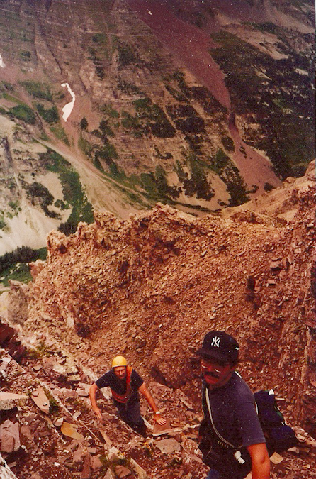
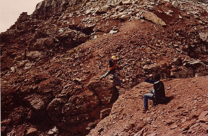
Ever since I was a child, I recall being mesmerized by the Maroon Bells, for both their scenic wonder and beauty and their dangerous mystique. My dad, Ray Payne, climbed the Bells back in August 1987 and returned home regaling his conquest with stories of incredible mountaineering feats (it must have sounded insane to my then 9-year-old ears) and near-death encounters with “The Deadly Bells.” Here's an old-school shot of my dad (yellow helmet) asending Pyramid Peak, rope in tow.
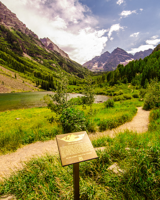
Per Wikipedia (and per my own witness of the sign), the term “Deadly Bells” refers to a U.S. Forest Service sign on the Maroon Lake access trail which calls the mountains "The Deadly Bells" and warns would-be climbers of "downsloping, loose, rotten and unstable" rock that "kills without warning". Sounds like my kind of mountain! Unlike other mountains in Colorado, the Maroon Bells are composed of metamorphic sedimentary mudstone that has hardened into rock over millions of years. This mudstone is weak and fractures readily, giving rise to dangerously loose rock along almost any route. This same mudstone is responsible for the Bells' famous and distinctive maroon color. The Bells got their "deadly" name in 1965 when eight people died in five separate accidents. Since then, many climbers have perished while attempting these dangerous peaks, including Spencer James Nelson in 2010.
In fact, just before leaving for this trip, I had learned that there was a missing hiker on the Maroon Bells. This news had cast a shadow on the trip and I had hoped he was found safely. The hiker was a New York City Paramedic named Lenny and had not reported to work. It later turned out that he took a fall and perished on North Maroon and was found the very same day we arrived.
Given the danger factor and overall awesome factor surrounding the fact that I was planning to complete the 14ers on these deadly mountains, I was quite nervous the week leading up to this trip. I think I had started packing four or five days before the trip, which is uncommon for even me and my neurotic trip planning. To make matters even worse, the trip had quite a few loose ends on the logistics side of things – originally I had planned to head-out Tuesday night with my climbing partner, Sarah, we’d climb some mountains, and then our other climbing partner, Ethan, would join us at Crater Lake on either Saturday or Sunday. Then a few wrenches got thrown into the mix – Sarah found out she had to work a cycling event on Sunday, and Ethan would be unable to join us on Friday. To make matters even more interesting, my Jeep Wrangler came up with some mechanical issues the day before we were supposed to leave. It was not looking good for team Payne. I called Sarah and we finally worked out all the details. Ethan would not be joining us after-all, and Sarah could drive. Crisis averted.
I decided to backpack using my Osprey Talon 44 instead of my regular backpacking pack – the huge and insane discontinued Dana Design Terraplane - a monstrous 95 Liter pack. Instead, I opted for the smaller 44 Liter pack so that I would force myself to take less gear and food and hopefully save some damage to my knees, which were still recovering from the massive 45 mile trip Sarah and I took last year to the Chicago Basin. To round things out, I opted to also purchase a knee brace, in hopes of preventing pain and further damage on this trip.
Choosing camera equipment for a trip such as this was a challenge, especially given the fact that I wanted to keep my over-all weight low without sacrificing my ability to take great photos. So, I opted to bring my Gitzo carbon-fiber tripod (which is quite solid and somewhat heavy despite being crafted out of carbon-fiber), Nikon D7000, a few filters, a shutter release cable (for long exposures), and two lenses – the Tokina 11-16 f/2.8 and the Nikkor 18-105 VR f/3.5-5.6. This would give me the ability to shoot very wide shots and some versatility with a zoom in the 18-105.
Day 1: The drive in
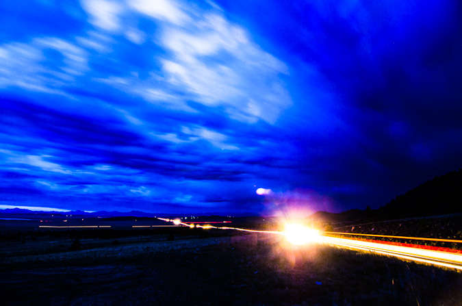
Loaded-up and ready to rock – Sarah picked me up from my house in Colorado Springs at 7 PM. We departed for our speedy adventure up Highway 24, which afforded us some pretty gruesome views of the damage caused by the Waldo Canyon Fire just the month prior. We stopped at the top of Wilkerson Pass to check-out the remnants of a thunderstorm there, hoping to capture some of that footage on film; however, all I was able to get was a long exposure of the cars driving through South Park below.
Thanks to some recon data provided by 14ers.com member Bill Wood, I knew our goal was to find the over-night parking lot just below the Maroon Lake trailhead. We found that lot at around midnight and prepared for what would become a very short 4-hour nap in the back of Sarah’s skinny pick-up truck.
Day 2: The backpack in to Crater Lake and an attempt on Maroon Peak
We were rudely awoken at around 3:45 AM by some guys next to us prepping for their hike, who were loud and even making jokes about how we were probably not too happy about how loud they were. Such is life at popular 14er trailheads, even on a Wednesday morning. We debated the night before about our intents and goals for this first day in the area, and decided to wake-up at a reasonable time (4:30 AM) to begin backpacking up into the basin to find a campsite, with the option to attempt Maroon Peak (weather dependent). We rose groggily from the truck and prepared our backpacks, which for me is always an interesting challenge with a large tripod attached. We began the hike in the dark and were passed quickly by a solo hiker looking to tackle Pyramid Peak by himself. Best of luck to that guy. The hike up towards Crater Lake was quite uneventful, and after a quick 1.5 miles, we stopped shortly before sunrise so I could quickly bushwhack up a hillside to photograph the Maroon Bells while the light was good. I did several versions at various focal lengths and lighting.
During this photo shoot, I made a nearly dire mistake when I switched lenses. I put my Tokina in my camera bag, which was attached to my chest. I forgot to zip it up, so when I leaned over, the lens rolled out onto the rocks. Fortunately, absolutely no damage was done. Close call!
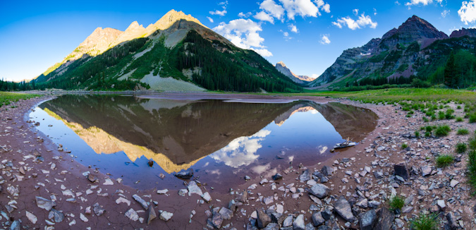
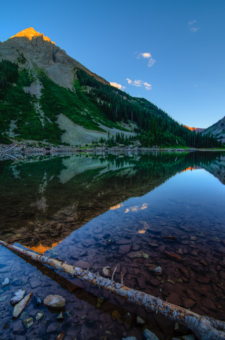
After shooting sunrise at the Maroon Bells, we made our way up the rest of the way to Crater Lake, where we would try to locate a campsite. Upon first arrival at the lake, the reflections of the Maroon Bells in the very still water and post-sunrise light were absolutely fantastic.
A wider view, including the Pyramid Peak massif:
The search for a campsite was on, and I had been given some good tips from Bill Wood that we should shoot for campsites 6-11. We finally landed on campsite 9, slightly south and west of Crater Lake on a large hillside. Sarah later joked it was no wonder the campsite was open, because you have to hike up a hill away from the water to reach it.
We quickly made camp, setting-up the tent and all of our stuff, and finally had summit packs ready by 8 AM. Not exactly the best start time for a 14er of Maroon’s caliber, but we thought we’d give it a shot either way, so off we went. We followed the trail quite a long ways up the valley to the south and reached the oh-so recognizable warped tree described by the 14ers.com guide.
After the tree, the real work was before us, and the Maroon Peak southeast slopes trail lay before us in all of its steep glory. The trail started quite steeply, much like the Manitou Incline.
We reached well above tree-line before my stomach started to really give me issues. I could not figure out why I was not feeling well, so we stopped at around 12,400 ft. This turned out to work out just fine, because weather was starting to build above, the clouds that were hanging low all morning had never really left. I later figured out that the culprit to my stomach issue was the Cliff Bar Builder’s Bar I had ate.
Sarah and I sat around for a bit, contemplating our options.
We had picked a pretty great place to stop. The views in all directions were great. We did not feel rushed at all.
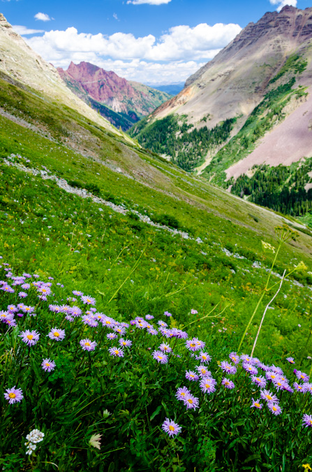
Even though my stomach was in pain, we found ourselves near a large meadow of wildflowers, which made for some fun photography.
It was a really cool spot, and since it seemed were not going to do any more climbing, I took the liberty of taking a ton of shots.
We headed on down and later ran into a group of three guys coming down as well. They were attempting Maroon as well and were turned back due to the weather just short of the ridge. These three guys were very cool, and we had a nice conversation about the area and climbing the Centennials. We all headed on down to the main trail, where we intersected two more hikers coming up to investigate the location of the Maroon Peak trail turn-off. This would not be our last encounter with these two guys, as we would later run into them twice more the following day.
Sarah and I hiked back to camp and took naps. After our short naps, we cooked up some food and I prepared my camera equipment for a walk down to Crater Lake for sunset shots and later night photography.
Upon arriving at the lake, I was immediately in my happy place, having many quite interesting landscape shots to attempt. I waited for the sun to set and the magic started to happen, lighting up the tips of the surrounding mountains to our East, which were part of the Pyramid Peak massif. I also tried out my ND filter and did some longer exposures of the clouds and Maroon Peak.
Sarah was able to sneak a shot of me geeking out on my camera.
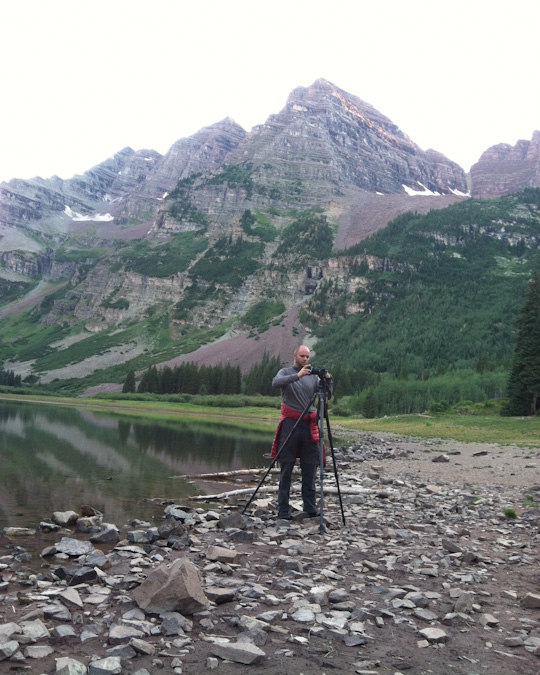
Composing the shot...
The sun was setting and the light started doing its thing.
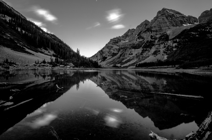
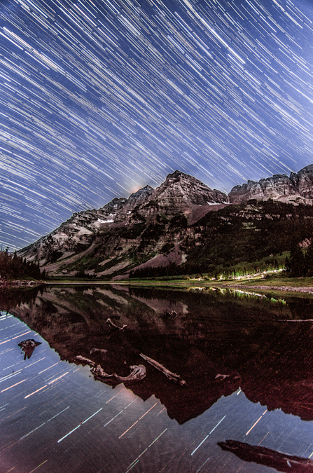
After the sun went down, Sarah went back to the tent to get some sleep. I stayed out and set-up for something I had been planning for a long time - star trails over the Maroon Bells, reflected in Crater Lake. This worked out pretty nicely, there was a group hiking in the dark up the trail and so my long exposures got their head lamps in the shot too, which I opted to keep in. The "break" in the trails is from my intervalometer stopping unexpectedly on me and me having to restart the sequence. Bummer! Still turned out great though, I think. You can see where the moon had just set over Maroon Peak's upper left cliff bands.
While photographing the star trails using the intervalometer on my camera, two sets of eyes appeared near me at the lake. I rose and walked closer to find two deer, one a quite large buck. I was both relieved and amazed. I’m not really sure how well I could defend myself against a mountain lion.
After shooting star trails above the Maroon Bells, I took advantage of the scene and clear night and took some fantastic shots of the Milky Way. My two favorite was this single shot of the Milky Way reflected in the lake, and the next one, which is a 9-shot panoramic of the Milky Way above the Pyramid Peak massif. Click on the single shot if you'd like to learn more or purchase it.
I just could not get over how clear the sky was!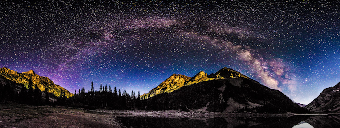
After capturing what I felt at the time were some great photos, I decided it was time to hit the sack, since our departure time for Maroon Peak was looming just a few hours away. I came back to the tent, where I found Sarah wide awake still. Apparently a field mouse had managed to find our tent and was crawling over the top of it, which kept freaking Sarah out. In fact, about 30 minutes later, the mouse bumped past the side of the tent next to Sarah’s face, which caused her to freak out and elbow me like she was trying to win a Karate match. It was awesome.
Day 3: Early start and successful summit of Maroon Peak - 14,156 ft.
Sarah’s iPhone alarm sounded off and sounded just like a self-destruct sequence, in fact, it was just like this YouTube video.
Mixed with my dream that President Obama had confiscated the valley we were in for national security reasons, and my head was all kinds of whacked out – too much, too early.
Nonetheless, we rose like zombies and hit the trail at a brisk pace at a quarter past 4 AM and head back up the valley to the Maroon Peak turn-off, in the dark. By the time we were working our way up the steep trail, the sun had begun to illuminate the mountainside and we were moving at a very steady pace.
Two of the three climbers from the prior day passed us quickly, having a deadline to meet – they were extremely fast – good on them! We kept our pace going at a good rate and eventually caught up with the two gentleman from the day before that were looking for the trail.
They were moving very slowly and had mentioned that there was only two others ahead of them other than the two we knew about – a photographer and their friend.
A photographer you say? This piqued my interest instantly. Who was ahead of me? Did I know them or of them?
The trail was one of the steepest I could remember. Exhausting, but a wonderful workout all the same.
Before long at all, Sarah and I crested the ridge after 2,800 feet of grueling non-stop high angle grinding. As Bill Middlebrook describes on the 14ers.com route description, “Conquering the East Slope is a major achievement, but now the more technical terrain remains.” Indeed. Time to refuel.
Sarah had maintained an excellent pace up Maroon Peak so far and was kicking my butt. Did I mention that while I'm at home editing photos, she's out racing single speed mountain bikes? Yeah. Wonder who's in better shape?
The remaining section of the ridge was more of the same; however, we had much better views of the surrounding area.
Once we reached the ridge, it was only a short section of maybe 400 feet to tackle before reaching the hard part.
The ridge section was still fairly steep, but the excitement of seeing the rest of Maroon Peak's impressive face kept us moving quickly.
Reaching the crest of the final ridge was exhilarating as always, made especially sweet by the awesome visage of Maroon Peak, which loomed in front of us like a giant sentinel.
Sarah and I followed the rest of the route religiously, having had a bad experience off-route last year on Snowmass. We took a break for food, and I ate another Honey Stinger Waffle which was delicious – these things are the real deal. The fun begins.
From the ridge crest, the route went very easily, much to my surprise and partial disappointment. I was expecting an epic class 3 adventure; however, Maroon Peak is more like class 2 with a sprinkle of class 3 in some lame locations. It looked intimidating as hell though.
The trail is very obvious most of the route and there are actually only a few spots you need to actually make a decision and “climb.” That being said, the terrain was still quite dangerous and we were vigilant. The views... oh man. So amazing. Intense.
Shortly after entering the more dangerous terrain, we ran into the other companion of the two guys we had passed earlier. He wanted to know how far behind they were. He was not very thrilled to learn about their slow pace, but the weather seemed to be holding so I felt like they still had a shot.
For the most part, the first section after the ridge involves following the trail up and over a bunch of small gendarmes near the ridgetop. As predicted, we found ourselves having to climb a small gully into a small and secluded alcove, which offered great views to the west.
Just at the top of this gully rested our next problem - a small gully with great hand and foot holds heading up.
On the other side of this gully, parts of Maroon Peak were back in view. The route certainly did not look obvious from here, but it worked out.
The most dangerous section was probably the set of gullies you can choose to ascend about 2/3 of the way through the route as pictured here.
We chose to climb the second gully and then follow a ledge system to the left. I feel that under the right circumstances and a lot of climbers, this section could be quite dangerous due to rockfall. Most of the rest of the route seemed quite safe with the occasional ledge area that was exposed. It looks worse than it is, trust me. Here's a view from the top of the gully, looking back across where we had come from.
At this point it felt like a great time to stop and soak in the views. It does not get much better than this.
The rock features on Maroon Peak were quite remarkable and made for a wonderful hiking experience. There were many times where I kept saying to myself, "I'm really here, this is one awesome place!"
Looking up or down made you feel so small. The sheer ruggedness and steepness of these peaks is easy to appreciate.
The final stretch of the climb includes a large boring dirt and rock section that reminded me of Columbia Peak, meaning, it was fairly awful – the kind of stuff that goes two steps up and you slide one step down.
Once at the top of this area, you climb a really short but interesting ledge system onto the flank of the peak and follow a long series of quite solid and fun-to-explore ledges before reaching the final summit ridge.
Pyramid Peak dwarfed Sarah.
Sarah, while only equipped with an iPhone, took some awesome shots on this trip as well. One of my favorites was this one she took of my near the summit.
Upon reaching the final summit ridge, I saw a man with a yellow helmet on the summit, in fact, the same yellow Edelrid helmet my dad handed down to me and seen in the photos of him in this report. He yelled down at me that it “was a great photo” and to “stay put if I didn’t mind.” This must be the photographer we learned about. While I waited for the light to get right for him to take my shot, I took a high contrast shot of him and Sarah on the summit.
He then snapped off this cool shot of me climbing the final section to the summit.
We got up to join him and he pulled out his business card. It was none other than the legendary Glenn Randall. Readers may recall Glenn’s name from an article I wrote earlier this year where I shared my thoughts on the twenty best Colorado landscape photographers. In fact, Glenn’s revered in the mountaineering-photography community as a pioneer, for, as he later explained to me, he has photographed sunrise from thirty-eight 14ers. This is a most impressive feat. Glenn explained that he was just on a recon mission today, because he was going to be doing Maroon Peak tomorrow as well to photograph sunrise from there. He was setting waypoints and familiarizing himself with the route. He had just done sunrise at Pyramid Peak the day before. Glenn’s dedication to this sub-set of photography is most impressive – in order to achieve sunrise on a peak like Maroon Peak – he would need to begin hiking at midnight and carry over 20 pounds of photography equipment with him to the summit. I was humbled to have met such a great photographer that I had modeled a great deal of my own personal work after.
Glenn gladly took our photo with Sarah's phone.
Glenn and I talked shop for quite awhile and he decided to head down. Shortly after though, two mountain goats came strolling up the side of the mountain from the descending route area with none other than Glenn behind them.
It was such a fun day on the summit, sharing the photographic experience with a true pro. I had fun composing images of the goats and of Glenn. I might be geeking-out a little, but it really was an incredible experience.
Sarah was able to get some incredible shots of all of the action too. Some of my favorites.
These were quite friendly goats, often coming within feet of me.
Pyramid Peak made for a killer backdrop for the goat.

I bet Glenn got some really great shots of the goats... he was sporting a quite nice Canon Fx camera and a 70-200 lens.
I took so many fun shots of the goats, and I hesitated to post so many here, but they turned out so great, I had to share.
My favorite shot of the mix was this shot of this goat peering out towards Pyramid Peak, foreshadowing the day to come, where I would complete the 14ers.
Through all the excitement, I had to stop and take some shots of Sarah and a couple panoramics.
The traverse over to N. Maroon looked like a lot of fun, but it was not on the agenda.
The obligatory 360 panoramic... which demonstrated how large of a summit Maroon Peak really had... and how amazing the views around us were.
The white coilour for Thunder Pyramid stuck out like a sore thumb above Len Shoemaker ridge.
The weather began to look a little shaky after a long time spent at the summit, so we all decided to head down together. On the way down, Glenn was a really great mountaineer, concerned with safety and route selection in many of the same ways Sarah and I were. It was such an honor to spend the afternoon chatting about photography methods, gear and stories while down-climbing. I felt kind of bad for Sarah but she rolled with it and contributed a great deal to the conversation, having many stories of our mountaineering adventures to convey.
On the way down, at the earlier described gullies, we opted to go with Glenn down a different gully. I think the original gully we took on the up-climb was sturdier (the second of the two when coming up, the first of the two when coming down). Other than this small section, we sailed down the mountain’s route, eventually running into the lone guy we had encountered earlier that was waiting for his friends. Indeed, he was again waiting for his friends and explained that they were very slow and he was concerned because he said they were very set on doing the traverse between Maroon Peak and North Maroon Peak, which is very dangerous and requires a great deal of time. He asked that we try to convince his partners not to attempt the traverse based on the weather and their slow speed.
Shortly after this, we ran into the ambiguously odd duo again as Glenn tried to convey the seriousness of the traverse given their speed and the weather. They did not seem convinced this was problem for them and so I hoped that I would not be reading about them on 14ers.com in the Memoriam section (if you guys are reading, I hope you got down safely). We continued on and eventually reached the ridge safely without any issues.
The hike down was relaxing. No threat of weather to worry about.
From here, we casually followed the steep trail back down from the summit, stopping occasionally to take photos of flowers and a small group of mountain goats, which consisted of two adults and two tiny baby goats (so adorable). This prompted me to wonder about the breeding habits of mountain goats and the herd consistency, so I made a mental note to read about that when I got home. I did learn that it was likely that we saw two females (nannies) with their two kids (babies) – as I learned from this almighty Wikipedia article.
The wildflowers were so fantastic on this hike, it reminded me a little bit of the wildflowers we saw the prior year on our hike up into Lead King Basin.
Glenn left us about halfway down to move a little faster so that he could get some rest before his epic sunrise hike. Sarah and I continued down at a decent pace and found ourselves back at camp at approximately 1:45 PM. The weather was holding quite well for the Elk Mountains, and we were starving. We cooked some food and took naps that lasted well into the late evening and eventually the night. We were certainly well rested for the next climb.
Day 4: Early start and successful summit of Pyramid Peak - 14,018 ft.
The alarm went off and we climbed out of the tent and started hiking at 4:15 for Pyramid Peak. The hike down to the lake and to the trail split off in the darkness was a fun experience as always. Once we found the turn off for Pyramid Peak, we were greeted by a couple that was heading up to do Pyramid as well. They were moving quite quickly and left us in their dust in no time at all. We were both thankful to have a really well-constructed trail to start the day on - the Colorado Fourteeners Initiative built an absolutely bomber trail up the first section of Pyramid in 2006 and it does not disappoint. The trail climbs steeply out of the valley over large boulders and is very well-maintained. Before we knew it, we were starting to get the first sunlight of the day at pre-dawn.
After switching back and forth up the steep slopes, the trail deposited us at the base of a giant boulder field, nick-named the "Ampitheater" due to the fact that it has three of its four sides surrounded by steep sections of Pyramid Peak.
As we rose up the Ampitheater, the views to the north became better and better, with the soft light of sunrise illuminating the surrounding peaks.
Eventually, we reached the top of the Ampitheater and were greeted with our next task, climbing up a very steep scree and dirt gully to the ridge. We were both overcome with glee over the prospect of such fun hiking (just kidding). Fortunately, the views behind us were starting to get good, with Snowmass Mountain and Capitol Peak poking above the ridgeline in the Ampitheater.
In addition to this, the clouds above were looking phenomenal, and the Maroon Bells were beginning to poke up above the ridge too.
The hike up this section was gruelling to say the least. It was steep, loose and unrelenting. The occasional break to look back was worth the climb though.
At last, we reached the top of this devilish section of climbing and our day's objective finally came into view for the first time. Pyramid Peak erupted above us like some freakish volcano. Here's a groovy photo with all of the mighty Elk 14ers in view - Pyramid, Maroon, North Maroon, Snowmass and Capitol. 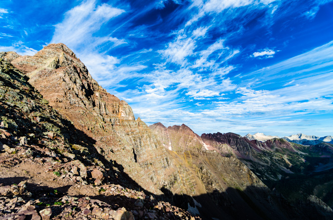
Sarah and I stopped for a bit at the top of this section to rest, eat and study up on the route. Sarah enjoyed what had become her signature staple food of the trip - PB&J on a hot dog bun. Yep. 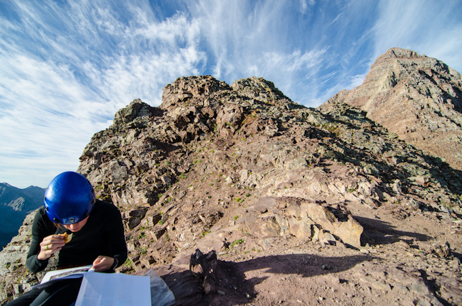
The clouds continued to provide a very dramatic feel for the whole morning.
After a short rest, two climbers joined us on the saddle - they were named Doug and Martin and asked to join us for the rest of the climb so that we would not kick rocks down on each other. This seemed like a great plan to us; although at first glance, Sarah and I were both a little taken back by Doug's bicycle helmet. Fortunately, it turned out he would be one of the safest climbers I've been with.
Doug snapped off a group photo for Sarah and I and we departed for the difficult section of the climb.
The route was quite obvious for most of the remaining part of the climb, with several cairns and a clear trail in many sections. At one point, we found ourselves at a section that was a huge crevasse in the trail, which totally reminded me a photo I remembered seeing of my dad when he climbed Pyramid Peak. Indeed, the crevasse was jumped by me both up and down. Here's a photo from the 1980s of my dad jumping a similar crevasse.
We reached the infamous "ledge" which proved to be a challenge with my camera bag affixed to my chest. Sarah captured this photo of me being quite relaxed while crossing, with camera in hand.
I had the camera out for a reason though, as I wanted to get a closer shot of Doug and Martin crossing this awesome section.
At last, we reached the infamous green gully, which turned to be the most enjoyable section to upclimb. It was quite solid and easy going, with little to no loose rocks to contend with. It was very steep though, and a miscalculation would prove fatal. Climbing to the top of this section was quite a lot of fun.
We then reached what many consider to be the crux of this route up Pyramid Peak, a section where you can choose between a very exposed class 3 section or an unexposed but more dangerous class 5 section. Coming down from this area were the two climbers we met earlier in the morning near the lake - they had already summited and were coming down, so we waited for them before continuing. As a group, we had a nice discussion about the route and the other two climbers departed.
The crux move was spicy but nothing too hard. I thought the summit block on Mt. Wilson was harder and more exposed for sure. The rest of the climb was as simple as weaving our way up cairned sections of ledges. Before we knew it, we were on the summit. Sarah was up first and captured a photo of me summiting my last 14er.
As I reached the top, I took one last look back behind me at the east Elks - they looked so good.
The feeling was surreal, exciting, sad, happy and relieving, all at the same time. It was a flood of feelings for sure, but they were all welcome feelings. I felt like I had accomplished something quite remarkable (even though thousands have done it before me). Perhaps it had something to do with the length of the time it took to finish, or the length of the time I had had the goal. Either way - it was pretty darn awesome! Sarah gave me a big hug and then dropped a huge surprise on me. She prefaced the surprise with the something like the following words, "Angela wanted me to give this to you when you got to the top... I ensured it was not a divorce letter or anything like that, but don't shoot the messenger!"
She then handed me a white folded envelope with my name on it. Inside was the most thoughtful, humorous and loving message I could ever ask for from my wife. Sarah said, "she said you might cry." Which of course, I did a little.
Sarah and I celebrated the amazing day and basked in all of the glory that I knew would come from the views from Pyramid Peak. It was the perfect mountain to finish on. The views of the Maroon Bells, Len Shoemaker ridge, Snowmass Mountain, Capitol, Castle, Conundrum, Cathedral and the rest of the killer Elk Mountains were absolutely surreal and wonderful.
The famous Pyramid Peak diving board was a very inviting spot for photos, and Sarah decided to go surfing. I did an HDR and a non-HDR of this, for fun. You can mouse-over or click to see the non-HDR version.
...and my celebratory pose!
It felt like a small little party up there, spirits were high, weather was looking good, and the views were to die for.
After some food, I fired off a 360 degree panoramic from the summit. One of my favorites to date.
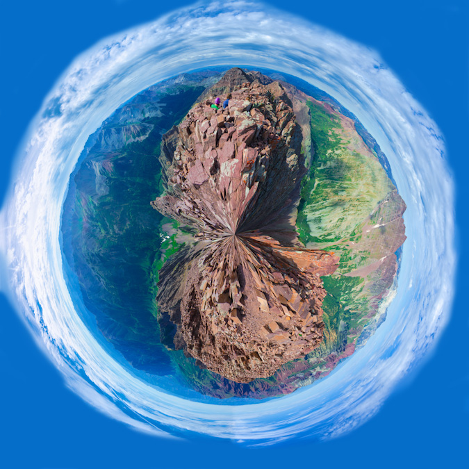
The same 360 degree pano made for a wonderful planet too... for more on those see this article...
One of Sarah's more awesome traditions is that every Friday she wears a tie and takes a photo of it. This Friday would be no exception!
Weather was starting to build to the west, so we decided to start to pack up our stuff. I still was in awe of the sheer nature of the valley below - how steep the walls were, how amazing the features of the rock were. I'm not religious at all, but this is as close as you can get to a religious experience.
Before we left, I wanted one more parting shot from Pyramid with the USGS marker.
Downclimbing Pyramid Peak was slow going. It always feels much more awkward to downclimb the steeper terrain and Pyramid was no exception. Our group took special care not to dislodge any rocks onto each other and we staggered our decents and ensured we were each clear of a run-out section before the next person started. It was pretty fun climbing though.
Pyramid was one steep mountain, with lots of loose rock to beware of.
I was still amazed at how rugged the terrain was on Pyramid - it looks so unclimbable from all directions, and even when you're up there it feels quite surreal.
The slowest and most challenging part of the downclimb was the green gully. We took turns decending into sections and just as we reached the bottom of it, small rain drops started to slowly fall. We had made it through the hard sections just in time.
Luckily for us, the rain lasted only a short time and we were able to reach the saddle quickly and safely. Upon arrival, we were greeted by a lone mountain goat, who was probably licking up the urine others had deposited there earlier in the day...
This mountain goat was quite photogenic and decided to pose just for me on the rocks above.
After enjoying the company of the goat, we decided to head on down the most wonderfully exciting and enjoyable dirt and scree fest that was the descent off of the ridge back into the Ampitheater. We both ran out of water at this point and decided to hoof it down as fast as we could, with plans of heading on out of the valley that evening. The thought of a celebratory meal in Aspen was too much to pass up. Once out of the ampitheater, the CFI trail down was quite solid. I could not really imagine how awful this trail would be before this work was done. I took one final parting shot of the Maroon Bells on the way down Pyramid.
Sarah snapped off one last shot of me hiking back to camp. This is one happy dude.
We got back to our campsite and packed up after refilling our water. Our legs were tired. Our souls were refreshed. It was time for beer and pizza. We headed out and I took one final "classic" shot of the Maroon Bells from Maroon Lake with the "Deadly Bells" sign. "DO NOT ATTEMPT IF NOT QUALIFIED."
I'm not sure if I was qualified or not, but I felt greatly accomplished and quite humbled to have experienced them either way.
A final look at the route map. Click on it for a larger version.
We decided on a restaraunt called Mezzaluna in Aspen for our celebration dinner. I had a vegetarian pizza (did I mention I'm a vegetarian) with truffle oil and Sarah had a sausage pizza. Two margaritas were served and congratulations were in order.
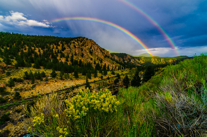
After leaving Aspen and dropping off of Independence Pass towards Buena Vista, we were greeted with a rare double rainbow, which capped off our most excellent trip in fine order. I could not have asked for a better trip, partner, or experience to finish the 14ers.
Conclusion and acknowledgements
A goal that takes 27 years to complete is one worthy of relishing, reflection and sincere acknowledgements to those that helped make it possible.
After fracturing my L5 vertabrae in 1995, I was not sure if I would ever be able to realize some of my goals. Fortunately, through hard work and incredible support from my family, I fully recovered from that and learned a great deal about work ethic. This quest for the mountains has tought me so many valuable lessons about life, about people, about myself...
Most importantly, it has taught me that despite people having severe differences of opinion on matters such as religion, politics or otherwise, something like the great mountains of Colorado can bring those people together to share in life-changing experiences that bind people unlike any other force. I hope to build on those lessons and continue to better myself as a person - my friends and family know there is plenty of room for growth.
To Sarah Musick: Thank you so much Sarah! It was such an honor to share those last two summits with you - you have been a true inspiration to me and my quest to finish. Your support over this past year has been fantastic. You are truly an amazing human being.
Of course, an achievment like this is never possible without the support of others, who are for sure some of the finest people I've had the pleasure to meet.
1. 1st - to my wife, Angela Payne (one fine Vegan chef with a killer sense of humor) - who has given me more support than I ever could have asked for - allowing me to chase my dreams is the best gift a person can give!
2. To my parents, they have been an inspiration for this life-long goal and I would have never have started without them introducing me to the mountains of Colorado at such a young age. My dad's goal to complete the highest 100 began in the 1970's and it quickly became my own goal as well.
3. To my family’s close friend – Dave LeShane – who also was on the quest for the highest 100 when I was a child – and inspired me to dream for the stars while climbing various 13ers with me as a child. Your wisdom, guidance and support over the years was like having a super-awesome uncle with bad-ass climbing stories.
4. To my regular climbing partners - Sarah Musick, Ethan Beute, Jeremy Park, and Regina Primavera (Yalegirl09) - you guys have been absolutely awesome to climb with! Your support, humor, talks, patience, insight and overall awesomeness has grounded me and reaffirmed my faith in mankind's future.
Sarah - you are one of the most amazing people I've ever met - our short but fantastic friendship has been such a blessing for me.
Ethan - our talks and hikes are always some of my most enjoyable days and most memorable experiences - I hope we can continue what I believe to be an incredible friendship!
Jeremy – while we have not done any 14ers together, we’ve known each other since high school and have been amazing friends ever since. Our epic adventure on Vestal’s Wham ridge will always be one of my fondest moments in my life!
Regina - you are one crazy, amazing and true friend! Our hikes are always a great time and I have enjoyed our talks!
5. To my other climbing partners, mostly from 14ers.com –
Terry Mathews (tmathews) - it was so great getting back into climbing with you back in 2009. Our adventures and introductions to class 3 on Crestone Needle, Crestone Peak, Blanca, Ellingwood, Kit Carson and Challenger were fantastic.
Micah (mountainmicah83)- dude – our epic day on Harvard and Columbia will never be forgotten - while I had hoped we could get out more – it was still awesome to learn rope/climbing skills from you and Matt!
Mike Vetter and Travis Arment - what can I say Mike - anyone who would drive all the way from South Dakota to climb Huron Peak with me is one awesome dude. Our adventure up Capitol Peak with the accomplished Travis Arment was unforgettable. You guys are fantastic people.
Barry Johnson (Johnson) – our climb of Shavano in 2009 was my re-introduction to the 14ers after a long hiatus – thank you for joining me on that fantastic day!
Mike (fiemus) and Bob Hay – our hike up Yale was great – learning about all of Mike's SAR stories was one of my favorite days in the hills.
Kara Bauman, Will (WillV), Alli Kolega and Tom Shaar – our climb of Mt. Wilson was absolutely wonderful! Thank you for allowing me to join you guys on such a fabulous adventure!
6. To Bill Middlebrook for creating and maintaining 14ers.com – it has been very helpful for me in this crazy pursuit.
7. All the other awesome mountaineers, climbers and hikers in this community - we need to continue to focus on our common goals and dreams.
Thank you for all for the inspiration to write these, and thank you for reading...
{fcomment}
2011 Colorado Mountaineering Deaths - A Review
Sunrise from 14,015 feet: Wetterhorn Peak
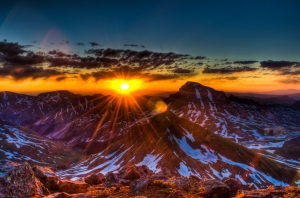
The adventure of my July 4th weekend for 2011 just wouldn't end on its own. After spending the morning in Telluride sulking about our partial defeat in Navajo Basin, Regina and I decided to drive back to Colorado Springs and lick our wounds. As we drove closer and closer to Blue Mesa Reservoir, I got a wild idea in my brain. Since both Regina and I still had three days off for climbing, I figured that it would be a total shame to waste that time off and gas money on only one climb up Wilson Peak. Even though we opted to not do El Diente and Mount Wilson, I still felt that we had more gas left in the tank, so to speak, so... I suggested to Regina that we head to Lake City and climb Wetterhorn Peak instead of driving home. At first Regina was more focused on a warm shower and a soft pillow, but it did not take long for the idea to set in and Regina enthusiastically agreed. Perhaps my tactic was not fair, since I knew that Wetterhorn Peak was Regina's favorite mountain of all time. Once Regina agreed, my mood increased dramatically and we set-off for Lake City and the Wetterhorn Peak Trailhead.
To make matters even more epic, I convinced Regina that we should start from camp at 2 AM so we could watch the sunrise from the summit. Climbing up the class 3 summit block of Wetterhorn in the dark sounded pretty fun too... We arrived at the trailhead and found a perfect campsite next to Matterhorn Creek. All night long, I had visions of a most epic sunrise over Uncompahgre Peak that looked something like this:
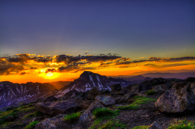
We quickly went over the game plan and Regina explained the route to me. Regina had been up this trail 3 times last year, so she knew all about it. The first time she went, she was pushed off before reaching the summit because of exhaustion. The second time, she was scared off the trail by actual mountain lions (true story), and the third time, she finally succeeded in reaching the top. She has never shut up about Wetterhorn in all of our trips together, so I figured that either she was exaggerating or that Wetterhorn was truly one of the best climbs in Colorado. 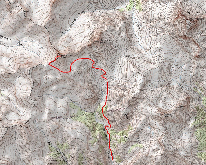
Our campsite was pretty awesome, and we were both thankful for our Mountain House meals that we had packed with us for Navajo Basin. 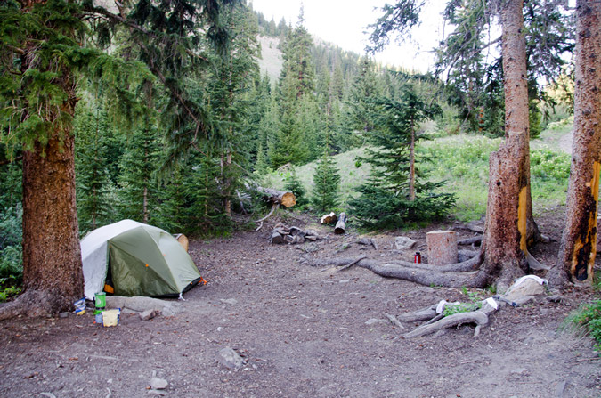
We went to bed, set the alarm for 2 AM, which arrived pretty quickly. I felt totally rested though, so we equipped our packs and opted to not pack up our tent so that we could hopefully reach the summit by sunrise. The trail was really easy to follow in the dark, but I could not help but think about the mountain lions that Regina encountered last year. Would they totally thwart our efforts? I really hoped not, and focused on the task at hand. We finally reached the area where Regina had encoutered the mountain lions last year, and wouldn't you know it, we looked down the hill to catch the gaze of three sets of eyes illuminated by our headlamps. Crap! Fortunately, we were able to realize pretty quickly that they were just deer, so we continued on up past treeline. It was not until we reached the final ridge of Wetterhorn that there as any light whatsoever in any direction, save the star light.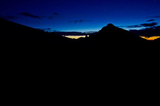
We continued on up Wetterhorn's ridge, enjoying the progressive light show that was starting to erupt to the east.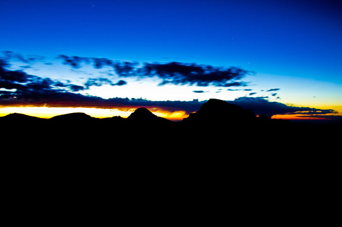
Just before we reached Wetterhorn's final section, the sun began to get closer and closer to emerging... would we make it to the top before the sunrise? I was getting nervous in anticipation.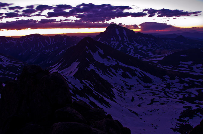
I was really having fun with my camera, firing off several bracketed shots for HDR, using rocks as a tripod and the self-timer to prevent camera shake. 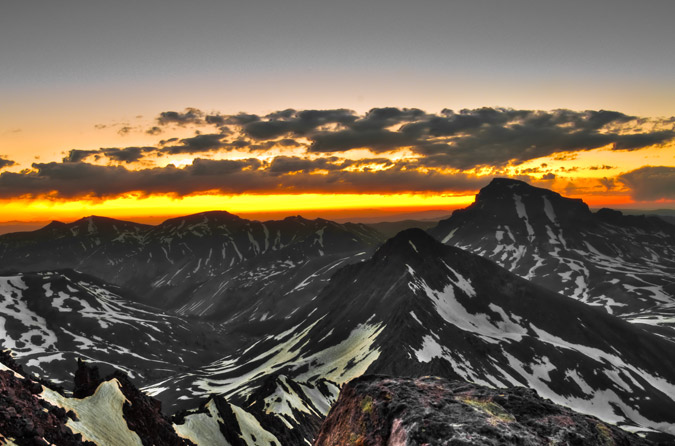
We finally reached a small snowfield that was in a small flat area before the top. The snowfield was at the base of the huge cliff walls of Wetterhorn and lead us to a notch that was a portal to the super fun Class 3 section of Wetterhorn.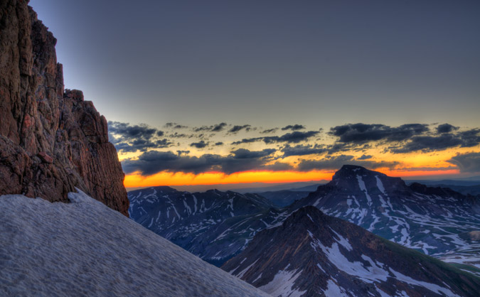
At last, we reached the final summit pitch and Regina went first. Her enthusiasm for Wetterhorn was impressive and nothing like her lack of enthusiasm two days prior on Wilson Peak.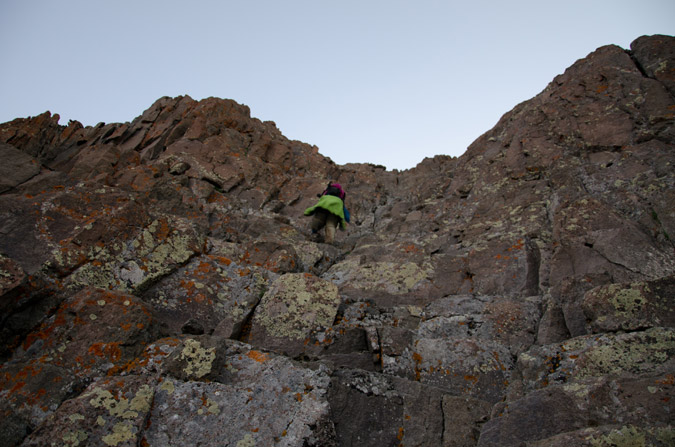
I was even able to take some video of Regina climbing up this section.
I followed Regina after she had secured herself above, and quickly made it up within a few seconds of fun climbing. We were literally about 20 seconds from the top and I told Regina that the sun would be rising in any second. I crested the summit and it was quite possibly one of the most amazing thing I've ever witnessed. The sun literally crested the horizon THE EXACT MOMENT that I crested the summit. The timing was insane. I ran as fast as I could to the other side, built a rock tripod, and began shooting. I knew that this was gold.
These two are HDR and almost the same except for some slightly different processing techniques.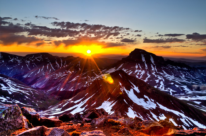
I was like a little kid on Christmas. I had no words to describe it. I didn't even realize it, but it was pretty cold up there. I think it took me a good 20 minutes to even feel it.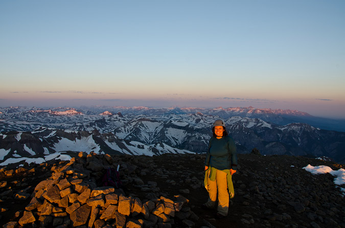
Regina was pretty excited too, being that it was the first time she had seen the sunrise from the top of the mountain.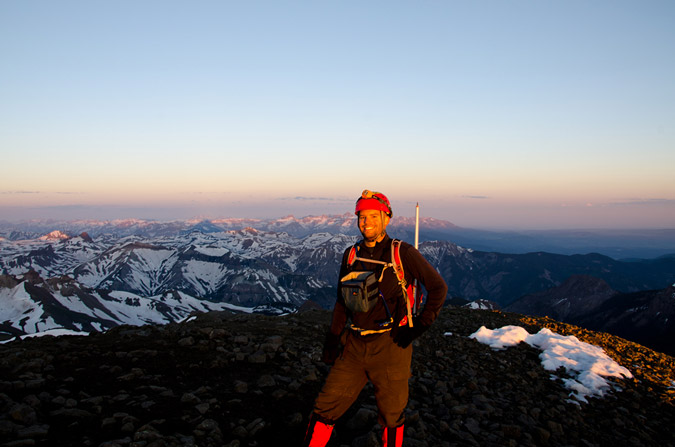
The views were simply incredible... including this 360 degree panoramic.
The lighting was perfect for High Dynamic Range (HDR). I knew that this would be the best chance I'd get in a long time to put together an HDR pano, so I gave it a shot. The results were mind-blowing. I can't wait to get one printed for my house.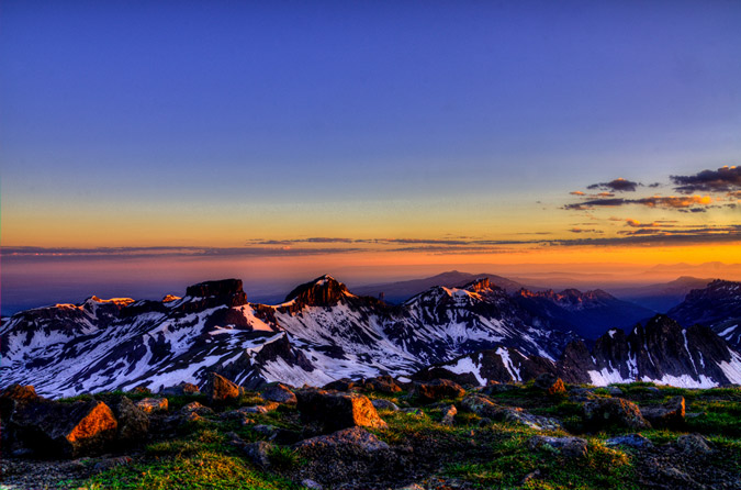
The views of Coxcomb and Redcliff were crazy!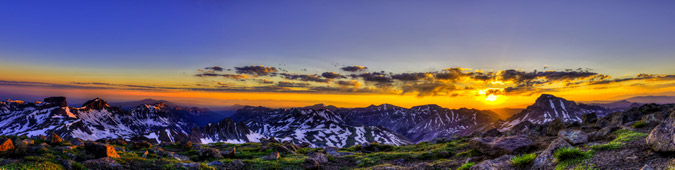
Hey, the summit shelter even makes a good tripod in a pinch! I decided to take a few HDR shots of Sneffels and the rest of the rugged San Juan Mountains to the west.
Uncompahgre Peak was truly an amazing feature to photograph from Wetterhorn.
I had always admired both Uncompahgre and Wetterhorn as a pair, especially last year from Handies Peak (Wetterhorn on the left, Uncompahgre on the right):
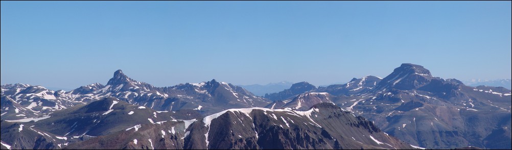
Is there really such a thing as too many sunrise photos?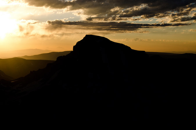
Or panoramics for that matter?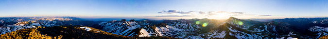

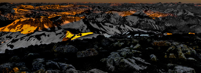
The craggy features of Redcliff to the North were quite impressive as well!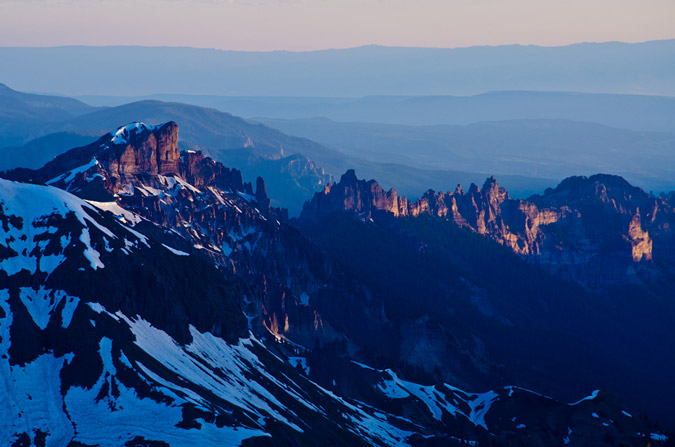
All this photography and I had almost forgotten that Regina was with me, obviously a bit chilled!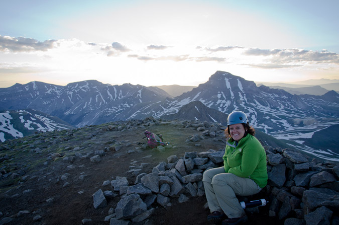
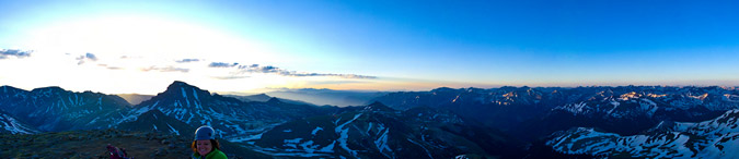
So, we decided we had enough amazing views for one morning and then departed the summit.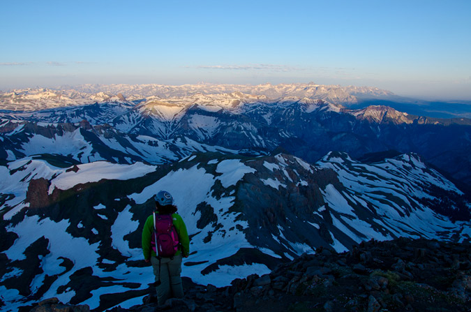
The downclimb was a little more tricky than the upclimb, but nothing worth worrying too much about. As long as you take your time and stagger your group, it is very safe.
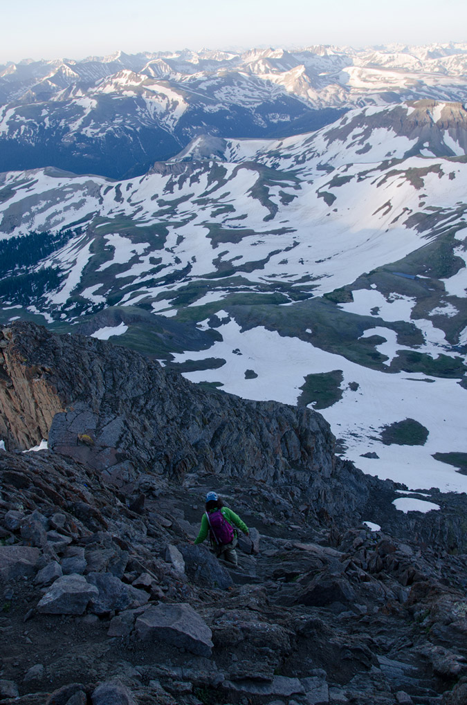 |
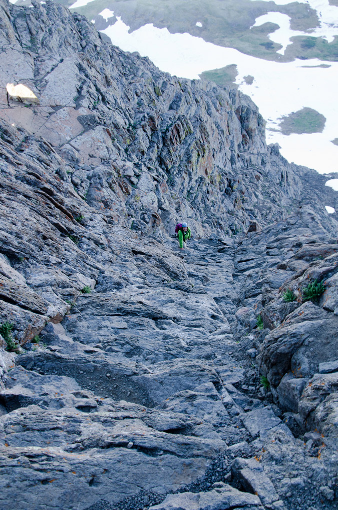 |
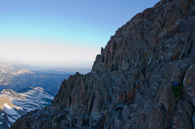
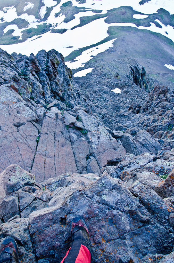 |
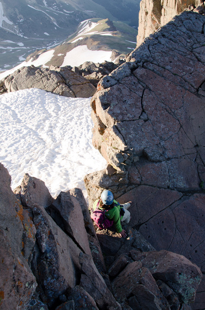 |
It never fails to amaze me what will grow on the side of a mountain...
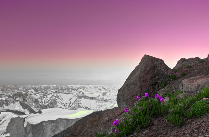
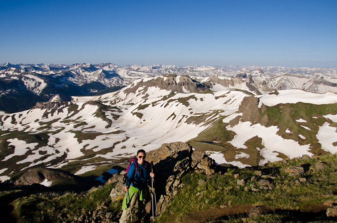
Naturally, Uncompahgre kept me in a state of wonder...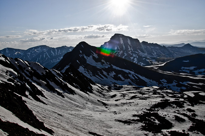
As did Sneffels...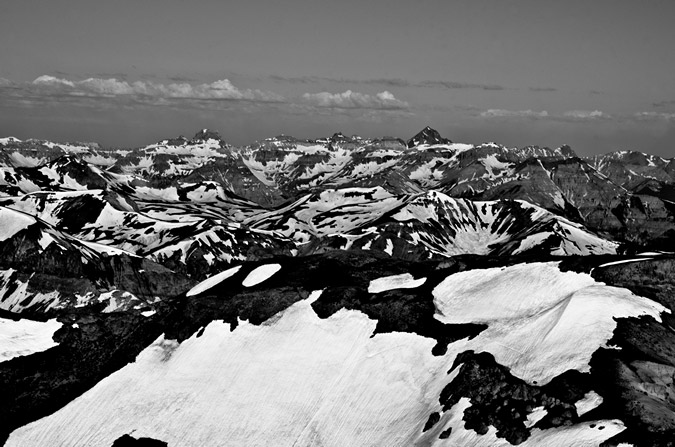
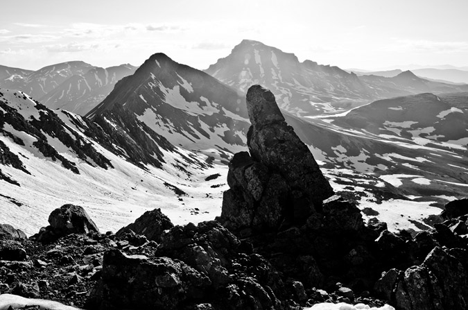
Wetterhorn was pretty awesome looking for below, which was awesome since it was completely dark when we headed up.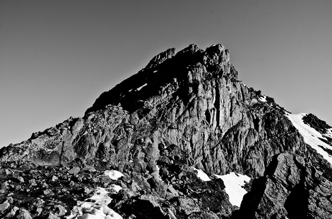
Also, a set of lower peaks kept my attention to the west, near Ouray. They were so impressive and gnarly looking! I was convinced that it could only be Bighorn Ridge, just east of Ouray. I believe I have confirmed this by looking on the Impressiveness List on my website.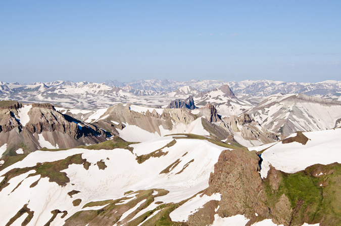
All this photography set me back from Regina quite a ways, and before I knew it, Regina had reached the Golden Saddle.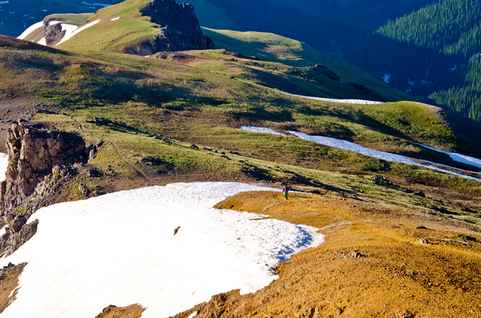
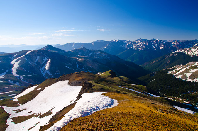
We finally ran into some early hikers just after the ridge, who turned out to be none other than "Kitten" from 14ers.com. 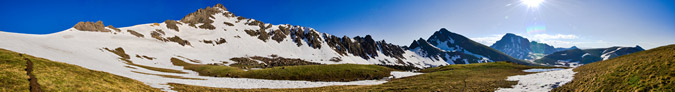
Regina and I both spotted this awesome little pool below and I knew it would make for an interesting shot...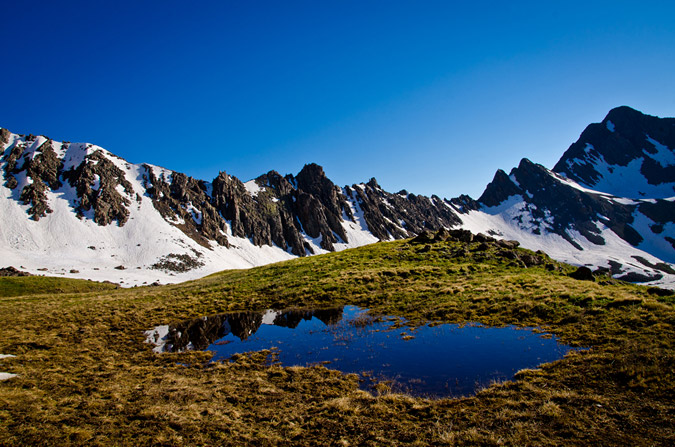
Funny thing - unknown to me at the time, "Kitten" shot a photo of me taking that photo, as I discovered it in her trip report.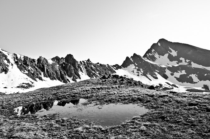
I even got a picture of Regina, and Wetterhorn, plus the pool.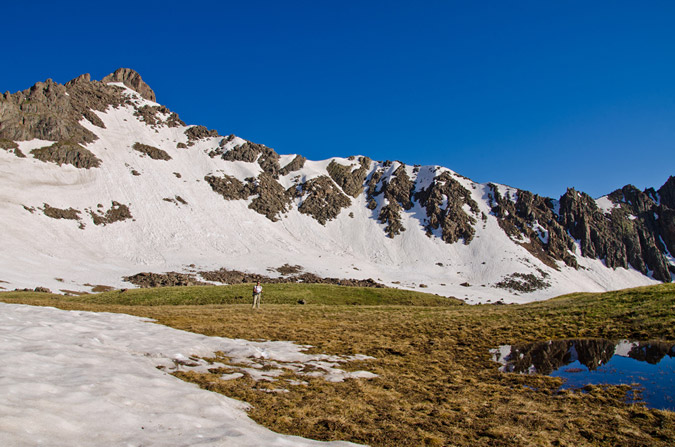
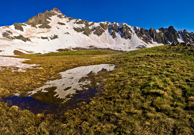
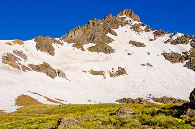
I spotted some interesting flowers off-trail and figured they might make for a cool shot with Uncompahgre behind them...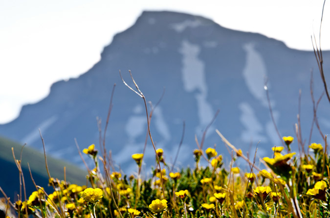
And, out of nowhere, a plane went zooming by over Wetterhorn...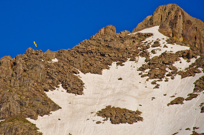
The hike out was pristine. The views never got old. Wetterhorn and Matterhorn painted such an incredible vista.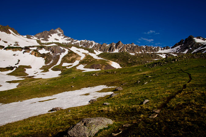
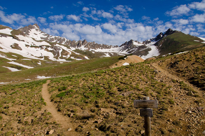
Wetterhorn looked pretty awesome from the valley below...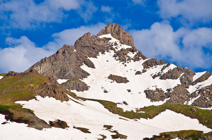
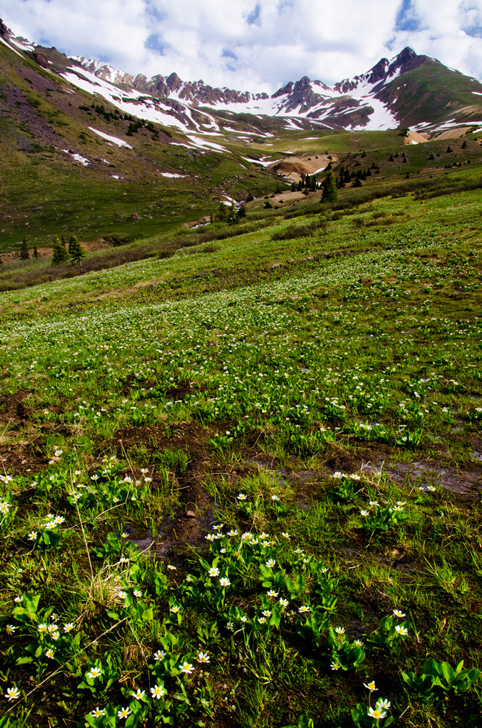
And of course, the weather started to move-in as we were heading out. The clouds were really intense, so I figured it might be fun to take some HDR shots of them.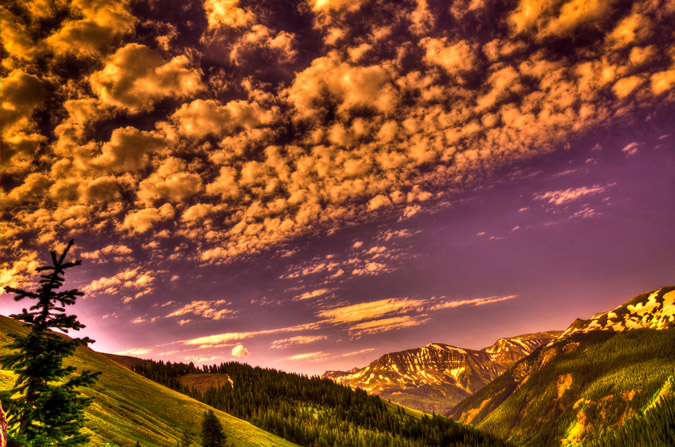
In case you were wondering, at the first trail junction, seen below... you go right. I barely noticed this one on the way up since Regina has this mountain memorized.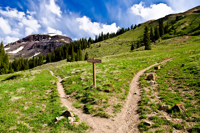
Matterhorn Creek provided some amazing opportunities for photos as well, having a ton of water in it.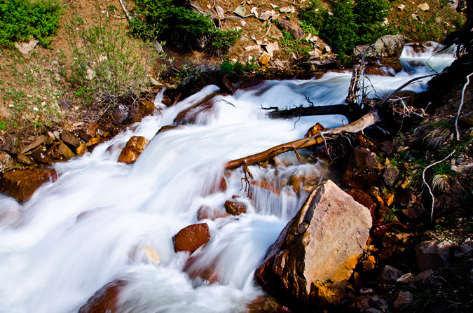
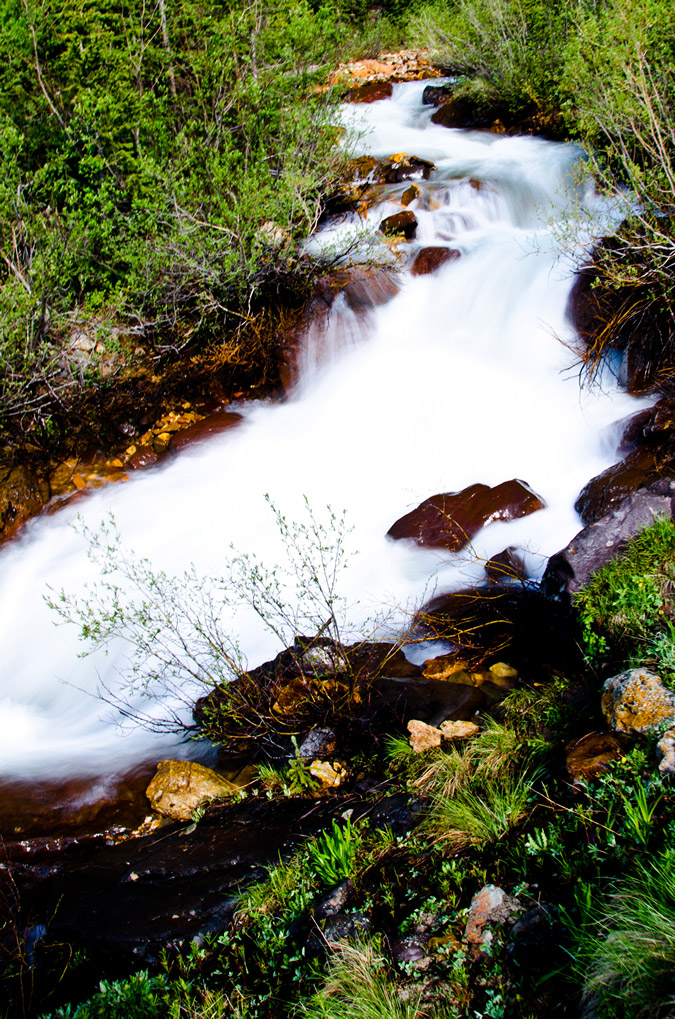
What else can be said about Wetterhorn? It is probably the perfect mountain. Here's why:
- The approach is short and easy, accesible to even the most novice of hikers.
- The route is solid - it is a terrific introduction to Class 3.
- The views are INSANE.
The only bad thing about Wetterhorn is that it is not closer to my house! I would rate it a 10/10.
I hope you enjoyed the photos! Please contact me if you would like to purchase any. See this page for more details.
{fcomment}