Displaying items by tag: Blackhawk helicopter
Mount Massive - A Frozen Wonderland
Some fun information about this great hike:
Mt. Massive - 14,421 ft. - 2nd highest in Colorado; third highest mountain in the contiguous U.S.
8 miles round-trip via Southwest slopes route
3,950 ft. elevation gain
More snow than I expected...
I thought that my climbing season had ended after being snowed on in mid-September on Grays and Torreys; however, I got the itch to climb again this weekend. Serendipitously, a fellow climber from Colorado Springs, Rob, posted on 14'ers.com that he was going to Mt. Massive on Saturday and that anyone from Colorado Springs was welcome to join him. I jumped all over the opportunity and we made plans to meet at 4:15 AM on the west-side of town to car pool. Rob had his friend Brad with him and we departed for Mt. Massive at around 4:30 AM.

Our route took us directly up the snowy south face of Massive.
On the way over we had good conversation, shared stories about our climbs and got to know each other. We arrived at the turn-off for Mt. Massive at 6:45 and met up with two other climbers from Denver. We reached the trail-head and began hiking at 7:40 AM. Right at the trail-head lies a memorial to the soldiers that died in a helicopter crash earlier this year on Mt. Massive. Here are some photos of the Memorial, notice a section of the helicopter is seen as well:

A memorial cross for the victims of the Blackhawk Helicopter crash on Mount Massive, 2009.

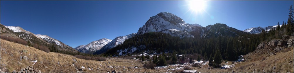
The forecast for the day was clear skies and a high of 60, and wow the weatherman did not disappoint! We swiftly hiked up the valley and reached the turn-off for Mt. Massive. Our view back down the valley was stunning:

The trail was covered in snow, making for a quite interesting hike. As we gained elevation, the trail became less and less apparent and eventually we just started hiking straight up towards Massive.
Looking back towards Elbert, you can see our footprints through the snow...

None of really expected to see so much snow, but it made for a very challenging hike. The snow was up to 3 ft. in depth in some spots, and it was quite slippery due to the 30-40 degree slopes were climbing on. We stopped several times to rest on the way up, and about halfway up I was able to take some shots, combined here into a smaller panoramic photo:

After approximately three hours, we were able to reach the saddle, which joined us with the standard route. By now I was pretty tired, partially due to the extra effort required by the snow, and partly due to the fact that I had not had much to eat. I made sure at this point to eat some snacks, and we headed back up. We found ourselves climbing up some pretty deep snow, as evidenced by this shot, looking up the ridge towards the summit, taken on our way back down:

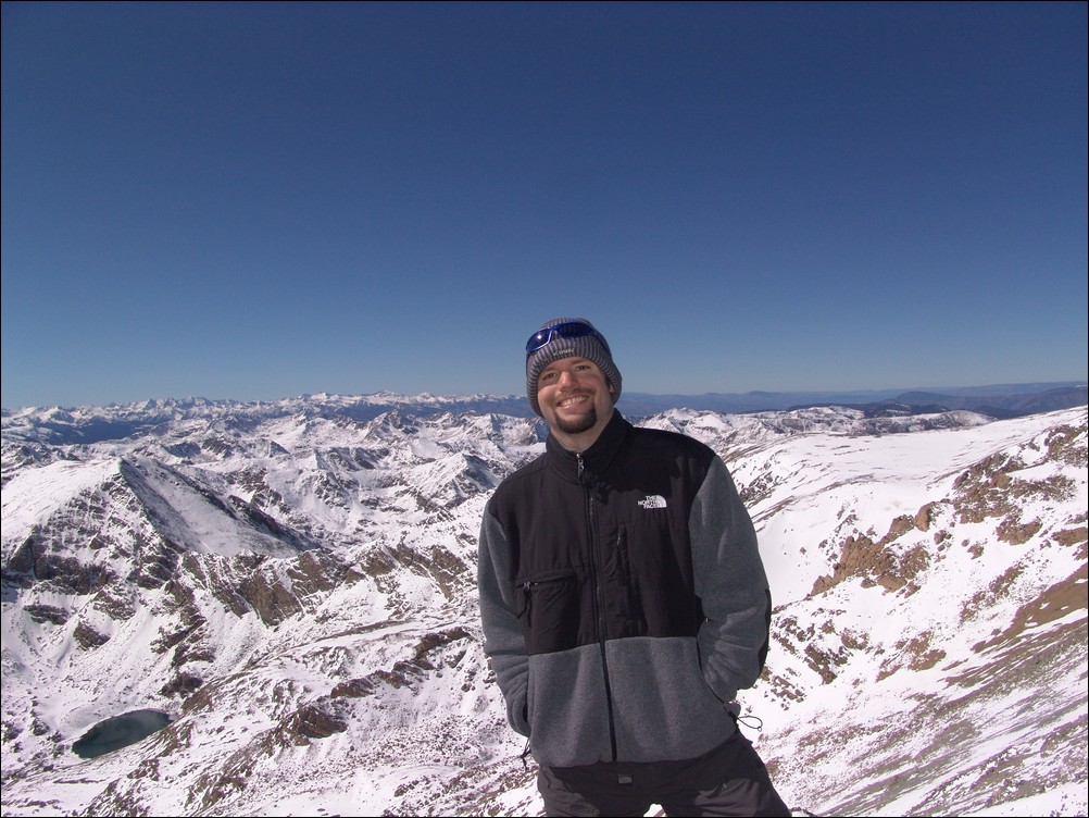
After trudging through the snow, we were able to reach the summit at 12:40 PM, a full 5 hours after we started. The snow really took a lot out of us! I was just really glad I brought my gators and had tons of warm clothing... Here is my obligatory summit pose, with the Elk range behind me:
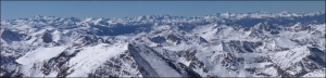
And of course my traditional 360 degree pano:

Before we left from the summit, I took some zoomed in shots of the Elk range, including the Maroon Bells. This stitched pano is one of my favorites from this 2009's shots:

We headed back down and had a good time rumbling down the snowy slopes. I took one last set of the valley, combined into a pano here:
All in all, I would highly recommend this route for Mount Massive. Even in October, the route is solid, and I could see this being feasible even through November or later.