Displaying items by tag: Colorado Springs
Adventures on Cameron Cone - Views of Pikes Peak and Beyond

This Spring has been quite dry and I've been feeling the itch to get out and get up a summit. I mulled the idea of heading up to do Lackawanna (a high 13er near Independence Pass); however, I knew my time was limited and that I would need to stay closer to home. So, I put out a feeler to my climbing partner Ethan Beute to see if he would be interested in doing something easy close to home. We both settled on Cameron Cone, the easily recognized point often seen in front of Pikes Peak in many photos of Pikes from Colorado Springs. I'd had my radar on Cameron Cone forever it had seemed, so it was a great choice in that regard. At the last minute, I also invited one of my other hiking partners, Sarah Musick, and plans were in motion to meet at Ethan's at 5 AM and hit the Cone. Since both Ethan and I are avid photographers, we opted for the early start in the hopes of getting some decent shots of sunrise from the trail somewhere.
Cameron Cone is named after a famous soldier and newspaper publisher, Robert Alexander Cameron. When originally dedicated, the summit was called Cameron's Cone. The Cone towers 10,707 feet above the city of Colorado Springs and is the fourth highest ranked summit in El Paso County and 1,935th highest in the State of Colorado. For a whole listing of summits in El Paso County, check out this link.
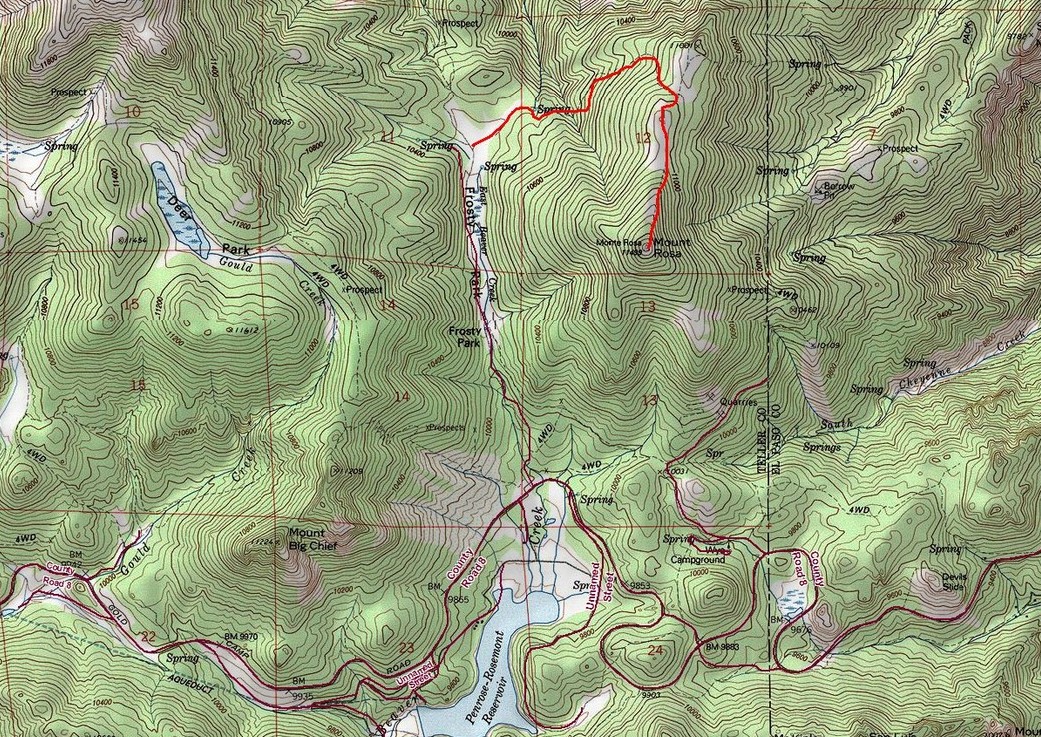
There are several routes to reach the summit of Cameron Cone; however, we chose one of the more rigorous routes to gain the summit. Instead of driving to Crystal Park, as some would suggest, we opted for the long route from Barr Trail. Here is a map of our route, feel free to click on it to see a slightly larger version. All in all the hike was 7.0 miles and 4,175 ft. of elevation gain - a nice work out for sure!

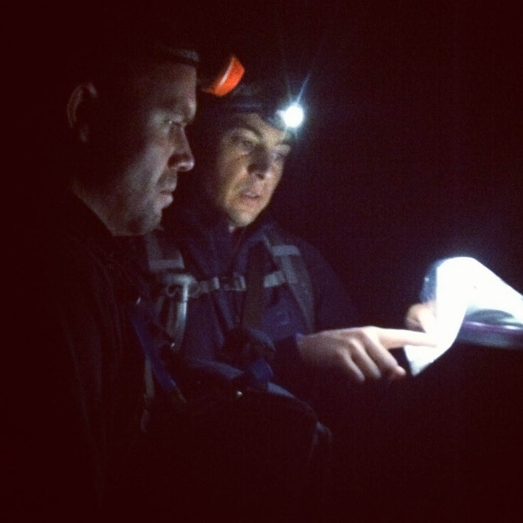
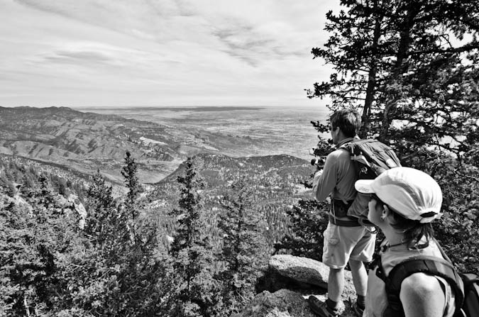
We decided to park on Ruxton Ave. in Manitou Springs and walk the road to where it ends. We then chose to cut left just after the chain link fence to the left of the Barr Trail and then walk the Cog Railway about a hundred feet. From there, we went straight up the hillside to the south until we reached the Englemann Trail. We found this guide to be very useful for the trip, as you can see from this photo of Ethan and I taken by Sarah.
We found the route to be fairly straight-forward once on the trail; however, we did lose the trail in one spot lower in the Englemann canyon. A simple up-climb and we were able to re-locate the trail. I would mention that I did bring my GPS with me and I had entered the coordinates from the Summitpost route description into my GPS as waypoints which proved useful.
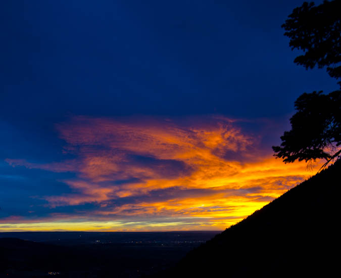
Before we knew it, the sun had begun to rise and we found a suitable place to stop. I set-up my new Gitzo carbon-fiber tripod and took a ton of shots with my Tokina 11-16 lens. I love this tripod! It was somewhat heavy, but well worth the haul. I was not terribly impressed with my sunrise photos, mostly because I think we were too low and some of the view was obscured by Eagle Mountain to the south and east. Nonetheless, here's a few of my shots.
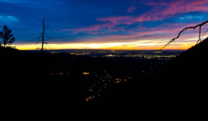
The city lights made for a very cool view.
I also had a little bit of fun doing a very short time-lapse video of sunrise using my intervalometer on my Nikon D7000.
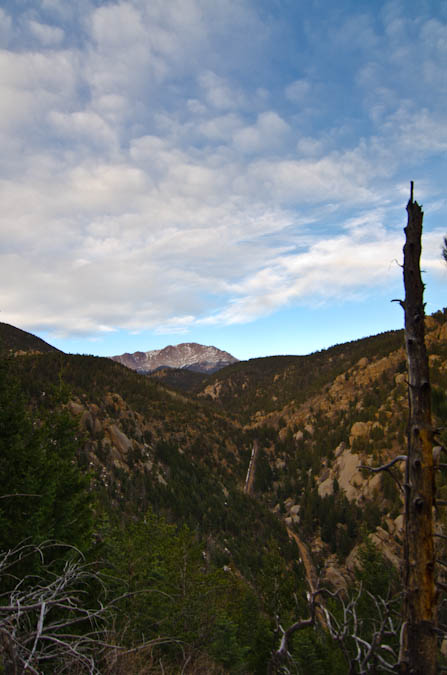
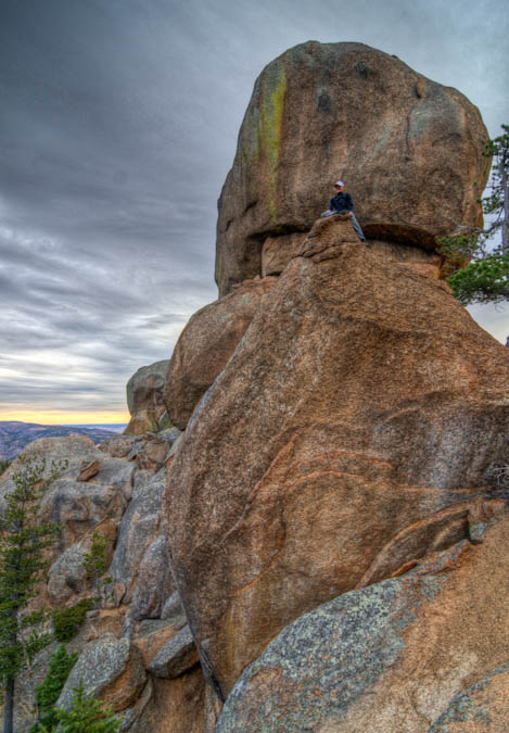
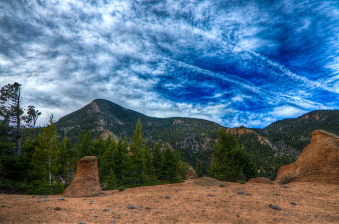
After stopping to take some shots of the sunrise, we continued on up the trail. The trail was fairly steep and kept our heart-rates going. Soon, the trail went around this huge rock feature and then dumped us out with a huge view of Pikes Peak and the Cog Railroad, which was pretty impressive.
The rock near the trail was very classic Pikes Peak Granite, with features very similar to those of outcroppings found in Lost Creek Wilderness Area. A truly fun playground, as Sarah was able to demonstrate.
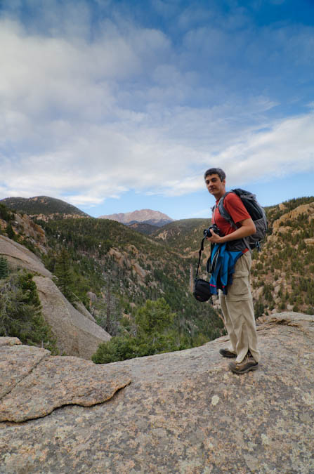
Ethan and I both enjoyed the view of Pikes Peak from this location.
The terrain was like a playground of sorts, with all kind of really cool features.
We took a few more pictures and then we were on our way up to the next section of the trail.
Soon, the trail opened-up again and dumped us out onto a very flat area which was the middle section of the hike. From here, we could see Cameron Cone finally - it seemed a lot futher away than I think we were anticipating. We could also see the Magog Ridge and Magog Rock. For the rest of the hike we all jokingly coined the phrase "Oh-my-Gog."
We went around the huge Magog Rock, which was one of the cooler features I'd seen. It had this smaller rock perched above it which made us all wonder how the heck something like that could even happen.
Ethan took many opportunities to take photos of it as well.
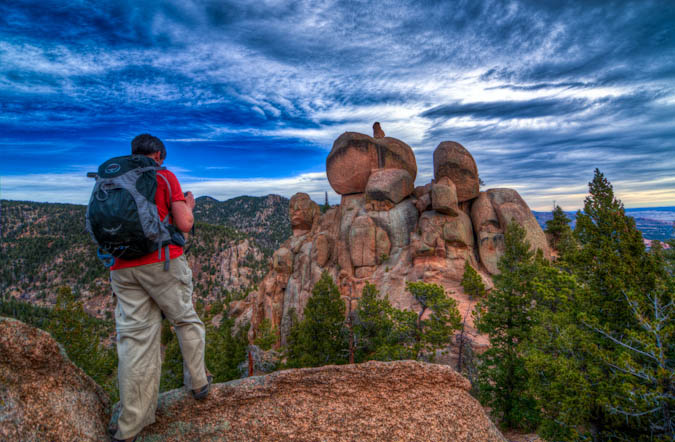
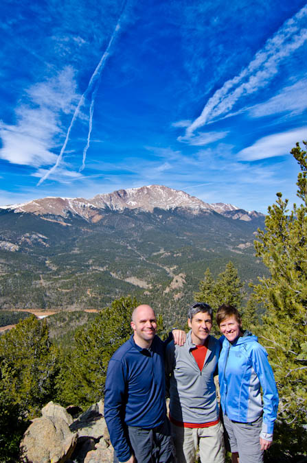
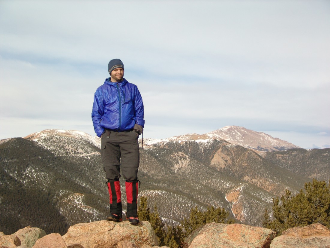
We followed a small road for a ways and then found the trail leading up to Cameron Cone, as advertised. Indeed, the trail was faint and sometimes hard to follow. We did find that there were small ribbons tied to trees at various intervals to help mark the way. We lost the trail a couple of times and found ourselves bushwacking through some steep and nasty terrain. Finally, we reached the ridge to the south of Cameron Cone and then ascended to the summit. It was pretty steep and I could understand if people turned back on this climb. It is much harder than it looks, for sure. Once we reached the top, we all enjoyed the view of Colorado Springs to the east and the unique view of Pikes Peak to the west. I busted out my tripod and set it up for some HDR work. Ethan caught me in the act, with Almagre in the background.
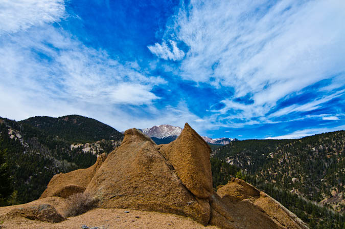
The sky was pretty cool for photography and some jet contrails added to the interest level.
One other nice advantage to bringing a tripod is that it makes for easy group photos.
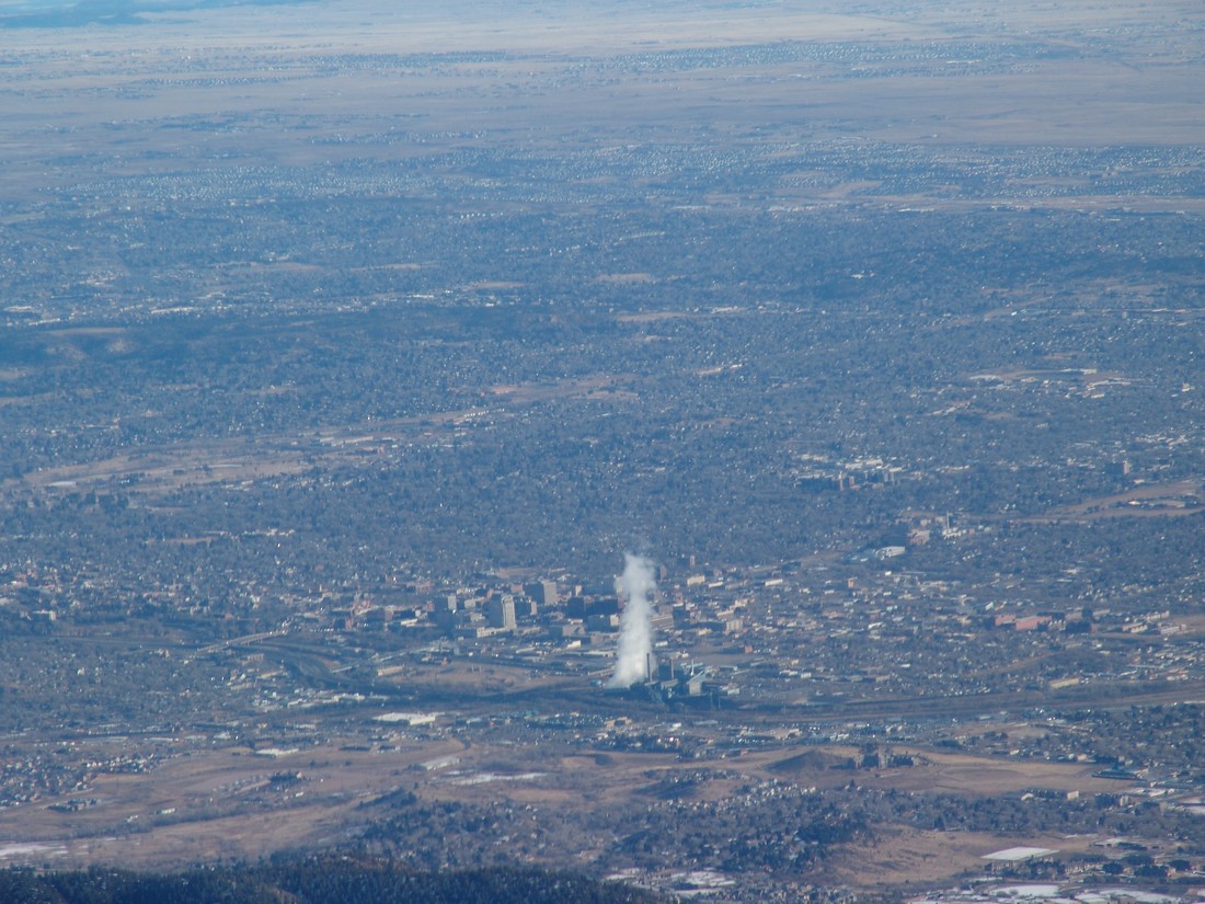
On the other side of the summit, the views of Colorado Springs, Waldo Canyon, Williams Canyon, Garden of the Gods and Colorado Springs were pretty impressive.
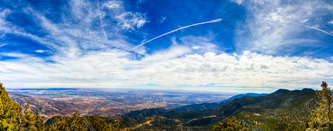
From here, I took a quick panoramic photo of the Colorado Springs area, looking northeast, east and southeast.
We spent about an hour on the summit and then head back down. The rest of the trip was pretty uneventful, albeit full of great conversation with some really great friends. I left with one parting shot of Pikes Peak.
Overall, Cameron Cone is a great hike! It is tougher than it looks and demands some respect when climbed from Barr Trail. Also, good route-finding skills are also required.
The views of Pikes Peak on this trip are totally worth the hike and are quite unique. You won't be disappointed if you choose this mountain that is off the beaten path.
{fcomment}
Mount Rosa - a Pointy Peak on the Front Range

Mount Rosa is a 11,499 ft. mountain located just west of Colorado Springs and from Colorado Springs appears to be next to (north of) Cheyenne Mountain. Mount Rosa is a deceptive mountain though because it is actually quite a bit west of Cheyenne Mountain. According to David Phillips, who wrote an entire thesis on the mountain, the peak was named in 1874 after Rose G. Kingsley, a prominent figure and devoted hiker in the early days of Colorado Springs. As a native to Colorado Springs, Mount Rosa has always intrigued me because of its visibility and prominent form.
In fact, most people don't know Mount Rosa by name, but if you said "that pointy mountain next to Cheyenne Mountain," most people would know which mountain you were talking about. So naturally, because of how visible this peak is, I have always been intrigued by it and wondered what kind of climb it would be. Not having researched it at all before doing this hike, I was surprised by the level of ease and high level of access that Mount Rosa affords the casual hiker. Within minutes, you can be at the trailhead from Colorado Springs and on the summit within another hour or two. This makes Rosa a great option for someone looking for a quick hike or a first ascent for less advanced hikers wanting to get a great view of Colorado Springs. Indeed, the views from the summit do not dissappoint and are surprisingly good despite Mount Rosa's low elevation of only 11,499 ft. In fact, from Mount Rosa, one can see most of the Sangre de Cristo Range, including the Blanca Massif.
To get to the trailhead for Mount Rosa, take Old Stage/Gold Camp Road approximately 12.5 miles to Forest Service Road 379 (close to the Penrose-Rosemont Reservoir). Turn north on 379 and travel on the 4WD road to Frosty Park for another 1.5 miles. There is no marked trail per-se; however, the Frosty Park area is easy to spot as it is a huge clearing with lots of mud tracks from off-road vehicles. Even in winter, we were able to get my Jeep Grand Cherokee (4 inch lift, 32 inch tires) to Frosty Park without any issues; however, a lower clearance vehicle or one lacking 4WD will cause you to add another mile or two to your hike.
From the Frosty Park trailhead, Mount Rosa is only a 1.75 mile hike up moderate terrain. We did not employ snowshoes although it would be probably be a good idea to have them with you if there were recent snowstorms. We had ours with us but opted to leave them in the car.
There is ample parking at Frosty Park; however, I would be curious to see this area in the summer months, as there was evidence that people go there to fire their weapons. It may be prudent to find alternative parking in that case.
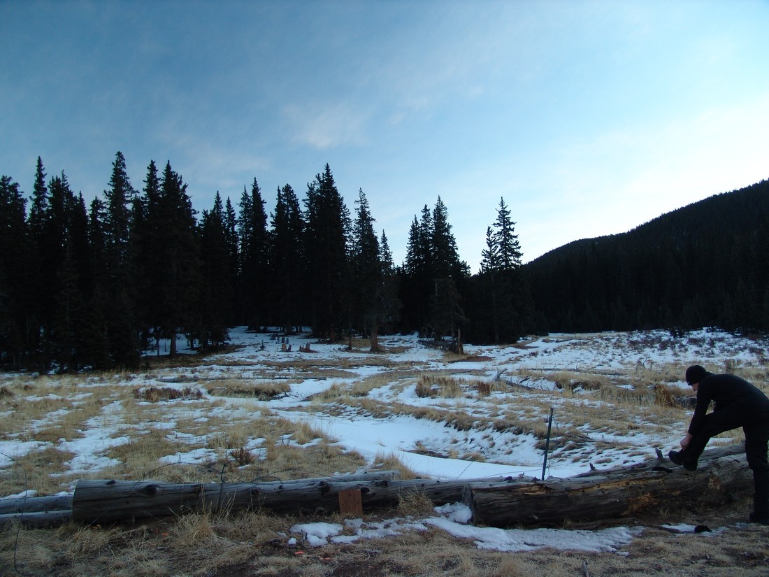
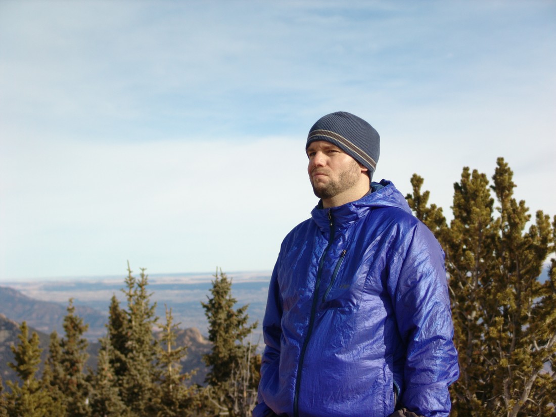
Ethan Beute prepares for our quick hike up Mount Rosa.
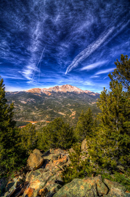
Although the trail was obscured by about 6 inches of snow for the entire hike, we found the route to be pretty straight-forward and easy to follow. If you've never been in the area, it may be advisable to bring a map and/or GPS just in case. The trail heads east and then gains the ridge for Mount Rosa pretty quickly. Before you know it, you're standing on the summit, with excellent views of Pikes Peak and the Colorado Springs metro area. Rosemont Reservoir looks really cool with the snow covering it as well.
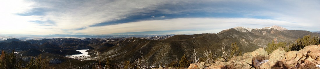
The views of the Sangre de Cristo range were also really nice, which was a surprise for sure.
You could also make out most of the major geographical points of reference down in town.
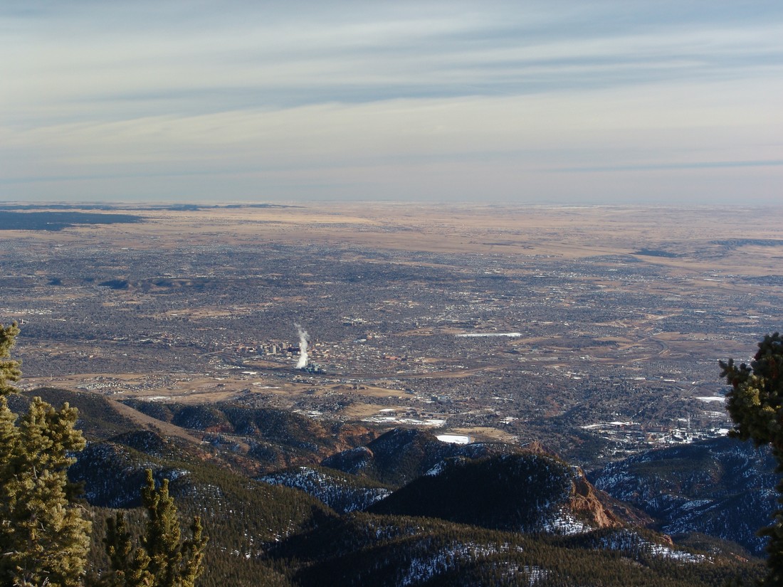
Can you see your house?
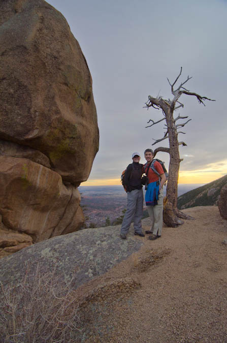
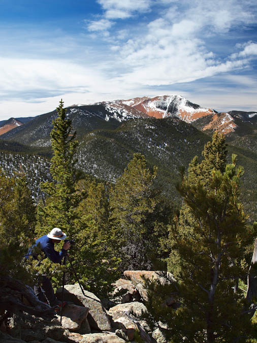
The weather was very nice for mid-January, so Ethan and I enjoyed our time on top of Mount Rosa. We also got a good idea of the route up Almagre Mountain from there, and made tentative plans to return to hike that mountain in the future.
Almagre Mountain seen behind Matt Payne
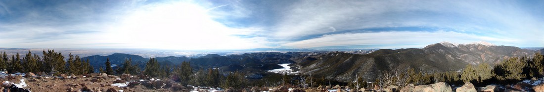
And to finish of the report - here's the 360 Degree view from the summit:
Mount Rosa looks intimidating from Colorado Springs, but in reality, it is a quite easy day hike that could be accomplished by nearly anyone. I hope you can get out and enjoy the views from Mount Rosa's great summit! If you find these trip reports useful, you can always follow 100summits.com on Facebook or Twitter to stay updated.
Rampart Range
Rampart Range is a sub-range of the Front Range. Rampart Range spans the area north of Pikes Peak and terminates west of the city of Castle Rock. As seen below, one prominent and popular feature within Rampart Range is Rampart Reservoir, one of the main sources of water in the Pikes Peak region. Rampart Reservoir lies between the United States Air Force Academy and Woodland Park.