Displaying items by tag: Front Range
Exploring Almagre Mountain - Sunrise on Pikes Peak and the Waldo Canyon Fire
Originally, my friend Ethan and I had made plans to climb the Three Apostles - three great 13ers over near Leadville; however, the Waldo Canyon Fire started the weekend prior and by Tuesday had burned out of control - 346 homes were burned to the ground in Mountain Shadows and Highway 24 was closed. The main access to the mountains was Highway 24, so we were pretty much stuck on the Front Range. Additionally, the whole week had been an emotional rollercoaster for everyone - my parents evacuated their house and stayed with us for a couple of nights. Ethan covered the fire quite a bit with video and social media throughout the week (by the way, if you have a chance, you really should check out his incredible blog post about social media, traditional media and the Waldo Canyon Fire - a fabulous read). The Waldo Canyon Fire had presented Ethan and I another opportunity - to hike a closer-to-home peak with the hopes of getting a birds-eye-view of the fire's extent.
So - we set off early on Sunday morning to do just that - I picked Ethan up at 3:30 AM from his house and we head up Gold Camp Road to tackle Almagre Mountain - a 12,367 ft. gently-sloped peak just South of Pikes Peak. Indeed, most Colorado Springs residents will recognize Almagre as a very plain looking set of mountains above tree-line to the left (south) of Pikes Peak. I'd always wanted to climb Almagre, and Ethan had already done it twice, so it seemed a great fit for our objectives.
We opted for the western approach from near the gate that Colorado Springs Utilities (CSU) has erected to keep people out of the city's water supply, which seemed to us to be quite low. To reach this spot, we drove quite a ways up Gold Camp Road, about 2/3 of the way to Cripple Creek, and turned right on Forest Road 376 to the CSU dead-end.
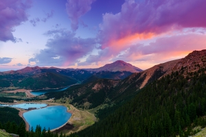
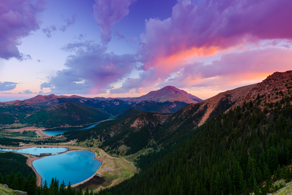
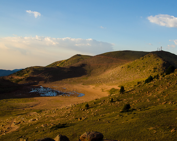
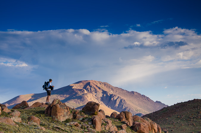
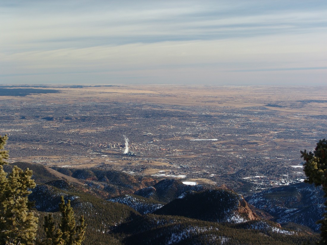
We arrived at the gate at approximately 4:15 AM and began in a wild rush up the steep 4WD road by foot towards McReynolds Reservoir. The air was quite cold this early and this high up, a stark contrast to the record-setting 100+ degree heat we had been experiencing in the scorched and dry urban setting of Colorado Springs. Eventually, the road leveled off and opened up into a large meadow, giving us a clue to begin to head west on a very faint trail, which crossed the CSU fence-line and connected to a more solid trail leading up towards Almagre Mountain. After a couple of miles of fairly steep climbing, we reached a great stopping point, giving us a wonderful vantage of Pikes Peak and the various reservoirs below - Mason Reservoir and McReynolds Reservoir - also known as the Seven Lakes area.
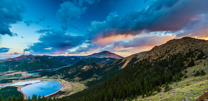
We stopped here to take in the great light hitting Pikes Peak, and I took advantage to take many photos from here as the sun continued to change the colors of the clouds and Pikes Peak.
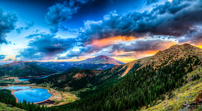
The lighting was fantastic, and it was such a rare view of Pikes Peak, I really loved it. This particular shot is also available on my photography website for sale.
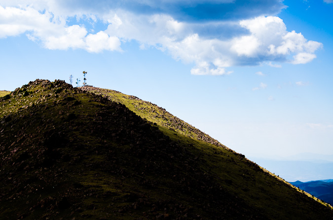
Eventually, Ethan and I packed up our tripods and continued up to the ridge for Almagre Mountain. Once on the ridge, we could see Stratton Reservoir, which looked more like Stratton pond. Additonally, we made lots of jokes about the "Weather Control Satellite" on top of Almagre Mountain South (which is really a microwave repeater). This was based on a very funny press conference earlier that week about the Waldo Canyon Fire where someone in the crowd actually seriously suggested that the government just use its weather control satellites to create rain to put out the fire. For more on the weather control satellite joke, check out this hilarious post.
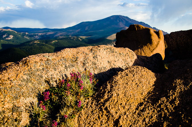
The terrain on the ridge was classic Pikes Peak granite - much of the same material found in the Lost Creek Wilderness Area.
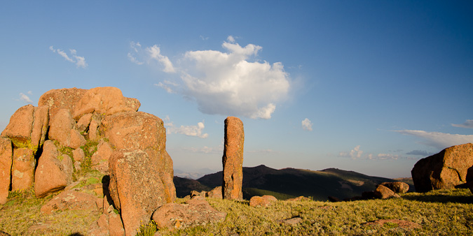
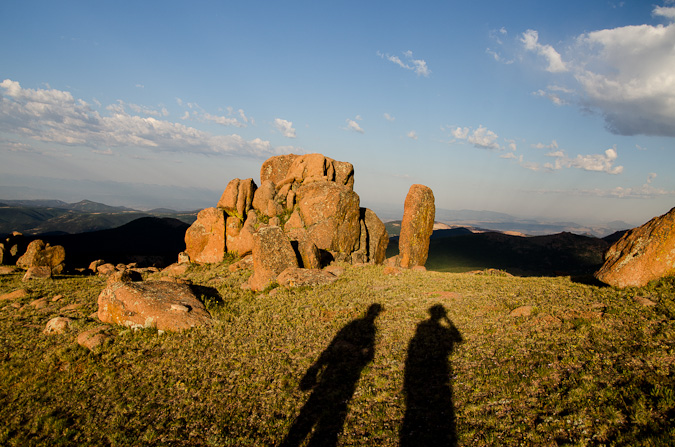
There were funky rock outcroppings all over the place. Nature sure does have a great sense of humor!
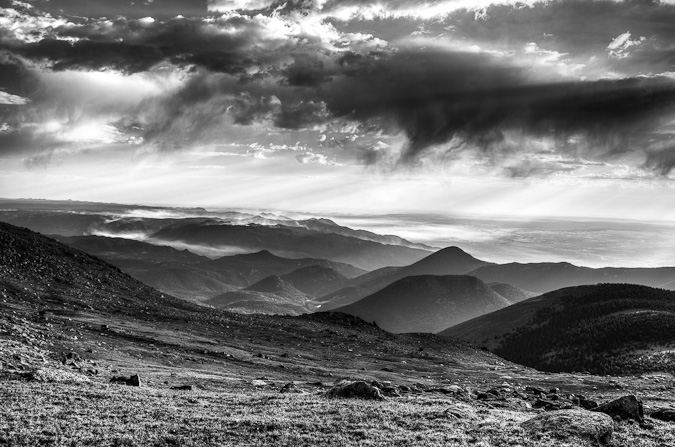
Ethan and I were both really loving the light and the color - somewhat tainted by the smoke from the huge fire that raged on to the north of us.
Ethan and I made several stops on the way up to take shots of the lakes and of Pikes Peak.
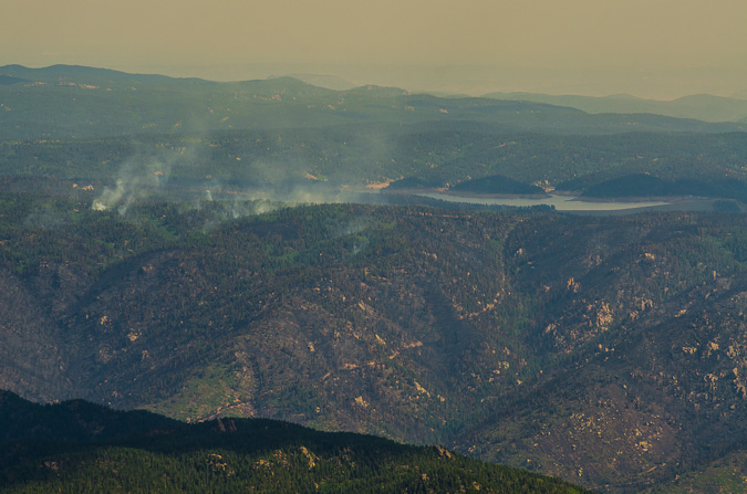
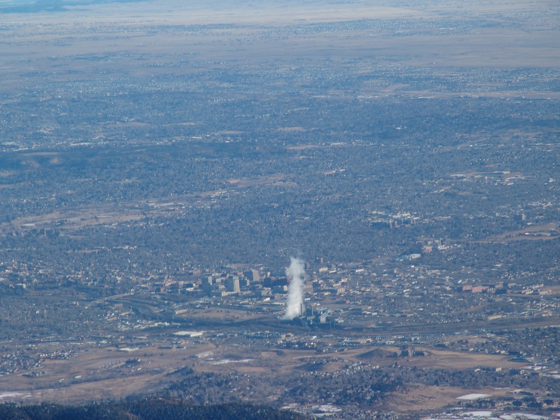
Before long, we had reached the summit without any problems. We had a great viewpoint of the fire burn area and the current burning zone. The smoke had settled into the valleys below us and made for quite the fantastic scene.
We both set-up tripods to take some time-lapse photos and video.
I was able to put together a 300 shot time-lapse video out of still images over a two-hour period from the summit. While it was pretty borning up there, I could not complain about the view.
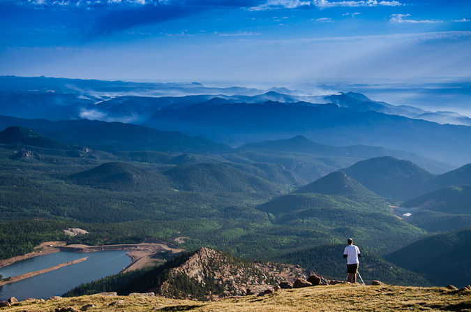
I was able to get some pretty great zoomed-in shots of Rampart Range Reservoir about Highway 24, where the fire was most active at this point. A zoomed in view shows quite a bit of destruction in that area, but as bad Ias I had thought would / could happen.
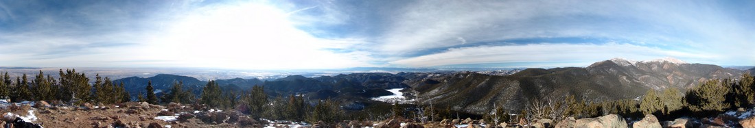
The 360 degree view was fantastic as well - with Pikes Peak anchoring the center of this peice.
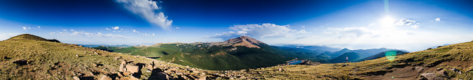
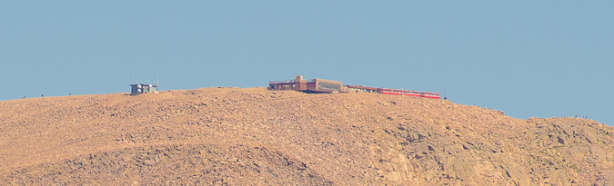
I was even able to get a super zoomed in view of the Pikea Peak summit, where I could make out people and the Cog Railway.
We both decided that after spending two hours on the summit that it was time to head-out. So we did just that. Right beforehand I was able to get a sweet shot of Ethan way up on the summit taking shots.

On the way back, I was able to get a better shot of Stratton Reservoir (with Mount Rosa in the background), now reduced to almost nothing.
And of course, our down-climb would not be complete without another shot of the Weather Control Satellite...
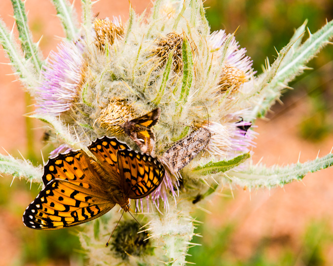
The hike back down to the car was quite uneventful. We noticed there were a lot of butterflys out and so we were able to follow one to this huge thistle plant, where countless other insects were hanging out, drinking nector from these hearty flowers.
All in all, I would rate Almagre Mountain as very easy - a mountain for all ages and skill levels. The rare views of Pikes Peak alone were worth the drive and hike for me.
{fcomment}
Mount Rosa - a Pointy Peak on the Front Range

Mount Rosa is a 11,499 ft. mountain located just west of Colorado Springs and from Colorado Springs appears to be next to (north of) Cheyenne Mountain. Mount Rosa is a deceptive mountain though because it is actually quite a bit west of Cheyenne Mountain. According to David Phillips, who wrote an entire thesis on the mountain, the peak was named in 1874 after Rose G. Kingsley, a prominent figure and devoted hiker in the early days of Colorado Springs. As a native to Colorado Springs, Mount Rosa has always intrigued me because of its visibility and prominent form.
In fact, most people don't know Mount Rosa by name, but if you said "that pointy mountain next to Cheyenne Mountain," most people would know which mountain you were talking about. So naturally, because of how visible this peak is, I have always been intrigued by it and wondered what kind of climb it would be. Not having researched it at all before doing this hike, I was surprised by the level of ease and high level of access that Mount Rosa affords the casual hiker. Within minutes, you can be at the trailhead from Colorado Springs and on the summit within another hour or two. This makes Rosa a great option for someone looking for a quick hike or a first ascent for less advanced hikers wanting to get a great view of Colorado Springs. Indeed, the views from the summit do not dissappoint and are surprisingly good despite Mount Rosa's low elevation of only 11,499 ft. In fact, from Mount Rosa, one can see most of the Sangre de Cristo Range, including the Blanca Massif.
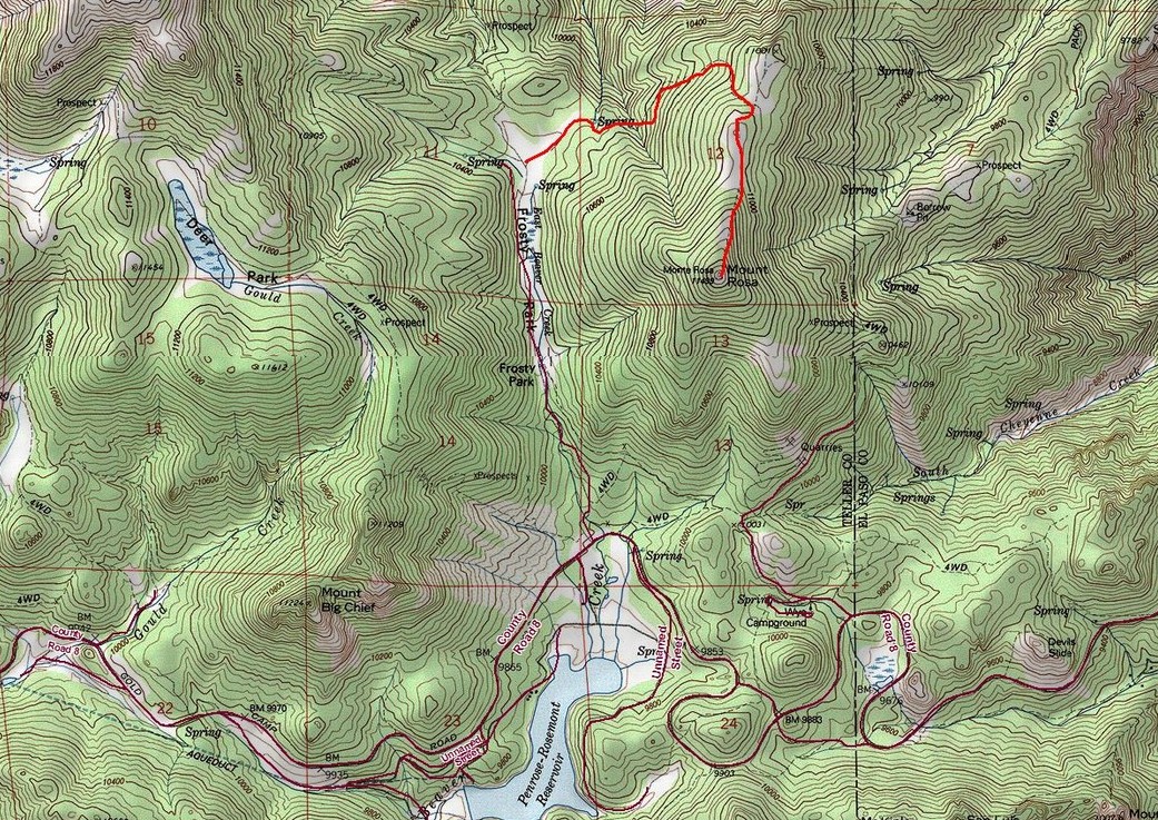
To get to the trailhead for Mount Rosa, take Old Stage/Gold Camp Road approximately 12.5 miles to Forest Service Road 379 (close to the Penrose-Rosemont Reservoir). Turn north on 379 and travel on the 4WD road to Frosty Park for another 1.5 miles. There is no marked trail per-se; however, the Frosty Park area is easy to spot as it is a huge clearing with lots of mud tracks from off-road vehicles. Even in winter, we were able to get my Jeep Grand Cherokee (4 inch lift, 32 inch tires) to Frosty Park without any issues; however, a lower clearance vehicle or one lacking 4WD will cause you to add another mile or two to your hike.
From the Frosty Park trailhead, Mount Rosa is only a 1.75 mile hike up moderate terrain. We did not employ snowshoes although it would be probably be a good idea to have them with you if there were recent snowstorms. We had ours with us but opted to leave them in the car.
There is ample parking at Frosty Park; however, I would be curious to see this area in the summer months, as there was evidence that people go there to fire their weapons. It may be prudent to find alternative parking in that case.
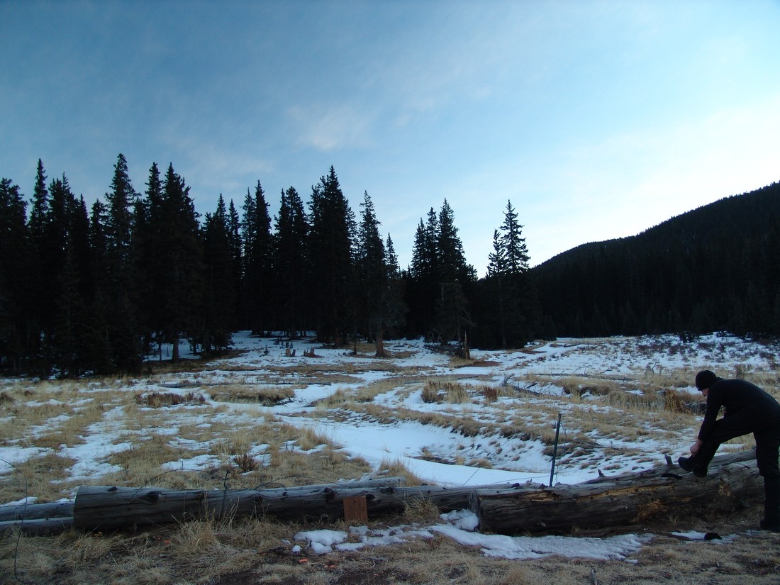
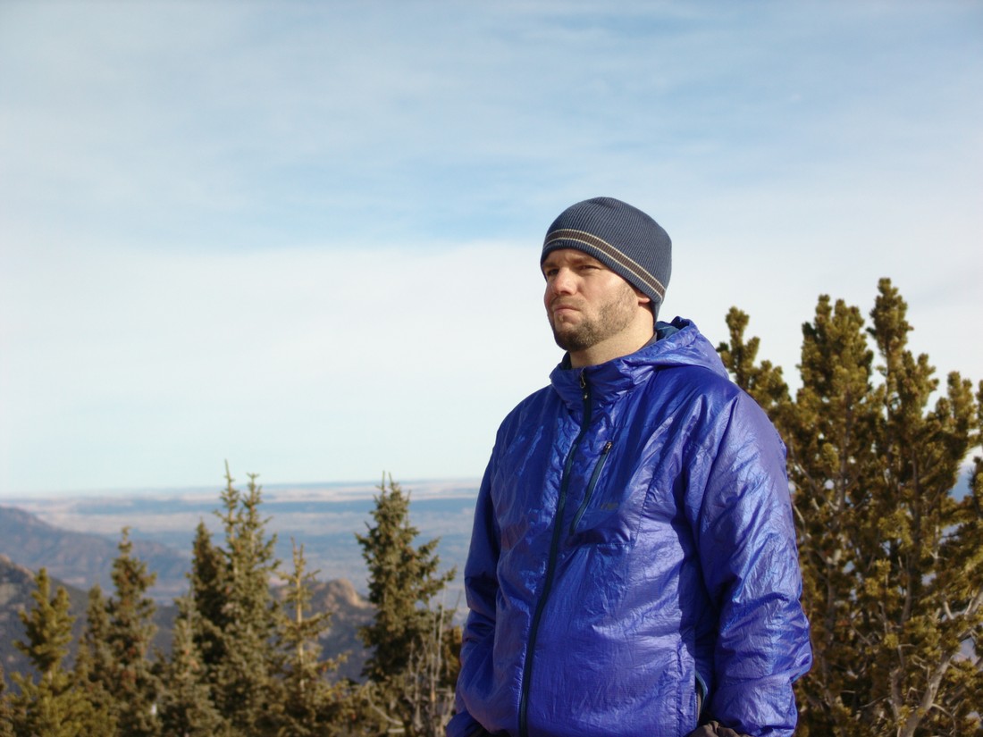
Ethan Beute prepares for our quick hike up Mount Rosa.
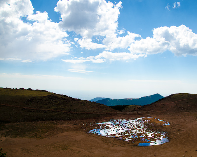
Although the trail was obscured by about 6 inches of snow for the entire hike, we found the route to be pretty straight-forward and easy to follow. If you've never been in the area, it may be advisable to bring a map and/or GPS just in case. The trail heads east and then gains the ridge for Mount Rosa pretty quickly. Before you know it, you're standing on the summit, with excellent views of Pikes Peak and the Colorado Springs metro area. Rosemont Reservoir looks really cool with the snow covering it as well.
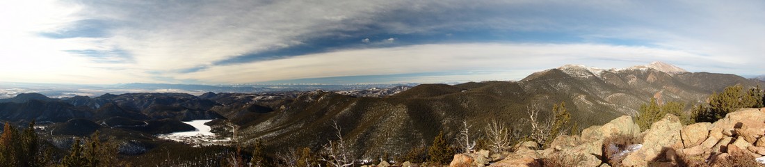
The views of the Sangre de Cristo range were also really nice, which was a surprise for sure.
You could also make out most of the major geographical points of reference down in town.
Can you see your house?
The weather was very nice for mid-January, so Ethan and I enjoyed our time on top of Mount Rosa. We also got a good idea of the route up Almagre Mountain from there, and made tentative plans to return to hike that mountain in the future.
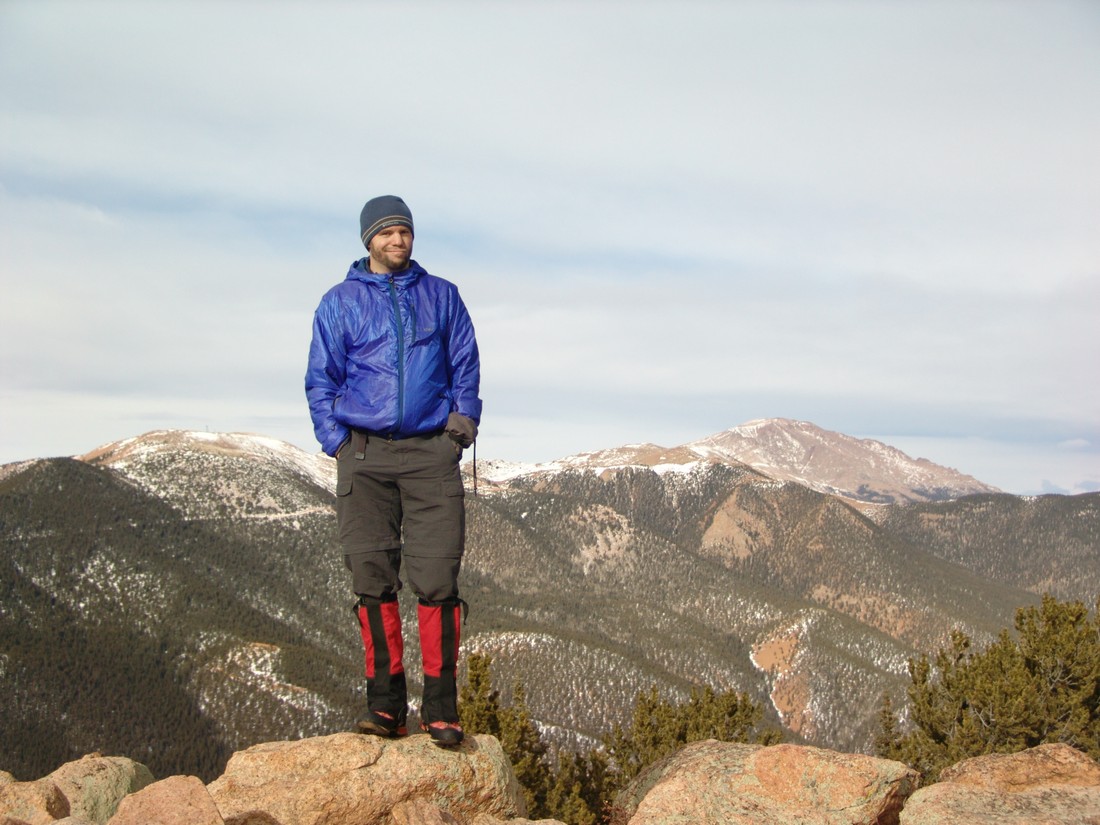
Almagre Mountain seen behind Matt Payne
And to finish of the report - here's the 360 Degree view from the summit:
Mount Rosa looks intimidating from Colorado Springs, but in reality, it is a quite easy day hike that could be accomplished by nearly anyone. I hope you can get out and enjoy the views from Mount Rosa's great summit! If you find these trip reports useful, you can always follow 100summits.com on Facebook or Twitter to stay updated.
Laramie Mountains
The Laramie Mountains are part of the Front Range and rests just north of Rocky Mountain National Park and the Mummy Range. With one exception, this mountain range consists mostly of gentle summits below 11,000 ft. The highest summit is just slightly higher than 11,000 ft. This range extends north into Wyoming and is easily visible from I-25.
Williams Fork Mountains
Disected by the Gore Range, the Williams Fork Mountains are split into two sub-areas - east and west. The eastern part of this mountain range comprises the western edge of the Front Range, just north and west of the Eisenhower Tunnel and the western part of this mountain range is just north of the Flat Tops. The east Williams Fork Mountains are just west of the Vasquez Mountains and consist mostly of very gentle slopes and easy summits. Due to their proximity to the rugged Gore Range and because of the fact that there are very few high summits in this range, spectacular views and solitude are not uncommon here.
Indian Peaks
Also known as the Indian Peaks Wilderness Area, the Indian Peaks lie within the Front Range, just south of the Rocky Mountain National Park. Due to its proximity to the Denver and Boulder area, the Indian Peaks are one of the most heavily accessed Wilderness Areas in Colorado. According to wilderness.net, the United States Congress designated the Indian Peaks Wilderness in 1978 spanning a total of 77,711 acres. Additionally, roughly 35% of this area is above treeline and the area is home to about 50 lakes. Summit elevations range from 8,300 to just over 13,500 feet, offering a wide range of climbing opportunities all year-round, including some challenging class 3 and 4 variations. In places, this range is rather rugged due to the glaciation that has occured to the mountains here.
Platte River Mountains
Measuring just 15 miles long, the Platte River Mountains are north of the Kenosha Mountains and are a sub-range of the Front Range consisting completely of gentle summits.
Front Range
The Front Range of Colorado is perhaps the most well-known mountain range in Colorado due to its proximity to three major metropolitan areas: Denver, Colorado Springs, and Ft. Collins. The Front Range is comprised of several sub-ranges, including Rampart Range, Kenosha Mountains, Platte River Mountains, Tarryall Mountains, Puma Hills, Vasquez Mountains, Laramie Mountains, Rocky Mountain National Park, Never Summer Mountains, Medicine Bow Mountains, Mummy Range, Williams Fork Mountains, and the Indian Peaks. Additionally, the Front Range covers roughly 7,000 square miles and spans more than 175 miles North-to-South, making it Colorado's longest mountain range.