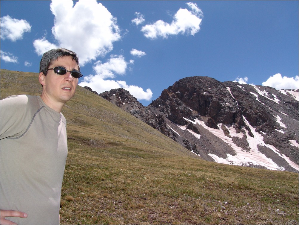
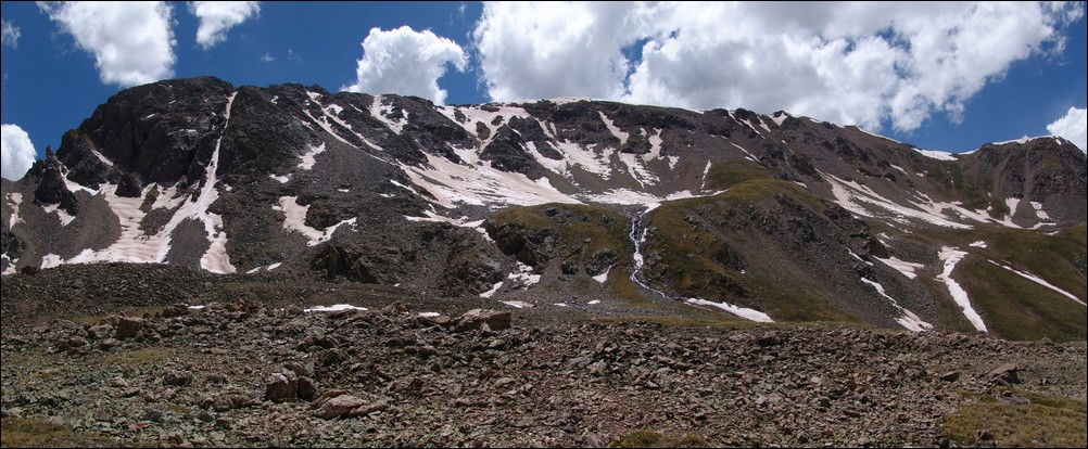
Displaying items by tag: Huron Peak
Missouri Mountain, Iowa Peak and Emerald Peak: The Sawatch Triple-Crown
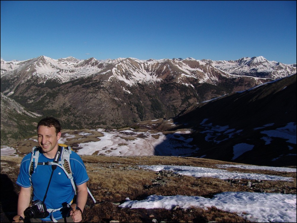
The Sawatch Range of Colorado is known for its long, gentle giants such as Mount Elbert, Mount Massive, etc. It would also seem that most visitors to this area of the state are solely interested in climbing only the 14ers, due to the popular sport it has become to summit all of the 14ers in Colorado. I must admit that I have been caught up in this craze myself; however, one of my favorite climbing past-times is to spend time tackling some of the lesser-known 13ers, and that is just what Ethan Buete and I did this past weekend.
To start off, here is a break-down of relevant numbers from the trip:
Missouri Mountain: 14,067 ft (ranked 36th in Colorado)
Iowa Peak: 13,831 ft (soft-ranked)
Emerald Peak: 13,904 ft (ranked 71st in Colorado)
Total elevation gain: 5,612 ft.
Total distance hiked: 13.44 miles
Total time hiking: 10 hours, 10 minutes
Total photos taken: 554
Total wildlife sightings: 2 (marmot and beaver)
Total distance driven: 124 miles
Trip duration: 27 hours
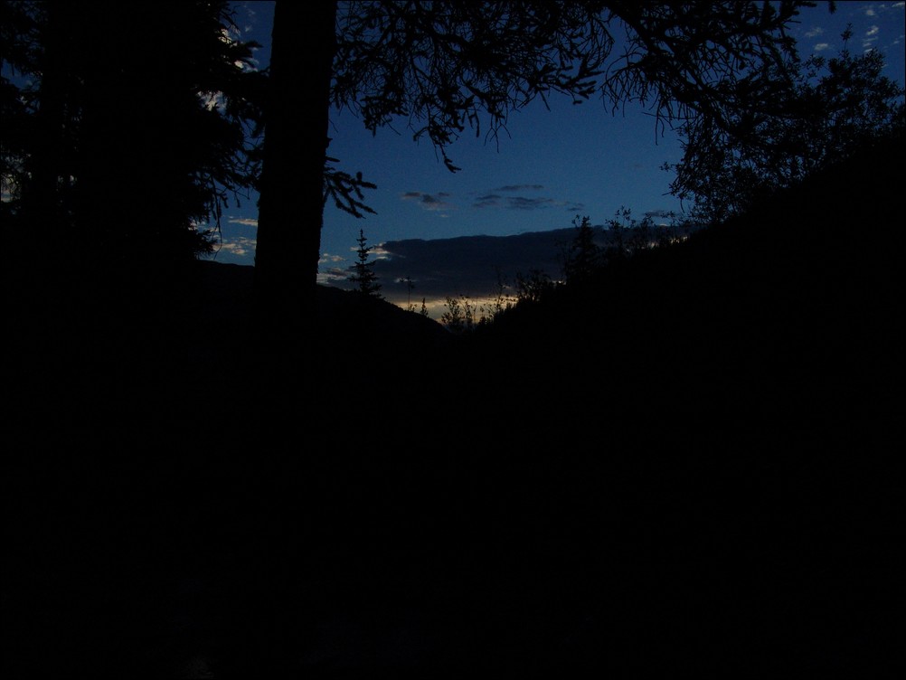
Ethan and left his house at 5:30 PM on Friday evening and stopped in Buena Vista at the Eddyline Brewery for dinner. The selection of food was superb - Eddyline supports local agriculture and the green movement - a definite bonus. I ordered the "Mount Princeton Calzone," which seemed quite fitting. After chowing down at the brewery, Ethan and I departed for Chafee County Road 390, just a few minutes North of Buena Vista, and headed up past Clear Creek Reservoir to find a camp-site next to a beaver pond along-side the road. Upon arrival, we were greeted by a friendly and noisy beaver as we began un-packing. We quickly set-up camp, set our alarm for 4 AM, and drifted into the always welcome pre-summit slumber.
We woke up at 4 AM and made some quick oatmeal and broke-down our campsite. Shortly afterwards, we departed for the Missouri Gulch trailhead and began hiking at 5:15 AM.
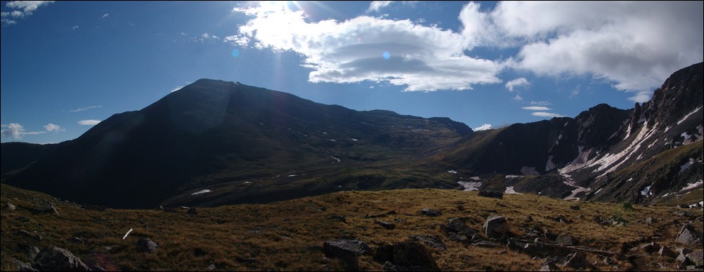
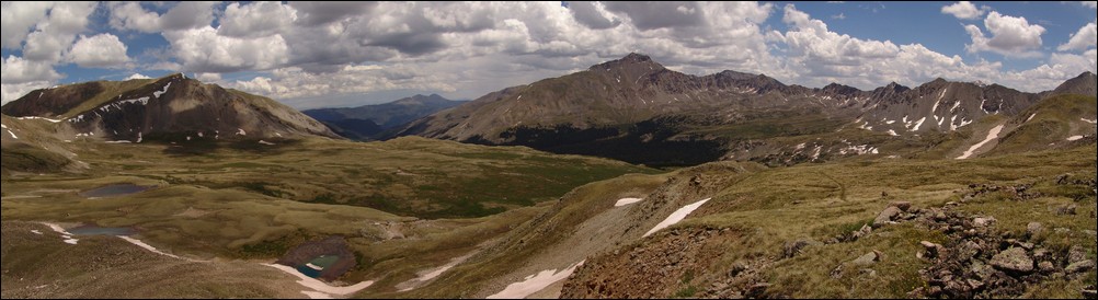
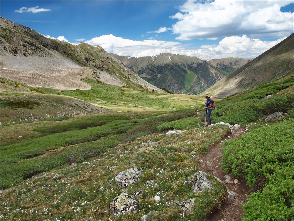
This particular trailhead provides access for several fourteen-thousand foot mountains, including Mount Belford, Mount Oxford and Missouri Mountain. We were hopeful that most other hikers would be aiming for the ever-popular Belford-Oxford combo and that we would be provided with some solitutude. Our goal was to climb the standard route of Missouri and then follow the ridge over to Iowa Peak and then Emerald Peak. We were not sure on our route quite yet, but figured we would have it solidified upon getting a full view of the area from each peak. Our eventual route took us up Missouri, over to Iowa, up Emerald, down into the Missouri Basin, and finally over Elkhead Pass back to the trailead.

A topographical map with our route shown in purple. We began and ended near Vicksburg at the Missouri Gulch trailhead.
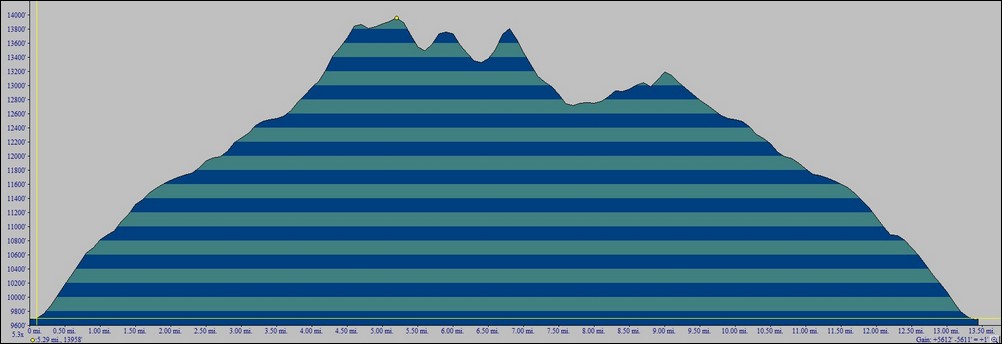
A vertical profile of our chosen route up Missouri, Iowa and Emerald.
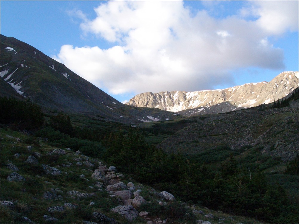
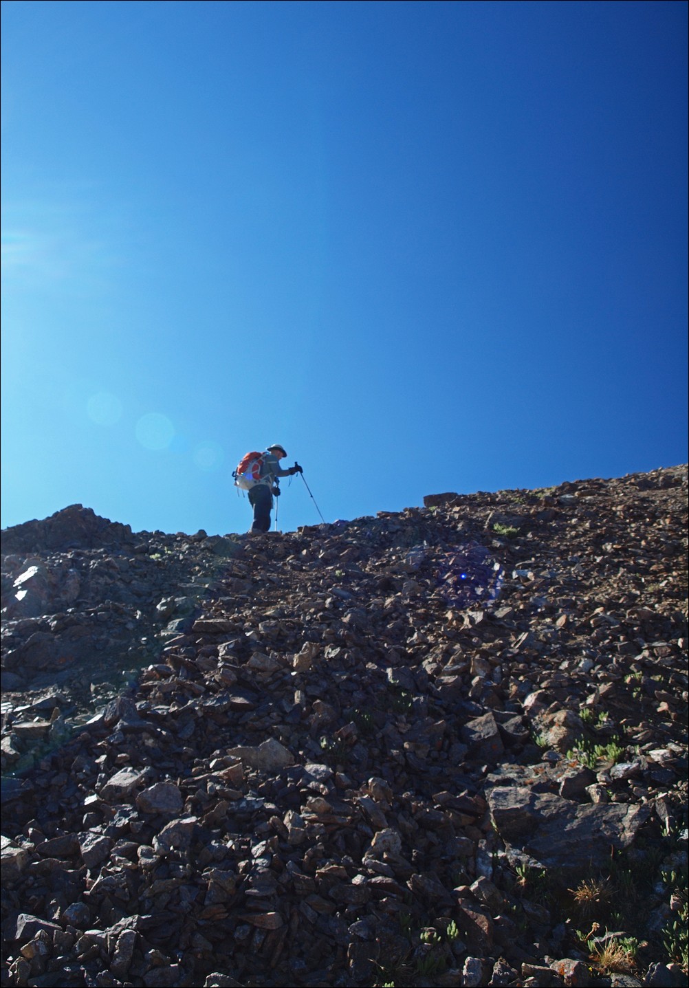
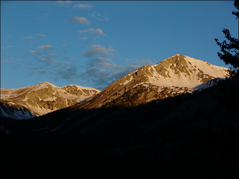
The trail going up Missouri Gulch starts out very steep and does not relent until after treeline. Ethan and I made excellent progress up the trail and only stopped a few times before reaching treeline shortly before the sun began to rise.
The sun rises below over the Clear Creek valley.

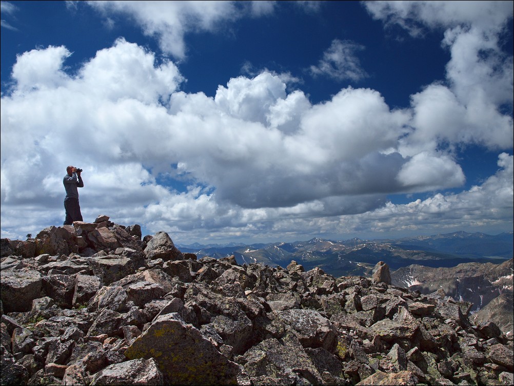
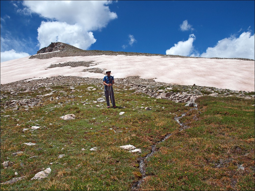
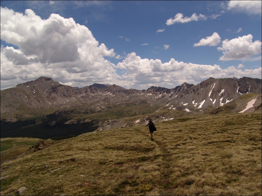
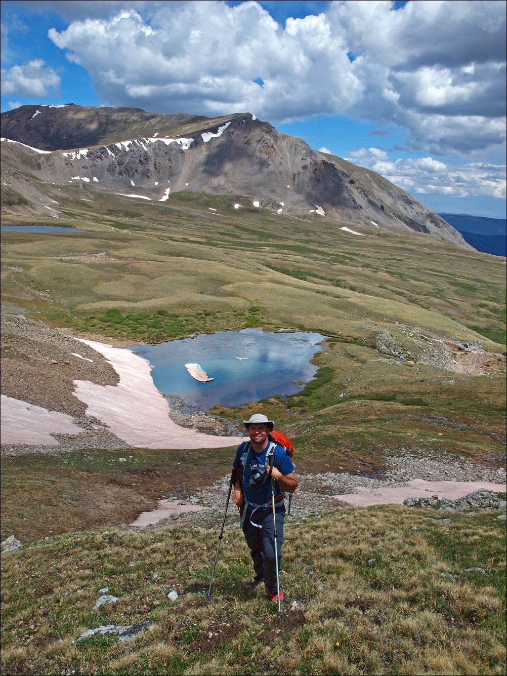
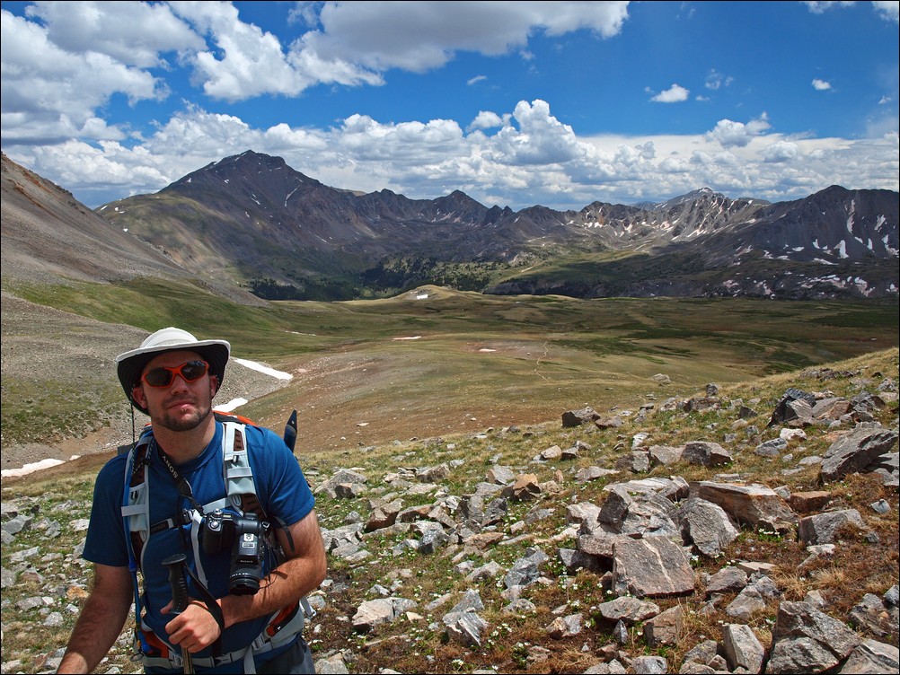
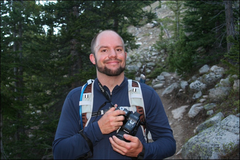
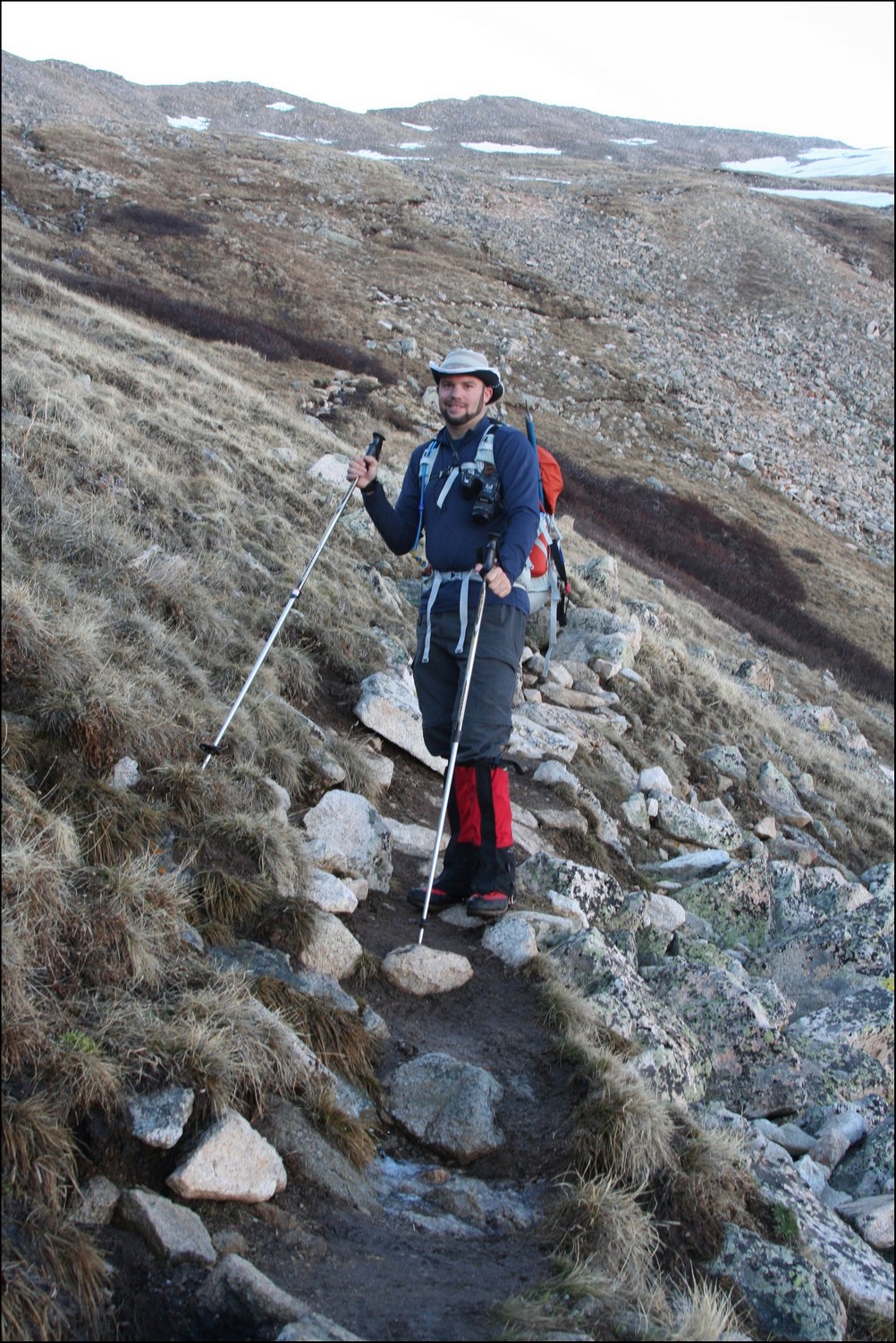
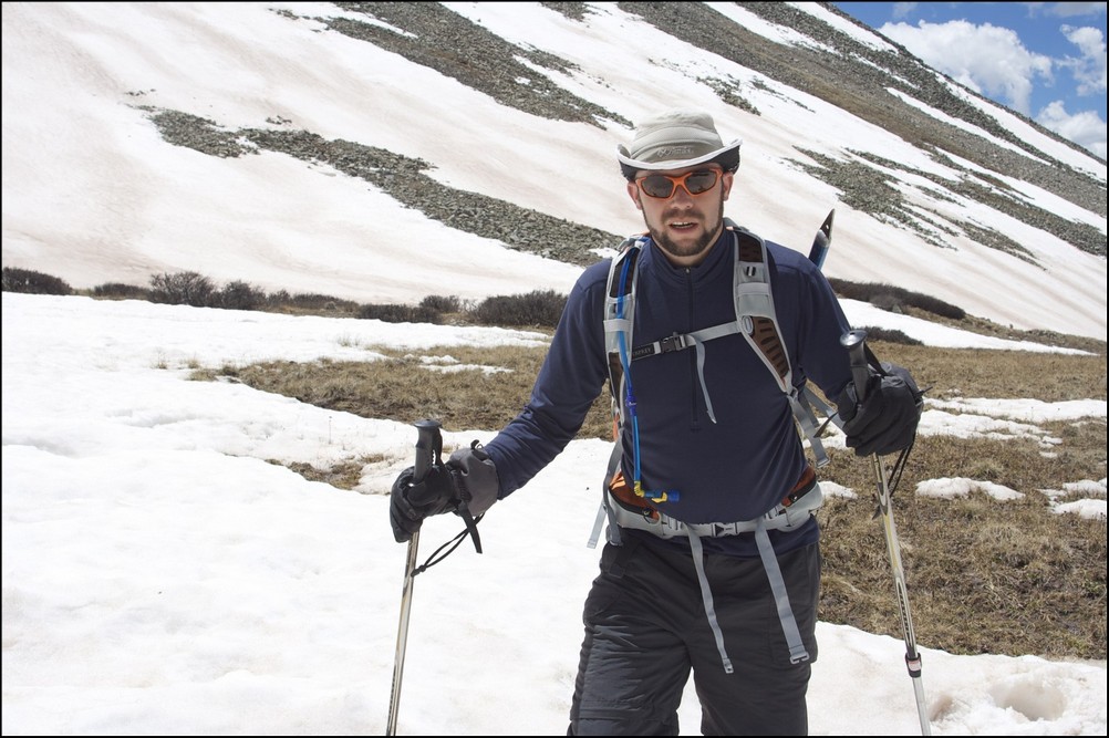
Matt Payne hikes quickly up Missouri Gulch
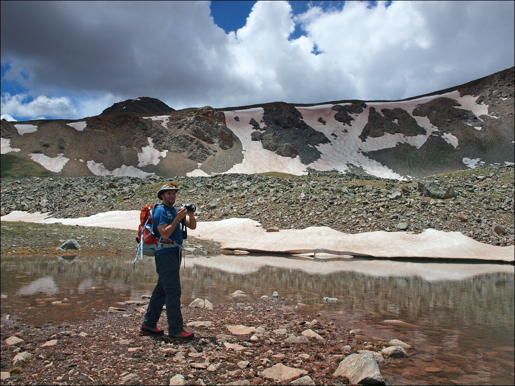
Shortly after reaching treeline, some favorable campsites appear near some old mining cabins alongside the Missouri Gulch drainage. It is at this point that you can begin to see Mount Belford above and to the east. Ethan and I both stopped to take some pictures of Mount Belford and the surrounding area.

Matt Payne stops to take a few photos of the Missouri Gulch and Mount Belford.

Mount Belford is illuminated by sunlight near Missouri Gulch
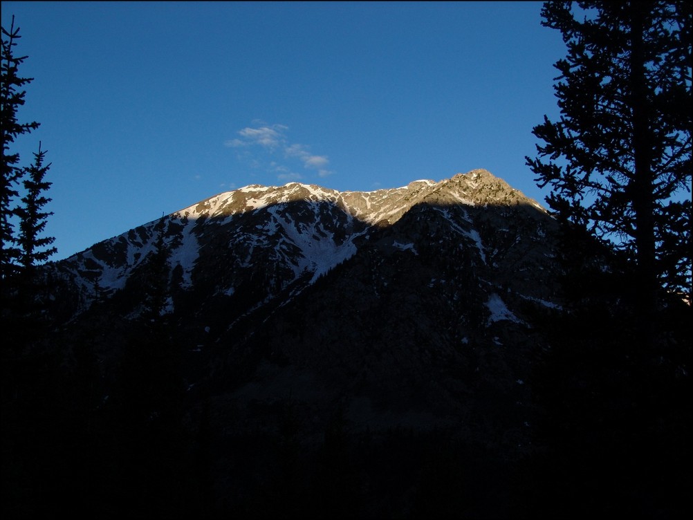
After hiking a short was further up into the basin, our first views of our first objective for the day, Missouri Mountain, became available.
Missouri Mountain appears before us, basked in early sunlight.
At this point, we were closer to Mount Belford. Ethan explained to me that when he climbed it, he climbed up Elkhead Pass, where most other hikers chose to go straight up a muddy slope on the northwest slopes, making for a terrible climb. It appeared that others were attempting to do just that on this day as well.

Mount Belford with hikers on the northeast slope.

Climbers are seen going up the gentle northeast slope of Mount Belford.
As we climbed higher, Missouri became more and more impressive. The light also afforded somewhat better views of the mountain, and afforded us with some photo opportunities.
Missouri Mountain with a small water flow with alpine flowers
At this point, were were passed by a group of 4 hikers heading up Missouri. I hate to judge people that I don't know, but I could not help but wonder about this group. It was a friendly but fairly odd group, all wearing cotton sweat-shirts (cotton is often considered a very poor choice for any article of clothing worn during high-altitude hikes due to its inability to quickly dry). One gentleman was wearing flip-flops and playing music out of a small radio in his backpack. I was both perplexed and annoyed - I really don't want to hear your music when I'm hiking, and I won't feel pity if Search and Rescue are called because you obtained frostbite on your toes. We later learned it was his first 14er and he had switched into ascent shoes, which made me feel a little better.
Ethan and I continued up the trail and kept our eye on Missouri, hoping to catch a view of the trial heading up to the ridge.
The sun rises over Mount Belford with Missouri to its immediate right.
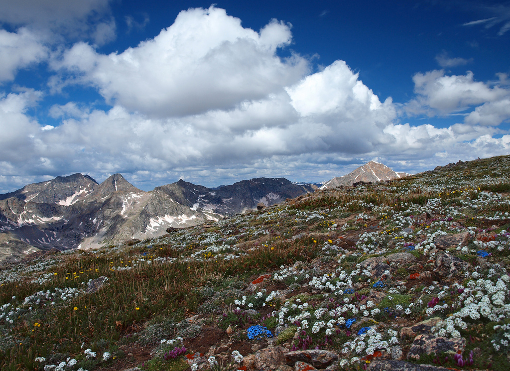
The extra light from the sun also revealed to us that there were many types of wildflowers in bloom, much to our surprise. The basin was covered in whites, purples, yellows, and blues.
Wildflowers cover the Missouri Gulch basin in late June.
The trail heading up towards Missouri was in great condition, often weaving through thick tundra grasses and around willow bushes.
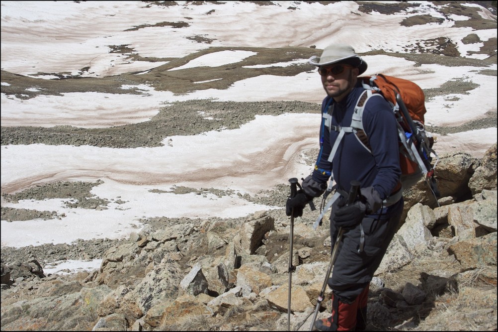
Shortly before reaching the base of Missouri Mountain, the trail hits an intersection. Heading left takes you up Elkhead Pass and heading right takes you up the standard trail for Missouri Mountain. Ethan and I refueled with nuts/fruit/powerbars and began our ascent up the relatively steep trail for Missouri.
Elkhead Pass can be seen to the right of Mount Belford (left of center).
At this point, Ethan and I kicked it into high gear, heading up the rocky, but well-maintained trail up Missouri's long sweeping north ridge. The trail takes you up very quickly, and before we knew it, we were cresting the ridge.
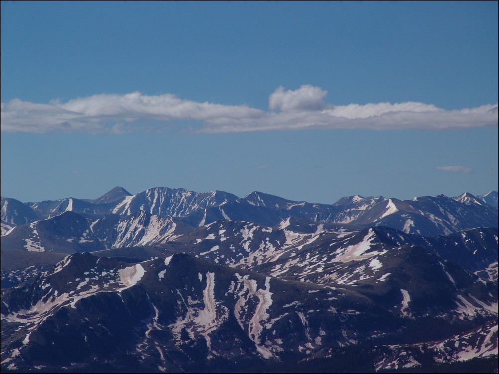
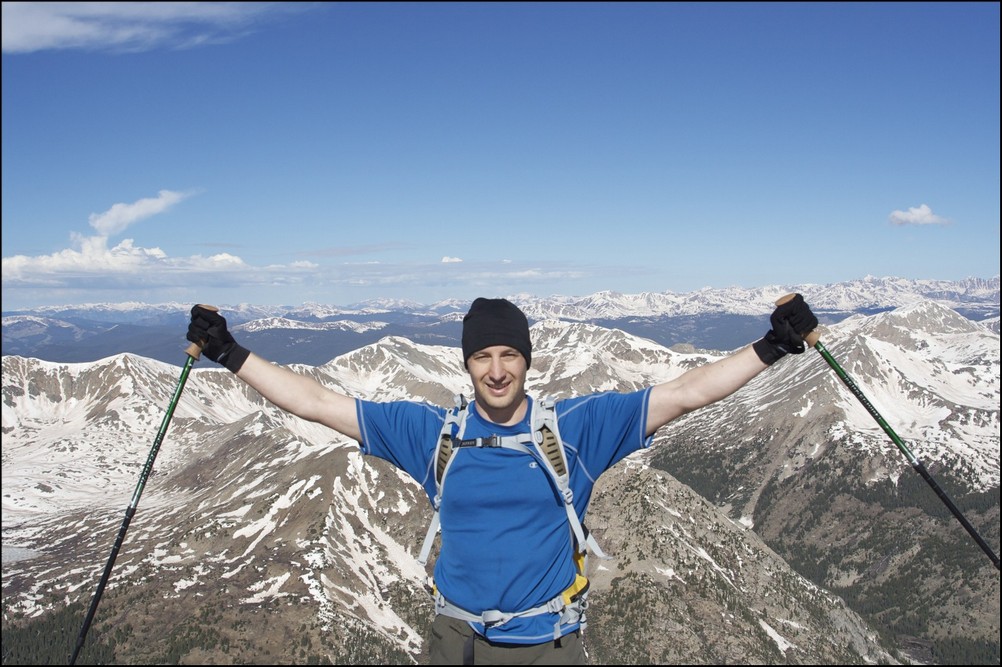
After reaching the ridge, awesome views of Huron Peak, La Plata Peak, and the Three Apostles, including Ice Mountain and North Apostle were revealed.
This was particularly exicting for me since I had just been on top of Huron Peak just a few short weeks previous to this trip.
Huron Peak comes into view upon gaining the north ridge of Missouri Mountain.

Huron Peak - zoomed in

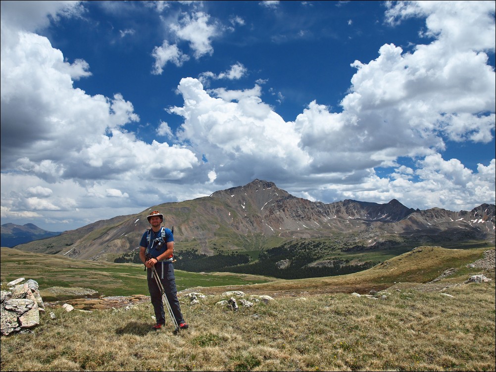
Ethan Buete looks over towards La Plata Peak (ranked 5th highest in Colorado).

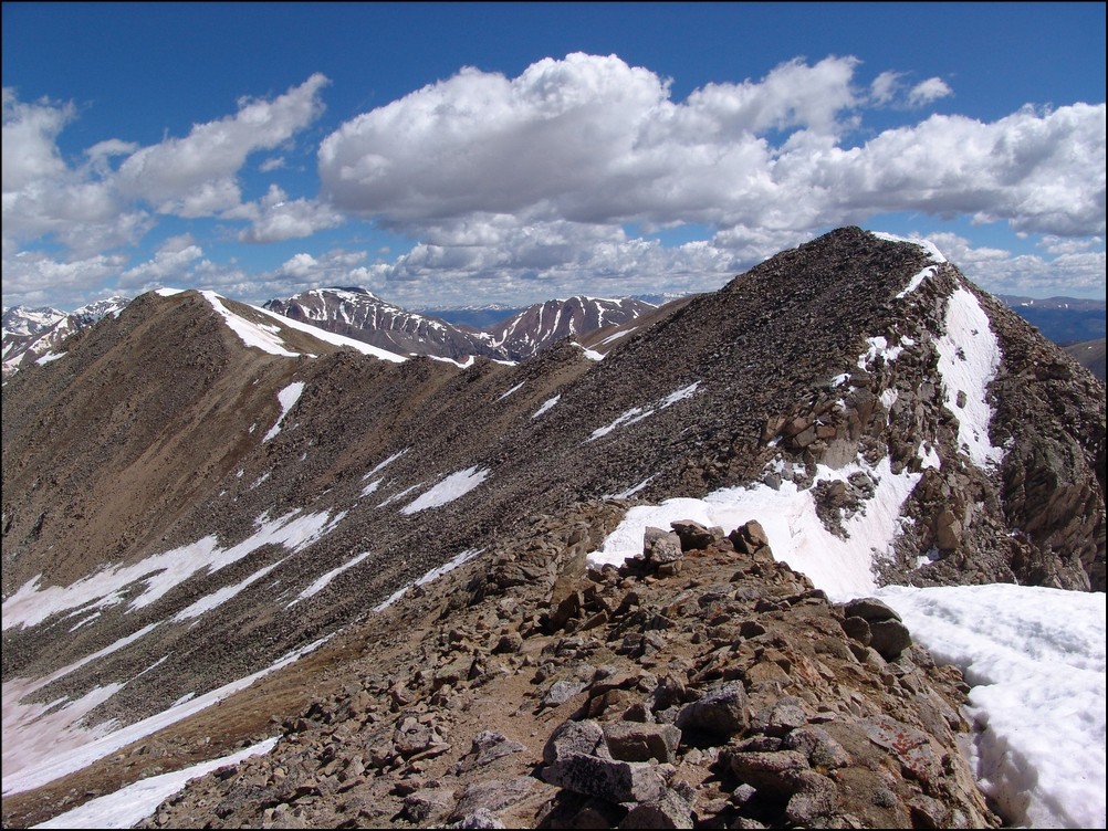
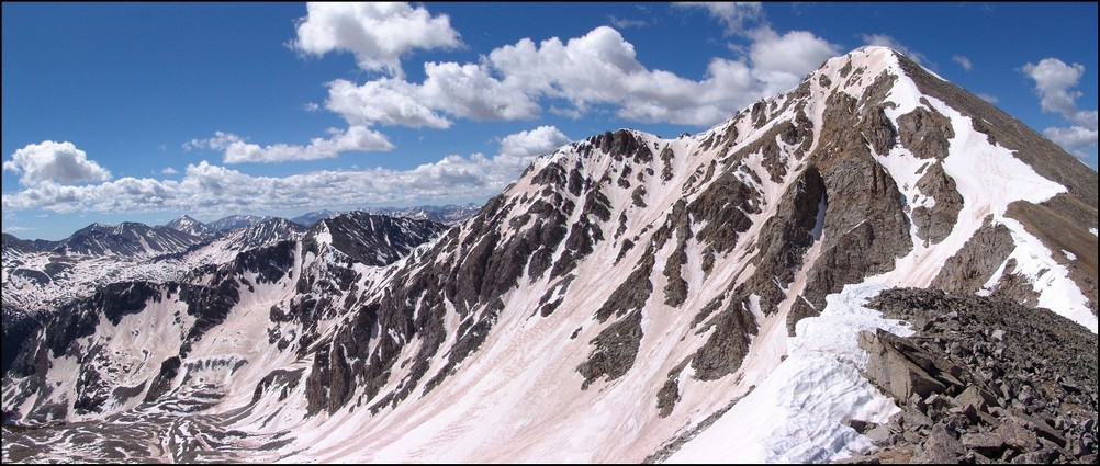
Missouri's Ridge is revealed.
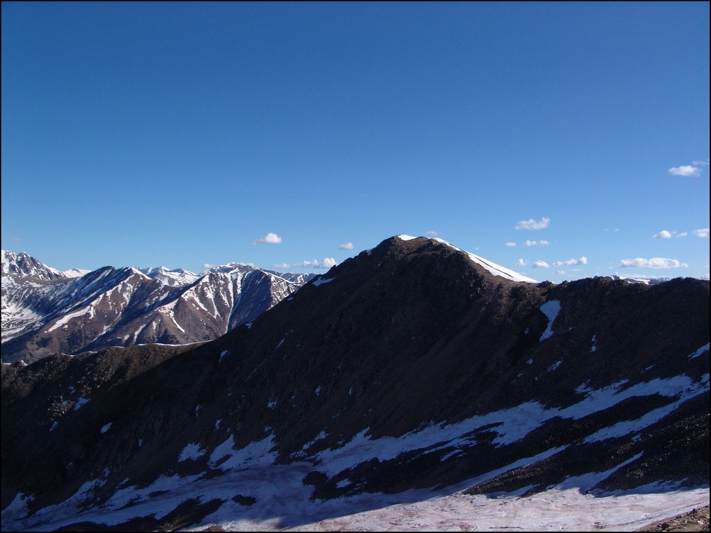
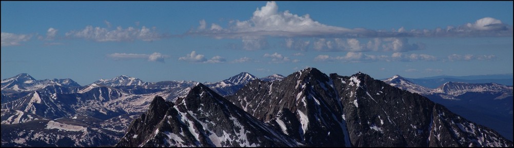
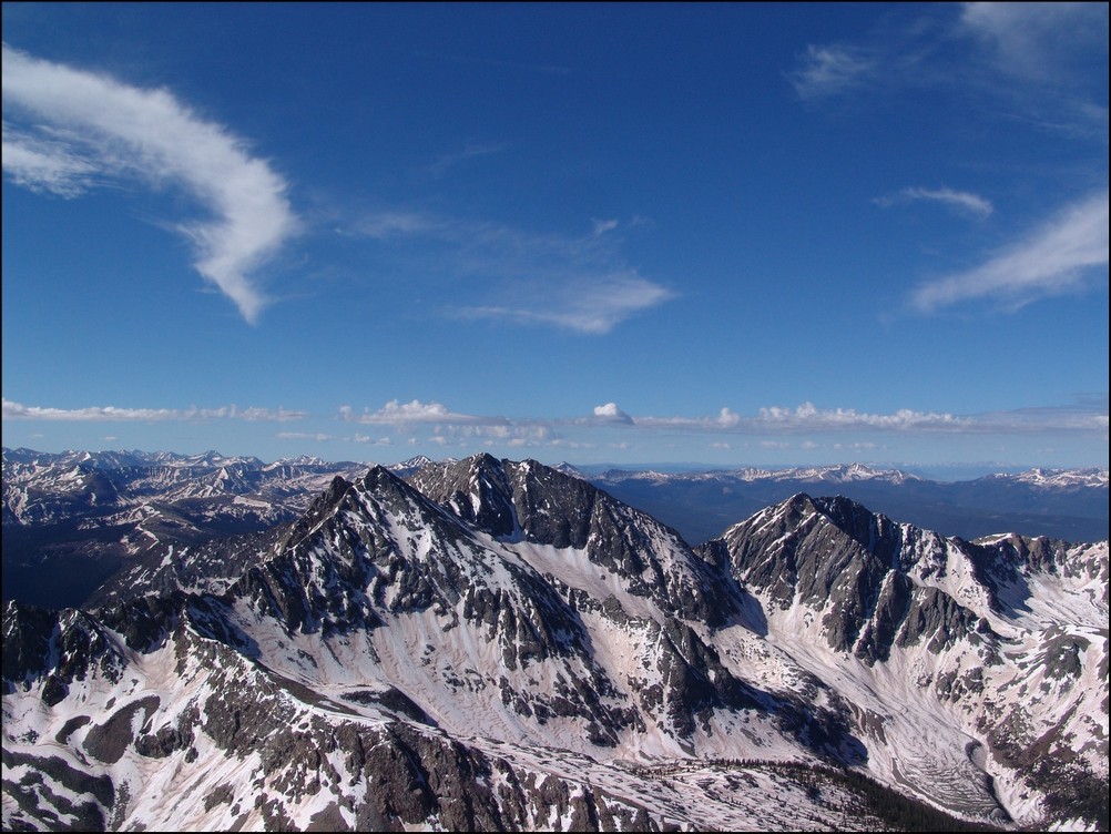
After taking a lot of photos, Ethan and I headed up and along the long ridge towards Missouri. The second and third objectives for the day finally appeared as well, with Emerald peaking over the top of Iowa.

Iowa Peak mostly obscures the view of Emerald Peak to the south of Missouri Mountain.

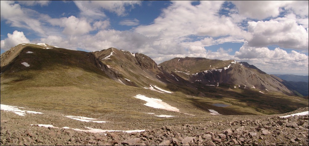
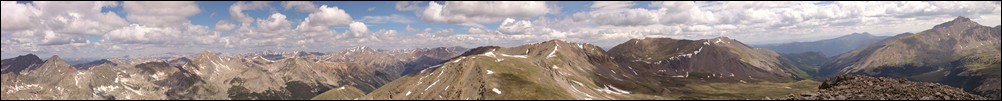
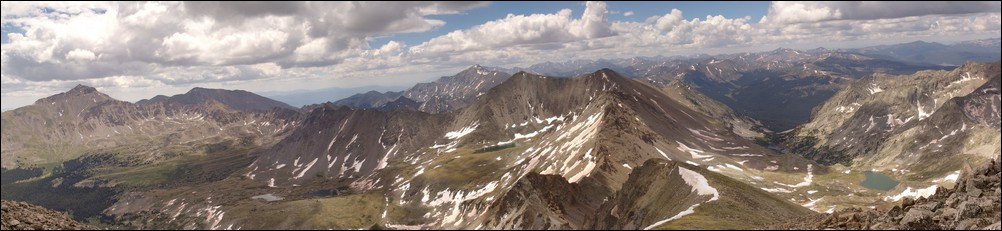
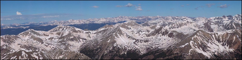
From the ridge of Missouri, views of Emerald Peak, Iowa Peak, the Three Apostles, Huron Peak, and La Plata Peak (among many others) can be seen in great detail (click to see the full resolution version).
Ethan's photo of Missouri's Ridge with Emerald and Iowa in view (left) and Missouri's Ridge behind us (right)
The ridge to Missouri was nothing harder than class 2 the whole way, and was quite simple to navigate. I've read reports of people calling the ridge class 3, and I can assure you, it is not even close to class 3 unless you stay high at the jagged rocks (seen above). Those rocks are easily navigated around though...
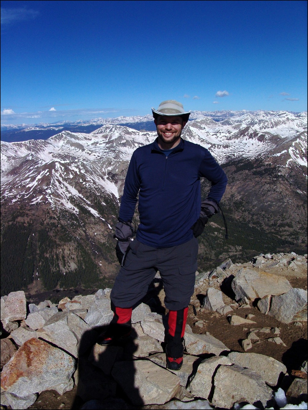
After 3 hours of hiking, we reached the summit of Missouri Mountain at 9:15 AM. Naturally, the flip-flop guy had his music playing on top and he was enjoying a beer. Ethan and I exchanged summit photos, took some 360o panoramic shots, ate some food, and quickly departed, knowing our day had really just begun. Later in the day, I was able to capture a nice view of the route we took up Missouri from the Missouri Gulch.

The route up Missouri Mountain.
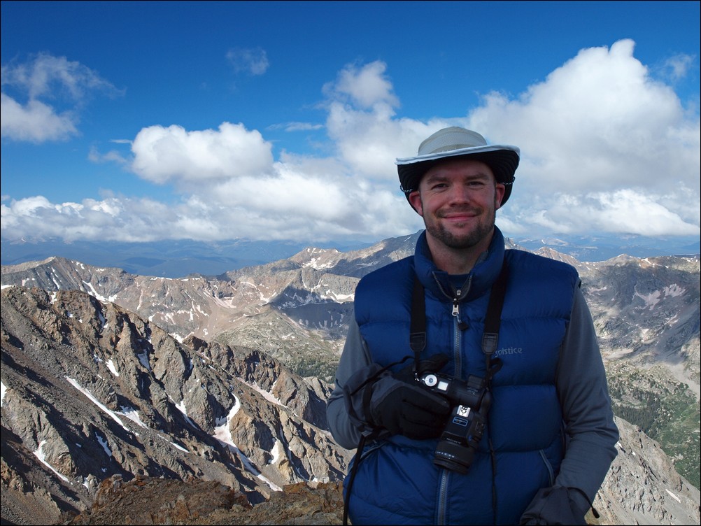
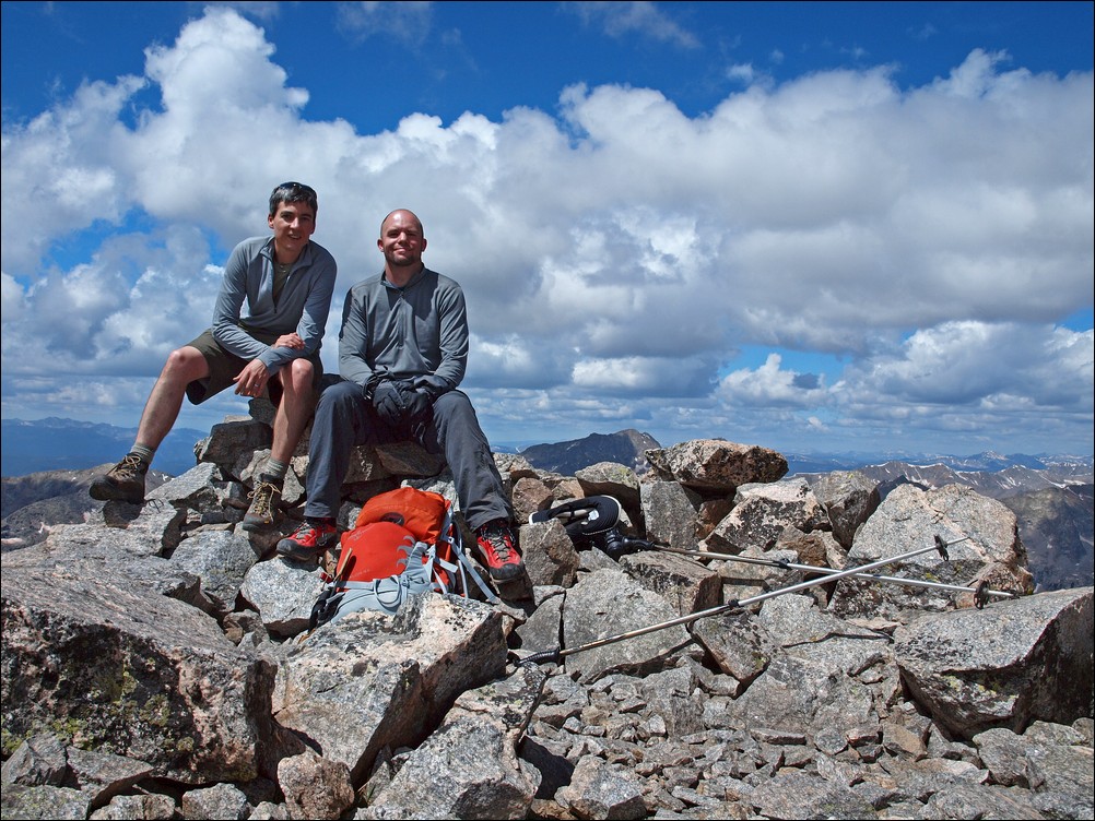
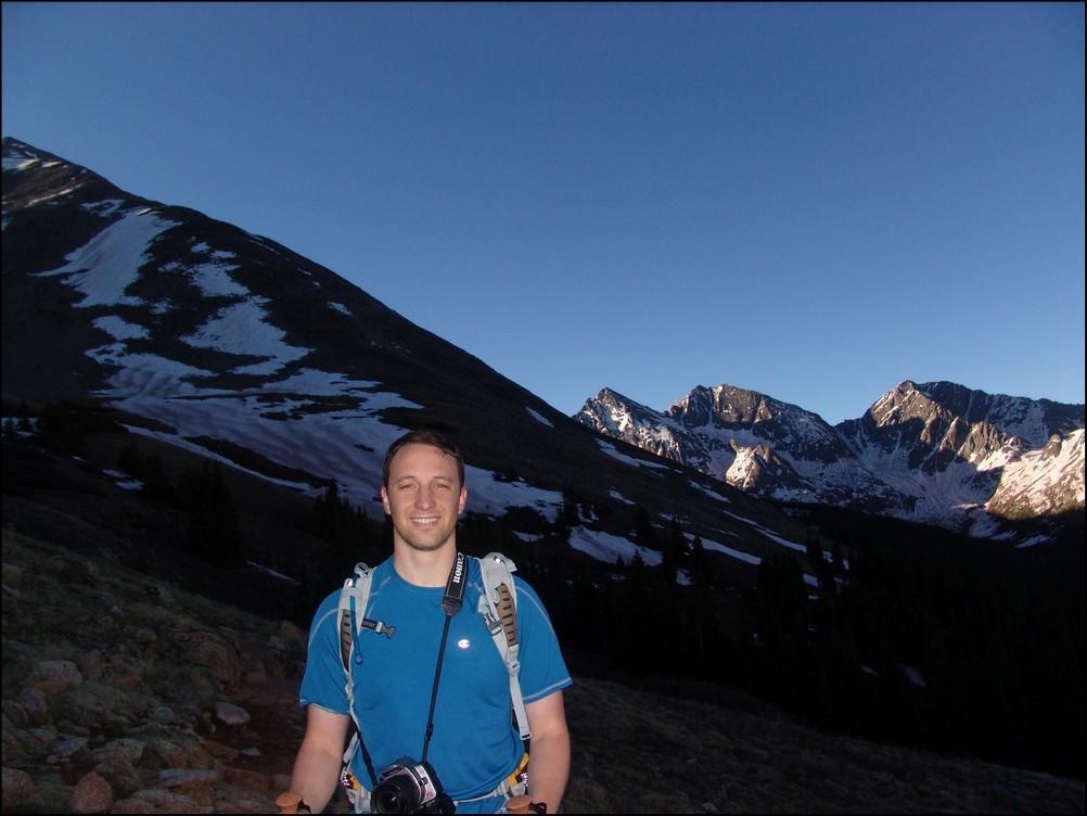
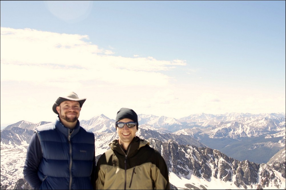
Matt Payne on the summit of Missouri Mountain, his 38th 14er climb (37 total 14ers).
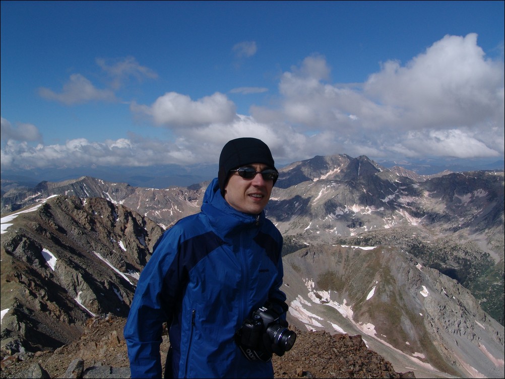
Ethan Beute on the summit of Missouri Mountain. Ethan was unsure of how many 14ers he has climbed, as he is not keeping track. 
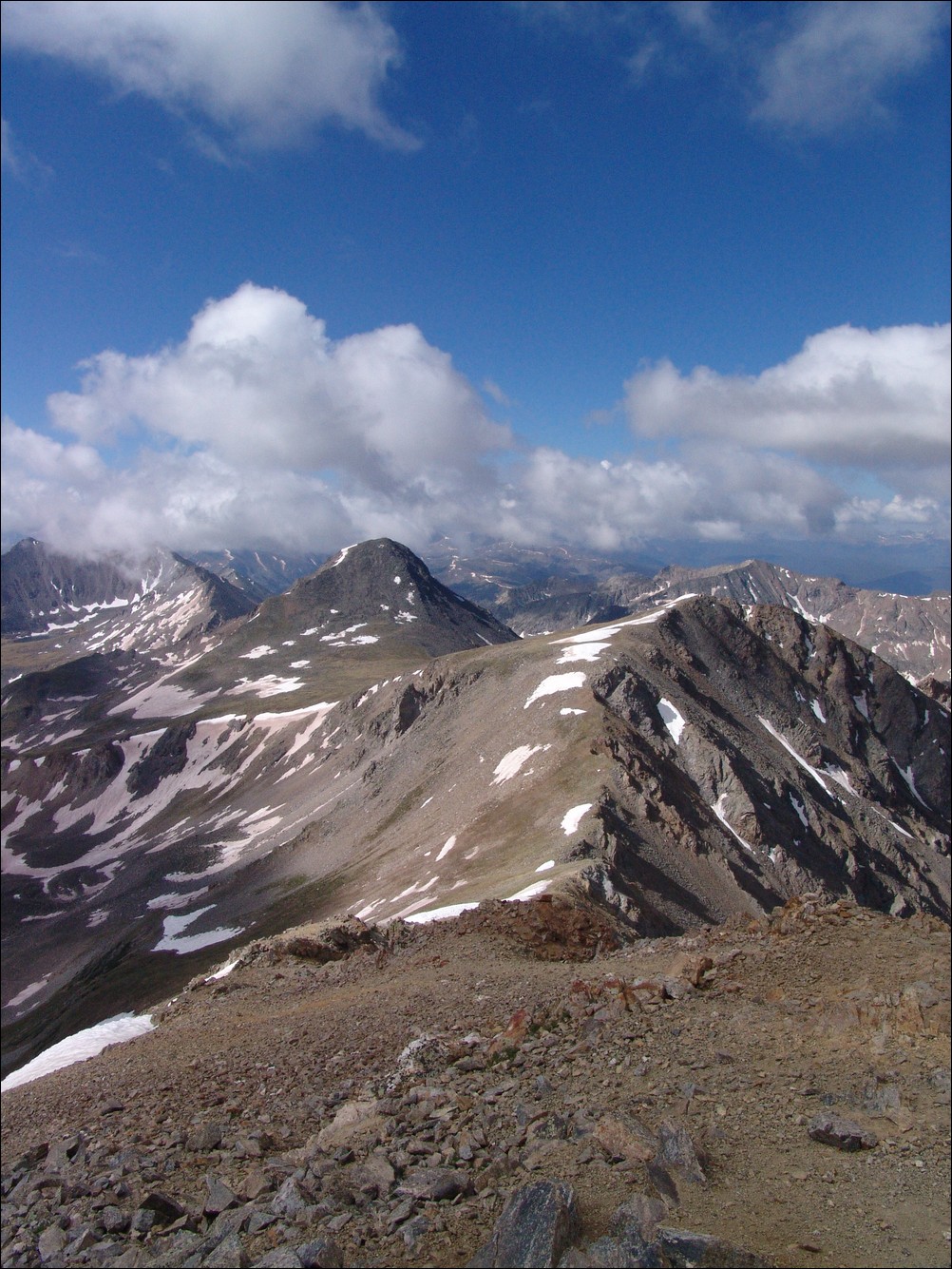
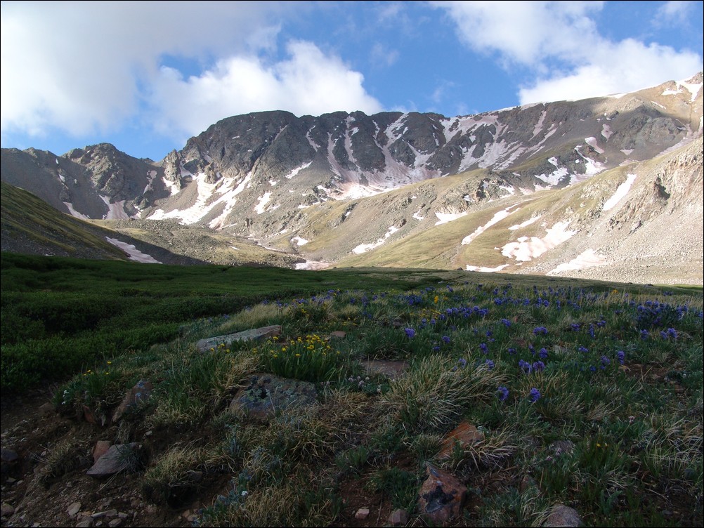
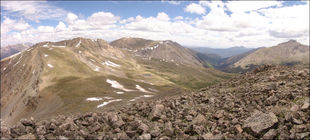
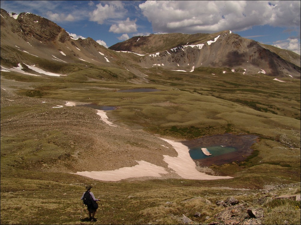
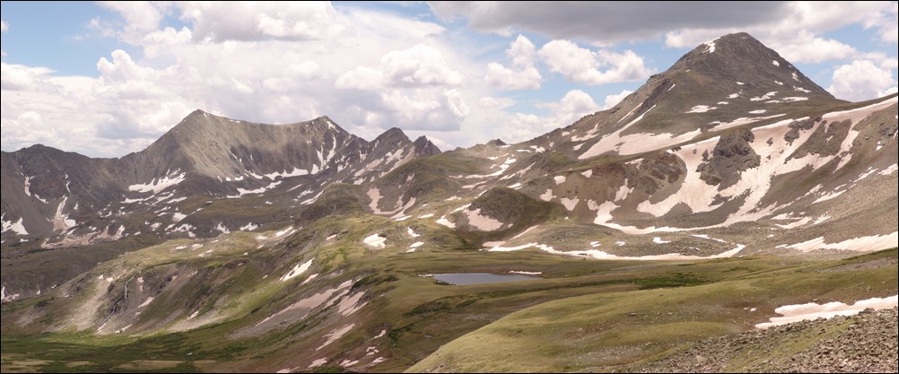
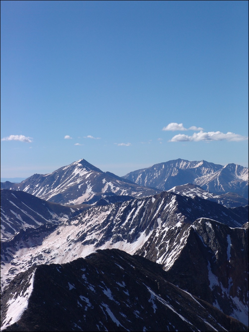
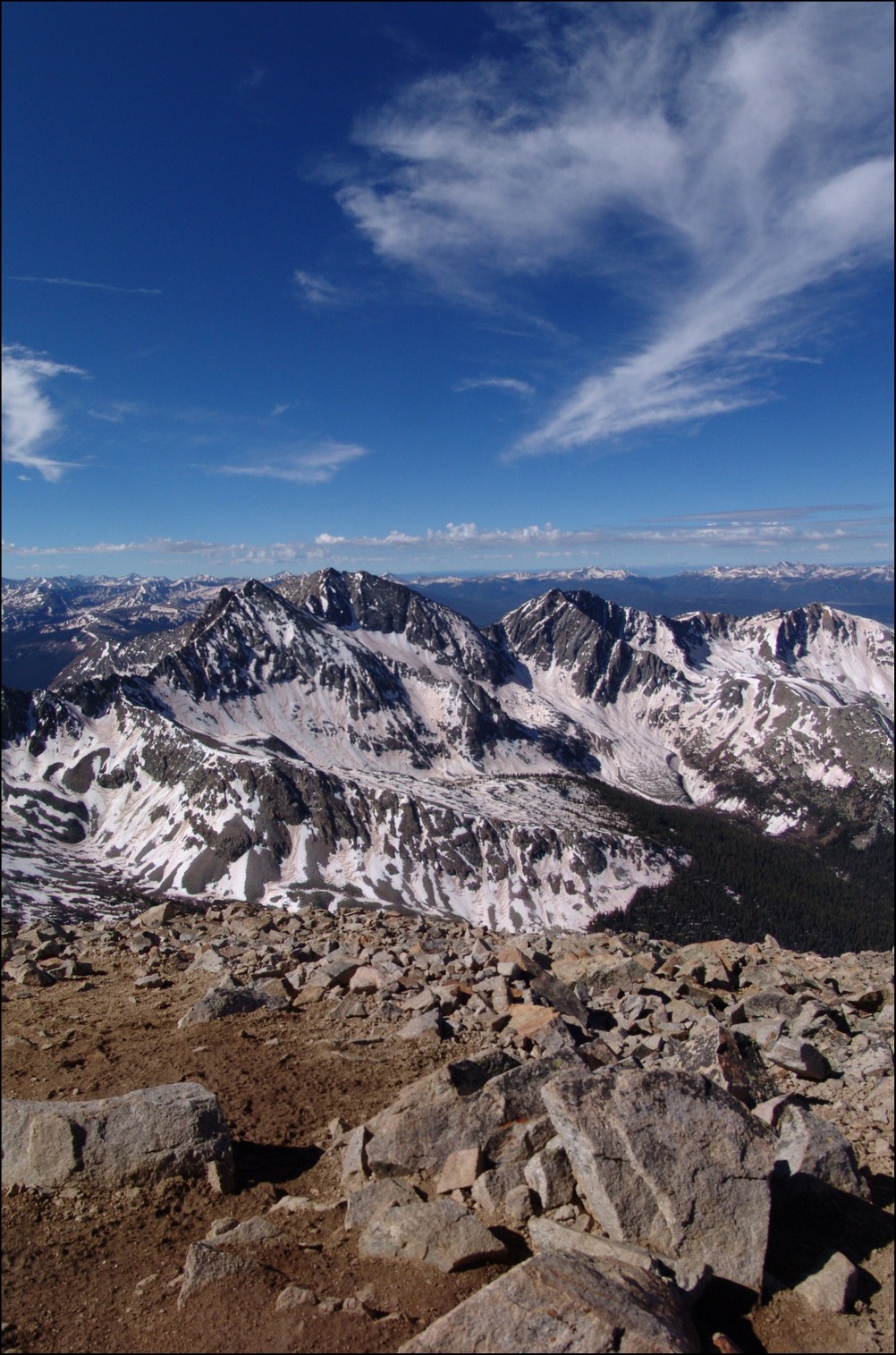
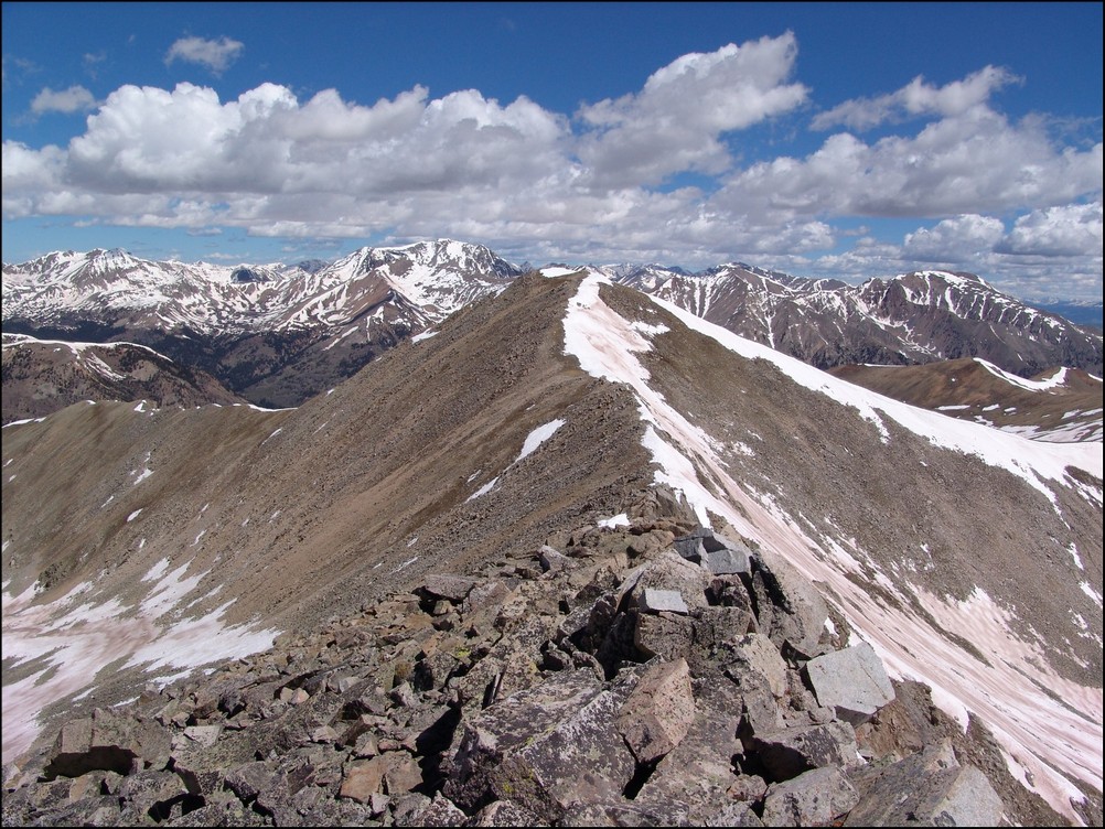
Iowa Peak (closest) and Emerald Peak (left and behind Iowa) drew our gaze.

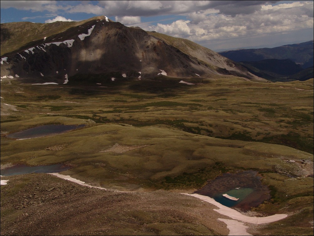
Mount Harvard (left) rises high above the Missouri Basin (middle), with Emerald Peak and Iowa Peak sitting above pristine alpine lakes.
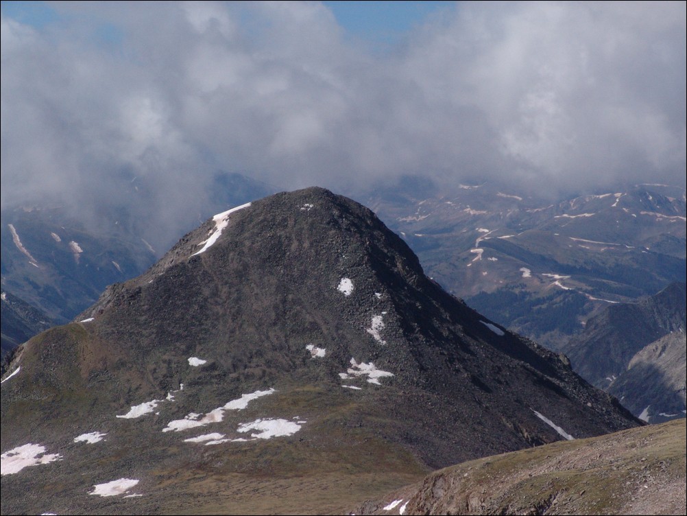
A zoomed in view of Emerald Peak from Missouri Mountain
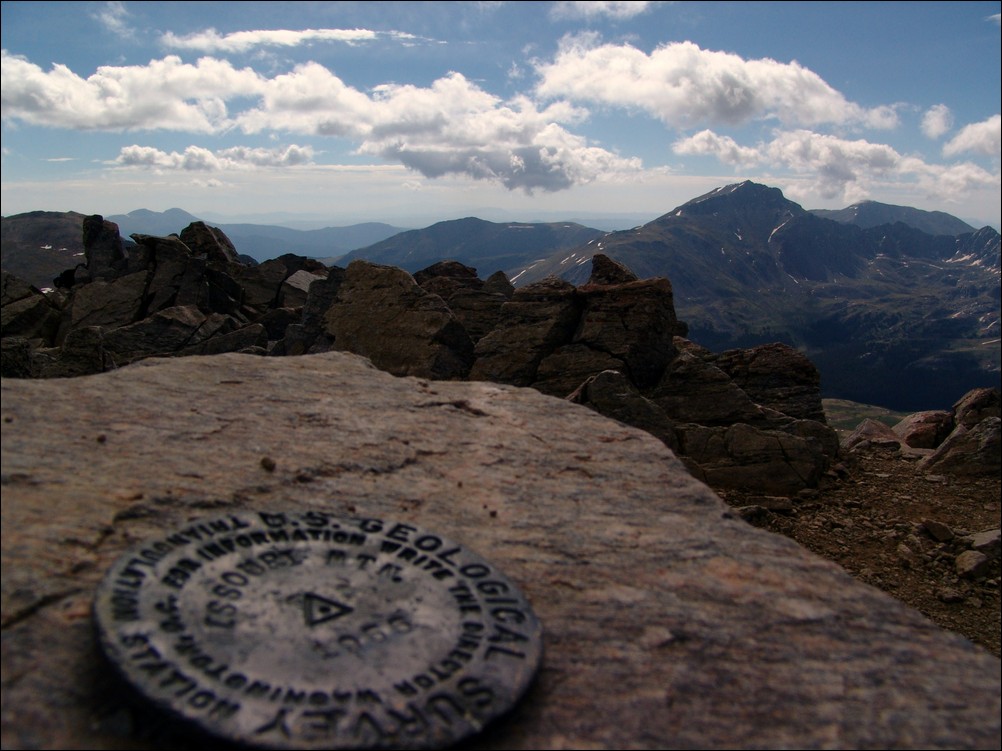
The USGS marker for Missouri Mountain with Mount Harvard in the background.
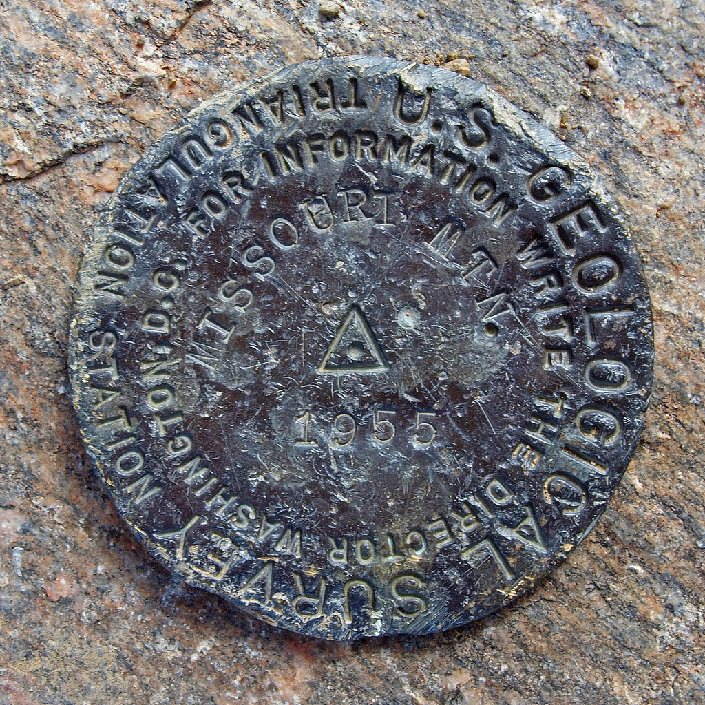
Ethan Buete captured this great macro shot of the Missouri Mountain USGS marker.
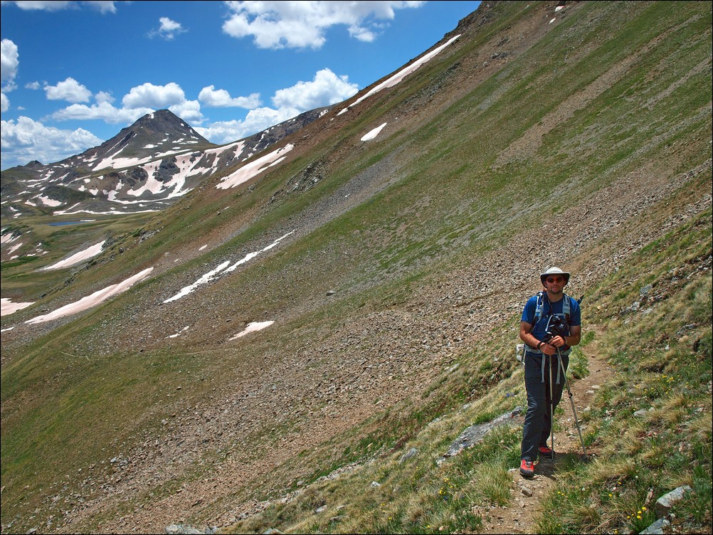
Ethan and I decided to pack up and head on over to Iowa Peak, leaving the summit of Missouri Mountain.

Matt Payne descends towards Iowa Peak - photo by Ethan Buete
The climb down to the ridge and up Iowa was fairly straight forward on a primitive trail.
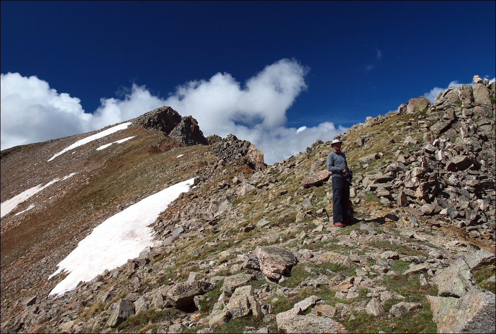
Matt Payne halfway up Iowa Peak.

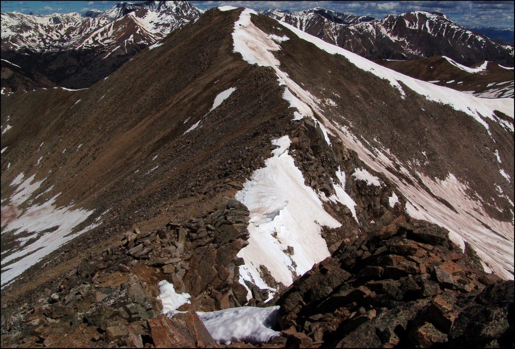
A look back at Missouri Mountain from near the top of Iowa Peak.
It took us about 30 minutes to reach the top of Iowa Peak, where we stopped to take more photos and re-hydrate.
Matt Payne on top of Iowa Peak.

Ice Mountain and North Apostle sit above the valley just below Iowa Peak.

180o view from the summit of Iowa Peak. Looking left to right - Missouri Mountain, Buffalo Peaks (in far distance), Mount Harvard (center), Mount Yale, Emerald Peak (above near snow).

Huron Peak rises high above Clohesy Lake as seen from the summit of Iowa Peak.
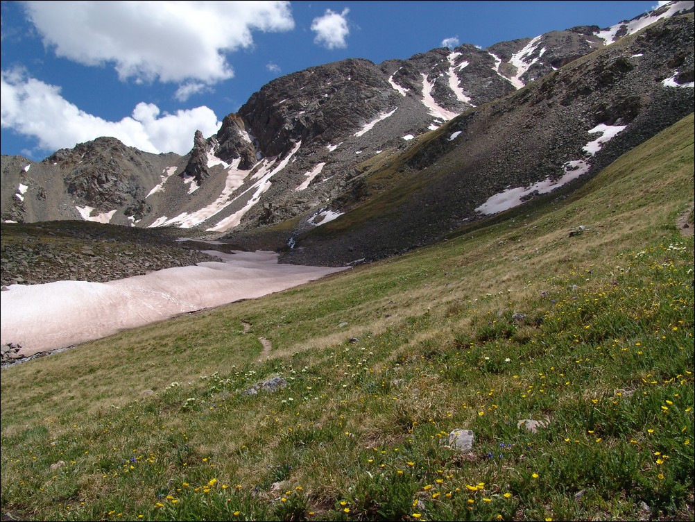
After a few minutes on top of Iowa Peak, we made an assessment on the weather. The cloud patterns had not changed since leaving Missouri Mountain and we were fairly confident that the weather would hold long enough to summit Emerald and make it down. So, we headed on down to the saddle between Iowa and Emerald.

Emerald Peak and its grassy slopes.

Ethan made it down to the saddle first, and promptly began photographing the area. He was able to capture some amazing photos, including the next one - one of my favorites from the trip. I love the images Ethan produced from this trip. The colors are astounding. I believe that Ethan uses the Olympus E-30 DSLR with a circular polarizer. I wrote a quick follow-up article about the use of circular polarizers here.
Wildflowers in bloom - photo by Ethan Buete.
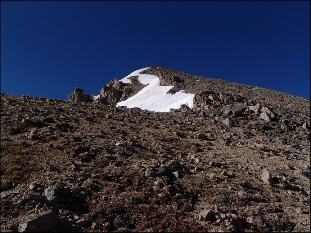
After reaching the saddle, we began hiking up Emerald's steep face. It was a fairly straight-forward climb requiring a few breaks on the way up.
A look back at Iowa Peak and Missouri Peak from the base of Emerald Peak.
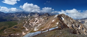
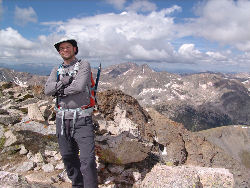
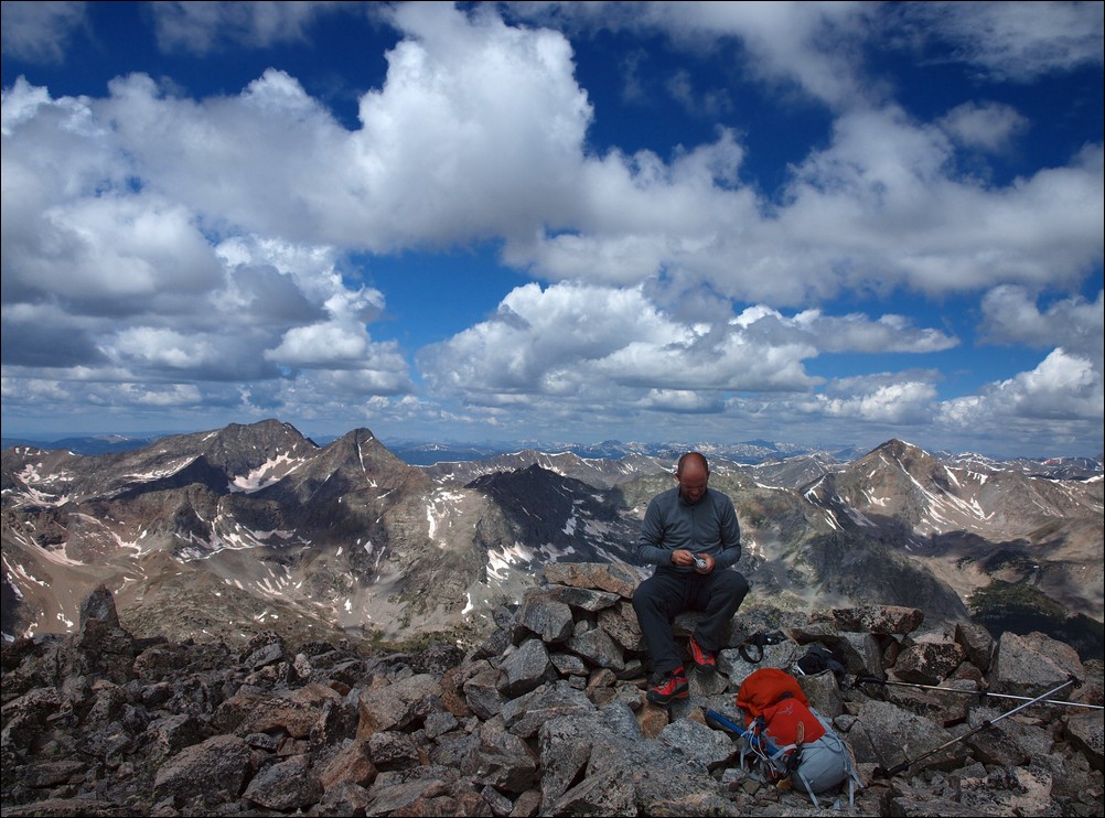
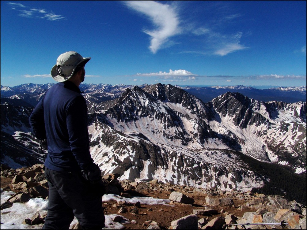
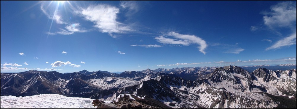
After reaching the summit of Emerald Peak at 10:30 AM, Ethan and I both agreed that the views from Emerald were the best of all three summits. Unabated views of Yale and Harvard and the surrounding basins made for a great resting spot. We probably spent about an hour on top, enjoying the views and taking photos while eating. I chowed down on some Reeses Peanut Butter Cups, which made for an even better experience 
Matt and Ethan enjoy the views from Emerald Peak.
Matt Payne signs the summit register of Emerald Peak, one of the 100 highest mountains in Colorado.
Matt Payne scouts for more Reeses Peanut Butter Cups.
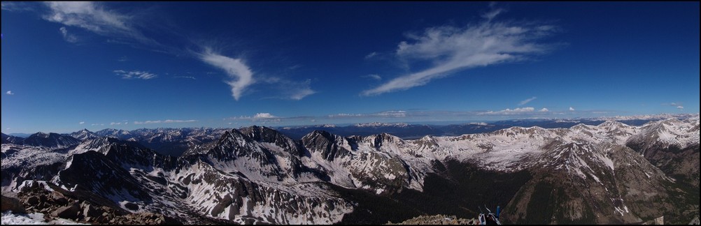
Views from Emerald Peak, west-to-east (left to right).
Ethan Buete gazes west from the summit of Emerald Peak, with La Plata Peak behind him.
Matt Payne on the summit of Emerald Peak, with Mount Yale in the distance (far left).
Views from Emerald Peak, looking east-to-north (left to right).
A view back at Iowa Peak and Missouri Mountain, with Mount Belford to it's right. Mount Harvard to the far right.
Ethan and I planned our route back to the trailhead from the summit. We decided that we would drop off of the east face of Emerald Peak and to the lakes below us. From there, we would aim for Elkhead Pass and head back down Missouri Gulch.
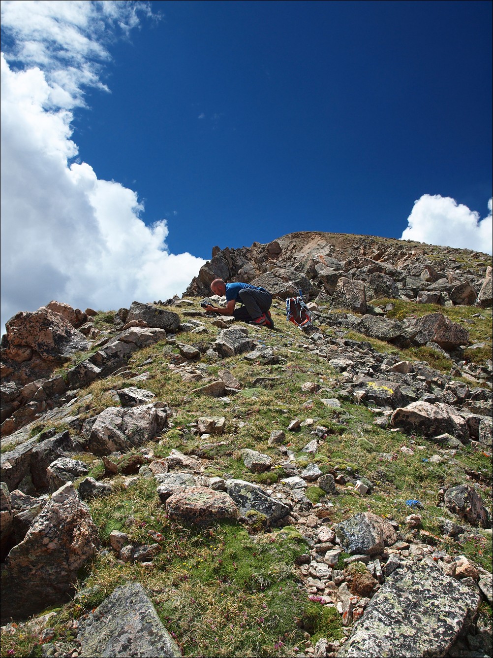
Matt Payne shooting some photos of flowers on Emerald Peak's east ridge.
And here is what I was photographing...
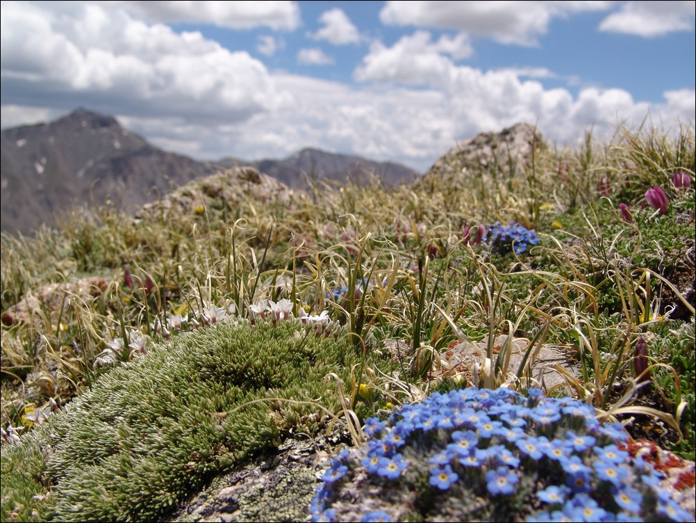
Wildflowers growing on Emerald Peak with Mount Harvard blurry in the distance.
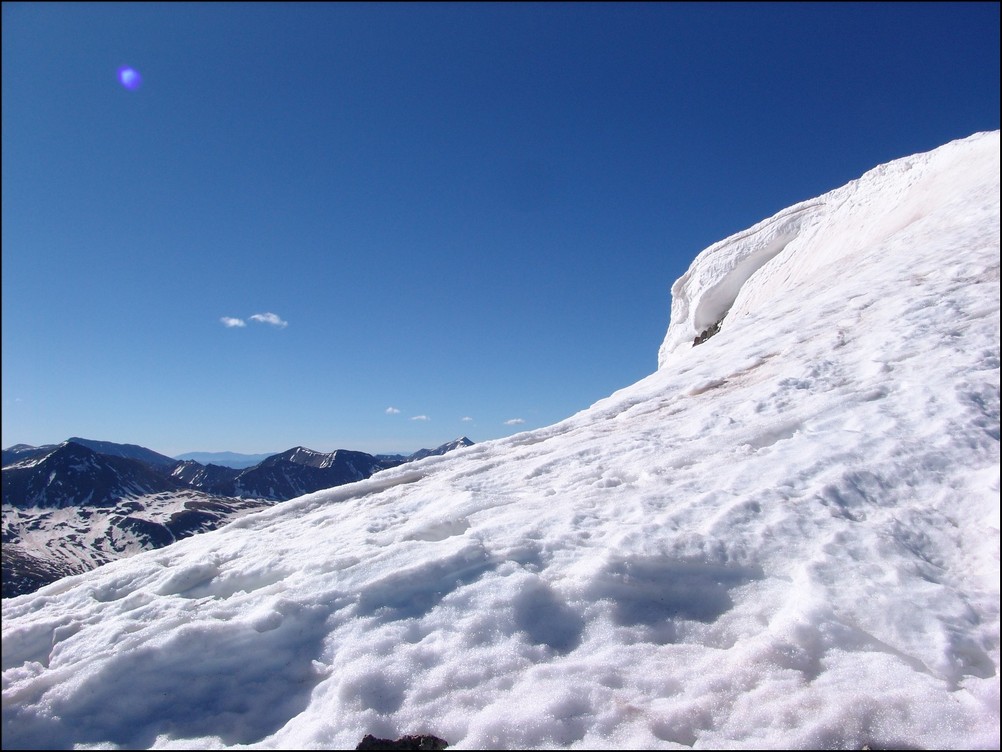
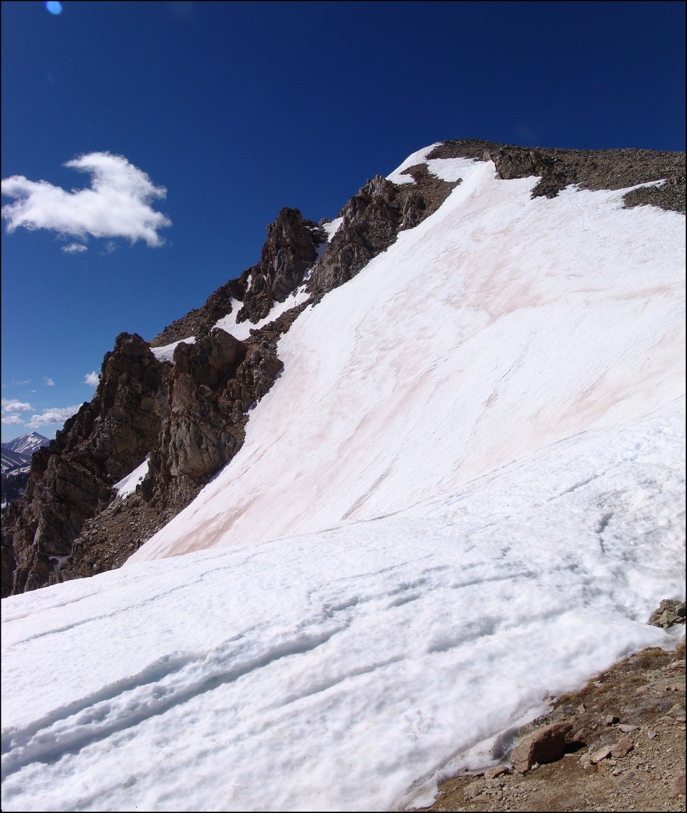
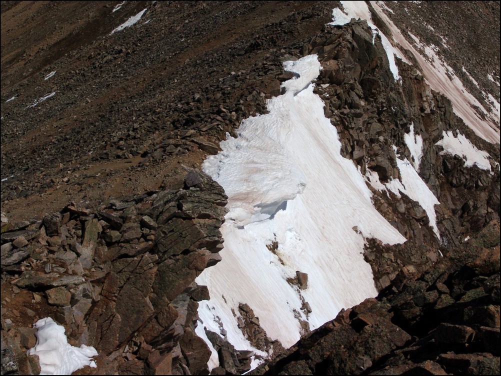
We continued down the ridge from Emerald and through a small snow field. The snow was solid and we were able to walk right on the top of it. No need for the ice axe after-all!
Still plenty of snow melt on Emerald Peak's east ridge in June.
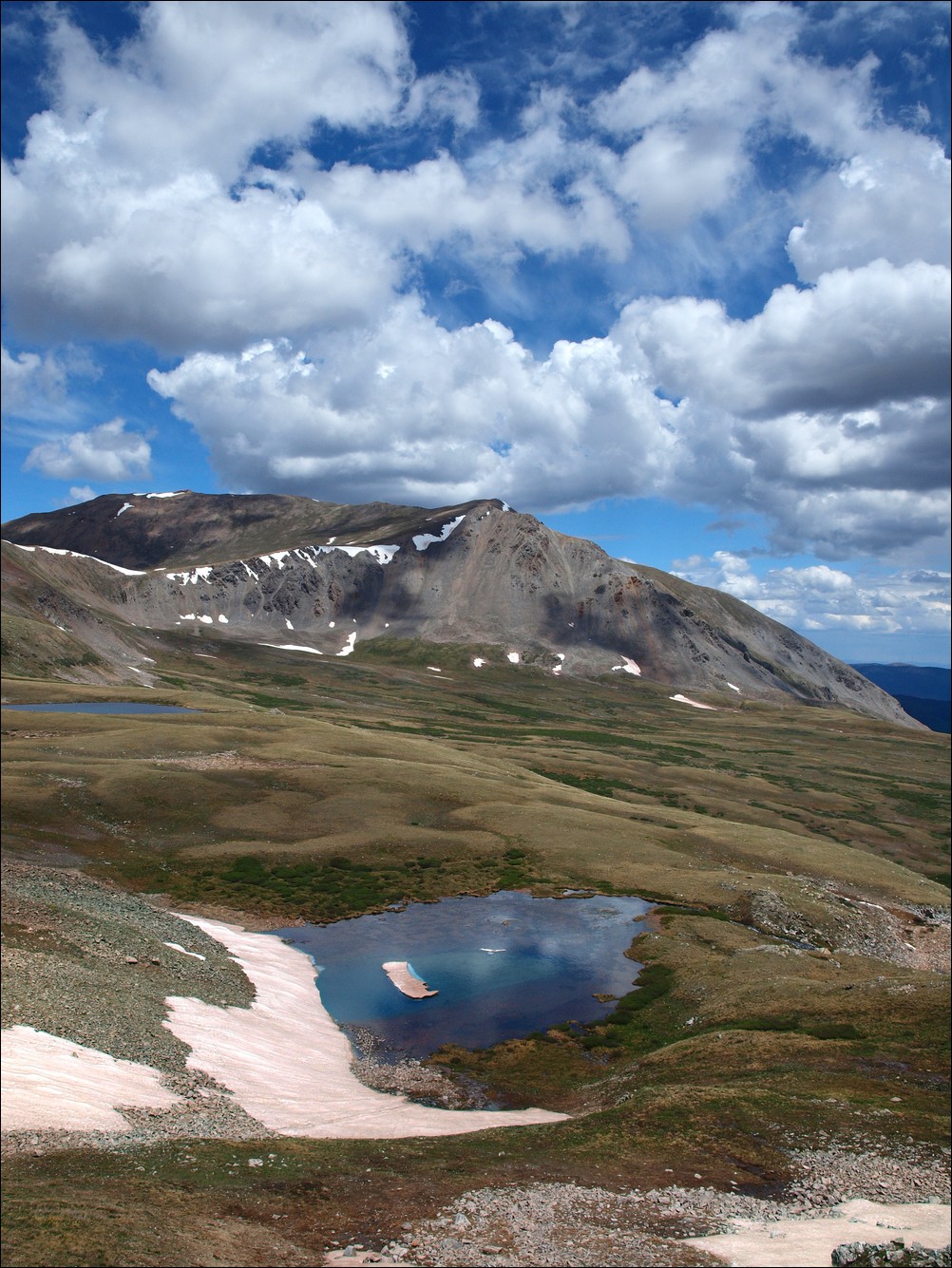
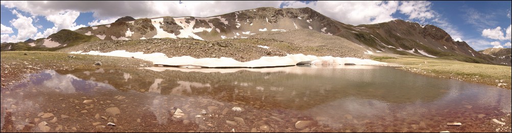
At this point, the hike became incredible. The lower lakes came into better view, and the alpine surroundings continued to amaze both of us. One of the lakes in particular had an island of snow still sitting in it, making for a very bright blue hue around it. It was fascinating and gorgeous.
Lakes sit at the base of Emerald Peak.
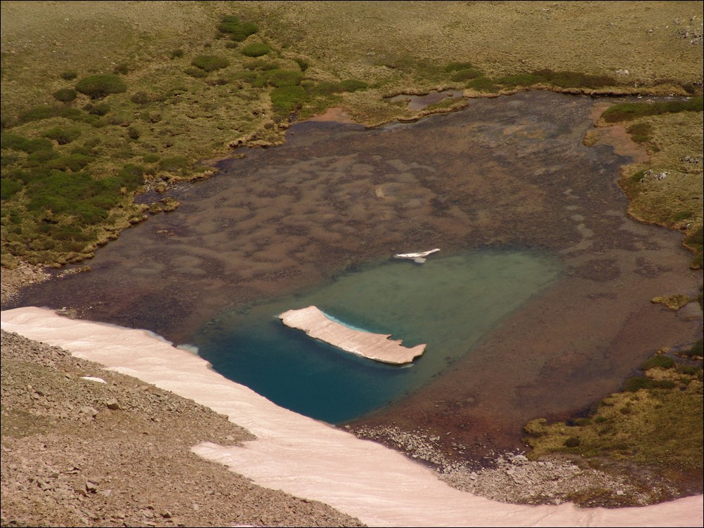
A zoomed in view of the odd and gorgeous blue lake.
Ethan captures the blue slight better than I through the use of a circular polarizer.

Ethan Buete captured this great photo of some small lakes.
We were able to connect with an old game trail and head down to the lakes.
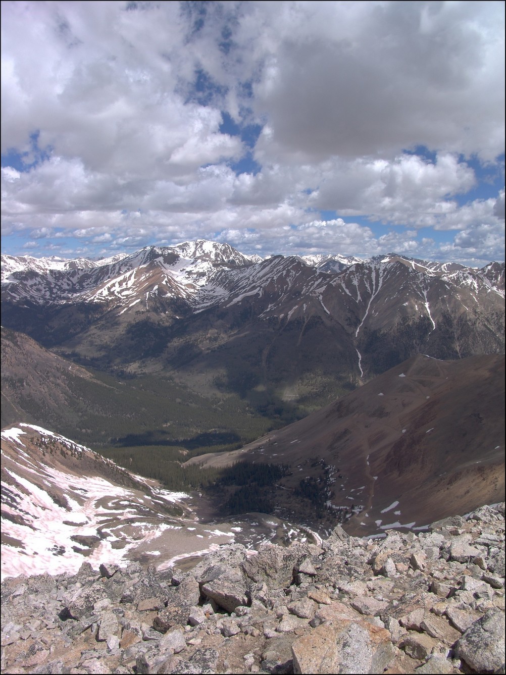
The Missouri Basin.
Ethan hikes towards Mount Harvard.
Ethan and I were continually impressed with the views of Mount Harvard from this area - a much more impressive view than you get when you actually climb it.
Mount Harvard towers above Matt Payne
Ethan descends down into the basin towards the awesome blue lake.
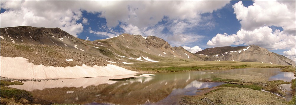
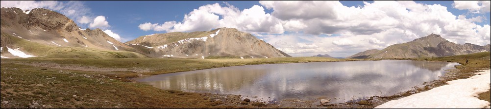
A panoramic photo of the first of three lakes found in the Missouri Basin, with Missouri Mountain at center.
Ethan Buete checks out the snow melt coming out of the 1st of three lakes at the base of Emerald Peak.
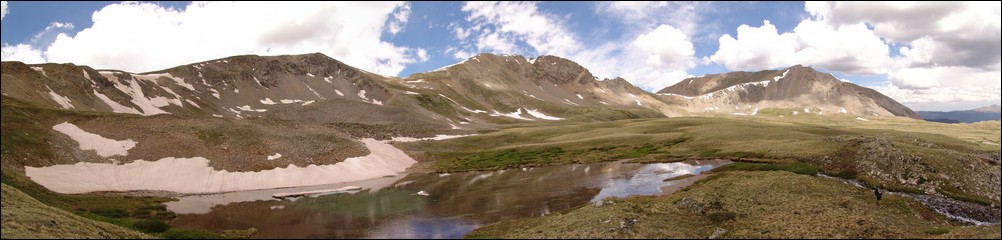
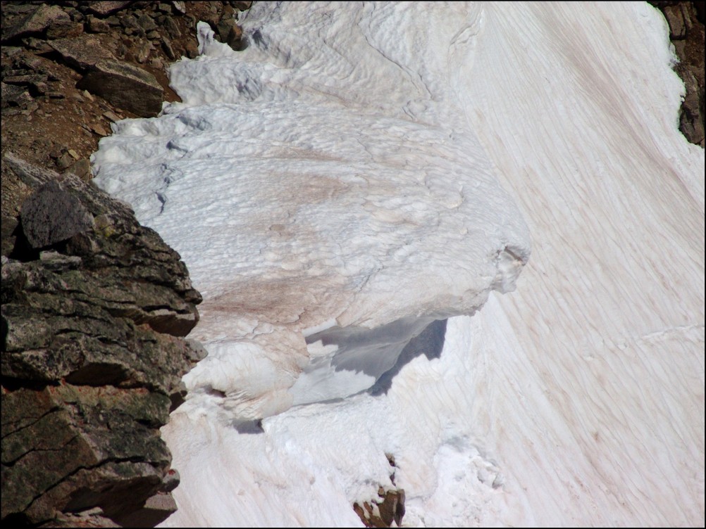
We made our way across the long basin and found the 2nd of three lakes. This lake had some snow that had begun calving from the rock face, much like a glacier would.
A glacier-like calving on the 2nd of 3 lakes below Emerald and Iowa Peaks.
The water was quite still for this panoramic shot of a small lake below Missouri Mountain, Iowa Peak and Emerald Peak (right to left).
Ethan catches me in action at the 2nd of 3 lakes.
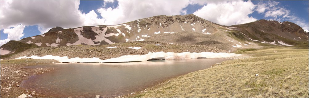
We headed on over to the 3rd lake, finding it to be the best of three due to its larger size and excellent views below Mount Harvard.
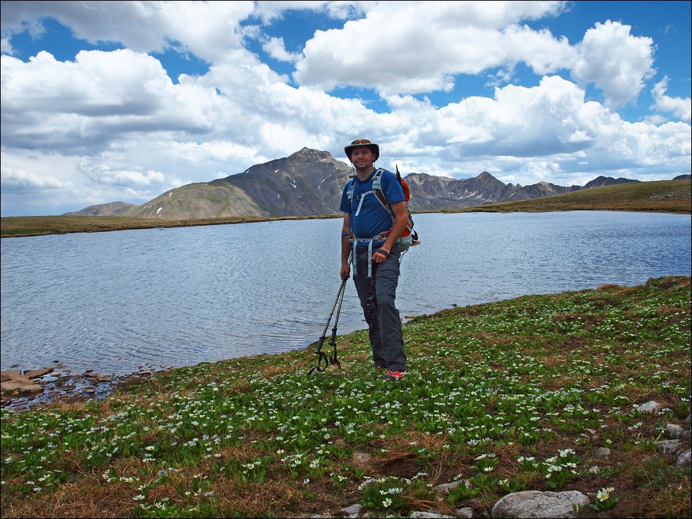
Matt Payne in front of a large apline lake and Mount Harvard.
Ethan Buete next to a large lake with Mount Harvard in the background.
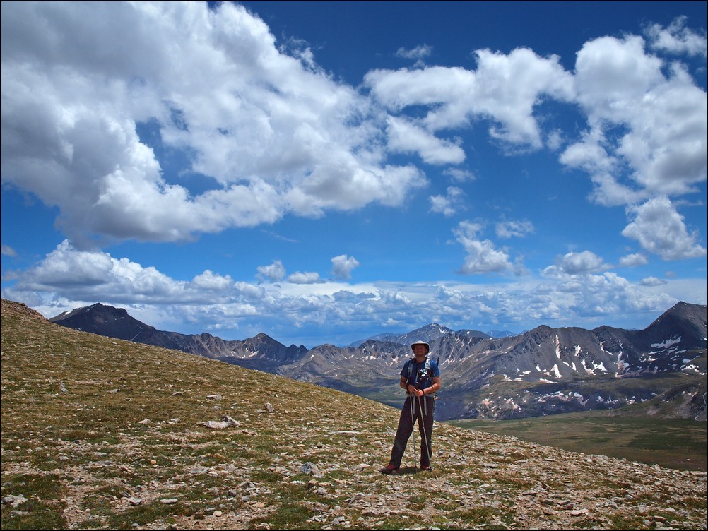
The sheer size of the Missouri Basin makes it a wonderful place to hike. With alpine vistas in every direction, it was tough for Ethan and I to leave. However, with weather looming on the horizon, we decided to head towards Elkhead Pass. Once reaching the end of the basin, looking back at Emerald left a great feeling in us. We had traveled a great distance today, and it was hard to believe just how far away Emerald looked already.

Matt Payne boogies on out of the Missouri Basin

A look back across the Missouri Basin. Mount Harvard sits as the basin's monarch to the far left with Emerald Peak and Iowa Peak resting at the far right.
After hiking more or less straight across the back-side of Missouri Mountain, we were able to connect back up with the trail leading up Elkhead Pass.
Matt Payne with Mount Harvard behind him.
Matt Payne on the Elkhead Pass trail with Emerald Peak at far left.
Near the top of Elkhead Pass, I noticed a giant waterfall below Emerald Peak, so I took several fully zoomed in photos of the basin and waterfall and composed them into one giant zoomed in view of the basin.
A super-zoomed in view of the Missouri Basin, with a giant waterfall flowing at far left. Emerald Peak sits above the basin at far right.Click on the photo to see the full resolution version.
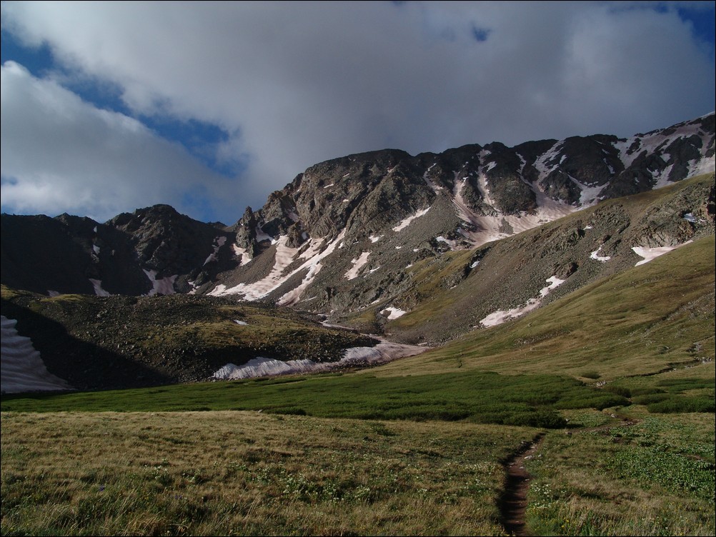
A short while later, Ethan and I managed to reach the top of Elkhead Pass and see down into Missouri Gulch where the whole day began.
Matt Payne at the summit of Elkhead Pass.
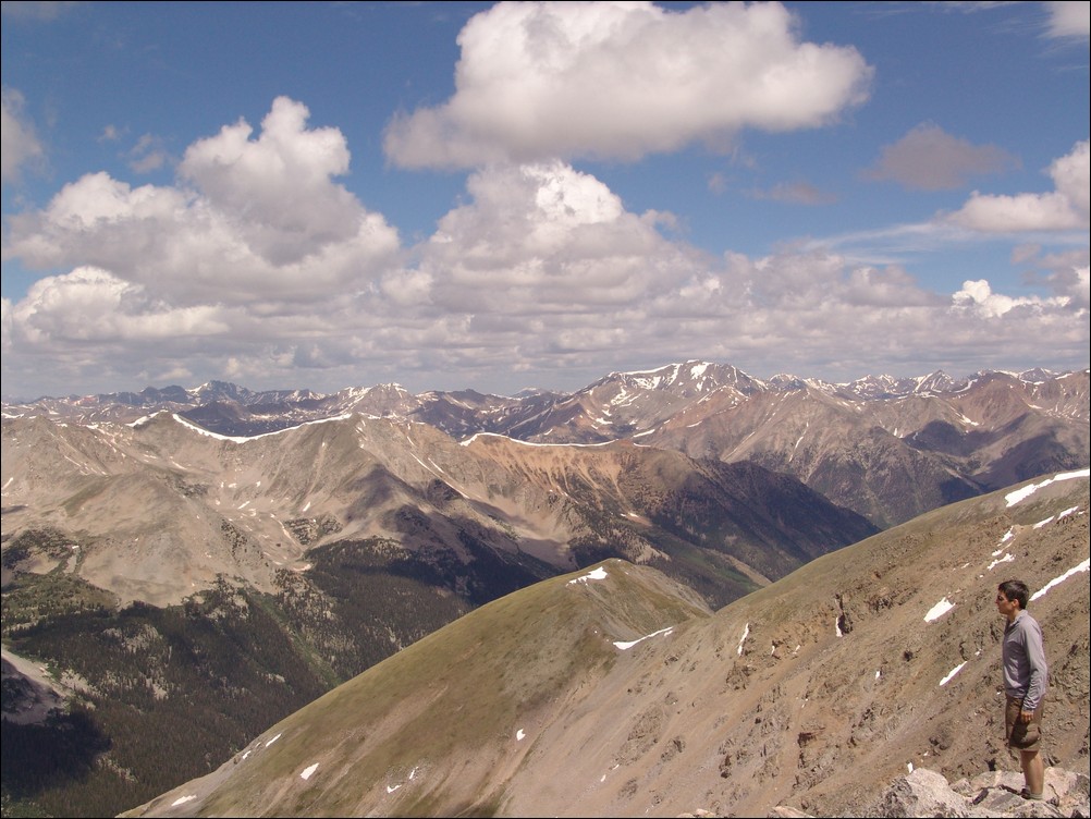
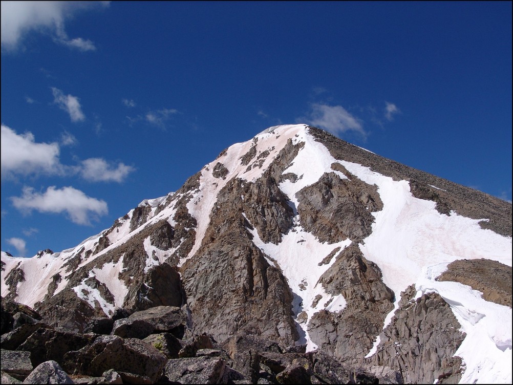
It was nice to hike downhill again and see the valley in the middle of the day with more light. We were also lucky to see the entire route up Missouri from slightly below the pass, as well as views of Missouri's class 4 northeast face.

Missouri Mountain's class 4 northeast face (far left).

A zoomed in view of Missouri Mountain's class 4 northeast face.
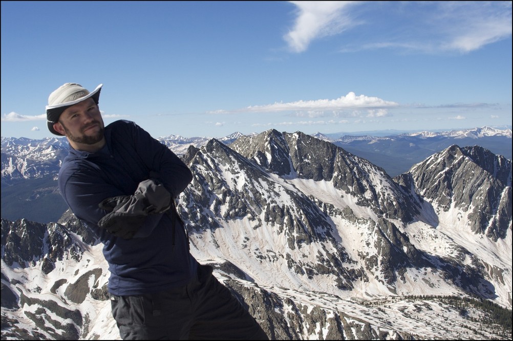
Ethan poses in front of Missouri Mountain.
We headed on down the pass and noticed a large waterfall coming down Missouri as well.
A large watefall flows down the face of Missouri Mountain's ridge.
After a short time, we reached the trail turn-off for going back up Missouri Mountain. We had made a full circle at 1:30 PM, a full six hours after we first encountered this split in the trail.

The trail forks - heading back up Missouri Mountain or down to the start of Missouri Gulch.
Matt Payne hikes down the Missouri Gulch trail.
A look back at Missouri Mountain and the Elkhead Pass trail.
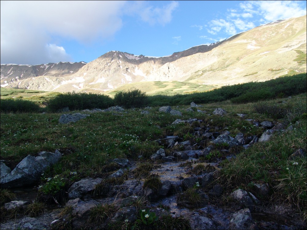
Ethan and I made excellent progress down the trail and made it back to a large stream crossing. Ethan took this time to train me on photographing water flows.

Water flows down Missouri Gulch.
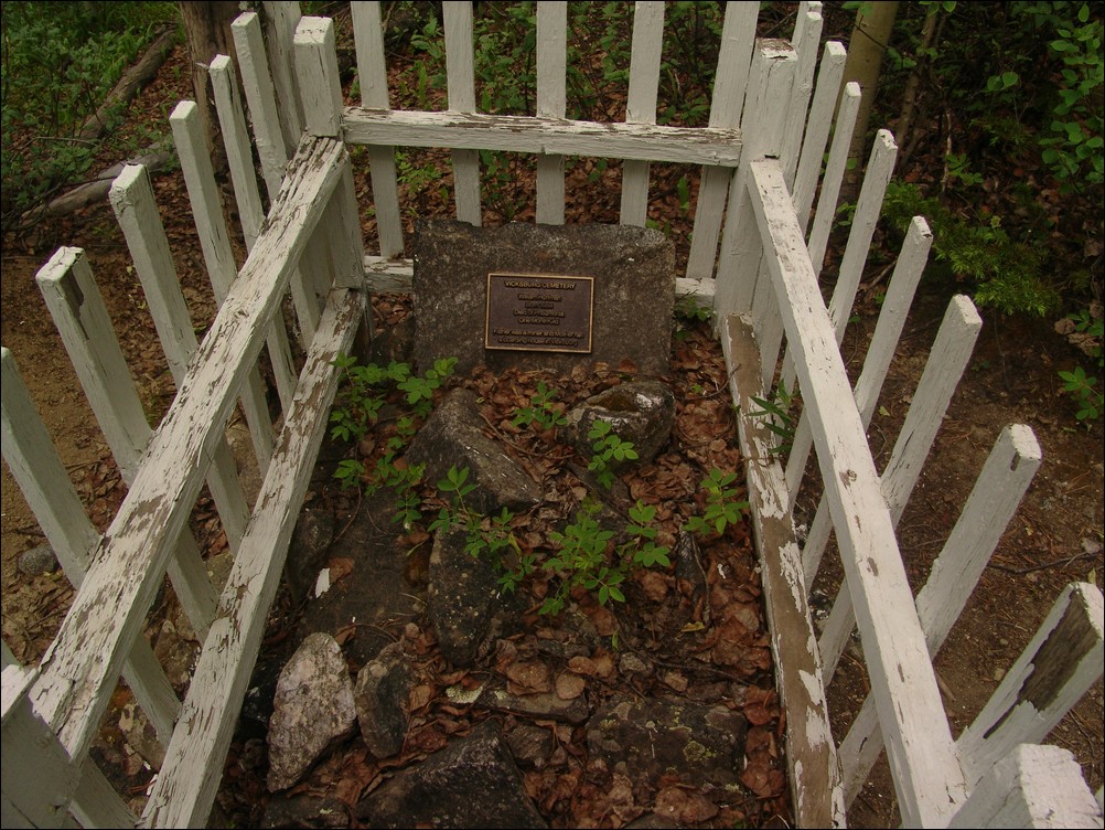
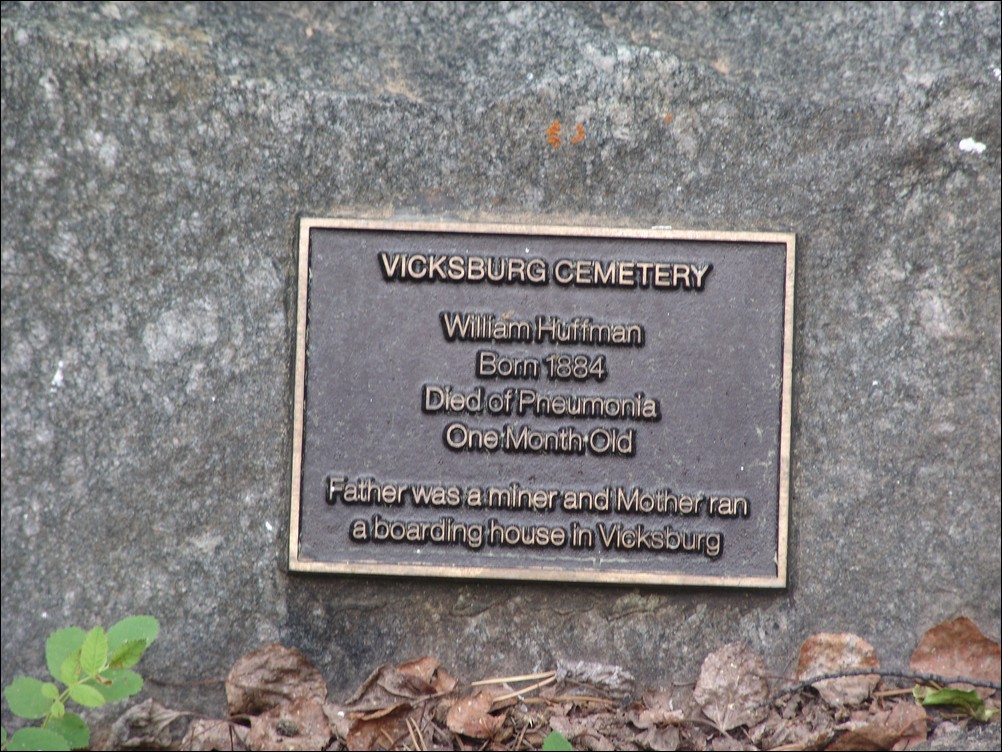
Ethan and I made excellent time back down the trail and to the trailhead. We made a quick stop at a small gravesite in the Vicksburg cemetary. The grave marker reads: "Vicksburg Cemetary. William Huffman, Born 1884. Died of Pnemonia. One Month Old.Father was a miner and mother ran a boarding house in Vicksburg."
We crossed Clear Creek over the bridge and made it to Ethan's car. All in all a very successful and aesthetically pleasing trip.
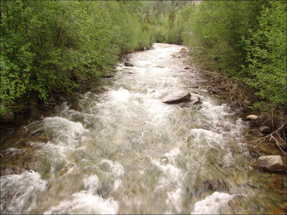
Clear Creek was still running fast near the end of June.
I hope you enjoyed this trip report. If you are interested in any of the photos, please contact me. If one of the photos belongs to Ethan Beute, I will forward your message to him.
Stay safe!
Huron Peak and Browns Peak - a Sawatch Throwdown!
Interesting statistics:
Start time: 5:30 AM
Summit time (Huron): 9 AM
Summit time (Browns): 11 AM
Finish time: 1:20 PM
Mileage up: 3.6
Mileage down: 4.2
Total mileage: 7.8
Huron Peak Elevation: 14,003 ft.
Browns Peak Elevation: 13,523 ft.
Total elevation gain: 3,900 ft.
Total photos taken: 219
GPS map of our route (ascent in red, descent in blue):

This trip report begins with an interesting back story. I had a new member join my site in May from South Dakota. This member eventually messaged me on Facebook and asked if he could join me on some of my climbs this year. After learning about my plans to attempt Huron that very weekend, he decided to join me. Mike Vetter drove all the way down from Sioux Falls, South Dakota on Saturday, June 5th to climb with me. Mike is the CEO of DataSync - a successful start-up software company. Our route to reach the trail-head was very simple: we drove west on Highway 24 to Buena Vista and turned left on Chaffee County Road 390 heading west. After driving about 14 miles on a dirt road, we turned left at the old mining town of Winfield and continued west another 2 miles to our campsite near the trail-head. We left my house at about 6:30 PM and reached our campsite near the Huron trail-head at approximately 10 PM.
On the way to Buena Vista, we were able to get some great views of the sun setting over the Northern Sangre de Cristo Mountain range:
We set-up our tents in the dark and set our alarms for 4 AM and hit the sack. A few cars drove past during the night, presumably looking for camp spots. Fortunately, the vehicles did not disturb my sleep too badly and I was able to get some quality rest. The alarm sounded at 4 AM and I hurried to get dressed and tear down my tent. As we were getting camp taken down, a skiier passed us, informing us that he was going to ski down Ice Mountain. I'm pretty sure this person was "benners" from 14ers.com. We were able to quickly break down our campsite and cook some oatmeal for breakfast before debarking for Huron's trail-head at 5:30 AM.
Mike and I were able to make quick work up to the trail-head and soon there-after, the sun broke through to light up the tips of the surrounding peaks in Silver Basin, including Virginia Peak and Granite Mountain:

Silver Basin illuminates a small lake

A closer look at the sunrise

Virginia Peak (right of center)
Virginia Peak
Sunrise hitting Granite Mountain

Sunrise hits Granite Mountain and Virginia Peak
Mike and I were energized by the great views of the valley across from us and made excellent time up the steep trail. Mike kept up with me as we blazed the trail. He did amazing considering he lives at 1,442 ft. and was not acclimated to the high elevation of Colorado yet.
<p
Mike Vetter proves he's got what it takes to climb mountains in Colorado
Matt Payne (author) hiking up Huron
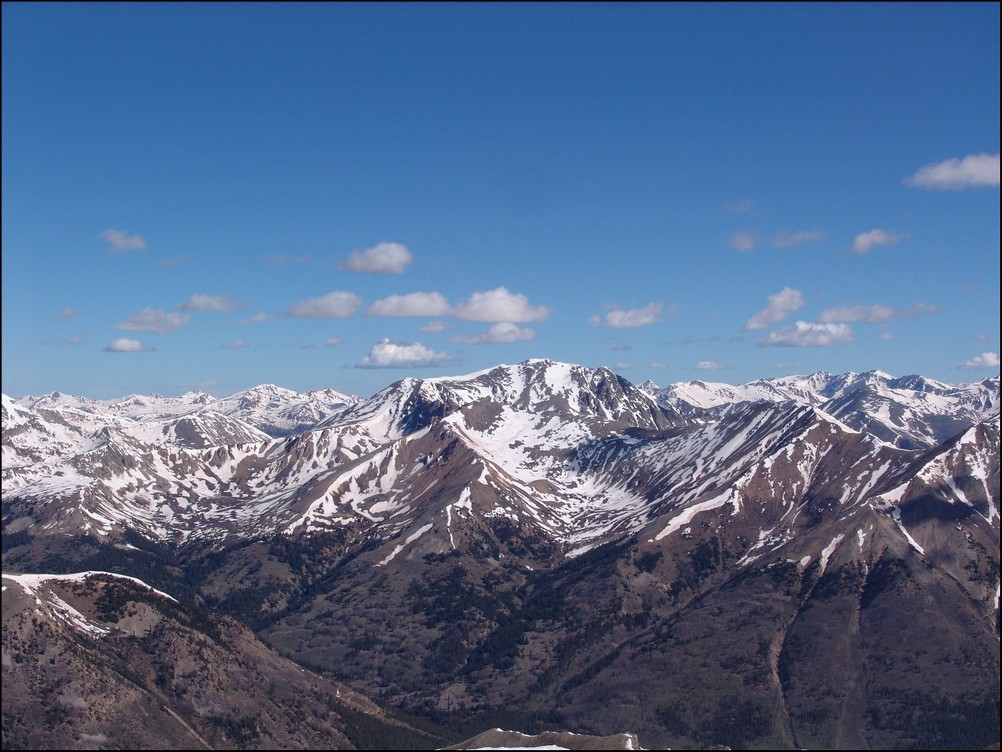
An hour and 15 minutes after we started hiking from our camp, the first view of the Three Apostles came into view. The Three Apostles are a group of 13ers located up the valley from Huron, and contain two of the highest 100 in Colorado, Ice Mountain (13,951 ft.) and North Apostle (13,860 ft.). West Apostle is also respectable at 13,568 ft.

The Three Apostles come into view for the first time
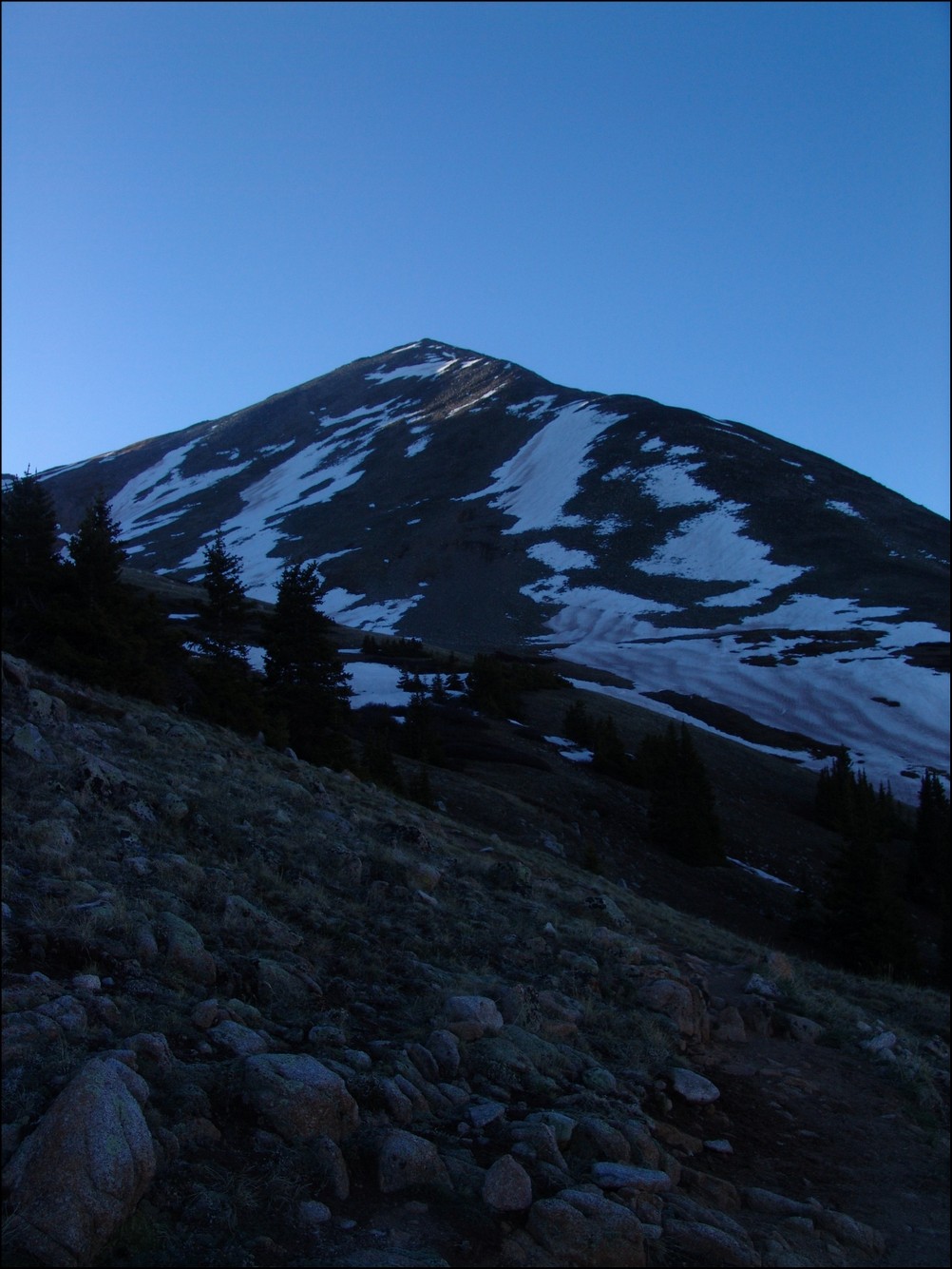
Soon thereafter, one of our objectives for the day came into view as well: Huron. Huron appeared above us like a giant pyramid, as if it were guarding some ancient treasure within its rocky shell.

Huron Peak comes into view for the first time

The moon sits over Huron Peak
Huron Peak in the early light

Huron, the Three Apostles, and Granite Mountain greet the rising sun
Now that we could see the beginnings of the amazing views, Mike became more and more awestruck by the Colorado Rockies. It was a real pleasure hiking with someone that shared the same level of appreciation for Colorado's awesome peaks. Mike and I exchanged photos of each other.
Mike Vetter looking excited in front of the Three Apostles
Matt Payne with the Three Apostles in the background
As we gained more elevation, views across the valley were getting even better. I noticed a long waterfall snaking down the side of Granite Mountain and decided that I wanted to try to capture a zoomed-in view of that waterfall. I took about 10 photos of the side of the mountain at 200mm and combined them into this photo:

Snow forms a waterfall down the side of Granite Mountain
I also wanted to get a zoomed in shot of the Three Apostles using the same method. Here are the results (click on the photo to see the super-hi-res version):

The Three Apostles in high detail
We continued to climb past treeline and up to Huron's base. I took some opportunities to take multiple photos of the views and stitched some photos together for a panoramic view.

Looking South and West, Huron casts a shadow over Granite Mountain
We quickly made our way up into the basin below Huron and were greeted by a giant snowfield. Normally, I welcome the sight of snow; however, the snow we encountered was very soft, with marshy streams and pools of water beneath. It was very much like crossing a field filled with 7-11 Slushies.
We made it through the slush and continued up the basin beneath Huron. The terrain was solid and only mildly wet from snowmelt. At this point, the sun had crested Browns Peak and began to heat the surrounding area.
Mike Vetter squinting into the sun on our approach of Huron
We continued to climb up towards Huron, following the trail through and around large snow fields. At this point, it was clear that snowshoes or other assistive devices would be fairly useless and I was glad I brought neither. As we gained elevation, the views of Browns Peak as well as the Elk Mountains began to get better and better.
Browns Peak sits to the North of Huron Peak
We made really great time up Huron, despite its relative steepness and other aforementioned challenges (did I mention Mike lives 13,000 ft. lower than Huron). Huron's summit block loomed over us, making us feel pretty small compared to this giant choss pile. The trail up this section of Huron was clearly maintained and the efforts of Colorado Fourteeners Initative to improve the trail were apparent.
Huron Peak's summit block
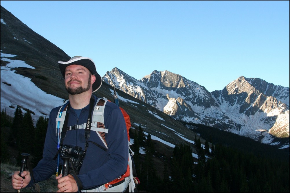
Matt Payne (author) hiking up Huron's Peak
We finally reached the ridge between Browns Peak and Huron Peak and were warmly welcomed by a giant cornice sitting at the top of the ridge.
A giant cornice on Huron's ridge
The final push to the top of Huron took exactly 10 more minutes. The views from Huron Peak were absolutely outstanding. Being somewhat more isolated than most of the other 14'ers in the Sawatch Range, Huron Peak offers excellent views of the rest of the Sawatch Range and the Elk Mountains as well. Mike and I were the first to summit that day, and spent an hour on top celebrating, eating, and taking large amounts of photographs.
Hero shot of Matt Payne on top of Huron Peak
Matt Payne gazes South towards the Three Apostles

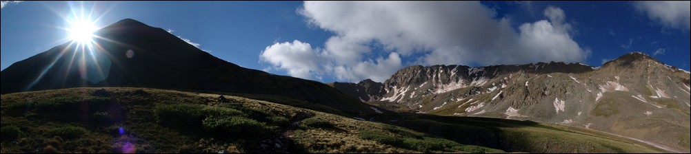
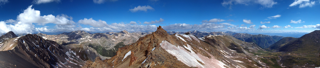
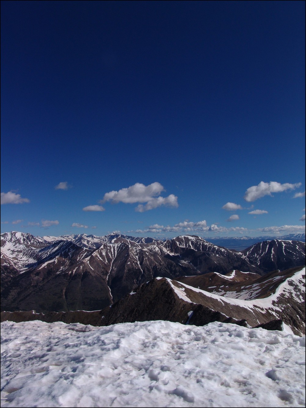
360 Degree View from the top of Huron Peak (click for full resolution version)
A 180 Degree View from North to South from Hurons Peak. The Three Apostles at center.
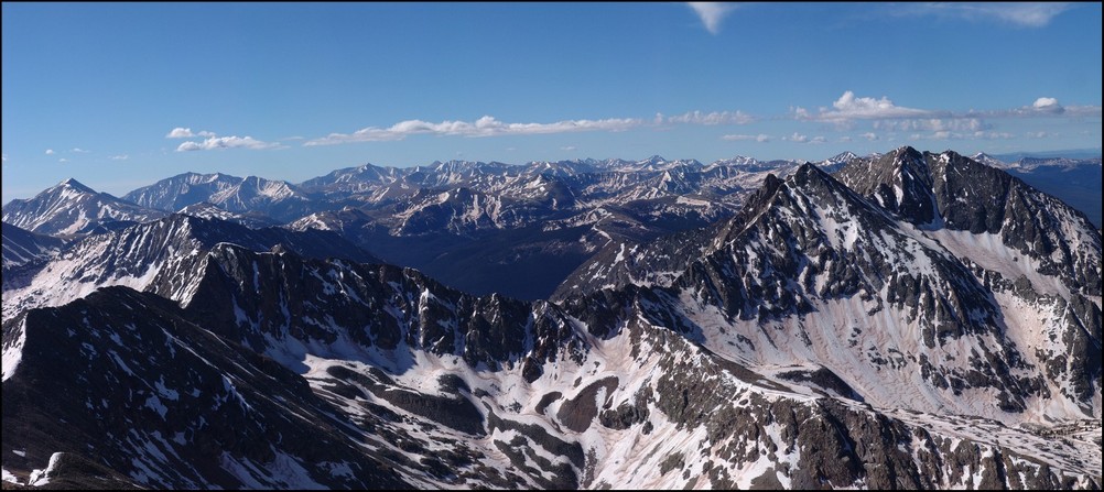
Mount Hope (the flat topped mountain) rests right of center. La Plata Peak rests far left.
The Elk Mountains loom in the distance, covered in snow.This photo is zoomed in at 200mm. Pyramid Peak, Maroon Peak, Snowmass Mountain, and Capitol Peak can all be seen from this vantage. Click on the image for the super hi-resoltution version.
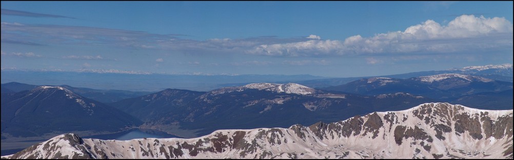
Taylor Reservoir can be seen in the distance, reflecting the surrounding mountains (click for full resolution version)
A closer look at the Sawatch Mountains south of Huron. Mount Antero, Mount Shavano, and Tabeguache Peak are all recognizable.
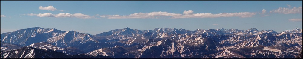
A zoomed in view of the Southern Sawatch mountains
Shavano and Tabeguache (high pointed peak and flat snowed peak respectively)
North Apostle and Ice Mountain zoomed in. If you click on the image you can see the full resolution version (and the climber atop North Apostle. I've confirmed that this climber is "Mad Mike" from 14ers.com
Mount Yale and Mount Princeton seen in the distance
La Plata Peak seen to the North of Huron across the valley
A great view of the Three Apostles from Huron
A 90 degree view looking Northeast, North, and Northwest from Huron
A vertically-oriented panoramic view of the Three Apostles
Matt Payne leaning to allow for a better view of the Three Apostles
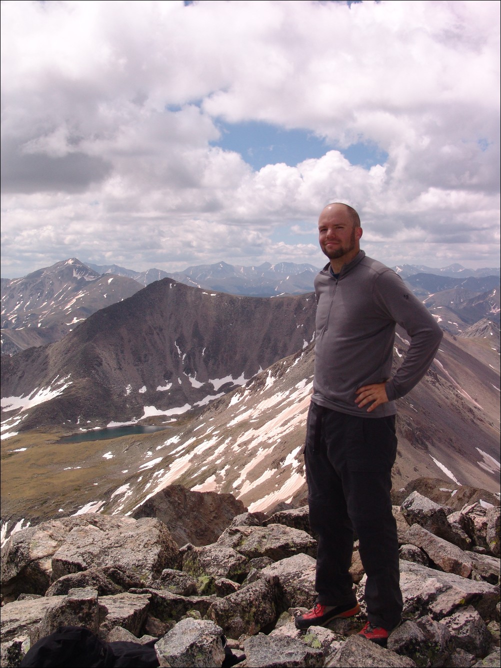
Matt Payne and Mike Vetter on top of Huron Peak
At this point we decided that after an hour of being on the summit we should head down to the ridge and make an attempt on Browns. Once down-climbing to the ridge, we were able to get a view of what we just climbed, decorated with a fair amount of snow still.
Still a lot of snow on Huron's eastern face
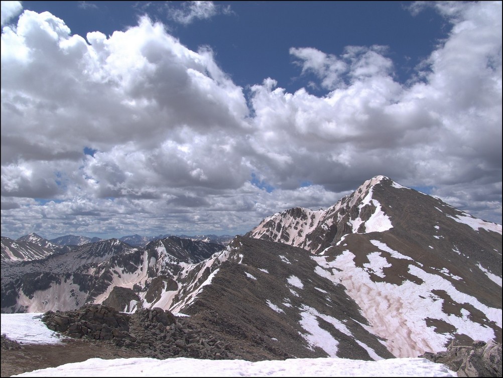
We took a look at our route - a straight ridge scramble to PT 13,518 and then to Browns.
PT 13,518 and Browns were a straight shot from Huron's ridge. Mount Hope seen in the background.
We quickly scrambled up PT 13,518 without any problems and looked back at Huron. The further away we got from Huron, the more we could appreciate just how steep it was.
Huron rises high above PT 13,518 to the Northwest
A zoomed in view of Huron from PT 13,518

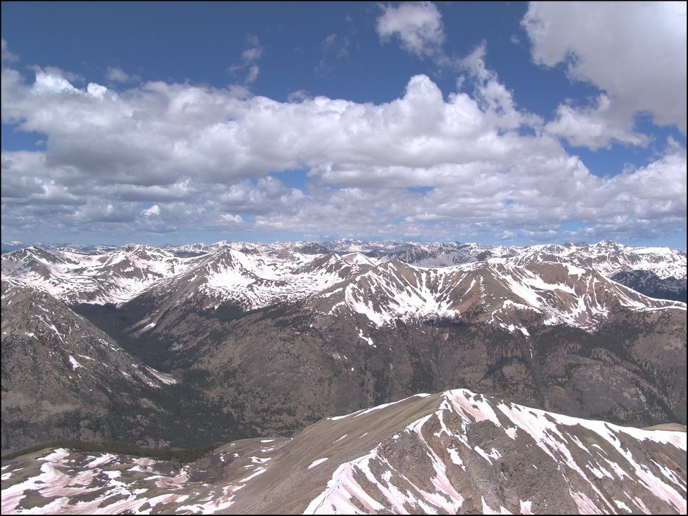
A wider view of Huron and the surrounding terrain
After reaching PT 13,518, we took a look over to our next and final objective: Browns Peak.
Browns Peak looked fairly easy with La Plata Peak behind it
On the way over to Browns, we were able to get a really awesome view of a nasty cornice, which looked more like a frozen tidal wave.
A huge cornice sitting in the saddle between PT 13,518 and Browns
A closer view of the cornice
A super-zoomed in view of the cornice
After a bit of mild scrambling, Mike and I reached the summit of Browns in quick order. The clouds were looking to get worse and worse, so we decided that after Browns that we would go ahead and head back down to the trail below us, making our own route down off of Browns and connecting with the Huron trail.
Mike Vetter celebrating on the summit of Browns
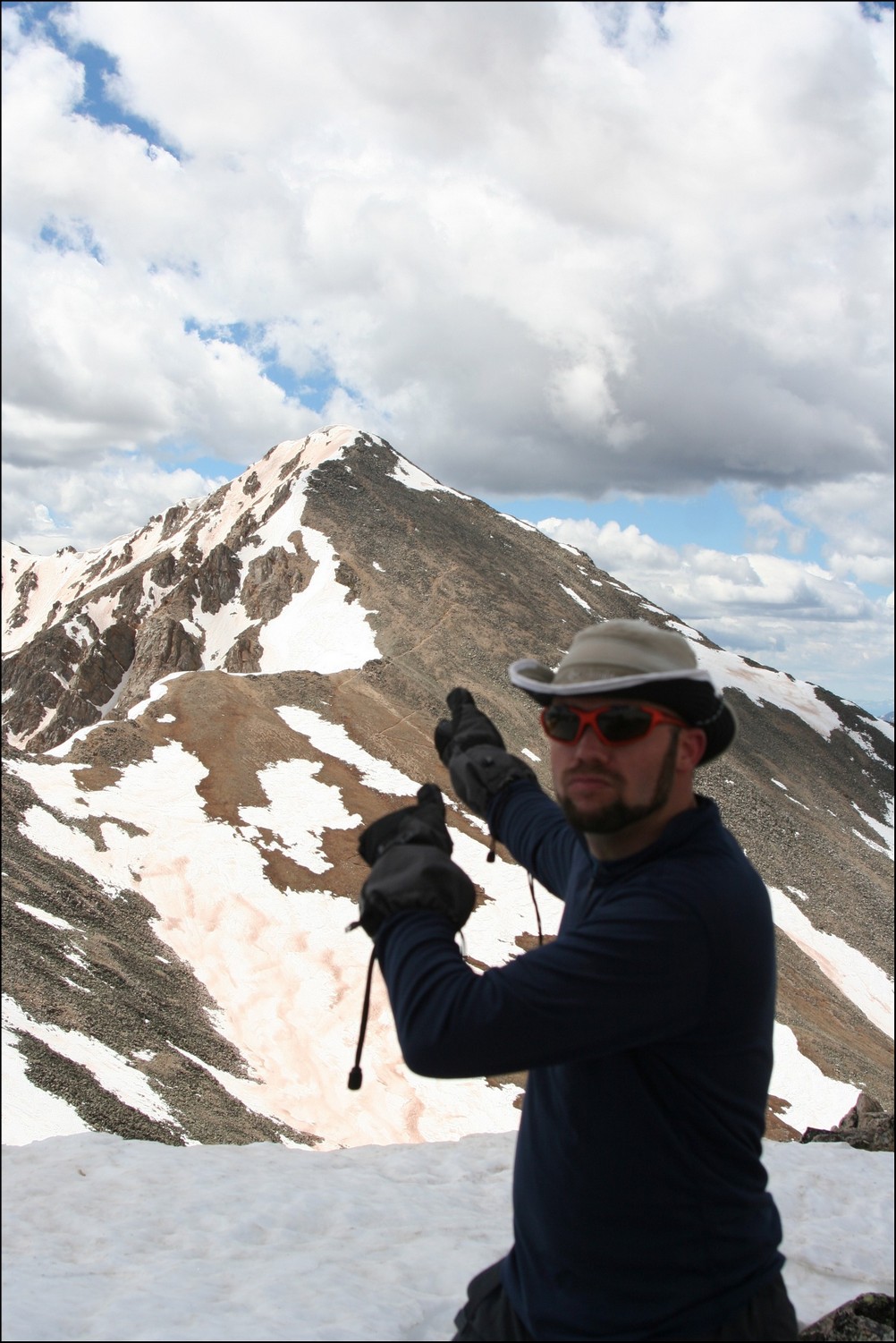
Matt Payne points back to Huron from Browns
We dropped off the north face of Browns just a few hundred feet and went straight down a scree gully. The dirt was quite loose but manageable. Soon after reaching the basin for Huron again, we were greeted by another large snow-field, which presented some pretty awful post-holing up to our wastes. Fortunately, my boots and gaiters kept my feet completely dry!
Matt Payne descending from Browns
After reaching the trail again, we headed back down the way we came and crossed the insane snow-field at the base of Huron. After a days worth of sunlight, the snow-field was quite soft and presented us with some unique and 'wet' hiking challenges.
Matt Payne crossing the slushy on Huron
Once we reached the bottom of the snow-field, the way down was pretty quick to treeline and below to the trailhead and eventually my vehicle.
All-in-all, this was an amazing trip filled with great views. And I must say, I could not have hiked with a better guy. Thanks for driving down and climbing with me Mike!
To complete the trip report, here are three HDR photos I combined. I am new to HDR but I do like how it can enhance the light.
Until next time, enjoy Colorado's summits!