Displaying items by tag: Molas Pass
Climbing Grand Turk and Sultan Mountain in late November
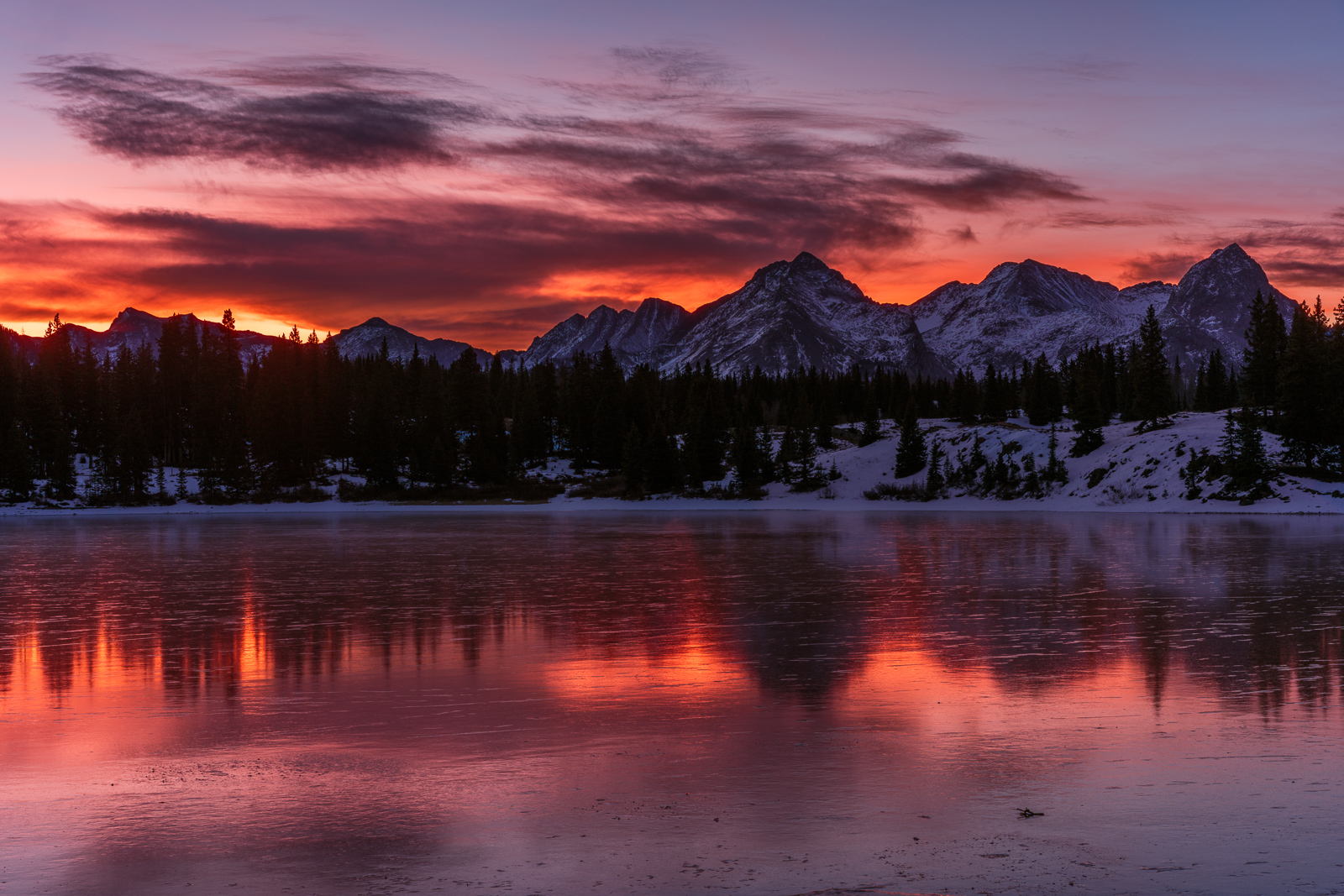
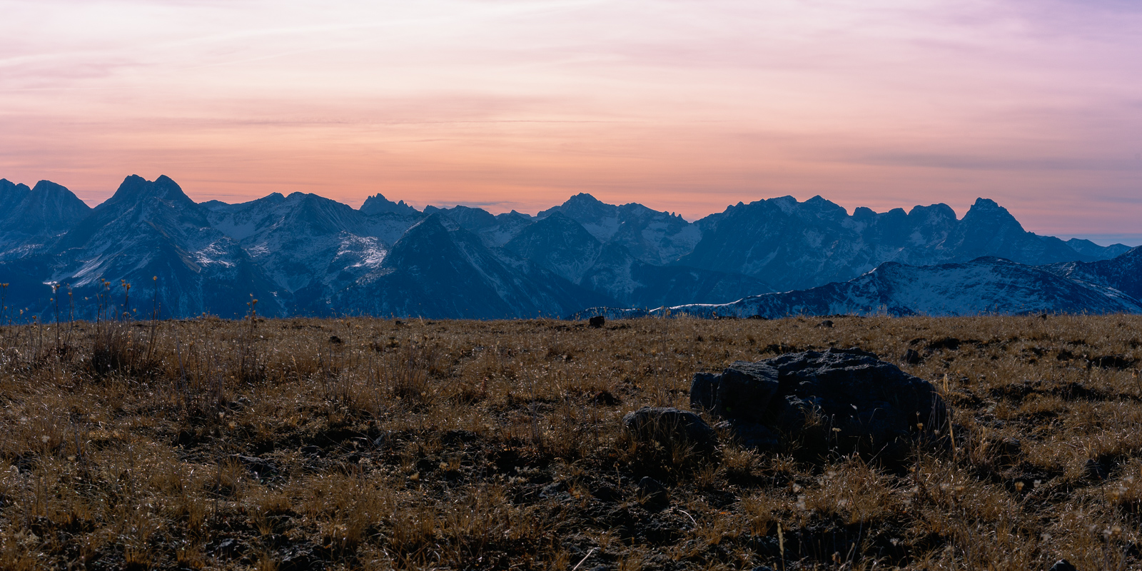
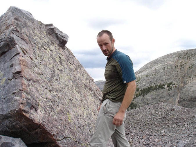
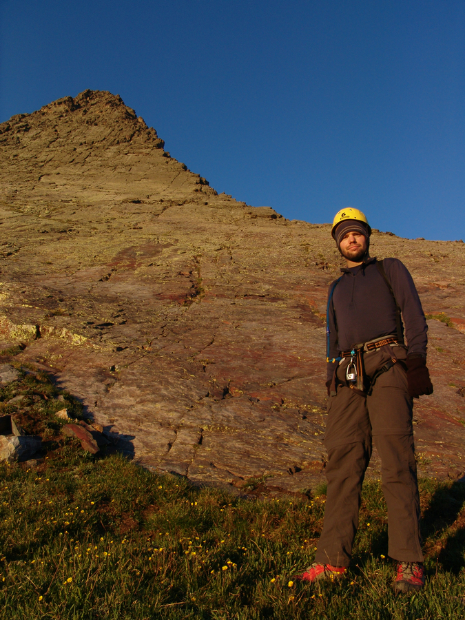
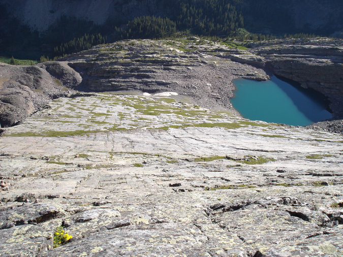
When the forecast in late November calls for sunny skies and temperatures exceeding 60 degrees, there are two thoughts that immediately come to mind: "climate change is real," and "maybe I should go climb a mountain!" Both Grand Turk and Sultan Mountain have been on my radar for many years, ever since I saw them for the first time from Ice Lake Basin in 2013. With the abnormally hot weather we have had in Southwest Colorado this autumn, I figured a quick 45-minute drive to the trailhead at Little Molas Lake would be a great way to spend a Sunday morning after a week of induldging on Thanksgiving leftovers. I also decided to make a stop at Molas Lake to see if I could get a decent photograph of sunrise from there. This turned out to be a great decision, as the clouds were fantastic. The lake was covered in very thin ice, making for a very interesting reflection!
I decided to more or less bushwhack up into the basin between "East Turkshead Peak" and "West Turkshead Peak" from Little Molas Lake. My full GPS file and route are available on Gaia GPS, which is an amazing program! I highly recommend it to anyone with a smart-phone. It is better than a stand-along GPS unit (let's admit it, you all carry cell phones) and is usable in airplane mode. Amazing stuff. You can purchase it here and help support the site.
For this hike and climb, I decided to bring my full compliment of prime lenses and my telephoto lens. I have to admit, my camera gear is so much more manageable now that I am shooting with a Sony mirrorless system. I love it. Camera and lenses used:
- Sony A7RII body (amazingly light and incredible image quality)
- Zeiss Loxia 21mm f/2.8 (amazingly light, sharp, and portable lens)
- Sony Zeiss FE 55mm f/1.8 ZA (amazingly light, sharp, and portable lens)
- Sony FE 70-300 f/5.6-6.3 telephoto (pretty light for the focal length, decently sharp)
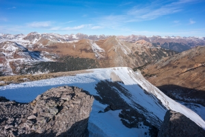
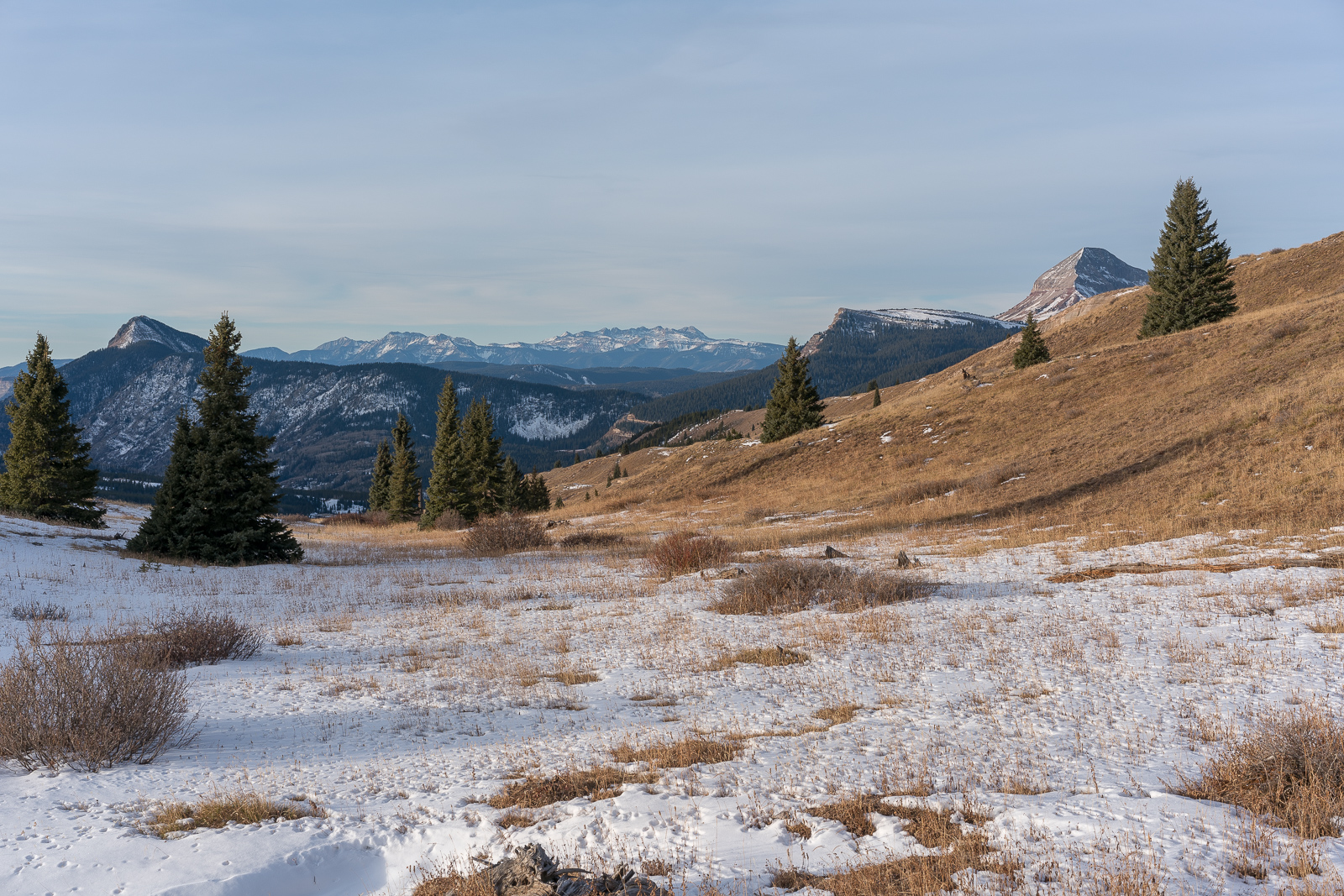
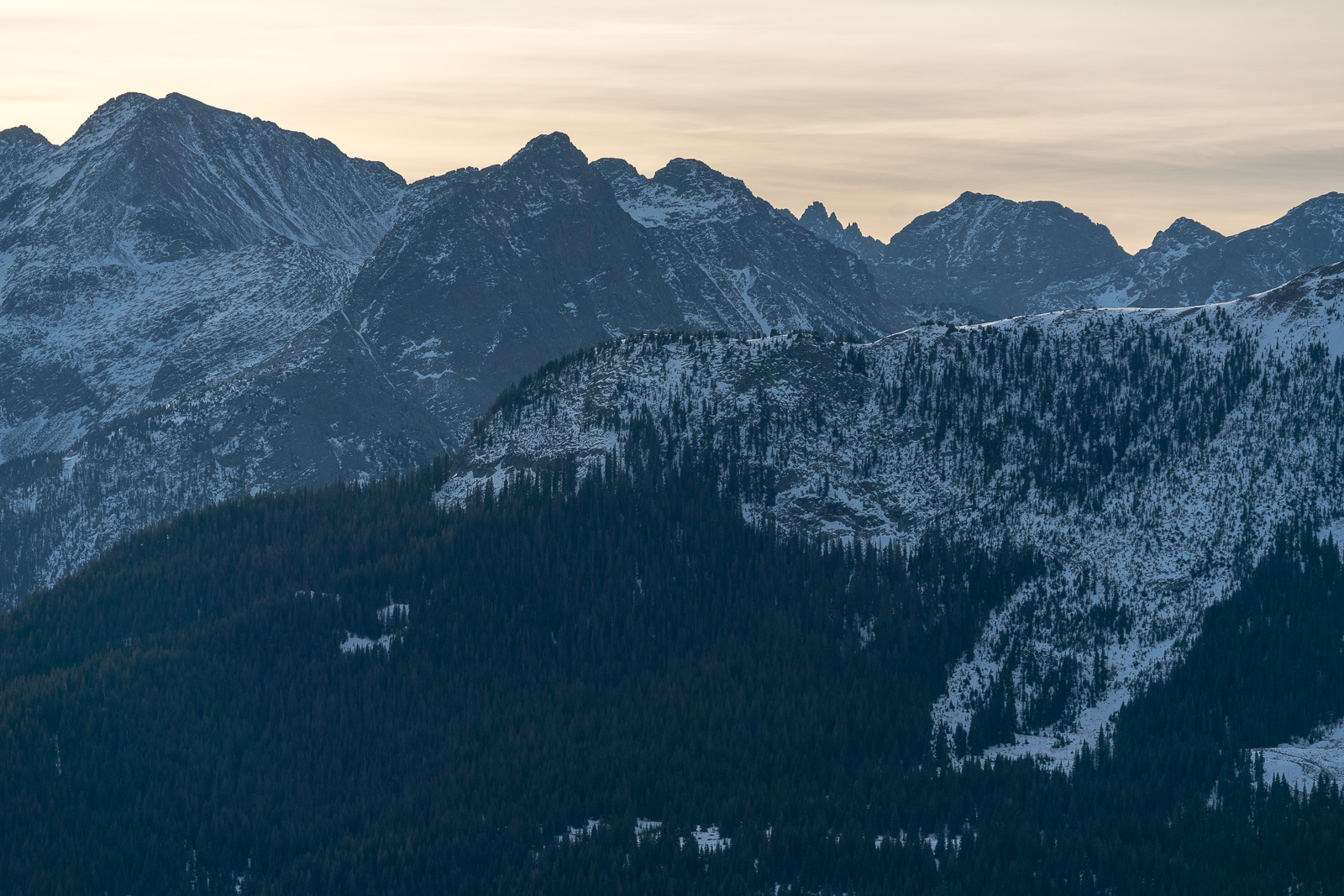
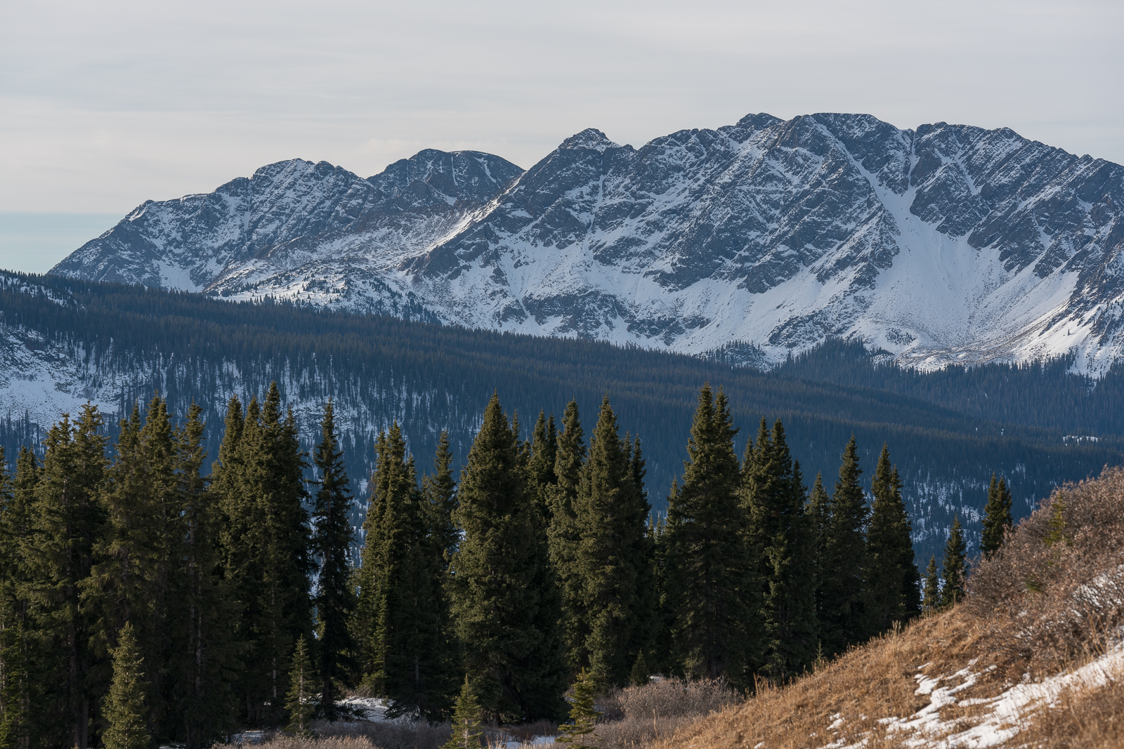
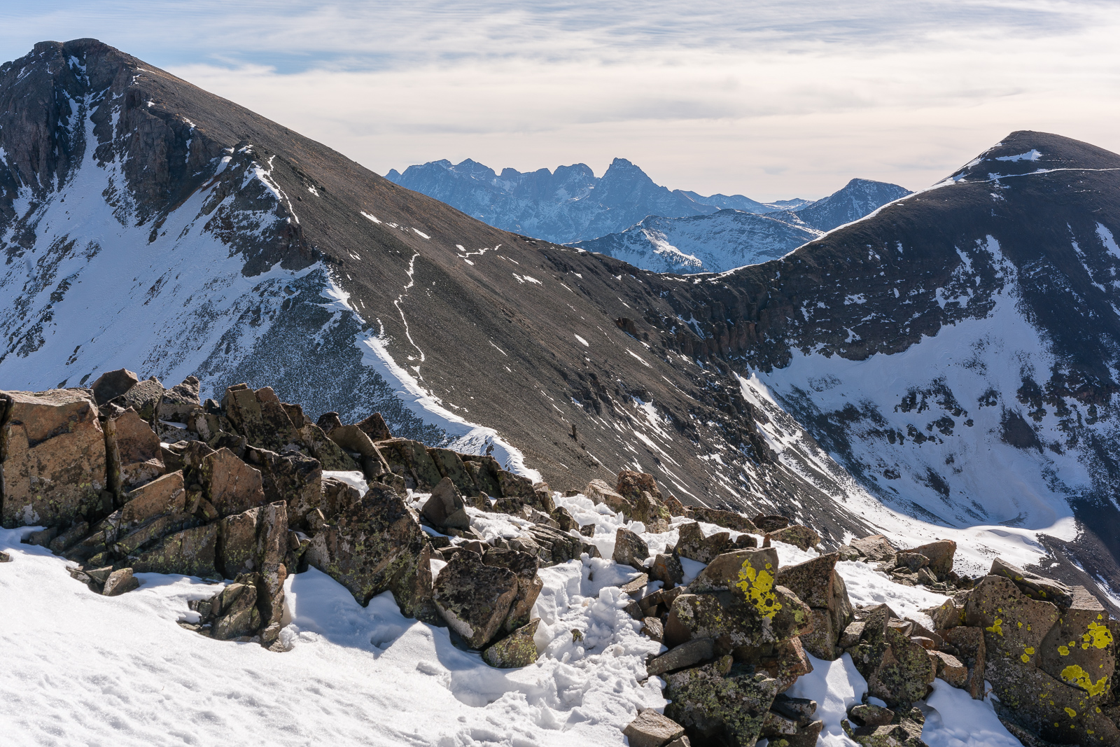
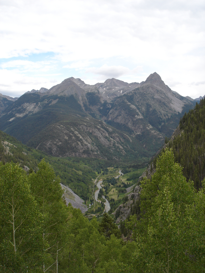
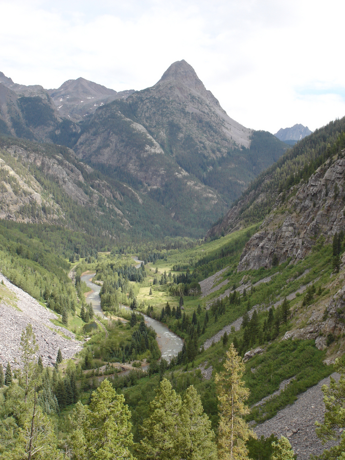
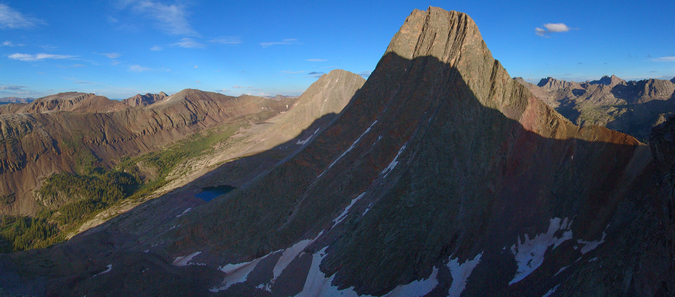
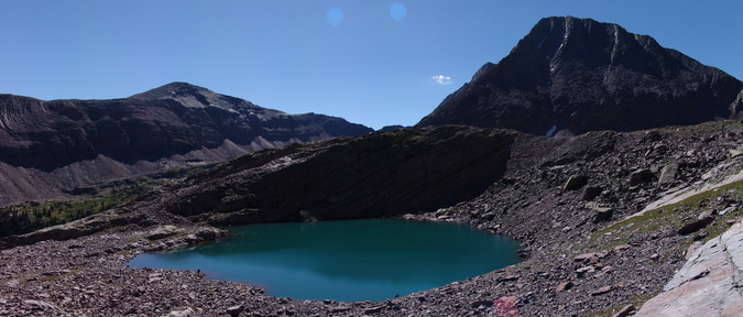
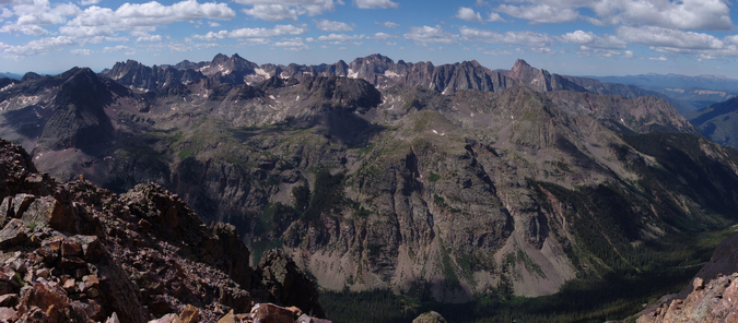
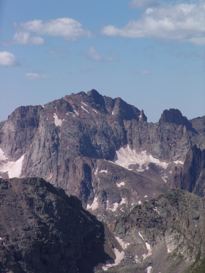
As I hiked up into the basin, the views just got better and better over time and did not let up. I was quite happy to have chosen this route. Snowdon Peak rose above Little Molas Lake behind me in a grand display of early winter.
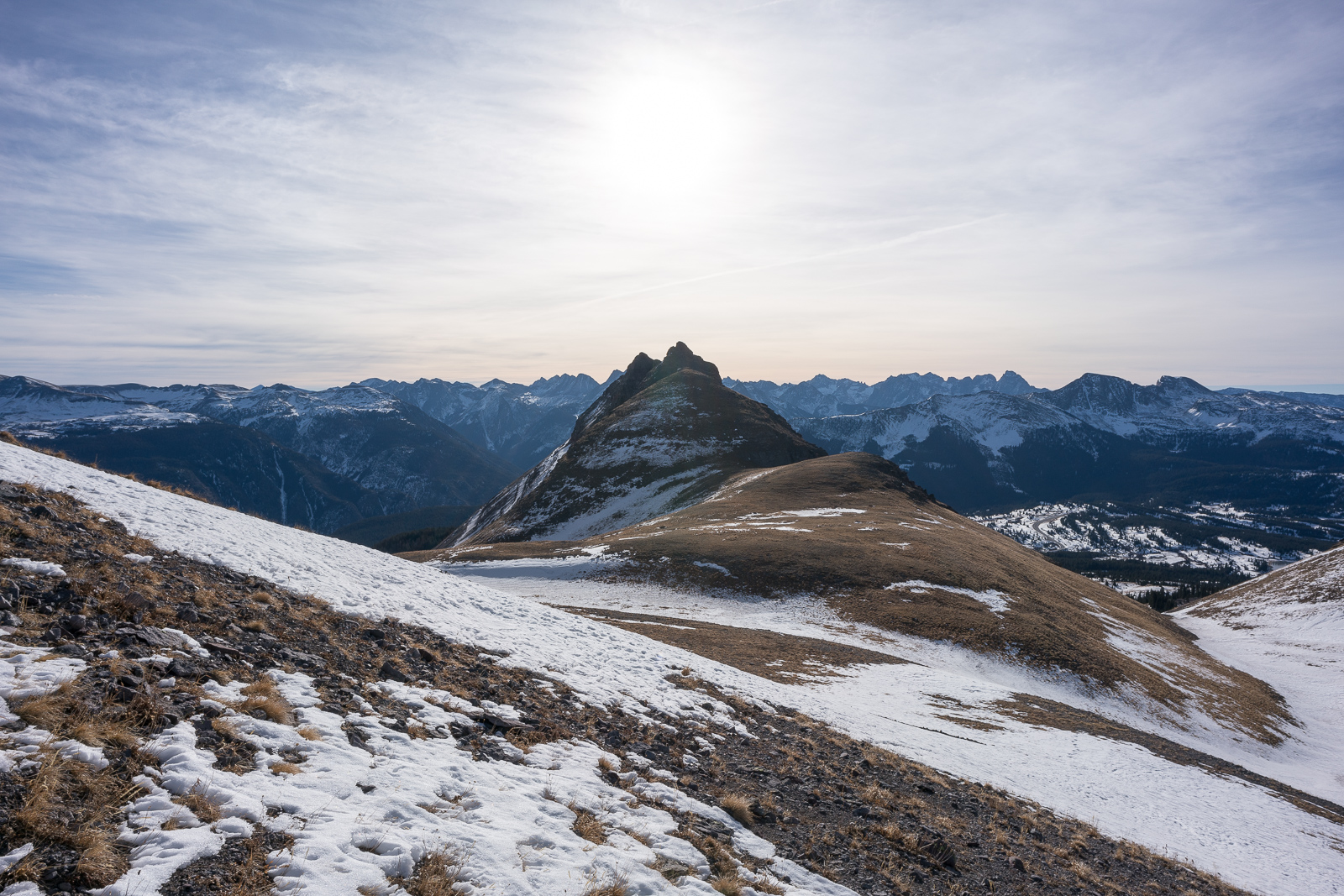
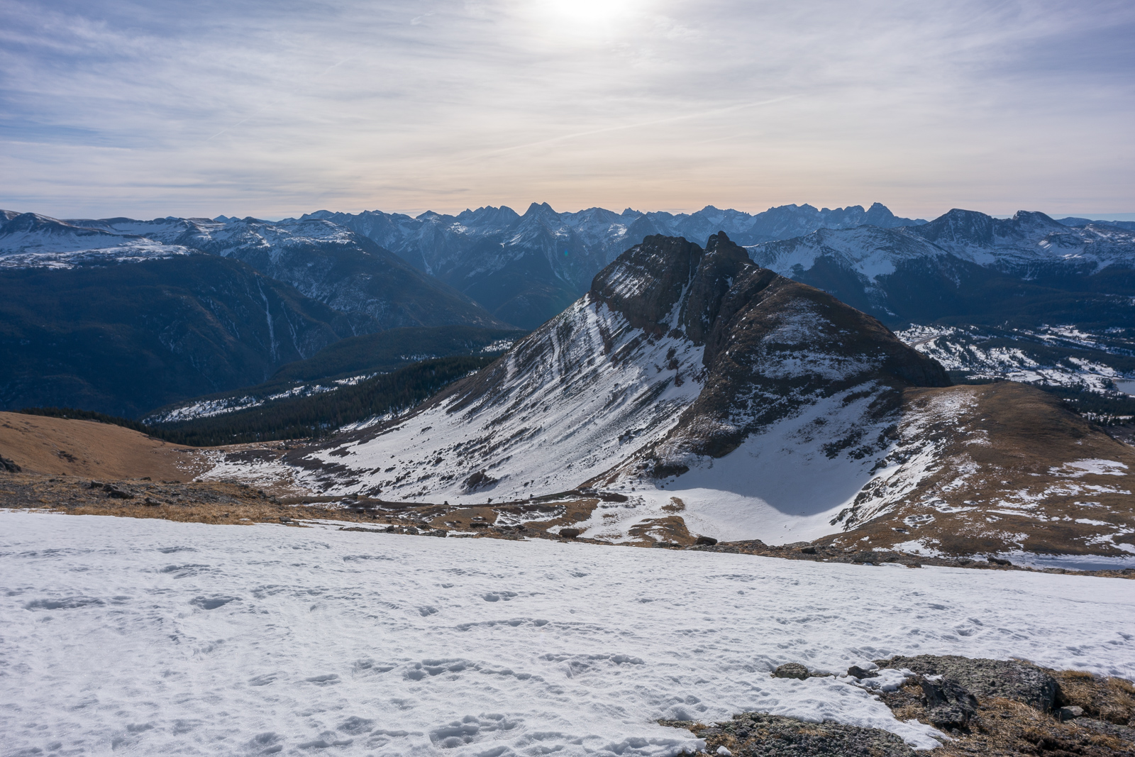
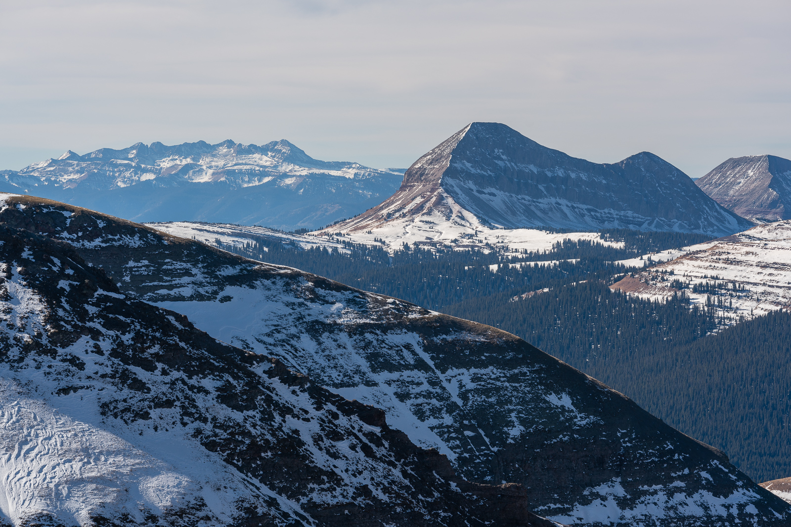
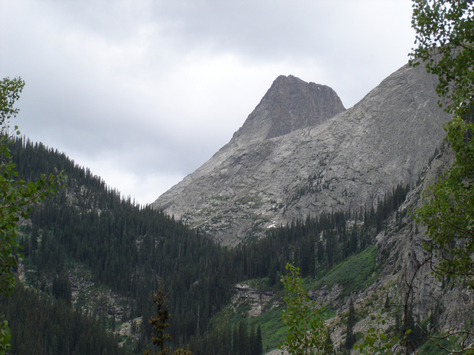
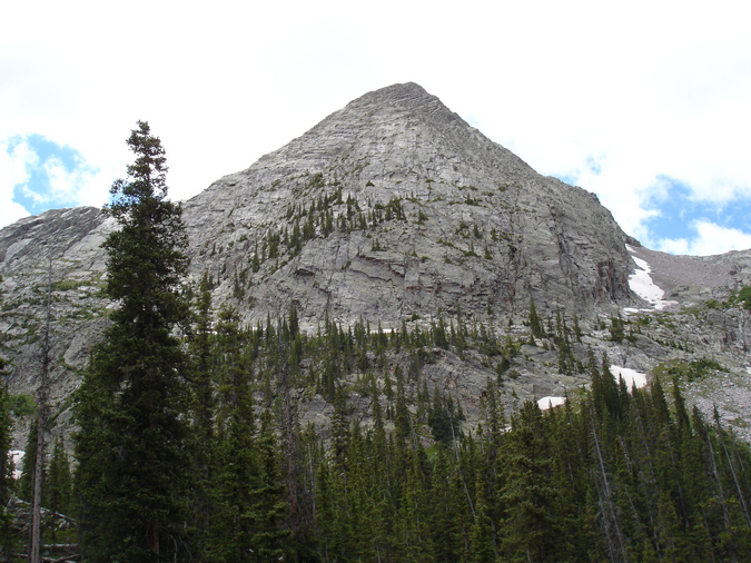
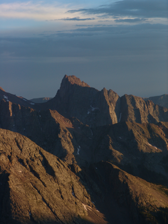
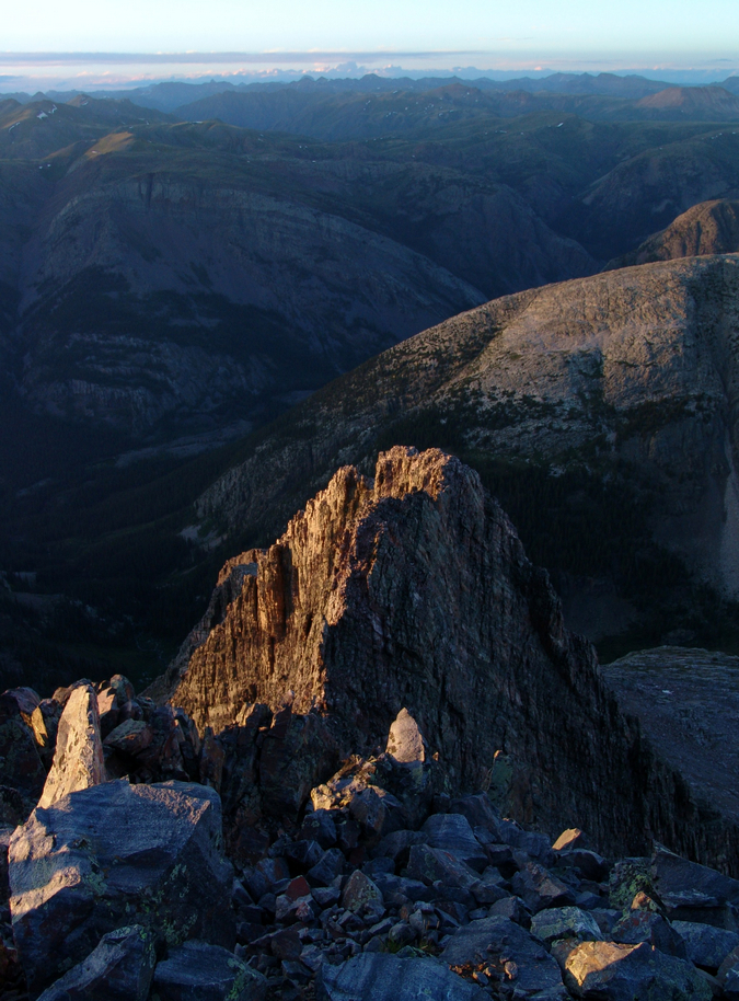
East Turkshead Peak, which is seen from Molas Lake, marked the right half of my passageway.
Finally, the La Plata Mountains and Engineer Mountain came into view as well.
The Twilights were looking pretty amazing too from this area.
Snowdon demanded my gaze on a frequent basis.
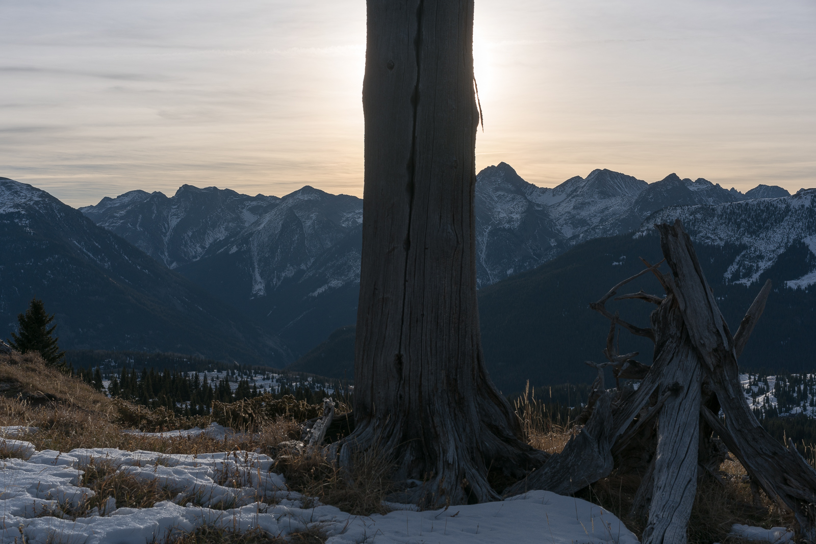
This lone dead tree caught my interest so I framed it with some mountains.
I never get tired of looking at the rugged Needles of the San Juans.
My telephoto lens allowed me to get nice close-up shots of the La Platas too.
And Engineer Mountain...
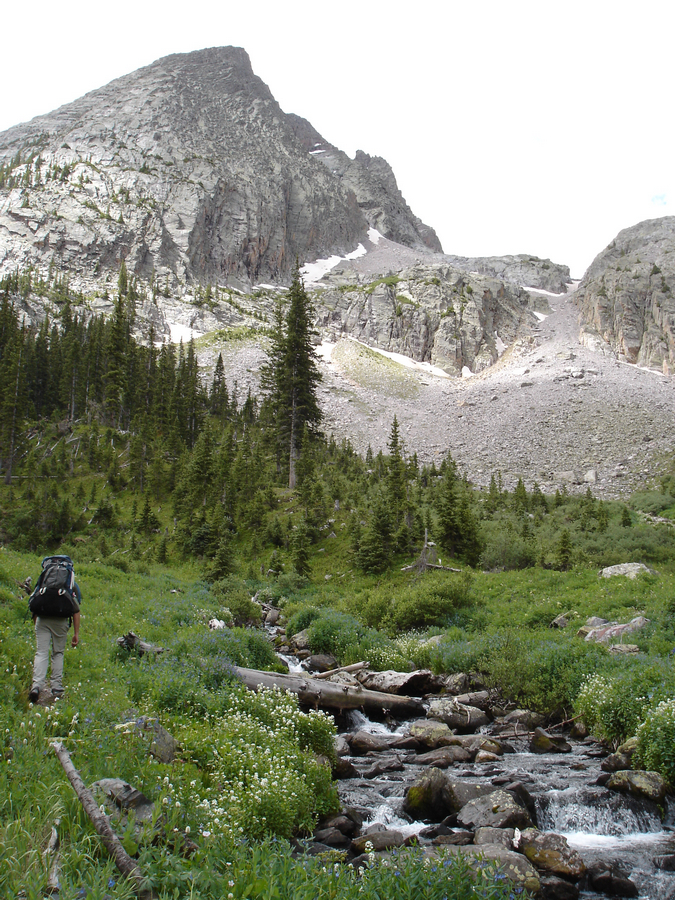
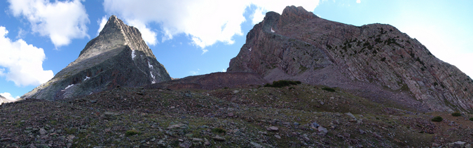
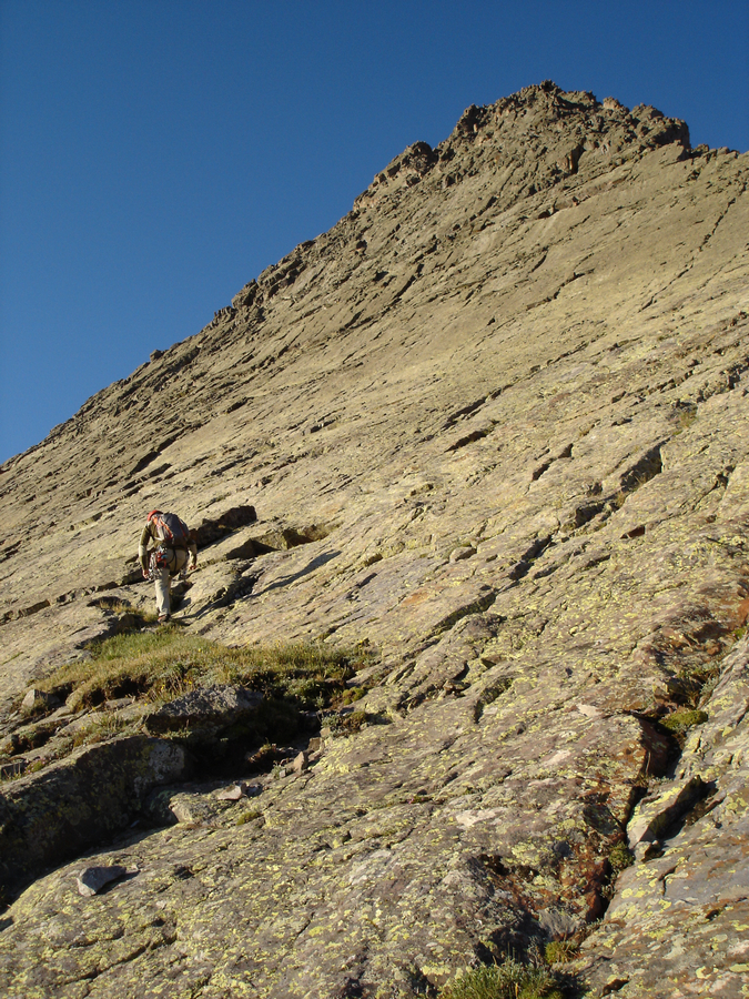
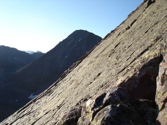
Below is a view of the route I took up into the basin. Pretty much straight ahead between the two rugged peaks.
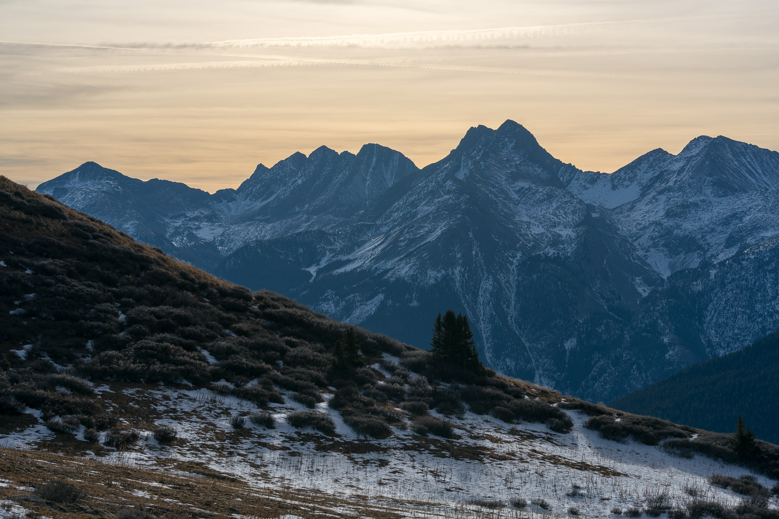
A low blanket of clouds pretty much stayed in place all day, making for some interesting lighting conditions.

The patterns in the snow and rock on the Twilights was mesmerizing.
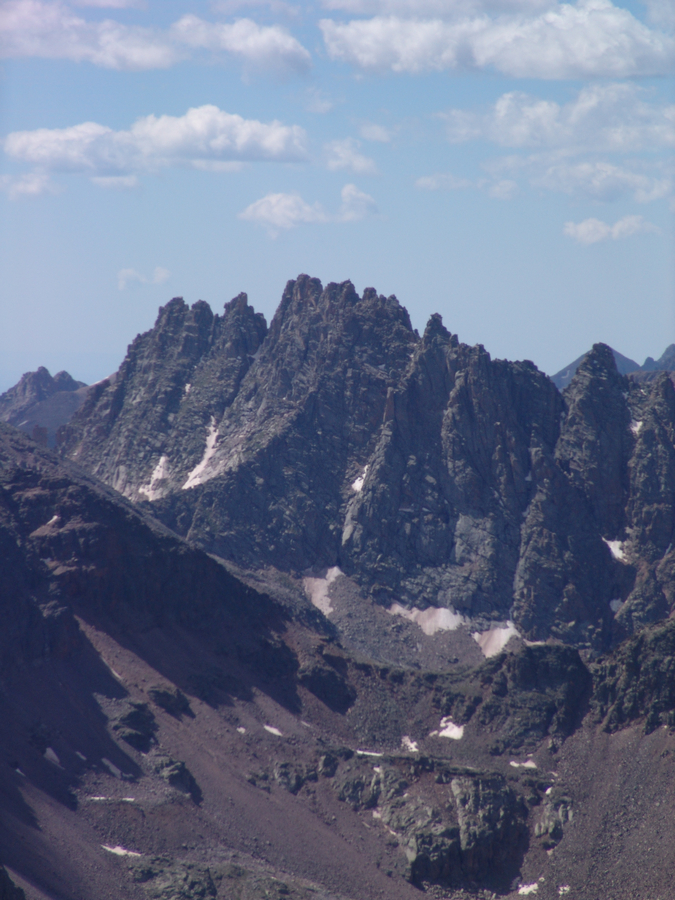
And of course, the Grenadiers, how could I forget about them? They almost made me trip over a rock so many times. I can't stop looking at them.
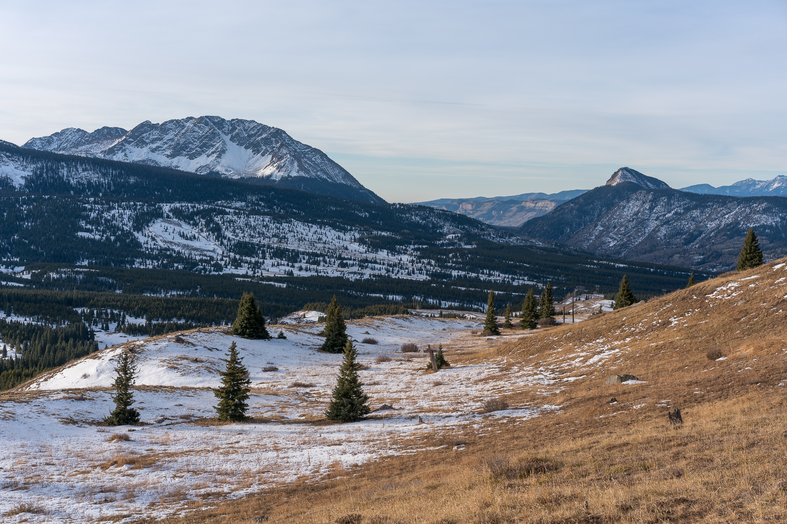
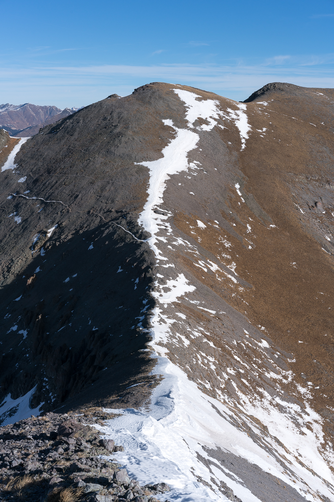
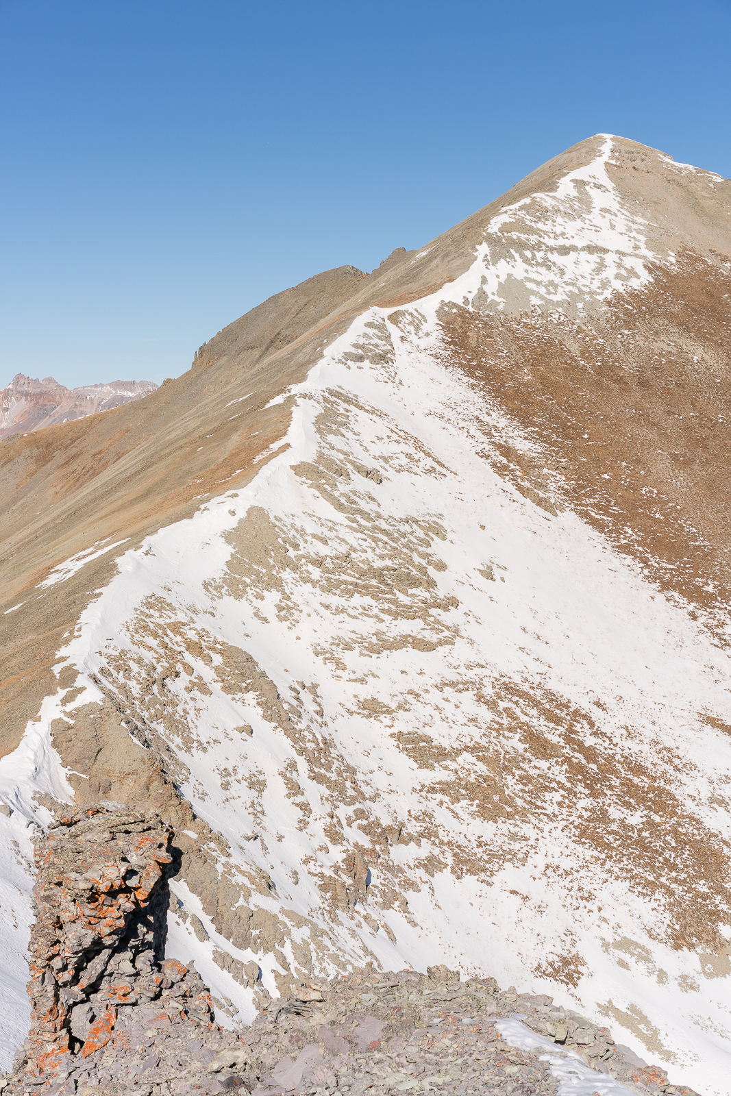
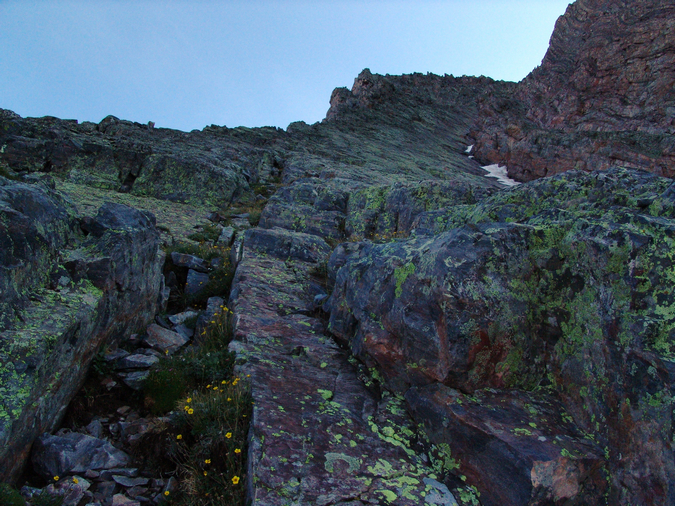
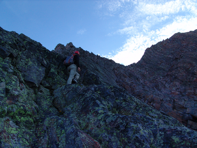
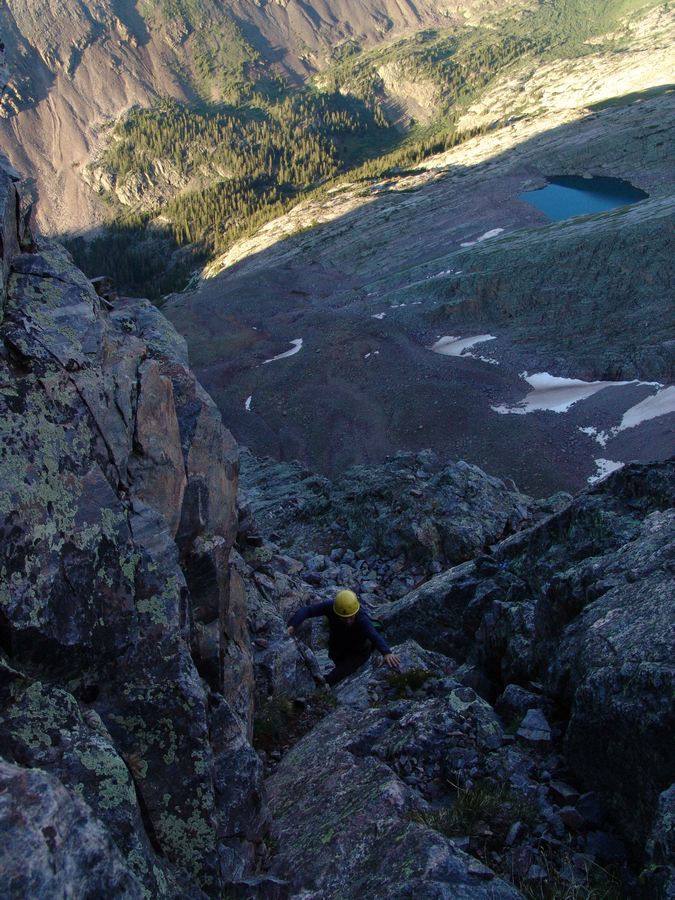
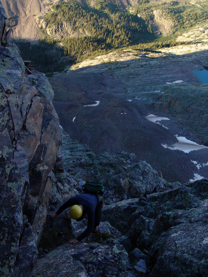
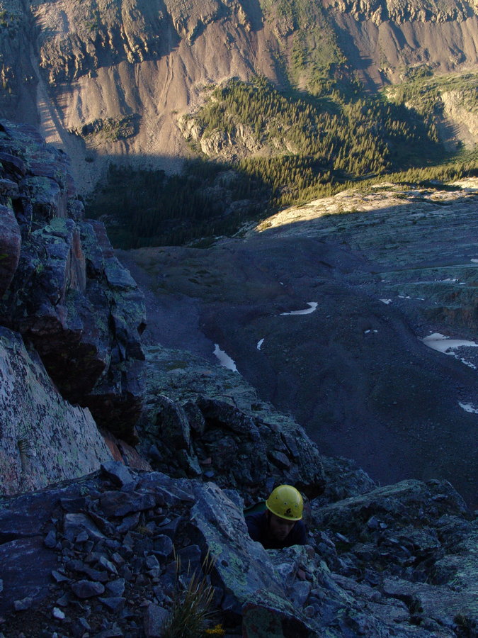
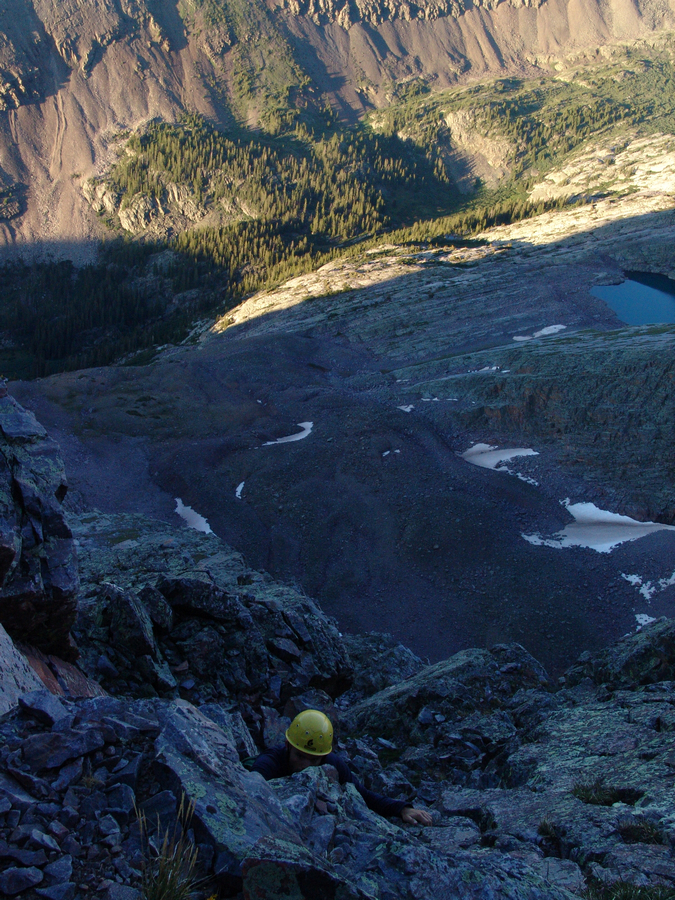
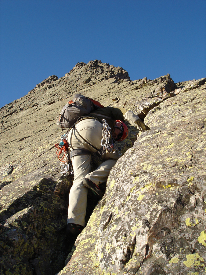
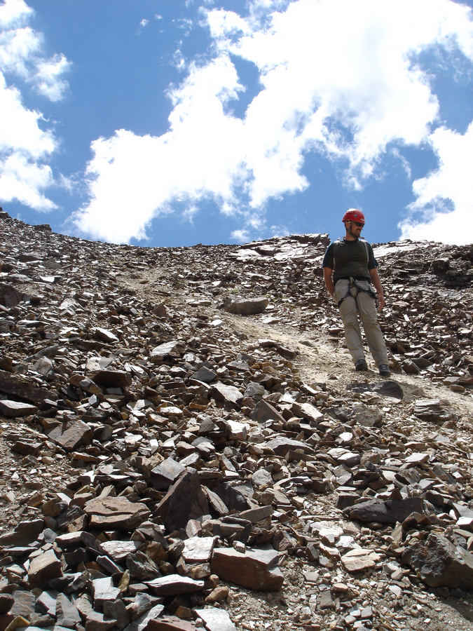
The route was pretty straight-forward, with a small trail going all the way up into the saddle. I decided to take my first rest and eat some snacks and enjoy the view south across towards the Twilights and the Needles, including Pigeon Peak and all her friends.
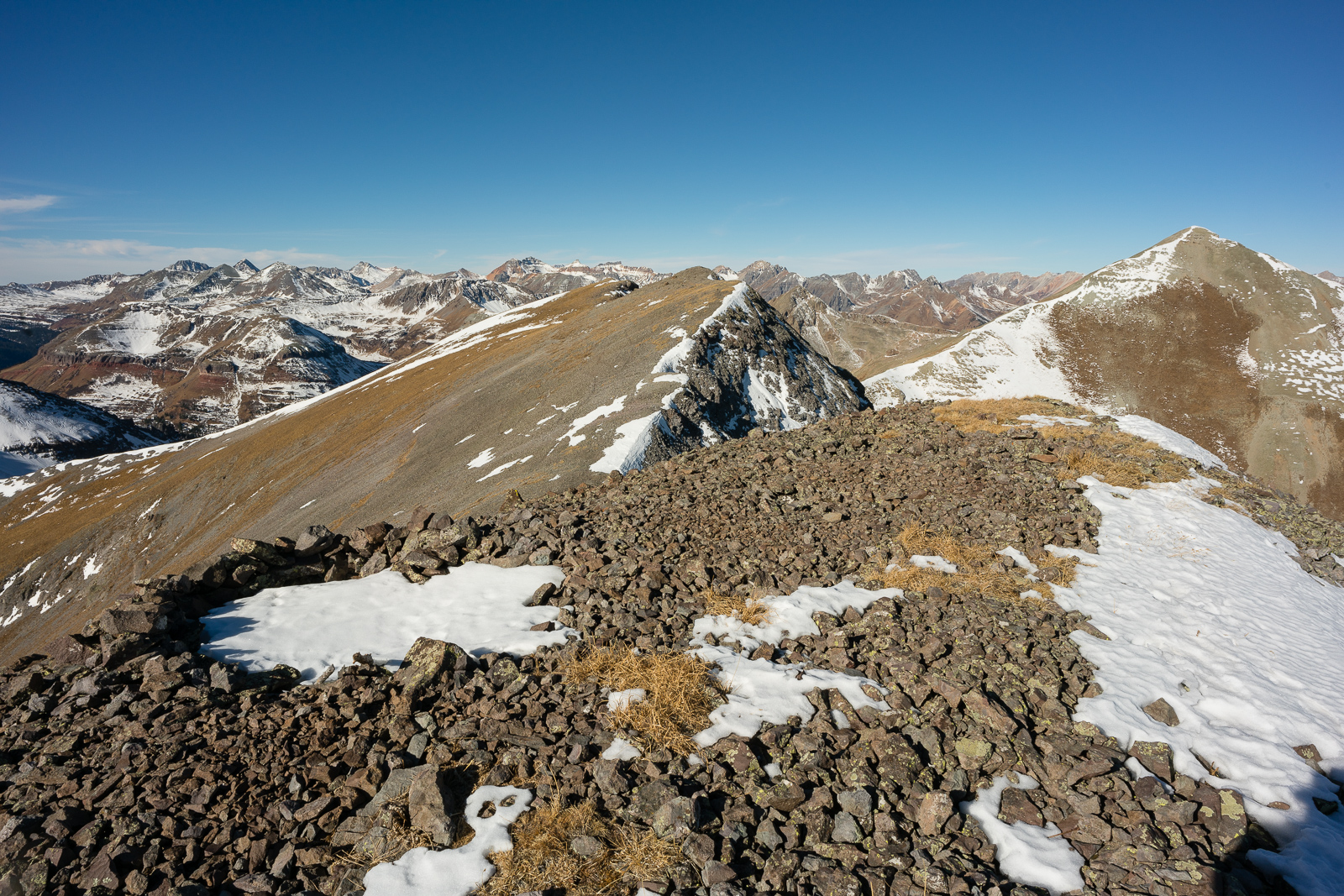
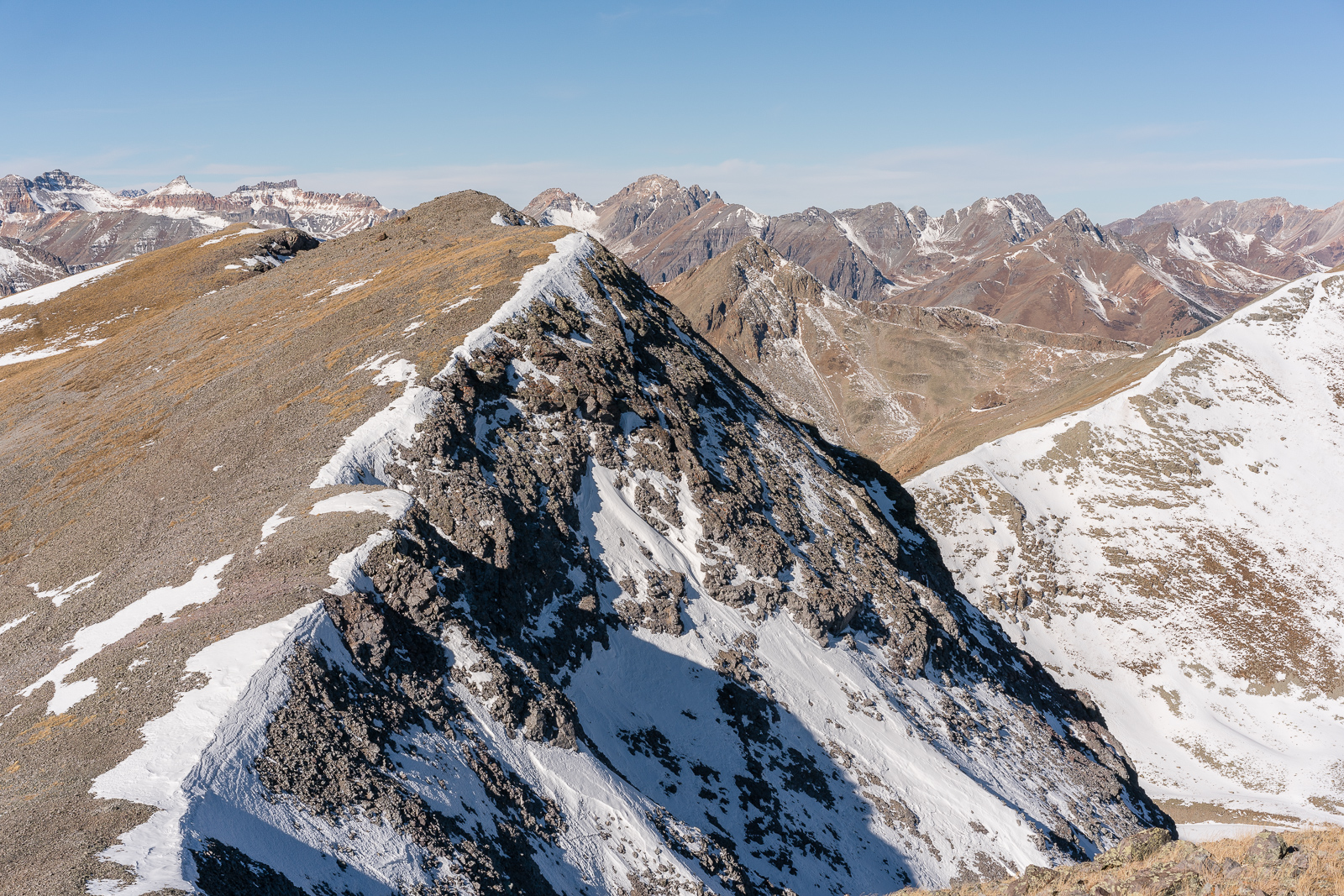
From here I had to make a decision. I could take the direct route and bypass UN 12,899 (seen left below), or go over it. I decided to go up and over it.
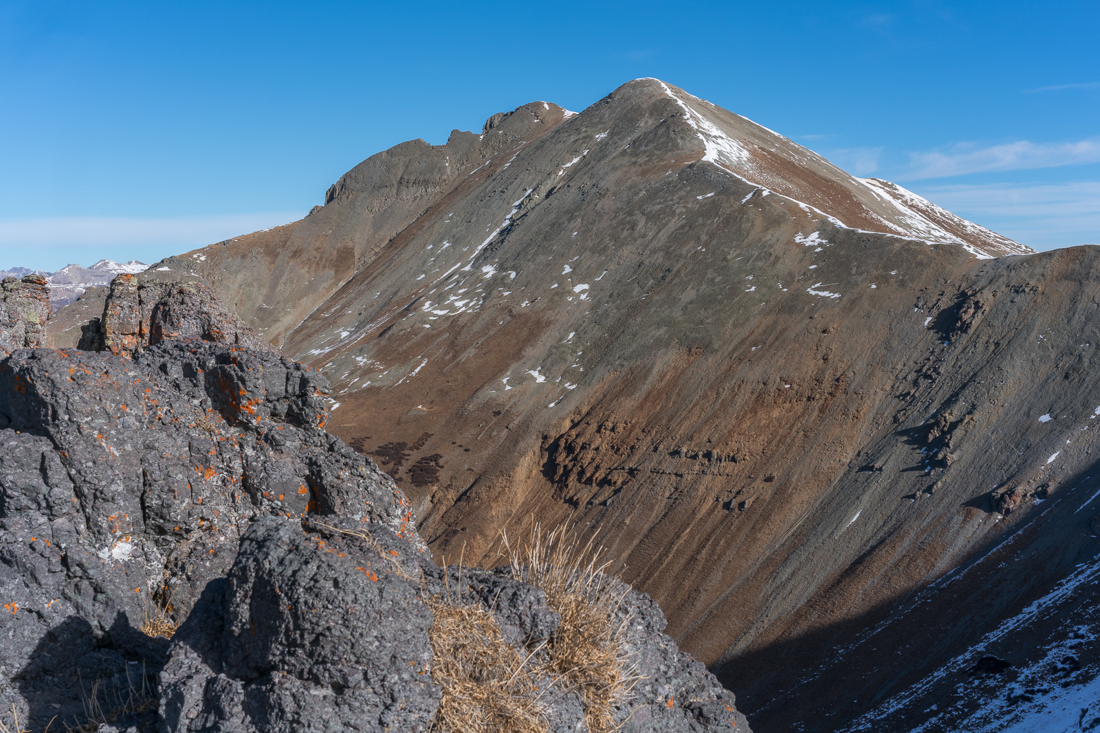
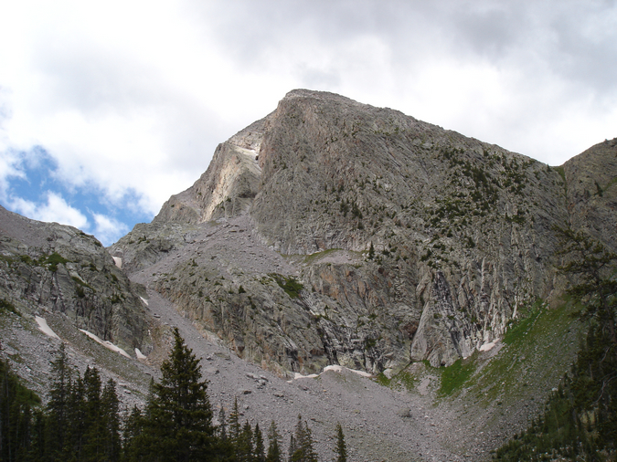
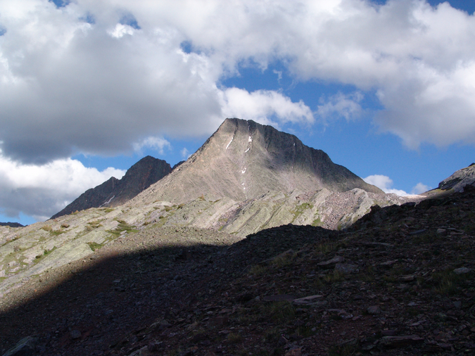
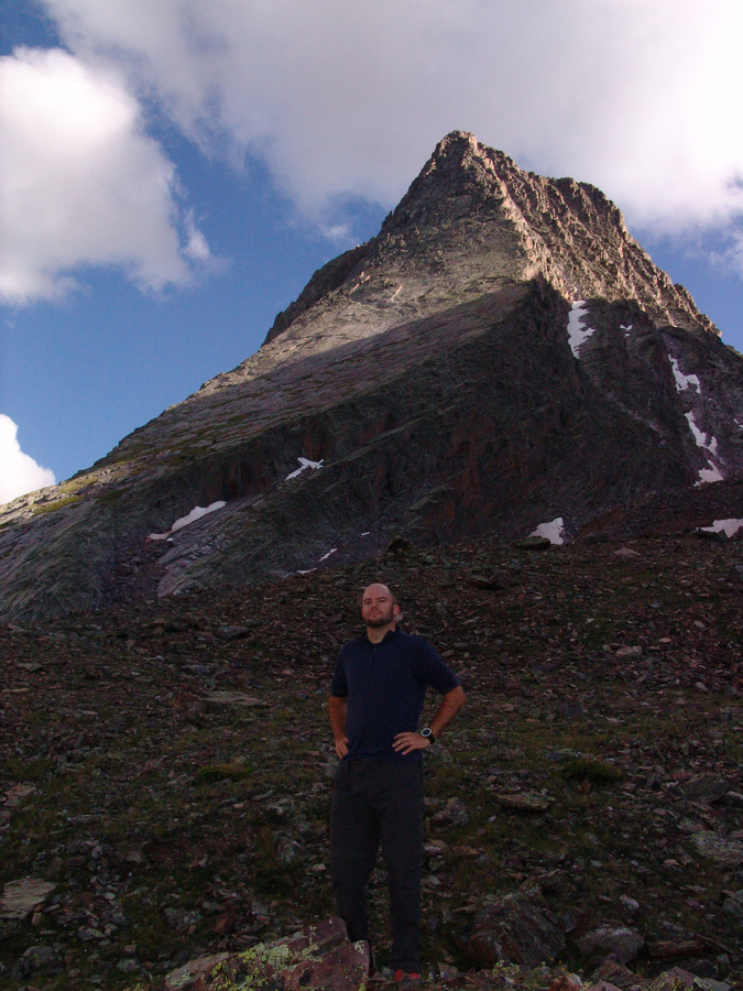
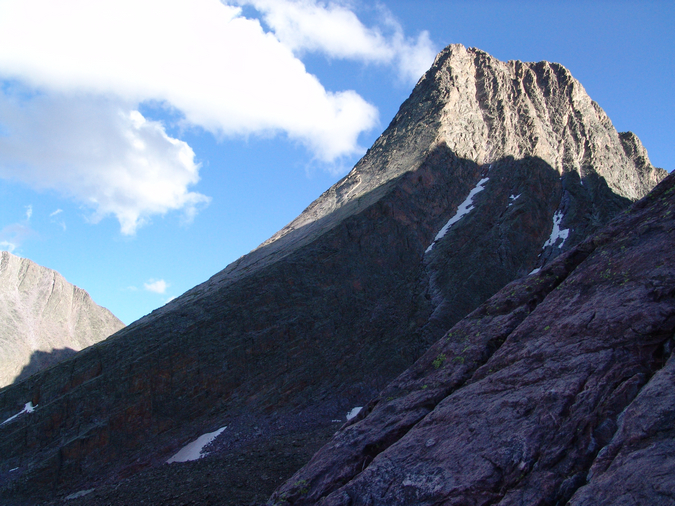
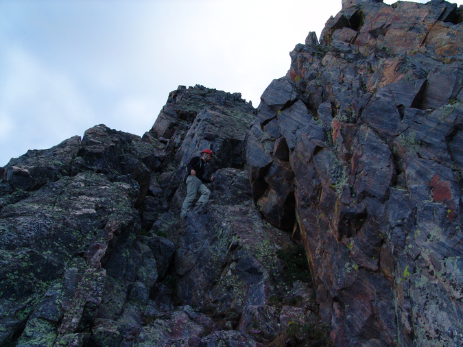
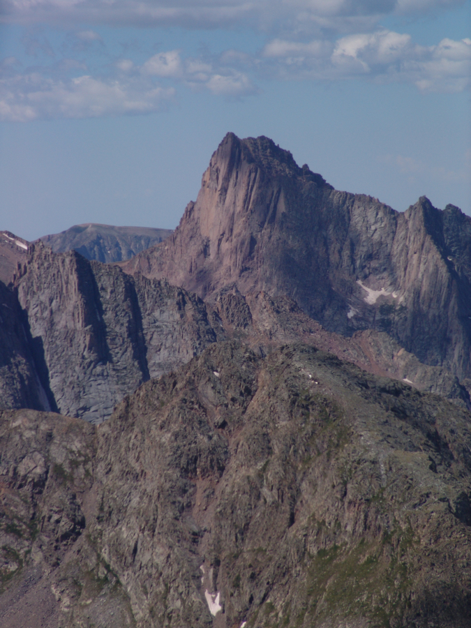
East Turkshead Peak dominated my view for much of my ascent of UN 12,899.
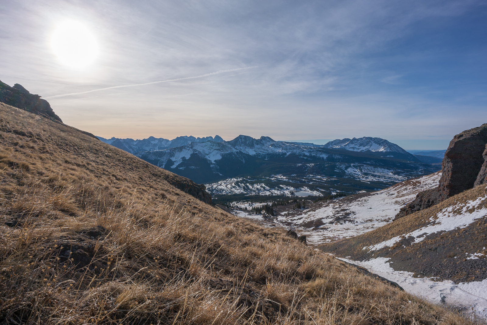
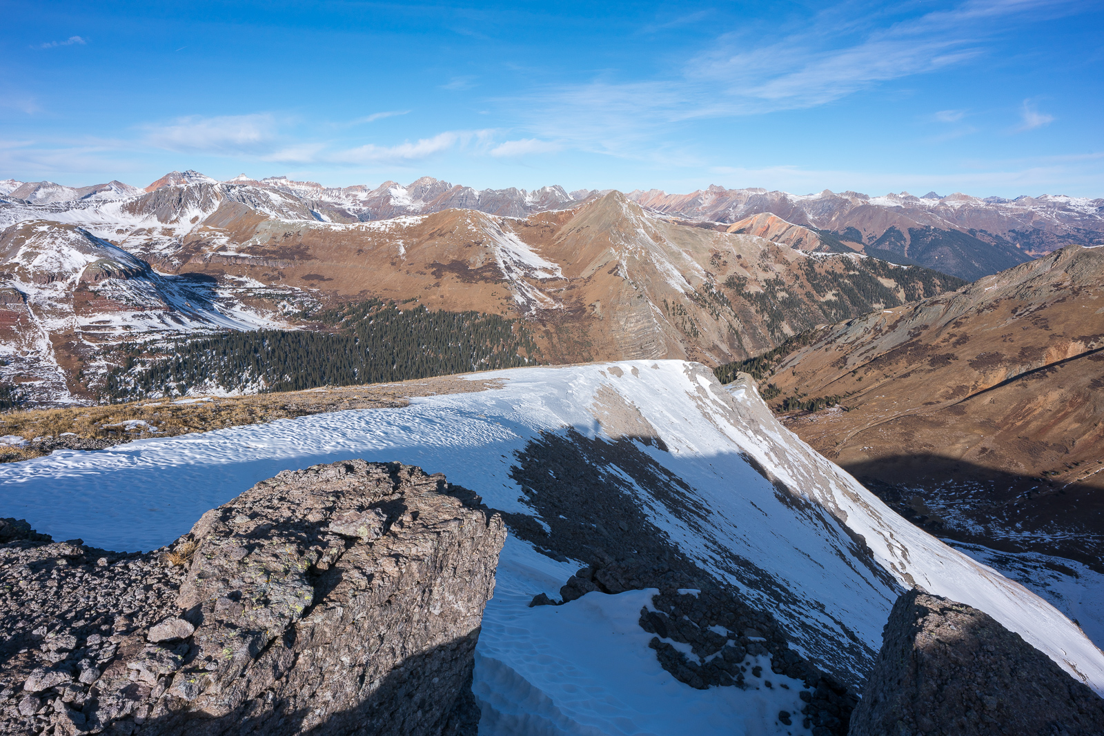
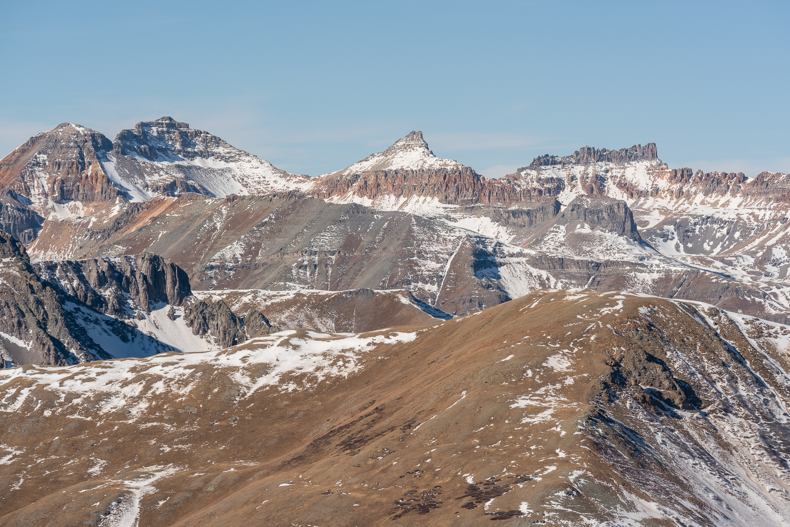
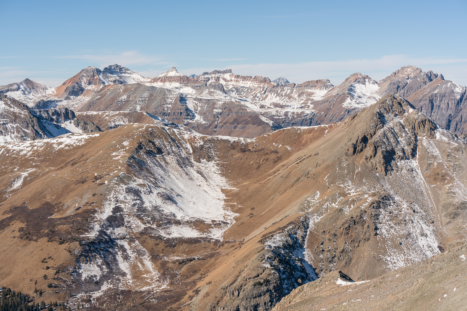
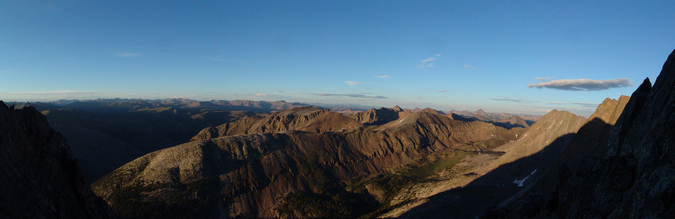
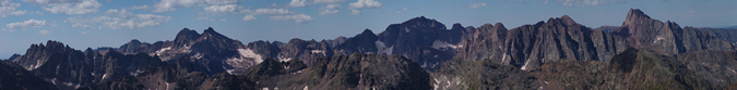
From this slopes of UN 12,899, I could pretty much make out every major peak in the Weminuche Wilderness Area.
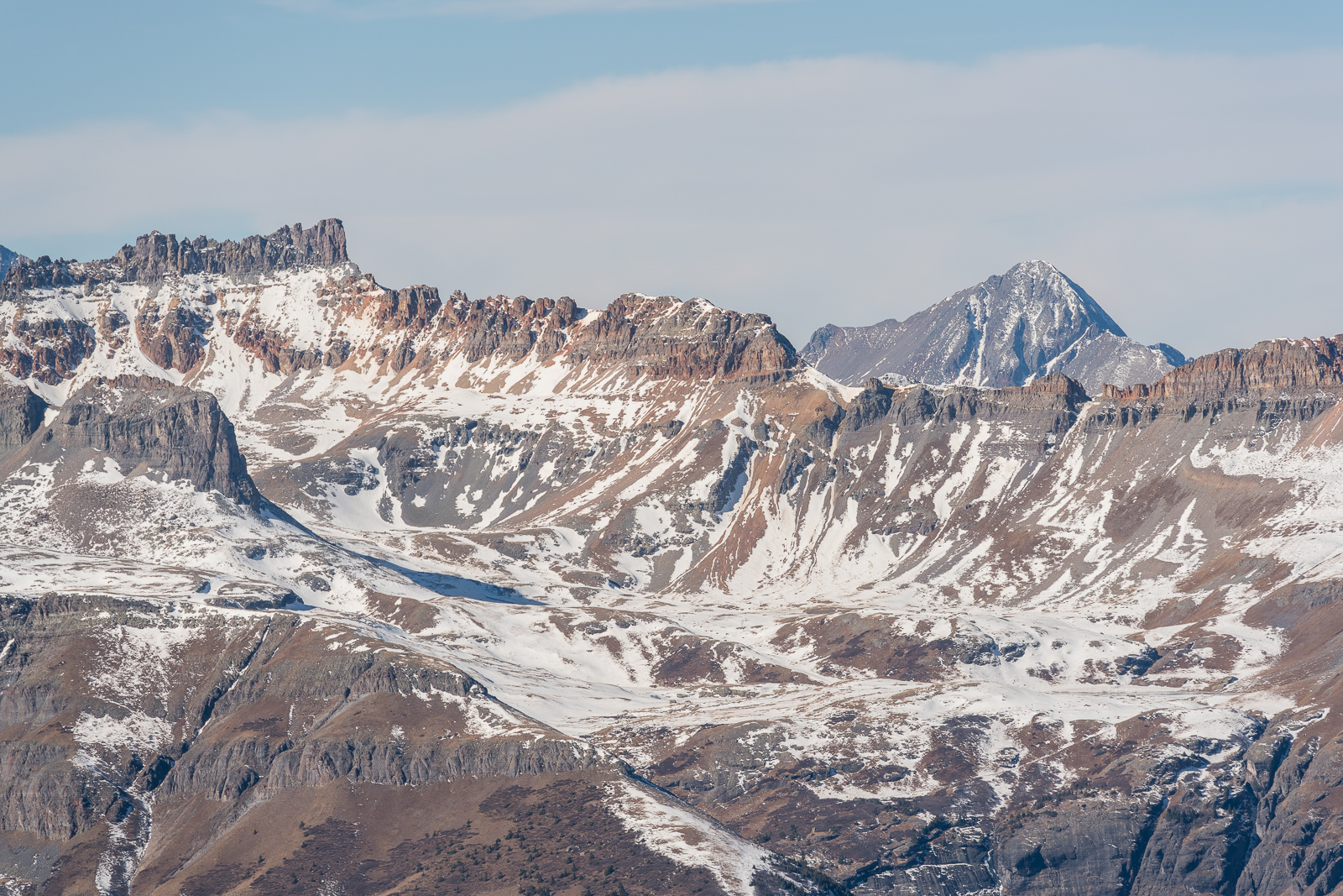
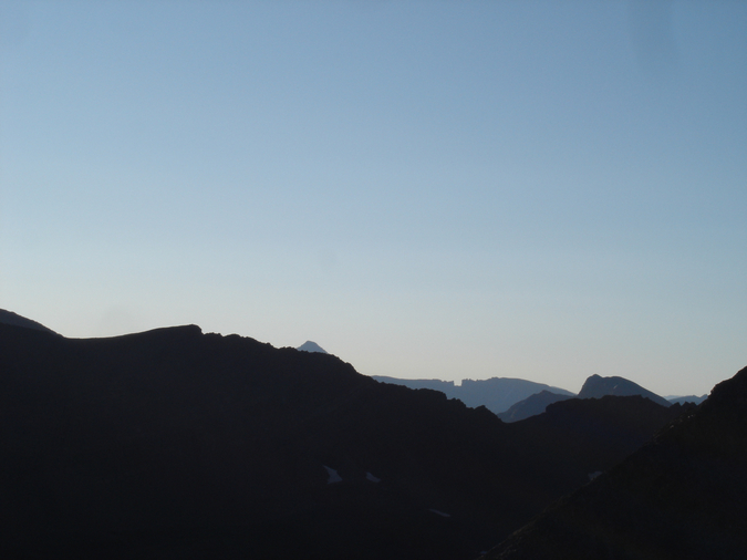
But then, as if I could not be any happier with the view, the line of sight to the west opened up, revealing all of the Ice Lake Basin 13ers, including Vermillion, Golden Horn, Pilot Knob, and U.S. Grant. What a great view from UN 12,899!
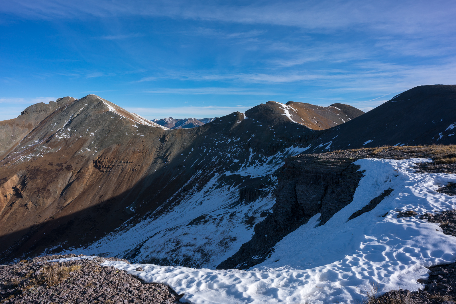
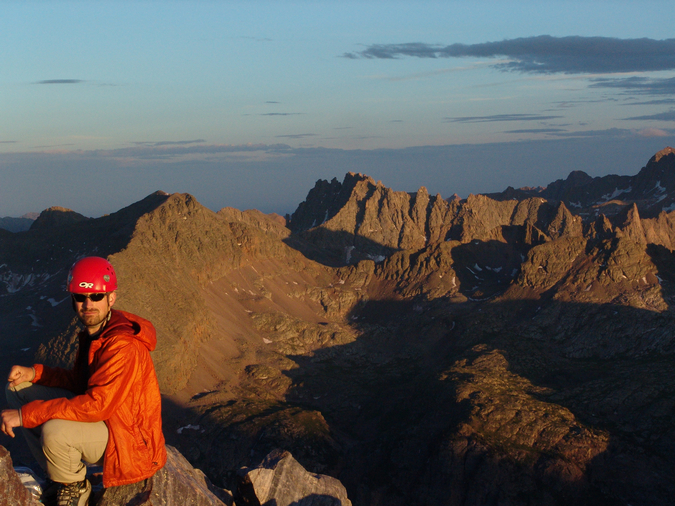
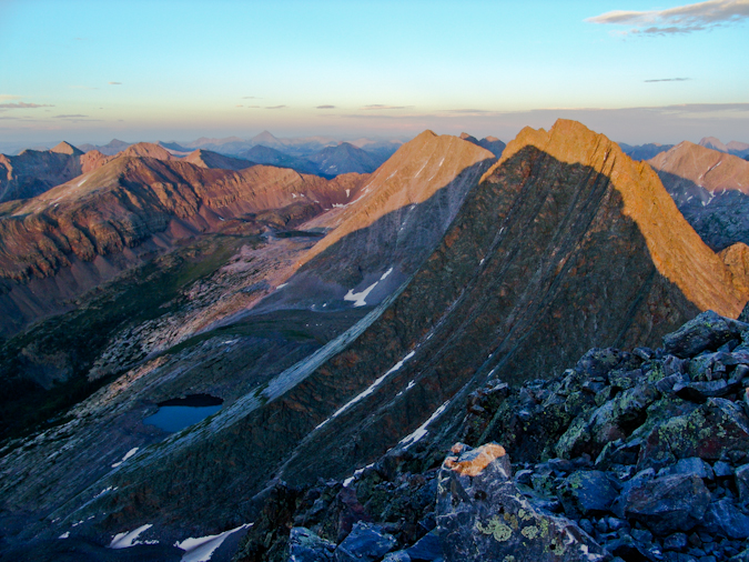
I could also see the remainder of my route for the day and how much further I had to go to reach Sultan. It was expansive! The plan was to hit Grand Turk and then head over the Sultan (left), but I also noticed Spencer Peak (right) was another possible target. Why not?
One last shot of the Needles from 12,899 was in order before heading over to Spencer Peak. I laid down on my stomach to get this one.
All those Ice Lake 13ers were looking mighty fine too...

It appeared that most people bypassed Spencer Peak to get to Grand Turk, based on the trail I could make out on the west slope.
More awesome views of Pigeon and friends...
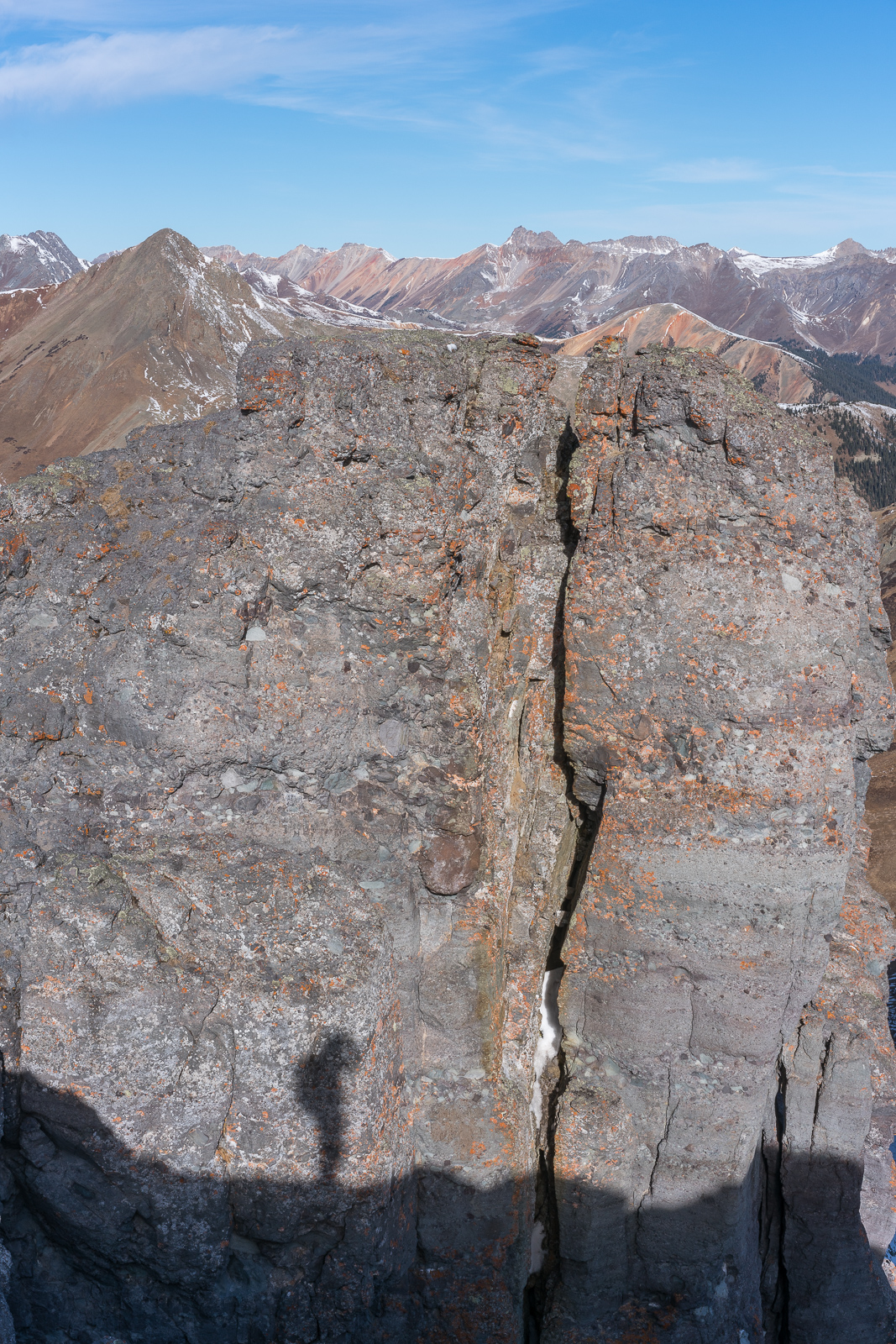
I found some interesting vantage points along the way over to Spencer which made for fun shooting of my shadow.
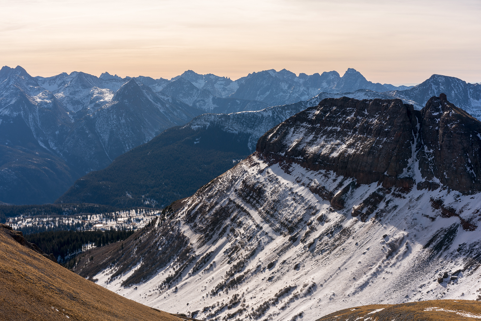
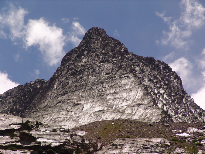
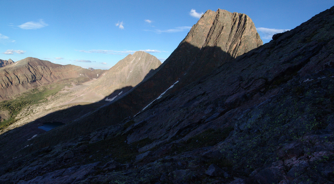
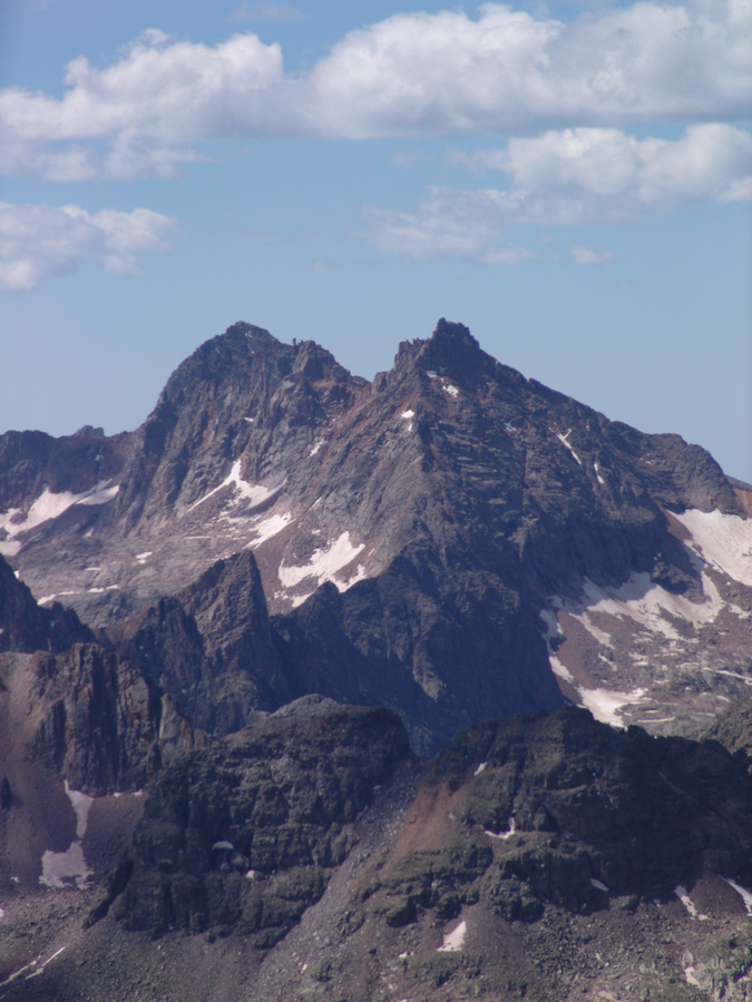
Sultan still dominated the horizon.
More shadow play.
I reached the summit of Spencer Peak in no time and enjoyed the views of Engineer from there.
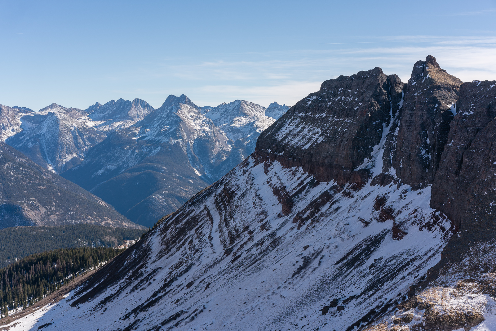
Looking down at Grand Turk from Spencer revealed another trail that bypassed Grand Turk altogether. I decided to head down and then go up Grand Turk (and I hit all of her sub-summits too).
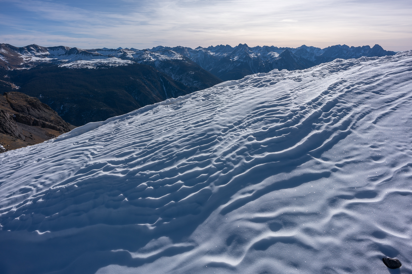
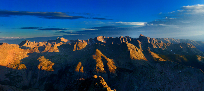
Perhaps my favorite photo from the hike, I really liked the way the snow lit up in the early morning sun, sparkling in interesting patterns, all leading up to a view of Pigeon Peak and the Grenadiers.
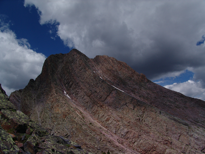
Reaching the saddle between Spencer and Grand Turk made for a fantastic view back at Spencer, which looked quite large from this vantage.
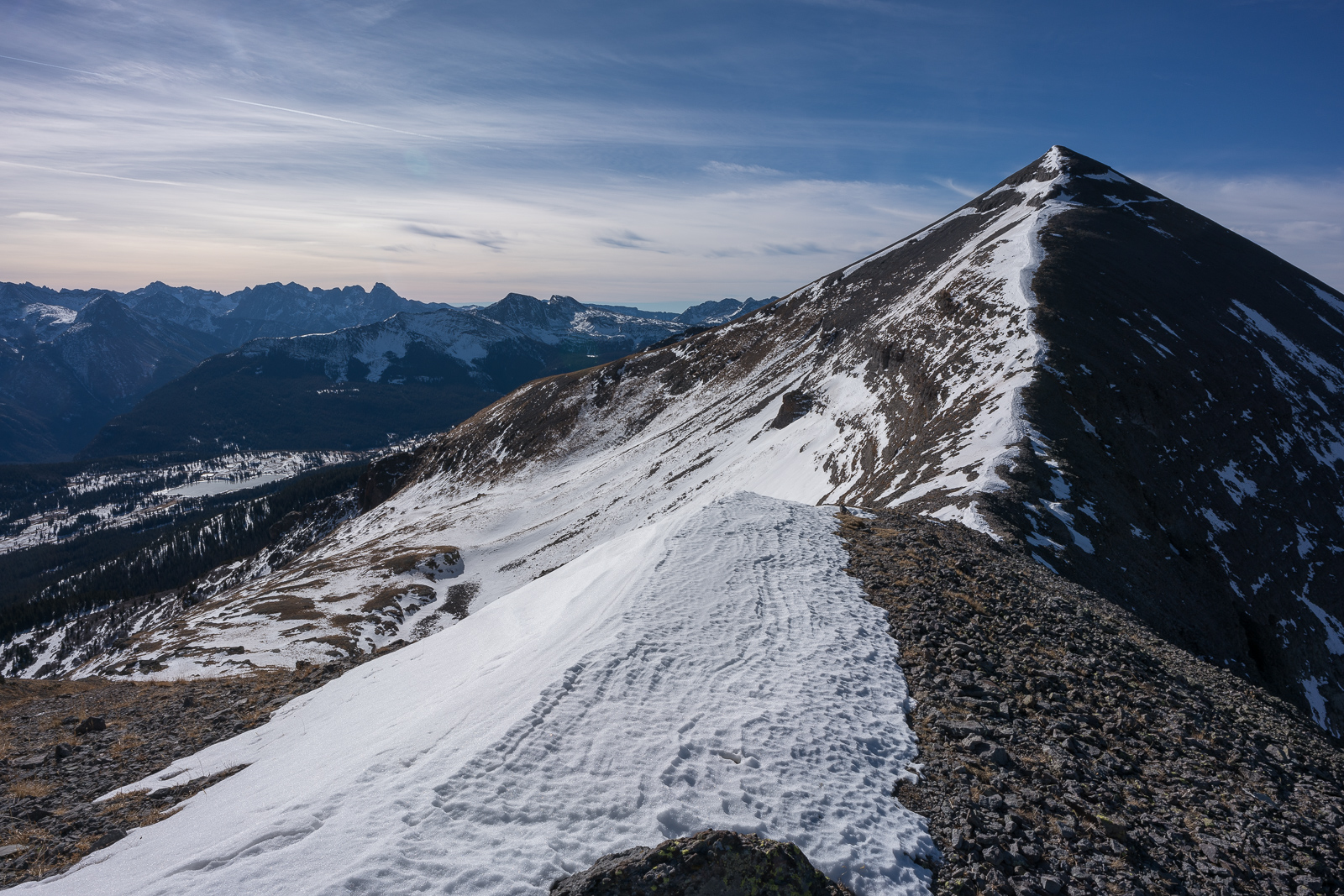
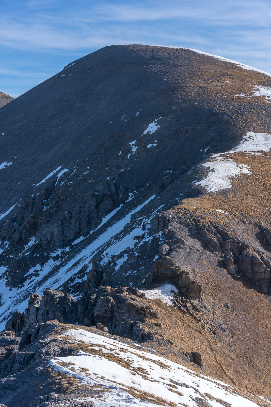
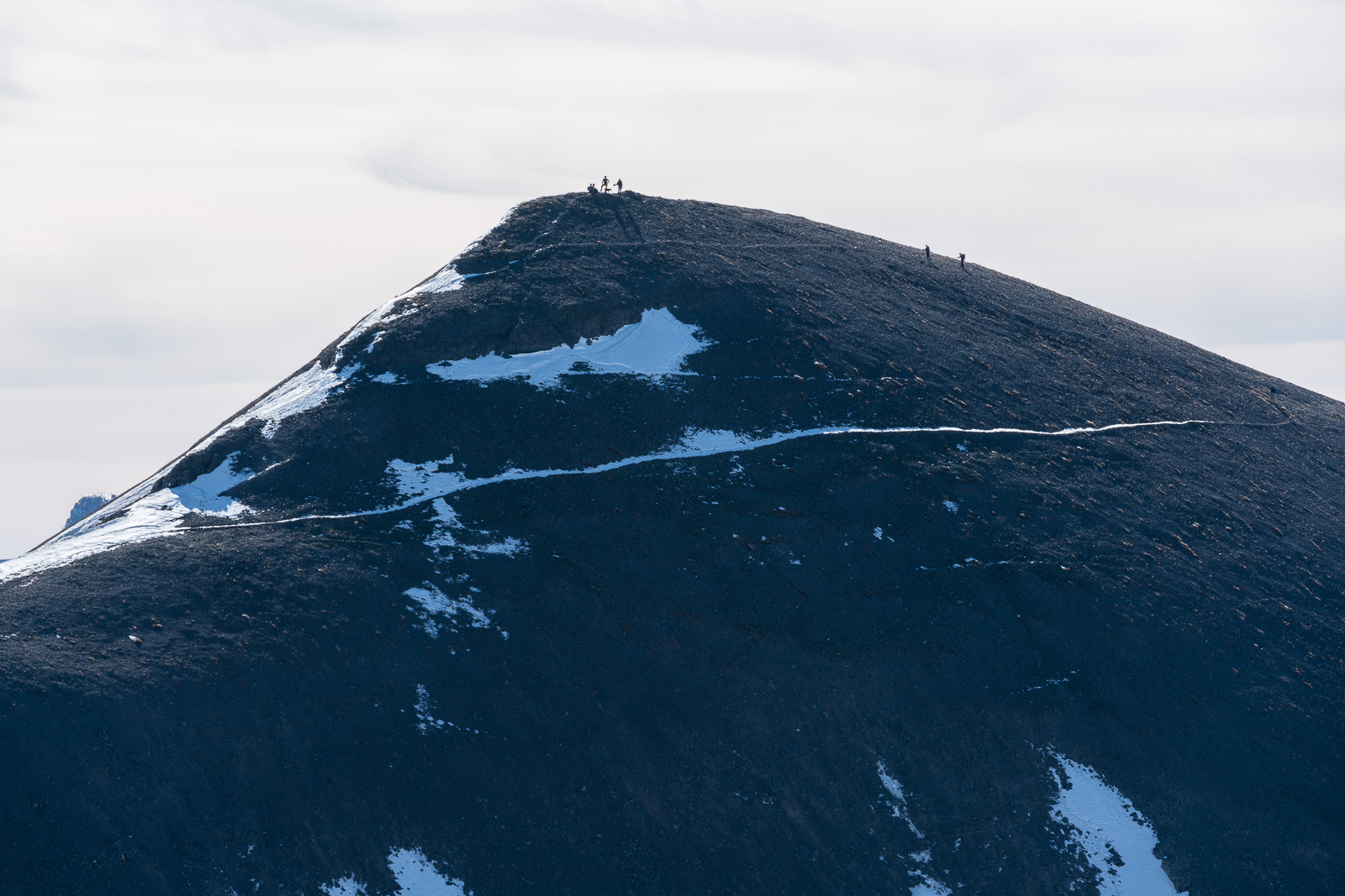
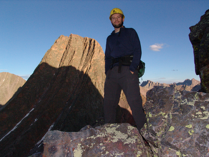
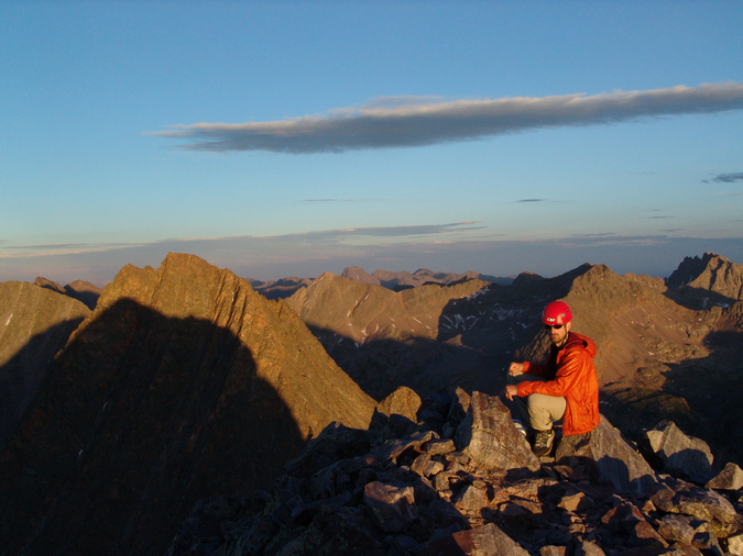
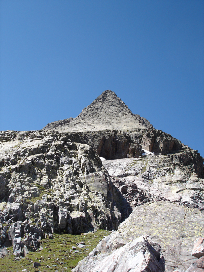
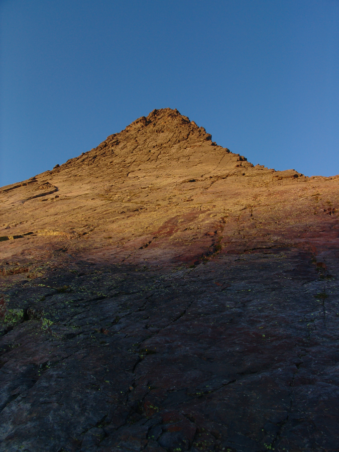
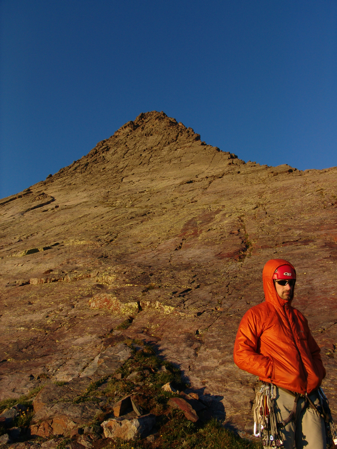
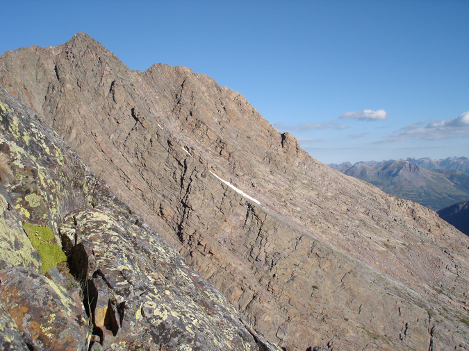
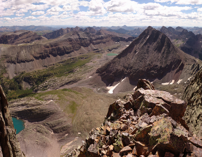
I reached the summit of Grand Turk pretty quickly and gazed over at Sultan, which still looked like it was a long ways away!
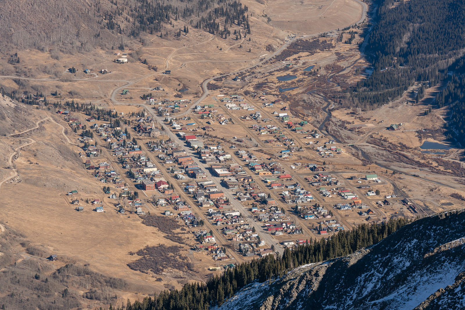
There was a nice view of the town of Silverton from Grand Turk, which had many notable 13ers and 14ers in view above it, including Half Peak, Jones & Niagra, Handies, Whitecross, and even the tip of Uncompahgre poking out.
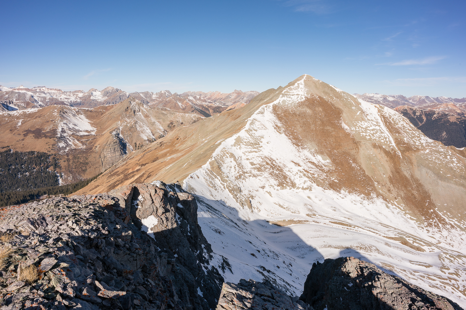
From the eastern-most summit of Grand Turk, looking back across the various sub-summits of Grand Turk and the Ice Lake Basin 13ers made for an impressive vantage and composition.
Grenadiers! :-)
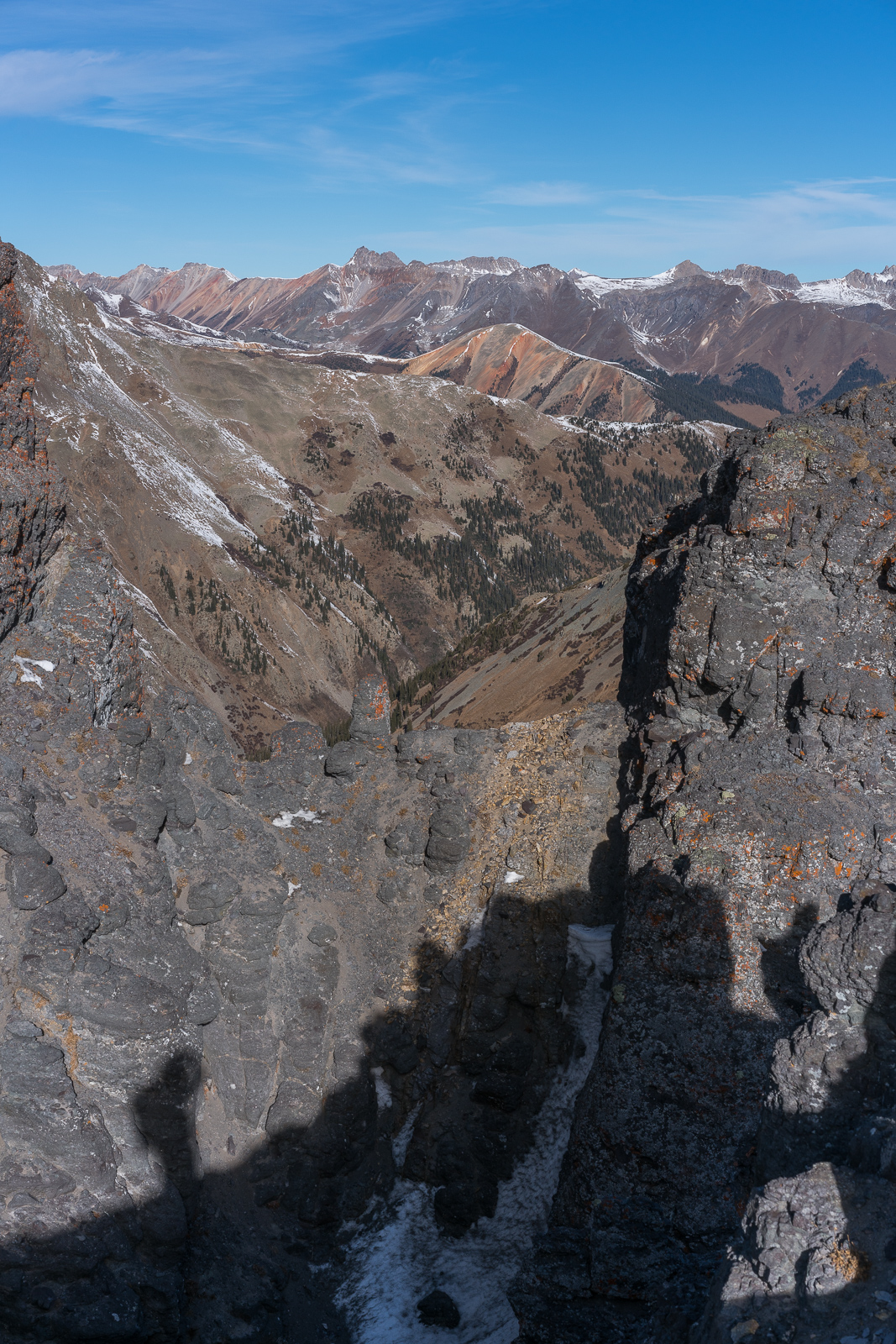
It's just a sea of peaks up here.
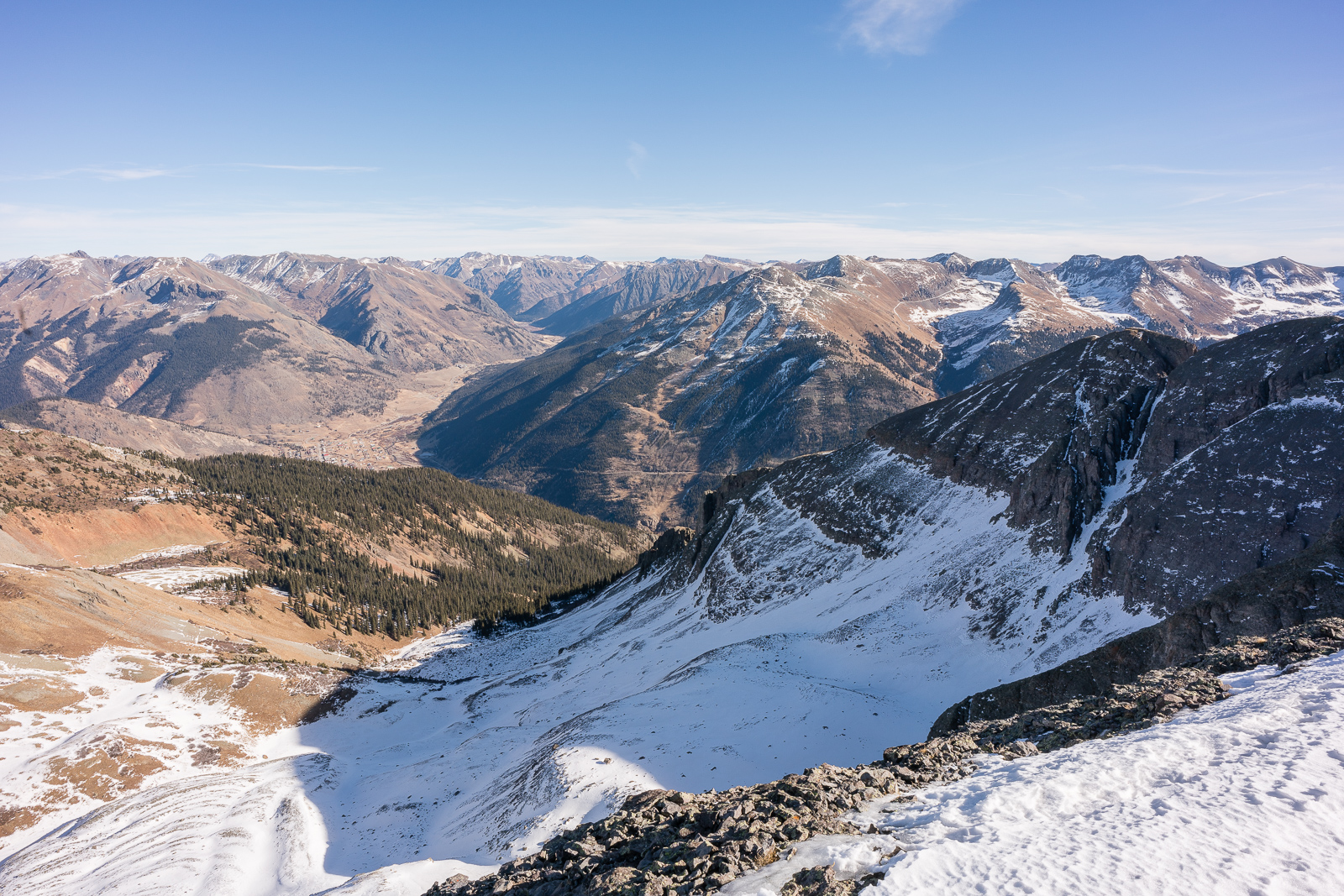
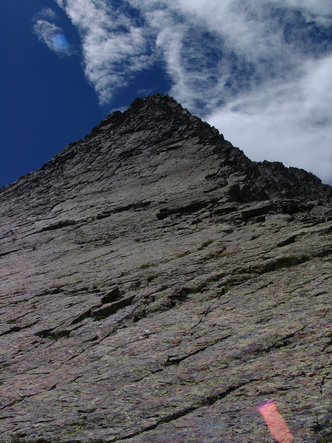
Off to Sultan. What a steep slog. Not bad though. She has an impressive stature.
On the way up Sultan, I took many breaks to take shots of the surrounding peak, including Engineer Mountain.
And this tight zoom of Vermillion, Golden Horn, and Pilot Knob...
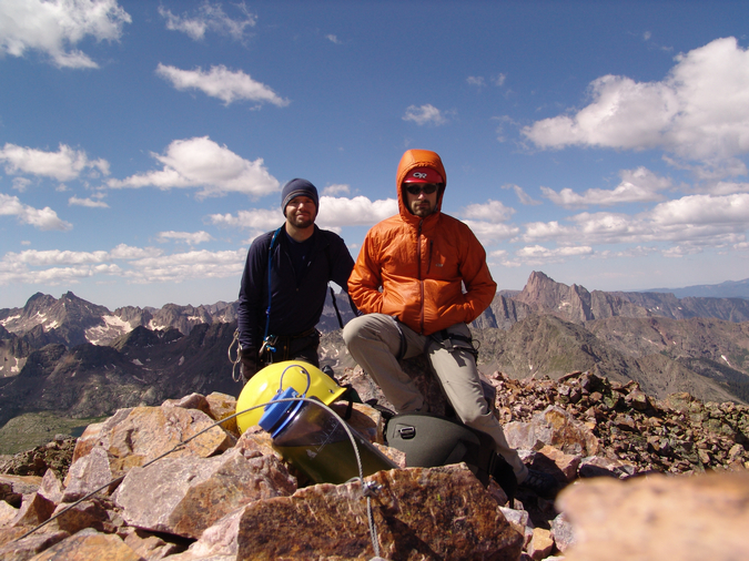
I was alone most of the day, but about half way up Sultan, I noticed some climbers cresting the ridge between UN 12,899 and Spencer. I enjoyed photographing them with the telephoto lens from my vantage points.
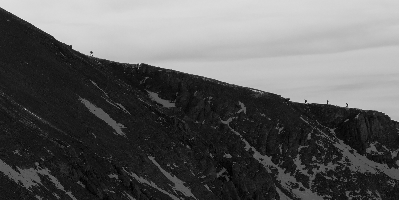
Here they are ascending Spencer.
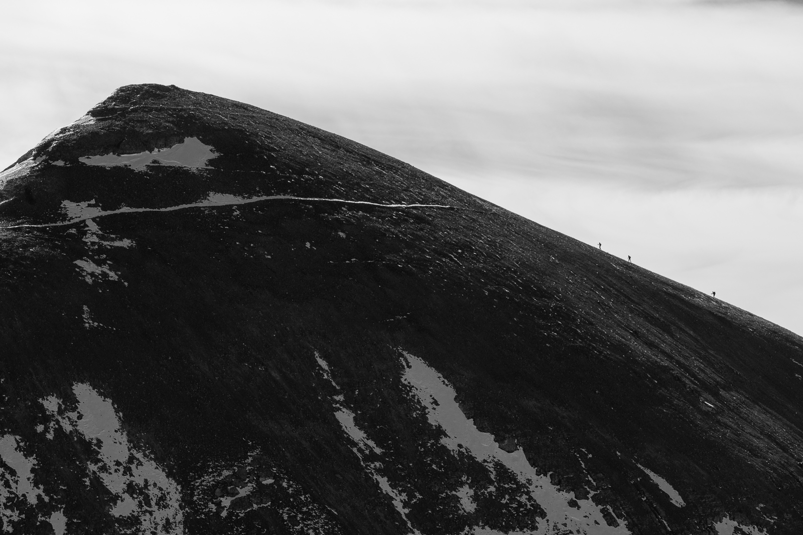
And no doubt, enjoying the reward of the summit on Spencer.
Another favorite shot from this climb. A tight zoom on Vermillion, Golden Horn, Pilot Knob, and U.S. Grant. I've done 2/4 of those so far.
A tight zoom of the Grenadiers was in order too.
Pilot Knob and the top of Wilson Peak.
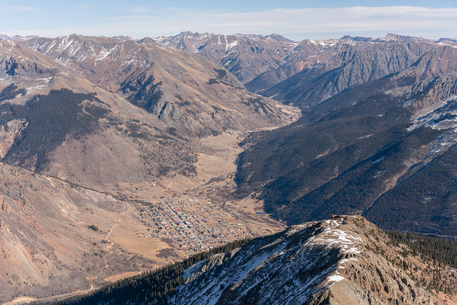
How about a tight zoom on Silverton?
Or Pigeon Peak in black and white?
Over and above Silverton...
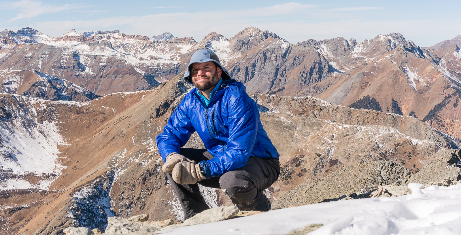
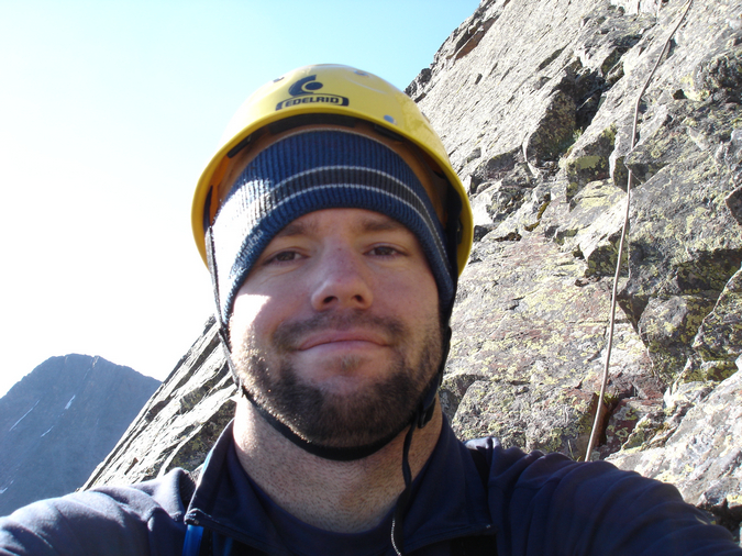
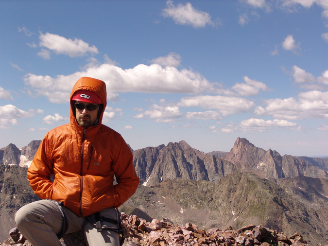
And of course the obligatory self-timer on top of Sultan.
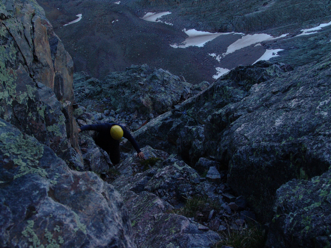
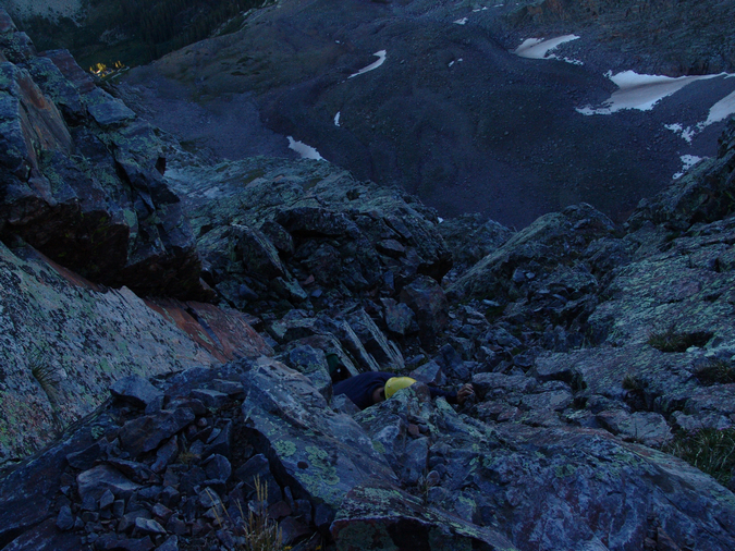
After spending a few minutes on top, I decided to head down so I could catch the Broncos game (what a disgrace they are this season). On the way down, I caught a nice shot of Pigeon framed by Spencer Peak and Grand Turk.
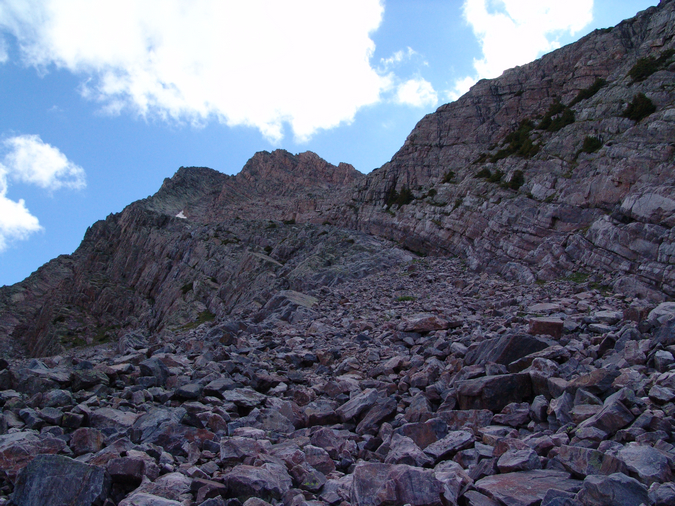
I made really great time down and stopped only a few more times to take photos. I loved the striations in the rock face of East Turkshead Peak which led into the Grenadiers.
And that was it! A lovely local hike and climb of two very dominant 13ers above Silverton, with the addition of the easy UN 12,899 and Spencer Peak. I hope you enjoyed this one? As always, feel free to reach out if you have any questions! Climb on!
Vestal Peak and Arrow Peak - the Grenadier Range's Finest
There really is only one word that can aptly describe the Grenadier Range: incredible. This sub-range of Colorado's San Juan Mountains rests deep within the Weminuche Wilderness Area and sweeps up from the valley below in a gravity-defying statement of beauty, ruggedness and splendor. Sitting approximately 9 miles south-southeast of Silverton, Colorado, and 32 miles northeast of Durango, Colorado, the Grenadier Range cannot be missed. In fact, I would go as far as to say that this group of mountains should be among the places one should see before they die. Made mostly of quartzite, these mountains are the spine of the San Juan Mountains, and arguably, some of Colorado's most difficult to climb. In fact, Arrow Peak was once considered the hardest major mountain in Colorado to climb until a class 3 route was established on its northeast rib1. Vestal Peak's "Wham Ridge," impressively seen from many vantage points in the San Juan Mountains, is considered by most to be a classic climb in Colorado. Lt. George Marshall of the U.S.G.S. 1876 Wheeler Survey reported on the Grenadier Range:
No where in Colorado can be found such steep slopes, such shapeless crags, such rocky and impassable ravines, such generally detestable characteristics and features as are here seen. The hard metamorphic rocks are shivered along their cleavage planes for hundreds of feet, leaving their odd pinnacles, there the likeness of the shattered outspread wings of some gigantic bird, and again of the grim grinning teeth of death.2
Additionally, from the summit of Mount Sneffels, Rhoda of the U.S.G.S. 1871 Hayden Survey reported:
The group of quartize peaks stood out as boldly as ever about thirty miles to the southeast. In fact, I may state here that we have never yet seen a group from any station (and we have viewed it from all sides) without feeling both deep respect and awe for their terrible ruggedness. The fact already stated, that the storm clouds seem to hover about them before starting on their meandering ways, only served to add to our other feelings of uneasiness.3
Given the incredible fanfare this group of mountains has received over the years by many visitors, I made sure to include it on my summer's climbing itinerary. Scheduling the trip would prove somewhat difficult since I was relying on the 5th class climbing expertise of one of my best friends, Jeremy Park. Jeremy was able to clear his calendar and join me from Seattle, Washington for this amazing backpacking adventure. Jeremy is a highly qualified trad climber who has spent many years climbing difficult routes in the rugged Cascade Mountains of Washington. For more on his adventures, see his profile on CascadeClimbers.com.
To start off, here is a break-down of relevant numbers from the trip:
Peaks summited:
Vestal Peak: 13,864 ft. (ranked 77th in Colorado)
Arrow Peak: 13,803 ft. (ranked 104th in Colorado)
Total elevation gain: 8,782 ft.
Total distance hiked: 25.12 miles
Total time hiking: Approx. 22 hours
Total photos taken: 582
Total wildlife sightings: 2 (marmots, mountain goats)
Total distance driven: 610 miles
Trip duration: 4 days, 16 hours
Day 1:
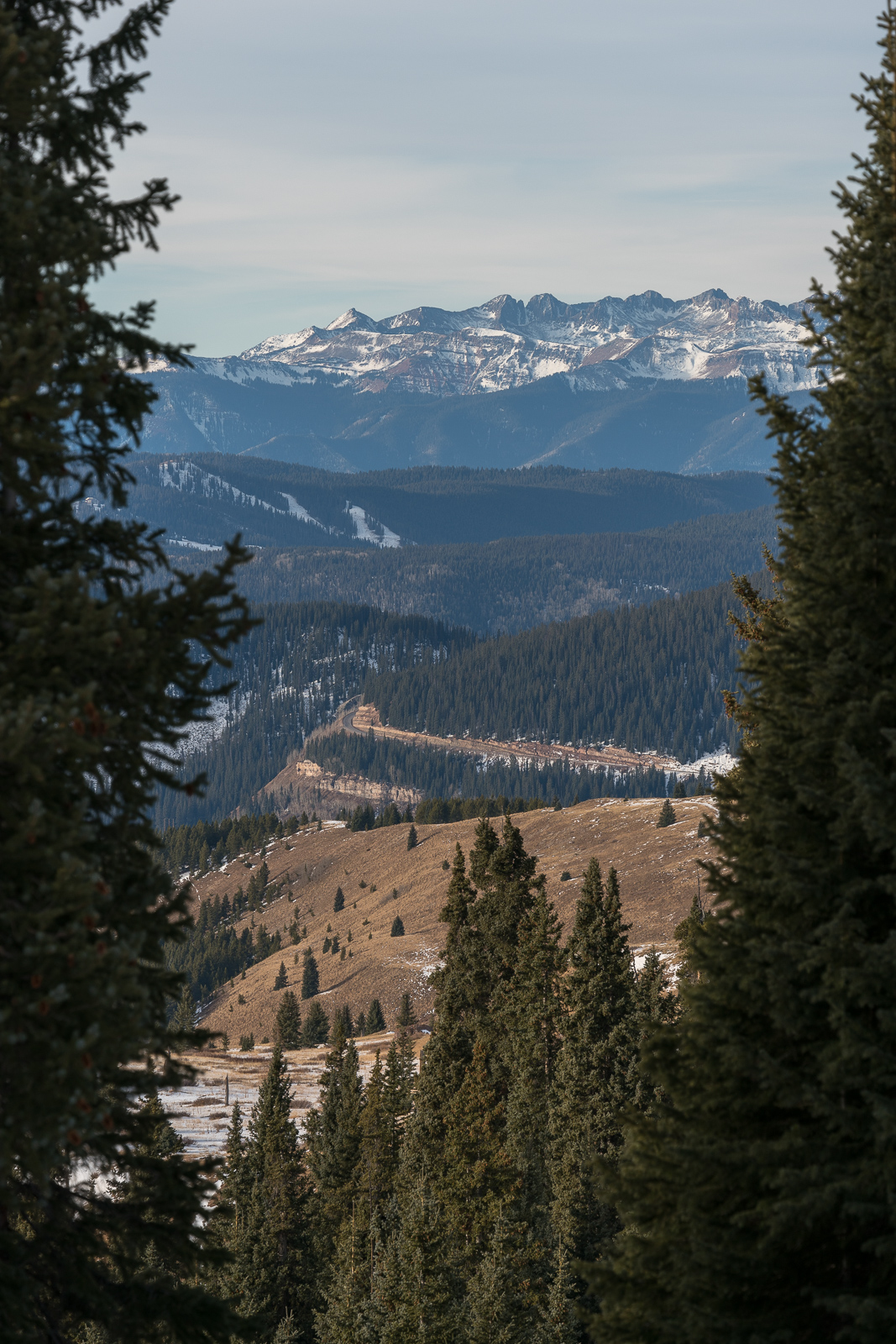
The rough plan was to leave Colorado Springs on Friday, July 9th, 2010 and return on Wednesday, July 14th, 2010. These plans were altered somewhat; however we did end up leaving at 8 AM from Colorado Springs on Friday and arrived at the Molas Pass trailhead at approximately 3 PM.
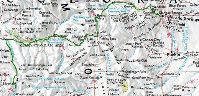
The long drive from Colorado Springs to Molas Pass
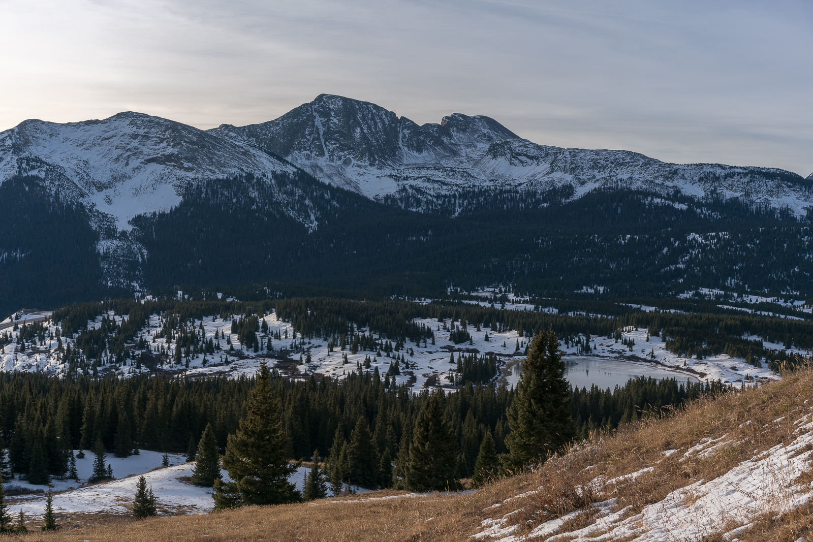
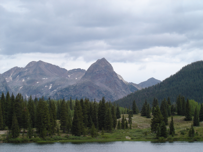
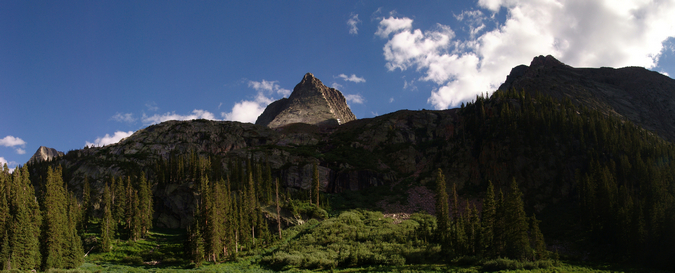
After arriving at Molas Pass, I became quite excited to see the Grenadiers for the first time. The range lived up to its name, striking both excitement and awe into me immediately.

The Grenadier Range as seen from Molas Lake.
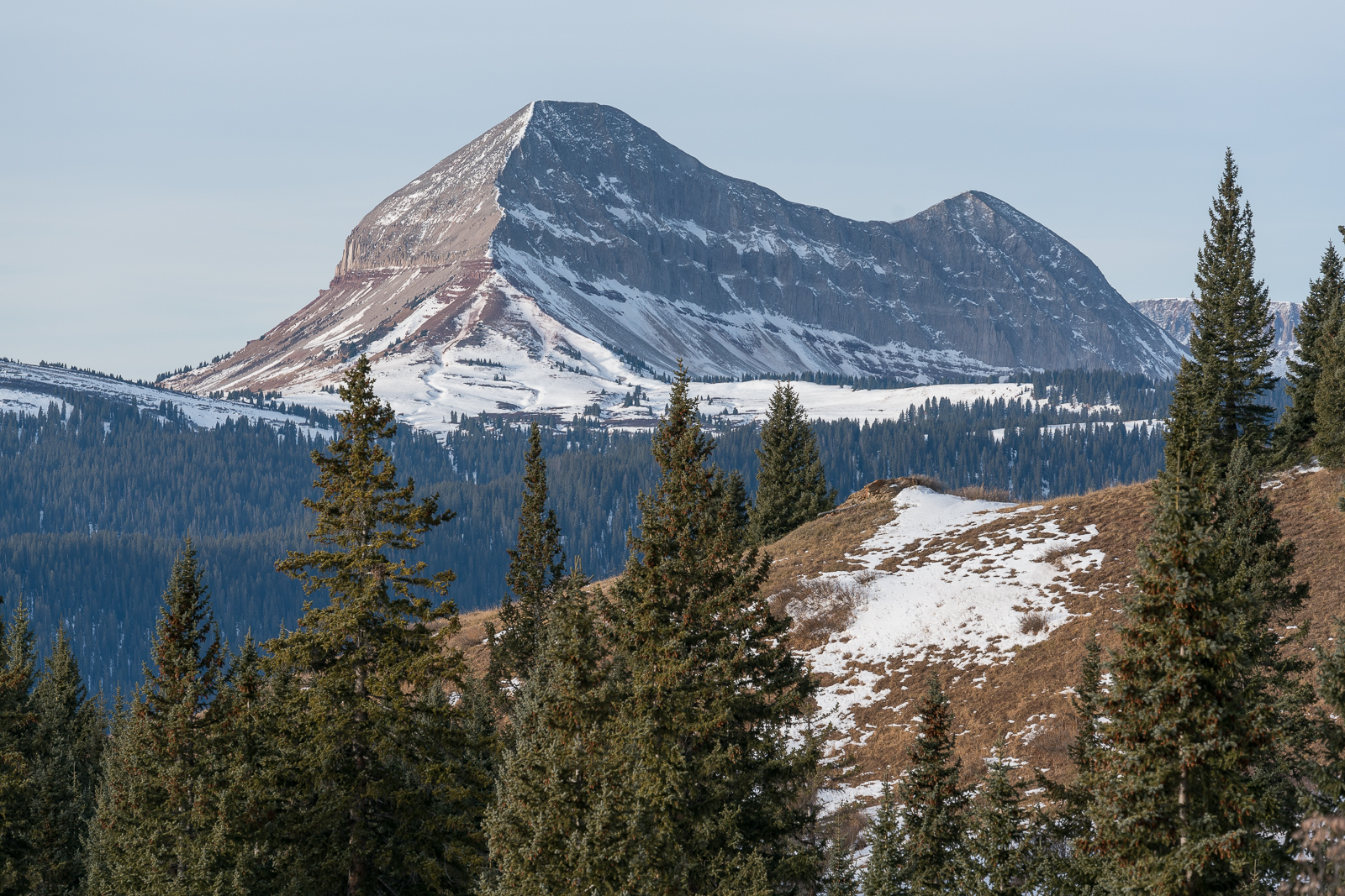
One of the Grenadiers, Mount Garfield, really rises quite steeply from the valley below, and is rated 33rd on my list of "most impressive summits."
Mount Garfield rises high above (right of center)
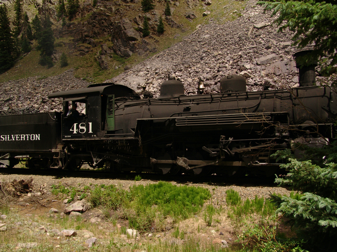
Jeremy and I loaded our heavy packs (mine was 65 pounds) onto our backs and began hiking. We started down the Colorado Trail, which leads down 1,700 ft over 2.5 miles and several switchbacks (37 to be exact) to the Animas River and to the Durango & Silverton Railroad. Generally, most people take the train to this point to avoid the downclimb (and later upclimb); however, Jeremy and I chose to hike from Molas Pass to save money and to avoid being tied to the train schedule.

The full route map for the trip. Click to see a larger version.
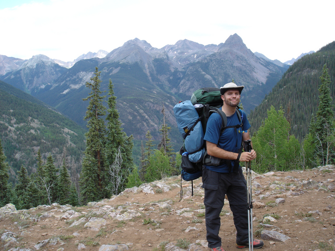
Matt Payne heading down the Colorado Trail.
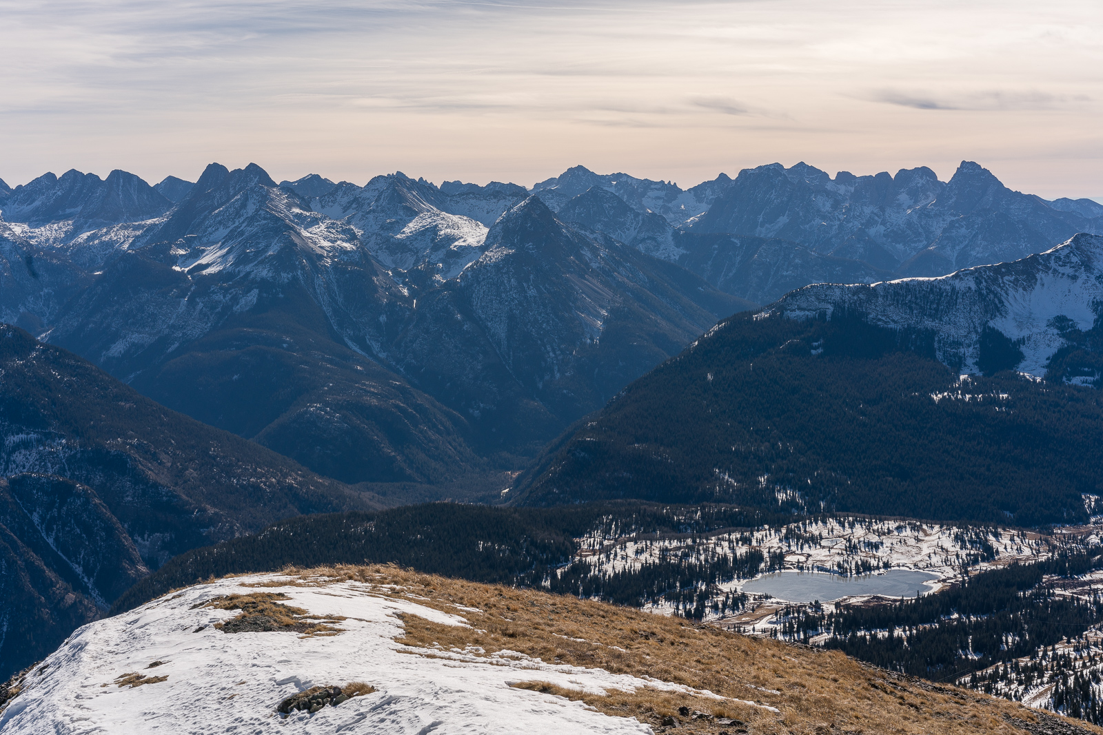
Before long, the river and railroad tracks became visible. Our route would eventually take us to the bottom, over the river, and up the valley to the left towards the steep looking mountains (the Grenadiers) that are nearly hidden left of center.
Looking down at the Animas River from the Colorado Trail
Once lower into the valley, Mount Garfield became more and more impressive, towering over the river like a midevil castle's guard.
Mount Garfield
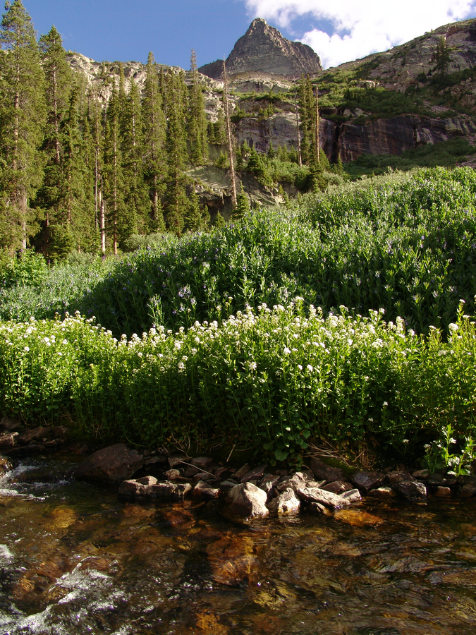
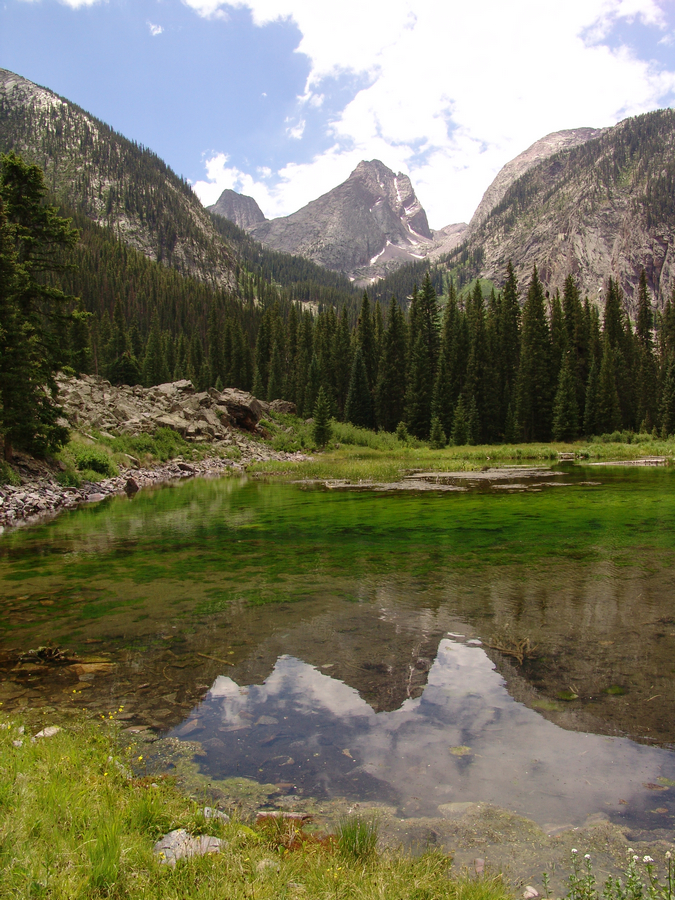
Once we crossed the river over a very well-maintained bridge and over the railroad tracks, the trail leading up Elk Creek appeared and started us up into the Elk Park valley. This trail is very well-maintained, and there was even quite a bit of evidence that trail crews had been working on it this summer to fix some washed out sections. The trail is quite steep, but very manageable with a heavy pack. We followed this trail for nearly 2.9 miles until we reached a set of beaver ponds at 10,000 ft., our pre-determined trigger to head up into the Vestal Basin.
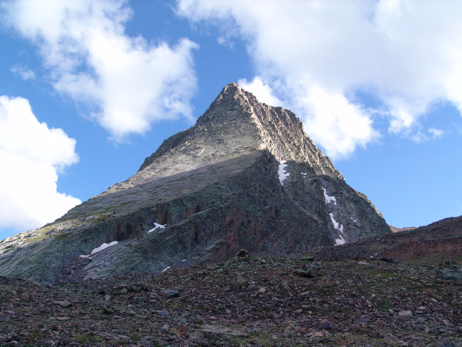
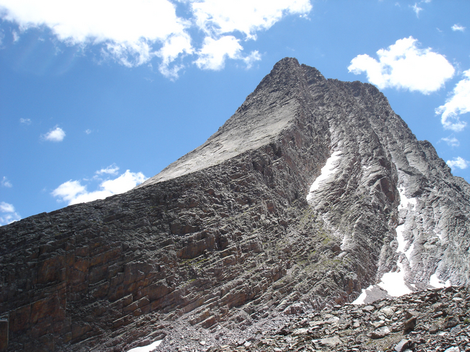
Vestal Peak towers above the Elk Creek valley and Vestal Basin.
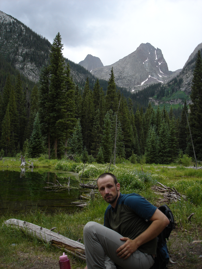
Jeremy looking tired at the beaver ponds with Vestal Basin in the background.
After 3 hours of backpacking, we were determined to make Vestal Basin before nightfall. We headed south up Vestal Basin's trail - an unmaintained, but easy to follow trail which climbs quite steeply up towards Vestal and Arrow Peaks. Did I mention that this trail is steep? The trail gained 600 feet in 3/4 of a mile with large amounts of fallen trees and boulders to navigate around. In several other trip reports I've read, people have mentioned that the trail was difficult to find or follow; however, we did not find this to be the case at all.
After hiking another two hours into the basin for a total of 8.7 miles, our legs finally gave out at 10,620 ft shortly after nightfall. We found a cozy campsite near a small tributary of Vestal Creek and made our first meal of the trip - two packets of Zatarain's ready to serve rice and chicken. This was surprisingly good and filled with sodium (a nice thing to take in after a full day of backpacking). We decided to set the alarm for 4 AM and hit the sack around 11 PM. It was at this point that I realized that my Thermarest pad had somehow sprung a leak from the hike up and that I would be sleeping on hard ground. Yay!
Day 2:
4 AM came and went, and we finally crawled out of the tent around 8 AM. Both us were thankful for the extra rest and tore down camp and hit the trail at about 10 AM, heading for the upper sections of Vestal Basin.
Jeremy hikes up into Vestal Basin along Vestal Creek.
Great views of both Electric Peak and Arrow Peak were had while hiking up into the basin.
Electric Peak
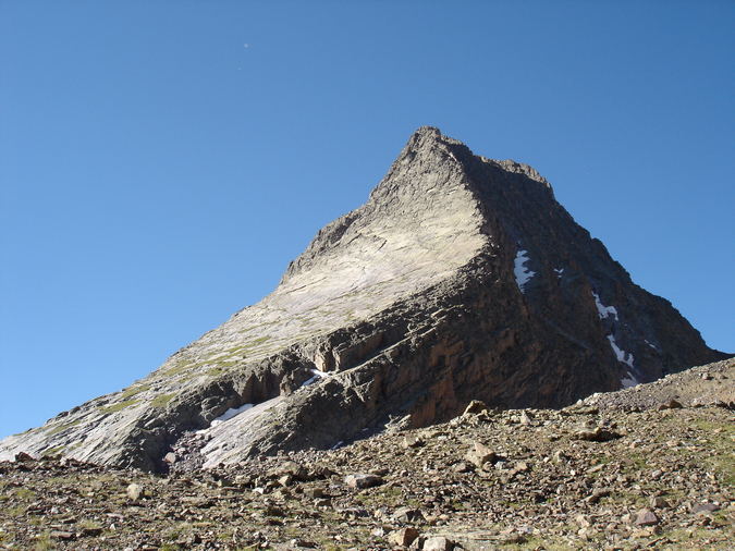
Arrow Peak's steep northeast face, seen from the Vestal Basin trail.
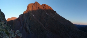
After hiking a little over a mile and gaining 893 ft., we found an ideal campsite at the foot of Vestal and Arrow, at the end of a long clearning and in some trees next to Vestal Creek. Vestal Peak itself could be seen directly from camp, with it's "Wham Ridge" rising above us.

Vestal Peak's Wham Ridge
Since we were planning on climbing Wham Ridge, it was particularly exciting to see it close-up.
Vestal's Wham Ridge zoomed in from our campsite.
After setting up camp, I repaired my Thermarest using a repair kit that I always carry with my on backpacking trips. For once the extra weight paid off! We set-up camp just in time. Clouds had been forming since we had woken up and as typically happens in the San Juan Mountains, a thunderstorm decided to develop quickly above us around 12 PM. We crawled into our tents and napped through the storm, which subsided around 4 PM. We woke up, ate a few snacks, and finished setting up our campsite. At around 5 PM, after the clouds had completely cleared out, I somewhat jokingly told Jeremy that we should climb Arrow that evening. Jeremy said, "why not," and before we knew it, we were packing our day-packs for an ad hoc summit of one of Colorado's finest summits. We departed camp at 6:15 PM, headlamps and helmets equipped, and headed up a climber's trail right next to our campsite, which went straight up the head-wall of the lower area beneath Vestal and Arrow. This trail was also easy to follow, but ridiculously steep, rising 645 ft. in just .45 miles until it reached a plateau in between Arrow and Vestal. Arrow's classic ramp was easy to spot, and Vestal's Wham Ridge continued to blow my mind.
Arrow Peak
Vestal Peak
Vestal and Arrow Peaks as seen from the top of the headwall above our campsite.
Additionally, the Trinities were quite prominent just to the left of Vestal.The Trinities are the middle three mountains of the Grenadier Range, composed of West Trinity, Middle Trinity, and East Trinity.
The Trinities as seen from the base of Arrow and Vestal Peaks.
Matt Payne posing with Vestal Peak behind.
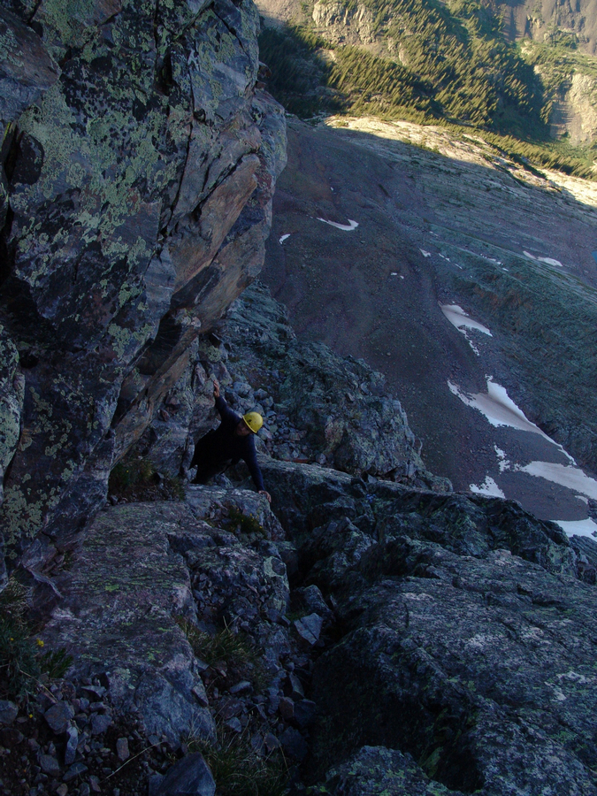
We headed up to the base of Arrow and began the climb up Arrow's prominent ramp. The ramp itself was nearly free of snow and consisted of easy class 3 climbing.
The base of Arrow Peak and the start of our route.
As we climbed, I could not help but constantly look left at the impressive nature of Vestal's Wham Ridge, which swept up as if it were carved out with a fine instrument.
The impressive profile of Vestal Peak's Wham Ridge.
The higher we were able to climb on Arrow, the more and more impressive Vestal became. I simply could not stop myself from gazing over at its sheer beauty, and eventually, Vestal Lake came into view as well.
A panoramic photo of Vestal's Wham Ridge.
Jeremy and I reached a junction in our route and made a decision to stay left and continue up a class 4 variation of Arrow. This decision was one of our best of the trip, as Arrow's upper ramp provides some of the most fun, yet least exposed, class 4 climbing I've done to date. For those that do not know, exposure is defined as "the condition of being on high vertical rock with full consciousness that nothing exists between you and the distant ground but thin air4."
The start of Arrow Peak's class 4 terrain
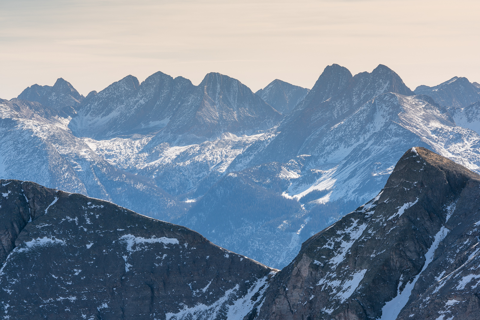
Following the higher ridge to the left also provided some great views of the Needle Range to the south, and Jagged Mountain, Windom Peak and Sunlight Peak came into view for the first time, Jagged's pinnacles rising up like upside-down stalagtites.

Jagged Mountain (left of center), Windom Peak and Sunlight Peak
Matt Payne with Vestal's insane Wham Ridge behind him.
A high resolution panoramic photo of Vestal's Wham Ridge.
Jeremy Park on Arrow Peak's class 4 ridge, just east of the traditional class 3 route
Jeremy Park navigating the class 4 terrain on Arrow
Jeremy took my camera and was able to take some photos of me negotiating some of the class 4 terrain. The climbing was fun, challenging, and quite rewarding. Exposure was minimal, and various holds were quite ubiquitous.
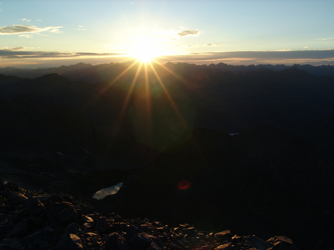
The sun was setting quickly, which was both exciting and troublesome, as we did not look forward to down-climbing Arrow in the dark, but I was really excited to see the sun set from 13,803 ft.
The sun setting on Vestal Basin.
After an exhilirating climb, Jeremy and I topped out on Arrow's summit at 8:15 PM, and enjoyed the sunset from the top. This was one of the most majestic and spiritually fulfilling moments of my life.

A 3600 view from the summit of Arrow Peak, with the sun setting over the San Juan Mountains.
The Needle Mountains across the Tenmile Creek and Noname Creek drainages from us were impressive, each living up to their namesake.
The Needle Mountains - from left to right: Jagged Mountain, Windom Peak, Sunlight Peak, Mount Eolus, Animas Mountain, Turret Peak and Pigeon Peak
Pigeon Peak was quite possibly one of the most impressive mountains I've ever seen, with its east face dropping off like the edge of table.
Pigeon Peak
Jeremy with Jagged Mountain directly behind him to the right
Jeremy with Vestal in Arrow's shadow to the left

A self-timer captures Matt and Jeremy on the summit of Arrow Peak
Rio Grande Pyramid and The Window were looking pretty awesome in the late evening sun as well. Rio Grande Pyramid has really piqued my interest lately since I am going to climb it in August, 2010 with my dad (update - completed - see the Trip Report). It should be pretty amazing to look back towards Arrow and Vestal.

Rio Grande Pyramid and "Window Peak" as seen from Arrow's summit. The Window is the notch on the ridge just right of Rio Grande Pyramid.
The sun sets behind the San Juan Mountains. Check out that lake below!
Arrow Peak's north face and an airy fin connecting it with the true summit
Vestal Peak's Wham Ridge during sunset.
After spending just 20 minutes on the summit to enjoy the sunset, Jeremy and I departed Arrow's amazing summit via the standard class 3 trail, which was marked by several cairns heading down the steep face of Arrow. Before long, we adorned our headlamps and were in complete darkness, but not before we had successfully navigated below the more treacherous sections. The down-climb in the dark provided quite an interesting challenge. The ramp on Arrow was quite solid and easy to climb down, rarely requiring either of us to sit down on steeper sections. We could see other campers much higher in the basin above our camp with their headlamps on, watching us. I thought the climbing down would be difficult in the dark; however, the route on Arrow is so straightforward that I think it could even be up-climbed in near darkness if one were experienced and comfortable. We reached our campsite at approximately 9:15, just 3 hours after we had set-out to climb Arrow.
We cooked our dinner in the dark again, this time creating an amazing medley of re-hydrated black beans, jalapenos, green chilis, velveeta cheese, and tortillas. We planned to climb Vestal's Wham Ridge the next day, so we set the alarm for 5 AM again, and hit the sack at 12 AM, snoozing the night away.
Day 3:
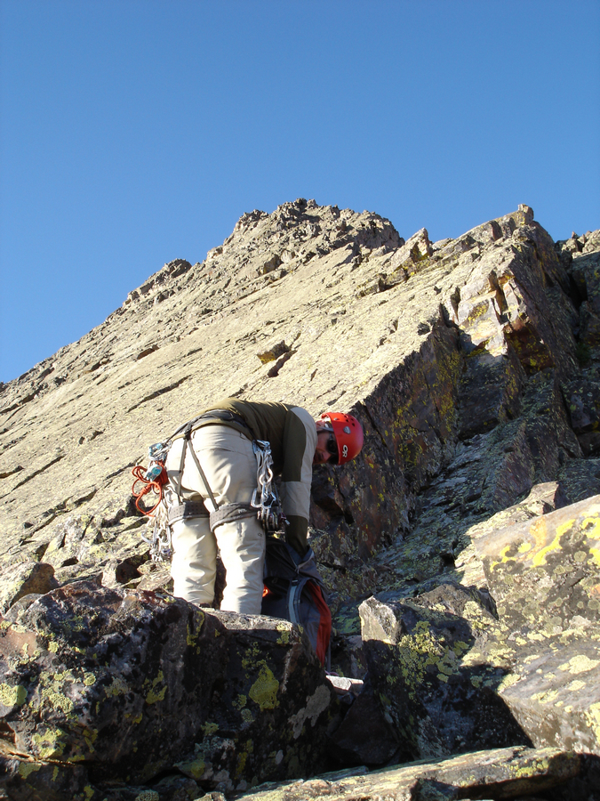
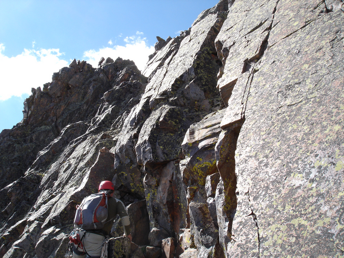
We awoke on day 3 and quickly prepared for what we hoped to be an amazing climb. Having read about Wham Ridge over and over again the past several years, I had mentally hyped up the climb to be an epic adventure. A small group of three climbers headed up the trail shortly before us, which was somewhat concerning to both Jeremy and I as we did not want any rocks to fall down onto us during our ascent. We decided not to deviate from our plans since Jeremy felt confident that if we bumped into the other group we could find a route around them. We left camp and headed up the steep climber's trail again to Vestal's base. I carried the 60 meter rope, a nut key for taking out nuts from the rock, as well as my personal gear, and Jeremy carried the climbing rack (a full compliment of anchors, quickdraws, webbing, camalots, and nuts). The Columbine flowers on the climber's trail were outstanding.
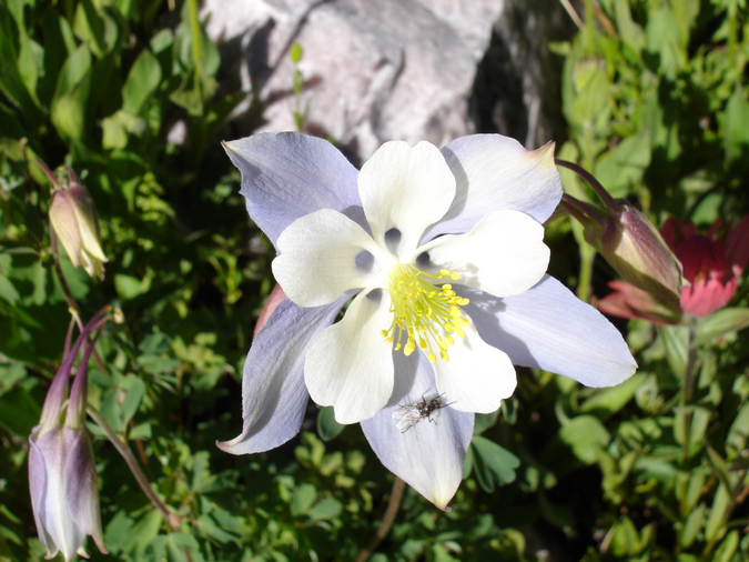
A Columbine flower
We reached the base of Vestal and Arrow again and headed towards the start of Wham Ridge.
Vestal Peak in the morning sunlight
We stopped at the base of Wham Ridge and put on our climbing harnesses and climbing shoes. We decided that we would stash the rest of our gear under a large rock at this point. Jeremy went to take out the climbing gear from his backpack and opened to find... all of his food. Yes, that's right - his food bag and climbing bag are identical and he mistakenly grabbed his food bag instead of his climbing bag when we left camp. So, Jeremy needed to hike back to camp and then back up to the start of Wham Ridge before we could begin climbing. While we were both upset, I assured Jeremy that it would be fine and that I was not mad at him. He left for camp and I headed over to Vestal Lake to take some photographs.This turned out to be a good mishap as I was able to capture some of the most stunning photos of the trip.
Vestal Lake and West Trinity

Vestal Peak reflected in Vestal Lake
There was a small group of 4 men fishing quite successfully at the lake, and I stopped to talk to one of them. He was from Memphis Tennesee and explained that he had climbed Wham Ridge the day before without rope, and that he had only climbed one mountain prior to this. While this seemed rather dangerous to me, it did instill some confidence in my ability to complete the climb. He also said he saw us downclimbing Arrow the night before and that he was praying for us to make it down safely. Not being a religious person, I thanked him for the warm thoughts and headed off to take more photos.
Vestal Peak's Wham Ridge
I headed back to the rendezvous point and waited for Jeremy to return. It was not until 10:30 AM that Jeremy reappeared and reconvened with me. At this point, clouds had already formed and we were questioning if we should continue or not. We decided to keep going and keep an eye on the clouds. With a full compliment of climbing gear, we headed up Wham Ridge in our climbing shoes. I reached the last grassy ramp of Vestal and re-evaluated the weather. Jeremy asked me what I thought and I told him that my gut told me we should bail. We both agreed that heading back would be the best choice - safer to start earlier the next day than to get struck by lightning. I took some parting photos of both Vestal and Arrow and headed back down the steep slopes of Wham Ridge, which proved to be a quite painful experience in climbing shoes.
A view of Vestal from the turn-around point
Arrow Peak with stormy weather forming above
The somewhat loose fitting climbing shoes were quite painful on the downclimb, and caused some very painful blisters to appear on 5 of my 10 toes. This did not bode well for my chances of using climbing shoes on the actual climb. Jeremy and I changed back into our mountaineering boots, and stashed all of our climbing gear at the same large rock at the base of Vestal in a waterproof bag for the next day.
Jeremy stashes our climbing gear under this huge boulder beneath Vestal Peak
We went back down to camp and decided to take a nap. The decision to bail on Vestal proved to be a very good one, as the whole basin was riddled with rain and lightning for three hours. Fortunately, the group ahead of us had safely made it down from Vestal before the storms hit.
We got out up and cooked dinner - this time a carbohydrate-filled meal consisting of re-constituted mashed potatoes, country gravy, Spam, and cheddar cheese. While this sounds horrible - it was amazing! Go Spam! We set our alarms for 3:30 AM and crashed at a much more respectable time of 9 PM.
Day 4:
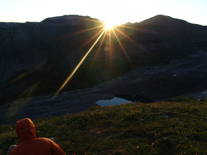
We woke up and made our way up to the base of Vestal to watch the sunrise from the final grassy ledge before the beginning of the more difficult climbing. Since my feet were completely mangled from the prior day's adventure, I decided to wear my La Sportiva Trango Evo Sport mountaineering boots for the ascent. With heavy socks on, I could barely feel my blisters. Watching the sunrise from the base of Wham Ridge was pretty awesome. The sun lit up the surrounding mountains and made for quite a peaceful start to an incredible climb.
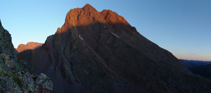
Arrow Peak in alpenglow from the start of Vestal's Wham Ridge.
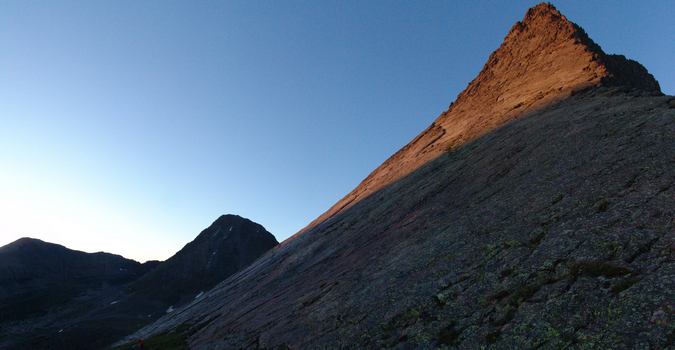
Vestal's Wham Ridge in alpenglow, with Jeremy resting at the base.

Jeremy watches the sunrise
I even took a short video of the sunrise:
Arrow Peak at sunrise.
A closer view of Wham Ridge - looks like fun!
Jeremy watches the sunrise over Vestal Lake

Jeremy warms up
Matt looking cold
Jeremy poses in front of Wham Ridge
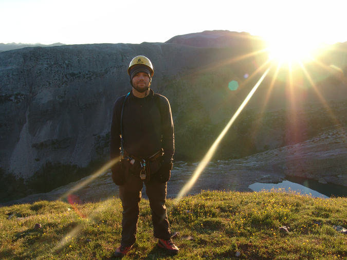
Matt looks ready to begin Wham Ridge
We finally started up Wham Ridge, making our way quickly up the small ledges and cracks. The going was pretty easy and unexposed for awhile, with plenty of great hand and foot holds to be found.
Jeremy heads up the ledges
We continued up into some 4th class sections, with exposure and steepness increasing gradually as we climbed.
Jeremy climbs the lower Class 4 section of Vestal Peak
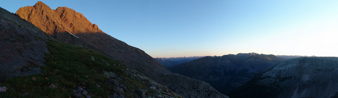
Before long, Rio Grande Pyramid and the Window appeared, looking really cool in the early light.
Our first view of the day of Rio Grande Pyramid and The Window
Wham Ridge continued to become more and more steep, decreasing my comfort level of being unroped.
Wham Ridge's profile
We reached a great stopping point with plenty of room at our feet for belaying, and prepped the rope and our gear for 5th class climbing. Let the fun begin! While I did the route in my La Sportiva EVO Mountaineering Boots, Jeremy did Wham Ridge in his Evolv Bandits. According to Jeremy, they were quite comfortable shoes and he felt like he probably could have gone without a rope (being that he is very experienced and the shoes made for great traction).
Jeremy prepares for our 1st pitch of Wham Ridge
Jeremy led the first pitch as I belayed from below, only placing two pieces of gear for protection on the way up - a camalot and a nut. Once Jeremy arrived safely at the next obvious stopping point above at about 55 meters up from me, he created an anchor and signaled me to begin climbing.
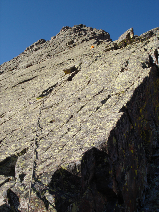
The first pitch
I easily ascended the first pitch, removing Jeremy's protection as I climbed. I reached the anchor and Jeremy prepped for the 2nd pitch. Meanwhile, I decided to take a few photos from this vantage, looking down.
Looking down Wham Ridge
Arrow Peak's profile from about 3/4 up on Vestal's Wham Ridge
We cruised up the 2nd pitch in quick order and set-up for one last pitch, which proved to be quite difficult in one section. I found myself at a point where there were no foot-holds and only one hand-hold - a large inset section holding a rusted cam. Having on mountaineering boots and not climbing shoes made the climb much more difficult than it needed to be, but I welcomed the challenge. The move required me to do a one-armed push-up with my right arm in the inset section and to reach up with my left arm to a hand-hold. Once in this position, I pulled myself up and placed my feet where my right hand was previously at. This was probably the crux of the entire route. It felt much harder than 5.4, but I suspect that was because I was wearing boots.
Matt on Wham Ridge
At this point, Jeremy and I both felt comfortable being unroped and headed up the class 4 / low class 5 remainder of the route. There was only one other section that was greatly exposed, which required us to do a really crazy move with about 1,000 ft. of exposure below us. The move was on a completely solid rock, so I felt comfortable enough to make a go at it without rope. This proved to be OK, as the move was totally solid, and fun to say the least.
The last section of Wham Ridge proved to be a very fun class 4 and 5 playground.
We finished up to the top of Vestal, and I celebrated. Since I had been dreaming of doing Wham Ridge for quite some time, this moment was especially exciting for me. I thanked Jeremy for leading the climb and began to go crazy with my camera. 
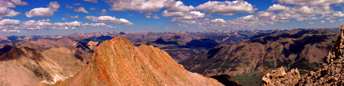
As expected, the views from Vestal were outstanding. The Needle Range and the remainder of the Grenadier Range to the east were quite the sight!
A view of the Needle Range to the south of Vestal Peak.
A zoomed in view of Pigeon Peak
A zoomed in view of Jagged Mountain
A zoomed in view of Windom, Sunlight, and Sunlight Spire
A zoomed in view of Mount Eolus
A zoomed in panoramic of the Needle Range.
The La Plata Mountains seen in the distance to the southwest, including Hesperus Mountain
A panoramic photo looking west to north from Vestal Peak.
A fully zoomed in panoramic view looking down and east from Vestal Peak, with Vestal Lake below. Seen at far right are the Trinities, Storm King Peak, Mount Silex, and The Guardian.
Jeremy sits on the summit of Vestal Peak with Pigeon Peak behind him.
Matt and Jeremy are captured in this self-timer from the summit of Vestal Peak.
Matt looking proud on the summit of Vestal Peak.
I think I see my house from up here!
A panoramic photo of the Needle Range
A panoramic photo from Vestal Peak, looking north to south - with Basalm Lake between the Grenadiers and the Needle Mountains.
With more sky this time...
After a great time on the summit, we decided to descent via the "class 3" route of Vestal on the south side of the mountain. I put class 3 in quotations marks because this was the worst, chossiest, nastiest, most unpleasant class 3 climbing I've done in my life. The route was unmarked, with no trail, and no cairns until the bottom. We weaved in and out of gullies, unsuccessfully finding one dead-end after another. Finally, as we were nearing desperation, Jeremy found a narrow but climbable gully leading down to a large cairn below. The climbing on the backside of Vestal reminded me of Crestone Needle, except steeper and looser. Not a good combination! We finally reached the saddle between Arrow Peak and Vestal Peak and descended via the "Dues Collector Couloir." I've often wondered why it was called this, and realized it was because it was loose talus and dirt, not the most enjoyable stuff to climb up or down.
Jeremy in the "Dues Collector Coulior"
We reached the end of the coulior and headed towards the end of the base of the mountains where we would down climb back to our campsite.
A view of Vestal's Wham Ridge on the way down
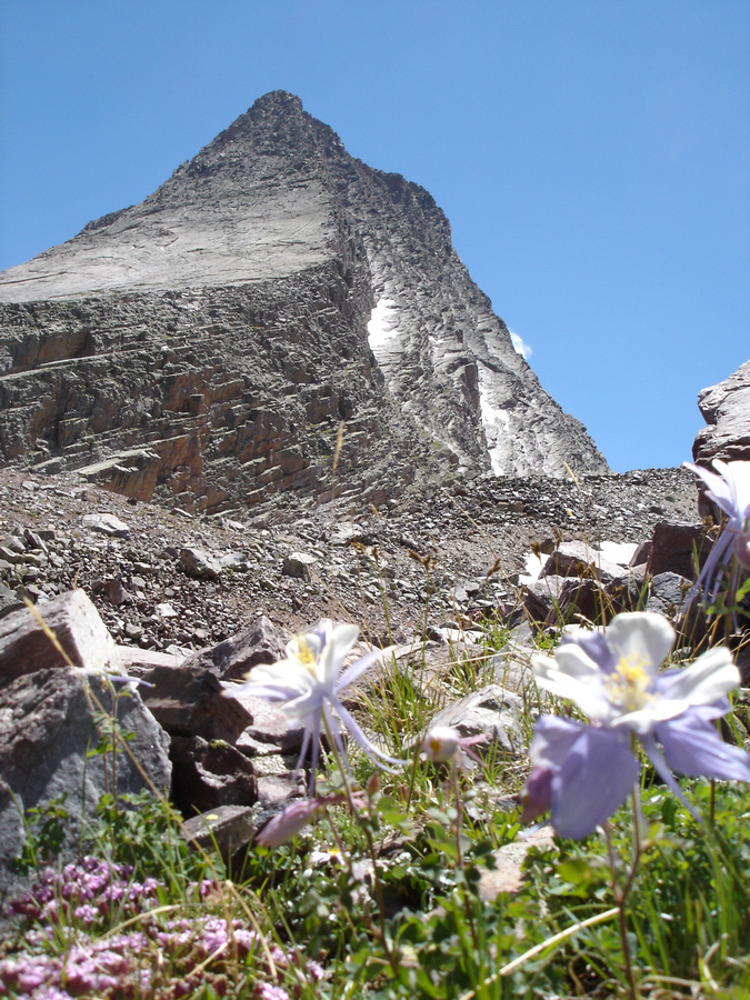
Vestal Peak and some Columbine flowers
We reached our campsite about six hours after we had begun, still high from the amazing climb. We prepped our dinner - this time a hearty meal consisting of tortellini and pasta sauce with chicken. Yum.
A view of Vestal Peak from Vestal Creek near our campsite. It should be noted that the steep section between us and Vestal (right of center) was the trail up from our campsite.
The flowers were incredible in the afternoon sun, so I took some time to photograph them after dinner.
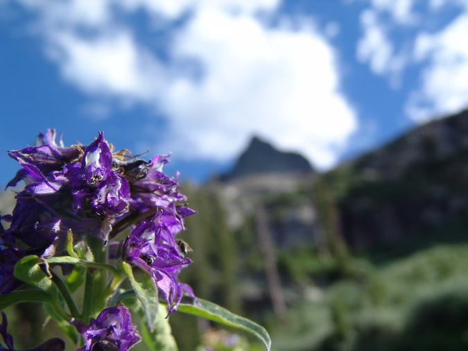
A purple flower in front of Vestal Peak
Lower Vestal Basin, where we were camped
We hit the sack around 10 PM, and set the alarm for 5 AM, tentatively planning to do the Trinity Traverse the next morning.
Day 5
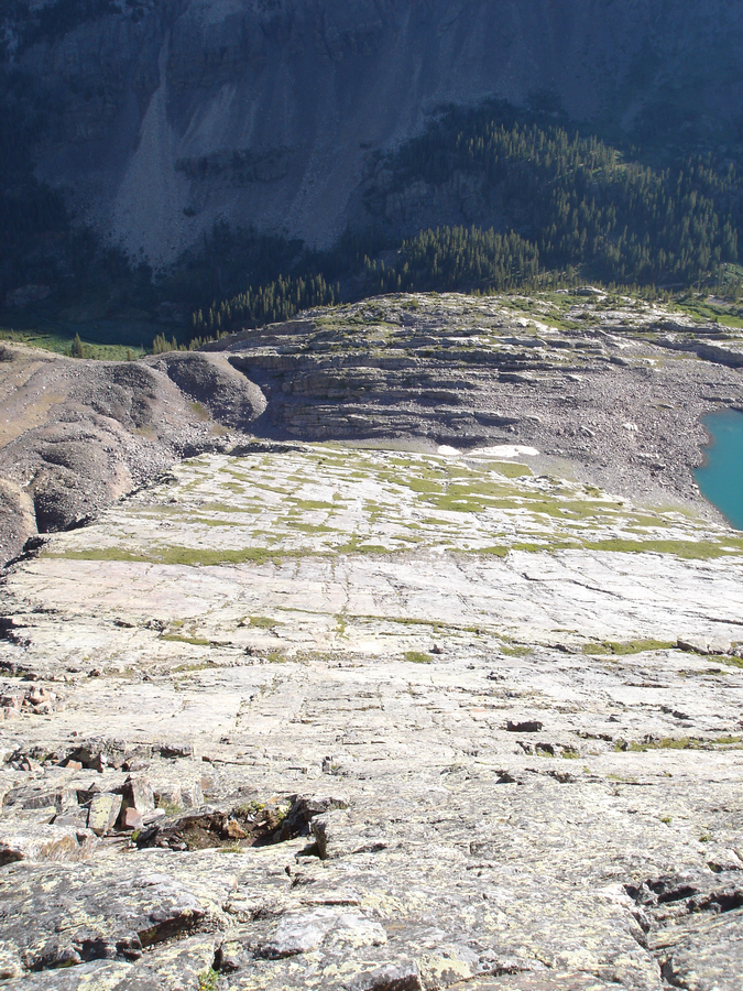
We awoke around 6 AM, seeing that the clouds had already formed in the basin. We opted to cancel the Trinity Traverse and head back to the car. We packed up and left camp around 11 AM, making our way back down the steep trail and to the beaver ponds. The view from the beaver pond was incredible as ever.
Vestal Peak and Arrow Peak are reflected in a beaver pond
We cruised back down the Colorado Trail, meeting up with the train around 2:30 PM.
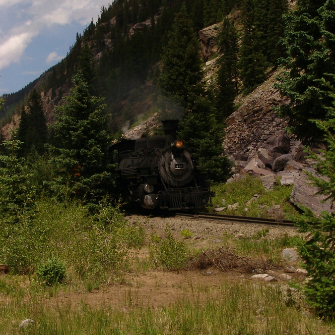
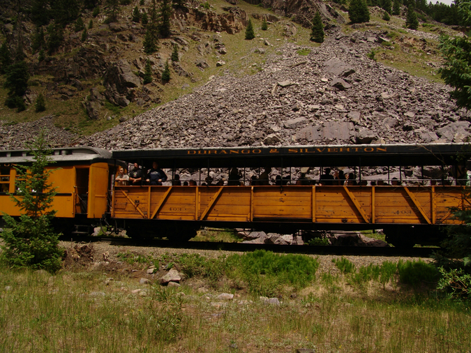
The Durango & Silverton Narrowgauge Railroad
We reluctantly trudged back up the 1,700 feet to our car in a matter of 2 hours and drove into Silverton, where we dined on Elk Burgers and French fries. The drive home was uneventul yet completely satisfying.
Vestal marked the 60th mountain of the highest 100 in Colorado for me. 40 to go!
References:
1. The San Juan Mountains - A Climbing and Hiking Guide. Robert F. Rosebrough
2. Wheeler, Annual Report of the Chief Engineers for 1876, Appendix JJ, p. 101
3. Rhoda, Summits to Reach, p. 75