Displaying items by tag: Mount Antero
Six 13ers in the Sawatch: Fall Colors Galore!
Earlier this year I had made plans to climb Mount Wilson, Wilson Peak, and El Diente with my dad; however, plans quickly changed through the summer as Ray painfully realized that he did not have the flexibility, strength, nor desire to conquer those mountains. We decided instead to take a camping trip with my son, Quinn, up to the southern Sawatch range and I would figure out alternative climbing options later.
Being that one of the best months to climb mountains in Colorado is September, I wanted to get in as much hiking time as possible to soak in the fall colors. I chose the far southern Sawatch range to begin my quest for great fall color photos and hoped to conquer my personal nemesis, Tabeguache Peak, as a bonus. Due to it's location, Tabeguache is generally climbed in conjunction with Mount Shavano - which I've already climbed twice in two years due to my quest for Tabegauche's summit. For this trip, I'd planned to hit Tabeguache from the north, while bagging Grizzly Mountain, Cyclone Mountain, and Carbonate Mountain; however, upon further inspection of the TOPO map for the area (St. Elmo Quadrangle), I discovered that there were several other 13ers right near where we were planning to camp, all of which were connected by long ridges, and that it would be a shame not to climb them while we were in the area. My plans quickly changed and I added Boulder Mountain and Mount Mamma to my itinerary.
Trip Statistics:
Summits reached:
Boulder Mountain: 13,528 ft. (ranked 236 in Colorado)
Mount Mamma: 13,646 ft.(ranked 173 in Colorado)
Grizzly Mountain: 13,708 ft. (ranked 142 in Colorado)
"Lo Carb": 13,591 ft. (unranked)
Cyclone Mountain: 13,596 ft. (ranked 192 in Colorado)
Carbonate Mountain: 13,663 ft. (ranked 165 in Colorado)
Total elevation gain: 4,883 ft.
Total prominence in feet: 2,723 ft.
Total distance hiked: 11.41 miles
Total time hiking: 10 hours, 30 minutes
Total photos taken: 592
Total wildlife sightings: 1 (Mountain Goat)

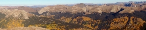
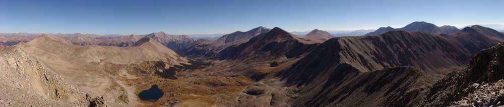
Collegiate Peaks - located in the Sawatch Range, including Mount Antero left of center, Mount Princeton at center and Mount Yale at far right.
On Saturday, September 18, 2010, my dad, my son, and I loaded into my Jeep Grand Cherokee and headed for Baldwin Gulch. To get there, we traveled to Highway 285 via Highway 24 and drove south from Buena Vista / Johnson's Corner to Chaffee County Road 162, heading west towards Mount Princeton & St. Elmo. After 12.5 miles, we took a left (south) on Chaffee County Road 277 (Mount Antero / Baldwin Gulch Road).

The aspen changing colors in Baldwin Gulch.
This is a 4WD road and put my Jeep to the test. In fact, when I purchased this Jeep earlier this year, I had this road in mind as a good barometer for how much clearance etc. I wanted to have. The road is fairly rough in spots, and I knew that after the road splits towards Baldwin Lake, it becomes even rougher. Sure enough, after passing the turn-off for County Road 278 at Baldwin Creek and staying right, the road became fairly crazy. If you don't have good clearance, this would be a great place to stop.
We found a great campsite roughly 4.3 miles up the road (1.7 miles from the Baldwin Creek turn-off) near a large boulder field near the smaller lakes below the main Baldwin Lake. We set-up camp and enjoyed the cool yet pleasant fall weather. Speaking of weather, the forecast for the weekend was ideal for hiking - no rain, no storms, no wind. I took a small hike around the area to enjoy the fall colors. I was very impressed by the golds, yellows, reds, and browns of the vegetation - it certainly made for quite the view, and complimented the diverse colors of the mined rock on the mountainsides.

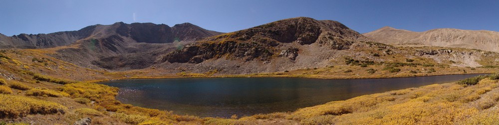
Antero Peak is reflected with vibrant blue colors.

Cronin Peak and lower Baldwin Lake.

Cronin Peak and lower Baldwin Lake.
Baldwin Creek.
The moon was nearly full and much to my surprise, there were great views of the moon rising above Cronin Peak in the early evening.

Cronin Peak with the moon rising above it, reflected in the water.

Cronin Peak with the moon rising above it, reflected in the water (lighter this time).
After enjoying a large campfire and roasting marshmellows with my son, we all went to bed. I set my alarm for 4 AM so that I would have a full day for my planned epic hike:

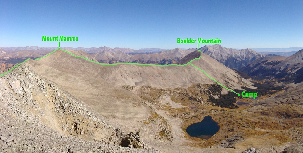
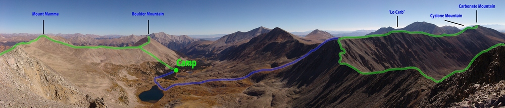
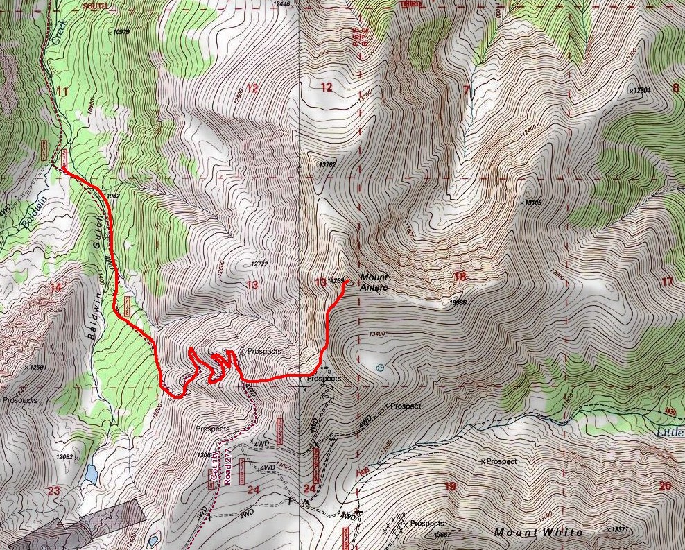
The route map for Boulder Mountain, Mount Mamma, Grizzly Mountain, "Lo Carb," Cyclone Mountain and Carbonate Mountain.
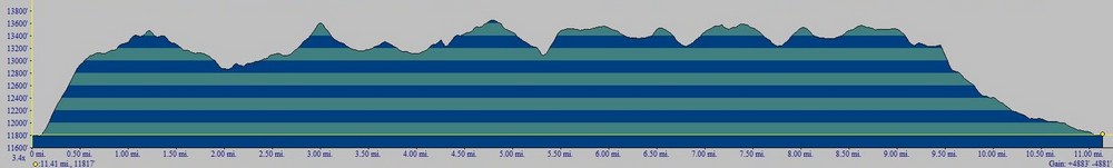
Elevation profile for Boulder Mountain, Mount Mamma, Grizzly Mountain, "Lo Carb," Cyclone Mountain and Carbonate Mountain.The first 1/2 mile was pure bushwhacking scree hell.
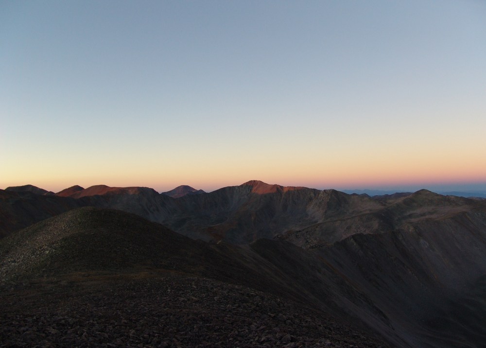
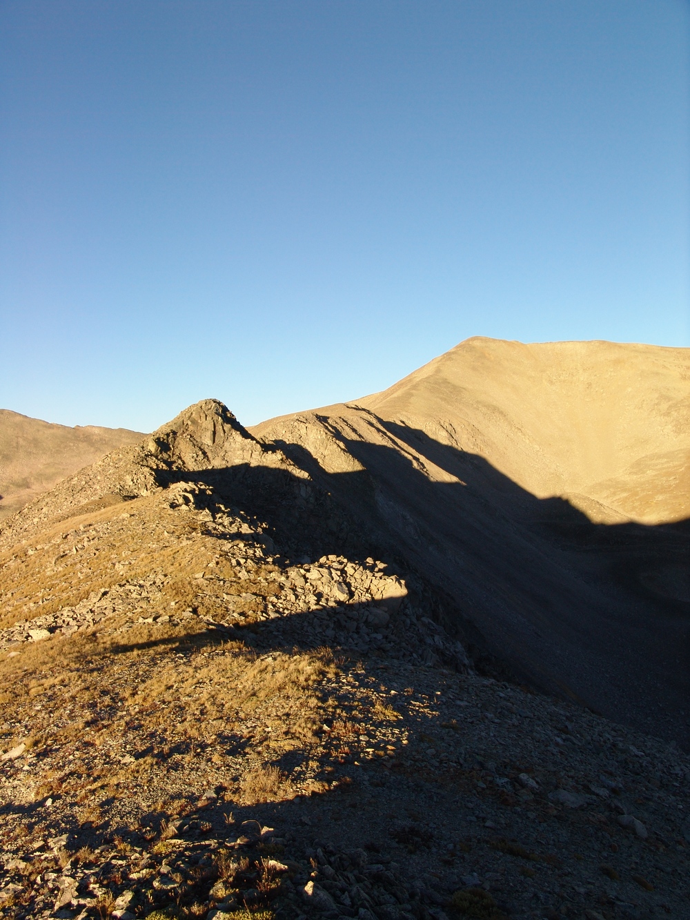
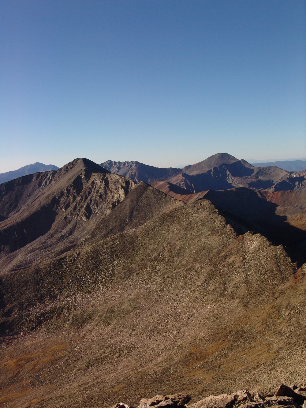
I left camp at 4:30 AM and bushwhacked straight up the side of the ridge of Boulder Mountain. I stumbled across an abandoned mine on the way up and found this part of the hike to be the worst part of the day. As you can see above, the first 1/2 mile of the hike was absolutely brutal - I gained 1,400 ft in the first 1/2 mile on loose scree, boulders and talus. It was the kind of rock where you took one step forward and then slid backwards half a step. It took me only an hour to reach the ridge, where I was greeted by strong, cold wind and pure darkness. The stars were amazing though, and the sun was just beginning to provide the first glimpse of light on the eastern horizon, left of Antero. Looking north, I could see the vague outlines of Boulder Mountain, which seemed to be pretty far away in the darkness. Through the cold wind, I pushed my way up the summit ridge of Boulder Mountain, and reached the summit at 6 AM, a mere 1.5 hours after I began my adventure. The summit had a very awesome looking cairn at the top, which provided nice contrast with the light of the rising sun.

If you've never experienced the sunrise from the top of a mountain before, it should be on your bucket list. This marks the third time I've been able to witness the sunrise from 13,000 ft+ and it never gets old. The sunrise provided excellent outlines of Mount Antero, Mount White, Tabeguache Peak, and Mount Shavano to my east. Additionally, as the sunrise continued to increase the amount of light, it became clear that there were incredible views of gold and red aspen across the valley along the ridgeline for Mount Princeton to the north. It was quite stunning to see all of the colors emerge from the darkness as the sun rose above the horizon.

The sunrise illuminates the sky, revealing Mount Princeton (left) and Mount Antero (right).

The sunrises behind Mount Antero.

The changing aspen are visible from the summit of Boulder Mountain.
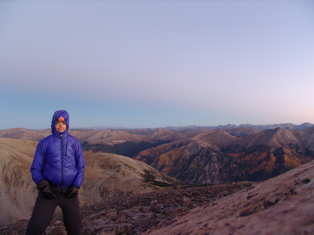
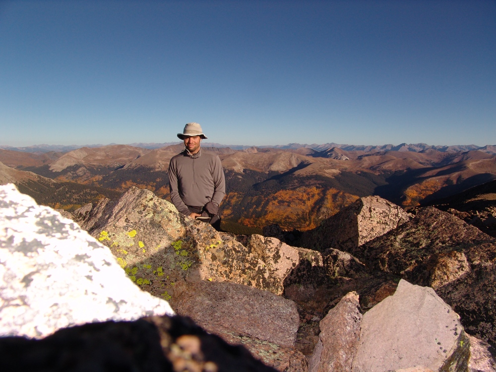
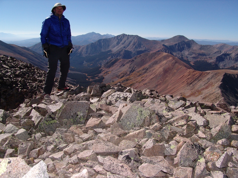
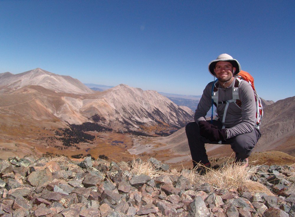
Matt Payne on the summit of Boulder Mountain - it was really windy!

Aspen change colors on the slopes of Mount Princeton and it's neighbors.
After enjoying the sunrise, I started to head back down the ridge of Boulder Mountain to the south. As I traveled along the ridge, the sunrise lit up skyline to my right (west) across the slopes of Mount Mamma and to the north, illuminating groves of aspen trees. It was nothing short of spectacular.
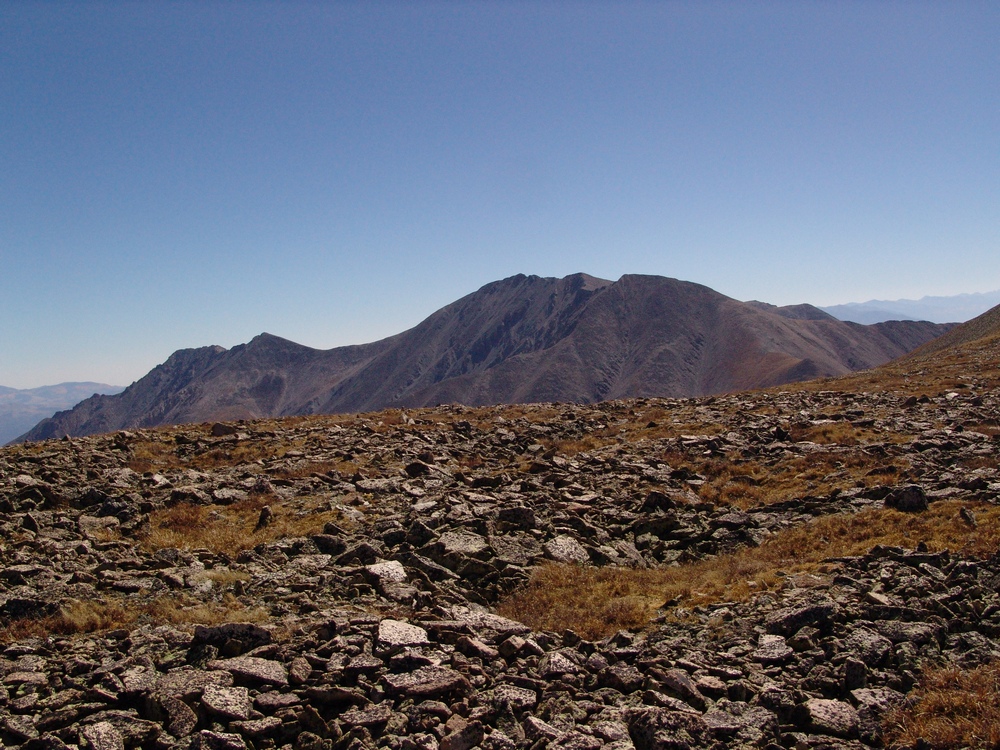
Grizzly Mountain in the far distance...
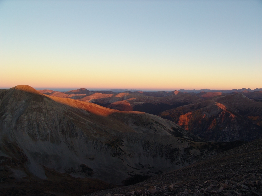
Mount Mamma is lit up by alpenglow.

Aspen are further revealed by the rising sun across from Mount Mamma's north ridge.
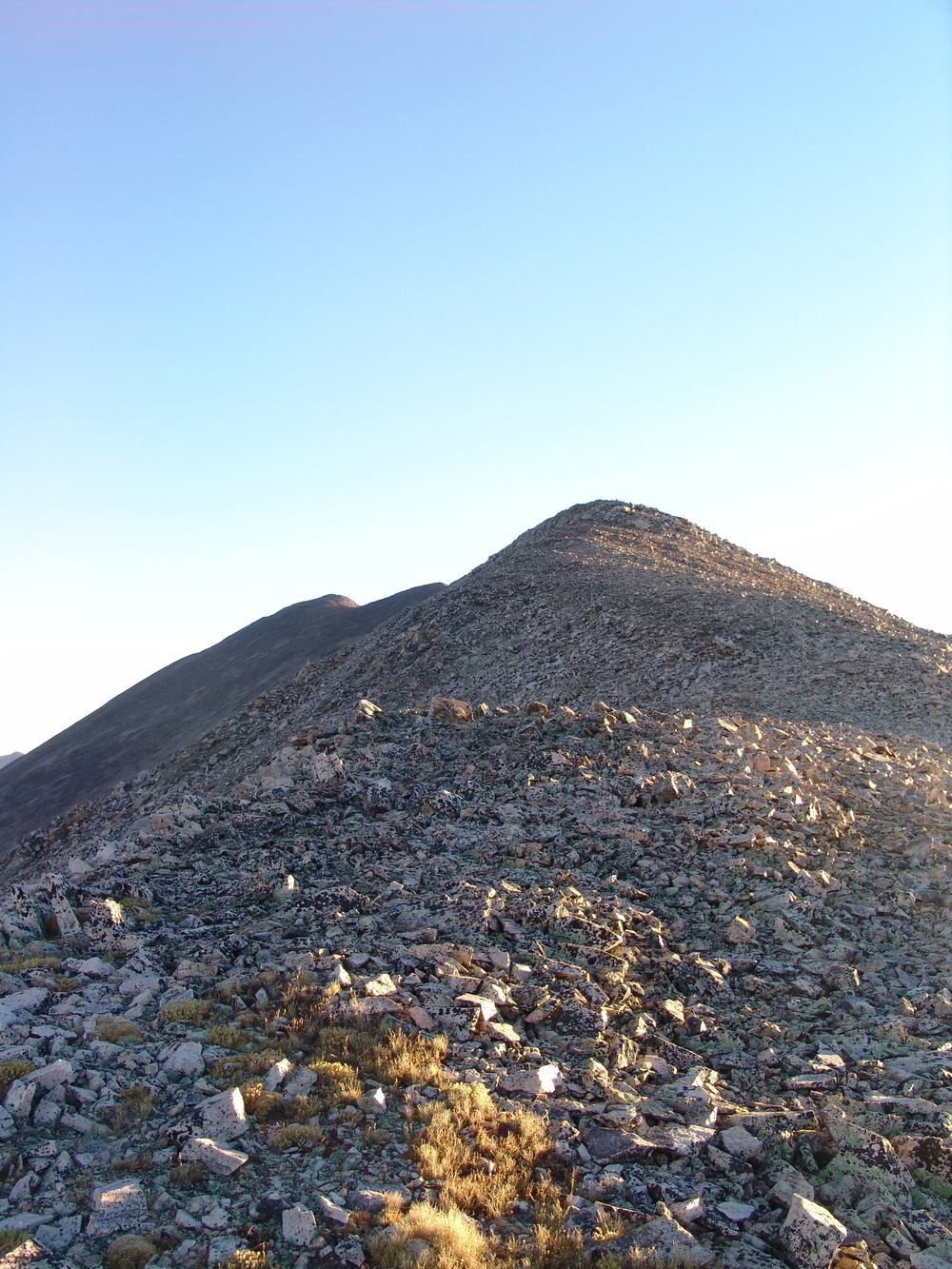
As I approached the ridge between Mount Mamma and Boulder Mountain, the full length of my next summit revealed itself in quite an overwhelming way. The distance between the two peaks seemed quite vast; however, I was so entranced by the surrounding views that any doubts I had about going onwards were destroyed.

At center - Cronin Peak. In the far distance just right and behind Cronin were the final two mountains I would end up climbing - Cyclone and Carbonate. The ridge to Mount Mamma is quite long from Boulder Mountain.
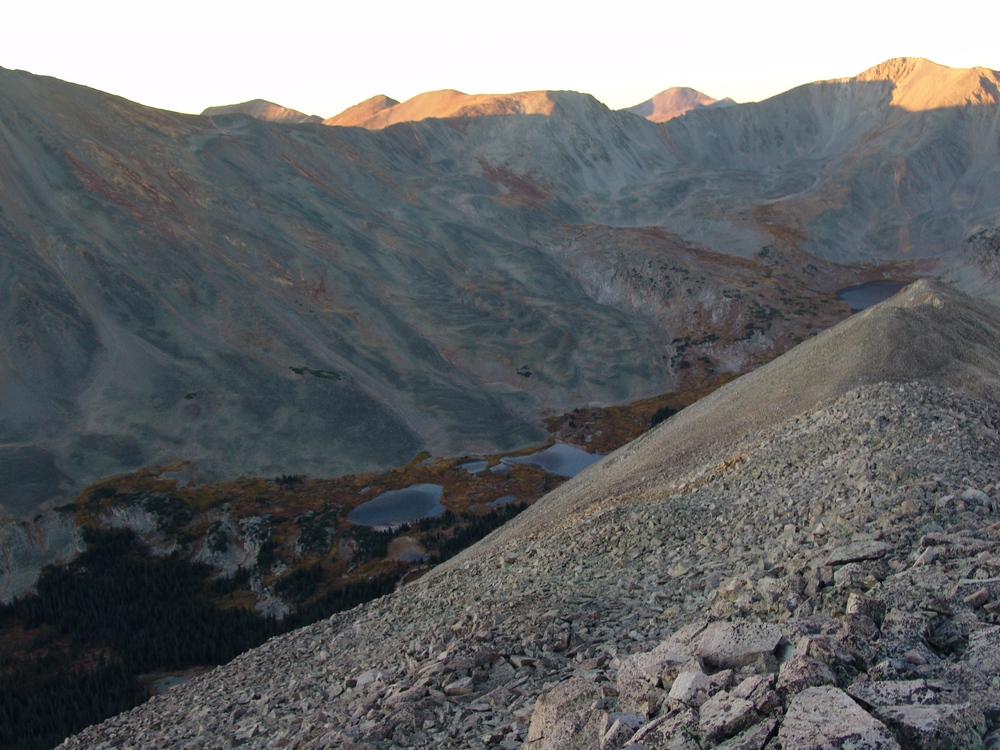
The lower Baldwin Lakes were right below me on the saddle between Mamma and Boulder.
Baldwin Lake pools reflect parts of "Lo Carb" to the South from the saddle between Mount Mamma and Boulder Mountain.
About halfway across to Mamma, it still felt like I had a long way to go...
Mount Mamma was quite a long haul from Boulder Mountain...
At 7:30 AM I finally reached the summit of Mount Mamma, just three short hours from the start of my trip. My legs were feeling extra spicy!
Matt Payne on the summit of Mount Mamma - with insane aspen in the background.
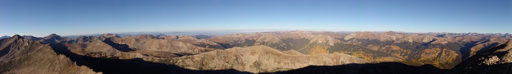
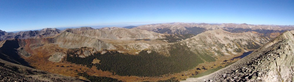
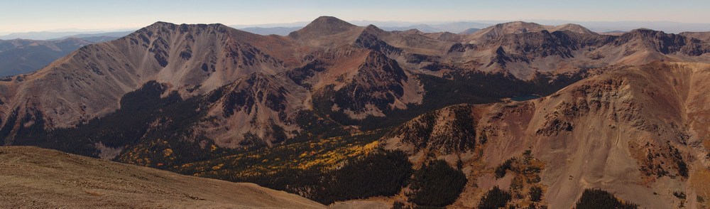
A panoramic landscape looking south to north from the summit of Mount Mamma.
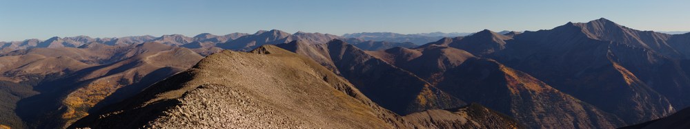
Mount Princeton seen at far right among changing aspen, as seen from the summit of Mount Mamma.
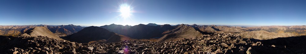
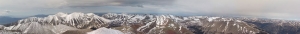
A 360 degree panoramic landscape from the summit of Mount Mamma.
Huge groves of aspen are seen to the north and west of Mount Mamma.

A zoomed-in panoramic landscape of aspen trees west and north of Mount Mamma.
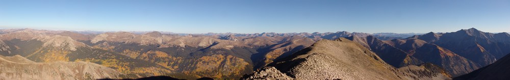
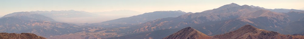
A panoramic photo looking west from Mount Mamma.
After taking some time to rest on Mount Mamma, I peered over to my next objective: Grizzly Mountain. Grizzly Mountain would be the highest mountain for me to summit this day, and it was not easy.
The terrain on the ridge from Mount Mamma to Grizzly Mountain is steep and rugged, without a trail. The rocks were looser and slightly more dangerous on this section of the route, so I was careful to choose my foot placements.
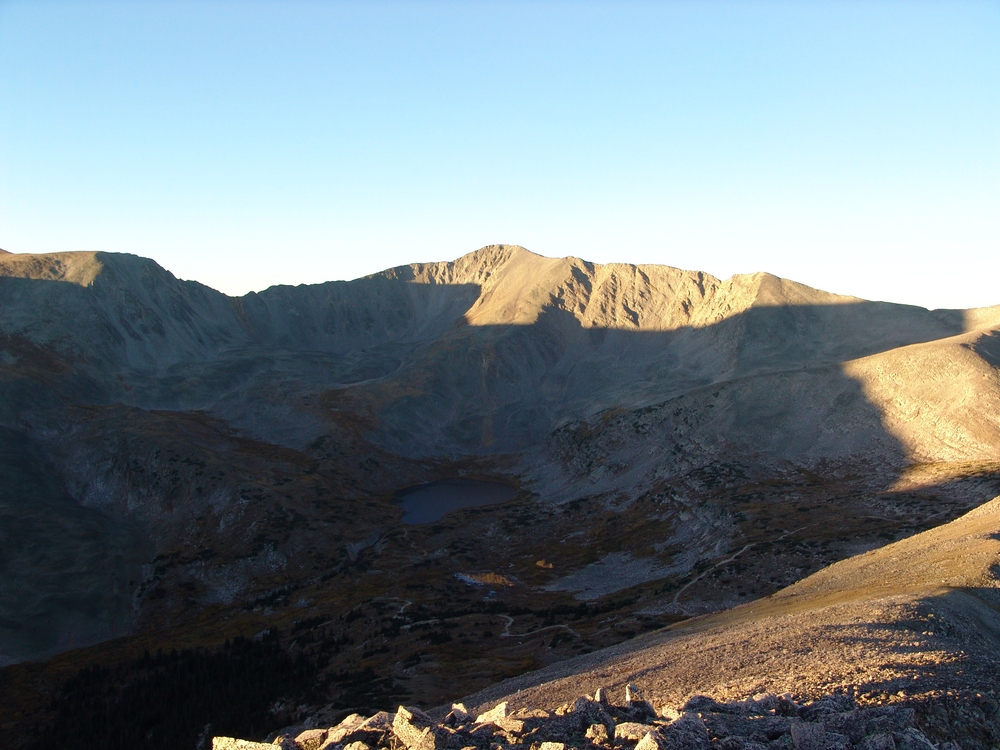
After another hour of hiking, I reached the saddle between Mamma and Grizzly and took time to appreciate the sheer northern face of Grizzly that stood before me. At this point, the ridge became quite narrow, and it was quite fun having nothing but sheer drop to my left and incredible views of Grizzly Gulch to my right. Grizzly Gulch contains Grizzly Lake and some of the most photogenic and pristine looking wetlands I've seen.
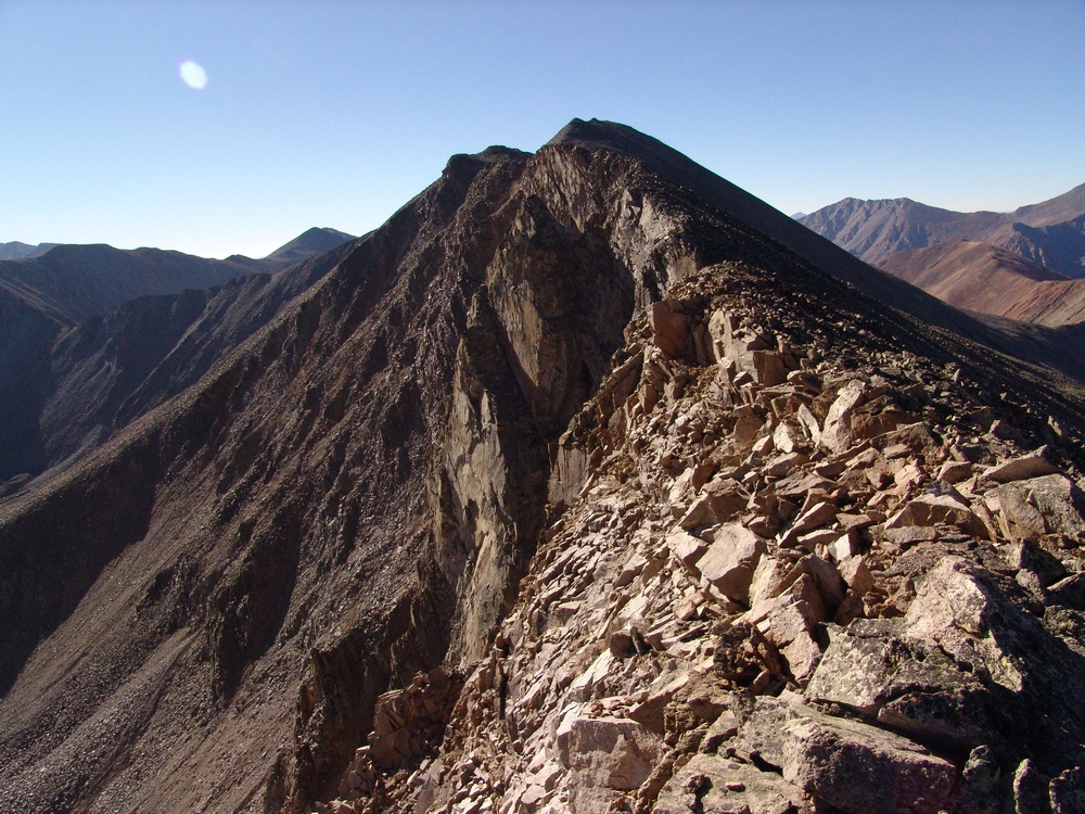
Grizzly Mountain's north face is quite impressive.
Grizzly Gulch seen from the saddle of Grizzly Mountain and Mount Mamma.
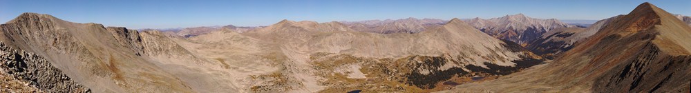
As I approached the summit of Grizzly Mountain, I could really gain some perspective on the hike I had completed so far. It was certainly impressive seeing the distance I had traveled thus far:
Additionally, I was able to get a great view of the entire route for the day, from start to finish. I had traveled a great distance already, but could see that I had a long way to go yet...
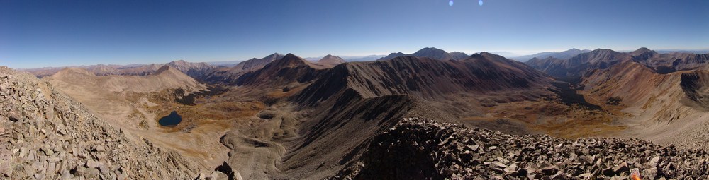
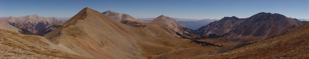
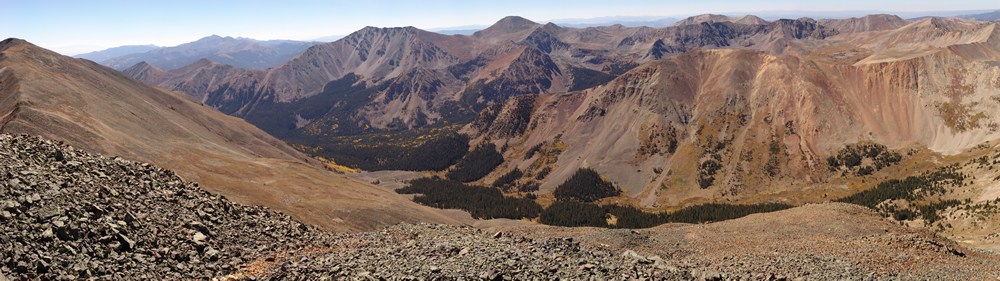
A view of Baldwin Gulch, including Baldwin Lake, Boulder Mountain, Mount Mamma, Cronin Peak, Antero Peak, Mount White, Cyclone Peak and Carbonate Peak.
The entire route as seen from Grizzly Mountain.
I finally reached the summit of Grizzly Mountain at 10 AM and dove into my pack for some much needed food. The views from Grizzly were great, but I could see that I still had quite a lot of ground to cover if I were to complete my goals.
Matt Payne on the summit of Grizzly Mountain, with Cyclone Creek Basin in the background.
Cyclone Creek Basin, south of Grizzly Mountain. Taylor Mountain in the foreground with Mount Ouray in the distance.
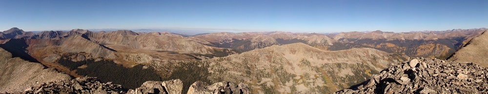
A 360 degree pano from the summit of Grizzly Mountain.
Knowing that I had a long day in front of me still, I departed Grizzly Mountain's summit promptly and made my way over towards saddle of "Lo Carb" and Grizzly. From afar, the terrain between Grizzly and "Lo Carb" seemed rather intimidating, and I was a little concerned with what I would find once I began climbing to the top of ridge at the end of the ridge-line.
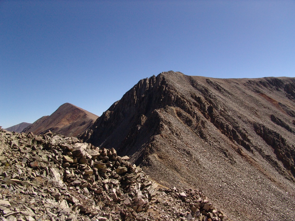
Steeper terrain greeted me at the saddle between Grizzly Mountain and "Lo Carb."
The terrain indeed proved to be challenging, but quite fun. I would rate the tough section of this climb low Class 4 or high Class 3.

At this point, Boulder Mountain seemed like a completely different trip - it was so far away!
After reaching the false summit of "Lo Carb," which is basically the high point between Lo Carb and Cronin Peak, I was able to get a full grasp of the distance I had traveled. It continued to amaze me.
Grizzly Mountain (left), Mount Mamma (center), Boulder Mountain (right of center) and Cronin Peak (far right).
I began the long hike towards Lo Carb, Cyclone Mountain and Carbonate Mountain. Tabeguache was still a long way away, which pretty much sealed the deal for me - I would be coming back for Tab a 3rd time!
I don't know what came over me at this juncture of the trip, but I just remember being overcome with positive feelings and I remember saying to myself, "Man - THIS is so awesome!" I think the combination of solitude, great weather, awesome views, and the sustained time above 13,000 ft. had something to do with it.
Cyclone and Carbonate are really gentle peaks nestled at the top of Brown's Creek Basin, which divides Mount Antero and Mount White from Tabeguache Peak.
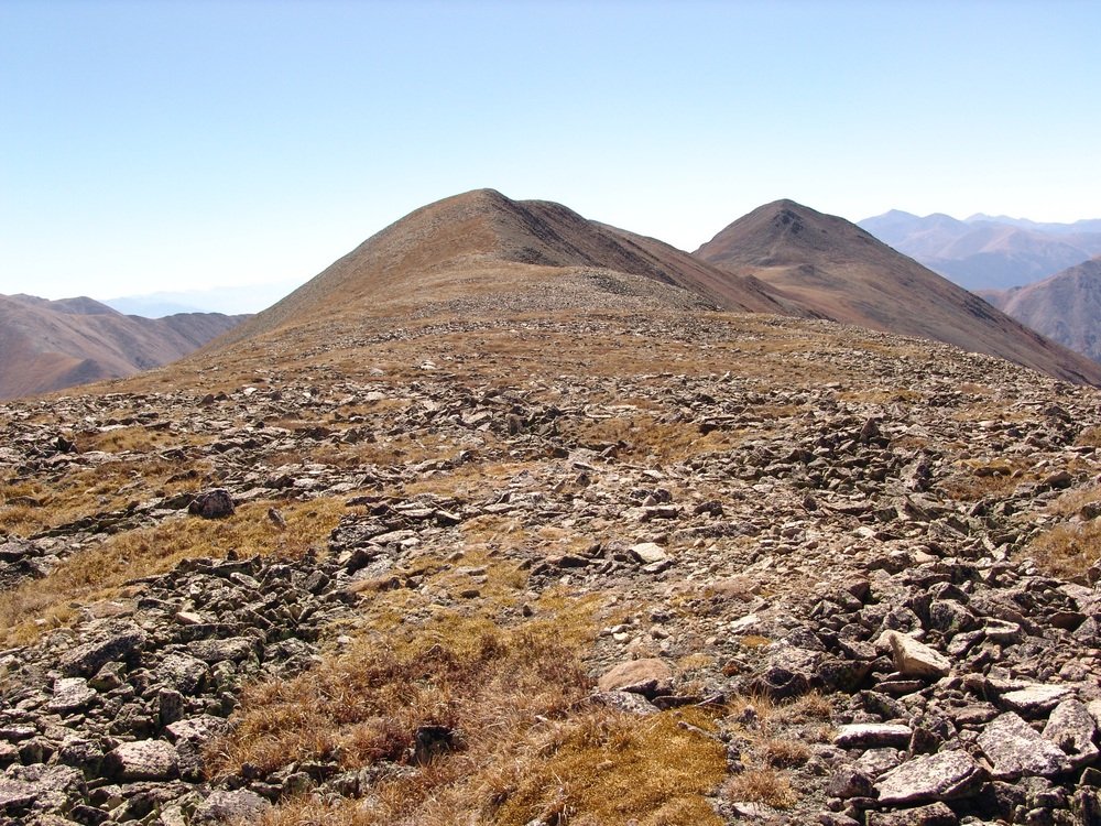
Cyclone Mountain and Carbonate Mountain.
One detraction from the view was the large network of roads that connects Mount White and Mount Antero. As many know, these mountains are rather famous for gemstone mining, so a lot of people probably make a living from these roads' existence. With that being said, it seems like there are too many roads up there and it is an eyesore for sure.
Mount Princeton, Cronin Peak, Mount Antero, Mount White and Tabeguache Peak as seen from the saddle of "Lo Carb" and Cyclone Mountain.
Reaching the summit of Cyclone was somewhat of a treat because the summit register there had listings from all the way back to 1349. Of particular note, I saw an entry there from the famed Bob Martin, of Martin and Garratt - Colorado's High Thirteeners, which is one of my favorite mountain books. One more note about Bob Martin - he's probably climbed every mountain in Colorado over 10,000 ft., not an easy task to complete! In fact, at the date of this report, he's climbed 2,563 mountains in Colorado... as compared to my 91 (at the date of this report) and some people think I'm obsessed! :-) My take on it - impressive dedication!
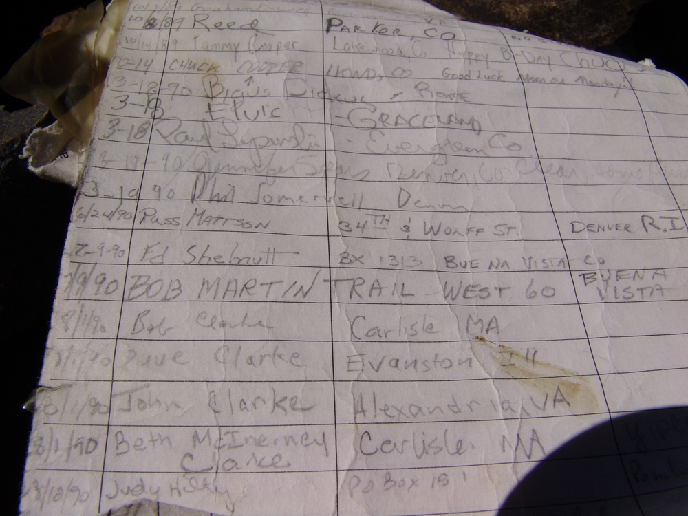
Bob Martin sighting...
From the top of Cyclone, I was able to get a really nice zoom-in pano of Cyclone Gulch and the mountains across the valley. In case you're wondering what that means - I take several photos where I've zoomed-in as far as I can with my camera, and I've combined them. The result is that you are able to see a great deal of detail in the photo. Individual trees can be made out easily. Of course to see this, you need to see the full resolution version of the photo. Let me know if you'd like to!
Cyclone Gulch seen at high resolution. Carbonate Mountain at far left with Taylor Mountain and Mount Aetna in the valley over above the groves of changing aspen trees.
At this stage, my legs were definitely getting tired. I strolled on over to the summit of Carbonate Mountain, and after seeing the huge drop in elevation between Carbonate and Tabeguache, I made an official declaration that Tab would just have to wait for another day.
Matt Payne on the summit of Carbonate Mountain.
Taylor Mountain and Mount Aetna rise above a forest of colorful aspen tree and North Fork Reservoir.
While it was somewhat of a hazy day, I could still see aspen changing in every valley that I could see with the naked eye.
Having summited 6 mountains in one day, 5 of which being ranked 13ers, I felt that my day was a huge success and that I was ready to return to camp for some awesome burgers. I made my way back over Cyclone Mountain and Lo Carb, down to the saddle between Lo Carb and Cronin, and down to Baldwin Lake.
Baldwin Lake.
Once I reached our campsite, it was only 3 PM. Quinn was happy to see me, and many burgers were happily consumed!
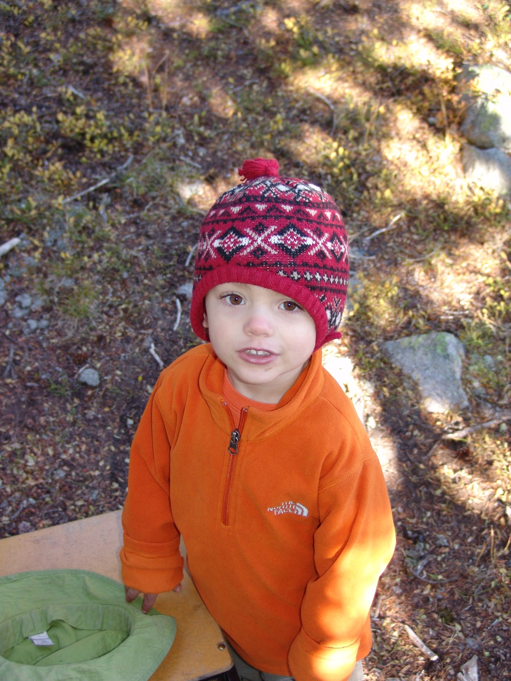
"Welcome back dad!"
Mount Antero - A Great 14er Season Starter
Mount Antero is one of the easiest mountains to identify as you are driving into Buena Vista from Colorado Springs. It is a very pointed peak to the South of Mount Princeton. Mount Antero towers above the Arkansas River Valley as one of the mighty 14ers in the Southern Sawatch.
Here are some fun statistics from this adventure:
Mountain climbed:
Mount Antero. 14,269 feet. 10th highest in Colorado
Elevation gain: 3,401 ft.
Total miles: 6.4 miles
My mission, and it was a fun mission indeed, was to reach the top of Mount Antero. Being out of shape and out of the climbing game for quite some time, I had exercised all Spring for this summer's adventures. This was an adventure indeed... Wind. Cold. Wildlife.
I drove from Colorado Springs on Friday night and made record time since the wife forced me to eat at home instead of on the way (thanks babe). I arrived at the turnoff for the Baldwin Lakes at around 8 PM and met up with Randy from 14ers.com there. We had met on 14ers.com and agreed to conquer Antero together. His cousin Daniel met us there and I decided to drive up the road where I would sleep for the night.If you've never been up the Baldwin Lakes road, its quite the adventure, especially if you're in a stock-equipped vehicle. My 2007 Jeep Grand Cherokee handled it like a champ, but not because I'm very good at driving off-road, that's for sure. The whole time I was driving up, I was white-knuckled and cringing for the inevitable scrape on the underside of my vehicle.
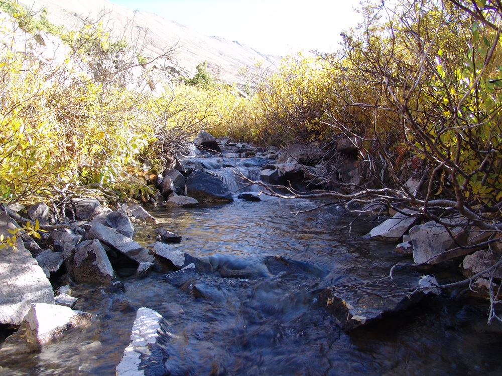
Fortunately it never came. On the way up the road I had two interesting moments. The first moment was when I was about half-way up and a big mammal was right in the road in front of me about 20 yards away. My vehicle startled it and it scurried off the road but I recognized it clearly - a porcupine. I had the wherewithal to not get out and investigate, but was glad I could see such a wild fella in the woods.The second interesting moment was at the stream crossing at the road intersection for Baldwin Gulch and Baldwin Lakes. I crossed the stream reluctantly, as this was something I had never done in my Jeep and I was not sure how deep the water was. I had read on 14ers.com that the stream was passable by a stock 4x4 truck, so I figured my Jeep would be OK. I was right, but I had trouble sleeping all night because all I could do was conjure up images of my Jeep being stuck in the water on the way down! Note, the water looked a heck of a lot deeper in the dark than in the daylight!

Baldwin Creek in early June - not for the faint of heart or stock-equipped vehicles...or, maybe, people afraid to get stuck, like me!
I set the alarm for 5 AM and tried to sleep in the car on a slight angle - always a fun endeavor. I woke up the next morning and shortly afterwards Randy and Daniel were at my car to start the hike. We started up the road and you could barely make out Antero in the darkness:
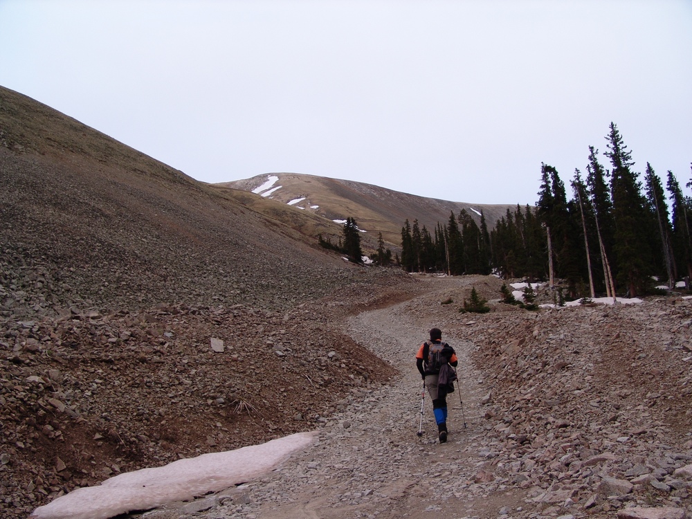
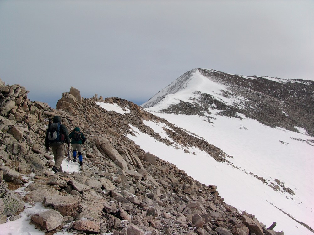
Its important to note that Antero has a well-developed 4x4 Jeep road going up the majority of the way up until about 13,800. This does not make it "easy" necessarily, but it certainly takes a lot of the mystery out of the hike. Randy blazed the trail ahead and set the pace for the morning:
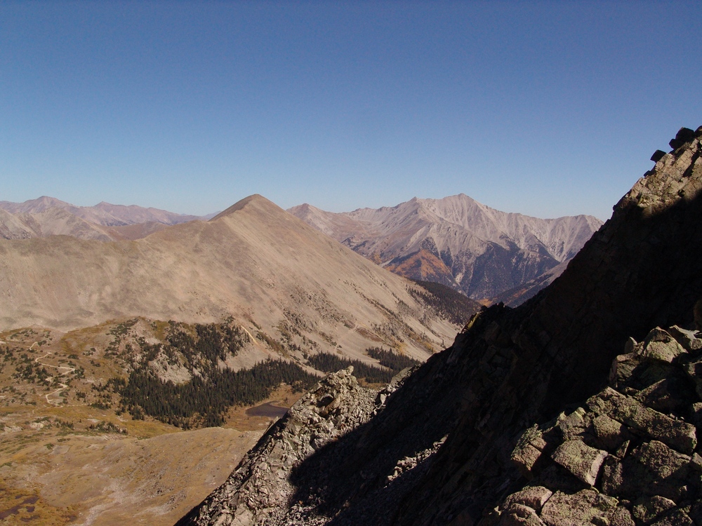
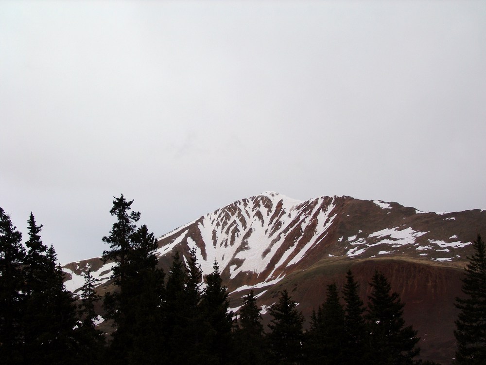
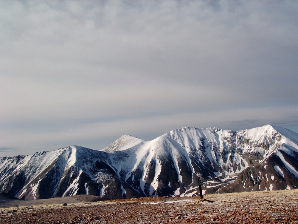
The road switches back and forth up the side of Antero, as seen from my picture taken from the top of Mount Shavano just the week prior:
Its also important to note that there is some considerable mining interest on Antero. Apparently there have been some very nice and quite valuable aquamarine finds on this peak, including the largest aquamarine specimen ever found in North America, as evidenced by this article. As we climbed up, the sun began to rise and we were able to make out North Carbonate and Baldwin lake below it to our west. I climbed North Carbonate, now called Cronin Peak, on 9/1/1985 when I was just 6 years old. My memories from that climb are vivid, as we were pushed from the top by lightning. That made this climb even more nostalgic.
Additionally, as we gained elevation we could see down the Baldwin Gulch valley where we came from.
The road we were hiking on was full of snow drifts pretty much the whole way up, making a very formidible barrier for all of the miners that make this mountain their home during the summers. I'll come back to that later.
Antero loomed above us and was shrouded in shadow for much of our ascent. We spotted some elk on the road as we climbed, which was a very surprising but welcoming sight in the cold morning.
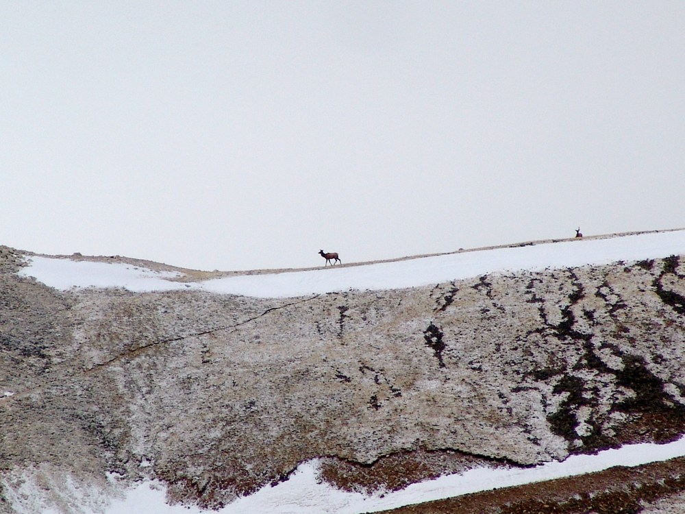
The elk stayed on the road for quite awhile as we approached and we came within 200 yards of them at one point.
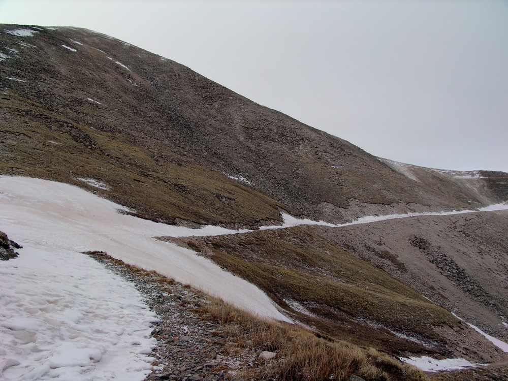
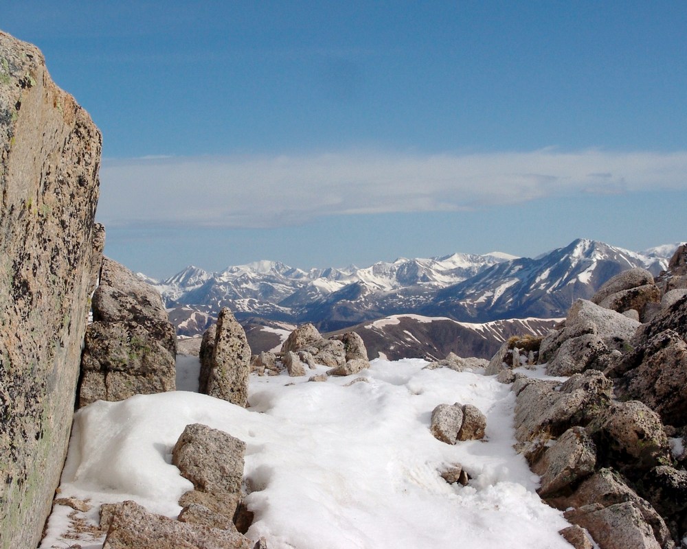
Finally, we were able to get to the top of the first ridge that separates the Baldwin Gulch from Brown creek valley. Numerous jeep trails cross and intersect on this part of the mountain, which did deter somewhat from the spectacular views of Shavano and Tabeguache:
At this point we decided to take a "short-cut" up the ridge by doing some boulder-hopping, which is quite challenging with trekking poles, something I've not grown accustomed to yet.
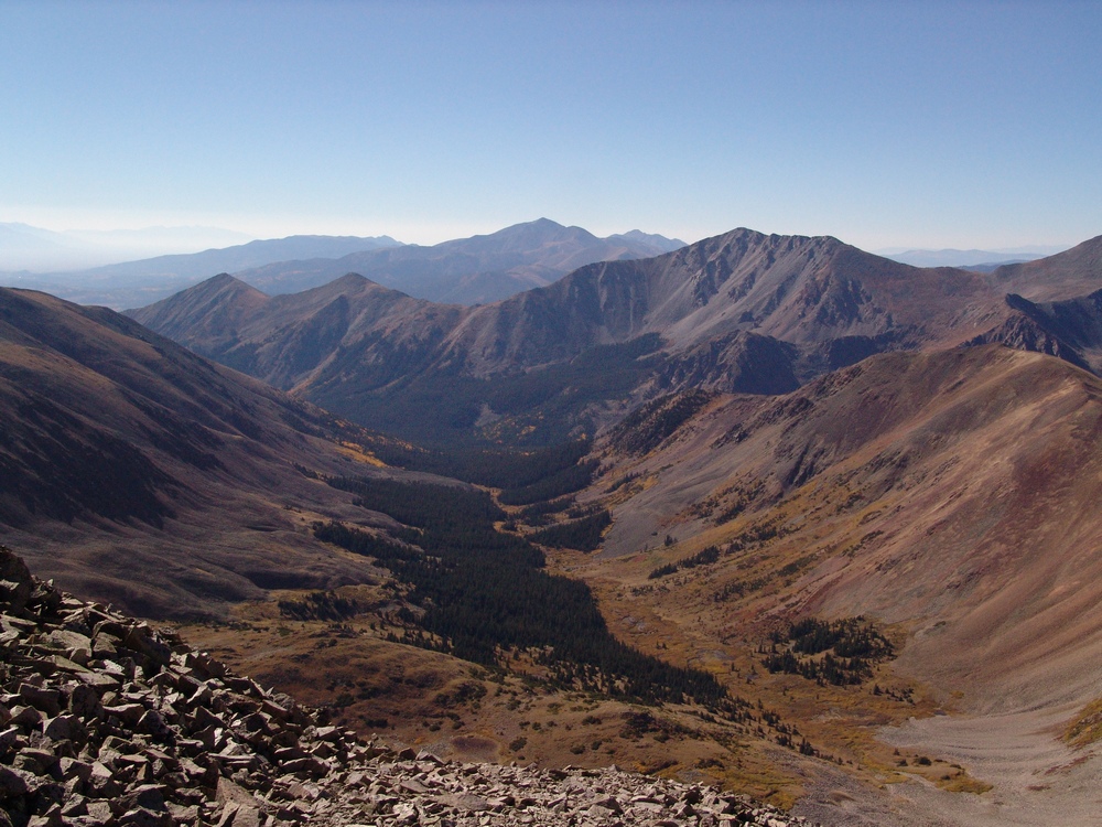
Looking back from the ridge we were climbing you could see the large basin/ridge we had came from that leads to the upper Brown creek valley.
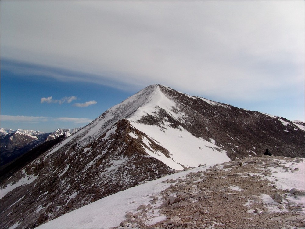
The northern Sawatch range broke out in the distance from the ridge we were climbing, and we could see that the weather was going to cooperate for us today.
The sun was finally cresting over the ridge at this point and was quite the contrast to the snow we were hiking on. The sunglasses were quickly dug out of my jacket and worn for much of the rest of the hike.Once we reached the top of the ridge we could see our final destination - the summit of Antero. Unfortunately, the wind at this point was maddening and brutally pounding our faces. We estimated that for the remainder of our climb, the wind on the ridge and the summit was about 50 MPH and gusts were up to 70 MPH. This, combined with 25 degree weather, made for a wind chill of about 5 degrees. My thin gloves were not cutting it at all, and my hands were punished. The North Face pants and jacket I was wearing were doing a superb job of keeping the rest of my body warm; however, and I was able to alternate keeping one hand in my pocket while using the other hand to hold both of my trekking poles.
We continued up the ridge, covered mostly with snow. The snow was hard enough to walk on and postholing was kept to a minimum, although, at one point, I did sink to about chest level in a snow drift.We continued up the ridge towards Antero, using the small rock formations as protection from the wind. The heavily fortified sections of rock were welcoming as the wind was beating them with a loud fury. I was really qutie impressed with the way in which the rock stopped the wind and created such amazing sound.
Here is a video I shot from the windy ridge:
Another great picture opportunity presented itself to me about halfway up the ridge, and I stopped to see if I couldn't capture it. My photography skills are not that good, but I think this picture came out pretty well.
Pictures from the rest of the climb did not happen because taking a picture in the wind and steep snow would have surely ended tragically for me. It was all I could do to keep my balance in the slippery, steep snow with the wind beating me down. At one point I lifted my hand up to my face and the wind caught my trekking pole and slammed it right into my face. The wind really was quite incredible. At one point I really felt as though I was on some epic climbing expedition.
I was able to summit a few seconds after a gentleman that had passed us right near the top. I took his picture and waited for Randy to arrive a few minutes later. Daniel took his time and was able to summit about 10 minutes after Randy.
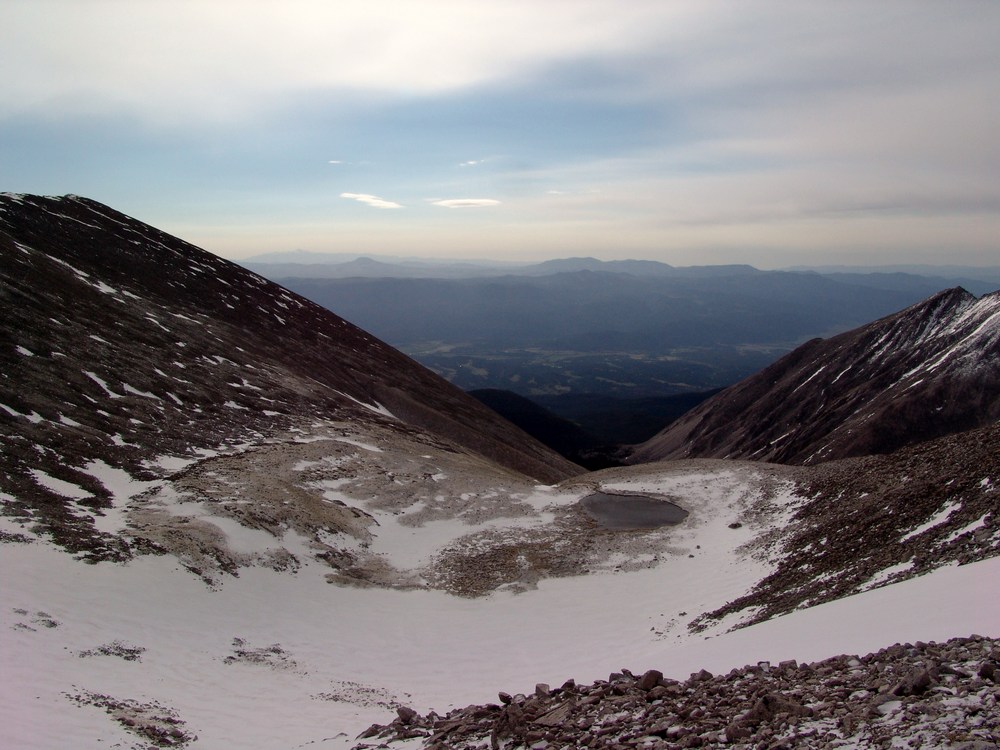
A small lake near the summit of Antero.
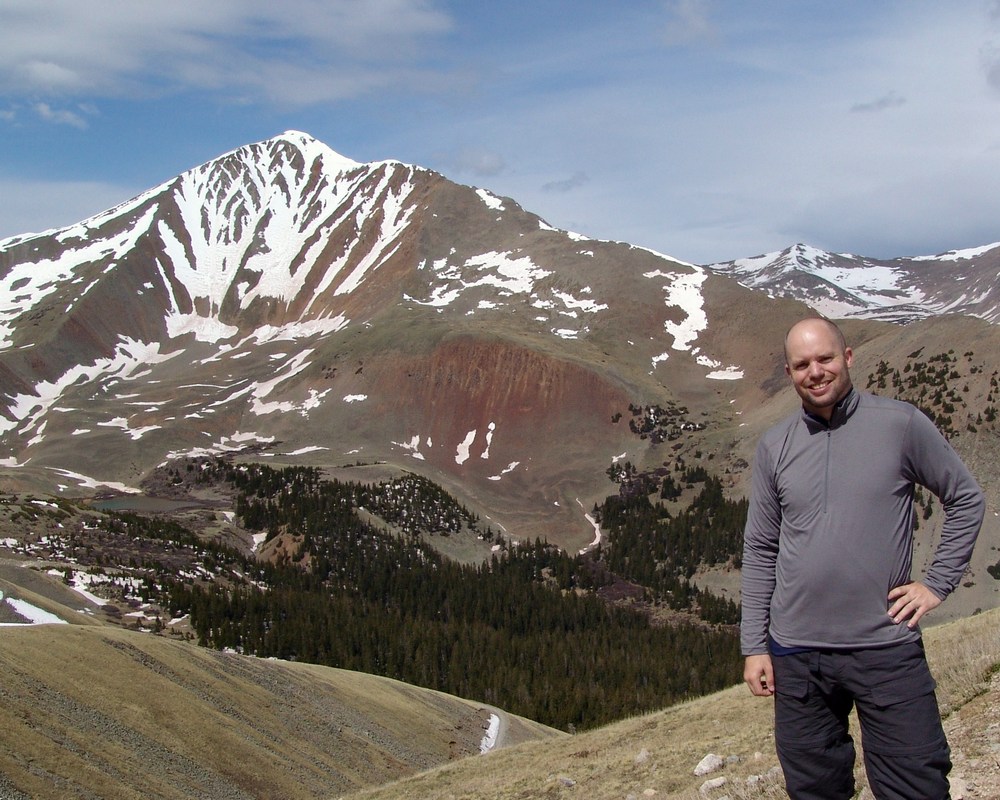
Once Daniel was on top, I asked him to take a few shots of me, which gave me a chance to pose. Something about being on the top of a high mountain reminds of you of the corny scene from Titanic.
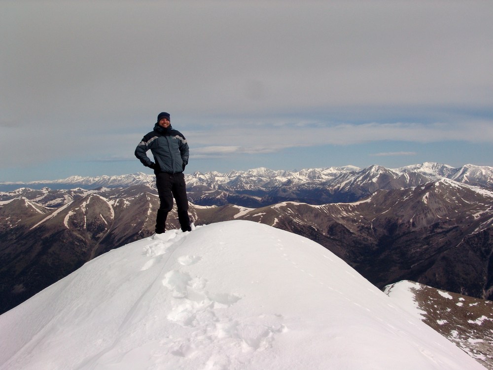
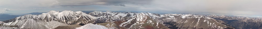
Poor Daniel had lugged a tripod to the top and never used it, but I took full advantage of it! I took a nice pano from the top, but unfortunately because of the wind, it was really hard to get it straight. The pano I ended up with was only partial, but still impressive nonetheless.
On the way back down I got one final shot of myself posing in front of Cronin. When we neared the stream crossing where my jeep was crossed, we encountered a gentleman that was shoveling the snow from the road. We theorized that he was an aquamarine miner based on his decor and by some of the things he said. It sounds like there's quite the mining operation on Antero in the summer.
We made amazing time back to the bottom and my Jeep made it across the stream easily - thankfully!