Displaying items by tag: Perseid Meteor Shower
Cathedral Peak in August - Photographing the Perseid Meteor Shower and Sunrise from the Summit
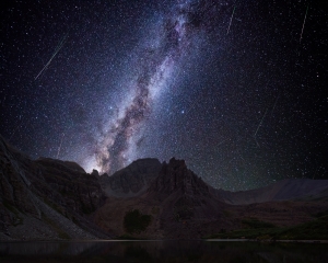
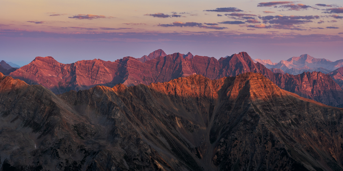
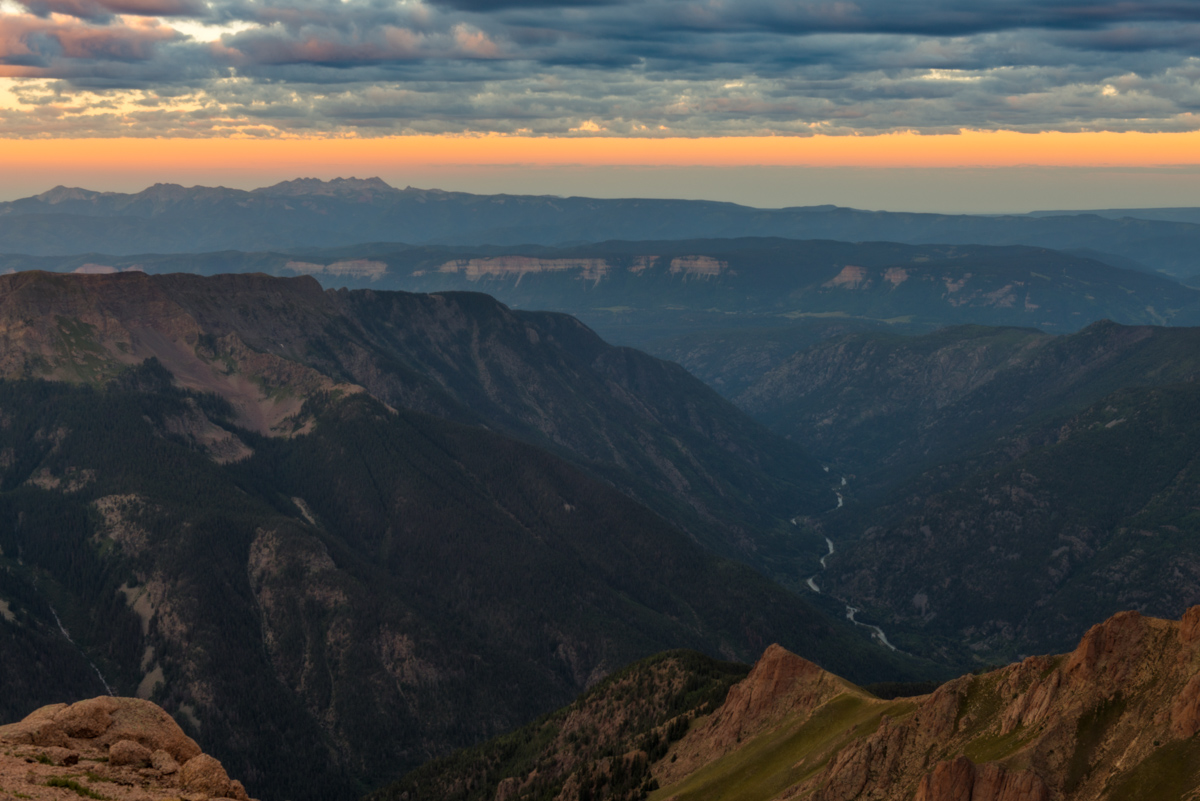
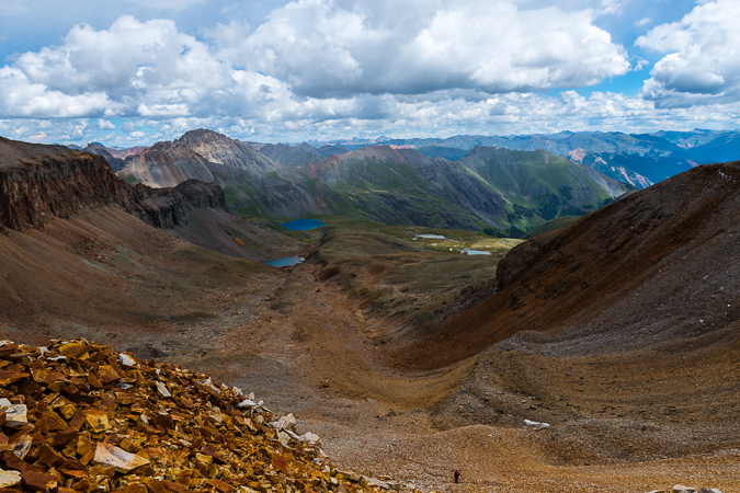
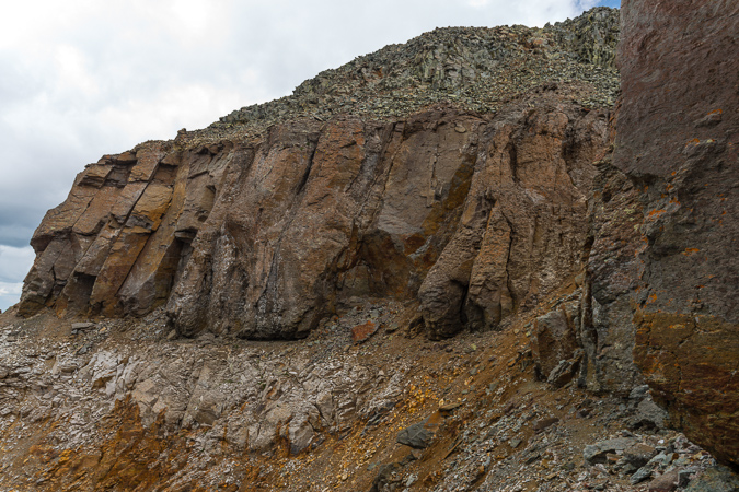
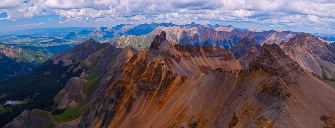
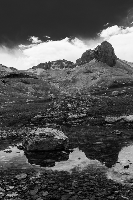
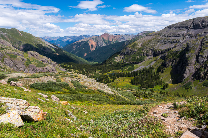
 Cathedral Peak as seen from Grizzly Peak in 2013
2018 is the year! I WILL complete the quest to climb the highest 100 mountains in Colorado! Cathedral Peak marked #99 and was only one of two peaks standing between me and my dreams. I set off for Aspen at noon on a Saturday. My plan was relatively simple yet ambitious: Backpack to Cathedral Lake, set-up camp, photograph sunset, find a composition for the Perseid Meteor Shower, photograph the Perseid Meteor Shower, sleep (maybe), climb Cathedral Peak in the dark, photograph sunrise from the summit. Seems doable, right? I have made it somewhat of a tradition to photograph the Perseid Meteor Shower whenever I can. Last year's was a total dud due to the moon being full, so I chose not to photograph it; however, the year before I photographed it from the saddle between Pigeon and Turret, which was also ambitious (and quite rewarding). I was hopeful for a similar outcome at Cathedral Lake.
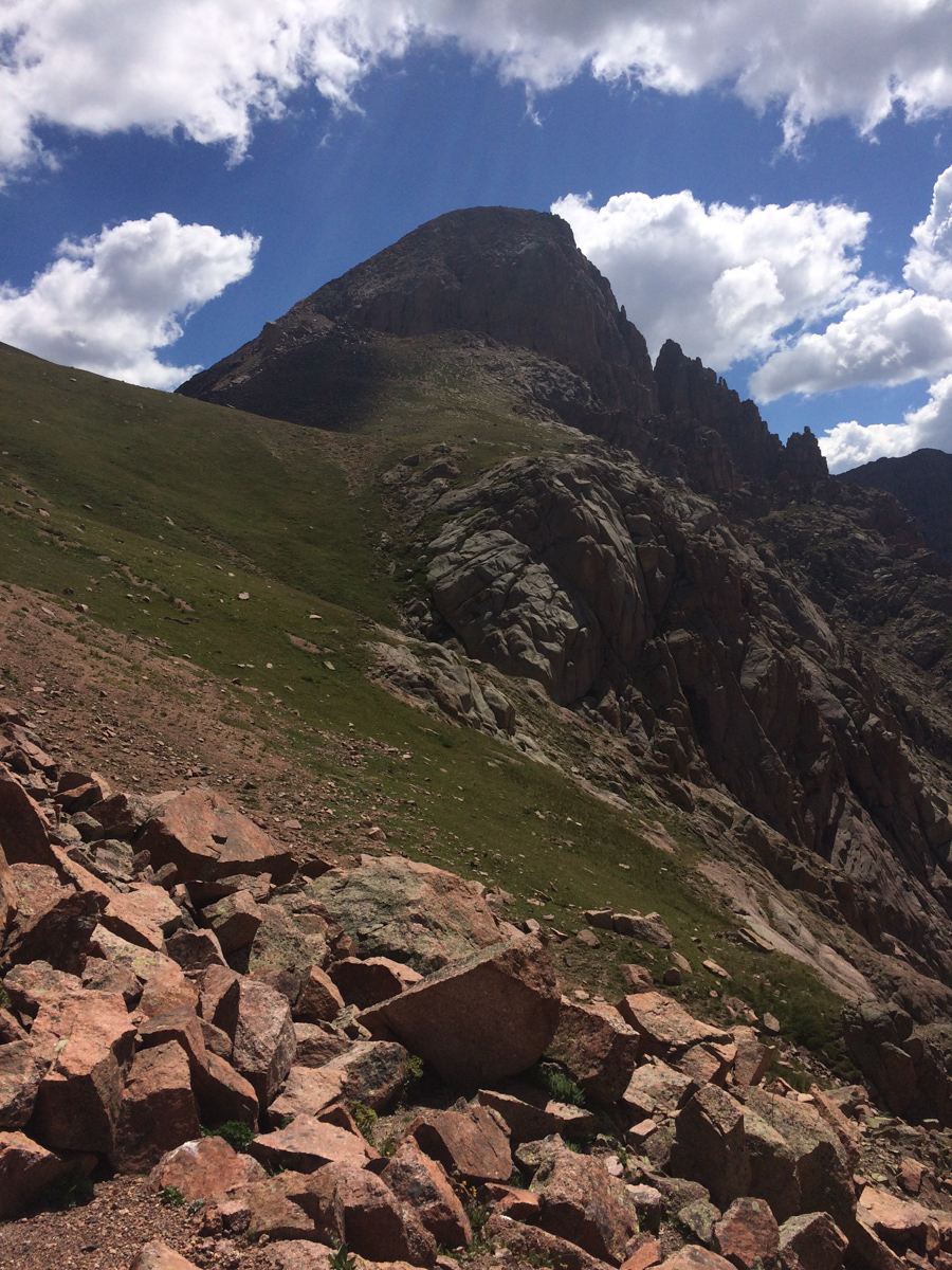
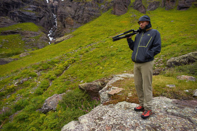
I have been dreading the climb of Cathedral for several years. Most people climb it in early summer when there is ample snow in the incredibly steep couloir leading to the summit saddle. I personally dislike snow climbing, but also did not have high hopes for climbing up that gully when it was all hard dirt and rock; however, I needed this peak and so it was on!
As always, you can see and download my full route and GPS tracks over on the incredible app, Gaia GPS, which I use on my iPhone to plan, track, and follow my routes on these trips. It is absolutely invaluable and worth every cent. I personally love that you have full access to all USGS topo maps and National Geographic Trails Illustrated maps as well. You can use the app while in airplane mode and even save maps for offline use. To get a nice discount on the application, follow this link and you'll also support my efforts to keep this site running.
My full stats for this particular climb, which included summiting Cathedral Peak (13,943 ft.):
- Peaks climbed: 1
- Miles hiked: 8.5
- Time: 5 hours, 23 minutes
- 3,987 ft. elevation gain
For this trip, I decided to pack quite a lot of camera gear (by the way, these are affiliate links and using them helps me pay for this site and to bring you better content):
- Sony A7R2 Camera
- Sony 12-24 f/4 lens
- Zeiss Loxia 21mm f/2.8 lens
- Sony 55mm f/1.8 lens
- Sony 70-300 FE telephoto lens
- Feisol Tournament 3442 tripod
As usual, I used the beta from Gerry Roach's High Thirteener Guidebook. I was still using the 1st edition of the book; however, his new edition is available on Amazon after many years of waiting - rejoice!

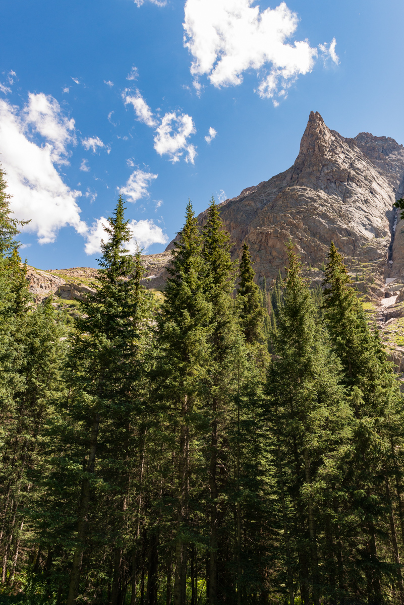
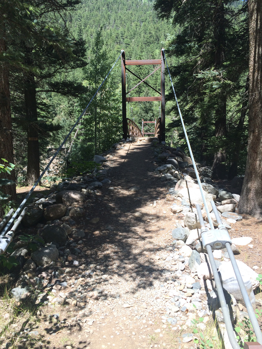
I reached the Cathedral Lake Trailhead at 5 PM. It was not very full and that made me smile. I embarked up the steep trail which Roach describes as unrelenting and pretty much did not stop until I reached the lake. The hike is steep but the trail is great and the scenery is wonderful as well.
As you climb the trail, the view opens up quite a bit across Castle Creek to reveal Ashcroft Mountain.
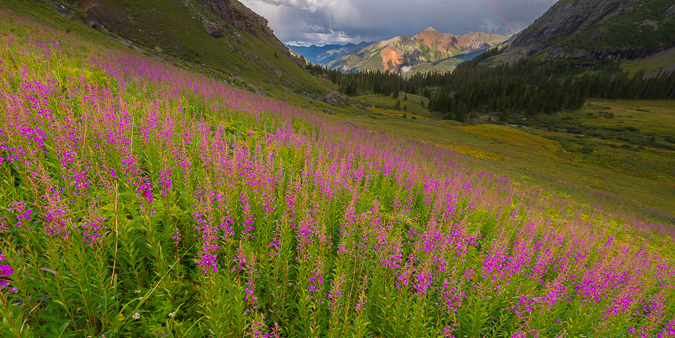
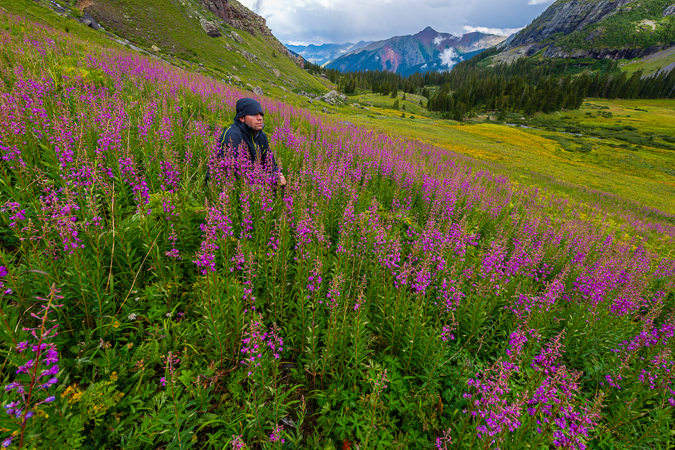
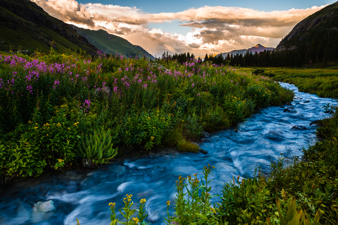
The fireweed had all grown super tall and looked really eerie.
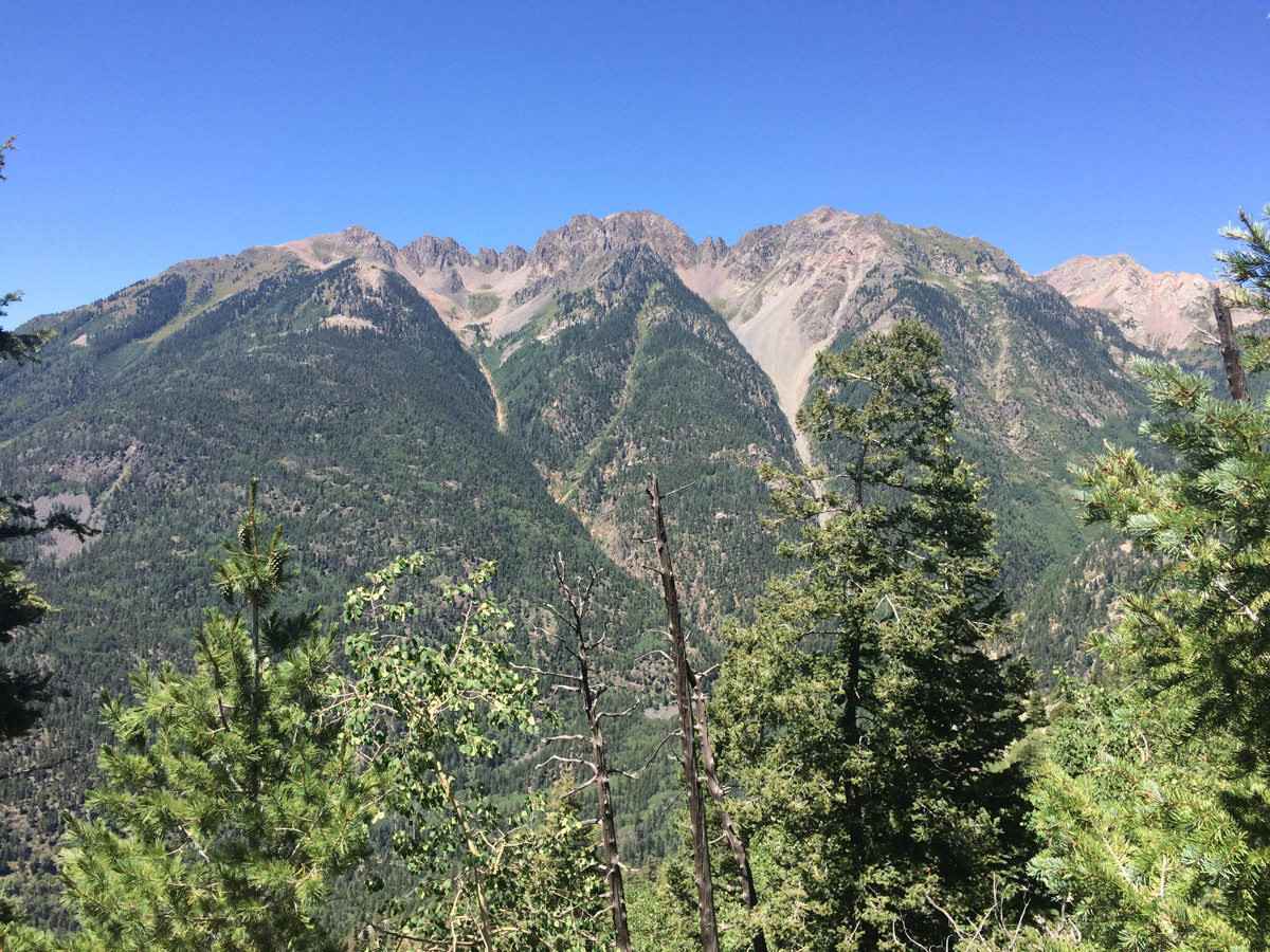
As I continued up, the eastern flanks of Malamute Peak began to reveal themselves.
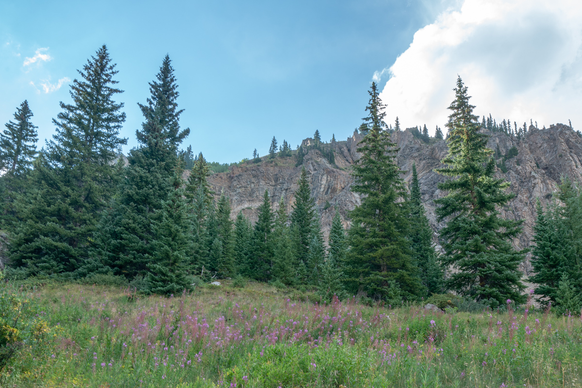
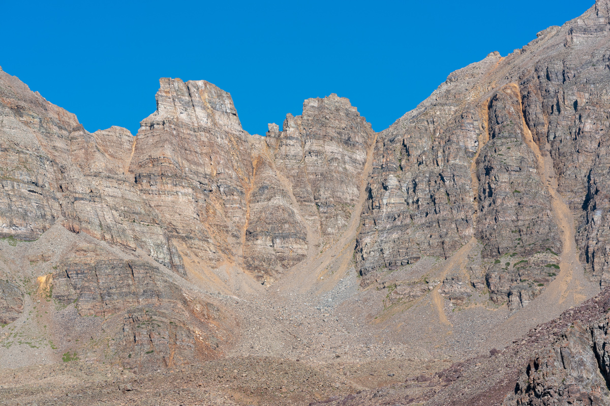
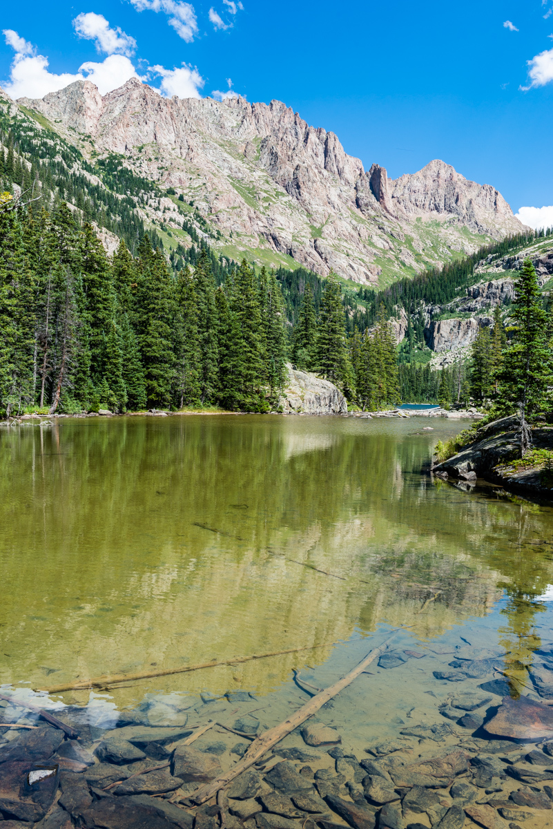
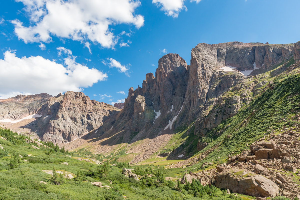
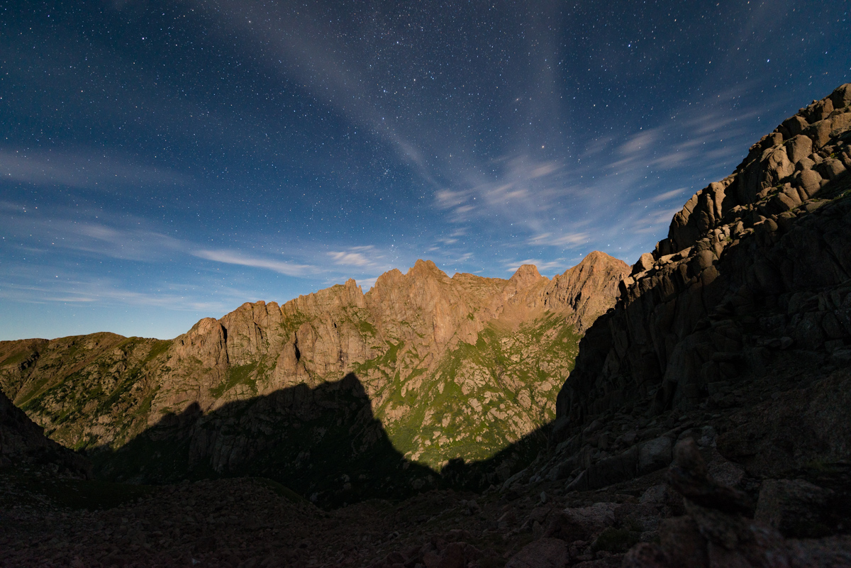
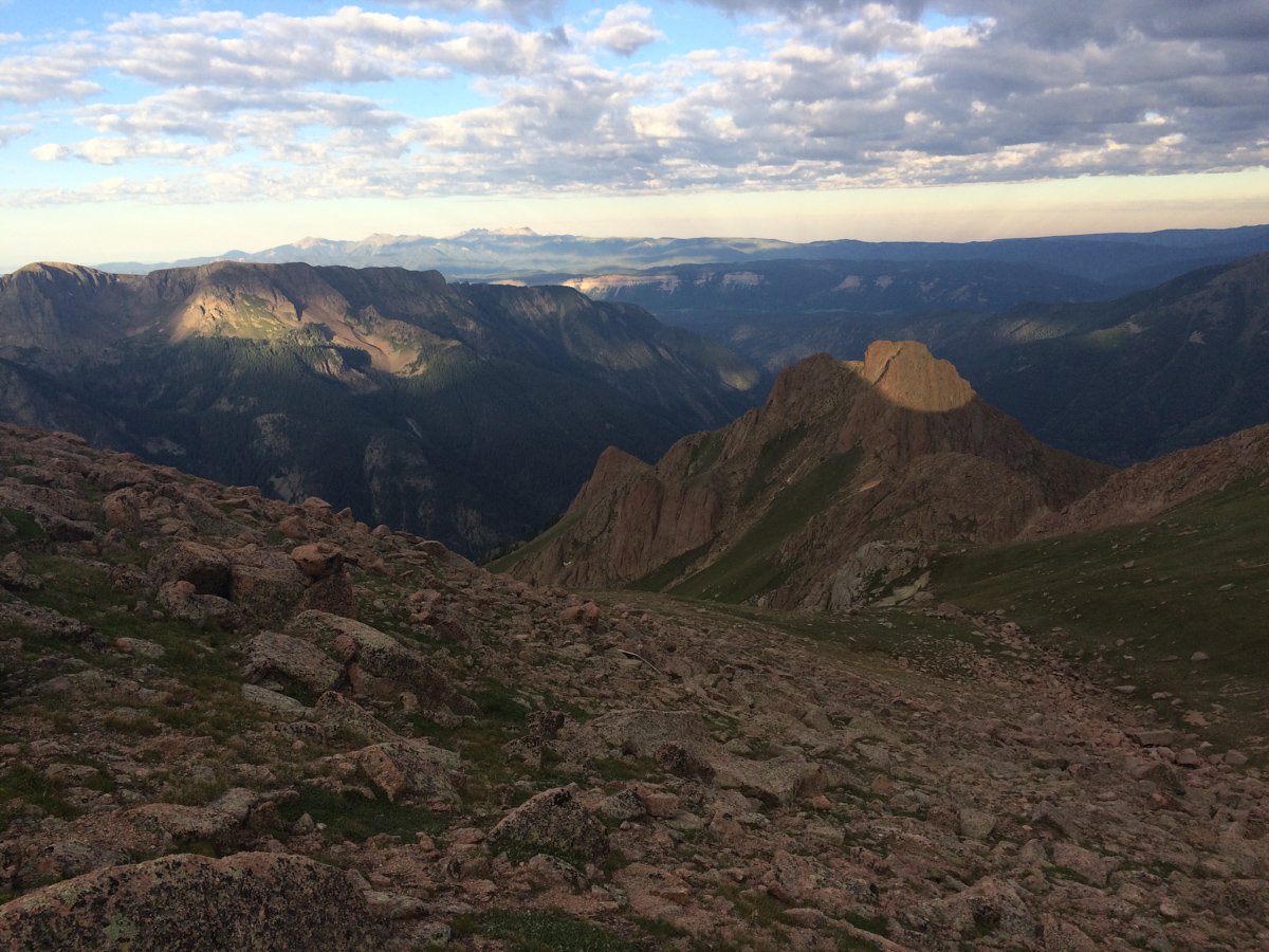
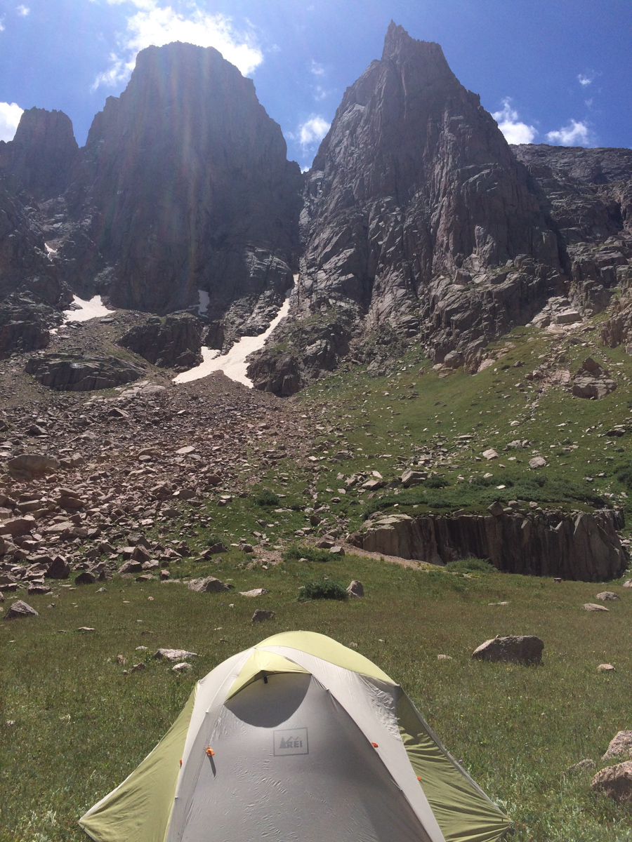
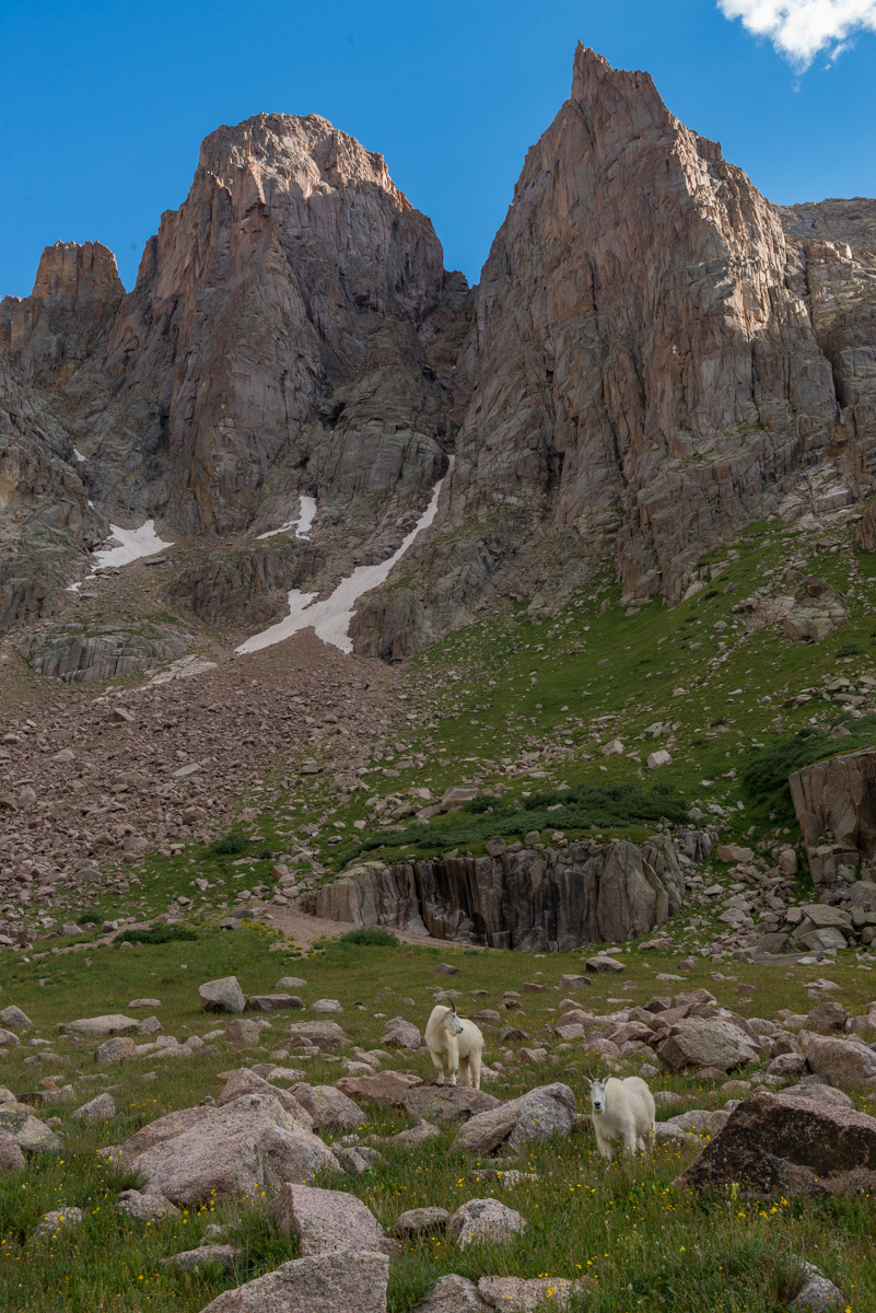
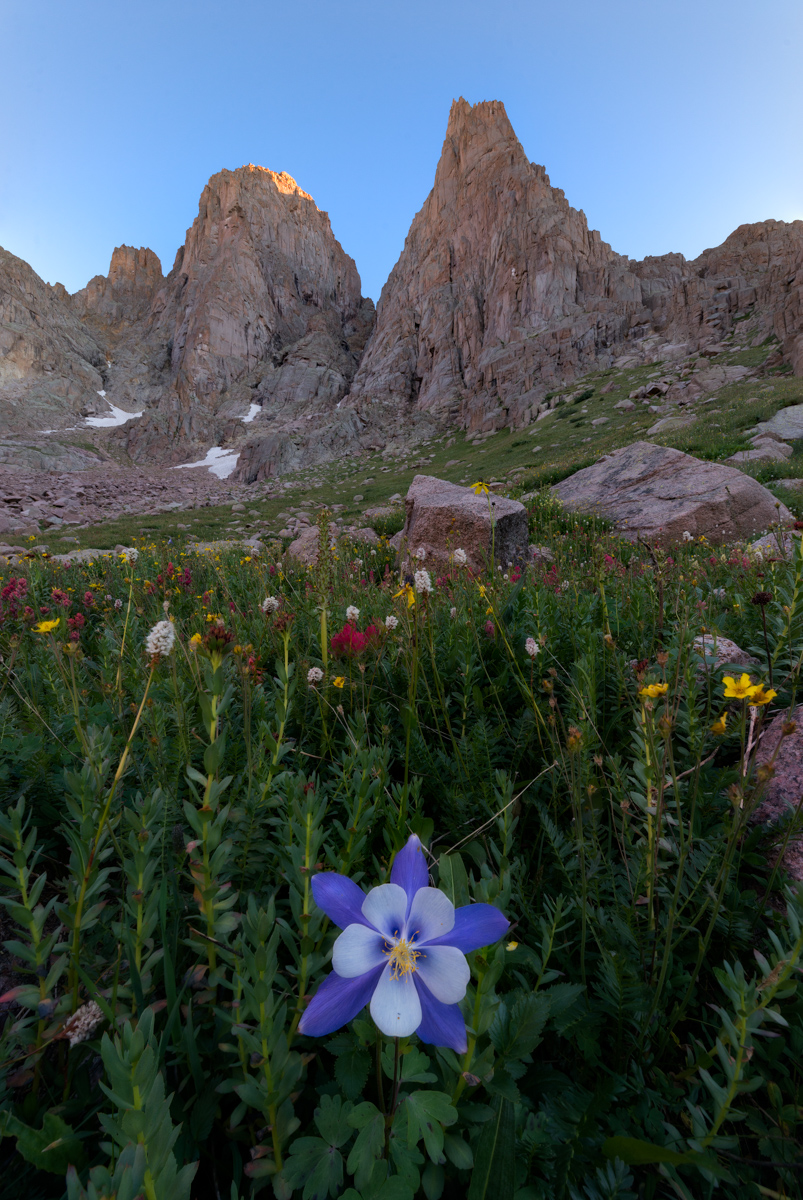
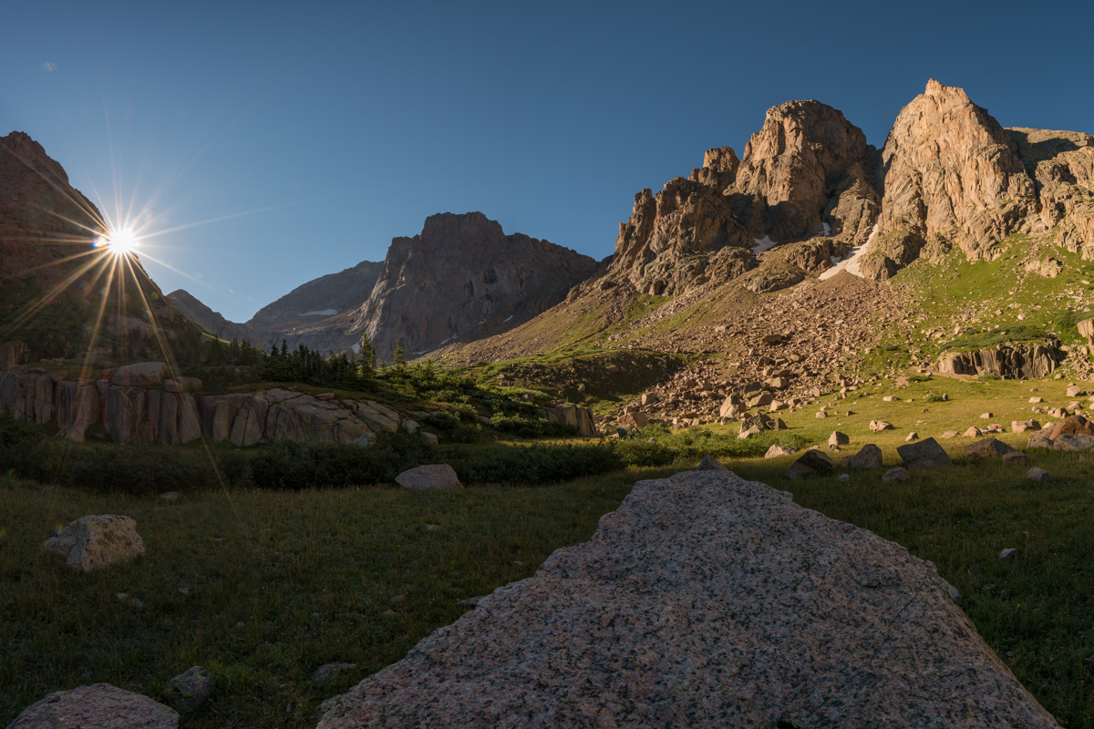
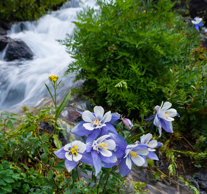
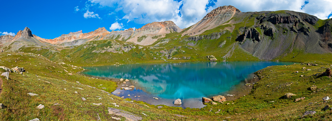
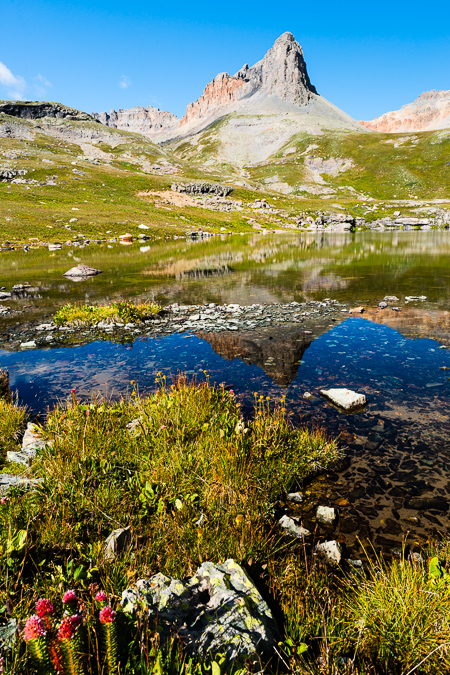
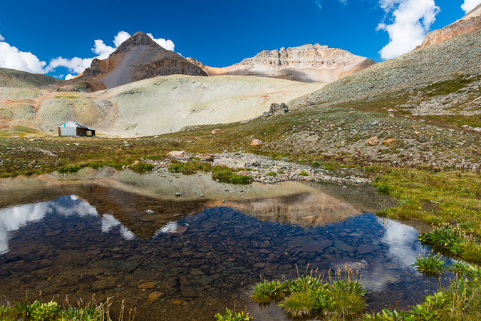
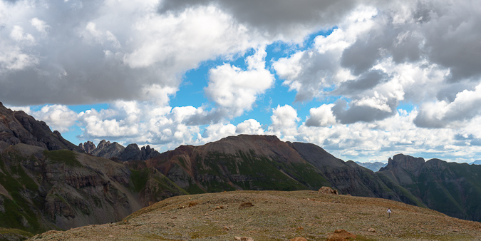
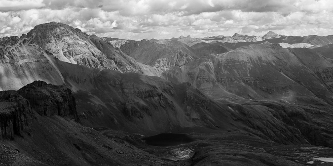
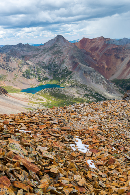
The area just before the lake has ample camping and some great sites near the stream. I opted to find a spot a little higher up near some small trees with a wonderful view of Cathedral Peak (center) and Leahy Peak (right).
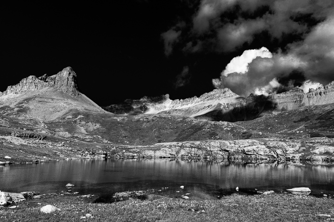
I set-up my campsite at 6:30 PM and began hydrating my dinner. Knowing I would need a good hour for it to hydrate, I hiked to the lake and found some spots to photograph the sunset from. It was really pretty and I was the only person up there except for a fisherman, who left shortly after I arrived. Being the only soul around at a high mountain lake is equal parts scary and serene.
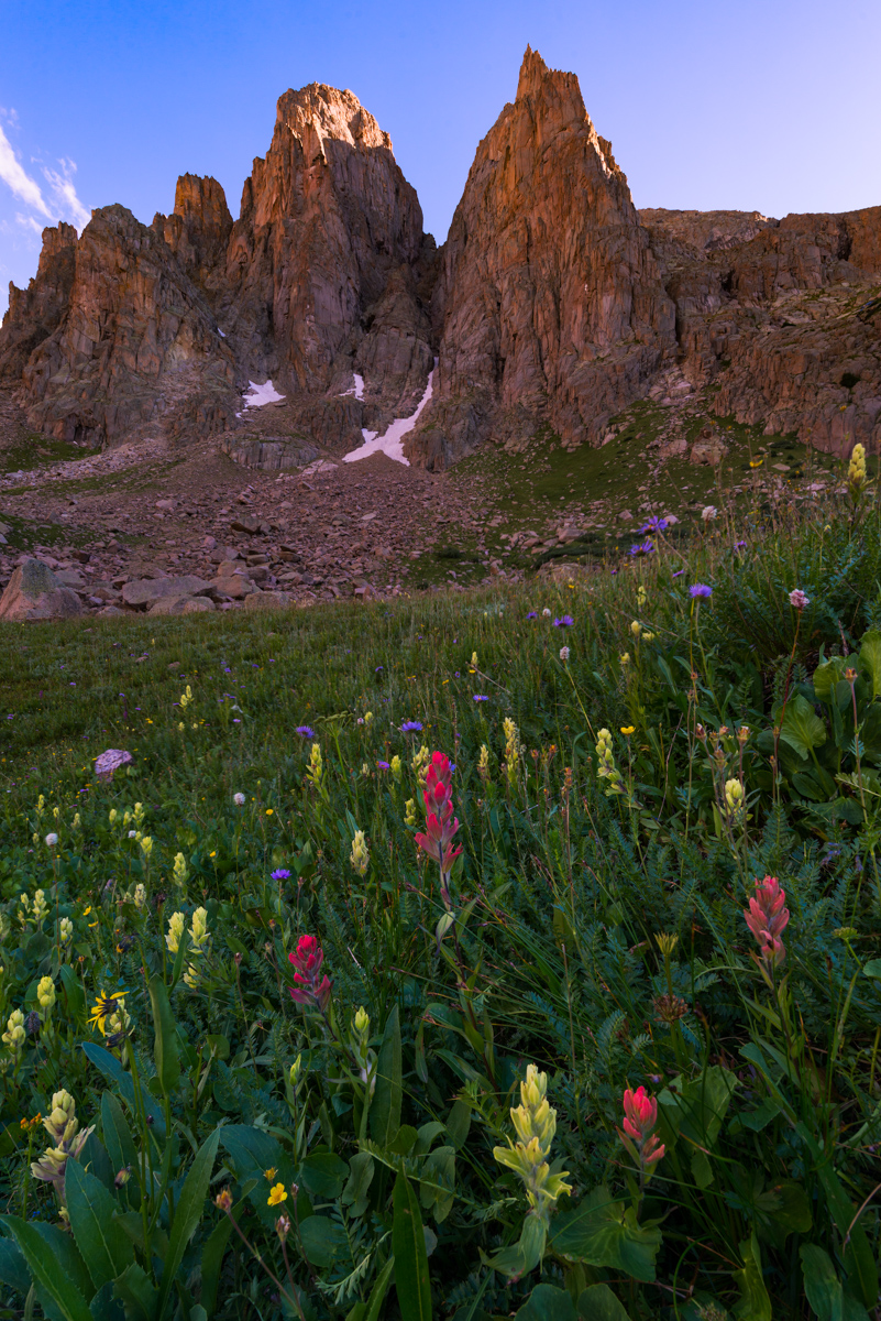
The sunset looked like it would open up over Cathedral Peak, so I repositioned myself on the eastern shore for some great shots of Cathedral Peak.
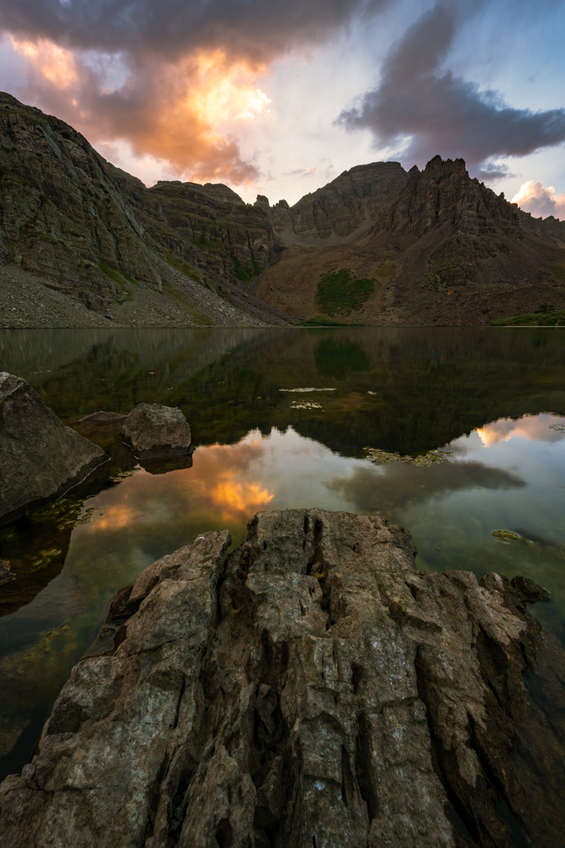
The light was bright, intense, and really colorful.
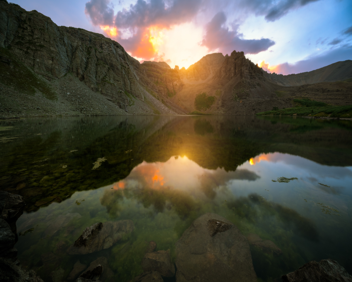
I decided it was time to go back and get ready for bed. I enjoyed one last gaze at the parting light before bed.
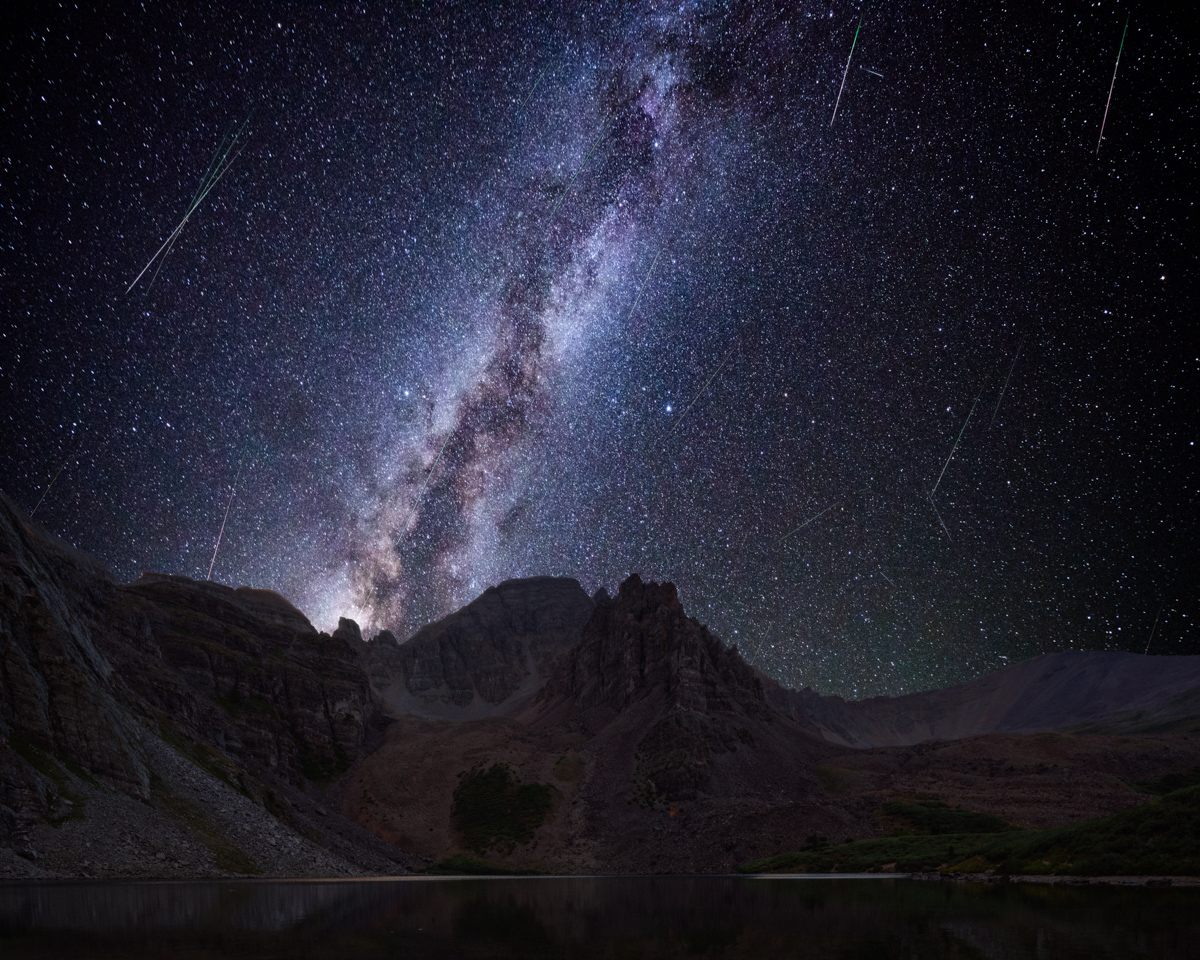
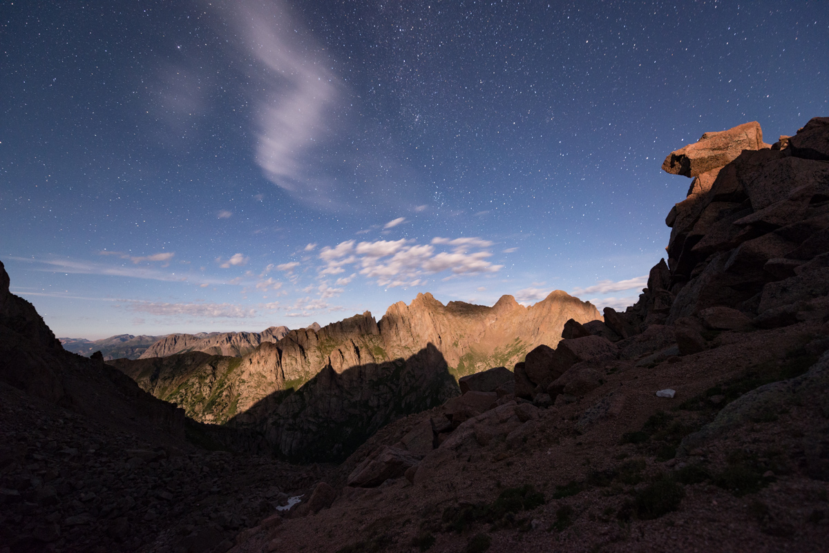
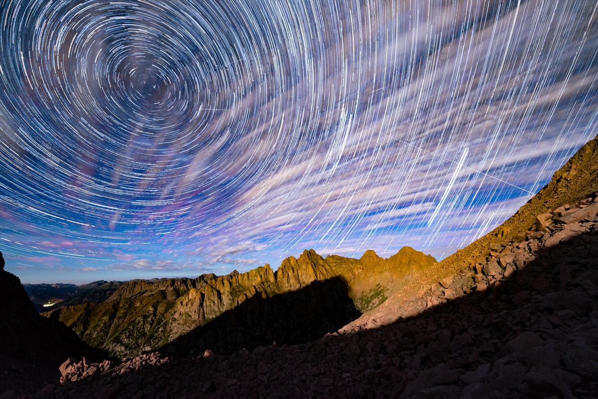
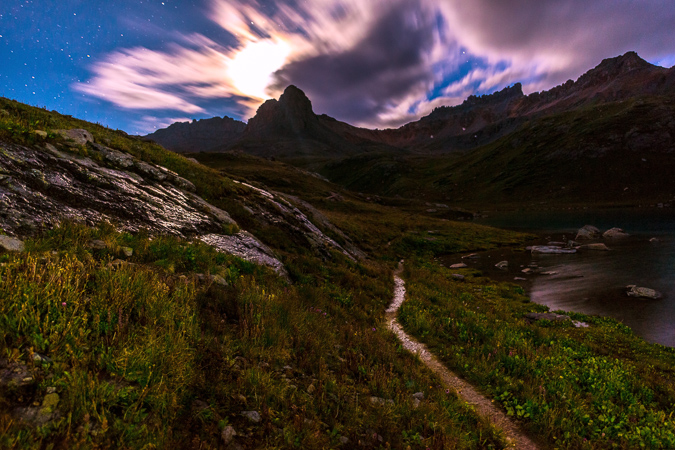
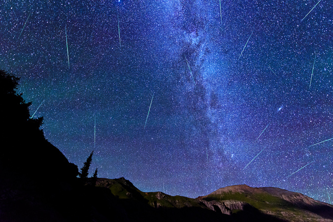
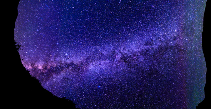
I set my alarm for 1:30 AM so I could photograph the Perseid Meteor Shower. I ended up waking up at 11:30 PM to some strange sounds (maybe just wind). I decided to get up and set-up my camera for the Meteor Shower. The Milky Way was ablaze to the south and I was loving it.
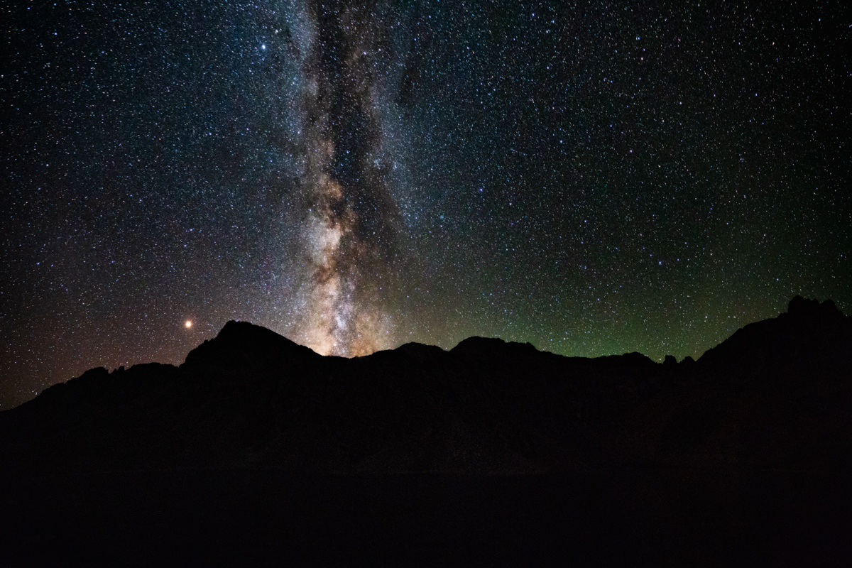
I found a nice compositon including Cathedral Lake and the Milky Way and set-up my camera to shoot on a time-lapse automatically every 31 seconds. I lay on my back and watched the meteors for about an hour or so - it was one of the best displays of the Perseids I could remember. Huge streaks across the sky. It was pitch black - no light from cities, no moon. I decided to leave my camera there all night and get some sleep. I wanted to shoot sunrise from the summit of Cathedral.
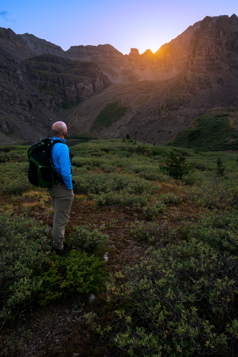
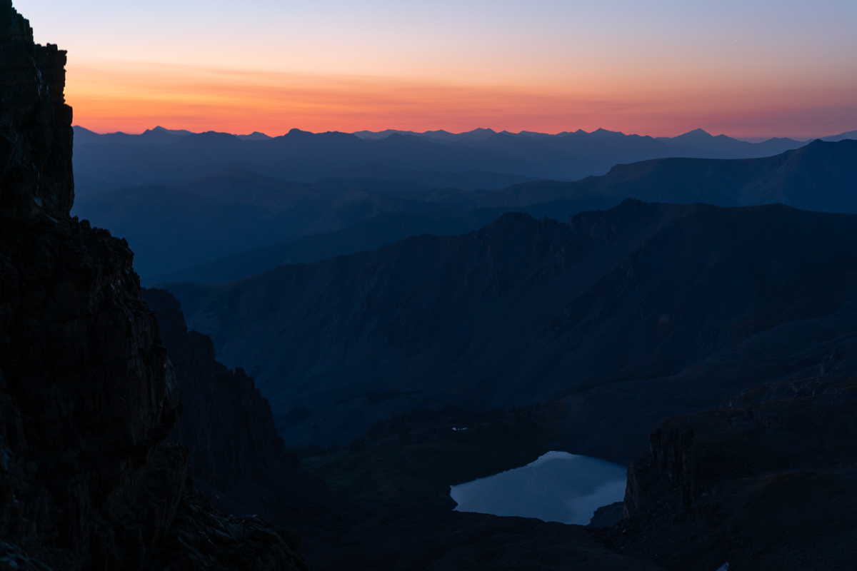
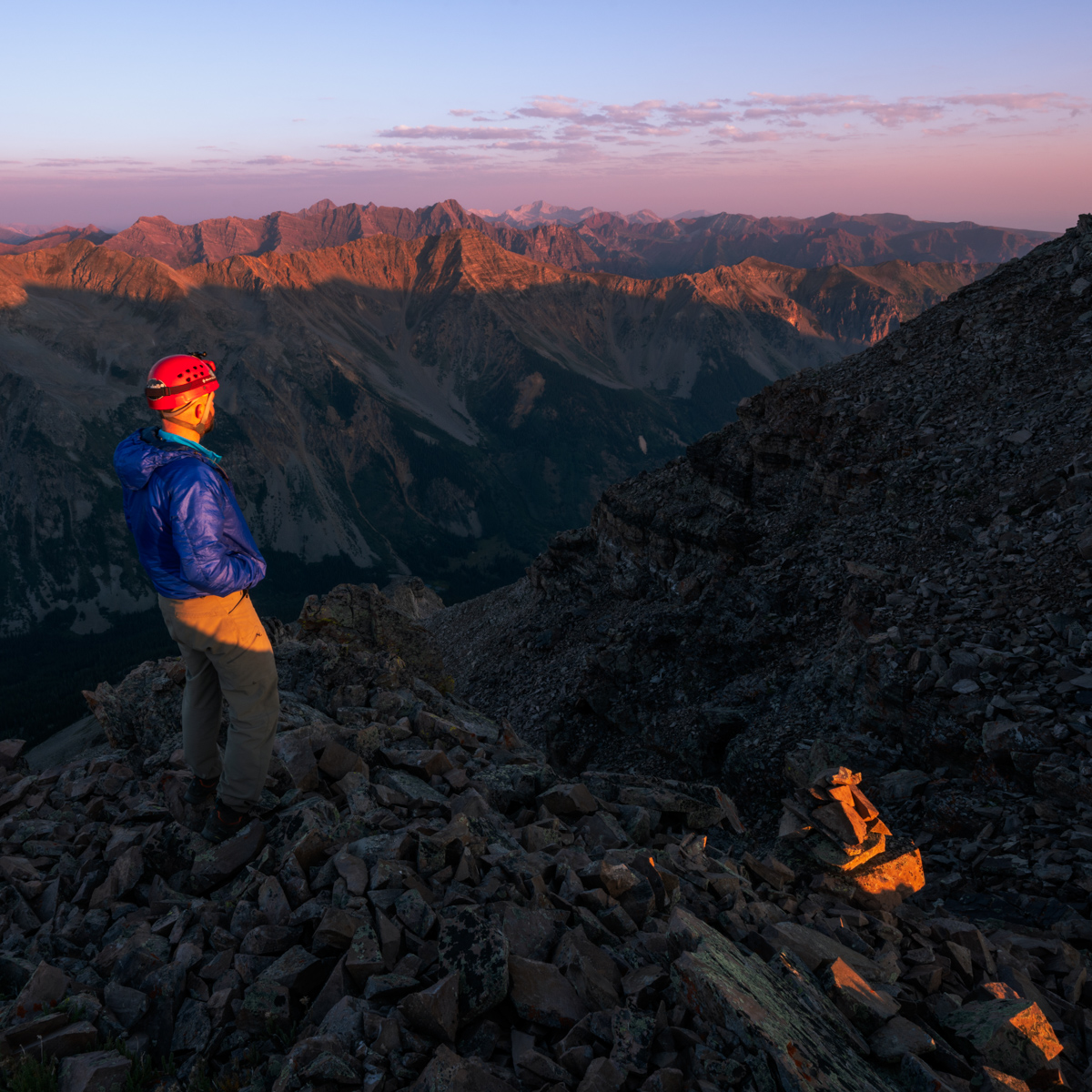
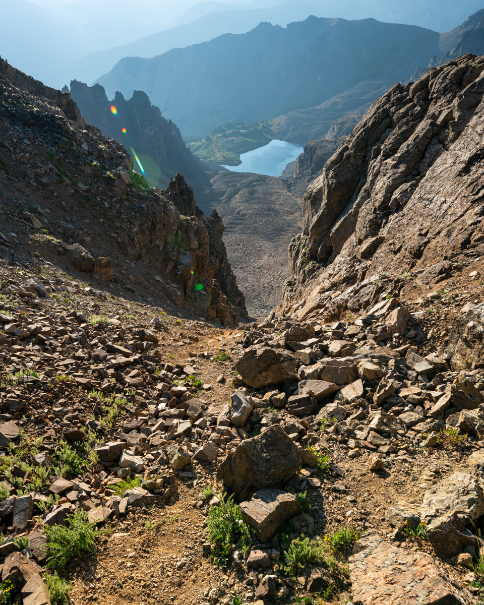
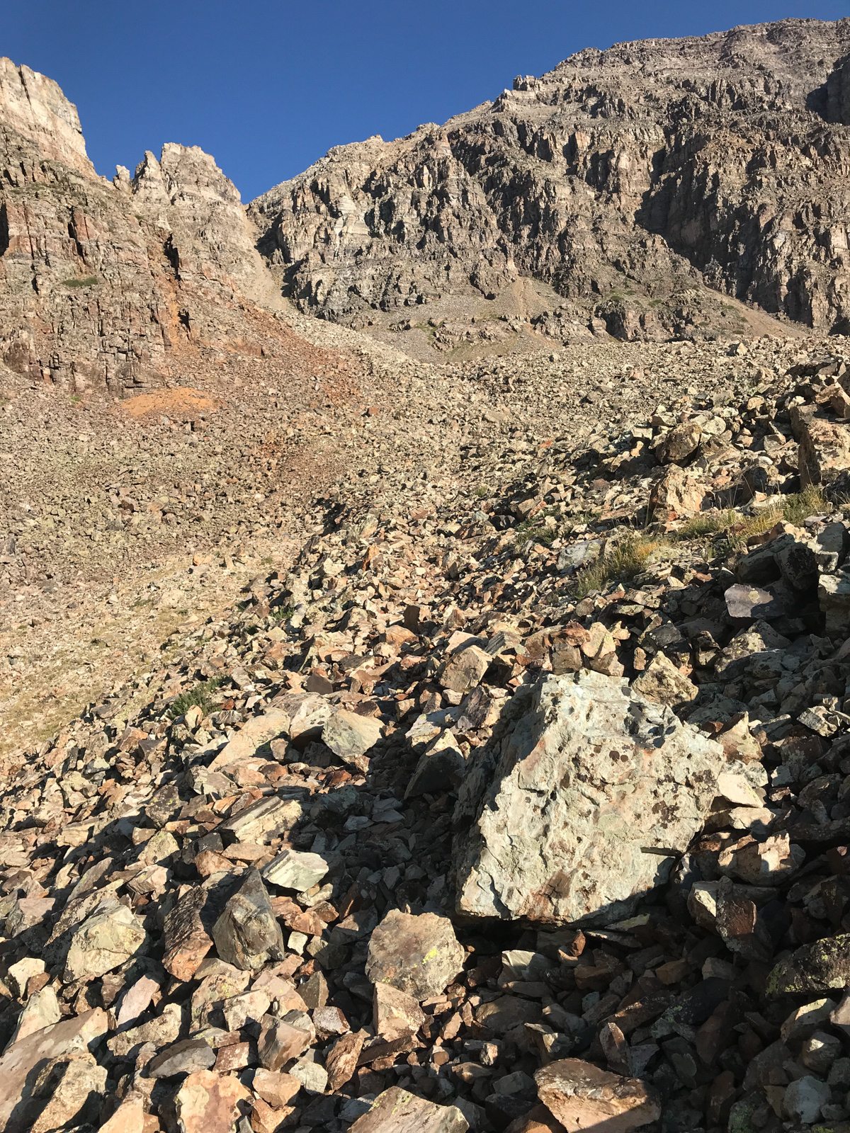
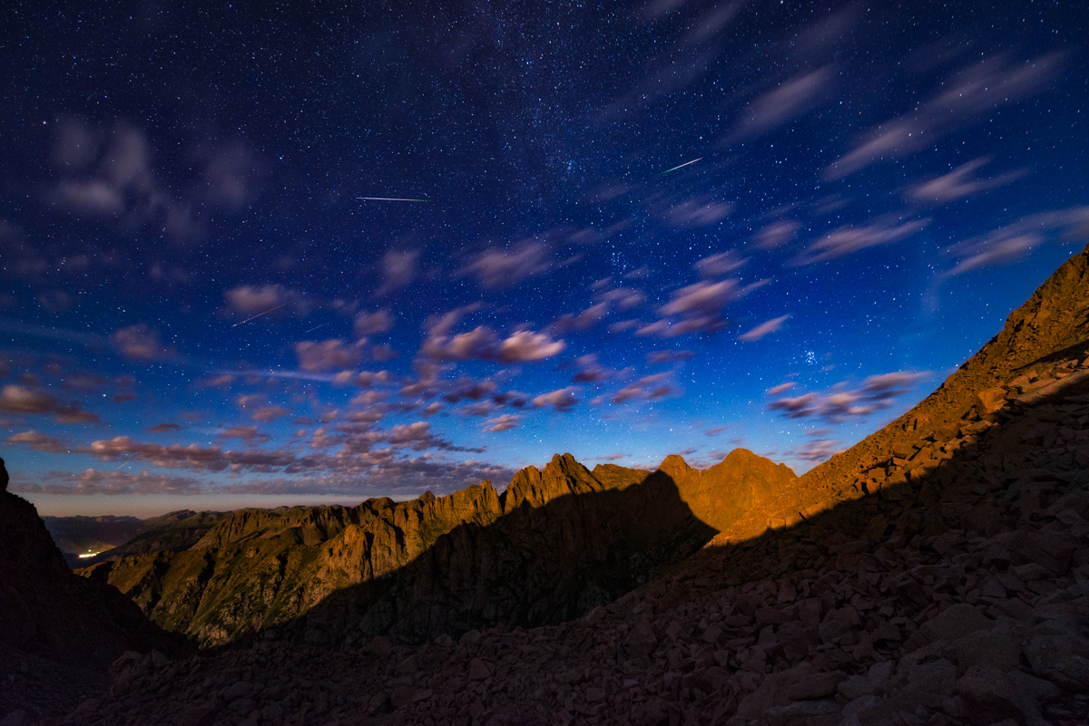
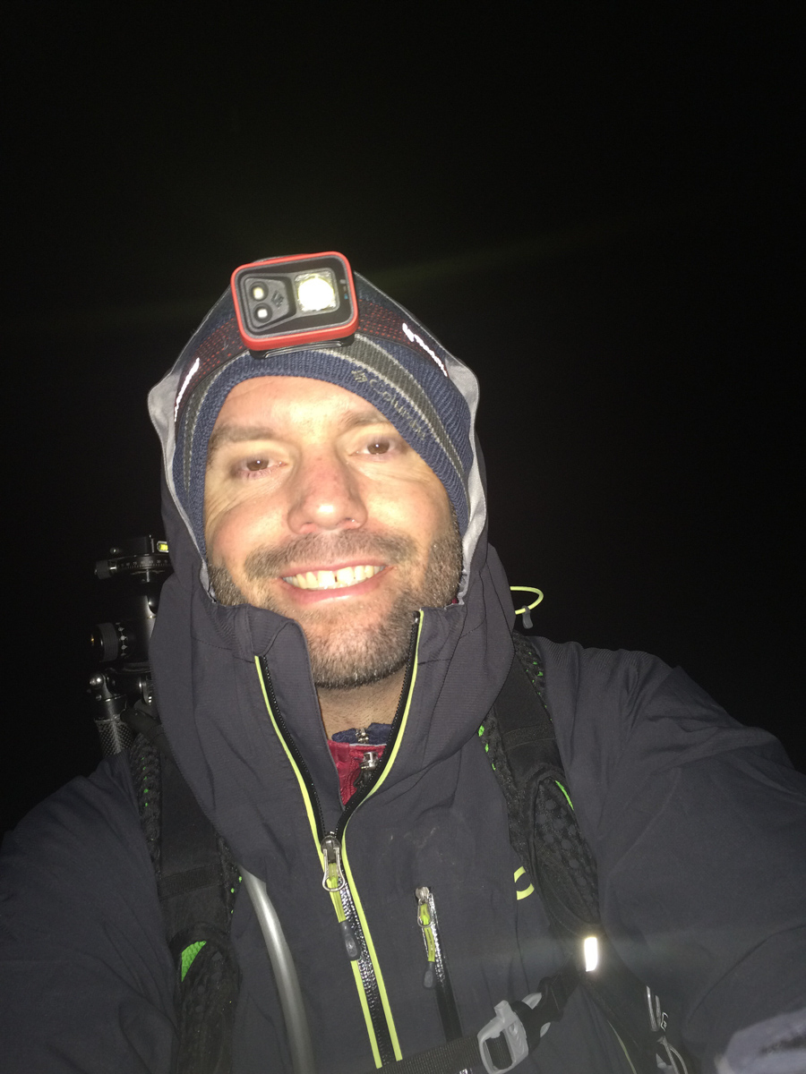
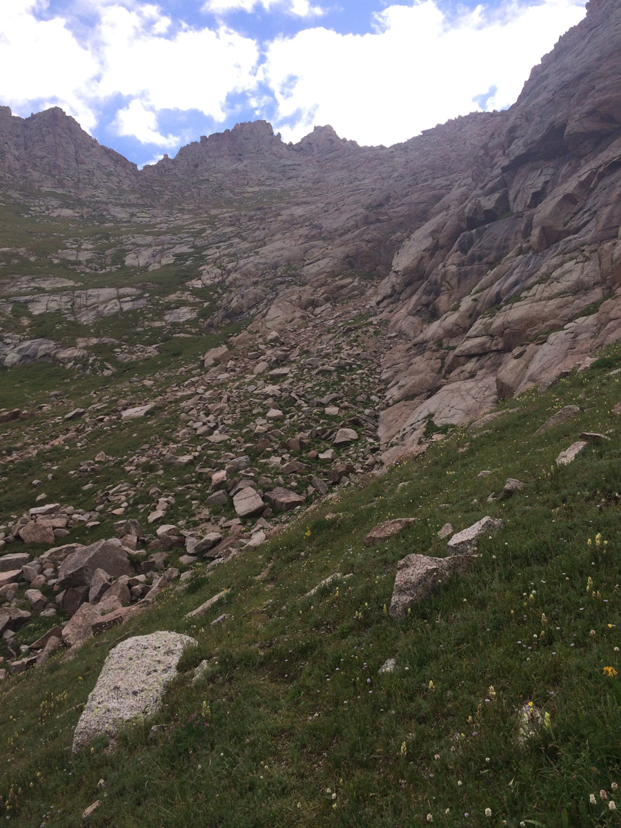
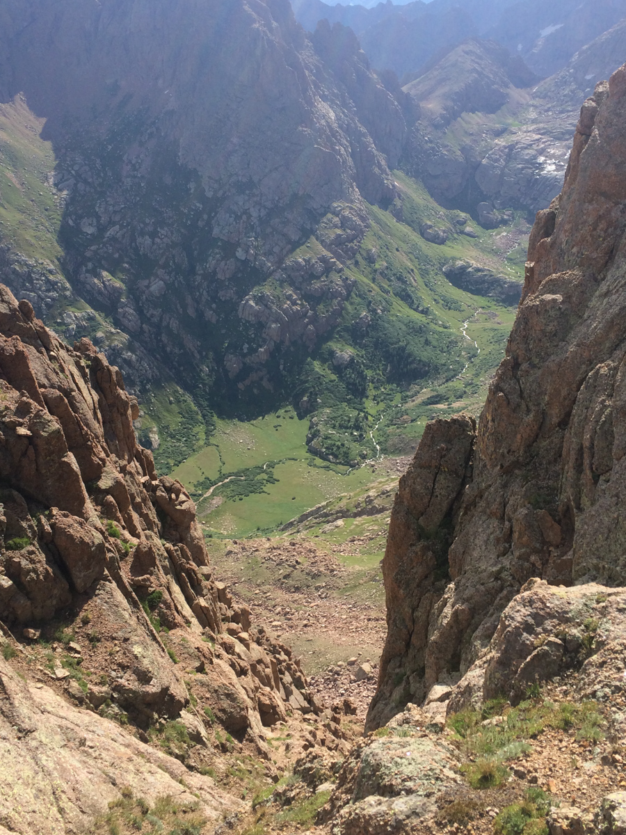
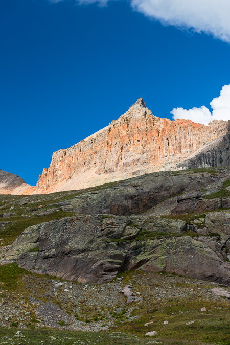
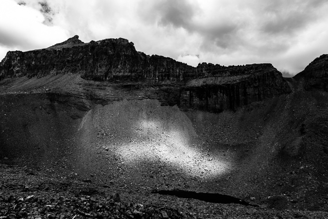
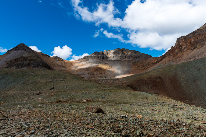
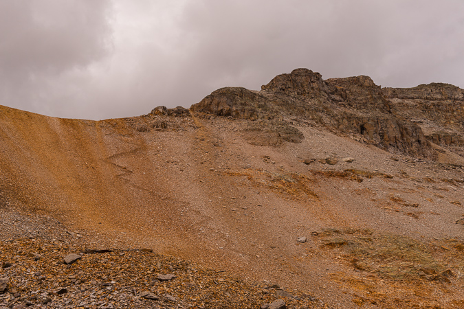
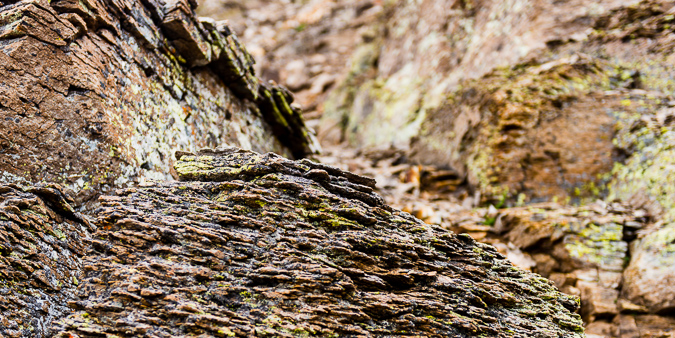
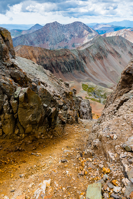
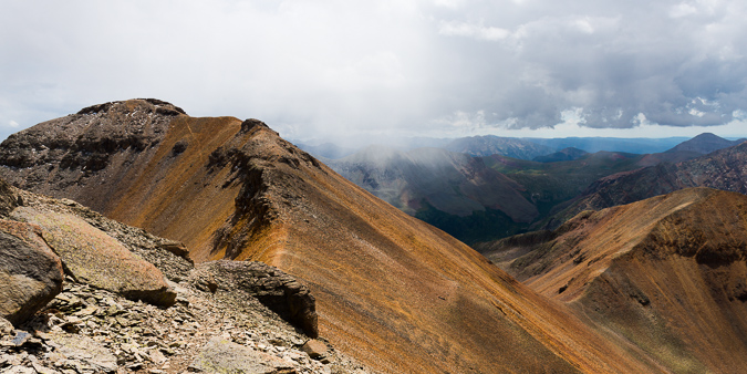
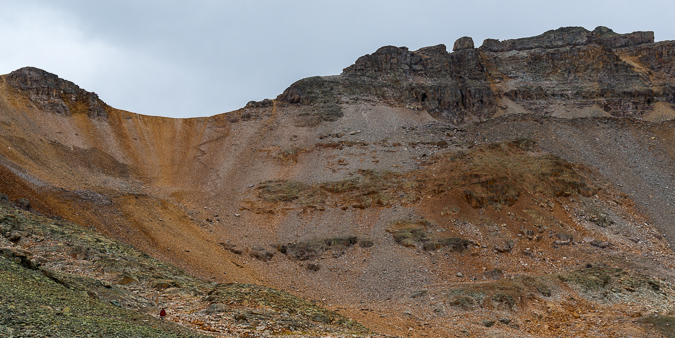
I got up at 3:45 AM, found my camera again, packed it up, and began my journey in the dark up Cathedral, following the description in Roach's book. I was not able to find the "mining trail" he describes until about 500 feet of elevation gain above the lake. I bushwhacked up a steep grassy slope and encountered the great trail heading west. I followed cairns all the way to the base of the infamous gully, where I watched the beginnings of sunrise. The gully itself was atrocious. It was some of the nastiest terrain I can ever recally climbing up. Class 3 loose dirt and rock. Maybe snow climbing would have been fine after-all! Oh well, I suffered up the steep gully and made great time.
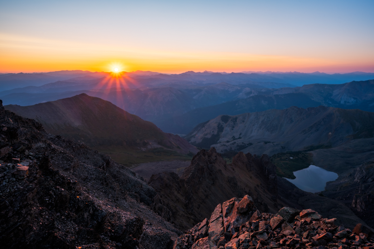
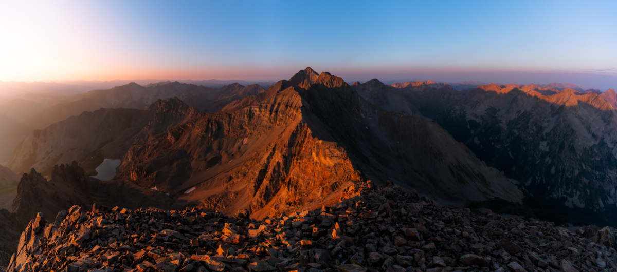
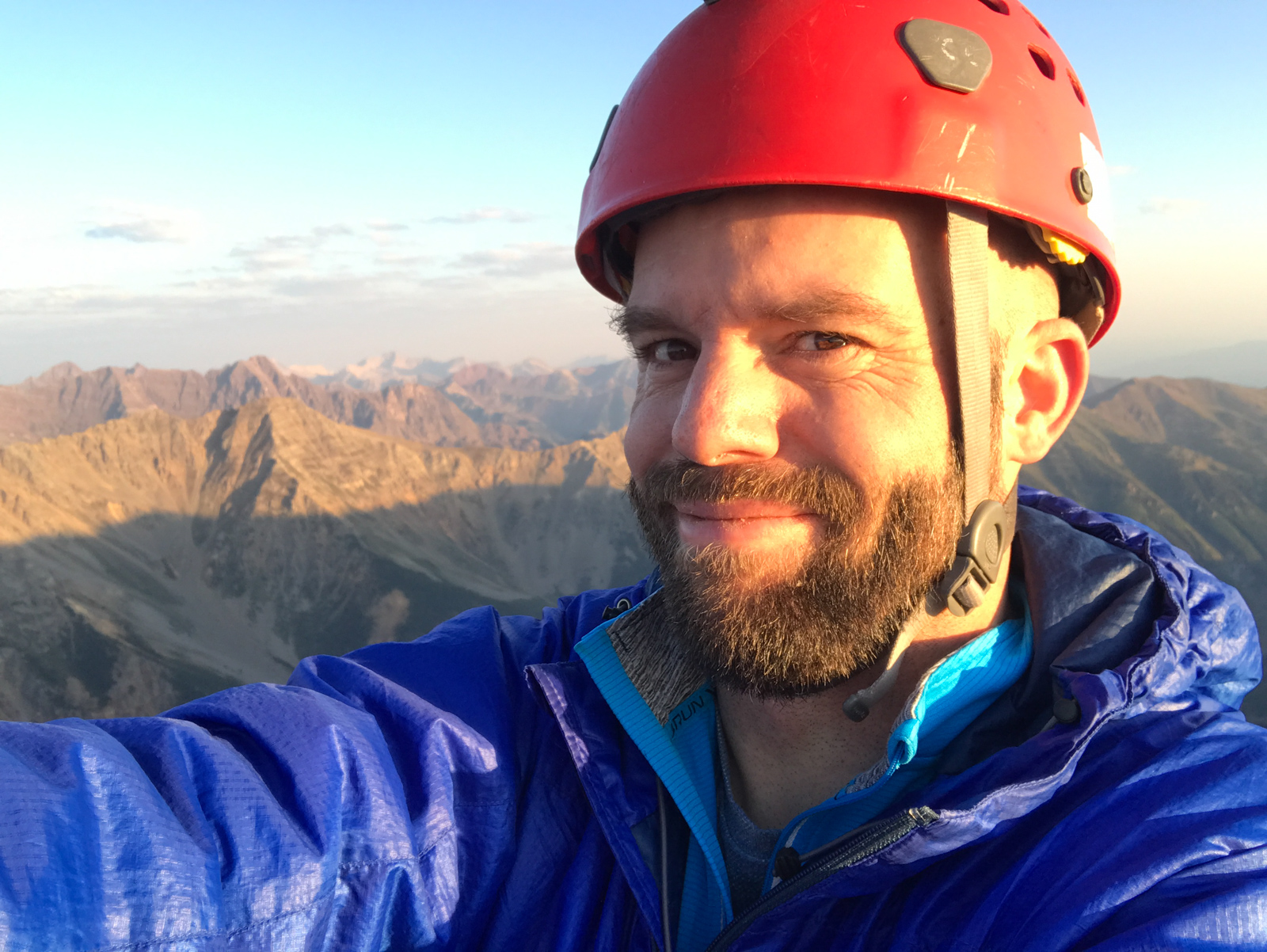
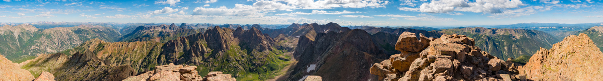
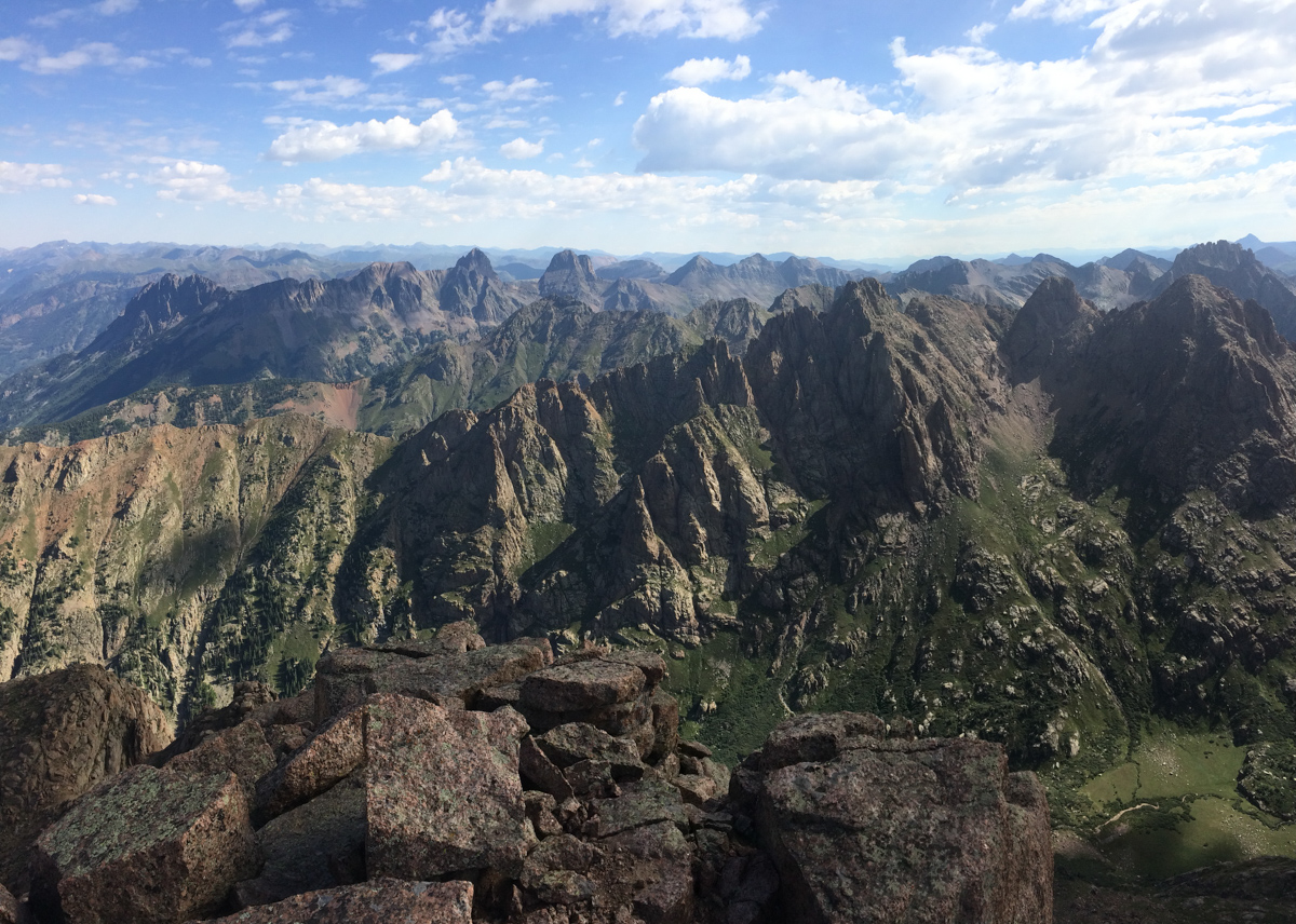
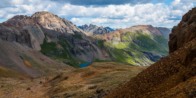
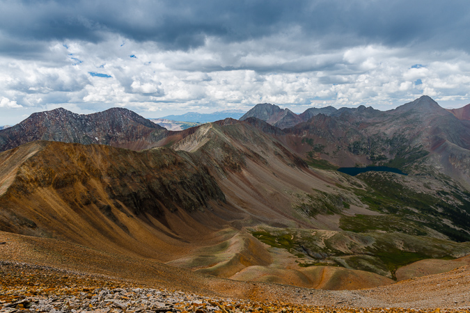
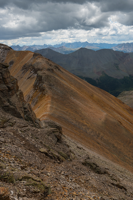
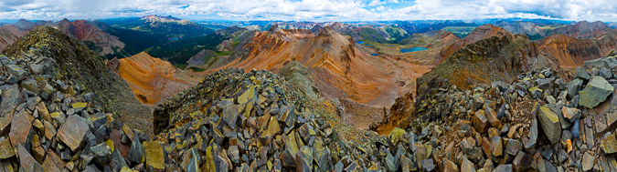
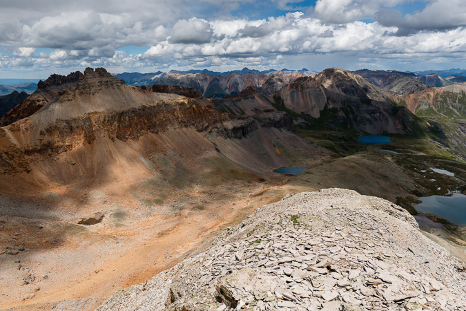
The terrain between the saddle and the summit was pretty interesting. It reminded me of Vermillion Peak or Hagerman Peak. It was loose in spots but relatively easy to find good solid holds. Some care was needed to ensure a good route up, but all-in-all I did not find it overly difficult to ascend. I reached the top just in time for sunrise, which was glorious to say the least!
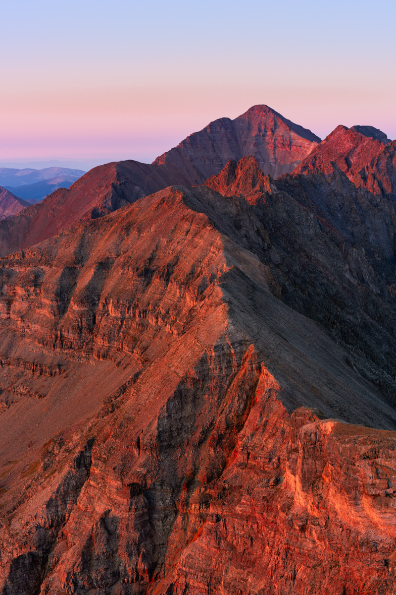
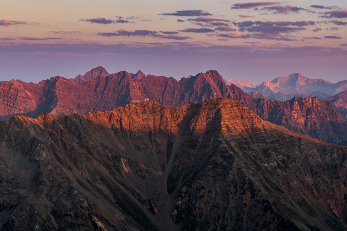
I was so focused on the Elk Mountain 14ers to my west, including the Maroon Bells, Pyramid Peak, and Capitol Peak that I had forgotten about Castle Peak to my south. I caught it in the corner of my eye and my jaw dropped. Castle never looked so good in the early light. So much red!
Of course the Elk Mountain 14ers looked amazing as well.
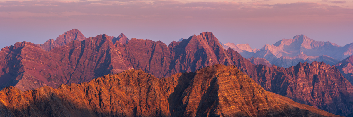
This telephoto rendition showcases all the great peaks, including, from left to right, Maroon Peak, Thunder Pyramid (my last Centennial), North Maroon Peak, Pyramid Peak, and Capitol Peak.
It was a magical display of light and might.
It was maybe not the most incredible display of color that I remember, but it was a damn good sunrise, and I was proud to have photographed another sunrise from the top of a Centennial.
The clouds and haze from the California wildfires added some interesting dynamics as well.
#99 was in the bag! Next up - Thunder Pyramid!
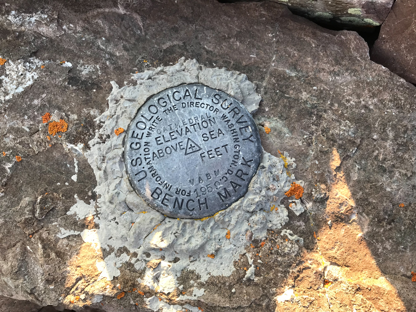
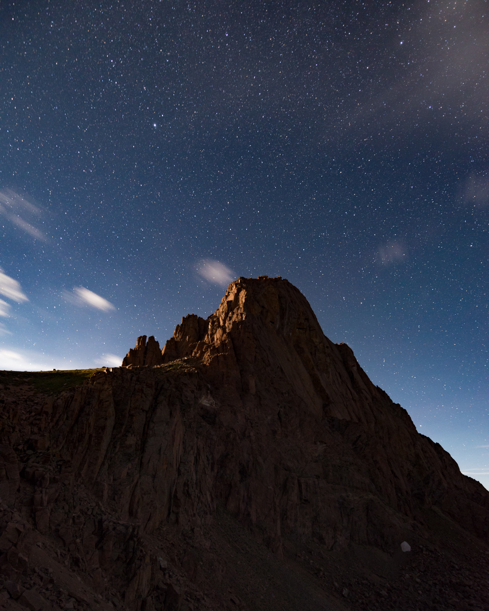
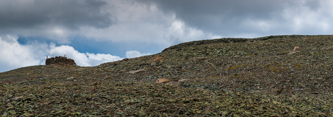
The Cathedral summit marker, looking great after 59 years.
I did not spend a ton of time on the top. I let my friends and family know I had made it to the top and then I made my way down. I reached the gully again in no time and prepared myself for hell.
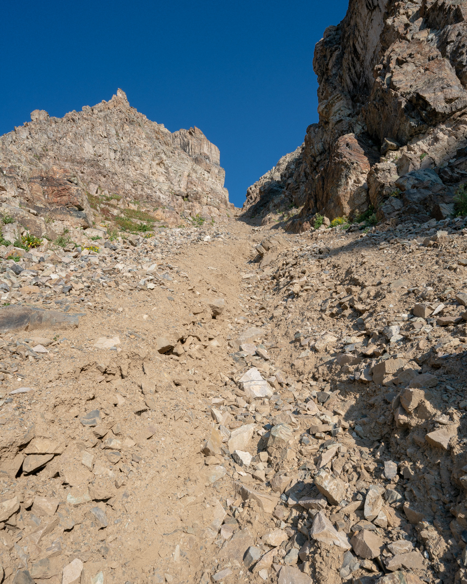
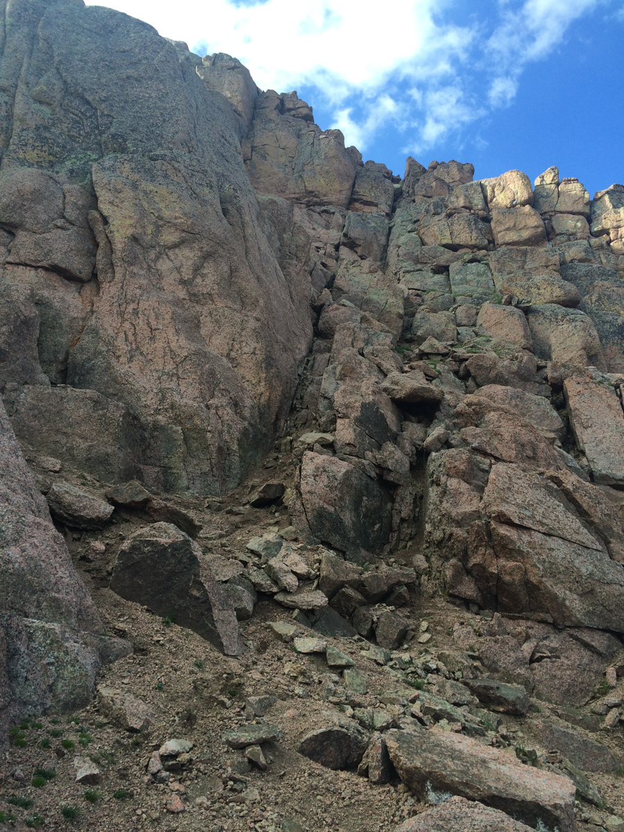
This next photo is looking back up the gully from just a little ways down. It was so steep, loose, and nasty.
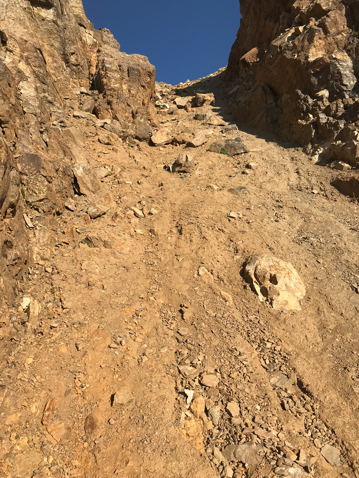
More from the nasty gully, to give you a good sense of what it is like when dry.
I finally reached the bottom of the gully and my feet were sore. What a nasty spot. I don't recommend it.
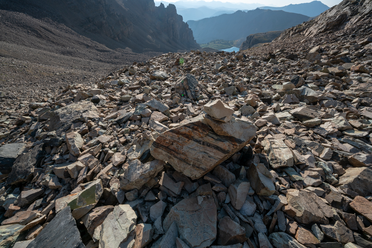
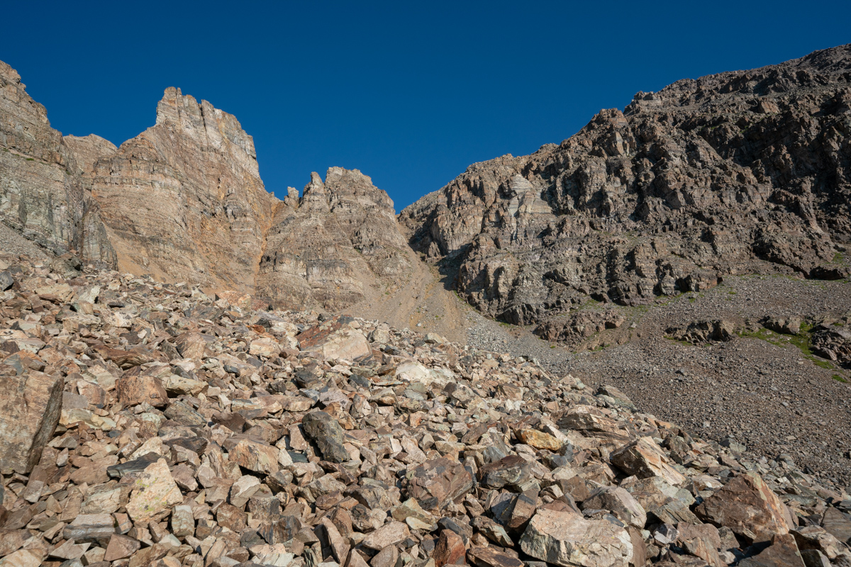
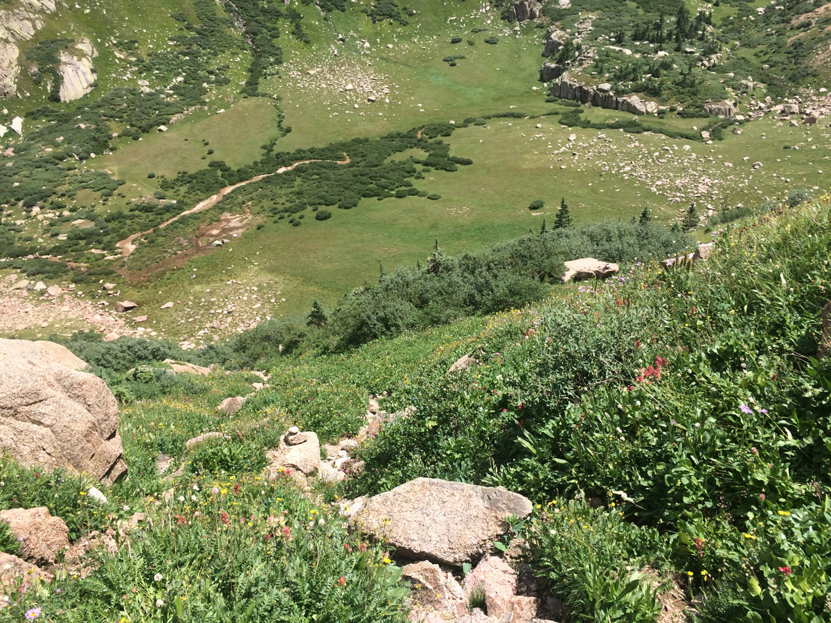
The next photo shows the highest cairn I was able to locate before the gully, in case anyone needs a good marker for their climb. Going down from here was pretty easy on a well-marked trail on precarious but mostly solid rock and boulder.
Here is a look back towards the start of the gully.
And another view of the gully from a little lower.
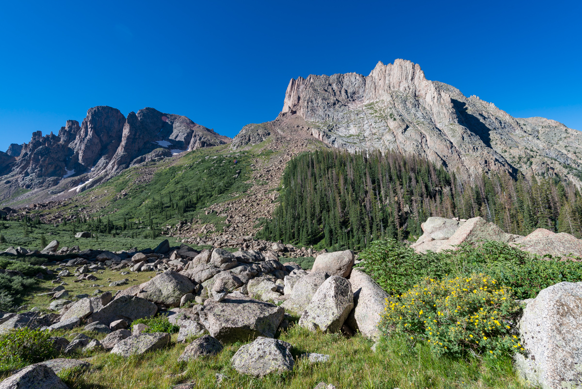
I loved the castle-like rock formations here, they were really cool to look at.
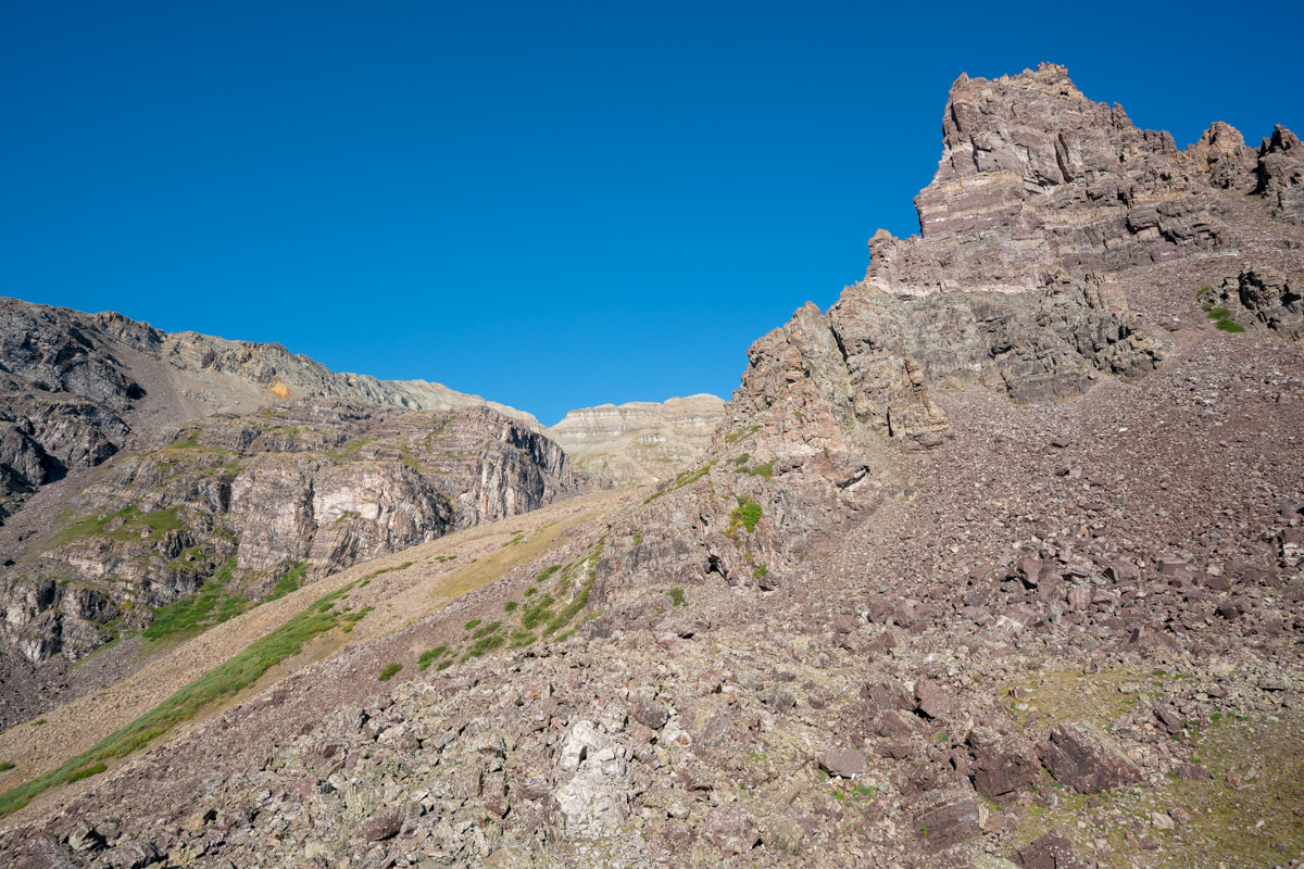
The eastern wing of Cathedral was especially impressive, towering over the whole area like some sort of watchman.
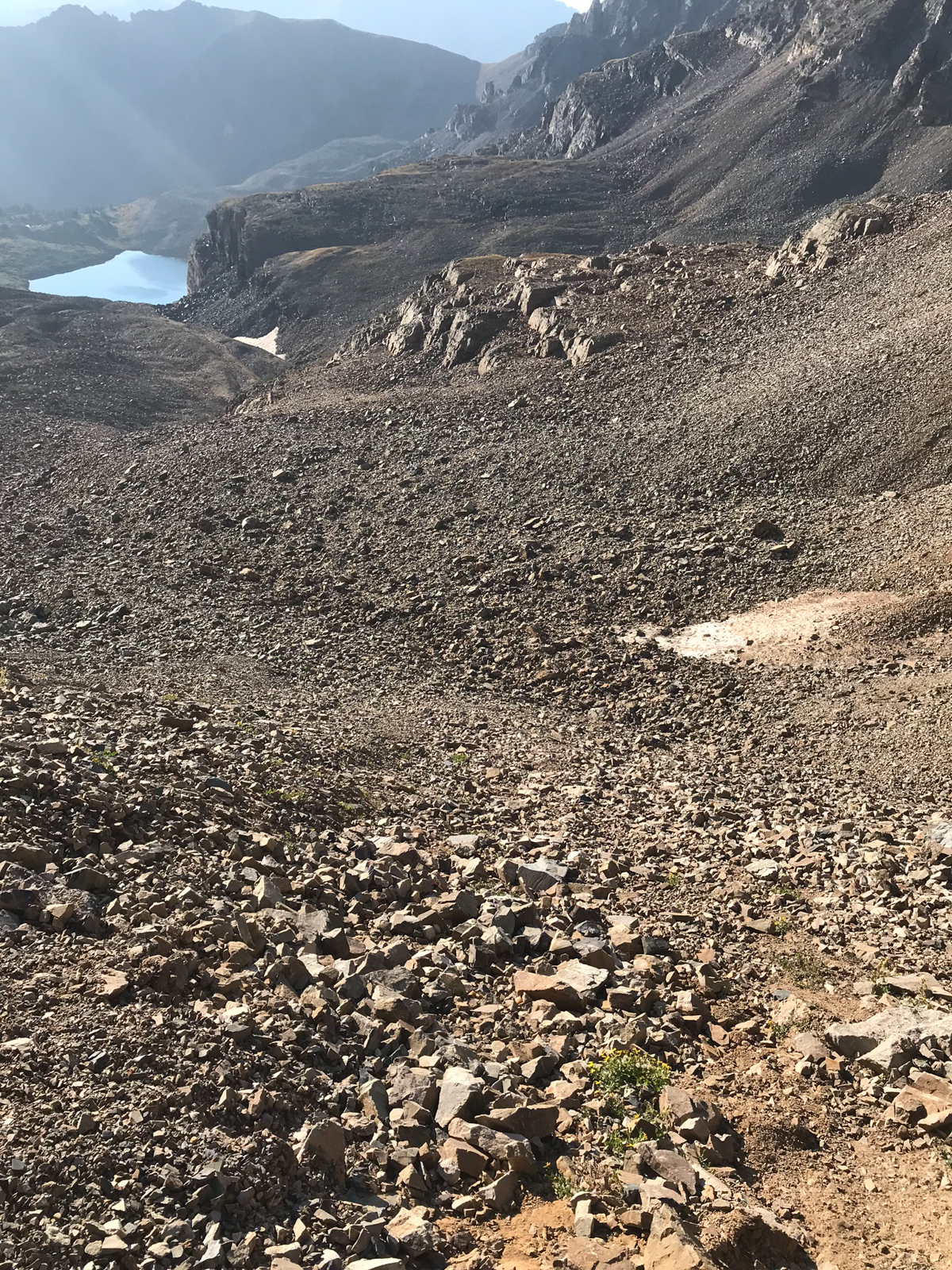
I made it back to my campsite at about 9 AM. I felt great about my time and my legs and feet were feeling strong still. The next photo shows a zoomed in view of the gully (right of middle) and shows just how crazy steep it is.
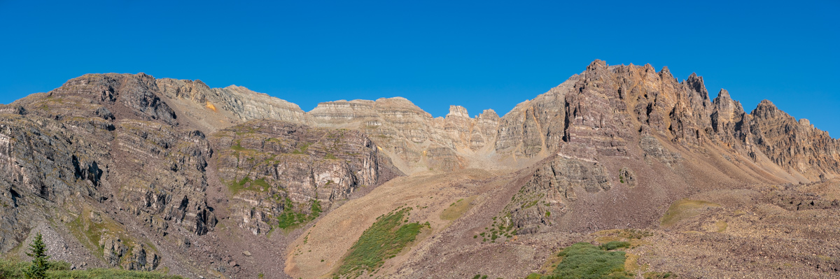
I took one more parting panorama of the area from camp to remember the day.
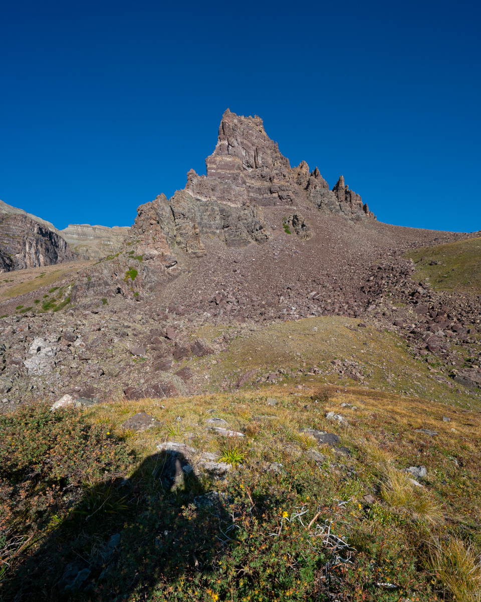
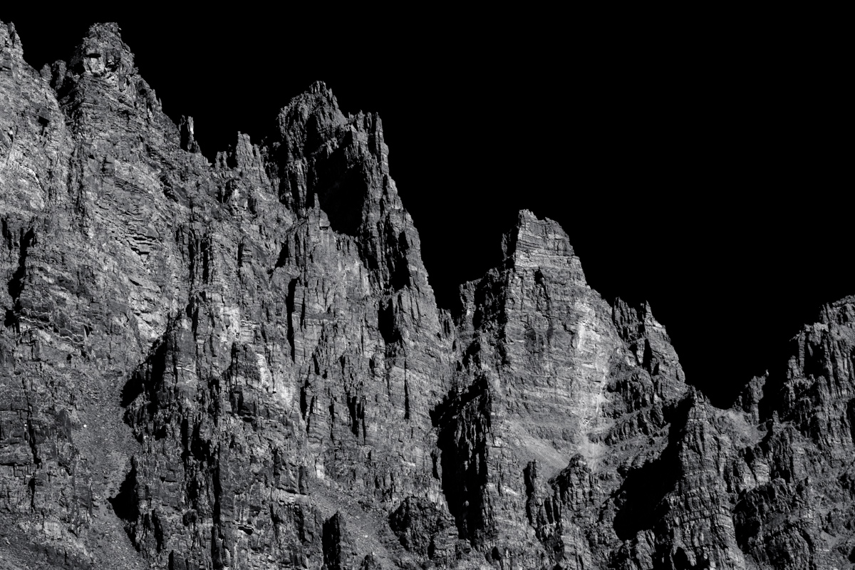
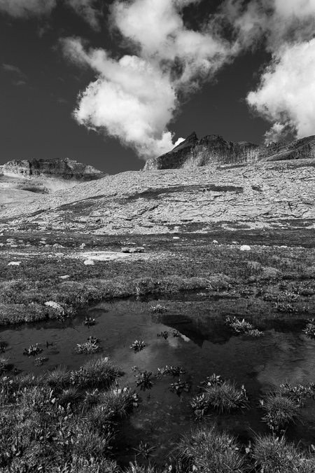
I could not help but get a telephoto black and white shot of the pinnacles east of Cathedral - so impressive!
Farewell Cathedral! Your eastern friend Leahy Peak looks way more inviting! =)
Thanks for reading. I hope you enjoyed my photos and description. One more to go!
Climbing Pigeon Peak & Turret Peak via Ruby Basin - a sleepless soul-filling adventure

I first admired Pigeon Peak's utterly impressive east face from the summit of Arrow Peak in 2010 on one of the most epic trips I've been on in my life. Ever since then, I knew that a trip up Pigeon Peak would be in my future. It only took 6 years, but I finally pulled it off. If someone would have told me at the start of the year that I was going to photograph the Perseid Meteor Shower from the saddle between Pigeon Peak and Turret Peak this year I would have just laughed it off. After living in Portland, Oregon for two years, I had developed a bit of a beer gut and lost some of my "mountaineering shape" I had worked on while going after the 14ers from 2008 - 2012. A year ago the idea of pushing myself hard enough to photograph the best meteor shower of the year from 13,000 ft. would have been laughable... but here we are in 2016 and that's exactly what I did. In fact, the details of my trip, in retrospect, are a bit staggering to take in, at least for my old 37-year-old body. The full details show nicely on my GaiaGPS track, which is downloadable. You can purchase GaiaGPS here and help support the site.
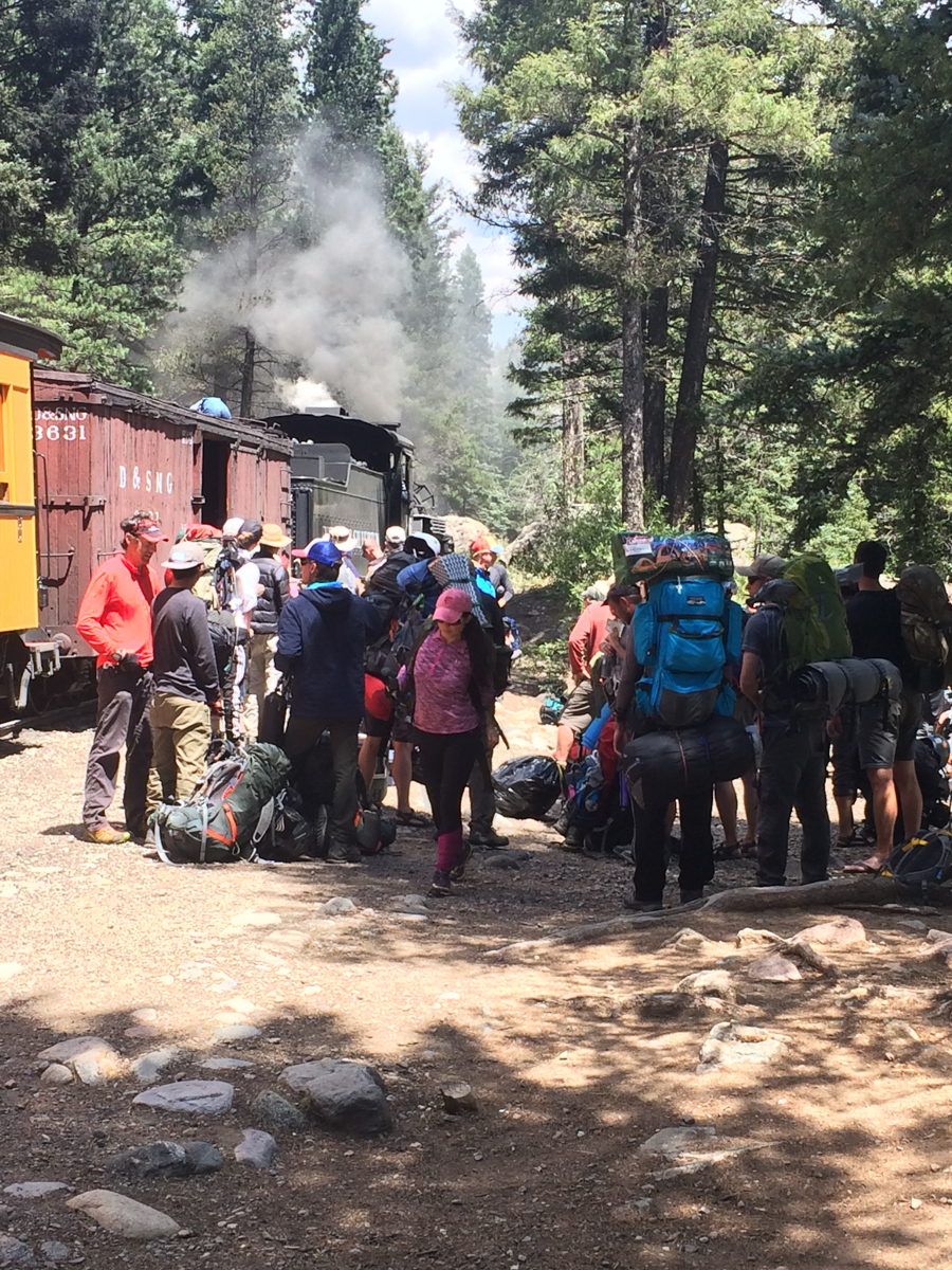
8/12/16 - 8:30 AM - depart Durango on the Durango & Silverton Narrow Gauge train
8/12/16 - 11:30 AM - dropped off at Needleton by the Durango & Silverton Narrow Gauge train
8/12/16 - 3:00 PM - arrived at Ruby Lake
8/12/16 - 5:00 PM - arrived at meadow in upper Ruby Basin below Turret Needles
8/12/16 - 10:30 PM - departed without sleep for the Turret Peak / Pigeon Peak saddle to photograph the Perseid Meteor Shower
8/12/16 - 11:45 PM - arrived at Pigeon / Turret saddle and began photographing Perseid Meteor Shower
8/13/16 - 2:00 AM - moon sets (still no sleep, too cold)
8/13/16 - 4:30 AM - arrived at Turret Peak summit
8/13/16 - 5:21 AM - began photographing sunrise from Turret Peak summit
8/13/16 - 6:15 AM - left Turret Peak summit to head back to saddle
8/13/16 - 6:45 AM - arrived at saddle
8/13/16 - 8:00 AM - arrived at secondary saddle to enter North Pigeon Creek basin and descend down 1,700 ft. to climb Pigeon Peak
8/13/16 - 8:15 AM - arrived at base of Pigeon Peak on northwest side of Pigeon
8/13/16 - 9:40 AM - arrived at summit block of Pigeon and class 4 section
8/13/16 - 10:00 AM - arrived on Pigeon summit
8/13/16 - 11:30 AM - arrived at secondary saddle and began to regain Pigeon / Turret saddle
8/13/16 - 12:55 PM - arrived back at camp in upper Ruby Basin (commence sleep for the first time since 6 AM on 8/12/16 - that's 31 hours of being awake without sleep)
8/13/16 - 7:00 PM - photograph sunset from upper Ruby Basin
8/14/16 - 7:30 AM - photograph sunrise from upper Ruby Basin
8/14/16 - 9:00 AM - leave upper Ruby Basin and hike out
8/14/16 - 10:00 AM - arrive at Ruby Lake
8/14/16 - 12:05 PM - arrive at Needleton and wait for train
The grand total was 9,286 ft. of vertical ascent in 10 hrs, 52 mins of movement with a total of 19.3 miles of distance covered. Not bad!
To some (like Andrew Hamilton) those stats not might seem very impressive, but it felt pretty great to me, especially considering the extra 10 pounds of photography weight I was carrying.
So, from the beginning... where was I? Ah, yes, taking the train from Durango. I had originally planned on going to climb Silex and The Guardian with Natalie Moran from 14ers.com, who I had done Dallas Peak and Teakettle Mountain with me back in 2013; however, I did not think I was going to be able to get the day off of work, so I cancelled... and at the last minute on Thursday night I was able to swing the day off, so I made hasty plans to get Pigeon and Turret under my belt. Knowing that the Perseid Meteor Shower was peaking Thursday and Friday night with the radiant (the part of the sky where the meteors originate) coming out of the north east, I made plans to hike all the way up into Ruby Basin and try for the Pigeon / Turret saddle with a view looking north east towards Animas Mountain and Monitor Peak, all illuminated by the setting moon until 2 AM. These plans were of course made possible by studying maps, reading Roach's 13ers guide, and by using a great app called PhotoPills, which I've written more about HERE.
The trip on the train went without a hitch and the scenery was nice, but nothing compared to what was in store for me soon.
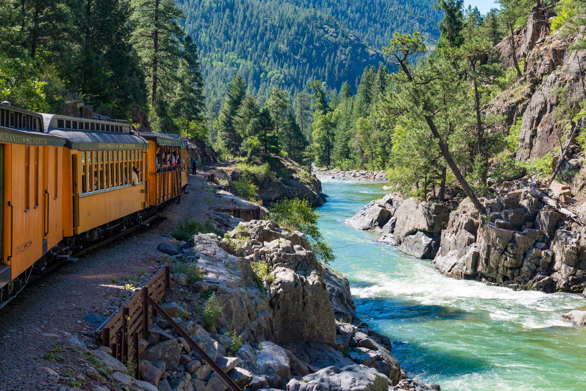
The train stopped at Needleton and at least 40 people got off to begin their backpacking trips in the area. The brakeman responsible for unloading the packs was throwing them off the box car in a rush, much to everyone's dismay. Water bottles, food, stoves, bags, and more went flying out of people's packs. I later found that my water filter was damaged in the ordeal. I was thinking about filing a complaint with the train company becuase this employee clearly did not care about anyone's stuff. I was lucky none of my camera equipment was damaged. I crossed the bridge over the Animas and watched as everyone else headed south towards Chicago Basin, while I went north for Ruby Lake & Ruby Basin. It turned out only two other people from our train went up into Ruby Basin with me, but I would not run into them until my second day. In preparation for this backpack, I read and re-read Roach's descriptions for the approach. It sounded pretty intense: "...this is a very rough approach. A direct ascent up Ruby Creek from the Animas is so difficult it has left several strong people speechless." Wow, those are pretty strong words from Roach, who I have often teased in other trip reports as being vague or non-descript. I took Roach's cautionary words with a grain of salt and went for it. I felt pretty strong and was up to the task, so I began. Luckily, I had my friend Natalie Moran's GPS track downloaded into my phone via GaiaGPS so that I could roughly keep track of the trail. This was particularly helpful right off the bat when trying to locate the turn-off from the Animas River Trail into North Pigeon Creek.
Shortly into this trail, it became steep. Steep and unrelenting. I had pared down my pack weight to 38 pounds, not bad considering all of my camera gear; however, this trail was downright brutal. Roach was not joking. I kept my eyes peeled for a carving of a columbine flower, which was supposed to signify that I was on the right trail up to Ruby Lake; but, I never did find it on the way up. I figured out later what I did wrong though. When I reached the small creek crossing for North Pigeon Creek (the only one), I spotted what I thought was the trail up off to the left on the side of the hill. That is the trail I followed (which eventually petered out and ended up in a bushwhack straight up until I found the right trail). The correct trail was to the right and up from the creek crossing, which I learned on the way back down. At least the views back across the Animas towards West Needle Mountain and the Twilights was great.
In preparation for this trip, I was looking through lots of trip reports and stumbled across a familar name. It was the name of one of my newest co-workers, Terri Horvath, who is a bi-Centennial finisher (she's climbed the highest 200 mountains in Colorado). Terri provided me with some excellent tips which kept me from going even more off course than I already had, including some solid advice in locating the "high trail" that Roach describes in his route descriptions. Right after a very steep step down, I looked to the right to find the proper trail. This trail worked steeply up and down above Ruby Lake and finally dropped me right at the base of the lower lake, with views of Ruby Lake finally realized.
Upon reaching Ruby Lake, I ran into a group of five guys from Denver that were really great to chat with, one of which being a fellow photographer named Jarad Switzer. We commiserated on the gruelling hike into the basin and then I shared my plans to shoot the meteor shower that night which I think left them all thinking I was a little bit crazy. Was I? Probably. I kept a solid pace up to the lake, making it there in 3 hours 30 minutes from Needleton. I continued on. The views of Pigeon began to blow me away. This thing is truly unbelievable!
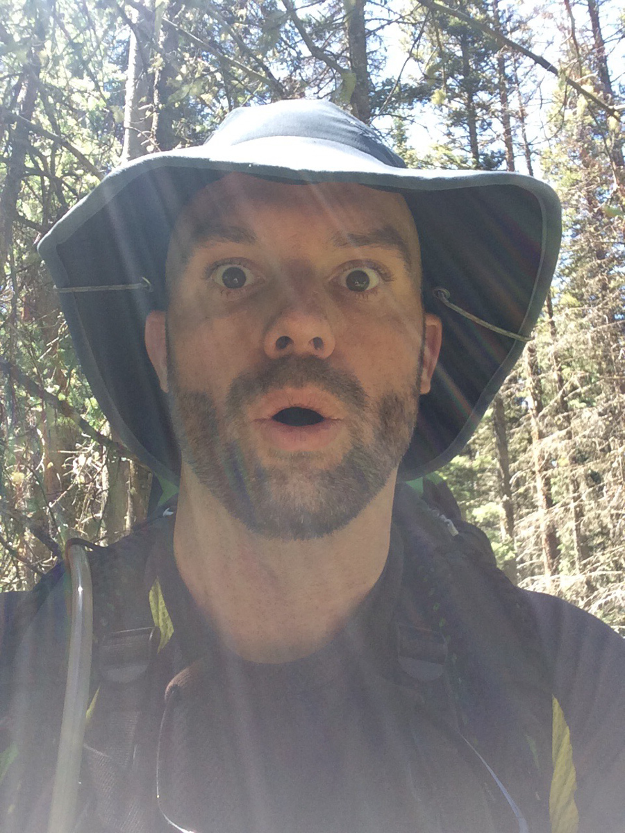
The trail became really hard to follow after the lake and was really only followable due to some well-placed cairns (thank you to whoever put those there). It weaved left above the cliffs at the headwall of the lake and through some really rugged terrain consisting of many fallen trees and steep hillsides. It reminded me quite a bit of No Name Creek, just one basin north of where I was at. My expression tells the story, I think.
Upon breaking into upper Ruby Basin, the trail flattened out considerably and opened up to some amazing views above. The willow maze in the upper basin was actually not that hard to navigate, having been trampled through enough times to make it easy to find the weaknesses. The meadow in the upper basin below the Turret Needles and Pigeon came into view and I was quite excited until I noticed two other tents. I was hopeful that the people camped there would not mind another person joining them in the meadow. It turns out that the meadow is quite large and it would take quite a few parties worth of tents to fill it up. I arrived at the meadow at 5 PM and was pretty exhausted. I was at the opposite end of the meadow from these other backpackers, who later informed me that they had unsuccessfully attempted the east face of Pigeon earlier in the day which caught my attention. The climber, named Rex (or Max,?) explained that he had climbed Pigeon's east face 20 years prior and that he wanted to see if he could do it again. Impressive! I set up my tent and destroyed my dinner in preparation for a night of photography and sleeplessness. I had hoped to catch some sleep, which was really just a pipe dream. No sleep was obtained. I did get some decent photos around camp though.
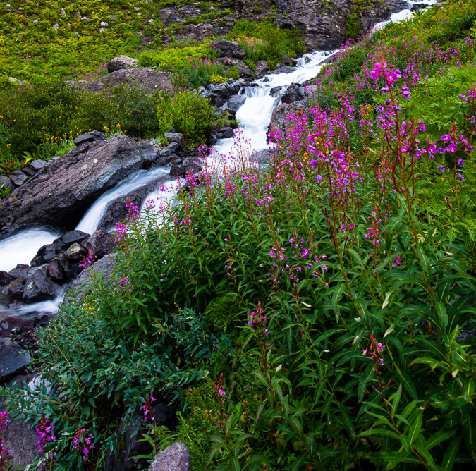
The Turret Needles were the most impressive feature of the basin and I decided to camp right below them about 100 feet away from the stream. Knowing that I would not have any trees to hang my food from, I had purchased an Ursack the day before from Backcountry Experience in Durango. The Ursack is designed to withstand the chewing of rodents like marmots and mice, which I anticipated finding lots of at the upper basin. I also employed a technique that I read about in another trip report where I suspended my food sack from the side of a cliff - a technique I also used at Lillie Lake on my Chicago Basin backpacking trip in 2011. At any rate, the wildflowers were still quite prolific in the upper basin, and I was pretty much in heaven as a photographer.
I shot exclusively with my Nikon 14-24 f/2.8 lens, and my Nikon 24-70 f/2.8 lens attached to my Nikon D800, which is getting a bit long in the tooth. Someday I'd love to upgrade to a D810 or maybe something lighter from Fuji or Sony.
I set my alarm for 10:20 PM, but never actually slept. When the alarm went off, I bounced right out of my sleeping bag and out the door. The climber I met in the meadow had indicated that the "best" route up to the saddle was to take a little gully just to the left of where it looked like the obvious trail went. Taking their advice in the dark was pretty daunting - but it did manage to get me up very high quickly above the meadow. I followed cairns in the dark and enjoyed the views behind me of Animas Mountain and Monitor Peak, which were illuminated by the moon. Pigeon cast a long shadow across the peaks and was a constant reminder of just how much more climbing was ahead.
As I climbed into the area just below the saddle, I found myself in a large boulder field which I did not recall being described in any of the route descriptions. I'm not sure if I can explain it or not, but trying to locate cairns within a boulder field in the dark is pretty fun... and by fun what I mean is pretty pointless. Fortunately, I had my phone with GaiaGPS and could keep myself on route for the most part. Above this large boulder field I found the terrain smooth out a bit and I stopped again to get another photograph of the mountains behind me, the scene accentuated by this really awesome rock formation to my right, which was also illuminated by the moon.
Upon reaching the saddle, I was of course not happy to find that there was some pretty cold breeze blowing over the top of the saddle. I knew that I was going to be in for a rough night of freezing my ass off. But hey, at least Pigeon looked absolutely stunning with the southeast face lit up by the moon.
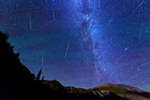
I found a nice spot to set-up my tripod for the night among some larger rocks that would be useful as a bed/chair/rest area in the cold wind. I clearly did not bring up enough warm clothing, because I basically shivered for 3 hours straight at this location, watching meteros streak by. In total, I believe I was able to capture about 15-30 meteors in my frame from 12 AM to 3 AM. The meteors were absolutely amazing to watch from this elevation, and I could even see the town of Silverton down below to the left.
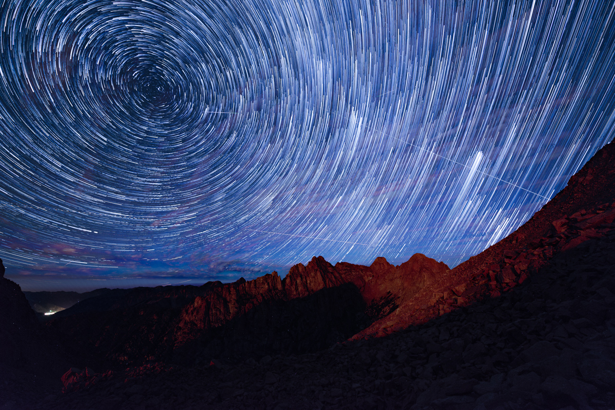
I combined the photos into some star trail sequences which turned out pretty well, and even did some timelapse video, which has music, so be warned!
More star trails!
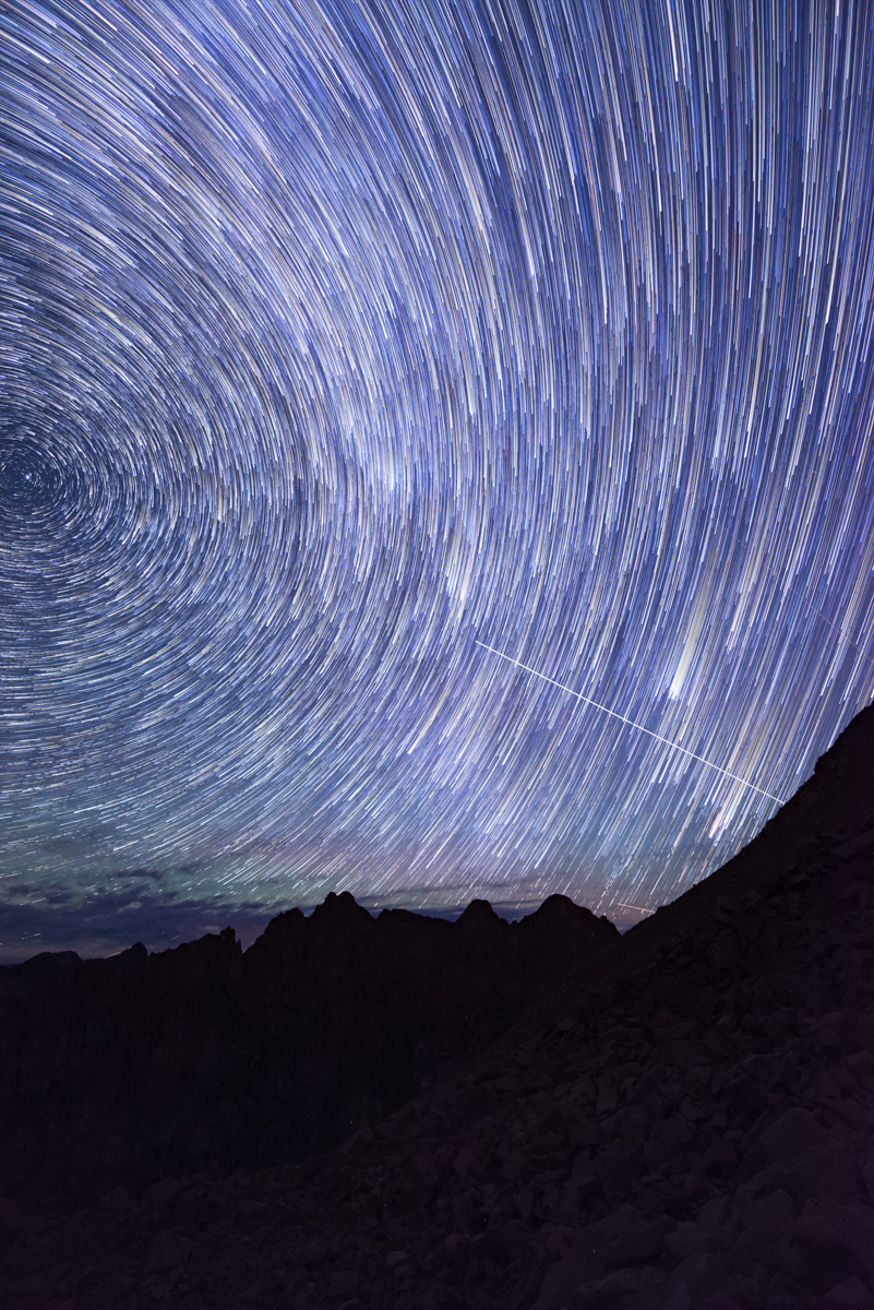
I noticed that a lot of meteors were originating at the apex of the night sky, so I turned my camera to portrait orientation for the last half of my shooting, this time in pitch black. I know I have some more photo editing to do to really highlight my work on the saddle, but this is what I have so far.
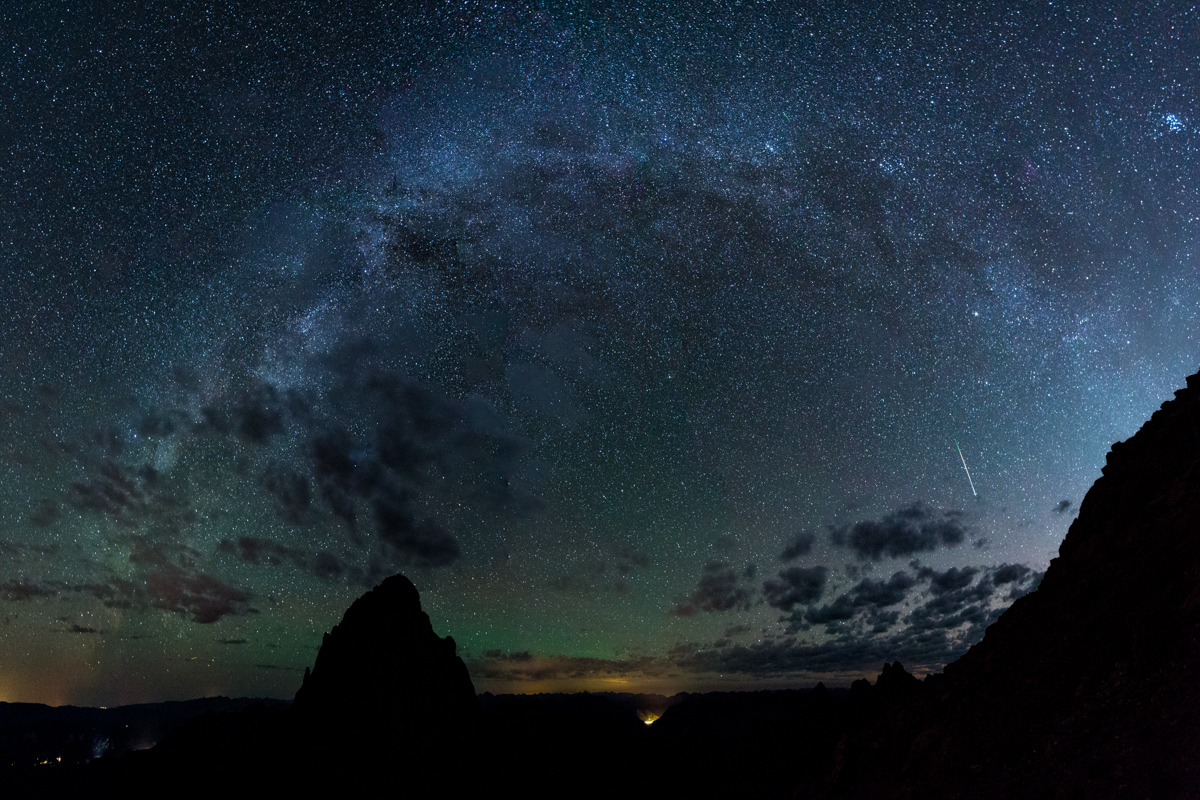
After freezing for a couple of hours I decided it was time to begin my ascent of Turret Peak. I also noted that since the moon had set that I might be able to get a glimpse of the Milky Way Core, which might open up a nice opportunity to photograph the Milky Way arching over Pigeon Peak. I pulled that off just below Turret's summit and even got a meteor in the last frame of the panorama - awesome!
I arrived at the summit of Turret at 4:30 AM and felt completely wiped out. I think this photo says it all.
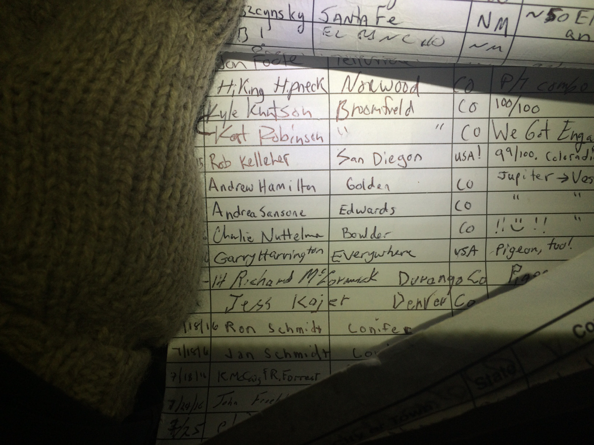
I saw some familar names on the summit register, including Andrew Hamilton from just a few weeks prior. His notes stated "Jupiter ---> Vestal" which I found quite interesting. If I'm reading it correctly, he started on Jupiter and this was just a spot in between his final destination of Vestal. That seemed like madness to me.
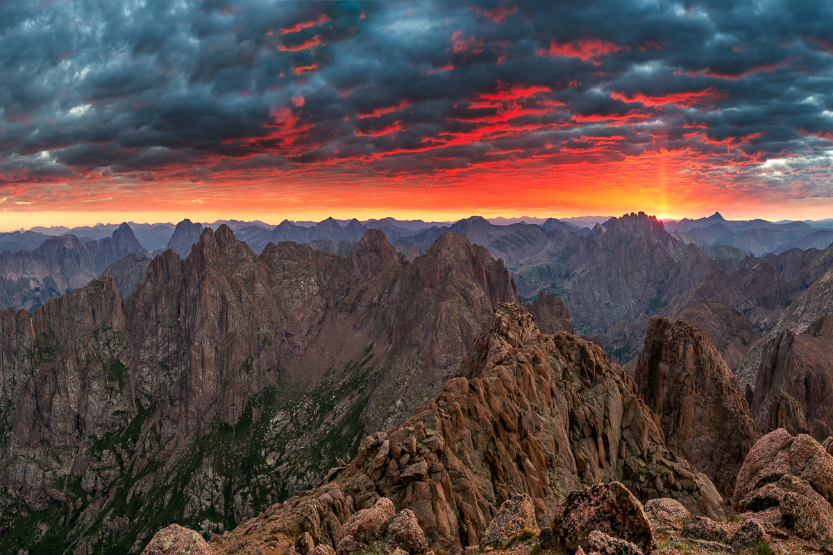
As I sat on Turret pondering life and getting my energy back up, I noted that the horizon behind Jagged Mountain was looking pink. There were a lot of low clouds, which was either going to spell disaster or complete success for photographing sunrise. It turned out to be a totally amazing sunrise to say the least. I would rate it as top three summit sunrises of my life, with the other two being North Eolus in 2011 and Uncompahgre in 2015, both of which I photographed (those links will take you to those photos). This one was pretty special though. The Grenadiers, including Arrow and Vestal as well as the Trinities were all nicely visible, accented by the Needles of Animas and Monitor. The sun was rising just behind Jagged Mountain and Rio Grande Pyramid and made for a really incredible showcase of color. Pinks, reds, oranges, and purples colored the sky and clouds. I am very proud of this one, which is available for sale on my photography website (click on it to follow there). I can't wait to print it up nice and big for display here in Durango.
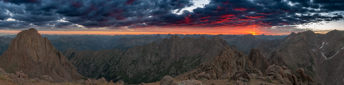
I was also able to get a nice panorama of this scene to include Pigeon Peak at left sweeping all the way over to the right to include North Eolus and Eolus. Unfortunatley, the light, sky, and clouds of about 1/2 of this scene were not very exciting, so I cut those out. Still - an amazing scene to say the least!
A few minutes later I was packing up to head down to the saddle again and noticed the light across to the La Plata Mountains and the Animas River below was looking quite nice as well, so I shot that.
Then I noticed the clouds above Jagged Mountain looking awfuly amazing, with beams of light come down through them from the sun. I guess I could spend more time up here.
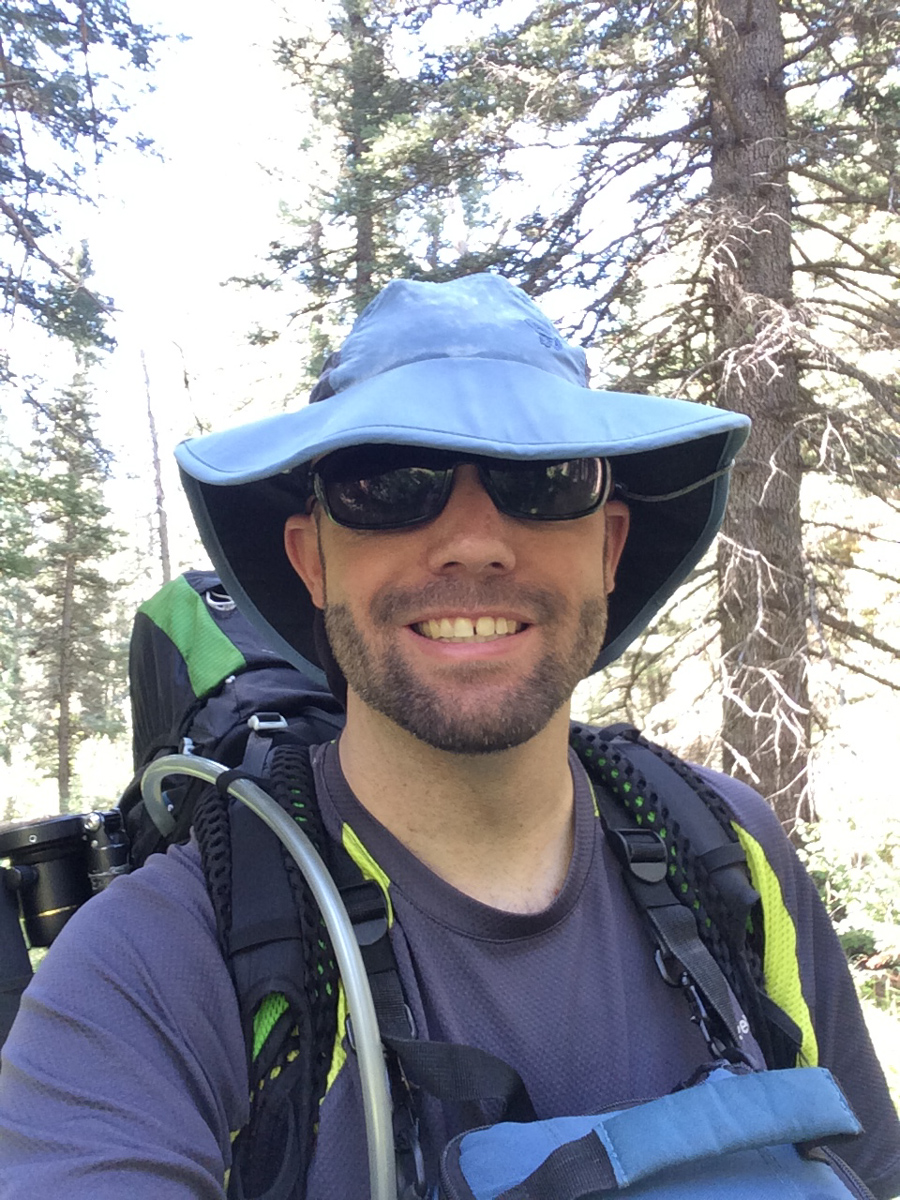
Lastly, I set-up for a quick self-timer shot of myself with some of my favorite peaks behind me. What a morning!
I packed up and set sights on my next objective - Pigeon Peak. I knew that in order to climb Pigeon from here I would have to descend down to the saddle and then down to another notch between Pigeon and a small un-named point southwest of it. After that, I would be forced to drop to 12,200 feet on the west face of Pigeon and all the way back up again to 13,972. I was not sure I could handle it, but the thought of coming this far and not getting Pigeon kept me motivated.
On the way down to the saddle, I enjoyed the light hitting the peaks around me and made a note of the small notch left of Pigeon, which was my next target (as seen just right of the large 'white' rock outcropping and below the illuminated peak in the photo below).
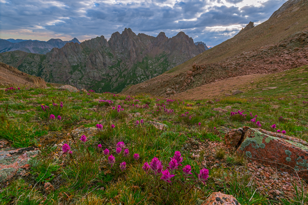
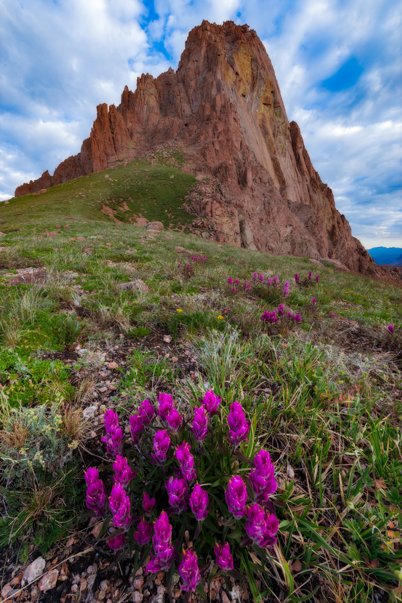
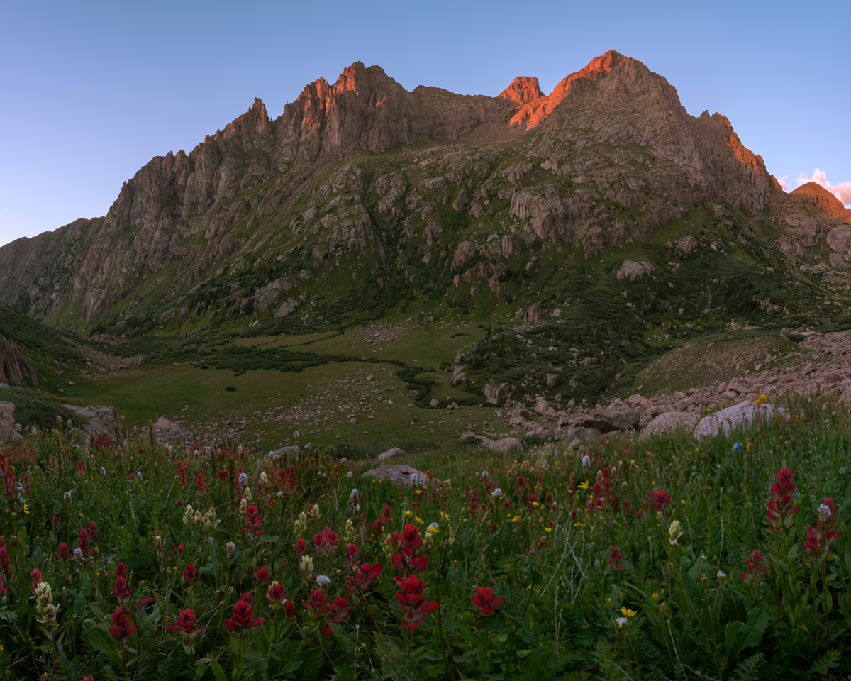
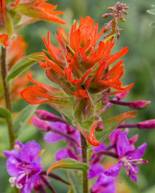
Reaching the saddle again was no problem and the scenery was incredible. The wildflowers at 13,000 ft. absolutely astounded me, in particular, these rosy paintbrush caught my attention.
Pigeon towered above me as a reminder of the pain I would endure if I wanted to summit today. I could see how a confident and equipped climber could take this gully off the ridge, but it was something way outside of my comfort zone and ability.
I descended from the saddle to my left towards the notch and reached it quickly. I undershot (went too high) the notch a little and had to downclimb some sketchy rock to reach the notch, which greeted me with a view west of West Needle and the Twilights. A look down to my next destination was demoralizing to say the least. It looked so steep, and knowing I'd have to come back up it was not a welcoming thought.
I reached the bottom of the descent without any issues and wrapped around the side of Pigeon to find myself at 12,200 feet with another 1,700 feet of gain to go on un-marked terrain. My legs were tired. I was hungry and tired. The clouds were concerning as well. Everything looked OK to my west, but I could no longer see to the east. The climb up the steep grassy dirt was awful. I had to stop about every 30 steps to catch my breath, which was not normal for me, but understandable given how long I'd been out. I was eventually passed by a young man and his dog that had came up from North Pigeon Creek. He flew by in ease. Jealous.
This young man and his dog stirred up some mountain goats while I pontificated my ability to finish, all documented in a quick video on my phone:
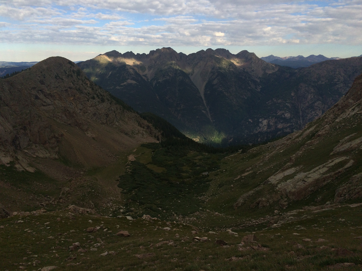
Alas, I was able to reach the top of the long gully leading up to a notch that looked back down to the meadow in upper Ruby basin and my campsite, some 2,000 feet below.
I quickly found the class 4 weakness in the summit block, just right of the terminus of the gully at the top of the grassy dirt slopes and made it over there in no time. Navigating the actual class 4 section was another story though. I enjoy exposure more than most; however, I found this move to be quite challenging, especially with all that camera weight on my back. I actually thought about leaving my backpack there but reminded myself of a classic Gerry Roach saying, "never leave your lunch," and kept it on. The class 4 section was only two or three moves deep, but there was a slight overhanging feel to the rock and the holds were a bit awkward for me. I think being alone played a part in making it feel harder than it was as well. A mistake here would have been fatal.
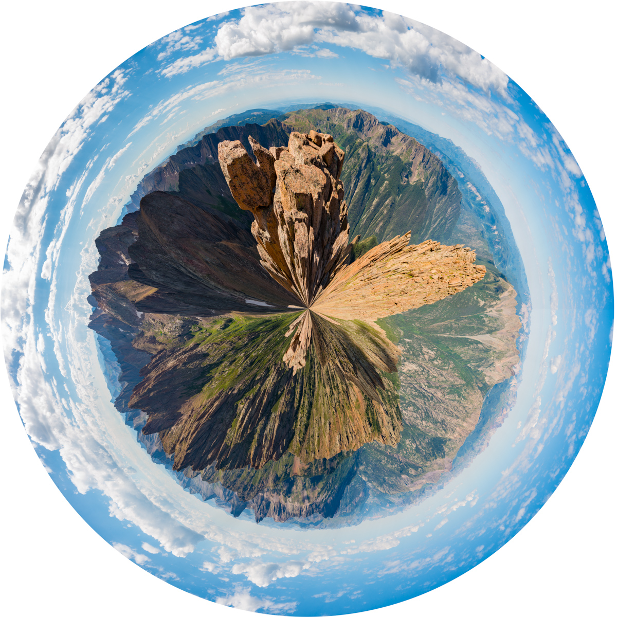
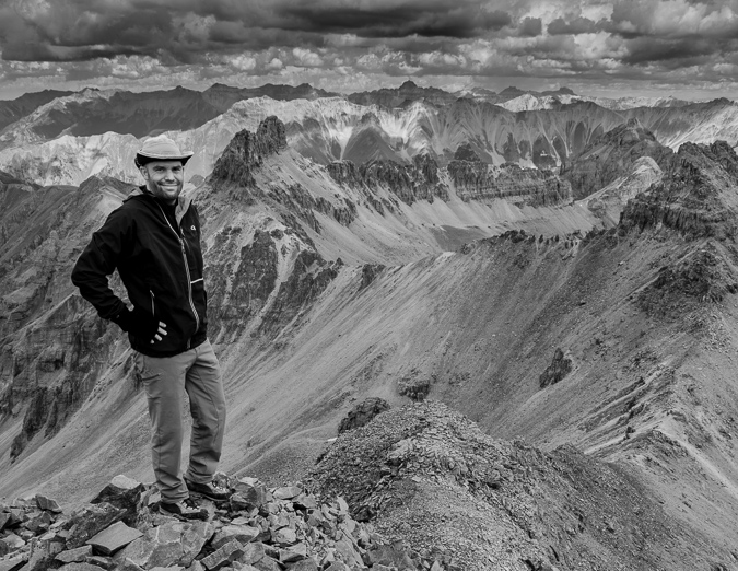
Alas, I reached the summit and enjoyed the view from my 89th Centennial. Only 11 to go! Here's a 360 degree view from Pigeon.
And here's the same photo made into a planet to show a different perspective.
The Grenadiers looked amazing as usual. I still think the view from Arrow Peak looking back towards Pigeon is the best I've had. Unbelievable.
While the clouds did not seem too threatening, I was quickly reminded of just how much more work laid ahead of me before I was safely back in my tent. I still had to safely downclimb Pigeon without dying and then make it down 1,700 feet and back up again to the Pigeon - Turret saddle, and then back down to upper Ruby basin. Yikes. I departed without delay, eating as I climbed down. I serendipitously found an alternative route to the class 4 route by following some cairns to the left of the class 4 section which was quite a relief since I did not really want to go down that way. The class 3 alternative was much easier to downclimb and brought me back to the same general area to allow a safe descent back towards North Pigeon Creek, which went quite quickly following the loose dirt and scree. I re-climbed up to the lower saddle below Pigeon in less time than I thought I would need and found myself gazing back up at Turret. My legs were feeling the burn to say the least!
Upon reaching the saddle between Pigeon and Turret, I ran into two young hikers I had seen on the train the day before. I talked to them for awhile and learned that they had camped at Ruby Lake and were thinking of ascending both Turret and Pigeon. I gave them some tips and it seemed as though they were going to just head up Turret for the day. I was starving and exhausted and told them I was going to go pass out in my tent. I quickly descended down towards the basin without any issues except for the constant feeling of hunger. I could not keep enough food in my system. To make it worse, I had really painful and annoying heartburn, I think caused by drinking Gatorade, but who knows. This later was quite annoying at dinner because I could not eat all of my food - I felt like I wanted to throw it up after every bite despite wanting to devour it. Maybe I was eating too quickly?
Making it back to camp was a great feeling and I had the whole meadow to myself.
Except for the five goats that joined me later on after I napped for three hours in the nude.
These goats were foraging around my tent pretty much all evening and night so I made the most of the situation and filmed a timelapse of the mountain goats grazing for about an hour long.
After filming the goats and eating dinner, I decided I still had some energy left in me before bed, so I found some flowers to photograph and some spots to shoot for sunset. I was particularly happy with how this photo of a single columbine flower turned out below Turret Needles.
Sunset was pretty remarkable, especially with the assortment of wildflowers at my feet above my campsite, which you can barely see in the middle of the photo.
After photographing sunset, I was ready to turn in for the night. My heartburn kept me up a lot of the night, which was incredibly frustrating given how exhausted I was; however, I did get some pretty solid sleep from about 2 AM until 6 AM, at which point I was woken up by some heavy breathing outside of my tent. I opened it up and found a large mountain goat staring right into my door. I tried to get a photo of him, but he lazily scurried off before I could. I made some coffee (the Starbucks Via Blonde Verdana is pretty amazing), packed up, and photographed sunrise.
I left my campsite at 9 AM. Even though my train was not supposed to pick me up until 3:30 PM, I wanted to get down earlier to try to get on an earlier train. The views down were just as good as going up and Pigeon dominated the scene.
I made it down to Ruby Lake quite quickly and ran into those two climbers from yesterday, named Jacob and Rose. Turned out that Jacob works for the train and Rose attends Fort Lewis College. Really nice kids! I then later learned that one of my employees at work is married to Jacob's cousin. Small town!
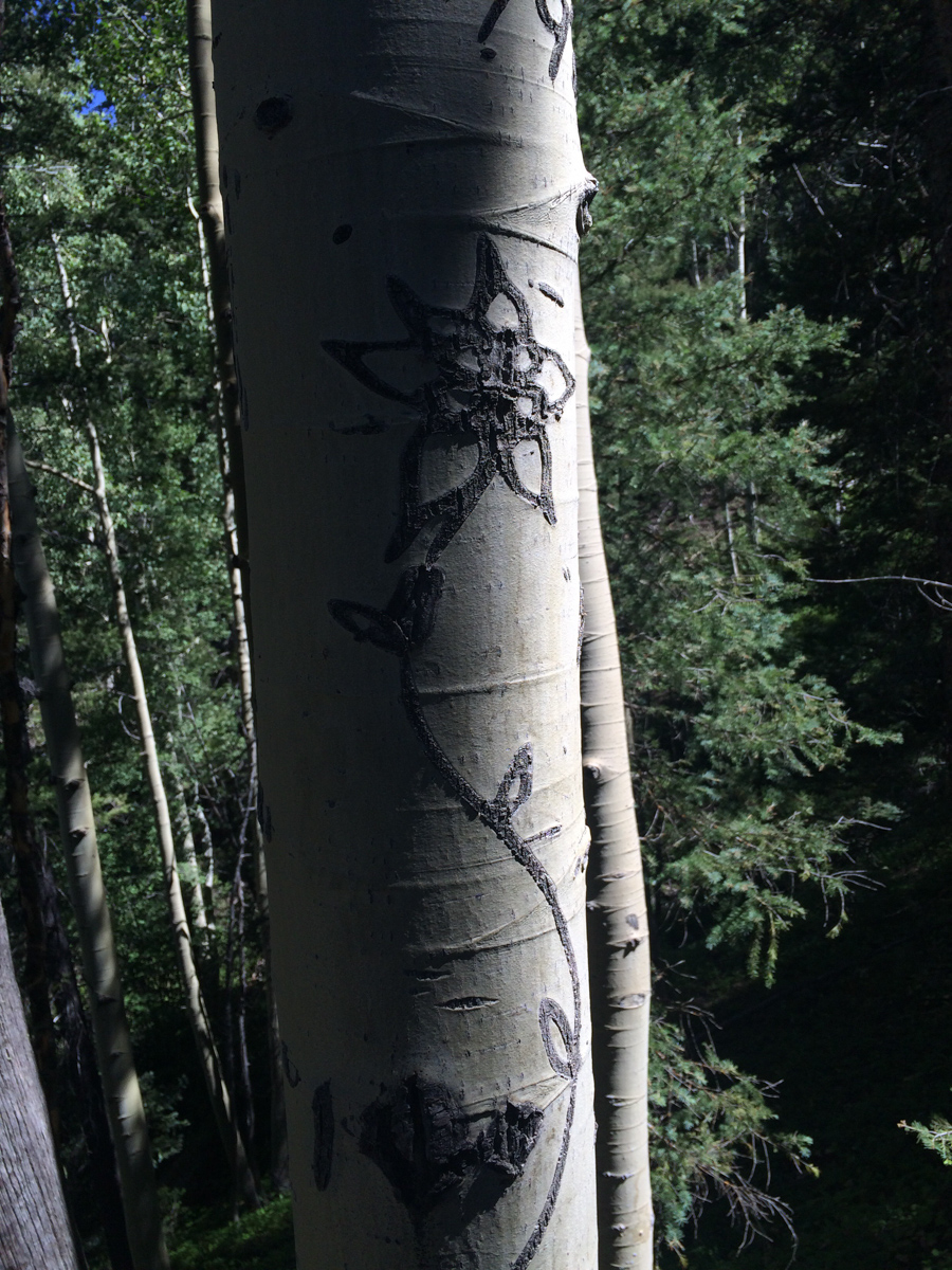
Routefinding on the way down was not as hard and I even found the tree with the Columbine carved into it - which is noted nicely on my GaiaGPS track.
I made it back to the bridge crossing the Animas at 12:05 PM without any problems and found myself among several other people waiting for the train. Apparently the train had derailed in Durango and was an hour and a half late. I wound up waiting there until 4:30 PM while hanging out with two guys from Arkansas, one of which had just moved to Greely, Colorado for work.
Once the train finally arrived heading to Silverton (I did not board this one), it was a mad dash to get on board.
I ended up riding on the train with Jacob and Rose and we had a nice talk about how great it is to live in Durango and how lucky we felt to be this close to such amazing mountains. Life is good.
Perseid Meteor Shower at Ice Lake Basin and a climb of Vermillion Peak
When the dates for the 2013 Perseid Meteor Shower were released, I knew I wanted to schedule some time in a very remote location to capitolize on the opportunity to capture as many meteor shower photos as possible. I did a little research and took a look at my remaining Colorado Centennials that were left to climb and enthusiastically declared that the Ice Lake Basin would be the perfect location. I knew that the trip would be amazing for a photographer, but perhaps boring for someone that is not into photography. I reached out to my friend Ryan Fonkert to see if he would be interested in joining me on a tour-de-Ice-Lake-Basin to shoot the Perseids and to climb Vermillion Peak. Without any hesitation he said he would join me.
Photographing meteor showers has only recently been something I've wanted to do, and my first successful foray into that realm of photography was back in December 2012 for the Gemind Meteor Shower, where I was able to come away with this photo:

Ice Lake Basin has long been on my radar as a location to visit. Ideally, I wanted to visit the area during the peak of wildflower season due to the idyllic photograpy opportunities afforded at the upper Ice Lake. Unfortunately, the Perseid Meteor Shower falls in mid-August, so this time would have to mostly be a scouting mission for wildflower-style photos.
Ryan and I carved out a chunk of time on our calendars to coincide with the Perseid Meteor Shower peak; we went with Sunday, August 11th through Wednesday, August 14th, knowing the Perseids would peak on Monday night, but also allowing us some flexibility in case of weather or other uncontrollable variables. We made preparations to spend three nights at 11,000 ft and higher, with weather forecasts showing significant rain and/or snow. Sunday afternoon we gathered at my house and departed for the long journey from Colorado Springs to Silverton via Highway 50. I was particularly excited for this trip for a billion reasons, one main reason being that Ryan and I had a ton of interests and world views in common. We were both atheists, both photography geeks, both vegetarians, and both fairly liberal in our political beliefs (don't hold it against us). It was going to be great to be able to chat about all of those awesome topics while camped in one of Colorado's premeir backpacking destinations.
We stopped in Montrose for dinner and wound up at Denny's. How sad for two vegetarians. I'm going to have to do more research before the next time I pass through Montrose needing food. The waitress looked at me really oddly when I asked her to withhold the giant sausage that came with my breakfast skillet, but the food was decent enough and the high sodium would probably be a benefit for the hike in. Since both Ryan and I were mostly heading in to do major photography work, our packs were insanely heavy. I was carrying a similar load as to what I had taken up Grizzly Peak a few months prior, with the additon of a couple more lenses and some large filters for my Nikon 14-24 lens.
Ryan and I were able to reach the turn-off for the South Mineral Creek Trailhead, located just two miles north of Silverton on Highway 550 at around 9 PM. We opted for the short-cut along the Clear Lake Road as described in Roach, which shaves off about a mile and a half total for the hike in and out of the Ice Lake Basin. We loaded up our packs (mine was just over 60 pounds) and head out. We were immediately greeted by the loud and insane waterfall described in Roach, which was highly enjoyable to cross beneath in the dark with 60 pounds on my back.
Here is a full list of photography equipment that I brought on this trip and the approximate weight of each item. I purchased a new tripod and ballhead for this trip alone, because my other tripod, while solid, was quite heavy. The new tripod and ballhead weighed less than half as the old setup, which helped some on weight, no doubt.
| Item | Weight (lbs) |
| Feisol Tournament CT-3442 Tripod w/ Photo Clam Pro Gold II Easy PQR Ballhead | 3.3 |
| Nikon D800 DSLR w/ Kirk L-Bracket | 2.8 |
| Nikon 14-24 f/2.8 Lens | 2.0 |
| Nikon 24-70 f/2.8 Lens | 2.0 |
| Nikon 50mm f/1.4 D Lens | 0.5 |
| Nikon 105mm f/2.8 D Micro Lens | 1.5 |
| Fotodiox Wonderpano Filter Kit w/ 5-stop ND filter & 6x8 grad ND for Nikon 14-24 lens | 2.0 |
| Nikon 300mm f/4 D Lens | 3.0 |
| 1.4x Teleconverter | 0.5 |
| Total | 17.6 |
The skies were quite clear on the hike in and we were thinkng we would be afforded some great opportunities to capture some meteor photos on the very first night; however, mother nature had other thoughts in mind. The hike in was quite uneventful until we reached what we believed was the lower Ice Lake Basin. I took out my very bright Brinkman light, which I use for light painting of distant foregrounds for astrophotography. The light was able to show us the area and we headed towards the very upper section of the lower basin. After some wandering in the dark, we stumbled upon an amazing campsite right next to the creek and a huge waterfall nestled at the very edge of the basin. The campsite was equipped with a ready-made bear-bag tree and someone had even salvaged some old mining equipment to form a nice metal bench next to the fire-ring, which we never did use. We setup our camp in the dark quickly so that we could venture out to photograph some meteors; however, by the time we finished setting-up, clouds had already moved into the basin, obscuring our view of the stars above. I was able to get one kind of cool photo of the night skies the first night while utilizing the Brinkman light to illuminate a distant mountain-top to our north east.
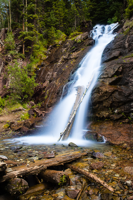
After a failed attempt of photographing the night sky, we decided to hit the sack and see what the next day would bring. We awoke pretty early and the sky was already filling with dark clouds. Sure enough, the sound of thunder came early, around 9 AM and we were more or less stuck to our camp area for the duration of the day. Not that we were complaining though, Ice Lake Basin is a pretty great place to be "stuck" for the day. We had pockets of sunshine and decent weather, so we kept going out around the basin for short photography hikes and then back to camp when weather became nasty. This yielded both Ryan and I many opportunities to capture some great images, especially of the ubiquitous waterfalls that were in the lower basin. It was one of the most awesome places I had ever camped, and I am eager to return, no question.
 As I mentioned before, our campsite was nestled against the headwall of the upper basin and was directly below a huge series of waterfalls that terminated in a huge field of wildflowers. It was really quite the scene and kept our minds off of the occasional thunder we would hear above. I took advantage of my 9-stop ND filter for taking photos of the waterfall and enjoyed the challenge of the changing light. There were endless opportunities to take photos of the waterfalls and I think I could have probably spent an entire day looking for a better composition or angle. I know Ryan came away with some real stunners too.
Ryan ventured off across the basin to photograph his own waterfalls while I tended to the huge one behind our campsite.
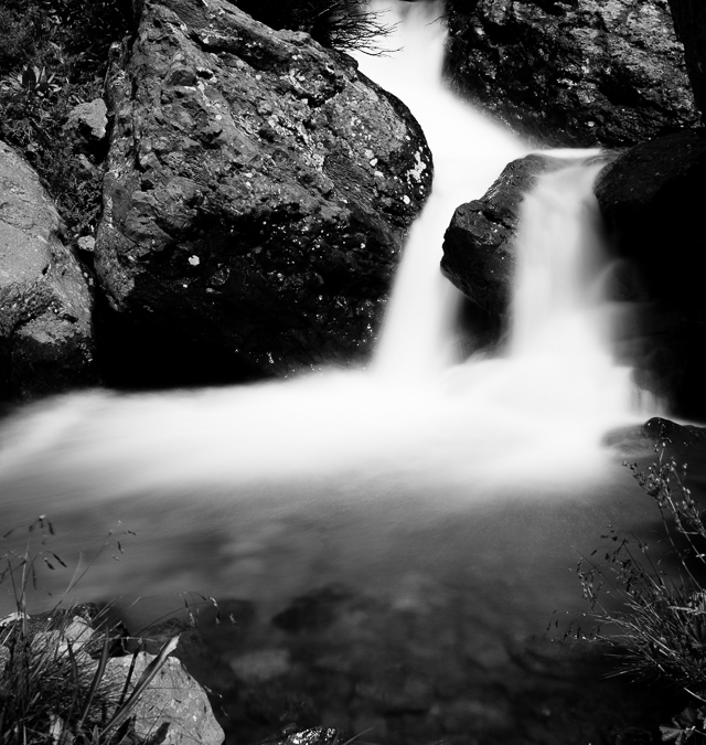
I tried a variety of spots near our campsite and ventured quite closely to the incredible series of waterfalls that came from the upper basin just above us to the west. I don't generally processing in black and white a lot, so I decided to shoot for black and white instead of color for the waterfalls, focusing more on the available light vs. the colors in the area. It proved to be a great way to study the subject and yielded some fairly good results I think. I loved the textures and lines that intertwined between both the rocks and the moving water and really loved how the ND filter treated the scene with a silky smooth aura.
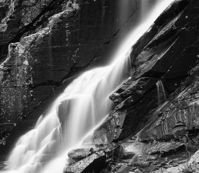
Black and White waterfalls taken with a 9-stop ND filter - a study in light and texture.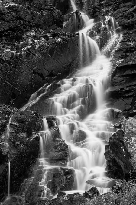
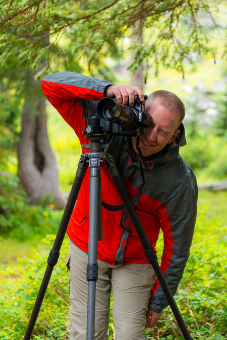
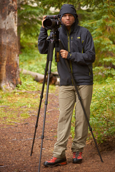
Ryan and I had a lot of time to kill due to the less-than-stellar weather in the basin, so we took turns taking shots of each other. Here's Ryan sporting his Sony and Minolta equipment and myself rocking the Nikon gear on the new tripod.
 |
 |
The "on again-off again" weather was both annoying and awesome. On one hand, it kept us close to camp, but on the other hand, it kept bringing in some interesting light and photography subjects to keep us busy. The heavy moisture in the air had created a lot of cool fog-like features in the valley below. Water vapor would rise up from the valley and up into the mountains across the valley from us. As we watched the weather continually change, the temperature kept fluctuating as well, keeping us on our toes and in and out of various layers. It also gave us some opportunity to widdle down on the over-abundance of food we both brought into the valley with us.
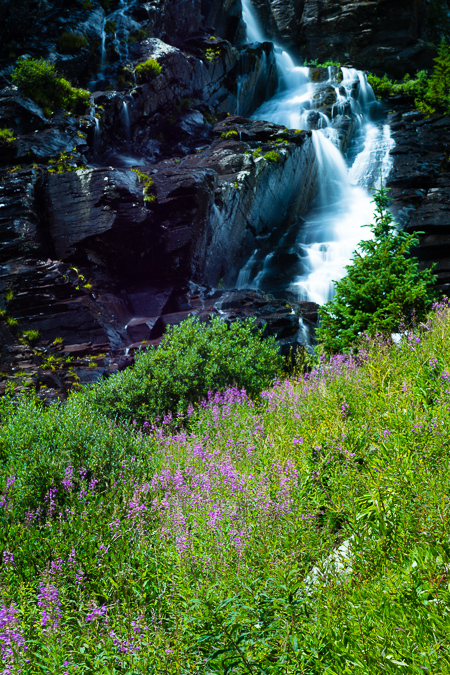
Even though the peak of wildflower season had passed, I was quite impressed with the quanitity and quality of wildflowers in the lower basin. I spotted all kinds of amazing flowers, including the Indian Paintbrush, Rocky Mountain Columbine, Mountain Bluebells, Parry's Primrose, Rose Crown, and more. I felt pretty happy to have brought the 105mm macro lens as I'd always wanted to get a nice macro shot of an Indian Paintbrush, so I ventured off to find the best one near our campsite. I found a few good subjects close-by and captured a few decent shots of one.
As the light shifted and the day progressed, I kept my eyes on a huge field of purple wildflowers up the hill from us. The sun shifted perfectly and I ran up to get some photos there. I was even lucky enough to get a rainbow in the photo, which was a huge bonus, no doubt. The field also looked out into the distance at one of the more impressive peaks of the area - Sultan Mountain.
As the storms passed over, I grabbed a self-photo from the wildflower field. What a peaceful place.
At this point, Ryan joined up with me from the area he was photographing from near the huge string of skinnier waterfalls across the basin from our campsite. He told me I could probably get some awesome shots over there with my ND filter, so I headed that direction, but not before he fired off a hero shot of me carrying my gear.
I headed on over to the fast-moving waterfall system up the hill from us and found some amazing scenery there - wildflowers galore with a raging waterfall, including more of those purple flowers and some Columbine as well.
I had to climb onto a really precarious island with cliffs and waterfalls on each side to get this shot of these magnificent Columbine.
I headed on back down towards camp and noticed the light continue to improve through sunset. I decided this would be the perfect opportunity to finally get to use my Fotodiox Wonderpana Filter system for the Nikon 14-24. As you may or may not know, the Nikon 14-24 is probably the best full-frame wide angle lens you can get, but it has one major flaw - it is unable to take filters since the lens hood is built into the lens. To compensate for this, you have to get elaborate and complicated filter systems if you want to use filters on this amazing lens. Filters are pretty important for certain applications like the highly dynamic light at sunrise or sunset, where the sky is very bright but the foreground is dark. To adjust for this, you use what are called graduated neutral density filters which basically are dark on top and clear at the bottom, allowing you to expose for the foreground and still get a perfect exposure on the brighter sky. This worked out pefectly for this sunset shot I took from the stream.
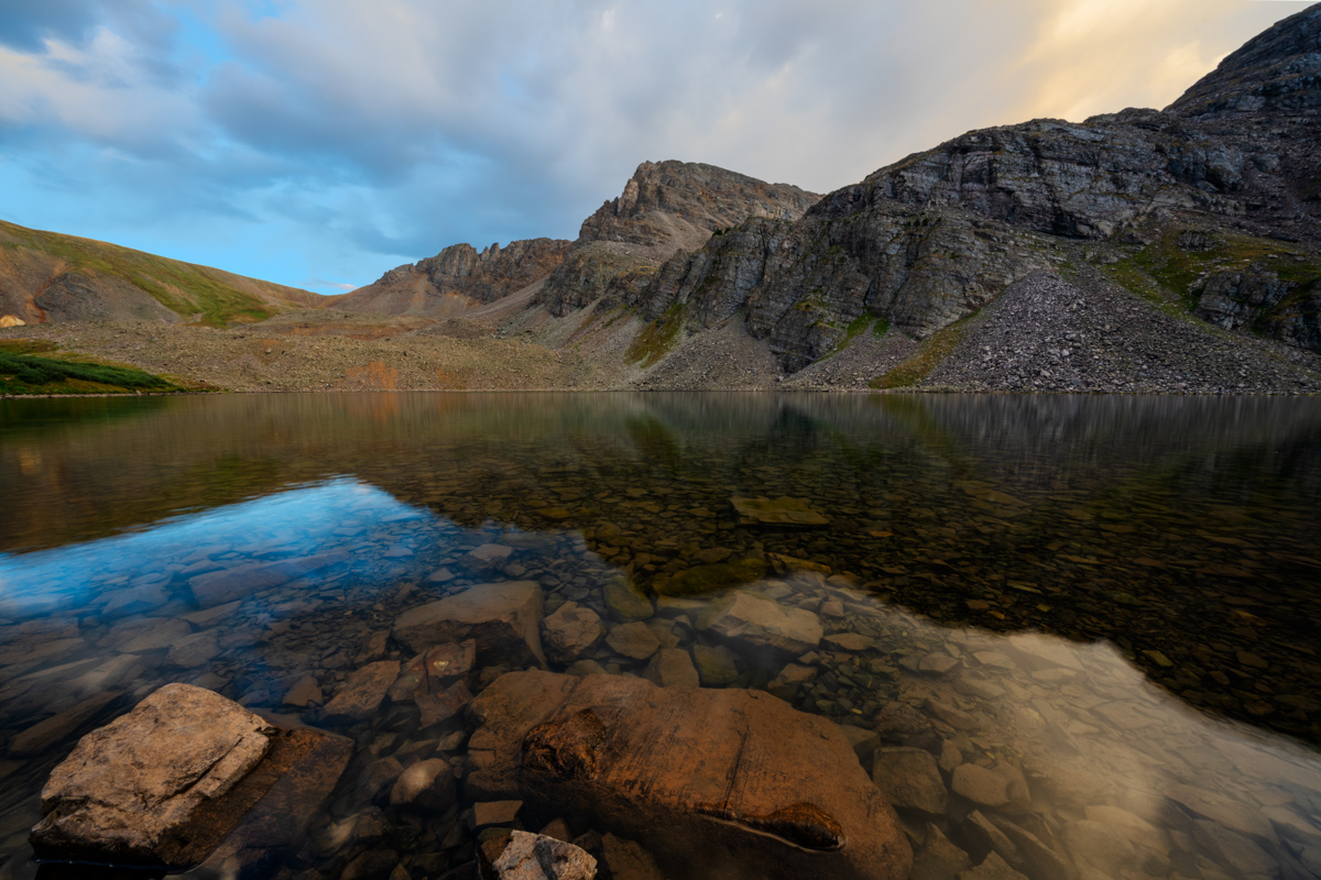
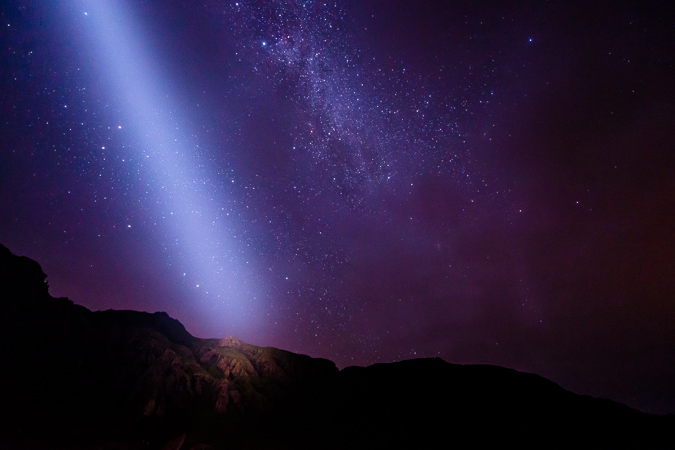
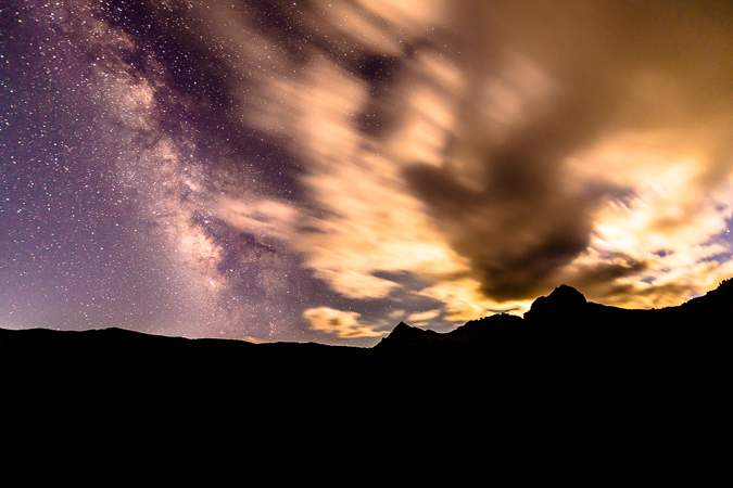
After getting some dinner and packing some of our things away, we kept a close eye on the clouds above, knowing that this second night would be the peak of the meteor shower. The clouds began to clear out, so we decided to head up into the upper basin and find a good spot to get shots of the Perseids. The hike up to Ice Lake from our campsite was pretty easy and finding the lake was no problem at all, even in the dark. As we set-up for our photos, we began to get nervous as the clouds began to return and we could see lightning in the distance to our north and west. Not good! Either way, I wanted a few shots from this area at night, so I set-up my tripod and got a few photos. The moon had not quite set yet but was behind some clouds, which made for a wicked silhouette of Golden Horn.
Additionally, the Milky Way made a brief appearance as well with the moon lighting up the passing clouds above.
Having seen some lightning and not really knowing how our luck would last, we decided to make the safe decision and head back down towards our campsite, which was very frustrating. I was hoping to setup at the shores of the lake for my meteor shower photos, so I was a bit disappointed; however, about halfway back down from the upper basin we noticed that the clouds had decided to dissipate, so we found a safe and acceptable spot with a nice clear view to the north and east where the Perseid Meteor Shower was radiating from. We setup our tripods and started the fun of doing a long series over several hours to capture as many meteors as possible. The moon was still high enough to light up the foreground too, so it made for a fairly decent spot to get the meteors from. I was quite pleased with my results, netting 19 meteors in total.
After freezing our butts off for a couple hours, we began to pack up our things, but not before I attempted a vertical panorama from horizon to horizon of the Milky Way. Before I was able to get this shot, I noticed that my lens was covered in condensation, which was a real bummer. I wondered how long it had been this way. I went into my camera to see and only a few shots were ruined. The temperature change from having the camera in my chest pack during the hike up and the very cold night must have caused the condensation - lesson learned!
We head back down to our campsite without incident (other than some super cold toes) and went to sleep, prepared to attempt Vermillion Peak in the morning.
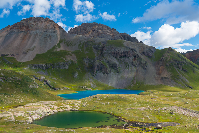
We got up a little later in the morning than I'm normally used to for summit attempts, but we were up really late taking photos of the meteor shower. It is always a challenge for me to balance my desires for mountaineering and my desires for photography. While they make quite a synergistic pair, they also sometimes compete with each other, mostly because of the time factor. We made it up to Ice Lake and were blown away at the beauty of this magnificent lake. I've never seen a bluer lake in all of my life.
I already knew I wanted to come back to the lake another time of year and get sunrise photos with wildflowers. It was just the most insane spot!
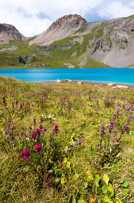
We found another small lake on our way up towards Vermillion and it was surrounded by wildflowers, including this nice Rose Crown as seen in the bottom left corner. Golden Horn made a nice reflection in the lake, and we could finally begin to make out Vermillion behind it.
The trail ascended up into the upper basin towards Fuller Lake and the views back down at Ice Lake were intense. I was still blown away by the blue hues in the lake.
Climbing further up the trail provided some great views of Golden Horn, which demanded a great deal of respect. The naming of Golden Horn was quite apt, as the sides of it were quite golden indeed.
 |
 |
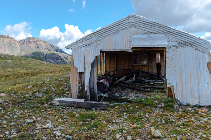
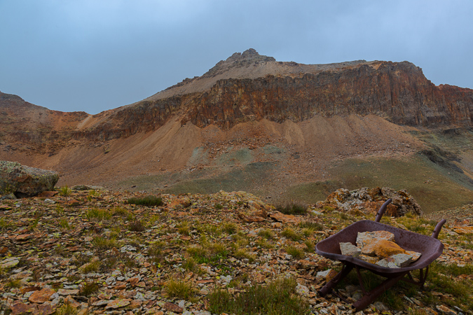
As we got further up the basin, we found yet another pond with Fuller Peak (left) and Vermillion (right) towering above. In addition, there was a really interesting building up there, or at least the remains of one. We speculated as to what the purpose of the building was, settling on the thought that it was probably used up into the middle of the last century for miners.
The building was in pretty good condition, with an intact roof and even some old bed springs still inside.
A look back over at Golden Horn revealed that weather seemed to be moving in, but it still seemed pretty spotty. We noted the weather and kept moving up the basin, weaving up a short boulder field above the structure to find a nicely worn trail with numerous cairns.
We could make out the nicely worn trail heading up to the saddle between Fuller and Vermillion, and kept heading in that direction.
The trail brought us up a nice rocky bench towards Vermillion and was a very pleasant hike up. The clouds continued to hold, so we kept on trucking. A look back at Ryan showed I was keeping a pretty good pace. Ryan indicated to me to keep going at my own speed, so I did.
We reached a small stone fortress near the end of the trail and stopped to put on some rain gear as light graupel had begun to come down. The weather still seemed OK but I must admit I was getting a bit nervous. We continued up and lost the trail at the base of Fuller, so we began to weave across a large loose boulder field, which proved to be a huge pain in the butt to cross.
Once we were able to get through the loose and physically rigorous boulder/scree fest, we found ourselves looking down and across at the proper trail. Oh well! We made our way across the boulders to the trail without any issues.
I was able to quickly make it up the saddle - my legs were feeling really great despite the lack of recent climbing I had done this year. From the saddle, I could easily make out a lot of mountains in the area, including the famous Wilsons, the distant Grenadiers and a really awesome looking peak to the south west that was covered in small bits of snow from the recent storms.
A look over at Fuller proved it was not a very long distance from the saddle, and I made tentative plans to come back and grab that peak if time and weather permitted after Vermillion. Looking back down at Ice Lake revealed Ryan's position about a quarter of the way up the trail to the saddle and all of the lakes we had passed throughout the day's journey. What an amazing view it was.
In the distance to the east I could now make out Uncompahgre and Wetterhorn, which is always a nice treat!
From the saddle, the trail leads up the back side of Vermillion. The trail is very well-worn and easy to follow. The rock on the back side was also very interesting.
A look back down towards the saddle showed just how worn and accessible the trail really was. It was also awesome seeing the Grenadiers in the distance above the ridge.
I reached an obvious end to the trail which had wrapped around the back side of Vermillion on a series of ledges and realized that it was time to head up a steep gully and onto the upper section to the summit, which was all fairly obvious to me at this point.
Once I reached the top of the golden gully, I looked back and down towards the awesome snow-covered mountain, which I later realized was one of the many mountains in Colorado named Grizzly.
You could also make out Engineer Mountain beyond Grizzly to the south. I was able to reach the summit without any issues and was amazed at all of the green rocks on the summit. I guess it is pretty obvious why the mountain was named Vermillon.
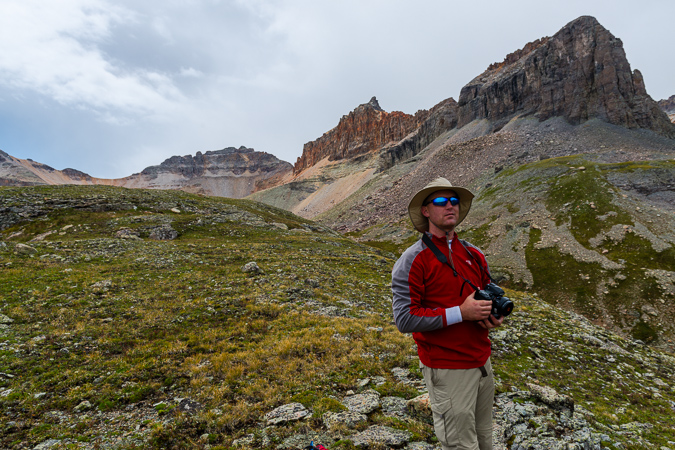
I posed for a few self-portraits using my tripod while I watched the weather nervously. The view of Golden Horn, Pilot Knob (just to my right), Sneffels (in the distance) and other notable San Juan giants was pretty killer from Vermillion.
I snapped off one more set of panoramas.
A look to the west caught my attention. Out of nowhere a giant storm had developed, with what appeared to be significant precipitation. I hastily packed my things and head back down towards the saddle. I ran into Ryan about halfway back to the saddle, where he had decided to give-up due to fatigue. The storm passed us to the south, fortunately, as seen below.
I reached the saddle fairly quickly and told Ryan I was going to head up and get Fuller really quickly. I made short order of Fully, ascending in just 10 minutes. From there, I was able to survey the basin again, with some interesting views back down towards Ice Lake and back at Vermillion.
On my way back down to the saddle, I was momentarily pleased with the bright colors and contrast between the red rocks on Fuller and the green vegetation below at Lake Hope, which rested at the foot of San Miguel Peak to the west.
I rejoined Ryan at the saddle and we made it back over below the rock shelter that sat beneath Fuller in no time at all.
A look back at Vermillion showed Ryan and the scope of the peak we had just came down from.
Ryan and I were amazed at just how much old mining equipment was just left up there. We saw lots of large tubing strewn about the mountain and even this handy wheelbarrow that looked to be quite old.
Coming down the basin was not a problem and the weather cooperated to our surprise and glee. Ryan and I took frequent stops to take photos of the area.
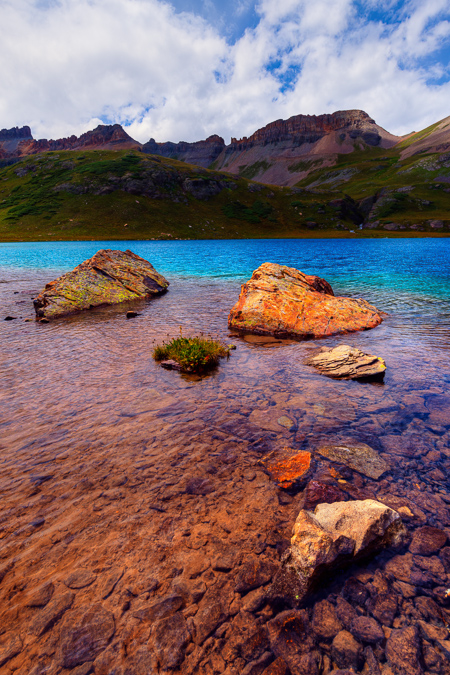
On the way down I found a very small pond with a large boulder in it that made for a nice landscape scene with Vermillion and Golden Horn reflected in the pool.
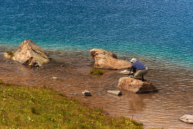
Once back down at Ice Lake itself, we stopped for some quick photos. I found some Rose Crowns and did a little focus stacking to get both the flowers and the distant peaks in focus.
You can really see how this basin would be incredible when the flowers are at their peak. I also found some interesting rocks on the shore to photograph from, and Ryan was able to get a photo of me perched on one of the rocks preparing for a shot.
And here's the shot I was composing.
Once we finished up at the lake we head back down the trail towards camp. We found a great vantage point where we could see Sultan Mountain and the lower Ice Lake.
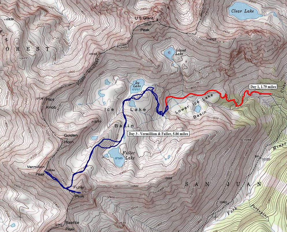
Here is a map of where we were at and what routes we took on the various days.
As sunset arrived in the lower basin where we were camped, I could not help but notice the great light. Sure enough, the sunset hit the clouds just right and made for a nice light show.
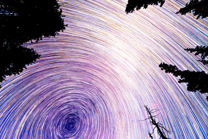
 Having one more night in the basin was quite the blessing. The night sky was quite clear on this last night and it made for some great star viewing. I decided to put together a few different star trails, this first one taken looking almost straight up at the sky. The stars form small looking meteors using a special processing technique.
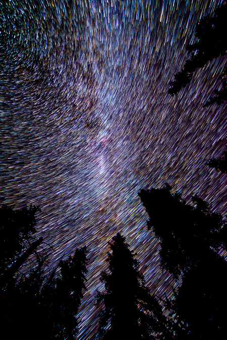
I really enjoy doing star trails with trees in the foreground. I love how the stars weave in and out of the trees.
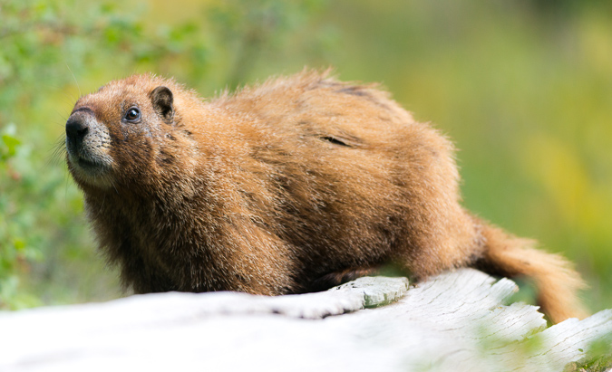
The following morning was pretty calm as we packed up. There were several marmots out and about that we could photograph while we packed and it made for a nice break between tasks.
We hiked out and ran into a couple that were camped across from us in the basin. It turned out that the woman knew one of my friends that I reguarly climb with - such a small world. It was nice talking with you Becky!
Almost back to the car and we ran into that awesome waterfall again. I had to stop and get a parting shot of it using the 9-stop ND filter.
On the drive out we noticed some really cool cliff bands in the basin as well, so we had to stop to get photos of that too. It is amazing where nature will allow trees to grow.
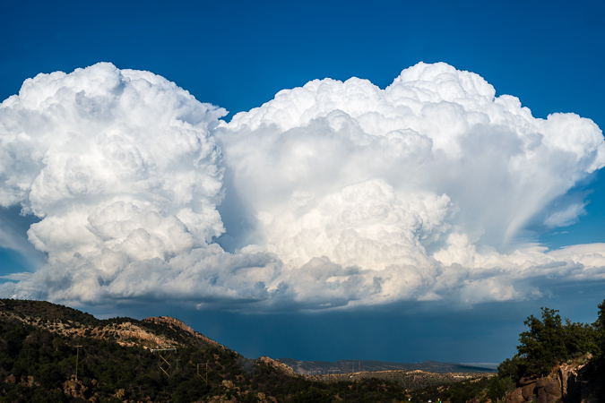
We stopped in Silverton for lunch and found a very nice restaurant called the Teller House. We were served some very tasty vegeterian burritos from their friendly staff, who filled our Odell Cutthroat Porter frequently. On the drive home, we bumped into a massive storm cell that was east of Canon City. It was one of the most impressive storm clouds I'd seen in awhile. We also learned that Manitou Springs had severe flooding while we were gone, due to the Waldo Canyon Burn Scar. What a memorable summer it had become.
Lastly, I put together a short time-lapse video from the lower Ice Lake Basin. The first two sequences were created in-camera on my Nikon D800 and the Milky Way sequence was built using iMovie and still images. My friend Nicole Buetti allowed me to use her music for my video. Stay tuned for more time-lapse movies featuring Nicole's amazing music later this year! To hear more of her music, go check out her website!