Displaying items by tag: Sunrise
Climbing Pigeon Peak & Turret Peak via Ruby Basin - a sleepless soul-filling adventure

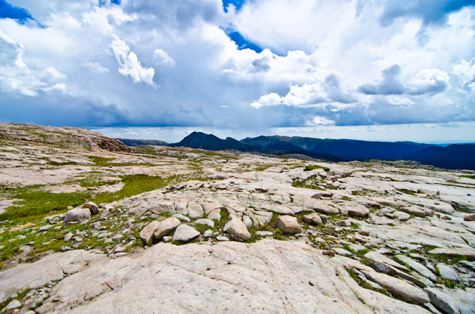
I first admired Pigeon Peak's utterly impressive east face from the summit of Arrow Peak in 2010 on one of the most epic trips I've been on in my life. Ever since then, I knew that a trip up Pigeon Peak would be in my future. It only took 6 years, but I finally pulled it off. If someone would have told me at the start of the year that I was going to photograph the Perseid Meteor Shower from the saddle between Pigeon Peak and Turret Peak this year I would have just laughed it off. After living in Portland, Oregon for two years, I had developed a bit of a beer gut and lost some of my "mountaineering shape" I had worked on while going after the 14ers from 2008 - 2012. A year ago the idea of pushing myself hard enough to photograph the best meteor shower of the year from 13,000 ft. would have been laughable... but here we are in 2016 and that's exactly what I did. In fact, the details of my trip, in retrospect, are a bit staggering to take in, at least for my old 37-year-old body. The full details show nicely on my GaiaGPS track, which is downloadable. You can purchase GaiaGPS here and help support the site.
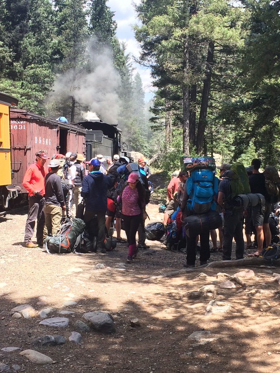
8/12/16 - 8:30 AM - depart Durango on the Durango & Silverton Narrow Gauge train
8/12/16 - 11:30 AM - dropped off at Needleton by the Durango & Silverton Narrow Gauge train
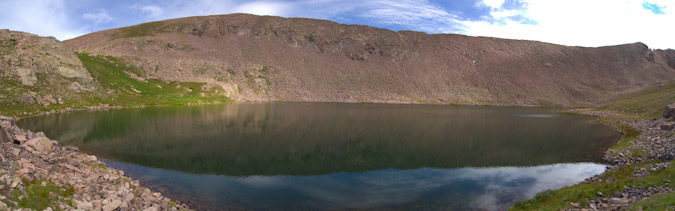
8/12/16 - 3:00 PM - arrived at Ruby Lake
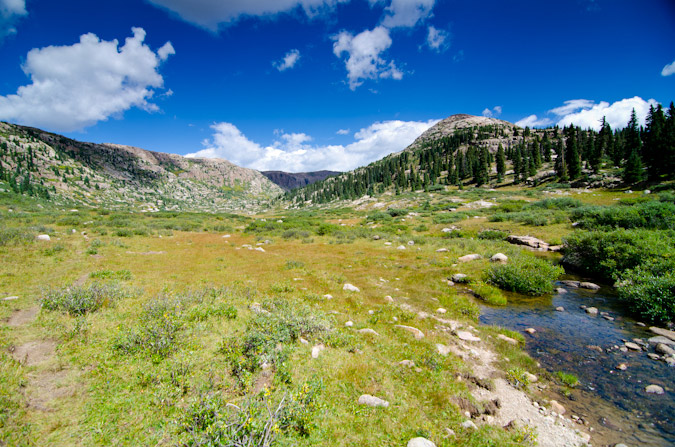
8/12/16 - 5:00 PM - arrived at meadow in upper Ruby Basin below Turret Needles
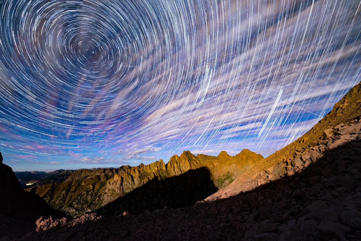
8/12/16 - 10:30 PM - departed without sleep for the Turret Peak / Pigeon Peak saddle to photograph the Perseid Meteor Shower
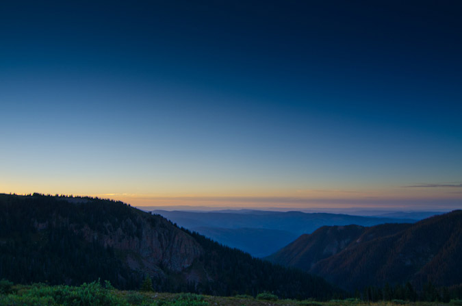
8/12/16 - 11:45 PM - arrived at Pigeon / Turret saddle and began photographing Perseid Meteor Shower
8/13/16 - 2:00 AM - moon sets (still no sleep, too cold)
8/13/16 - 4:30 AM - arrived at Turret Peak summit
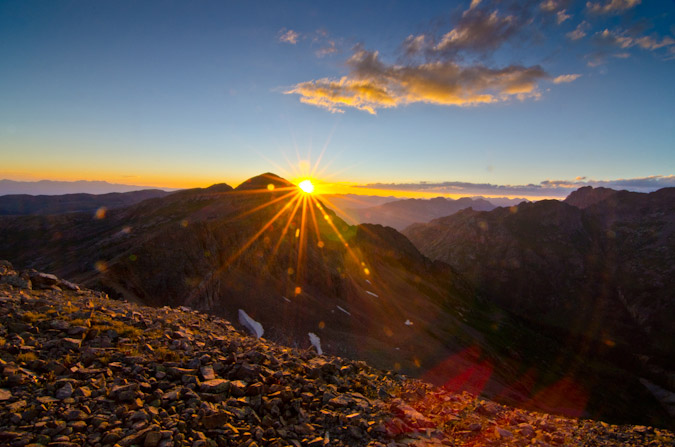
8/13/16 - 5:21 AM - began photographing sunrise from Turret Peak summit
8/13/16 - 6:15 AM - left Turret Peak summit to head back to saddle
8/13/16 - 6:45 AM - arrived at saddle
8/13/16 - 8:00 AM - arrived at secondary saddle to enter North Pigeon Creek basin and descend down 1,700 ft. to climb Pigeon Peak
8/13/16 - 8:15 AM - arrived at base of Pigeon Peak on northwest side of Pigeon
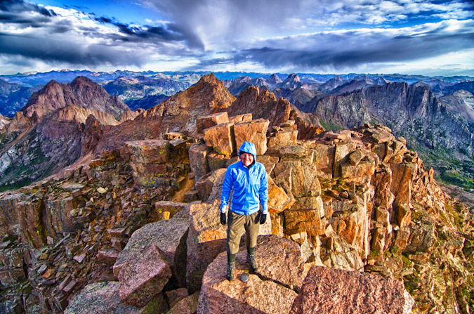
8/13/16 - 9:40 AM - arrived at summit block of Pigeon and class 4 section
8/13/16 - 10:00 AM - arrived on Pigeon summit
8/13/16 - 11:30 AM - arrived at secondary saddle and began to regain Pigeon / Turret saddle
8/13/16 - 12:55 PM - arrived back at camp in upper Ruby Basin (commence sleep for the first time since 6 AM on 8/12/16 - that's 31 hours of being awake without sleep)
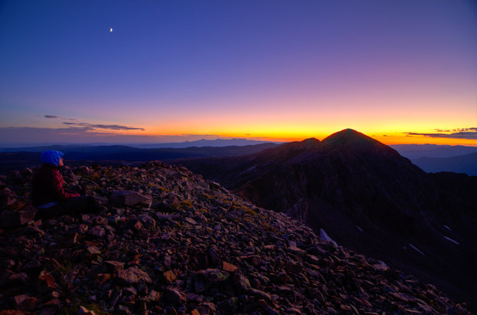
8/13/16 - 7:00 PM - photograph sunset from upper Ruby Basin
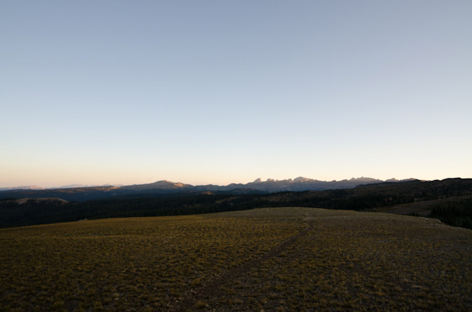
8/14/16 - 7:30 AM - photograph sunrise from upper Ruby Basin
8/14/16 - 9:00 AM - leave upper Ruby Basin and hike out
8/14/16 - 10:00 AM - arrive at Ruby Lake
8/14/16 - 12:05 PM - arrive at Needleton and wait for train
The grand total was 9,286 ft. of vertical ascent in 10 hrs, 52 mins of movement with a total of 19.3 miles of distance covered. Not bad!
To some (like Andrew Hamilton) those stats not might seem very impressive, but it felt pretty great to me, especially considering the extra 10 pounds of photography weight I was carrying.
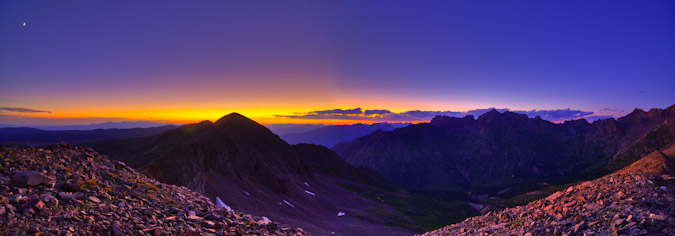
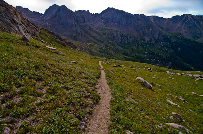
So, from the beginning... where was I? Ah, yes, taking the train from Durango. I had originally planned on going to climb Silex and The Guardian with Natalie Moran from 14ers.com, who I had done Dallas Peak and Teakettle Mountain with me back in 2013; however, I did not think I was going to be able to get the day off of work, so I cancelled... and at the last minute on Thursday night I was able to swing the day off, so I made hasty plans to get Pigeon and Turret under my belt. Knowing that the Perseid Meteor Shower was peaking Thursday and Friday night with the radiant (the part of the sky where the meteors originate) coming out of the north east, I made plans to hike all the way up into Ruby Basin and try for the Pigeon / Turret saddle with a view looking north east towards Animas Mountain and Monitor Peak, all illuminated by the setting moon until 2 AM. These plans were of course made possible by studying maps, reading Roach's 13ers guide, and by using a great app called PhotoPills, which I've written more about HERE.
The trip on the train went without a hitch and the scenery was nice, but nothing compared to what was in store for me soon.
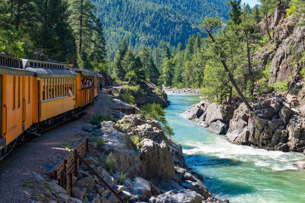
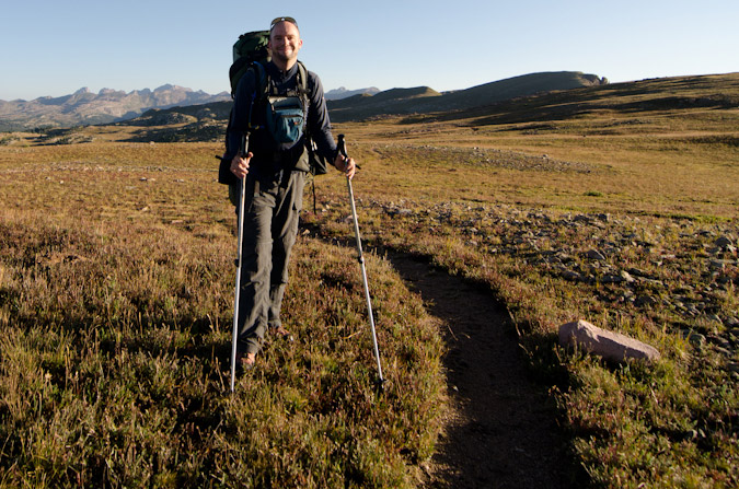
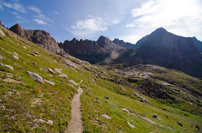
The train stopped at Needleton and at least 40 people got off to begin their backpacking trips in the area. The brakeman responsible for unloading the packs was throwing them off the box car in a rush, much to everyone's dismay. Water bottles, food, stoves, bags, and more went flying out of people's packs. I later found that my water filter was damaged in the ordeal. I was thinking about filing a complaint with the train company becuase this employee clearly did not care about anyone's stuff. I was lucky none of my camera equipment was damaged. I crossed the bridge over the Animas and watched as everyone else headed south towards Chicago Basin, while I went north for Ruby Lake & Ruby Basin. It turned out only two other people from our train went up into Ruby Basin with me, but I would not run into them until my second day. In preparation for this backpack, I read and re-read Roach's descriptions for the approach. It sounded pretty intense: "...this is a very rough approach. A direct ascent up Ruby Creek from the Animas is so difficult it has left several strong people speechless." Wow, those are pretty strong words from Roach, who I have often teased in other trip reports as being vague or non-descript. I took Roach's cautionary words with a grain of salt and went for it. I felt pretty strong and was up to the task, so I began. Luckily, I had my friend Natalie Moran's GPS track downloaded into my phone via GaiaGPS so that I could roughly keep track of the trail. This was particularly helpful right off the bat when trying to locate the turn-off from the Animas River Trail into North Pigeon Creek.
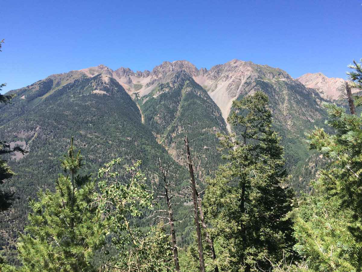
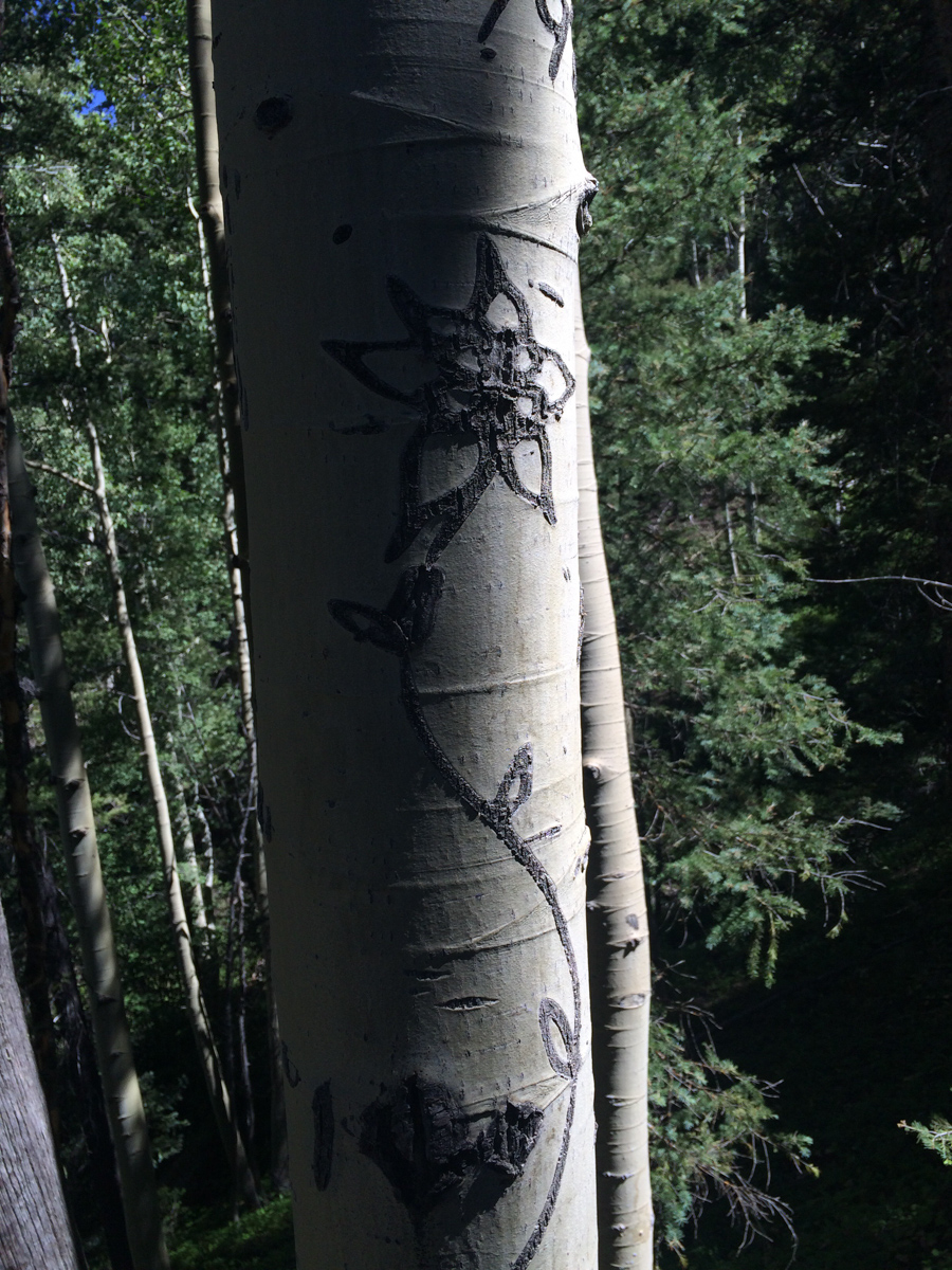
Shortly into this trail, it became steep. Steep and unrelenting. I had pared down my pack weight to 38 pounds, not bad considering all of my camera gear; however, this trail was downright brutal. Roach was not joking. I kept my eyes peeled for a carving of a columbine flower, which was supposed to signify that I was on the right trail up to Ruby Lake; but, I never did find it on the way up. I figured out later what I did wrong though. When I reached the small creek crossing for North Pigeon Creek (the only one), I spotted what I thought was the trail up off to the left on the side of the hill. That is the trail I followed (which eventually petered out and ended up in a bushwhack straight up until I found the right trail). The correct trail was to the right and up from the creek crossing, which I learned on the way back down. At least the views back across the Animas towards West Needle Mountain and the Twilights was great.
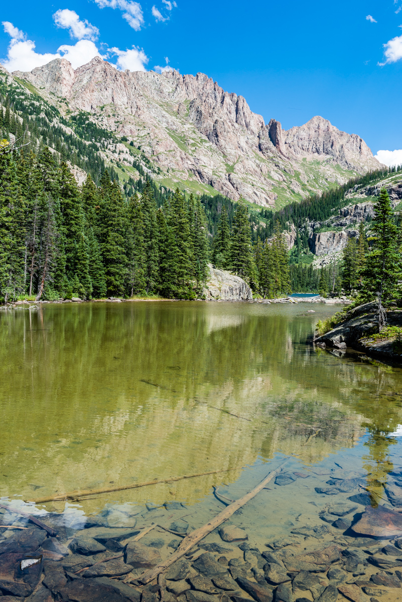
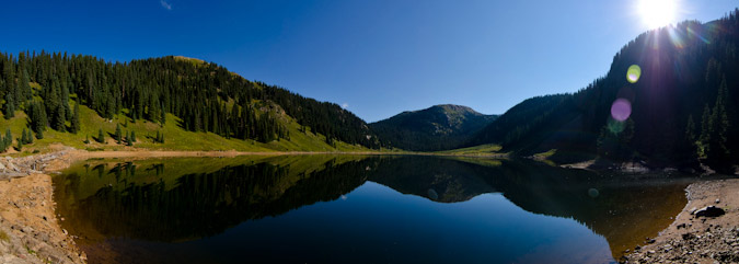
In preparation for this trip, I was looking through lots of trip reports and stumbled across a familar name. It was the name of one of my newest co-workers, Terri Horvath, who is a bi-Centennial finisher (she's climbed the highest 200 mountains in Colorado). Terri provided me with some excellent tips which kept me from going even more off course than I already had, including some solid advice in locating the "high trail" that Roach describes in his route descriptions. Right after a very steep step down, I looked to the right to find the proper trail. This trail worked steeply up and down above Ruby Lake and finally dropped me right at the base of the lower lake, with views of Ruby Lake finally realized.
Upon reaching Ruby Lake, I ran into a group of five guys from Denver that were really great to chat with, one of which being a fellow photographer named Jarad Switzer. We commiserated on the gruelling hike into the basin and then I shared my plans to shoot the meteor shower that night which I think left them all thinking I was a little bit crazy. Was I? Probably. I kept a solid pace up to the lake, making it there in 3 hours 30 minutes from Needleton. I continued on. The views of Pigeon began to blow me away. This thing is truly unbelievable!
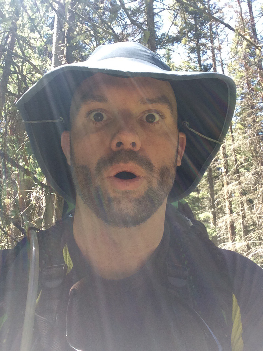
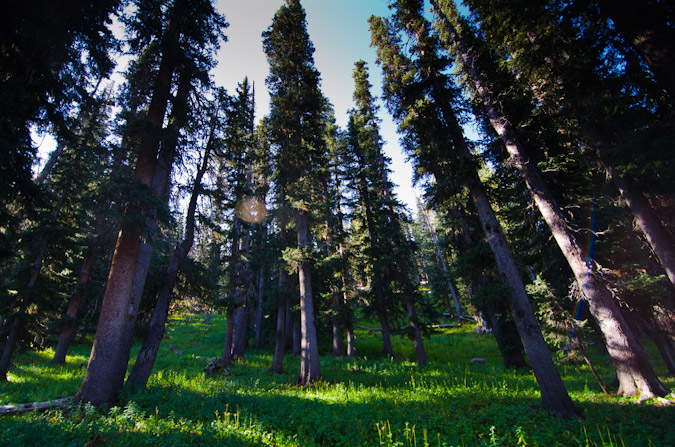
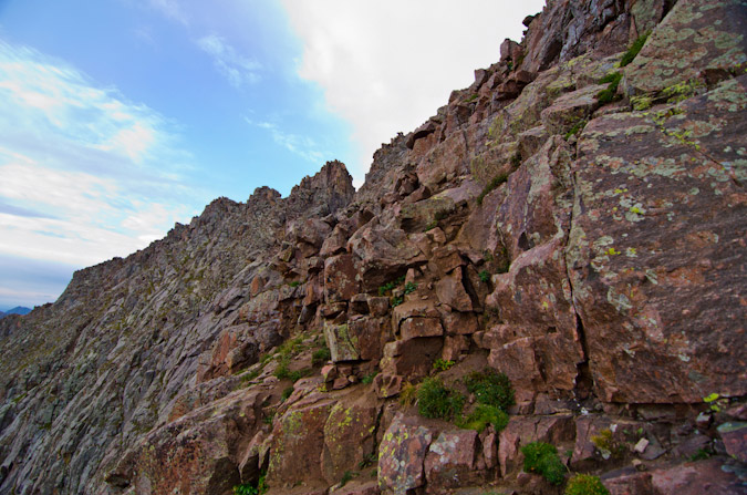
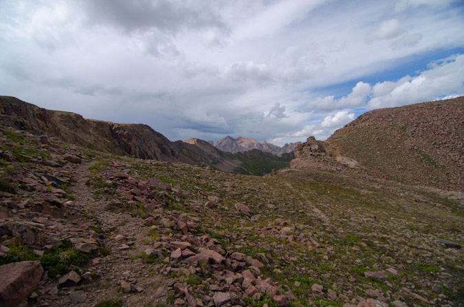
The trail became really hard to follow after the lake and was really only followable due to some well-placed cairns (thank you to whoever put those there). It weaved left above the cliffs at the headwall of the lake and through some really rugged terrain consisting of many fallen trees and steep hillsides. It reminded me quite a bit of No Name Creek, just one basin north of where I was at. My expression tells the story, I think.
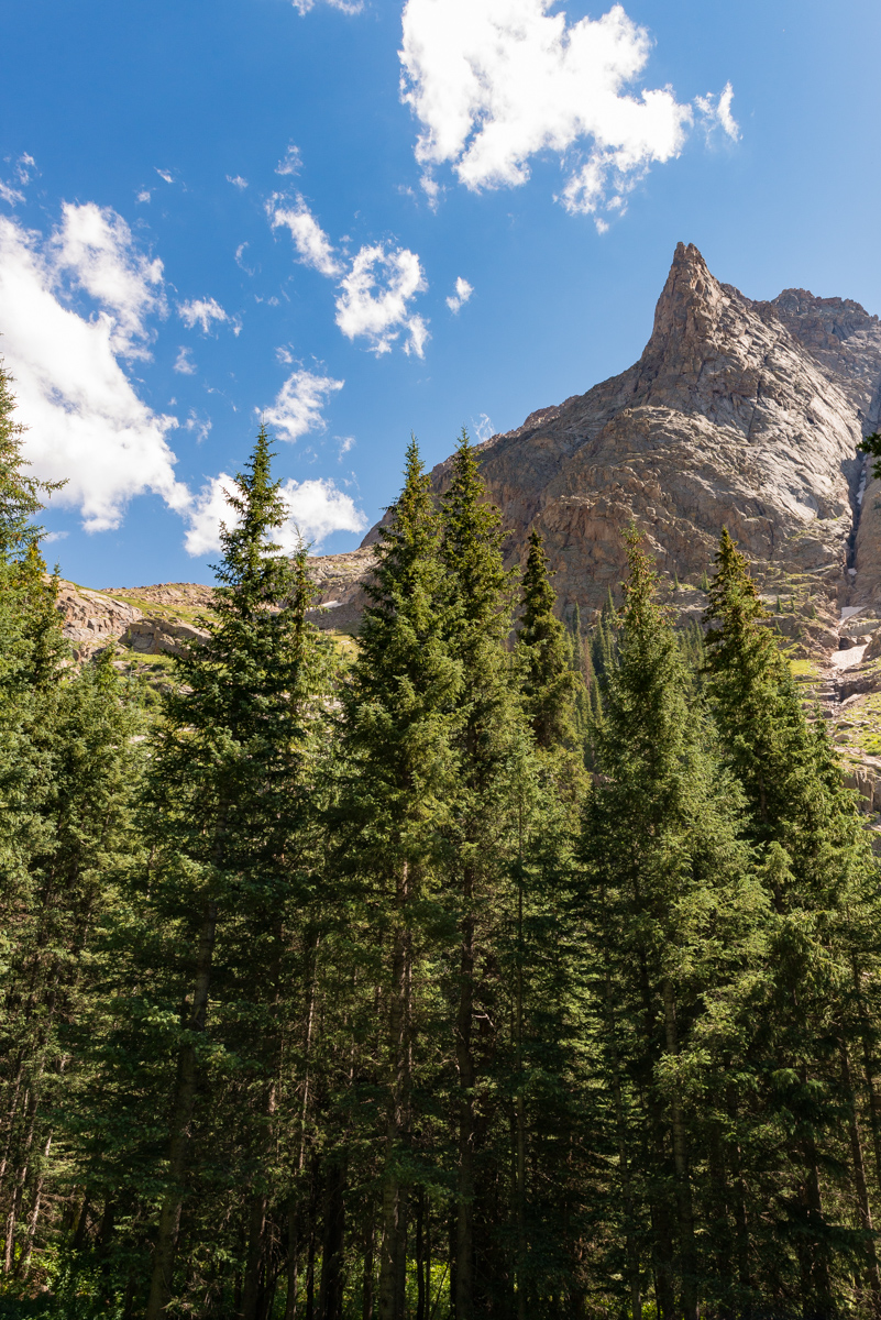
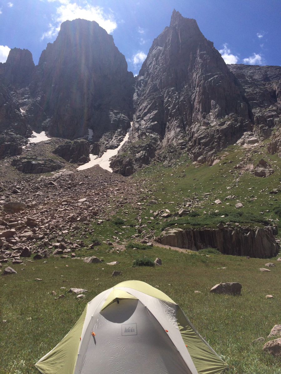
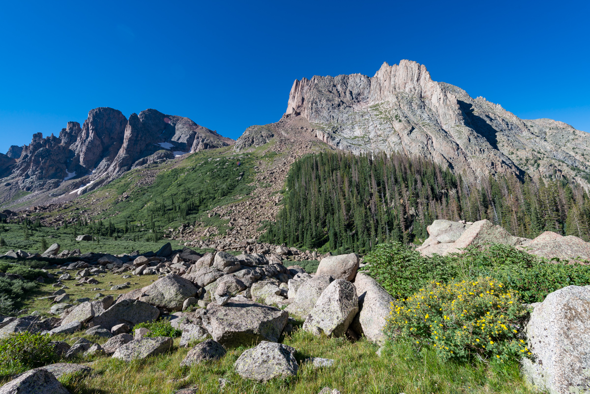
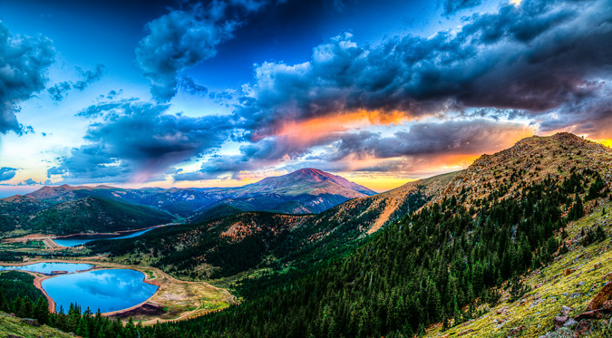
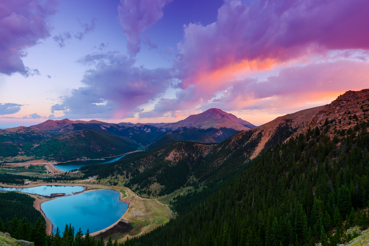
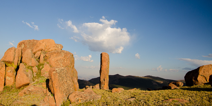
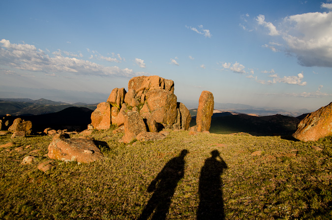
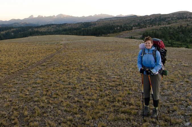
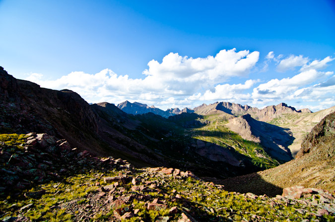
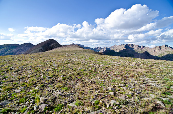
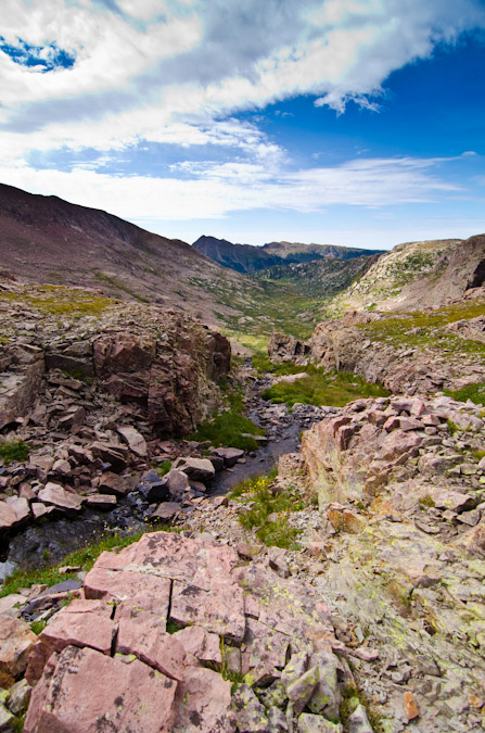
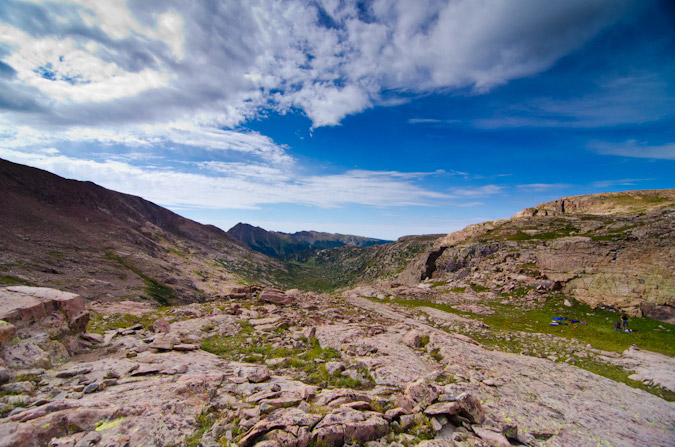
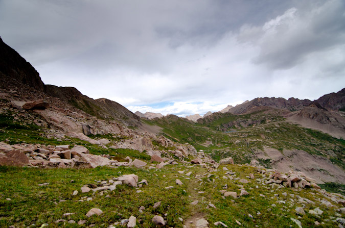
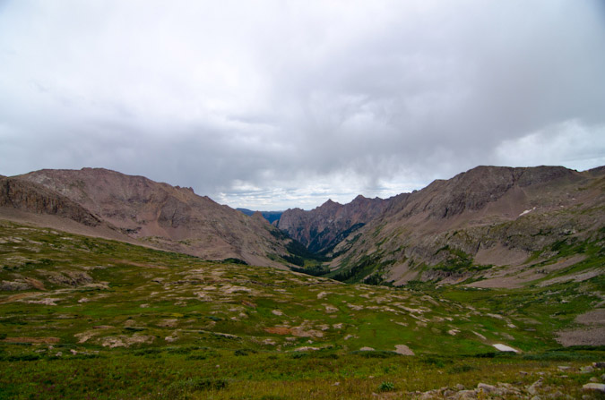
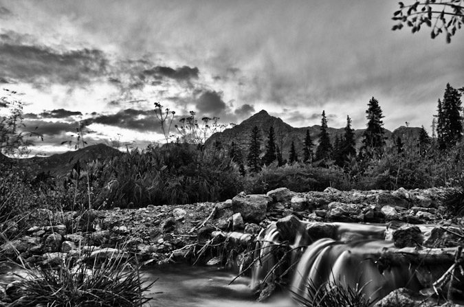
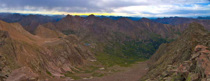
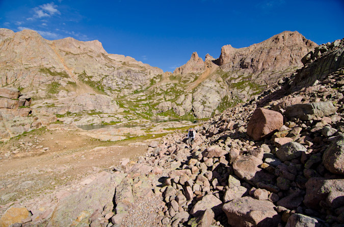
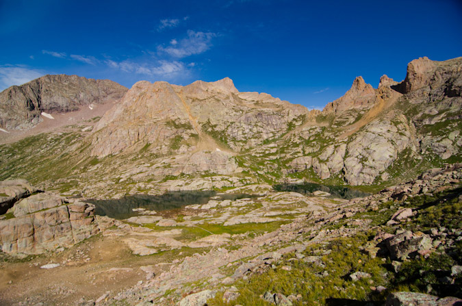
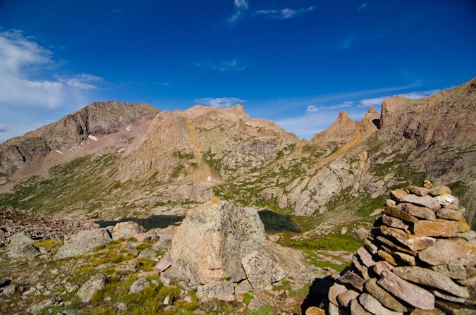
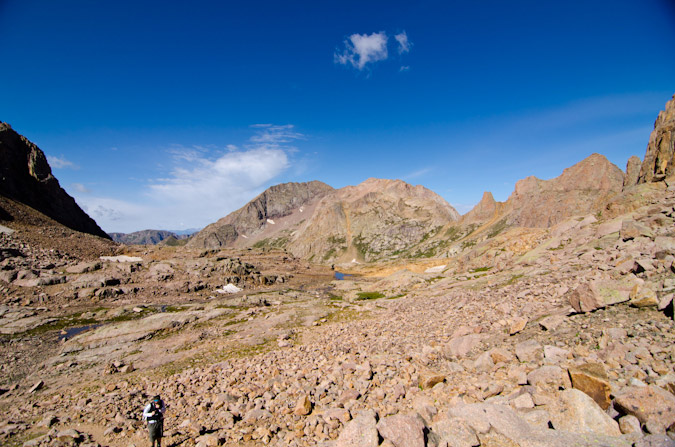
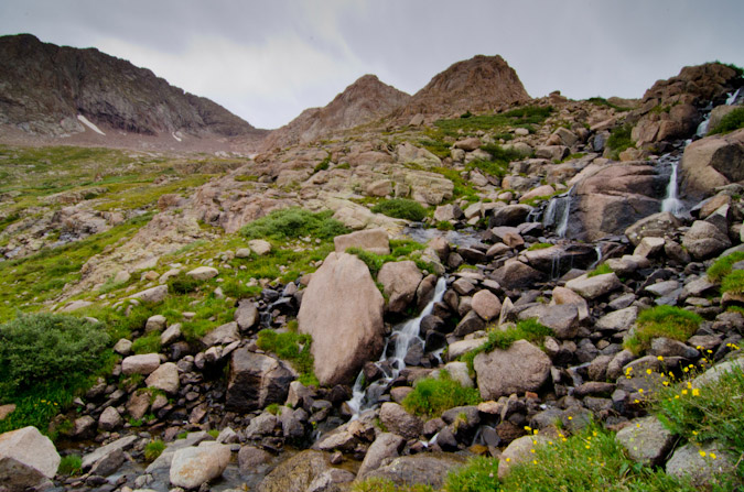
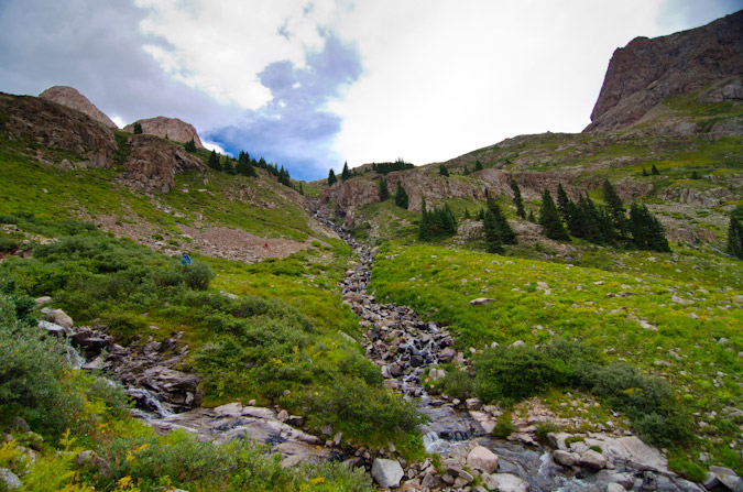
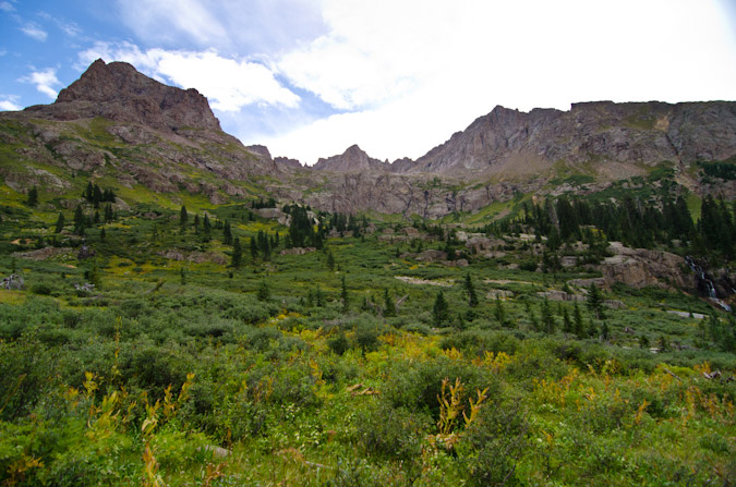
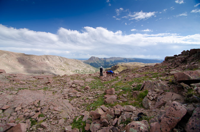
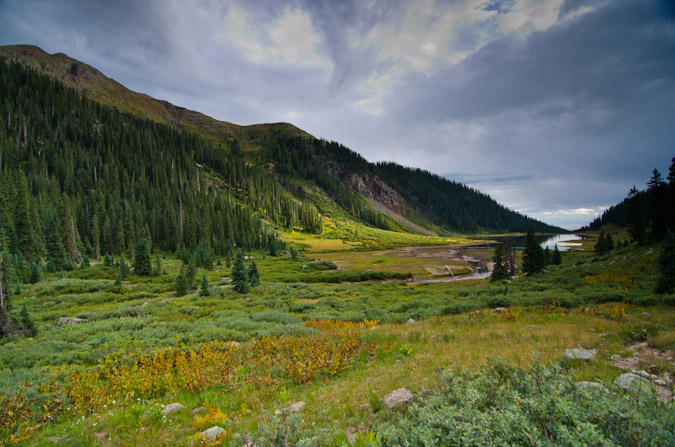
Upon breaking into upper Ruby Basin, the trail flattened out considerably and opened up to some amazing views above. The willow maze in the upper basin was actually not that hard to navigate, having been trampled through enough times to make it easy to find the weaknesses. The meadow in the upper basin below the Turret Needles and Pigeon came into view and I was quite excited until I noticed two other tents. I was hopeful that the people camped there would not mind another person joining them in the meadow. It turns out that the meadow is quite large and it would take quite a few parties worth of tents to fill it up. I arrived at the meadow at 5 PM and was pretty exhausted. I was at the opposite end of the meadow from these other backpackers, who later informed me that they had unsuccessfully attempted the east face of Pigeon earlier in the day which caught my attention. The climber, named Rex (or Max,?) explained that he had climbed Pigeon's east face 20 years prior and that he wanted to see if he could do it again. Impressive! I set up my tent and destroyed my dinner in preparation for a night of photography and sleeplessness. I had hoped to catch some sleep, which was really just a pipe dream. No sleep was obtained. I did get some decent photos around camp though.
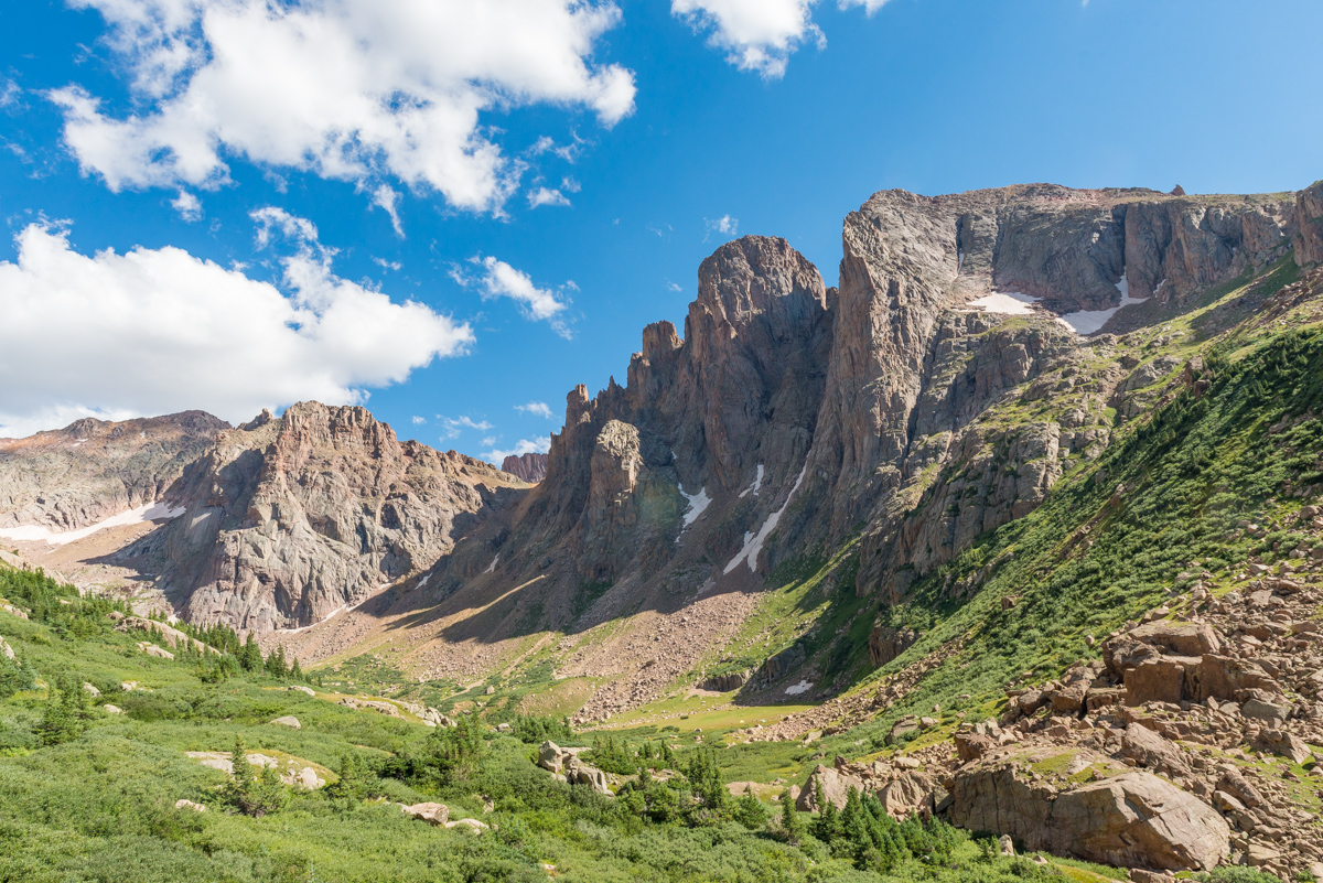
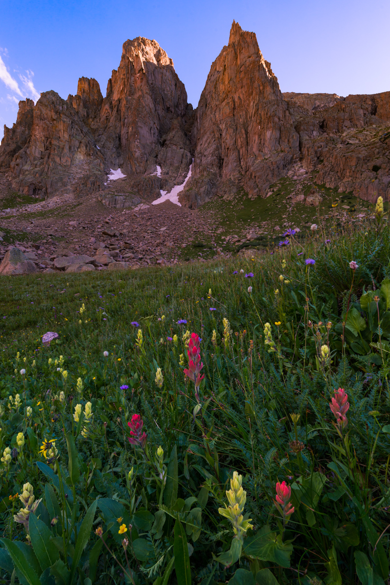
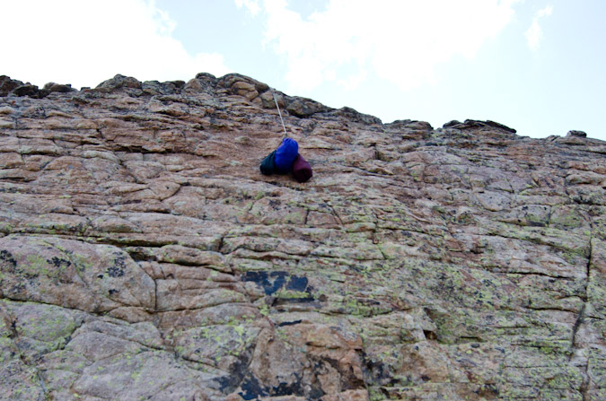
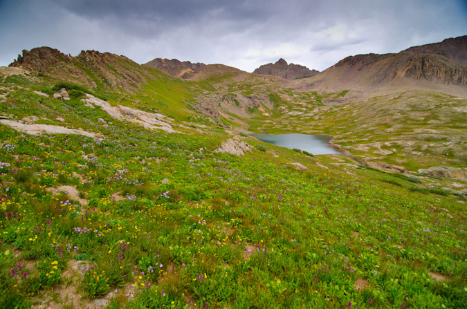
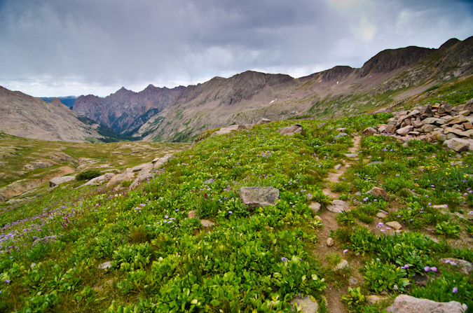
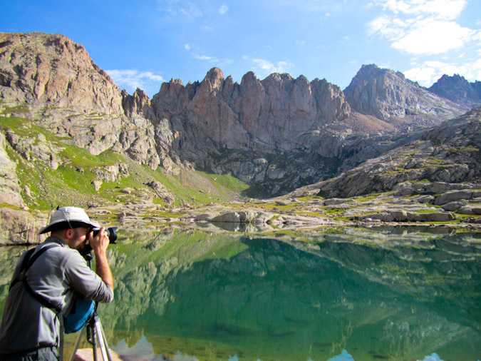
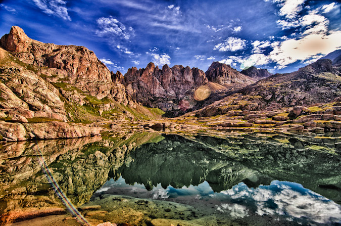
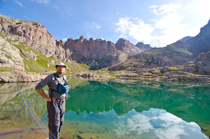
The Turret Needles were the most impressive feature of the basin and I decided to camp right below them about 100 feet away from the stream. Knowing that I would not have any trees to hang my food from, I had purchased an Ursack the day before from Backcountry Experience in Durango. The Ursack is designed to withstand the chewing of rodents like marmots and mice, which I anticipated finding lots of at the upper basin. I also employed a technique that I read about in another trip report where I suspended my food sack from the side of a cliff - a technique I also used at Lillie Lake on my Chicago Basin backpacking trip in 2011. At any rate, the wildflowers were still quite prolific in the upper basin, and I was pretty much in heaven as a photographer.
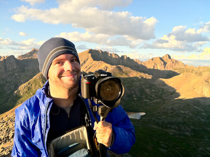
I shot exclusively with my Nikon 14-24 f/2.8 lens, and my Nikon 24-70 f/2.8 lens attached to my Nikon D800, which is getting a bit long in the tooth. Someday I'd love to upgrade to a D810 or maybe something lighter from Fuji or Sony.
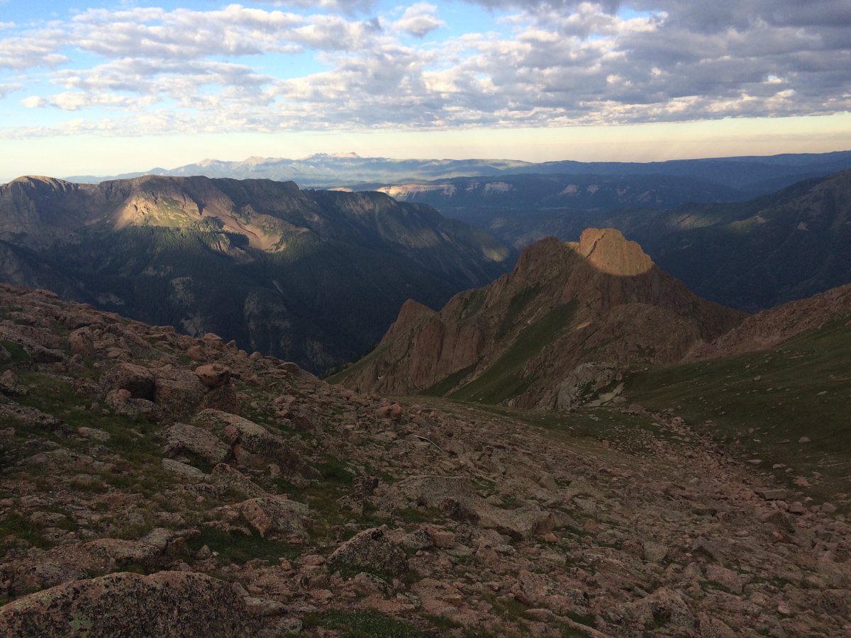
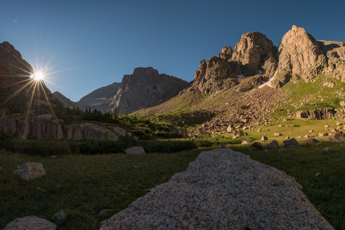
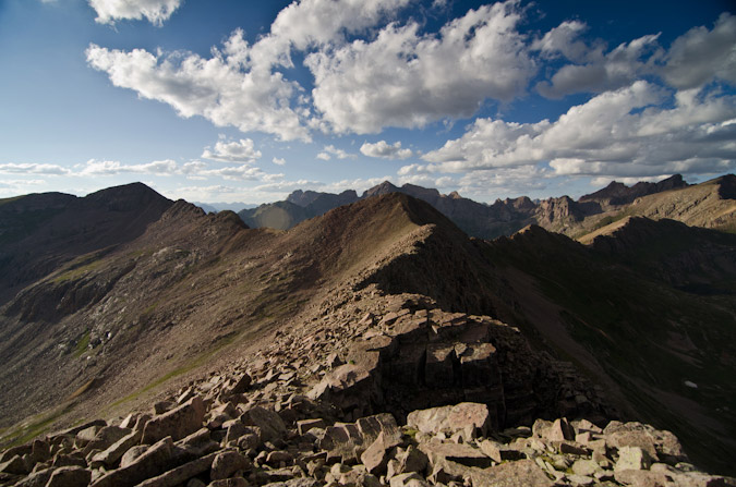
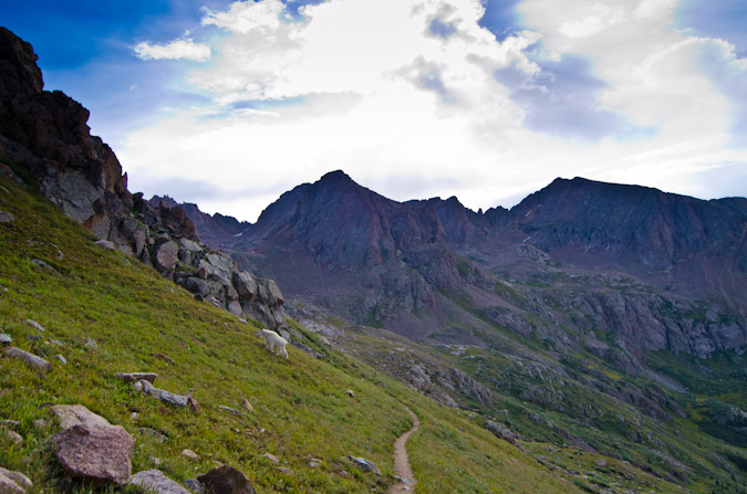
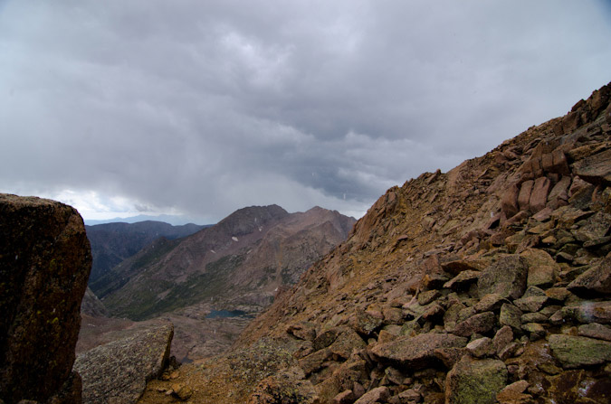
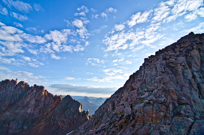
I set my alarm for 10:20 PM, but never actually slept. When the alarm went off, I bounced right out of my sleeping bag and out the door. The climber I met in the meadow had indicated that the "best" route up to the saddle was to take a little gully just to the left of where it looked like the obvious trail went. Taking their advice in the dark was pretty daunting - but it did manage to get me up very high quickly above the meadow. I followed cairns in the dark and enjoyed the views behind me of Animas Mountain and Monitor Peak, which were illuminated by the moon. Pigeon cast a long shadow across the peaks and was a constant reminder of just how much more climbing was ahead.
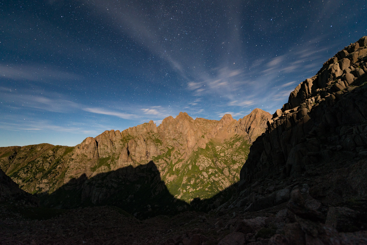
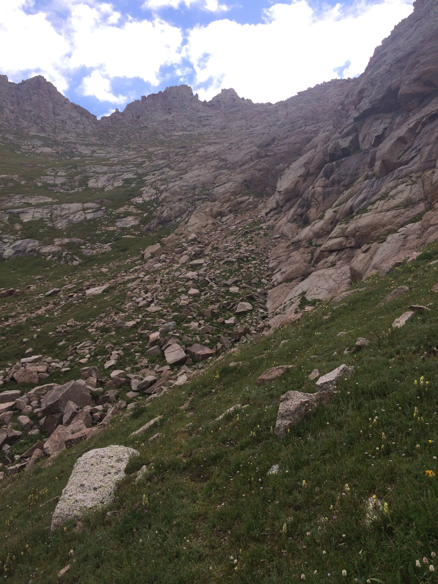
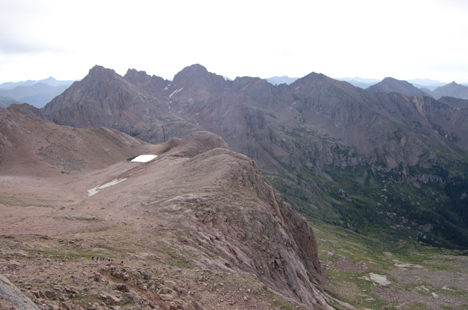
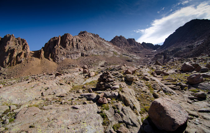
As I climbed into the area just below the saddle, I found myself in a large boulder field which I did not recall being described in any of the route descriptions. I'm not sure if I can explain it or not, but trying to locate cairns within a boulder field in the dark is pretty fun... and by fun what I mean is pretty pointless. Fortunately, I had my phone with GaiaGPS and could keep myself on route for the most part. Above this large boulder field I found the terrain smooth out a bit and I stopped again to get another photograph of the mountains behind me, the scene accentuated by this really awesome rock formation to my right, which was also illuminated by the moon.
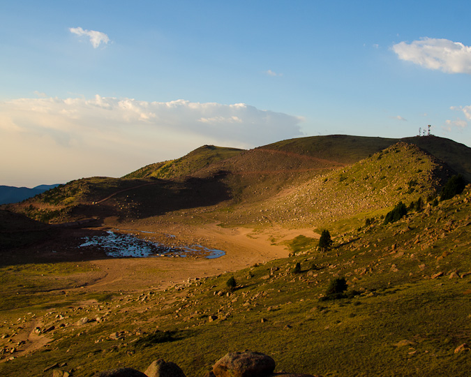
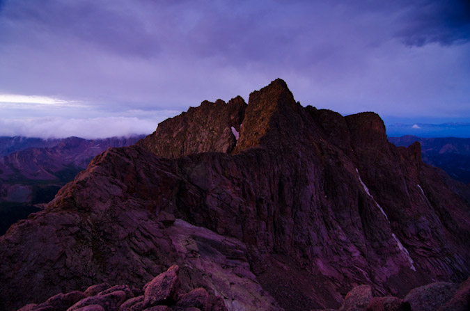
Upon reaching the saddle, I was of course not happy to find that there was some pretty cold breeze blowing over the top of the saddle. I knew that I was going to be in for a rough night of freezing my ass off. But hey, at least Pigeon looked absolutely stunning with the southeast face lit up by the moon.
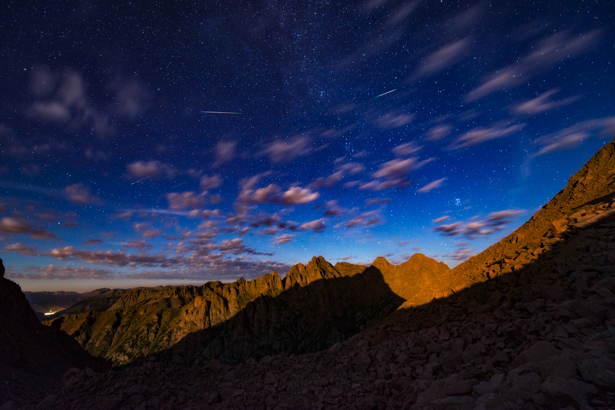
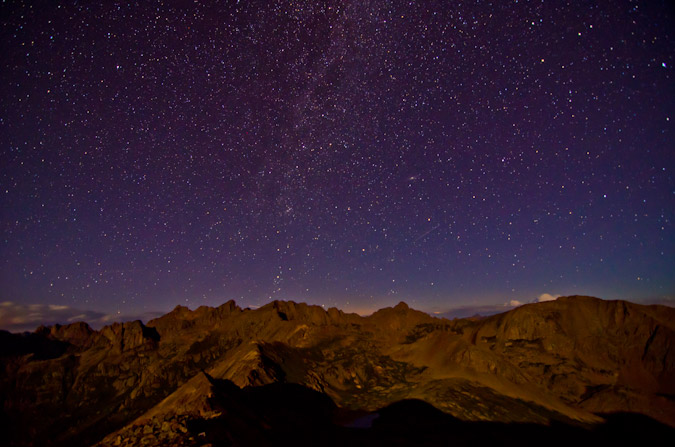
I found a nice spot to set-up my tripod for the night among some larger rocks that would be useful as a bed/chair/rest area in the cold wind. I clearly did not bring up enough warm clothing, because I basically shivered for 3 hours straight at this location, watching meteros streak by. In total, I believe I was able to capture about 15-30 meteors in my frame from 12 AM to 3 AM. The meteors were absolutely amazing to watch from this elevation, and I could even see the town of Silverton down below to the left.
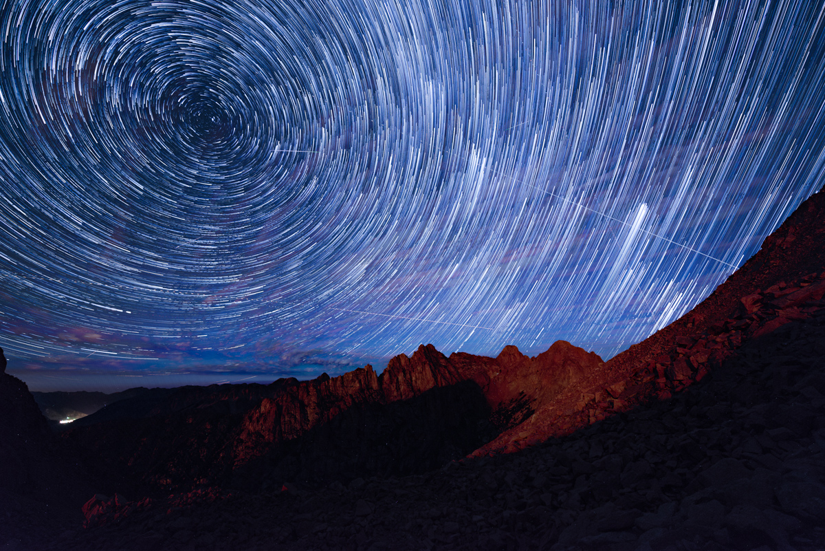
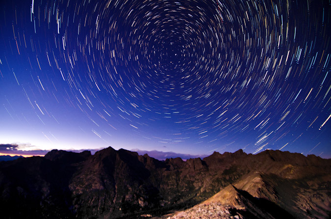
I combined the photos into some star trail sequences which turned out pretty well, and even did some timelapse video, which has music, so be warned!
More star trails!
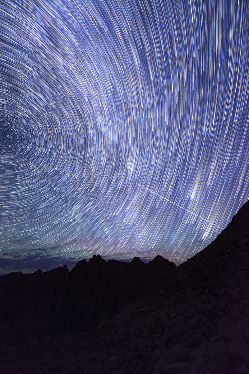
I noticed that a lot of meteors were originating at the apex of the night sky, so I turned my camera to portrait orientation for the last half of my shooting, this time in pitch black. I know I have some more photo editing to do to really highlight my work on the saddle, but this is what I have so far.
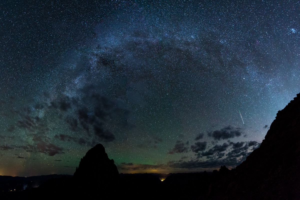
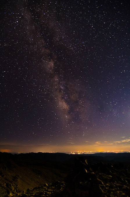
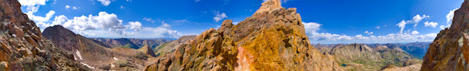
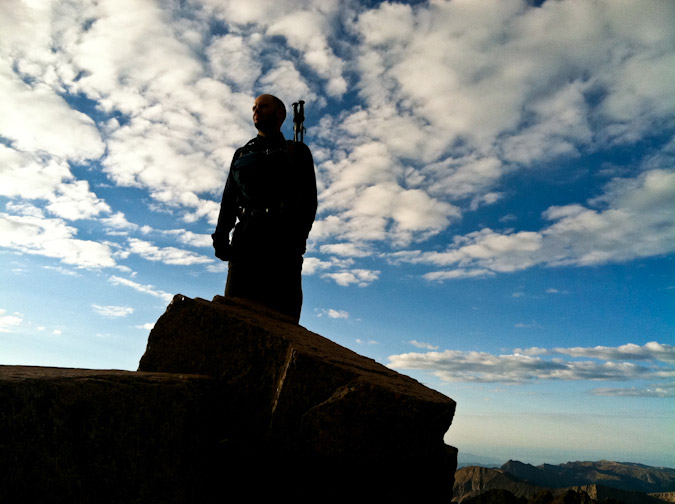
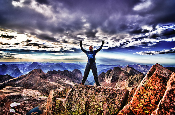
After freezing for a couple of hours I decided it was time to begin my ascent of Turret Peak. I also noted that since the moon had set that I might be able to get a glimpse of the Milky Way Core, which might open up a nice opportunity to photograph the Milky Way arching over Pigeon Peak. I pulled that off just below Turret's summit and even got a meteor in the last frame of the panorama - awesome!
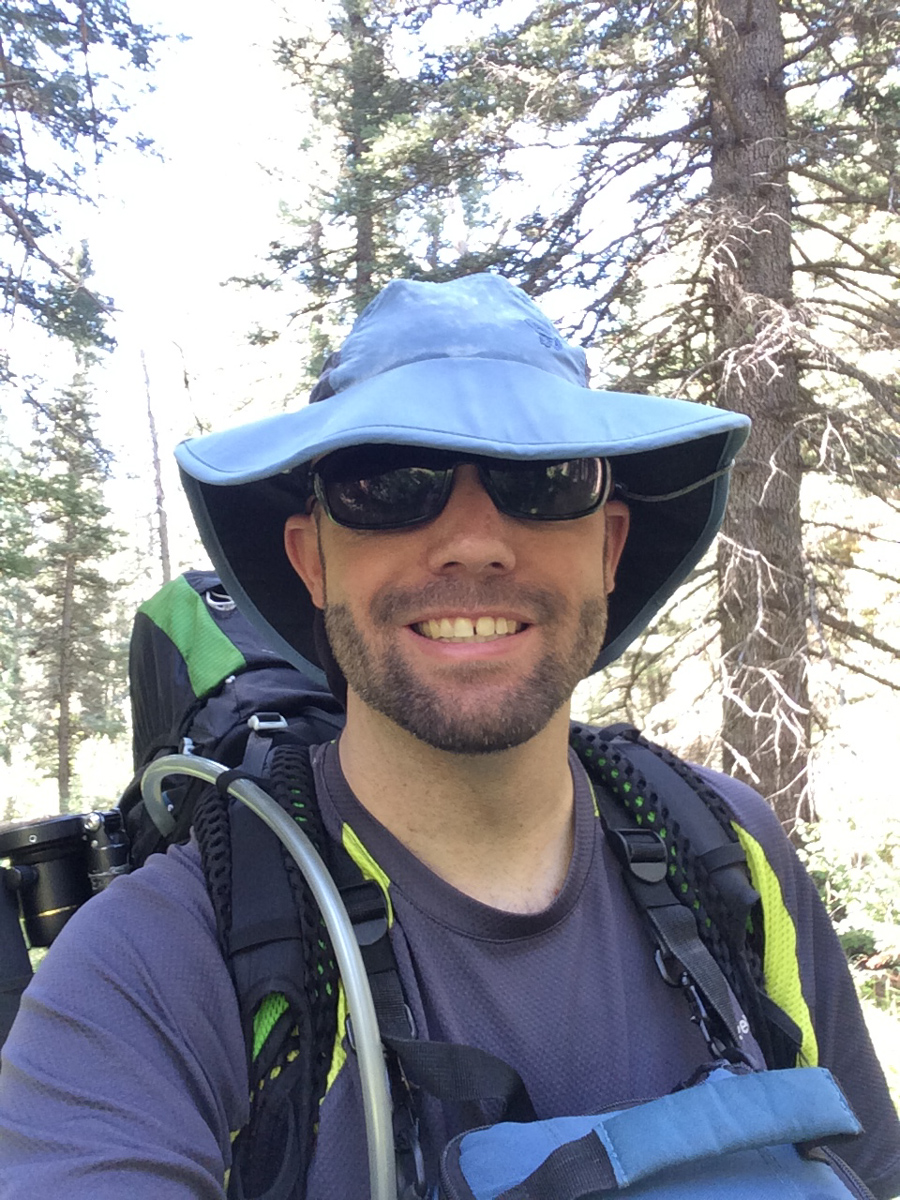
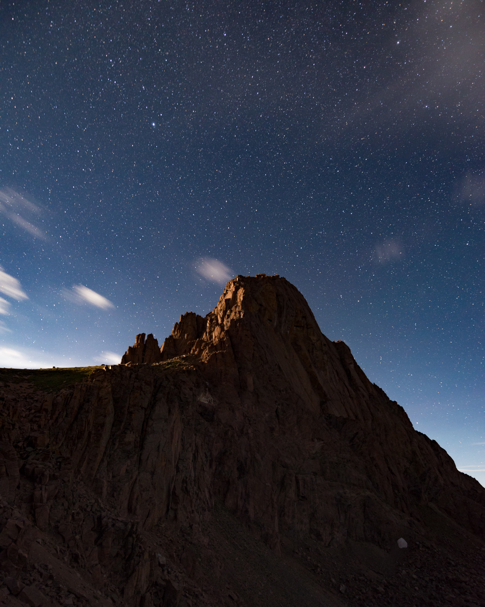
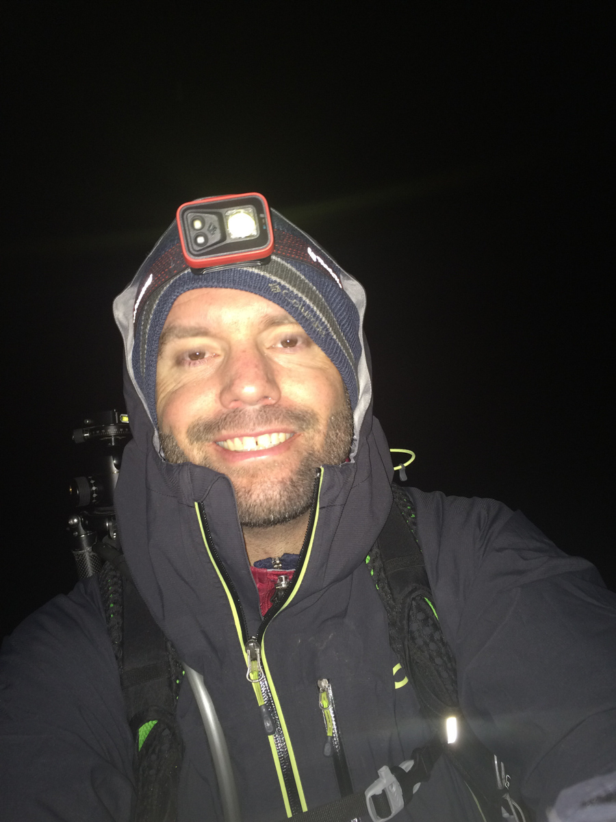
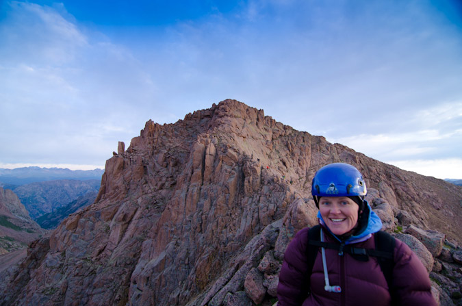
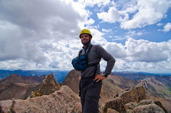
I arrived at the summit of Turret at 4:30 AM and felt completely wiped out. I think this photo says it all.
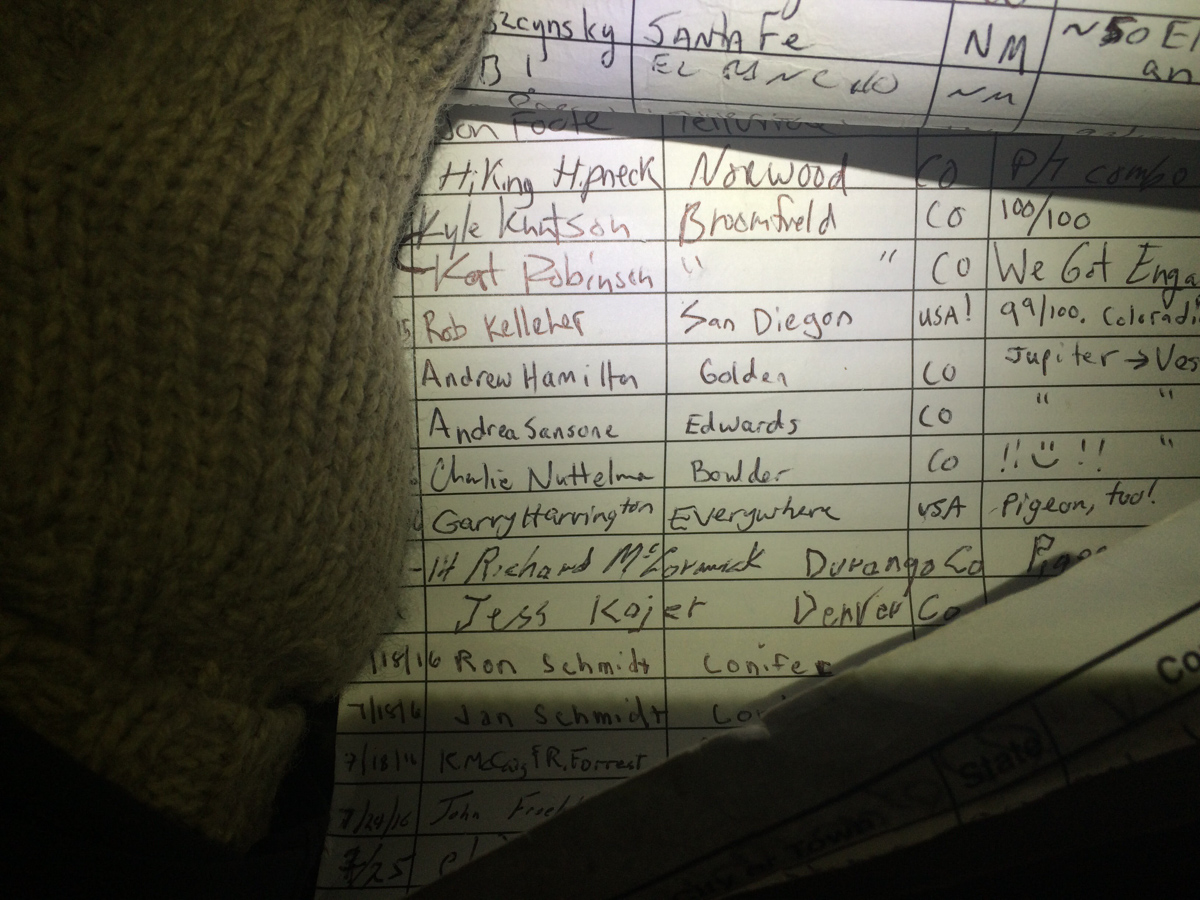
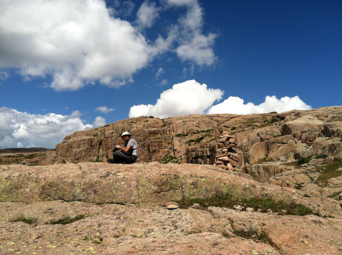
I saw some familar names on the summit register, including Andrew Hamilton from just a few weeks prior. His notes stated "Jupiter ---> Vestal" which I found quite interesting. If I'm reading it correctly, he started on Jupiter and this was just a spot in between his final destination of Vestal. That seemed like madness to me.
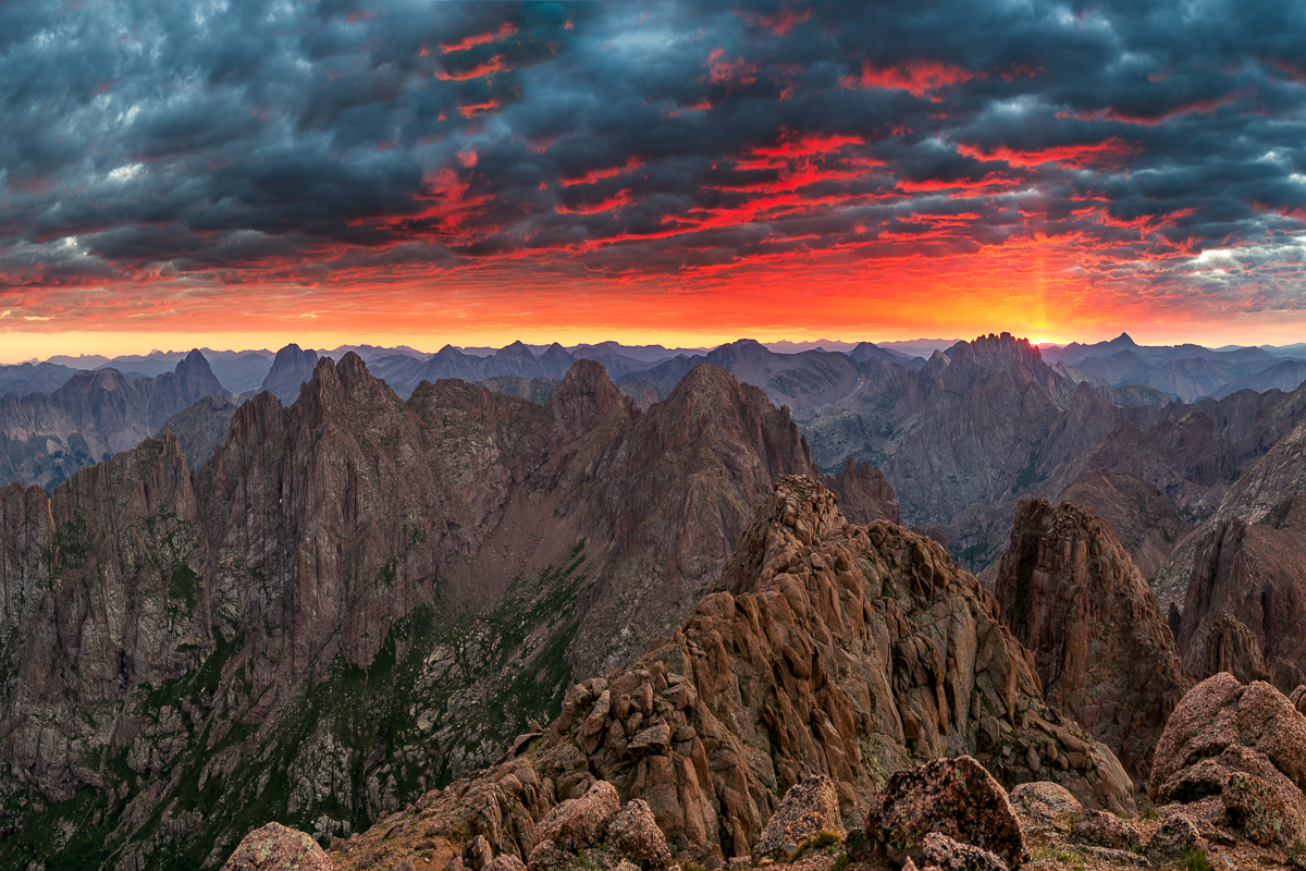
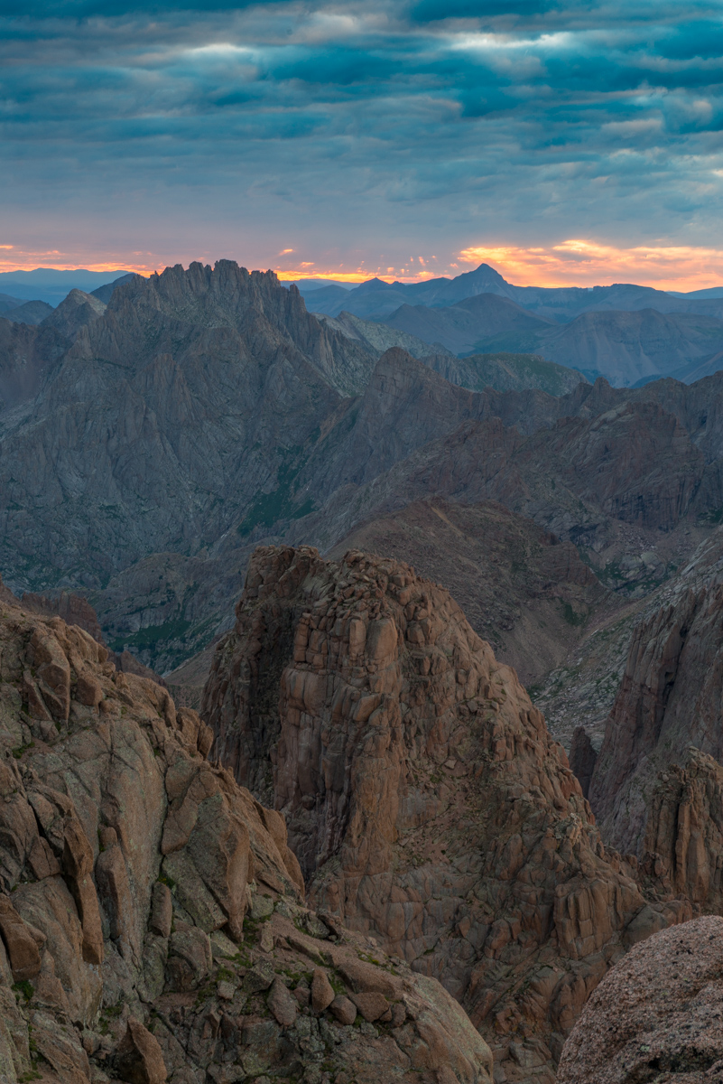
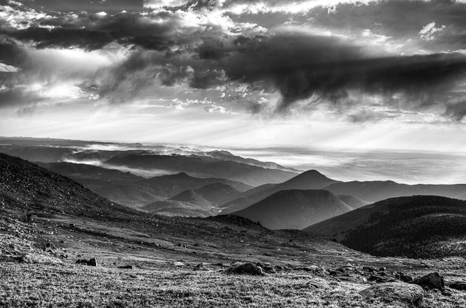
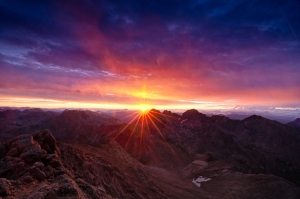
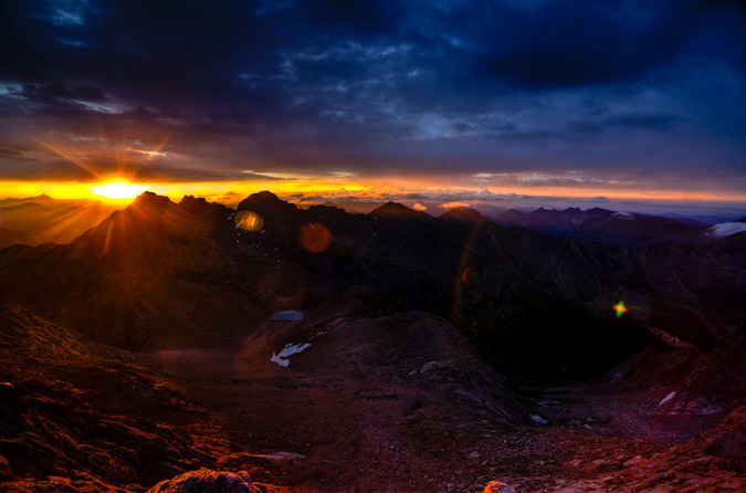
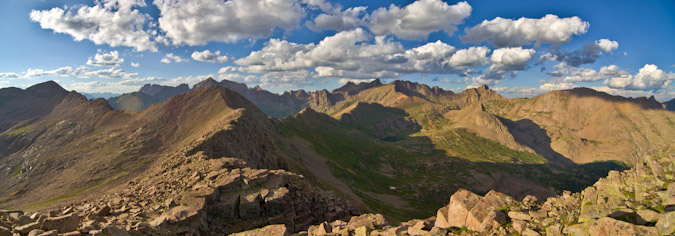
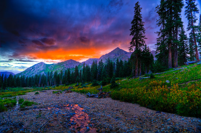
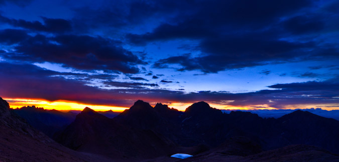
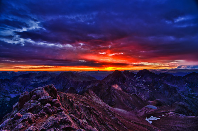
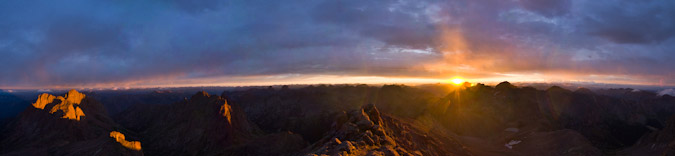
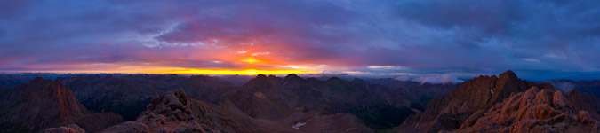
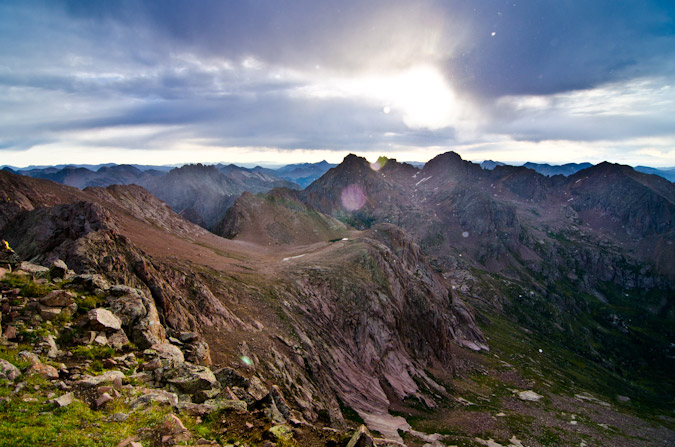
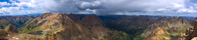
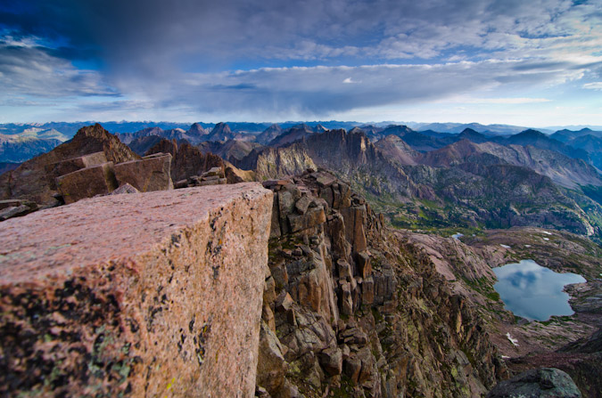
As I sat on Turret pondering life and getting my energy back up, I noted that the horizon behind Jagged Mountain was looking pink. There were a lot of low clouds, which was either going to spell disaster or complete success for photographing sunrise. It turned out to be a totally amazing sunrise to say the least. I would rate it as top three summit sunrises of my life, with the other two being North Eolus in 2011 and Uncompahgre in 2015, both of which I photographed (those links will take you to those photos). This one was pretty special though. The Grenadiers, including Arrow and Vestal as well as the Trinities were all nicely visible, accented by the Needles of Animas and Monitor. The sun was rising just behind Jagged Mountain and Rio Grande Pyramid and made for a really incredible showcase of color. Pinks, reds, oranges, and purples colored the sky and clouds. I am very proud of this one, which is available for sale on my photography website (click on it to follow there). I can't wait to print it up nice and big for display here in Durango.
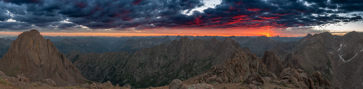
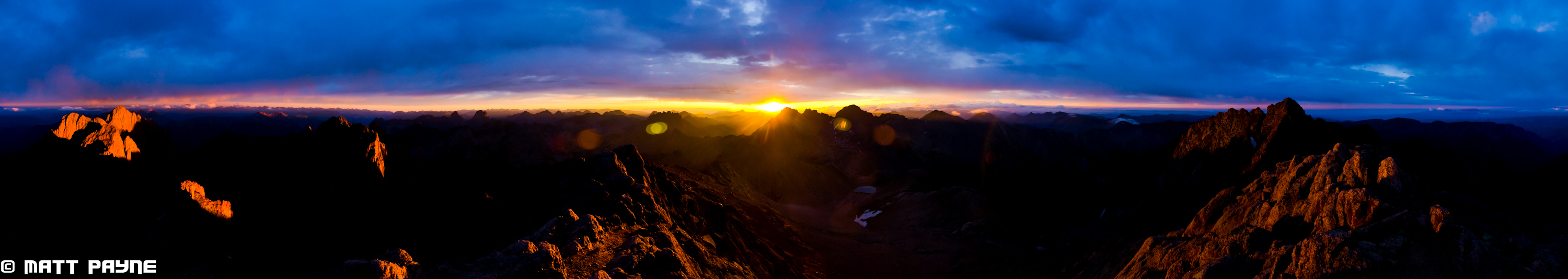
I was also able to get a nice panorama of this scene to include Pigeon Peak at left sweeping all the way over to the right to include North Eolus and Eolus. Unfortunatley, the light, sky, and clouds of about 1/2 of this scene were not very exciting, so I cut those out. Still - an amazing scene to say the least!
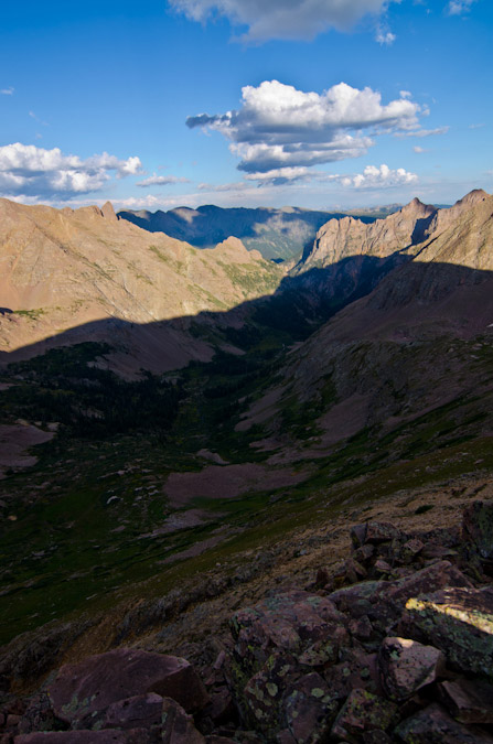
A few minutes later I was packing up to head down to the saddle again and noticed the light across to the La Plata Mountains and the Animas River below was looking quite nice as well, so I shot that.
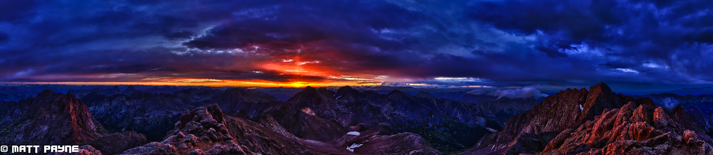
Then I noticed the clouds above Jagged Mountain looking awfuly amazing, with beams of light come down through them from the sun. I guess I could spend more time up here.
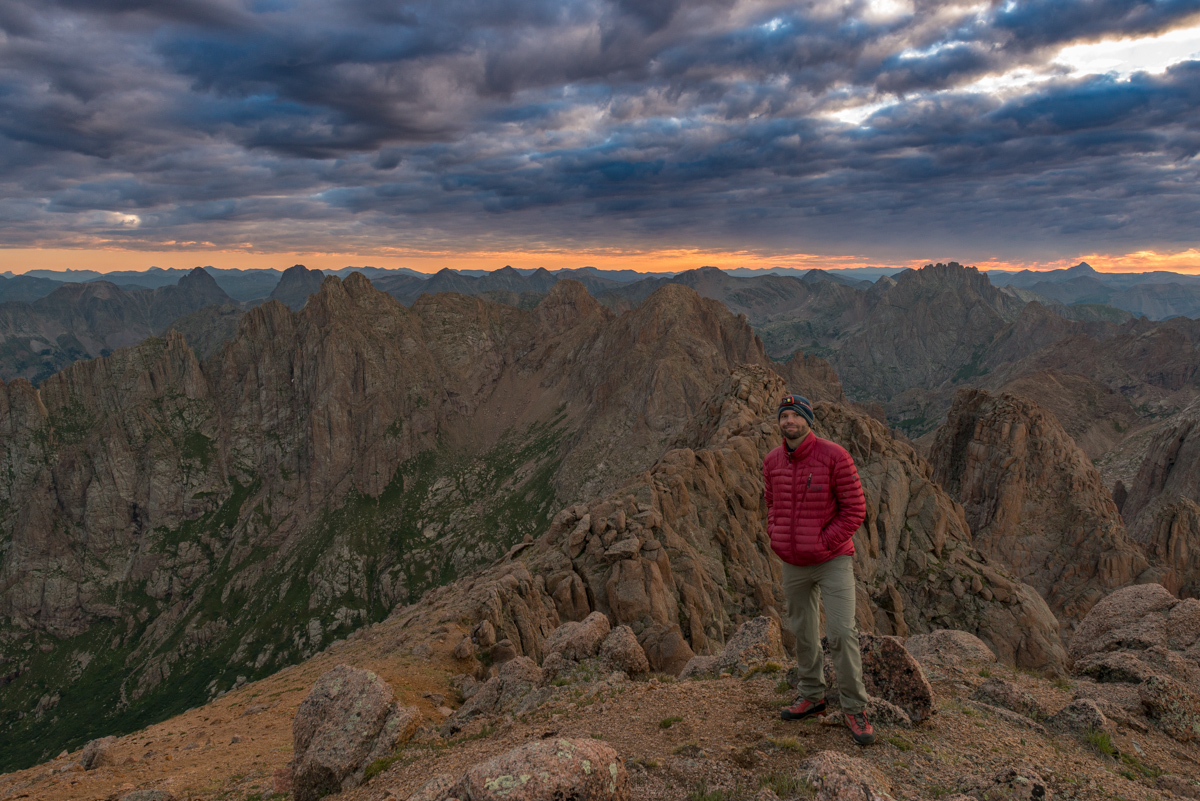
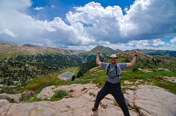
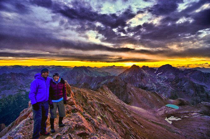
Lastly, I set-up for a quick self-timer shot of myself with some of my favorite peaks behind me. What a morning!
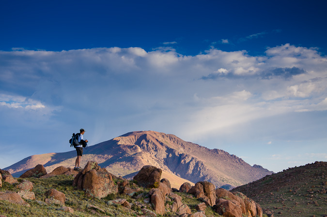
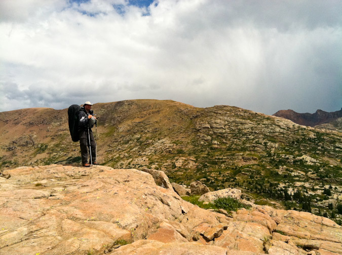
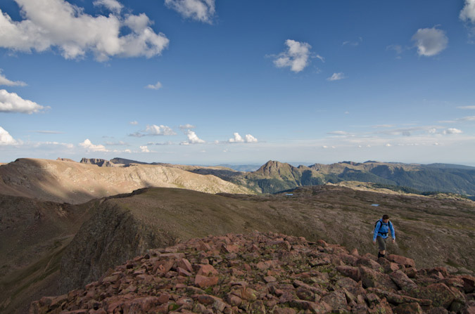
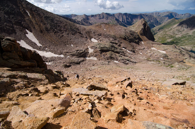
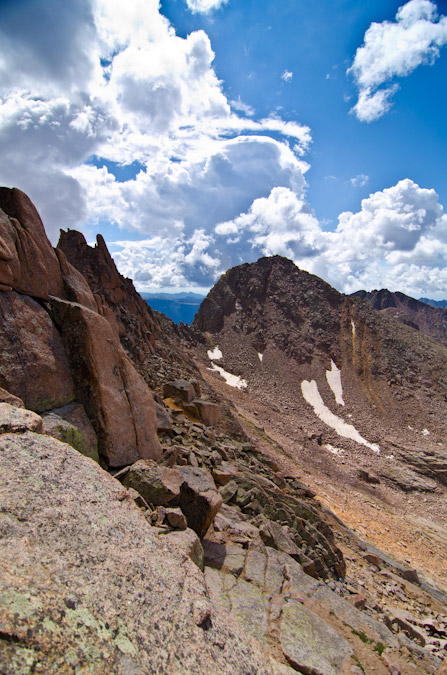
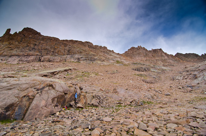
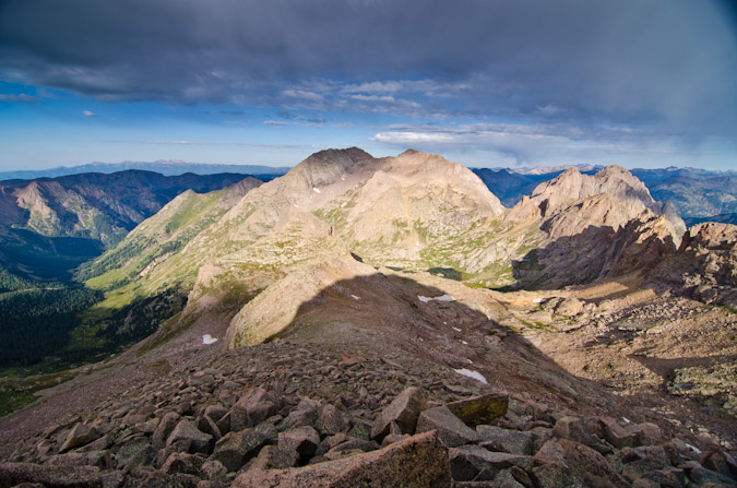
I packed up and set sights on my next objective - Pigeon Peak. I knew that in order to climb Pigeon from here I would have to descend down to the saddle and then down to another notch between Pigeon and a small un-named point southwest of it. After that, I would be forced to drop to 12,200 feet on the west face of Pigeon and all the way back up again to 13,972. I was not sure I could handle it, but the thought of coming this far and not getting Pigeon kept me motivated.
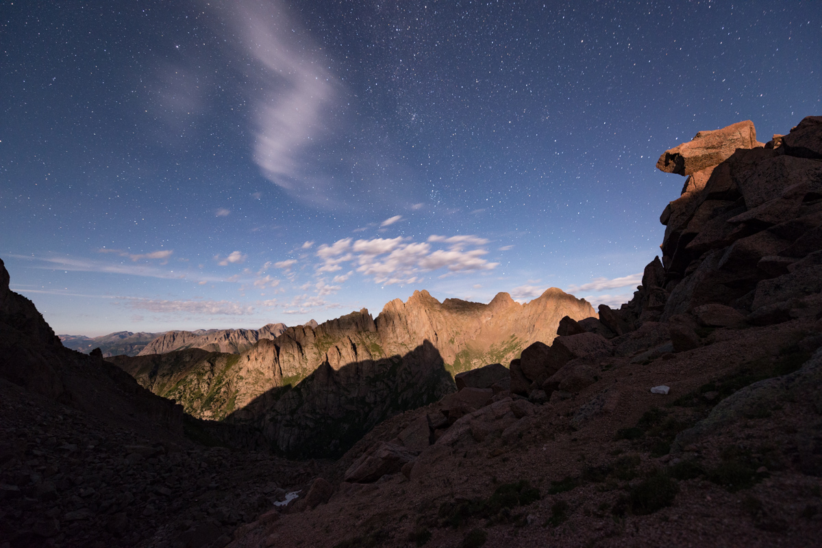
On the way down to the saddle, I enjoyed the light hitting the peaks around me and made a note of the small notch left of Pigeon, which was my next target (as seen just right of the large 'white' rock outcropping and below the illuminated peak in the photo below).
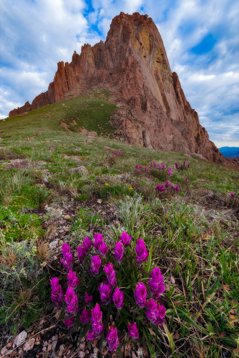
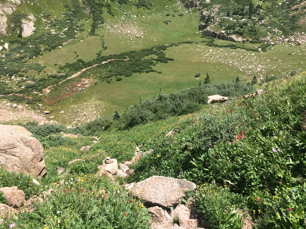
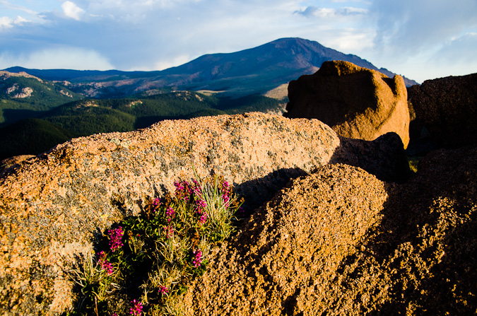
Reaching the saddle again was no problem and the scenery was incredible. The wildflowers at 13,000 ft. absolutely astounded me, in particular, these rosy paintbrush caught my attention.
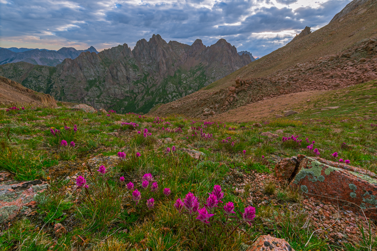
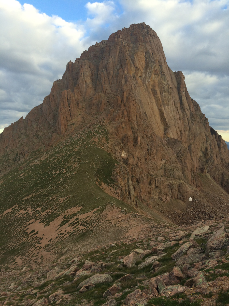
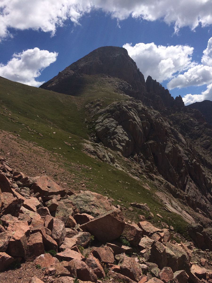
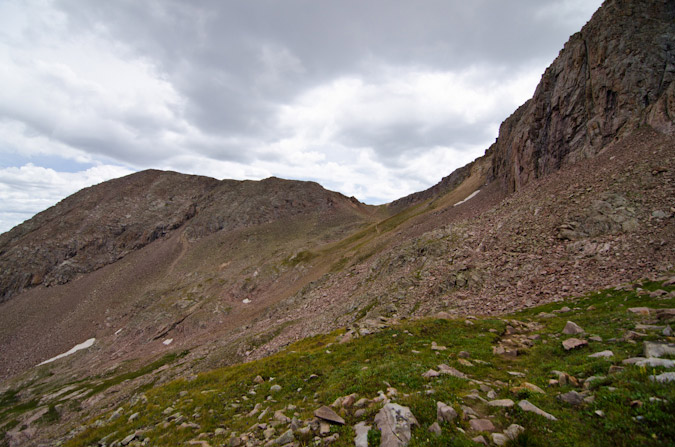
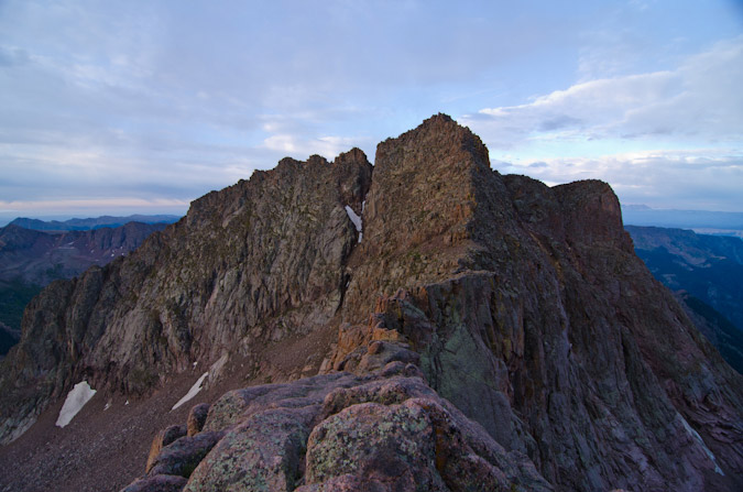
Pigeon towered above me as a reminder of the pain I would endure if I wanted to summit today. I could see how a confident and equipped climber could take this gully off the ridge, but it was something way outside of my comfort zone and ability.
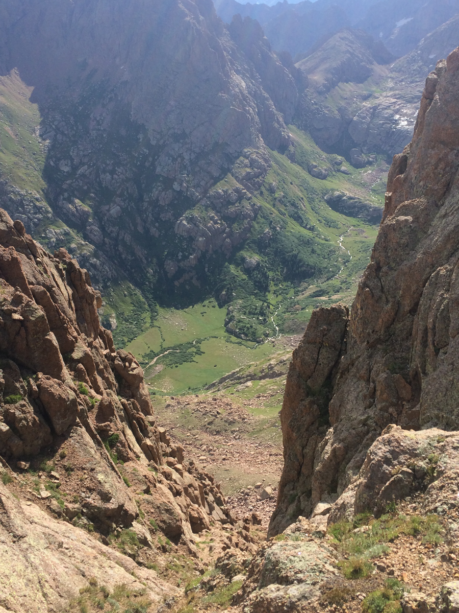
I descended from the saddle to my left towards the notch and reached it quickly. I undershot (went too high) the notch a little and had to downclimb some sketchy rock to reach the notch, which greeted me with a view west of West Needle and the Twilights. A look down to my next destination was demoralizing to say the least. It looked so steep, and knowing I'd have to come back up it was not a welcoming thought.
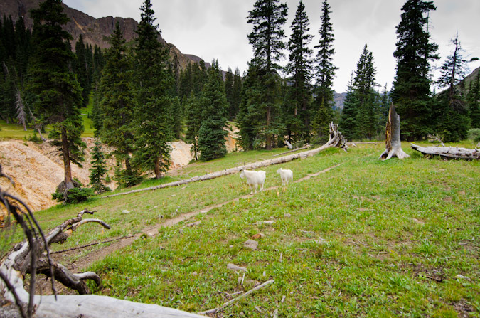
I reached the bottom of the descent without any issues and wrapped around the side of Pigeon to find myself at 12,200 feet with another 1,700 feet of gain to go on un-marked terrain. My legs were tired. I was hungry and tired. The clouds were concerning as well. Everything looked OK to my west, but I could no longer see to the east. The climb up the steep grassy dirt was awful. I had to stop about every 30 steps to catch my breath, which was not normal for me, but understandable given how long I'd been out. I was eventually passed by a young man and his dog that had came up from North Pigeon Creek. He flew by in ease. Jealous.
This young man and his dog stirred up some mountain goats while I pontificated my ability to finish, all documented in a quick video on my phone:
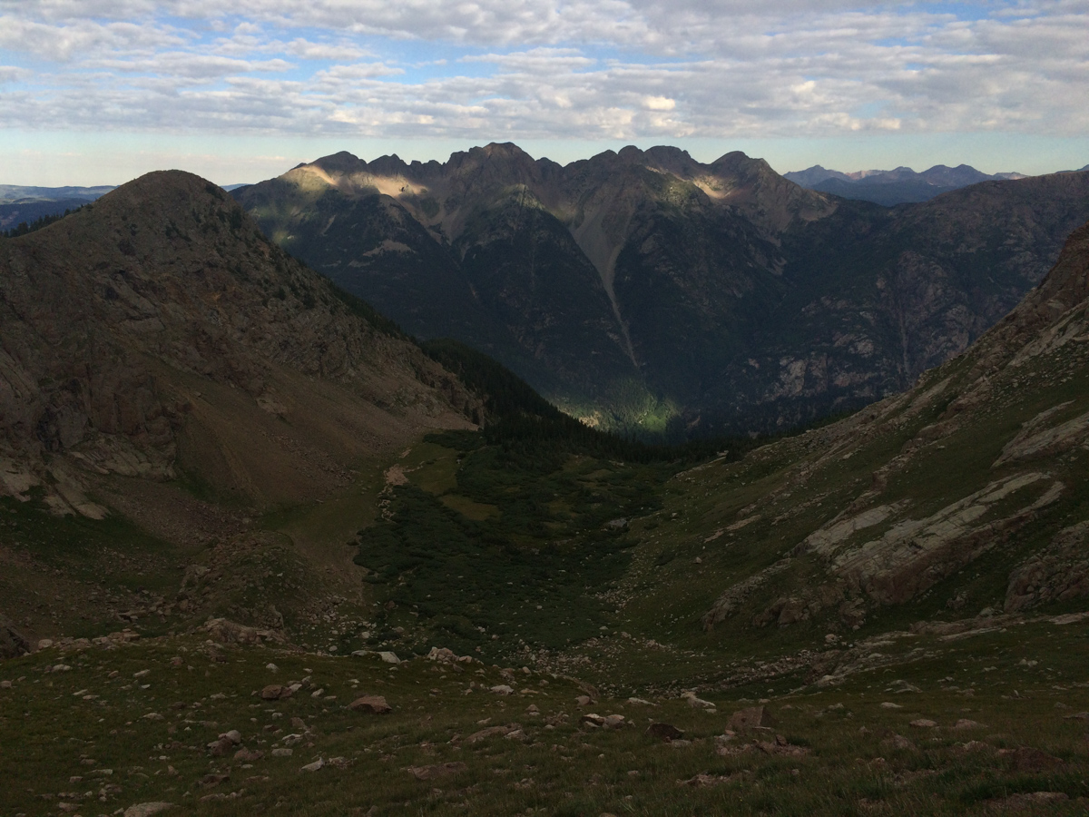
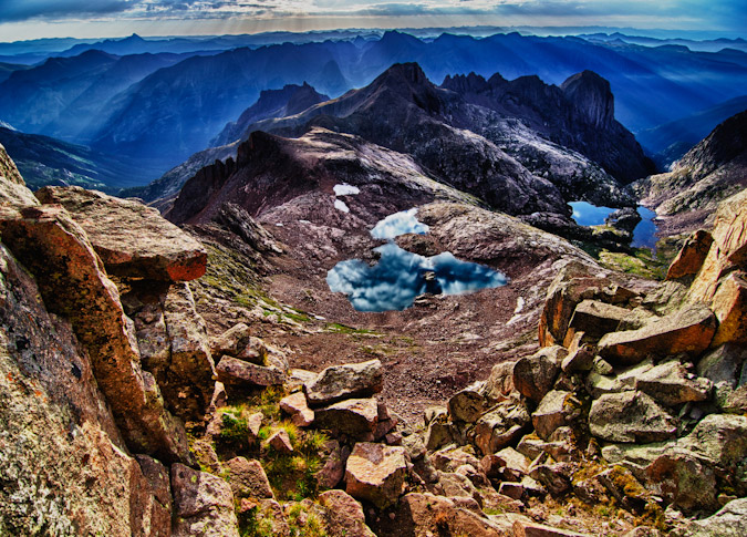
Alas, I was able to reach the top of the long gully leading up to a notch that looked back down to the meadow in upper Ruby basin and my campsite, some 2,000 feet below.
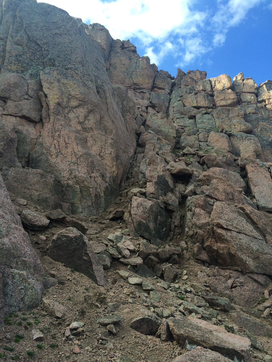
I quickly found the class 4 weakness in the summit block, just right of the terminus of the gully at the top of the grassy dirt slopes and made it over there in no time. Navigating the actual class 4 section was another story though. I enjoy exposure more than most; however, I found this move to be quite challenging, especially with all that camera weight on my back. I actually thought about leaving my backpack there but reminded myself of a classic Gerry Roach saying, "never leave your lunch," and kept it on. The class 4 section was only two or three moves deep, but there was a slight overhanging feel to the rock and the holds were a bit awkward for me. I think being alone played a part in making it feel harder than it was as well. A mistake here would have been fatal.
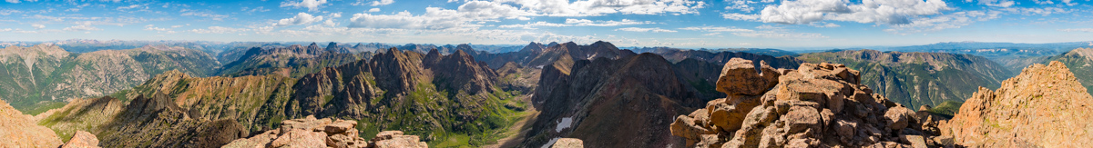
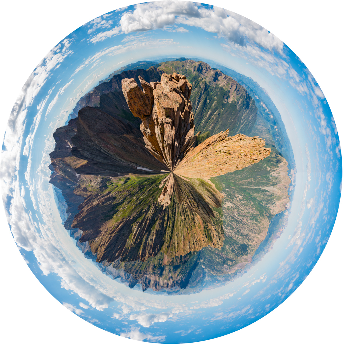
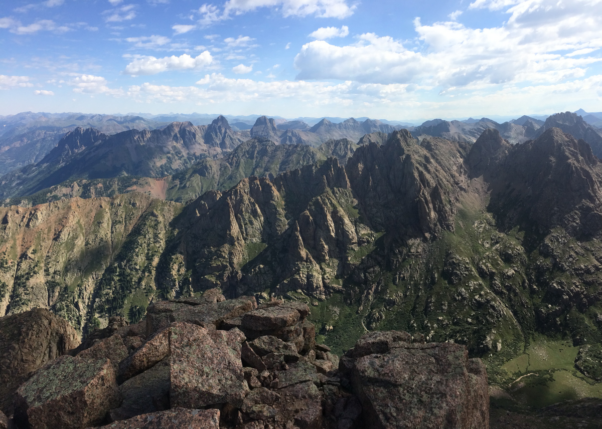
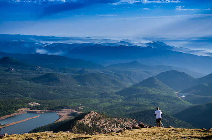
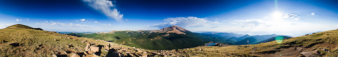
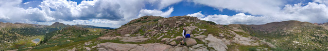
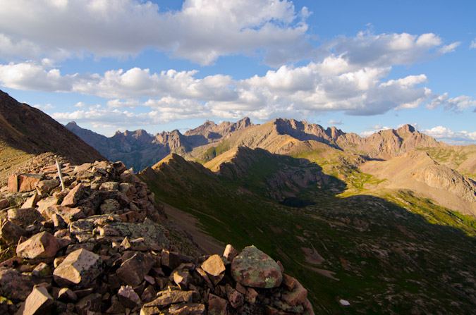
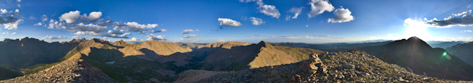
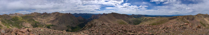
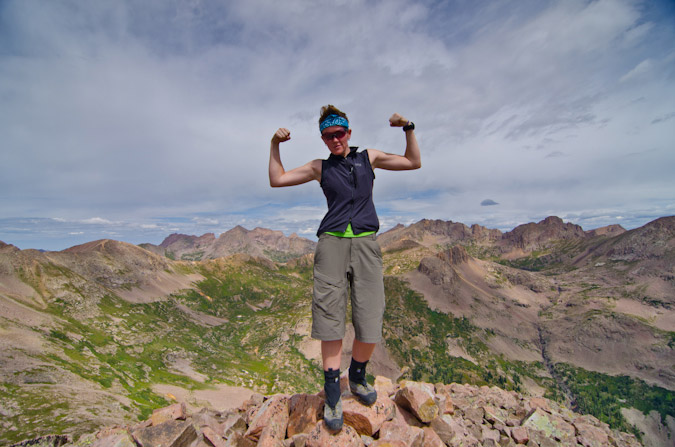
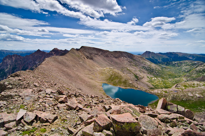
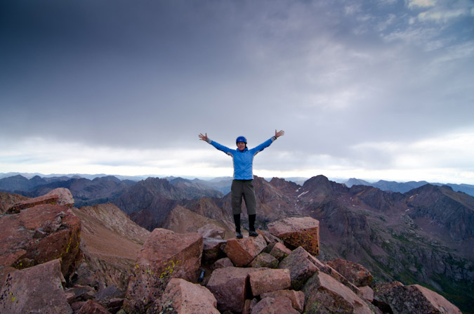
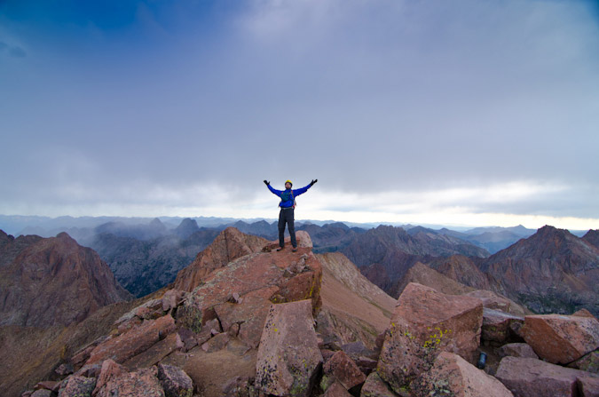
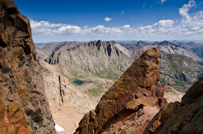
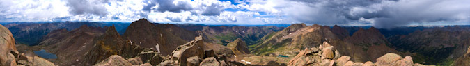
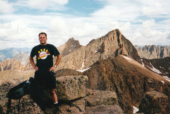
Alas, I reached the summit and enjoyed the view from my 89th Centennial. Only 11 to go! Here's a 360 degree view from Pigeon.
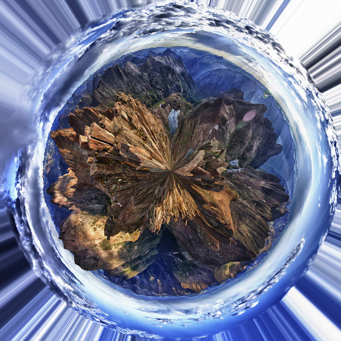
And here's the same photo made into a planet to show a different perspective.
The Grenadiers looked amazing as usual. I still think the view from Arrow Peak looking back towards Pigeon is the best I've had. Unbelievable.
While the clouds did not seem too threatening, I was quickly reminded of just how much more work laid ahead of me before I was safely back in my tent. I still had to safely downclimb Pigeon without dying and then make it down 1,700 feet and back up again to the Pigeon - Turret saddle, and then back down to upper Ruby basin. Yikes. I departed without delay, eating as I climbed down. I serendipitously found an alternative route to the class 4 route by following some cairns to the left of the class 4 section which was quite a relief since I did not really want to go down that way. The class 3 alternative was much easier to downclimb and brought me back to the same general area to allow a safe descent back towards North Pigeon Creek, which went quite quickly following the loose dirt and scree. I re-climbed up to the lower saddle below Pigeon in less time than I thought I would need and found myself gazing back up at Turret. My legs were feeling the burn to say the least!
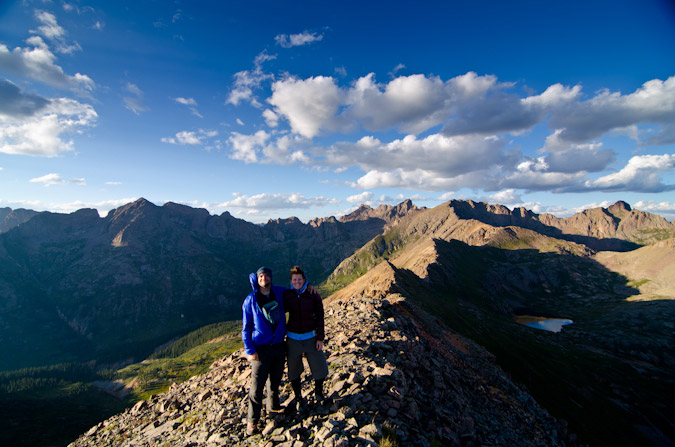
Upon reaching the saddle between Pigeon and Turret, I ran into two young hikers I had seen on the train the day before. I talked to them for awhile and learned that they had camped at Ruby Lake and were thinking of ascending both Turret and Pigeon. I gave them some tips and it seemed as though they were going to just head up Turret for the day. I was starving and exhausted and told them I was going to go pass out in my tent. I quickly descended down towards the basin without any issues except for the constant feeling of hunger. I could not keep enough food in my system. To make it worse, I had really painful and annoying heartburn, I think caused by drinking Gatorade, but who knows. This later was quite annoying at dinner because I could not eat all of my food - I felt like I wanted to throw it up after every bite despite wanting to devour it. Maybe I was eating too quickly?
Making it back to camp was a great feeling and I had the whole meadow to myself.
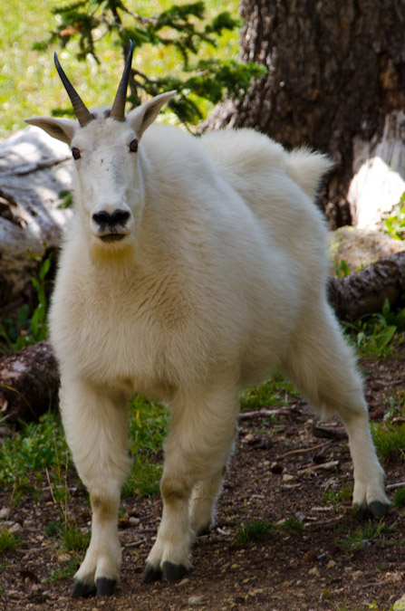
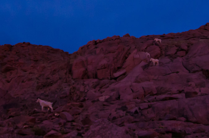
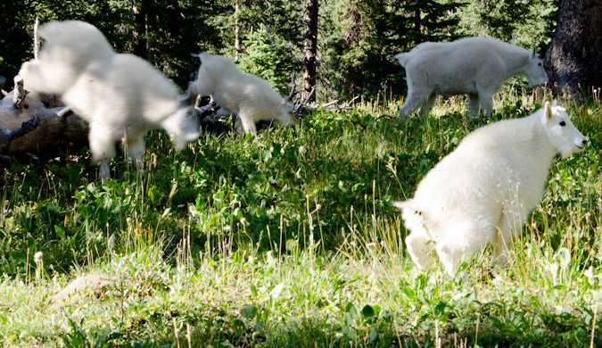
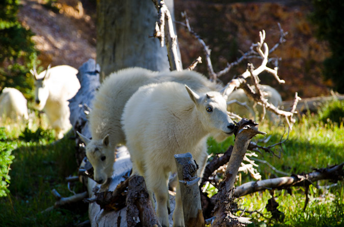
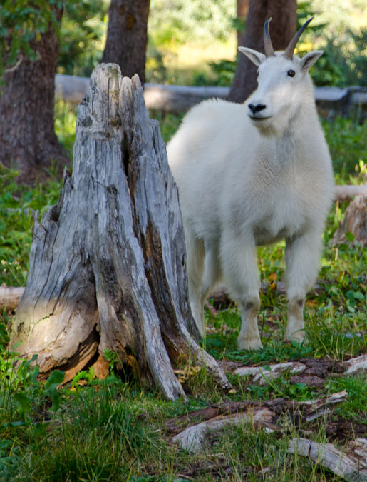
Except for the five goats that joined me later on after I napped for three hours in the nude.
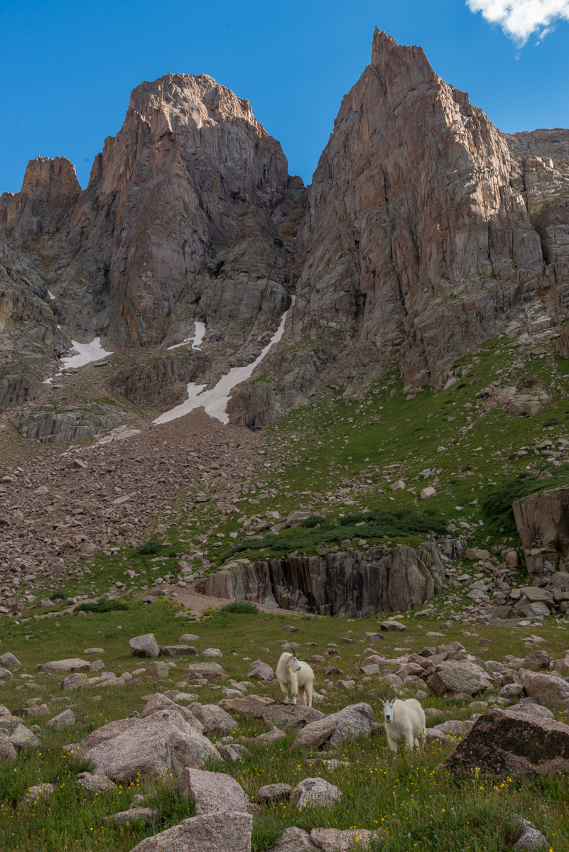
These goats were foraging around my tent pretty much all evening and night so I made the most of the situation and filmed a timelapse of the mountain goats grazing for about an hour long.
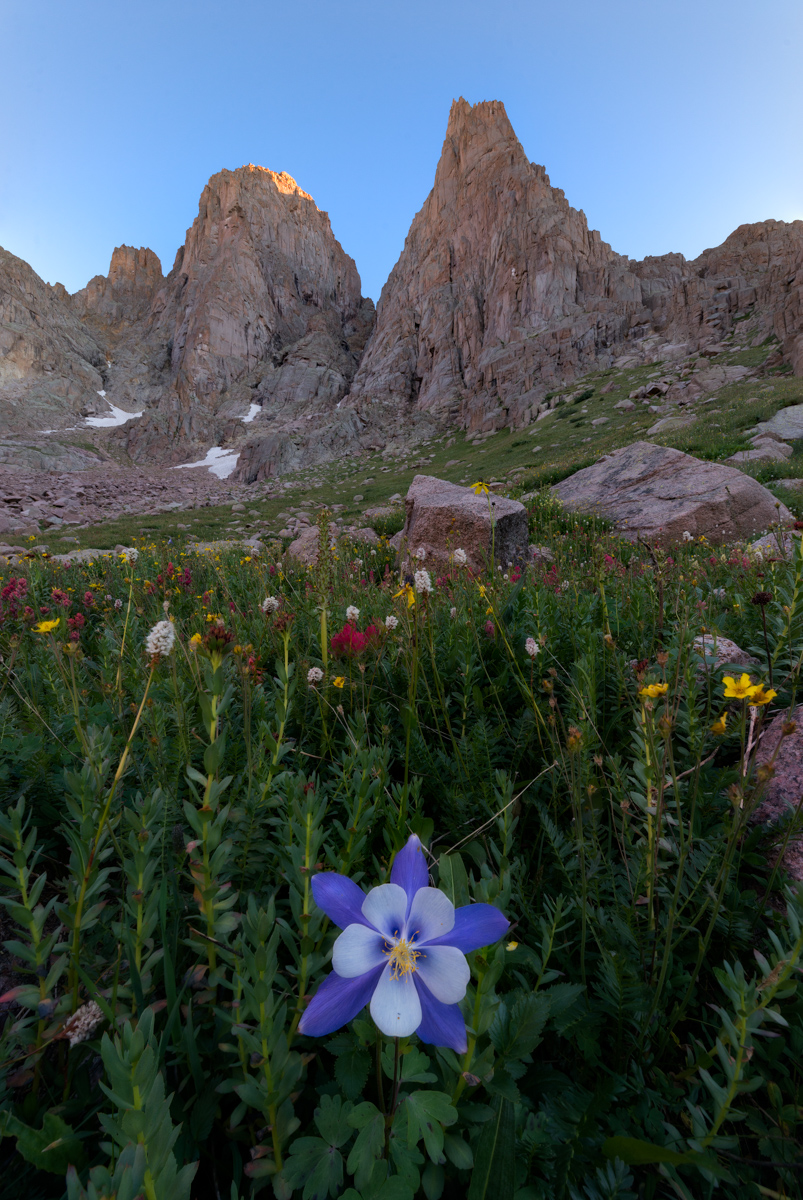
After filming the goats and eating dinner, I decided I still had some energy left in me before bed, so I found some flowers to photograph and some spots to shoot for sunset. I was particularly happy with how this photo of a single columbine flower turned out below Turret Needles.
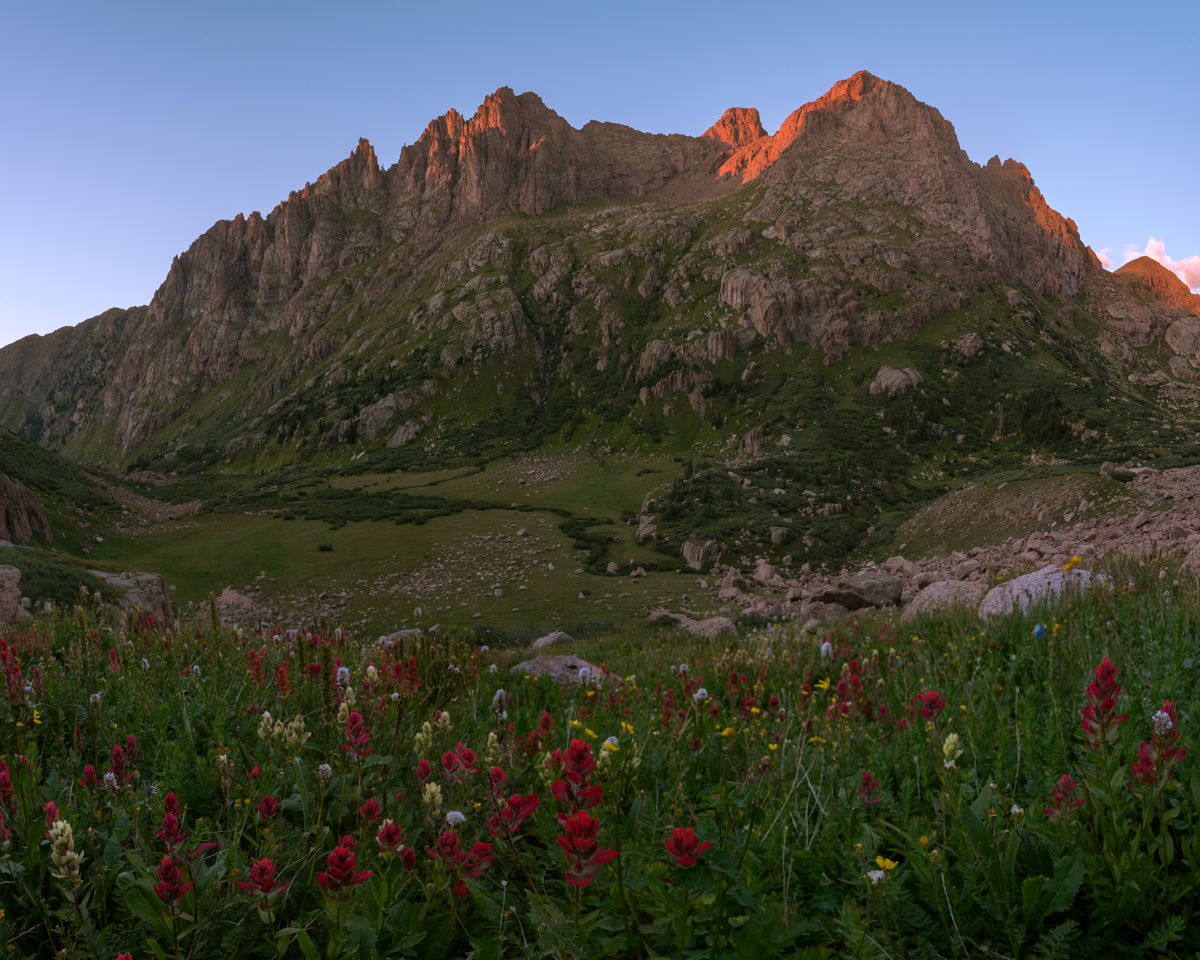
Sunset was pretty remarkable, especially with the assortment of wildflowers at my feet above my campsite, which you can barely see in the middle of the photo.
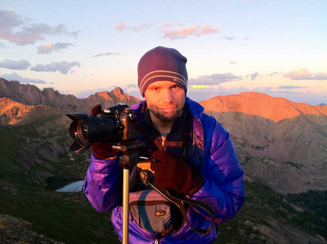
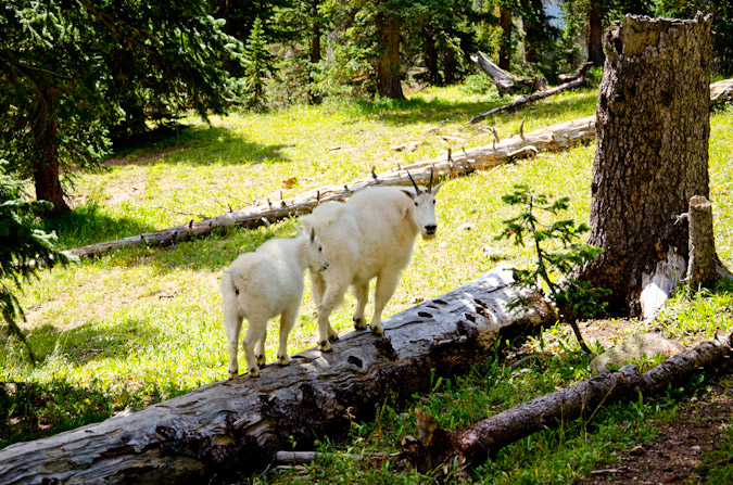
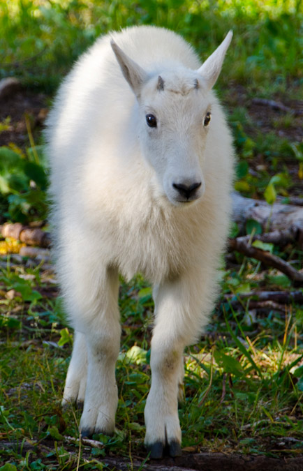
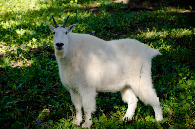
After photographing sunset, I was ready to turn in for the night. My heartburn kept me up a lot of the night, which was incredibly frustrating given how exhausted I was; however, I did get some pretty solid sleep from about 2 AM until 6 AM, at which point I was woken up by some heavy breathing outside of my tent. I opened it up and found a large mountain goat staring right into my door. I tried to get a photo of him, but he lazily scurried off before I could. I made some coffee (the Starbucks Via Blonde Verdana is pretty amazing), packed up, and photographed sunrise.
I left my campsite at 9 AM. Even though my train was not supposed to pick me up until 3:30 PM, I wanted to get down earlier to try to get on an earlier train. The views down were just as good as going up and Pigeon dominated the scene.
I made it down to Ruby Lake quite quickly and ran into those two climbers from yesterday, named Jacob and Rose. Turned out that Jacob works for the train and Rose attends Fort Lewis College. Really nice kids! I then later learned that one of my employees at work is married to Jacob's cousin. Small town!
Routefinding on the way down was not as hard and I even found the tree with the Columbine carved into it - which is noted nicely on my GaiaGPS track.
I made it back to the bridge crossing the Animas at 12:05 PM without any problems and found myself among several other people waiting for the train. Apparently the train had derailed in Durango and was an hour and a half late. I wound up waiting there until 4:30 PM while hanging out with two guys from Arkansas, one of which had just moved to Greely, Colorado for work.
Once the train finally arrived heading to Silverton (I did not board this one), it was a mad dash to get on board.
I ended up riding on the train with Jacob and Rose and we had a nice talk about how great it is to live in Durango and how lucky we felt to be this close to such amazing mountains. Life is good.
Exploring Almagre Mountain - Sunrise on Pikes Peak and the Waldo Canyon Fire
Originally, my friend Ethan and I had made plans to climb the Three Apostles - three great 13ers over near Leadville; however, the Waldo Canyon Fire started the weekend prior and by Tuesday had burned out of control - 346 homes were burned to the ground in Mountain Shadows and Highway 24 was closed. The main access to the mountains was Highway 24, so we were pretty much stuck on the Front Range. Additionally, the whole week had been an emotional rollercoaster for everyone - my parents evacuated their house and stayed with us for a couple of nights. Ethan covered the fire quite a bit with video and social media throughout the week (by the way, if you have a chance, you really should check out his incredible blog post about social media, traditional media and the Waldo Canyon Fire - a fabulous read). The Waldo Canyon Fire had presented Ethan and I another opportunity - to hike a closer-to-home peak with the hopes of getting a birds-eye-view of the fire's extent.
So - we set off early on Sunday morning to do just that - I picked Ethan up at 3:30 AM from his house and we head up Gold Camp Road to tackle Almagre Mountain - a 12,367 ft. gently-sloped peak just South of Pikes Peak. Indeed, most Colorado Springs residents will recognize Almagre as a very plain looking set of mountains above tree-line to the left (south) of Pikes Peak. I'd always wanted to climb Almagre, and Ethan had already done it twice, so it seemed a great fit for our objectives.
We opted for the western approach from near the gate that Colorado Springs Utilities (CSU) has erected to keep people out of the city's water supply, which seemed to us to be quite low. To reach this spot, we drove quite a ways up Gold Camp Road, about 2/3 of the way to Cripple Creek, and turned right on Forest Road 376 to the CSU dead-end.
We arrived at the gate at approximately 4:15 AM and began in a wild rush up the steep 4WD road by foot towards McReynolds Reservoir. The air was quite cold this early and this high up, a stark contrast to the record-setting 100+ degree heat we had been experiencing in the scorched and dry urban setting of Colorado Springs. Eventually, the road leveled off and opened up into a large meadow, giving us a clue to begin to head west on a very faint trail, which crossed the CSU fence-line and connected to a more solid trail leading up towards Almagre Mountain. After a couple of miles of fairly steep climbing, we reached a great stopping point, giving us a wonderful vantage of Pikes Peak and the various reservoirs below - Mason Reservoir and McReynolds Reservoir - also known as the Seven Lakes area.
We stopped here to take in the great light hitting Pikes Peak, and I took advantage to take many photos from here as the sun continued to change the colors of the clouds and Pikes Peak.
The lighting was fantastic, and it was such a rare view of Pikes Peak, I really loved it. This particular shot is also available on my photography website for sale.
Eventually, Ethan and I packed up our tripods and continued up to the ridge for Almagre Mountain. Once on the ridge, we could see Stratton Reservoir, which looked more like Stratton pond. Additonally, we made lots of jokes about the "Weather Control Satellite" on top of Almagre Mountain South (which is really a microwave repeater). This was based on a very funny press conference earlier that week about the Waldo Canyon Fire where someone in the crowd actually seriously suggested that the government just use its weather control satellites to create rain to put out the fire. For more on the weather control satellite joke, check out this hilarious post.
The terrain on the ridge was classic Pikes Peak granite - much of the same material found in the Lost Creek Wilderness Area.
There were funky rock outcroppings all over the place. Nature sure does have a great sense of humor!
Ethan and I were both really loving the light and the color - somewhat tainted by the smoke from the huge fire that raged on to the north of us.
Ethan and I made several stops on the way up to take shots of the lakes and of Pikes Peak.
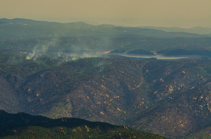
Before long, we had reached the summit without any problems. We had a great viewpoint of the fire burn area and the current burning zone. The smoke had settled into the valleys below us and made for quite the fantastic scene.
We both set-up tripods to take some time-lapse photos and video.
I was able to put together a 300 shot time-lapse video out of still images over a two-hour period from the summit. While it was pretty borning up there, I could not complain about the view.
I was able to get some pretty great zoomed-in shots of Rampart Range Reservoir about Highway 24, where the fire was most active at this point. A zoomed in view shows quite a bit of destruction in that area, but as bad Ias I had thought would / could happen.
The 360 degree view was fantastic as well - with Pikes Peak anchoring the center of this peice.
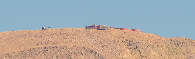
I was even able to get a super zoomed in view of the Pikea Peak summit, where I could make out people and the Cog Railway.
We both decided that after spending two hours on the summit that it was time to head-out. So we did just that. Right beforehand I was able to get a sweet shot of Ethan way up on the summit taking shots.
On the way back, I was able to get a better shot of Stratton Reservoir (with Mount Rosa in the background), now reduced to almost nothing.
And of course, our down-climb would not be complete without another shot of the Weather Control Satellite...
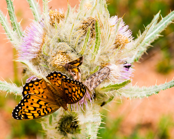
The hike back down to the car was quite uneventful. We noticed there were a lot of butterflys out and so we were able to follow one to this huge thistle plant, where countless other insects were hanging out, drinking nector from these hearty flowers.
All in all, I would rate Almagre Mountain as very easy - a mountain for all ages and skill levels. The rare views of Pikes Peak alone were worth the drive and hike for me.
{fcomment}
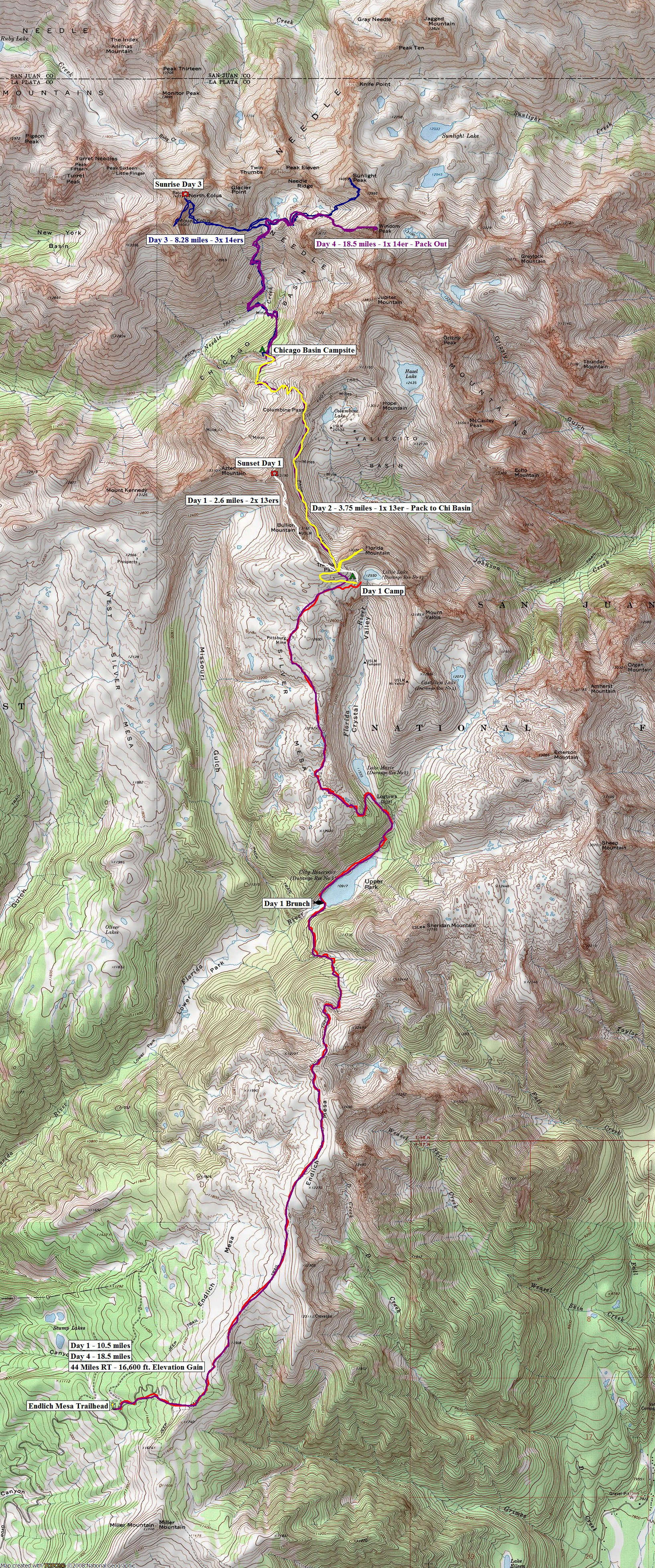
Sunsets, Sunrises and Mountain Goats - Chicago Basin from Endlich Mesa
Day 1: Backpack from Endlich Mesa to Lillie Lake
Day 2: Climb one 13er, backpacking over Trimble Pass and Columbine Pass
Day 3: Sunrise from North Eolus, summit of Eolus and Sunlight
Day 4: Climb of Windom Peak and pack-out
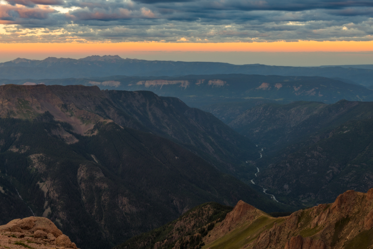
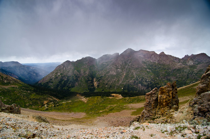
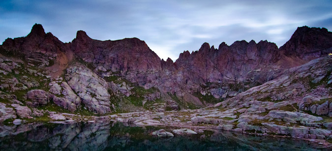
The Weminuche Wilderness Area and the mountains it contains are quite possibly some of the most incredible places on Earth. My first memory of the area was from 2000, when I led a group of 8th and 9th graders from Highland Mary Lakes to Vallecito Reservoir as part of my employment with Colvig Silver Camps. I remember fondly the views of the Needle and Grenadier sub-ranges and never thought in a million years I'd actually climb them. From many vantage points, the mountains in this area look unclimbable and untouchable. Indeed, the Needle sub-range of mountains which consists of Pigeon Peak, Turret Peak, Monitor Peak, Mount Eolus, Sunlight Peak and Windom Peak were some of the few mountains not explored by the Hayden or Wheeler surveys. According to Rhoda of the Hayden Survey, the weather pattern of the Needle sub-range was quite impressive: "Early in the day we noticed clouds hovering about the quartzite peaks, as we had seen them so often before. They never completely veiled all the peaks in the group, but early each day began to circle about them in a restless sort of way, like so many mighty lions about their lair. To us this apparent restlessness suggested a concsiousness of their terrific destructive power, which only awaited a mandate from the 'God of Storms' to be set in motion. We even now held these peaks in awe, as there seemed to be established somwhere in their midst a regular 'manufactory of storms.'1 Based on this notation, it is no wonder that Mount Eolus is named after the Greek God of Winds. Indeed, the clouds and winds were quite notable this trip, as seen in this preview...
With only five ranked 14ers left to climb, I was eager to finally get into Chicago Basin and climb those restless peaks. The route I chose for this adventure has been in the making for two years now, piecing together various adventures I'd had in the area in the past. In 2001, I hiked from Vallecito Reservoir and to Columbine Pass and climbed Jupiter Peak. In 2000, I did a backpacking trip from the start of Endlich Mesa to City Reservoir. With these two separate trips embedded in my memory, I knew it would be quite an adventure to go from Endlich Mesa to Chicago Basin and back. Adventure indeed.
45 miles round-trip.
16,600 ft. elevation gain.
4 days.
Here's a map of our adventure - please click on it to see the full version (including the rest of the map that you can't see here):
Day 1: Backpack from Endlich Mesa to Lillie Lake; summit two 13ers - 13.1 miles, 4,083 ft. elevation gain.
Two years ago, I had planned to do this trip with my dad. The Chicago Basin 14ers were three of the seven 14ers he had not climbed and I wanted to share those summits with him. Unfortunately, he suffered a freak knee accident this past Christmas and has not been able to hike this year, so I planned the trip with my new friend, Regina. Another set of unfortunate events happened, and I had a last-minute scheduling conflict on the dates Regina and I had chosen for the trip; however, another freak incident happened and I was able to clear some dates on my calendar and go on the trip with another friend, Sarah Musick. I explained the somewhat insane trip plan with Sarah and she bought-in right away, knowing that it would be a monster of an adventure. The plan was to drive to the Endlich Mesa trailhead on Thursday night, backpack as far as possible on Friday, backpack to Chicago Basin on Saturday, climb the 14ers on Sunday and Monday, and backpack all the way out on Tuesday for the drive home. It would be a feat no matter how you looked at it. The only positive to the approach was that we would be starting at 11,250 ft. elevation! All packed and ready to go on Wednesday night, I weighed my pack - 58 pounds! This was going to be painful! Sarah and I had opted to eat well this trip, so the bulk of the weight was in food, but trust me, it paid off later! So - off we went from Colorado Springs for the Endlich Mesa trailhead, which was up a long 9-mile forest service road north and east of Lemon Reservoir near Durango, Colorado. Earlier in the year, I had gotten some great information from Barry Raven from 14ers.com about how to get to the trailead - HERE is the map he shared with me, which I found highly useful in finding the trailhead in the dark.
We slept in Sarah's truck and set our alarm for 5:00 AM, which came after a night of rain. We secured our gear and kissed civilization good-bye. I had pre-prepared some an awesome breakfast for us to cook consisting of bacon, scrambled eggs and hash browns; however, neither of us were remotely hungry, so we opted to pack it in and eat a late breakfast somewhere on the trail. More pack weight! We ascended the Endlich Mesa trail fairly quickly in the early morning and reached the expansive and flat Endlich Mesa in no time at all, with views in all directions.
To the east, the mesa dropped off and revealed some pretty country.
Before too much longer, I was filled with glee as the first views of Pigeon Peak's east face were revealed, as well as the mountains of Chicago Basin. How far away they looked!
I was really excited to finally use my new camera lens, the Tokina 11-16 f/2.8 super wide angle. It is the highest-rated and best-reviewed wide angle lens for the Nikon DX format camera on the market. The lens is really hard to get these days because of the earthquake and tsunami that hit Japan. I was able to score one from Craigslist and have been itching to get it into action!
The wide angle view was really awesome and I knew I was going to have a lot of fun on this trip. Just in case, I had packed my 18-105mm lens for other shots. Oy vey! More pack weight! Sarah's pack was pretty heavy too, but she was a real trooper!
The mountains behind Sarah were indeed the mountains we were aiming for. Wow. Just wow.
We continued up the mesa, which was a very fun approach. It was mostly flat, with a few sections of up-and-down. The views were great the whole way in.
Sarah was able to capture just how geeked-out I looked for the hike...
We continued on and after enjoying some spectacular views from the mesa, headed on down towards City Reservoir, where we planned to cook some breakfast. The hike down to the reservoir was steep, and we both knew it was going to be one hell of a hike back up at the conclusion of the trip.
We stopped at Durango City Reservoir and enjoyed the early morning light on the water.
The Soup Nazi unpacked and prepared breakfast.
No Soup for YOU!
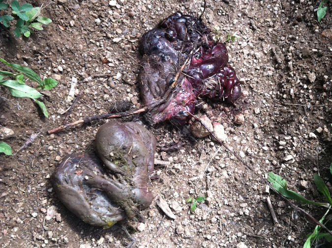
The breakfast was amazing. Two other backpackers passed us on the trail, one of which I later learned was "alwetend" from 14ers.com. These two guys had on packs that weighed at most 30 pounds and looked as though they were in lightweight ascent shoes. Jealousy set-in. We packed up and headed-out. For some reason, we felt like we were both moving much slower than before. It must have been the bacon. The trail heading up towards our second objective for the day, Lake Marie, was pretty steep (with heavy packs on anyways). We passed by the entrails of something on the way, perhaps a deer? Or perhaps someone with a heavy pack on puked their guts out... thanks Sarah for taking a photo!
At 11:30 AM we reached Lake Marie. Above it to the left (west) was Silver Mesa, where we were heading next. Above it to the north was Florida Mountain, which had at its base City Reservoir #2 aka Lillie Lake.
Climbing up to Silver Mesa was pretty straight-forward. The trail was clearly marked and it followed the USGS topo to a tee. Once on the second mesa of the day, we knew we were committed. We knew that our day's fate was sealed and that we needed to find a campsite somewhere between here and Trimble Pass before dark. I had my sights set on Lillie Lake, which was just below Trimble Pass. While exposed to the elements at such a high elevation, it was a great location to aim for due to the presence of water. So we worked our way up the Mesa at a slow pace. Huge cairns marked the way the whole way in.
Storms moved in and we put on our rain gear. Fortunately, it did not rain for long...
We reached a nice stopping place about halfway up Silver Mesa. Lake Marie was seen far below and the summit of Florida Mountain was seen far above. Here's a nice view of that whole scene in a 360 panoramic, with the lake to the left and the summit to the right.
At this point we were both pretty delerious and tired. Everything was funny.
We soldiered on up Silver Mesa further, which provided literally a highway of silver for us to hike on and up through a large notch.
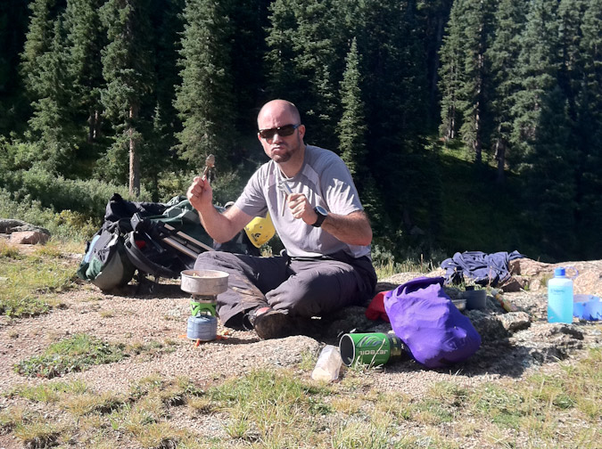
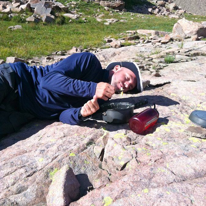
 We stopped again about 3/4 of the way near the Pittsburgh Mine and ate some food. Sarah swears I was meditating in this photo, but I'm pretty sure I was just enjoying the views!
Indeed the views back to the south of Endlich Mesa and Sheridan Mountain were great, and it really put things into perspective in terms of how far we had already hiked. The large map I linked to early in the report really gives you a great idea of this as well.
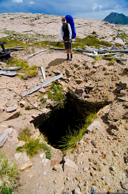
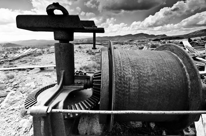
Break time was over and onward we trekked to Pittsburgh Mine, which I had vague recollections of for some reason. I'm not sure if I had visited this place before, but was awfully familiar to me. At any rate, the mine was great. It still had a great deal of equipment and huge holes to look out for. One spot was easily 30-40 feet deep, and Sarah and I marvelled at it for a few minutes.
The whole area looked like a tornado hit it. Maybe it was the God of Wind, ÆOLUS (actual spelling on the Eolus summit marker)!
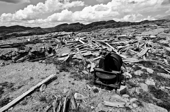
In a way, the scene really made you feel like an old miner.
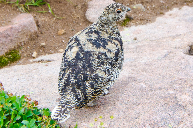
Once past the mine, we were almost to Lillie Lake. We could taste it. Sarah stopped me to ask how much further. I looked at the GPS and told her, "one more mile." This turned out to be the joke of the trip, as it really turned out to be more like two miles since my estimation was as the crow flies. On the way to the lake, I stumbled upon a family (flock?) of Ptarmagin, or snow chicken, which are surprisingly approachable since their only known predator is the golden eagle. This was a rare instance where I did not want the wide angle lens, but it would have to suffice.
We continued on and found several small pools on the way.
We reached Lillie Lake, a mere 10.5 miles from the start of Endlich Mesa trailhead, and found an amazing campsite just above the lake to the west. The campsite was nestled against a large cliff about 50 ft. high, and surrounded on all sides by ramps of rock except to the south, which led to a cliff overlooking the Marie Lake drainage. We were beat and we were starving!
We cooked up our first dinner of the trip - pasta alfredo. It was so good, but I really struggled to put away my half...
Since there were no trees above tree-line (imagine that), I thought of a great way to hang our food on the 50-ft. rock wall. I had read about this method in a trip report posted on 14ers.com for Pigeon Peak and it worked great! We used a large rock at the top as an anchor and suspended the food bags on the rock wall.
Having refueled and rested, I somehow convinced Sarah that we should climb a 13er and watch the sunset from it. So, away we went with small day-packs, water, a camera and a tripod. We made our own trail above the lake and bushwhacked up to Trimble Pass, where our first close-up views of Chicago Basin were found, with much jubilation.
Our attention was turned to the northwest, to Bullion Mountain's 13,182 ft. summit. This would be our target 13er. Bullion is the slightly steep sloped mountain on the left.
Sarah and I cranked it out on weary legs. The views back south were sobering. We had really come a long ways in one day.
We reached the summit of Bullion Mountain in just 40 minutes and realized we had plenty of time and legs left. I set my sights on un-ranked, un-named point 13,190 to the north, as it would provide superb views of Chicago Basin. The ridge looked like it would go just fine, with maybe one tricky section to navigate across.
The views of Columbine Pass and Columbine Lake were great from Bullion Mountain, as were the Chicago Basin 14ers and the mighty 13ers Jupiter Mountain and Grizzly Peak.
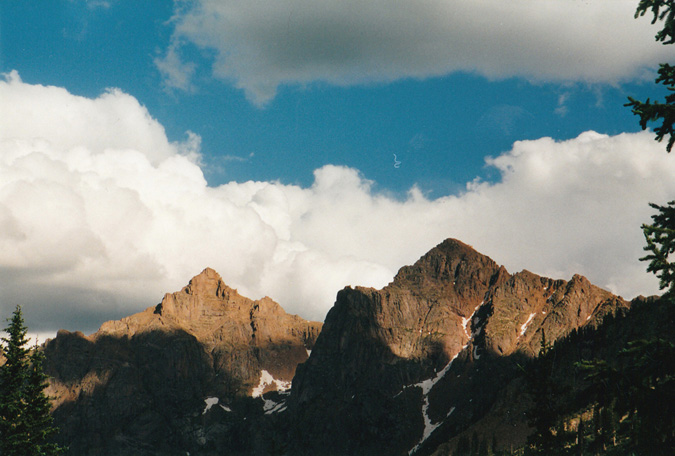
About halfway across to UN 13,190, we stopped to admire the constrasted view of Johnson Creek below and the towering wall that is Organ Mountain and Amherst Mountain to the east. Organ Mountain demanded our attention and respect for the remainder of the trip. Sarah was particularly mesmerized by its impressive stature and was drawn to gaze upon it repeatedly. Organ Mountain is the pointy peak one mountain to the left of the furthest mountain on the right-hand-side of the photo (Amherst Mountain).
Indeed, Organ and Amherst were impressive peaks. Back in 2001, when I had backpacked up Vallecito Creek and Johnson Creek with my parents, I had admired them tremendously from below, and I even recalled taking several photos of them with my crappy 35mm camera at the time. I was able to dig one of those up and scan it.
Sarah and I kept on trucking, and encountered a fun yet challenging section of the ridge that required some class 3 climbing. We easily manuvered that section but wondered how fun that would be in the dark later on. The Chicago Basin 14ers were still looking great in the late day sun.
We slogged up the scree slope to the top of UN 13,190 and celebrated. 10.5 miles of backpacking plus two 13ers was a pretty impressive day.
I promptly set-up my tripod on the summit and began taking some photos. Having a tripod on top of a mountain offers some pretty good advantages, starting with consistency. The ease in which photos are to take using a tripod, especially panoramic photos, is well worth the effort. Additionally, the quality of photos increases a great deal. Here's a 360 panoramic from the summit, with the sun cresting over Aztec Mountain (which I wanted to climb so badly, but we ran out of time and energy):
A tripod also makes it easier to do self-timer shots with groups of people, which we took advantage of! This is a view looking north at Chicago Basin and Columbine Lake. You can really appreciate the wide view afforded by my new lens.
For the photography geeks out there, one of the cool things about this lens is that it has 13 elements in 11 groups, which can make for some really great star-burst effects when stopped-down to f/22. The small aperture makes for a really small hole for the light to pass through, and the result is a diffraction spike, which are also explained HERE. Check out my results:
Sarah got to play witness to all this photography geeking-out and documented it with her super-awesome iPhone camera.
The sun continued to set and the moon began to show itself as well. It was a new moon, and it looked really great in the darkening sky. I captured Sarah witnessing her first sunset from the top of a mountain in HDR. Her words: "one of the five greatest moments of my life."
I was a pretty happy guy too, having witnessed only one other sunset from the summit of a mountain, which was from Arrow Peak last year, as documented in THIS trip report.
I tried my hand at my first HDR panoramic of the trip, which I believe turned out pretty well. Chicago Basin looked awesome.
Having witnessed her first sunset from the top of a mountain, Sarah was elated. I took full advantage of this and convinced her that we should stay on top for another hour or two to watch the stars and the milky way (and for me to photograph them). I was really glad she agreed, and we made sure we were bundled up for what we knew was going to become a cold night on the top. A thunderstorm boomed in the far distance behind Chicago Basin, and lit up the clouds behind it in the dark.
Before this trip, I did a little homework. I read some blogs and watched some videos on shooting stars, specifically the work of Ben Canales, who won the National Geographic Traveler's photography contest. This video of his, was very helpful for me, and I learned two tricks from it. The first trick was the 600/focal length rule, which basically states that when shooting stars in photography, to get a shot without blurry stars from star movement, you can shoot a maximum of x seconds, where x = 600/your focal length. In my case, I was shooting at 11mm, so I could shoot almost a full minute exposure without star blur. The second trick I learned was to take test shots at your highest ISO (in my case 26,600) to look for good shots. Check out his video for more! I wanted to get a good shot of the Milky Way with my new lens. At f/2.8, I could really gather a lot of light and it proved worth the investment.
Lastly, I wanted to get some fun star trails over Chicago Basin, and again this proved quite effective. I only did it for about 30 minutes, so it is not as impressive as it could be; however, we needed to get some rest for the big day ahead of us. For this shot, I found the North Star and centered the shot on it. To locate the North Star (which is stationary in the sky, and appears as a pin-point in star trails), find the big dipper. The two bottom right stars that comprise the Big Dipper form a line that points to the North Star.
I also decided to throw together a really short time-lapse of the sunset with the stars. Someday I'd like to do a full day's worth!
We head back over to Bullion Mountain in the dark and were able to find out campsite without any problems. Its funny how good of a memory your mind has, even in the darkness of night. We crashed and slept in, letting the heat of the morning sun wake us up.
Day 2: Climb one 13er, backpacking over Trimble Pass and Columbine Pass to our campsite in Chicago Basin - 800 ft. elevation gain with 1,750 ft. lost, 3.75 miles.
Having a good night's sleep, we were able to quickly pack-up our stuff and eat some breakfast bars. I took a quick hike up to Lillie Lake for one last view before our departure. It was an awesome place and I was happy to have visited it. Lake Marie sat far below, seemingly waving us goodbye, for now...
One cool fact about Lillie Lake - it is the headwaters for the city of Durango's water supply - the Florida River - and sits beneath a relatively unimpressive 13er, Florida Mountain, which we had our sights set on for the start of the day.
A better view of the area, with our campsite at far right -
We packed up and trudged up to Trimble Pass. We left our packs here and strolled up to the summit of Florida Mountain's 13,076 ft. summit to enjoy views of Chicago Basin and Johnson Creek.
Sarah was especially excited to be on top of her fourth 13er, all with me.
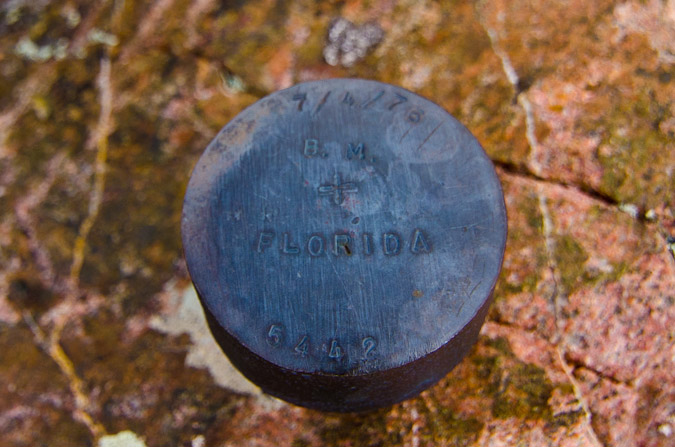
It even had a cute little benchmark on the top, which was fairly unique.
Lillie Lake was especially pretty from this vantage, and was nice to see in actual sunlight...
We returned to our packs and began the arduous journey over to Columbine Pass. This section of the hike was quite pretty. We really loved the views from here and only passed two other hikers the whole way over. Looking back on Trimble Pass - we had already come a long ways...
... but we had a long ways to go yet before the top of Columbine Pass. We'd have to return this way? Yikes.
Organ Mountain still drew our attention and made for quite the scenic backdrop to an otherwise desperate slog under the weight of our monstrous packs.
Amazingly, there were still quite a few wildflowers in this basin, and they provided quite a lovely foreground for Columbine Lake and the Chicago Basin '3' -
The flowers also proved to be quite a nice foreground for Trimble Pass and the rugged Organ Mountain.
At 1:30 PM, just three hours after we left camp, we had arrived at Columbine Pass. We were greeted to Chicago Basin by wind, rain, and thunderstorms, which all quickly subsided. Storm clouds hovered over Eolus and heeded the command of the God of Wind.
The path down from Columbine Pass was a fairly straight-forward one, following a very worn trail on somewhat steep scree and dirt.
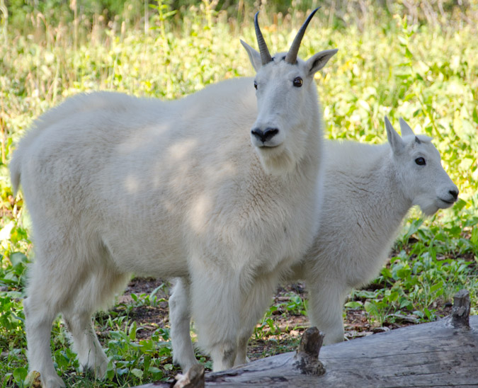
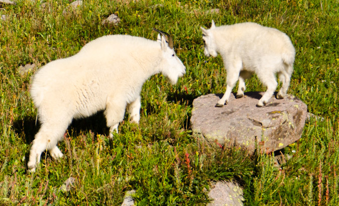
We descended into the Basin in quick order. I had tentative plans to find a campsite closer to Columbine Pass rather than going down deep into the basin. My reasoning for this was two fold. For starters, there would certainly be less people up higher near Columbine Pass, and I prefer not to camp near a ton of people. Lastly, this would afford an easier ascent from Chicago Basin on our exit day. Indeed, we located a very clean and impacted site just into the trees and called it our home. As soon as we arrived, two mountain goats, a mom and a baby, arrived to greet us to the neighborhood.
It was at this point that I knew that I did not haul my heavy 18-105mm lens in vain. I swapped lenses and took some closer shots of the goats.
Peculiar animals - they always seemed to gravitate to difficult terrain, even in a huge meadow...
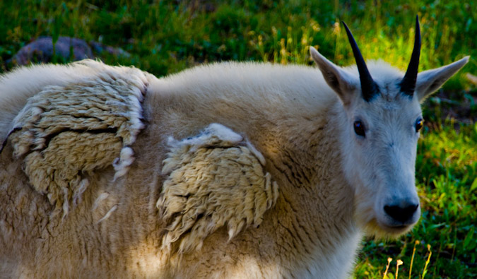
And they always seemed to leave behind some of their fur - must be their welcoming gift to us!
I swapped lenses again as we prepared dinner. Tonight's meal would consist of a wonderful medly of jambalaya and sausage. Hell yes.
We devoured the food and Sarah went in and took a nap. I decided to venture up the valley to see what trouble I could get into with my camera. The sun was setting and I knew it might present some fun opportunities. I found a few good spots and gave it a shot.
Here is Aztec Mountain in HDR:
I followed the stream that entered our campsite up a ways and found a nice view of the sunset over Eolus.
I found the water to be a fun subject to play around with.
... in black and white too...
I went back to camp and found a deer was trying to eat our food, which we had not quite hung yet. I shooed the dear off and hung our food and hit the sack. We wanted to get a sunrise summit and hopefully all four 14ers, so we set the alarm for 3 AM...
Day 3: Sunrise from North Eolus, summit of Eolus and Sunlight - 5,112 ft. elevation gain, 8.7 miles.
The alarm sounded and we rose out of the tent like two zombies. Two long days of backpacking had taken its toll on our bodies. We were both sore and tired, and we knew that today was going to be huge. We also knew it would pay large dividends if we committed to going hard and strong. We raced out of camp in the darkness with our headlamps guiding the way. I knew we were looking for a sign that would point us up another trail to Twin Lakes. We dropped 500 ft. in elevation to the valley floor and crossed the fairly large drainage coming down from Twin Lakes. We ran into a solo hiker that was coming up and he said he was heading to Twin Lakes as well. I was certain we had not passed the turn-off yet, so I asked him if he passed it. He did not really know what I was talking about, nor did he know what Columbine Pass was. I was not terribly sold on his sense of direction, but decided we should follow him for a minute to see if we passed the turn-off by mistake. About 20 seconds in, I decided to look again at my map and sure enough, we had not yet reached the turn-off. I tried to signal him but his head-phones prevented him from hearing us, so we turned back and headed down further and found the turn-off within minutes. Up we went without him towards Twin Lakes. We hiked fast. Blazingly fast, considering the amount of miles and elevation we'd done the past 48 hours. We reached Twin Lakes in the dark at 5:00 AM, which felt great. We knew we needed to turn left and find the trail up to Eolus. This proved difficult, so I just went with my instincts based on what I had read. We found ourselves in the right general area below some cliffs without a trail. Through urging from Sarah, I consulted the GPS and sure enough, we were roughly 50 feet below the trail, and we found it right away. We continued up the steep trail towards Eolus and found the ramp leading up to a flat bench before the saddle between Eolus and North Eolus. The sun was just beginning to light the Earth at this point in time, and it was magical. The low light created great silhouettes of Sunlight and Windom, and the small lake below looked like a sheet of glass.
We continued up towards the saddle and found another herd of goats coming down from above. The baby goats were making an adorable high-pitch sound that could only be encapsulated thusly, "eeeeeeeeeeeeeeeeeeeeeeeeeeeee!"
It was truly a gift to be able to witness these creatures in their true habitat. I know that Chicago Basin trip reports are oft too full of tales of mountain goats, but in this case, I really felt like I witnessed something special, watching these beasts navigate this rugged terrain. I coined a geeky phrase while watching them, which I shared with Sarah - "Wanting to Buy - Mountain Goat skills."
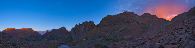
Pushed by the imminent sunrise, we climbed on, and reached the Eolus - North Eolus saddle. The famous Mount Eolus catwalk and Mount Eolus were looking mighty fine in the early light.
Looking up at North Eolus, I knew it would be an incredible vantage point for sunrise, and so we went for it. In true form, we reached the summit just moments before sunrise. I was jubilant and ecstatic, like a kid on Christmas, and I captured some footage on video:
For all of you detractors of HDR photography out there - I decided to showcase both methods (HDR and non-HDR) for this trip report, to please everyone and to demonstrate the difference. You can mouseover / click to see the other version. Here is what greeted us at the summit (mouseover / click to see the non-HDR version).

Slowly but surely, the sun began to poke through the clouds, which were the most insane feature of the scene - absolutely magically dramatic.
This next shot is non-HDR, and one of my favorites from the entire summer.
I was in heaven (probably quite literally). The views of Pigeon, Turret, Monitor, Animas, Arrow, Vestal, Sunlight, Windom and even Rio Grande Pyramid were stunning. Breathtaking. Here's a near-360o panoramic. Click to see a larger version.
The HDR Panoramic version turned out pretty well too, although in this case, I almost prefer the non-HDR version, except for the fact that the clouds look INSANE in HDR (click for a higher resolution version).
I have about 20 versions of these panoramics that I can't set my mind on picking a favorite, so I decided so share a few more...
As we were both getting pretty chilly, we decided to get a quick group photo and head out. Click / Mouseover to see non-HDR version.
We found ourselves back at the catwalk, which was impressive. Sarah and I immediately began reciting the classic Right Said Fred 1992 song, "I'm Too Sexy."
Once we reached the catwalk, I could not help but sing, "I shake my little toosh on the catwalk" and do a little wiggle. After revisiting that video, I can't help but feel a little light in the feet if you know what I mean...
Sarah was kind of nervous for the catwalk, but her smile said otherwise.
Once past the catwalk, we were greeted by some really fun and intricate ledges on the face of Eolus. I had read some about them, but nothing is quite like being there. It kind of reminded me of the final sections of Crestone Peak, only a ton more of it.
One thing was blantantly clear - a mis-step and you would be tumbling to your death. In a moment's notice, the sky became filled with small snow-flakes, adding to the magic of the morning.
At 7:40 AM, we reached the top of Mount Eolus and it was a great feeling. We felt like we had accomplished so much this trip.
It was so awesome to see Arrow and Vestal again after my trip up them last year. Soon after we summited, a solo hiker joined us on top. I mentioned how awesome Arrow and Vestal looked and he asked me what they were. It made me very sad. My reply in my head: "Only the two coolest mountains in Colorado!" He said I was wierd for climbing 13ers before 14ers... sigh. They are seen just left of me in my summit photo.
The views looking down the valley we had just came up were so awesome. In the dark, you can't fully appreciate the scale of your hike, but once above, it becomes really clear that what you accomplished was huge.
After spending about 10 minutes on top, we decided to head down, knowing we still had more mountains to climb before the weather got really bad. The clouds seemed to be holding in our area, but looked crazy in other areas. Time would be of the essence if we were to get all three in one day. On the way down, we passed one older guy with huge calves that provided the absolute best opportunity for laughter for Sarah and I. I should not jest, but when you're tired, almost everything is funny. He was wearing almost no gear, super old-school boots, no helmet... and socks on his hands for gloves - yep. Also on the way down, we saw a large group closely together, coming up. I was almost certain that it was either a guided trip or some sort of vacation group. As we passed them, they were indeed somewhat odd, but very enthusiastic to be up there nonetheless, and that's what matters! They were coming quite slowly and when we passed them, they were studying maps and routes and 14ers.com printouts. They also appeared to be wearing helmets that were fit for people twice their size. At least they had helmets. You can see them as small dots in the photo below.
The way down was fast. Too fast. I felt like I was at cruising speed. My legs felt great, like adamantium.
Naturally, we passed a solo goat on the way down. Those guys were everywhere!
We rounded the corner and the Twin Lakes came into view, including Needle Ridge, Sunlight and Windom. Spectacular!
I raced down to the lakes, knowing it was just going to be a feast for my eyes and camera. Right as we reached the lake, a friend of mine, Will, who joined me for my hike of Mt. Wilson last month, met up with us. He was gracious enough to refill my Camelbak bladder with purified water. He was planning to head up Eolus, as he had done Sunlight and Windom the day before. I set-up my tripod at the lake and started shooting photos. Will captured the moment.
For this particular scene, I decided to do HDR since the sun was in the scene, which made it really tough to get all of the dynamic light into the shot. I would be the first to agree that this shot is totally over the top, but I love it just the same.
I also decided to get a shot of me at the lake, using the tripod and the self-timer.
Sarah and I refueled by eating some awesome tortillas w/ peanut butter and honey we had made the night before and then set-off for Sunlight. The trail up Sunlight was so awesome. The incredible work of the Colorado 14ers Initiative was obvious here. Huge cairns marked the way. Stone-work that would make a dwarf from Lord of the Rings envious demarcated the trail, paving a highway up the slope of the mountain.
As we climbed, the Twin Lakes were looking as awesome as ever.
And the cairns were monsterous. Looking back at Eolus was also humbling.
Looking up, we still had a ways to go to reach the Sunlight Peak - Sunlight Spire saddle (top - center).
The cairns also provided some good resting areas.
We reached the top of the basin and started climbing up towards Sunlight.
Which became steeper the higher we got, and eventually the paved road provided by CFI ended, and scree began.
I reached the saddle and admired the views to the north of Jagged Peak, which is one of the last few mountains in the highest 100 I have left to climb.
Sunlight was still high above from the saddle, as evidenced by this 360 panoramic photo with Sunlight at center.
At this point, Sarah was feeling light-headed. I knew her stamina was OK but something was going on with her body. I suggested that perhaps she needed more protein, since we had not had much through the day. I pulled out the huge log of summer sausage and we snacked for a bit. Sure enough, within minutes, she felt much better and we were off to the races again. A view back at Windom and the clouds forming above provided motivation.
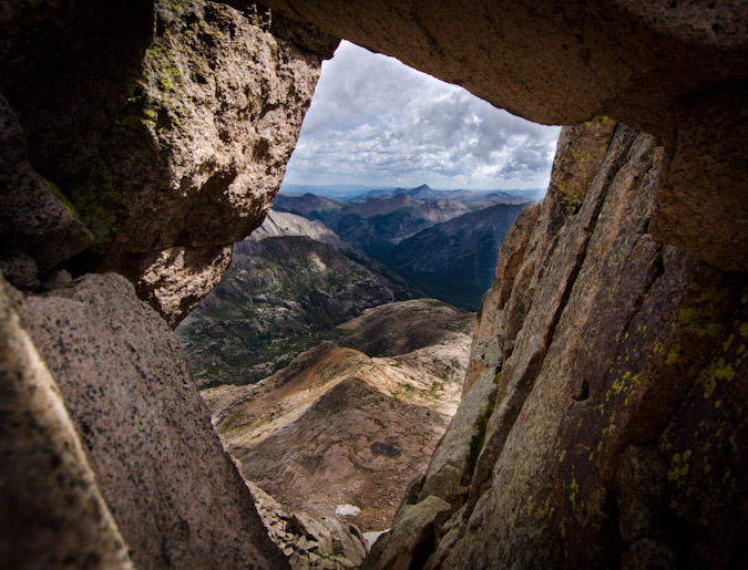
We reached a small gap during the climb, which was quite challenging to say the least, and I loved the window. The views of Rio Grande Pyramid and "The Window" were great! So this photo is called - "The Window through the Window."
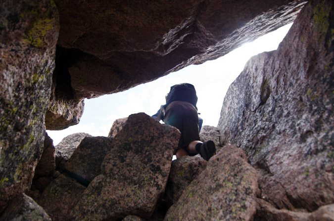
We found ourselves actually using some climbing skills - and head up a small chimney.
We reached the summit of Sunlight Peak at 11:45 AM, which felt pretty great considering we had been on Mount Eolus just 4 hours prior. The weather was moving in though, and that dampened our spirits. An exciting climb like this should feel amazing when you get to the top, but the thought of being electricuted tends to temper those feelings for a while. I managed to get a few panoramics anyways, which show how nasty the storm moving in looked.
Here's a near 360 pano:
And a quick summit photo by way of Sarah, including Sunlight Spire's incredible summit just left of my camera bag:
The air filled with graupel, a sign that things were not going to be good - weather-wise. We reached the Sunlight Peak - Sunlight Spire saddle in quick order, passing several people still heading up. Not sure if that is the best idea to head up when the storm is depositing ice on the rocks, but that's just me. Here's my reaction to that!
Here comes the weather!
The crazy kids in tennis shoes and cotton hoodies kept going up through the graupel and thunder, but we booked it down to safety and took refuge.
Luckily for our friends in cotton and tennis shoes, the weather let up, dumping only light amounts of rain in the area. The rocks were slick though, and that was a real concern to us, even though Windom was just 1,100 feet up from our safety spot. We sat for awhile, watching the weather, contemplating our next moves. Would we be able to wait out the storm? Would it be safe to go up? We sure did not like the thought up coming up again in the morning on tired legs. We finally agreed that it made the most sense to head down, especially given the fact that it was still slightly raining and the rocks were getting wet and it was still sounding off with thunder. Even on the way down, I stepped on a large wet rock slab that was slightly at an angle and it dropped me on my side like a hit from a middle linebacker. I was fine but it was a good reminder that we had made the right choice to go down. Even still, more and more people kept heading up. Madness.
The views on the way down were still great though, including this wonderful shot of some waterfalls below Twin Lakes.
The weather persisted most of the way down into Chicago Basin.
And in true San Juan Mountain form, the weather started to dissipate as we got lower...
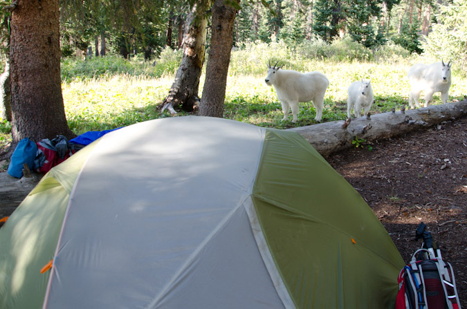
We reached our campsite slightly demoralized, tired, and sore. My knee was starting to really hurt from all of the pounding it had received on the downclimbs, which did not bode well for the climb up and down Windom for the following day. Such is life on a quest for mountain tops. Sarah decided to take a nap and sulk over our defeat, while I decided to eat some food and think about the day's highs and lows and the strategy for the following days. As we were moping, a herd of goats decided to come see what all the whining was about and one of them even decided to piss on our pity parade.
This herd was pretty big - I believe there were 7 of them total, including two babies, a real scruffly looking one, and a bigger grandpa type.
Here's Mr. Scruffly:
And my favorite goat photo... I was photographing them from near a fallen tree when all the sudden this baby goat decided to jump on the tree and walk towards me - he came all the way down and started nibbling on the tree - it was really cool.
One of them kept a good eye on me. I think he was making sure I was not going to attack them or something. It was funny to watch them interact so closely. Sometimes the babies would go under a female for milk and they would get shoed off. Sometimes one goat would kick another goat out of a grazing spot in a fury. They were hilarious.
I probably got too excited about the goats, but I've been waiting years to see goats up close again, so it was a real treat.
It was really funny how close they got to our campsite! One time, one of them charged another one, and did not see that Sarah was right behind the other goat. When he turned to run, he almost jumped right into Sarah!
They were really fun to photograph.
This little guy was playing king of the hill. I think he ended up losing.
I did some video footage of the goats as well -
After the goats were dispursed from our campsite, we cooked dinner. Our dinner consisted of a glorious mixture of mashed potatoes, country gravy and spam - a tried and true recipe from the annals of the backpacking hall of fame. The alarm was set for 3:30 AM and we crashed hard into the gelatinous wall of sleep that always greets you after a hard day of mountain climbing.
Day 4: Climb of Windom Peak and pack-out - 19 miles, 6,500 ft. elevation gain - 20 hours of hiking...
3:30 AM came all too soon, and I hit snooze twice. So, we did not leave camp until 4:15 AM. The going was slower and we were feeling pain. In fact, I was quickly questioning my physical capability to complete the climb, and we had not even reached Twin Lakes. Halfway up Twin Lakes, I had to stop and take some vitamin-I (Ibuprofen), as the pain my knee was excruciating. The pain quickly faded and we reached the lakes in the darkness of the early morning.
Hiking up to the Windom side of the basin was accomplished in short order, and the stellar light of sunrise kissed the mountains around us.
We reached the saddle between Peak 18 and Windom pretty quickly. On the hike down from Eolus, one of the climbers in the cluster of oddly-equipped people told us that Windom was underestimated. We were not quite sure what the heck he meant by that, considering so far both Eolus and Sunlight were both more difficult. There was a trail 3/4 of the way up Windom. We finally did find out what he meant, since the trail gave way to some very fun scrambling on class 3 rock if you wanted it. Many inappropriate jokes were exchanged between Sarah and I regarding the 'underestimation' of Windom and we were off to the races. We both agreed that had we done this climb while wet, it would have been quite dangerous. The views of Sunlight Spire and Sunlight were great. Loved it. Here you can see sun light just hitting Sunlight Spire with Windom's steep class 3 rock on the right.
We reached the summit block and the views to the east were insane. The sun had been shrouded by some odd clouds, and light beamed forth like needles cutting through a gray sheet in front of car headlights. Unnamed lake at 13,100 ft. to the east was also a real treat - a sheet of glass suspended in heaven.
I reached the summit first and just felt complete and total gratification for our efforts. After the demoralizing defeat the day before, this summit was delicious.
The summit of Windom was curious. It was a series of huge blocks, all seemingly suspended by some unknown force.
It was hard to believe that I had finally made it to Windom's summit. I had first admired this summit back in 2001, when I climbed Jupiter in a cotton t-shirt with my dad. Wow, have I come a long way! Check out that summit shot from 2001!
Due to the absolute absurd (meaning awesome) lighting, the opportunity for HDR photography was endless. I opted to just go for it. Sarah was pleased with this summit as well. It was totally under-rated - great challenge, great route and great views.
Sarah snapped off three bracketed photos of me on Windom's summit block - and the HDR result was WAY over-the-top, but epic looking either way.
At this point I did some pano work and went for the classic 360 HDR pano. I fell in total love with the results. The way the light just penetrates the low clouds just floored me. The details on Sunlight and Sunlight Spire were magnificent. Thank you Tokina 11-16! Check out the larger verison by clicking on it.

Windom provided such a great view of Arrow and Vestal too...
We headed down and enjoyed the views of Eolus all the way down.
Before we knew it, we had already reached the trail junction for Columbine Pass and headed back to camp. We passed an old mine again but this time stopped to take pictures. Another group had mentioned that the mine was actually pretty cool to explore, but that was not high on our list.
We reached camp at about 11:15 AM and packed up. We set our minds to the idea of getting all the way back to the car today. It was a lofty goal, to be sure, but we felt like we could do it, plus for some reason my legs decided that they were no longer sore. So we departed at 12:00 PM, with rain gear at the ready, and minds determined. Hell or high water, we were going to make it to the car. The climb out of the basin to Columbine Pass was gruelling. It was painful and slow. The weight of our packs and the fatigue of the weekend's work had us moving a consistent snails pace. We reached Columbine Pass and looked back - it felt great to get this far already, but we knew that the day had just begun...
A look over the other side of the pass revealed clear weather and an inviting Columbine Lake. Trimble Pass - here we come! I turned on a podcast of Mike and Tom Eat Snacks - which had me in stitches for most of the hike up to Trimble Pass. Sarah was comforted by the idea that she was hiking with a madman.
The journey from Columbine Pass to Trimble Pass was pleasant, albeit slow and methodical.
We reached Trimble Pass at 3:30 PM. We were still tired and sore, and required some time to rest, but we soldiered on.
As we downclimbed from Trimble Pass onto Silver Mesa, I took one final parting shot of Chicago Basin... what a great place!
As we marched across Silver Mesa to the beat of our own music or podcast, we could not help but notice a huge storm brewing to the west. It looked as though it was moving our direction, so we kept eyes on it constantly. It was quite a sight either way.
Silver Mesa had so many inviting campsites that tempted us. We kept going.
Before we knew it, we were at Lake Marie again. Just below Lake Marie we stumbled across a man from Boulder with four llamas. He was looking for Lake Marie. He had been up the trail and did not see it. I showed him where he was on the map. He thanked me. We were puzzled how one can miss a giant lake, but did not question it a whole lot, as we were focused on a mission. A mission of muscle-pounding and soul-crunching. We reached City Reservoir. It was also teasing us with its ample camping potential...
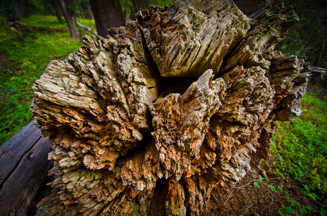
We cruised past City Reservoir and began a maddening climb out of the basin and towards Endlich Mesa. I found an interesting tree trunk to keep my attention off my aching bones.
Darkness came quickly. We reached the beginning of Endlich Mesa around 9:00 PM. It was snowing. We were tired. We were hungry. We were quite certainly in foul moods. Sarah wanted food and so did I. I did not want to make camp though, so we got some light food out and ate. I confirmed our location on GPS. Only a few more miles to go. We finally reached the car at 11:30 PM and collapsed into sleeping bags in the truck. It was the best shitty night of sleep I've ever had.
This trip was the most physically demanding thing I've ever done. I pushed my body to its limits. I lost 6 pounds. I think both Sarah and I conquered some inner demons on this trip. It was, in retrospect, one of the greatest trips of my life.
Thanks for reading! I leave you with a playful creation - the world of Chicago Basin!
Citations:
1 Rhoda, Summits to Reach, pp 31-32
{fcomment}
Sunrise from 14,015 feet: Wetterhorn Peak
The adventure of my July 4th weekend for 2011 just wouldn't end on its own. After spending the morning in Telluride sulking about our partial defeat in Navajo Basin, Regina and I decided to drive back to Colorado Springs and lick our wounds. As we drove closer and closer to Blue Mesa Reservoir, I got a wild idea in my brain. Since both Regina and I still had three days off for climbing, I figured that it would be a total shame to waste that time off and gas money on only one climb up Wilson Peak. Even though we opted to not do El Diente and Mount Wilson, I still felt that we had more gas left in the tank, so to speak, so... I suggested to Regina that we head to Lake City and climb Wetterhorn Peak instead of driving home. At first Regina was more focused on a warm shower and a soft pillow, but it did not take long for the idea to set in and Regina enthusiastically agreed. Perhaps my tactic was not fair, since I knew that Wetterhorn Peak was Regina's favorite mountain of all time. Once Regina agreed, my mood increased dramatically and we set-off for Lake City and the Wetterhorn Peak Trailhead.
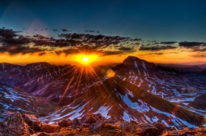
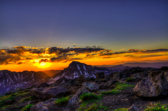
To make matters even more epic, I convinced Regina that we should start from camp at 2 AM so we could watch the sunrise from the summit. Climbing up the class 3 summit block of Wetterhorn in the dark sounded pretty fun too... We arrived at the trailhead and found a perfect campsite next to Matterhorn Creek. All night long, I had visions of a most epic sunrise over Uncompahgre Peak that looked something like this:
We quickly went over the game plan and Regina explained the route to me. Regina had been up this trail 3 times last year, so she knew all about it. The first time she went, she was pushed off before reaching the summit because of exhaustion. The second time, she was scared off the trail by actual mountain lions (true story), and the third time, she finally succeeded in reaching the top. She has never shut up about Wetterhorn in all of our trips together, so I figured that either she was exaggerating or that Wetterhorn was truly one of the best climbs in Colorado. 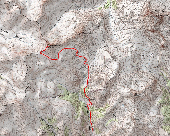
Our campsite was pretty awesome, and we were both thankful for our Mountain House meals that we had packed with us for Navajo Basin. 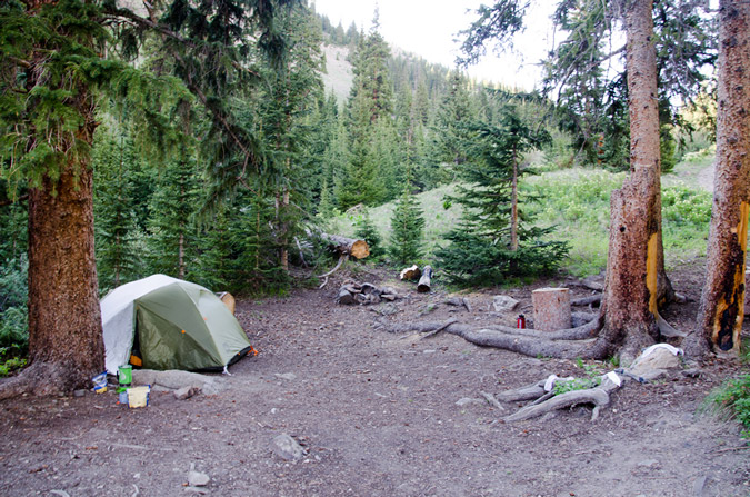
We went to bed, set the alarm for 2 AM, which arrived pretty quickly. I felt totally rested though, so we equipped our packs and opted to not pack up our tent so that we could hopefully reach the summit by sunrise. The trail was really easy to follow in the dark, but I could not help but think about the mountain lions that Regina encountered last year. Would they totally thwart our efforts? I really hoped not, and focused on the task at hand. We finally reached the area where Regina had encoutered the mountain lions last year, and wouldn't you know it, we looked down the hill to catch the gaze of three sets of eyes illuminated by our headlamps. Crap! Fortunately, we were able to realize pretty quickly that they were just deer, so we continued on up past treeline. It was not until we reached the final ridge of Wetterhorn that there as any light whatsoever in any direction, save the star light.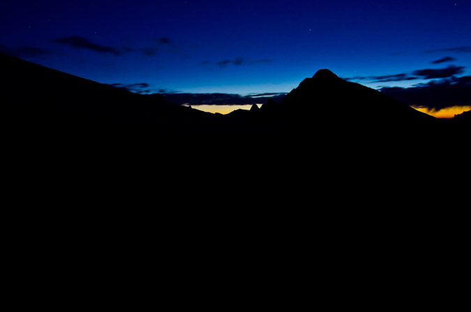
We continued on up Wetterhorn's ridge, enjoying the progressive light show that was starting to erupt to the east.
Just before we reached Wetterhorn's final section, the sun began to get closer and closer to emerging... would we make it to the top before the sunrise? I was getting nervous in anticipation.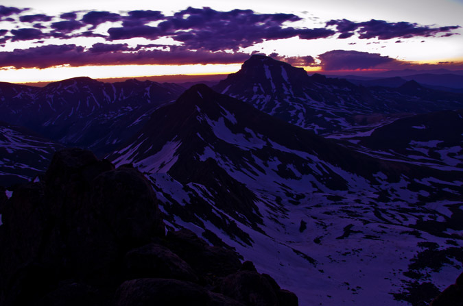
I was really having fun with my camera, firing off several bracketed shots for HDR, using rocks as a tripod and the self-timer to prevent camera shake. 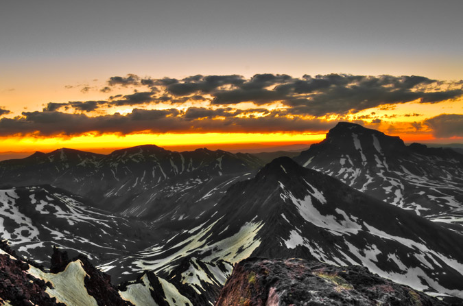
We finally reached a small snowfield that was in a small flat area before the top. The snowfield was at the base of the huge cliff walls of Wetterhorn and lead us to a notch that was a portal to the super fun Class 3 section of Wetterhorn.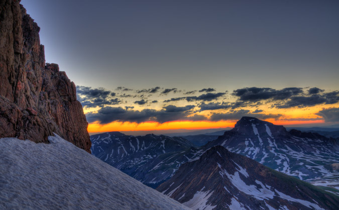
At last, we reached the final summit pitch and Regina went first. Her enthusiasm for Wetterhorn was impressive and nothing like her lack of enthusiasm two days prior on Wilson Peak.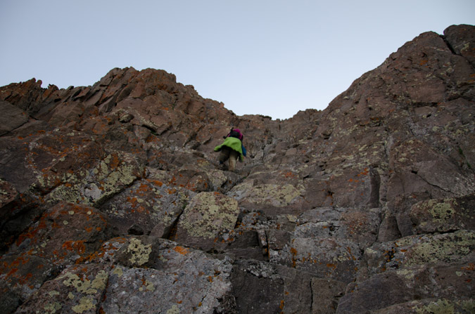
I was even able to take some video of Regina climbing up this section.
I followed Regina after she had secured herself above, and quickly made it up within a few seconds of fun climbing. We were literally about 20 seconds from the top and I told Regina that the sun would be rising in any second. I crested the summit and it was quite possibly one of the most amazing thing I've ever witnessed. The sun literally crested the horizon THE EXACT MOMENT that I crested the summit. The timing was insane. I ran as fast as I could to the other side, built a rock tripod, and began shooting. I knew that this was gold.
These two are HDR and almost the same except for some slightly different processing techniques.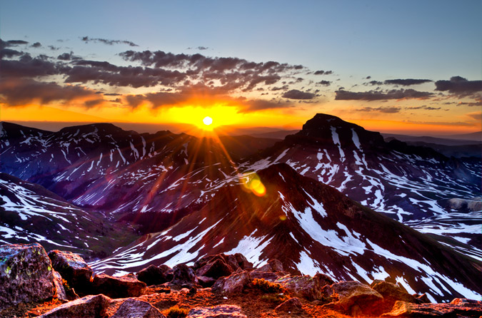
I was like a little kid on Christmas. I had no words to describe it. I didn't even realize it, but it was pretty cold up there. I think it took me a good 20 minutes to even feel it.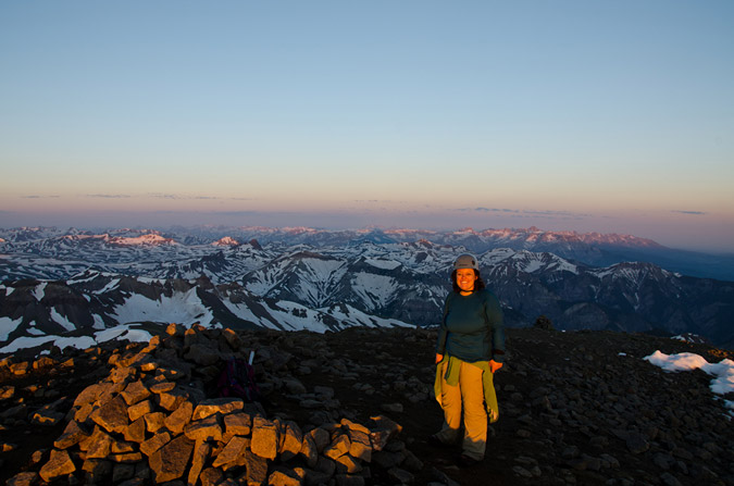
Regina was pretty excited too, being that it was the first time she had seen the sunrise from the top of the mountain.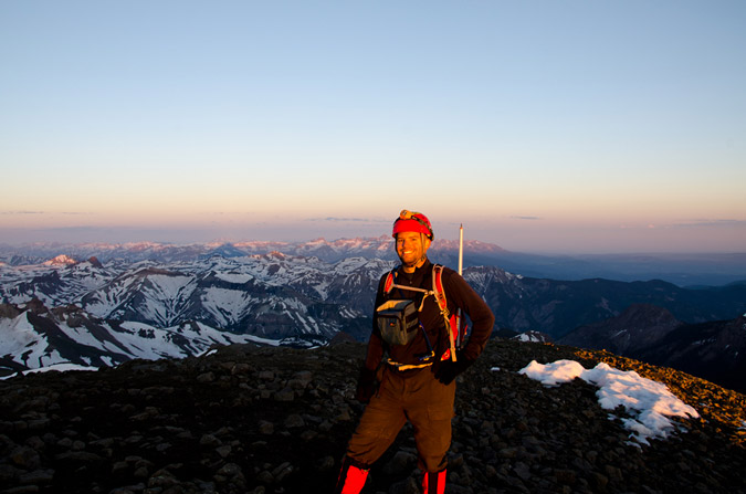
The views were simply incredible... including this 360 degree panoramic.
The lighting was perfect for High Dynamic Range (HDR). I knew that this would be the best chance I'd get in a long time to put together an HDR pano, so I gave it a shot. The results were mind-blowing. I can't wait to get one printed for my house.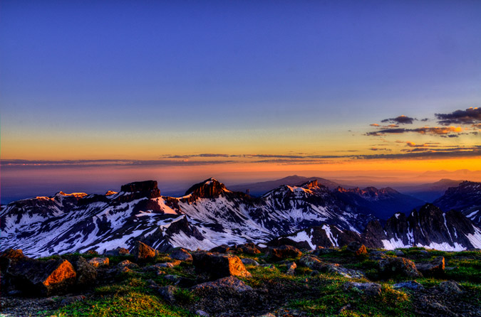
The views of Coxcomb and Redcliff were crazy!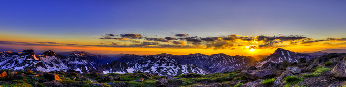
Hey, the summit shelter even makes a good tripod in a pinch! I decided to take a few HDR shots of Sneffels and the rest of the rugged San Juan Mountains to the west.
Uncompahgre Peak was truly an amazing feature to photograph from Wetterhorn.
I had always admired both Uncompahgre and Wetterhorn as a pair, especially last year from Handies Peak (Wetterhorn on the left, Uncompahgre on the right):
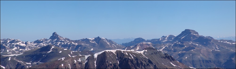
Is there really such a thing as too many sunrise photos?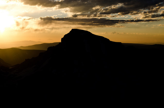
Or panoramics for that matter?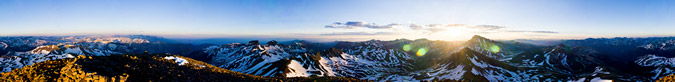

The craggy features of Redcliff to the North were quite impressive as well!
All this photography and I had almost forgotten that Regina was with me, obviously a bit chilled!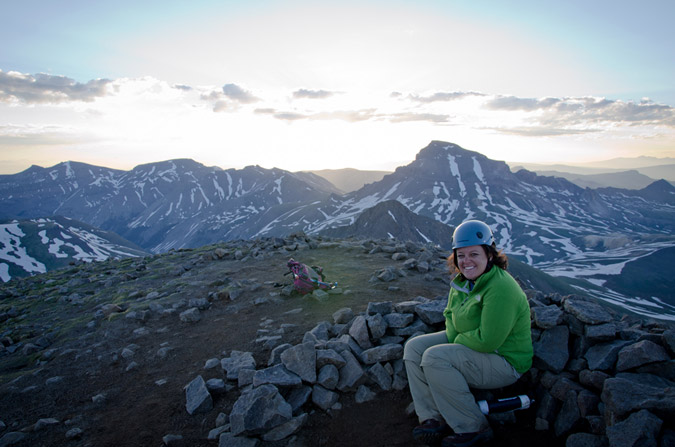
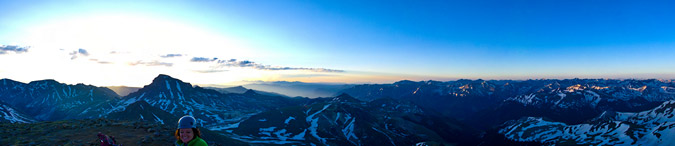
So, we decided we had enough amazing views for one morning and then departed the summit.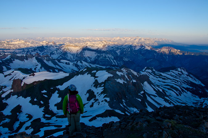
The downclimb was a little more tricky than the upclimb, but nothing worth worrying too much about. As long as you take your time and stagger your group, it is very safe.
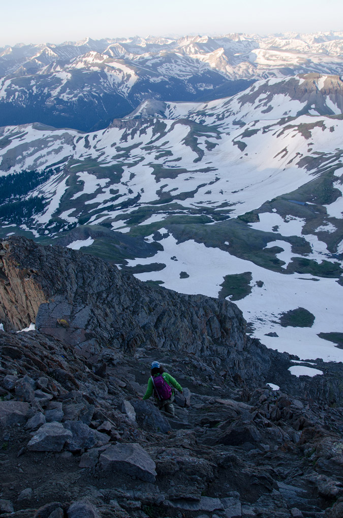 |
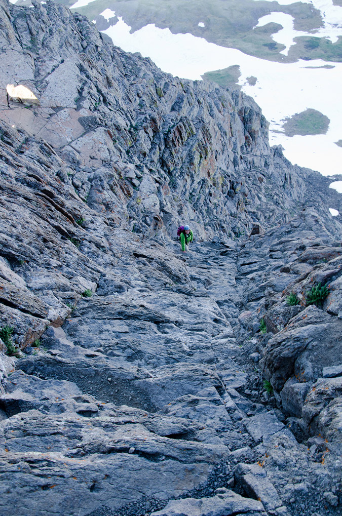 |
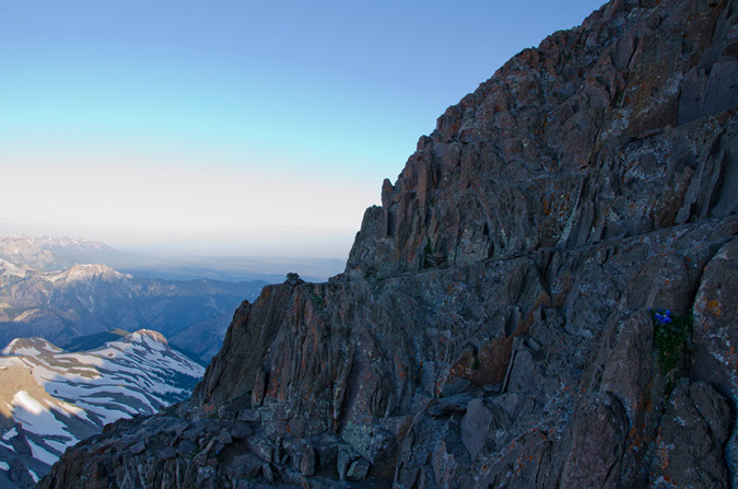
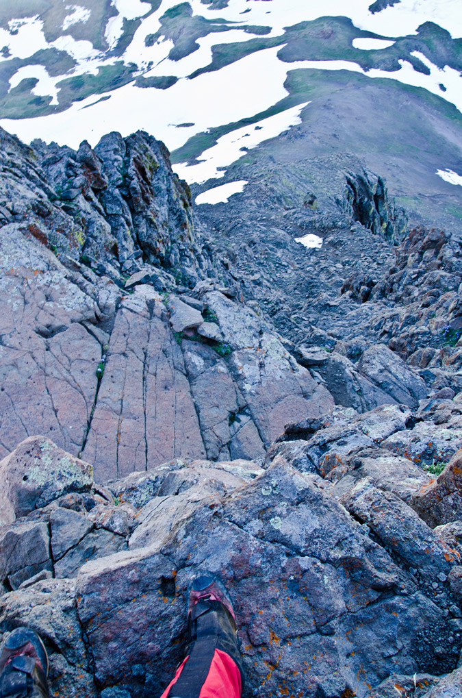 |
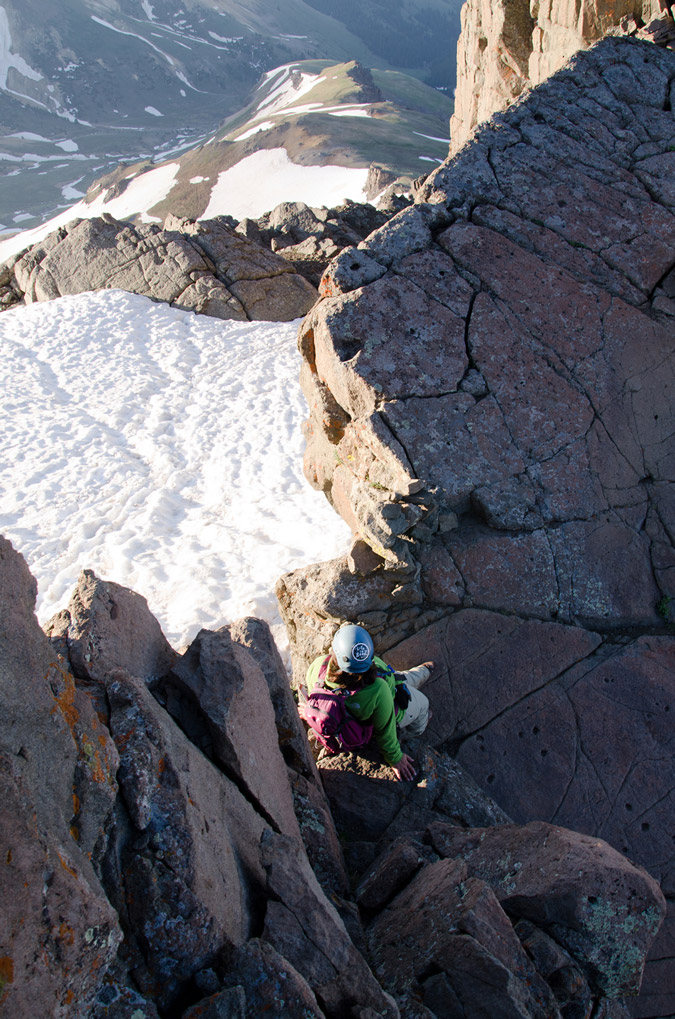 |
It never fails to amaze me what will grow on the side of a mountain...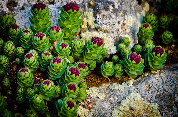
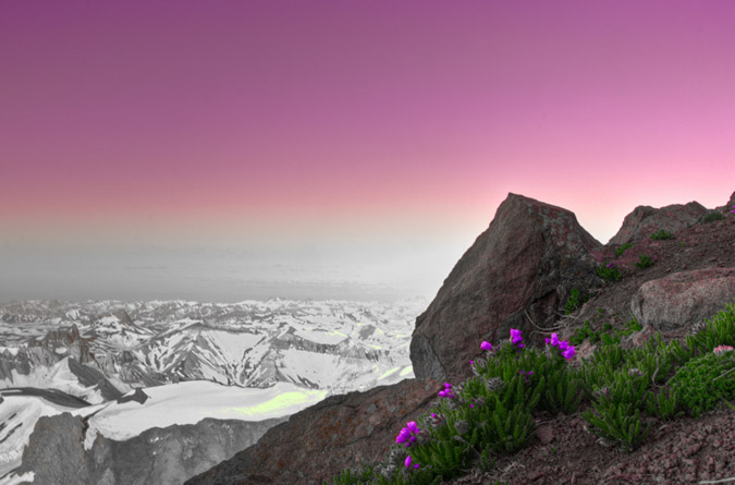
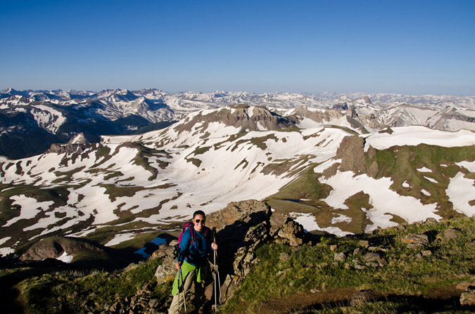
Naturally, Uncompahgre kept me in a state of wonder...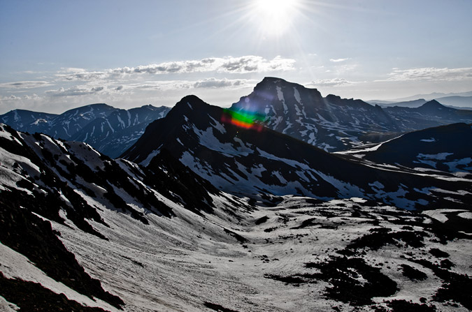
As did Sneffels...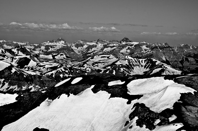
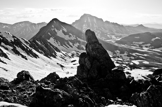
Wetterhorn was pretty awesome looking for below, which was awesome since it was completely dark when we headed up.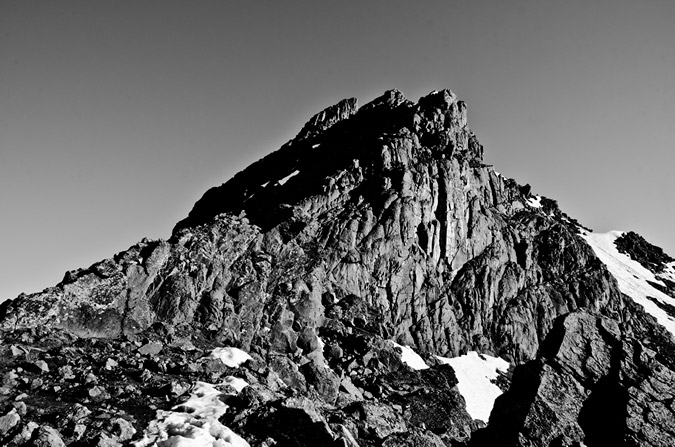
Also, a set of lower peaks kept my attention to the west, near Ouray. They were so impressive and gnarly looking! I was convinced that it could only be Bighorn Ridge, just east of Ouray. I believe I have confirmed this by looking on the Impressiveness List on my website.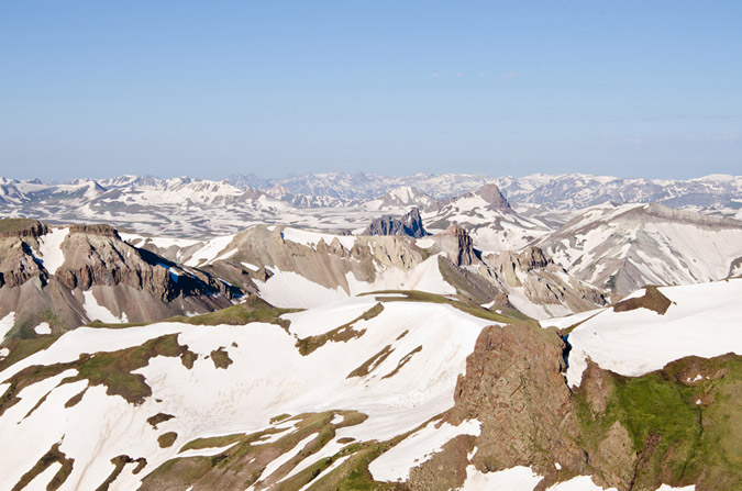
All this photography set me back from Regina quite a ways, and before I knew it, Regina had reached the Golden Saddle.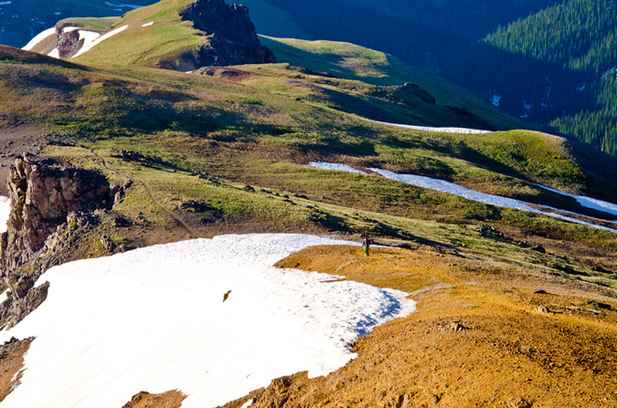
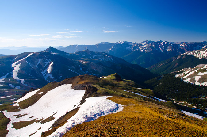
We finally ran into some early hikers just after the ridge, who turned out to be none other than "Kitten" from 14ers.com. 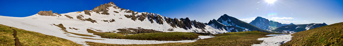
Regina and I both spotted this awesome little pool below and I knew it would make for an interesting shot...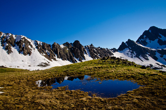
Funny thing - unknown to me at the time, "Kitten" shot a photo of me taking that photo, as I discovered it in her trip report.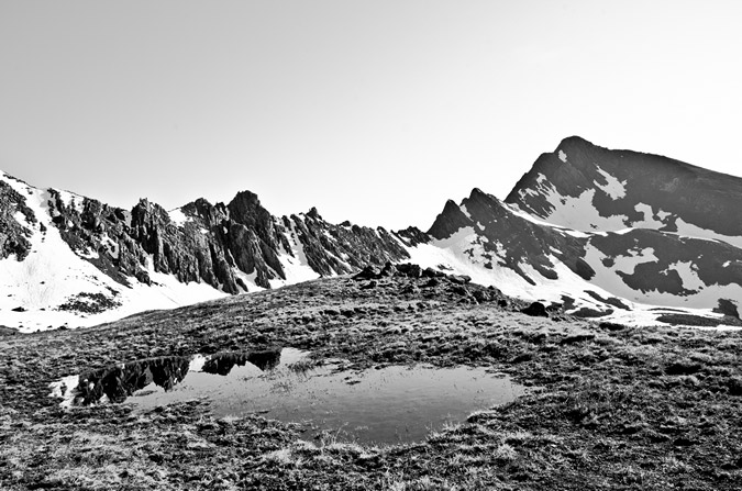
I even got a picture of Regina, and Wetterhorn, plus the pool.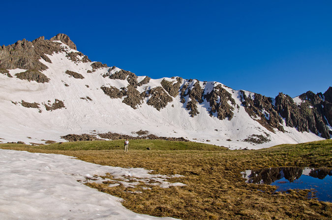
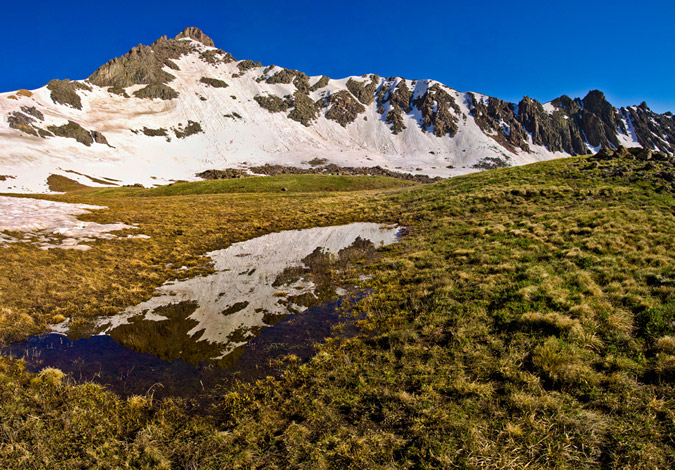
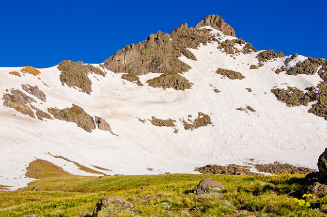
I spotted some interesting flowers off-trail and figured they might make for a cool shot with Uncompahgre behind them...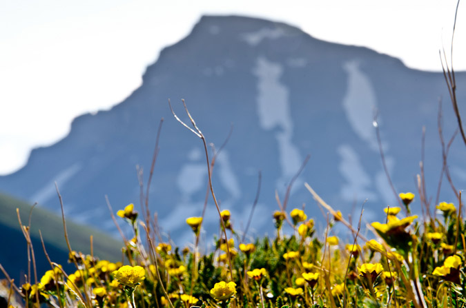
And, out of nowhere, a plane went zooming by over Wetterhorn...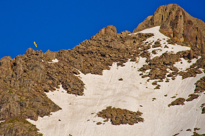
The hike out was pristine. The views never got old. Wetterhorn and Matterhorn painted such an incredible vista.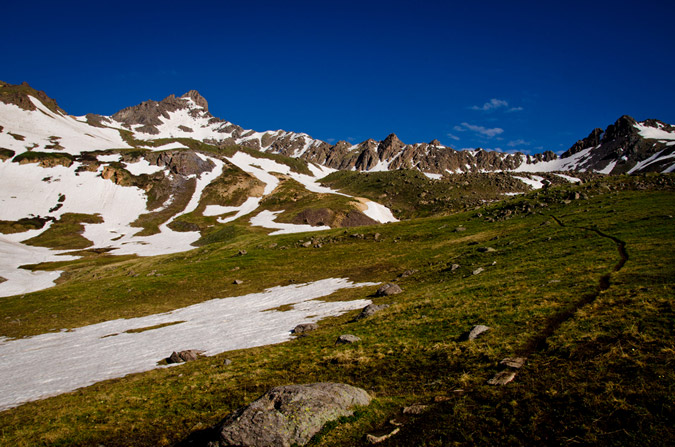
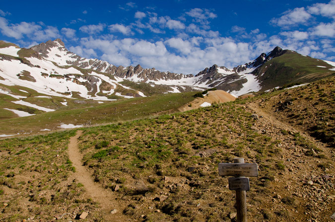
Wetterhorn looked pretty awesome from the valley below...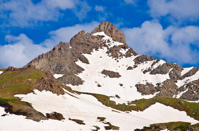
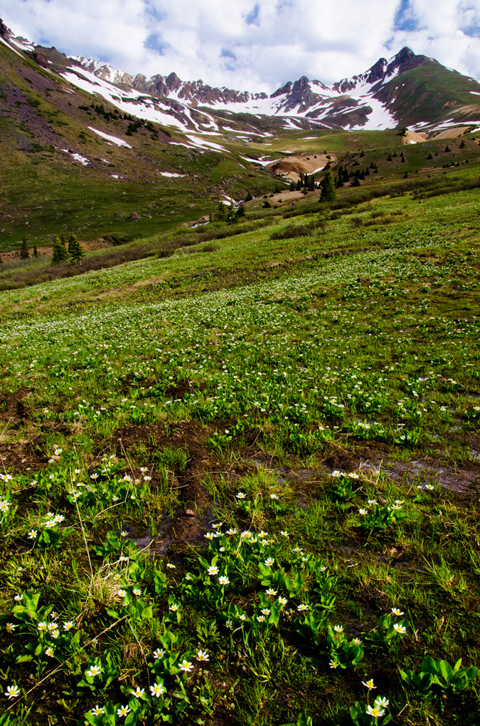
And of course, the weather started to move-in as we were heading out. The clouds were really intense, so I figured it might be fun to take some HDR shots of them.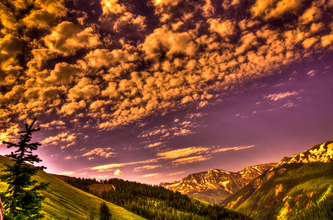
In case you were wondering, at the first trail junction, seen below... you go right. I barely noticed this one on the way up since Regina has this mountain memorized.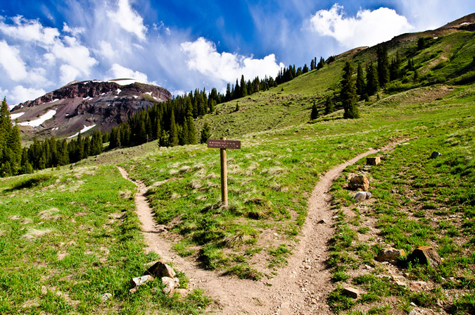
Matterhorn Creek provided some amazing opportunities for photos as well, having a ton of water in it.
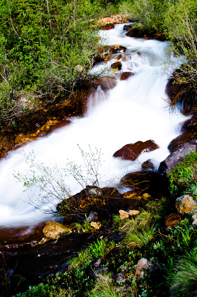
What else can be said about Wetterhorn? It is probably the perfect mountain. Here's why:
- The approach is short and easy, accesible to even the most novice of hikers.
- The route is solid - it is a terrific introduction to Class 3.
- The views are INSANE.
The only bad thing about Wetterhorn is that it is not closer to my house! I would rate it a 10/10.
I hope you enjoyed the photos! Please contact me if you would like to purchase any. See this page for more details.
{fcomment}