Displaying items by tag: Telluride
Gladstone Peak and Wilson Peak from Bilk Basin - A Backpacking Trip Never to be Forgotten
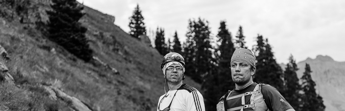
Backpacking into the wilderness is an activity that is not easily surpassed. There is something about the raw nature of it all, like a tribute to our roots as human beings, which makes it such a powerful experience. Pair that experience with the ascent of two of Colorado's more challenging Centennial peaks, all while being with one of your favorite humans on Earth, and you have yourself a recipe for unforgettable memories. When my friend Silas asked me to go with him to climb Wilson Peak and Mount Wilson again, I knew we would be in for an adventure to remember. Even though I'd already done both Wilsons already, I welcomed the opportunity to help to help him finish off the 14ers, just like he had with me on Pyramid Peak in 2012. Silas and I have done a lot of hiking and climbing together - I counted that this was our 18th summit together since 2011. When I met Silas in 2011, he went by Sarah and had recently had a suicide attempt. Since then, Silas has really turned his life around - he got married, he had a child, and he has made a successful career as a non-profit badass. I'm still getting used to the idea of calling Sarah by Silas, but it is growing on me quickly.
Our hike started with Silas telling me about the recent development of not feeling comfortable in his body as a woman and wanting to transition to a man. At first I was really skeptical just as his wife was; however, when Silas told me after our trip that the decision was official, it washed over me and made me smile. No matter what, I love this person for who they are, man or woman, and really, it just does not matter one bit. Anyways, my guess is that you're here to read about climbing and not Silas, I digress.
I enjoyed the short drive to Telluride from my new home in Durango. It felt so awesome to be so close to the best climbing and wilderness in the state!
We both eventually agreed on an alternative route into the area since I'd been up there via Navajo Basin and the Rock of Ages Trailhead already and wanted to try something new... plus Bilk Basin offered stunning views of Lizard Head Peak to the south and east and by my calculations offered some pretty amazing photographic opportunities since the Milky Way would be rising behind Lizard Head Peak. So, we settled on Bilk Basin via the Sunshine Mesa trailhead. This trailhead was not terribly hard to find using both Roach's 13er guidebook and other online resouces. Silas met me in Telluride and we drove up to the trailhead together.
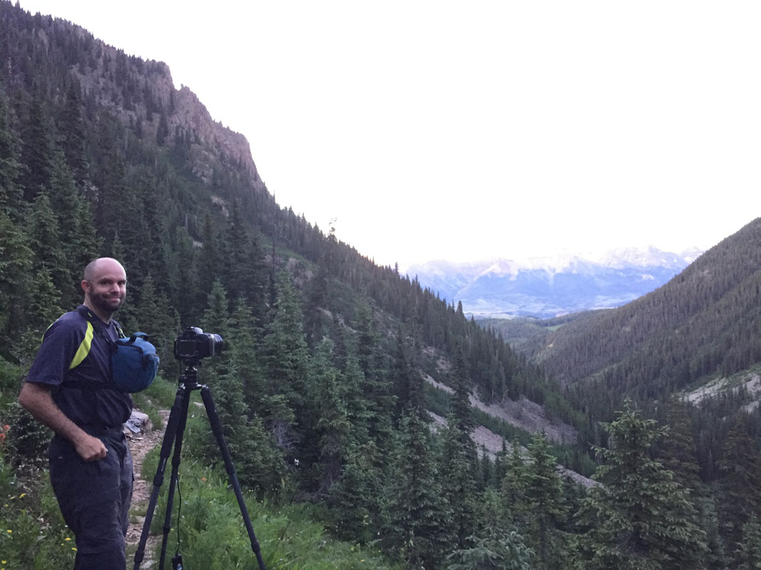
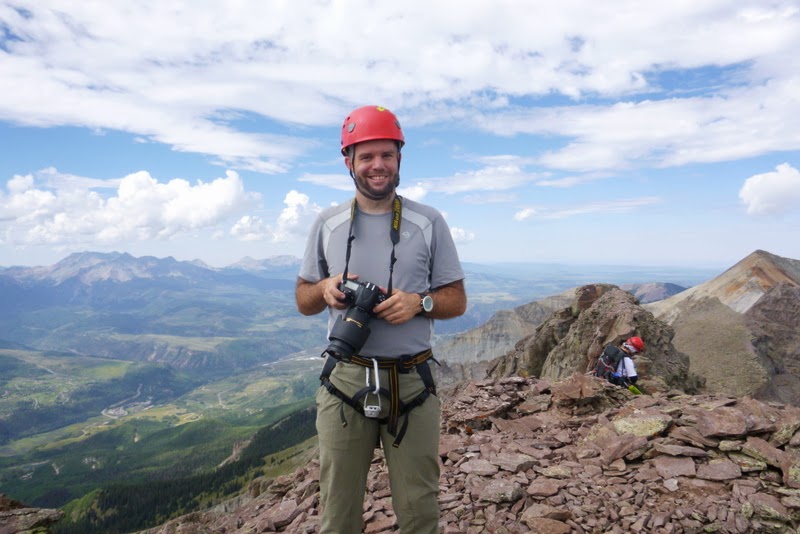
For this particular trip, I opted to bring my Nikon D800, my Nikon 14-24 f/2.8 lens, and my Nikon 24-70 f/2.8 lens. I felt like those two lenses would cover the ranges I'd want to be shooting on this trip, even though they were both quite burly. Nothing really beats the 14-24 for night photography. I also decided to bring my new GoPro 4 with me to shoot some footage using my helmet mount during the ascent of Gladstone. Additionally, I know it sounds crazy, but I'm on my 3rd pair of the La Sportiva S EVO Trango boots - they are so good for mountaineering in Colorado - really there is not a better boot for me and my feet in my experience. I love the higher rubber on the sides because they protect my feet during difficult scrambles and I know I can step anywhere with confidence, plus they are super lightweight. You can pick up a pair from Bentgate, a great local Colorado gear shop.
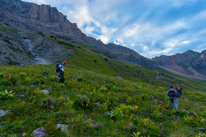
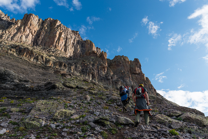
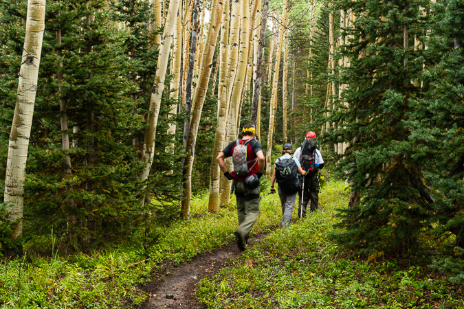
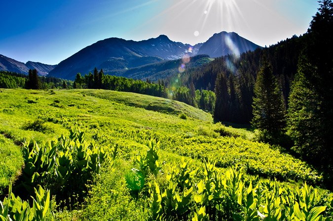
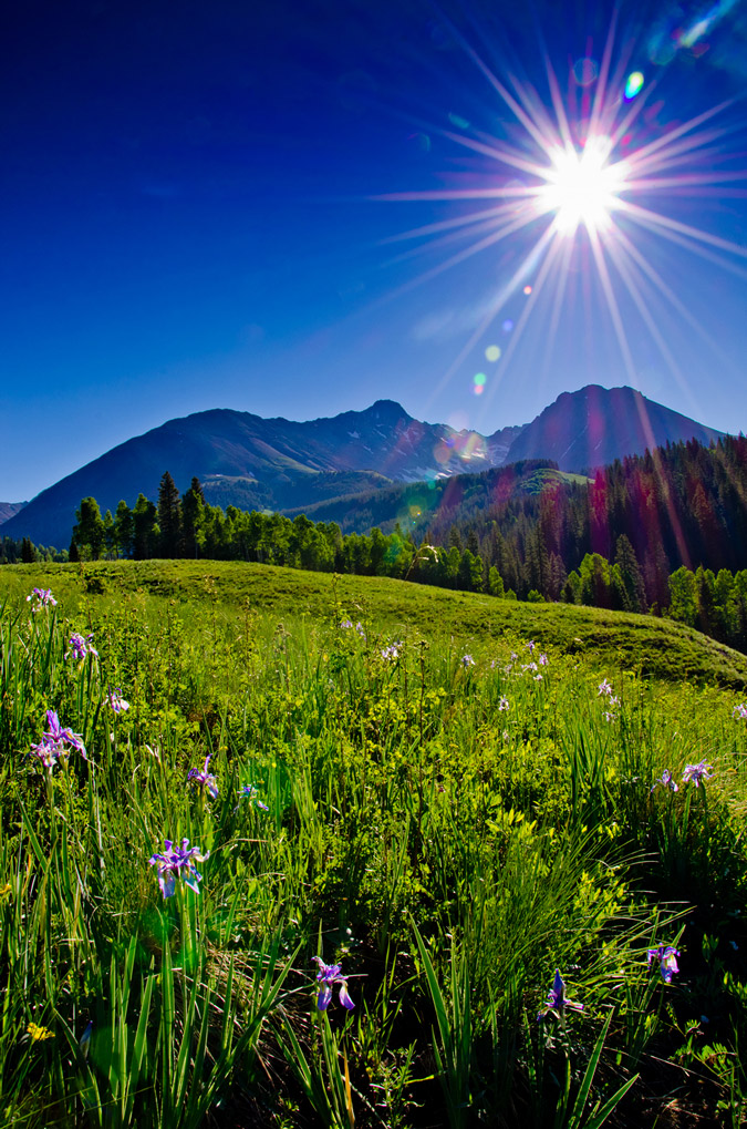
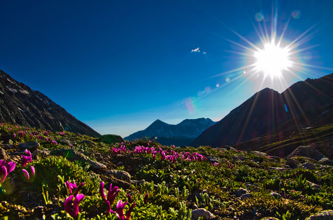
The hike up into Bilk Basin was pretty outstanding - I really enjoyed this approach and think it is the best of the three that I've done into this area.
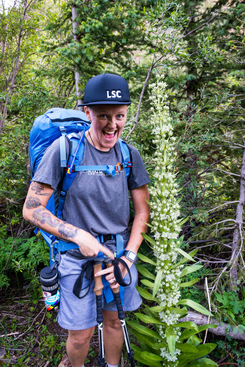
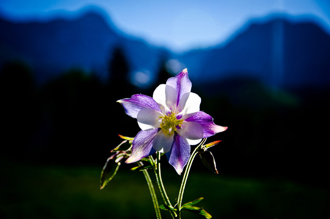
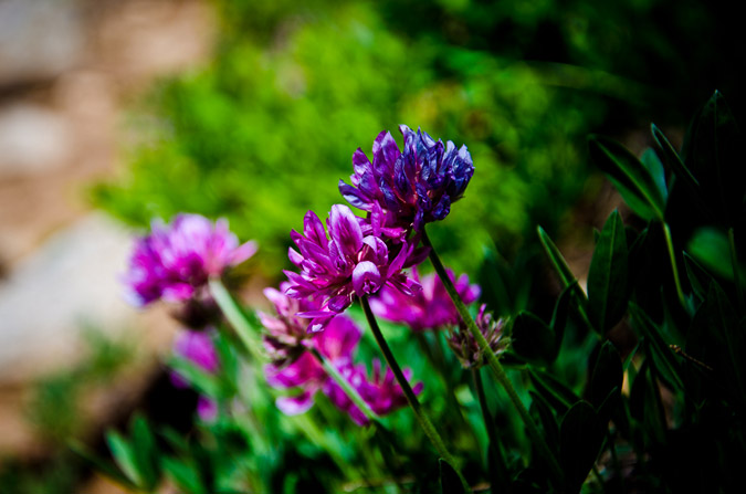
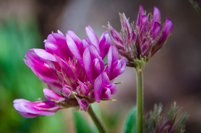
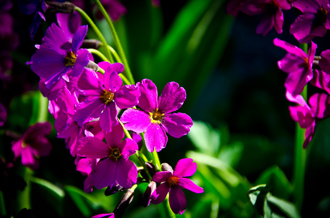
The trail was very full of wildflowers and interesting features like this crazy tall flower.
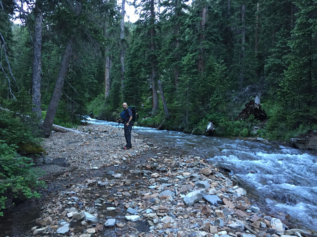
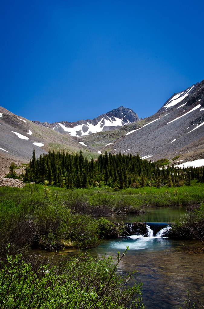
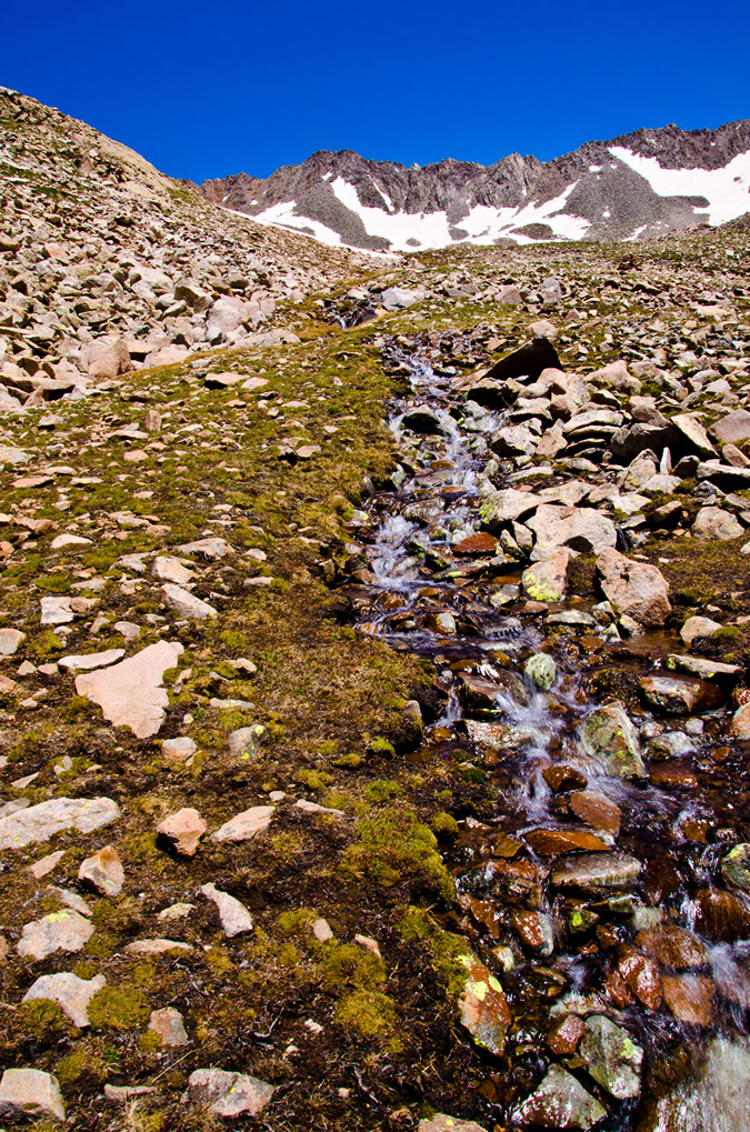
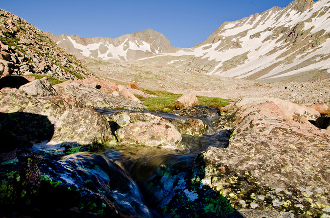
About 1/2 way up the Basin we encounted a stream crossing, which was not in any of the guidebooks to my knowledge. The location of the crossing was right after some old abandoned mining buildings, which I had read about before and seen on the USGS Topo map.
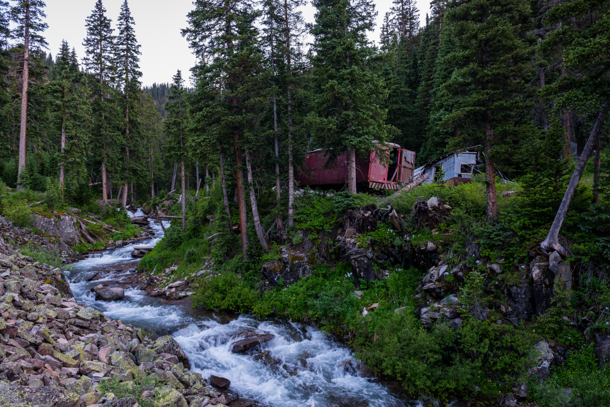
Instead of crossing the creek where it made sense, I wondered if the trail kept going higher since I had not read about the crossing. We ventured up into the valley further and even found ourselves on the creekbed, but eventually did decide to head across where the log dam was at after the mine.
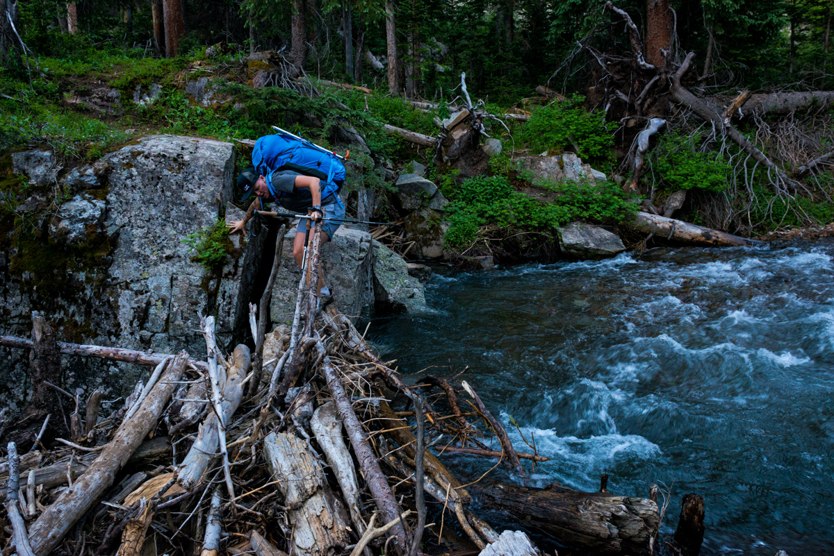
It was a pretty easy log jam crossing, and it reminded me of the log jam at Snowmass, except not nearly as insane or difficult. I went first as Silas photographed me.
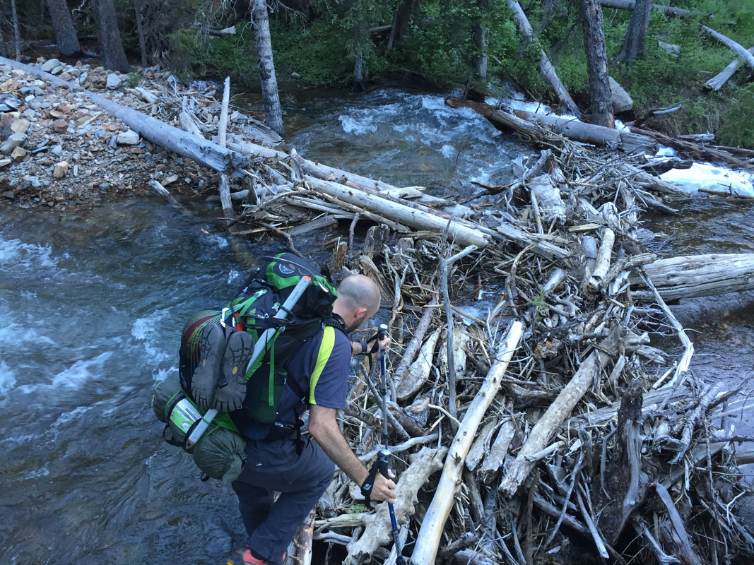
And then Silas followed. It was a bit tricky dropping down onto the logs but in the end it was no problem at all.
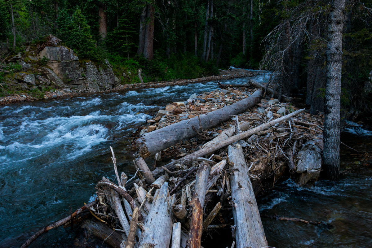
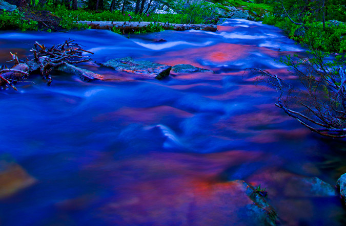
The early evening light was quite nice paired with the dark forest and the aquamarine creek.
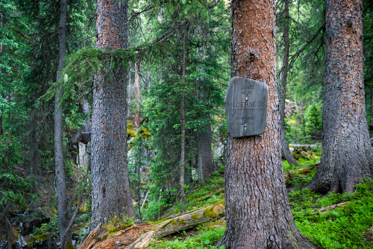
Ahhh... Wilderness.
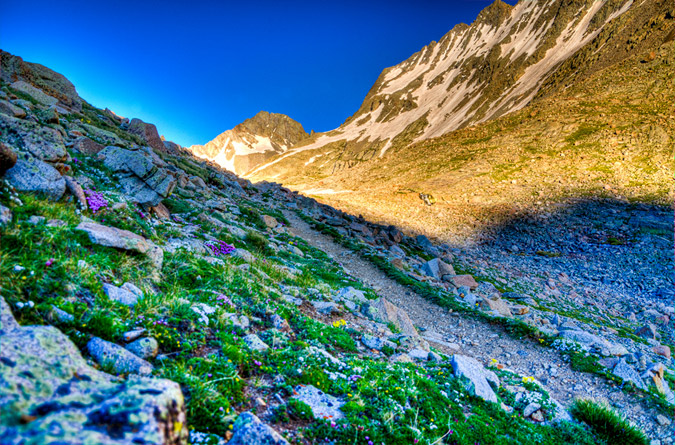
After crossing the creek, the trail was very straightforward, following the creek until eventually going up some switchbacks. The evening light was lovely.
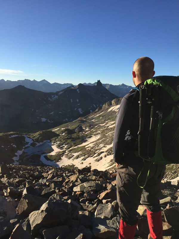
Silas enjoyed the view.
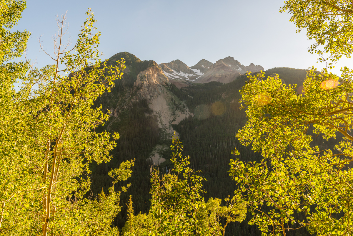
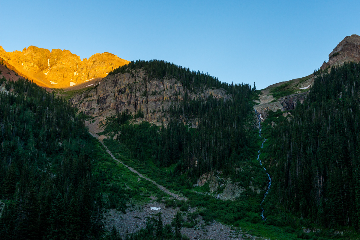
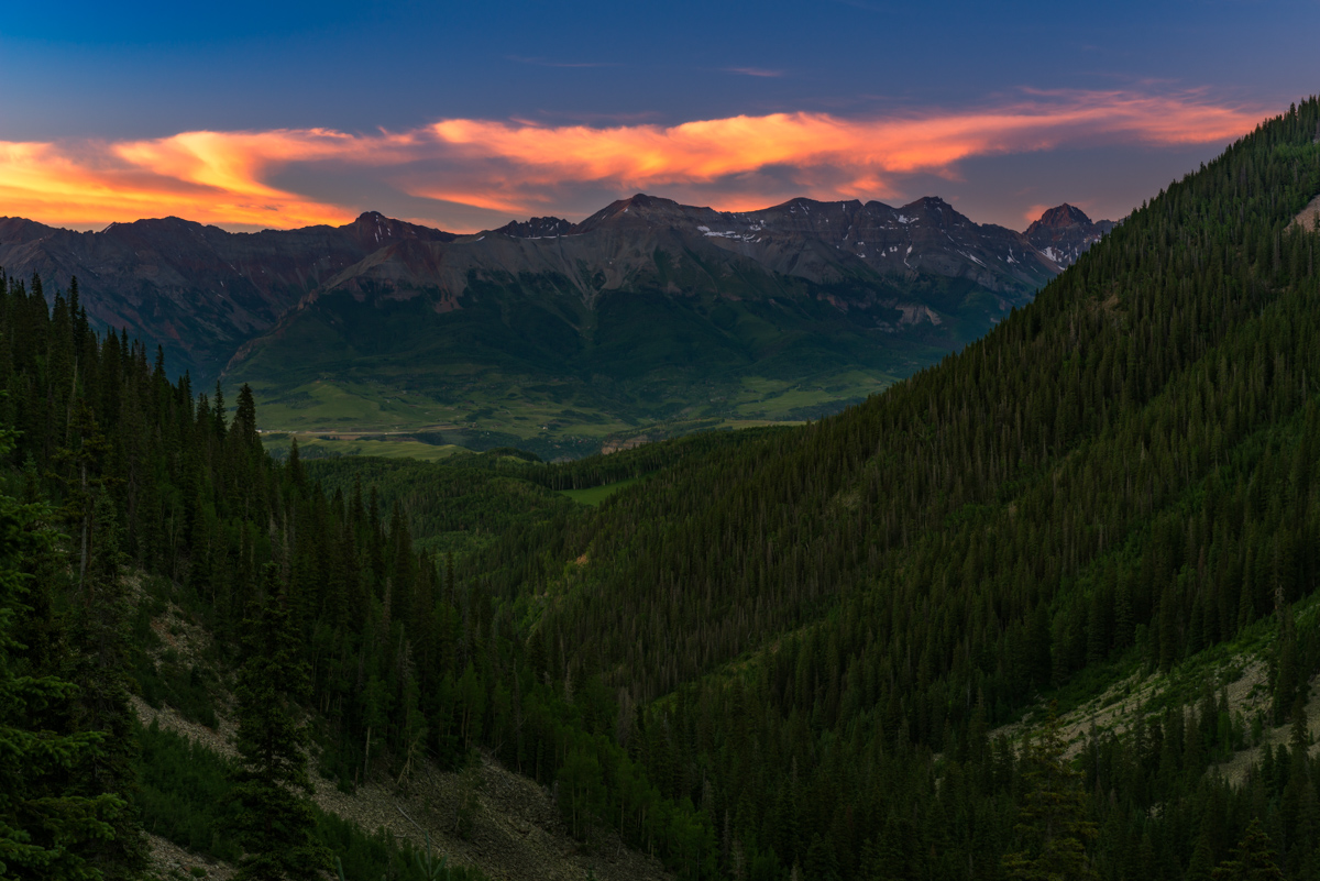
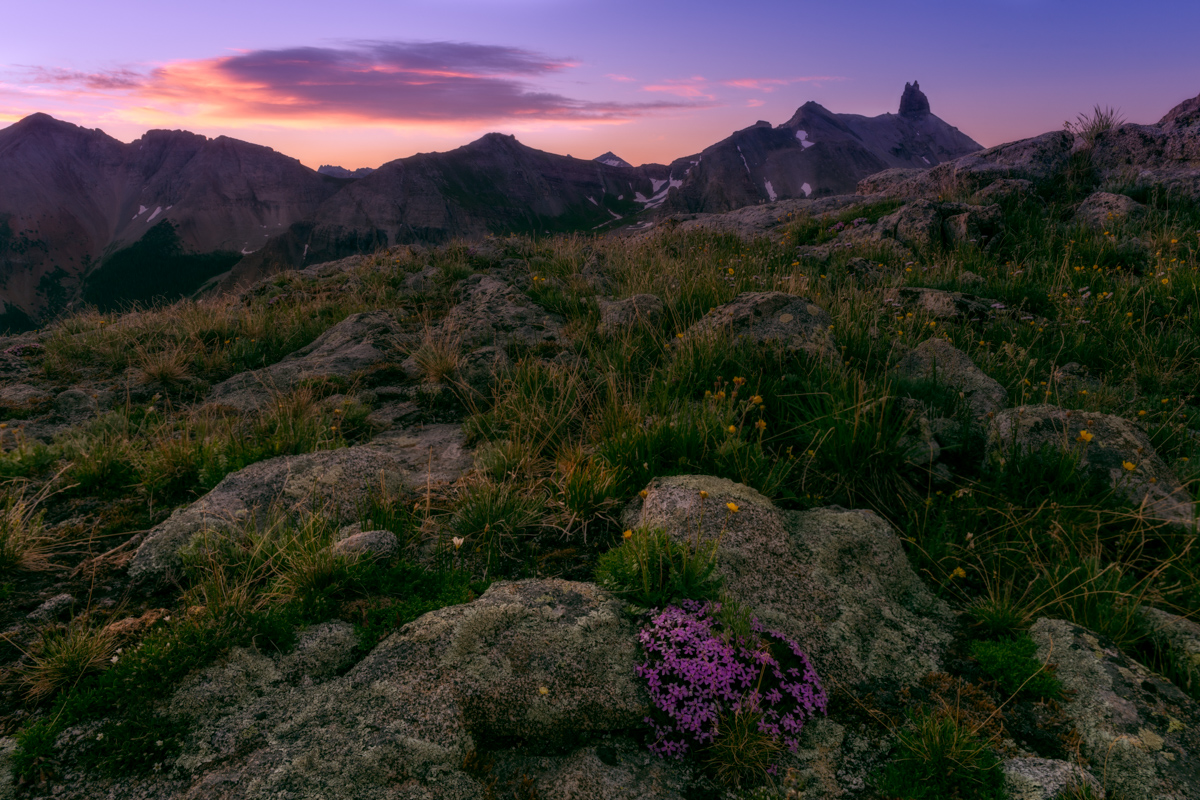
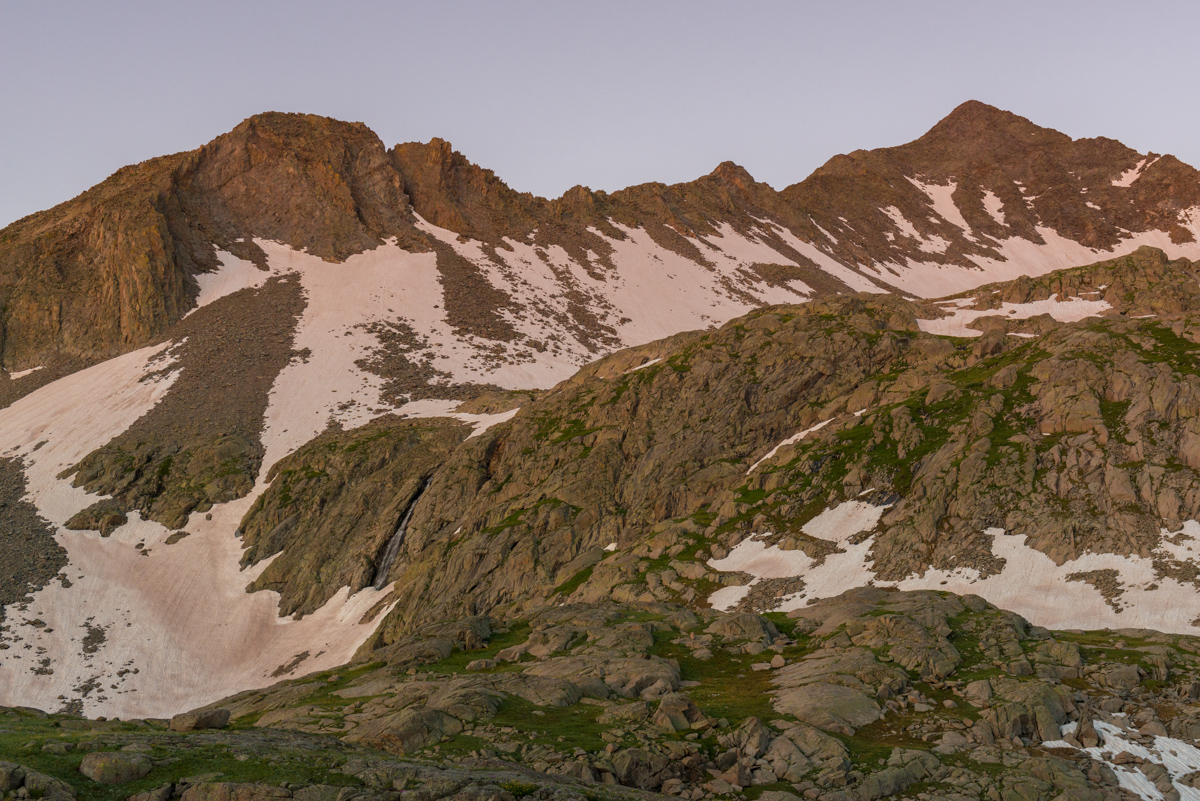
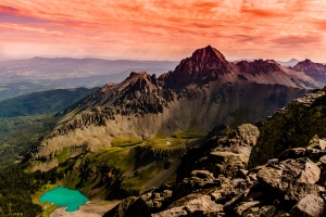
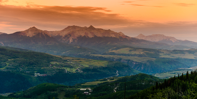
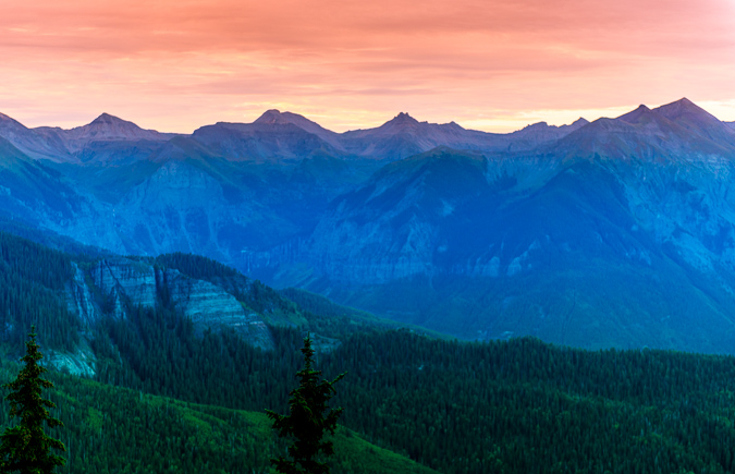
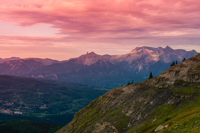
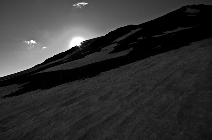
About 2/3 of the way up into the basin, the light began to change dramatically, with clouds hovering over the Mount Sneffels Wilderness Area across the valley from us. The last of the sun illuminated the summits of Campbell, Dallas, Gilpin, and Sneffels. I had to stop to capture it.
Well worth the stop, I think. For this one, I used a Circular Polarizer on my 24-70 lens in order to get greater color and tonal saturation and to reduce haze. Prints of this one are available HERE.
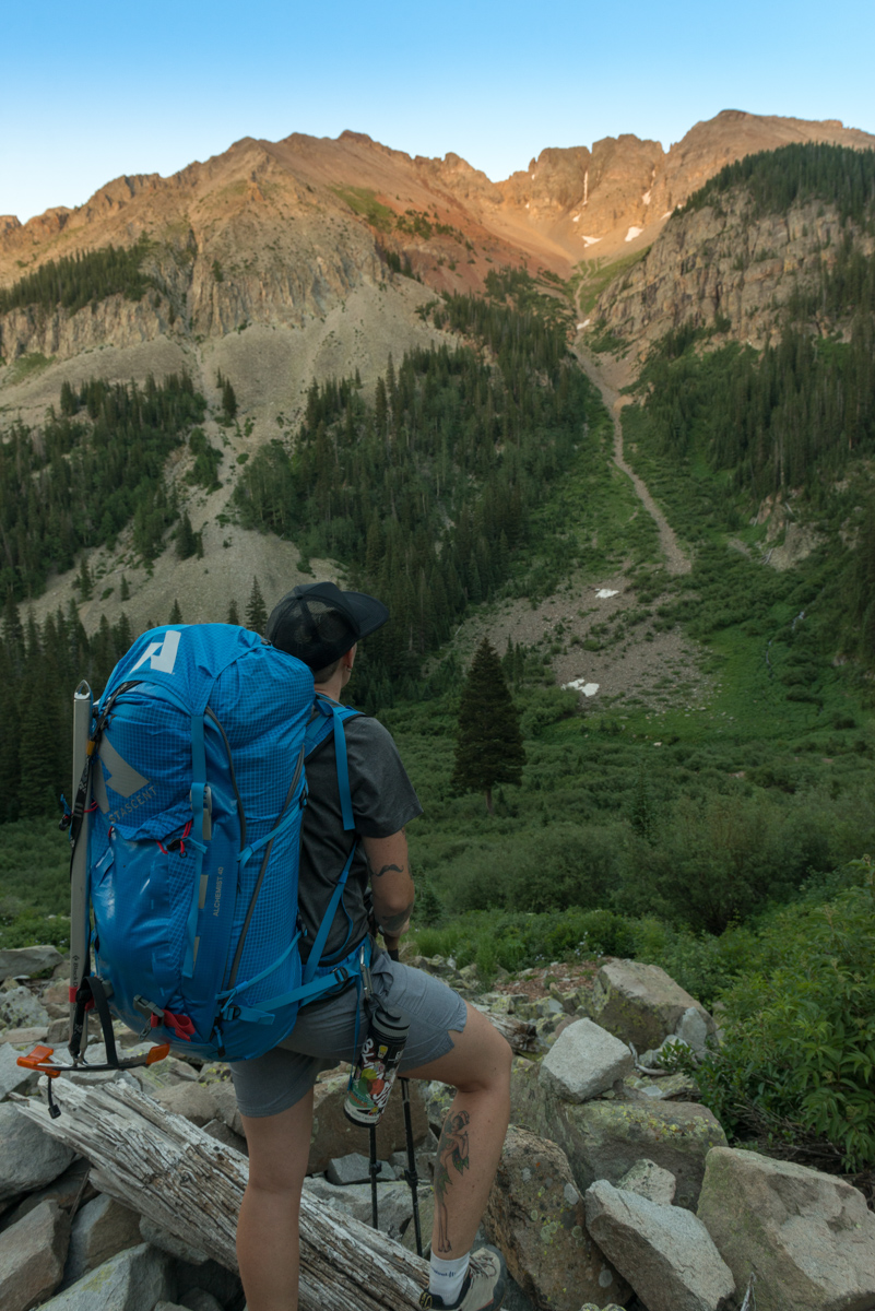
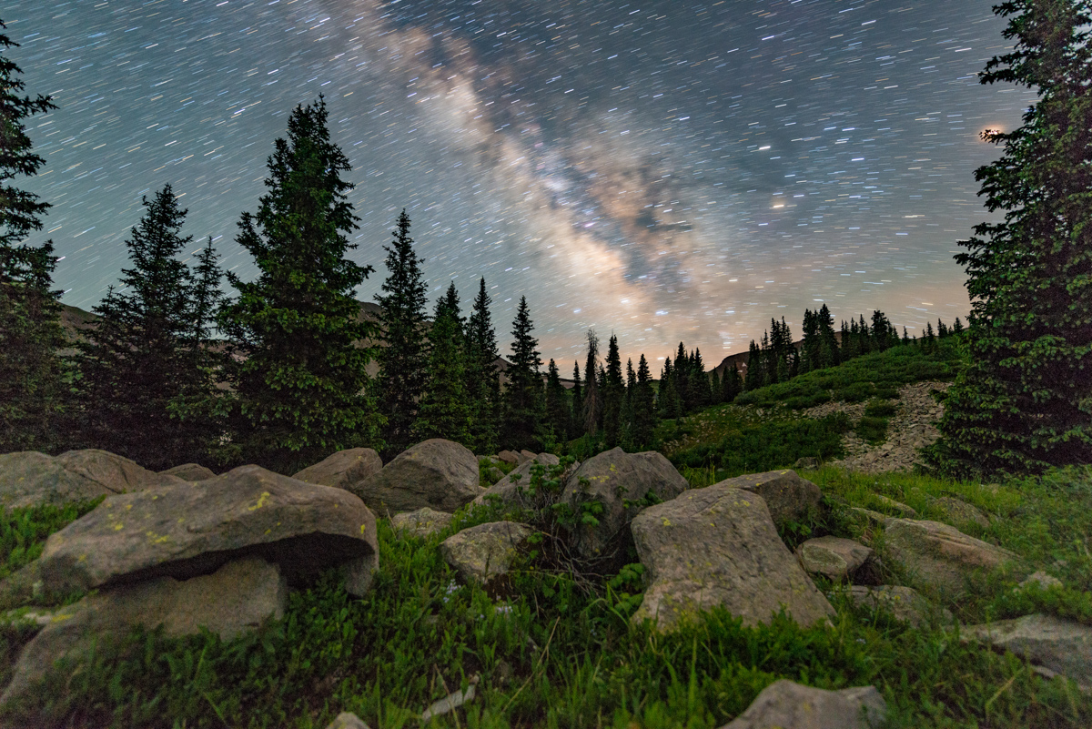
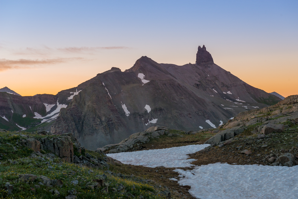
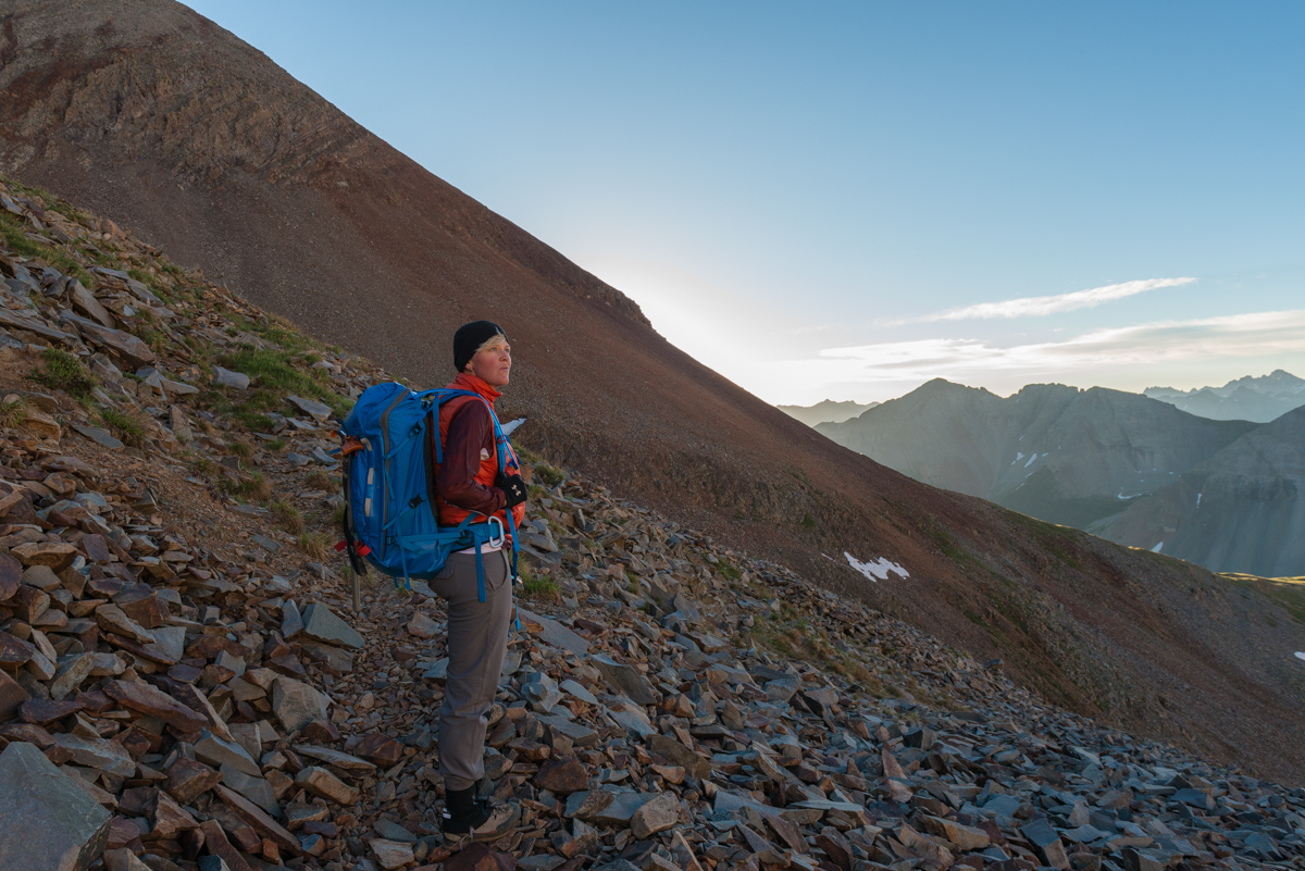
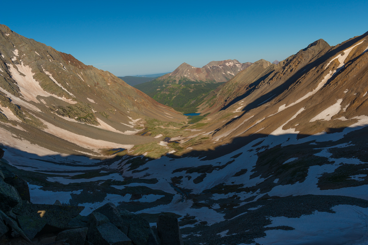
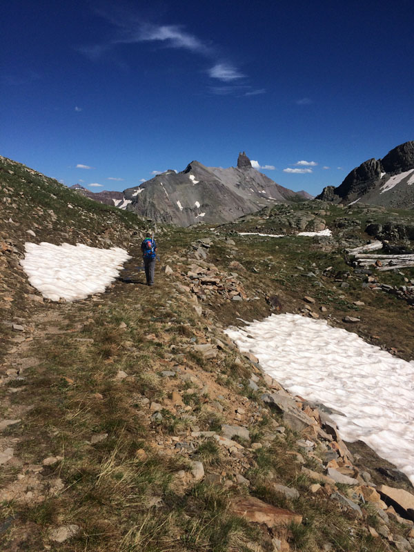
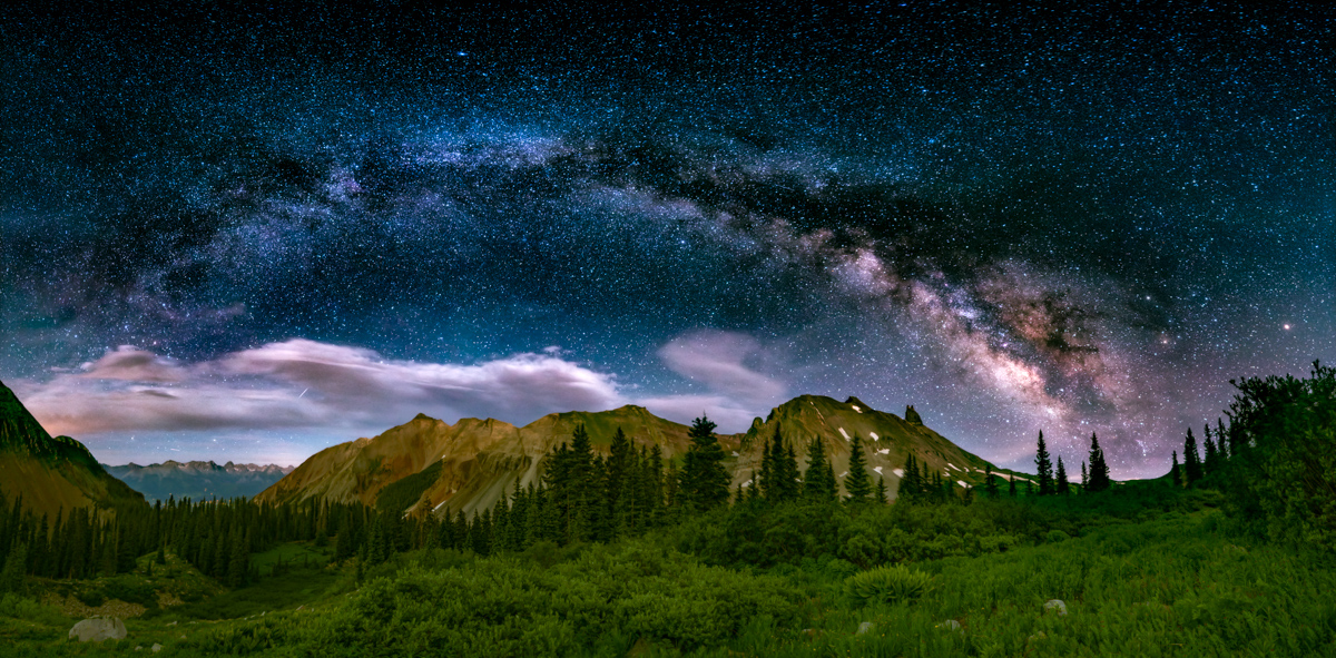
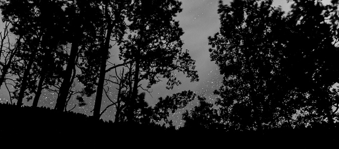
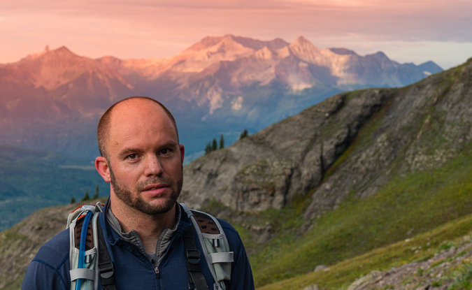
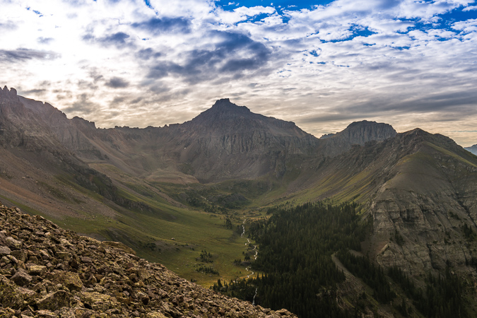
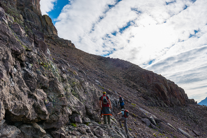
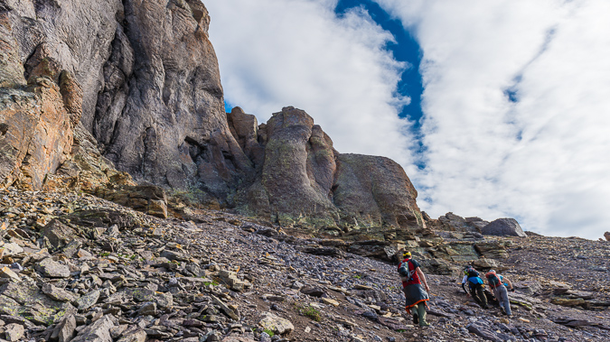
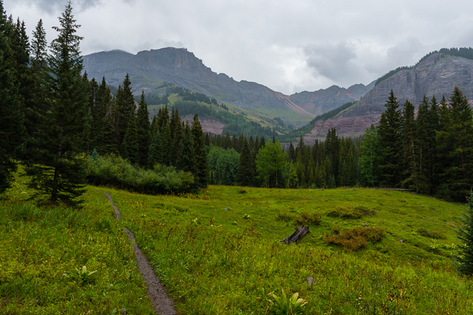
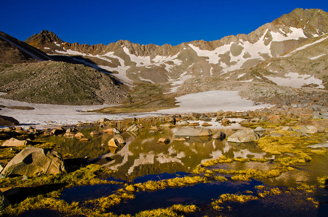
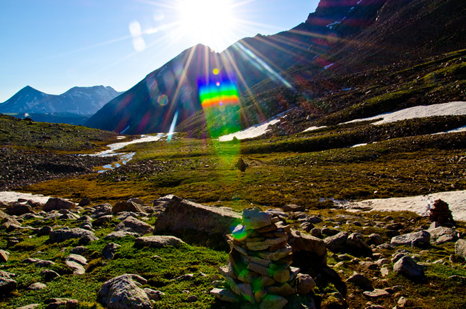
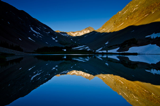
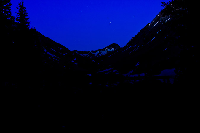
We managed to make it into Bilk Basin at dark and had trouble locating the trail going up to the lake below Wilson Peak (objective/camp possibility #1). We thought the basin would make for a good camping area too but it was super marshy down below and we did not want to get wet. We opted to try to follow where the trail that goes up to the Lizard Head Trail was supposed to be by using Gaia GPS GPS on my phone. Gaia is so amazing! You can purchase it here and help support the site. Since there was no trail to follow, we had to rely on technology. What an amazing application. It shows your location on a USGS map, tracks your progress, and even works in airplane mode. It is the best $20 I've ever spent in my life. We found some campsites just below the Lizard Head Trail and opted to stay there since we were both tired and the lake was a good distance away yet. After setting up my tent, I shot single long exposure of the Milky Way from camp. I kept the shutter open for 241 seconds for this shot using a cable shutter release in order to bring out the foreground. Then I crashed into bed at 11 PM to rest up for our big day of climbing. We set our alarm for 4 AM and declared that our 1st goal would be Gladstone Peak, followed by Wilson Peak.
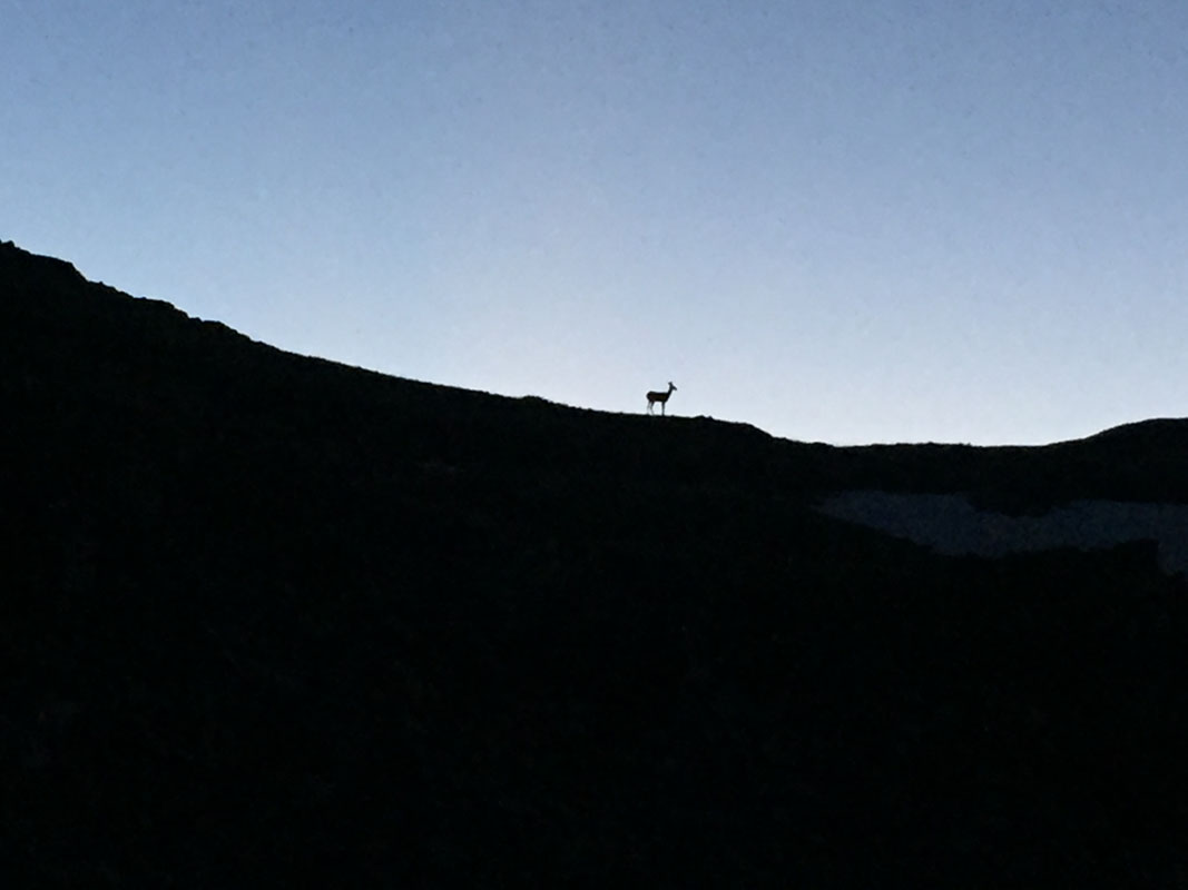
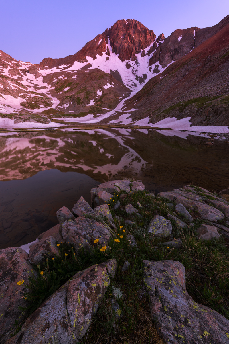
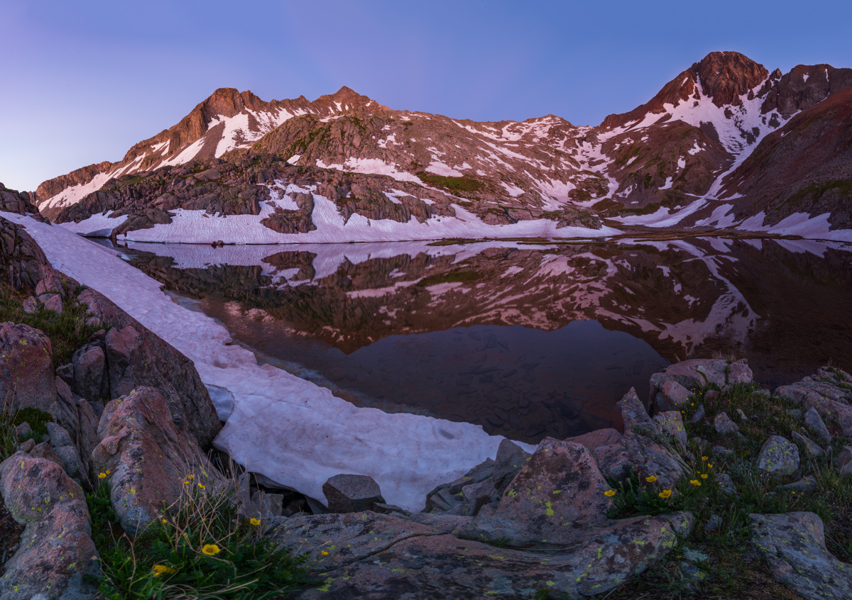
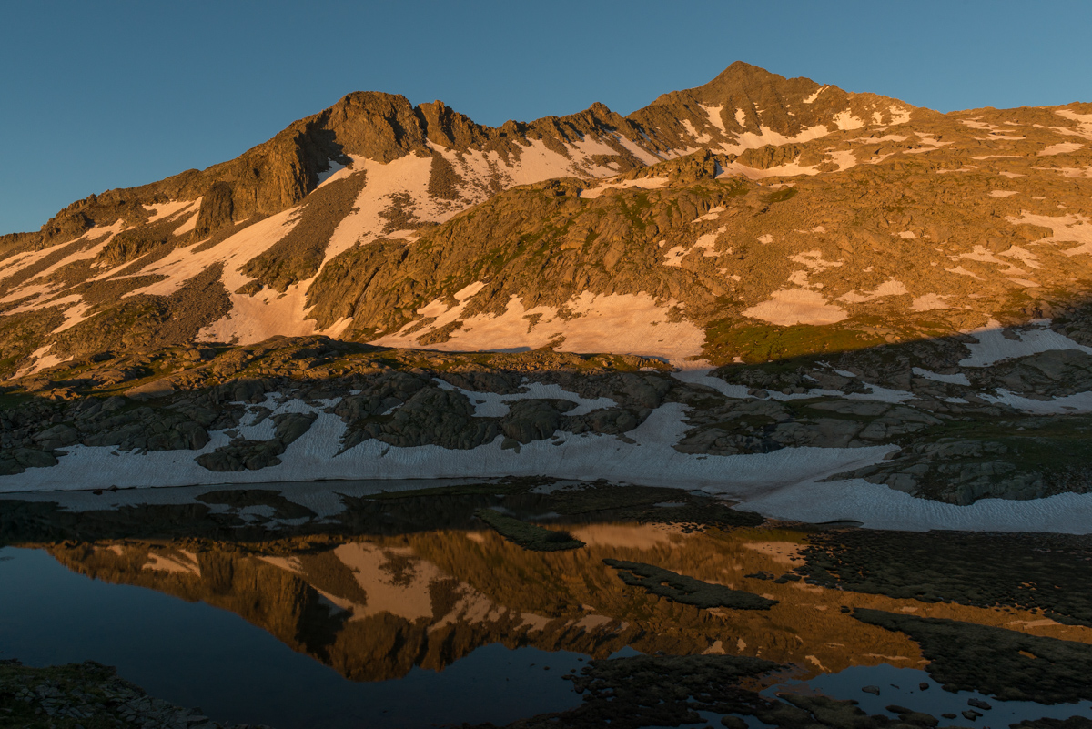
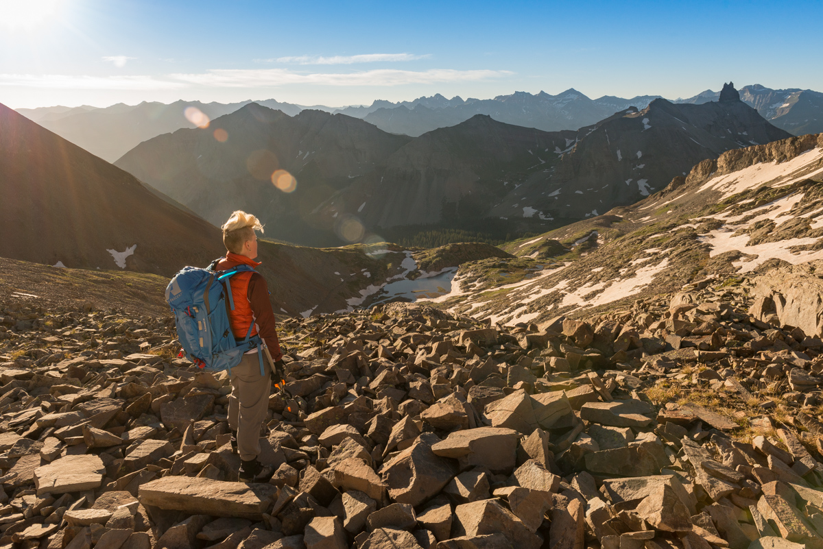
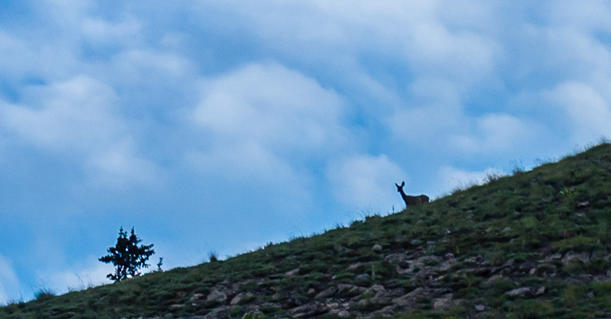
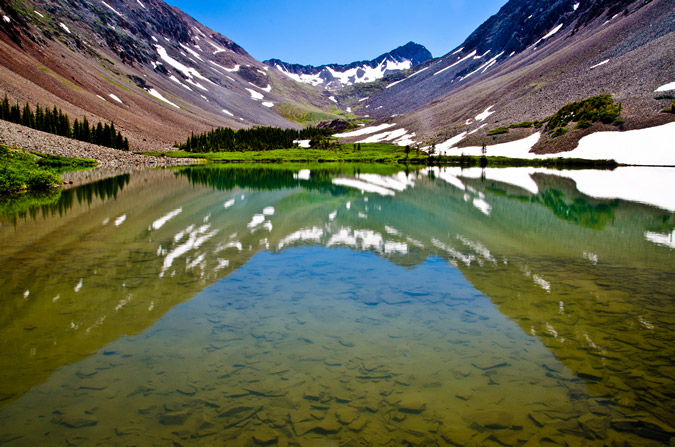
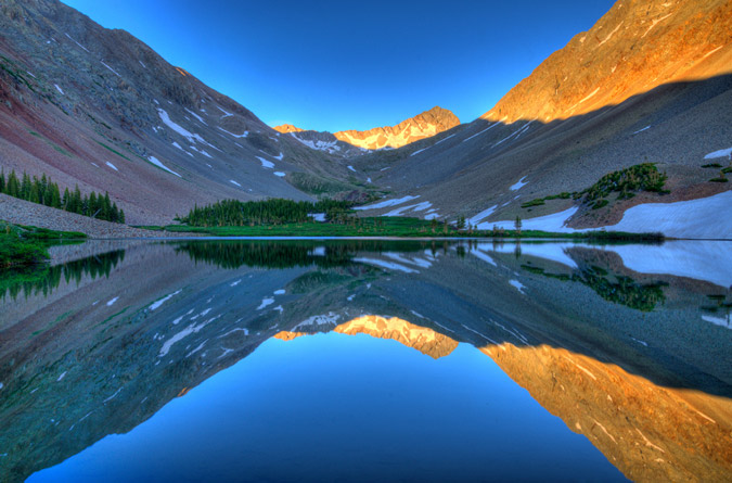
Silas and I got very little sleep but that is the name of the game when it comes to mountaineering and backpacking. We got out of our tent quickly and started off in the dark at around 4:15 AM. We followed the trail by our campsite south and west for a very short distance and found the Lizard Head trail that comes up from the Cross Mountain trail at Lizard Head Pass and turns west towards Gladstone and Wilson Peak. We followed that trail west but it ended abruptly at the creek after about a quarter mile. According to the map, the trail appeared to cross the creek here and continue up into the basin following switchbacks, but the creek was way too deep and flowing fast for our comfort, so we bushwhacked up the hill, following the creek closely. After about 200 feet of elevation gain, we located the trail again and another creek crossing, which was much more desireable and easy to cross. We crossed here and followed the trail up into the basin in the dark. It was not terribly difficult to stay on the feint trail; however, we did have some trouble from time to time. Luckily, I had Gaia GPS to help me stay on course. After about an hour we found the small lake we had hoped to reach the night before. It was a glorious lake to say the least, nestled at the base of Wilson Peak with views of Lizard Head to the southeast. I set-up my tripod and camera for some blue hour photography (the hour prior to sunrise but before the beloved Golden Hour) and Silas enjoyed the view as well. As I was setting up, Silas was able to photograph some deer that paid us a visit on the ridge behind us.
I was incredibly impressed with this location. The low light prior to sunrise coupled with the huge towering massif of Wilson Peak made for a delightful photographic subject. P.S. on some of my photos in this trip report, you can click on it, which takes you to my photography website, where prints can be purchased. I wanted to disclose that up front so that readers were not expecting to be able to click on it to see a larger version.
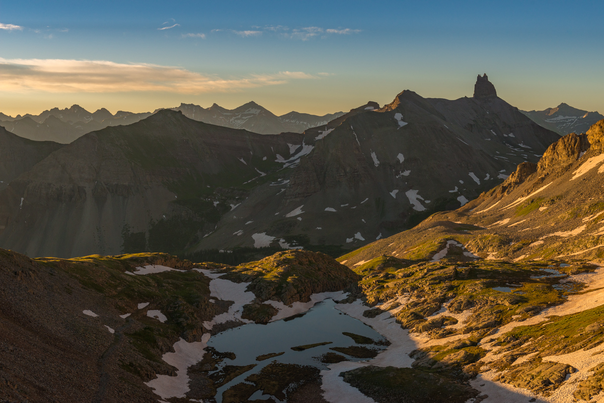
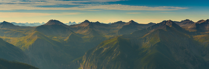
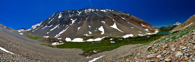
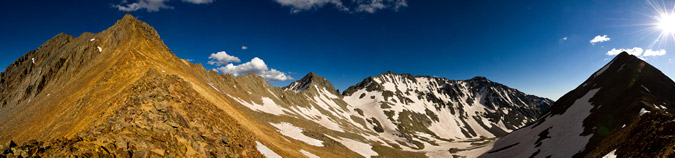
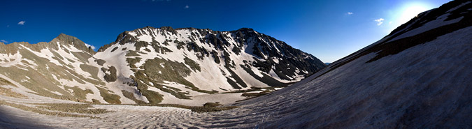
I also combined some shots for a panorama of Wilson Peak (right) showcasing the long ridge over to Gladstone (left of center).
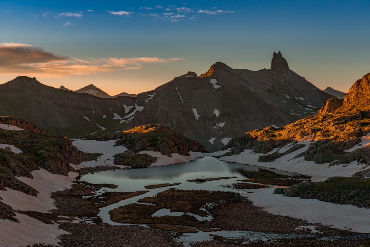
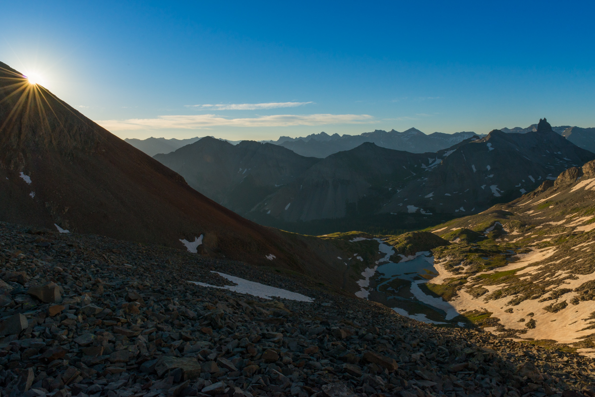
When I finished shooting at the lake, I started packing up my gear when I looked back and saw the clouds changing color. I raced up the hillside back where we came from and set-up for this shot of the sunrise and Lizard Head Peak. What an amazing sight!
Finally, we continued on, having spent about 45 minutes total at the lake.
I think Silas and I were equally jacked up and elated by the sights from the lake - it was quite tremendous indeed.

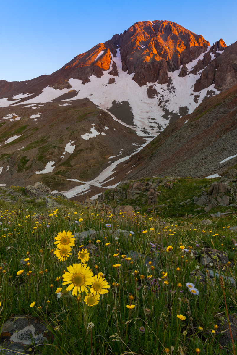
Just when I thought I was done using the tripod for the morning, I noticed some alpine sunflowers blooming and the early light of Wilson Peak, well, peaking. I had to stop and get this one. I have always admired the work of Jack Brauer and he has a shot with Wetterhorn Peak and alpine sunflowers that I've always greatly admired, so that was my inspiration for this shot.
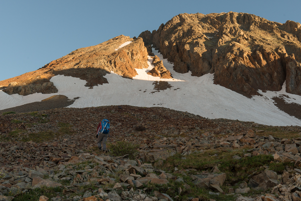
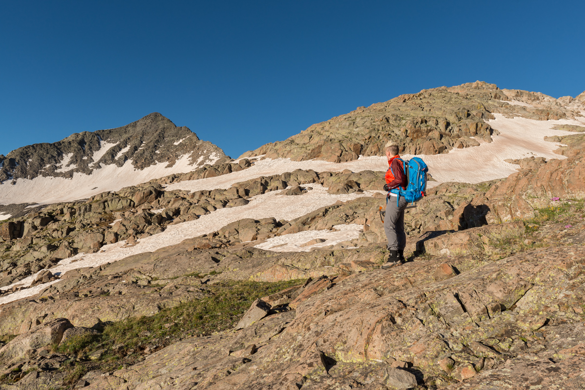
As we contined up the basin, we kept our eyes on Gladstone.
The early light from the sunrise was looking good behind us, constantly changing the amazing beauty of Lizard Head Peak. I could not stop looking.
Finally, the sun hit in full force and illuminated all of Gladstone and created some wonderful light for this reflection in the lake.
Lizard Head Peak kept looking better and better behind us, and I could not help but stop and take photos - it was truly fabulous.
I'm sure Silas was sick of me constantly looking back, but I think we were both pretty stoked to have this basin to ourselves to witness this great sunrise.
Silas kept her gaze above at Gladstone and the nasty, crumbly ridgeline between Wilson Peak and Gladstone. It was intimindating for sure.
More sunrise beauty behind us - this time with the gorgeous Ice Lake Basin peaks including U.S. Grant, Pilot Knob, Golden Horn, and Vermillion showing up to the left of Lizard Head Peak. I was paying close attention to those peaks since my plan was to hit Ice Lake Basin the following weekend. What an amazing thing it is to live this close to such incredible scenery.
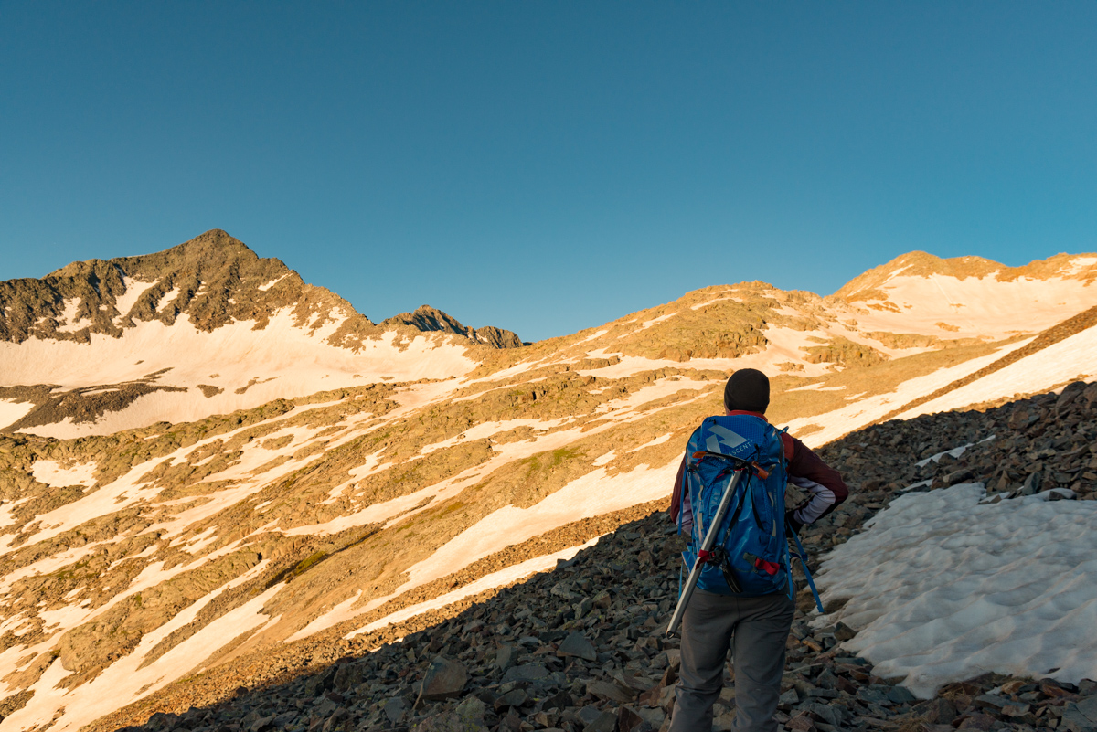
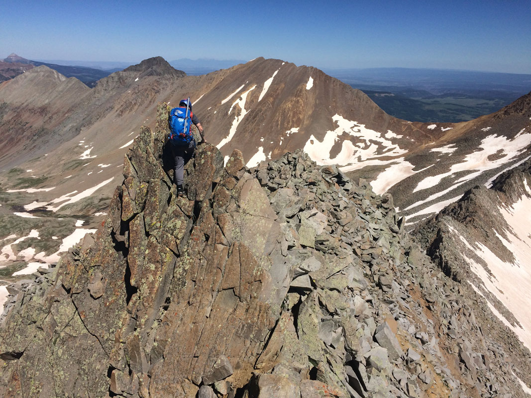
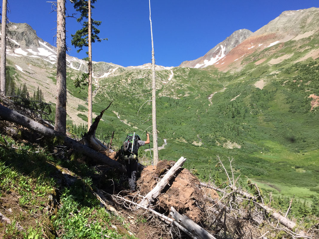
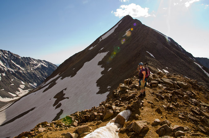
Alas, we continued up the long steep slopes of Bilk Basin, heading towards the most southernly weakest point between Gladstone and Wilson Peak.
As we climbed higher into the remote basin, Mount Wilson finally came into view just left of our target on the ridge. We had a lot of snow between us and Gladstone and knew we had some snow travel in our future. Fortunately, we had both brought ice axes and did some mental preparation for some snow travel. I even spent some time refreshing my memory for snow travel by reading a couple pages of Freedom of the Hills before leaving home. Actually, that probably saved my life. More on that later.
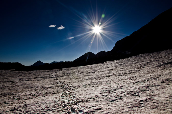
Finally, the sun came into view and I took advantage by getting a nice sunstar photo looking back east.
Silas also enjoyed the view of Lizard Head and the Ice Lakes peaks to our east. It was hard not to stare, honestly.
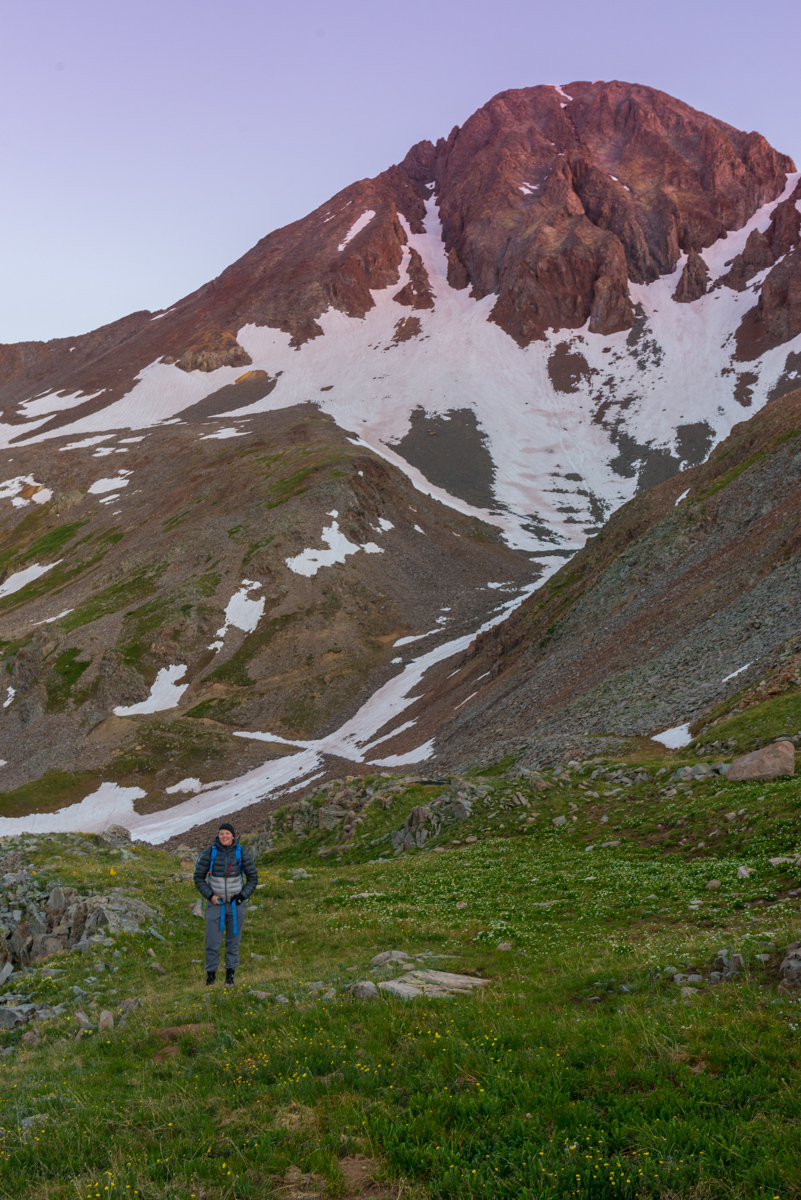
Climbing higher and higher into Bilk Basin and closer to our 1st objective. Silas weighs our route and contemplates life...
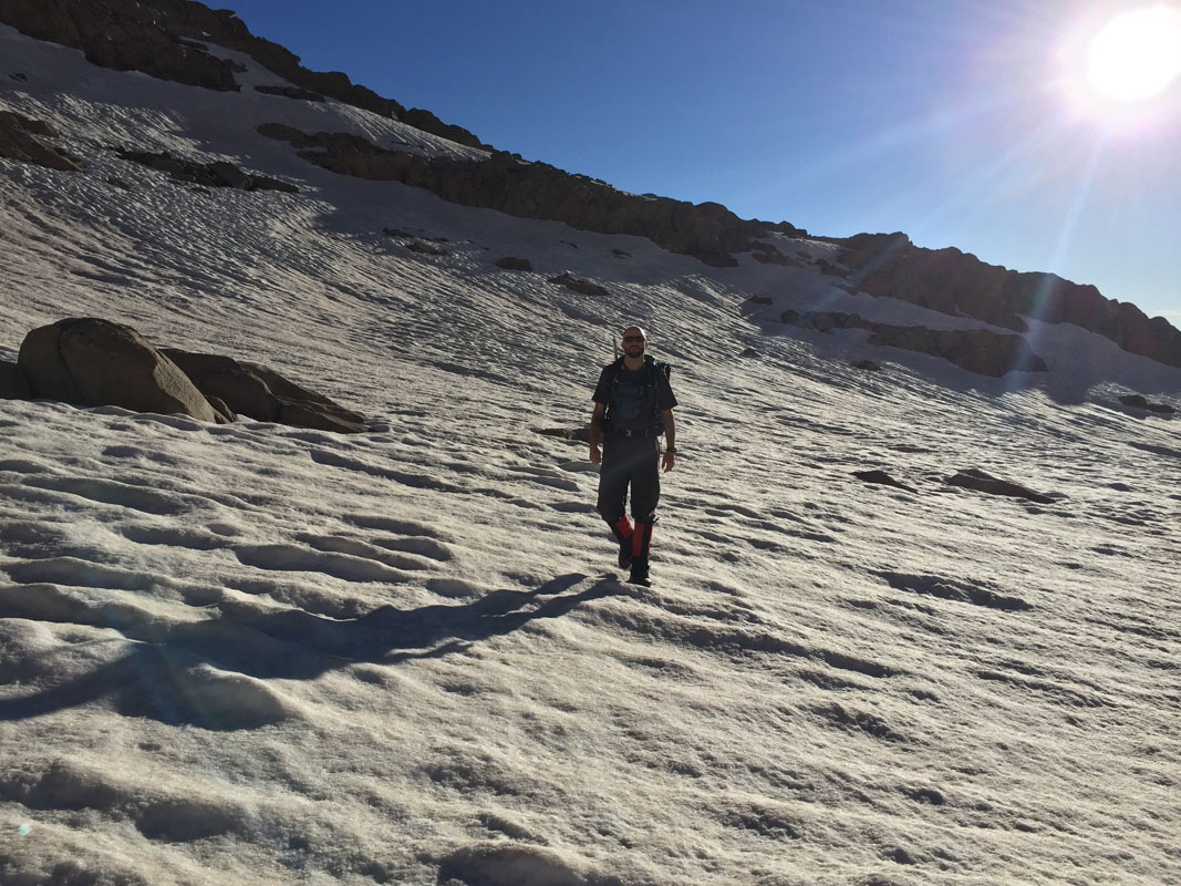
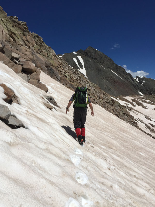
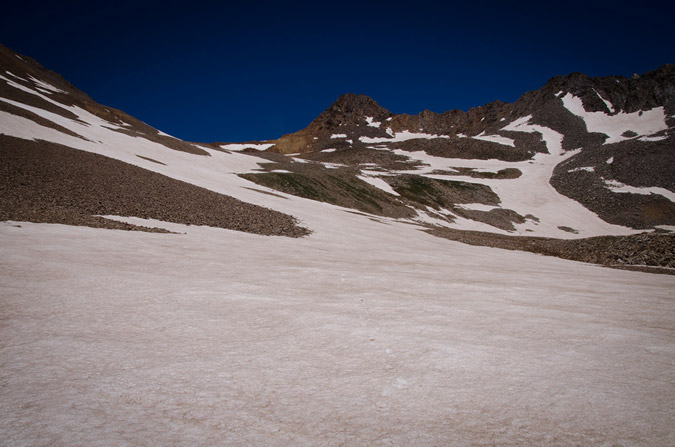
The snow travel began in full effect. The snow at this point was quite hard and finding our footing was a challenge. We did not bring crampons, which was fine. We just took our time and slowly ascended carefully.
Just a leisurely stroll up a giant snowfield...
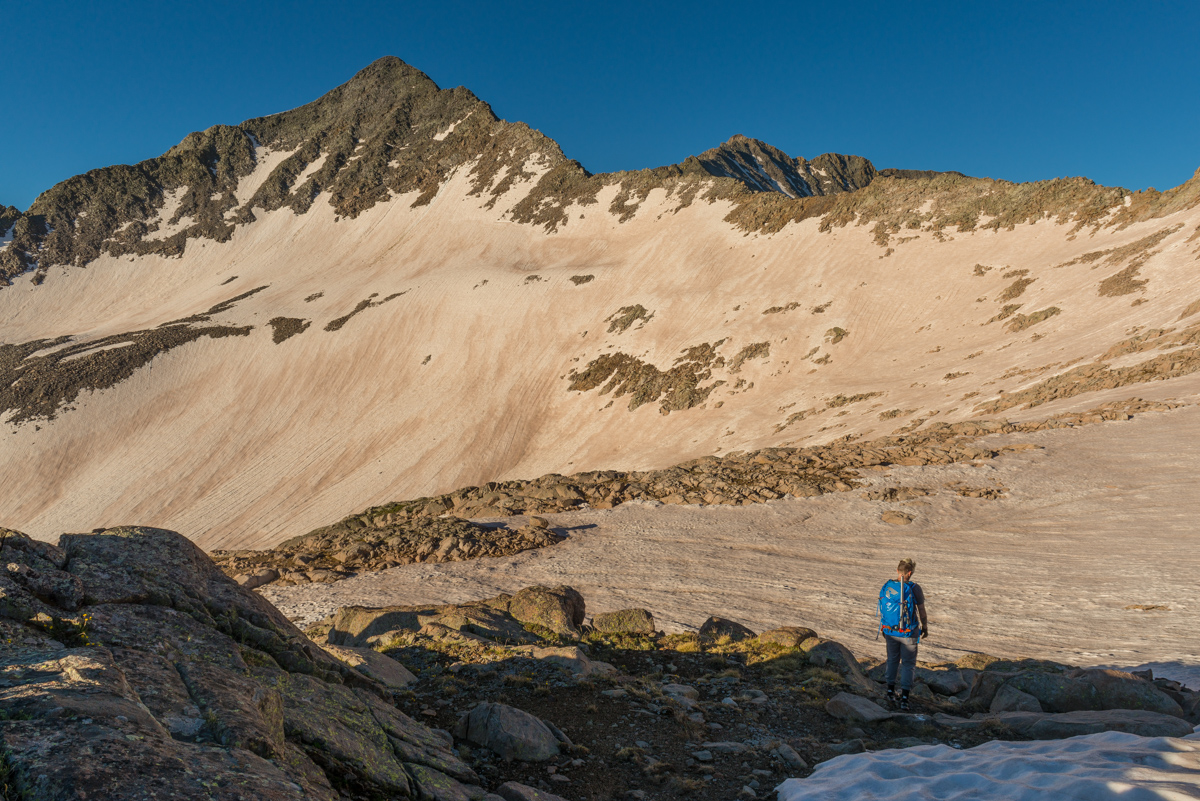
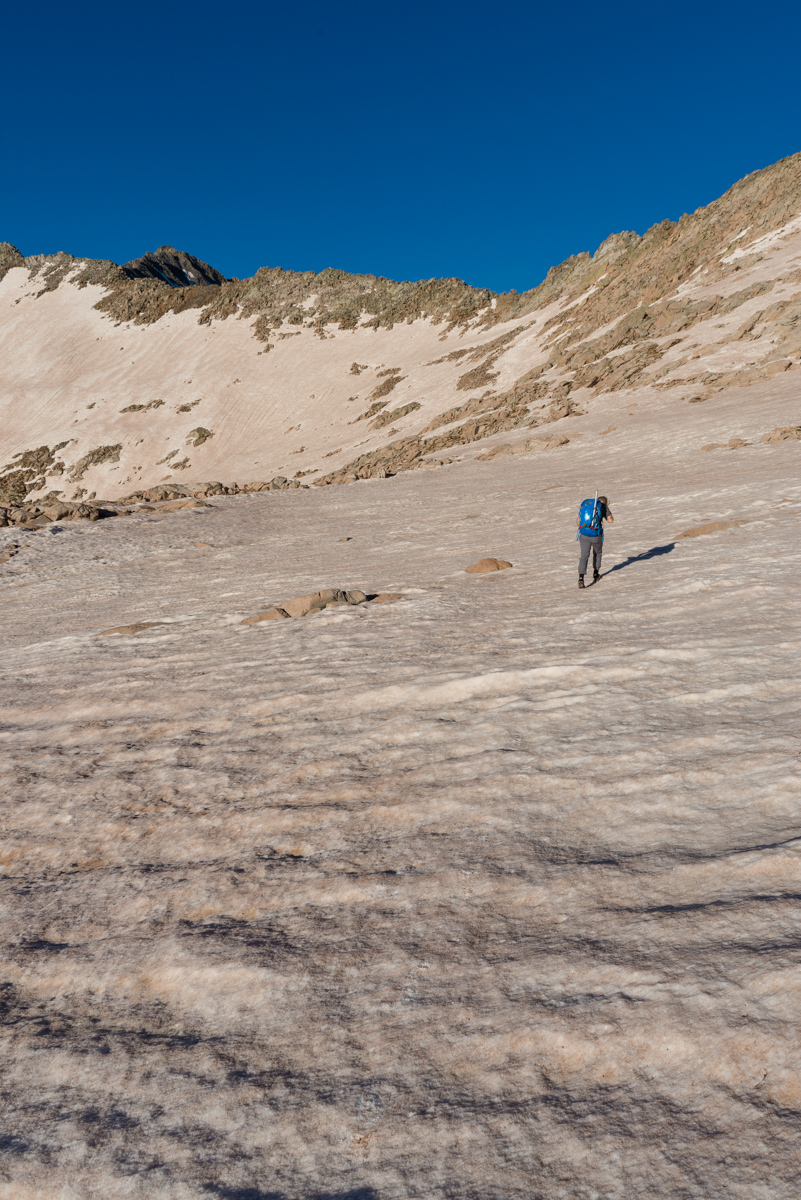
The snow was quite blinding in the early sun, but it was quite warn and there was no wind at all. I had a feeling that this snow would be quite soft later in the day. We contined towards our destination - the notch just above and left of Silas in the photo below.
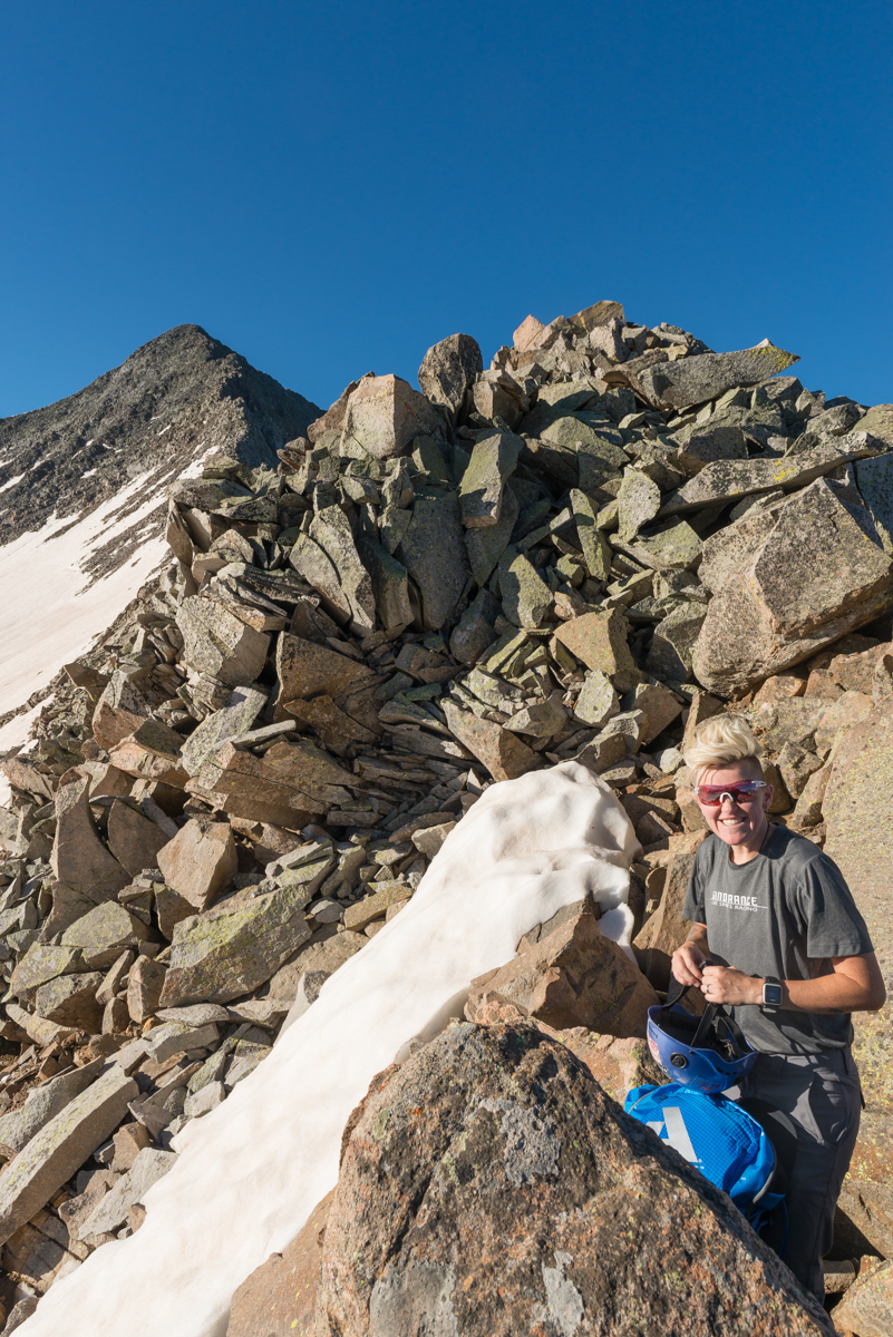
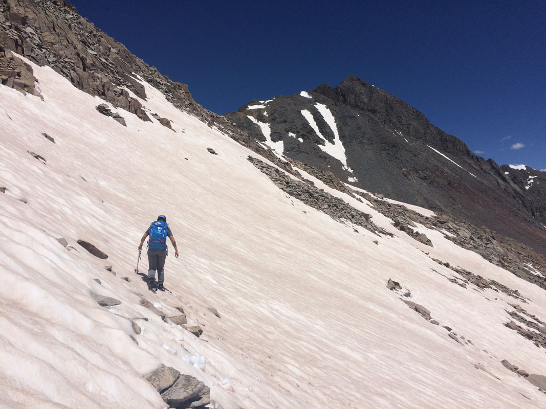
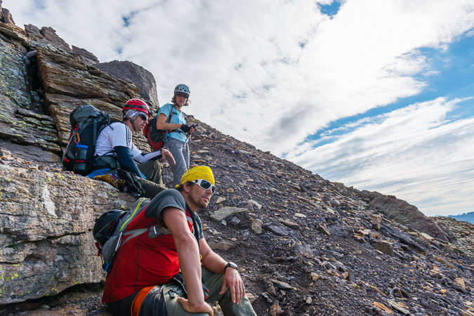
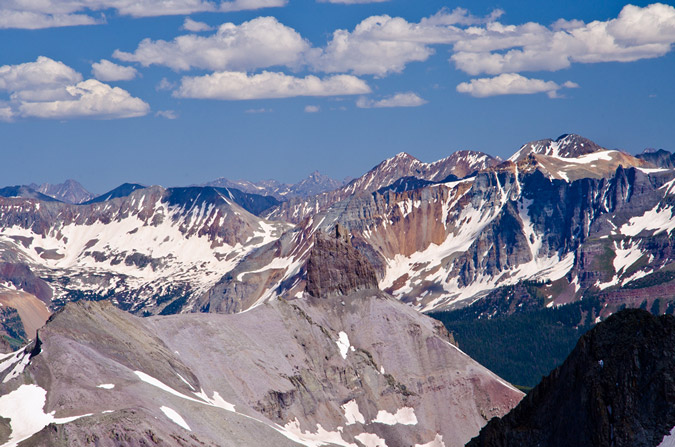
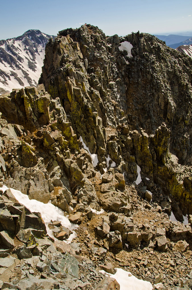
Without much trouble, we reached the Gladstone Peak - Wilson Peak saddle and enjoyed views of Navajo Basin to the west. I was really happy we chose Bilk Basin - the view on the way up was really quite a bit better than that of both the Navajo Basin and the Rock of Ages routes, in my opinion.
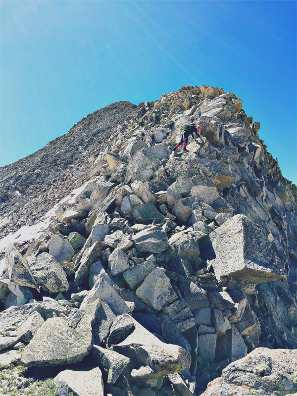
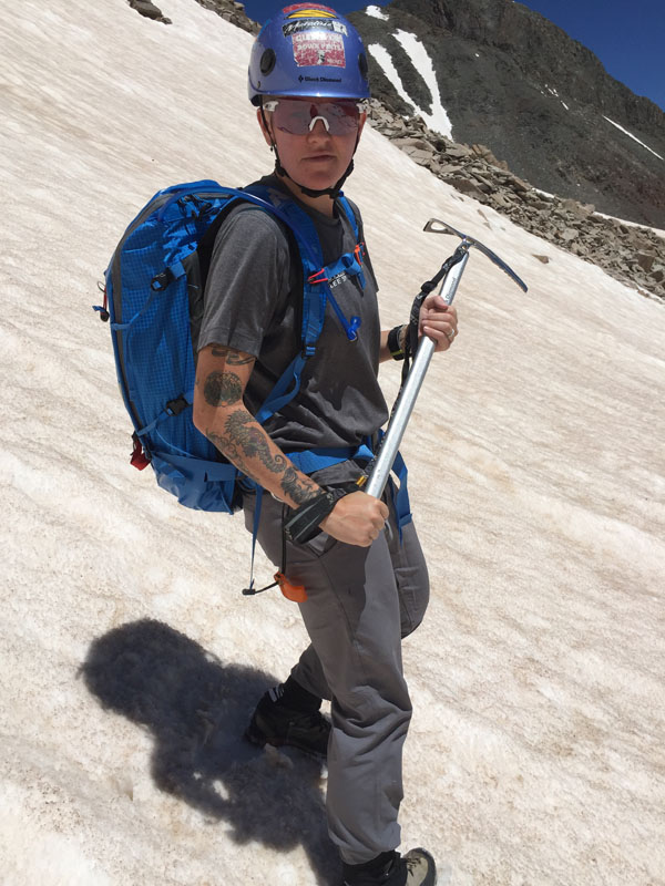
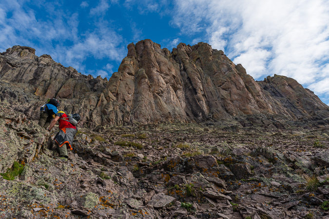
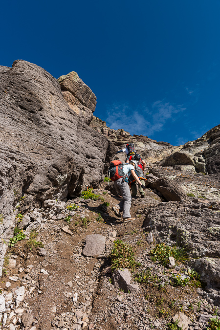
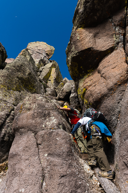
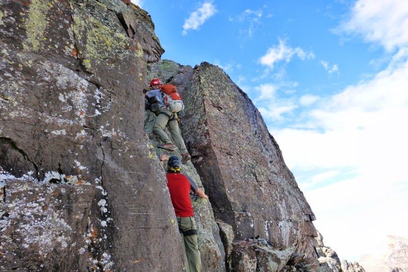
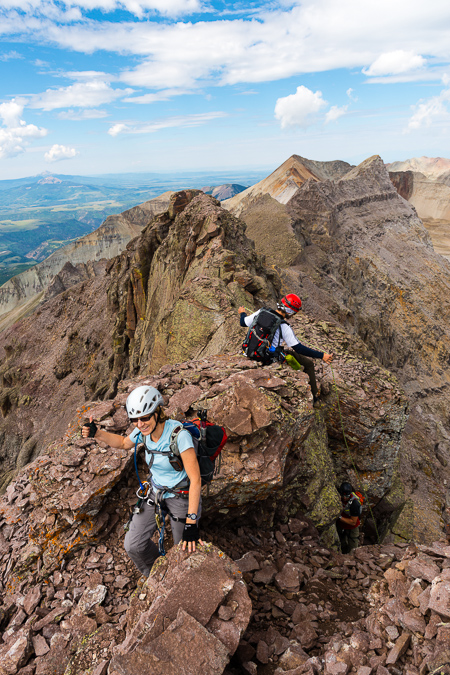
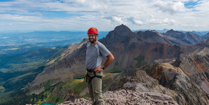
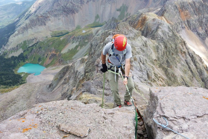
It was time to gear up. We both donned our helmets and mentally prepared for the ridge. I had read a lot of horror stories about this ridge up Gladstone and knew that we needed to remain vigilant throughout the morning to stay safe. I also decided it was a good time to finally use my GoPro that my wife bought me. I attached it to my helmet and we set sail.
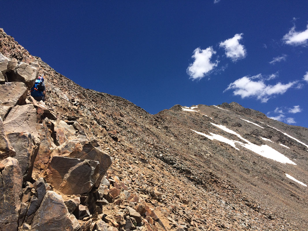
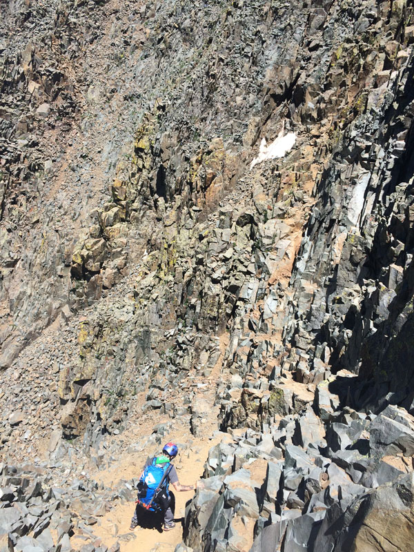
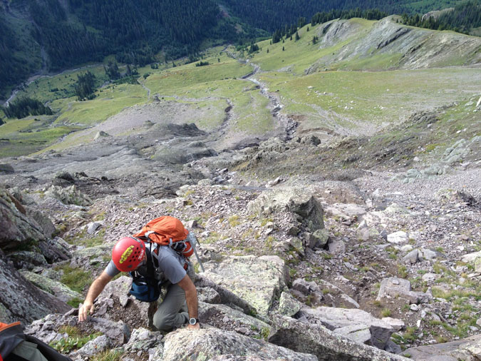
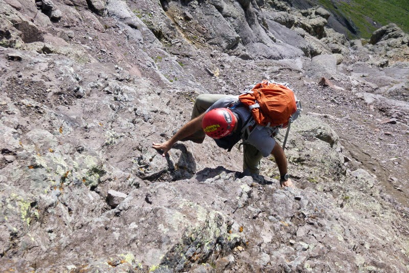
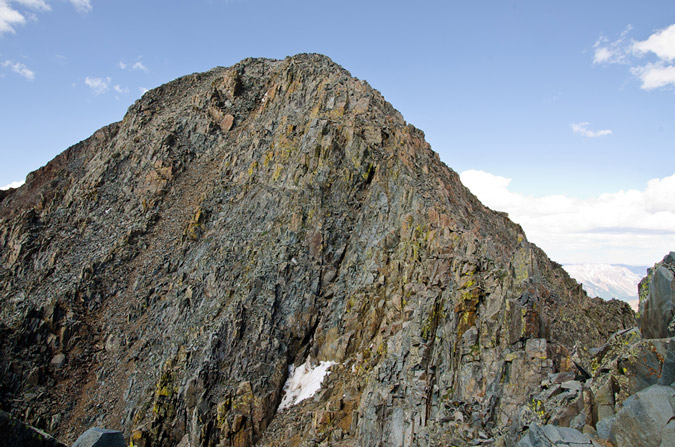
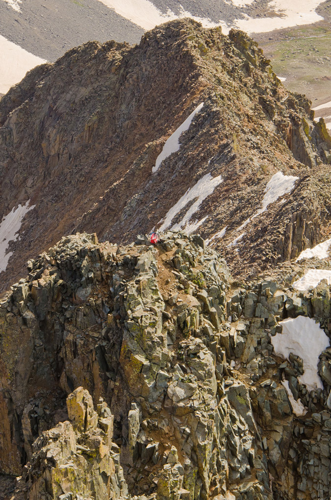
Let's rock! It was good to be doing a hardcore scramble again. I love this type of stuff. Unfortunately, this particular scramble was frought with potential peril.
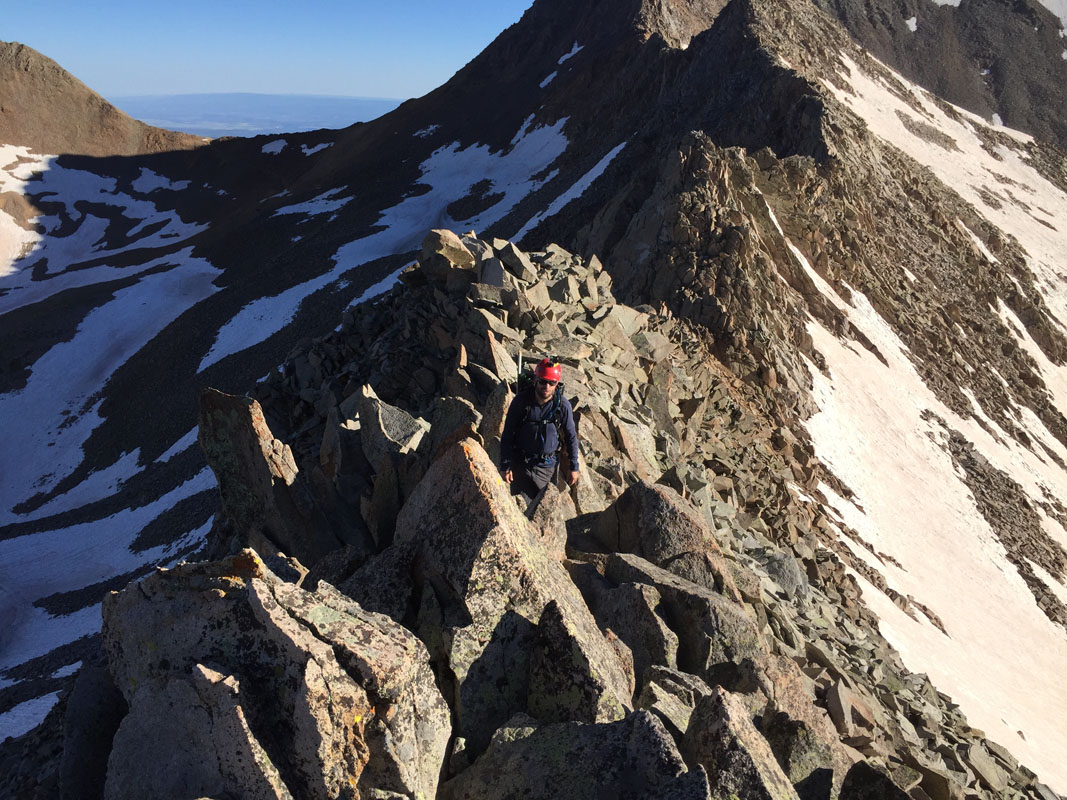
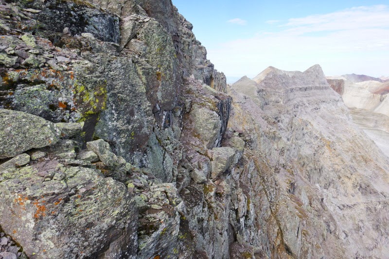
The rock on the way up Gladstone was chossy, loose garbage. Every time I looked up to find the next rock to step on, my thought was, "there's that rock, which is held up by that rock, which is held up by that rock, which holds up this rock." It was mentally exhausing to say the least. I tested every step, every hold, and kicked rocks before placing my weight on them. I was also extra careful to watch Silas as he ascended, making sure I could dodge a rock at any time. I'm so glad I did... because as you can see in the GoPro video below, I had a near miss that would have been very harmful, perhaps fatal. This video gives you a taste of the journey up Gladstone. I have about 40 minutes of footage that I condensed into 3-4 minutes. The video is a bit shaky - so be warned! I smoothed it out a bit which caused some strange effects, but I think it a bit more watchable now.
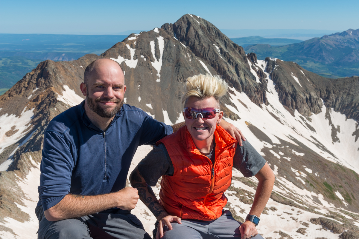
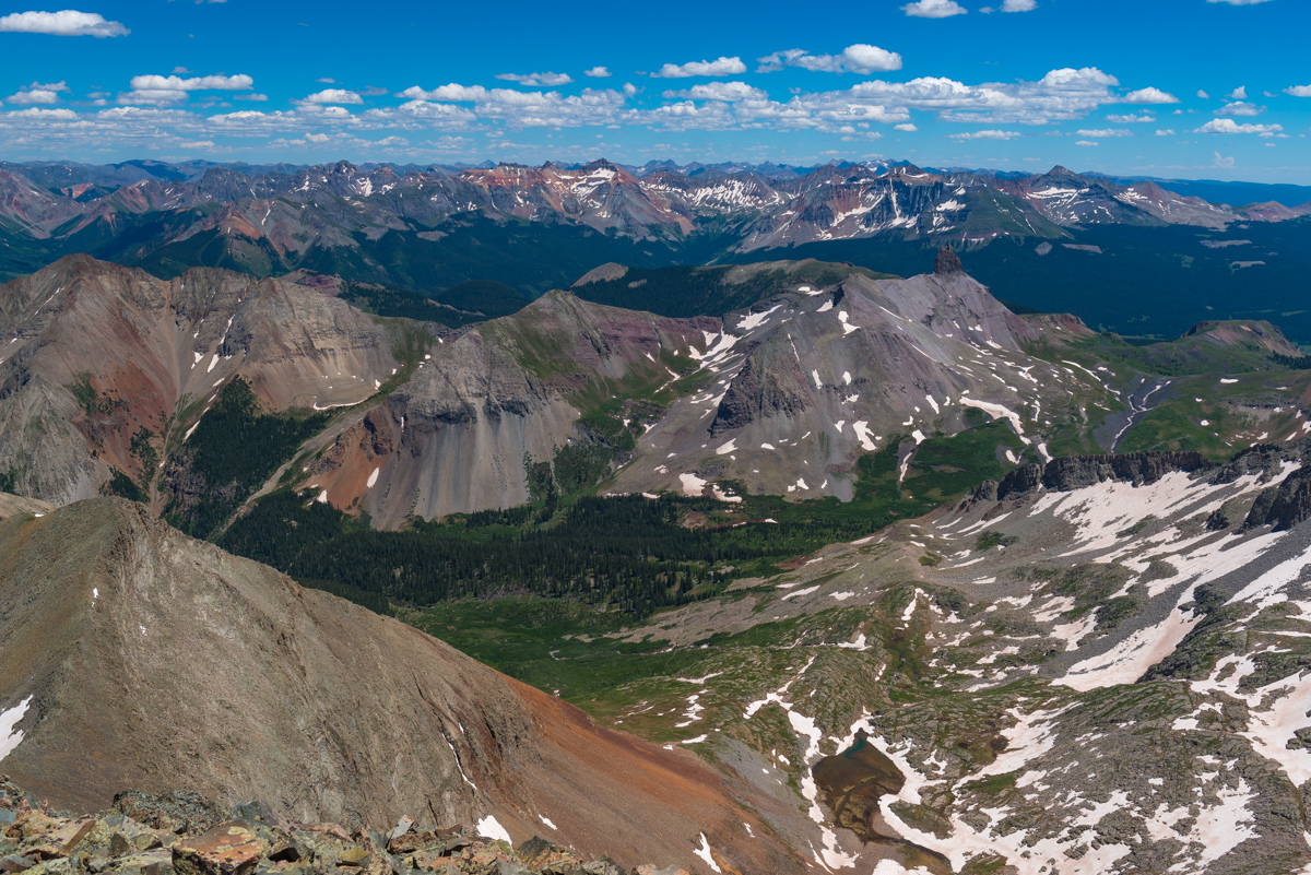
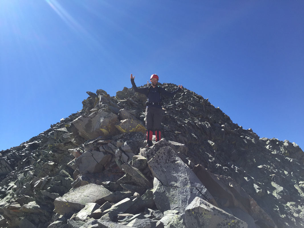
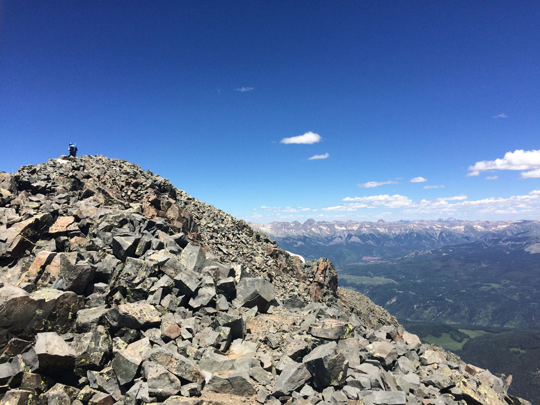
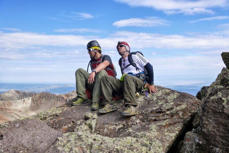
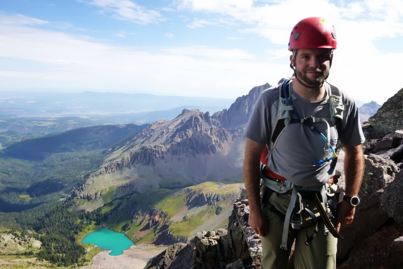
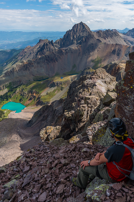
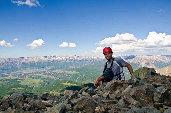
The high risk climbs like this always feel good when you reach the top, but for this one, I had a pretty bad feeling the whole time we were on top because I knew we had to go back down the same way and it was not something I looked forward to. Alas, we enjoyed the summit and our company while some people were yelling in joy from over on Mount Wilson. Wilson Peak loomed in the distance to the north and I was apprehensive to give it a go at this point. I was running really low on water and my body felt a bit tired from the near miss.
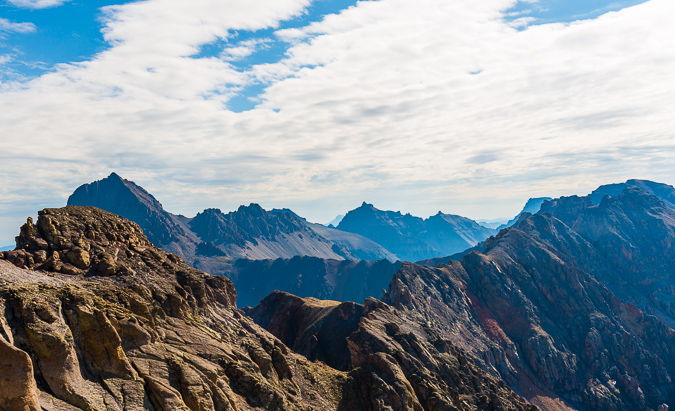
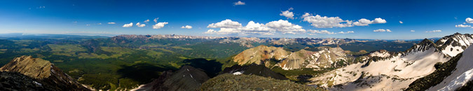
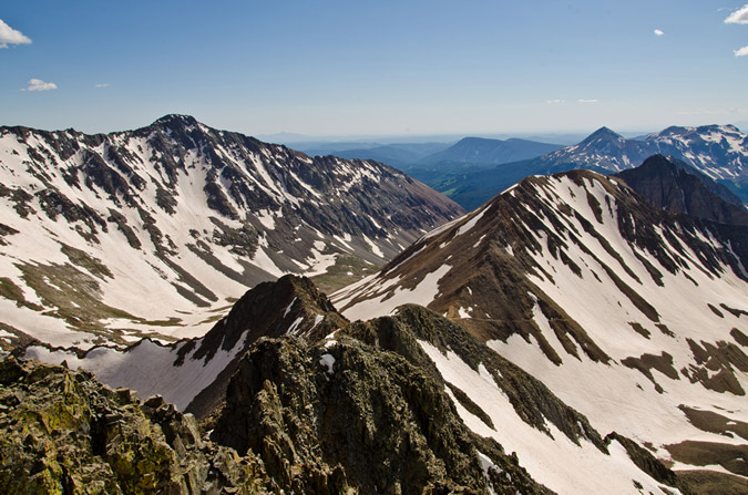
A 360 summit panorama from Gladstone...
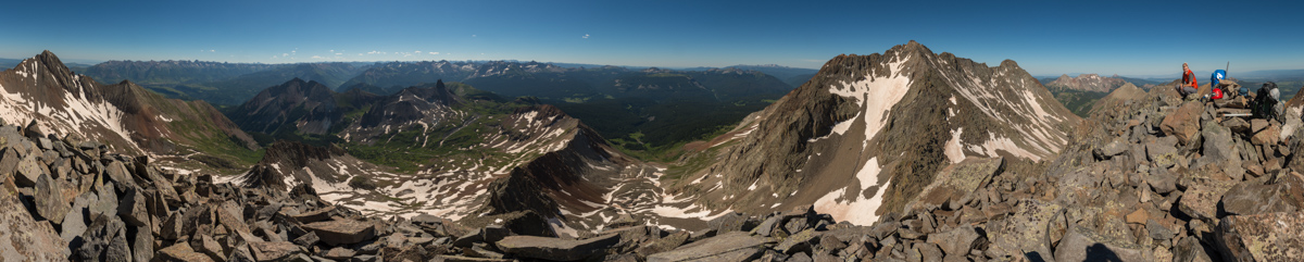
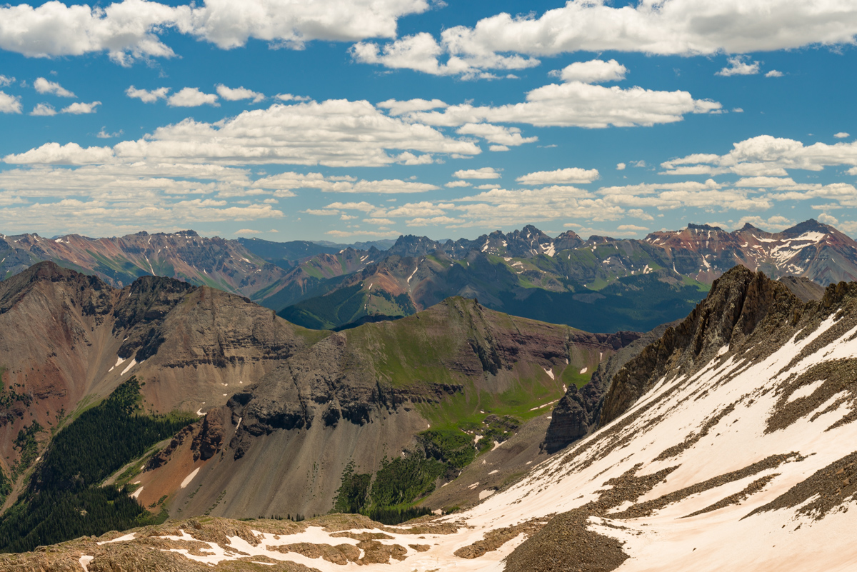
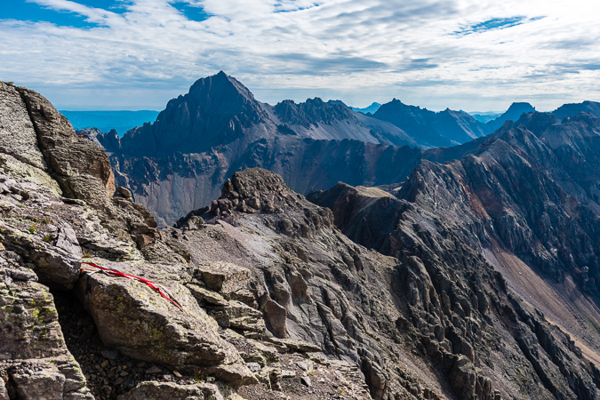
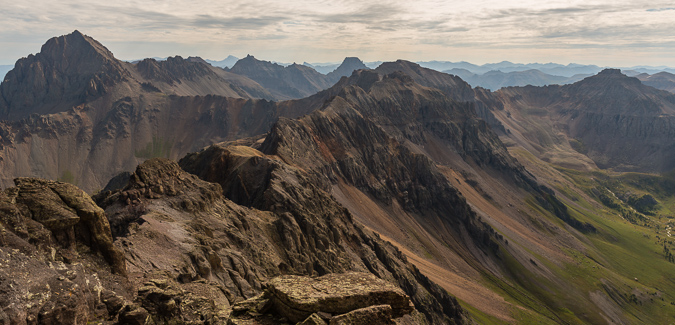
One of my favorite features to stare at from up here was Lizard Head Peak and the long shadow it cast below with a sea of amazing mountains behind. Really tough to beat.
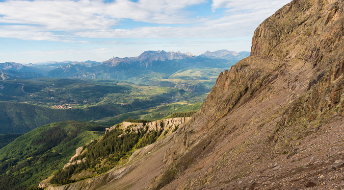
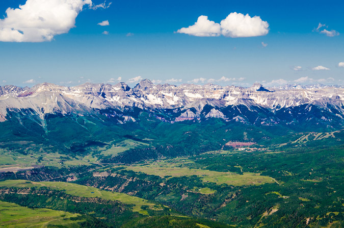
Also visible were Dallas Peak, Mount Sneffels (left of center), Teakettle (center), Potosi, Wetterhorn, and Uncompahgre (right of center), all above the town of Telluride. Pretty amazing view from this part of Colorado, for sure.
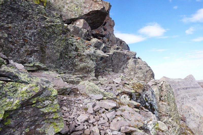
After enjoying the summit for awhile and posting updates to our loved ones, we decided to head down. For the way down, we stayed high on the ridge the entire way, which proved to be more challenging in some ways but much, much more stable than on the way up, where we decided to dodge left below the ridge (which in retrospect was a mistake). We also decided to see how we both felt once reaching the saddle again and decide on Wilson Peak from there. Since I was basically out of water, it was going to be an interesting decision. The views east were great so I was pretty happy no matter what.
More awesome views looking east on the way down...
Being goofy...
There was a really awesome section on the way down which had a pretty committing move up a sheer face that probably saved us a lot of downclimbing into the nasty section of the ridge. Here is a glimpse of that section which I think was one of the highlights of the whole day.
The way down was tricky to say the least. I had to do some interesting manuevers to get across some sections.
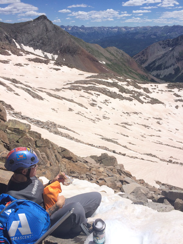
We found ourselves at the top of a gully filled with snow and decided it made sense to fill up my Camelbak with snow and try to get it to melt so that I had water. It actually worked pretty well. We packed the Camelbak very tightly and after awhile it did melt some (about an ounze every 15 minutes. After every sip, I blew hot air back into the tube and the reservior, which helped facilitate the melting process. It was at this point we decided that we would keep going up to Wilson Peak.
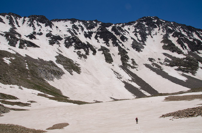
To get to Wilson, we had to go around a small un-ranked 13er between Gladstone and the Rock of Ages saddle. Roach recommends dropping into the Navajo Basin side, but we thought that the Bilk Basin side looked more doable on the snow. I don't regret the decision to do that; however, the snow was steep and soft and made for slow travel with our ice axes. At one point, Silas started to slide and had to self-arrest, which worked like a charm.
Crossing snowfields sideways is just awkward and slow. Some sections were totally melted and made for uncomfortable and surprising post holing (which sucked)... and other sections were harder and more dangerous. I really dislike snow travel.
Silas looked bad-ass though...
We finally made it to the Rock of Ages saddle and committed to going up Wilson Peak. We passed a lot of people on the way, none of which were wearing helmets, which was a little surprising given the looseness and seriousness of this climb. To each their own, I guess.
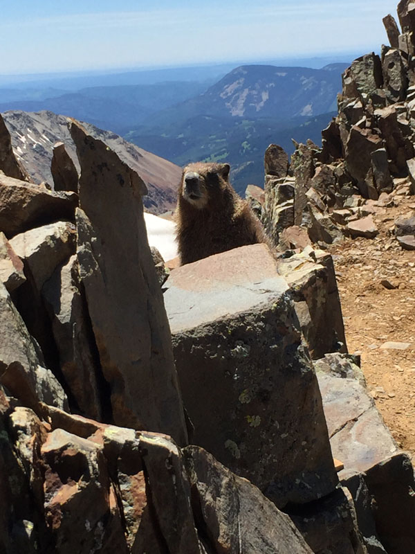
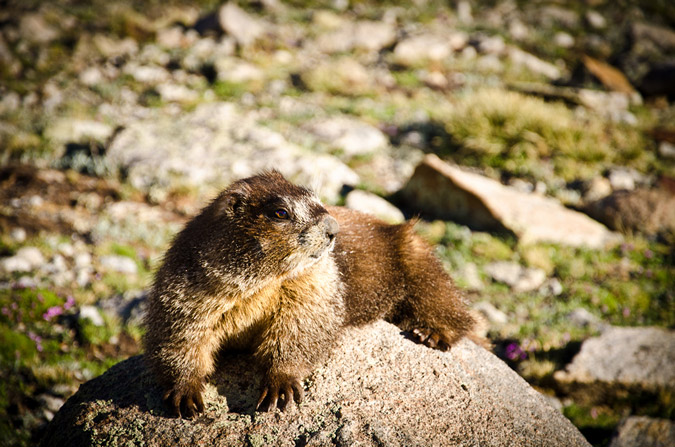
Near the top of Wilson Peak, Silas got to hang out with a Marmot.
Wilson Peak is probably one of the more challenging and enjoyable 14ers. This was my second time up and I still found it to be quite fun, even after a very long day on Gladstone already under the belt. The rock on Wilson Peak is mostly picked through and the loose stuff mostly kicked or pulled down off the mountain. It still demands respect; however, and the sheer steepness of the final section is a real nail-biter. The consequences of any mistakes would be fatal for sure.
Silas topped out on Wilson Peak just before me and I was able to snap a quick shot on my cell phone of that moment - pretty awesome - two peaks in one day.
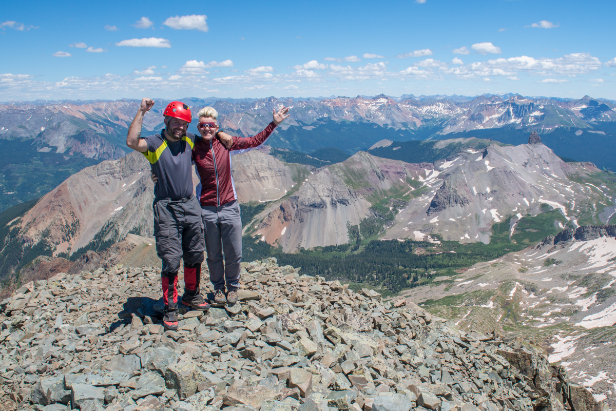
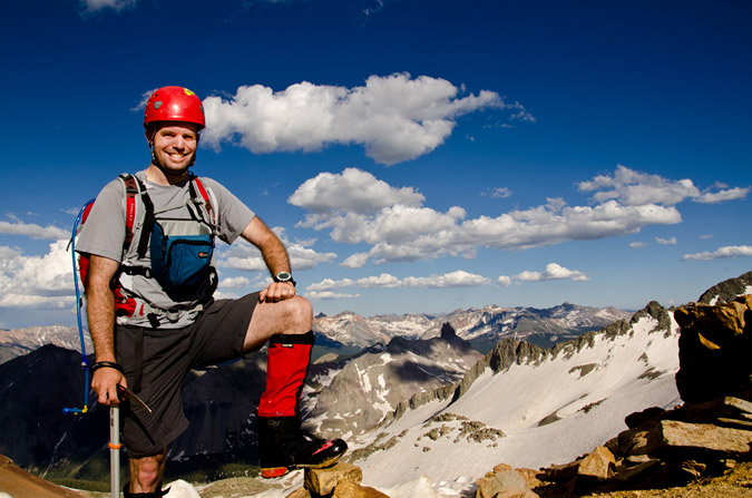
I setup the tripod and we got a self-timer shot of us celebrating.
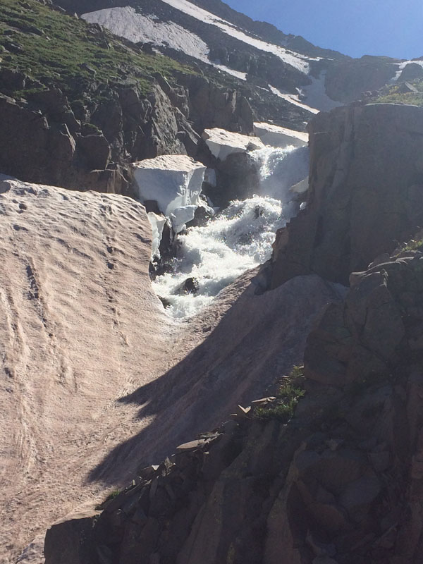
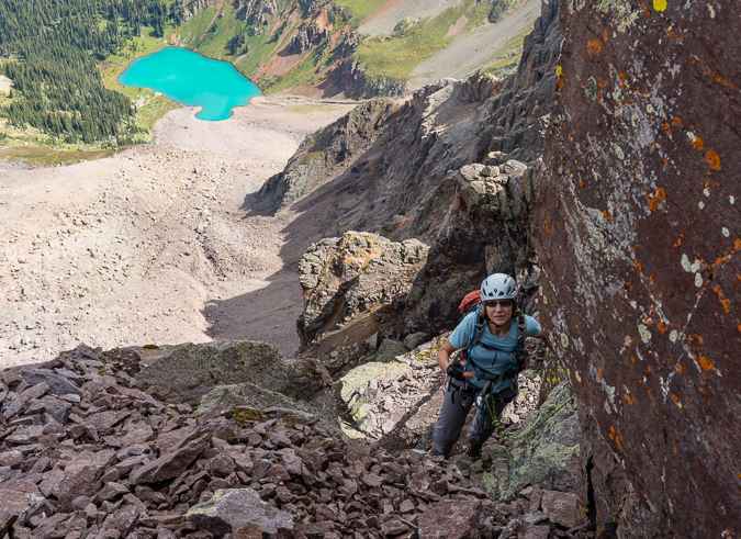
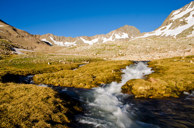
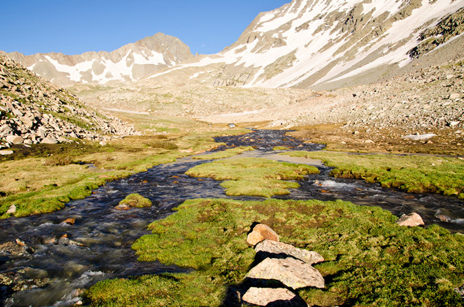
We spent very little time on top and headed back down. Our plan was to take the Wilson Peak trail down just before the Rock of Ages saddle where it meets up with snow that decends into Bilk Basin and to glisade down from there. The plan, while super smart, was not devoid of risk, as I later found out. We reached the snow field and Silas went first. Silas used his axe and feet to keep the brakes on and made it down about 300 feet without issue. I followed on the same path (mistake #1) and sat down in the snow, readied my axe, and started to go. After mere seconds, my speed increased behind a point where I could slow myself with my axe and I began to worry. I knew that I was out of control and heading straight for Silas. This was bad. I'm not sure why, but I remained calm (maybe I read that in Freedom of the Hills) and did not yell or scream even though I was careening out of control towards Silas. I dug my elbows and feet in - nothing. It hurt like a bitch. Per what I read in Freedom of the Hills for an uncontrolled slide, I flipped over on my chest and planted my axe deep into the snow with the long end going into the snow and my hands firmly holding onto the axe part. It worked! I stopped immediately. Silas said he was going to take video of me but before he knew it, I was right next to him. Yep - that's because I was travelling at like 30 miles an hour down the hillside. Two close calls in one day - not OK. We carefully decended the rest of the snow without incident. I grew tired from the lack of water, and I had also run out of food. Fantastic. Way to prepare! We finally reached running water above the lake at the creek that feeds Bilk Basin and we stopped to refill our water. I had fortunately brought my water filter with me (which I usually don't do) and I began to engorge myself with sweet, sweet water. Too much of it... like a half gallon. Whoops. Now I felt sick from drinking too much water too quickly. Not my best day. When we reached the lake, I stopped to vomit, another first. Nothing really came out but it still sucked just the same. I thought we were done with the shenannagins until we reached the creek crossing from earlier in the morning. Guess what? It was about 3 feet higher from all of the snow melt! Fantastic. We both knew we had to keep going down and look for another way to cross. The below photo shows just how much water was coming down...
 |
 |
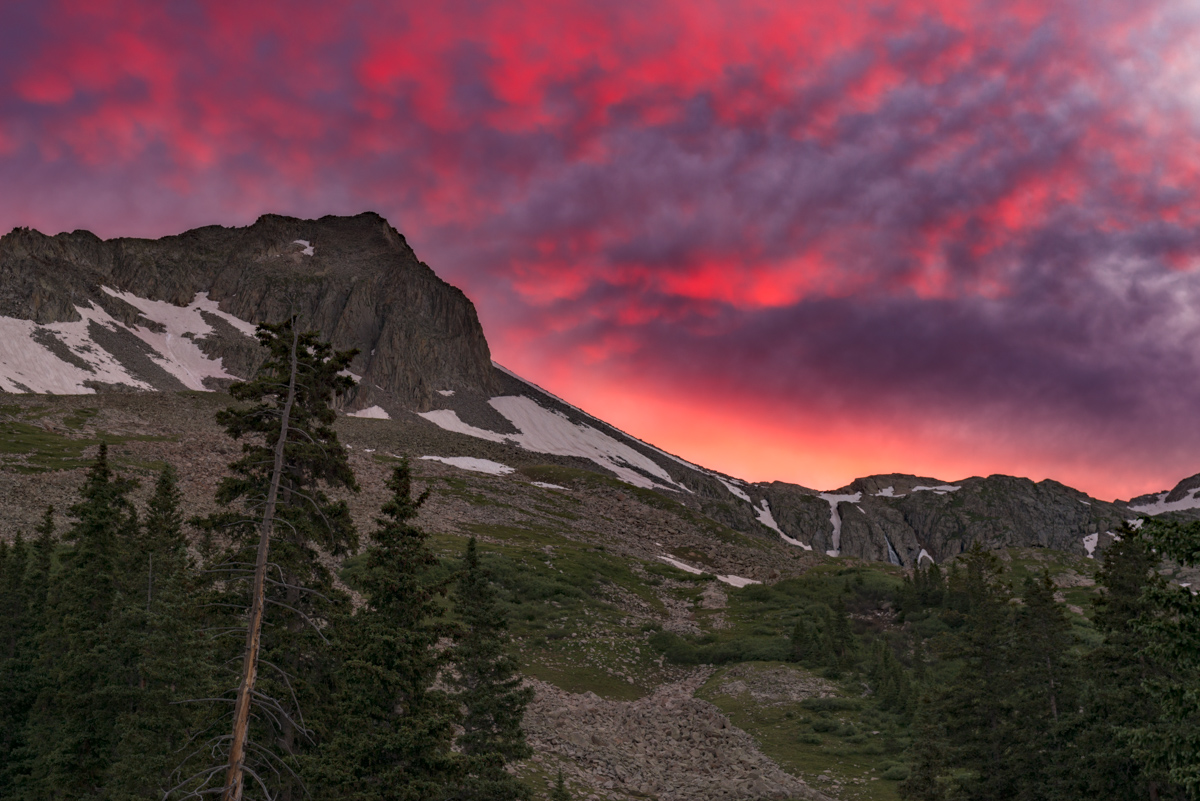
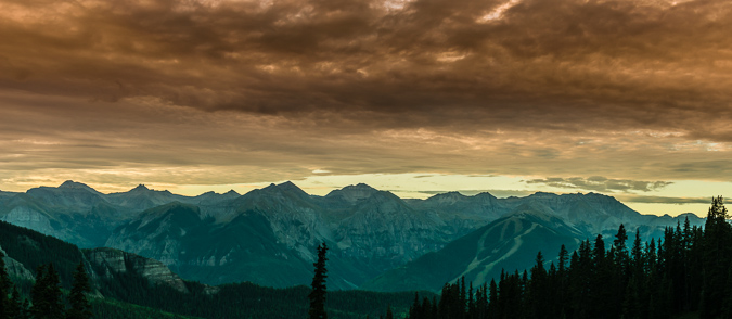
Unfortunately, we never did find another place to cross and had to go all the way back down to the start of the basin through Willows and fallen trees. It was a slog. We were both absolutely destroyed, mentally and physically. We had to climb all the way back up about 200-300 feet to our campsite through an area without a trail. Awesome. When we got to the top of the hill to the feint trail leading to our campsite, I vomited again. Excellent. We reached camp and Silas hooked me up with some electrolyte water. That shit works! I was feeling great after about 20 minutes of rest and ready to rock and roll again, excited for photographing sunset. Unbelievable. Sunset looked like it was going to be a total dud. The first "wave" of light after the sun set was pretty dull, some weak yellows and golds in the sky... then out of nowhere I looked back and saw the sky filled with small clouds all turning pink and purple. I ran out to a decent spot out of camp and barely had enough time to snap off this shot of sunset... which faded after only 2-3 minutes. We ate dinner and celebrated our accomplishments.
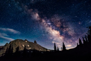
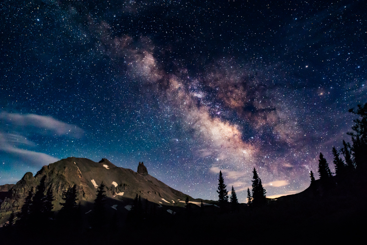
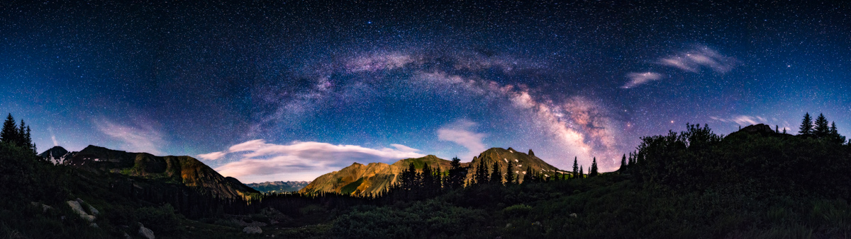
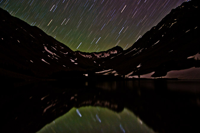
After dinner, I was totally exhausted. I knew that I really wanted to get some Milky Way photographs over Lizard Head Peak, but was not sure if I could make it long enough awake to pull it off. I slowly hiked up the hill to the south of our camp to find a spot. I was so exhausted after finding my spot to shoot that I set up my camera on my tripod, found a spot to lay down in the grass, and set my alarm on my phone to wake up two hours later so I could not miss the amazing night sky scene. This one did not disappoint - the dark skies of Southwest Colorado are not easily surpassed in quality. The position of the Galactic Core above Lizard Head's impressive massif was just about perfect with the dimly illuminated moon shining just the right amount of light onto Lizard Head Peak. This is a single exposure shot using the Nikon D800, using the 14-24 f/2.8 lens at f/2.8 at 24mm for 15 seconds at ISO 6400 and in-camera noise reduction.
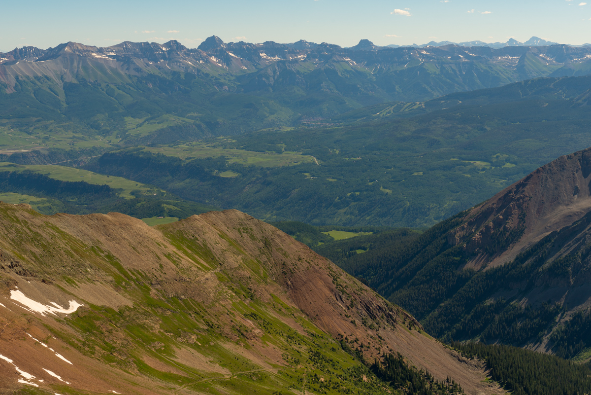
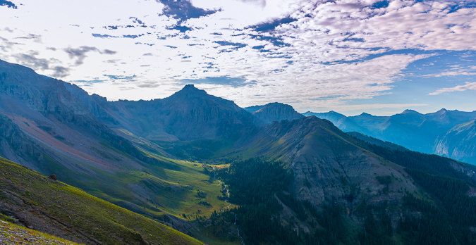
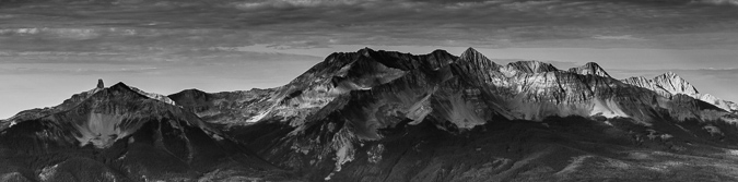
I also was able to shoot some pretty nice panoramas, sweeping from right to left, getting 13,113 ft. Lizard Head Peak (right), 12,930 ft. Sunshine Mountain (center), and all of the Mount Sneffels area peaks in one photograph, above Telluride.
Lastly, I went for it all, getting Wilson Peak in the mix in a 360 degree panorama. The clouds were a really awesome compliment to the Milky Way.
I was pleased with my efforts to capture the night sky and head back to camp to get some much needed sleep. We decided to sleep in and then hike out, which meant Silas would have to return another day to get Mount Wilson. The "trail" down Bilk Basin from the Lizard Head trail was non-existent. We had to cross through some really huge fallen trees before we reached the creek again and trail out. Add in yet another memorable experience, why not?
We cruised down the Sunshine Mesa trail in no time, passing some day hikers on the way. We settled on Tellurde Brewing for our final stop to get some brews and to commemorate our unforgettable backpacking adventure before heading home.
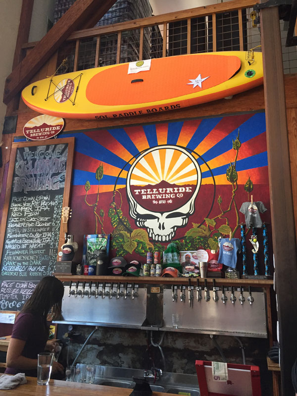
Tellurude Brewing has some fantastic beers! I think my favorite was the Freshwater Double IPA or the Brown on nitro. Yum!
You can view and download my GPS track from Gaia GPS HERE. Hope that it is useful!
Climbing Dallas Peak - Roped Up Above Telluride Colorado
August 30, 2013
Distance: 11.5 miles (according to GPS)
Elevation: ~5,700 ft (according to GPS)
Time: 10.5 hrs (4.50 am to 3.20 pm)
Team: Rick McBee, Ben, Matt Payne and Natalie Moran
I suppose I never dreamed of climbing Dallas Peak. First viewing it's full stature from the summit of Mount Sneffels in 2010, I was immediately struck by how intimidating the peak appeared and how overwhelmed I was with a sense of fear and surrender. I'm pretty sure my exact words were, "F*!$ that!" :-)
Fast forward three years and a few climbs later and my attitude towards difficult mountaineering feats has shifted quite a bit. Peaks like Dallas are a now a hearty and welcome challenge in my quest for the highest 100 mountains of Colorado. Ever since reading about Dallas as a boy, I've been fascinated with the technical aspects of how to summit it. When you're a kid, everything looks a lot harder than it really is, and this is especially true of mountains. My mountaineering hero, my dad Ray, never did make it to the top of Dallas, having deferred his quest for the highest 100 for a middle-aged devotion to my baseball career, which surely made him father of the year multiple years running. Knowing Dallas was never completed by Ray made it even more magical and impossible in my mind, just as I had thought of Vestal's Wham Ridge before I also completed it successfully in 2010. Exacerbating my Dallas Peak magical thinking was its extremely short-lived climbing history. The thing has quite simply not been climbed a whole lot. As Rosebrough puts it:
"Interest was renewed in Dallas Peak in 1976 when Spencer Swanger made a solo climb of the peak, which was the last of the hundred highest peaks in Colorado which he had not climbed. Swanger felt that of the nearly 300 climbs he had made, 'perhaps Dallas had been the toughest.' Indeed, only two ascents of Dallas have been recorded before Spencer Swanger's, Don McBride and Everett Long in 1934; and Stuart Krebs in 1956." - Robert Rosebrough - The San Juan Mountains - A Climbing and Hiking Guide.
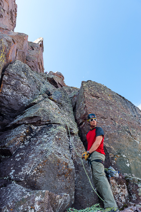
So, when I received an email from Rick McBee about climbing Dallas and Teakettle on Labor Day weekend, I immediately responded with a prompt "I'm all in." Rick and I became acquainted with each other last year when he sent me a message after I completed the 14ers. He purchased several of my photographs for his company after seeing my shots from my Pyramid Peak and Maroon Peak trip report. I knew Rick as a fellow 14er completer and a very awesome dude. He had also named another accomplished mountaineer, Natalie Moran, as being a part of the climbing party, so my confidence in our success was very high. I had heard great things about Natalie from other 14ers.com members and so I felt great about our odds. The plan was to meet at the Mill Creek Trailhead above Telluride on Thursday night and climb Dallas on Friday morning. After Dallas Peak, we'd head over to Ouray and climb Teakettle Mountain on Saturday. Both mountains demanded the use of ropes and a keen ability for rappelling, neither of which being things that I am an expert in. I warned Rick of this and he assured me it was not a problem at all.
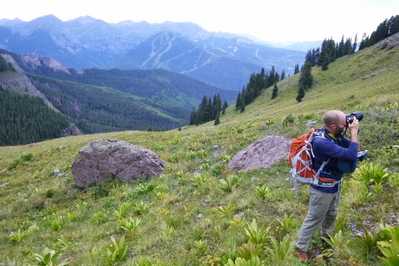
I debated a great deal as to which camera lens or lenses to bring for this trip, knowing I would be doing some technical climbing and quite a bit of tricky maneuvering on shaky terrain. I eventually decided to bring the heavier yet versatile Nikon 24-70 f/2.8 attached to my D800. Strapping the camera and lens to my chest vis-a-vis my Lowepro Toploader would not be too difficult, and I could always opt to throw the camera bag into my backpack for the roped sections. Note and shameless disclaimer: those are affiliate links above, so if you like to shop at B+H and want to help keep the site running, please consider using them.
The drive to Telluride was totally uneventful minus some construction on Highway 50 between Gunnison and Montrose. My last stint through Montrose led me to a Denny's which was not exactly the most vegetarian-friendly establishment. I regretted not doing more research, again, and opted for a trip to Subway before heading to Telluride from Montrose. The trip began well, as I caught up on my email while eating dinner to learn I had won tickets to see Bill Burr at the Pikes Peak Center. Woohoo! A good omen indeed. Per usual Centennial procedure, I consulted Gerry Roach's "Colorado's Thirteeners" book for directions on how to find the trailhead. The description provided by Roach was quite accurate, taking me up an un-marked road exactly 1.9 miles east of the Highway 145 turn-off for Telluride. So far so good. My Subaru Forester made it up the hill without incident and I found both Rick and Natalie's vehicles parked on the side of the road near the end of the Mill Creek Road. I parked my car and introduced myself to Rick and his friend Ben, who was joining us for Dallas. Natalie was already fast asleep in her Forester. I decided to sleep next to them in front of my car, so I would have to test the sleepability of my Forester another night. The stars were out, but only for a brief moment as clouds rolled into the valley.
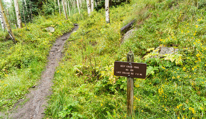
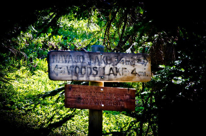
We all woke up at 4:30 AM for a 5 AM start. I introduced myself to Natalie, after having exchanged several private messages with her over the past couple of years on the 14ers.com forum. I knew that Natalie was from Russia, so it was quite awesome to hear her accent. You see, as my wife will attest, I have a thing for accents. They intrigue me, and I love listening to people talk with them. We began our hike up the trail and were immediately stumped by a marked split in the trail, a common occurrence when you begin hikes in the dark. Fortunately or unfortunately, depending on your outlook on the accuracy and usefulness of Roach's route descriptions, Natalie had brought a copy of the route description from Roach's book, which clearly stated to take a left at the signed trail junction, which we eventually did after some debate. Here's a photo of that trail junction taken later in the day on our waydown, which is clearly marked as the Deep Creek Trail.
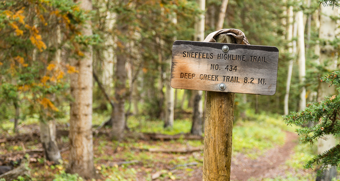
From this junction, Roach writes that you need to hike another .7 miles through three switchbacks to a meadow at 10,000 ft. and then west through the meadow. For some reason we thought there would be another trail to take after finding the meadow; however, that was our misunderstanding. We found the large meadow in the dark, which continued west and then north. A heavy layer of clouds still obscured our views. We knew we were looking for the Sneffels Highline Trail after reaching a ridge at 10,600 ft. We found this trail without any issues as well, but were confused quite a bit in the dark before finding and turning right onto the marked trail junction as depicted below.
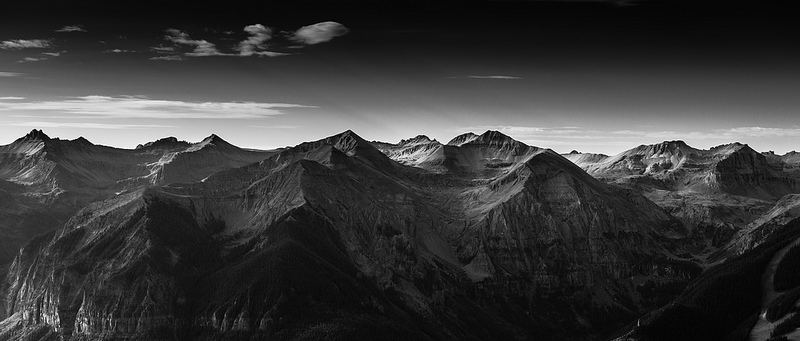
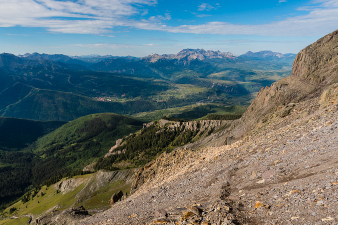
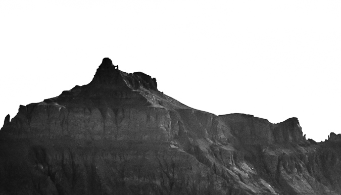
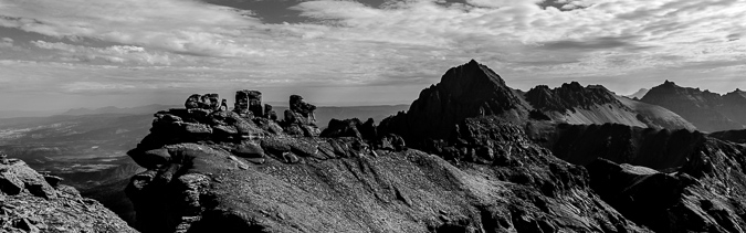
The views from the Sneffels Highline Trail were divine in the early morning light, showcasing amazing scenes of the Wilson Peak group to the southwest of us.
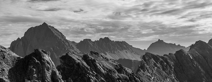
The light hitting the mountains above Telluride was absolutely sublime, and made for quite the stunning black and white image.
We followed up the trail through seven switchbacks as described by Roach and then found ourselves wondering when to start climbing up the slopes of Dallas. We found the trail quite easy to follow but often questioned our location and direction, having to consult GPS and map quite often before agreeing on our next course of action.
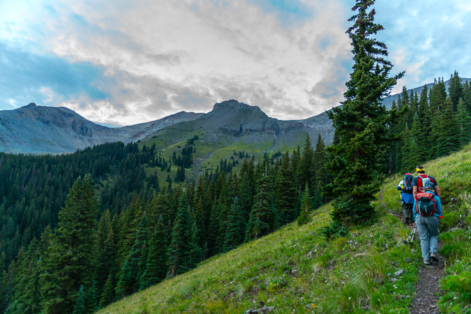
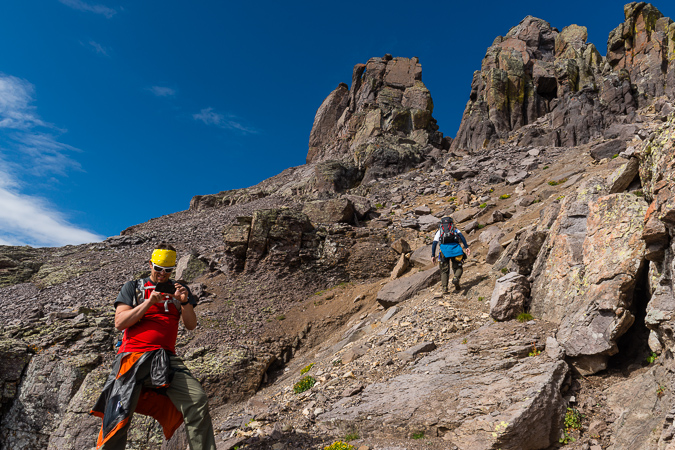
As the trail wrapped up and around the southern flank of Dallas, views to the north and west continued to wow us as the morning progressed. We were making great time, taking minimal breaks. I tried to stay back a little so I could get some good photos of the route heading up and of our awesome party.
Rick and Ben were setting the pace and keeping us on the right path, with an occasional team discussion about our next moves. Man, it was great having competent mountaineers on this trip. Rick was a strong leader, and Ben was a true champ.
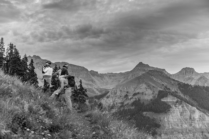
The sky was pretty overcast most of the morning, but that did not stop the sun from lighting up the San Juan peaks above Telluride, across from us to the south.
We continued up the Sneffels Highline trail and enjoyed our views to the south very much. It was a very calm morning, and we were holding onto hope that the weather would improve and that our day would be marked with success on Dallas.
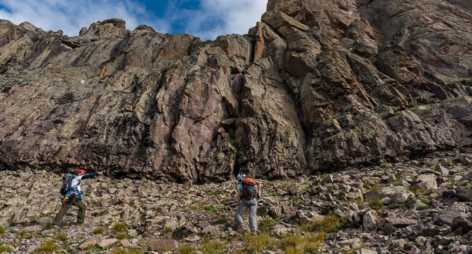
After losing a little elevation and crossing a small creek, the trail wraps around to the south and west and then across a large grassy area below Dallas, where we began eye-balling our route up to the first cliff bands on Dallas' southern flank, shown as a white band in the photo below.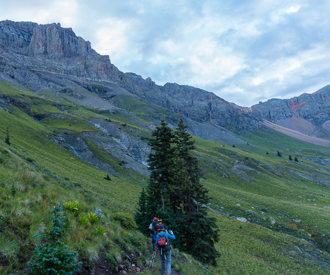
We left the trail at stream coming down from Dallas and fanned out to ascend the very steep grassy slope up to Dallas' cliffs.
As we climbed, a deer was seen above us on a ridge. I did not have a telephoto lens with me, so this is heavily cropped from the D800 (about 100%).
Natalie sneaked a photo of me taking that shot. It was great having some people other than me taking photos!
Telluride was still looking great in this photo of Natalie as we continued up the steep grassy hillside.
And of course Lizard Head, Mount Wilson, El Diente and Wilson Peak (left to right) looked amazing across the valley from us.
Ben volunteered to take a shot of me heading up with my camera, with the great light behind us. Thanks Ben!
Mount Emma was also looking amazing as we ascended to the cliff bands, with early sun behind.
The lower section of this part of the climb was pretty straight forward, albeit rather steep. There was good rock and grass to grip with our boots, and the larger rocks were quite avoidable through here. We found this part of the climb to be relatively simple with little to no route-finding needed. There were numerous areas that had a clear trail identified all the way up to the cliff bands. We stopped a few times to catch our breath and take in the views.
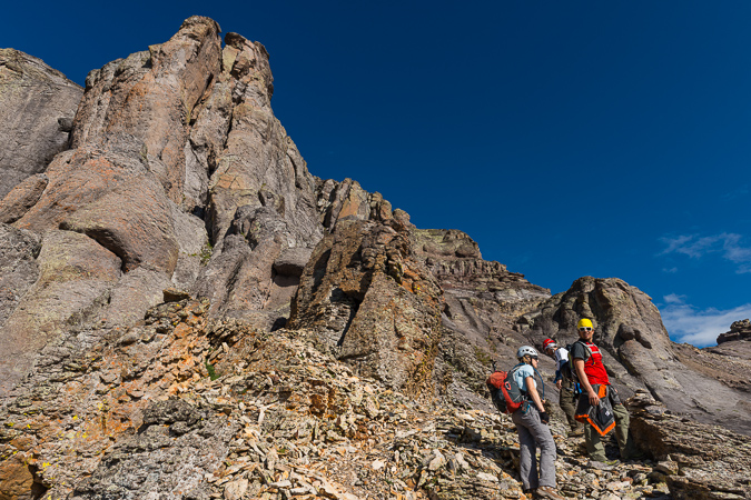
We were a very strong group, so stops were not very frequent. Also, for not climbing together before, we were quite friendly and the group's conversations were very enjoyable. Rick carried the rope while I did the heavy lifting with the camera. Ben and Rick wore their harnesses all the way up, while Natalie and I opted to leave those in our packs until they were needed later.
We continued up the easier section without any issues. When we reached the first set of cliff bands, we were a little unsure where to go until some cairns revealed themselves to us and the route up past the cliff bands to the left became obvious. Also, the climbing become much more exciting as we entered some very fun class 3 sections of rock ledges.
Here's a shot of me heading up the class 3 section, taken by Rick. You can also see the general area we came from, having left the trail about where the trees end near the bottom of the rock gully far below.
As we continued up the lengthy class 3 section, the light below Mount Emma improved, illuminating the awesome stream coming down from above.
We found the climbing in this area to be very fun and enjoyable, with only the occasional loose section of rock. Natalie was a wicked climber and did a wonderful job of surveying the route.
Dallas was quite imposing as we reached higher and higher to the base of the peak.
And damn, the light over on the Wilson's was spectacular in the early morning sun.
The terrain got a little more tricky as we kept heading higher on the southern flank of Dallas, forcing us to find fun and entertaining routes up the mostly solid rock. Here's Natalie powering up one of the final sections of this part of the route.
Once up to the end of the cliff band, the route evened out quite a bit and lead us to the west to a notch referred to as 13,000 ft. notch. Rick led the way.
The route heading up to the notch was very straight-forward, we just followed the cliff band and up a boulder field on a very well-established trail.
A look back on the route we took up to the notch.
As we rounded the corner a bit, the route to the notch became even more apparent - stay as far left as possible without climbing straight up a wall.
We stopped just below the notch to enjoy the views.
The frequent rain over the past few months really greened-up the mountain-sides. Vestal and Arrow were just coming into view in the distance (left middle).
A look back at the Wilson Peak/Mount Wilson massif shows the trail we followed up to the notch.
As we reached the notch and rounded the corner to head up the west face of Dallas, Sneffels and Teakettle came into view, filling us all with a sense of excitement and glory.
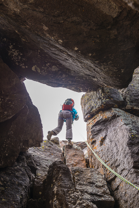
Once the notch is reached, the fun begins. We immediately began working our way up a fairly obvious route towards Dallas' summit towers above through loose dirt and rocks.
Teakettle was looking quite awesome. I was savoring it already. I was wishing I had a longer lens to get a nice zoomed-in look at the handle of the kettle, but a super-cropped shot from the 24-70 would have to do.
 Climbing up this section was pretty straight-forward, but quite loose. I could see this being a challenging section if there was snow on the ground still or if significant rain had happened prior to the climb. There seemed to be a feint trail all the way up to the class 4 section on the west face. The trail led us up this loose gully that was directly against the face of the peak, and then over some ledges to the west.
Once over the ledge system we reached what was clearly the class 4 section. To our left was an impassable chimney and to our right was a huge drop-off into the basin between Dallas and Sneffels. We worked our way up to the base of the class 4 section and mentally prepared for the steep rocks that awaited us above.
Finding the class 4 section was not hard, but locating a route up it was quite the challenge! I love class 4, personally, so I was very happy to find this section, as I had mostly forgotten about it from the route descriptions I had read. A look back down where we came up showed just how steep the west face was, but it was certainly nothing too hard, in my opinion.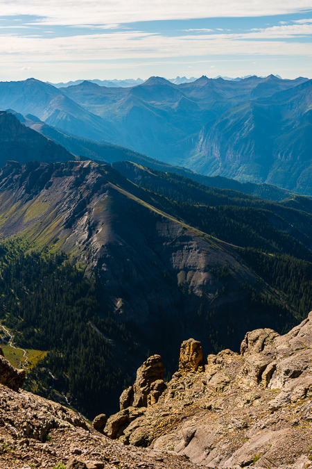
Approaching the class 4 section was not hard, but it was strewn with a lot of loose garbage.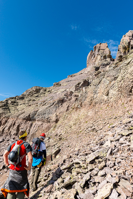
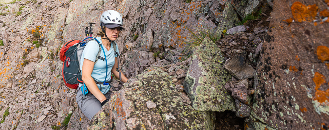
I kept my position as caboose and Natalie fired off some shots of me coming up the class 4 section, which I found to be quite exposed but very solid.
I continued to enjoy the views of Sneffels as we continued up the side of Dallas.
We found the class 4 anchor station, which we figured some people used to rappel down the class 4 on the way off the mountain.
At this point, the route became looser and steeper, but nothing overwhelming in nature. We followed the loose scree up to the first crux below the summit towers.
A look back towards Sneffels revealed some awesome hoodoos on the ridge. What a cool geologic playground.
Almost to the first crux, Ben and I stop to revel in the San Juan glory behind us.
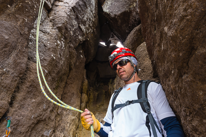
We reached the first crux, which was quite obvious and marked at its base with a cairn. This chimney looked very challenging and I was wondering how I would get up it with my camera on my chest.
Thinking that would not work out so well, I opted to put my camera bag away and head up the same way as the rest of the group. The chimney was low class 5, for sure.
I found ample but difficult handholds on the left side of the chimney and worked my way up to the first ledge seen just above Ben's yellow bandana above.
From this ledge, the route becomes a little less obvious, and the footing is somewhat unstable due to the slope of the rock you are standing on; however, I decided to head to the left through an awkwardly diagonal weakness between rocks.
We did not rope up for this short section, but I think some parties might benefit from a rope at this spot for some added security and peace of mind.
Natalie captured a photo of me coming up the small chimney from above. 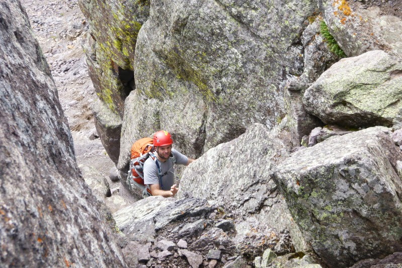
A view from above, shot by Rick:
 |
 |
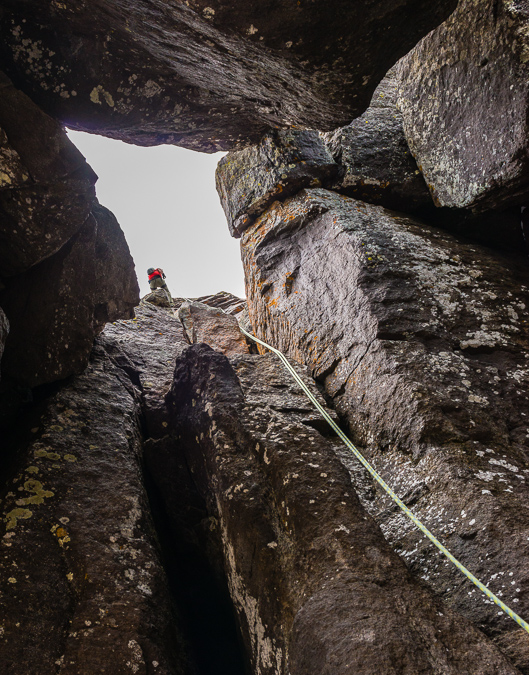
Here's another view looking up from the bottom, showing the general line you take to reach the top of the chimney.
We also found an anchor at the top of the 1st crux and figured it was used to top rope the chimney. Photo by Natalie.
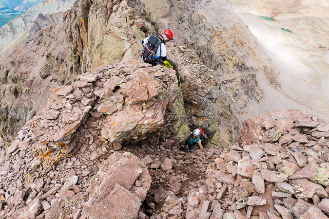
Once past the chimney, we were a little perplexed as to where to go next. Ben and Rick study the route in this photo from Natalie.
The route was not obvious at all. Roach describes down-climbing from here, but we found no such need or desire. The only way that looked even do-able was a ledge system going up and around the north face of Dallas, which had dramatic exposure as seen in this photo snapped by Natalie. Would you downclimb here? No - thanks though Roach.
Following a lightly worn area of rock up a small series of ledges proved to be the best bet.
At least the views were still holding up.
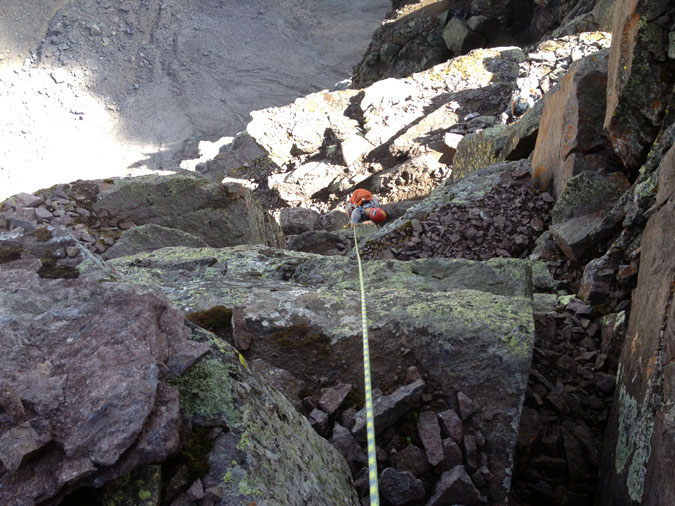
We found it difficult to find the summit pitch, but some sleuthing by yours truly discovered a dirt gully leading up to a ledge which was at the base of the summit pitch, which looked quite challenging. Rick set-up his rope and got down to business as soon as Ben arrived to belay.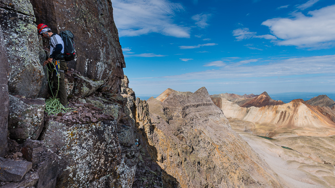
Here is another view of the dirt gully leading up to the summit pitch.

Rick placed only one cam for protection before reaching a belay ledge about 30 ft. above. Our route went right over the first boulder and then up to the right.
After watching Rick tear up the face to the belay station, I took one last look over at Sneffels and Blue Lake before mentally preparing for the ascent up the face. Rock climbing is not really my area of expertise, with only a few other forays into the alpine roped climbing arena in my past. Ben ensured I was tied in correctly and helped clean some mud off my boots.

Natalie got one last photo of me before my first alpine ascent in several years. Adrenaline started pumping.
A look up revealed my route. Nothing too crazy, right? That's Rick perched up there with the white hat barely showing. Oh, and hey, an appearance by the moon.
Up we go into the crazy class 5 crux. I found it pretty tough in muddy mountaineering boots, but managed to find some solid footholds with the help of Ben's finger pointing out some spots for me to try. Photo by Natalie.
A patient and watchful Rick watched from above. I'm not sure if I should be happy or disturbed he got photos of me while belaying. All is well that ends well. All joking aside, Rick was an awesome leader.
Once up the 1st big boulder, climibing became quite a bit easier.
After I unclipped, Rick threw the rope down to Ben.
Ben topped out with ease and enjoyed the views of Sneffels while Natalie roped up.
Natalie made it up to the belay station without any issues and Rick continued up the route. We found the next section to be a bit easier.
Rick went first and got to the top within about a minute. He setup a belay and I went 2nd, deciding to clip in for added security. The final section was exposed but there was a lot more handholds and footholds to choose from and it felt very low class 5, perhaps class 4. I reached the top of Dallas and was overwhelmed with joy. What an amazing climb! Natalie came next, and I was able to document her topping out beneath Rick's "meat anchor."
Natalie was just as excited to get to the top as I was.
The views from Dallas were expansive and incredible. Blue Lake was awash in light. This panorama is pretty huge. In the full resolution version, you can see all of the buildings at Telluride and make out people on top of Sneffels. Click on it to go to my photography gallery.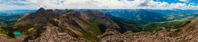
I was all smiles on top of the world. Only 18 more Centennials to go!
Natalie got a great shot of me after I fired off my summit panorama.
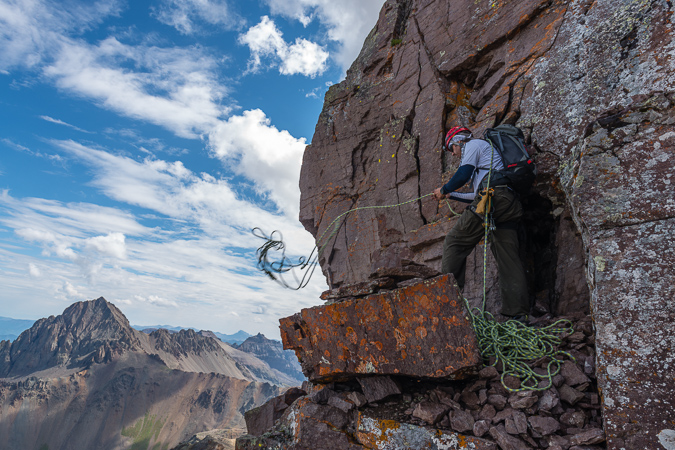
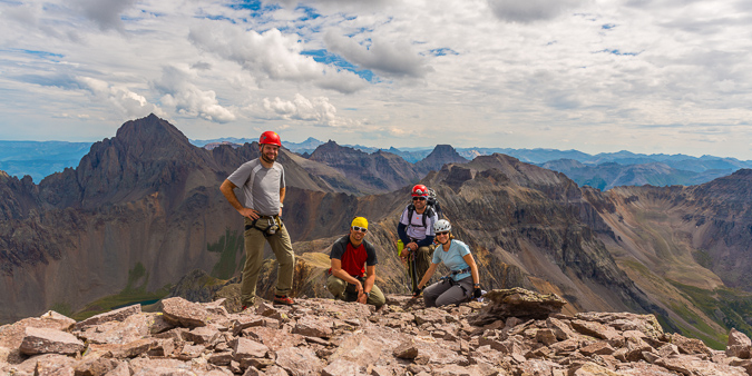
After enjoying some lunch and watching the storms build to the west, we decided to get a group photo and prepare for the rappel off the top.
Rick set up the rappel and everyone gave me a needed refresher on rappelling. Rick went first and I went second. Setting up the rappel for this was a bit tricky. Natalie let me borrow some cord to anchor myself to the anchor and then I got onto the final ledge and roped up. We had about a 90 foot rappel off the west face of Dallas, which contained some interesting rappelling features. First of all, as soon as you step off the edge, the rock inverts and you're off to the races. Second of all, you have to aim for a hole between a giant car-sized chockstone below, about 60 ft down. Natalie got an awesome shot of me moving into the first part of the rappel.
I think the rappel was even more heart-pumping than the climb up. Don't get me wrong, I really enjoy rappelling, but it had been at least two years since my last rappel and I was hanging off the side of a huge mountain. Amazing stuff.
Once I popped through the hole below, I was ectatic. I photographed the others coming down through - here's Natalie.
Our fearless leader awaited us below.
Another view of the hole we rappelled through, this time Ben coming down.
After the rappel, we head down pretty fast. I took a nice tumble on the class 3 section on the south slopes and got a few cuts, nothing too crazy. We made it down to tree-line just as rain began to move in.
We reached the infamous meadow that Roach refers to and I decided to get a parting shot of Dallas above.
Back at the parking lot, we conspired for our plan of attack on Teakettle for the following day.
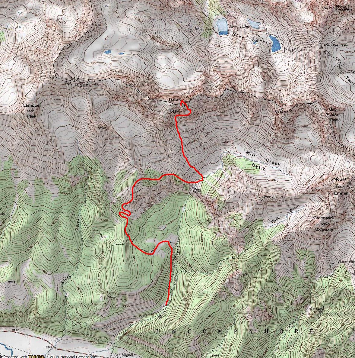
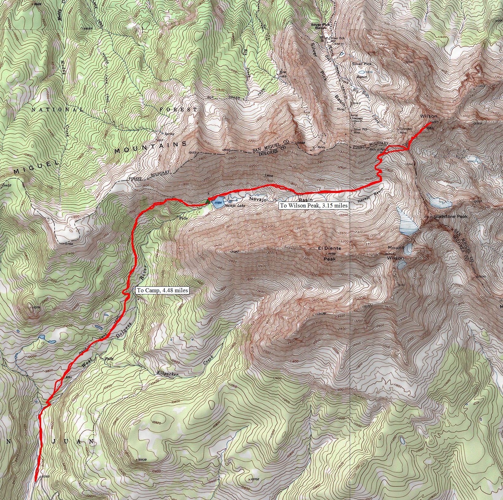
Overall, I would rate Dallas Peak as one of the hardest Centennials (highest 100 mountains in Colorado). The long, steep approach coupled with the challenging route-finding and intense class 5 climbing as well as the bomber rappel make this one of the most demanding peaks in Colorado. So far, I think Dallas would be rated as the hardest mountain I've climbed to date. As far as route-finding goes, don't rely to heavily on Roach. We found his descriptions somewhat lacking, especially on the upper section of the route after the 1st crux. Study our photos carefully and you should have no problems finding your way if you should choose to attempt Dallas. I would highly encourage other climbers to use Natalie's GPX file and reference her trip report as well. Here's a map and a rough hand-drawn route to reference as well.
For more information on travel and lodging in and around Telluride, check out this site, full of great information.
Lastly, I want to thank my amazing climbing partners, Rick, Natalie and Ben. These three were amazing to climb with and I could not be more happy with how our climb went. Next up, Teakettle...
Wilson Peak - An 'Airy' Scramble Above Navajo Lake

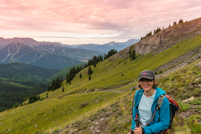
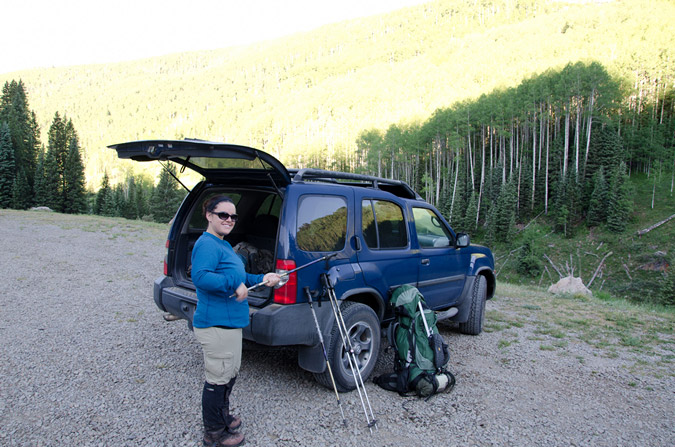
Fourth of July weekend always provides a tremendous opportunity for mountaineering, and this year was no different for me. Early in the year (January), I was eagerly planning my summer's climbs and saw this weekend and knew it would be both tremendous and controversial. You see, my wife's birthday is July 3rd. I begged her to allow me to climb on this weekend, knowing that it would probably be the only way I would be able to successfully complete the 14ers this year, which was my goal. My wife was really cool about it and said I could go. With that being said, I knew that the perfect match for this date range would be the Wilsons (Wilson Peak, El Diente and Mount Wilson). I set aside a total of 5 days for the trip and hoped I would not need all 5 days, but knew that weather could necessitate the use of all 5 days. My climbing partner, Regina and I roughly sketched what we thought would work best earlier in the year and when June 30th finally arrived, we were both excited to get out of town and up into the mountains! The plan was to drive to the Navajo Lake trailhead on June 30th and camp there, backpack up to Navajo Lake on July 1, establish camp, climb Wilson Peak and go to bed. After this, on July 2, we would do El Diente via the North Slopes route in the snow and then traverse over to Mount Wilson. This would leave July 3 for completing Gladstone Peak (a centennial 13er) and for the hike out. It even factored in one extra day for weather or for kicking it in Telluride for a bit.
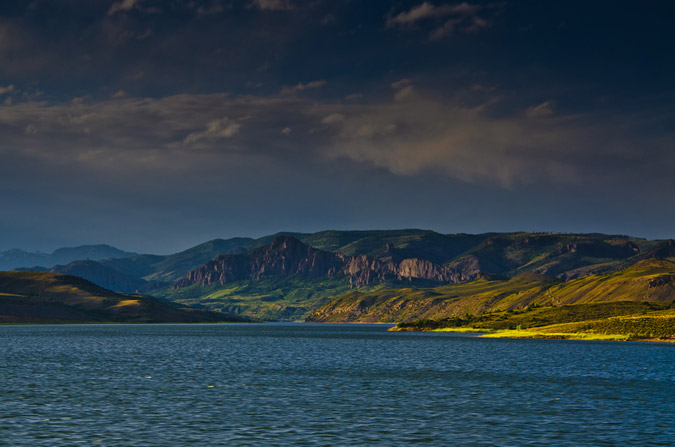
So, with all that being said, Regina and I embarked for the Telluride area, a good 300 miles away. We drove through the Blue Mesa Reservoir area during dusk, and I was able to get one decent photo from the car while Regina was driving. I have always really enjoyed that part of the drive and someday I'll time it just right to get a gorgeous sunset photo there. Until then...
The plan unfolded perfectly and before we knew it we had arrived at the trailhead for Navajo Lake at around midnight. We set-up camp away from the trailhead and set the alarm for 7 AM since we were looking at a good 4.5 miles or so to the lake and an additional 8 miles to Wilson Peak and back to the lake for our itinerary. The alarm went off and we sprang out of the tent and packed up quickly, eager to hit the trail. The weather was absolutely fantastic. This week, I decided to try something I've never done before and pack my tripod with me. While this added some additional weight, it would allow me to get some great photos at Navajo Lake and even try my hand at some more star trails photography.
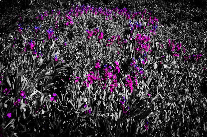
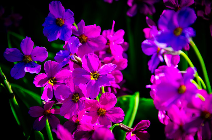
The Navajo Lake trail was really quite fantastic - it weaves in and out of huge groves of corn lilies (Veratrum Californicum), but I like to refer to them as Indian Toilet Paper since back when I taught Leave No Trace we would always use them for, ahem, wiping.
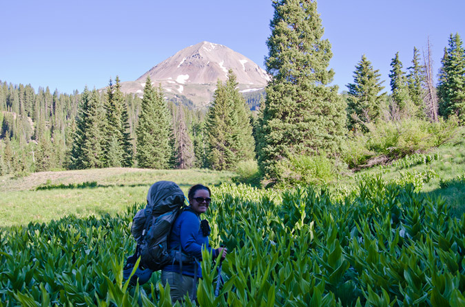
Pretty quickly, the trail leads you up the long meadows and into view of El Diente, which by the way was one of the most deadly mountains last year.
The whole area was covered in those corn lilies and wildflowers, which slowed me down a bit due to me wanting to take a ton of photos. I think I have a serious photography problem or something... what do you think?
 |
 |
 |
 |
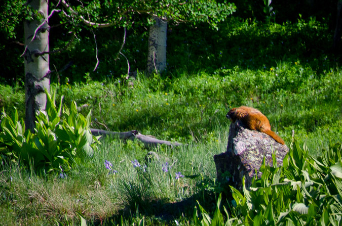
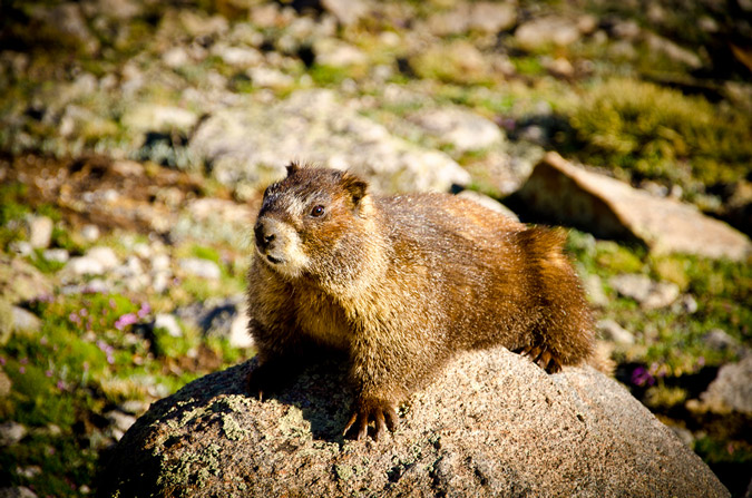
Naturally, a hike in the San Juans and the Lizard Head Wilderness Area are not complete without a sunbathing marmot!
The trail kept winding up towards Navajo Lake and eventually we reached the trail junction for Woods Lake.
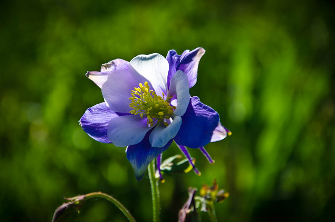
The closer we got to the lake, the more vibrant and ubiquitous the wildflowers became and I could not help but take more photos. What can I say, I'm a sucker.
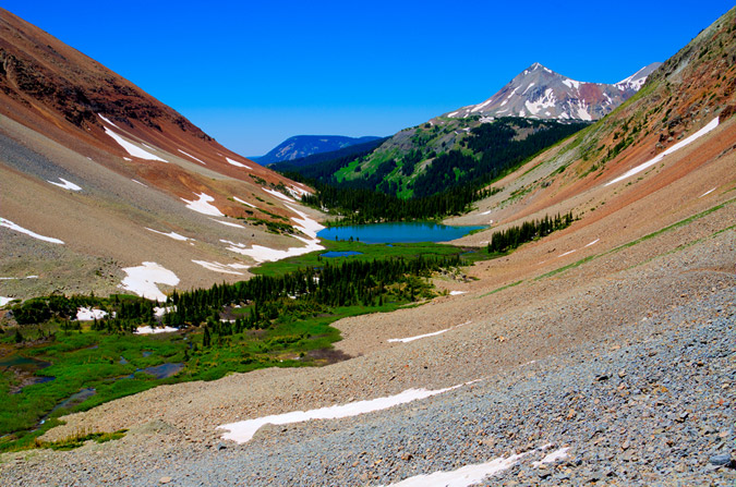
A mere 3 hours later we finally arrived at Navajo Lake. The view of the lake and Gladstone Peak was absolutely stunning.
We were able to establish camp about 300 feet away from the lake up on a small plateau - it was an absolute gem of a campsite. After setting up our tent and getting everything else situated, we packed up our daypacks and headed on up the trail with the objective of Wilson Peak in mind. Our departure time was 12 PM. Normally, I would not attempt to climb a mountain so late in the day, but the weather was superb and I knew the forecast was totally clear, so we opted to give it a shot. Worst case scenario, we could always head back down to the lake if the weather turned on us.
Now, Wilson Peak has never held much status in my mind, purportedly being the easiest of the group's 14ers, so I never did much research on the route. Sure, I read the route description and printed off a few photos and paragraphs, but I felt pretty confident that it would be a fairly easy climb. Boy - I was really pleasantly surprised and wrong about that assumption, as you'll read later on.
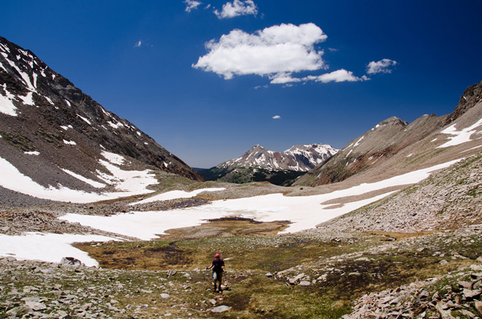
The hike up into Navajo Basin was really enjoyable from the lake.
 |
 |
After awhile, the trail finally brought us even with El Diente to our right, the view of the North Slopes route came into view nicely. Mount Wilson sits at the top of the basin, right of Gladstone Peak, and is connected to El Diente by a massive, spiny ridge, as seen in the below pano.
Additionally, the blue hues of Navajo Lake kept me looking back, enjoying the vistas of the valley.
The trail was not terribly steep but it did weave in and out of large snowfields, making it a bit more interesting but nothing too dicey, so far.
Finally, we reached the headwall that leads to the Wilson Peak - Gladstone Peak saddle beneath the Rock of Ages Mine, which required us to head up a giant snowfield. The snow was quite firm and easy to hike through.
I was feeling really good and had gained a bit of distance between Regina and I, so I periodically stopped to let her catch up.
The snow in the North Slopes Couliour for El Diente looked superb and I was a bit excited to see how that would work out on the following day.
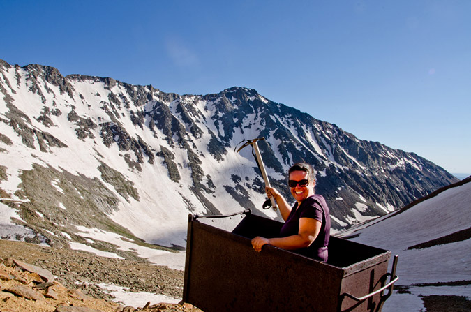
At 2:30 PM, we both reached the Rock of Ages mine, which felt quite like something out of the 1800's. An old wooden mine shack still sits on the mountainside along with a small wooden bench, a mining cart and some other odds and ends.
We rested at the mine, ate some food and discussed the next steps. The trail continued on up towards the Rock of Ages saddle to our left, but I knew from reading the route description that the trail winds back across the mountain just above the mine itself, so I figured it would be a good opportunity for some off-route exploring up through some easy class 2 boulders above us to the Wilson Peak - Gladstone Peak saddle.
Personally, this terrain is a playground for me - the rock was somewhat loose but not too crazy, and it was fairly obvious which rocks were stable and where you needed to go. Regina on the other hand, not having grown up climbing off-route like me, felt a little less comfortable on the boulder field and was starting to have some doubts about the rest of the climb. I assured her that she would be fine and that she needed to treat the rocks with respect, expect that they will move, and be nimble about her movements. Eventually we made it up to the saddle without incident and were greeted by the first insane views of the day to our east. A cornicopia of San Juan mountains laid before our eyes and I was excited to finally get views of Lizard Head Peak, Fuller Peak, Vermillion Peak, Golden Horn, Pilot Knob, U.S. Grant Peak and South Lookout Peak, which all rest at the head of Ice Lake Basin - one of the most gorgeous locations in Colorado. Can you identify them all?
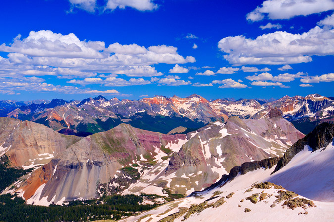
Here, let me help you!

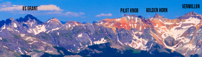
Of particular awesomeness was the view of Lizard Head Peak, which will likely forever rest on my unclimbed list!
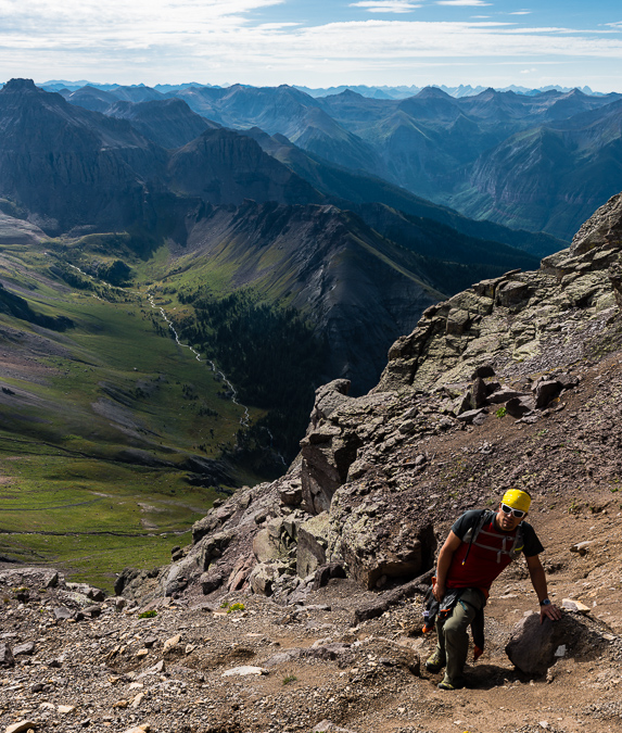
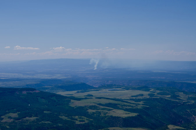
At this point, Regina and I had to make a decision. The weather was great. Barely any clouds in any direction. But - Wilson Peak was still a long ways off and it was already 3:30 PM. I still felt strong but Regina was fairly demoralized by how far away Wilson Peak looked still. From the saddle Wilson Peak was still a half mile away and a good 600 feet up across insane snowfields and rotten rock. I encouraged Regina to give it a shot with me, so we did. Right off the bat, we were greeted by a pretty intense snow field at the base of a cliff that was quite run-out, meaning, if you fell down, you were going to travel a long way down and probably die. We deployed our ice axes and secured our helmets and crossed, using extreme caution. Soon, a second and then a third snow field of equal danger were presented to us as well as crumbling rock and difficult trail-finding. Regina became really sketched out by the whole thing and decided that it was as far as she would travel and told me to keep going and that she would wait there. I was fine with that idea, so I continued on. I'm not going to lie - I was not mentally prepared for this climb. I thought Wilson Peak would be a walk in the park. Having much of the route obscured by steep and dangerous snow that had softened considerably throughout the day, my mountaineering skills were certainly challenged. The route before the false summit was chossy at best, with huge loose boulders cascading above and below me on a regular basis. Oddly enough, I was calm in this environment. I have an odd knack for loose rock and when my footholds and handholds gave way, I went with it, almost like walking onto an escalator. I chose my route carefully enough so that I could avoid the larger messes, but a few rocks did manage to take huge chunks of flesh out of my finger and hand. No worries though, the bleeding stopped quickly and I didn't even stop to apply a bandage. All in a days work. I was finally able to reach the ridgeline that connects to the false summit, and was able to catch views of a small wildfire that had broken out to the north-west of me.
Of even more interest at the time, Wilson Peak's daunting summit block stood before me like some ancient pyramid. Again I found myself thinking - wow - really? I never expected this much awesomeness from this mountain. I was excited. Was this going to turn into a class 4 scramble? I sure hoped it did! The exposure looked inviting, but the rock was crumby and resembling of tiny pinnacles. I knew that I needed to choose my route carefully. The route description from 14ers.com stated that there was two ways to skin this cat - go left and downclimb to some safer class 3 sections, or continue on the ridge and challenge yourself with some nuts class 4 stuff. I chose the class 4 stuff and it did not disappoint me in the least.
In the interest of weight and balance, I decided to take a huge drink of gatorade and leave my pack on the false summit, bringing along my camera, which was attached to my chest by my new Lowepro Toploader bag. Yes, I realize that I broke one of the key tenets of mountaineering by leaving my pack behind, but I still feel it was the best decision.
After carefully finding my way down and through the class 4 section, I reached the summit at 4:50 PM. I was still feeling great. Naturally, the views were absurd and rediculous - in a good way of course! Sneffles towered to the north-east alongside all of her insanely shaped neighbors. All-in-all I would rate the Wilson Peak views as a 8 or 8.5. Pretty amazing.
Sneffles and her friends:
I was able to set my camera up to take a quick self-timer too - how fun.
I figured with Regina waiting below, I should get off the summit pretty quickly, and so I did, leaving at 5:03 PM. In the distance, I spotted my pack and I thought it was neat to see the nastiness of the downclimb I did earlier as well as my pack for a dose of perspective. I basically went straight down from where my pack was at.
Zoomed out, you can see that the saddle where Regina was waiting for me was a long ways off. I believe she was waiting for me just where the snow was starting to end.
Another view of the climb back up to the false summit from Wilson Peak with my backpack at the top:
The downclimb back to Regina went much faster and I was able to reach her in just 30 minutes from the summit. She had safely crossed back to the saddle and had waited for me there. She also took a shot of me on the Gladstone Peak - Wilson Peak saddle:
We opted to head back down the standard way to the Rock of Ages Saddle and had a long conversation on the way down. I knew that Regina was probably feeling pretty bummed about not getting to the top of Wilson Peak, especially after the absolute disaster that was our Snowmass Mountain attempt the week prior. I was pretty proud of the way Regina handled this situation. We talked about how this type of climbing just was not fun for her and that if she was feeling uncomfortable on the rock that it was not worth getting killed just to check off a box on a list. I knew that Regina had a strong goal to finish the 14ers this year, but I think she has a much richer appreciation for mountaineering and all of its challenges. I think that in time she will grow more and more comfortable on class 3 and class 4 climbs, and will complete the 14ers; however, there's no sense in getting killed because you don't feel comfortable! Kudos to Regina for having a clear mind about this issue. All too many climbers lose sight of this important perspective in their quest for glory.
The Rock of Ages Saddle proved to be a nice location to capture a nice panoramic of the Navajo Basin, with Gladstone Peak (center) at the head and continuing on down the ridge to El Diente.
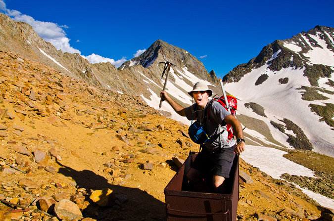
We took pause back at the Rock of Ages Mine for some good 'ol fashioned mining fun. Regina took a more conservative approach to her mining pose:
But... I was still pumped from doing Wilson Peak, plus I wanted to give my best Miner-49-er impression! I think the result was more of a hybrid between pirate and crazy guy...
Cruising back down the Navajo Basin was quite fun since the snow had softened up just enough for some glissading and boot skiing.

However, the sun was beginning to set, and my photographic funny bone started to shake. I knew that the Golden Hour was approaching and that there would be some amazing opportunities for some killer shots soon.
 As we worked our way down the snow fields, I was getting more and more anxious for the photography opportunities. I kept looking down at my altimeter watch to see what time the sun was setting. According to my watch, the sun would set at 8:45 PM. I was really pushing myself to get down to Navajo Lake before then so that I could take advantage of my tripod and the sunset.
Unfortunately, there were just too many awesome things to take pictures of on the way down!
I even found a model marmot to pose for me - how kind of him!
I thought he was pretty funny! He even gave me his best "oh crap" look! Haha.
As the sun set further and further, I kept pushing myself to hike faster and faster. Would I make it?
The photographic opportunities were endless...
I was even able to get a quick HDR from the trail, although the results were not terribly great.
I finally passed Regina and she pretty much knew what I was up to - I needed to get back to that lake! Alas - I did reach the lake right on time at 8:00 exactly, 8 hours after we had left camp. Navajo Lake submitted her glory to me quite beautifully...
And I even did a pretty decent HDR too:
Regina and I convened at camp and decided to cook some Mountain House meals ASAP to refuel. While I gathered some water at the creek, I could not help but notice that the red rocks of El Diente were reflected off of the creek...
Regina and I talked about our plans for the remainder of the weekend. We tossed around a few ideas. Maybe I could climb Mount Wilson and El Diente with another group at the lake? Maybe we would just head out and call it good? We decided on the latter. I did not want Regina sitting around all day while I climbed some more, and since the mountains are not going anywhere, I figured it would be totally cool.
Regina and I threw down on our meals like two starving children. Regina was pretty tired and went to bed, but I knew that my adventure had just begun. With tripod at hand and camera at the ready, I set-up for a night of star trails photography, which is quickly becoming one of my favorite things to do.
Navajo Lake would provide the perfect setting for star trails, and I knew that I would get a few keepers out of my efforts.
As I waited for the perfect amount of star light, I embarked on a slight experiment. I knew that in a lot of star trails photos, the goal is to center the photo on the North Star, since that star does not move across the sky. The result is a center star that does not move with the rest of the stars rotating around it like a carousel. Unfortunately, I totally forgot how to identify where the North Star is in the sky, but knew that it had something to do with the Big Dipper. I realized that the Big Dipper's cup pointed at the North Star, so I centered my camera on that star and tested it out. Sure enough, I had successfully located the North Star.
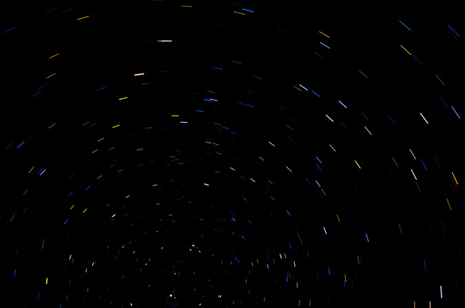
Finally, the moment was right and I opted to do the one exposure method of shooting star trails, where combining photos is not required, but precision is. I think it went pretty well, although I really wanted to do it for longer, but literally fell asleep on the shores of the lake while the camera took the shot...
I also decided to compile a set of exposures @30 seconds each to see which method produced the best results. I certainly feel torn!
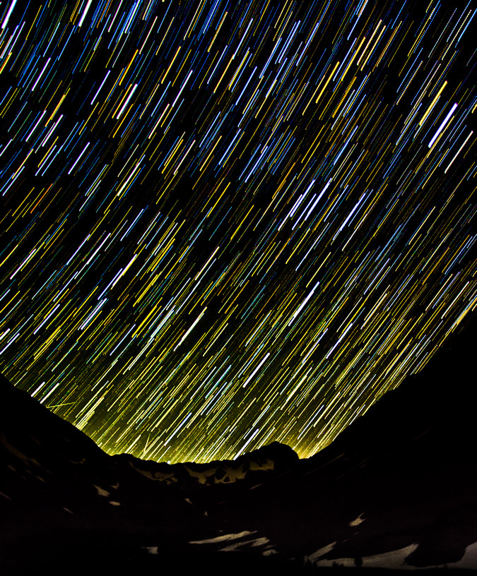
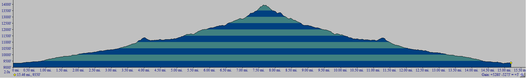
I finally went to bed, knowing that I had captured something magical in the reflection of the lake. In all, I ascended 5,280 ft. and hiked over 15 miles. Click the elevation profile for a larger version if you'd like.
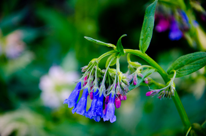
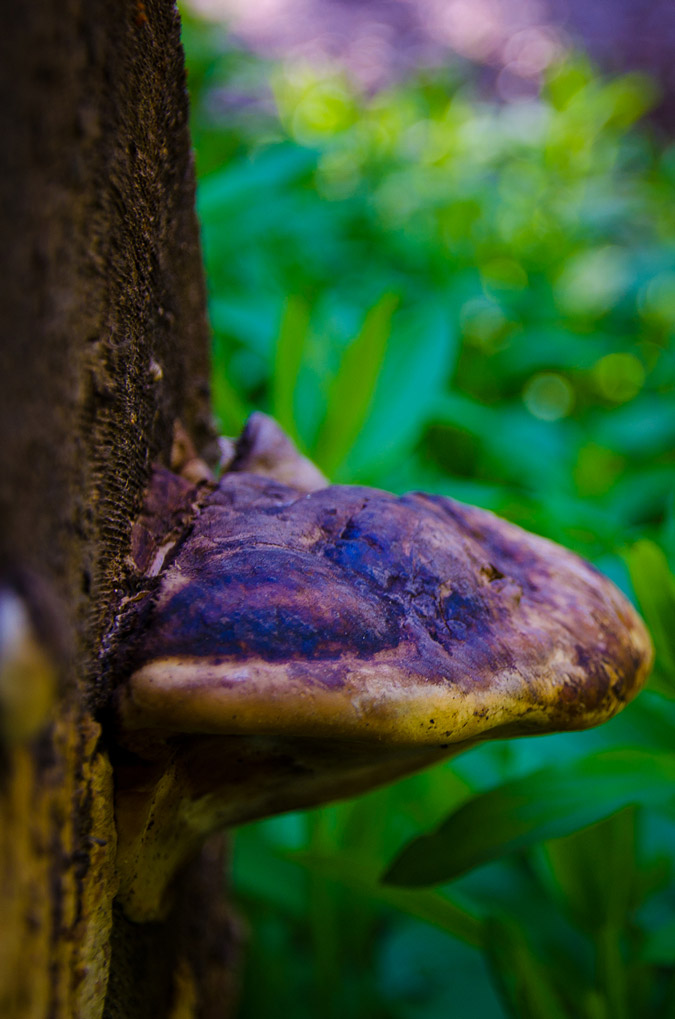
The next day, we packed our packs and headed out, but not without some obligatory shots of more wildflowers and one whacky mushroom!
 We departed the valley thinking that our adventure had ended. We left knowing that we had gleaned some positives from the trip and that even though our plans did not pan out the way we intended, that it was still a great time. Little did we know then that our adventure had just begun...