Displaying items by tag: Three Apostles
Climbing the Crown Jewel of Colorado's Sawatch Range - Ice Mountain & North Apostle
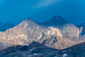
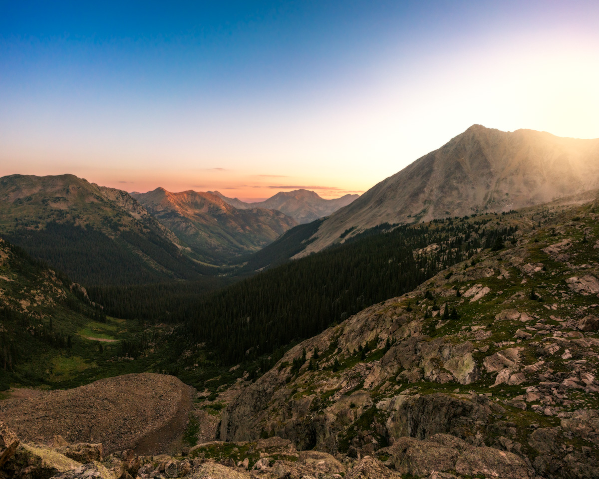
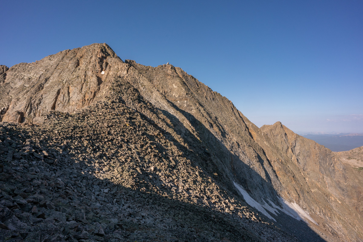
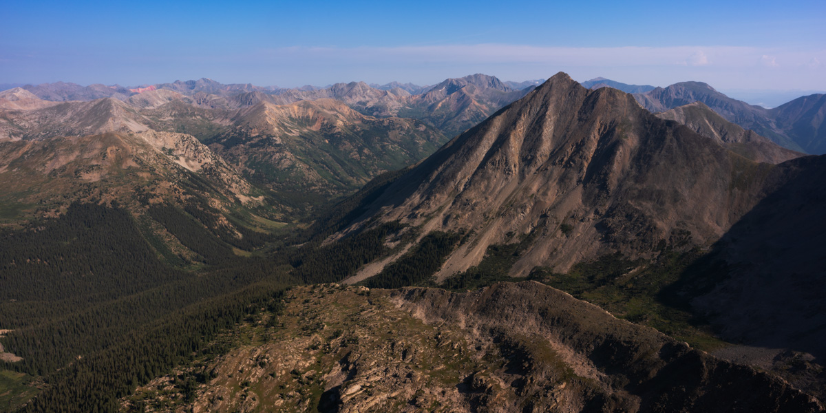
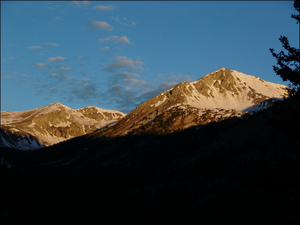
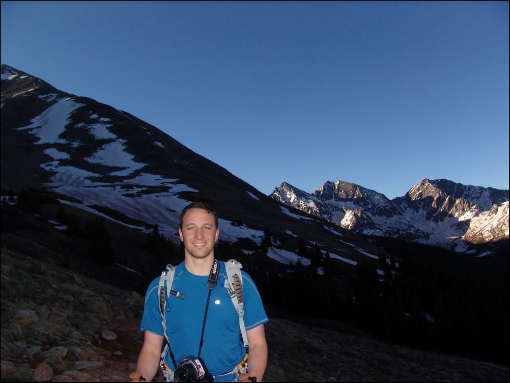
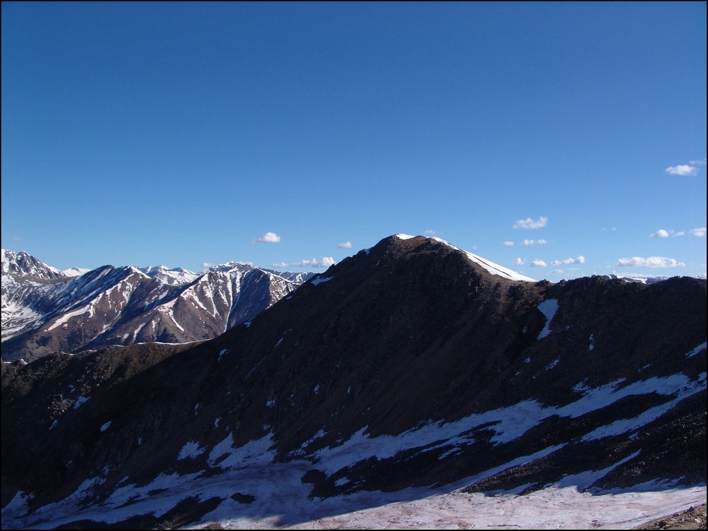
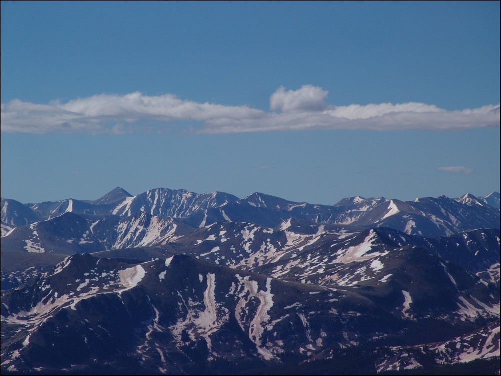
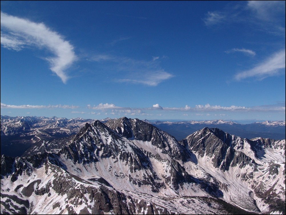
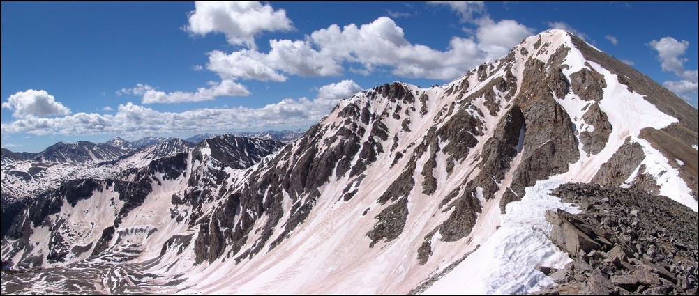
North Apostle and Ice Mountain as seen from Grizzly Peak in 2013.
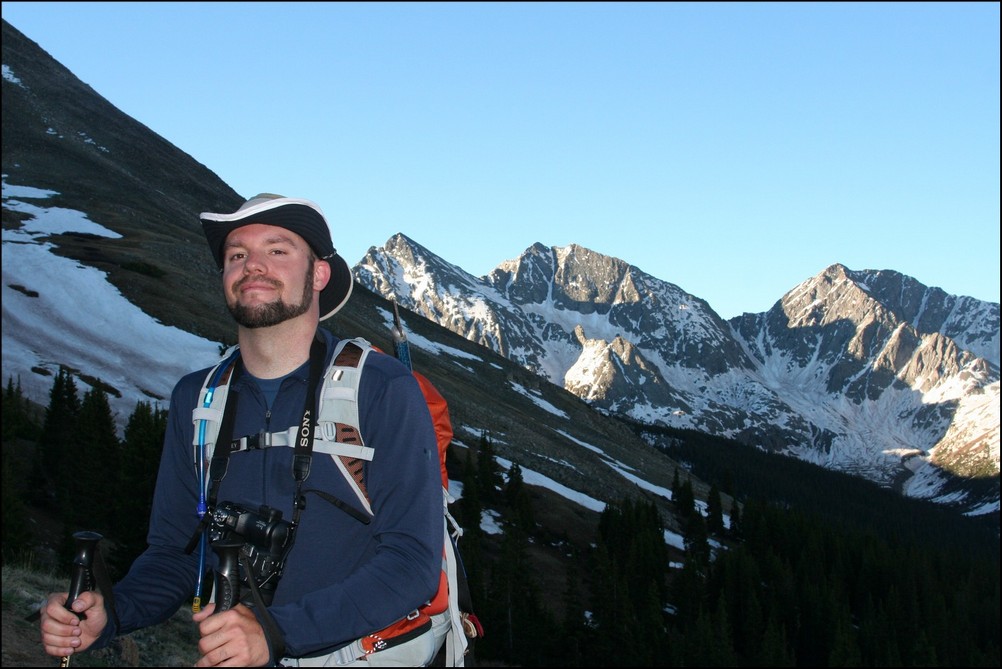
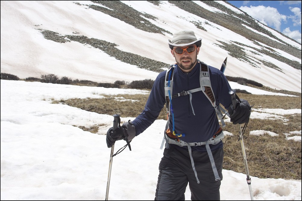
2018 will be the year that I finish my lifetime goal of climbing the highest 100 mountains in Colorado. Or at least that is what I keep telling myself to stay motivated! Having climbed Dyer Mountain back in May, and Silverheels, Buckskin, and Stewart earlier in June, I found myself faced with only four mountains left to complete my goal: North Apostle, Ice Mountain, Cathedral, and Thunder Pyramid. Having Fridays off of work most of the time, I was faced with some options in terms of climbing - I could leave Friday from Durango, find a camp-site, climb on Saturday, and then drive home; or, I could do something stupid. I went with stupid. My friend Silas (featured in many trip reports here) was climbing Capitol Peak the same weekend and I really wanted to climb that again with him. I decided I would try to squeeze both climbs into one packed weekend, at the last second. So, I packed my car with both backpacking and car camping stuff and left my house in Durango after work on Thursday at 8:30 PM to drive to the trailhead for the Three Apostles. I ended up arriving at the trailhead at 1:00 AM and slept in my car until 3:45 AM, at which point I left the car and began my journey on almost no sleep. Huge mistake...
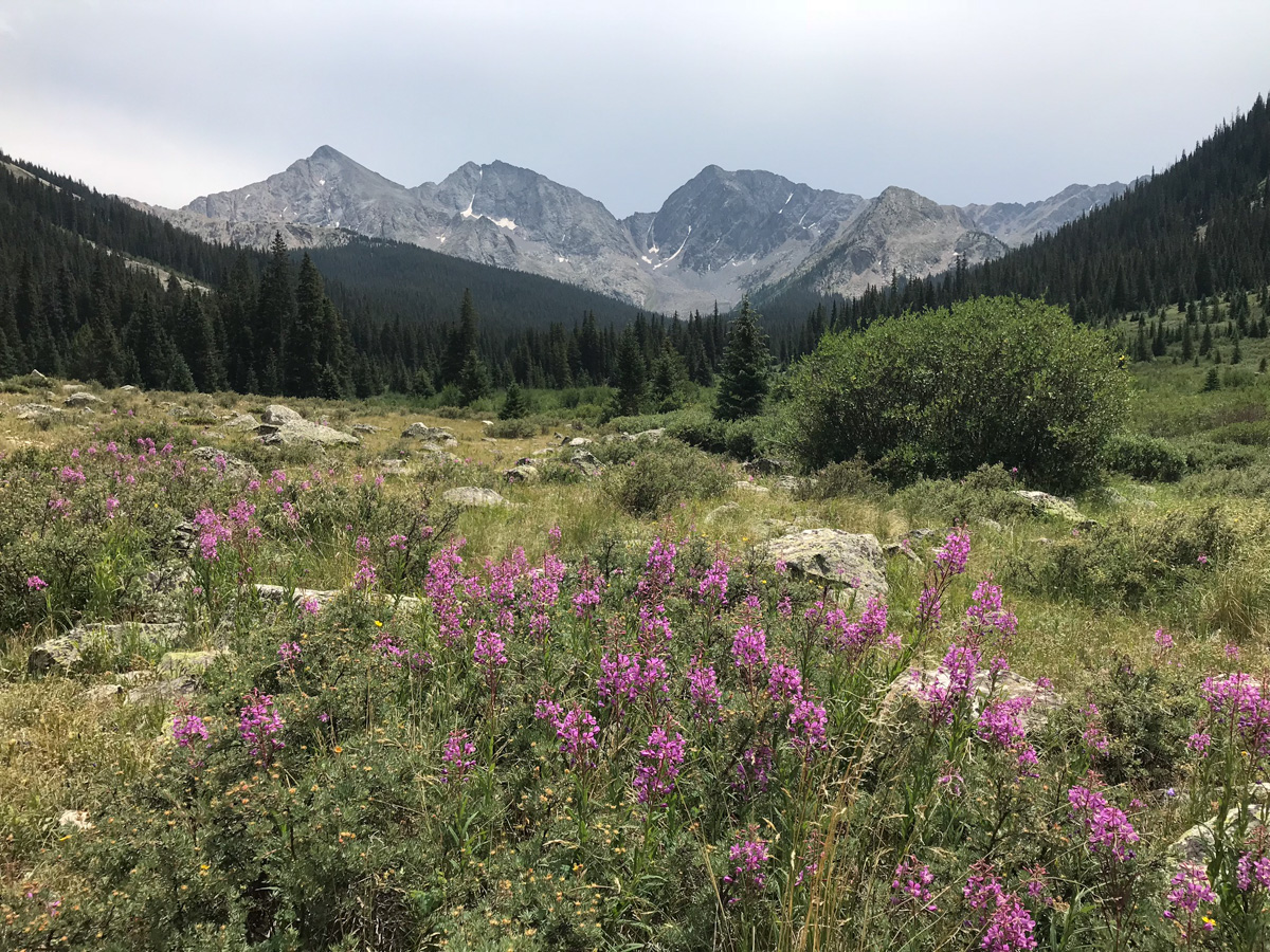
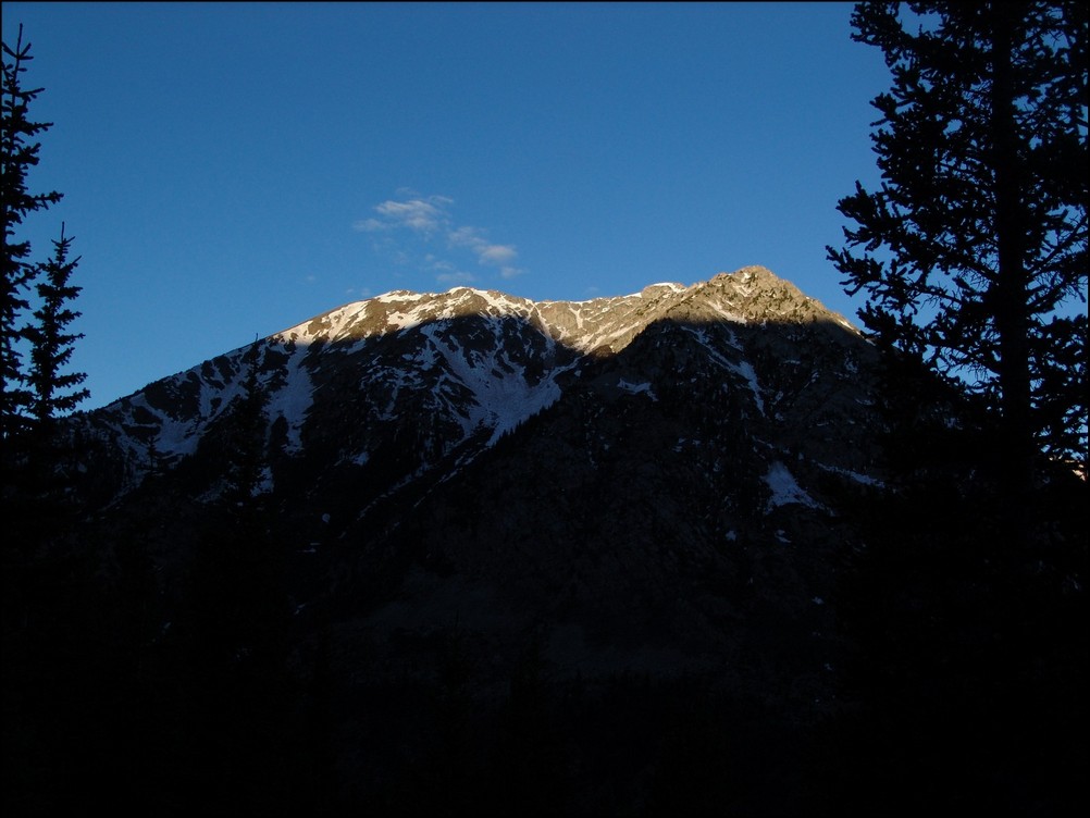
I've been eyeing the Three Apostles for years. I first admired their incredible stature when I was much younger on camping trips with my parents around Winfield. I remember one particular year going on a camping trip with my parents and my friend Jeremy where we hiked up into the upper basin and could see the Three Apostles - they looked intense! My next foray in seeing them up close and personal was in 2010 when I climbed Huron and Browns with my friend Mike Vetter - I recall being quite impressed with the peaks then as well. My latest encounter with them was watching the sunset from the summit of Grizzly Peak to the northwest of the Three Apostles and seeing a huge rainbow over Taylor Park. That was awesome! That particular trip, I hauled a huge telephoto lens up to the top with me and shot North Apostle and Ice Mountain at sunset. Good times!
As always, you can see and download my full route and GPS tracks over on the incredible app, Gaia GPS, which I use on my iPhone to plan, track, and follow my routes on these trips. It is absolutely invaluable and worth every cent. I personally love that you have full access to all USGS topo maps and National Geographic Trails Illustrated maps as well. You can use the app while in airplane mode and even save maps for offline use. To get a nice discount on the application, follow this link and you'll also support my efforts to keep this site running.
My full stats for this particular climb, which included summiting North Apostle (13,860 ft.) and Ice Mountain (13,961 ft.):
- Peaks climbed: 2
- Miles hiked: 10.8
- Time: 10 hours, 34 minutes
- 3,657 ft. elevation gain
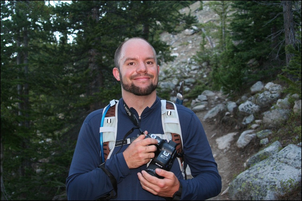
For this trip, I decided to pack quite a lot of camera gear (by the way, these are affiliate links and using them helps me pay for this site and to bring you better content):
I found the trail going up to the Three Apostles to be very straight-forward. I followed the decent trail beta from Gerry Roach's High Thirteener Guidebook. I was still using the 1st edition of the book, which I'm told has some route errors for this mountain; however, his new edition is available on Amazon after many years of waiting - rejoice!

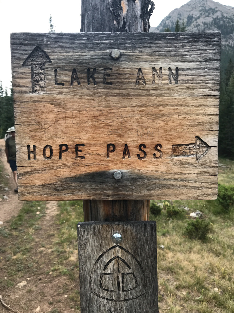
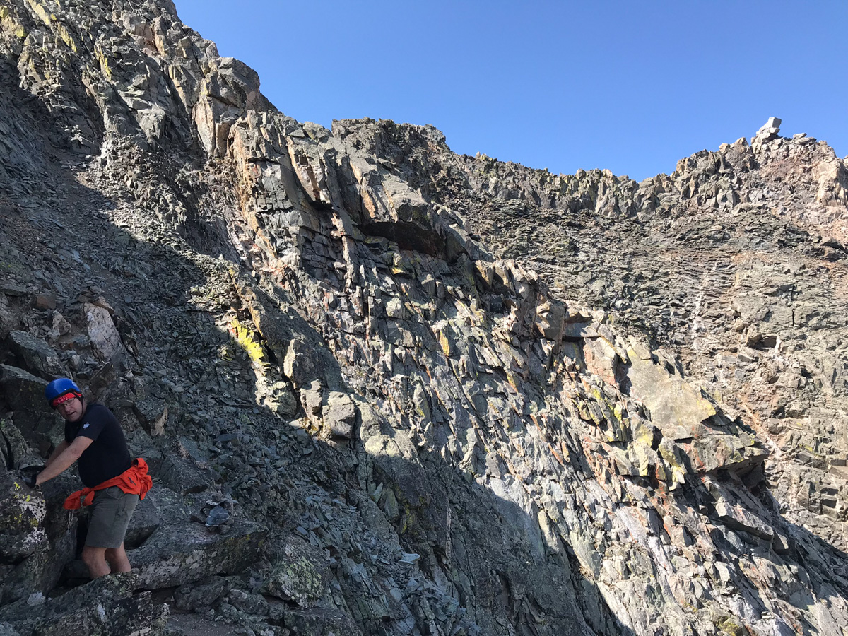
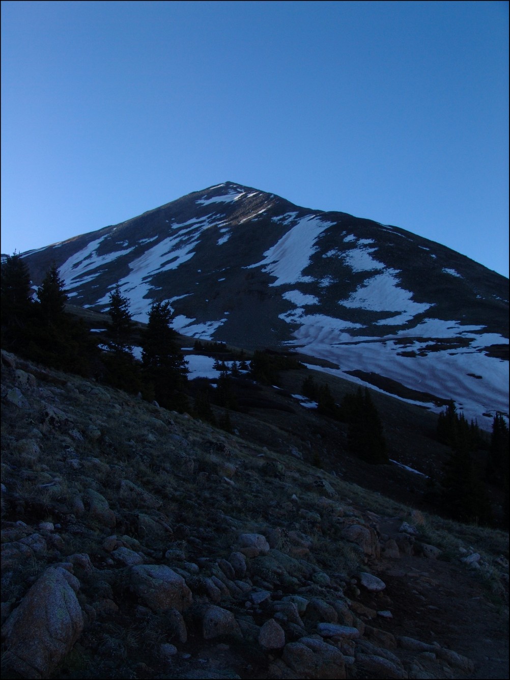
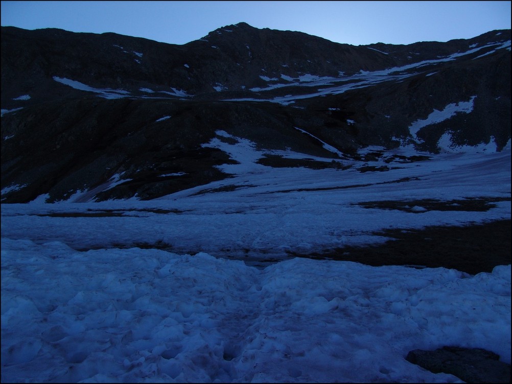
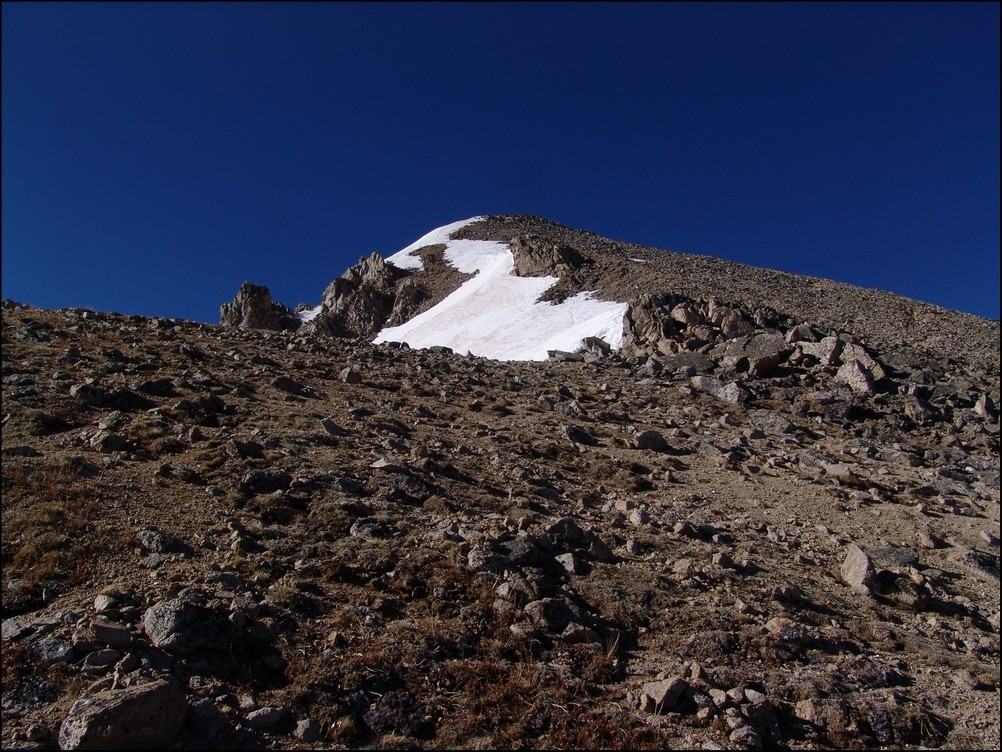
The trail follows the same trail as Huron for a while; however, there are several branches off of the trail to keep note of. Generally, you keep going straight. There are two signs before you are officially on the Trails Illustrated Apostles Trail 1445. I took a picture of one of them on the way down as seen below. I especially enjoyed seeing someone pencil in that if you were at this particular sign, and were climbing Huron, you had gone too far. That's how you know you're on the right trail for the Three Apostles. Having departed my vehicle at around 4 AM in the dark under a full moon, I had optimistically hoped to shoot sunrise from the summit of North Apostle (or nearby). Due to having almost no sleep, this proved impossible. Once I hit treeline, I found my pace slowed significantly.
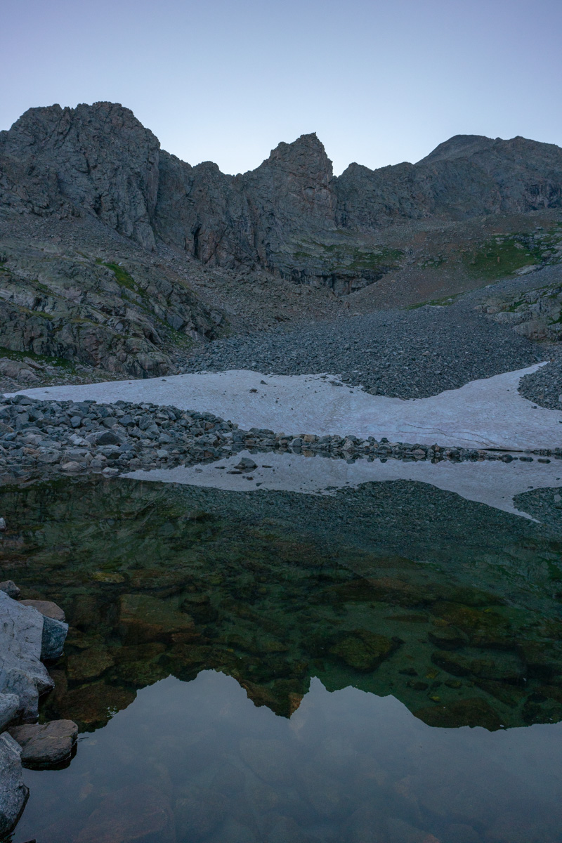
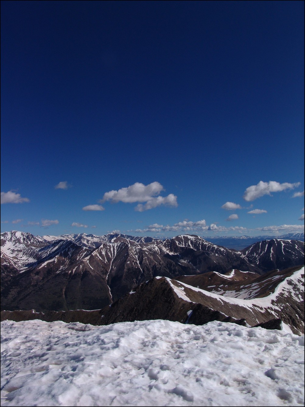
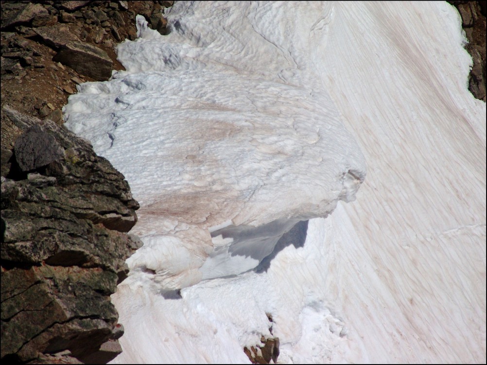
I reached treeline at about 5:30 AM and the scene really opened up above me. You could make out the Three Apostles easily. It was at this point I realized I was not going to be able to shoot sunrise from the top. Oh well, there were not any clouds anyways, so it would have been a boring image. Having followed the Roach route description as opposed to the 14ers.com route description, I was aiming for a high lake below West Apostle and Ice Mountain. I figured that would be a fantastic spot to get some sunrise shots as well. The trail petered out after treeline and so I was forced to bushwhack through some willows which were quite wet still. Huge mistake again. Have I ever said how much I hate willows? After reaching the end of the willows, I followed the weakness in the drainage east towards a huge cliff band below North Apostle. From the end of there, I followed a steep dirt and rock slope south towards the base of the lake described by Roach. On my Gaia track you can see my ascent as the most southerly part of the route as opposed to my descent which was a little north of the lake.
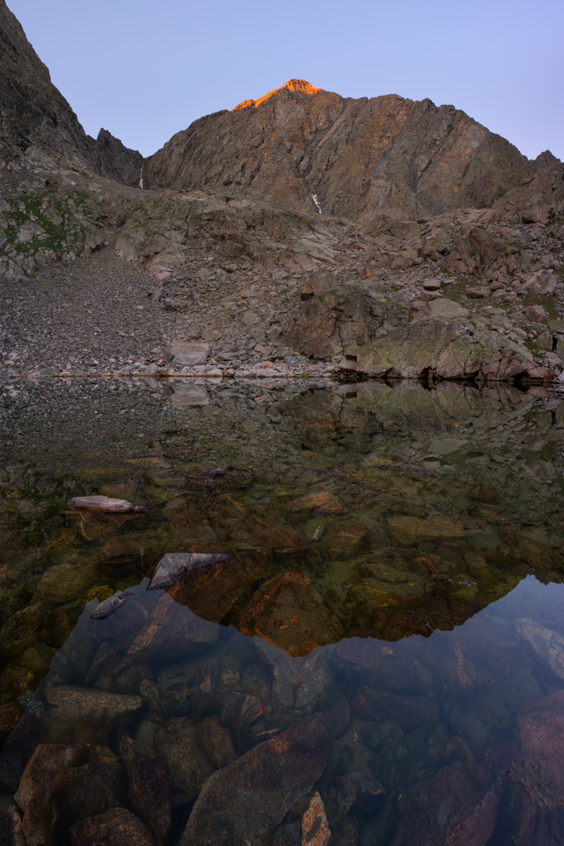
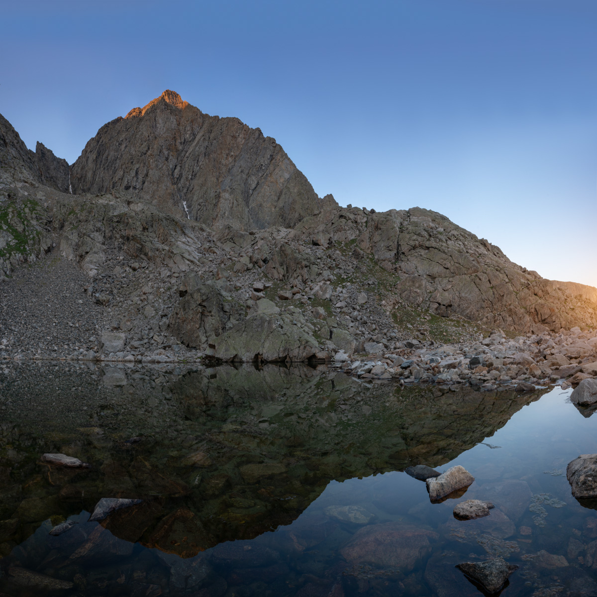
Above the dirt and rock slope, I found myself in a strange spot. There was a huge rocky and cliffy section between me and the lake. I could try to go around to the south or cut across the rock face for some fun scrambling. I chose the latter and it was fun. I would not recommend this section if it were wet; however, it was fun to navigate and climb on. It was easy class 3 / hard class 2. A good warm-up for Ice Mountain for sure! Having reached the lake, I looked for some spots to take shots at sunrise. There were not a ton of options or time, so I found myself looking north towards La Plata and Huron.
The early light kissed the tip of West Apostle above the small lake and made for a very fun scene to shoot with the Loxia 21 lens. I was wishing for a wider lens for sure, but nothing a two-row panorama stitch could not overcome. The waters were crystal clear and quite still.
I spent some time enjoying the lake and snacking to regain some strength. I was really feeling the fatigue from the lack of sleep and was hopeful that food and water would help.
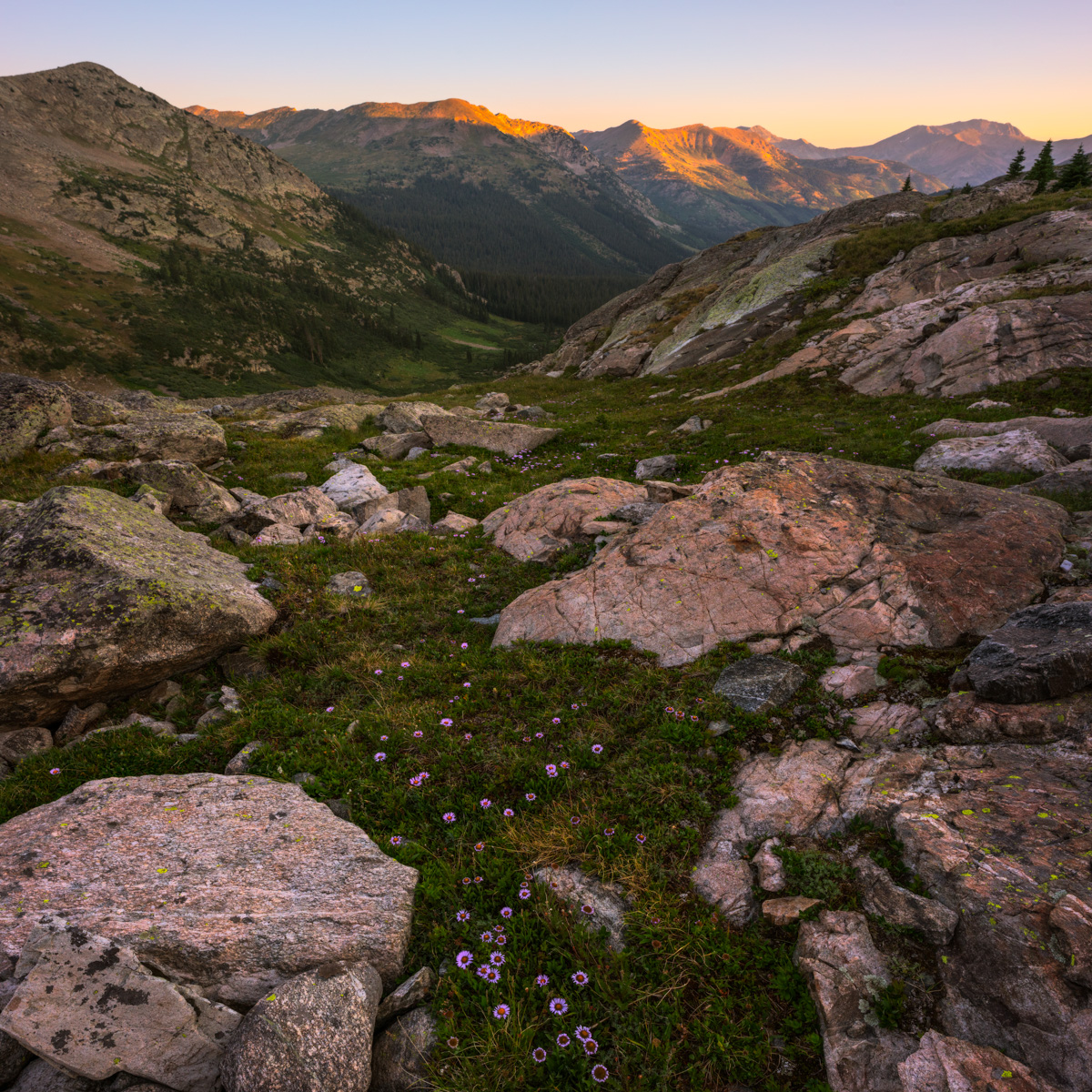
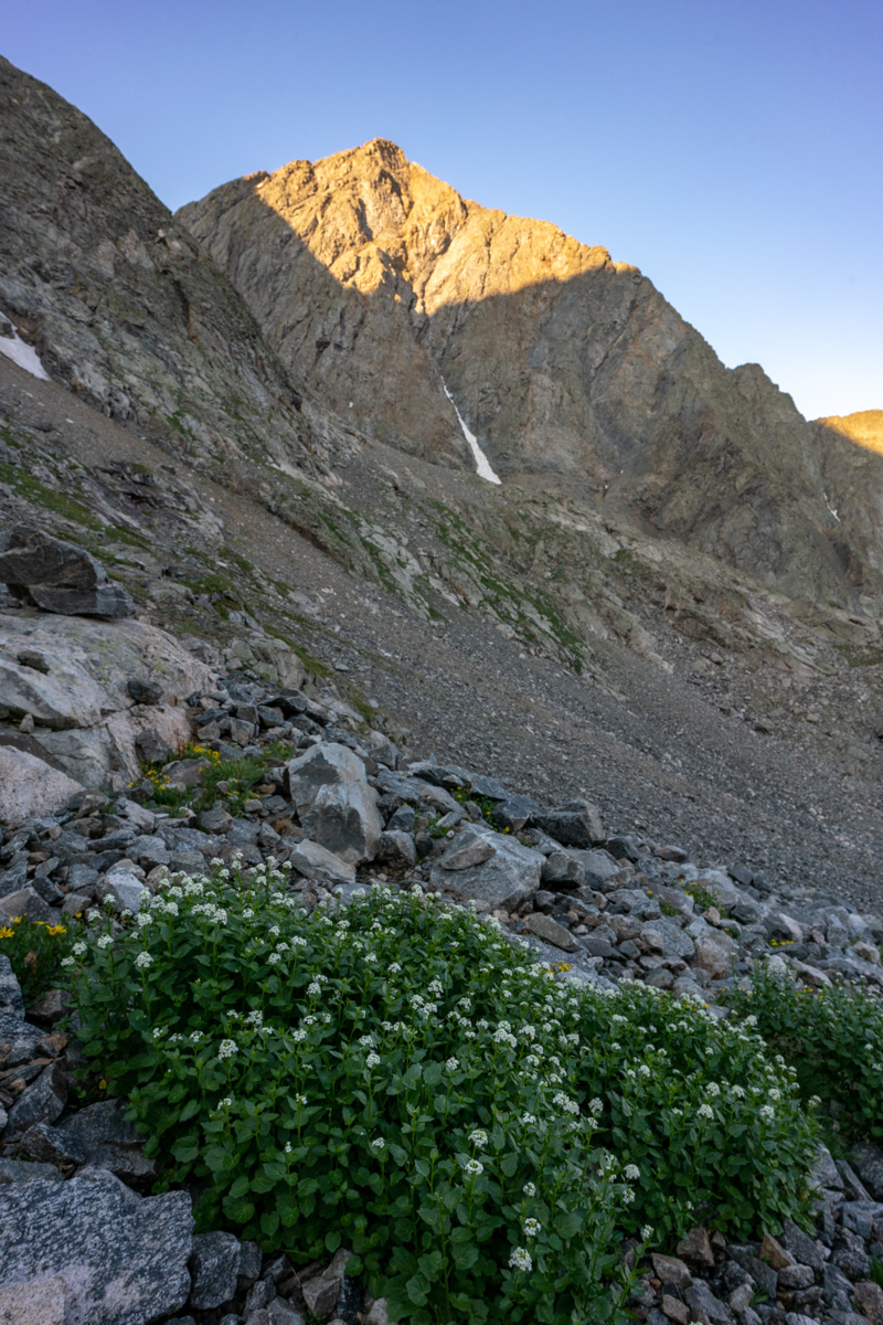
The light over on La Plata was pretty great too - accentuated by some pretty purple flowers on the ground between the huge boulders that were strewn about below the Three Apostles.
I wanted to take one final shot before leaving the lake and found a nice reflection of the lower sections of North Apostle, which were these awesome cliff bands and spires. Good stuff.
The path up from the lake seemed to be pretty straightforward. I just followed the grassy and rocky slope up near the creek coming down from snow-melt. The slope contoured up towards the base of North Apostle. It seemed that there were two ways to go - through a notch in some rocks next to the south wall of North Apostle or around the notch and around. I chose the notch.
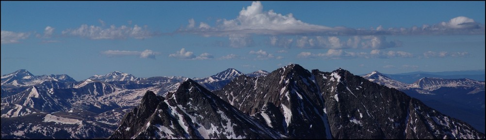
West Apostle in early light
As I climbed up, I stopped to admire the running water under the boulder field. There's something about that experience that always brings a smile to my face. Sometimes the most simple things in nature are the most relaxing and impressive.
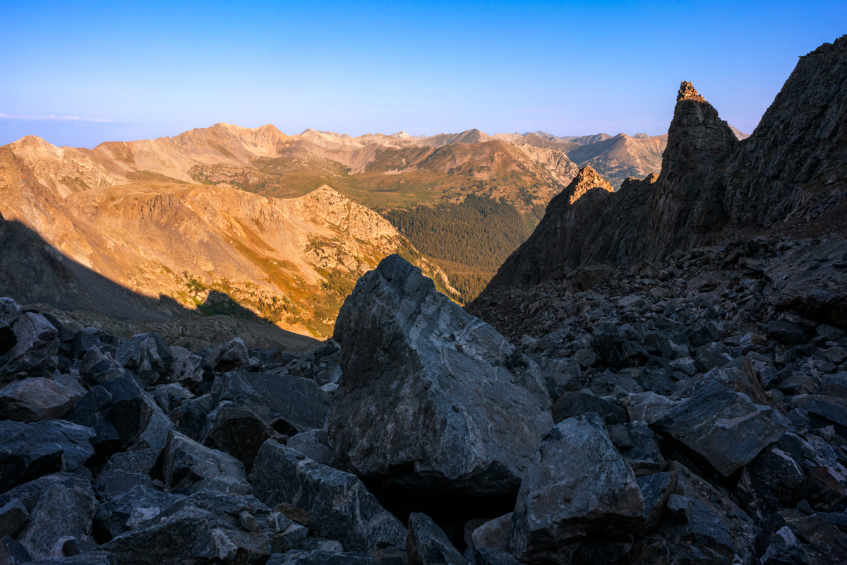
I continued up towards the notch below North Apostle and looked back to admire the early morning light that was shining on Harrison Flats to the west. The whole area just looks amazing from here.
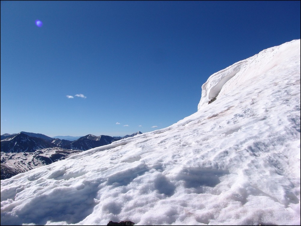
As I climbed, there was a lot of rock fall happening on Ice Mountain, caused by mountain goats, likely disturbed by me and my huffing and puffing. I call them jerks in the video, but I'm joking. It should be noted that these goats could pose a huge safety concern for anyone doing the snow climb route of Ice Mountain, so beware!
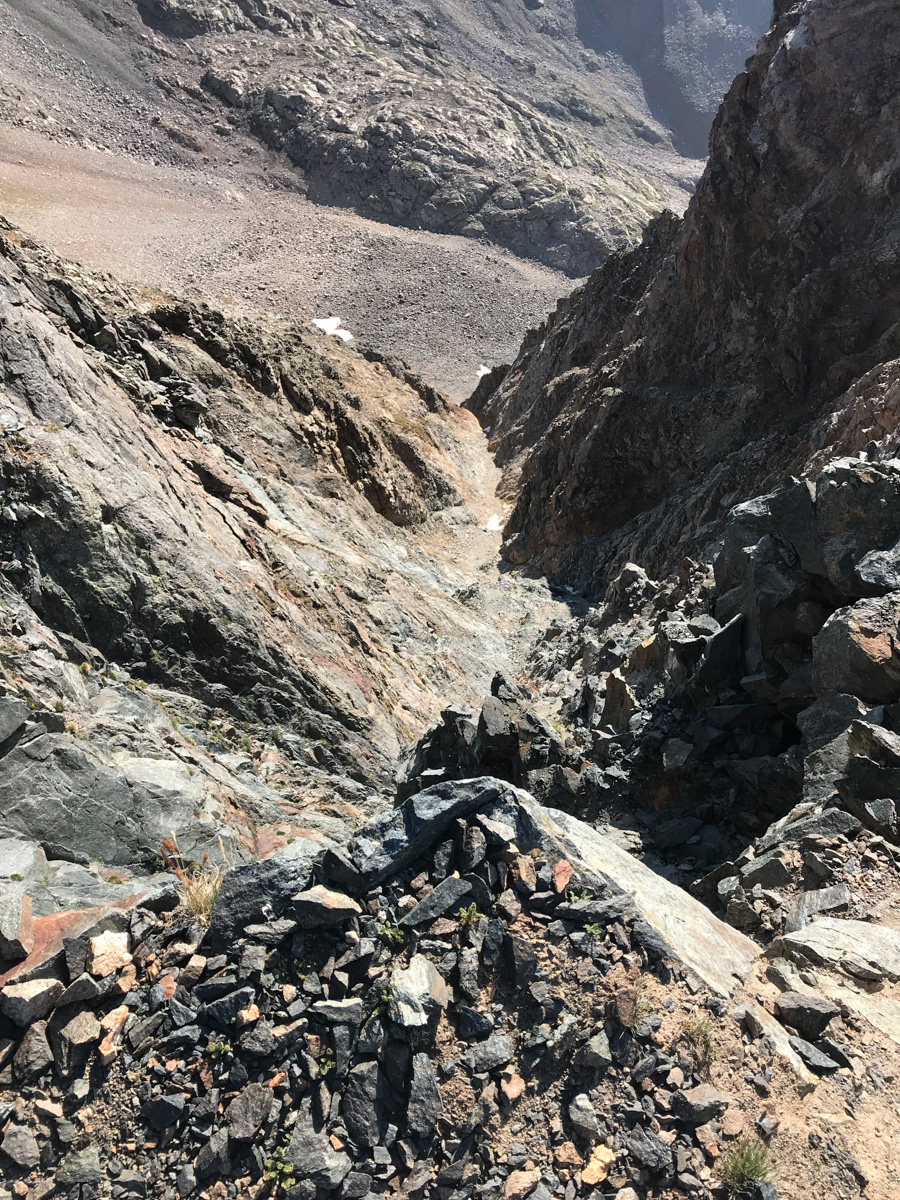
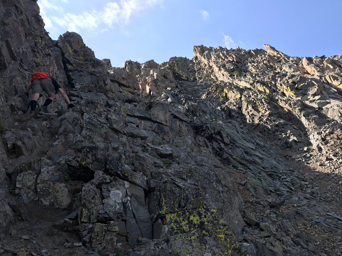
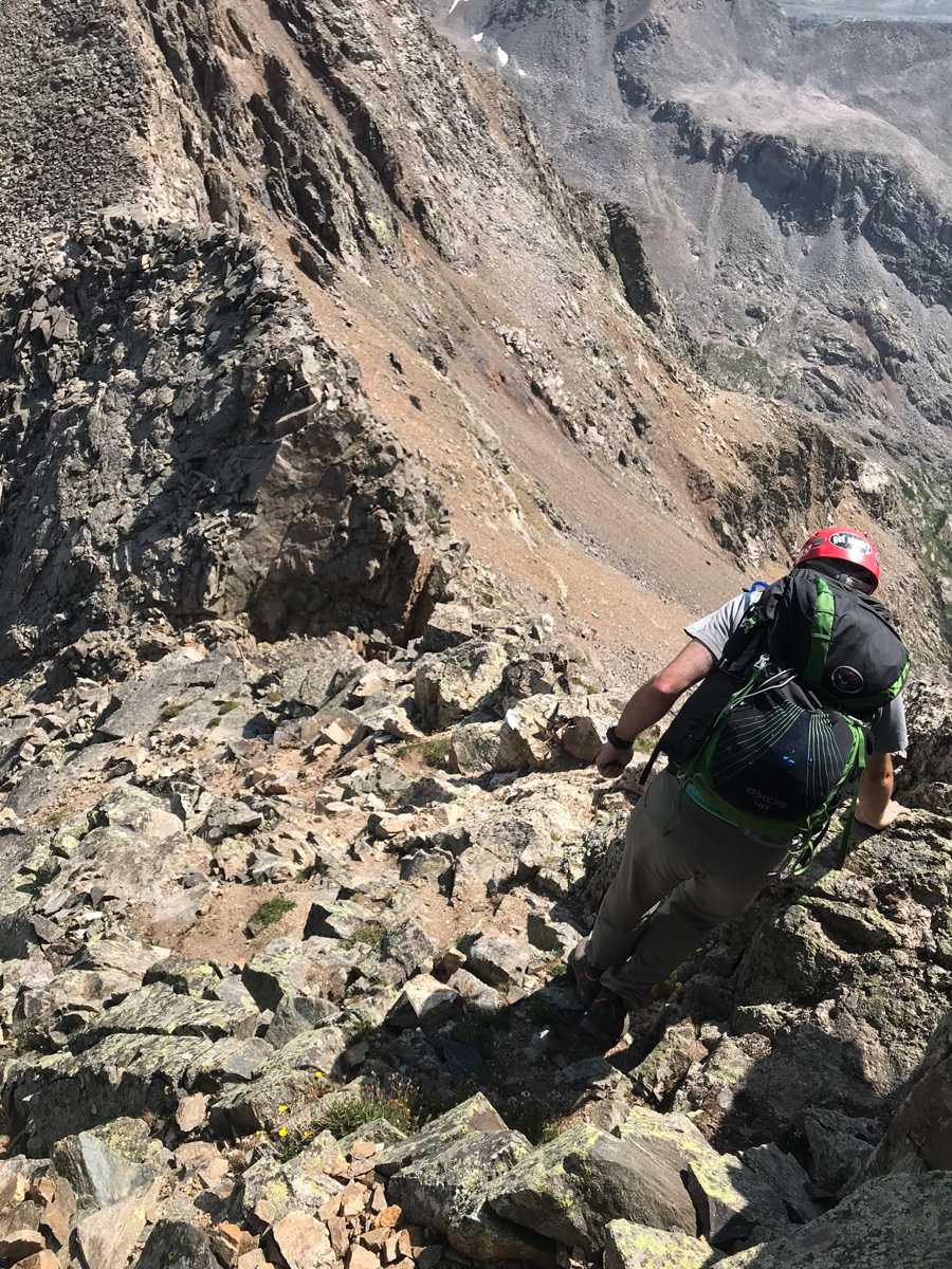
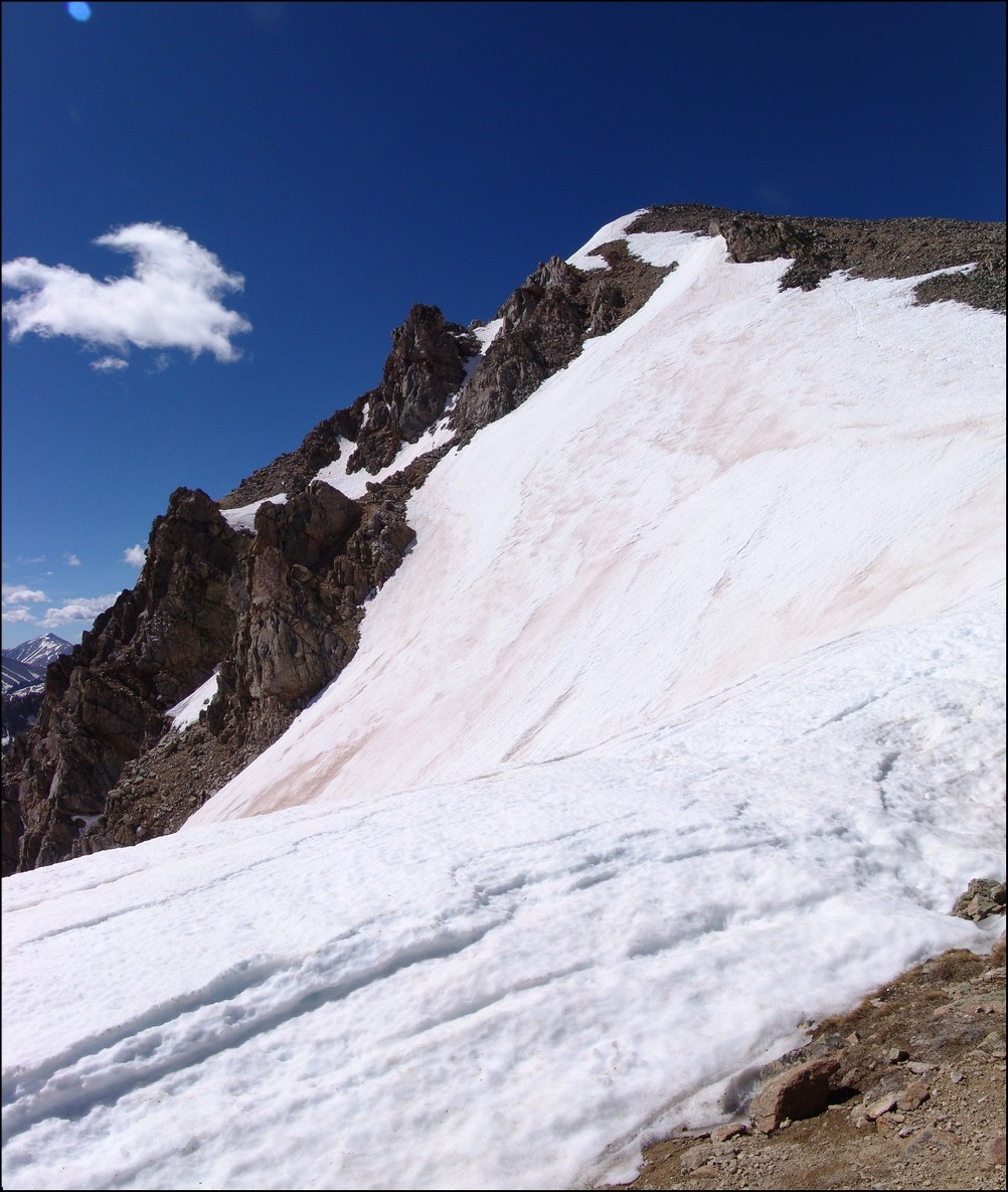
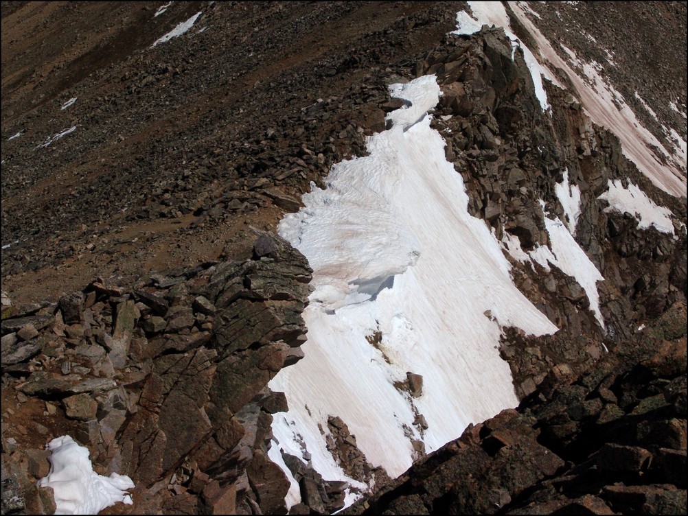
The rocks above the notch and below the North Apostle / Ice Mountain saddle were absolutely horrific. They were huge boulders, many of which were loose, on steep terrain. Special caution should be taken while climbing to the saddle.
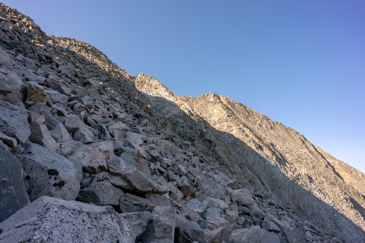
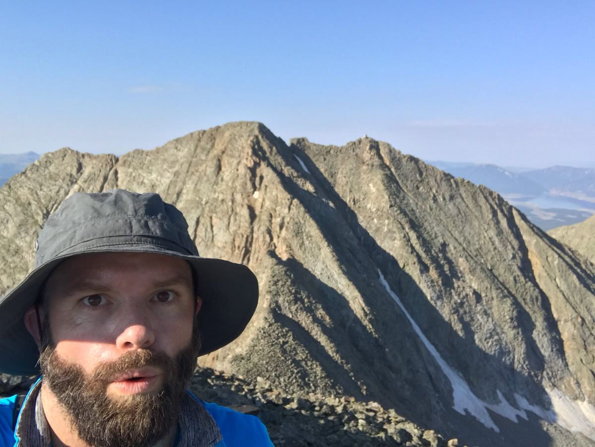
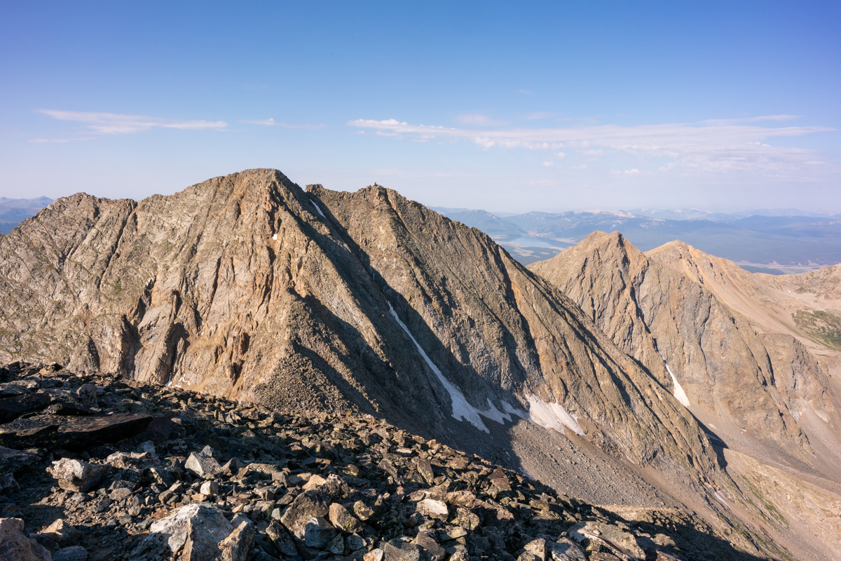
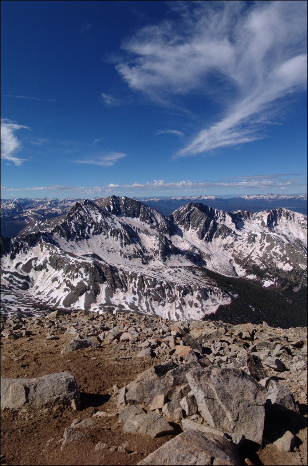
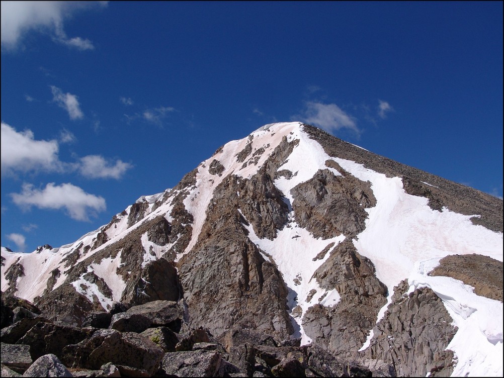
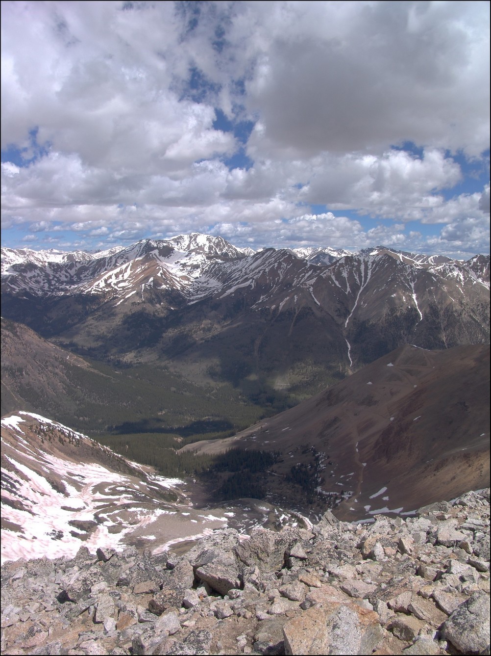
Upon reaching the saddle, a good view of Ice Mountain avails itself and caused me to take pause. It looked really gnarly from this vantage point. Paired with my exhaustion, this view was pretty demoralizing. I was not sure I was going to be able to finish Ice Mountain on this trip. I kept climbing up to North Apostle.
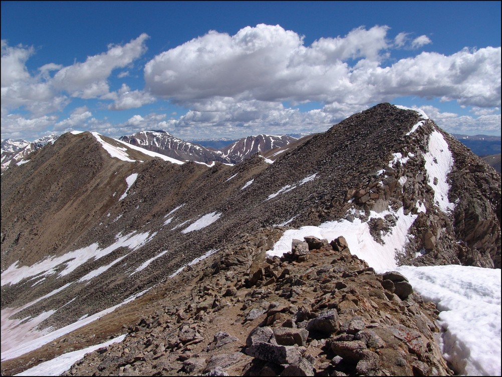
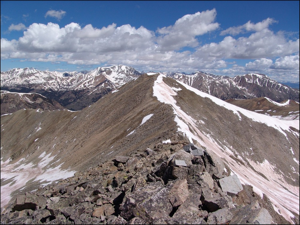
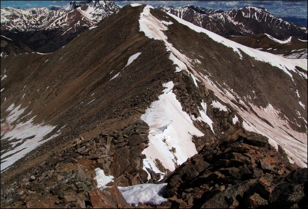
The route from the saddle to the top of North Apostle was quite simple and pretty fun, all things being equal. The east face of North Apostle was pretty intense to look down on. I would hate to take a fall here.
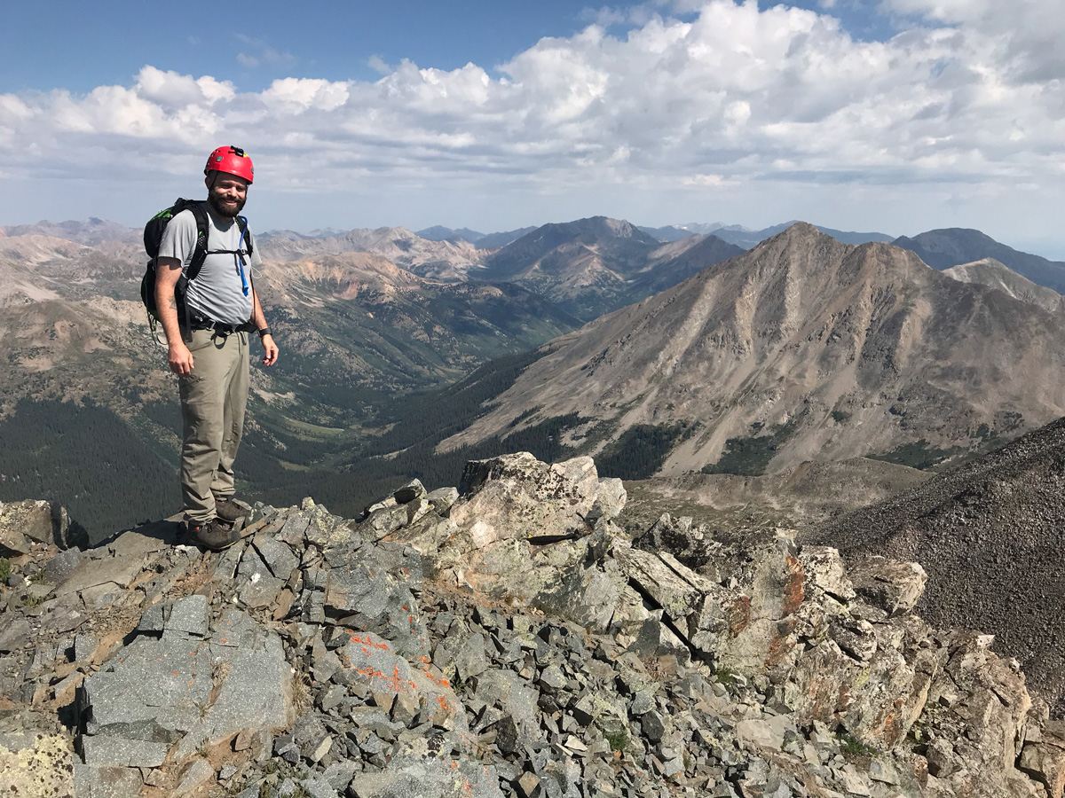
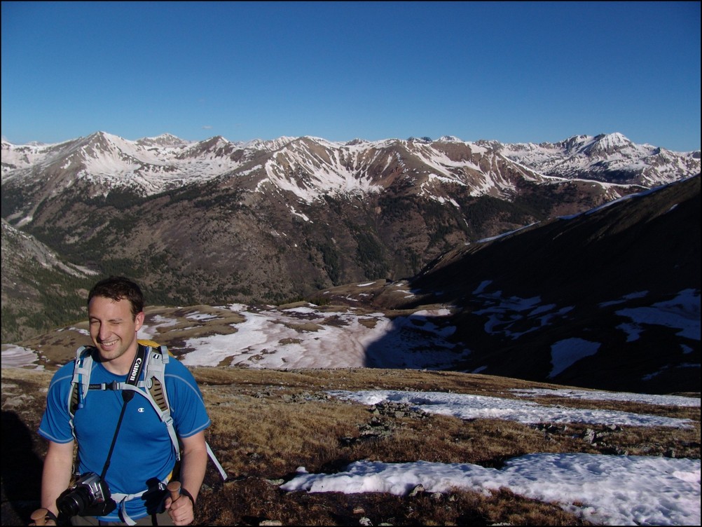
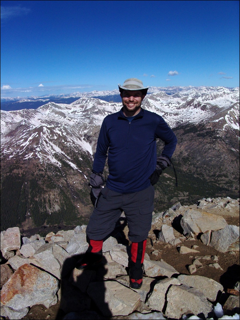
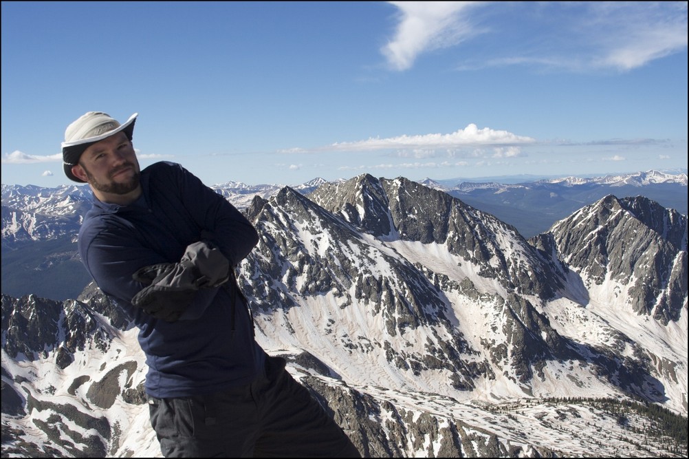
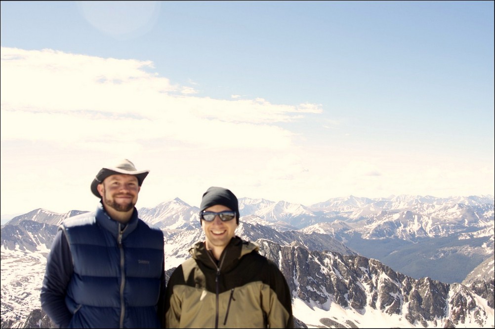
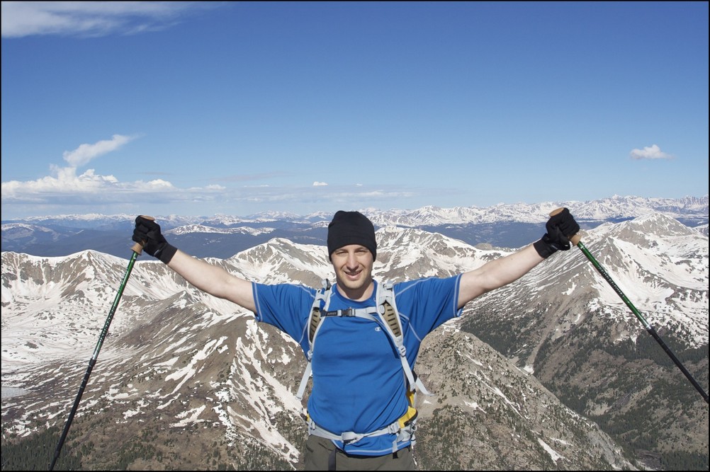
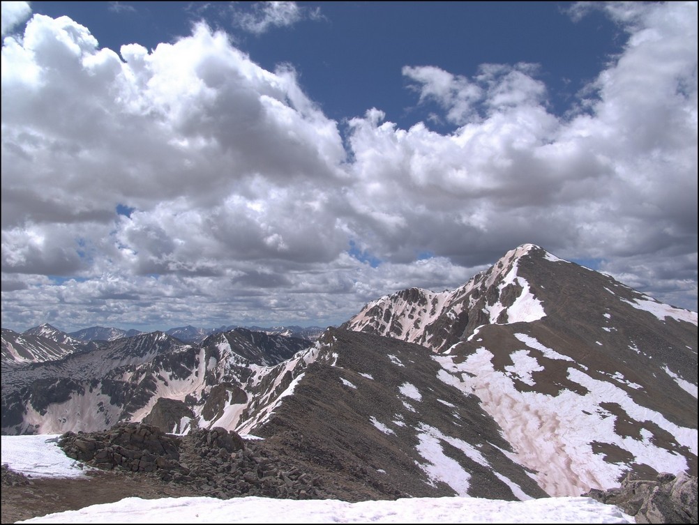
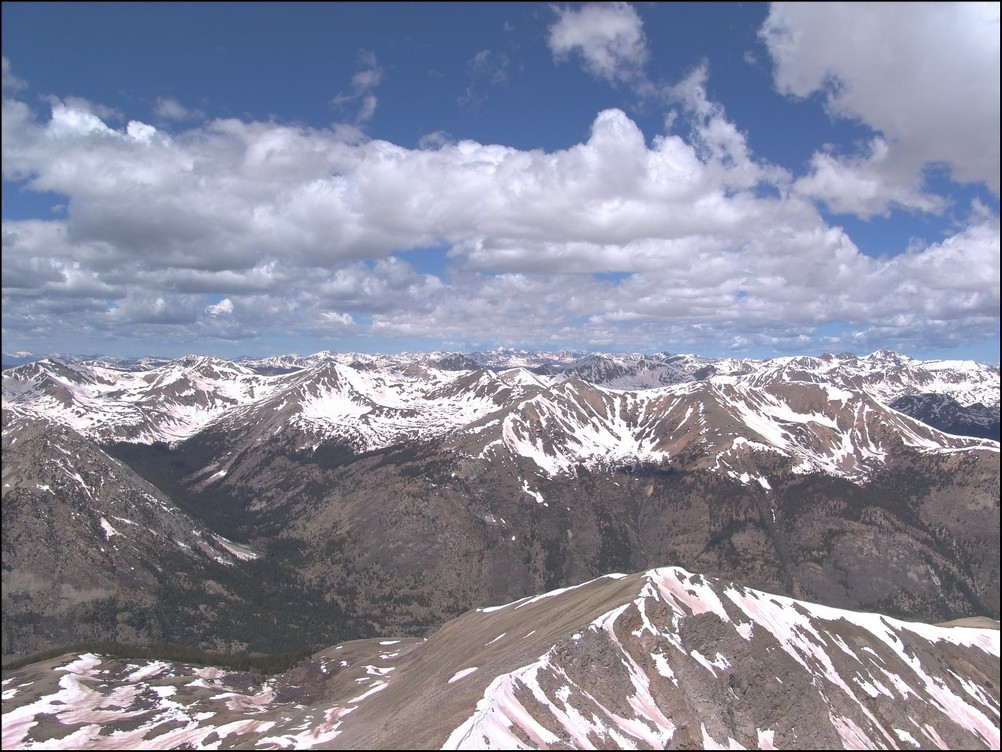
I reached the summit of North Apostle at 8:30 AM and was really tired. The views though - they were amazing. Huron was quite impressive from this vantage point.
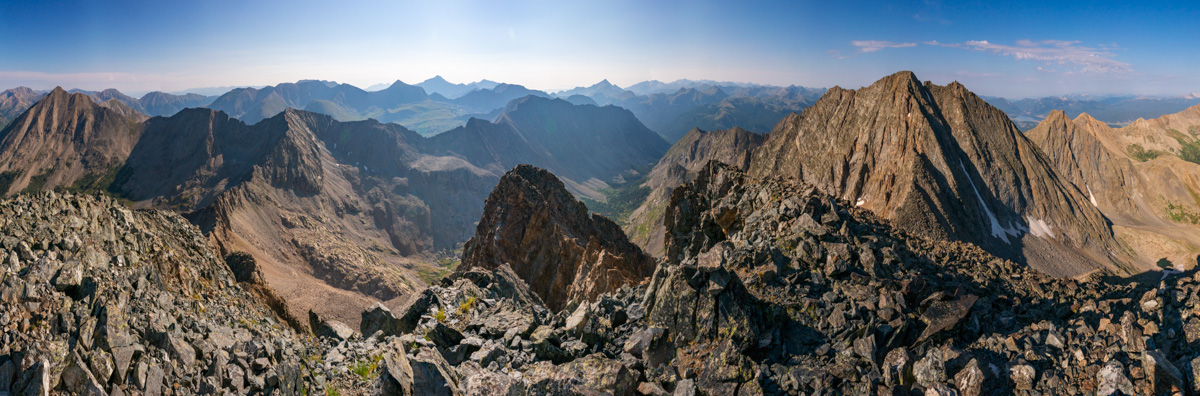
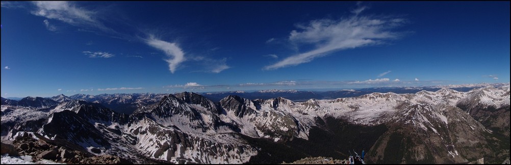
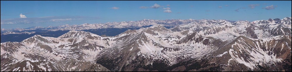
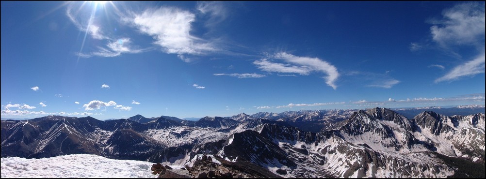
I let my friends and family know I was safe on top of North Apostle and took a panorama with my wide angle lens. Huron at far left, Ice Mountain at far right. Lots and lots of 14ers in between.
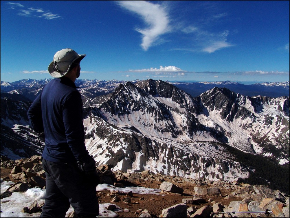
Huron and La Plata looked really fantastic from North Apostle, and I wanted to make sure I showcased Huron in at least one shot, with the huge valley below it.
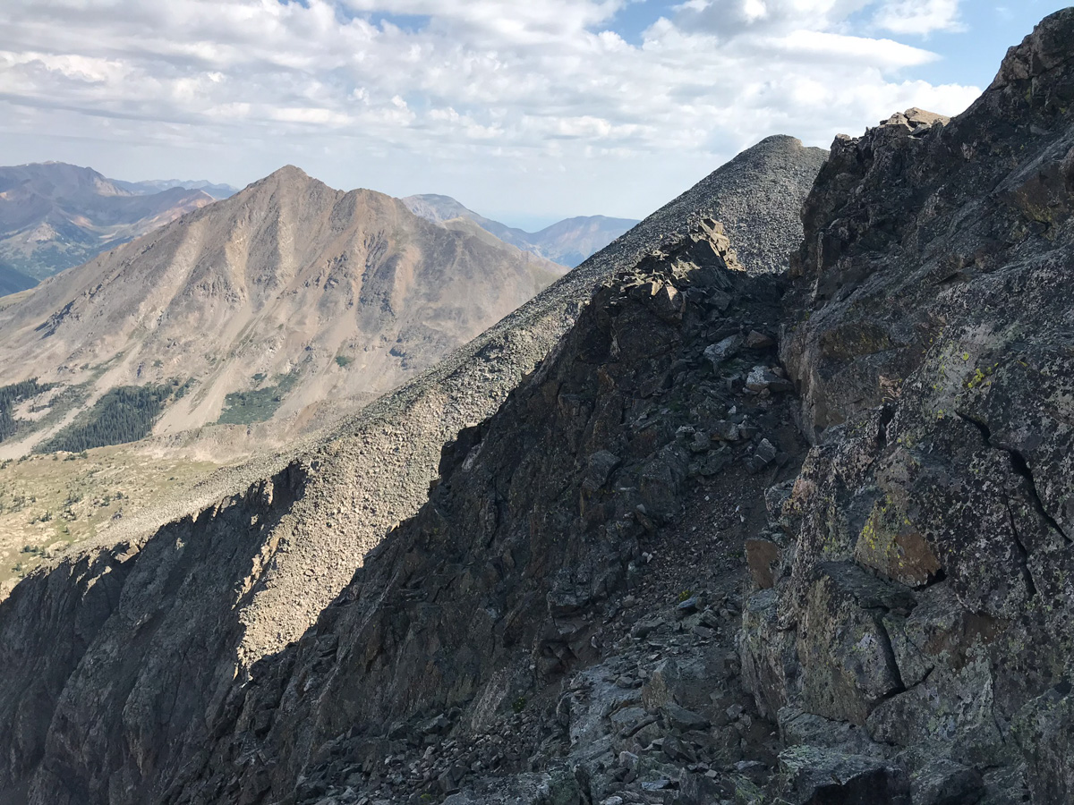
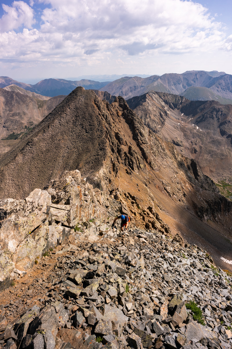
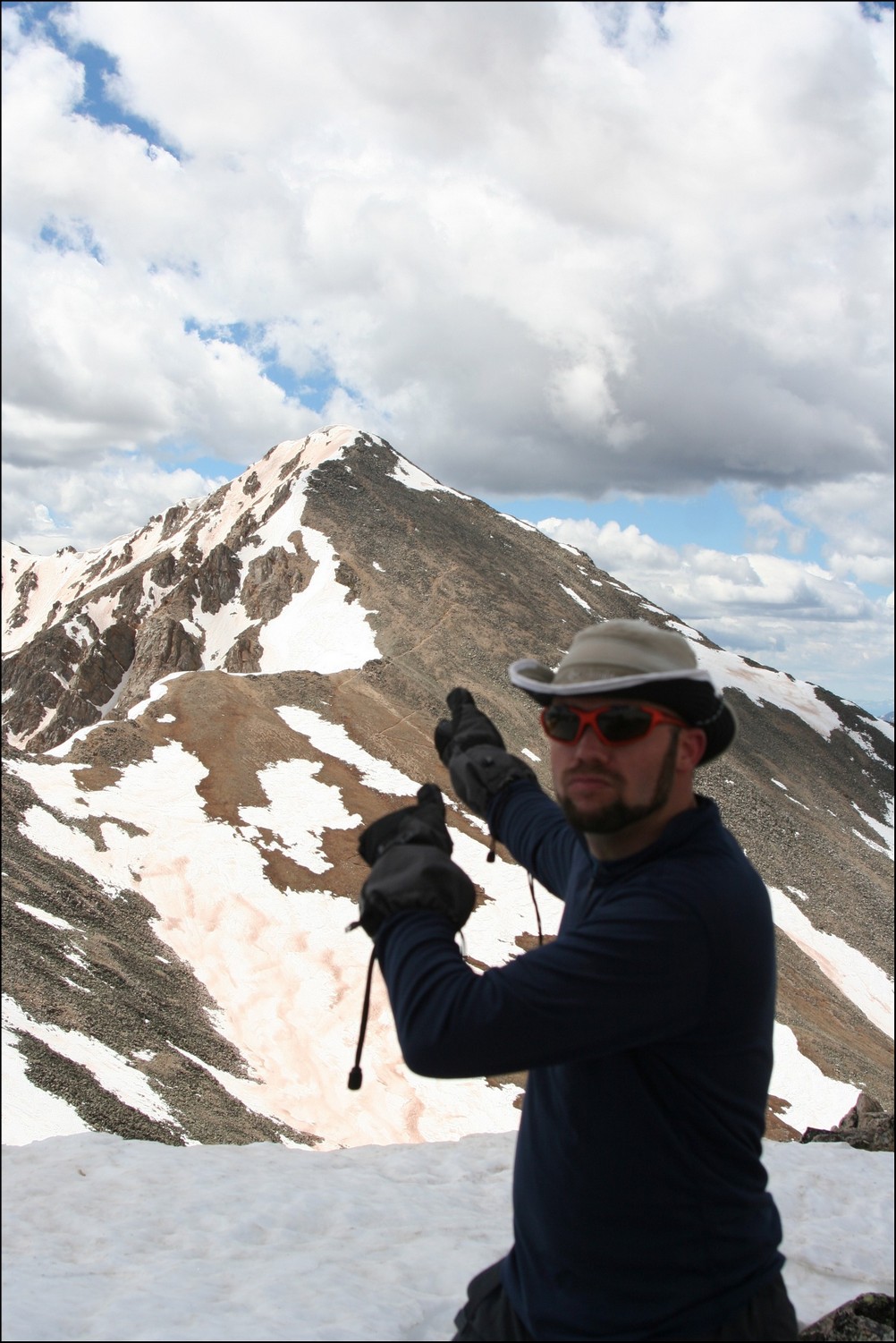
I head back down towards the saddle, eyeing Ice Mountain's impressive and dangerous stature the whole time. I was one part excited and one part nervous. The route looked really intense from this spot; however, mountains always look harder than they are...
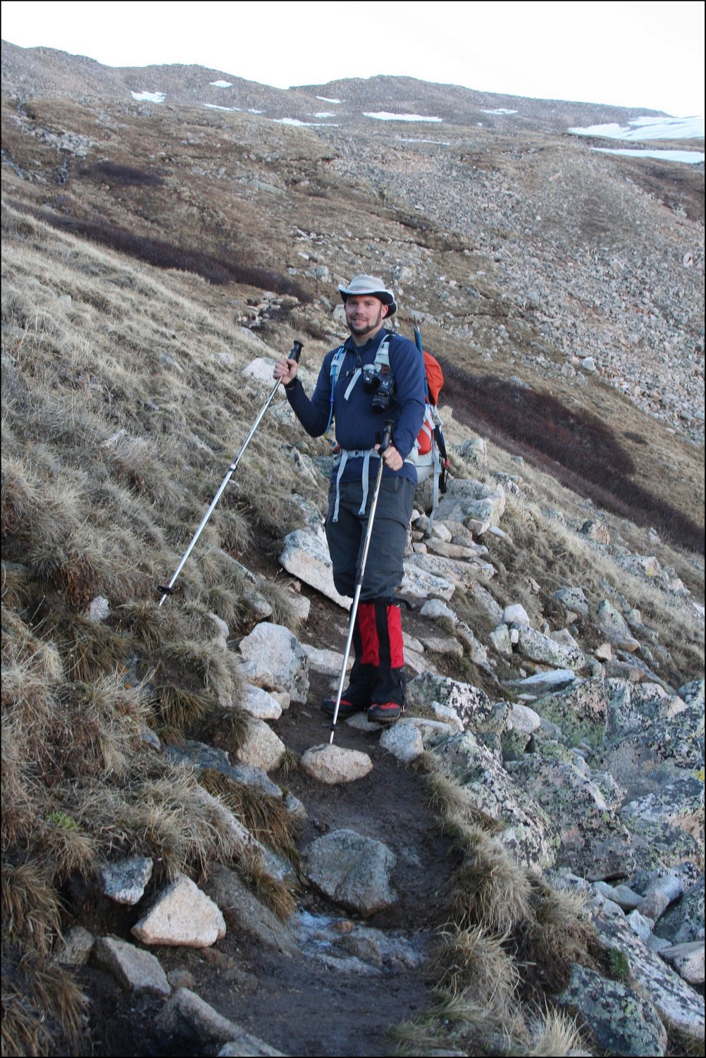
About halfway down the saddle, I ran into a gentleman named Dempsey Andrews from Denver. He asked if I was planning on doing Ice Mountain and I said that I was. He offered to allow me to join his group - himself and two other gentlemen that were waiting for him on the saddle - Kyle and Jerry. I was excited to run into a group that was also doing Ice Mountain and said I would join them, absolutely! Jerry planned on hanging out on the saddle so it was just Kyle, Dempsey, and I for the ascent of Ice Mountain. They were great climbing partners. Dempsey is an English as a Second Language teacher and Kyle is a financial advisor. Dempsey used to do high alpine rescue and so I felt like we were in good hands for the climb. Fortunately, Dempsey had downloaded the route description from 14ers.com which was very clear to follow compared to the one I found in the 1st edition of Gerry Roach's book. Dempsey lead us up, following cairns the whole way. It was surprisingly excellent rock and a ton of fun.
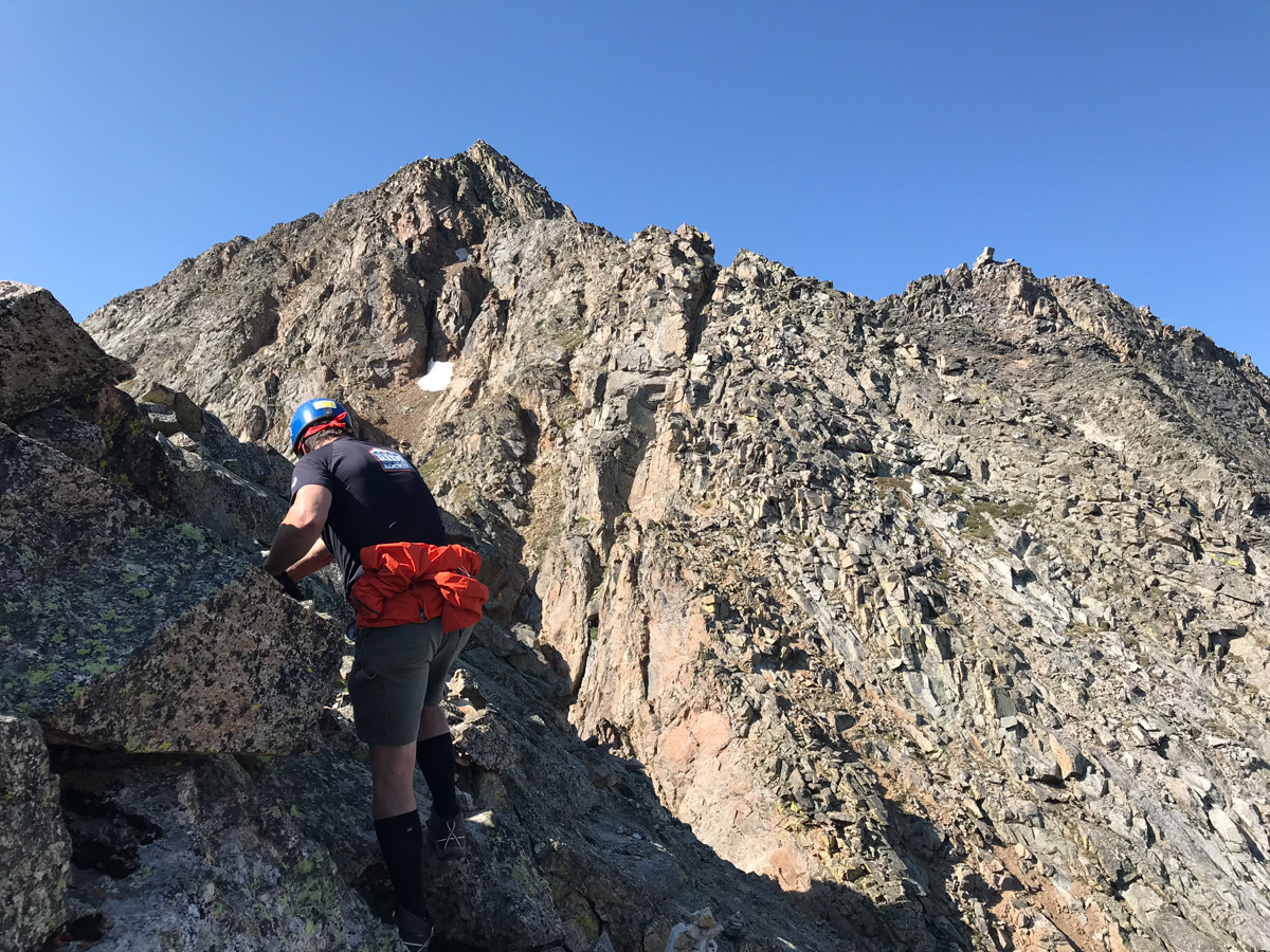
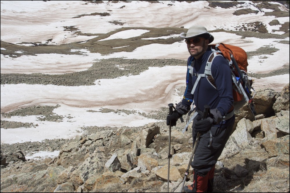
I found myself taking the rear most of the way up and as you can see above, care was needed to plot our route on loose rocks and boulders. We mostly followed the ridge and then found a nice set of gulleys to climb up towards the end.
The final section of the route before the summit was very difficult class 3 / easy class 4 and reminded me of the Wilsons in the San Juans. There were good foot and hand-holds to be found, but each needed to be tested for stability. We kept our distance between climbers and played it safe.
All in all I really enjoyed Ice Mountain's route here. It was pretty easy to follow and offered up numeous challenges that were fun to tackle.
Kyle ascends the final pitch of Ice Mountain
We reached the summit at 10:00 AM and enjoyed the views. It looked like the weather would hold up for us to get down safely, but we knew that the clouds appeared to be forming some of their awesome lightning jam.
I got a cool shot of Kyle on the very final section before the summit - what a mountain! We enjoyed the summit views, called loved ones, and head out. It was a short stay. The downclimb for the 1st section was facing in and quite slow.
As long as you take your time on the downclimb, it should not be too bad. It is very steep and loose though, so great care should be taken on each step.
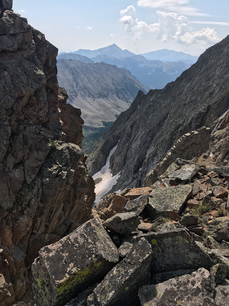
As you can see above, the terrain is nasty but really awesome to be in. These are the types of peaks I long for each year. Ice Mountain does not disappoint if you seek exposure and a challenge. We did encounter a small amount of rain above treeline on our way down and some lightning was starting to strike nearby; however, we were able to avoid the storm for the most part. We took a blend of my route up and their route up for our path down and I found it to be very solid - we stayed high and went into the trees southeast of the willows and avoided the willows altogether. Finding the trail again was easy with Gaia GPS and the hike out from here was completely uneventful.
Huron Peak and Browns Peak - a Sawatch Throwdown!
Interesting statistics:
Start time: 5:30 AM
Summit time (Huron): 9 AM
Summit time (Browns): 11 AM
Finish time: 1:20 PM
Mileage up: 3.6
Mileage down: 4.2
Total mileage: 7.8
Huron Peak Elevation: 14,003 ft.
Browns Peak Elevation: 13,523 ft.
Total elevation gain: 3,900 ft.
Total photos taken: 219
GPS map of our route (ascent in red, descent in blue):

This trip report begins with an interesting back story. I had a new member join my site in May from South Dakota. This member eventually messaged me on Facebook and asked if he could join me on some of my climbs this year. After learning about my plans to attempt Huron that very weekend, he decided to join me. Mike Vetter drove all the way down from Sioux Falls, South Dakota on Saturday, June 5th to climb with me. Mike is the CEO of DataSync - a successful start-up software company. Our route to reach the trail-head was very simple: we drove west on Highway 24 to Buena Vista and turned left on Chaffee County Road 390 heading west. After driving about 14 miles on a dirt road, we turned left at the old mining town of Winfield and continued west another 2 miles to our campsite near the trail-head. We left my house at about 6:30 PM and reached our campsite near the Huron trail-head at approximately 10 PM.
On the way to Buena Vista, we were able to get some great views of the sun setting over the Northern Sangre de Cristo Mountain range:
We set-up our tents in the dark and set our alarms for 4 AM and hit the sack. A few cars drove past during the night, presumably looking for camp spots. Fortunately, the vehicles did not disturb my sleep too badly and I was able to get some quality rest. The alarm sounded at 4 AM and I hurried to get dressed and tear down my tent. As we were getting camp taken down, a skiier passed us, informing us that he was going to ski down Ice Mountain. I'm pretty sure this person was "benners" from 14ers.com. We were able to quickly break down our campsite and cook some oatmeal for breakfast before debarking for Huron's trail-head at 5:30 AM.
Mike and I were able to make quick work up to the trail-head and soon there-after, the sun broke through to light up the tips of the surrounding peaks in Silver Basin, including Virginia Peak and Granite Mountain:

Silver Basin illuminates a small lake

A closer look at the sunrise

Virginia Peak (right of center)
Virginia Peak
Sunrise hitting Granite Mountain

Sunrise hits Granite Mountain and Virginia Peak
Mike and I were energized by the great views of the valley across from us and made excellent time up the steep trail. Mike kept up with me as we blazed the trail. He did amazing considering he lives at 1,442 ft. and was not acclimated to the high elevation of Colorado yet.
<p
Mike Vetter proves he's got what it takes to climb mountains in Colorado
Matt Payne (author) hiking up Huron
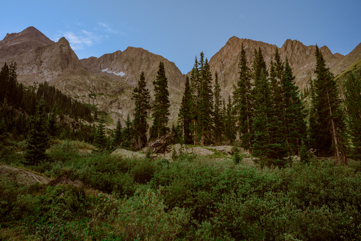
An hour and 15 minutes after we started hiking from our camp, the first view of the Three Apostles came into view. The Three Apostles are a group of 13ers located up the valley from Huron, and contain two of the highest 100 in Colorado, Ice Mountain (13,951 ft.) and North Apostle (13,860 ft.). West Apostle is also respectable at 13,568 ft.

The Three Apostles come into view for the first time
Soon thereafter, one of our objectives for the day came into view as well: Huron. Huron appeared above us like a giant pyramid, as if it were guarding some ancient treasure within its rocky shell.

Huron Peak comes into view for the first time

The moon sits over Huron Peak
Huron Peak in the early light

Huron, the Three Apostles, and Granite Mountain greet the rising sun
Now that we could see the beginnings of the amazing views, Mike became more and more awestruck by the Colorado Rockies. It was a real pleasure hiking with someone that shared the same level of appreciation for Colorado's awesome peaks. Mike and I exchanged photos of each other.
Mike Vetter looking excited in front of the Three Apostles
Matt Payne with the Three Apostles in the background
As we gained more elevation, views across the valley were getting even better. I noticed a long waterfall snaking down the side of Granite Mountain and decided that I wanted to try to capture a zoomed-in view of that waterfall. I took about 10 photos of the side of the mountain at 200mm and combined them into this photo:

Snow forms a waterfall down the side of Granite Mountain
I also wanted to get a zoomed in shot of the Three Apostles using the same method. Here are the results (click on the photo to see the super-hi-res version):

The Three Apostles in high detail
We continued to climb past treeline and up to Huron's base. I took some opportunities to take multiple photos of the views and stitched some photos together for a panoramic view.

Looking South and West, Huron casts a shadow over Granite Mountain
We quickly made our way up into the basin below Huron and were greeted by a giant snowfield. Normally, I welcome the sight of snow; however, the snow we encountered was very soft, with marshy streams and pools of water beneath. It was very much like crossing a field filled with 7-11 Slushies.
We made it through the slush and continued up the basin beneath Huron. The terrain was solid and only mildly wet from snowmelt. At this point, the sun had crested Browns Peak and began to heat the surrounding area.
Mike Vetter squinting into the sun on our approach of Huron
We continued to climb up towards Huron, following the trail through and around large snow fields. At this point, it was clear that snowshoes or other assistive devices would be fairly useless and I was glad I brought neither. As we gained elevation, the views of Browns Peak as well as the Elk Mountains began to get better and better.
Browns Peak sits to the North of Huron Peak
We made really great time up Huron, despite its relative steepness and other aforementioned challenges (did I mention Mike lives 13,000 ft. lower than Huron). Huron's summit block loomed over us, making us feel pretty small compared to this giant choss pile. The trail up this section of Huron was clearly maintained and the efforts of Colorado Fourteeners Initative to improve the trail were apparent.
Huron Peak's summit block
Matt Payne (author) hiking up Huron's Peak
We finally reached the ridge between Browns Peak and Huron Peak and were warmly welcomed by a giant cornice sitting at the top of the ridge.
A giant cornice on Huron's ridge
The final push to the top of Huron took exactly 10 more minutes. The views from Huron Peak were absolutely outstanding. Being somewhat more isolated than most of the other 14'ers in the Sawatch Range, Huron Peak offers excellent views of the rest of the Sawatch Range and the Elk Mountains as well. Mike and I were the first to summit that day, and spent an hour on top celebrating, eating, and taking large amounts of photographs.
Hero shot of Matt Payne on top of Huron Peak
Matt Payne gazes South towards the Three Apostles

360 Degree View from the top of Huron Peak (click for full resolution version)
A 180 Degree View from North to South from Hurons Peak. The Three Apostles at center.
Mount Hope (the flat topped mountain) rests right of center. La Plata Peak rests far left.
The Elk Mountains loom in the distance, covered in snow.This photo is zoomed in at 200mm. Pyramid Peak, Maroon Peak, Snowmass Mountain, and Capitol Peak can all be seen from this vantage. Click on the image for the super hi-resoltution version.
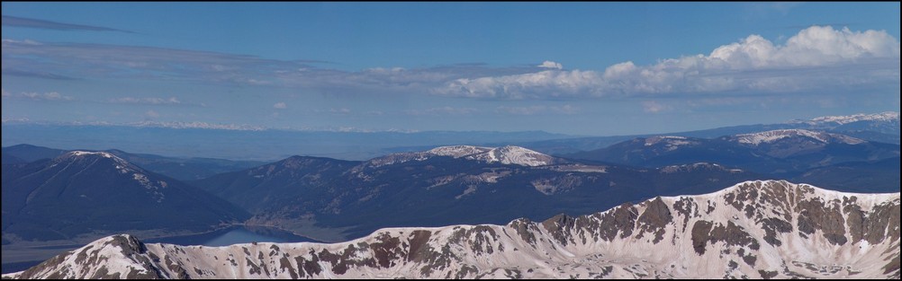
Taylor Reservoir can be seen in the distance, reflecting the surrounding mountains (click for full resolution version)
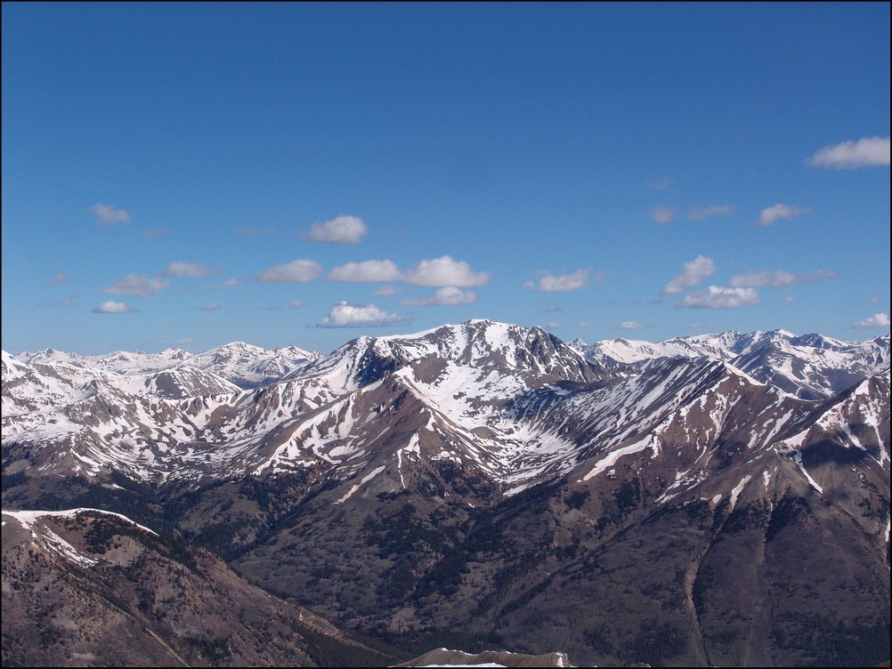
A closer look at the Sawatch Mountains south of Huron. Mount Antero, Mount Shavano, and Tabeguache Peak are all recognizable.
A zoomed in view of the Southern Sawatch mountains
Shavano and Tabeguache (high pointed peak and flat snowed peak respectively)
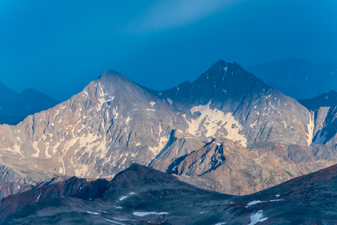
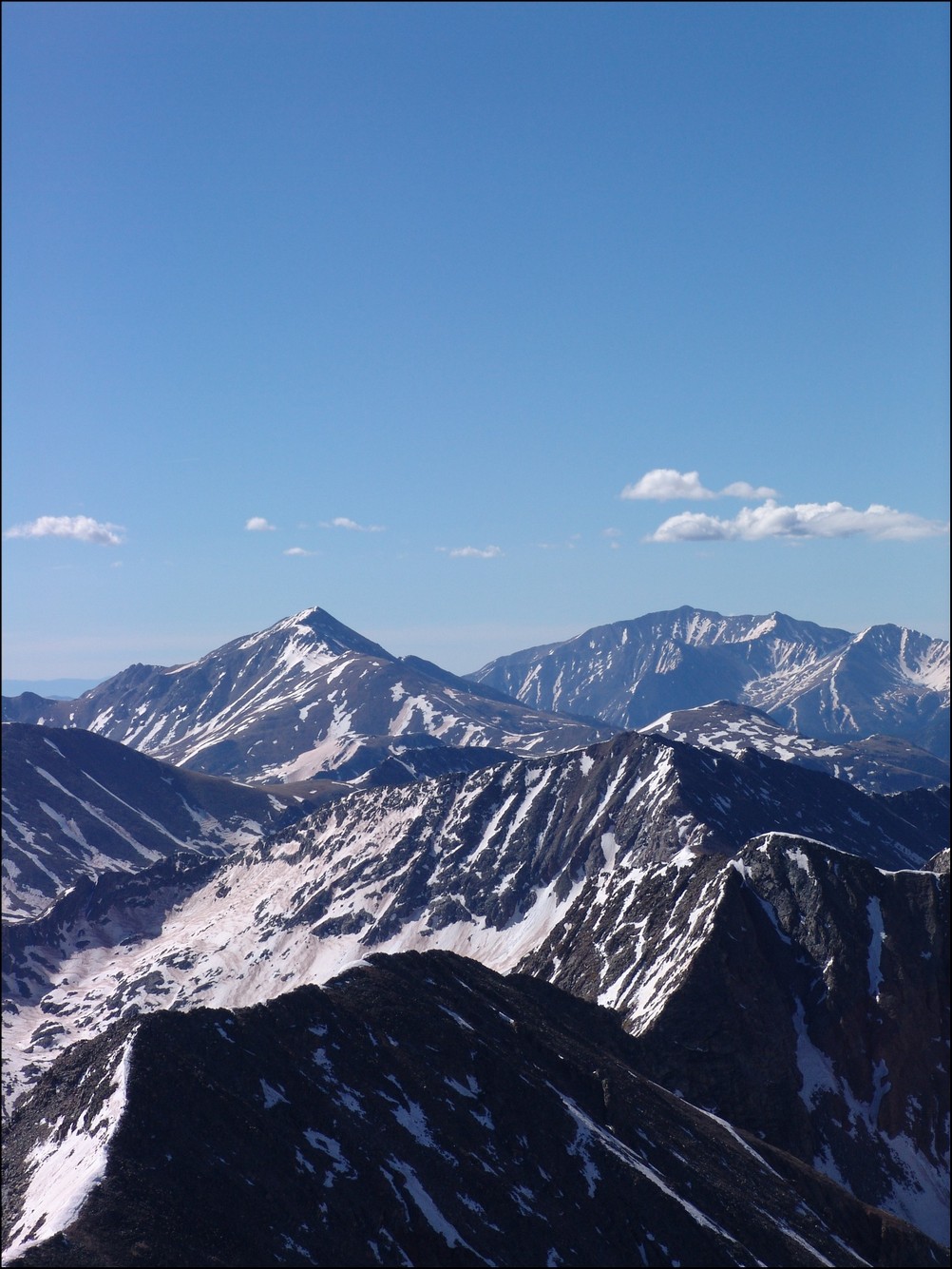
North Apostle and Ice Mountain zoomed in. If you click on the image you can see the full resolution version (and the climber atop North Apostle. I've confirmed that this climber is "Mad Mike" from 14ers.com
Mount Yale and Mount Princeton seen in the distance
La Plata Peak seen to the North of Huron across the valley
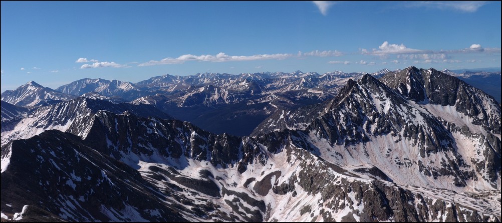
A great view of the Three Apostles from Huron
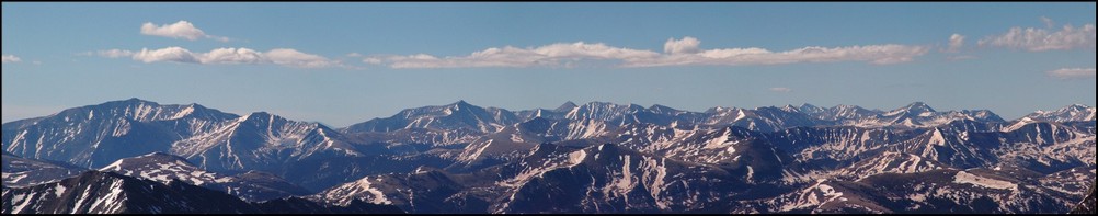
A 90 degree view looking Northeast, North, and Northwest from Huron
A vertically-oriented panoramic view of the Three Apostles
Matt Payne leaning to allow for a better view of the Three Apostles
Matt Payne and Mike Vetter on top of Huron Peak
At this point we decided that after an hour of being on the summit we should head down to the ridge and make an attempt on Browns. Once down-climbing to the ridge, we were able to get a view of what we just climbed, decorated with a fair amount of snow still.
Still a lot of snow on Huron's eastern face
We took a look at our route - a straight ridge scramble to PT 13,518 and then to Browns.
PT 13,518 and Browns were a straight shot from Huron's ridge. Mount Hope seen in the background.
We quickly scrambled up PT 13,518 without any problems and looked back at Huron. The further away we got from Huron, the more we could appreciate just how steep it was.
Huron rises high above PT 13,518 to the Northwest
A zoomed in view of Huron from PT 13,518

A wider view of Huron and the surrounding terrain
After reaching PT 13,518, we took a look over to our next and final objective: Browns Peak.
Browns Peak looked fairly easy with La Plata Peak behind it
On the way over to Browns, we were able to get a really awesome view of a nasty cornice, which looked more like a frozen tidal wave.
A huge cornice sitting in the saddle between PT 13,518 and Browns
A closer view of the cornice
A super-zoomed in view of the cornice
After a bit of mild scrambling, Mike and I reached the summit of Browns in quick order. The clouds were looking to get worse and worse, so we decided that after Browns that we would go ahead and head back down to the trail below us, making our own route down off of Browns and connecting with the Huron trail.
Mike Vetter celebrating on the summit of Browns
Matt Payne points back to Huron from Browns
We dropped off the north face of Browns just a few hundred feet and went straight down a scree gully. The dirt was quite loose but manageable. Soon after reaching the basin for Huron again, we were greeted by another large snow-field, which presented some pretty awful post-holing up to our wastes. Fortunately, my boots and gaiters kept my feet completely dry!
Matt Payne descending from Browns
After reaching the trail again, we headed back down the way we came and crossed the insane snow-field at the base of Huron. After a days worth of sunlight, the snow-field was quite soft and presented us with some unique and 'wet' hiking challenges.
Matt Payne crossing the slushy on Huron
Once we reached the bottom of the snow-field, the way down was pretty quick to treeline and below to the trailhead and eventually my vehicle.
All-in-all, this was an amazing trip filled with great views. And I must say, I could not have hiked with a better guy. Thanks for driving down and climbing with me Mike!
To complete the trip report, here are three HDR photos I combined. I am new to HDR but I do like how it can enhance the light.
Until next time, enjoy Colorado's summits!