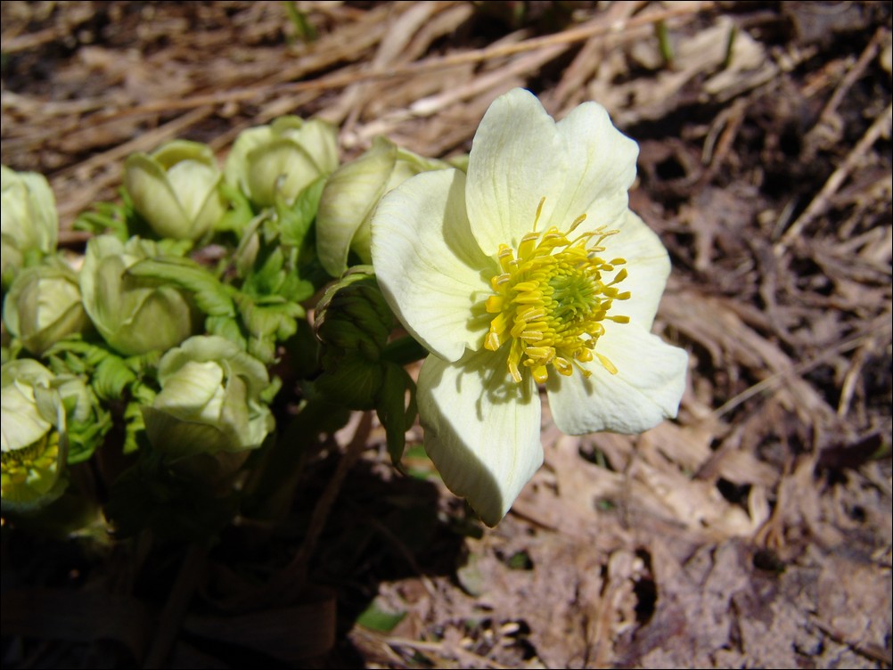
Displaying items by tag: moose
San Luis Peak - an adventure in photography and friendship
San Luis Peak is a gentle giant, rising to 14,014 feet in the middle of the La Garita Wilderness Area, which means "The Lookout" in Spanish, according to Wilderness.net. The 50th highest ranked peak in Colorado, San Luis Peak is named after the valley it towers over, the San Luis Valley. According to Hayden's 1877 Atlas of Colorado, the valley itself was named by an early unknown Spanish explorer, the patron saint of whose village was San Luis.
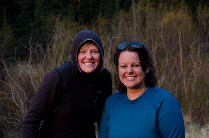
I've been wanting to climb San Luis for awhile now. Not a technical climb nor arduous hike, San Luis is generally considered one of the easier 14ers; however, due to its remote location, it is not climbed nearly as frequently as other 14ers. Indeed, the trail-head is located nearly 50 miles from any recognizable form of civilization. For this reason, I am quite thankful that I was able to get a ride with Regina Primavera (Yalegirl09 on 14ers.com), my friend and hiking partner. Regina and I planned out many of our hikes quite early this year and San Luis was to be the first mountain for us to tackle together. Additionally, another awesome person, Sarah Musick, found me through my website and a mutual friend, and asked if she could join us.
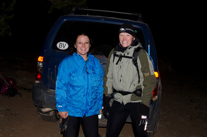
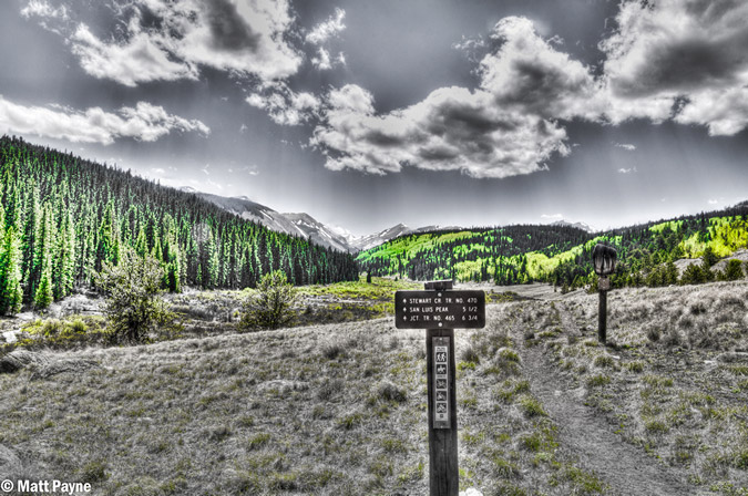
Regina and I picked up Sarah and departed for the San Luis trailhead on Friday evening, June 10th, 2011. Excellent conversation ensued and we were all quite acquainted with each other before we reached Salida, Colorado for dinner. We made a stop at Amica's Pizza and Microbrewery, which reminded us all of Il Vicino in Colorado Springs (and for good reason too, apparently Amica's used to be a Il Vicino and was later converted by the new owner). The food and beer were all quite fantastic. With spirits high, we continued on to the town of Saguache, Colorado (pronounced Saw-watch), refueled, and drove the beautiful yet never-ending road to the San Luis trail-head. A note about the road - it was somewhat confusing for us coming from the San Luis Valley. If you are coming from the San Luis Valley area, drive north on Colorado 114 to Dome Lakes, then turn left onto the "15-GG" road. Our mistake was that we did not drive all the way to the 15-GG road, but instead headed up the NN-14 road before reaching Dome Lakes. It still gets you there by going the way we did, but it is MUCH longer! For our trip, we opted to take the Stewart Creek trail.

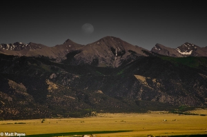
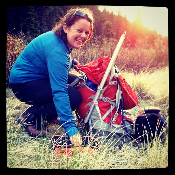
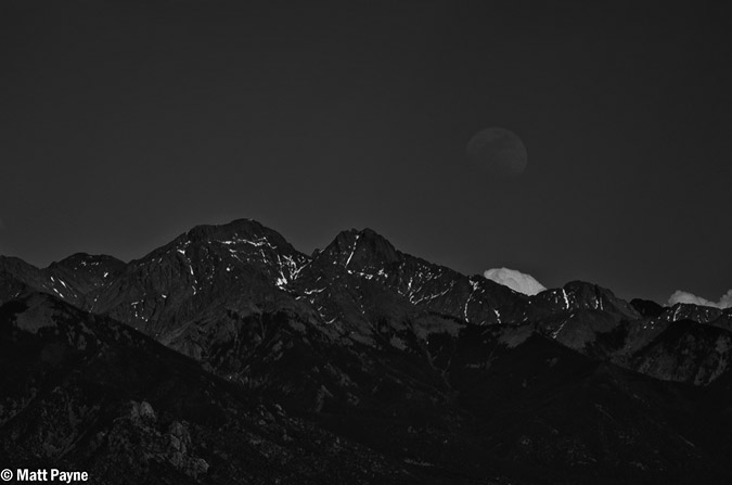
Upon reaching the trail-head parking lot, we set-up our camp site quickly with the aid of headlamps. The stars were pretty incredible since we were in the middle of nowhere, and I decided it would be a great time to try out some star trails photography.
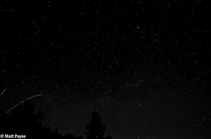
The stars were looking good... hopefully the star trails version would be just as good!
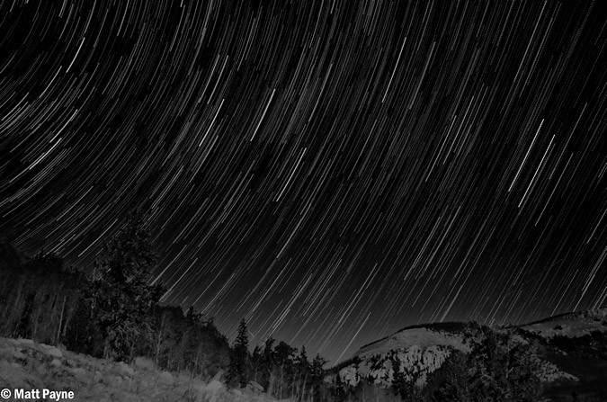
There are a couple techniques one can use to accomplish star trails in a photo. The basic method is to take one long exposure (over an hour), which captures the movement of all of the stars as trails across the photo. The drawback from this technique is that you have no room for error because of the long single exposure and, due to noise caused by heat and other factors in the camera, you need to turn on noise reduction in camera, which basically takes an equally long exposure with the shutter closed at the end of the shot and then reduces noise based on the comparison of the open and closed shutter shots. The second method, which I employed, is to take multiple shorter exposure shots (30 seconds to 4 minutes each) over a period of time, with little time between shots to ensure that no gaps exist in your trails (unless that is what you want), and then combine them later in a program like photoshop or startrails.exe. In order to get the below photo, I set-up my camera, a Nikon D7000, to take a photo every 45 seconds. The camera was set on manual focus, with the stars in focus, at aperture of 5.6; the shutter speed was set for 30 seconds because I forgot to bring my shutter release cable, otherwise I would have probably set my shutter speed at 2 minutes or so. I then imported the photos into Adobe Lightroom and adjusted the exposure and cleaned up any unwanted artifacts that streaked through the exposures (airplanes, satellites, etc). I copied the development settings of the photo I did the work on and applied it to the other 47 images for consistency purposes. Finally, I loaded all of the images into startrails.exe, which is a free program. Startrails combines all of the photos together into the one you see below. All-in-all, I was very pleased with the results.
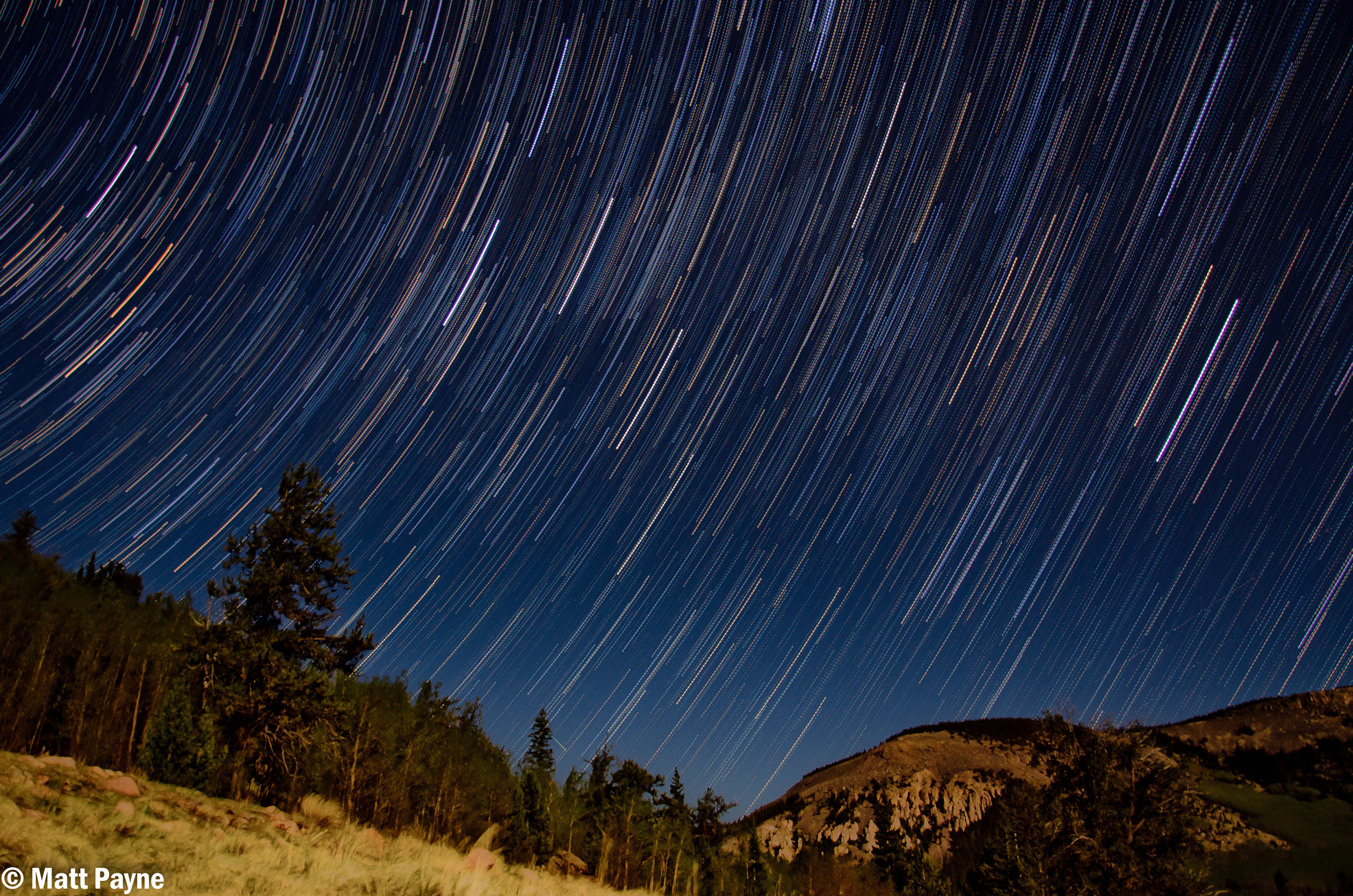
Additionally, I decided to add the photos together into a time-lapse video, showing the change in star position across the 35 minute time-span, as seen in this YouTube video:
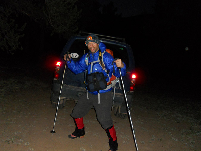
After waiting in the cold for an hour with Regina while the camera captured the photos, we set our alarm for 4 AM and crashed in the tent. 4 AM came sooner than I liked, but I felt much more rested than I did on my last adventure up Princeton.
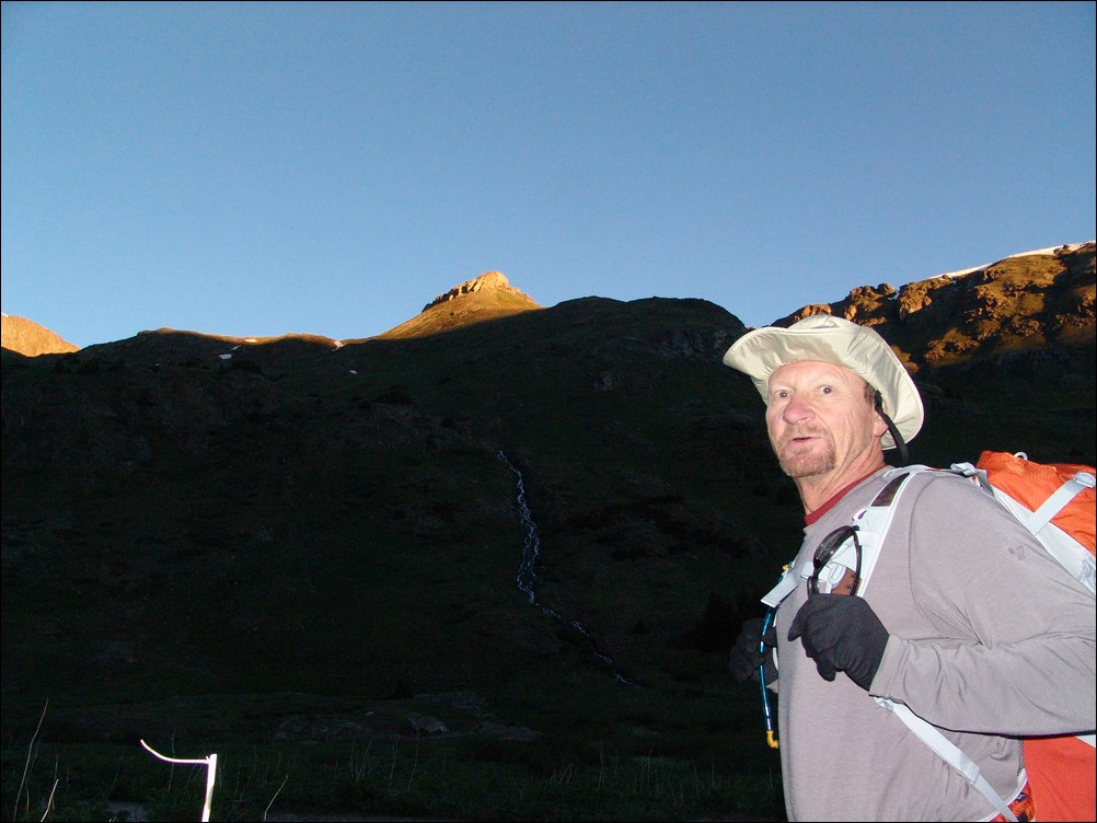
We packed up our tent and sleeping amenities, ate some quick trail food, and departed. Since none of us were really sure about the conditions of the mountain due to a real dearth of trip reports online for San Luis recently, Regina and I opted to pack our crampons, and we all had ice axes. Regina and Sarah were looking quite excited to begin the hike at 5 AM, despite Regina stating she felt sick.
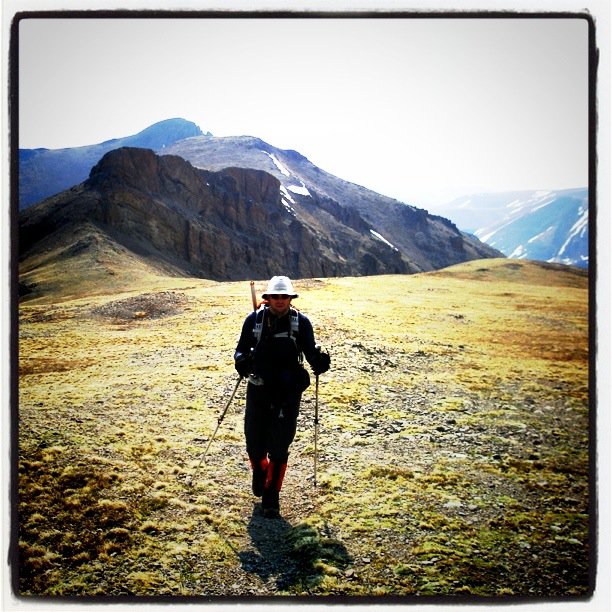
Naturally, I had to look as excited as possible, despite the fact that I am not a morning person!
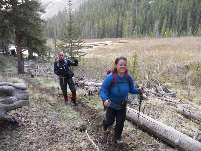
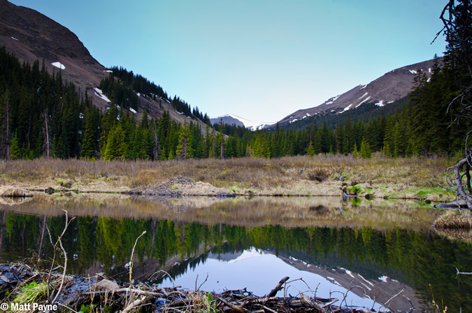
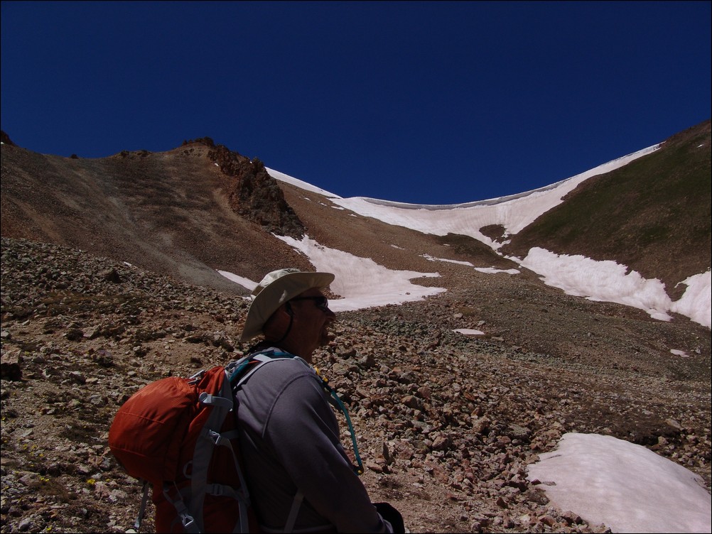
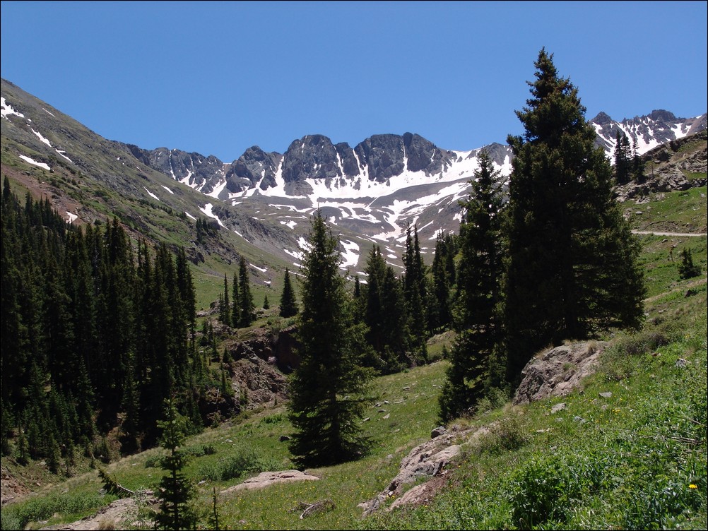
The trail heading up the Stewart Creek valley was gentle and steady. One thing that was remarkable was the beaver ponds, which were quite ubiquitous. We were even lucky enough to be greeted in the early morning by a couple of beavers, whom used their tails to loudly splash water, as if to say, "this is our house!" As we continued up the trail, we shortly glimpsed a very young moose that was grazing near one of the beaver ponds. Before we could capture any photos of it, it ran into the woods. Oh well!
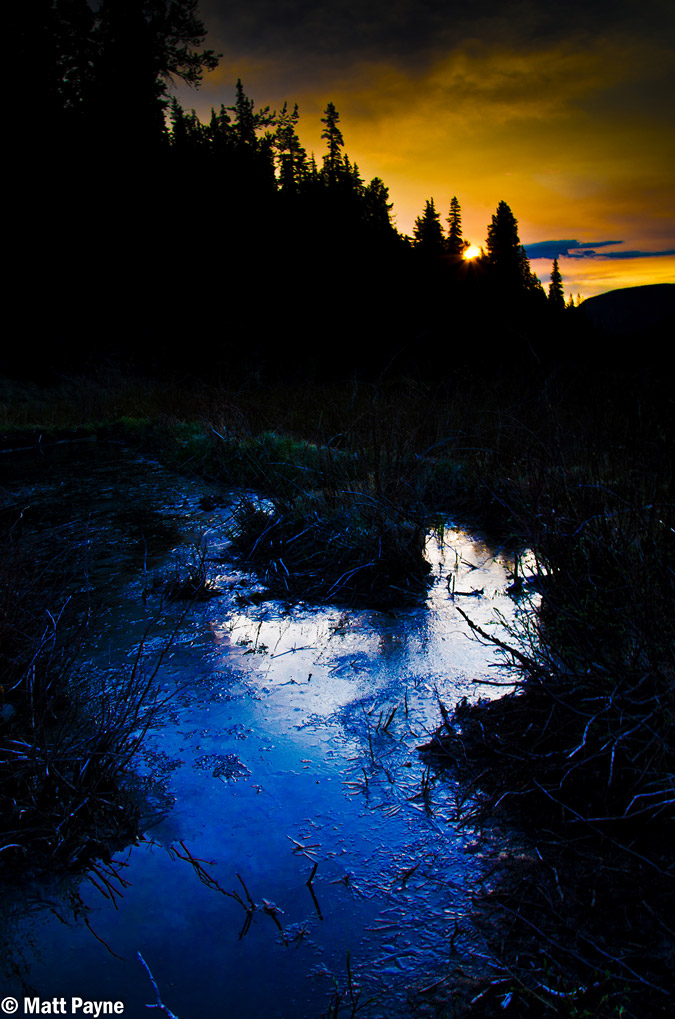
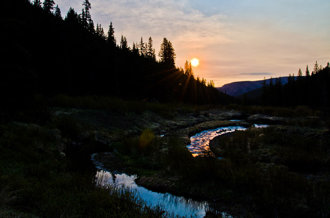
Before long, the sun began to rise and the inner nerd photographer in me began to get excited. The Golden Hour is easily one of the best times to take photos, and I quickly searched for some beaver ponds or other water features to balance out my compositions.
 |
 |
We stopped near a small pond and a crook in the stream and I set-up my camera.
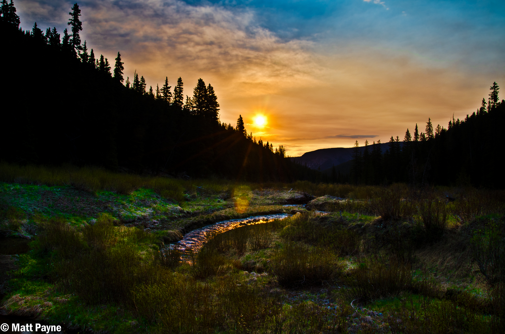
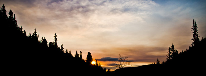
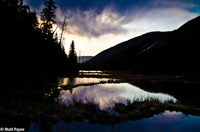
If you are not familiar with The Golden Hour, it is well defined by Wikipedia: "In photography, the golden hour is the first and last hour of sunlight during the day, when a specific photographic effect is achieved due to the quality of the light." Today was no exception. Due to the fires on the Colorado-New Mexico border and in Arizona, the sky and the clouds had a brownish-red hue to them, making for some interesting light effects.
I think I may have frustrated Regina and Sarah with the amount of time I spent shooting photos at this point, but I think the time was well worth it, personally. I have been trying to focus a little more on composition in my photographs lately, including thinking about the rule of thirds and incorporating lines into the photo in order to draw the viewer into the photo. I've also been using Lightroom to do most of my editing. Let me know what you think about my efforts!
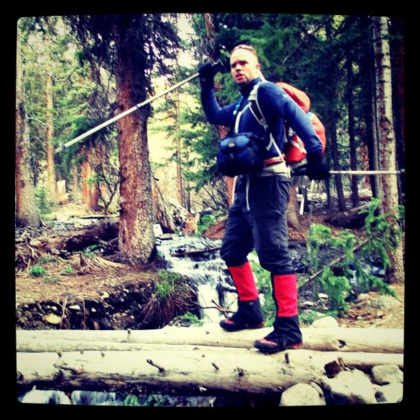
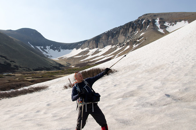
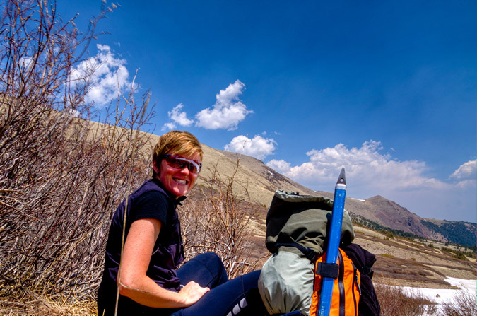
While I was playing in the woods with my camera, Regina decided it would be fun to take a picture of me, taking pictures.
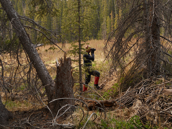
Something about me being rich and famous someday (yeah right)! Additionally, Regina and Sarah teamed-up and came up with the brilliant plan of putting Regina's crampons in my pack as punishment for the long wait I had caused (and more importantly, because Regina did not feel well).
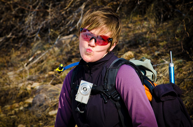
On we continued up the trail, with Sarah playing videographer to our adventures.
Sarah and Regina made for great companions, it was amazing how well we all got along and how closely aligned our political, religious and philosophical views were.
We rested for a little bit to eat and drink, and Sarah shared some amazing little snacks her friend made. Apparently, her friend is beta-testing these snacks to be sold to cyclists, hikers, climbers, triathalets, etc. I must say, they were delicious! They were little balls of goodness!
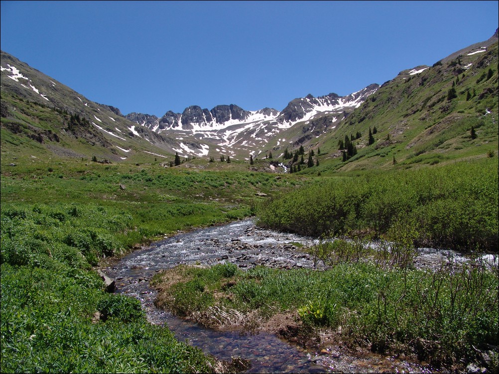
We spent a little time at a huge set of beaver ponds, admiring the clear water and great morning air.
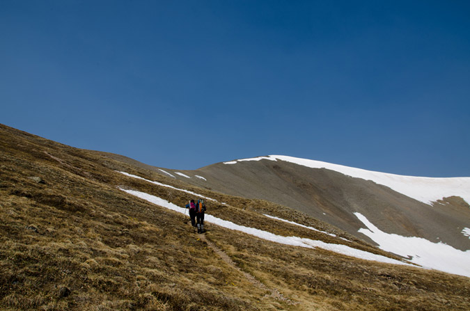
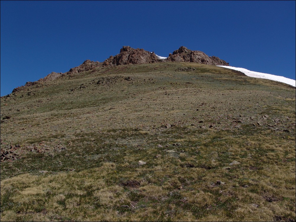
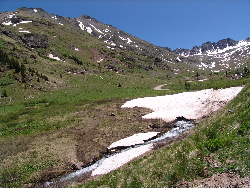
Before we knew it, we were at treeline after a few simple creek crossings.
Once we hit treeline, the trail ran right into a huge snowfield that presumably went over where Stewart Creek is supposed to be.
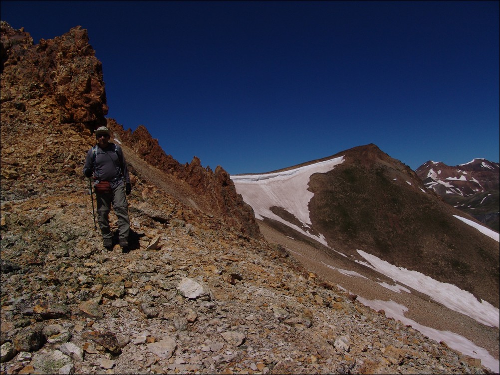
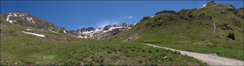
From here, the goal was to gain the saddle between Organ Mountain and San Luis. The trail was hit or miss through the snow, but never felt difficult. The snow was not a problem at all, and I think Regina was a little bummed that she didn't get to use her crampons.
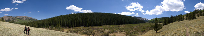
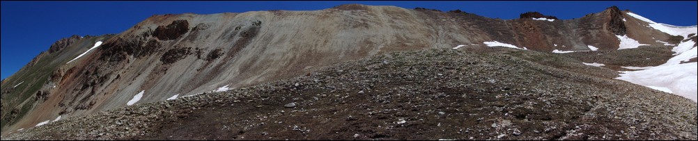
There was a group of 5 guys that were behind us pretty much the whole way up. In total we counted 15 people including ourselves the whole day. I was able to get a large pano from most of the way up to the saddle, which included the guys behind us.
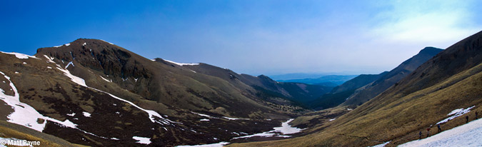
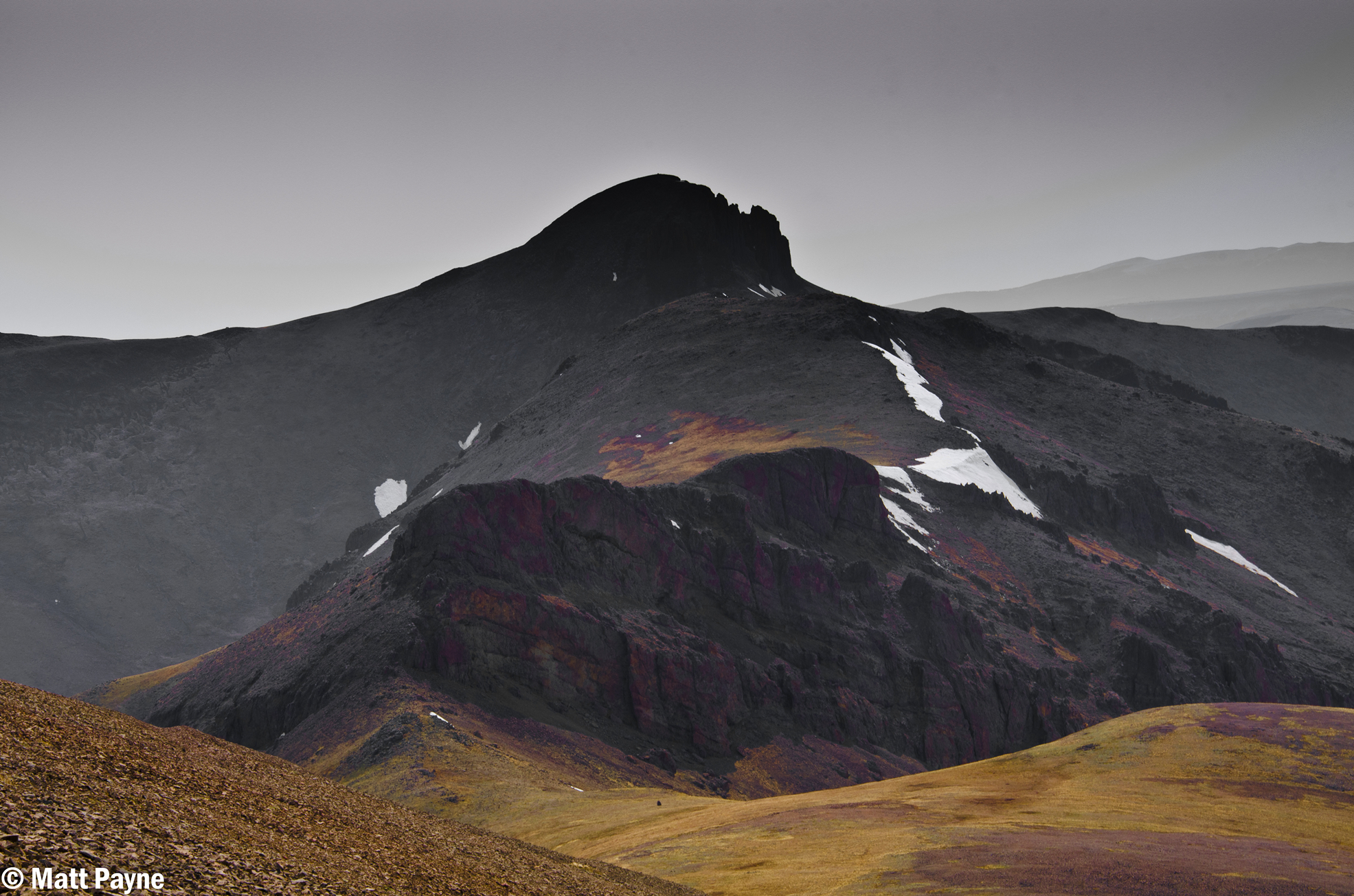
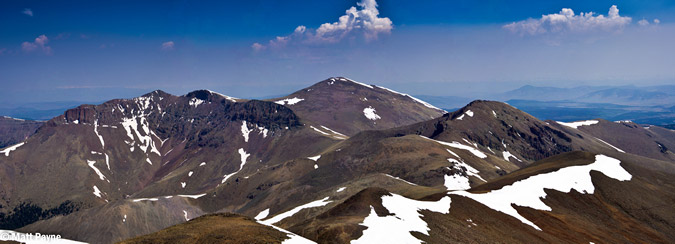
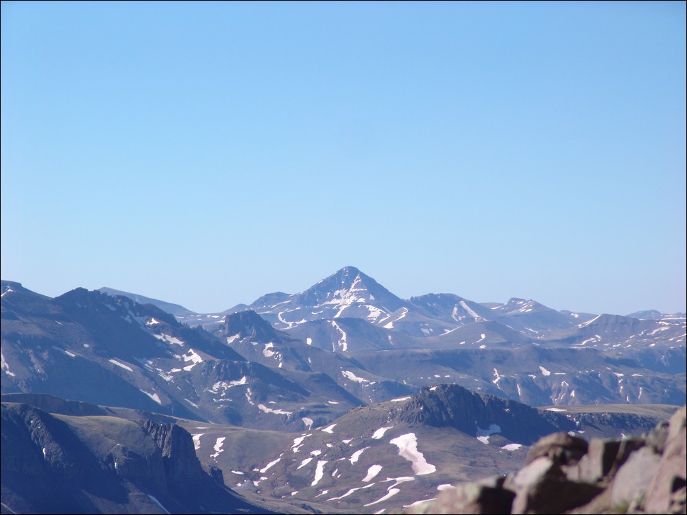
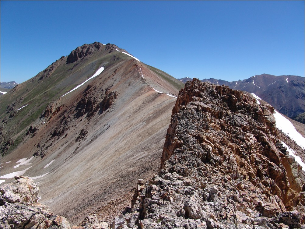
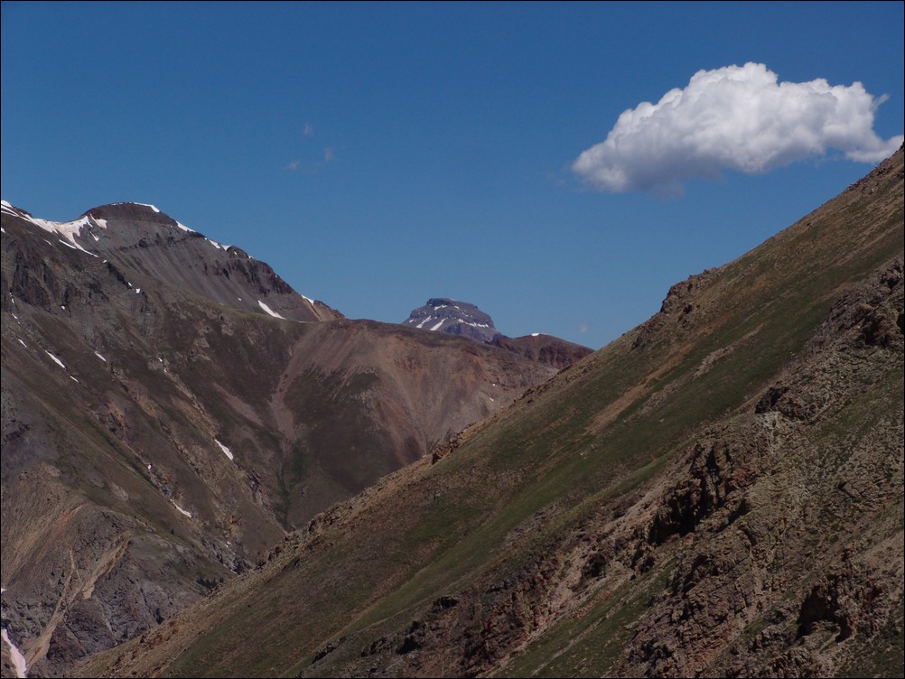
We quickly gained the saddle and enjoyed views of both Organ Mountain and San Luis, which was pretty close!
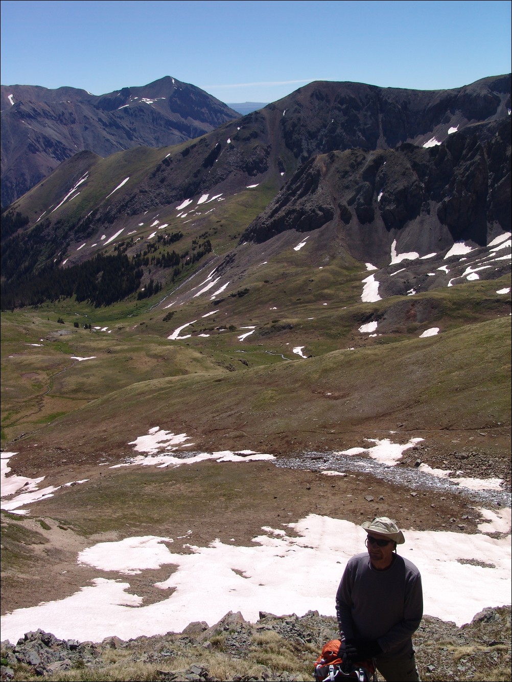
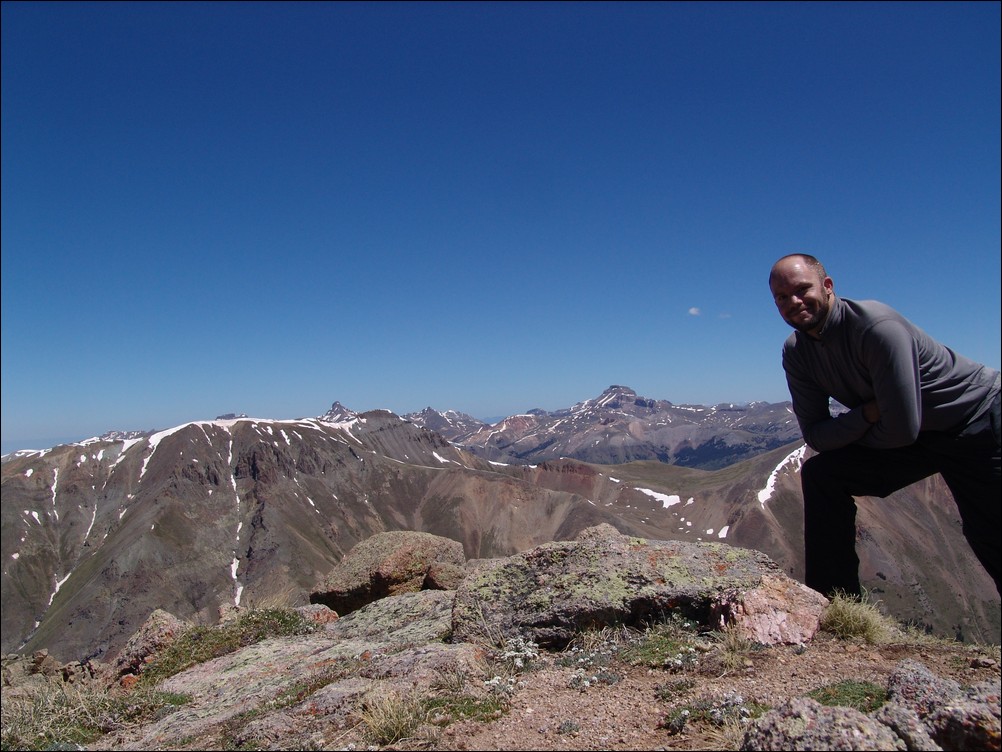
Organ Mountain behind Matt.
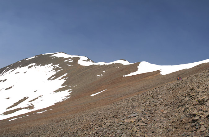
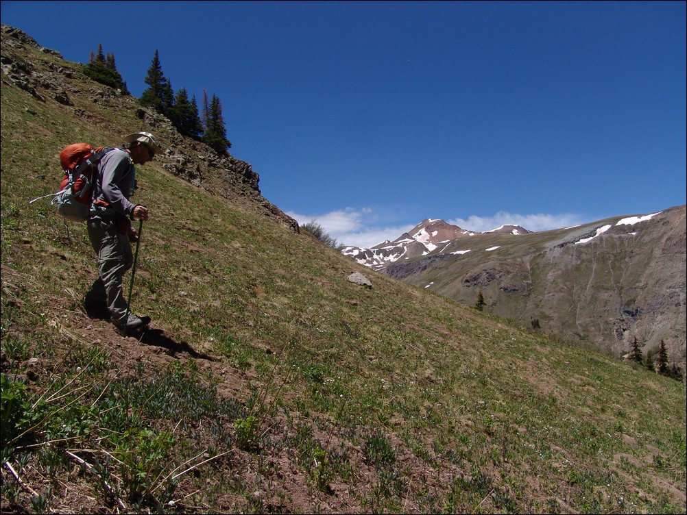
After the saddle, the trail leads you up towards a bump that Regina kept saying was Baldy Alto, but is in fact just a bump on the way up San Luis. The trail bypasses this bump to the left and then heads right up below San Luis' ridge.

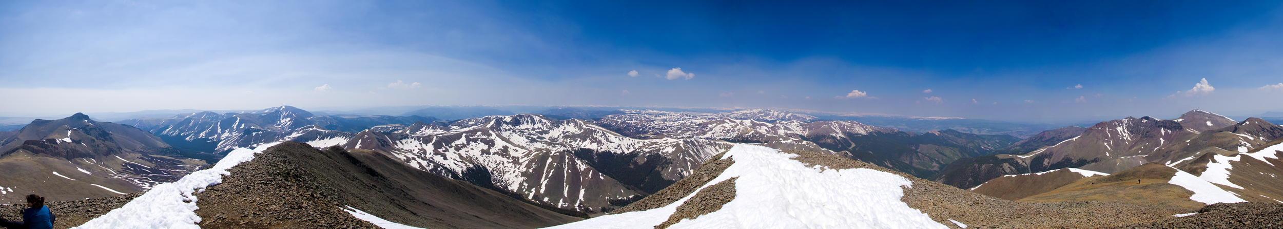
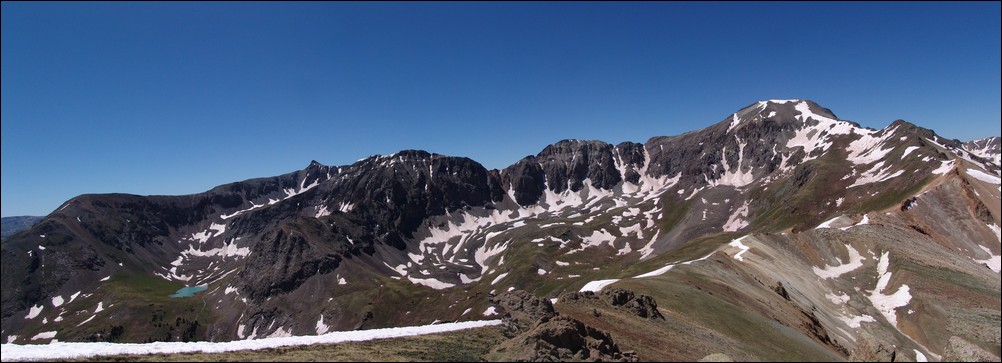
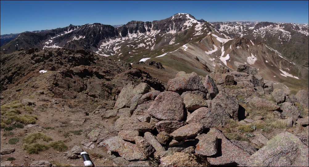
A 360 view from the ridge between Organ and San Luis. Click for a higher resolution version.
Organ Mountain was impressive. I had originally thought we might have time and energy to hit it as well, but with Regina not feeling well, I decided to just do San Luis Peak. Anyways, I really liked the imposing feel that Organ Mountain imparted upon me here, so I had fun editing this photo to really convey that feeling.
We opted to follow the trail and stay low instead of going up to the top of the ridge.
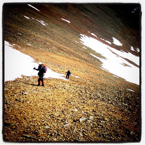
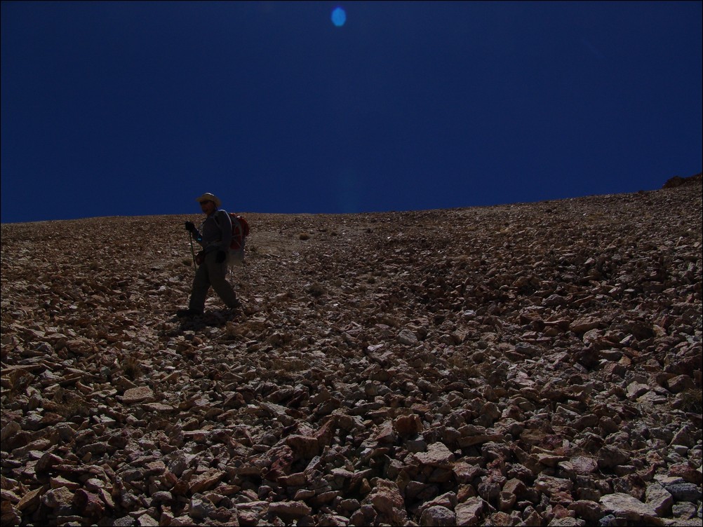
Subsequently, the trail led us into some nasty snowfields, which we had to downclimb to go around. We later lost the trail due to the snow and ended up going straight up some relatively unpleasant scree to the ridge.
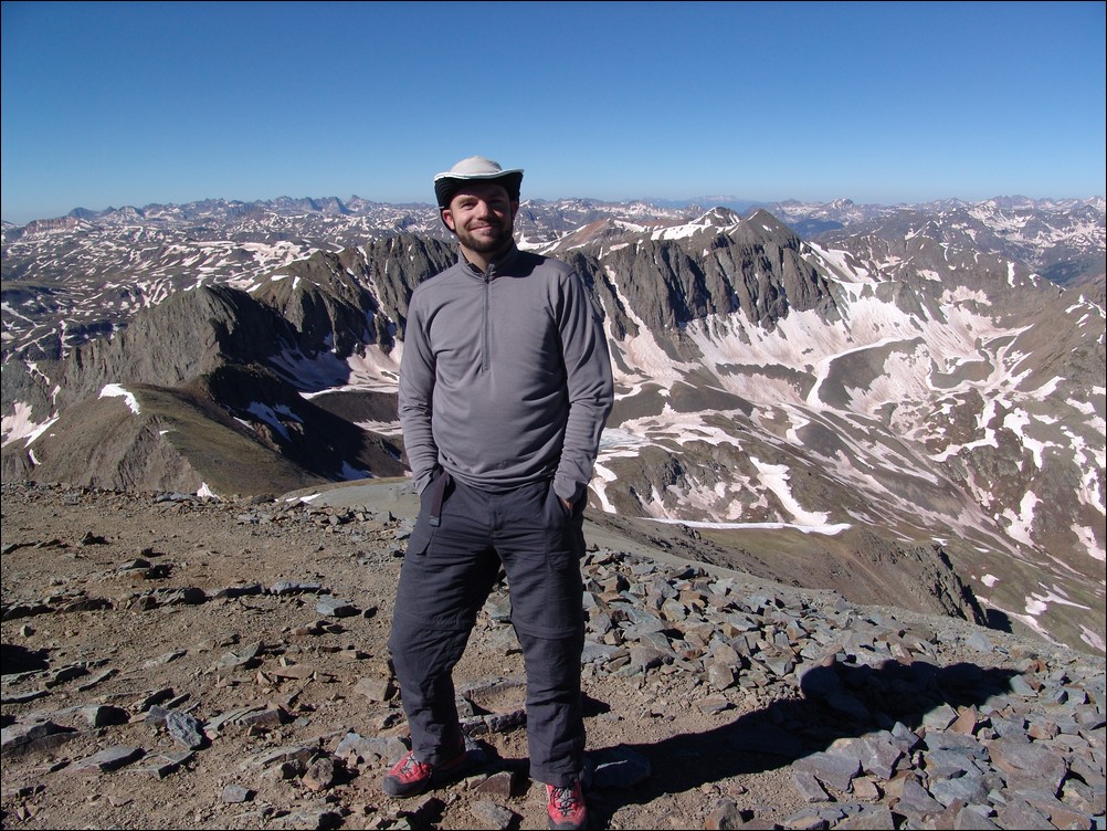
We reached the summit at 10:45 AM, a modest 6 hours since we left the car. Surely if Regina wasn't sick and if I didn't own a camera we could have shaved a good 2 hours off the time!
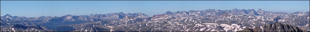
The smoke was very evident from the top, by sight and smell. It really degraded the view and photography. Regardless, I was able to get some good shots from the top, including this near-360 view (click for higher resolution).
I was also contemplating knocking out Stewart Peak (center) and Baldy Alto (right of center), as seen below, but opted not to due to Regina not feeling well. I did not want to split the group up if someone was not feeling good.
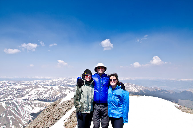
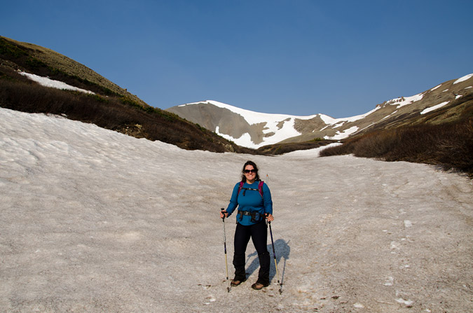
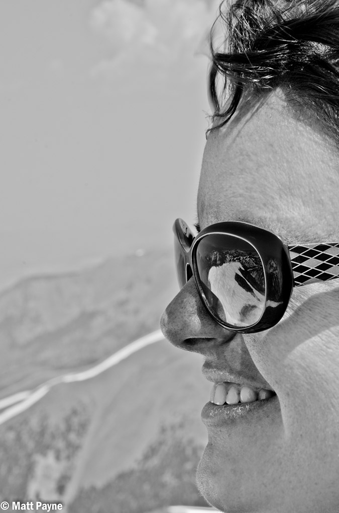 I had fun shooting this photo of Regina - the mountains to the west were reflected nicely in her sunglasses, plus she was quite a cooperative model! All in all, it felt great to climb my first mountain with both Regina and Sarah, and I think everyone was quite proud of their accomplishment!
After enjoying some cliff bars on top, we all decided to head back down. The hike down was quite easy, and before we knew it, we were all back at the first snowfield we had encountered before. Regina cracked some jokes about falling into the snow, which was hard enough to prevent post-holing, thankfully.
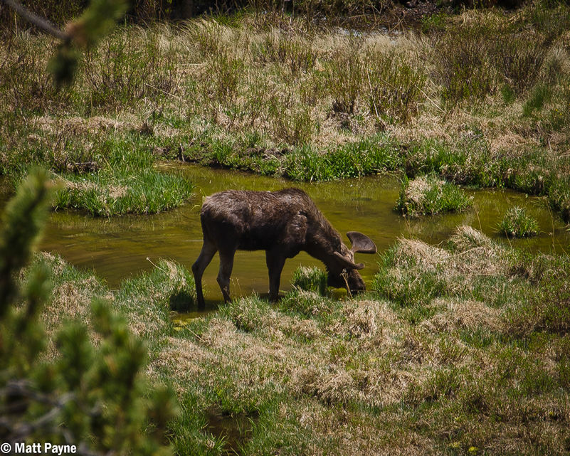
On the way back down, I caught something moving out of the corner of my eye. Much to my surprise, a huge moose was moving slowly through the beaver ponds below. That was probably the highlight of the trip!
The Stewart Creek valley is a very beautiful place. I am glad I need to return to do other climbs nearby!
We finally reached the trailhead again, and I took some fun bracketed photos to run through Photomatix. If only I had a tripod...
The total hike was 11 miles round-trip, including 3,500 feet in elevation gain. I would rate this hike as moderate to easy in comparison to other 14ers I've climbed.
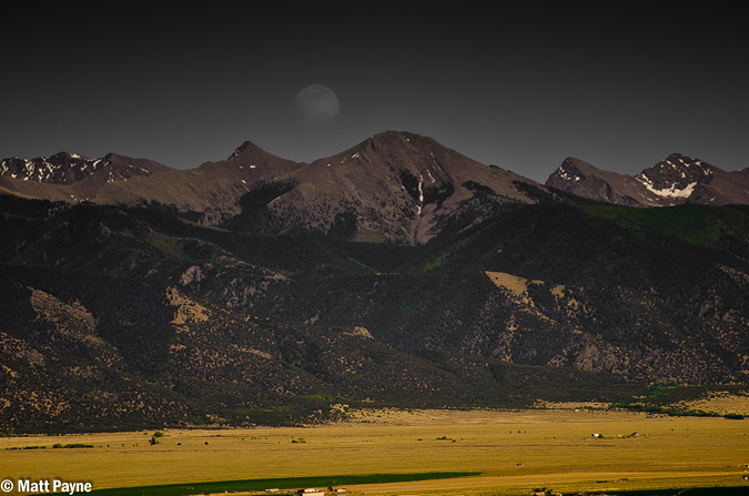
The drive home was fairly uneventful until I was able to discover the moon rising above the Sangre de Cristo Mountains, including Crestone Peak (right) and Kit Carson Mountain (center).
As soon as I returned home, I made sure to check-off another box on my 100summits t-shirt. Thirty-eight of the highest 100 to go and ten 14ers to go!
I look forward to more exciting hikes with Regina and hopefully Sarah too!
If you would like to stay up-to-date on all of my articles, photography musings, trip reports and other mountaineering related news, please feel free to follow 100summits on Twitter or Facebook! Also, if you're planning on doing any online shopping and if you enjoyed the content, please help keep the site going by using the links on this page to help fund the site.
Handies Peak and Whitecross Mountain - a sweet San Juan saunter

Hiking in the San Juan Mountains was quite possibly the best gift a dad could get. Make that two dads.
My dad is who introduced me to climbing mountains at the young age of six, and it was fitting that we spend Father's day climbing a mountain that we had both had our eyes on for quite a few years. While my dad had originally planned in the 1980's to save Handies Peak as his last 14er, he decided to give up that idea. The last time my dad climbed a 14er was Uncompahgre Peak in 2001 - another father-son outing in the San Juan Mountains, nearly 10 years ago. Having prepared for the past two months through rigorous training and exercise, my dad, now 60 years old, believed he was ready again for climbing. Since all I talk about anymore is climbing mountains, it was no surprise that his interest in climbing is renewed and I was very pleased that he asked to join me on my attempt of Handies Peak. My dad (Old Climber on this site) and I debarked from Colorado Springs at roughly 5:00 PM on Friday, June 18th 2010, heading straight for the rugged San Juan Mountains in southwestern Colorado. We drove south down State Highway 115 and connected with Highway 50 heading west. We stopped for a bite to eat in Salida and drove to Gunnison and south towards Lake City. The drive up towards Cinnamon Pass from Lake City was a somewhat confusing one in the dark - there are a couple points where you can make a wrong turn - neither intersection having been mentioned on the route description at 14ers.com. To top things off, the road was pretty rough, but my Jeep handled it like a champion. We managed to find our way to the American Basin near Handies Peak and began setting up camp with our headlamps on at around 11:30 PM.
Here are some interesting statistics from this amazing adventure:
Total elevation gain: 3,629 ft.
Total distance hiked: 8.22 miles
Total time hiking: 8 hours, 15 minutes
Total photos taken: 346
Total wildlife sightings: 3
Total distance driven: 480 miles
Trip duration: 28 hours

A map of our driving route to our campsite in the American Basin from Colorado Springs
As we began setting up camp, I turned back towards my vehicle to see two glowing eyes about 20 feet away. These were no ordinary glowing eyes - these were quite large and clearly fit a very large animal. I whispered to my dad, "Ray - look - there is an animal over there!" Ray got out his flashlight and revealed a giant moose! We were both in shock, as neither of us had seen a moose in the wild in Colorado before. The moose walked around our campsite for much of the remainder of the night and at one point got within 5 feet of the tent before walking away. I decided to name the moose "Tim" since I thought it would be funnier and more convenient to refer to the moose by name instead of "it" or "moose."
The moon was about half-full and lit the basin up quite well. We could make out the ridge line of Handies Peak and the American Basin crags (American Peak, ranked 102nd highest in Colorado).
We enjoyed the views of the basin in the moonlight and set the alarm on my Suunto Core watch for 5 AM. The tent was sitting on a lot of wierd bumps, so sleeping was not the easiest of tasks. I think I did get a few hours of pretty spotty sleep before the alarm went off. We woke up and broke down our camp pretty quickly while eating some oatmeal. "Tim" was still hanging around, eating some willow trees 50 or so yards away from our campsite. We prepared our packs and debarked up the road towards the trailhead, but not before taking a photo of the basin around our campsite.

Handies Peak seen at left of center with American Peak at dead center and UN 13,512 at far right. The American Basin is a very peaceful locale.
The plan for the day was to ascend Handies Peak (14,048 ft. and ranked 40th in Colorado) via the standard trail and then to traverse over to Whitecross Mountain (ranked 222) to the northeast of Handies. Starting the hike pretty early and at a respectable elevation, I believed that the itinerary would be quite manageable.

A topo map with my route shown in red. We began the hike near the word "Fork" on the map.
Ray and I quickly began the hike up the trail at 6:15 AM and within minutes, the sun began to light up the surrounding peaks, including American Peak.

American Peak gets a healthy dose of sunlight.
The basin itself was quite serene, with waterfalls everywhere and green slopes and orange mountain tops surrounding us in all directions.
Ray Payne with an awesome waterfall in the background
We probably could have made better time, but I was taking tons of photos the whole way up!

Matt Payne with American Peak in the background.
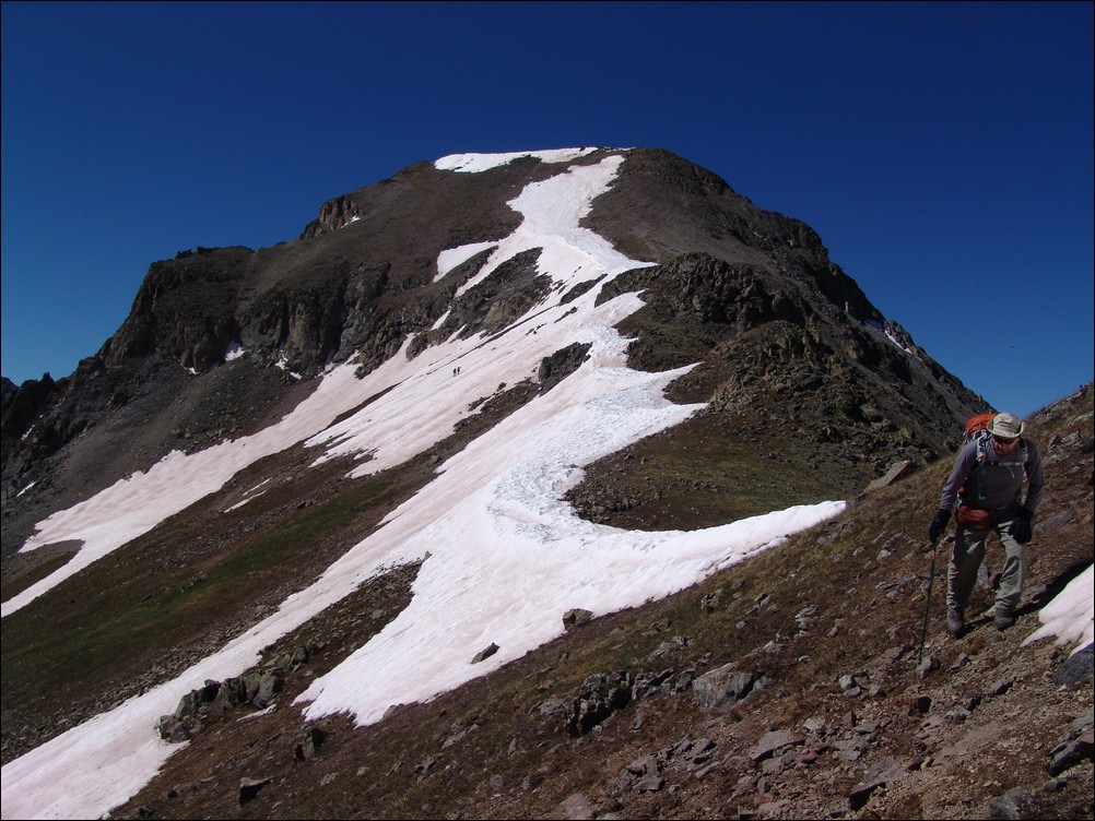
The trail was mostly snow-free, with a few sections of snow obscuring the trail. We were able to quickly follow the trail up the side of Handies Peak, weaving our way up towards Sloan Lake.

Ray Payne gazes up the side of the relatively steep trail leading up Handies.
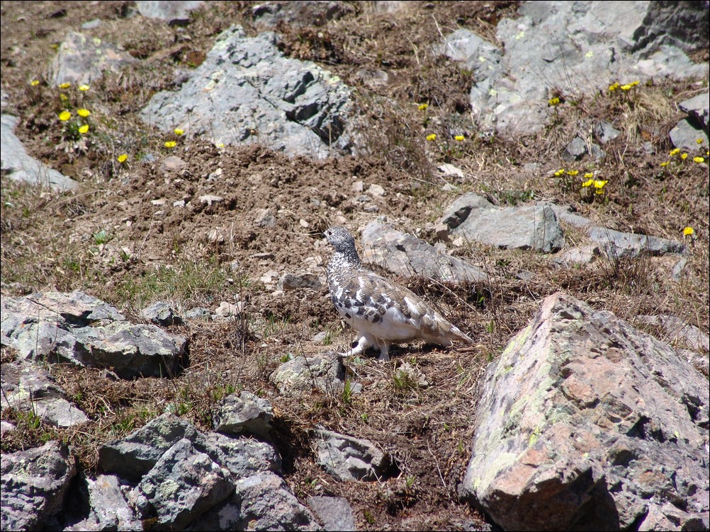
Shortly before reaching the turn-off for Sloan Lake, I stumbled across a beautiful ptarmagin, still in the process of changing out of its winter coat and into its summer colors.

A ptarmigan rests on rocks near the trail leading up Handies Peak.

The ptarmigan peers back at me, wondering if it is on the menu for dinner.
The ptarmigan made a loud squak and flew down the trail and away from our threatening gaze. What a pleasure it was to see wildlife!
Shortly after heading away from Sloan Lake, the trail turns back towards Handies and down through a small snowfield. The snow was steep but easy to navigate.

Ray navigates through a steep snow field.
The trail quickly zig-zags up Handies and before we knew it, we gained some incredible views back down into the American Basin.

Sloan Lake sits in front of American Peak, with the Handies standard route trail below. The first view of distant San Juan Mountains is revealed.
We rested in the shadows for a bit and resumed the hike up towards the saddle between Handies Peak and American Peak. Once gaining the saddle, views east into the next valley over were presented with the morning sun welcoming us.

A 360o view from the Handies - American Peak saddle. As a reminder - many images can be clicked on to view the full resolution versions!
We continued up towards the summit of Handies and were wildly surprised with a view of Rio Grande Pyramid, one of the top 100 summits in Colorado (ranked 97).

Rio Grande Pyramid sits prominently in the far distance to the south of Handies Peak.
This was a particularly exciting discovery for Ray and I since we are planning to climb Rio Grande Pyramid at the end of August of this year. Getting a first-hand view of this magnificent mountain was quite awesome.
We also could not help but notice the other quite prominent mountain sitting in front of Rio Grande Pyramid Peak on the near side of Pole Creek Mountain (ranked 138th in Colorado) - Half Peak (ranked 86th in Colorado).

Half Peak (left of center) sits left (northeast) of Pole Creek Mountain, and Rio Grande Pyramid.
Additionally, views of Mount Sneffles (ranked 27th in Colorado) and the surrounding mountains came into view.

Ray Payne gazes towards Mount Sneffels to the northwest.
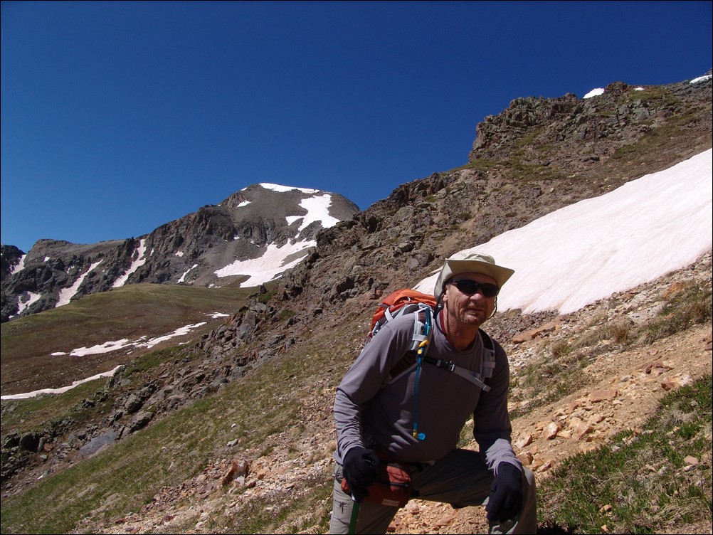
Ray snapped a shot of me before I continued up the trail.

Having gained the amazing views of the San Juans, I was re-energized to hike faster, so I quickly made my way up towards the summit of Handies. I peered back to catch the first glimpse of the Grenadiers and Needle Mountains near Silverton. I have always been completely awe-struck by these mountains, so seeing them from here was quite exciting for me. Views of Pigeon Peak (ranked 57), Vestal Peak (ranked 77), and Arrow Peak (ranked 104) were impressive. Due to the fact that I am climbing Vestal's Wham Ridge and Arrow Peak in three weeks, this view was especially awesome.

Ray Payne ascends Handies with the Grenadier range and Needle Mountains showing themselves above American Peak. Pigeon Peak seen just above American Peak, with Arrow and Vestal Peaks to its left.
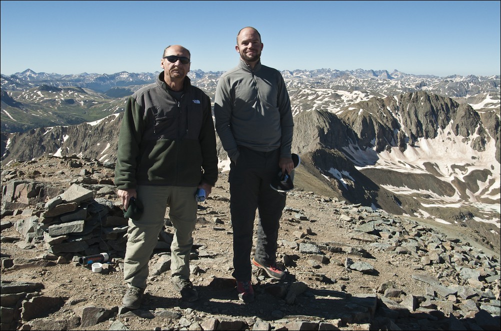
I was able to complete the climb of Handies at 9 AM, a brisk 2 hours and 45 minutes after we started, and was greeted at the top by Ray within minutes. Handies was the 48th 14er for Ray and the 36th 14er for me.

Matt and Ray Payne celebrate on top of Handies with the Grendiers and Needle Mountains in the background.
The wind on top was fairly chilly, so Ray and I found shelter on the eastern side of the summit. Ray got out his topographical maps and I began to take my ritual photos for the 360 degree panoramic photo from the summit. The views from Handies were much more impressive than I could have ever imagined.

A 360o view from the top of Handies Peak. The views of the mighty San Juan Mountains were astounding. Click on the image for the full resolution version (very large).

A 180o view looking northeast to west from Handies Peak.
I continued to marvel at the sheer impressiveness of the Grenadiers. The thought of climbing them in a few weeks seemed very surreal. Vestal's Wham Ridge looked impossible.

The Grenadiers and Needle Mountains zoomed in.
Views of other areas of the San Juans also did not disappoint. The Ice Lake Basin and Wilson group were quite impressive as well.

Looking west from the summit of Handies Peak
In my office at work, I have a framed topographical map composed of many different 7.5 minute maps of the Grenadiers and Needle Mountains. I had always wanted to capture a comprehensive photo of that area, showing the various summits of the region. I had a great time using the 100summits.com Google Earth plugin tool to attempt to correctly identify all of the mountains in the following giant panoramic photo. I would greatly welcome and appreciate any feedback or corrections to the labels, as the viewpoint from Handies made for a distorting and confusing process for peak identification. Be sure to click on the images to see the full resolution versions and the labeled photo (2nd photo).
A large zoomed-in panoramic photo of the San Juan Mountains.

Many mountains are labeled in this version. Send corrections to This email address is being protected from spambots. You need JavaScript enabled to view it.
For a more natural way of viewing this photo, check out THIS PAGE.
Views of both Wetterhorn Peak and Uncompahgre to the north were also outstanding.

Wetterhorn Peak

Wetterhorn Peak (left of center) and Uncompahgre Peak (right of center) rise up impressively to the north of Handies
Looking further west, were able to identify Mount Sneffels and Teakettle Mountain (ranked 98th).

Mount Sneffels (largest at center) and Teakettle Mountain (right of Sneffels)
Due west of our position on Handies, were caught view of the Ice Lake Basin. We originally thought this was the Sneffels group; however, upon further investigation, we believe we have correctly identified the mountains west of Handies as U.S. Grant Peak (ranked 119) et.al.
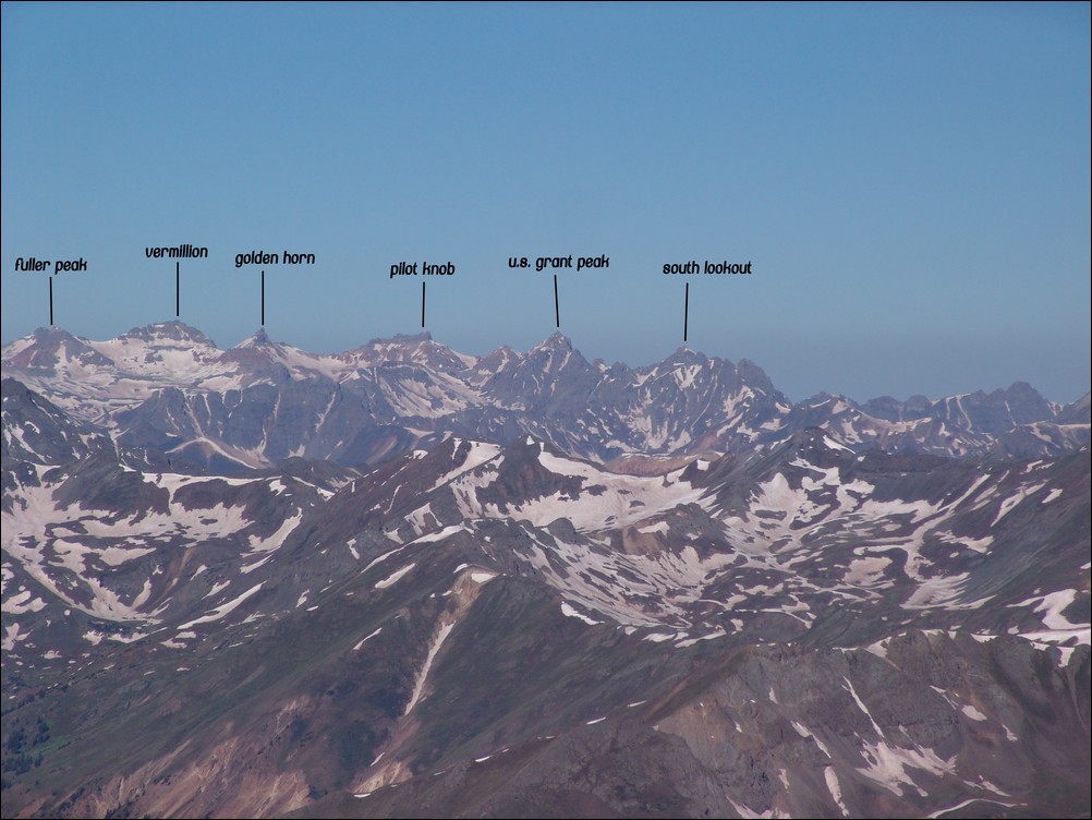
The Ice Lake Basin - send corrections to Matt at This email address is being protected from spambots. You need JavaScript enabled to view it.
After the whirlwind of photo taking, I decided to sit-down and eat some food. Ray ate his hard-boiled egg (apparently a long-standing tradition for him), while I chowed down on a Clif Bar and some cashews.
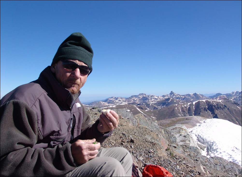
Ray chows down on a hard-boiled egg with Wetterhorn Peak behind him.
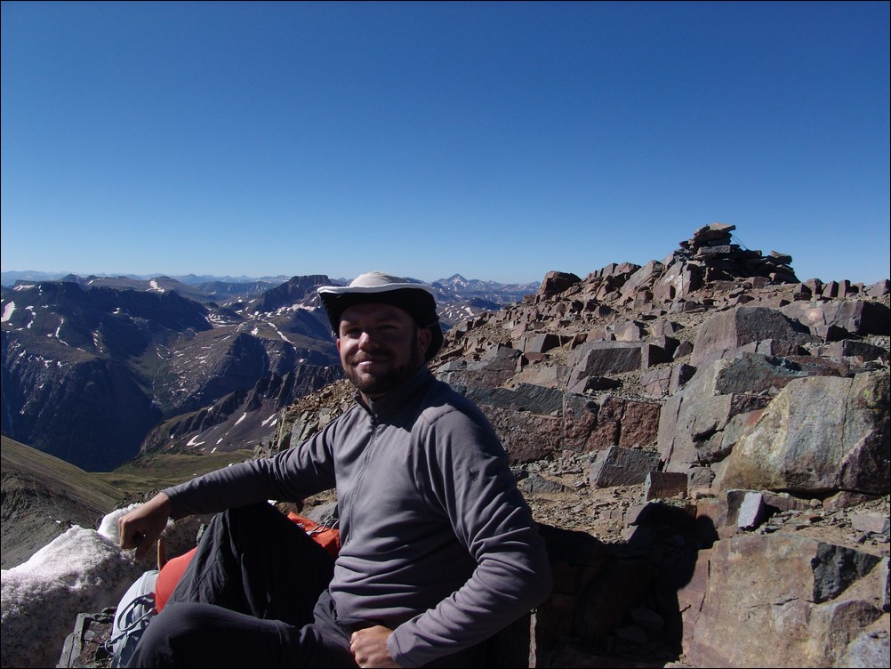
Matt Payne relaxes on the summit of Handies.
Sitting on the east side of Handies to eat, we were able to get a great view of Grizzly Gulch, Sunshine Peak and Redcloud Peak (ranked 53 and 46 respectively).

Redcloud and Sunshine Peaks rest just east of Handies.
Additionally, I was able to get a good glimpse of my second objective for the day - Whitecross Mountain. Whitecross looked further away than I thought it would, but with the insanely great weather we had and with my legs feeling superb, I was not concerned.

Whitecross Mountain and the traverse to it (partially obscured by snow).
We were joined on the summit by Ben Smith of 14erPlatinumTeam.com. Ben was with his friend Don, and they were quite friendly. We chatted for a bit about our climbing adventures and plans and exchanged website information.
I took more photos of the surrounding peaks.
Half Peak
Rio Grande Pyramid
I had Don snap one more photo of my on top and Ben volunteered to take some photos with his camera as well. He was kind enough to email me the photo he took of Ray and I on top.
Matt Payne on top of Handies Peak
Matt and Ray Payne atop Handies Peak - photo courtesy of Ben Smith.
Ray and I packed up and got ready for our traverse over to Whitecross Mountain. Ray informed me that he would probably not go to Whitecross but would wait for me at the saddle between Handies and Whitecross. This sounded like a good plan and we began to head north after bidding adieu to Ben and Don.
Shortly after making our way down towards the Handies - Whitecross saddle, we gained an excellent view down to the west into the valley we started in. Lo-and-behold we could see my Jeep way down below.

Matt Payne's Jeep far below in the American Basin.
After making it down the steepest section from Handies' summit, we gained excellent views of the Whitecross traverse and the terrain we ultimately needed to navigate across.

Whitecross Mountain's traverse terrain
By this point, we could look back at Handies and get a really nice profile of it from the north side.
Ray Payne traversing towards Whitecross Mountain away from Handies Peak
Being mid-June still, we encountered some difficult snow on the traverse and at one point I fell up to my hips into a snow bank. This was rather uncomfortable, being on a quite steep section with about 100 feet of run-out below me. I decided to pause to gather my wits and to get out my ice axe. I used the ice axe as a safety device as I faced into the mountain and slow kicked steps into the snow while heading down at an angle towards the saddle. Ray followed in my footsteps and we both decided that it would have been smart to just stay high above on the ridge proper instead of angling around the side of the saddle near PT 13,577.
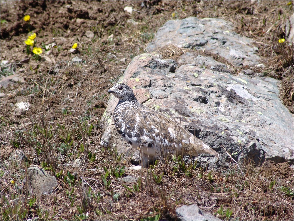
After successfully making it past the snowy sections, I once again stumbled upon a ptarmigan. This time, it let me get very close to it before I even noticed.
A Ptarmigan feeds upon the tundra near the saddle between Handies and Whitecross
The views down into Grizzly Gulch were great during the traverse and I paused several times to get photos of the area.
Ray Payne, traversing towards Whitecross Mountain, with Redcloud Peak left of center.
Most of the way to the saddle between Whitecross and Handies, we encountered some nasty scree below the ridge that we were forced to cross. The rock was the kind that when you stepped on it, huge sections of rock would slide above and below your feet. While this terrain is rather fun when down-climbing, it was not so fun while going across it.

Scree with a red hue made for an interesting traverse to Whitecross Mountain.
Looking back towards Handies Peak - Ray Payne welcomes the break in crossing the awkward terrain.
Ray and I reached the saddle near some fun rock outcroppings and discussed my plans for heading to Whitecross. I told Ray to "send the cavalry if I'm not back by midnight." I took off most of my gear and left it with Ray so that I could increase my speed for the traverse.
Whitecross Mountain sits above interesting terrain
Ray Payne nears our meeting place
I started my traverse over to Whitecross at 11 AM. There were no threatening clouds and I felt solid.

Matt Payne poses on top of a rock formaton on the way up Whitecross Mountain
About halfway up Whitecross, I was able to get a better view of the cornice across the way and Golden Horn (ranked 116) behind it in the distance.

Cornice with Golden Horn behind it.
I made my way up Whitecross quite steadily and quickly. I made great time to the tundra field below it and could see the route up the summit block.
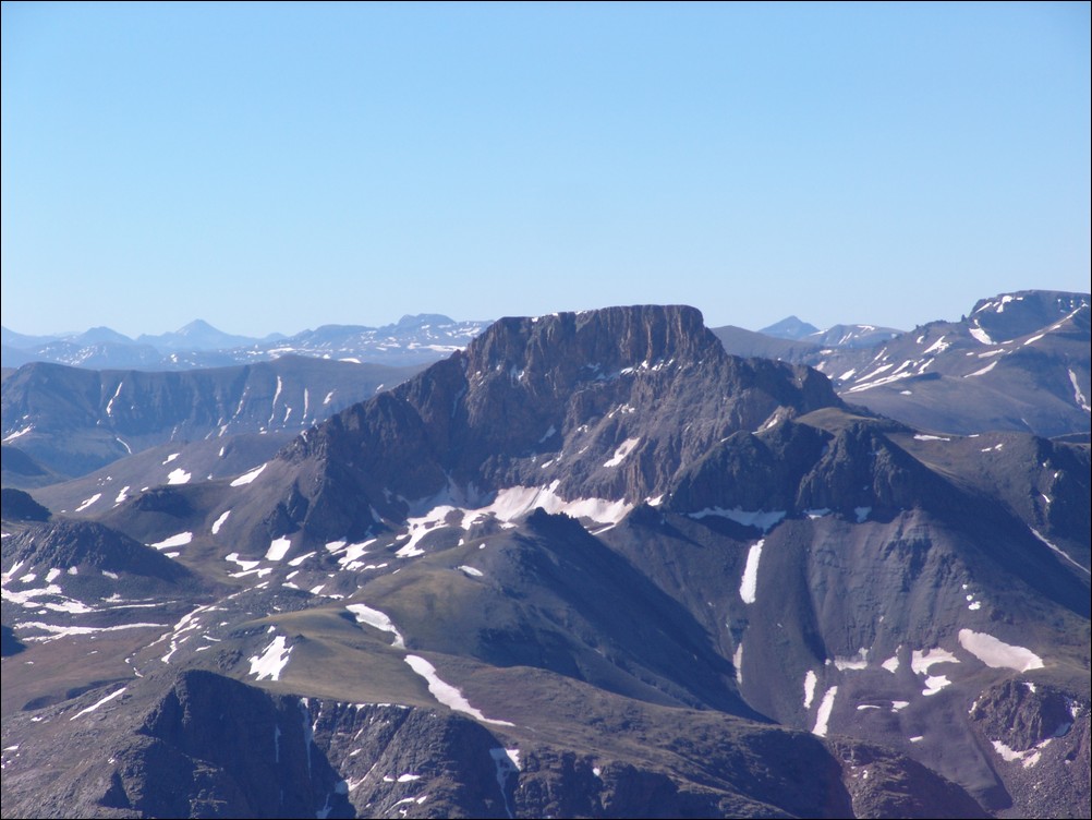
Whitecross Mountain's summit block
I also could see some amazing views of the western ridge of Handies and a couple lakes below it.
A small lake rests in the basin below the western ridge of Handies Peak.
I made my way up towards the top of Whitecross rather quickly and was greeted with views of another neat cornice sitting in front of Uncompahgre Peak and Whitecross (to its left).

A cornice sits below the summit of Whitecross with Uncompahgre and Wetterhorn in the distance.
I finished up the climb up Whitecross and enjoyed views of Handies and the valley below Whitecross which was obscured before. The traverse from the saddle took 30 minutes on the mark.

Handies as seen from the summit of Whitecross
The summit register lays out on the summit of Whitecross.
I signed the summit register (first to do so in 2010), and gathered a few more photos for a panoramic photo and a self-timer summit photo.

Redcloud and Sunshine are seen in better detail from Whitecross Mountain.

A view north, east, and south from Whitecross Mountain.
A self-timer summit shot on top of Whitecross Mountain.
After spending a few minutes on top, I headed back down the ridge towards Ray, stopping once on the way to capture a shot of some wildflowers on the ridge.
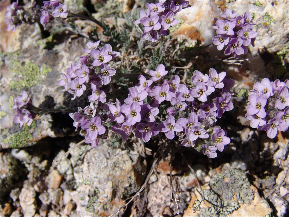
A macro shot of some purple flowers on the ridge between Whitecross and Handies.
After 20 minutes of down-climbing, I reached Ray again, having spent a total of 50 minutes on the traverse from the saddle and traveling a distance of 1.11 miles with 558 ft. of elevation gain. Ray and I packed our belongings and headed down the steep scree to the north of the saddle. We had studied our maps and determined that this route would get us back to the road eventually and that it was the safest descent route. The only downside was that we would be required to hike back up the road to my car. A small price to pay for a great traverse.
Ray descends the steep and loose scree below the Handies-Whitecross saddle.
Ray Payne with the Whitecross-Handies saddle above
On the way down, we captured one last view of Uncompahgre.
Uncompahgre Peak pokes above the surrounding ridges.
The route down towards the road was straight-forward and enjoyable. We made awesome time down towards tree-line.
A look back towards the Whitecross-Handies saddle and the steep terrain negotiated on the way down from Whitecross.
We made quick time to tree-line, and after less than an hour, we were entering the trees and much steeper terrain.
Ray Payne down-climbs from the Whitecross-Handies saddle.
The wildflowers on the fridge of the forest were amazing -yellow flowers were blooming everywhere on the mountainside.
A yellow flower blooms in this macro shot near tree-line.
Soon after entering the trees, the terrain became much steeper and was littered with huge deadfall and other fun obstacles. We negotiated through the deadfall for about 20 minutes until reaching somewhat of a clearing.
Deadfall on the descent of Whitecross and Handies.
From this clearing, we were able to find a small service road on the mountain side. We aimed for this road, hoping we were not trespassing on private property, and followed it down. We were grateful for finding the road, as it had a bridge across the Lake Fork Gunnison River where it connects with the main American Basin road.
We also saw a large mine shaft with railroad tracks leading into it - evidence of that at one time this region was heavily mined.
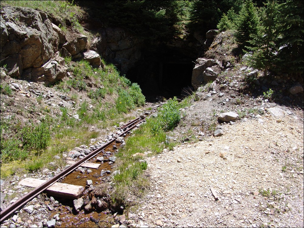
Railroad tracks lead into the darkness of an abandoned mine shaft.
Once back on the main road, we were able to get a good view of the valley and mountainside we had come down.
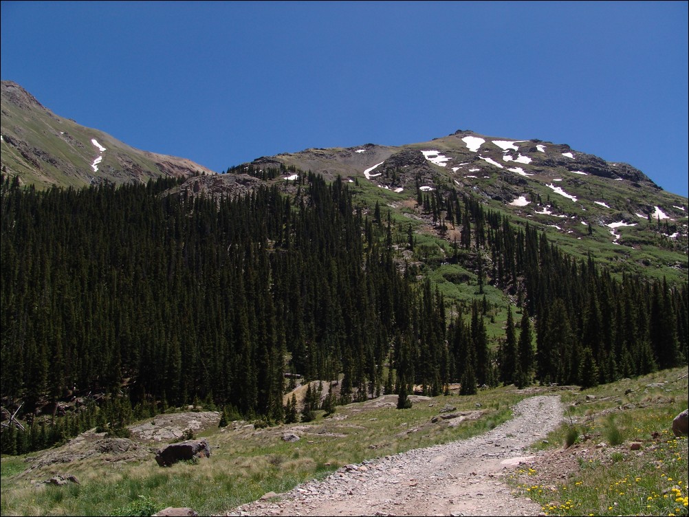
Ray and I hiked back up the road towards my Jeep. The road was pretty long and we needed to hike about a mile or so. American Basin was looking impressive in full sunlight.
American Basin
We crossed the head of the river near a large snowbank we had noticed on the way up the night before.
I took one more photo of the American Basin on the way back up to my Jeep. The waterfalls and surrounding terrain were very aesthetically pleasing after the long day of hiking.
We finally made it back to the Jeep at 2:30 PM and I took one final set of photos to illustrate the daytime views from where we camped.
We packed up our gear after eating some snacks and headed back down the road in my Jeep. This is one of the best hikes up a relatively easy 14er with highly rated views. Given the ease of climb and the rewarding views, I would say that Handies Peak should be on all beginner and serious hikers' to-do lists.
I hope you enjoyed this trip report for Handies Peak and Whitecross Mountain. Next weekend: Missouri Mountain, Iowa Peak and Emerald Peak with my friend, Ethan Buete.