Displaying items by tag: photos
Adventures on Cameron Cone - Views of Pikes Peak and Beyond

This Spring has been quite dry and I've been feeling the itch to get out and get up a summit. I mulled the idea of heading up to do Lackawanna (a high 13er near Independence Pass); however, I knew my time was limited and that I would need to stay closer to home. So, I put out a feeler to my climbing partner Ethan Beute to see if he would be interested in doing something easy close to home. We both settled on Cameron Cone, the easily recognized point often seen in front of Pikes Peak in many photos of Pikes from Colorado Springs. I'd had my radar on Cameron Cone forever it had seemed, so it was a great choice in that regard. At the last minute, I also invited one of my other hiking partners, Sarah Musick, and plans were in motion to meet at Ethan's at 5 AM and hit the Cone. Since both Ethan and I are avid photographers, we opted for the early start in the hopes of getting some decent shots of sunrise from the trail somewhere.
Cameron Cone is named after a famous soldier and newspaper publisher, Robert Alexander Cameron. When originally dedicated, the summit was called Cameron's Cone. The Cone towers 10,707 feet above the city of Colorado Springs and is the fourth highest ranked summit in El Paso County and 1,935th highest in the State of Colorado. For a whole listing of summits in El Paso County, check out this link.
There are several routes to reach the summit of Cameron Cone; however, we chose one of the more rigorous routes to gain the summit. Instead of driving to Crystal Park, as some would suggest, we opted for the long route from Barr Trail. Here is a map of our route, feel free to click on it to see a slightly larger version. All in all the hike was 7.0 miles and 4,175 ft. of elevation gain - a nice work out for sure!

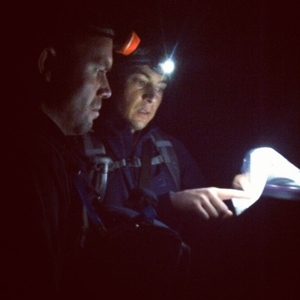
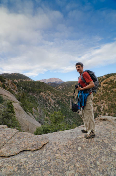
We decided to park on Ruxton Ave. in Manitou Springs and walk the road to where it ends. We then chose to cut left just after the chain link fence to the left of the Barr Trail and then walk the Cog Railway about a hundred feet. From there, we went straight up the hillside to the south until we reached the Englemann Trail. We found this guide to be very useful for the trip, as you can see from this photo of Ethan and I taken by Sarah.
We found the route to be fairly straight-forward once on the trail; however, we did lose the trail in one spot lower in the Englemann canyon. A simple up-climb and we were able to re-locate the trail. I would mention that I did bring my GPS with me and I had entered the coordinates from the Summitpost route description into my GPS as waypoints which proved useful.
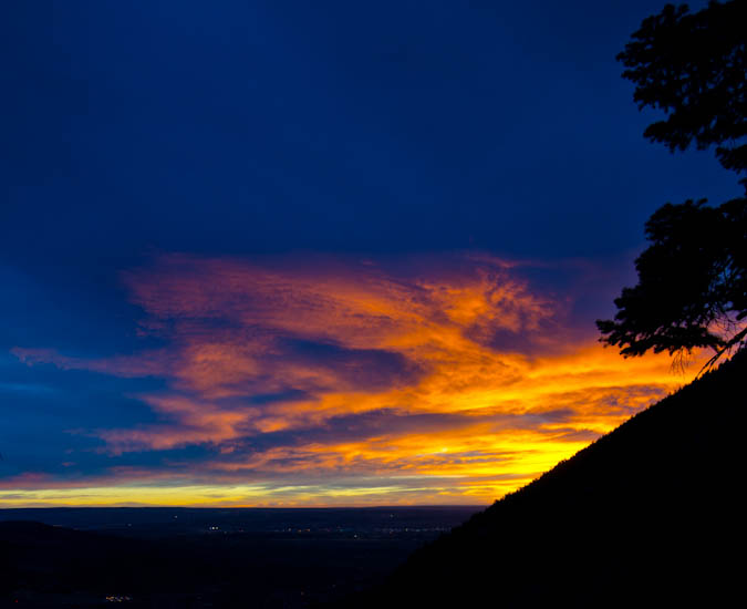
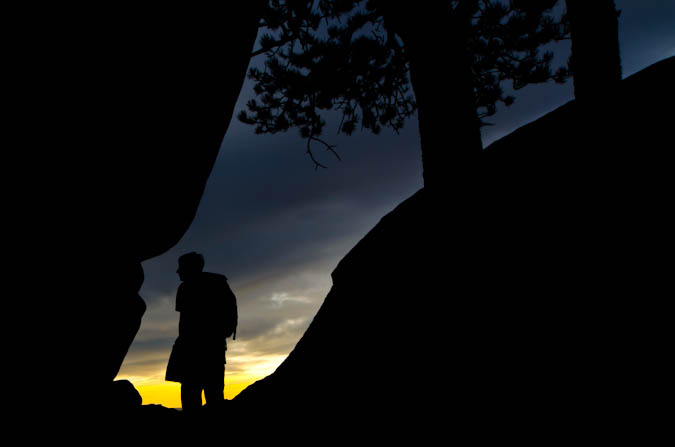
Before we knew it, the sun had begun to rise and we found a suitable place to stop. I set-up my new Gitzo carbon-fiber tripod and took a ton of shots with my Tokina 11-16 lens. I love this tripod! It was somewhat heavy, but well worth the haul. I was not terribly impressed with my sunrise photos, mostly because I think we were too low and some of the view was obscured by Eagle Mountain to the south and east. Nonetheless, here's a few of my shots.
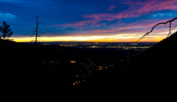
The city lights made for a very cool view.
I also had a little bit of fun doing a very short time-lapse video of sunrise using my intervalometer on my Nikon D7000.
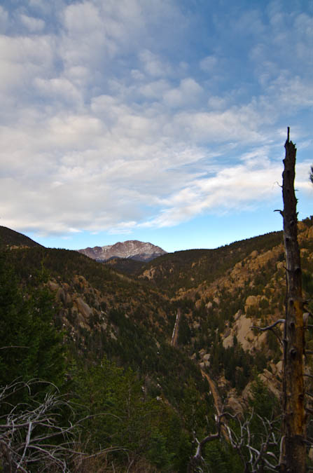
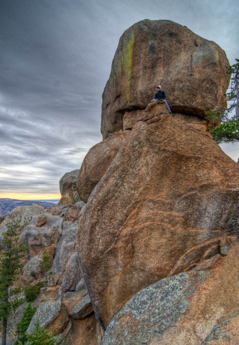
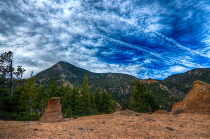
After stopping to take some shots of the sunrise, we continued on up the trail. The trail was fairly steep and kept our heart-rates going. Soon, the trail went around this huge rock feature and then dumped us out with a huge view of Pikes Peak and the Cog Railroad, which was pretty impressive.
The rock near the trail was very classic Pikes Peak Granite, with features very similar to those of outcroppings found in Lost Creek Wilderness Area. A truly fun playground, as Sarah was able to demonstrate.
Ethan and I both enjoyed the view of Pikes Peak from this location.
The terrain was like a playground of sorts, with all kind of really cool features.
We took a few more pictures and then we were on our way up to the next section of the trail.
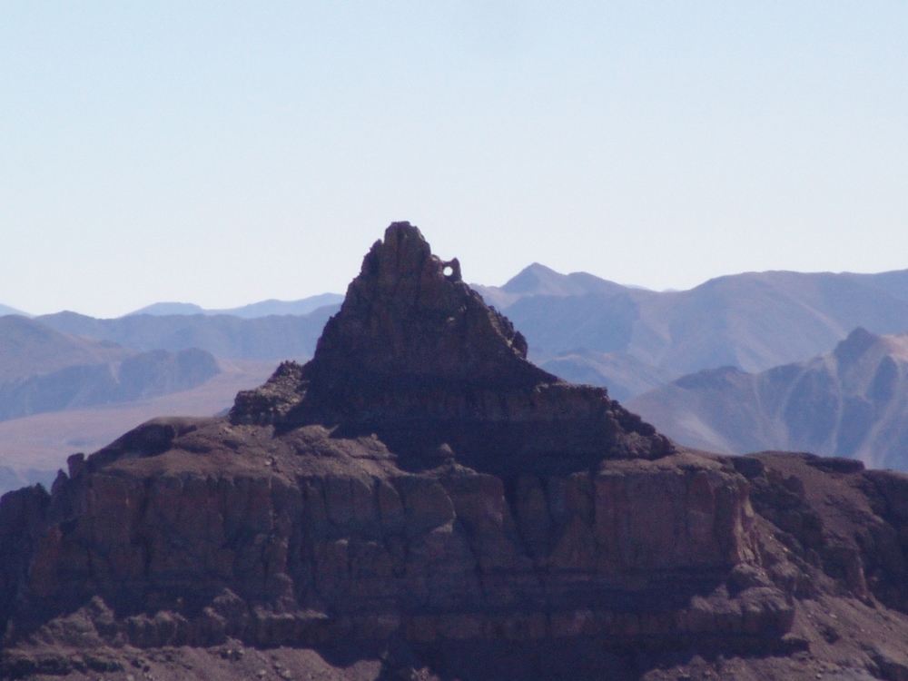
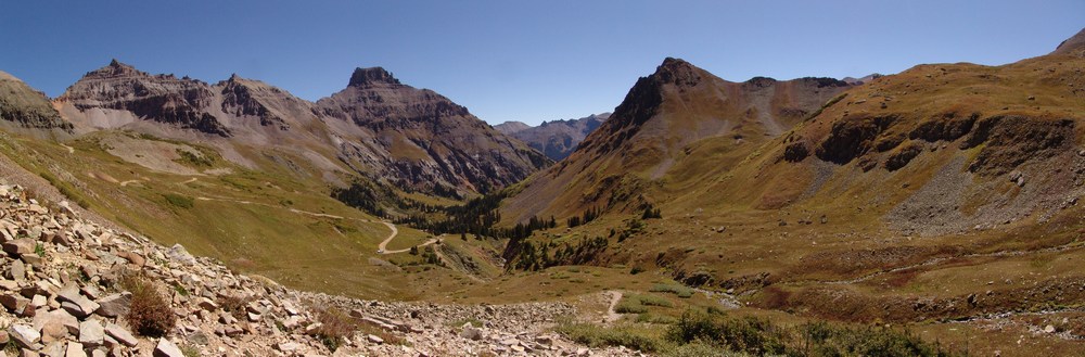
Soon, the trail opened-up again and dumped us out onto a very flat area which was the middle section of the hike. From here, we could see Cameron Cone finally - it seemed a lot futher away than I think we were anticipating. We could also see the Magog Ridge and Magog Rock. For the rest of the hike we all jokingly coined the phrase "Oh-my-Gog."
We went around the huge Magog Rock, which was one of the cooler features I'd seen. It had this smaller rock perched above it which made us all wonder how the heck something like that could even happen.
Ethan took many opportunities to take photos of it as well.
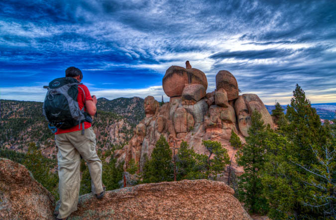
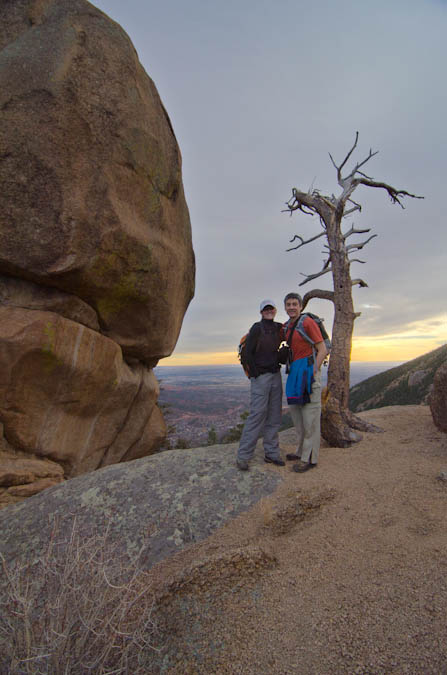
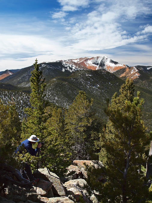
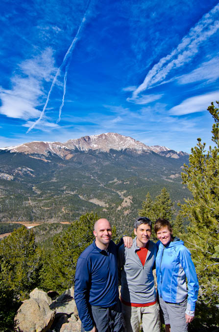
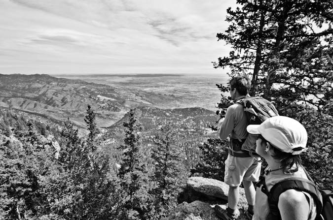
We followed a small road for a ways and then found the trail leading up to Cameron Cone, as advertised. Indeed, the trail was faint and sometimes hard to follow. We did find that there were small ribbons tied to trees at various intervals to help mark the way. We lost the trail a couple of times and found ourselves bushwacking through some steep and nasty terrain. Finally, we reached the ridge to the south of Cameron Cone and then ascended to the summit. It was pretty steep and I could understand if people turned back on this climb. It is much harder than it looks, for sure. Once we reached the top, we all enjoyed the view of Colorado Springs to the east and the unique view of Pikes Peak to the west. I busted out my tripod and set it up for some HDR work. Ethan caught me in the act, with Almagre in the background.
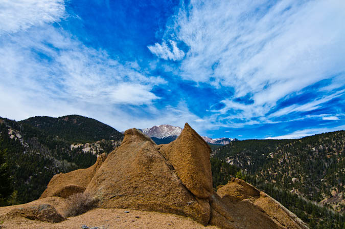
The sky was pretty cool for photography and some jet contrails added to the interest level.
One other nice advantage to bringing a tripod is that it makes for easy group photos.
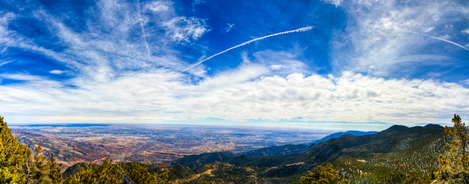
On the other side of the summit, the views of Colorado Springs, Waldo Canyon, Williams Canyon, Garden of the Gods and Colorado Springs were pretty impressive.
From here, I took a quick panoramic photo of the Colorado Springs area, looking northeast, east and southeast.
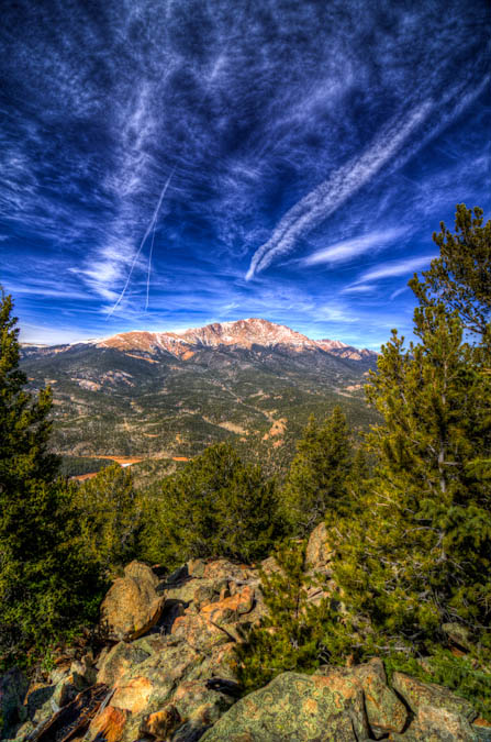
We spent about an hour on the summit and then head back down. The rest of the trip was pretty uneventful, albeit full of great conversation with some really great friends. I left with one parting shot of Pikes Peak.
Overall, Cameron Cone is a great hike! It is tougher than it looks and demands some respect when climbed from Barr Trail. Also, good route-finding skills are also required.
The views of Pikes Peak on this trip are totally worth the hike and are quite unique. You won't be disappointed if you choose this mountain that is off the beaten path.
{fcomment}
Mount Sneffels - A taste of the Southwest Ridge

I've had my eye on Mount Sneffels for quite some time. This gem of a mountain located near Ouray, CO, is one of the most splendid-looking mountains in all of Colorado. Sneffels first caught my attention back in February, when I snowshowed on Miller Mesa, to the North of Sneffels.

Mount Sneffels as seen in February, 2010.
Additionally, I was able to get great views of Sneffels and the surrounding rugged peaks back in June from the summit of Handies, and in July from the summits of Arrow and Vestal.

Sneffels and Teakettle as seen from Handies. Sneffels' pinnacles can barely be seen at the base of the Southwest ridge.

The Sneffels group as seen from Vestal.
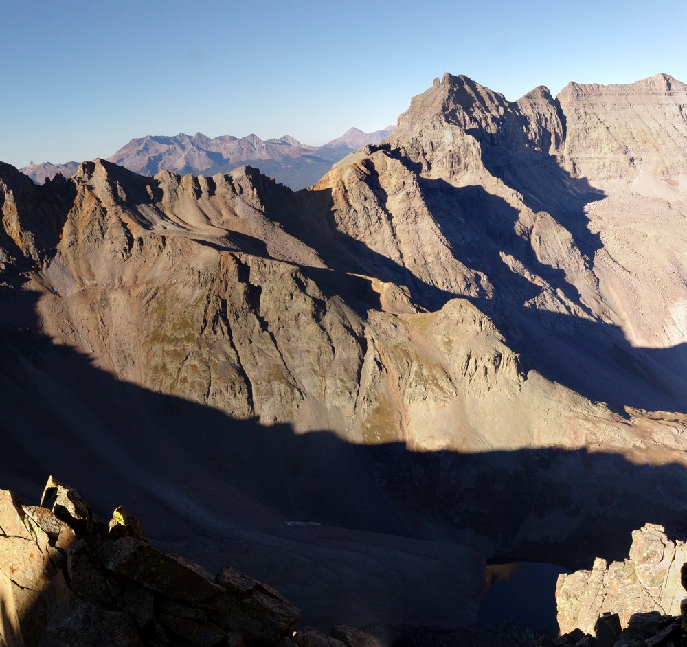
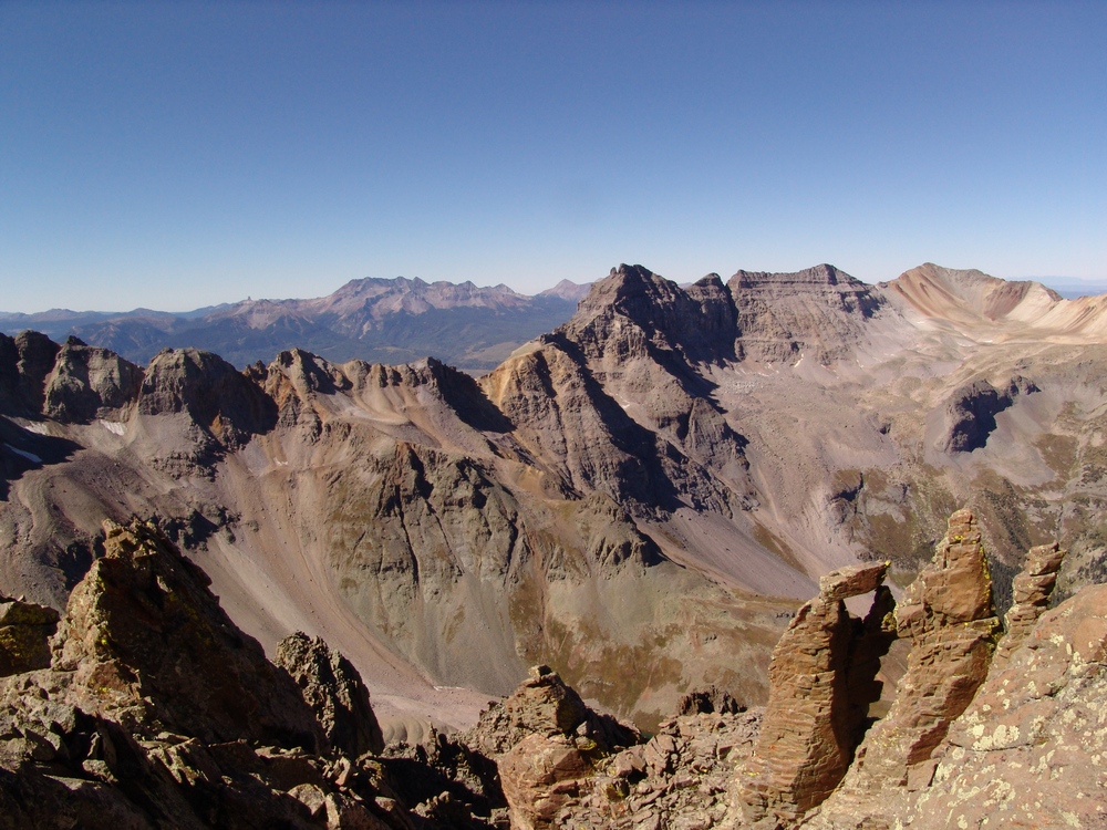
The surrounding mountains are all very rugged, and access to the peak is accentuated by the well-traveled and world-famous Yankee Boy Basin.

The Sneffels "sub-range" (seen above) is probably the second most rugged group of mountains in all of Colorado, next to the Grenadier-Needle range. Sneffels is generally climbed via Yankee Boy Basin from the upper trailhead at 11,600 ft and up what is known as the Southeast Couloir route; however, for this trip, I'd had my mind set on the Southwest Ridge route of Sneffels, which follows the same basic start path of the standard route, but instead of going up the couloir, you gain the top of "Blue Lakes Pass" and then continue up the ridge to the top. In fact, the first recorded ascent of Sneffels, on September 10, 1874 (almost exactly 136 years before) was made by the Hayden Survey via the Southwest Ridge. The Hayden Survey had to "climb with care" because this route is "quite steep in some places."1
From Yankee Boy Basin, the Southwest Ridge looks to be unclimbable because of the jagged pinnacles, known as "The Hand." However, these are avoided by going up the back side of the pinnacles and up a series of steep gullies to gain the ridge, and eventually the top of Sneffels.
Here are some meaningful statistics from this adventure:
Peak summited:
Mount Sneffels: 14,150 ft. (ranked 27th in Colorado)
Total elevation gain: 2,550 ft.
Total distance hiked: 3.86 miles
Total time hiking: 5.5 hours
Total photos taken: 330
Total distance driven: 620 miles
14er # 41 for me.
Joining me on this ascent of Sneffels was my wife's best friend's husband - Arron Shaver. Arron is not an experienced mountaineer by any stretch of the imagination; however, he is a very athletic and fit individual with a love for the outdoors. Arron and I made plans earlier in the summer to tackle Sneffels together in September, and when the week we had planned to climb it rolled around, I received a very prompt call from Arron and we finalized our plans. We left Colorado Springs on Friday night and arrived at Yankee Boy Basin at around 10:30 PM. The drive was made more interesting because the power steering of my Jeep had begun to fail on the way over. Fortunately, this did not prove to be a huge problem and we were able to make camp near where the road has a sign that indicates that "short wheel-base 4WD vehicles only past this point." Although my Jeep is very capable, I did not know what to expect up the road, and did not want to test my vehicle in the dark. We set the alarm for 5 AM and crashed very quickly.
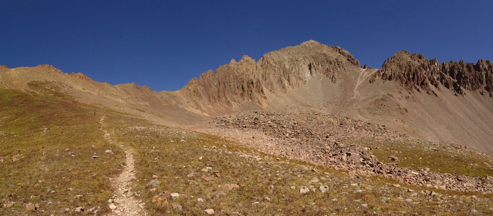
When the alarm went off we were both amazed by the huge drop in temperature from the night before. I am guessing that we woke up to 25-30 degree temps in the morning. After a quick breakfast of oatmeal, we were off to the races. We continued up the road another mile to the end of the road and the start of the trailhead. I was not overly impressed with the difficulty of the road and in retrospect, I would have driven much further had I known it was not a very difficult road. Once at the trailhead, Arron and I were greeted there by a few other hikers, about 5 in total. We started up the trail and quickly reached the fork in the trail for the two different routes available from this trailhead: the Southwest Ridge route (Blue Lakes Pass) and the standard Southeast couiloir route (Mt. Sneffels trail). We broke to the left towards Blue Lakes Pass and watched as the rest of the hikers headed up the standard route. From this point until the summit, Arron and I did not see another person the rest of the ascent.

Our route up Mount Sneffels.
Views of the surrounding peaks were outstanding, right from the start. Teakettle Mountain, Gilpin Peak, and Potosi Peak were impressive. Having seen them all at a distance from many vantage points this summer, it was great seeing them up close and personal!

Gilpin Peak in alpenglow.

Gilpin Peak at sunrise.

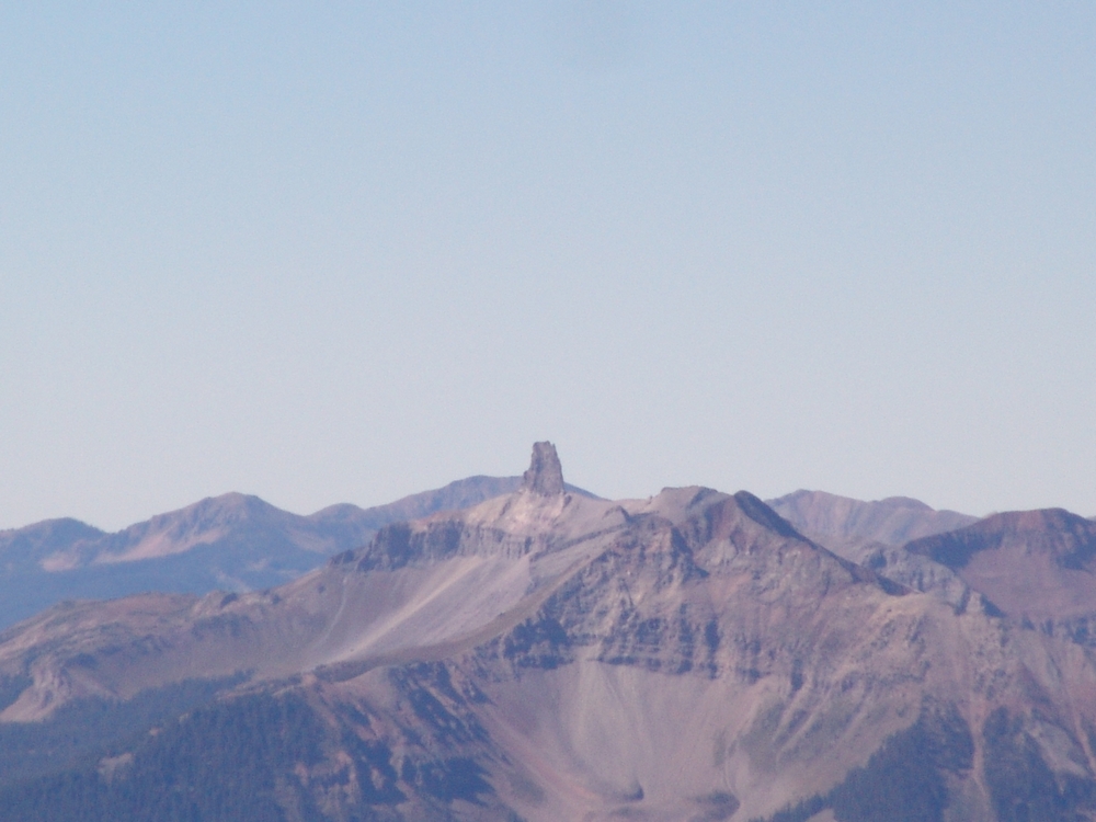
Sneffels' pinnacles.

Arron Shaver - trusty hiking partner.

Potosi Peak.

Gilpin Peak in the early sun.

Matt Payne nearing the top of Blue Lakes Pass. The ruggedness of the pinnacles can be seen.
The hike up to Blue Lakes Pass was quick and painless, and before we knew it, we were enjoying intense views of Dallas Peak, West Dallas Peak and "T 0" after crossing into the Mount Sneffels Wilderness Area.

Blue Lakes Pass provided awesome views of Dallas Peak.

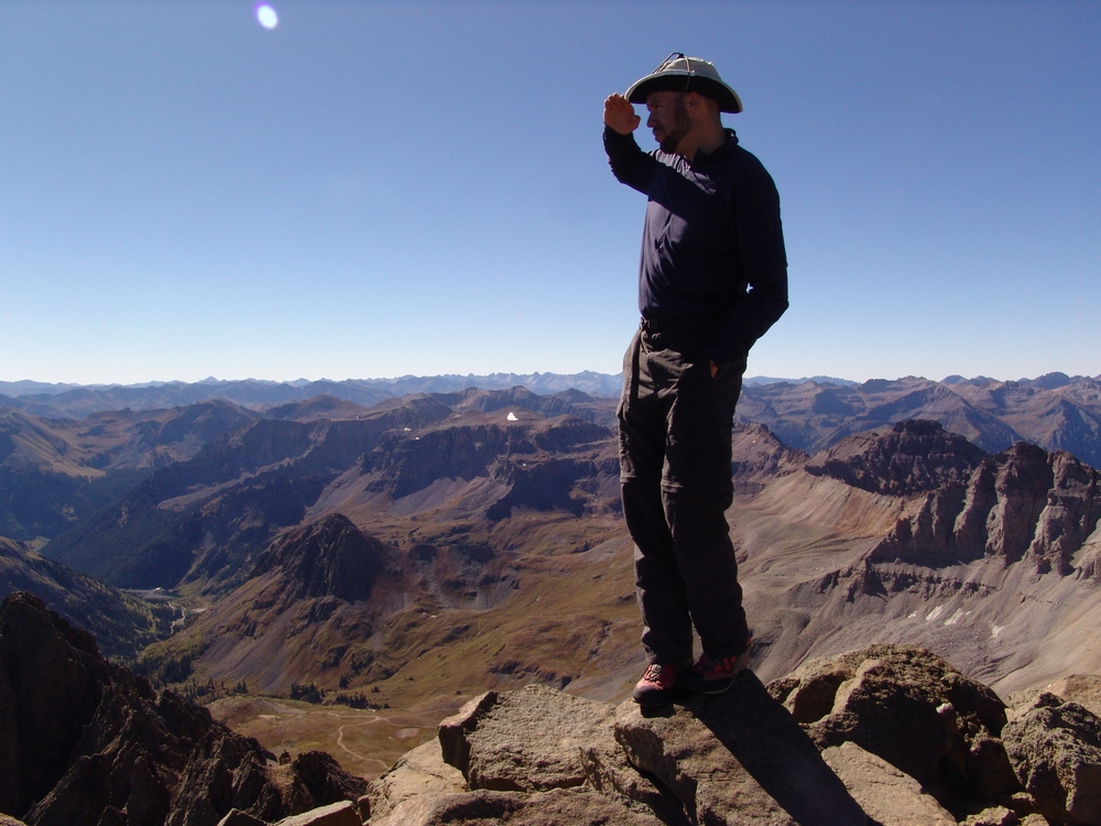
Matt Payne at the top of Blue Lakes Pass.
From the top of Blue Lakes Pass, the route heads directly behind the pinnacles and up a somewhat steep boulder field.

The backside of the pinnacles of Sneffels.
The trail here was fairly easy to find and the route seemed fairly self-explanatory - up! As the sun continued to rise, we could see the awesome Blue Lakes basin below Dallas Peak.

As we continued to climb up the gullies, Lizard Head finally came into view for the first time. Lizard Head is a tall spire near the Wilson group to the Southwest of Sneffels and is only climbed by experienced rock climbers, as the route up it is 5.8 on the YDS. For a great read on the Lizard Head approach and climb, see Sarah Thompson's site, 13ergirl.com.
Lizard Head is barely seen at far left, with the Wilson group rising above the ridge between Dallas Peak and Gilpin Peak.
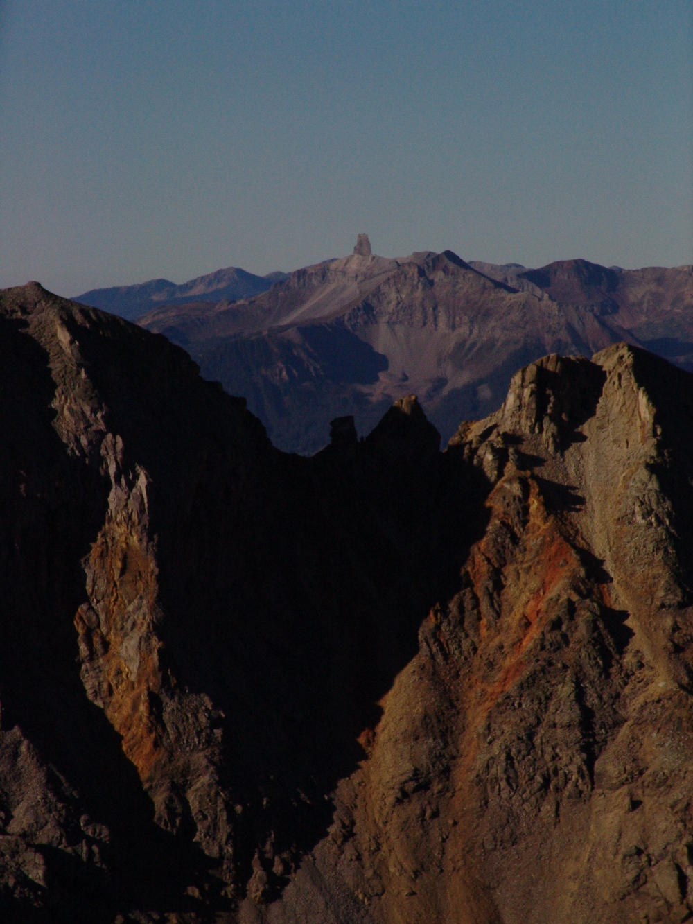
Lizard Head - zoomed-in.
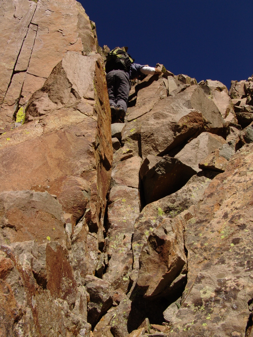
As we continued to climb up the first gully on the Southwest ridge, we finally reached the top of the gully and were forced to down-climb to a ledge, which led us to the base of some class 4 sections just before the obviously last ridge section.
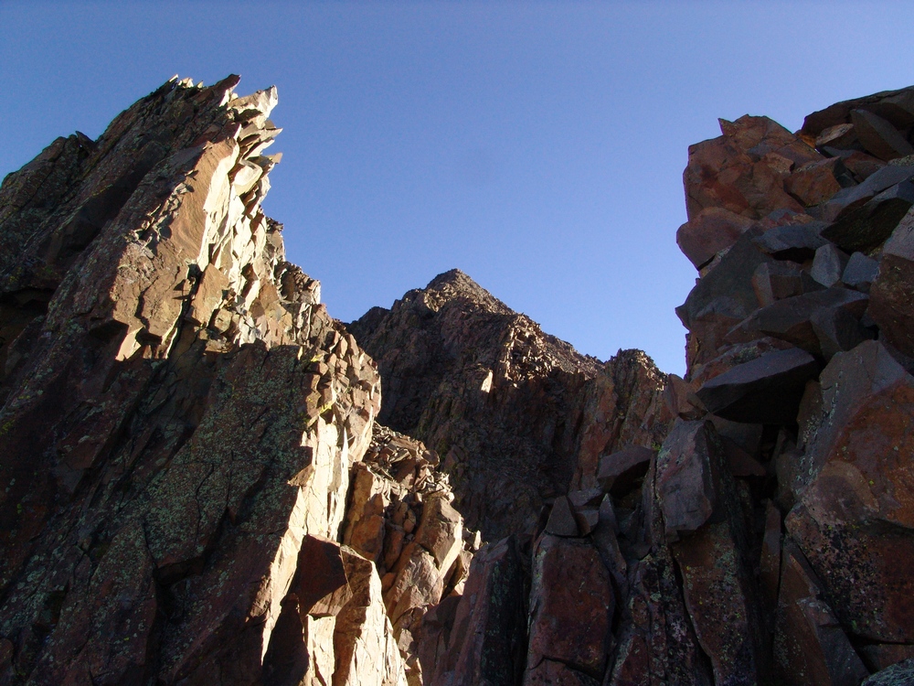
The terrain on the Southwest ridge was crumbly and jagged.

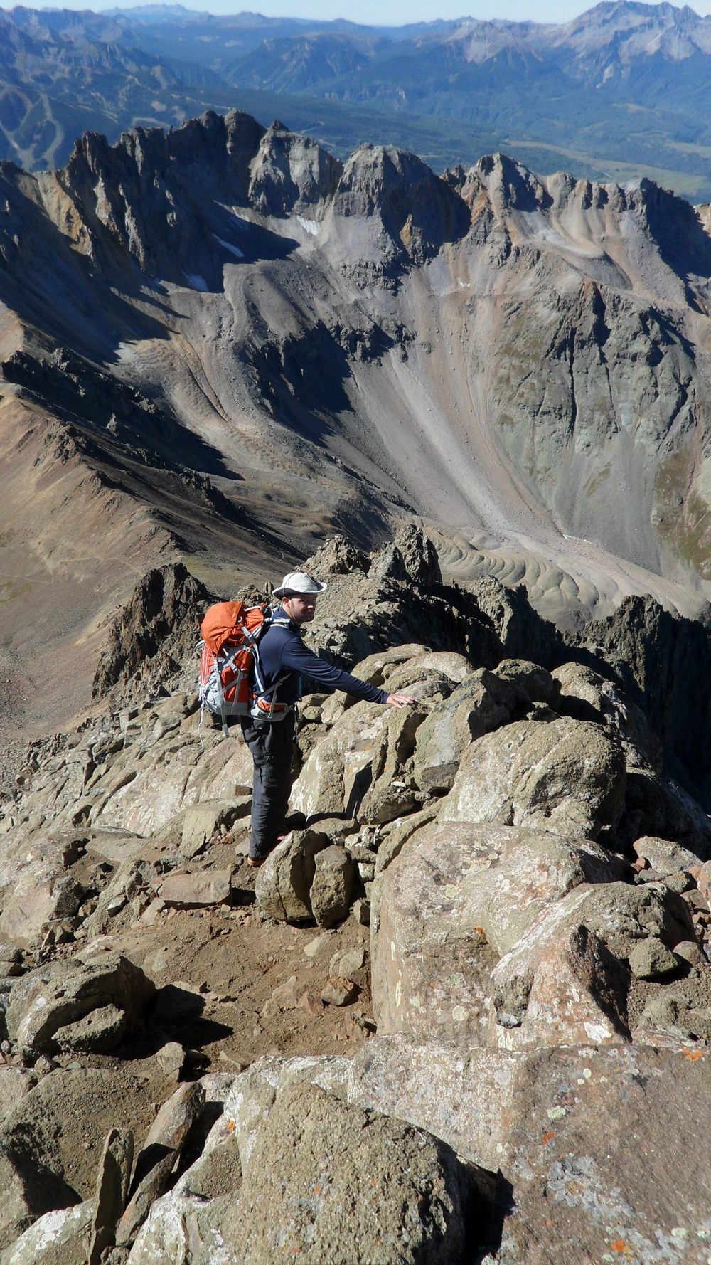
Matt Payne starting the Southwest Ridge of Sneffels.

Arron Shaver on the Southwest Ridge of Sneffels.
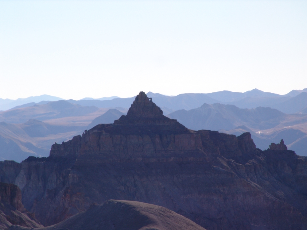
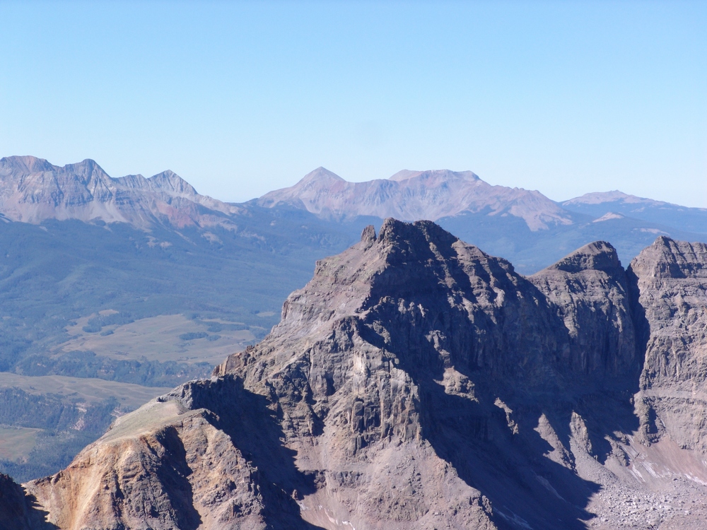
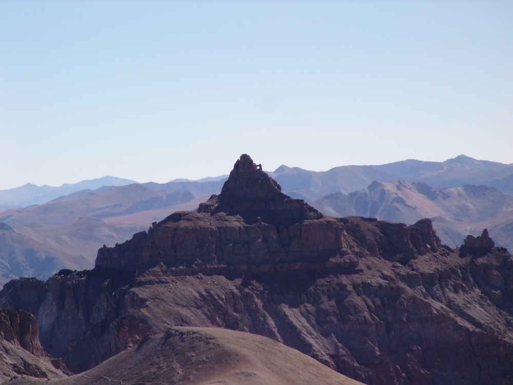
The climbing up the ridge was quite enjoyable. The rock was quite solid, with ample hand-holds and foot-holds during the class 4 sections. Finally, Teakettle and Potosi came back into view, and they did not disappoint. Teakettle is one of the most appropriatly named mountains in Colorado. Shaped like an actual teakettle, sporting a spout and a handle - Teakettle is both a geologist's and a photographer's dream.

Teakettle Mountain is seen at far left, with it's handle represented as a large hole in the rock. Potosi Peak seen at far right.
I remember being very impressed by Teakettle, even as a child. My dad climbed Teakettle in the 1980's and this photo was taken of him inside the handle of the teakettle:


Teakettle Mountain, zoomed-in.
At this point, our views of Yankee Boy Basin below was quite impressive as well, with the golds, browns, yellows and greens of fall accentuating the pristine basin.

Yankee Boy Basin.
Looking in any direction, we could see some amazing peaks. Teakettle, Potosi, Gilpin, and Dallas made for quite the fall back-drop.

On the way up the ridge, we were able to find the Kissing Camels rock outcropping that is often described on route descriptions for Sneffels. The landmark is almost impossible to miss.
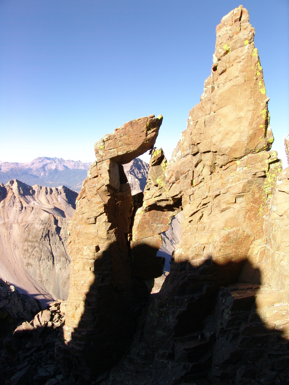

Dallas Peak can be seen through the Kissing Camels rock outcropping. Arron caught me in the act of taking that photo...
Yankee Boy Basin far below.
The climb from the Kissing Camels was very straight-forward - we continued up the steep ridge, appreciating the added difficulty and greater views of the Southwest Ridge route over the standard route.
Teakettle Mountain was difficult to keep from staring at. It truly is one of the more remarkable mountains I've seen. So remarkable, that I had to get a super-zoomed in view of it!
Arron was also excited about the route - being that Sneffels was his first 14er of his life - I think I may have spoiled him with one of the more fun routes of any 14er.

Arron with the ridge behind him. "Cake Batter" spills down the ridge between Dallas and Gilpin. (Zoomed in at right)
I suspect that the "cake batter" looking stuff is probably caused by mud slides during the monsoon seasons that often plague the San Juan Mountains.
We finally reached the summit just as the other group was reaching the top as well. The weather was perfect. No clouds. No wind. Warm. We could not have picked a better day to climb.
As usual, I took several photos from the summit and celebrated with the other climbers.


Arron's summit shot.
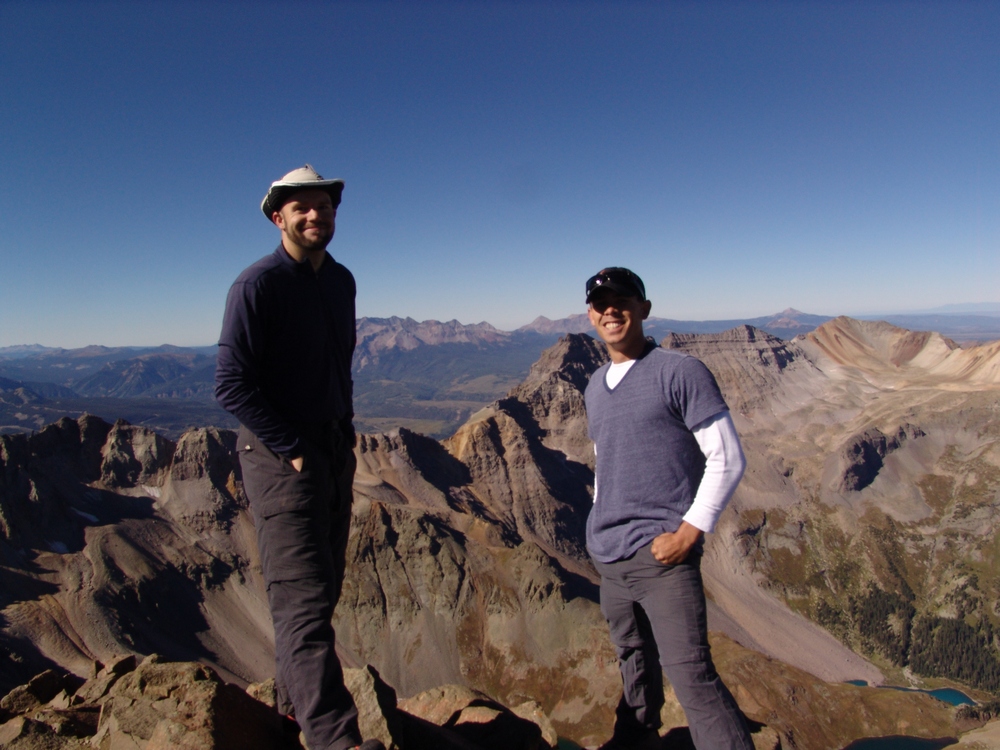
Matt and Arron on the summit of Mount Sneffels.
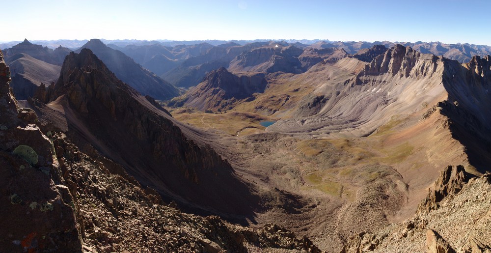
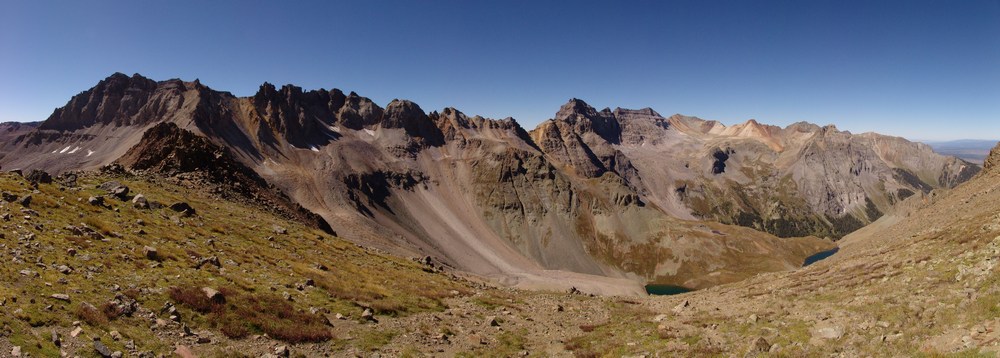
Views of the Grenadier Range (Vestal, Arrow, etc), and the Needle Range (Eolus, Windom, Sunlight, Pigeon, etc) were great as well as views of Uncompahgre and Wetterhorn. What I was most impressed by was the views of the Grand Mesa and the land between Sneffels and the mesa. The town of Ridgway, Ridgway State Park, and Ridgway Reservoir could all be seen easily as well. What was also impressive were the views of the Telluride Ski Area, the Wilson group (Mount Wilson, Wilson Peak, El Diente, and Gladstone Peak), and the La Plata Mountains.

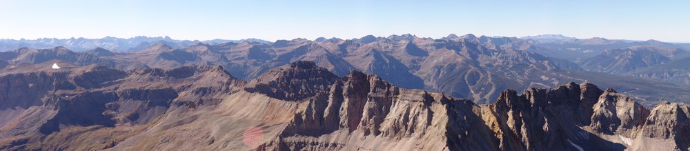
Mount Sneffels East to West Summit Pano.
Gilpin Peak and Telluride Ski Resort. The Grenadier and Needle ranges seen in the far distance to the left.
Teakettle Mountain and Potosi Peak zoomed in.
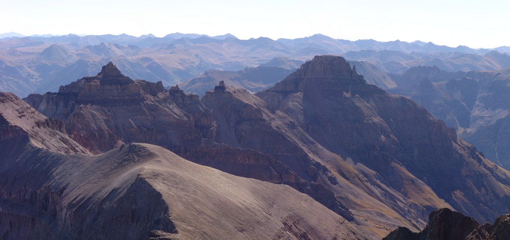
Teakettle, Potosi, Yankee Boy Basin, Gilpin, and Telluride.

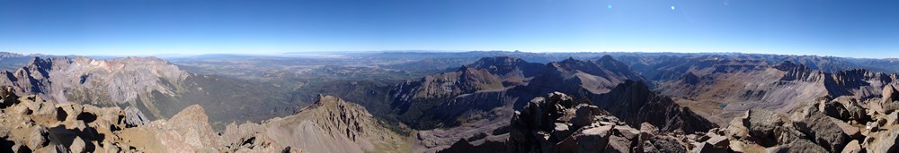
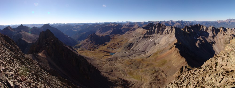
360 Degree Summit Pano from Sneffels.

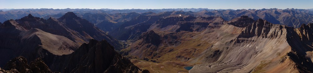
Sneffels summit pano - north and east

Uncompahgre seen in the distance...
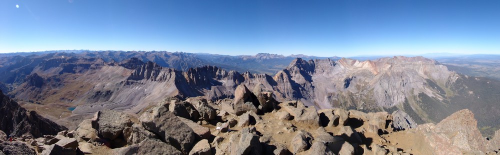
Sneffels Summit - looking south
Dallas Peak, Zoomed-in.
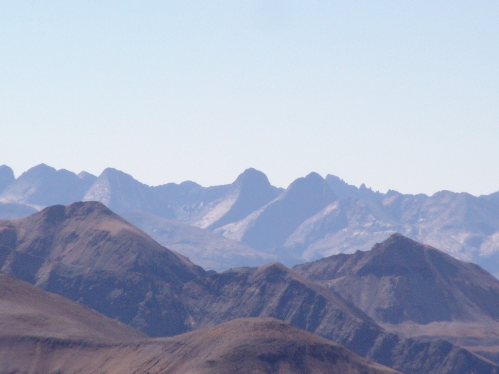
The Grenadier Range - Zoomed-in - including Vestal Peak and Arrow Peak. See that trip report here.
Lizard Head Zoomed-In
And of course, a summit photo is no fun unless I'm posing in a silly way...

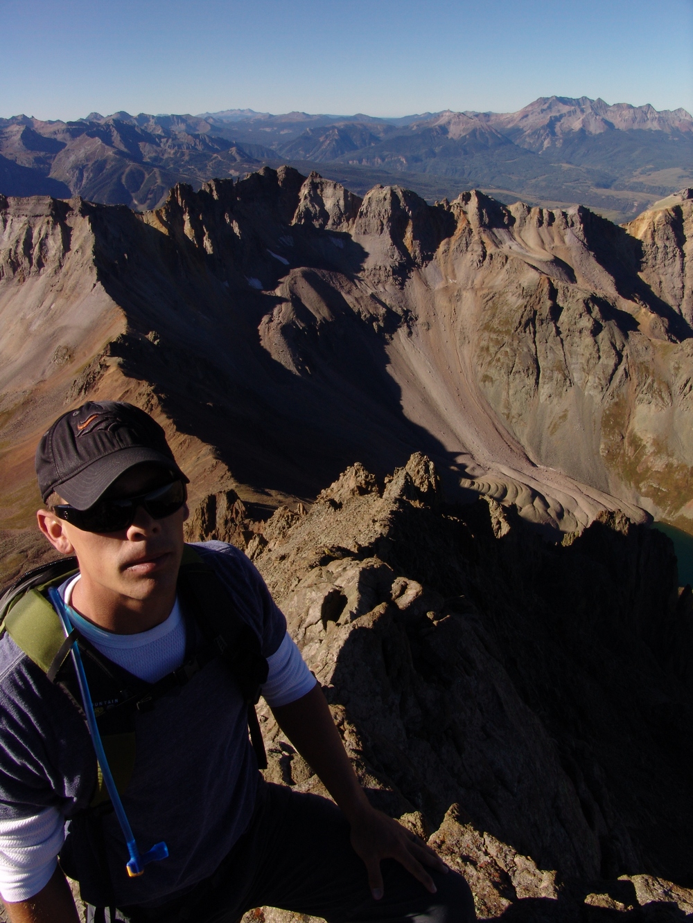
Matt Payne taking photos on the summit of Sneffels.
After quite some time on the top, Arron and I decided to descent the same way we ascended. The down-climb was challenging but solid. There were some tricky sections that required some in-facing down-climbing, and a few spots where we needed to wait for each other to ensure neither of us were hurt by rock-fall from above.
Down the Southwest Ridge!
Teakettle Mountain
Teakettle with digital zoom.
We reached the camels again in no time and I took one last shot of the Wilson group.
The trickiest part was when we came across some class 4 rock that we had to negotiate. It was a fun challenge for sure.

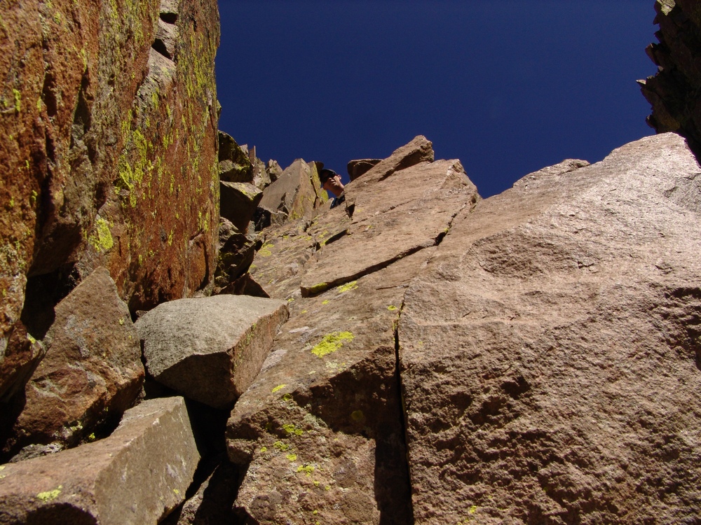
The class 4 section provided some entertainment.
We headed back down to the Blue Lakes Pass ridge without any problems.
Blue Lakes Pass. I wonder why it is called Blue Lakes Pass?
The Blue Lakes Pass trail and Mount Sneffels.
We hiked down the Pass back towards Yankee Boy Basin and decided to take a side trail that led us to a small lake at the base of Gilpin Peak.
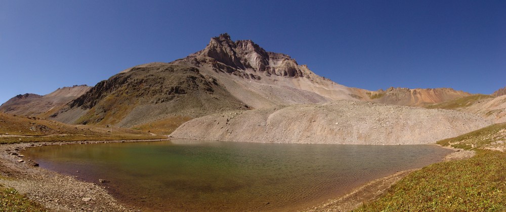
Gilpin Peak and Mount Sneffels.
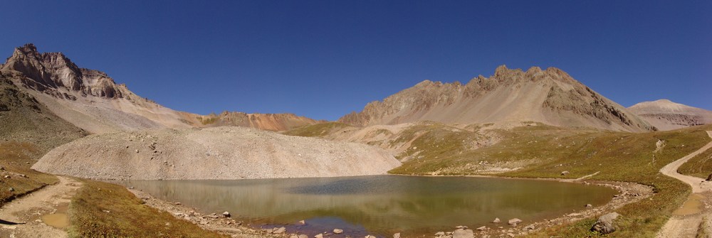
As we hiked down, we were blessed with one last great view of Yankee Boy Basin.
Yankee Boy Basin
We reached my Jeep at 12:00 PM and drove out. The road was quite enjoyable in 4WD without power steering...

If you've never been up the road, it is worth it to drive up it. There is a really awesome overhang about halfway up the road that is quite impressive.
We drove into Ouray and ate lunch at the Ouray Brewery, which proved to be a great decision because they have a patio on their roof that made for excellent fall weather dining.
I hope you found this trip report useful and / or enjoyable! Thanks for reading!
References:
1 Rhoda, Franklin, Summits to Reach, An Annotated Edition of Franklin Rhoda's "Report on the Topography of the San Juan Country," edited and with preface by Mike Foster, Boulder, Pruett Publishing (1984).
2 Rosebrough, Robert F., The San Juan Mountains: A Climbing and Hiking Guide, Evergreen, Cordillera Press (1986).