Displaying items by tag: Collegiate Peaks
Climbing the Crown Jewel of Colorado's Sawatch Range - Ice Mountain & North Apostle
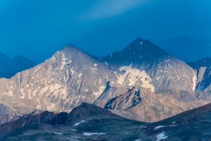
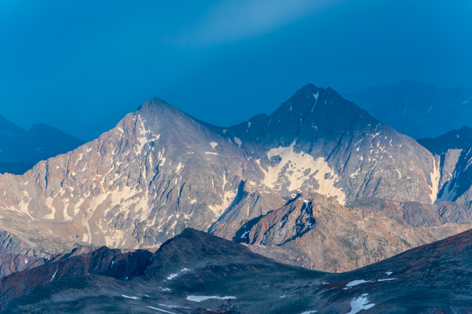
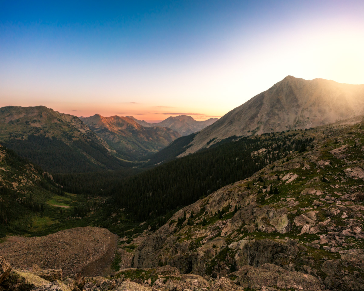
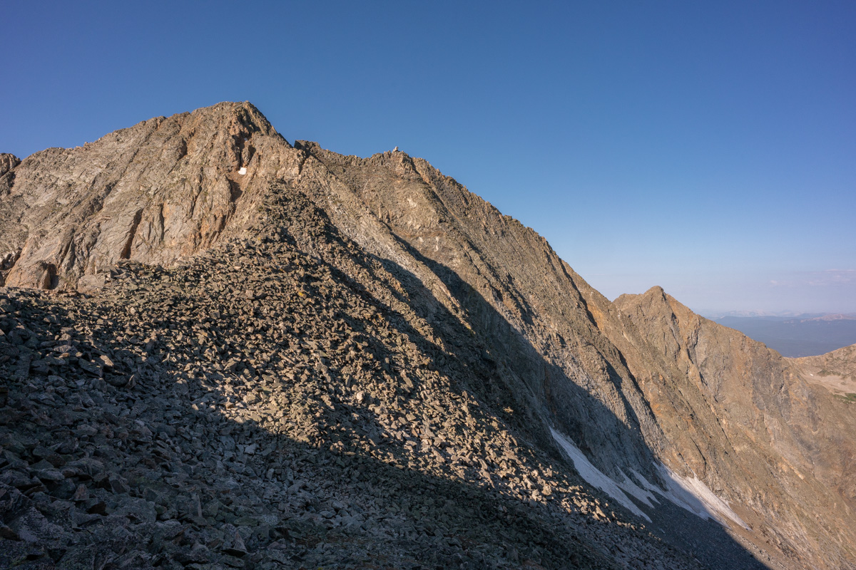
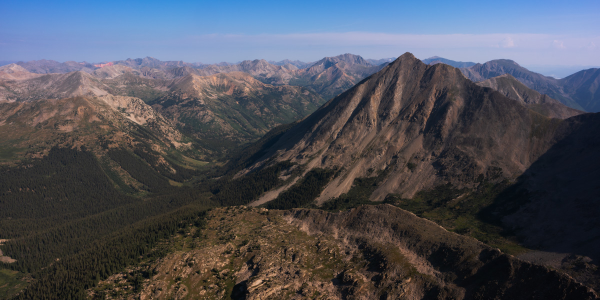
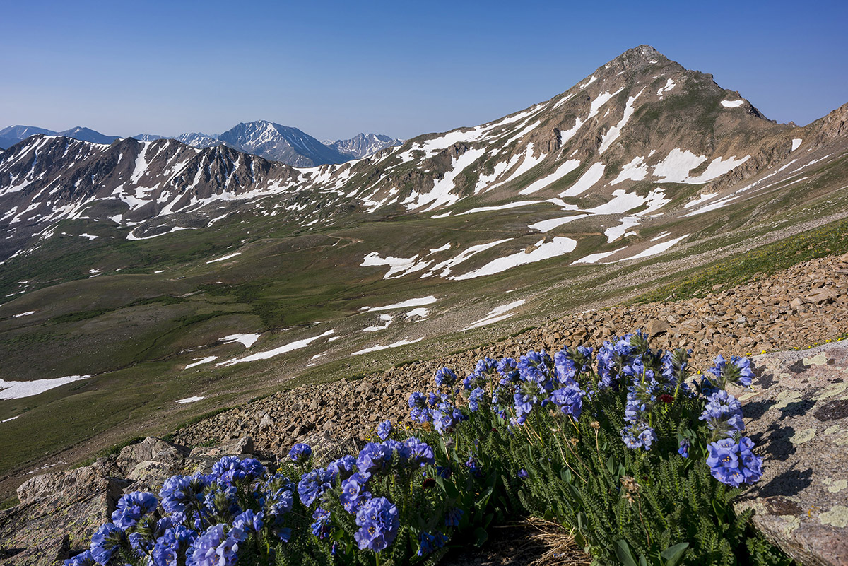
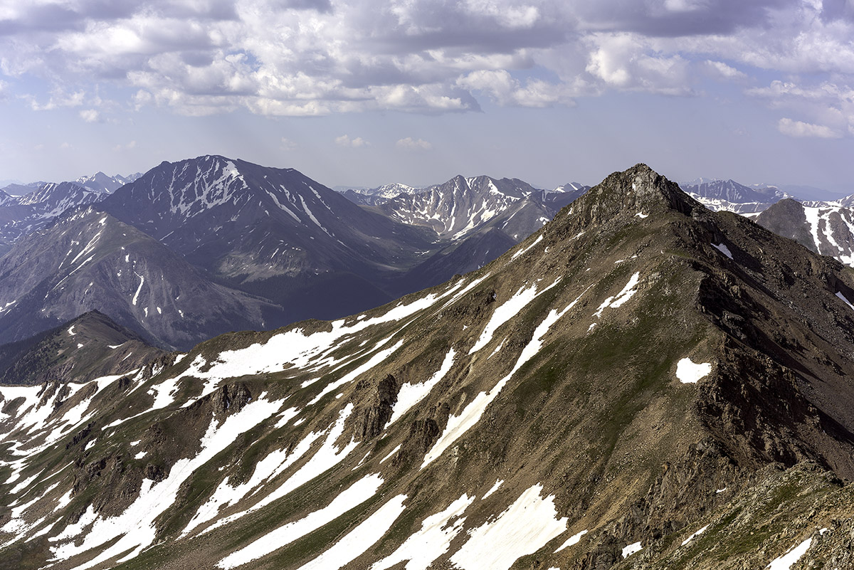
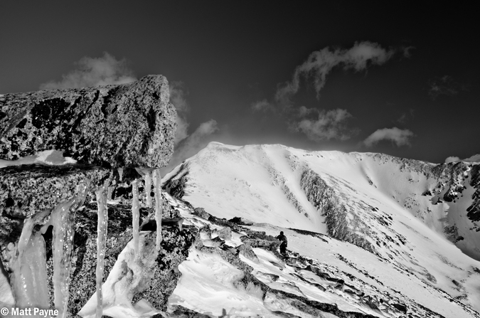
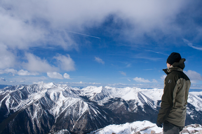
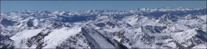
North Apostle and Ice Mountain as seen from Grizzly Peak in 2013.
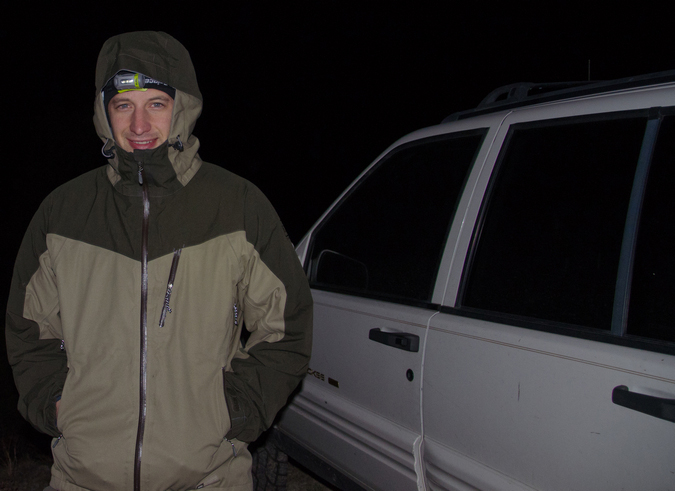
2018 will be the year that I finish my lifetime goal of climbing the highest 100 mountains in Colorado. Or at least that is what I keep telling myself to stay motivated! Having climbed Dyer Mountain back in May, and Silverheels, Buckskin, and Stewart earlier in June, I found myself faced with only four mountains left to complete my goal: North Apostle, Ice Mountain, Cathedral, and Thunder Pyramid. Having Fridays off of work most of the time, I was faced with some options in terms of climbing - I could leave Friday from Durango, find a camp-site, climb on Saturday, and then drive home; or, I could do something stupid. I went with stupid. My friend Silas (featured in many trip reports here) was climbing Capitol Peak the same weekend and I really wanted to climb that again with him. I decided I would try to squeeze both climbs into one packed weekend, at the last second. So, I packed my car with both backpacking and car camping stuff and left my house in Durango after work on Thursday at 8:30 PM to drive to the trailhead for the Three Apostles. I ended up arriving at the trailhead at 1:00 AM and slept in my car until 3:45 AM, at which point I left the car and began my journey on almost no sleep. Huge mistake...
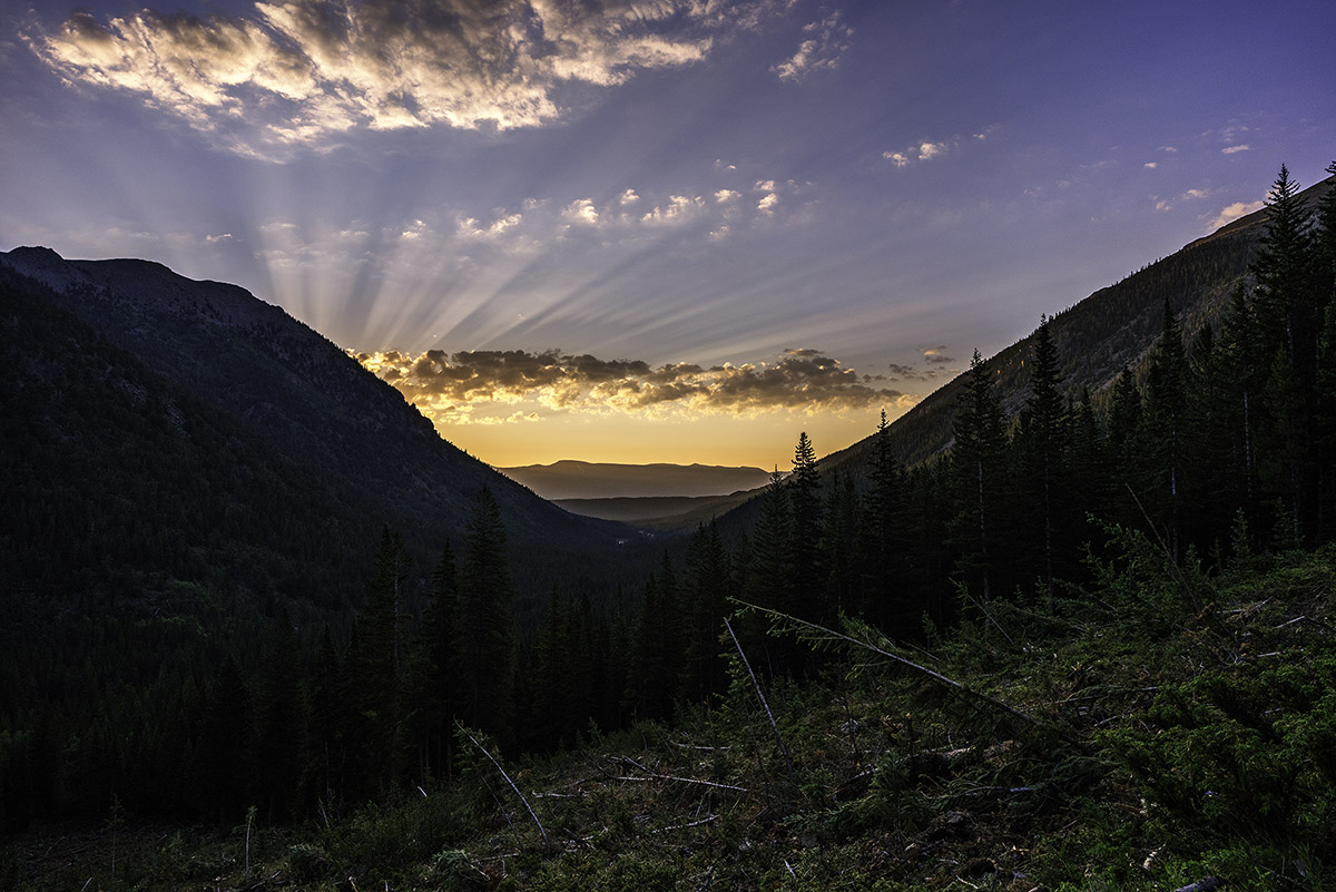
I've been eyeing the Three Apostles for years. I first admired their incredible stature when I was much younger on camping trips with my parents around Winfield. I remember one particular year going on a camping trip with my parents and my friend Jeremy where we hiked up into the upper basin and could see the Three Apostles - they looked intense! My next foray in seeing them up close and personal was in 2010 when I climbed Huron and Browns with my friend Mike Vetter - I recall being quite impressed with the peaks then as well. My latest encounter with them was watching the sunset from the summit of Grizzly Peak to the northwest of the Three Apostles and seeing a huge rainbow over Taylor Park. That was awesome! That particular trip, I hauled a huge telephoto lens up to the top with me and shot North Apostle and Ice Mountain at sunset. Good times!
As always, you can see and download my full route and GPS tracks over on the incredible app, Gaia GPS, which I use on my iPhone to plan, track, and follow my routes on these trips. It is absolutely invaluable and worth every cent. I personally love that you have full access to all USGS topo maps and National Geographic Trails Illustrated maps as well. You can use the app while in airplane mode and even save maps for offline use. To get a nice discount on the application, follow this link and you'll also support my efforts to keep this site running.
My full stats for this particular climb, which included summiting North Apostle (13,860 ft.) and Ice Mountain (13,961 ft.):
- Peaks climbed: 2
- Miles hiked: 10.8
- Time: 10 hours, 34 minutes
- 3,657 ft. elevation gain
For this trip, I decided to pack quite a lot of camera gear (by the way, these are affiliate links and using them helps me pay for this site and to bring you better content):
I found the trail going up to the Three Apostles to be very straight-forward. I followed the decent trail beta from Gerry Roach's High Thirteener Guidebook. I was still using the 1st edition of the book, which I'm told has some route errors for this mountain; however, his new edition is available on Amazon after many years of waiting - rejoice!

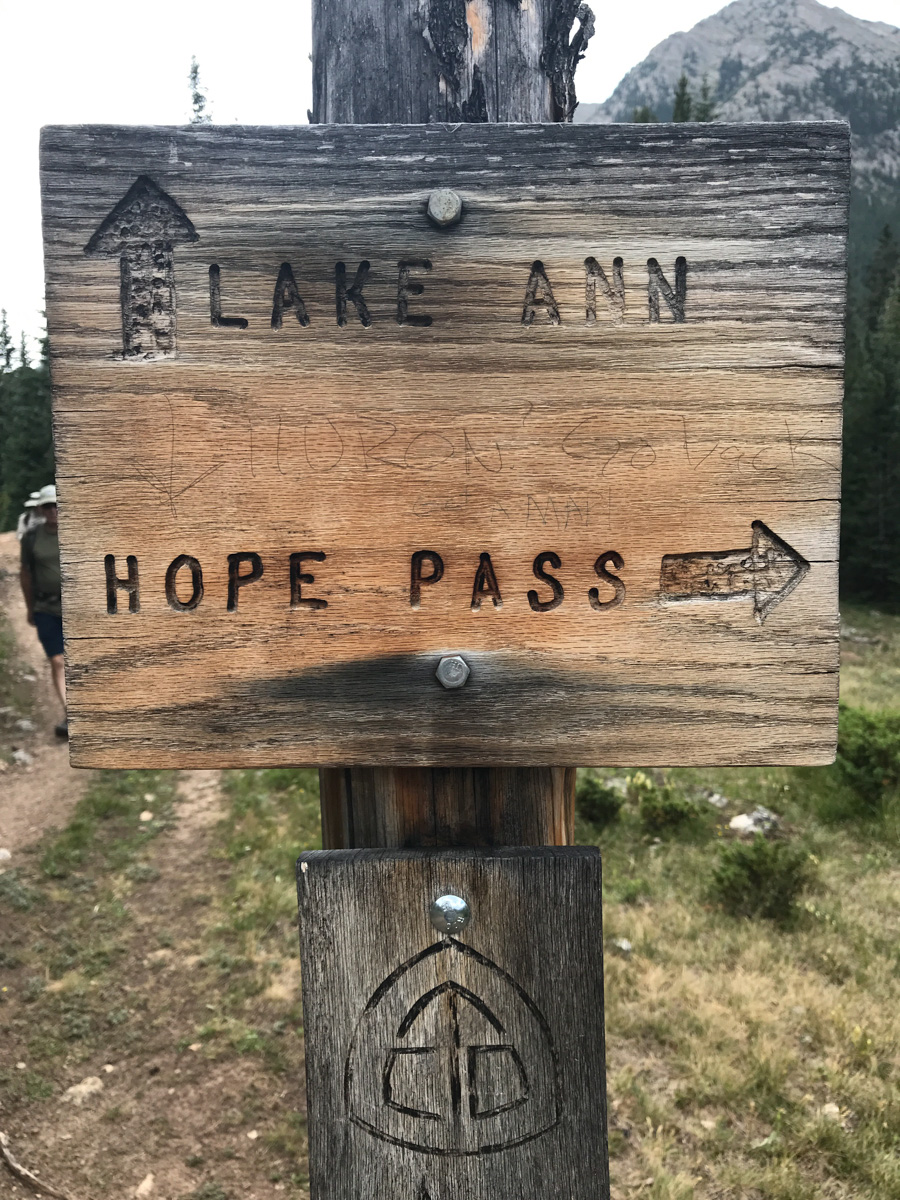
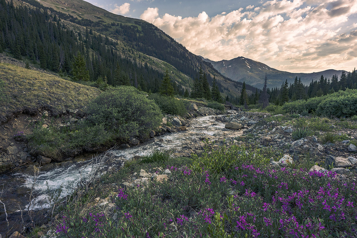
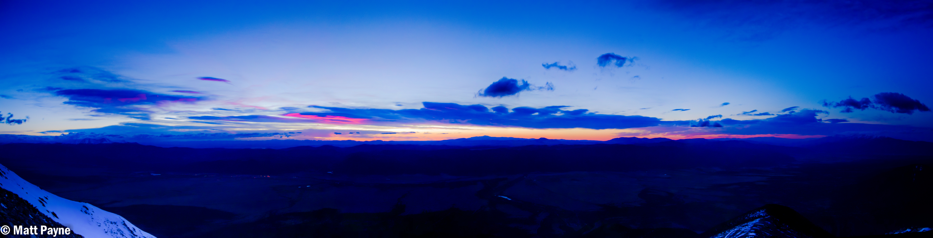
The trail follows the same trail as Huron for a while; however, there are several branches off of the trail to keep note of. Generally, you keep going straight. There are two signs before you are officially on the Trails Illustrated Apostles Trail 1445. I took a picture of one of them on the way down as seen below. I especially enjoyed seeing someone pencil in that if you were at this particular sign, and were climbing Huron, you had gone too far. That's how you know you're on the right trail for the Three Apostles. Having departed my vehicle at around 4 AM in the dark under a full moon, I had optimistically hoped to shoot sunrise from the summit of North Apostle (or nearby). Due to having almost no sleep, this proved impossible. Once I hit treeline, I found my pace slowed significantly.
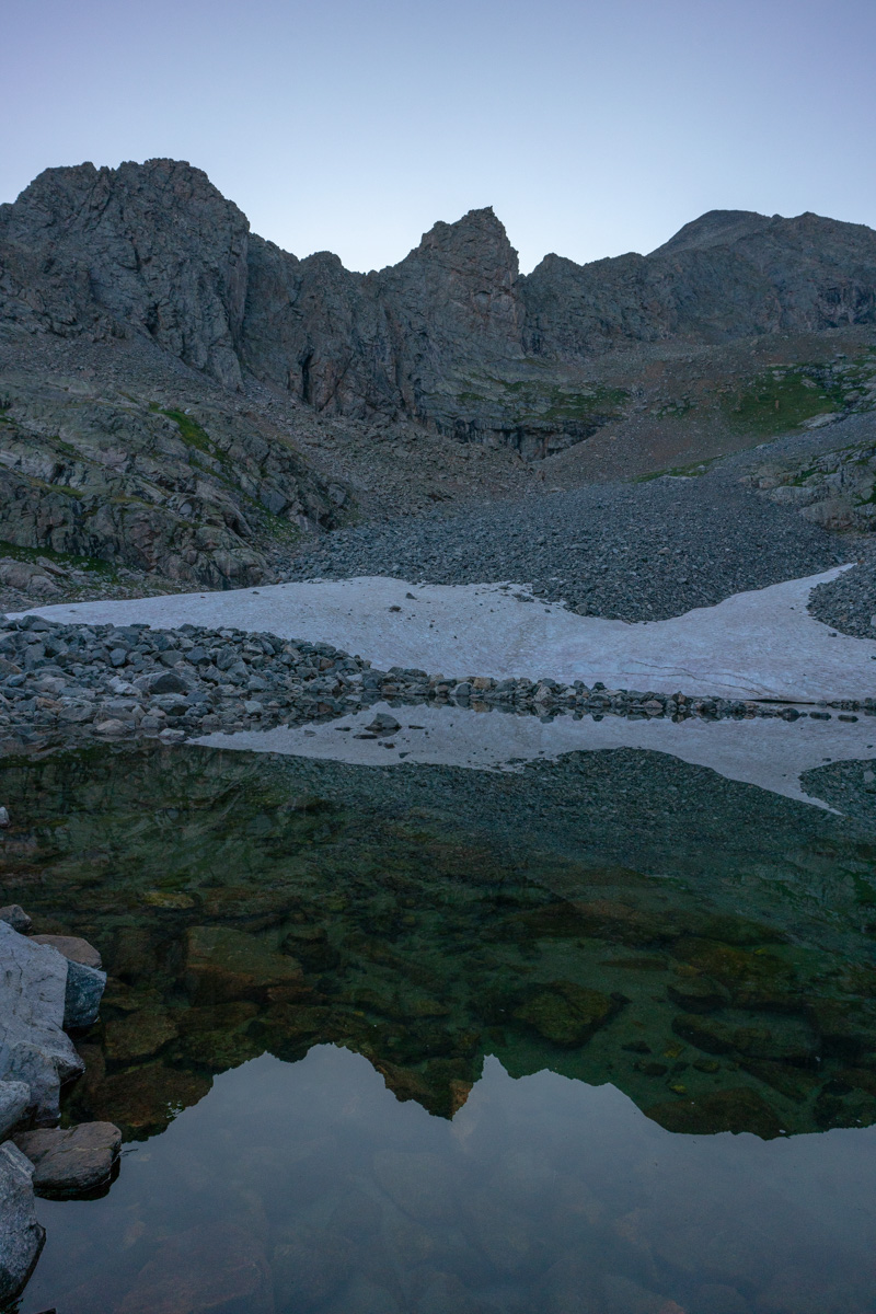
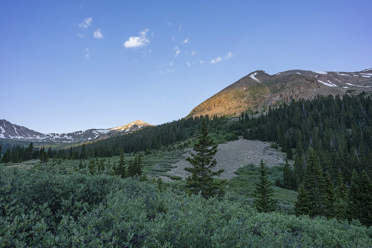
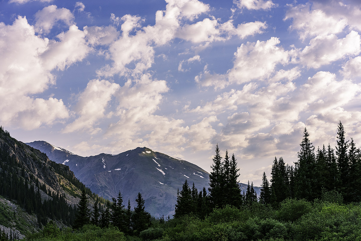
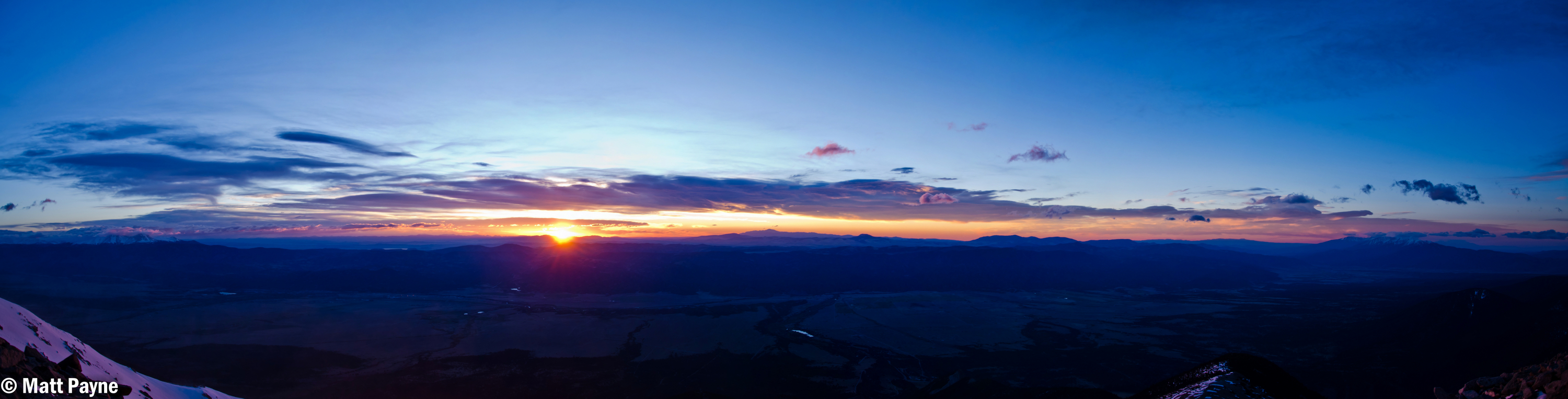
I reached treeline at about 5:30 AM and the scene really opened up above me. You could make out the Three Apostles easily. It was at this point I realized I was not going to be able to shoot sunrise from the top. Oh well, there were not any clouds anyways, so it would have been a boring image. Having followed the Roach route description as opposed to the 14ers.com route description, I was aiming for a high lake below West Apostle and Ice Mountain. I figured that would be a fantastic spot to get some sunrise shots as well. The trail petered out after treeline and so I was forced to bushwhack through some willows which were quite wet still. Huge mistake again. Have I ever said how much I hate willows? After reaching the end of the willows, I followed the weakness in the drainage east towards a huge cliff band below North Apostle. From the end of there, I followed a steep dirt and rock slope south towards the base of the lake described by Roach. On my Gaia track you can see my ascent as the most southerly part of the route as opposed to my descent which was a little north of the lake.
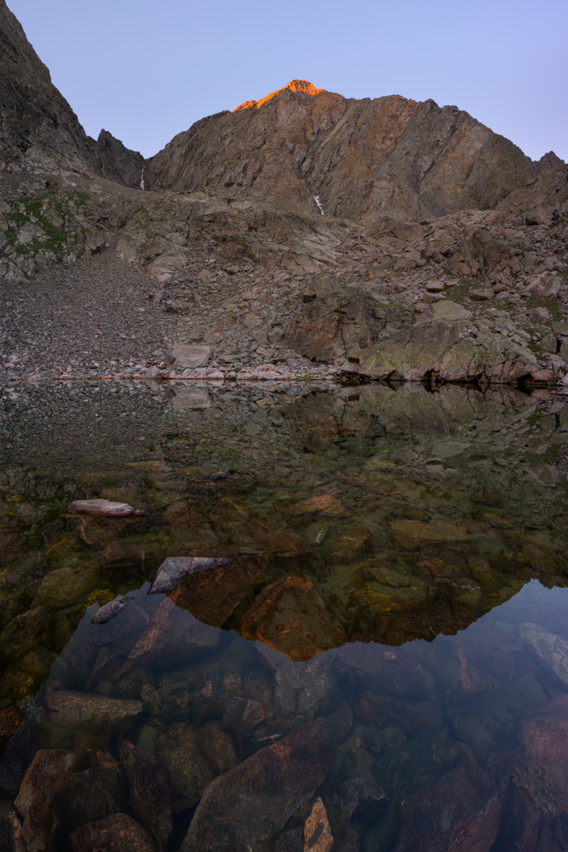
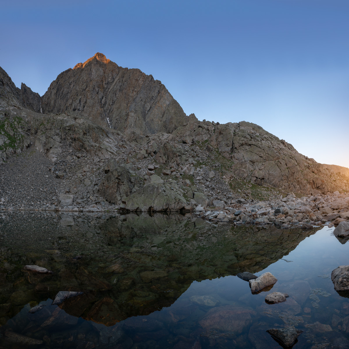
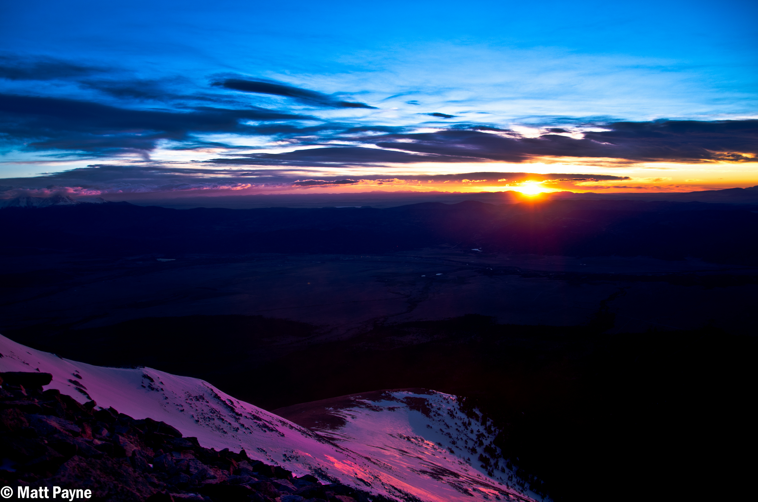
Above the dirt and rock slope, I found myself in a strange spot. There was a huge rocky and cliffy section between me and the lake. I could try to go around to the south or cut across the rock face for some fun scrambling. I chose the latter and it was fun. I would not recommend this section if it were wet; however, it was fun to navigate and climb on. It was easy class 3 / hard class 2. A good warm-up for Ice Mountain for sure! Having reached the lake, I looked for some spots to take shots at sunrise. There were not a ton of options or time, so I found myself looking north towards La Plata and Huron.
The early light kissed the tip of West Apostle above the small lake and made for a very fun scene to shoot with the Loxia 21 lens. I was wishing for a wider lens for sure, but nothing a two-row panorama stitch could not overcome. The waters were crystal clear and quite still.
I spent some time enjoying the lake and snacking to regain some strength. I was really feeling the fatigue from the lack of sleep and was hopeful that food and water would help.
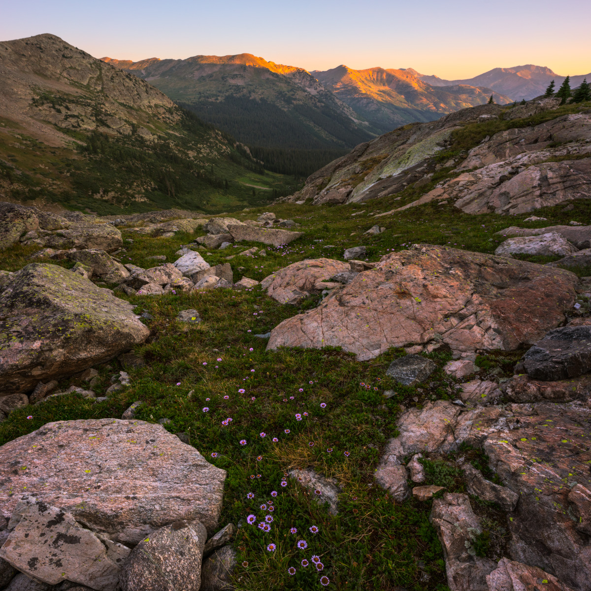
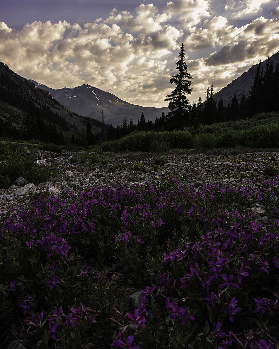
The light over on La Plata was pretty great too - accentuated by some pretty purple flowers on the ground between the huge boulders that were strewn about below the Three Apostles.
I wanted to take one final shot before leaving the lake and found a nice reflection of the lower sections of North Apostle, which were these awesome cliff bands and spires. Good stuff.
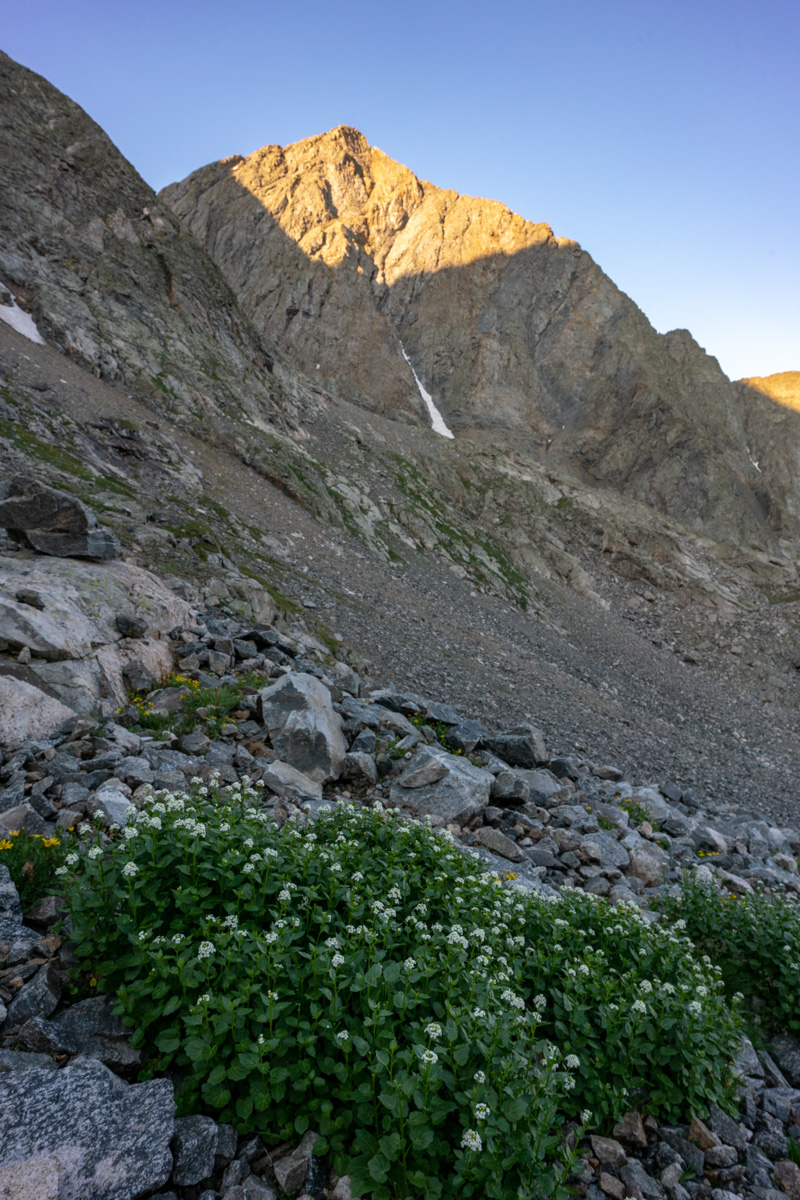
The path up from the lake seemed to be pretty straightforward. I just followed the grassy and rocky slope up near the creek coming down from snow-melt. The slope contoured up towards the base of North Apostle. It seemed that there were two ways to go - through a notch in some rocks next to the south wall of North Apostle or around the notch and around. I chose the notch.
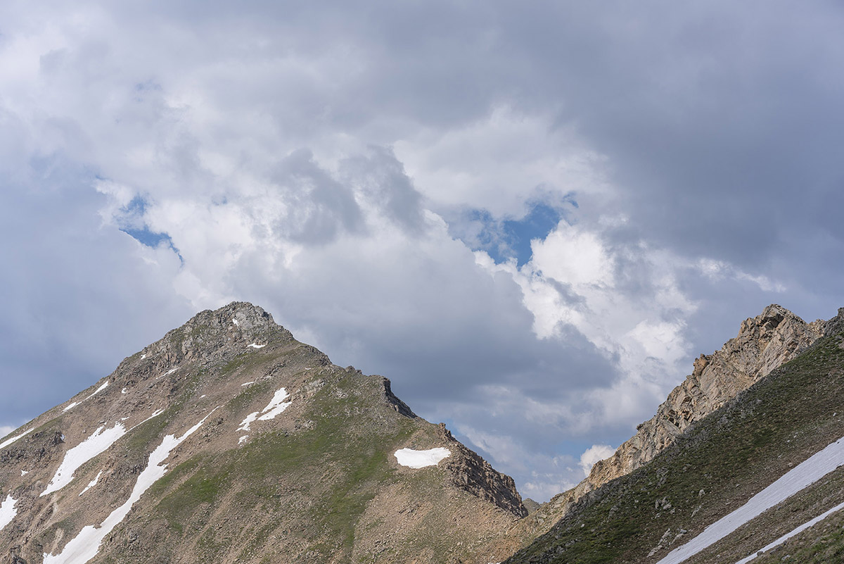
West Apostle in early light
As I climbed up, I stopped to admire the running water under the boulder field. There's something about that experience that always brings a smile to my face. Sometimes the most simple things in nature are the most relaxing and impressive.
I continued up towards the notch below North Apostle and looked back to admire the early morning light that was shining on Harrison Flats to the west. The whole area just looks amazing from here.
As I climbed, there was a lot of rock fall happening on Ice Mountain, caused by mountain goats, likely disturbed by me and my huffing and puffing. I call them jerks in the video, but I'm joking. It should be noted that these goats could pose a huge safety concern for anyone doing the snow climb route of Ice Mountain, so beware!
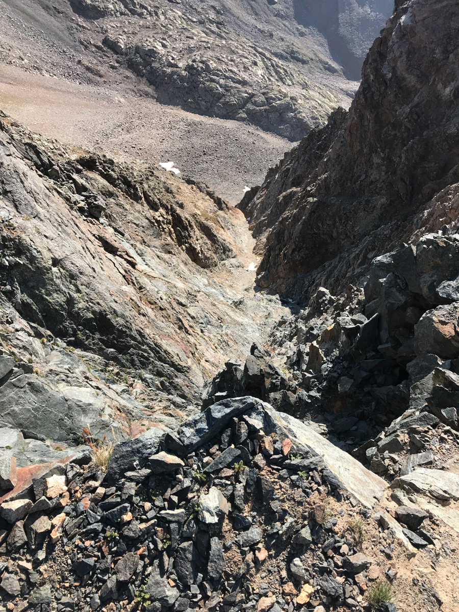
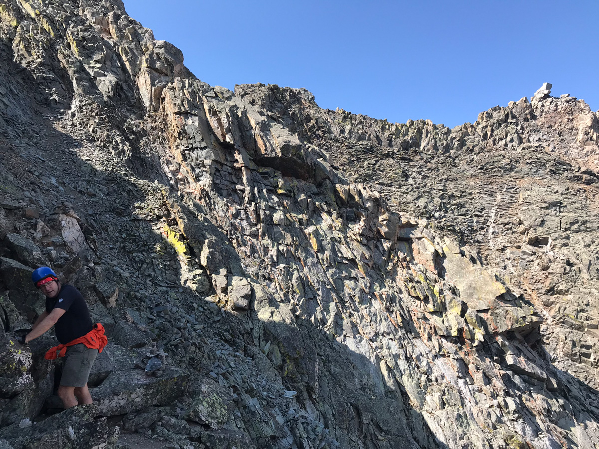
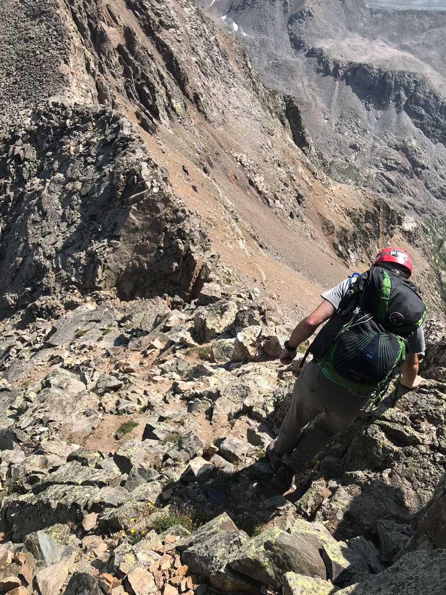
The rocks above the notch and below the North Apostle / Ice Mountain saddle were absolutely horrific. They were huge boulders, many of which were loose, on steep terrain. Special caution should be taken while climbing to the saddle.
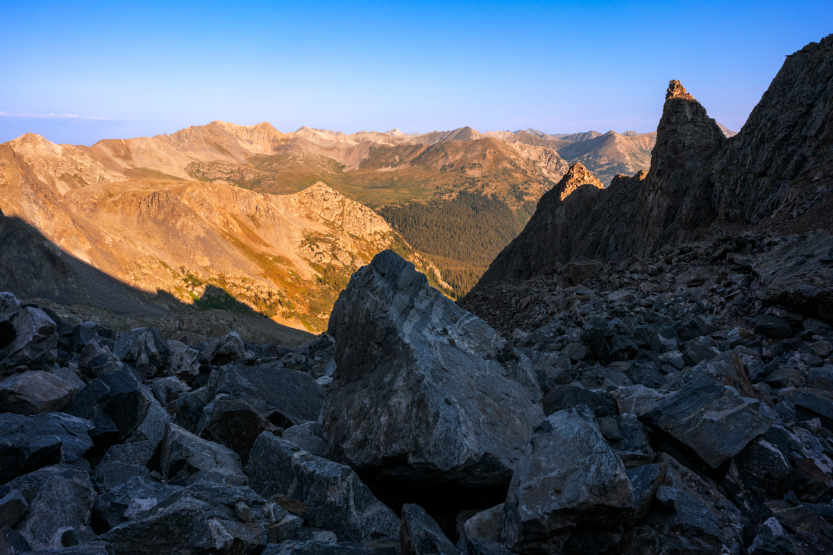
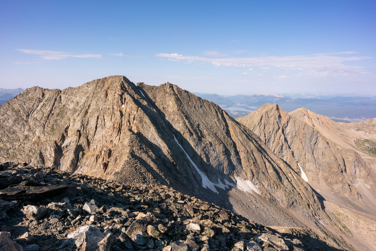
Upon reaching the saddle, a good view of Ice Mountain avails itself and caused me to take pause. It looked really gnarly from this vantage point. Paired with my exhaustion, this view was pretty demoralizing. I was not sure I was going to be able to finish Ice Mountain on this trip. I kept climbing up to North Apostle.
The route from the saddle to the top of North Apostle was quite simple and pretty fun, all things being equal. The east face of North Apostle was pretty intense to look down on. I would hate to take a fall here.
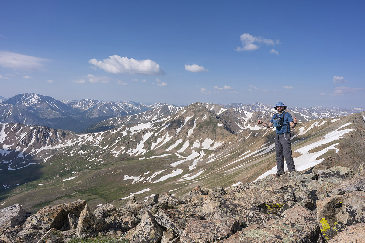
I reached the summit of North Apostle at 8:30 AM and was really tired. The views though - they were amazing. Huron was quite impressive from this vantage point.
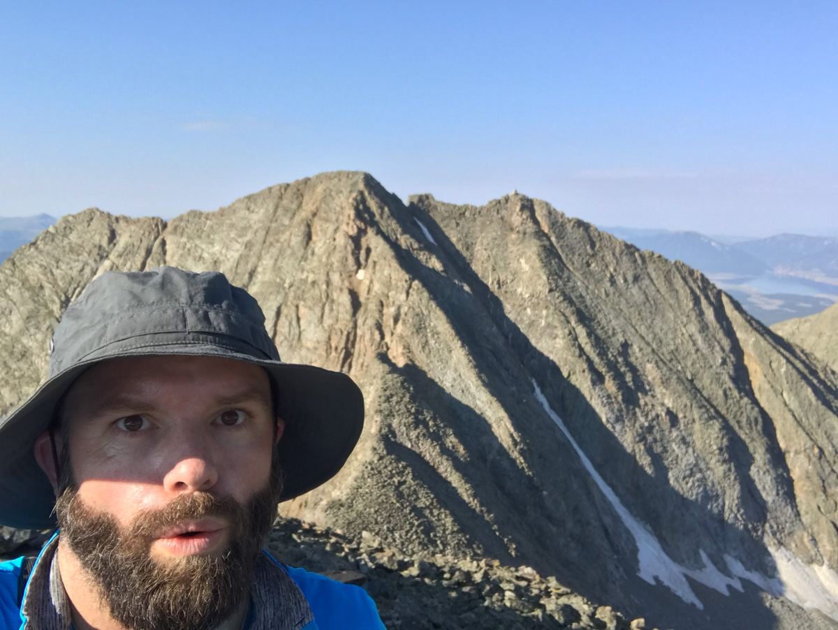
I let my friends and family know I was safe on top of North Apostle and took a panorama with my wide angle lens. Huron at far left, Ice Mountain at far right. Lots and lots of 14ers in between.
Huron and La Plata looked really fantastic from North Apostle, and I wanted to make sure I showcased Huron in at least one shot, with the huge valley below it.
I head back down towards the saddle, eyeing Ice Mountain's impressive and dangerous stature the whole time. I was one part excited and one part nervous. The route looked really intense from this spot; however, mountains always look harder than they are...
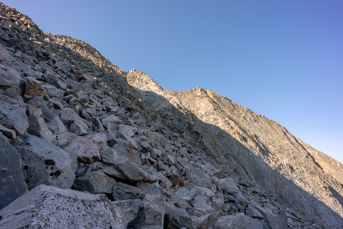
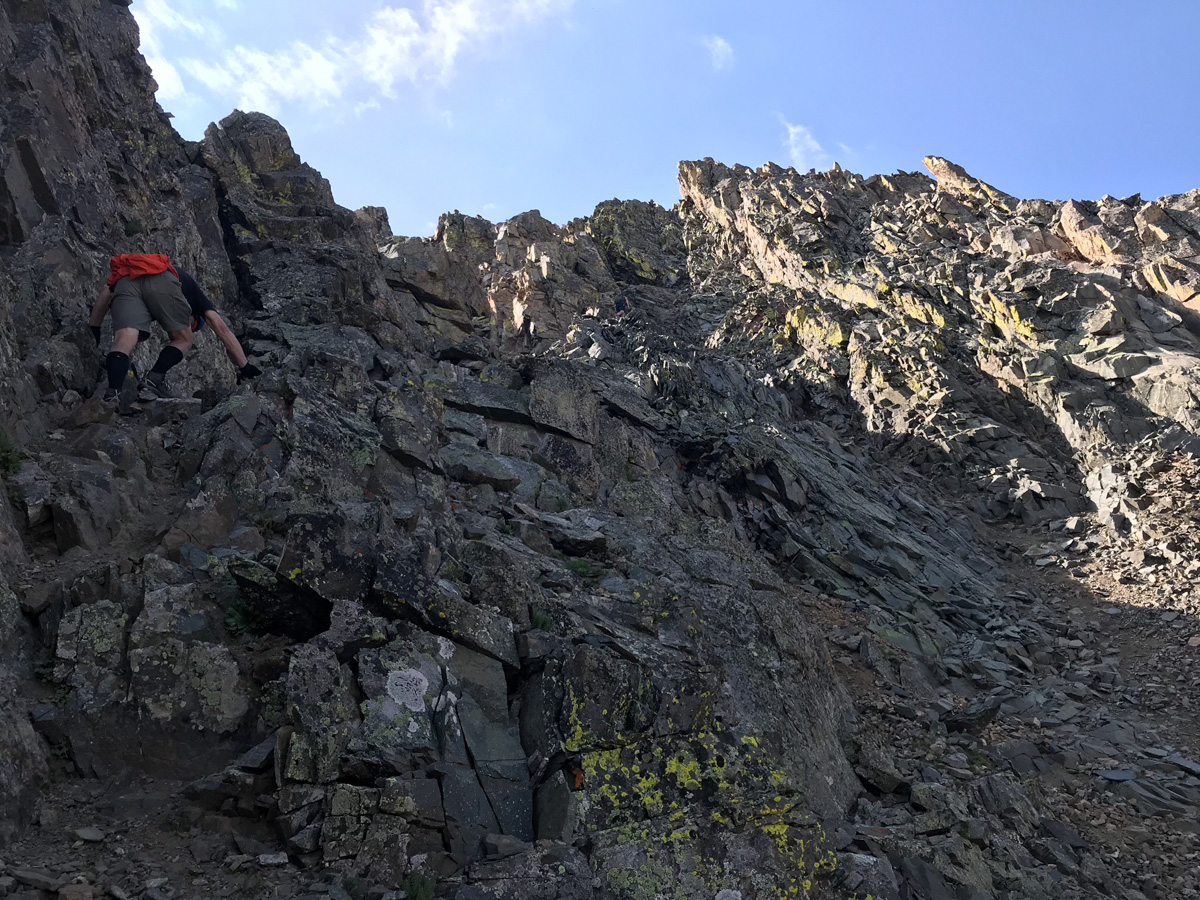
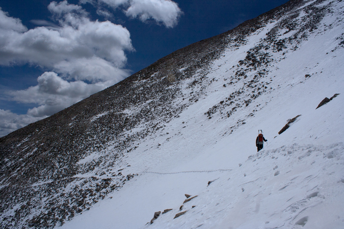
About halfway down the saddle, I ran into a gentleman named Dempsey Andrews from Denver. He asked if I was planning on doing Ice Mountain and I said that I was. He offered to allow me to join his group - himself and two other gentlemen that were waiting for him on the saddle - Kyle and Jerry. I was excited to run into a group that was also doing Ice Mountain and said I would join them, absolutely! Jerry planned on hanging out on the saddle so it was just Kyle, Dempsey, and I for the ascent of Ice Mountain. They were great climbing partners. Dempsey is an English as a Second Language teacher and Kyle is a financial advisor. Dempsey used to do high alpine rescue and so I felt like we were in good hands for the climb. Fortunately, Dempsey had downloaded the route description from 14ers.com which was very clear to follow compared to the one I found in the 1st edition of Gerry Roach's book. Dempsey lead us up, following cairns the whole way. It was surprisingly excellent rock and a ton of fun.
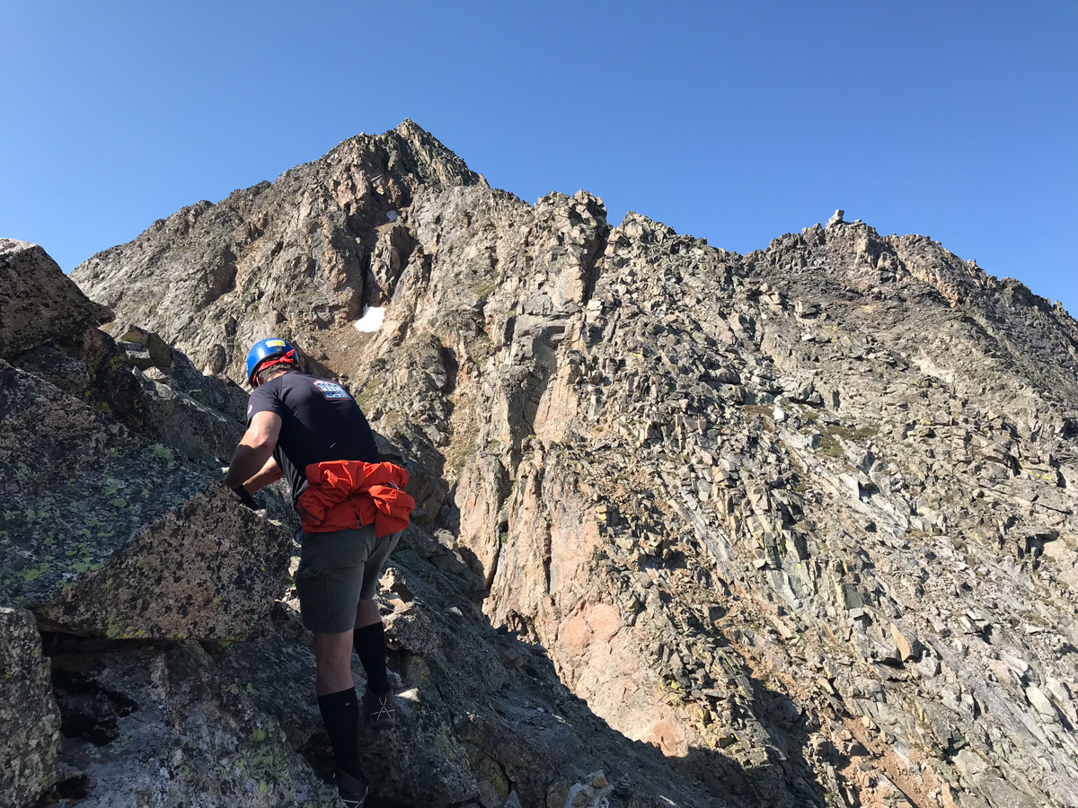
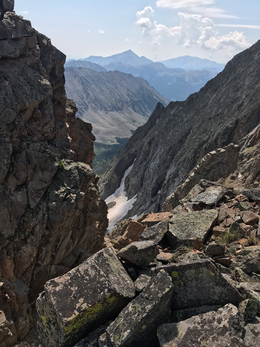
I found myself taking the rear most of the way up and as you can see above, care was needed to plot our route on loose rocks and boulders. We mostly followed the ridge and then found a nice set of gulleys to climb up towards the end.
The final section of the route before the summit was very difficult class 3 / easy class 4 and reminded me of the Wilsons in the San Juans. There were good foot and hand-holds to be found, but each needed to be tested for stability. We kept our distance between climbers and played it safe.
All in all I really enjoyed Ice Mountain's route here. It was pretty easy to follow and offered up numeous challenges that were fun to tackle.
Kyle ascends the final pitch of Ice Mountain
We reached the summit at 10:00 AM and enjoyed the views. It looked like the weather would hold up for us to get down safely, but we knew that the clouds appeared to be forming some of their awesome lightning jam.
I got a cool shot of Kyle on the very final section before the summit - what a mountain! We enjoyed the summit views, called loved ones, and head out. It was a short stay. The downclimb for the 1st section was facing in and quite slow.
As long as you take your time on the downclimb, it should not be too bad. It is very steep and loose though, so great care should be taken on each step.
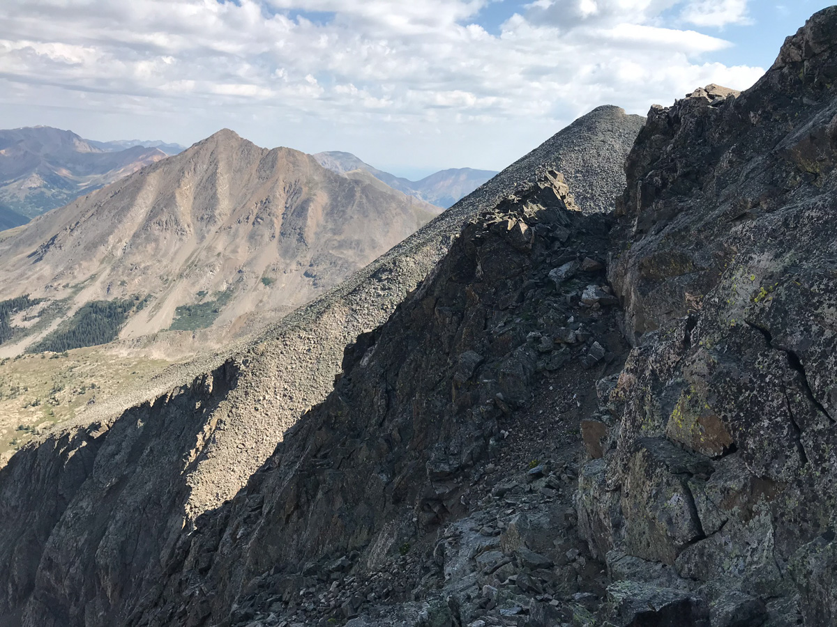
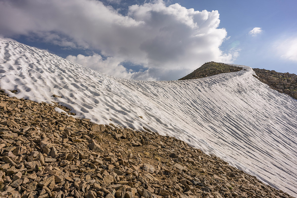
As you can see above, the terrain is nasty but really awesome to be in. These are the types of peaks I long for each year. Ice Mountain does not disappoint if you seek exposure and a challenge. We did encounter a small amount of rain above treeline on our way down and some lightning was starting to strike nearby; however, we were able to avoid the storm for the most part. We took a blend of my route up and their route up for our path down and I found it to be very solid - we stayed high and went into the trees southeast of the willows and avoided the willows altogether. Finding the trail again was easy with Gaia GPS and the hike out from here was completely uneventful.
Climbing French Mountain and Frasco Benchmark - two hidden Collegiate 13ers
With only a small handful (10) of the highest 100 mountains in Colorado (Centennials) left to climb, I have become quite picky about my approach to choosing the trips I embark on. For my first climb of 2017, I chose to ascend 13,940 ft. French Mountain and its soft-ranked neighbor, 13,876 ft. Frasco Benchmark. These are two fantastic 13ers hidden in the Collegiate Range between Colorado's highest mountain, Mt. Elbert, and Colorado's 2nd highest mountain, Mt. Massive.
A KML file and overview of my hike are available over on GaiaGPS - which is my absolute favorite iPhone app! You can purchase it here and help support the site.
This was my 5th time in this basin for a climb, and hopefully the last (prior trips included climbs of Casco, Massive - twice, and Oklahoma). The crowds have become overwhelming due to the proximity of Colorado's two highest peaks. I drove in from Durango on a Friday afternoon, arriving around 10 PM to find only one flat spot to park my car at the trailhead for French and Oklahoma near South Halfmoon Creek. I slept in my car. I fear that one day these areas will be placed on a permit system due to the over crowding and popularity of 14ers (probably with no help from yours truly in writing these reports). The lack of respect for other people and the environment has become tragic. Within 50 feet of my parking spot at the trailhead, I found several areas where people used the bathroom and left toilet paper just laying right there on the surface - all within 10 feet of the creek, no less. C'mon people. Anyways...
This particular area will always have a special place in my heart and mind. I climbed French / Frasco Benchmark's neighbor, Casco Peak, on July 5th, 1986 when I was just 7-years-old. When my dad and I reached the summit, we noticed weather moving in but it did not seem too threatening. About 15-minutes later, our friend Dave arrived and asked if we heard the sound coming from the lightning rod. We found the long metal rod protruding straight up into the sky near the summit and it was humming with electricity. I remember wearing a ball-cap with one of those small metal bulbs on the top and it was humming too. We all raced to get off of the summit, and the lightning and thunder began to crash around us, with rain pouring down on the rocks. We all made it safely down the wet granite rocks, but it was my first exposure and experience with lightning and it always left an impression on me, later informing my trepidation and habits around start times and weather awareness in the mountains.
I set my alarm on this trip for 4:30 AM, hoping to avoid afternoon thunderstorms. The alarm sounded and I quickly got ready to go. I decided to wear my Chacos for the first 200 feet of the hike since I would have to cross South Halfmoon Creek, which was raging with about 3 feet of depth. My feet became ice cold, but welcomed the comfort of dry socks and shoes right after the crossing. The beta for this climb was pretty straight-forward - hike up the road until it terminates at the Iron Mike Mine and then ascend straight up the south face of French. Pretty simple! The ascent up into the basin where the Iron Mike Mine at was pretty steep at first, and required a second stream crossing after about a mile. The first light behind me to the east was pretty fantastic though.
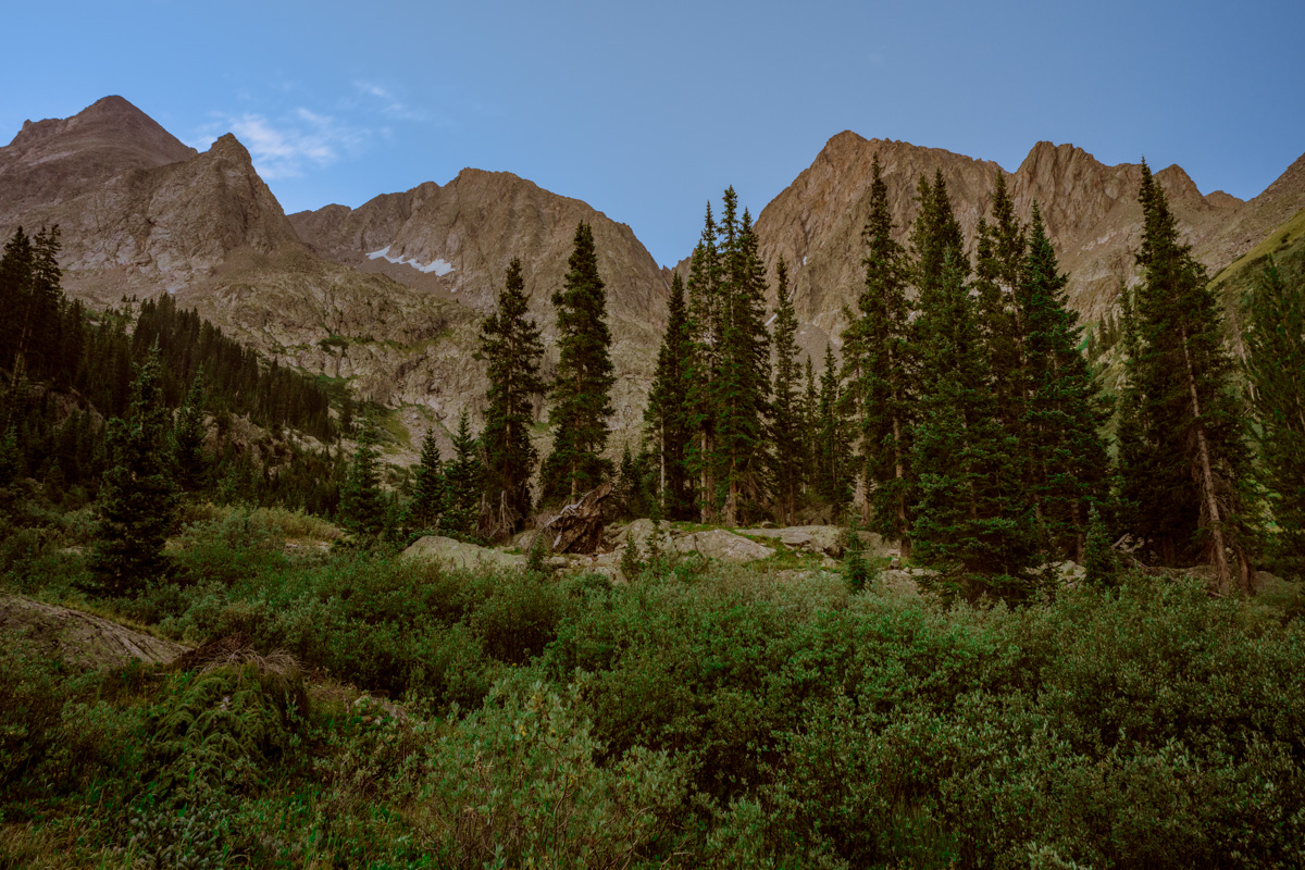
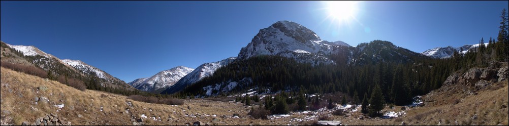
Once up near tree-line, the whole basin opened up to reveal Casco Peak, French Mountain, and a whole lot of willows.
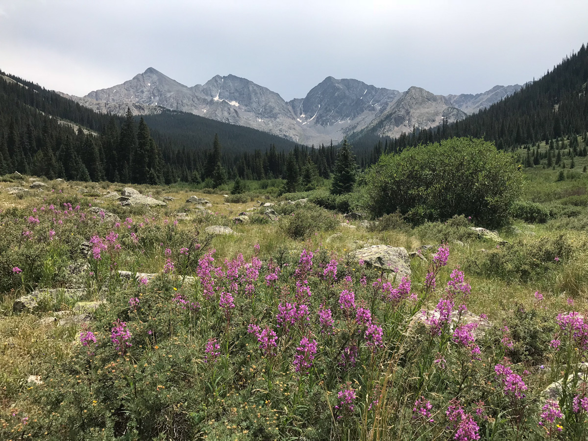
The clouds to the east were still magnificent above Mount Massive, seen here paired with Alpine Fireweed wildflowers in the foreground.
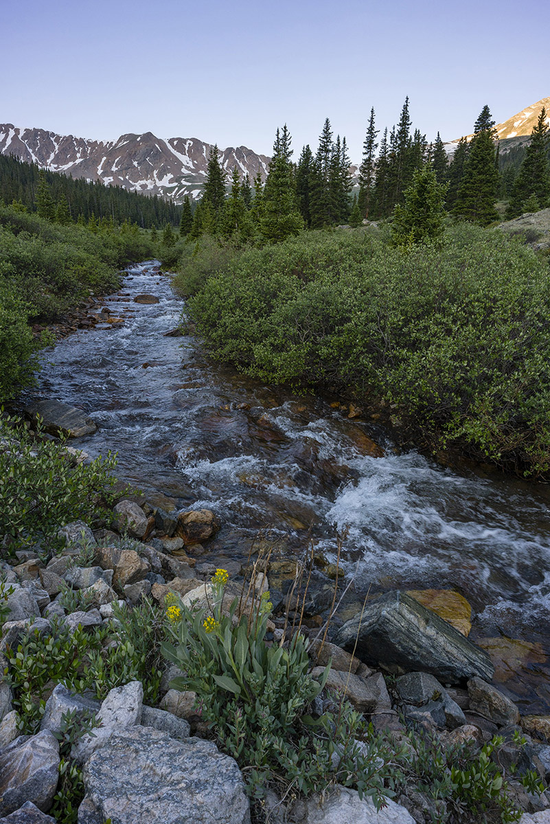
South Halfmoon Creek's headwaters were much tamer at the higher elevations and provided an excellent lead-in for the upper basin.
As I continued hiking up the road, my gaze kept returning to the east, where the clouds danced with the mountains.
The southern shoulder of Mount Massive was a prominent feature that constantly kept me looking back at it. I have fond memories of climbing Massive in early winter conditions in October of 2009.
As I climbed higher into the basin, the sun cast some interesting light on the southeast face of French Mountain, offering a preview for what was coming soon.
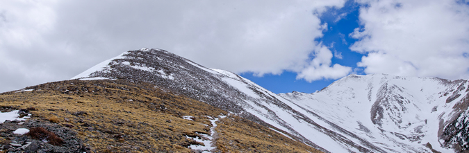
Above treeline, the route up French became quite obvious. In the photo below, you can see the route quite nicely - I basically went straight up, left of the snowfields and then crossed to the middle between the two snowfields and then up to the saddle.
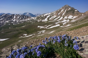
My legs were feeling great, and I pushed hard to make good time up French's south slopes to find this nice grouping of Sky Pilot flowers with Casco Mountain (right) and La Plata Peak (left).
Upon reaching the saddle, I saw there were two other climbers ahead of me. Just two climbers. I love 13ers.
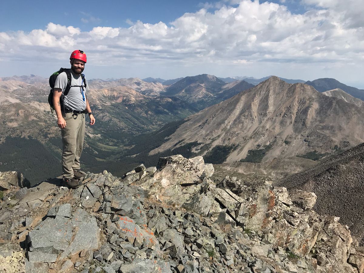
I chatted with the two climbers, who were doing French, Frasco, and Casco. They asked if I was doing the same. I explained I had already done Casco and that I was just hoping to get French today. They were really nice guys. Reaching the summit of French was about as straight forward as you can get on a mountain climb, as a simple and easy trail went from the saddle to the summit. The views were spectacular.
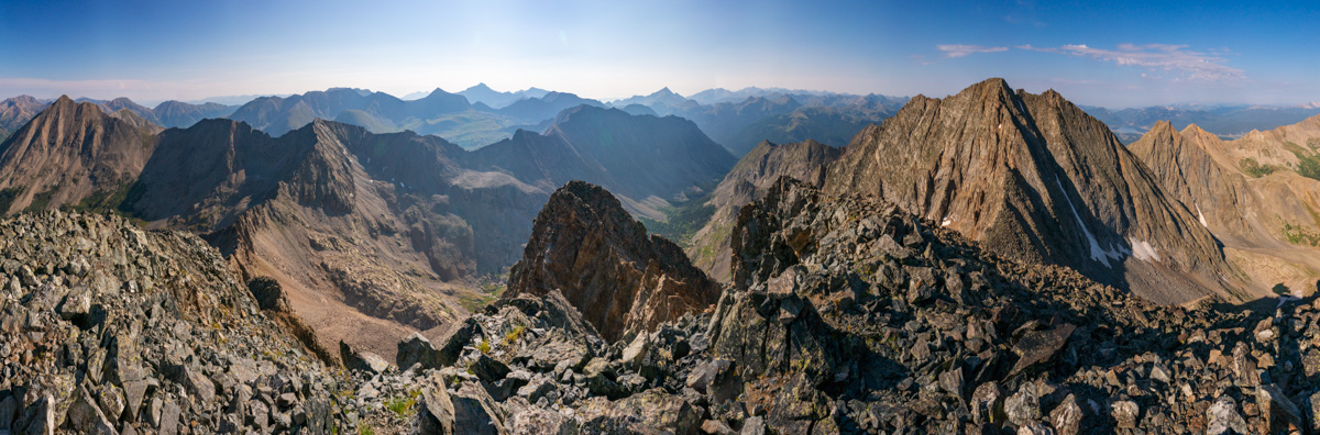
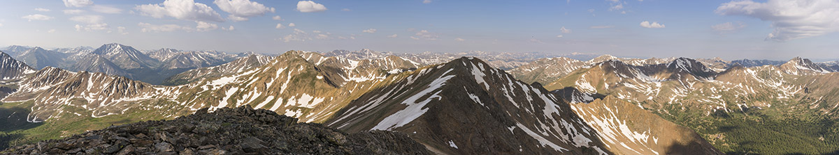
Once on the summit, I plowed through some lunch and took a panorama looking north/west/south, including La Plata Peak, Grizzly Peak, Casco Peak, Frasco Benchmark (middle), and the Elk Mountains in the distance (Snowmass, Maroon Bells, Capitol).
La Plata Peak commanded my attention - I just love the gnarly view of it from this side. The Three Apostles including Ice Mountain are seen left of La Plata (and comprise 2/10 of the Centennials I have remaining).
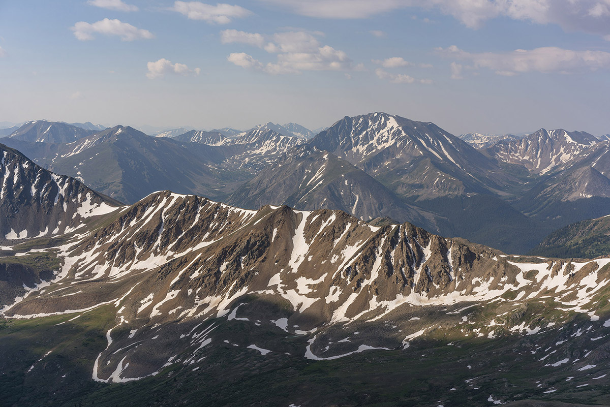
The view of the Elk Mountains from this part of the Collegiates has always been something I greatly appreciate as well. Snowmass Mountain (right) is an all-time favorite.
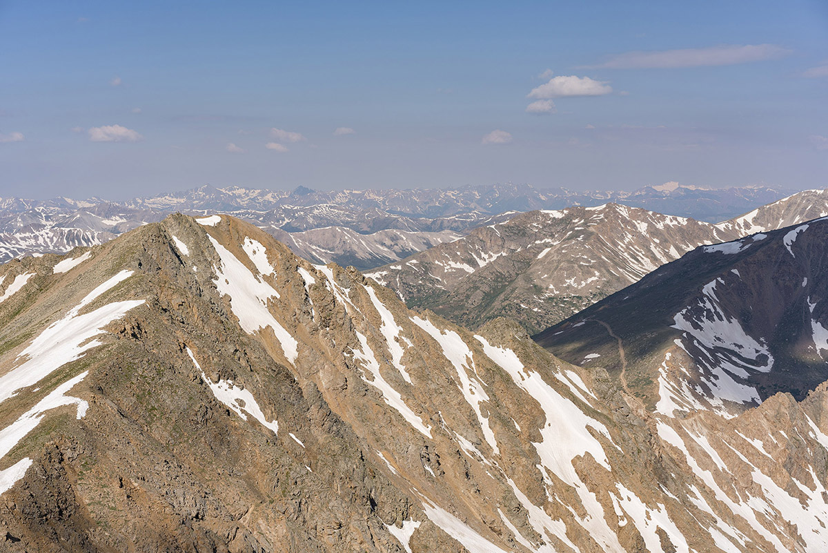
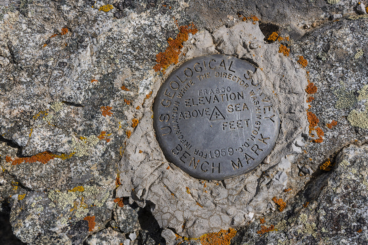
I decided to make the trip over to Frasco Benchmark, which was surprisingly quite enjoyable with some minor scrambling along the ridge. The benchmark was pretty obvious, but I was left wondering why they just say Frasco and don't include the elevation... oh well.
A look back at French from Frasco...
From Frasco, I really enjoyed the view of Casco Peak and began to see that clouds were forming for the daily afternoon thunderstorm. I was glad I was not continuing on to Casco. I really like this photo for some reason - the balance between La Plata (left) and Casco (right) is compelling.
I decided to go straight down what Roach describes in his 13ers guidebook as the "Fiascol" couloir between Frasco Benchmark and Casco Peak. It was pretty much what you'd expect - fun scree and dirt boot skiing. I kind of like this terrain - I can go really fast down it! As I descended, I took a photo of Casco Peak - it looked like the storms were going to hit soon.
Once down the scree field, I took a photo looking back up the gully - nothing special, but it shows the route!
Back near the Iron Mike Mine, I found a huge field of wildflowers which made a nice foreground for Colorado's highest mountain, Mount Elbert.
After reaching the car, I drove out and decided to drive to Colorado Springs to enjoy my 20-year High School Reunion. I'm old.
If you are wondering what kind of camera gear I take with my on my climbs, check out this page - it has links to all of my gear, which is now a mirrorless system to minimize weight and maximize my ability to reach those summits. Reach out if you have questions!
Hope you enjoyed this trip report! Next up: No idea!
Again, links to my GPS track are at the top of the trip report. Until next time...
Sleepless on Mount Princeton - Sunrise in the Collegiate Peaks
Mount Princeton has been on my radar for a long time. As the most visually prominent (but only 8th most prominent, literally speaking) mountain in the Sawatch Range and Collegiate Peaks, it always has greeted me with warmth and nostalgia to the Arkansas River Valley and the quaint town of Buena Vista (yes, it is pronounced "Bewna," we know) during my travels into Colorado's mountains. Mount Princeton is the 18th highest mountain in Colorado, towering over the valley below at 14,197 feet in elevation. According to The Princeton Alumni Weekly, the first recorded ascent of Mount Princeton was on July 17, 1877, by William Libbey of Princeton University, hence the namesake. Sitting next to Mount Princeton is "Tigger Peak," an unranked mountain with 13,300 feet in elevation, which is often climbed in conjunction with Mount Princeton (which is what we did as well). The Princeton University history would also help explain the name of "Tigger Peak," since the mascot for Princeton University is the Tiger.
The plan to climb Mount Princeton was hatched earlier this month when I was chatting with a climbing friend of mine, Mike Vetter, about him coming to Colorado for his next climb. Mike actually found me through this website last year from his home in Sioux Falls, South Dakota, and joined me for my climb of Huron and Browns, and later, Capitol Peak. Mike found some seriously cheap plane tickets to Denver for the date we both had open, and he decided to pull the trigger. We both knew it would be a challenge, logistically, since he was flying into Denver and I lived in Colorado Springs, not to mention that his return flight departed the same day as our climb. Mike flew into Denver International Airport at 6 PM on Saturday evening and I picked him up from the terminal. We drove west on I-70 to C-470 and then caught US 285 towards Fairplay. After a quick meal in Conifer, we were ready for our adventure to begin.
We arrived in Johnson's Corner at around 10 PM and made our way to the Mount Princeton Road. We were happy to find the road completely clear to the Radio Towers on Mount Princeton Road, where we planned to camp for the night. We eagerly set-up camp in some hellacious wind and cold temperatures. Little did we realize (out of sheer stupidity mostly) that we were smack-dab on top of a giant hill, and consequently, the wind was outrageous. Not only did this make setting up tents quite difficult, it made sleep simply impossible. Due to the tight time constraints we were under due to Mike's departure flight, we knew we needed to start early if we were to make his flight on time. So, as a matter of necessity, we set our alarms for 2 AM and hoped for at least 3 hours of sleep. Unfortunately, neither of us were able to sleep one bit due to the insane wind.
The experience of trying to sleep through huge wind gusts in a tent was surreal to say the least. Even though I did not sleep at all, the experience was very peaceful and restful, yet violent at the same time. Never before have I simultaneously experienced fear and happiness, it truly is difficult to explain what the experience was like. On top of getting zero hours of sleep, I managed to contract my son's cold, so I was feeling quite under the weather for this hike; nevertheless, we woke up at 2 AM, tore down our tents, secured our gear and began our hike at 2:45 AM. Here is a map of our route (click for larger version), which took us up the road and under "Tigger Peak," over "Tigger Peak," and up the ridge to Mount Princeton.
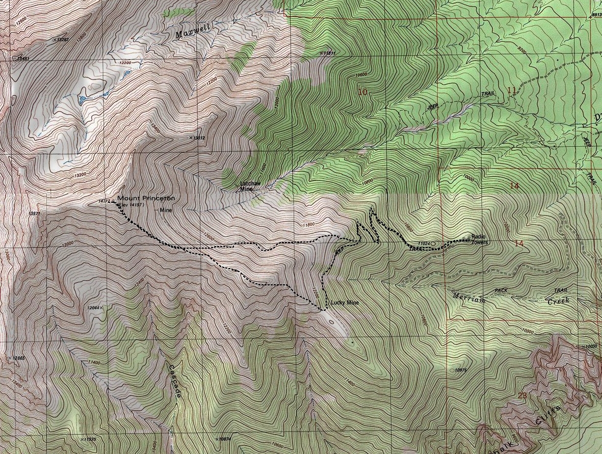
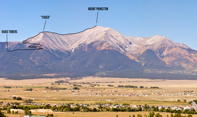
To get some perspective of our route, I decided to dig into my archives and illustrate the route, as seen from the Collegiate Peaks lookout, just east of Johnson's Corner. As you can see, the radio towers provides a good starting point and a clearly defined route all the way up the mountain.
The route seen above was made even more interesting by the record snowpack that Colorado has received this Spring, which many believe will cause flooding and massive avalanches. Indeed, as I returned home from this trip, I learned that someone died on a nearby 14er the day before due to an avalanche. Relative to our climb, the snow was a concern for both of us; however, we made sure to take our time and heed the utmost caution at all times. The snow appeared to be settled on Princeton for the most part, and we benefited from a very early start, which guaranteed snow that was not melting, and therefore, more stable. On the approach, just before heading up Tigger, we encountered several steep snowfields that were somewhat difficult to navigate because of how hard the snow was; crampons would have been a really nice thing to bring along, but instead we both had snowshoes with us (which were never deployed - story of my life).
Early on in the hike, the effects of sleep deprivation and a strong and nasty head-cold were considerable and noticeable. I felt awful. Mike was gracious enough to capture the essence of that feeling in a photo, taken just a half mile into our hike. 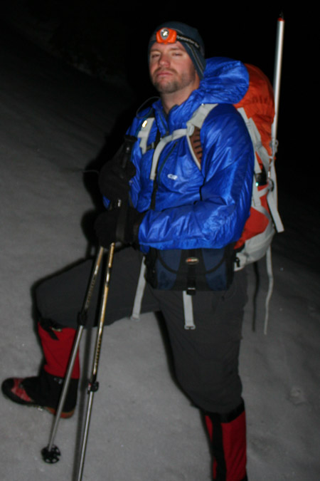
I think I actually felt worse than I looked, which says a lot based on how awful I look in this photo! On the flip side, Mike was looking chipper, as seen in this photo taken right as we left our campsite.
Despite feeling as if a large semi-truck had ran me over, I kept my head down and my spirits up. Once we reached the upper section of the trail beneath Tigger, I knew we needed to start heading up sooner rather than later. Despite the map in Roach's guide showing the hike following the trail to the top of the hill, we opted to leave the trail early and bushwhack straight up the ridgeline of Tigger. This proved to be a fairly good decision despite the absence of anything resembling a trail and the interesting route-finding required on the ice and snow strewn rocks that adorned the eastern face of Tigger. Most of the way up Tigger, we decided to stop and enjoy the sunrise, which was, by far, one of the most beautiful ones I have ever witnessed. Now, if you don't know me by now, you should know - I'm pretty obsessed with sunrises and sunsets, so that probably says something about the quality of this particular sunrise. The colors were fantastic. The presence of snow made it even more special, with the snow giving off a pinkish glow. We spent quite a bit of time watching this sunrise, and it was well worth it. I compiled several panoramic photos of the moment, including a couple single shots that I thought were pretty fabulous as well. Feel free to click on them for higher resolution versions (and full resolution prints are of course available for sale if anyone were interested).
The pre-sun sunrise color was intense, casting a deep red and pink hue on the clouds, with a cream-sickle orange glow around the silhouette of Pikes Peak.
The sunrise itself was great - of particular note, the clouds around the Buffalo Peaks were glowing, which was pretty marvelous!
Not sure what else to say about it - the sunrise was exceptional, and a dream for an amateur photographer!
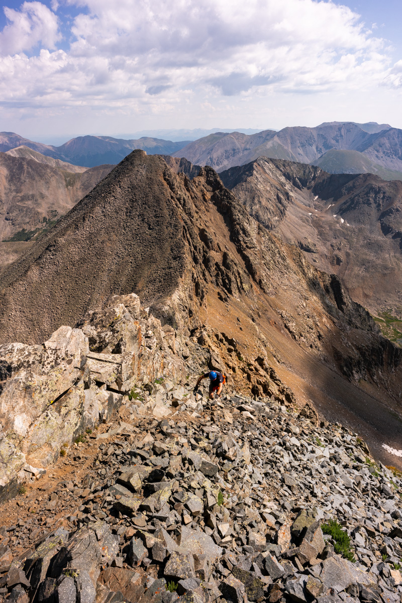
Having indulged enough in the amazing sunrise, Mike and I were ready to keep on going since the wind was blowing pretty strongly, making it a very cold morning. We made our way to the top of the ridge of Tigger and were greeted with some of the strongest wind I've ever felt. The wind was easily gusting to 60 miles per hour or more, making it very difficult to hold your ground or take steps. Mike and I both later commented that this moment was very demoralizing for us both because we could not fathom continuing all the way up Princeton in these conditions. Nevertheless, we continued up and over Tigger, taking frequent breaks to catch our breath and regain our strength. The combination of the snow, wind, cold, lack of sleep and head-cold was forcing me to take much more frequent stops than I am generally accustomed.
It was a very pretty environment though, with views of the Southern Sawatch acting as further motivation to continue. Additionally, the ground was covered with thin ice and deep snow, littered with ice-cycles drooping from large boulders. It almost felt like another planet.
Mike and I soldiered on, with wind gusts and broken terrain slowing our climb. Mike was still in high spirits, and I had caught a second wind. Thank God.
We had a long ways to go yet, and it felt like an eternity just taking one step. Sleep deprivation does not mix well with mountaineering.
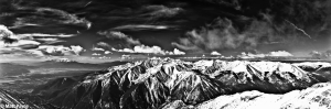
After about two hours, our traverse up to Princeton from Tigger was complete. It was a very exhausting haul up the deep snow. We were both wishing we left the snowshoes at home and packed crampons instead. Lesson learned. It was a great feeling, having completed my 43rd 14er and 61st mountain in the highest 100. Naturally, the views from the summit were breathtaking. It was a fairly clear day, and fortunately, the wind had magically subsided while we were on the summit, making our photography efforts that much easier. One of my favorite captures from the top was the view of Antero, Shavano, Tabeguache, Boulder Mountain, Cronin, Mount Mamma, Carbonate and Grizzly. Having spent numerous days hiking on those mountains last year, it was neat to see them from this vantage point. Here's the black and white version, feel free to click to see a higher resolution version.

And of course the obligatory 360 panoramic shot... click for a larger version.
.JPG)
And if you're interested in an interactive version of the 360 view, take a look at these files, one is smaller in size (1.2 megs) and one is larger in size (16.7 megs).
CLICK HERE for small version (1.2 megs) of the interactive 360 panoramic.
CLICK HERE for large version (16.7 megs) of the interactive 360 panoramic.
Additionally, Mike was able to catch me in the act of shooting some photos and generous enough to share the photo with me.
And here's one of Mike enjoying the views from the summit.
Knowing that the sun was melting the snow, we decided not to spend too much time on top and head on down. On the way down, we were lucky enough to run into a few skiers, several of which were from 14ers.com, including LostSheep5 and EatinHardTack. They were able to confirm that the standard route trail was clear, so we opted to detour to the trail to avoid the ridge. I was excited about descending the snow to some degree, because I wanted to test out my new ice axe, which I purchased at REI recently. With ice axes in hand, we crossed the giant snowfield between Tigger and Princeton, which felt quite solid despite the warming temperatures and avalanche concerns in the back of our minds. I did slip a few times on the way down, and needed to use the axe for self-arrest. I was thankful that I had already experienced this before, because self-arresting came quite naturally.
We were able to wrap around Tigger, following the snow-filled trail and look back to see the skiers making their descent.
It was about at this point that the trail ended and we had to make a decision, not knowing where the most logical place to descend from since we did not come up this way. I did some scouting at the end of the ridge and much to my surprise, spotted the radio towers and my Jeep in a straight line down from us. We opted to bushwhack in that direction and quickly met back up with the trail, which we happily followed all the way back to the Jeep. Those radio towers never looked so good!
That concludes this trip report. If you would like to stay up-to-date on all of my articles, trip reports and other mountaineering related news, please feel free to follow 100summits on Twitter or Facebook! Also, if you're planning on doing any online shopping and if you enjoyed the content, please help keep the site going by using the links on this page to help fund the site.
Mount Massive - A Frozen Wonderland
Some fun information about this great hike:
Mt. Massive - 14,421 ft. - 2nd highest in Colorado; third highest mountain in the contiguous U.S.
8 miles round-trip via Southwest slopes route
3,950 ft. elevation gain
More snow than I expected...
I thought that my climbing season had ended after being snowed on in mid-September on Grays and Torreys; however, I got the itch to climb again this weekend. Serendipitously, a fellow climber from Colorado Springs, Rob, posted on 14'ers.com that he was going to Mt. Massive on Saturday and that anyone from Colorado Springs was welcome to join him. I jumped all over the opportunity and we made plans to meet at 4:15 AM on the west-side of town to car pool. Rob had his friend Brad with him and we departed for Mt. Massive at around 4:30 AM.

Our route took us directly up the snowy south face of Massive.
On the way over we had good conversation, shared stories about our climbs and got to know each other. We arrived at the turn-off for Mt. Massive at 6:45 and met up with two other climbers from Denver. We reached the trail-head and began hiking at 7:40 AM. Right at the trail-head lies a memorial to the soldiers that died in a helicopter crash earlier this year on Mt. Massive. Here are some photos of the Memorial, notice a section of the helicopter is seen as well:

A memorial cross for the victims of the Blackhawk Helicopter crash on Mount Massive, 2009.

The forecast for the day was clear skies and a high of 60, and wow the weatherman did not disappoint! We swiftly hiked up the valley and reached the turn-off for Mt. Massive. Our view back down the valley was stunning:

The trail was covered in snow, making for a quite interesting hike. As we gained elevation, the trail became less and less apparent and eventually we just started hiking straight up towards Massive.
Looking back towards Elbert, you can see our footprints through the snow...

None of really expected to see so much snow, but it made for a very challenging hike. The snow was up to 3 ft. in depth in some spots, and it was quite slippery due to the 30-40 degree slopes were climbing on. We stopped several times to rest on the way up, and about halfway up I was able to take some shots, combined here into a smaller panoramic photo:

After approximately three hours, we were able to reach the saddle, which joined us with the standard route. By now I was pretty tired, partially due to the extra effort required by the snow, and partly due to the fact that I had not had much to eat. I made sure at this point to eat some snacks, and we headed back up. We found ourselves climbing up some pretty deep snow, as evidenced by this shot, looking up the ridge towards the summit, taken on our way back down:

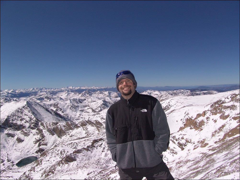
After trudging through the snow, we were able to reach the summit at 12:40 PM, a full 5 hours after we started. The snow really took a lot out of us! I was just really glad I brought my gators and had tons of warm clothing... Here is my obligatory summit pose, with the Elk range behind me:
And of course my traditional 360 degree pano:

Before we left from the summit, I took some zoomed in shots of the Elk range, including the Maroon Bells. This stitched pano is one of my favorites from this 2009's shots:

We headed back down and had a good time rumbling down the snowy slopes. I took one last set of the valley, combined into a pano here:
All in all, I would highly recommend this route for Mount Massive. Even in October, the route is solid, and I could see this being feasible even through November or later.
Sawatch Range
The Sawatch Range is by far one of the largest mountain ranges in Colorado, spanning over 100 miles from north to south. This range contains some of the highest mountains in the whole continent, including Mount Elbert, Mount Massive, Mount Harvard, Mount Princeton, and Mount Yale. The Sawatch Range is known for some of the best views in all of Colorado, due to the huge number of high elevation peaks there.