Displaying items by tag: 13er
Kit Carson Mountain, Challenger Point, Columbia Point, and "Kitty Kat Carson" - An Elevated Playground
Kit Carson Mountain is a very prominent mountain located in the Sangre de Cristo Range. The area surrounding Kit Carson Mountain is both rugged and pristine, with views of amazing peaks such as Crestone Needle and Crestone Peak in abundance. The hike to Kit Carson Mountain by way of the Willow Creek trailhead is nothing short of astounding, with breathtaking vistas available the whole way up. To put it lightly, this is one of the best hikes in Colorado, bar none.
Here are some meaningful statistics from my adventure up these amazing mountains:
Challenger Point – 14,081 ft – ranked 34th highest in Colorado
Kit Carson Peak – 14,165 ft – ranked 23rd highest in Colorado
Columbia Point – 13,980 ft – ranked 56th highest in Colorado
“Kitty Kat Carson” – 13,980 ft – unranked
Total distance traveled: Approximately 15 miles
Total elevation gain: 6,500 ft.
By now you might be wondering what makes a mountain ranked versus unranked. This is a fairly controversial topic in the climbing community. Basically, there is only one factor to consider when determining if a mountain should be "ranked" and that is prominence. The prominence of a peak is the height of the peak’s summit above the lowest contour line encircling it and no higher summit. Prominence is interesting to some mountaineers because it is an objective measurement that is strongly correlated with the subjective significance of a summit (and how difficult it is to climb). Peaks with low prominences are either subsidiary tops of some higher summit or relatively insignificant independent summits. Peaks with high prominences tend to be the highest points around and are likely to have extraordinary views. In the case of Colorado mountains, most mountaineers use a cutoff of 300 ft / 91 m to determine whether or not a mountain is ranked or not. So using “Kitty Kat Carson” above as an example, since there’s only 80 ft in elevation drop between itself and Columbia Point, it is not ranked. Alternatively, since there is 360 ft in elevation drop between Columbia Point and Kit Carson Peak, it is ranked.
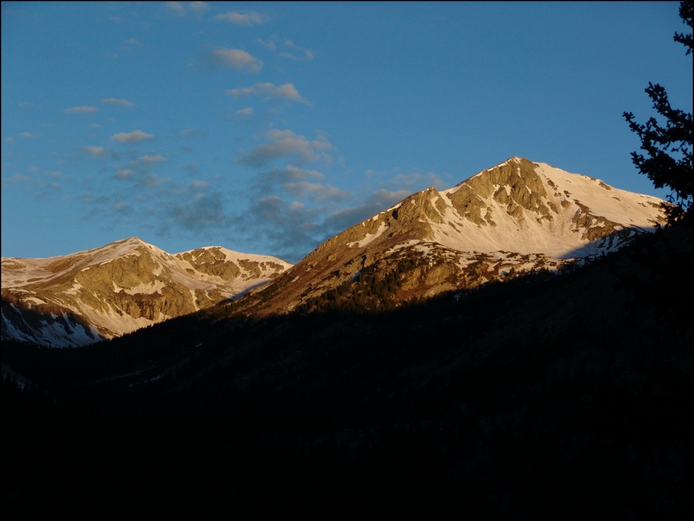
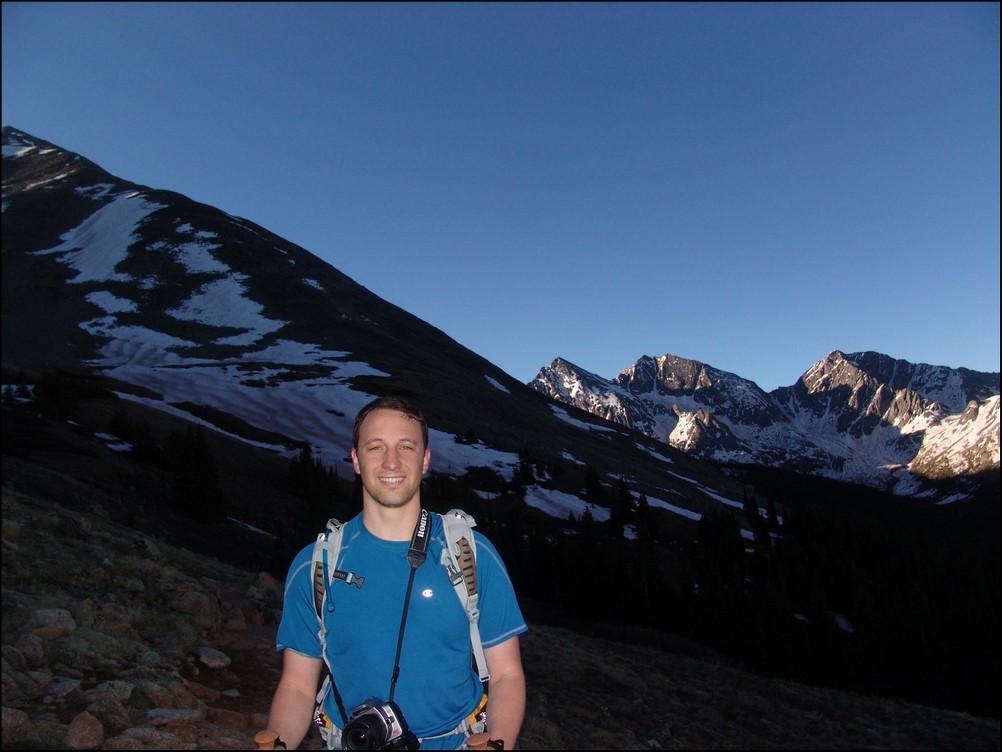
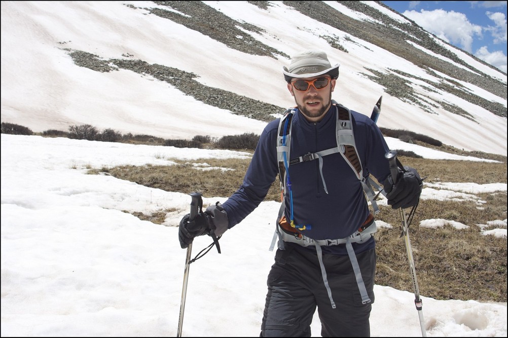
I picked up my friend Terry from his condo at 5 AM on Friday and departed for the quaint town of Crestone. We arrived at the Willow Creek Trailhead at about 9 AM. There were several vehicles at the trailhead, which was kind of surprising given that it was still early on a weekday. This was going to be our third backpacking trek in as many weeks. This week I was able to get my pack down to 45 pounds, thanks in part to some lightweight food my mom graciously provided to me the previous day. We began our hike up the trail, which was well travelled. About 5 minutes into our hike, a gentleman with a long gray beard was coming down the trail and was very friendly to us, warning us of electrical storms. I commented to Terry that this was not my first rodeo and that the man reminded me of Jesus. I was hoping that his presence was not a sign of things to come… bearded man looking like Jesus appears out of nowhere and warns us of lightning… The trail was such a nice change from last week since it was actually easy to follow and was clearly maintained and free of vegetation and confusing side trails. The trail makes many large switchbacks up a gradual slope and then at the top of this slope it drops you right next to a huge meadow, accompanied by great views of part of Challenger Point.
After awhile, the trail brought us closer and closer to Challenger’s headwall.
Shortly thereafter, the trail begins a long series of shorter switchbacks leading to the north and east until a large waterfall is exposed at the base of the headwall.
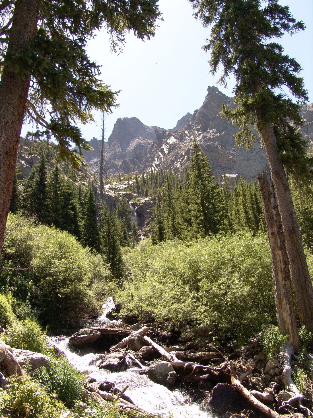
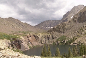
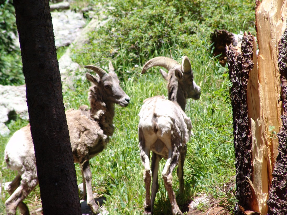
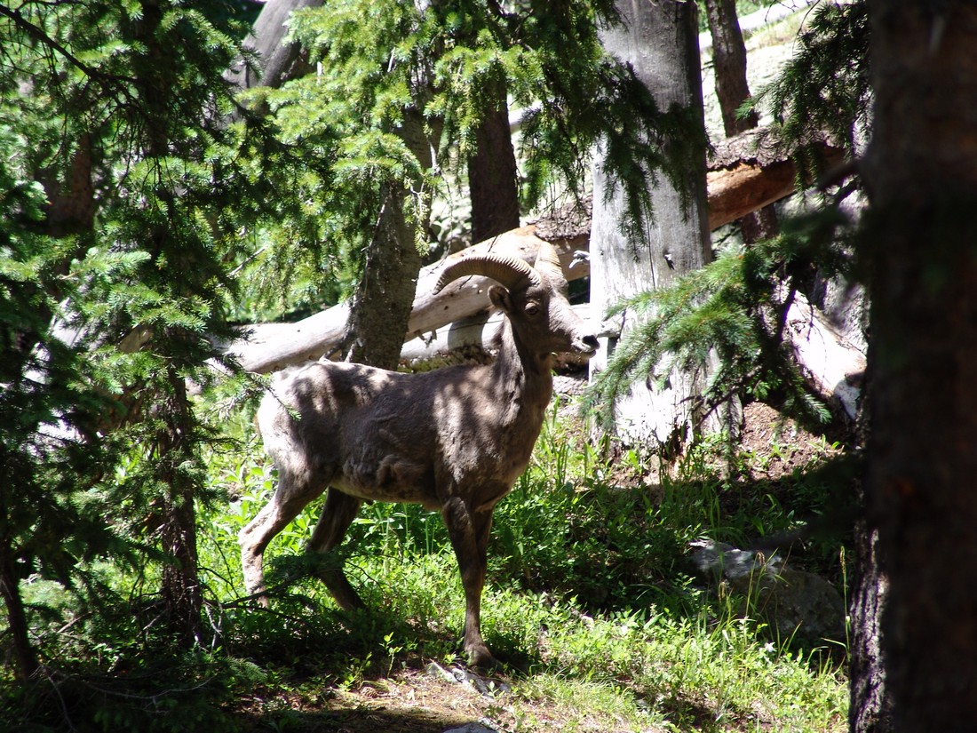
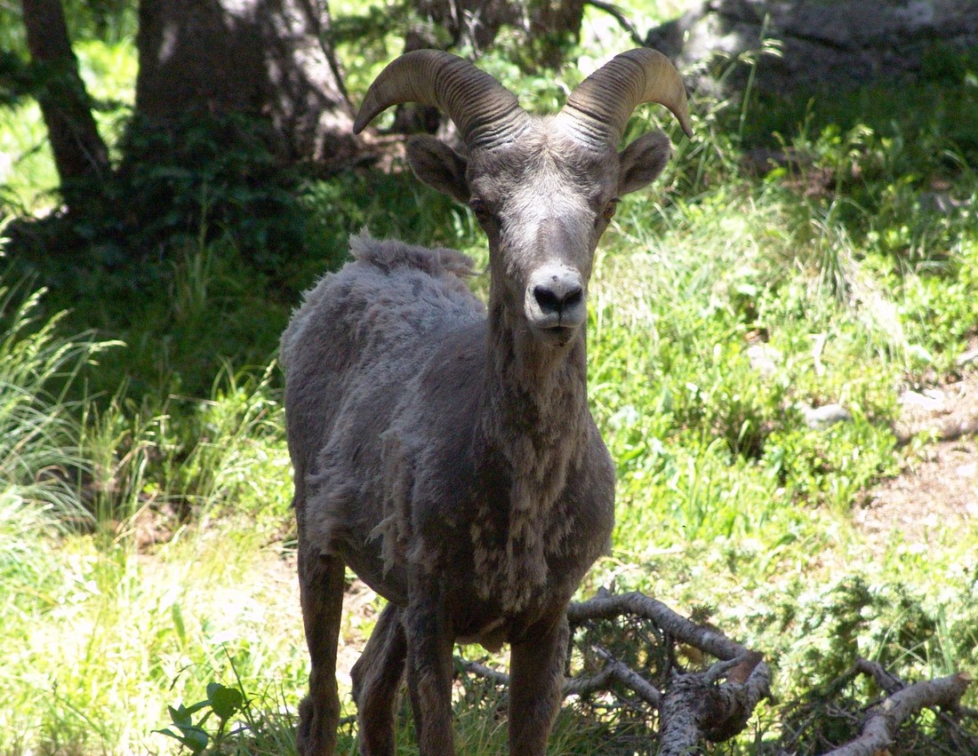
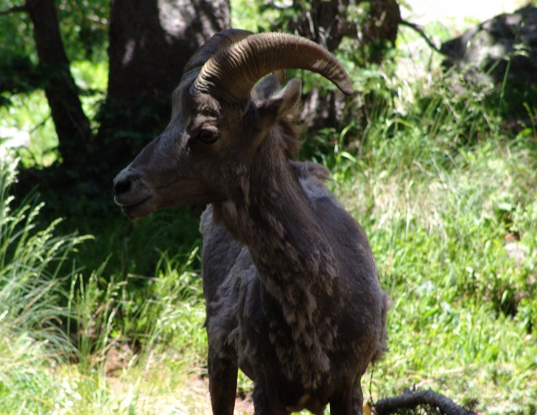
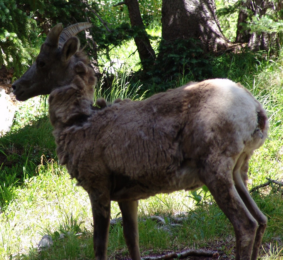
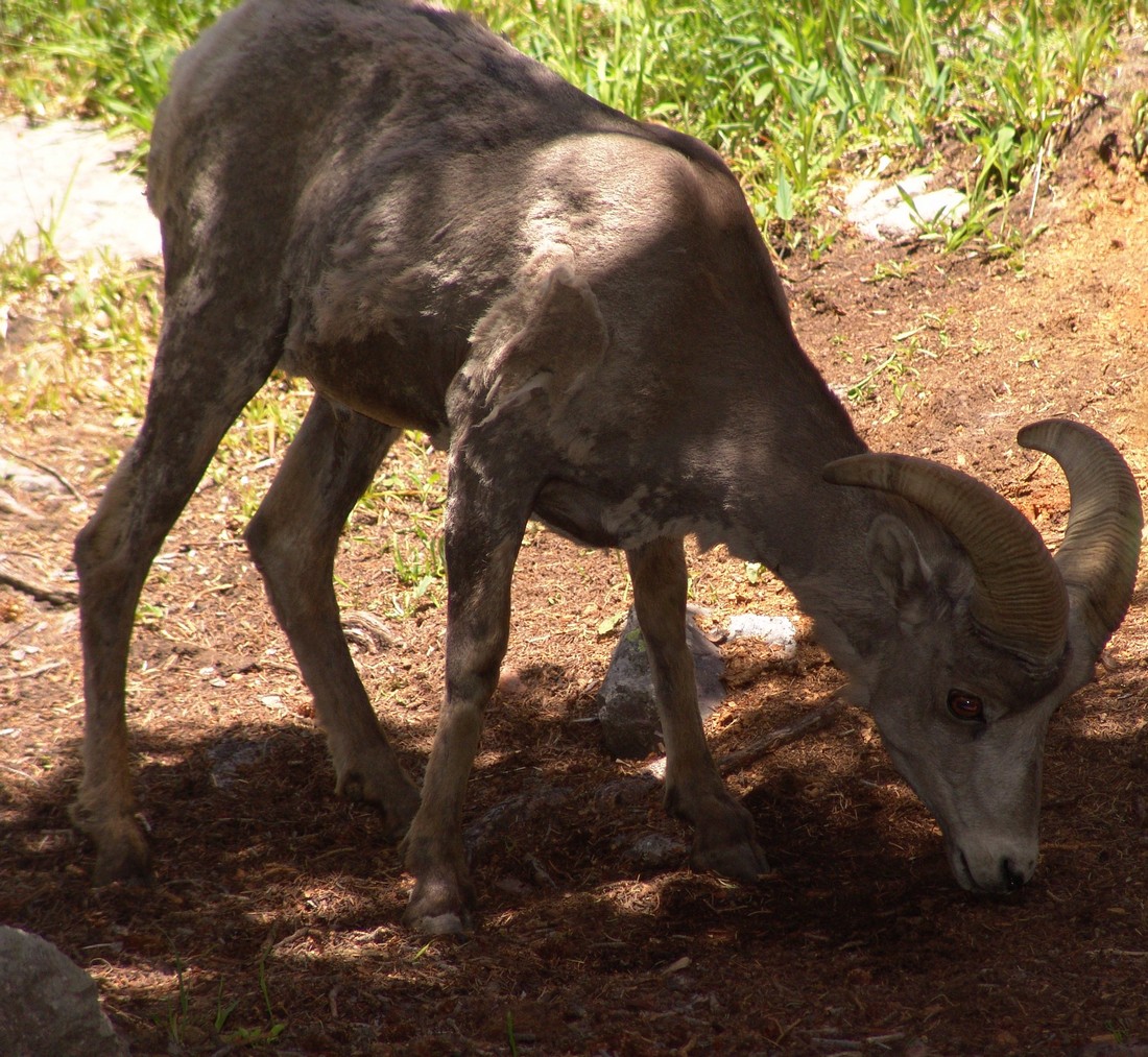
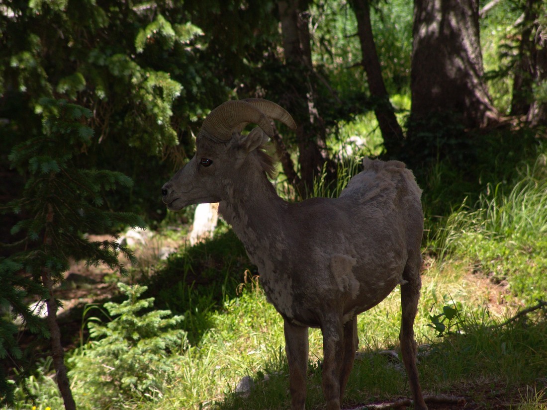
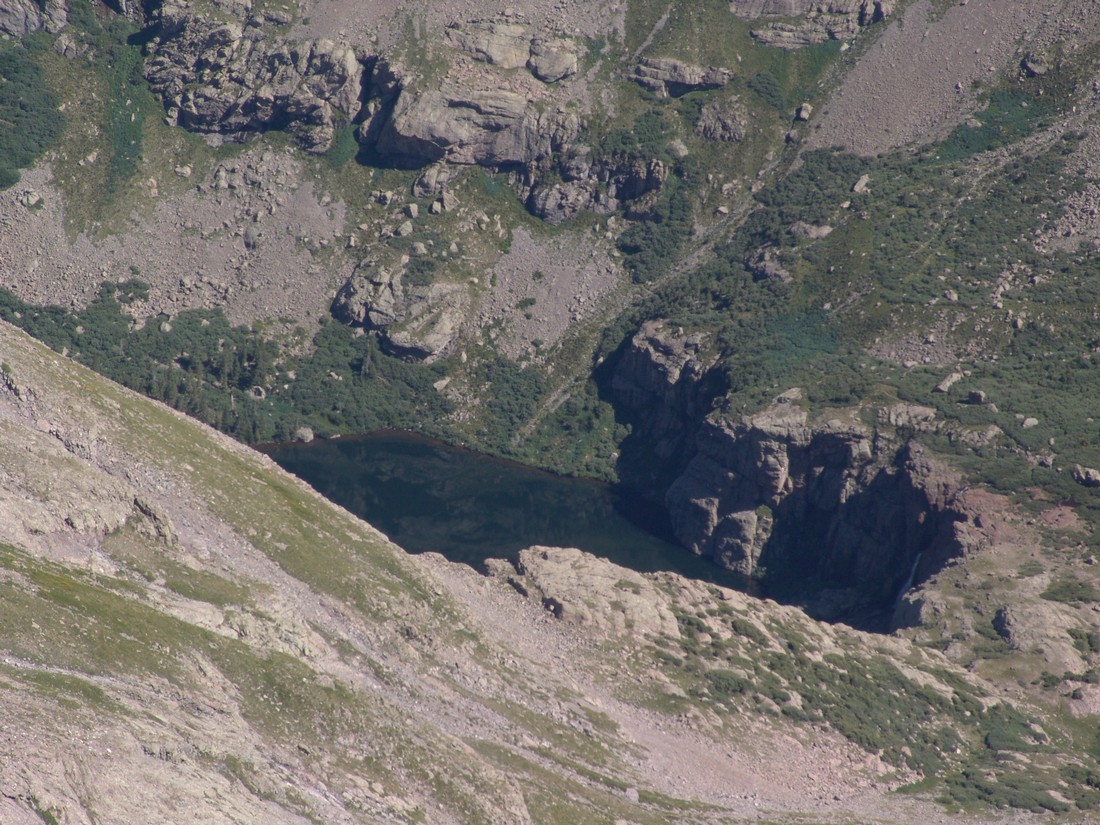
After gaining the headwall and hiking further up the trail, we were right at the base of Willow Lake. Being that we were in a Wilderness area, camping was restricted to areas no closer than 300 ft of the lake. One of the very first campsites we encountered had some Big Horn sheep grazing at it.
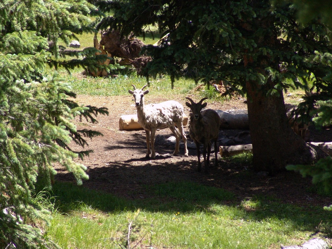
The sheep quickly scattered up the valley towards the lake. 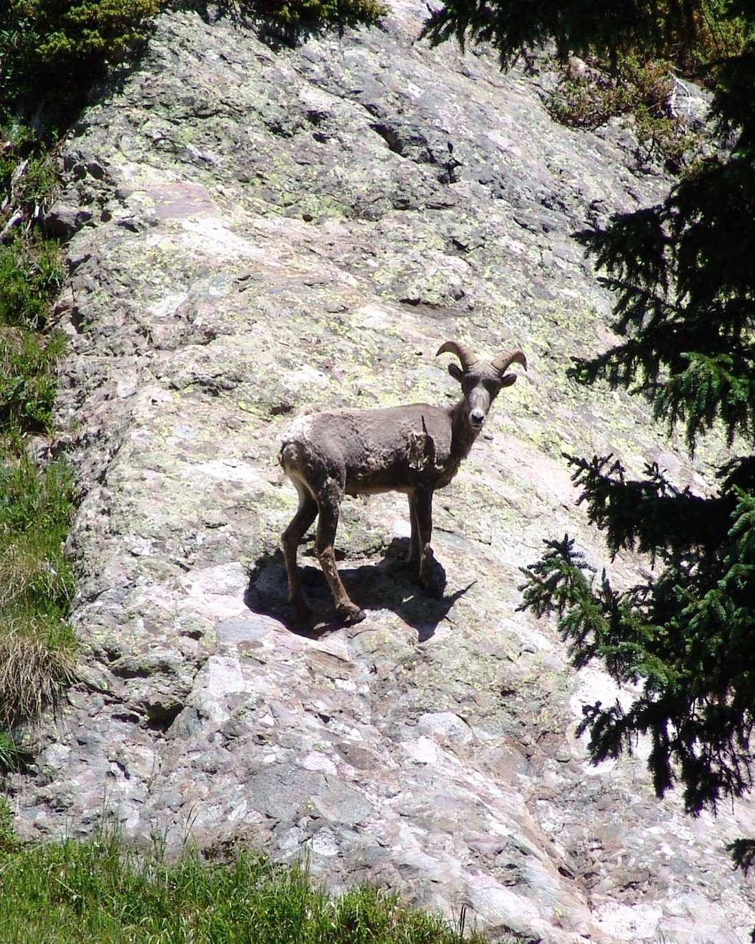
We kept going on the trail and found a really wonderful campsite left of the trail nestled in some trees. The funny thing was that the sheep were hanging out in this campsite. I was able to take several pictures of the sheep after we were able to claim the campsite as our own. This was one of the cooler things that has happened to me this year because one of my lifelong goals has been to see Bighorn sheep up close in the wild.
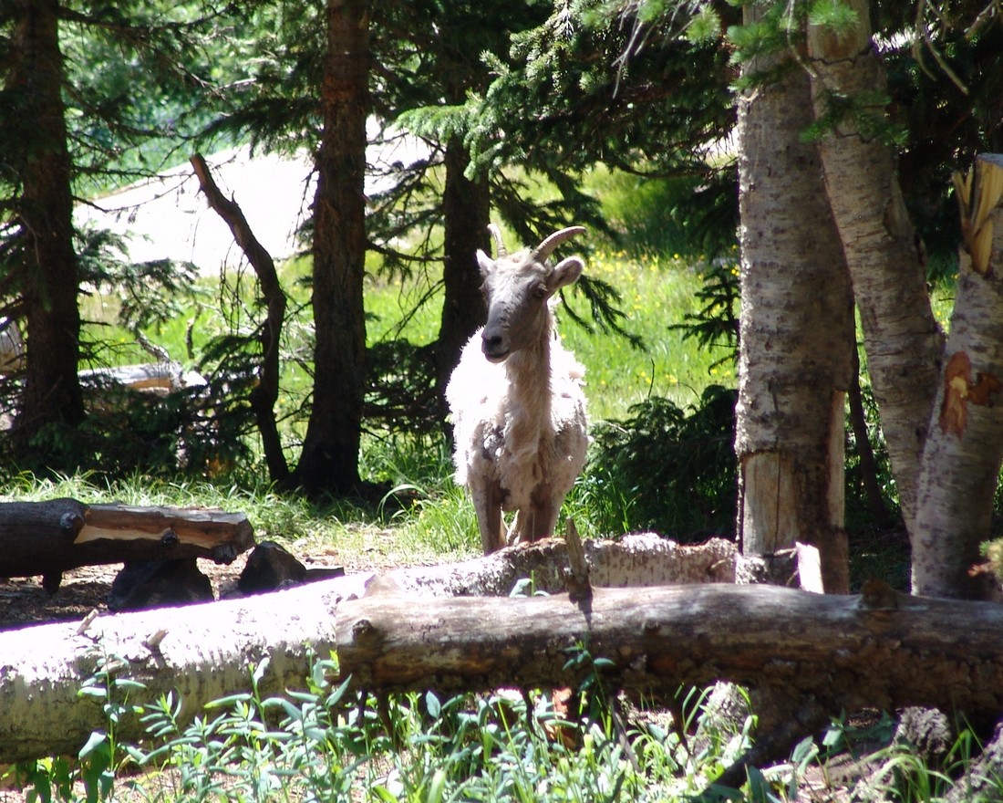
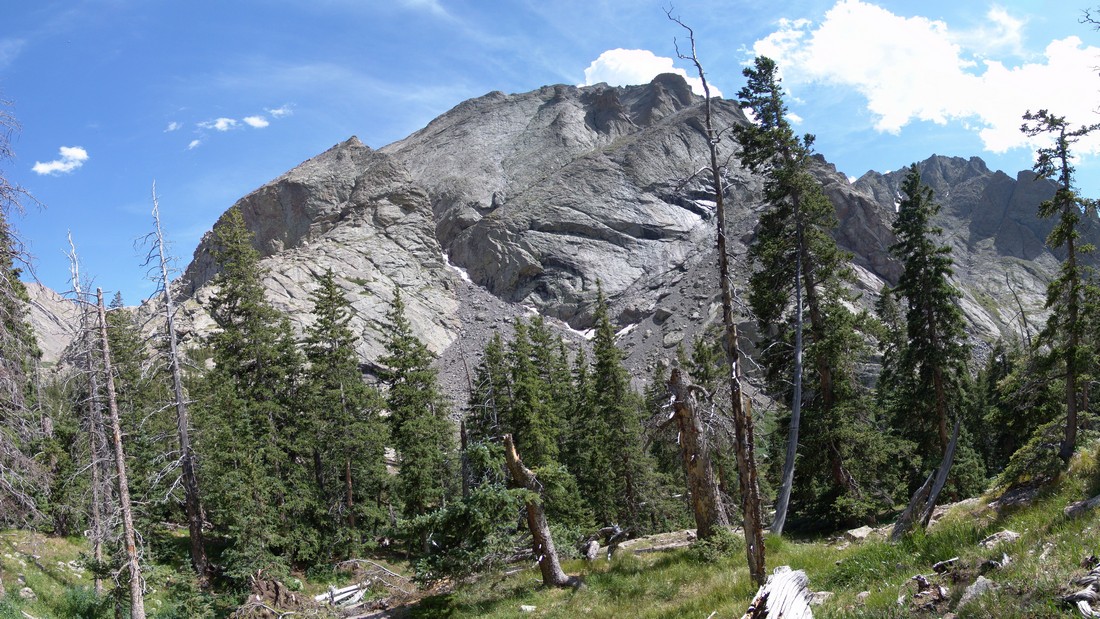
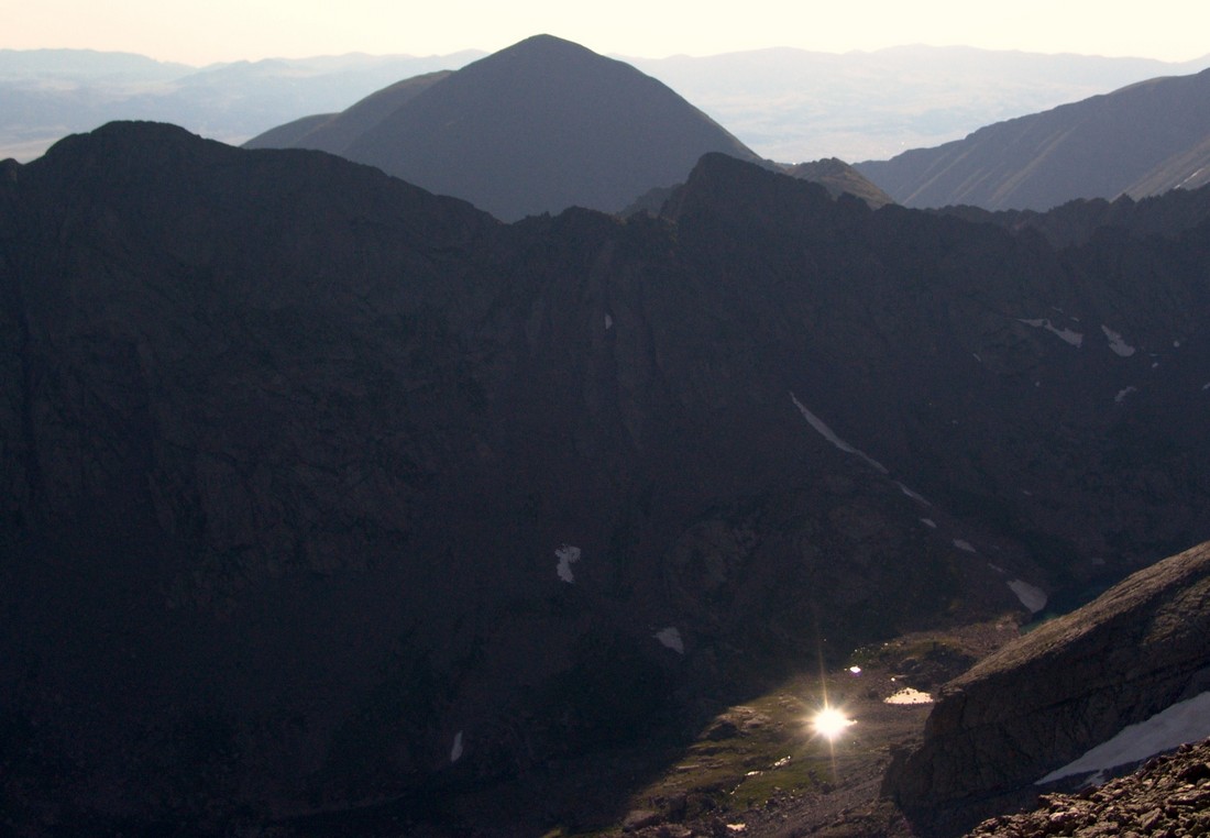
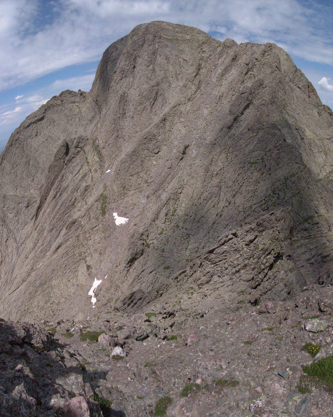
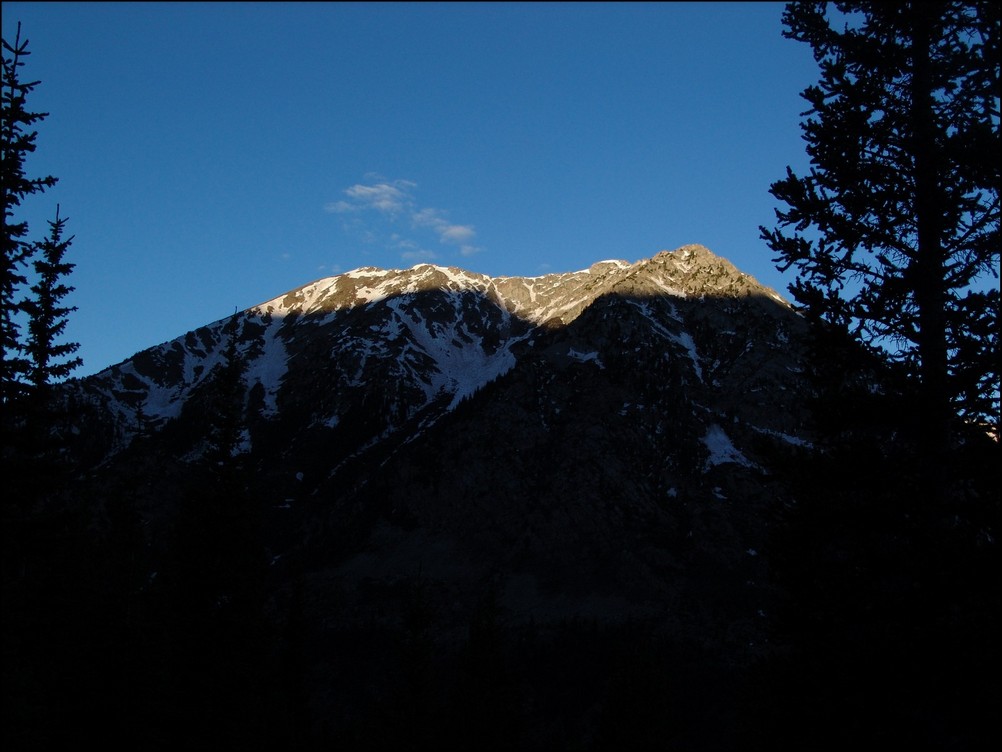
After we were able to chase off the sheep, we set-up camp. The campsite was very nice, with an established fire pit and logs all around it for seating. Here is the view we had of Challenger Point’s north face:
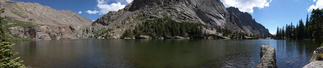
After setting-up camp, we decided to head up the lake to see what it was like. Boy, were we in for a scenic treat! The lake had a giant waterfall at its head and was surrounded by small cliffs where the waterfall was at. Here’s some stitched panoramic photos from the lake: 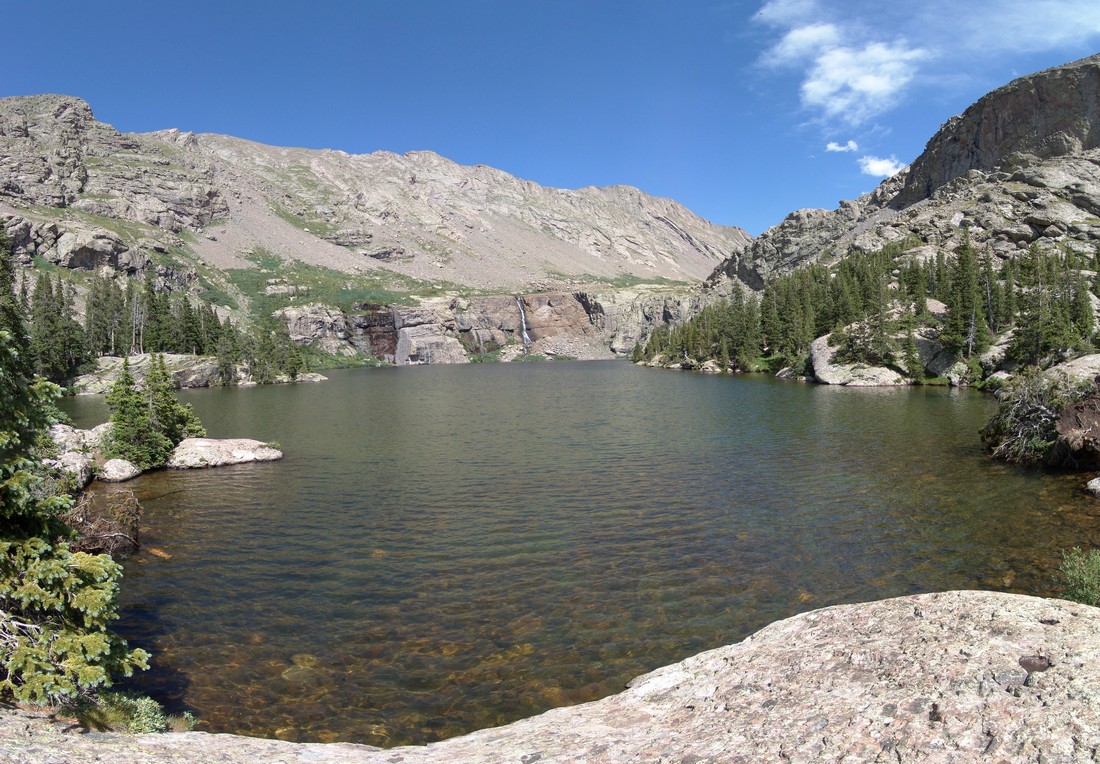
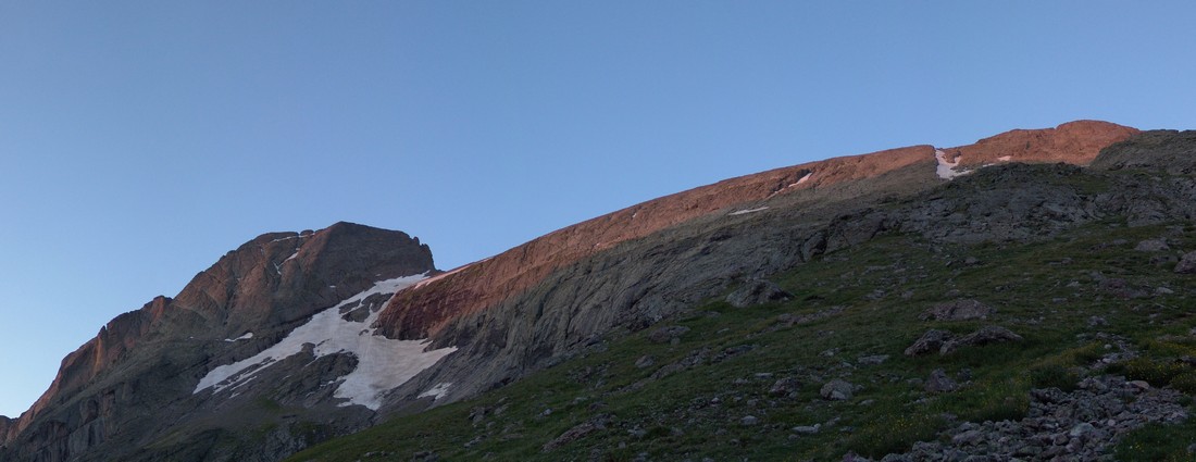
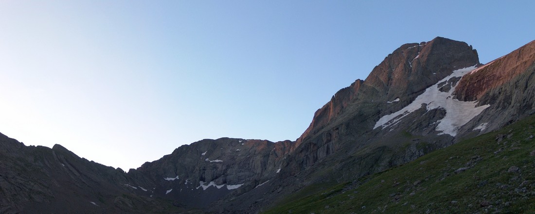
After soaking in as much of the lake as we could, we decided to head back to camp, cook dinner, and call it a night. We woke up at 4 AM the next day and quickly readied ourselves for what was going to be a very long but rewarding day.
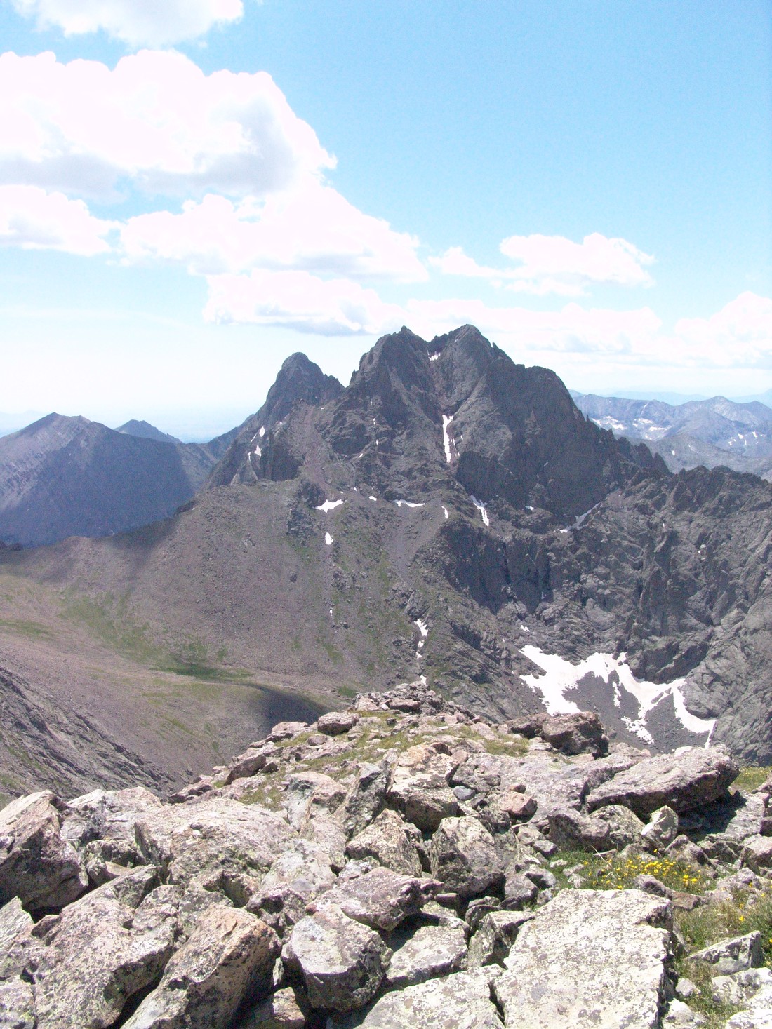
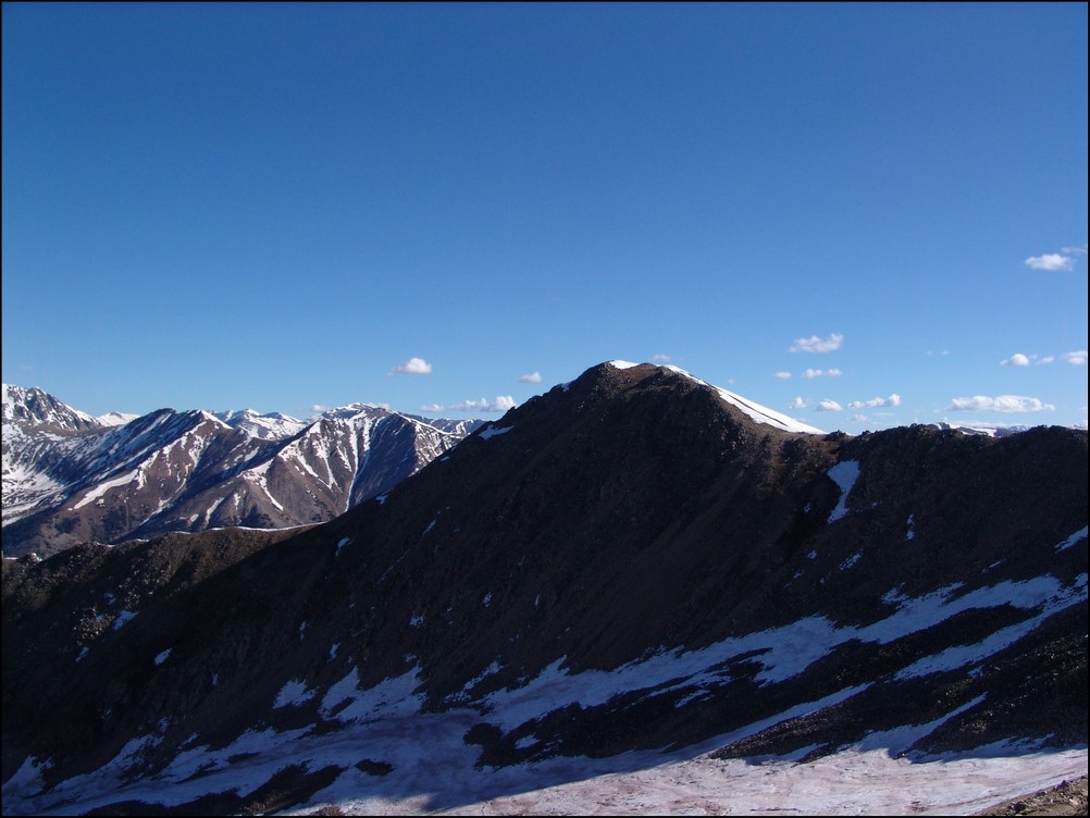
We hiked up past the lake and began up the valley to the south. Quickly Kit Carson and Challenger came into view (left and right respectively):
I think Kit Carson looks like a Klingon’s forehead. Who’s with me?

I originally thought that this was “The Prow,” a semi-famous section of Kit Carson that is a a notorious rock-climbing route; however, it turns out that “The Prow” is on the other side of Kit Carson and is seen from Columbia Point.
Another view looking up the valley at Kit Carson (right) and the adjoining ridge to its South and East.
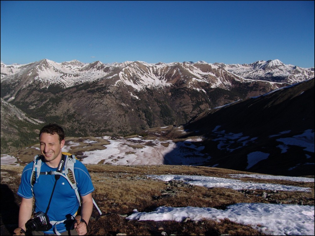
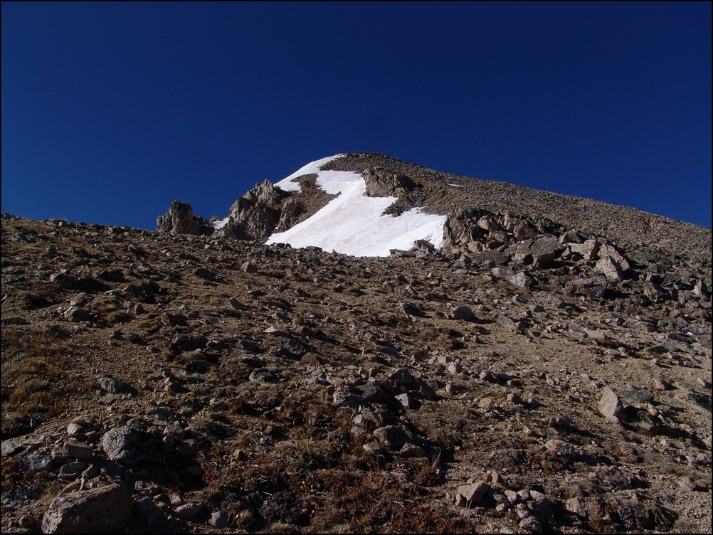
We climbed up the grassy slopes of Challenger Point and then up a loose talus section to the ridge. From the ridge we could see the top of Challenger Point and looking down we could see the upper Willow Lake and the sun’s reflection on it.
We started climbing up the ridge to the southeast towards Challenger Point. Here is a view from near the summit of what the ridge climbing looked like. 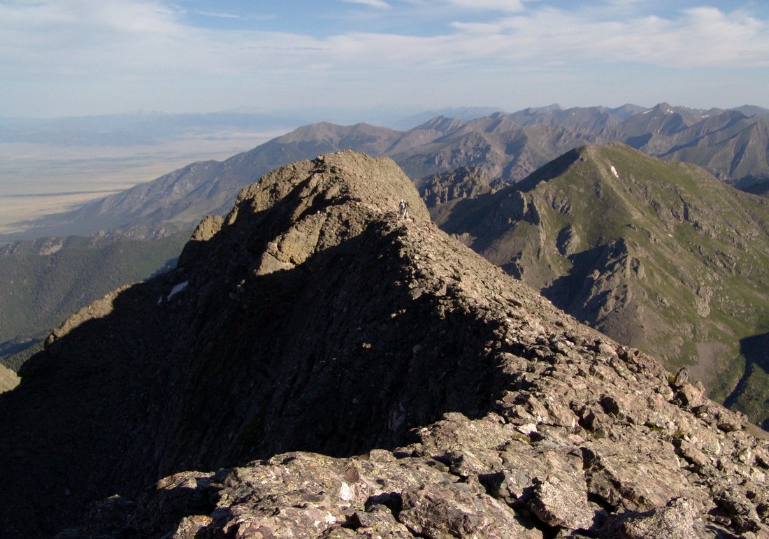
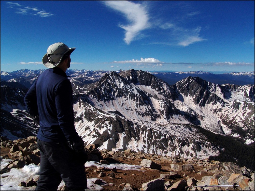
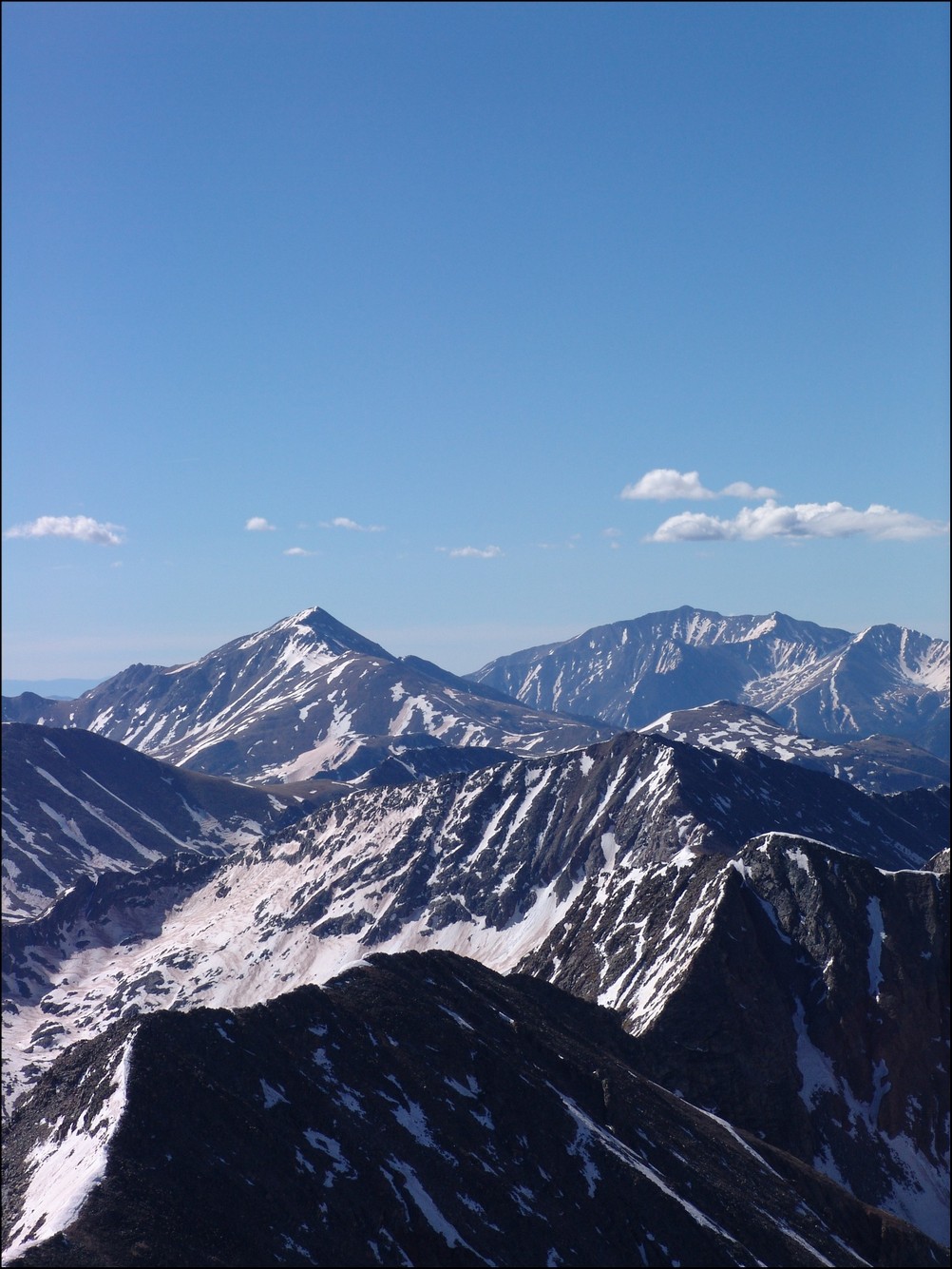
A few minutes later and we arrived on top, with Kit Carson and Crestone Peak in full view and the Blanca group in the distance to the South. 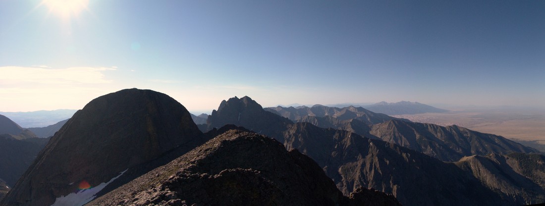
Looking east we could see Mount Adams poking up towards the sky. 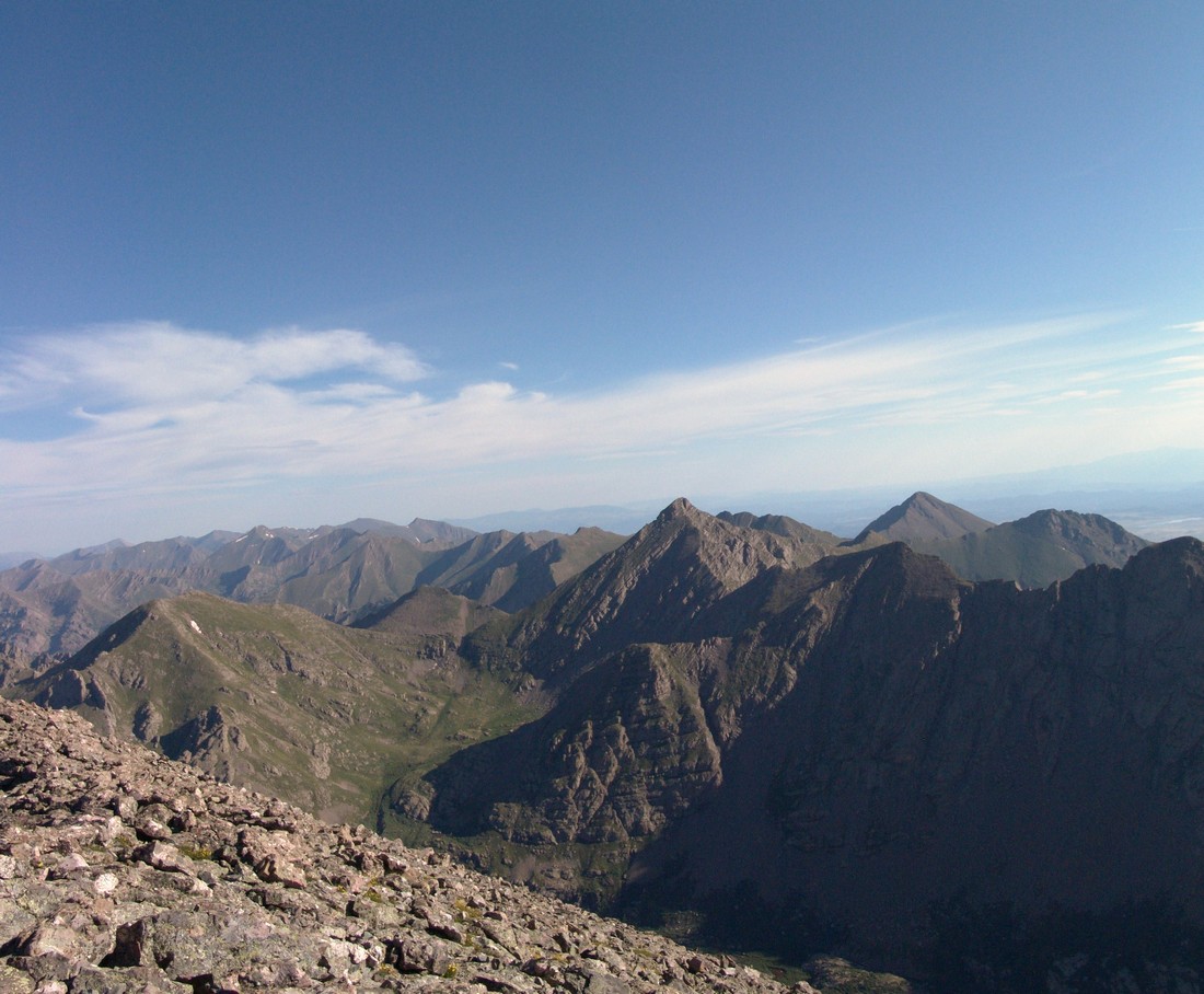
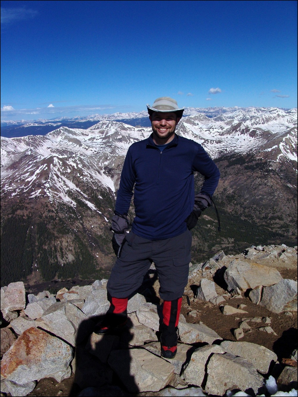
And here’s a shot of me on the summit looking southeast towards Crestone Peak and Kit Carson: 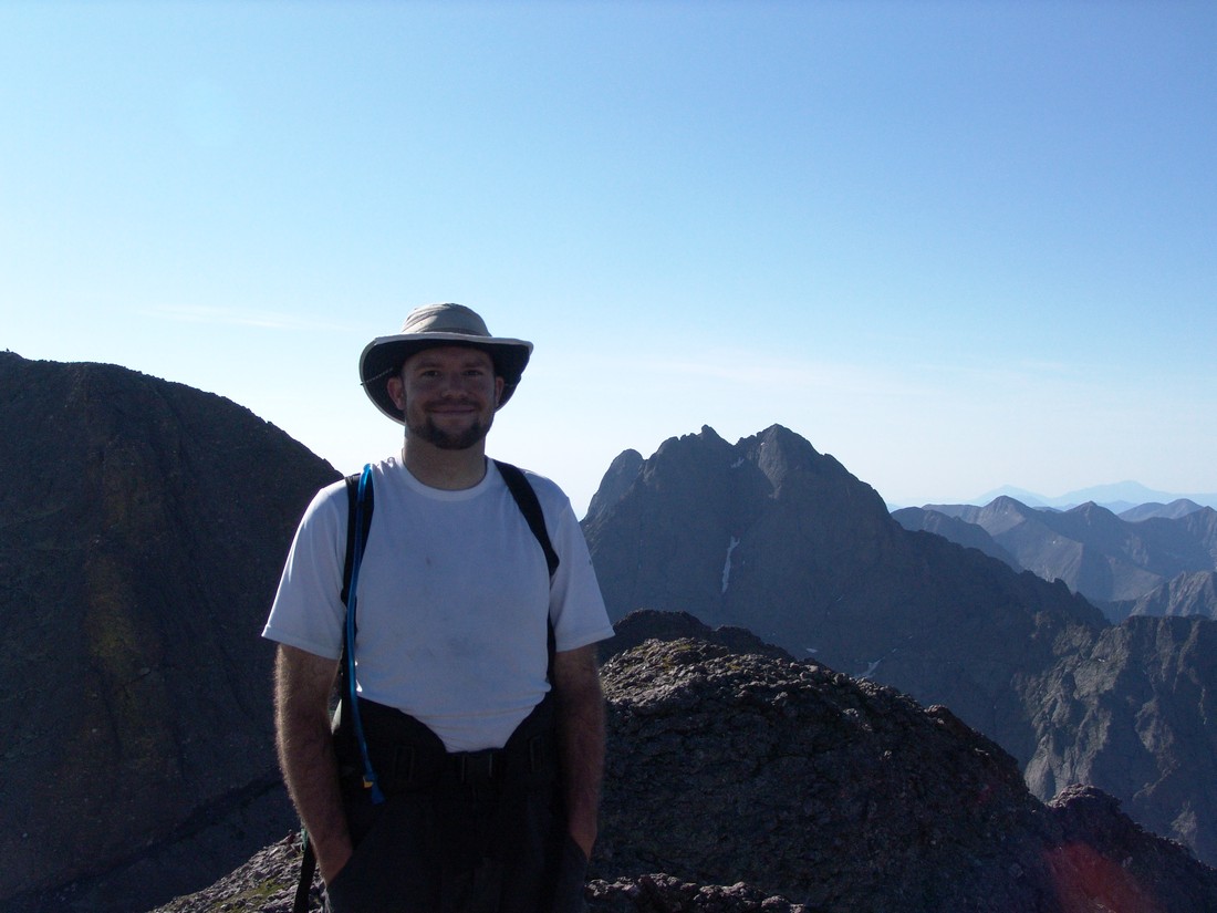
On top of Challenger Point rests a plaque dedicating the mountain to the Challenger shuttle disaster of 1986. 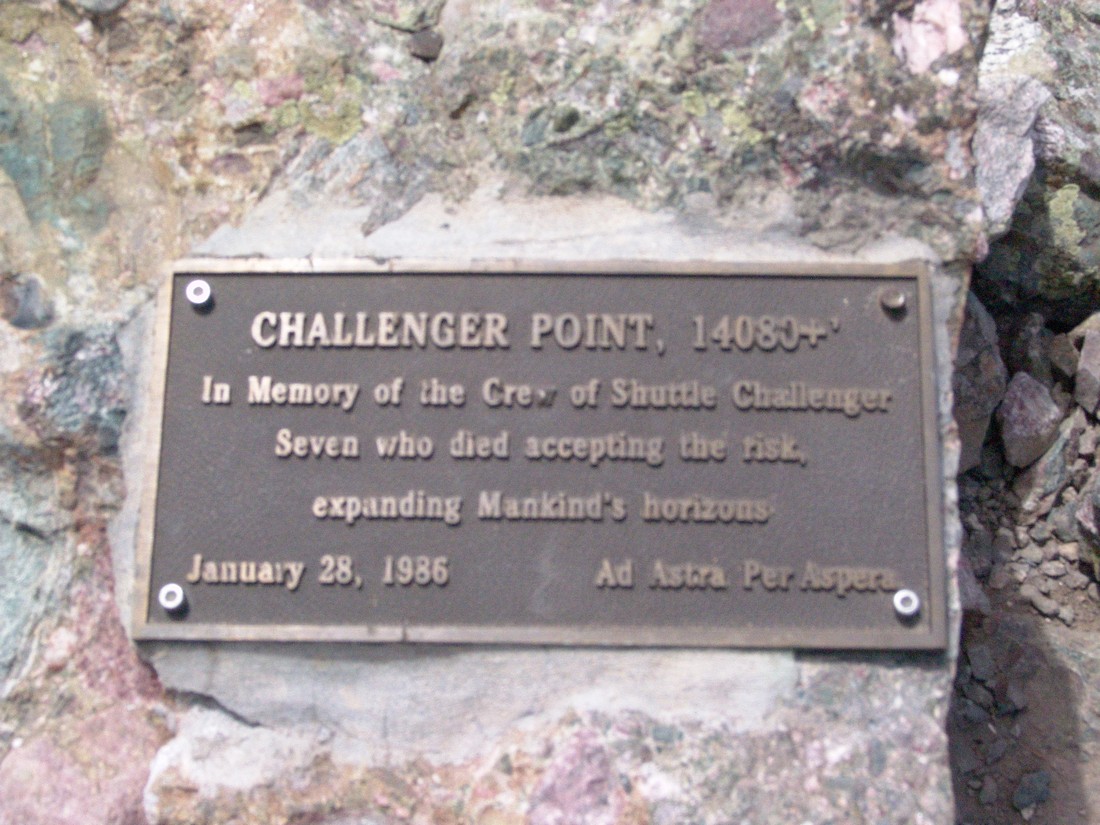
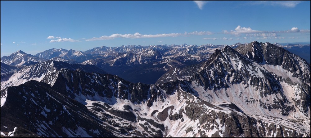
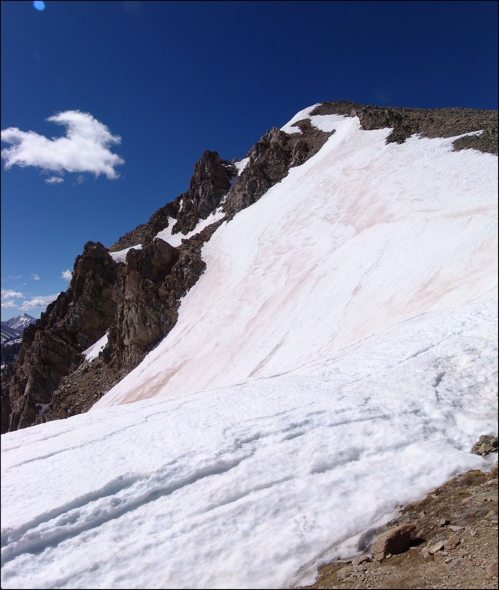
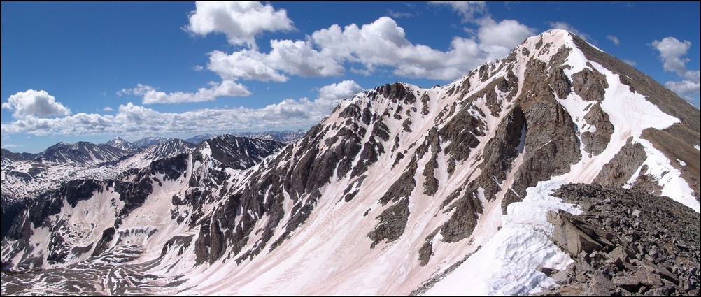
After refueling on top of Challenger Point, we began the journey down Challenger Point’s southeast ridge towards Kit Carson and the Kit Carson Avenue, a long ledge leading around the side and then around the back of Kit Carson. Here’s a look at some of the perilous cliffs below Kit Carson Avenue and subsequently, a photo of the Avenue and the route up it. 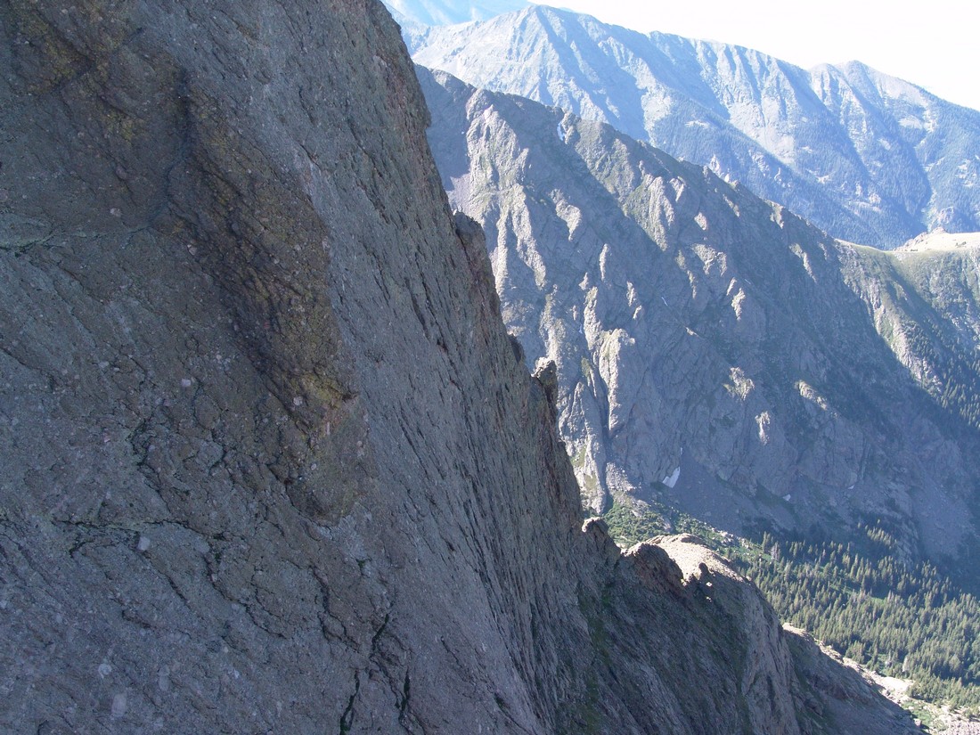
The Avenue looks pretty sketchy from here but in reality it was a nice ledge with plenty of room for walking. Once at the top of the Avenue, you once again can see the awesome Crestone Peak (center) and Columbia Point (left) with the back-side and downward heading remainder of Kit Carson Avenue. 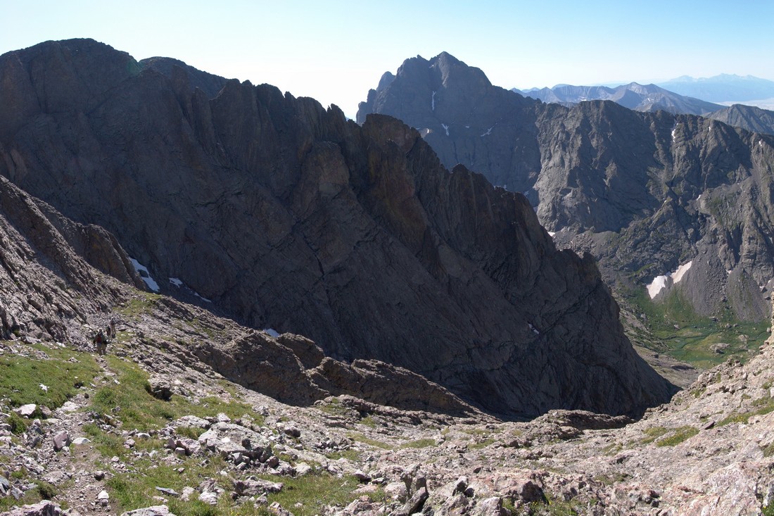
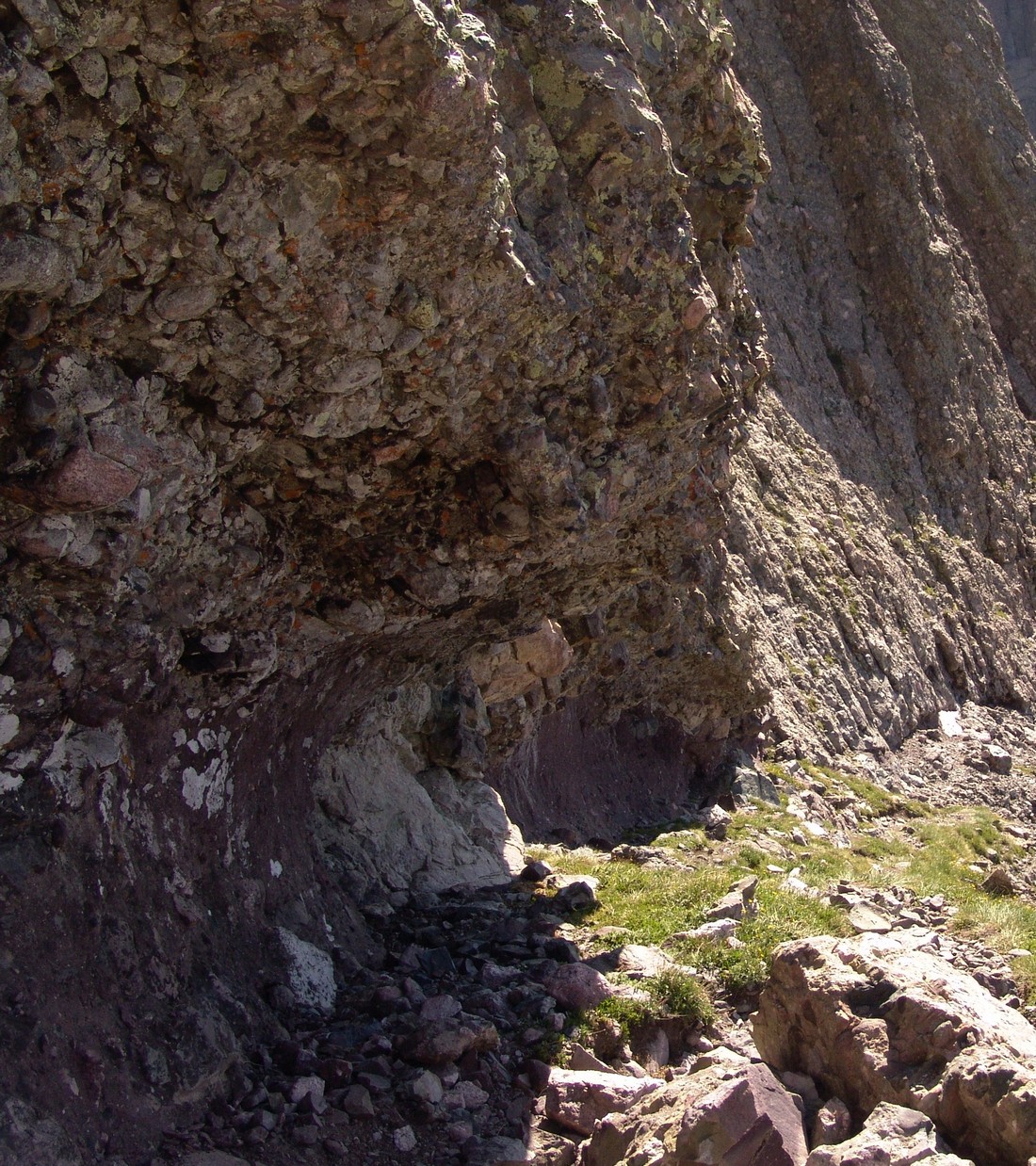
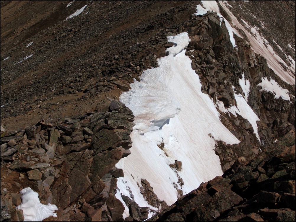
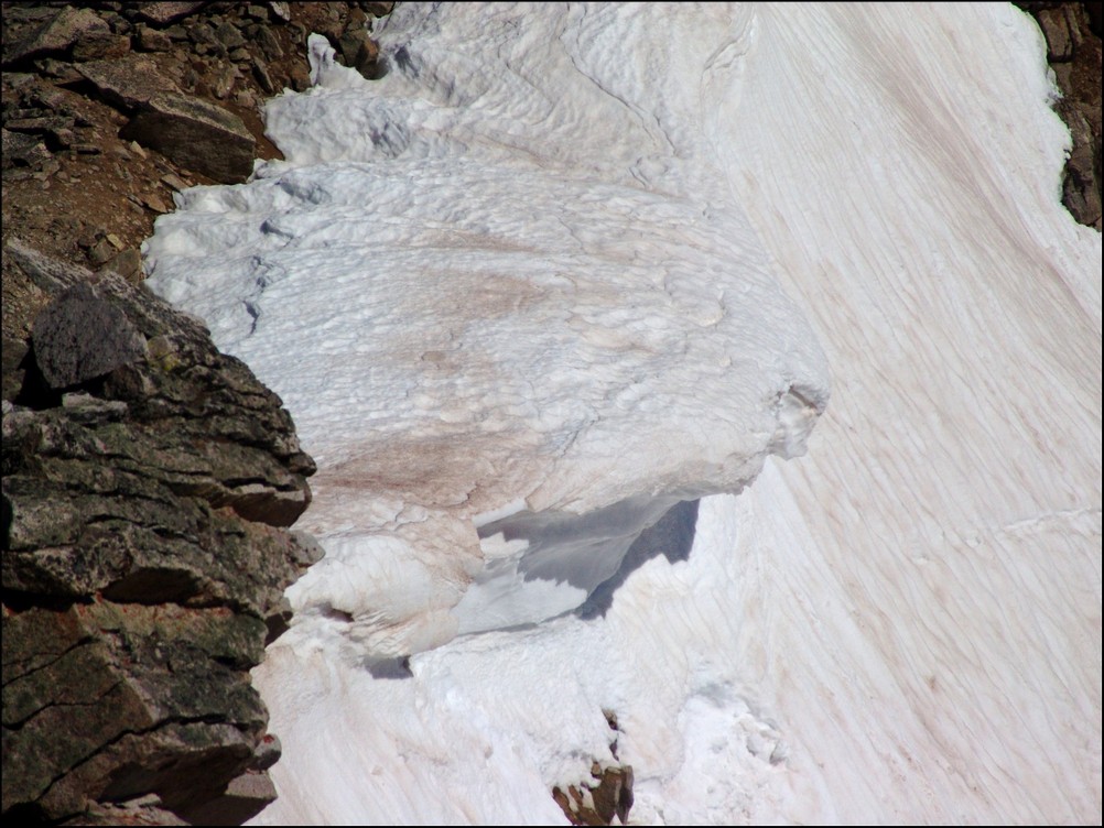
Going down the Avenue, I was struck by the really remarkable geological formations. It appeared to me that water had eroded the underside of Kit Carson in the Avenue, making it look like something had burrowed its way right through the rock all the way down.
And another view looking down the Avenue – it looks far less intimidating than it did from the top of Crestone Peak. 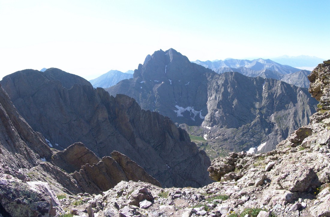
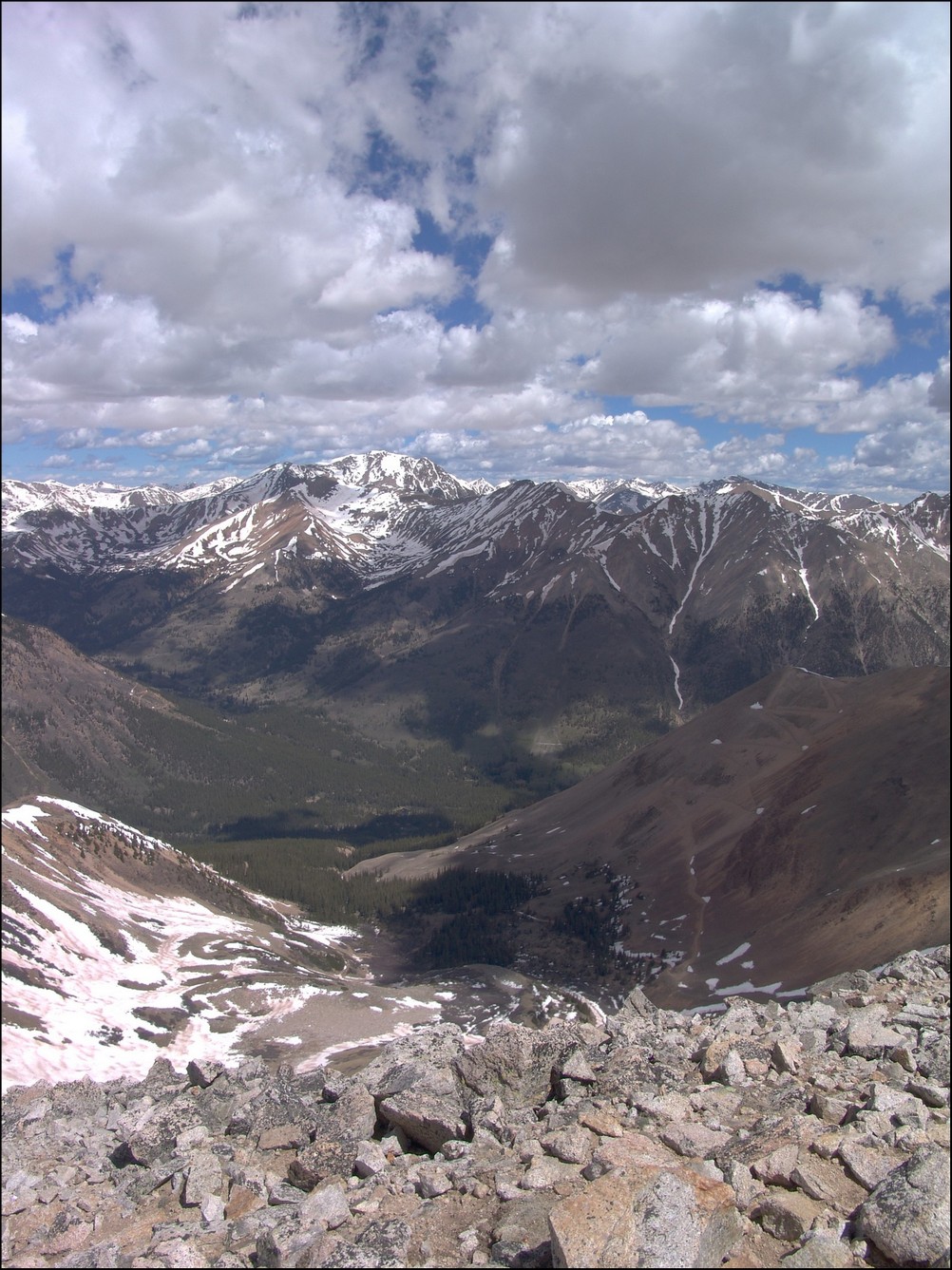
Once we reached the bottom of the Avenue, the route took us sharply to the northwest. The climbing was pretty standard class 2 stuff. Near the top of this last section Terry ran out of gas and took a break to rest. I decided to make the final push to the top after visually verifying that Terry was not injured and was continuing. Here’s a shot looking towards Columbia Point and Crestone Peak again. Take special note on the intimidating nature of Columbia Point (closest peak) from this vantage point, as it was the side of that mountain that I would later climb… Looking at Columbia Point you can see a small fin that is separated from the mountain by a small gap. That is the fin I would later ascend to reach the top (more later). 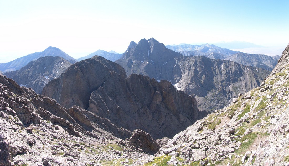
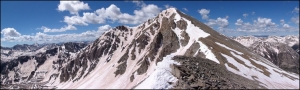
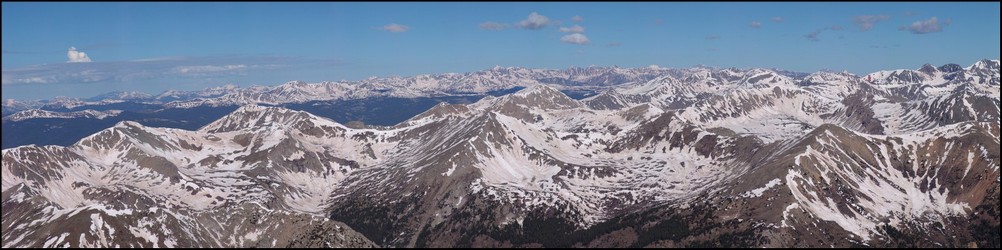
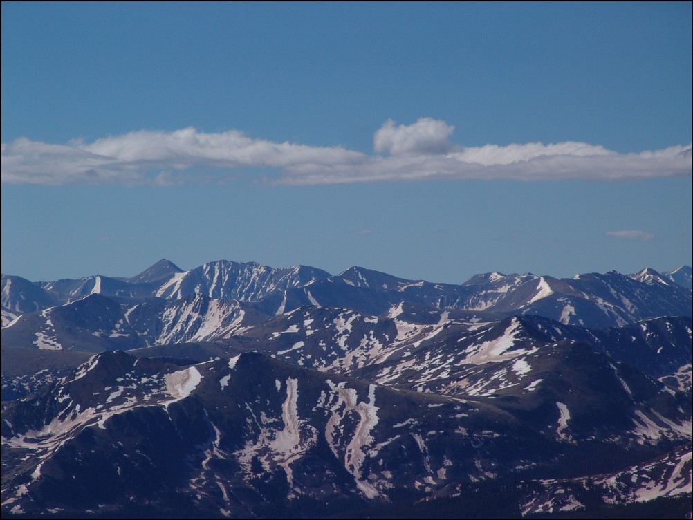
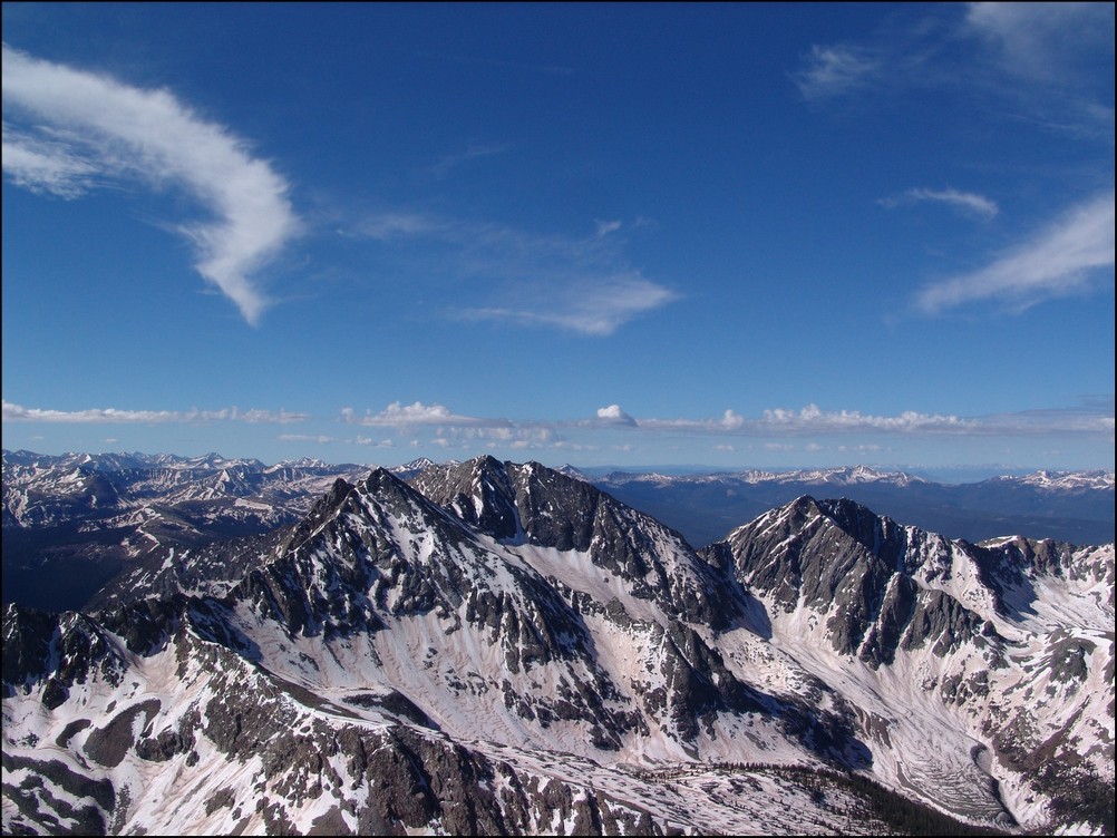
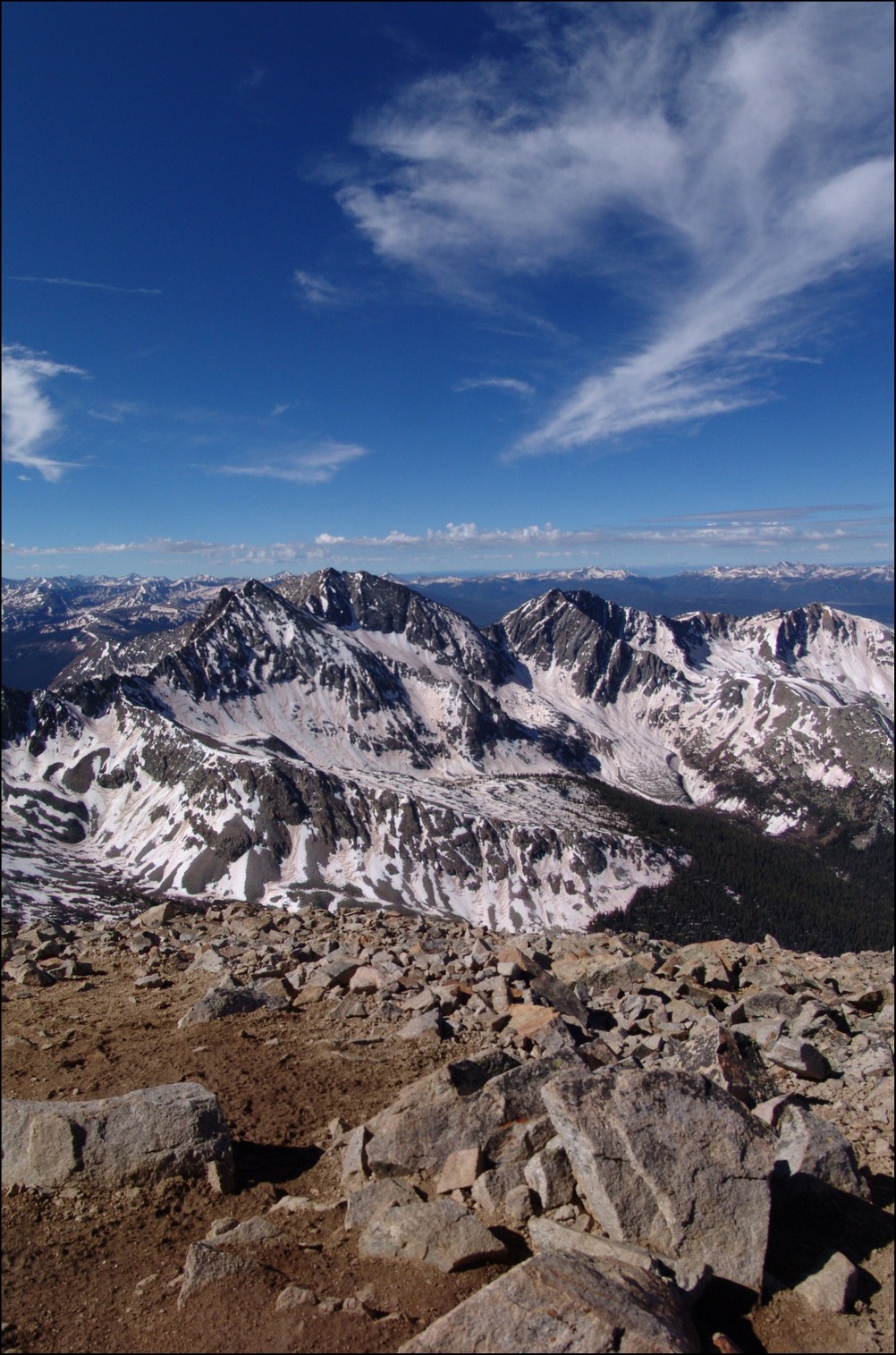
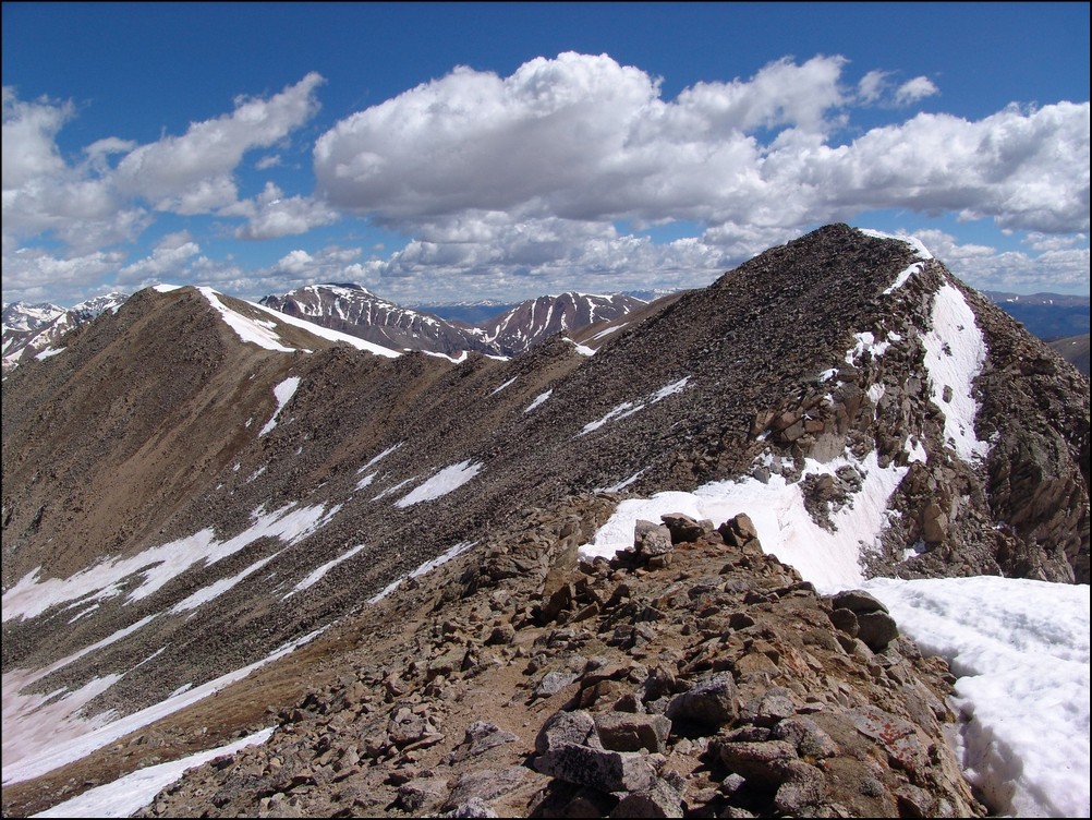
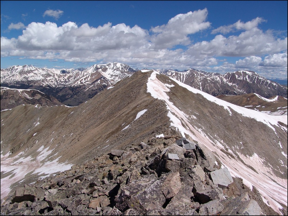
From here, reaching the top of Kit Carson was a breeze. There were several other groups on top. Here’s some stitched photos looking towards Challenger Point. This is a good view of the route we had to come up earlier in the day. Basically starting from the large lake pictured right of center, you climb up the grassy section and then up the rocks to the ridge. 
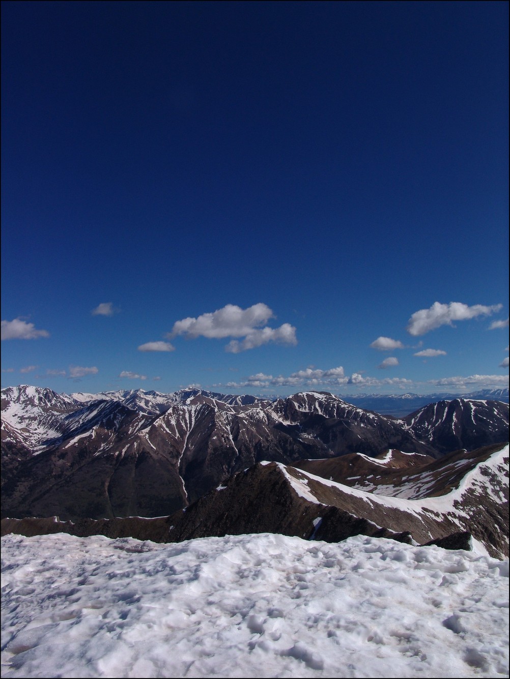
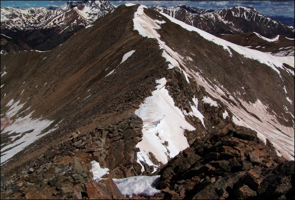
Speaking of the lake, here’s a really high-detail pano of it.
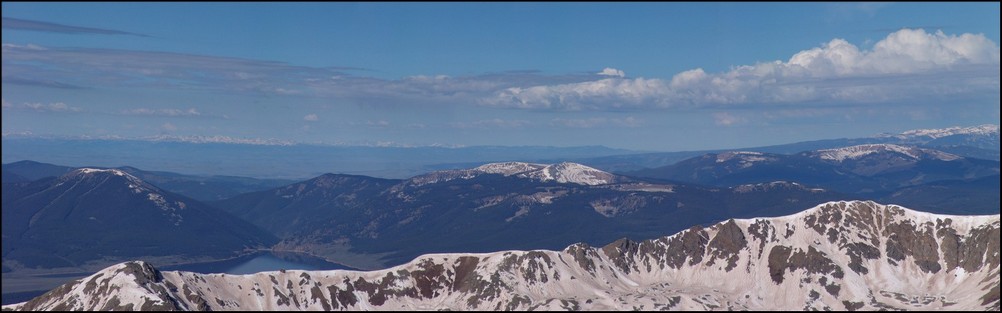
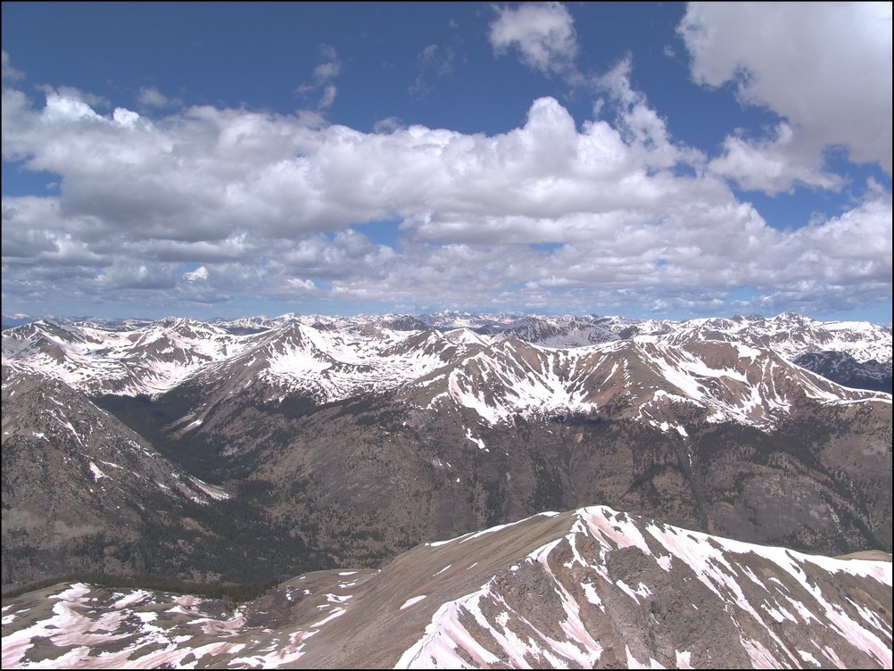
And a shot looking south. 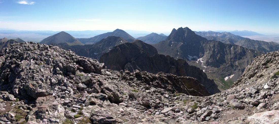
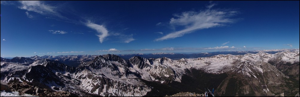
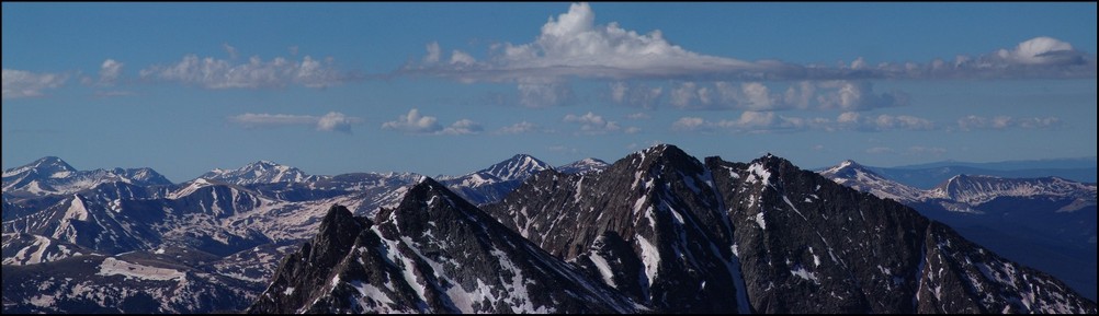
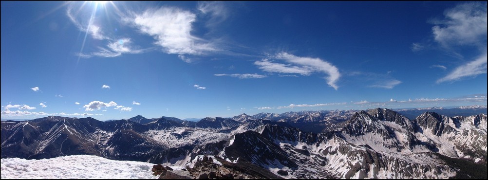
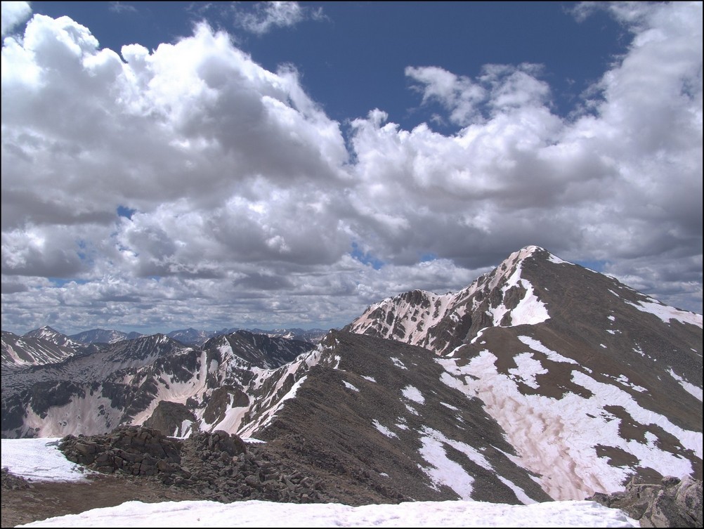
And a 180 degree pano with Columbia Point in center. 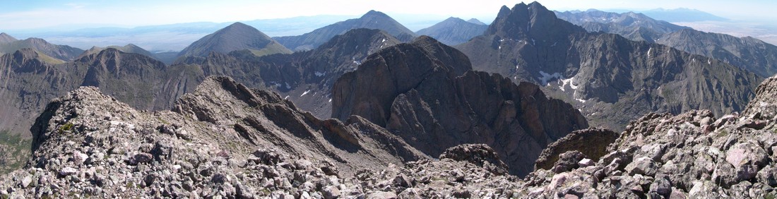
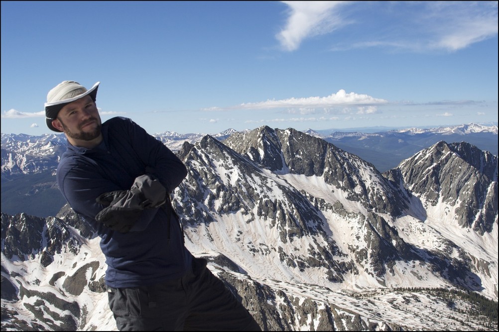
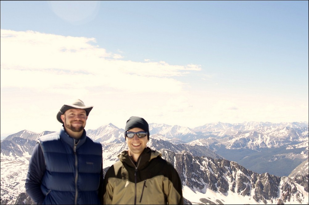
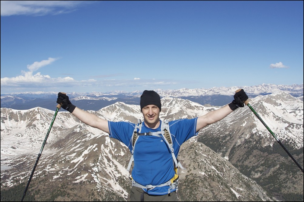
And of course here I am flexing victoriously on the summit. 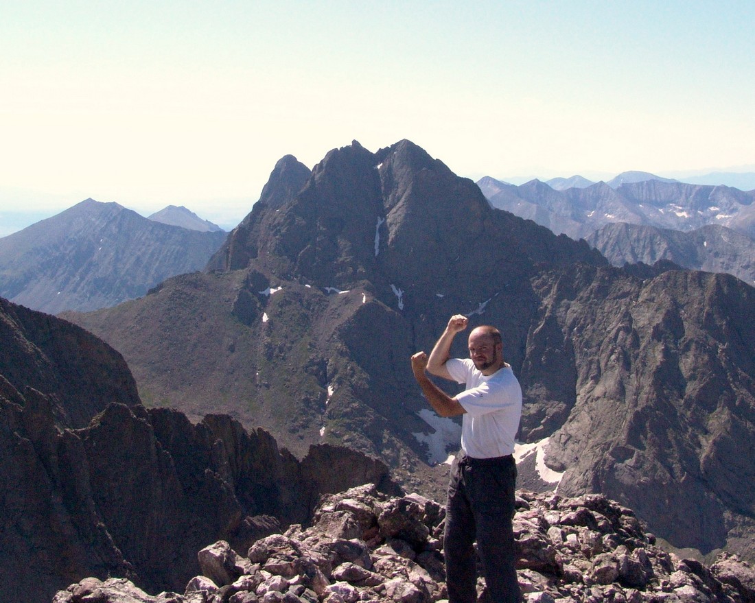
After a quick snack on top I decided it was time to go back down and decide if I was going to climb Columbia Point. Terry had already headed down and would not be attempting Columbia Point. After running into another climber on the way down and picking his brain on the approach for Columbia Point and assessing the weather, I decided to give it a shot solo. This was possibly the most technically challenging climbs I’ve done to date. The route was not well-established and there was a couple of spots where I was exposed and could have fallen to my demise. Here’s a picture outlining my rough route up. 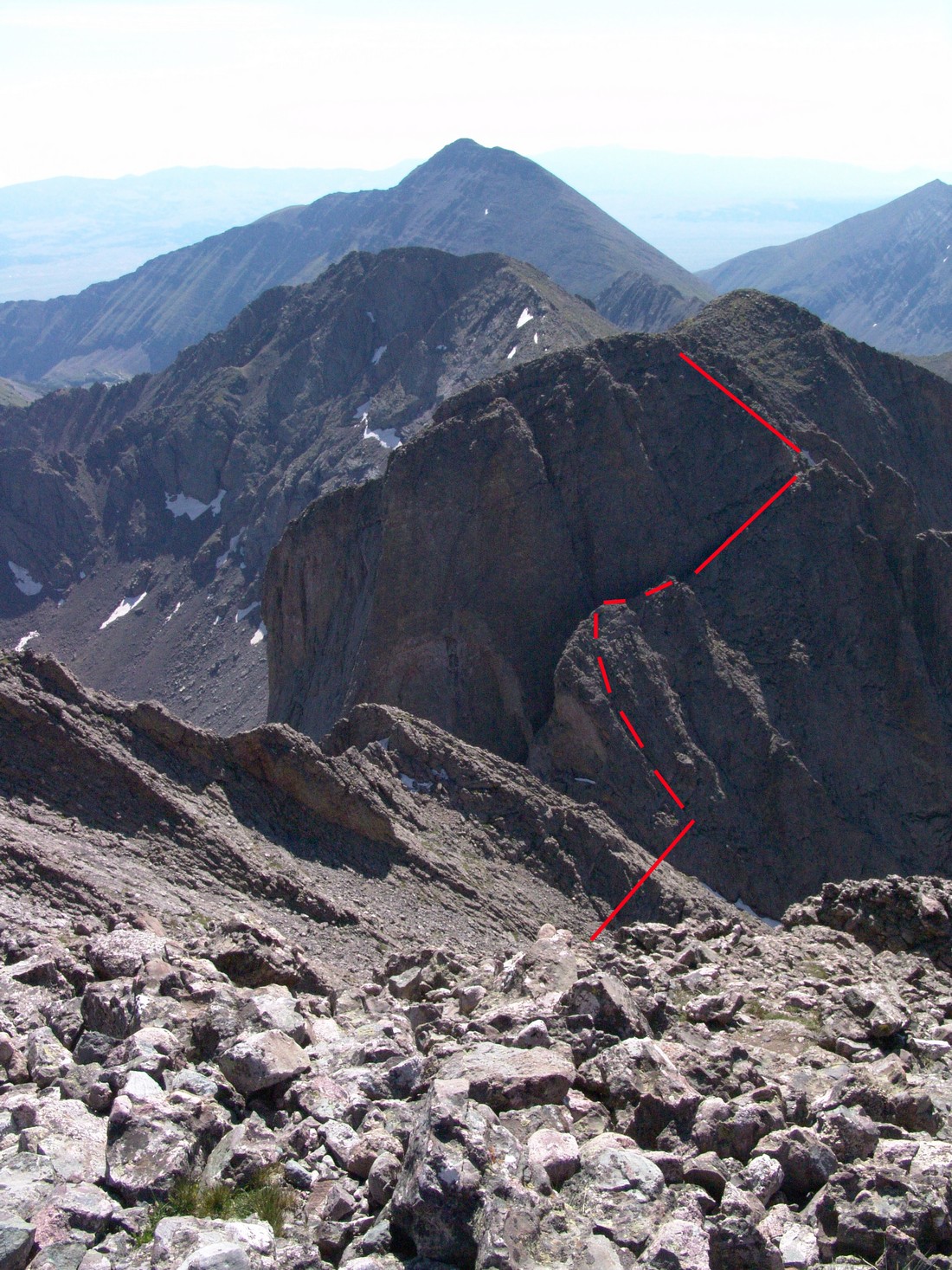
Once I reached the top of the first gully of the fin (5th red line from bottom), I had to make a really risky move to down-climb about 10 feet to the next section of the fin. I sat there for at least two minutes and contemplated the move’s risk and thought of turning around. I would definitely rate the move as Class 5 (Class 5: Technical free climbing involving rope, belaying, and other protection hardware for safety. Un-roped falls can result in severe injury or death) as it was 100% vertical and required both hand holds and footholds. Even though I still had on my backpack and had my camera around my neck, I decided that I had the skills and the mental acuity to give it a shot. This move was really tricky as I had to somehow flip myself around and onto the face of the rock wall, with 300 feet of exposure (Empty space below a climber, usually referring to a great distance above the deck through which the climber could fall) to the left and a steep rocky slope below me to the right. I took a photo of the spot but it really does not do it any justice. Perspective is everything. I was amazingly cool during the attempt but did find myself shaking a little and my heart was racing pretty fast. Once I secured myself onto the face of the wall, I descended several feet down, ensuring that my hands and feet had secure holds with each move. In retrospect, this was a very risky move and leaving the gully earlier to avoid it would have been prudent. After this, the route was pretty straight forward up the fin and then up the steep ridge. It was hand over hand the rest of the way up. I reached the top and took photos of the mountains surrounding me; Crestone Needle, Crestone Peak, and Kit Carson. 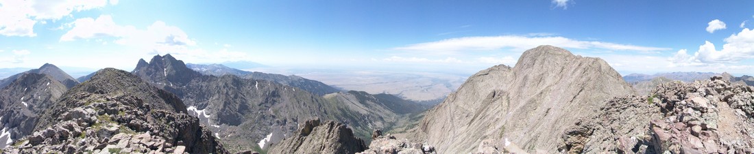
At this point, “The Prow” of Kit Carson was readily apparent to the left of Kit Carson’s summit.
After taking pictures I took some time to search for something I had heard about… I was unable to locate a plaque that was dedicated to the Columbia shuttle disaster of 2003 as seen here:
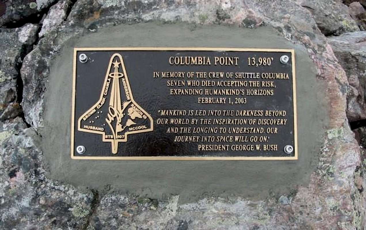
This was a real disappointment because it was one of the reasons I wanted to climb this mountain. I searched around the summit in all directions but could not find it. Frustrated, I second-guessed that I was truly on the summit of Columbia Point and not “Kitty Kat Carson,” an unranked 13’er right next to Columbia Point to the south. You can see it behind Columbia Point in the photo above. Even though a summit register on top said I was on Columbia Point, I wanted to go over to the other summit to be sure. After a quick trip over to “Kitty Kat Carson,” I determined that I was indeed on Columbia Point previously; however, the trip was well worth it as I was able to get some pictures of the full-on and un-obscured view of Crestone Needle and Crestone Peak.
After enjoying the views from “Kitty Kat Carson,” I decided to go BACK over to Columbia Point one more time to try to find the plaque. Unfortunately I was not able to find it. Looking east, I noticed that some clouds were building so I decided it was time to head back towards Kit Carson and back up the Kit Carson Avenue. Another look back towards Kit Carson revealed that another climber was coming up Columbia Point so I knew I needed to be careful not to kick any rocks down on him.
I reached the top of the Outward Bound Couloir between Kit Carson and Columbia Point and headed back over towards Kit Carson Avenue by way of a steep gully with a large rock terraced over it, which created a nice and tight fit back over to the Kit Carson side of the couloir.
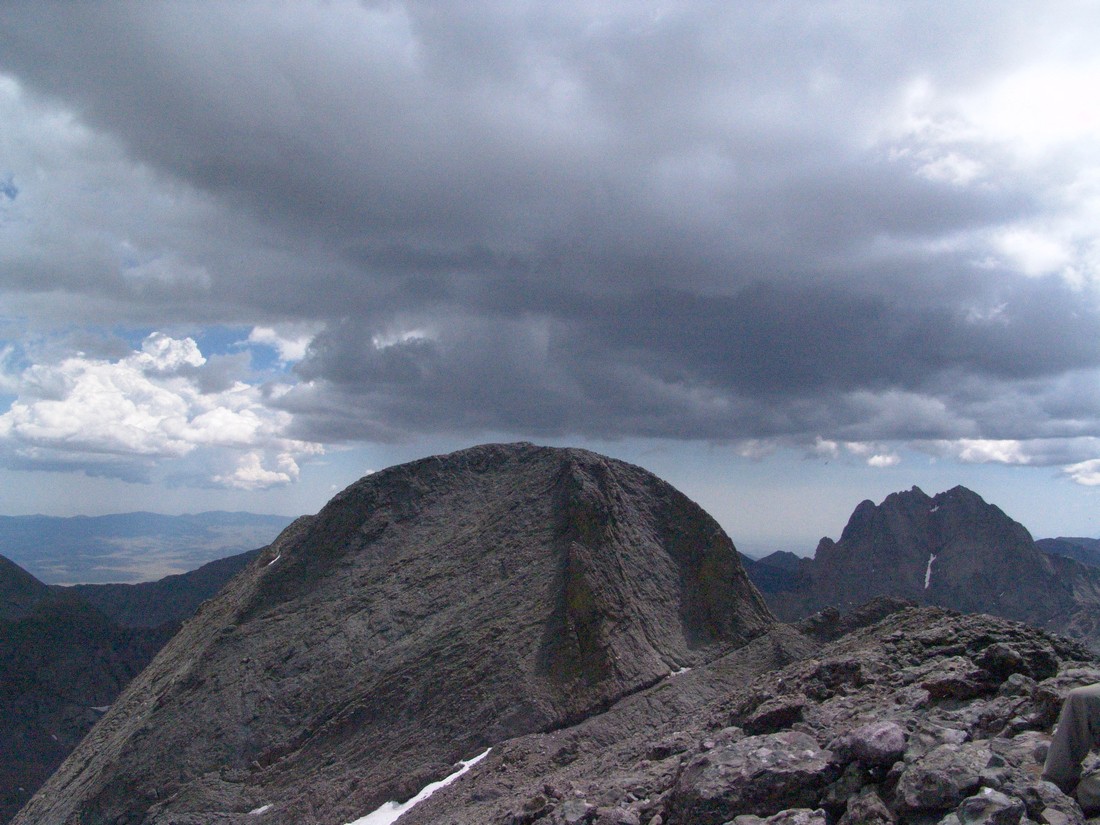
After reaching the top of Kit Carson Avenue, I climbed back down to the saddle between Kit Carson and Challenger Point and decided to re-summit Challenger Point as to ensure that the same route we took to get up would be the one used to get down. Once at the top of Challenger Point again, the nasty weather was building and looking more and more ominous.
Fortunately the weather cooperated just enough to let us get back down to the lake in our haste. It was pretty cool seeing the flora down there since it was dark earlier in the morning when we were coming up. 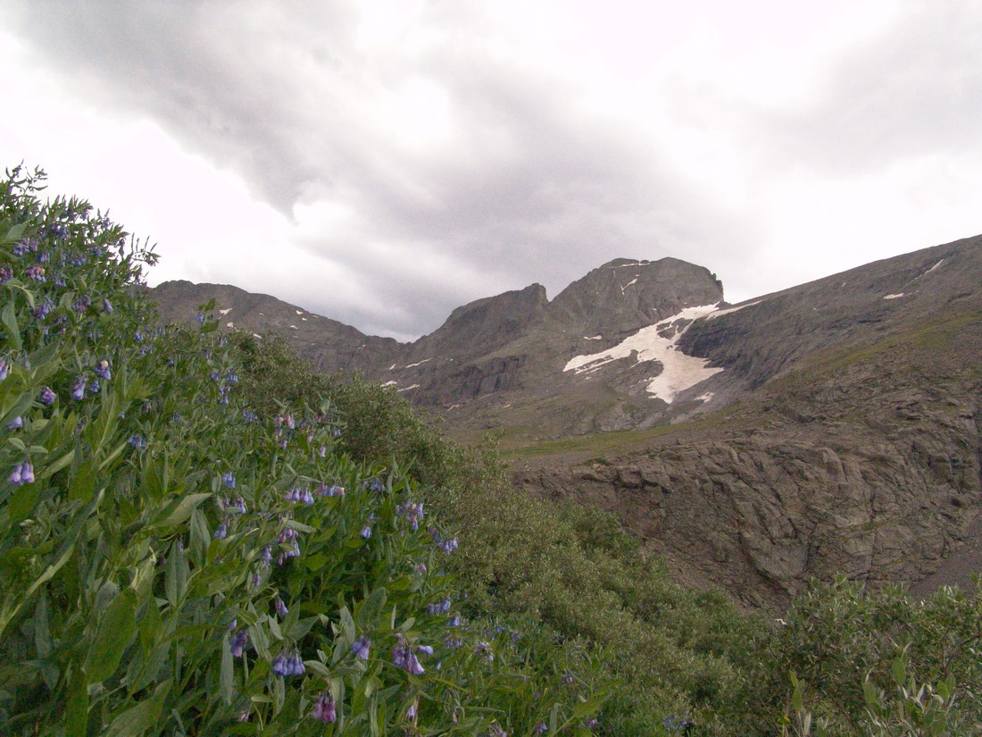
We made it back to camp, packed-up, and headed out. We got back to Colorado Springs at about midnight and I was exhausted.
I would rate this climb highly. It is challenging, offers many routes, and there are several peaks to ascend in the area. All in all, this is a must-do climb for any serious Colorado mountain climber.
Huron Peak and Browns Peak - a Sawatch Throwdown!
Interesting statistics:
Start time: 5:30 AM
Summit time (Huron): 9 AM
Summit time (Browns): 11 AM
Finish time: 1:20 PM
Mileage up: 3.6
Mileage down: 4.2
Total mileage: 7.8
Huron Peak Elevation: 14,003 ft.
Browns Peak Elevation: 13,523 ft.
Total elevation gain: 3,900 ft.
Total photos taken: 219
GPS map of our route (ascent in red, descent in blue):

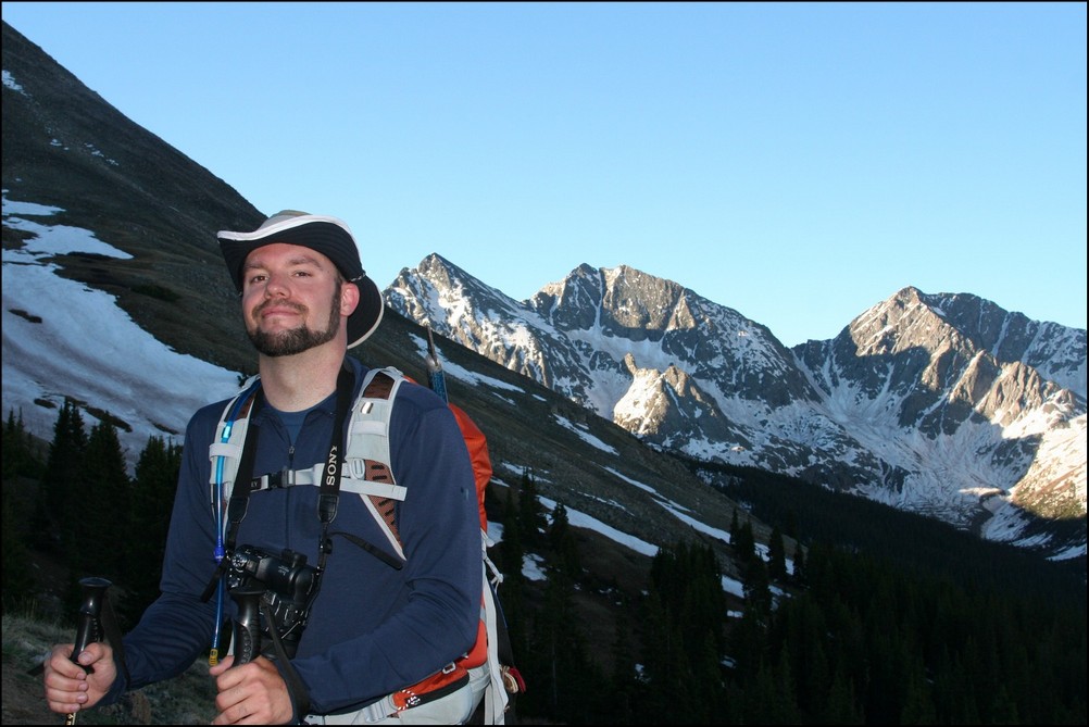
This trip report begins with an interesting back story. I had a new member join my site in May from South Dakota. This member eventually messaged me on Facebook and asked if he could join me on some of my climbs this year. After learning about my plans to attempt Huron that very weekend, he decided to join me. Mike Vetter drove all the way down from Sioux Falls, South Dakota on Saturday, June 5th to climb with me. Mike is the CEO of DataSync - a successful start-up software company. Our route to reach the trail-head was very simple: we drove west on Highway 24 to Buena Vista and turned left on Chaffee County Road 390 heading west. After driving about 14 miles on a dirt road, we turned left at the old mining town of Winfield and continued west another 2 miles to our campsite near the trail-head. We left my house at about 6:30 PM and reached our campsite near the Huron trail-head at approximately 10 PM.
On the way to Buena Vista, we were able to get some great views of the sun setting over the Northern Sangre de Cristo Mountain range:
We set-up our tents in the dark and set our alarms for 4 AM and hit the sack. A few cars drove past during the night, presumably looking for camp spots. Fortunately, the vehicles did not disturb my sleep too badly and I was able to get some quality rest. The alarm sounded at 4 AM and I hurried to get dressed and tear down my tent. As we were getting camp taken down, a skiier passed us, informing us that he was going to ski down Ice Mountain. I'm pretty sure this person was "benners" from 14ers.com. We were able to quickly break down our campsite and cook some oatmeal for breakfast before debarking for Huron's trail-head at 5:30 AM.
Mike and I were able to make quick work up to the trail-head and soon there-after, the sun broke through to light up the tips of the surrounding peaks in Silver Basin, including Virginia Peak and Granite Mountain:

Silver Basin illuminates a small lake

A closer look at the sunrise

Virginia Peak (right of center)
Virginia Peak
Sunrise hitting Granite Mountain

Sunrise hits Granite Mountain and Virginia Peak
Mike and I were energized by the great views of the valley across from us and made excellent time up the steep trail. Mike kept up with me as we blazed the trail. He did amazing considering he lives at 1,442 ft. and was not acclimated to the high elevation of Colorado yet.
<p
Mike Vetter proves he's got what it takes to climb mountains in Colorado
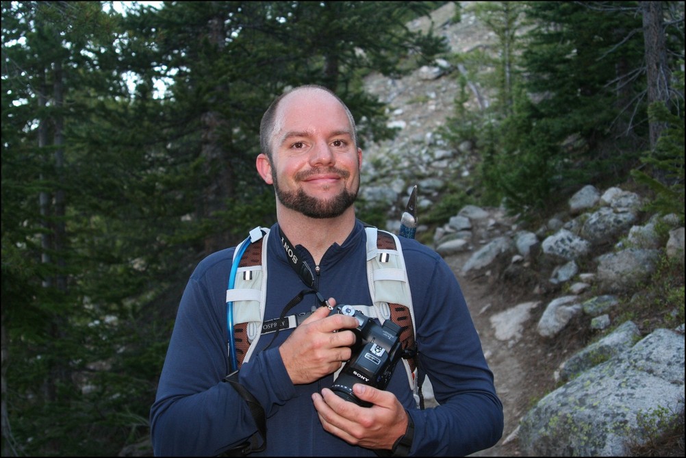
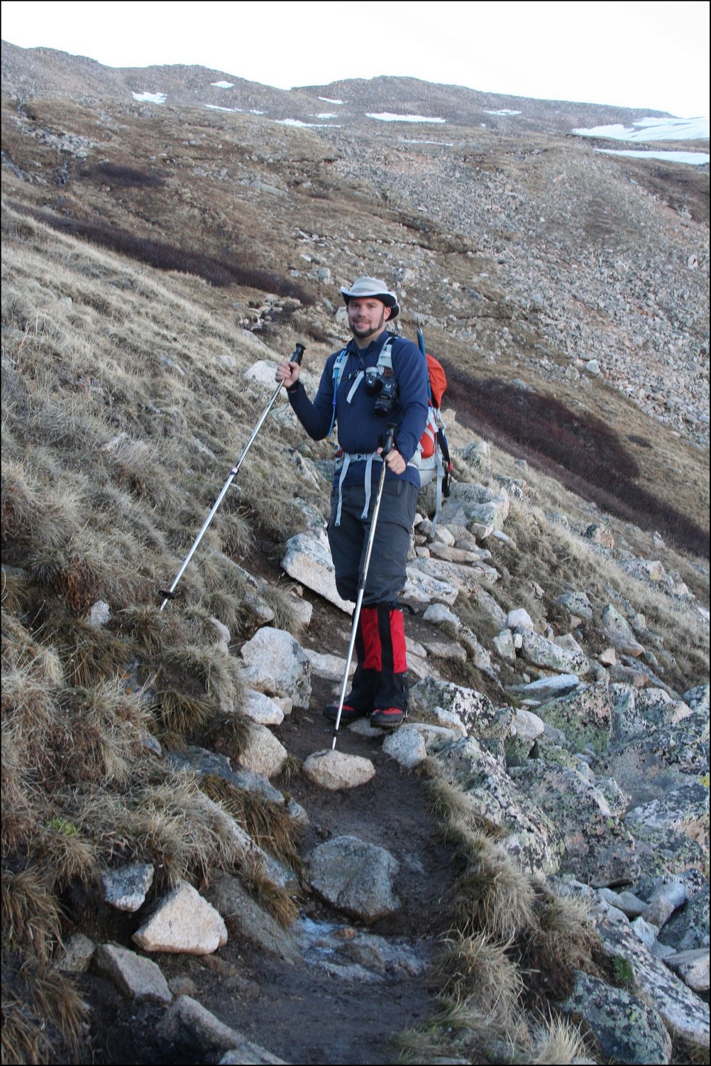
Matt Payne (author) hiking up Huron
An hour and 15 minutes after we started hiking from our camp, the first view of the Three Apostles came into view. The Three Apostles are a group of 13ers located up the valley from Huron, and contain two of the highest 100 in Colorado, Ice Mountain (13,951 ft.) and North Apostle (13,860 ft.). West Apostle is also respectable at 13,568 ft.

The Three Apostles come into view for the first time
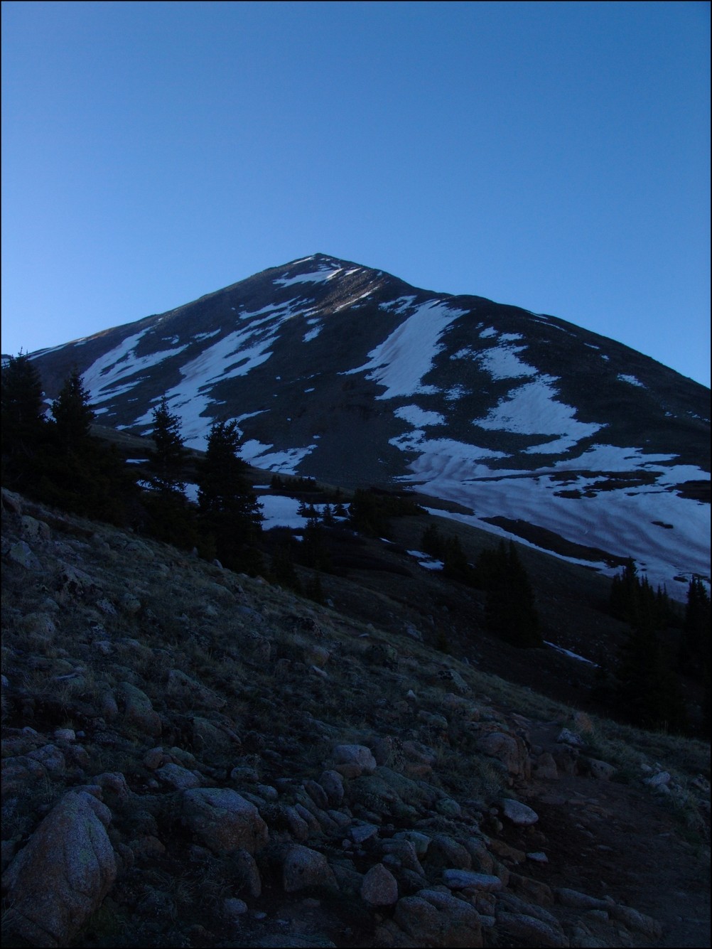
Soon thereafter, one of our objectives for the day came into view as well: Huron. Huron appeared above us like a giant pyramid, as if it were guarding some ancient treasure within its rocky shell.

Huron Peak comes into view for the first time

The moon sits over Huron Peak
Huron Peak in the early light

Huron, the Three Apostles, and Granite Mountain greet the rising sun
Now that we could see the beginnings of the amazing views, Mike became more and more awestruck by the Colorado Rockies. It was a real pleasure hiking with someone that shared the same level of appreciation for Colorado's awesome peaks. Mike and I exchanged photos of each other.
Mike Vetter looking excited in front of the Three Apostles
Matt Payne with the Three Apostles in the background
As we gained more elevation, views across the valley were getting even better. I noticed a long waterfall snaking down the side of Granite Mountain and decided that I wanted to try to capture a zoomed-in view of that waterfall. I took about 10 photos of the side of the mountain at 200mm and combined them into this photo:

Snow forms a waterfall down the side of Granite Mountain
I also wanted to get a zoomed in shot of the Three Apostles using the same method. Here are the results (click on the photo to see the super-hi-res version):

The Three Apostles in high detail
We continued to climb past treeline and up to Huron's base. I took some opportunities to take multiple photos of the views and stitched some photos together for a panoramic view.

Looking South and West, Huron casts a shadow over Granite Mountain
We quickly made our way up into the basin below Huron and were greeted by a giant snowfield. Normally, I welcome the sight of snow; however, the snow we encountered was very soft, with marshy streams and pools of water beneath. It was very much like crossing a field filled with 7-11 Slushies.
We made it through the slush and continued up the basin beneath Huron. The terrain was solid and only mildly wet from snowmelt. At this point, the sun had crested Browns Peak and began to heat the surrounding area.
Mike Vetter squinting into the sun on our approach of Huron
We continued to climb up towards Huron, following the trail through and around large snow fields. At this point, it was clear that snowshoes or other assistive devices would be fairly useless and I was glad I brought neither. As we gained elevation, the views of Browns Peak as well as the Elk Mountains began to get better and better.
Browns Peak sits to the North of Huron Peak
We made really great time up Huron, despite its relative steepness and other aforementioned challenges (did I mention Mike lives 13,000 ft. lower than Huron). Huron's summit block loomed over us, making us feel pretty small compared to this giant choss pile. The trail up this section of Huron was clearly maintained and the efforts of Colorado Fourteeners Initative to improve the trail were apparent.
Huron Peak's summit block
Matt Payne (author) hiking up Huron's Peak
We finally reached the ridge between Browns Peak and Huron Peak and were warmly welcomed by a giant cornice sitting at the top of the ridge.
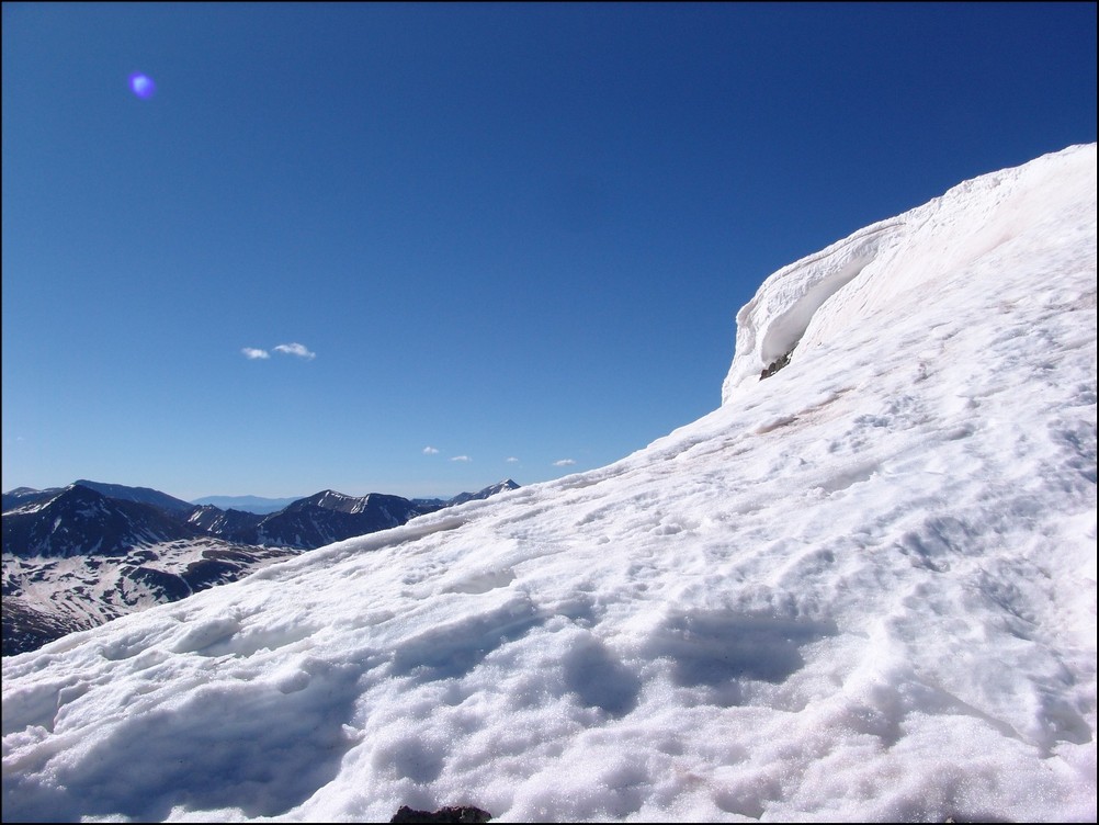
A giant cornice on Huron's ridge
The final push to the top of Huron took exactly 10 more minutes. The views from Huron Peak were absolutely outstanding. Being somewhat more isolated than most of the other 14'ers in the Sawatch Range, Huron Peak offers excellent views of the rest of the Sawatch Range and the Elk Mountains as well. Mike and I were the first to summit that day, and spent an hour on top celebrating, eating, and taking large amounts of photographs.
Hero shot of Matt Payne on top of Huron Peak
Matt Payne gazes South towards the Three Apostles

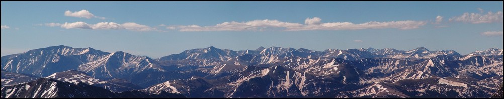
360 Degree View from the top of Huron Peak (click for full resolution version)
A 180 Degree View from North to South from Hurons Peak. The Three Apostles at center.
Mount Hope (the flat topped mountain) rests right of center. La Plata Peak rests far left.
The Elk Mountains loom in the distance, covered in snow.This photo is zoomed in at 200mm. Pyramid Peak, Maroon Peak, Snowmass Mountain, and Capitol Peak can all be seen from this vantage. Click on the image for the super hi-resoltution version.
Taylor Reservoir can be seen in the distance, reflecting the surrounding mountains (click for full resolution version)
A closer look at the Sawatch Mountains south of Huron. Mount Antero, Mount Shavano, and Tabeguache Peak are all recognizable.
A zoomed in view of the Southern Sawatch mountains
Shavano and Tabeguache (high pointed peak and flat snowed peak respectively)
North Apostle and Ice Mountain zoomed in. If you click on the image you can see the full resolution version (and the climber atop North Apostle. I've confirmed that this climber is "Mad Mike" from 14ers.com
Mount Yale and Mount Princeton seen in the distance
La Plata Peak seen to the North of Huron across the valley
A great view of the Three Apostles from Huron
A 90 degree view looking Northeast, North, and Northwest from Huron
A vertically-oriented panoramic view of the Three Apostles
Matt Payne leaning to allow for a better view of the Three Apostles
Matt Payne and Mike Vetter on top of Huron Peak
At this point we decided that after an hour of being on the summit we should head down to the ridge and make an attempt on Browns. Once down-climbing to the ridge, we were able to get a view of what we just climbed, decorated with a fair amount of snow still.
Still a lot of snow on Huron's eastern face
We took a look at our route - a straight ridge scramble to PT 13,518 and then to Browns.
PT 13,518 and Browns were a straight shot from Huron's ridge. Mount Hope seen in the background.
We quickly scrambled up PT 13,518 without any problems and looked back at Huron. The further away we got from Huron, the more we could appreciate just how steep it was.
Huron rises high above PT 13,518 to the Northwest
A zoomed in view of Huron from PT 13,518

A wider view of Huron and the surrounding terrain
After reaching PT 13,518, we took a look over to our next and final objective: Browns Peak.
Browns Peak looked fairly easy with La Plata Peak behind it
On the way over to Browns, we were able to get a really awesome view of a nasty cornice, which looked more like a frozen tidal wave.
A huge cornice sitting in the saddle between PT 13,518 and Browns
A closer view of the cornice
A super-zoomed in view of the cornice
After a bit of mild scrambling, Mike and I reached the summit of Browns in quick order. The clouds were looking to get worse and worse, so we decided that after Browns that we would go ahead and head back down to the trail below us, making our own route down off of Browns and connecting with the Huron trail.
Mike Vetter celebrating on the summit of Browns
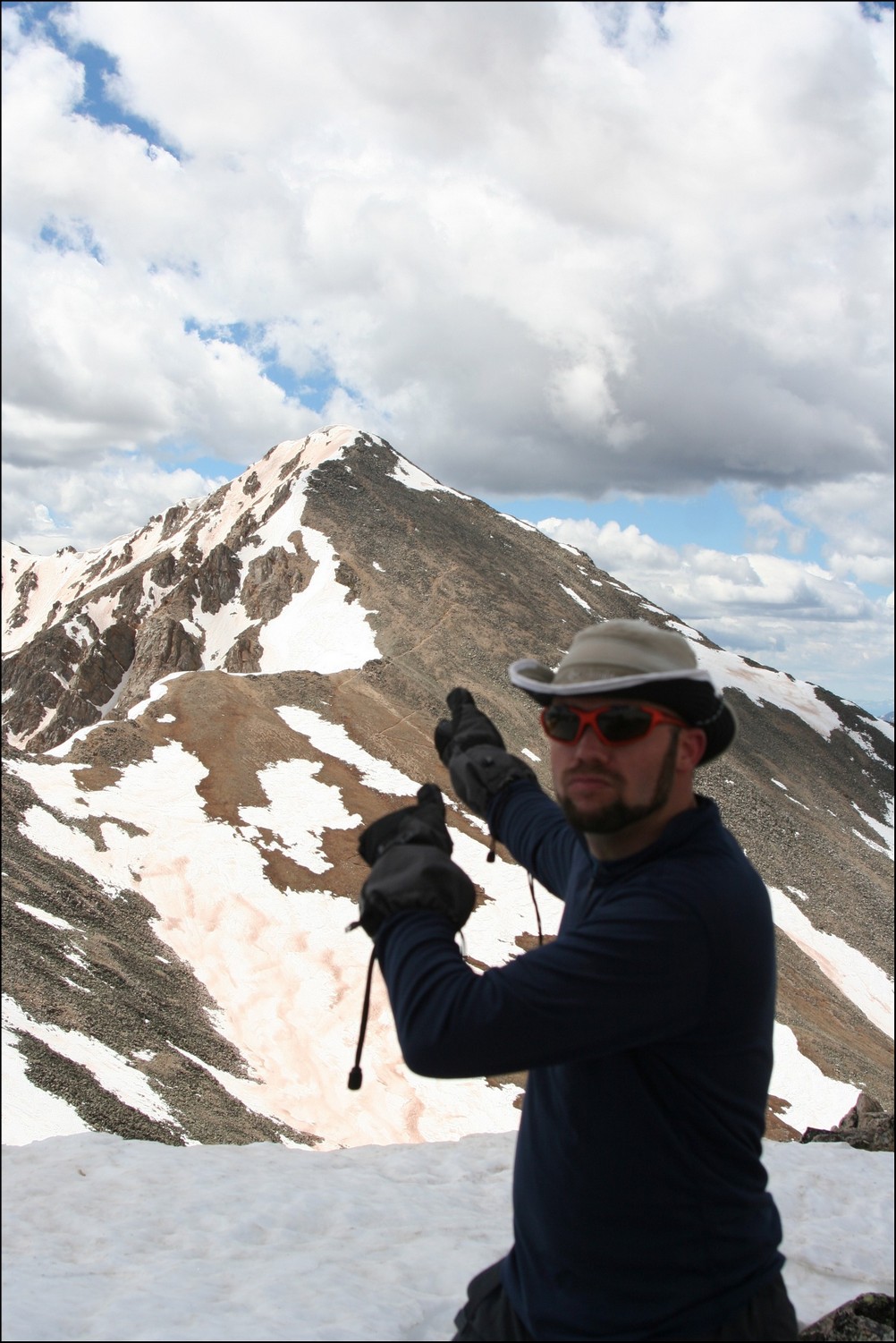
Matt Payne points back to Huron from Browns
We dropped off the north face of Browns just a few hundred feet and went straight down a scree gully. The dirt was quite loose but manageable. Soon after reaching the basin for Huron again, we were greeted by another large snow-field, which presented some pretty awful post-holing up to our wastes. Fortunately, my boots and gaiters kept my feet completely dry!
Matt Payne descending from Browns
After reaching the trail again, we headed back down the way we came and crossed the insane snow-field at the base of Huron. After a days worth of sunlight, the snow-field was quite soft and presented us with some unique and 'wet' hiking challenges.
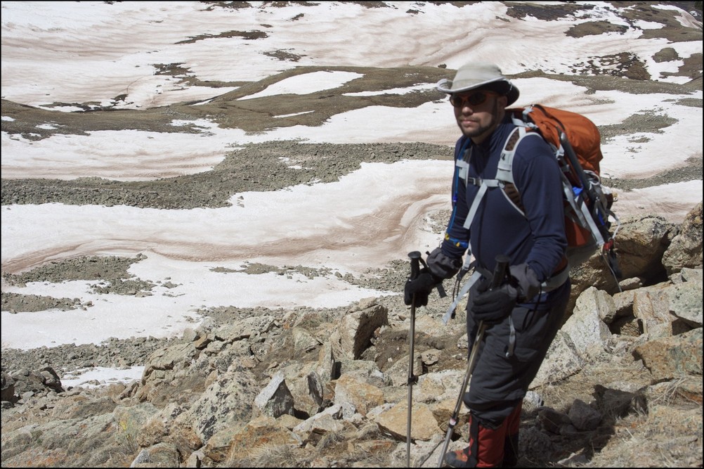
Matt Payne crossing the slushy on Huron
Once we reached the bottom of the snow-field, the way down was pretty quick to treeline and below to the trailhead and eventually my vehicle.
All-in-all, this was an amazing trip filled with great views. And I must say, I could not have hiked with a better guy. Thanks for driving down and climbing with me Mike!
To complete the trip report, here are three HDR photos I combined. I am new to HDR but I do like how it can enhance the light.
Until next time, enjoy Colorado's summits!
Mummy Range
The Mummy Range mostly lies within Rocky Mountain National Park, and encompasses over 160 square miles of rugged glaciated summits, six of which are above 13,000 ft. The Mummy range is part of the Front Range, and shares similar characteristics as its neighbors to the southwest, the Never Summer Mountains.
Never Summer Mountains
A small mountain range just over 15 miles in length from north-to-south, the Never Summer Mountains sit within the Front Range, with the western section sitting within the Never Summer Wilderness Area and the southern portion of the Never Summer Mountains within the boundaries of Rocky Mountain National Park. No summits within this mountain range surpass the magical 13,000 ft. mark; however, the range offers several exceptional climbing opportunities, typically within relative solitude. Like other mountain ranges in this part of Colorado, the Never Summer Mountains were impacted by glaciation and therefore many of these summits have cirques and other rugged geologic features. Specifically, the Nokhu Crags in the northern area of this mountain range characterize the rugged and rotten rock that can be found here, especially in the northern parts of the mountain range. Popular summits in this range are Mount Richthofen and Howard Mountain.
Indian Peaks
Also known as the Indian Peaks Wilderness Area, the Indian Peaks lie within the Front Range, just south of the Rocky Mountain National Park. Due to its proximity to the Denver and Boulder area, the Indian Peaks are one of the most heavily accessed Wilderness Areas in Colorado. According to wilderness.net, the United States Congress designated the Indian Peaks Wilderness in 1978 spanning a total of 77,711 acres. Additionally, roughly 35% of this area is above treeline and the area is home to about 50 lakes. Summit elevations range from 8,300 to just over 13,500 feet, offering a wide range of climbing opportunities all year-round, including some challenging class 3 and 4 variations. In places, this range is rather rugged due to the glaciation that has occured to the mountains here.