Displaying items by tag: Mount Wilson
Colorado's 12 Hardest 14ers to Climb
Colorado's Fourteeners (14ers) are legendary. Each of the 53 ranked peaks offers unique challenges and rewards. They are the some of the most amazing mountains in the world and have been the number one object of adoration for hundreds of thousands of Coloradoans. Indeed, according to the Colorado Fourteeners Initiative (CFI), approximately half a million people attempt to climb a fourteener each year. Climbing 14ers is a dangerous activity; however, good planning, fitness, and awareness of the potential hazards will provide climbers with good opportunities to accomplish these monsterous peaks. Each year I'm usually asked one of two questions - which 14ers are the easiest; and, which 14ers are the hardest? I decided to lay out the hardest 14ers here for you in this article. Let me know how I did based on your own experience. Lastly, it might be a good idea to arm yourself with the most up-to-date information about mountaineering accidents in Colorado. Who knows, reading about these tragic events may just save your life. Additionally, I highly recommend obtaining GaiaGPS for your phone. It allows you to see your track and location on a USGS map overlay even in airplane mode. It has saved me so many times. You can purchase it here and help support the site.
While it may make sense to simply use the only existing data available regarding mountaineering accidents in Colorado to determine 14er difficulty, my experience has been that the difficulty of a peak is more than just cold, hard facts. Indeed, Longs Peak is not nearly as difficult as, say, Capitol Peak; however, it has far more accidents due to the sheer number of inexperienced and/or unaccomplished people attempting it each year. With that being said, I'm going to use a mixture of my personal experience and some subjective ratings to present my case to you. For these ratings it is assumed that the climber is approaching via the standard route in "normal" conditions. I've intentionally left out un-ranked 14ers such as North Maroon and El Diente - assume they can be bundled with Maroon Peak and Mount Wilson, respectively. Additionally, consideration of any traverses between 14ers was not considered for these ratings.
I will rate each mountain's difficulty ranking based on four equally weighted variables:
1. Sustained difficulty: this rating establishes the peak's sustained difficulty over the course of the entire climb
2. Most difficult section: this rating establishes the difficulty of the peak's most difficult section
3. Terrain: this rating establishes the difficulty of the peak's overall terrain, taking exposure and looseness of rock into account
4. Access: this rating establishes the difficulty to reach this peak or how long it takes to get to the top
Feel free to let me know if you disagree with my ratings!
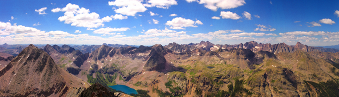
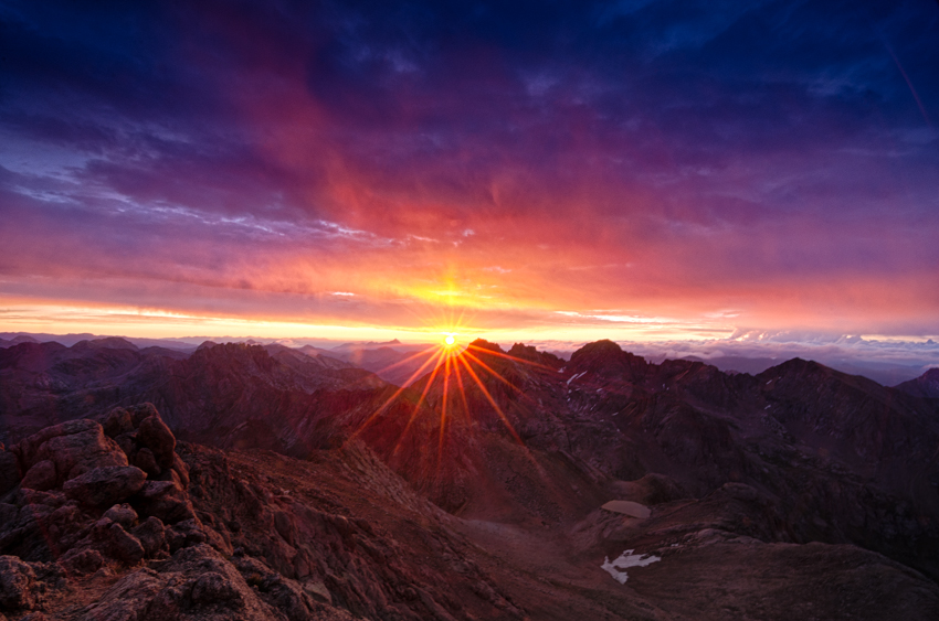
#1. Capitol Peak
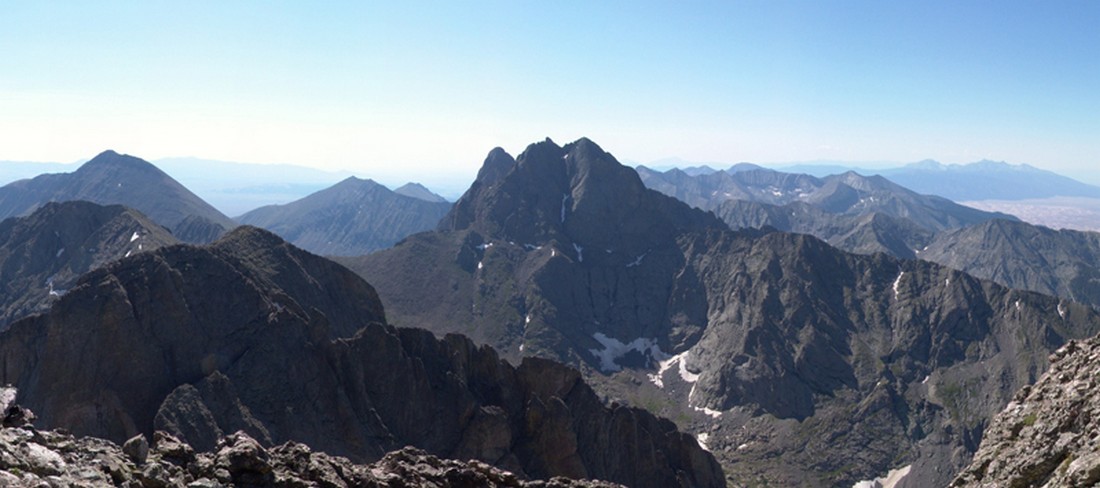
While Capitol Peak has only seen two deaths since 2010 compared to five on Longs Peak (as of August 2014), it is arguably the most difficult 14er in Colorado, as I attested in my 2010 trip report. As pictured above in the panoramic taken between Capitol Peak and K2 near the infamous Knife Edge, the terrain is rugged, exposed, loose and dangerous. Not only does Capitol Peak have some very difficult sections, it has, in my opinion, the highest sustained difficulty out of any of the 14ers. The climb up Capitol is relentless and requires mountainners to focus on the mountain's terrain for a very long period of time. There are very few breaks to be had and simple mistakes can and do prove to be fatal. Additionally, Capitol Peak requires a lot of time to accomplish and once you are past the knife edge, you are committed to at least two hours more of climbing. This makes the mountain especially mentally taxing as those are two hours straight of focused climbing on rugged terrain where you also have to keep a keen eye on the weather. Lastly, access to Capitol, while doable in a single day, usually requires an arduous backpacking trip to Capitol Lake and a very early start on a subsequent day. Let's see how Capitol Peak rates in the four domains:
| Sustained Difficulty: 10/10 | |
| Most difficult section: 9/10 | |
| Terrain: 10/10 | |
| Access: 9/10 | |
| Total: 38/40 |
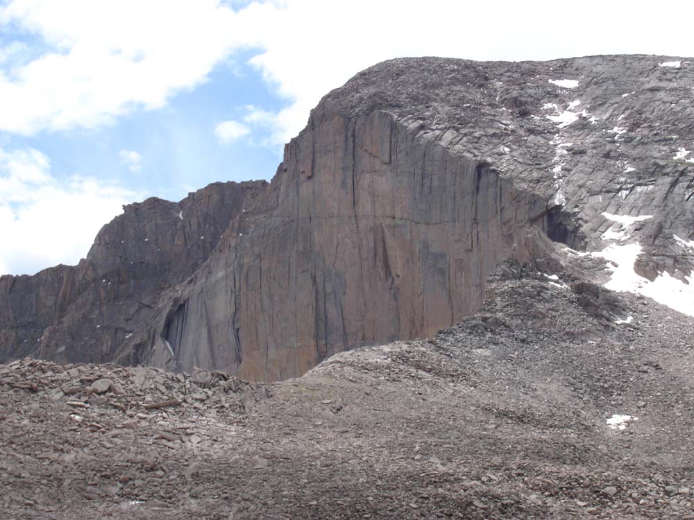
#2. Mount Wilson
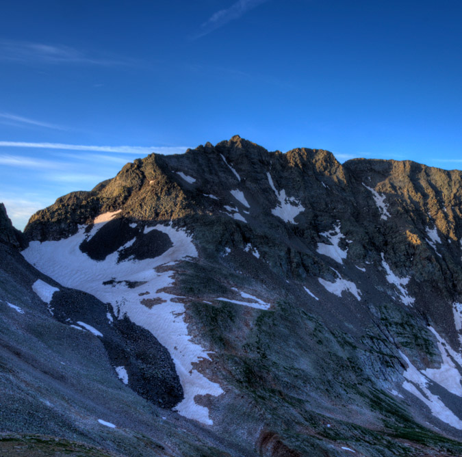
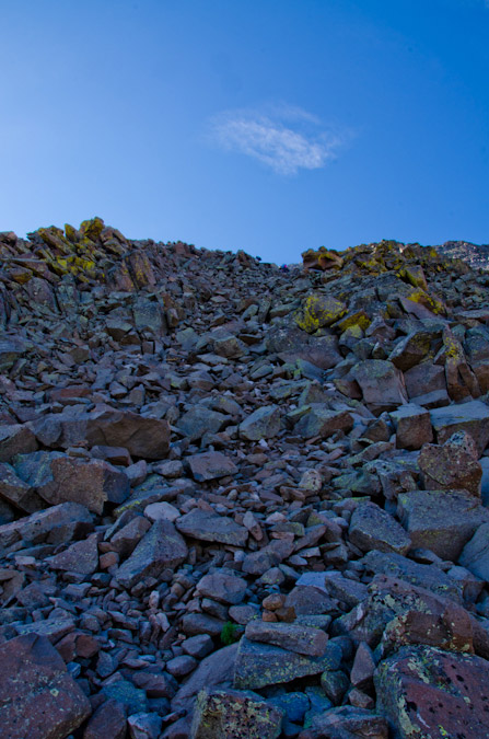
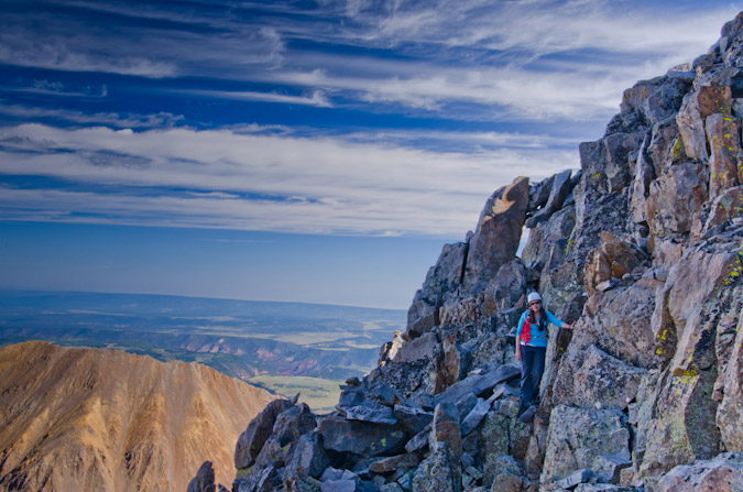
Mount Wilson is easily one of the most challenging 14ers in Colorado to climb - the standard route, while mostly straight-forward, has many difficult sections of very loose rock at the summit. The summit block itself has stopped many people in their tracks, just a few feet from the summit. The exposure there is intense and not for the feint of heart. Examples of this can be seen in my trip report from 2011. In addition to the tremendous exposure found on the summit block, Mount Wilson's approach from the Rock of Ages trailhead is fairly long and quite committing, with a lot of up-and-down climbing (unless approached from Kilpacker Basin or Navajo Basin). The difficult section of climbing found on the upper 1/3 of the route is difficult to negotiate and offers many challenges for climbers of all levels. The rock on Mount Wilson is extremely loose and many people have perished on the slopes between Mount Wilson and the un-ranked beast to the west - El Diente.
| Sustained Difficulty: 10/10 | |
| Most difficult section: 9/10 | |
| Terrain: 10/10 | |
| Access: 7/10 | |
| Total: 36/40 |
#3. Little Bear Peak

Out of all of the Fourteeners, Little Bear Peak is quite possibly my least favorite and least likely to be something I'd like to repeat. The approach is terrible - either a long slog on a rocky road in hot weather or an insane jeep ride over some of Colorado's toughest jeep obstacles (OK - those are kind of awesome). My ascent in 2010 was quite memorable, notably - the infamous "Hourglass" section just about scared me to death. Many people have perished in the Hourglass over the years, including one of the most memorable deaths in the past 5 years - Kevin Hayne. The Hourglass presents some very difficult climbing, with few good hand-holds and potentially fatal ice and water sections, not to mention the hazard of frequent rockfall from above. While Little Bear Peak is very straight-forward and mostly an easy climb, the Hourglass section marks it as one of the toughest mountains around.
| Sustained Difficulty: 6/10 | |
| Most difficult section: 10/10 | |
| Terrain: 10/10 | |
| Access: 7/10 | |
| Total: 33/40 |
#4. Pyramid Peak

Pyramid Peak, while not having many known fatalities, presents some truly heinous climbing obstacles, especially in wet conditions. The rock in the Elk Mountains is notoriously loose and nasty - making it very suspect in down-climbs and even more dangerous in rain or snow. The approach to Pyramid is fairly straightforward, albeit somewhat long and committing once above tree-line. The terrain on Pyramid is steep almost the entire climb and once above tree-line the mountain demands your concentration for the duration. While Pyramid is likely one of my favorite climbs of all time, it is not for a beginner climber and should be taking quite seriously. Of course, the views from the summit are to die for.
| Sustained Difficulty: 8/10 | |
| Most difficult section: 8/10 | |
| Terrain: 9/10 | |
| Access: 6/10 | |
| Total: 31/40 |
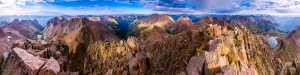
#5. Maroon Peak

The photo above was taken from the summit of Pyramid Peak looking out across the valley at the Maroon Bells and their insane stature. The whole area is steep and impressive, which comes with some inherent dangers and difficulties. The Maroon Bells have claimed many lives through the years and are certainly some of the most dangerous mountains in America. Of particular note, the traverse between Maroon Peak and North Maroon has claimed several victims and is a force to be reckoned with. Maroon Peak is a steep monstrosity full of beauty and loose rock as well as an intricate network of rocks, spires and falling rock that a blessing and a curse. Maroon Peak holds some of Colorado's worst rock and even the most experienced climbers have been subdued by the dangerous terrain found there.
| Sustained Difficulty: 8/10 | |
| Most difficult section: 8/10 | |
| Terrain: 9/10 | |
| Access: 6/10 | |
| Total: 30/40 |
#6. Snowmass Mountain

Snowmass Mountain is usually climbed in the early months of summer, when the face of the mountain is mostly covered in snow, making for somewhat easier travel up the snow in crampons; however, the rock beneath the snow is quite loose and is constantly shifting due to erosion. Indeed, Snowmass has proved to be particularly dangerous in the past few years due to these shifting conditions and has claimed a couple lives in the past 5 years. Snowmass' upper slopes contains large white boulders that look secure but are often quite loose and came come crashing down at any moment. The approach on all routes of Snowmass requires quite a bit of travel, which increases the difficulty.
| Sustained Difficulty: 8/10 | |
| Most difficult section: 6/10 | |
| Terrain: 7/10 | |
| Access: 8/10 | |
| Total: 29/40 |
#7. Sunlight Peak
Sunlight Peak is one of the few 14ers requiring class 4 climbing to reach the summit and is generally preceded by a very long backpacking trip and a steep ascent into the Twin Lake basin. Terrain in the Chicago Basin where Sunlight resides is notoriously loose and dangerous as well as highly susceptible to frequent and quickly changing extreme weather conditions. The summit block of Sunlight presents a particularly interesting challenge for climbers and many people skip the summit block altogether if there is any moisture on the rock. Many people may rate Sunlight's next door neighbor, Windom Peak, as being the more difficult of the two; however, I personally found Sunlight to have more challenging route-finding and climbing requirements. Since Sunlight is often paired with Eolus and Windom on the same day and often as the last peak climbed, it presents even more inherent danger as many climbers attempting it are more exhausted than if doing Sunlight on its own.
| Sustained Difficulty: 7/10 | |
| Most difficult section: 8/10 | |
| Terrain: 6/10 | |
| Access: 8/10 | |
| Total: 29/40 |
#8. Crestone Needle

Coming in at number 8 on my list of Colorado's most difficult 14ers to climb is the venerable, impressive and just-plain-freaking-awesome Crestone Needle - my favorite 14er of all. The standard route of Crestone Needle brings you up a steep approach and then plants you right in a series of difficult route-finding challenges and some of the steepest yet most solid rock there is. Even though the rock is quite solid and sturdy, make no mistake - an error in judgement would likly prove fatal, especially in severe weather conditions. Indeed, Crestone Needle has claimed many lives and is a surely one of the most dangerous peaks in the Sangre de Cristo Range. Most approachs require a backpack trip or a very early start and once above tree-line the terrain is quite extreme.
| Sustained Difficulty: 7/10 | |
| Most difficult section: 7/10 | |
| Terrain: 9/10 | |
| Access: 5/10 | |
| Total: 28/40 |
#9. Longs Peak
Longs Peak, located within the heart of Rocky Mountain National Park, is likely Colorado's most frequently visited mountain other than perhaps Greys and Torreys. This mountain's location in a National Park makes it a very popular destination by people from all over the world and it often lures inexperienced climbers on its more dangerous upper sections where people find themselves ill-equipped to complete the climb, both mentally and physically. Perhaps the most notable part of Longs Peak's approach is the sheer length of the climb, a full-day affair to be sure. A simple google search of Longs Peak deaths will just tell you how dangerous this peak really is, especially on the upper areas such as the Narrows and the Trough. Additional hazards plaguing this peak are the frequent deposits of snow and ice early and late in the climbing season that often contribute to the dangerous nature of the climb.
| Sustained Difficulty: 9/10 | |
| Most difficult section: 6/10 | |
| Terrain: 8/10 | |
| Access: 5/10 | |
| Total: 28/40 |
#10. Kit Carson Mountain
Kit Carson Mountain is one of the Sangre de Cristo giants located right by Crestone Peak and Crestone Needle. The approach to Kit Carson's standard route involves a lengthy backpacking trip and an ascent over the less impressive, albeit quite steep 14er, Challenger Point. The steep approach, coupled with a downclimb mired in confusion and difficult route-finding, makes Kit Carson quite eligible for this list. Several climbers have perished on Kit Carson in recent years, almost always due to off-route climbing.
| Sustained Difficulty: 8/10 | |
| Most difficult section: 6/10 | |
| Terrain: 6/10 | |
| Access: 7/10 | |
| Total: 27/40 |
#11. Mount Eolus
Mount Eolus marks the second of the Chicago Basin 14ers to make this list and arguably the more difficult of the three, despite my lower rating here. Eolus' "Catwalk" and steep, confusing route on the upper third of the mountain make it a top contender. The approach for Eolus is quite taxing as well and many climbers reaching the upper sections of Eolus find themselves out of energy and weakened - a terrible combination when paired with the rugged and loose terrain of the San Juan Mountains.
| Sustained Difficulty: 6/10 | |
| Most difficult section: 7/10 | |
| Terrain: 6/10 | |
| Access: 8/10 | |
| Total: 27/40 |
#12. Crestone Peak
Crestone Peak has single-handedly claimed many climbers' lives over the past several years due to the loose and difficult terrain found on the upper sections of the mountain. While the mountain's standard route is mostly straight-forward, there are certainly sections that demand one's full attention and good climbing skills in order to ensure a successful summit. Like Crestone Needle, Crestone Peak's approach is a very long day up very steep trails and rock formations, increasing the difficulty of this impressive peak found in the awesome Sangre de Cristo Mountains.
| Sustained Difficulty: 6/10 | |
| Most difficult section: 7/10 | |
| Terrain: 6/10 | |
| Access: 8/10 | |
| Total: 27/40 |
How did I do? Would you have rated them differently? How so? I'd love to hear your thoughts!
The Rock of Ages - Mt. Wilson and New Friends
Mount Wilson's claim to fame as one of Colorado's most dangerous 14ers is certainly well deserved. As Colorado's 16th highest mountain, Mount Wilson rises to an impressive 14,246 ft. above sea level and the boasts the State's 9th most amount of prominence with 4,024 ft. The monarch of the San Miguel sub-range of the San Juan Mountains, Mount Wilson is a formidable mountain, without question. The history surrounding this mountain is quite intriguing as well. The first ascent of Mount Wilson is somewhat contested, but it is generally agreed that the first group to ascend it was the Hayden Survey on September 13, 1874, which included A.D. Wilson, after which the mountain was named. Additionally, Franklin Rhoda, a member of the team, later wrote in the survey notes about Mount Wilson: "Only one peak of which we had any dread remained to be ascended, and that was Mt. Wilson. From various circumstances, we have reason to believe that this was higher than any station we had yet made, and from its rugged appearance we dreaded its ascent not a little." Rhoda later reported that, "Mt. Wilson was by far the most dangerous climb of the summer."
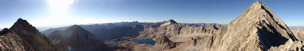
I personally had hoped to climb Mt. Wilson back in July; however, that climb was cancelled mid-trip due to my climbing partner not feeling capable of the climb, which is totally understandable given the loose and dangerous nature of the San Miguels. With Wilson Peak already in the bag, I really wanted to return to the basin for a shot at Mt. Wilson, El Diente and Gladstone Peak. Here's a view of Mt. Wilson from the Rock of Ages Saddle:
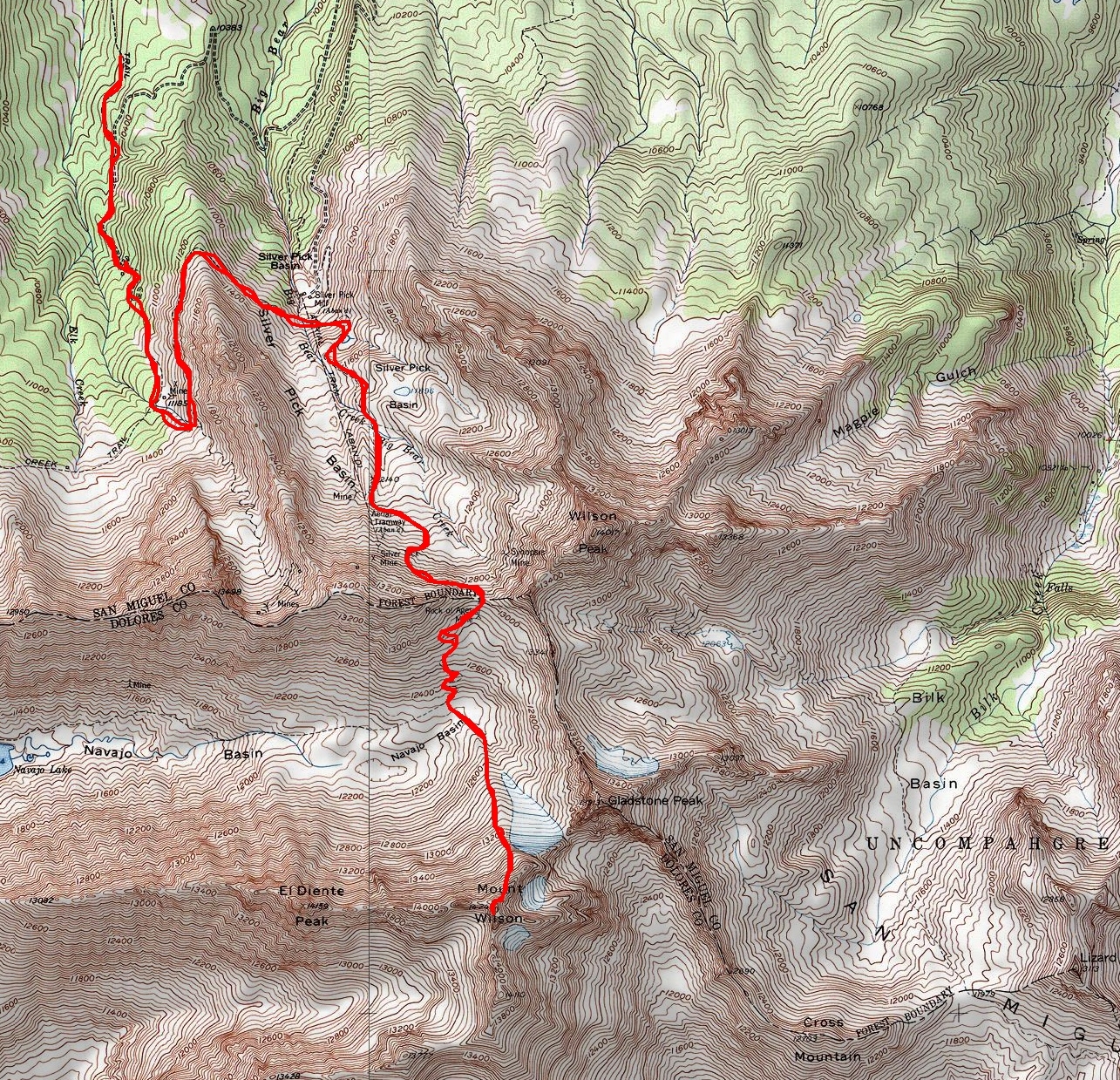
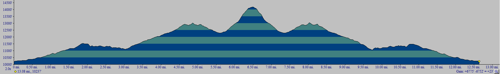
With a little less than a week left before my hike was scheduled, I was still without a partner. I scrambled to locate one on 14ers.com, but did not have much success. I finally did reach a guy named Will, who wanted to set-up a car shuttle, but it still meant that I would be driving out there alone, which was not something I wanted to do given the unreliable nature of my Jeep. I searched further on Facebook and found that one of my Facebook friends, Kara Bauman, was also planning a trip to the Wilsons. I communicated with her and we quickly made plans to join up. Her group was leaving from Denver on Friday afternoon and I could join them if I could get to Denver. I made it work - and before I knew it - I found myself at the Ken Caryl Park and Ride in Denver at 1 PM on Friday 8/12/11. Our group was comprised of Kara Bauman, Alli Kolega, Tom Shaar and me. The group all assembled and loaded our stuff into Tom Shaar's killer SUV and we departed on our 6 hour journey to the Wilsons. On the way over, we all discussed possible options on which order to climb the mountains and where from. We all conceded that the best day for weather was Saturday, so that made the most sense for an attempt on Mt. Wilson, since it was a longer approach. We would see about the traverse to El Diente from there, and then they would do Wilson Peak on Sunday while I would do Gladstone Peak. We also decided to make Silver Pick Basin our headquarters for the weekend since the trailhead had recently re-opened at a new location after several years of closure due to property issues. In total, our climb took us about 10 hours and we covered 12.7 miles and gained 6,775 vertical feet. Our route up Mt. Wilson and the elevation profile can be seen below (click on each for a larger version).
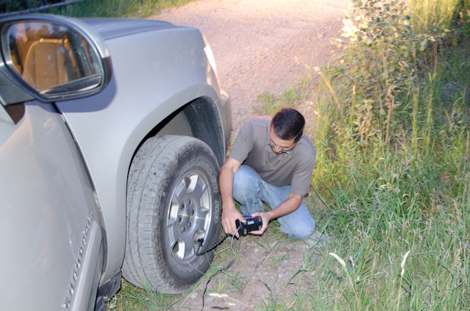
On the way up Silver Pick Basin road, Alli was telling a story about someone she had heard about on 14ers.com that had been threatened with a gun. Before she could finish the story, I spoke up - "that was me!" Indeed - she was referring to my horrendous situation from 2009 where I encountered some quite disrepectful gun-toting young men. I had just finished telling the story about how the young men had a flat tire when Tom stopped me and said, "I think we have a problem - the tire pressure is dropping." It was crazy timing considering I was telling the story about the guys with the flat tire. Sure enough, Tom's tire had a hole in it. Fortunately, he had a Slime Portable Flat Tire Repair Kit, which enabled him to fix the tire quickly so we could at least reach the trailhead. He also had a portable air compressor, which turned out to be quite awesome!
While Tom did all the heavy lifting, Alli and Kara (left and right respectively) were busy updating the world on our woes via Facebook. 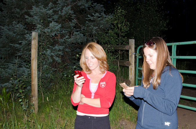
Since the basin had just re-opened the week before, we had anticipated that the trailhead would be busy. Indeed the area had quite a few people in it, and subsequently, all of the good campsites were taken. Tom and Alli ended up sleeping in the car, while Kara and I put up our tents in a field nearby. We decided to set our alarms for 3:30 AM for a 4:00 AM start and hit the sack. The next morning, we started up the trail, guided mostly by the numerous signs that were on the trail. We did find ourselves second guessing the trail at one point on the way up, which I will point out later in the report. It was at that point that we met up with a solo hiker, who turned out to be Will from 14ers.com who I had talked to earlier in the week. He decided to join us for the day and we did not regret it - he was a great companion! We wrapped around the long ridge to the west of Silver Pick Basin and entered the basin proper. The road and trail were very nice and well maintained. We also enjoyed the sunrise over Wilson Peak.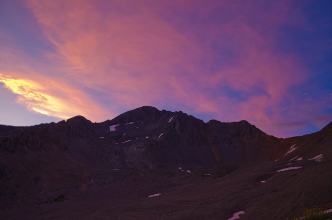
The clouds over Wilson Peak were great!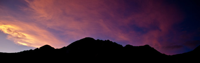
Kara and I stayed near the back of the pack, talking about life, religion and all other important topics that we could think of. I think I was putting her to sleep with my stories...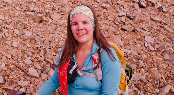
We finally reached the stone building which is a remnant of the old Silver Pick Mine, and enjoyed the views of Wilson Peak from there. 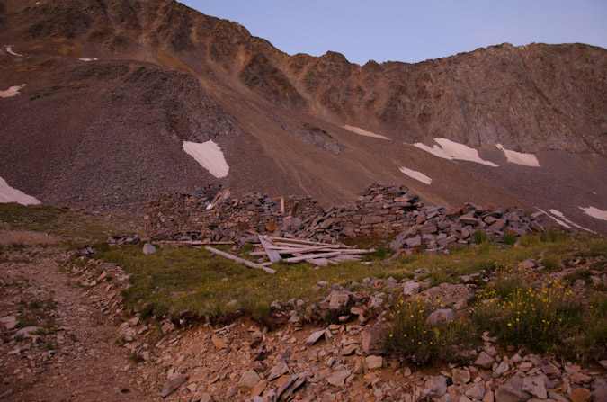
Wilson Peak had some great clouds above it and made for an interesting subject to experiment with HDR.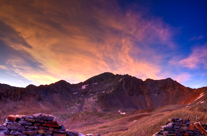
The trail winded up the side of the mountain at a very manageable rate and soon we found the stone building well behind us.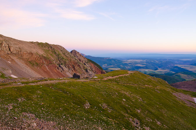
I found myself taking the lead up the trail with Will and we were soon joined by two solo hikers who both had a dog, one of which was a Chihuahua that was on its first 14er climb. The Chihuahua passed Kara on the trail, which was a humerous but sore subject for Kara for the remainder of the hike. We later joked that the dog had gotten to her psychologically and that it was haunting her the whole day. How do you let a small dog on its first hike pass you on the trail? Just kidding of course Kara!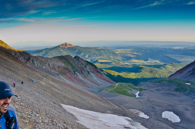
Wilson Peak and the Rock of Ages Saddle neared and Will was getting pretty excited!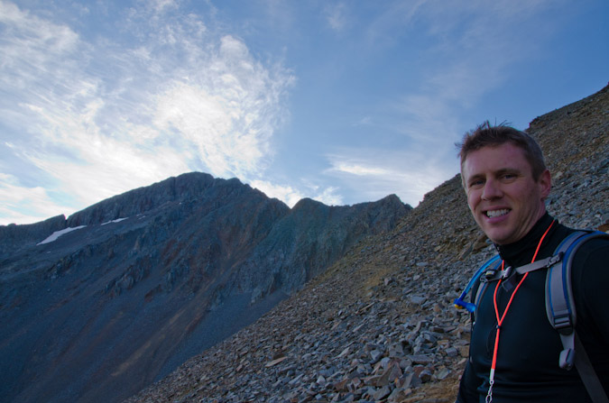
So excited that he took off and made it up first!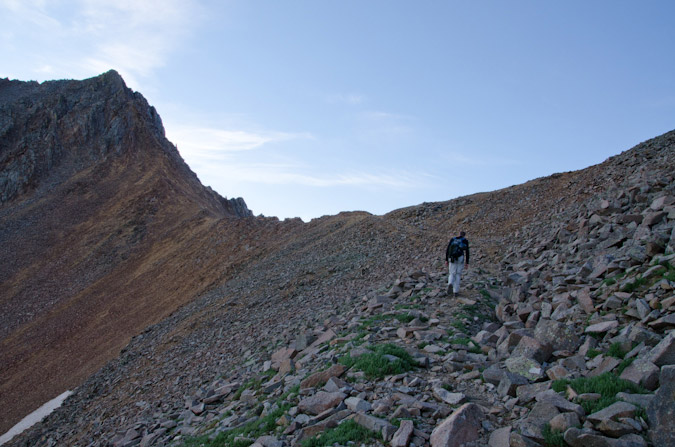
Tom and I kept on trucking...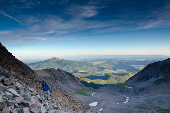
The sunrise had finally fully illuminated the valley below and made for quite the sight! Will reached the saddle first and was trying to decide on what to do - Wilson Peak was right there, but he knew he couldn't pass up an opportunity to climb Mt. Wilson with some experienced climbers, so he stuck with us. Both Tom and I are very close to completing the 14ers, and would prove good leaders on the class 3 and 4 terrain ahead.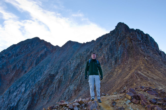
The approach from Silver Pick Basin proved longer than advertised, and before we knew it, we had already hiked 4 miles just to reach the Rock of Ages Saddle at 13,000 ft. The thought of descending down into Navajo Basin to 12,400 ft. and back up Mt. Wilson was not exactly enticing, but we knew it was the best thing to do given the weather forecast for the weekend.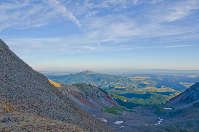
Eventually, both Alli and Kara caught up with us and we stopped to eat some food and take in the views. 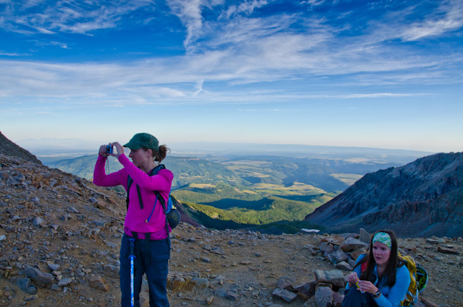
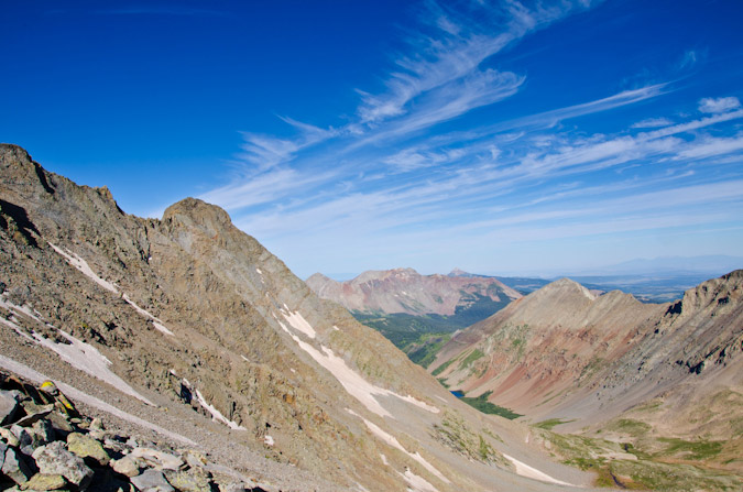
The sunrise was lighting up Navajo Basin and the surrounding mountains, including Gladstone Peak (center), Mt. Wilson (right of center) and El Diente (right).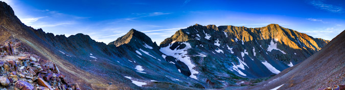
We headed on down into the basin and I stopped to get a few photos of Mt. Wilson from below.
Here you can see a view from the base of Navajo Basin - mouse-over to see our route up Mount Wilson.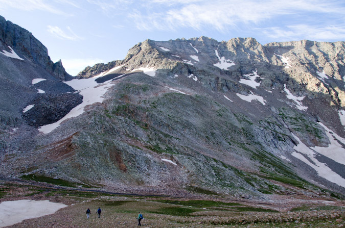
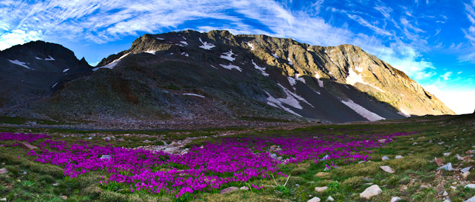
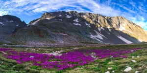
We found the most amazing wildflower field at the base of Mt. Wilson, and I stopped to get some photos of it, including this panorama.
We all started up Mt. Wilson eagerly. It felt like it was right there! I stuck behind with Kara, listening to her stories about life. I also wanted to make sure that someone stayed with her since she was not feeling her best on that day. 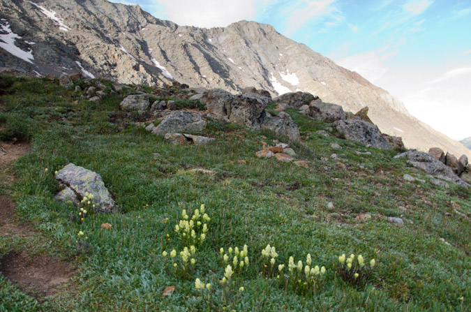
Before we knew it, we found ourselves looking back at the Rock of Ages saddle and Wilson Peak to its right. The climbing up the initial half of Mt. Wilson was quite easy, nothing more than a simple hike. 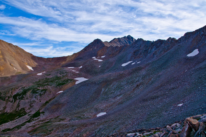
At the end of the easy terrain, we all stopped to rest and prepare for the meat of the climb.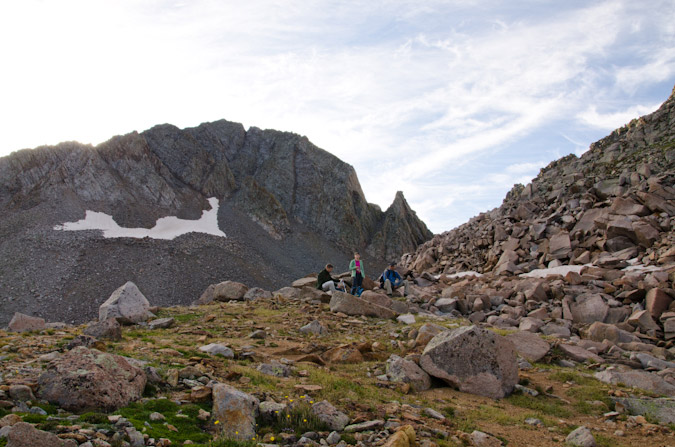
Gladstone Peak loomed over us to the left, blocking the sunlight for the first half of the climb. Eventually, the sun did rise above it, and I found myself drawn to the view of the sun and Gladstone repeatedly.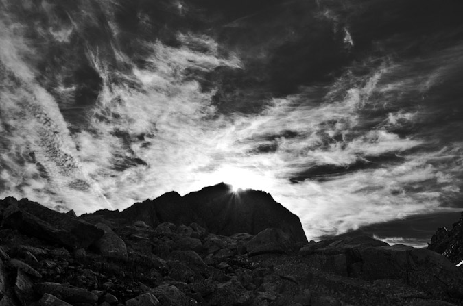
I decided it would also be a good opportunity to test out some sun-framed HDR photography. The lens flares in the below photo initially bothered me, but after processing the image, I feel like they add value.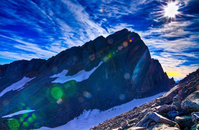
The climbing got more difficult and we reached the class 3 section. We all put on our helmets and started up the more difficult terrain. I found it to be much easier than advertised and the rock responded quite well to my intuitively-placed hands and feet. The rock was solid where I expected it to be solid, and loose where I expected it to be loose. Eventually we found ourselves at the base of a giant gully leading up, and I stuck behind with Kara to make sure she made it up safely.
 |
 |
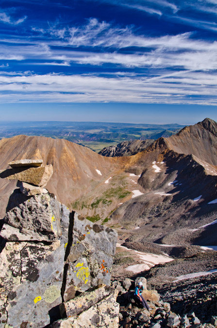
The entire route was littered with well-marked cairns that were also adorned with flourescent surveyors tape, making them easy to locate. I know that this is a controversial practice; however, I think everyone in the group found them to be helpful given the terrain we found ourselves in. The views of El Diente and Navajo Lake were quite superb.
Once we reached the top of the gully, we knew we needed to start traversing across Mt. Wilson. The cairns pointed the way and we followed. 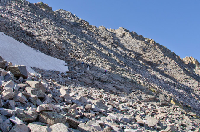
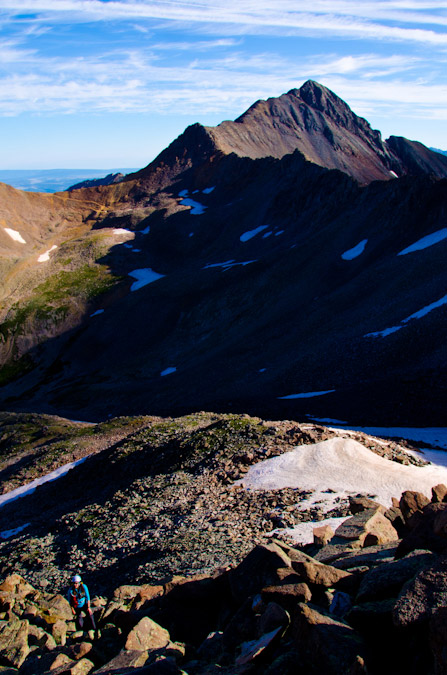
From here the terrain continued to increase in difficulty. The rock was looser and less stable in general. We picked our steps carefully. A look back towards Wilson Peak revealed that we were gaining elevation quickly.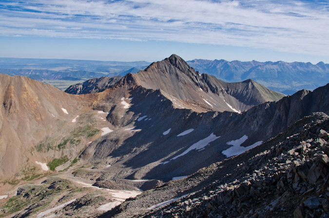
We finally reached the top of another loose gully and the route became obvious but less stable. The rock was getting better but the higher we climbed, the greater the consequences of a loose rock breaking free. The rocks were bigger and the terrain was steeper.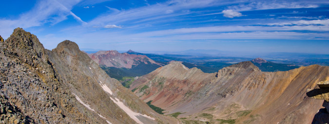
Kara was a real champ on this section.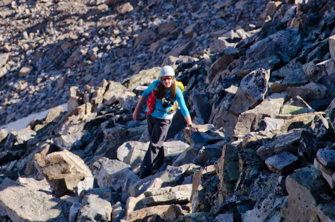
Finally, we reached the ridgeline and could get views to our east. Tom had made it up to the summit by now.
 |
 |
The route was getting more and more challenging and I was loving it. Kara was keeping her own as well and I think she was having fun on the interesting class 3 rock. By now, Tom had made it up and Will was photographing the journey.
Tom topped out just before Will.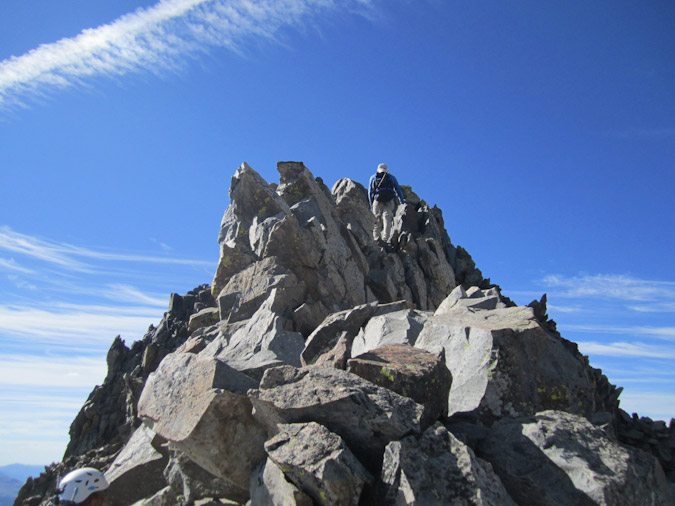
Tom contemplates the route on the crazy summit block of Wilson...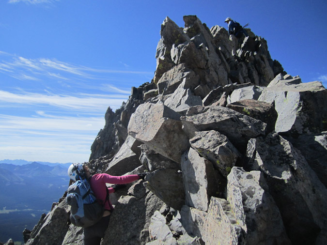
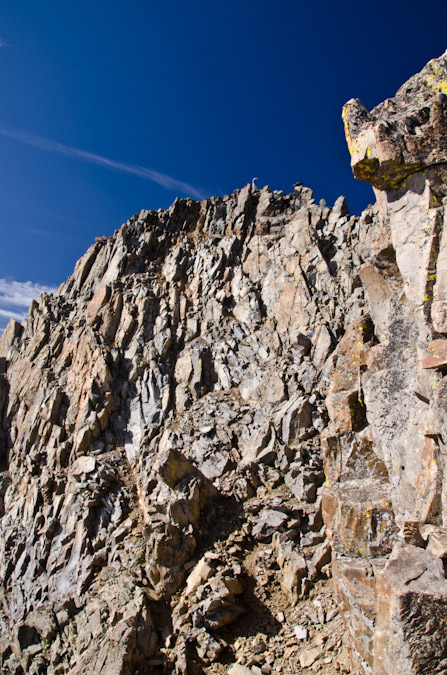
And Tom makes it up! As you can see, the terrain at the summit of Mt. Wilson is crazy and exposed. While it was very solid, I found the terrain to be the most exposed out of any section of any mountain I've done to date. The rocks were totally solid, but they looked like they could slab off at any moment. Someday in the future, someone is going to have the whole summit block slip off and it won't be pretty.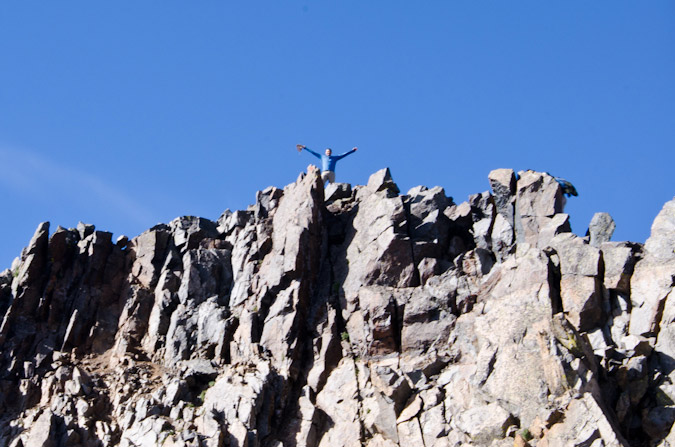
I finally reached the summit block and was totally shocked with the difficult nature of it. I had read about it, but that never really does it justice. There were two moves in particular that would end in death if not executed properly.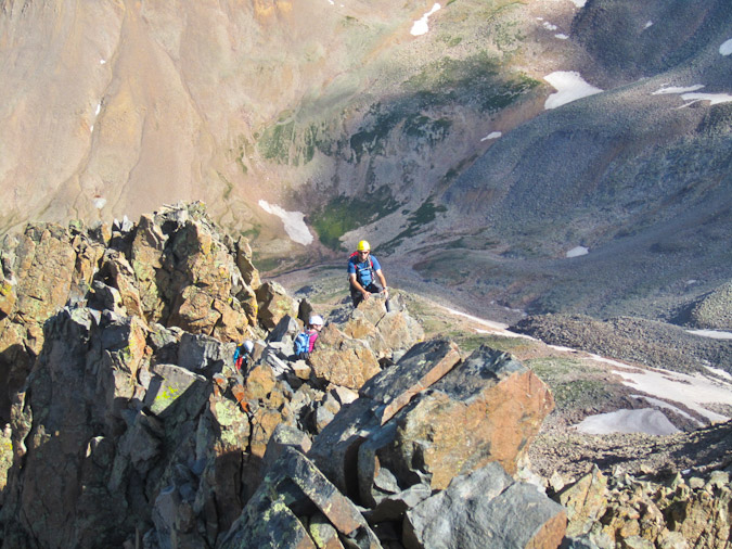
Alli captured me doing one of them...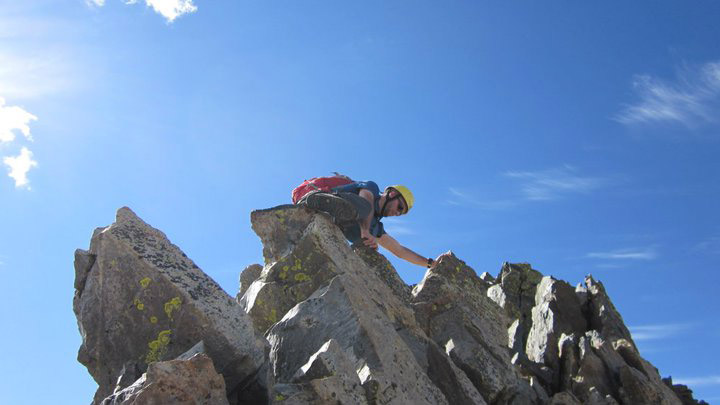
Here's the view down from there - very exposed! The rock was no wider than a person at the most.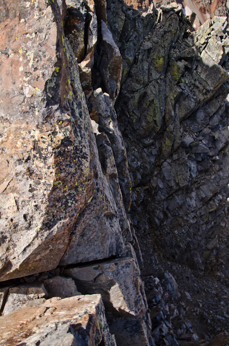
Once I reached the top, Tom, Will and I celebrated and took photos. The summit shots did not turn out great, but we were somewhat rushed because Tom wanted to get off the mountain and head for Wilson Peak before the weather got bad.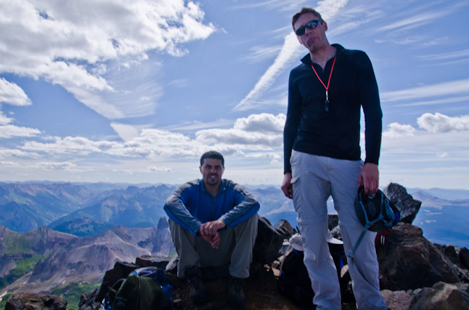
Tom and Will on Mt. Wilson.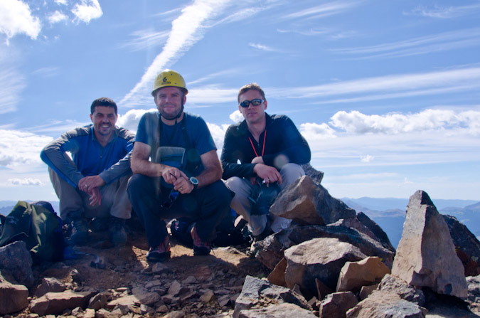
Tom, Matt and Will.
I took one look at El Diente and the weather conditions and said - "No thanks." It looked crazy from there. I know that looks are always deceiving, but I had no interest in soloing the traverse over to El Diente that day. Take a look for yourself: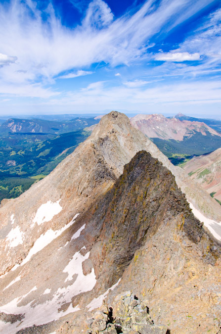
I did get time to shoot off some shots and capture a 360 from the top. Click to see a larger version.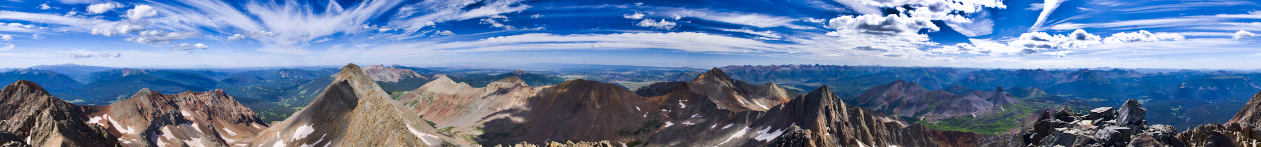
And I played around with an HDR panoramic of Wilson Peak, Sneffels, Wetterhorn, Uncompahgre, Lizard Head and the Ice Lake Basin peaks.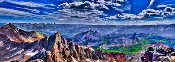
Tom and Will started down before me, and it made for a good dose of perspective on the downclimb.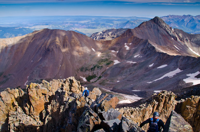
Will graciously stopped and photographed me coming down off the top. It was wild stuff! It definately had my heart pumping!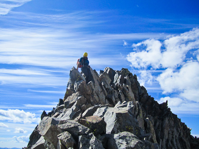
Will and I stayed in the back with Kara, while Tom and Alli went ahead. 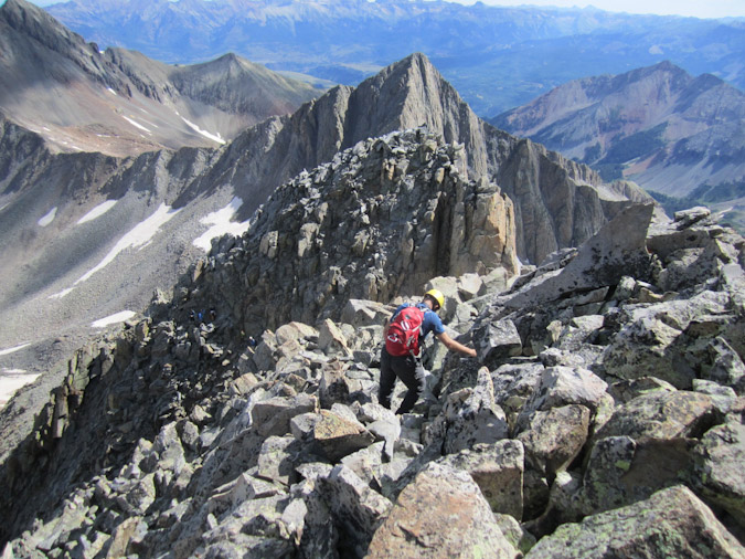
Then the craziest thing happened. We ran into a group of 4 young men coming up. None of them had helmets. One of them had a backpack and water. 3 of the 4 were wearing tennis shoes and one of them had a brace or cast on his arm, essentially rendering him one-armed. My only response to that was: "Fascinating." Since I don't liken myself as the 14ers police, I just said hello and kept on going. Now, I could be off here, and you might say I'm a bit of a safety freak and that I need to lighten up... I could not help but wonder though - what the hell were they thinking? Water? Helmets? Broken arm? Wow. Mouseover to see what he must have been thinking.
"Dude! Water is for pansies!"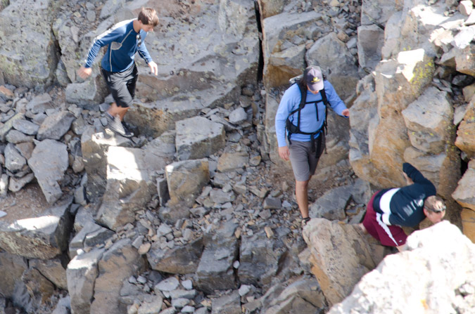
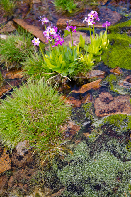
We took our time coming down, probably too long; however, Kara was good company and we wanted to make sure we did it safely. I kept my eyes on the sky and kept contemplating a hike over to start Gladstone; however, I abandoned the idea at the first sight of bad weather. Even though the weather did hold for the rest of the day, I feel like I made the right choice. We reached that awesome field of flowers again and I went crazy with the camera.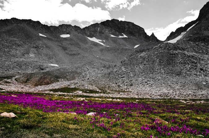
Wildflowers and Gladstone Peak.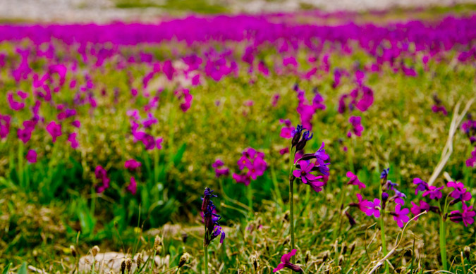
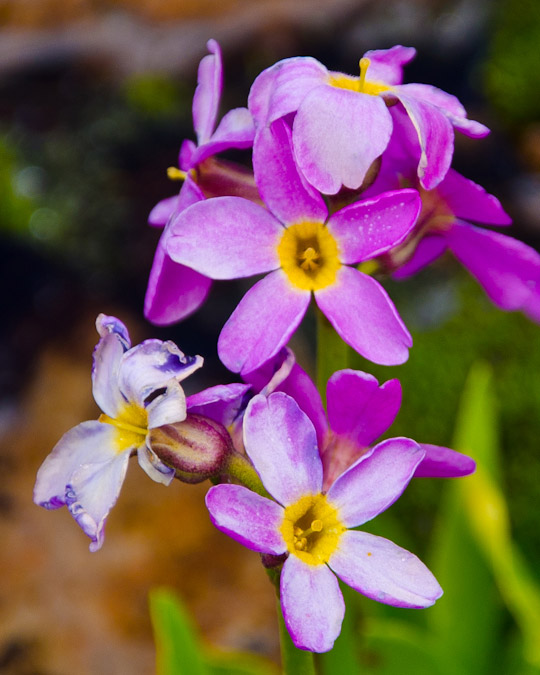
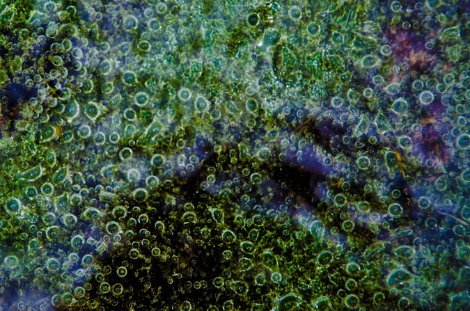
The flowers made for a nice subject for some depth of field (DoF) work. Maybe someday I'll get a real lens that makes the bokeh look creamier. I found a really neat pond with some odd plants growing in it that were exuding bubbles. They also made for an interesting subject. With the thought of Gladstone out of my mind, I focused in on looking for interesting things to photograph on the way back down. I also wanted to find things with interesting texture and depth of field.
 |
 |
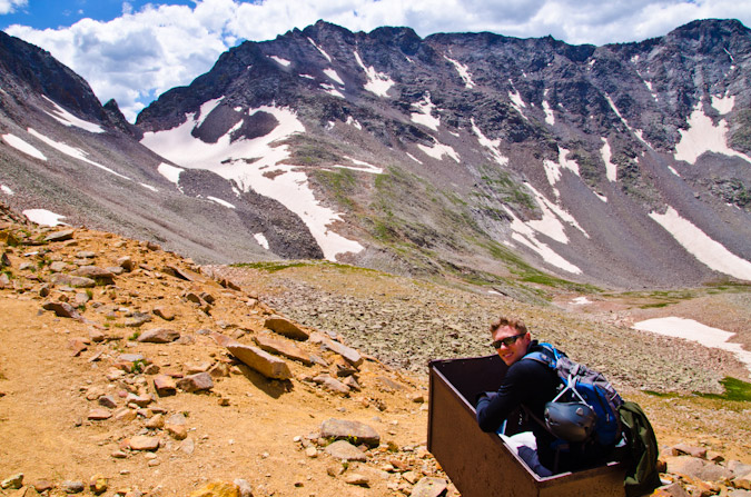
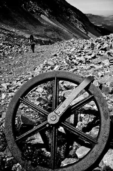
We finally reached the Rock of Ages mine again and the ever-so-popular mining cart that always makes for great photo opportunities.
Will jams out on the mining cart.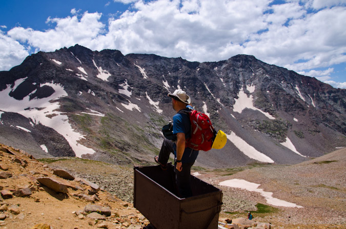
My best captain salute for Mt. Wilson.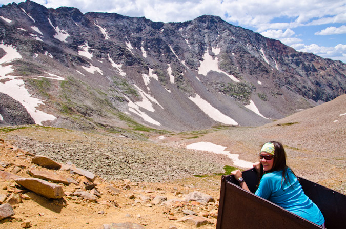
Kara, riding the cart to victory!
We made up to the saddle again, where Tom and Alli were waiting for us. We all decided to head back down, despite the fact that the weather was holding. I was good with this decision since we had another day yet to climb.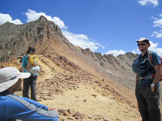
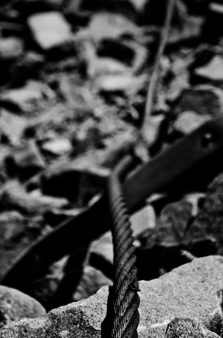
One thing I love about getting out on these hikes and climbs is that it lets me play around with different subjects for photography. In this case, I chose the old mining building and a barbed wire to focus on for a small depth of field. I can't wait for the day when I can get myself a nice 50mm prime lens to really make these kinds of photos pop.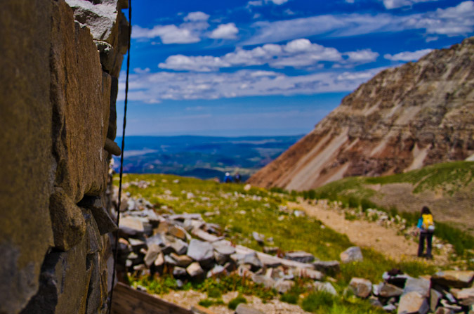
I also looked for things with interesting textures.
And of course the wildflowers were great too.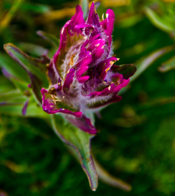 One cool thing about this area is the large amount of old mining equipment left behind. I felt like they made good subjects for black and white photos. The below left image is one of my favorites. It combines a few concepts that I wanted to demonstrate - lines and depth of field. I hope that you like them!
 |
 |
We finally wrapped back around to the other side of the long ridge that separates the new Rock of Ages trail from the Rock of Ages basin.
The clouds above were pretty neat.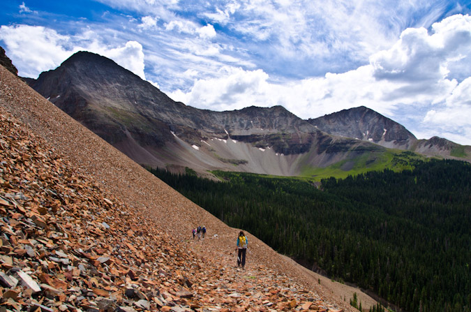
As mentioned at the beginning of the report, we did encounter one area that confused us on the way up because we felt like we were going the wrong way (which we weren't). This rock in the trail led me to think that maybe we should turn-off on a less-worn trail here, but that proved to lead to nowhere. I wanted to point the rock out to anyone else doing this route so that you know to keep on going straight when you find this rock.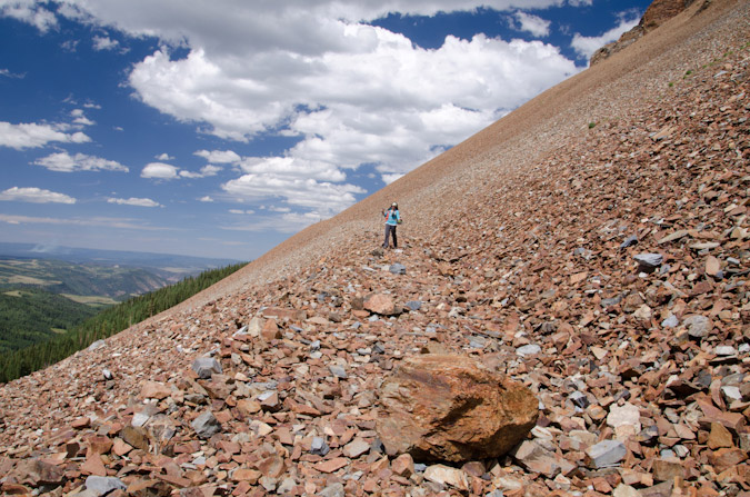
Also of interest, I noticed that the fire I saw last month was still happening in the same general area as before, so that led me to think that maybe there were some controlled fires going on in the area.
I took this photo to not only shot off the fire, but to also demonstrate the difference between using a polarizing filter and not. I took the below photo without the filter, and if you mouse-over it, you can see the same photo only with a filter, with all the same settings in camera. The filter really brings out the blues and adds some punch to the clouds. Check it out!
We reached our campsite and cooked dinner. We all decided to get up early the next day to finish our weekend of climbing. I opted to set my alarm for 1 AM because I wanted to reach the Rock of Ages saddle and then the Gladstone-Wilson saddle for star trails and sunrise. When my alarm went off at 1 AM, I got dressed and ready to go. I got out of my tent and looked up - the sky was full of clouds! Nooooo! I set the alarm for 3 AM and when I woke up again, it was raining. Eventually, we all agreed to cancel the Sunday climbs and head back to Denver. Tom's tire was still holding up, so we headed on out. Wetterhorn poked into view on the drive over Dallas Divide. 
Sneffels was looking really awesome with the nasty weather in the area.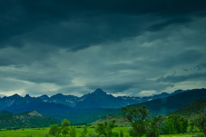
Shortly before reaching Ridgway, Tom's air pressure went down again and he replaced the hole with another repair kit. 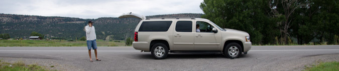
We once again found ourselves waiting for the air pressure to increase, so I took some photos of our group. Alli was in high spirits.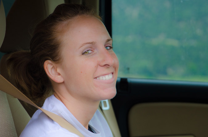
But Kara, our Lisa Loeb lookalike contest winner, was less than happy.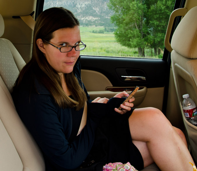
And then, the most amazing thing happened. While the tire was airing up, I noticed a beam of light hitting the mountains to the east. 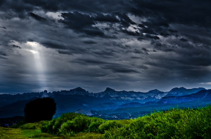
It was a good sign!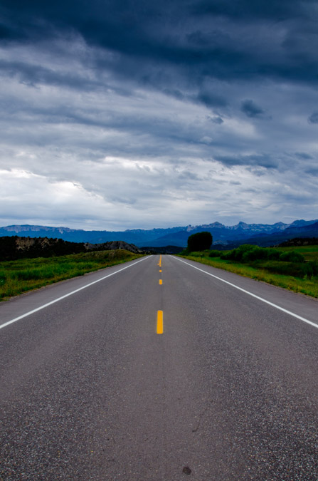
But alas, shortly after Ridgway, the tire failed again and we decided to replace it with the spare. Fortunately, the views of Sneffels and the thought of breakfast kept our spirits high!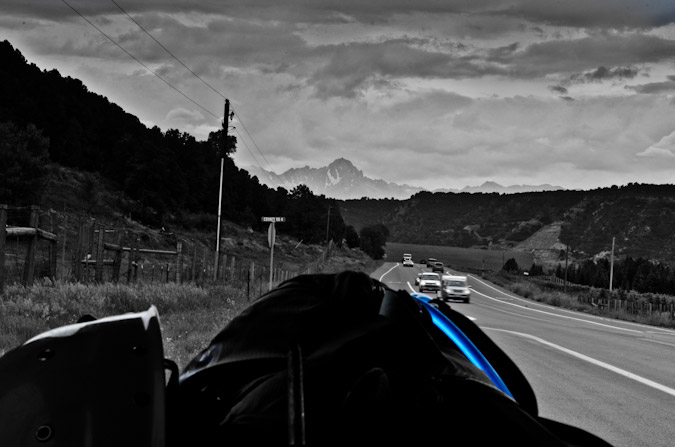
We stopped just by County Rd. 4 for the tire swap. 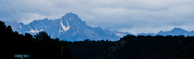
After switching out tires, we headed to Montrose and ate a glorious breakfast at Starvin' Arvins. The drive to Denver was uneventful.
It was a great weekend depsite some of our set-backs. I met some new people who were all really great. I hope to hike with all of them again!
At the time of this report after climbing Mt. Wilson, I am left with five of the ranked fifty-three 14ers: Mount Eolus, Windom Peak, Sunlight Peak, Maroon Peak and Pyramid Peak. I am on-track to finishing the 14ers this year, which is an amazing feeling!
Thanks for reading! Just a reminder - this site costs me time and money to maintain - if you find it useful, please consider supporting the site by remembering to use the affiliate links, especially if you purchase photography related gear from Adorama.
References:
"The San Juan Mountains: A Climbing and Hiking Guide" - Robert F. Rosebrough. 1986. Cordillera Press.
{fcomment}
San Juan Mountains
The San Juan Mountains span approximately 6,000 square miles in the southwestern portion of Colorado and contain several sub-ranges, including the Grenadier Range, Needle Mountains, West Needle Mountains, La Garita Mountains and the La Plata Mountains. The San Juans are home to some of the most rugged and breathtaking mountains in the continental United States.