Displaying items by tag: Adventure
Climbing Pigeon Peak & Turret Peak via Ruby Basin - a sleepless soul-filling adventure

I first admired Pigeon Peak's utterly impressive east face from the summit of Arrow Peak in 2010 on one of the most epic trips I've been on in my life. Ever since then, I knew that a trip up Pigeon Peak would be in my future. It only took 6 years, but I finally pulled it off. If someone would have told me at the start of the year that I was going to photograph the Perseid Meteor Shower from the saddle between Pigeon Peak and Turret Peak this year I would have just laughed it off. After living in Portland, Oregon for two years, I had developed a bit of a beer gut and lost some of my "mountaineering shape" I had worked on while going after the 14ers from 2008 - 2012. A year ago the idea of pushing myself hard enough to photograph the best meteor shower of the year from 13,000 ft. would have been laughable... but here we are in 2016 and that's exactly what I did. In fact, the details of my trip, in retrospect, are a bit staggering to take in, at least for my old 37-year-old body. The full details show nicely on my GaiaGPS track, which is downloadable. You can purchase GaiaGPS here and help support the site.
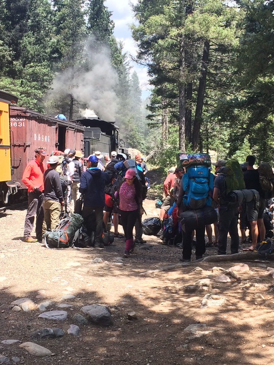
8/12/16 - 8:30 AM - depart Durango on the Durango & Silverton Narrow Gauge train
8/12/16 - 11:30 AM - dropped off at Needleton by the Durango & Silverton Narrow Gauge train
8/12/16 - 3:00 PM - arrived at Ruby Lake
8/12/16 - 5:00 PM - arrived at meadow in upper Ruby Basin below Turret Needles
8/12/16 - 10:30 PM - departed without sleep for the Turret Peak / Pigeon Peak saddle to photograph the Perseid Meteor Shower
8/12/16 - 11:45 PM - arrived at Pigeon / Turret saddle and began photographing Perseid Meteor Shower
8/13/16 - 2:00 AM - moon sets (still no sleep, too cold)
8/13/16 - 4:30 AM - arrived at Turret Peak summit
8/13/16 - 5:21 AM - began photographing sunrise from Turret Peak summit
8/13/16 - 6:15 AM - left Turret Peak summit to head back to saddle
8/13/16 - 6:45 AM - arrived at saddle
8/13/16 - 8:00 AM - arrived at secondary saddle to enter North Pigeon Creek basin and descend down 1,700 ft. to climb Pigeon Peak
8/13/16 - 8:15 AM - arrived at base of Pigeon Peak on northwest side of Pigeon
8/13/16 - 9:40 AM - arrived at summit block of Pigeon and class 4 section
8/13/16 - 10:00 AM - arrived on Pigeon summit
8/13/16 - 11:30 AM - arrived at secondary saddle and began to regain Pigeon / Turret saddle
8/13/16 - 12:55 PM - arrived back at camp in upper Ruby Basin (commence sleep for the first time since 6 AM on 8/12/16 - that's 31 hours of being awake without sleep)
8/13/16 - 7:00 PM - photograph sunset from upper Ruby Basin
8/14/16 - 7:30 AM - photograph sunrise from upper Ruby Basin
8/14/16 - 9:00 AM - leave upper Ruby Basin and hike out
8/14/16 - 10:00 AM - arrive at Ruby Lake
8/14/16 - 12:05 PM - arrive at Needleton and wait for train
The grand total was 9,286 ft. of vertical ascent in 10 hrs, 52 mins of movement with a total of 19.3 miles of distance covered. Not bad!
To some (like Andrew Hamilton) those stats not might seem very impressive, but it felt pretty great to me, especially considering the extra 10 pounds of photography weight I was carrying.
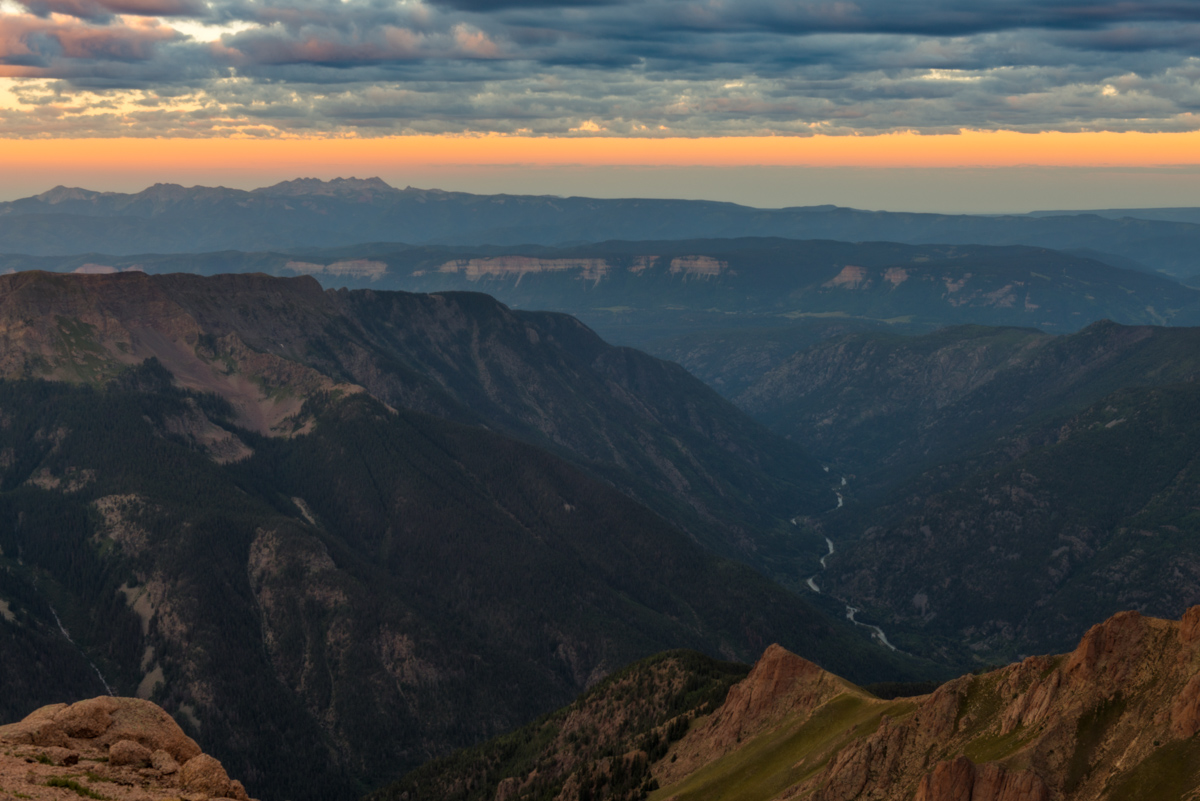
So, from the beginning... where was I? Ah, yes, taking the train from Durango. I had originally planned on going to climb Silex and The Guardian with Natalie Moran from 14ers.com, who I had done Dallas Peak and Teakettle Mountain with me back in 2013; however, I did not think I was going to be able to get the day off of work, so I cancelled... and at the last minute on Thursday night I was able to swing the day off, so I made hasty plans to get Pigeon and Turret under my belt. Knowing that the Perseid Meteor Shower was peaking Thursday and Friday night with the radiant (the part of the sky where the meteors originate) coming out of the north east, I made plans to hike all the way up into Ruby Basin and try for the Pigeon / Turret saddle with a view looking north east towards Animas Mountain and Monitor Peak, all illuminated by the setting moon until 2 AM. These plans were of course made possible by studying maps, reading Roach's 13ers guide, and by using a great app called PhotoPills, which I've written more about HERE.
The trip on the train went without a hitch and the scenery was nice, but nothing compared to what was in store for me soon.
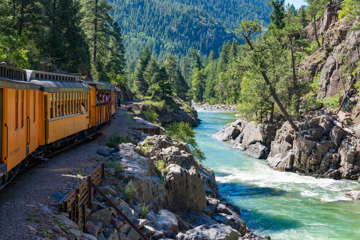
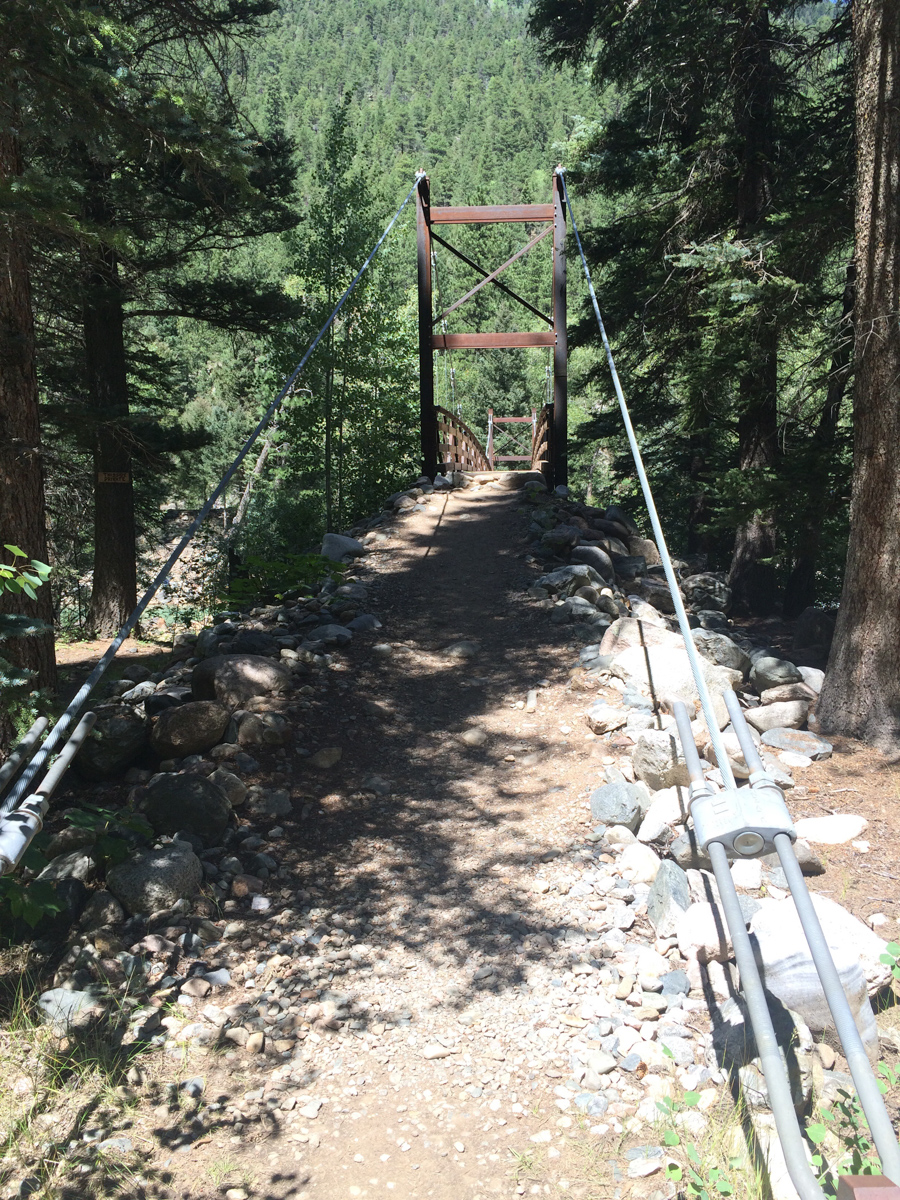
The train stopped at Needleton and at least 40 people got off to begin their backpacking trips in the area. The brakeman responsible for unloading the packs was throwing them off the box car in a rush, much to everyone's dismay. Water bottles, food, stoves, bags, and more went flying out of people's packs. I later found that my water filter was damaged in the ordeal. I was thinking about filing a complaint with the train company becuase this employee clearly did not care about anyone's stuff. I was lucky none of my camera equipment was damaged. I crossed the bridge over the Animas and watched as everyone else headed south towards Chicago Basin, while I went north for Ruby Lake & Ruby Basin. It turned out only two other people from our train went up into Ruby Basin with me, but I would not run into them until my second day. In preparation for this backpack, I read and re-read Roach's descriptions for the approach. It sounded pretty intense: "...this is a very rough approach. A direct ascent up Ruby Creek from the Animas is so difficult it has left several strong people speechless." Wow, those are pretty strong words from Roach, who I have often teased in other trip reports as being vague or non-descript. I took Roach's cautionary words with a grain of salt and went for it. I felt pretty strong and was up to the task, so I began. Luckily, I had my friend Natalie Moran's GPS track downloaded into my phone via GaiaGPS so that I could roughly keep track of the trail. This was particularly helpful right off the bat when trying to locate the turn-off from the Animas River Trail into North Pigeon Creek.
Shortly into this trail, it became steep. Steep and unrelenting. I had pared down my pack weight to 38 pounds, not bad considering all of my camera gear; however, this trail was downright brutal. Roach was not joking. I kept my eyes peeled for a carving of a columbine flower, which was supposed to signify that I was on the right trail up to Ruby Lake; but, I never did find it on the way up. I figured out later what I did wrong though. When I reached the small creek crossing for North Pigeon Creek (the only one), I spotted what I thought was the trail up off to the left on the side of the hill. That is the trail I followed (which eventually petered out and ended up in a bushwhack straight up until I found the right trail). The correct trail was to the right and up from the creek crossing, which I learned on the way back down. At least the views back across the Animas towards West Needle Mountain and the Twilights was great.
In preparation for this trip, I was looking through lots of trip reports and stumbled across a familar name. It was the name of one of my newest co-workers, Terri Horvath, who is a bi-Centennial finisher (she's climbed the highest 200 mountains in Colorado). Terri provided me with some excellent tips which kept me from going even more off course than I already had, including some solid advice in locating the "high trail" that Roach describes in his route descriptions. Right after a very steep step down, I looked to the right to find the proper trail. This trail worked steeply up and down above Ruby Lake and finally dropped me right at the base of the lower lake, with views of Ruby Lake finally realized.
Upon reaching Ruby Lake, I ran into a group of five guys from Denver that were really great to chat with, one of which being a fellow photographer named Jarad Switzer. We commiserated on the gruelling hike into the basin and then I shared my plans to shoot the meteor shower that night which I think left them all thinking I was a little bit crazy. Was I? Probably. I kept a solid pace up to the lake, making it there in 3 hours 30 minutes from Needleton. I continued on. The views of Pigeon began to blow me away. This thing is truly unbelievable!
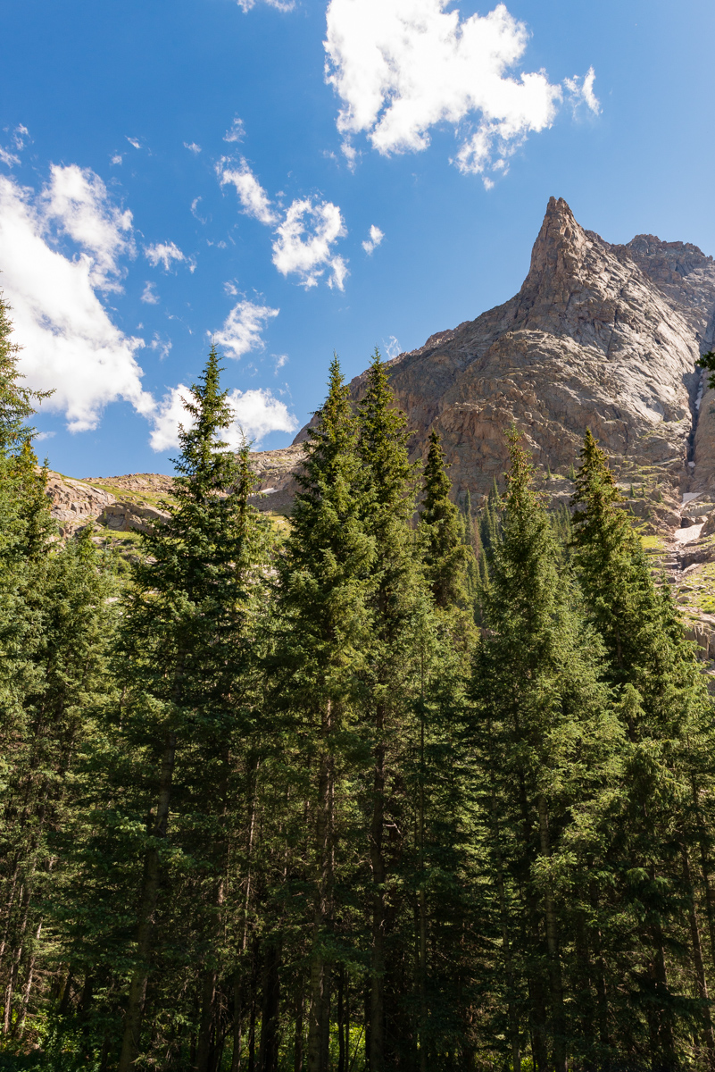
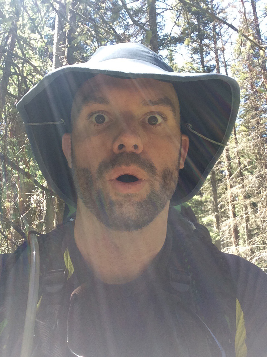
The trail became really hard to follow after the lake and was really only followable due to some well-placed cairns (thank you to whoever put those there). It weaved left above the cliffs at the headwall of the lake and through some really rugged terrain consisting of many fallen trees and steep hillsides. It reminded me quite a bit of No Name Creek, just one basin north of where I was at. My expression tells the story, I think.
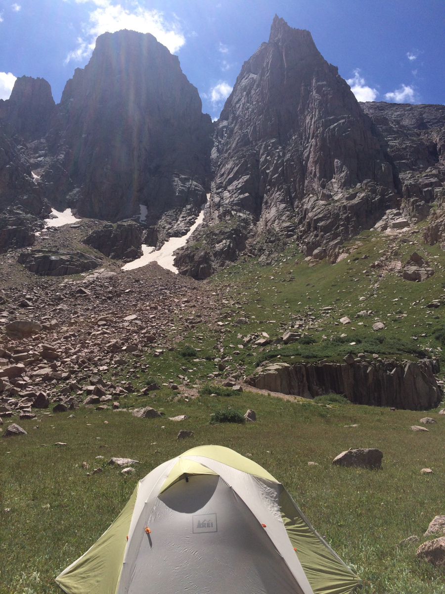
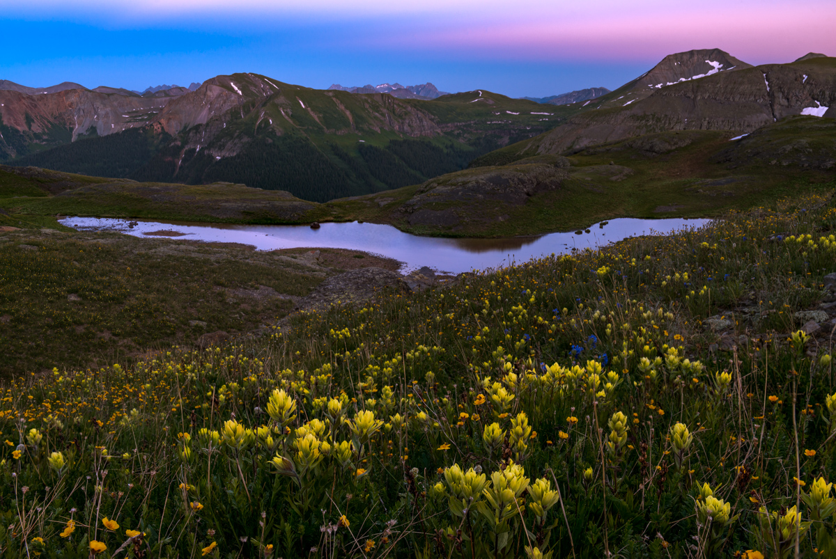
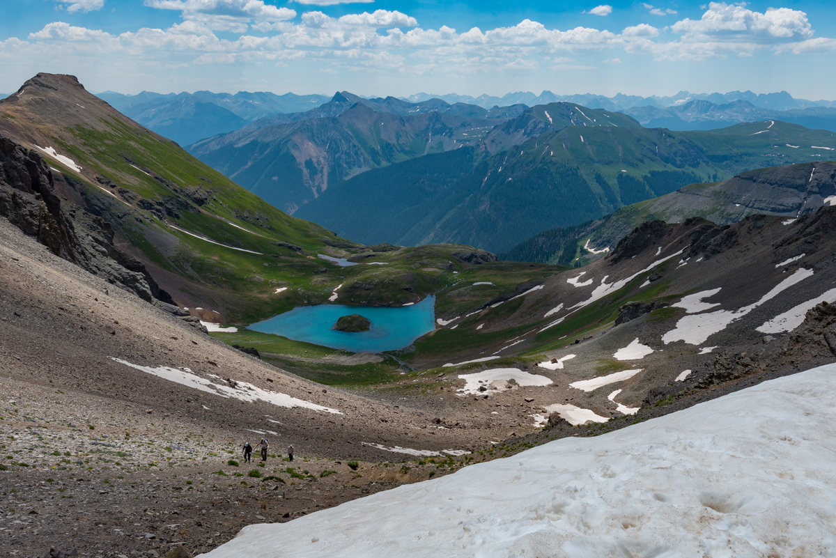
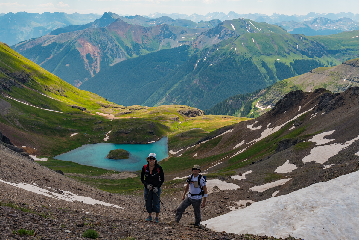
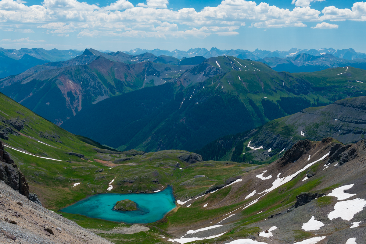
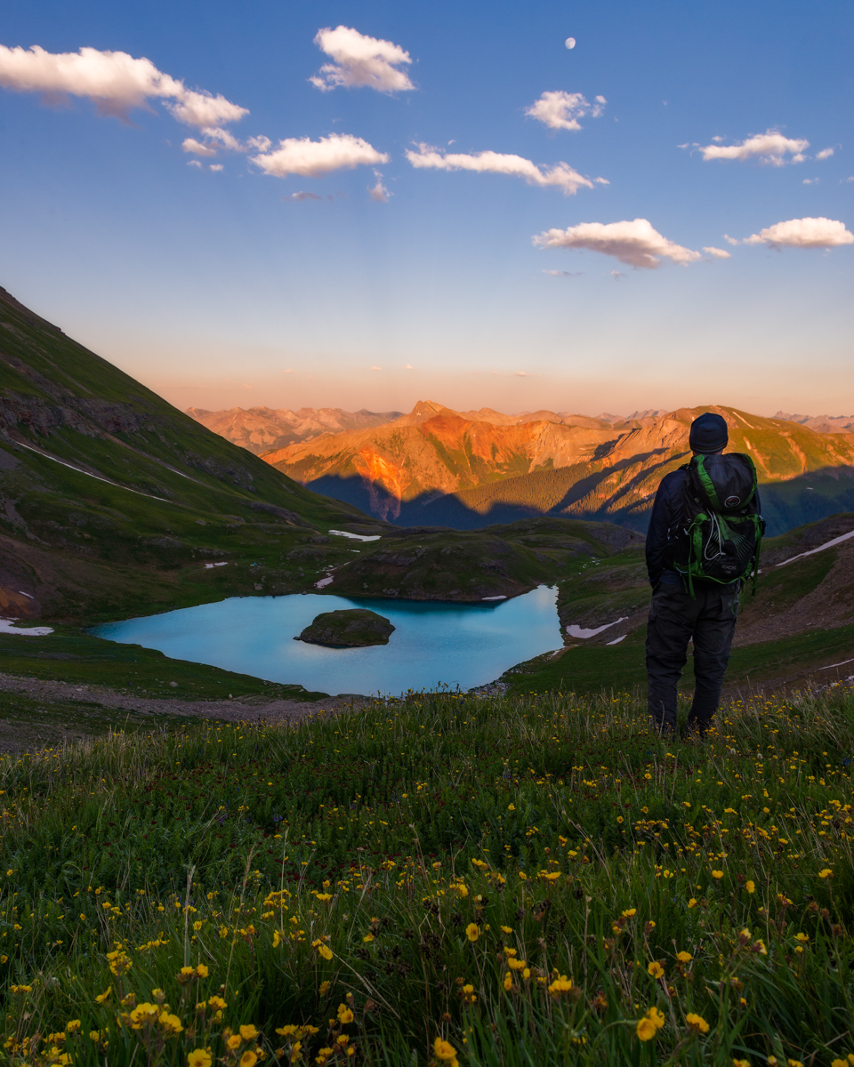
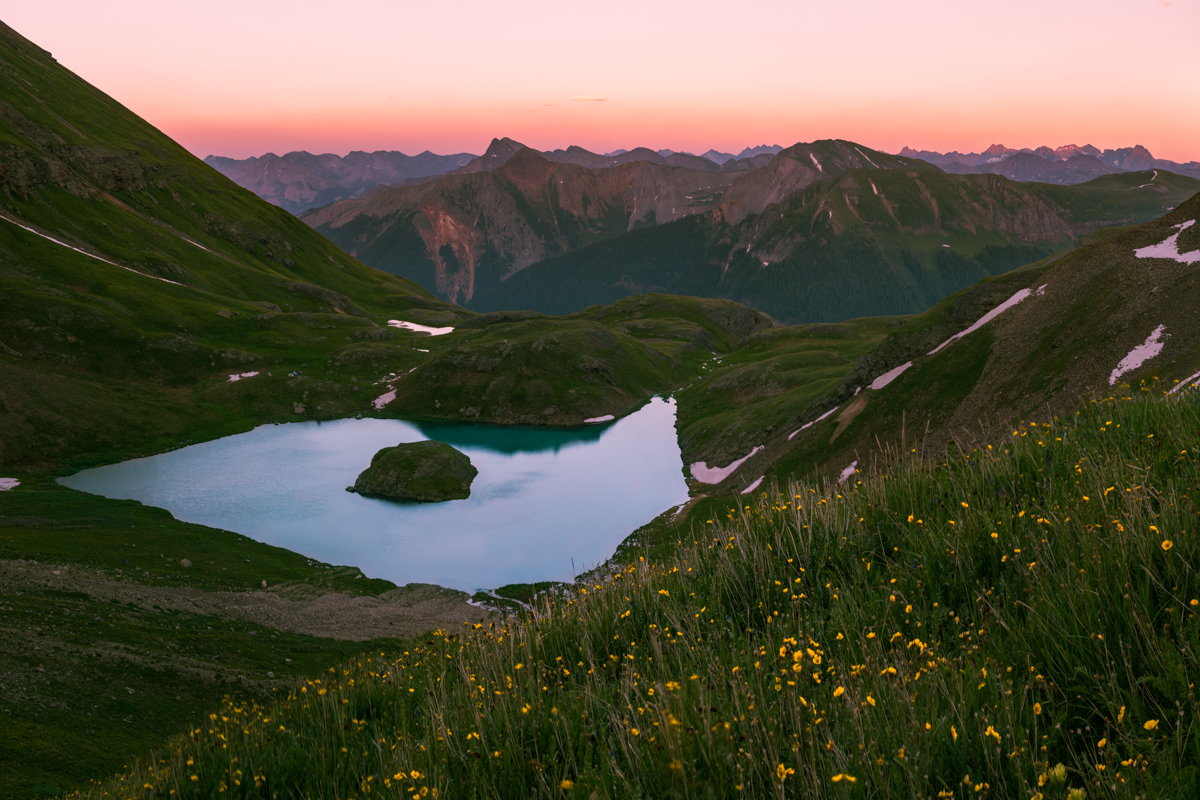
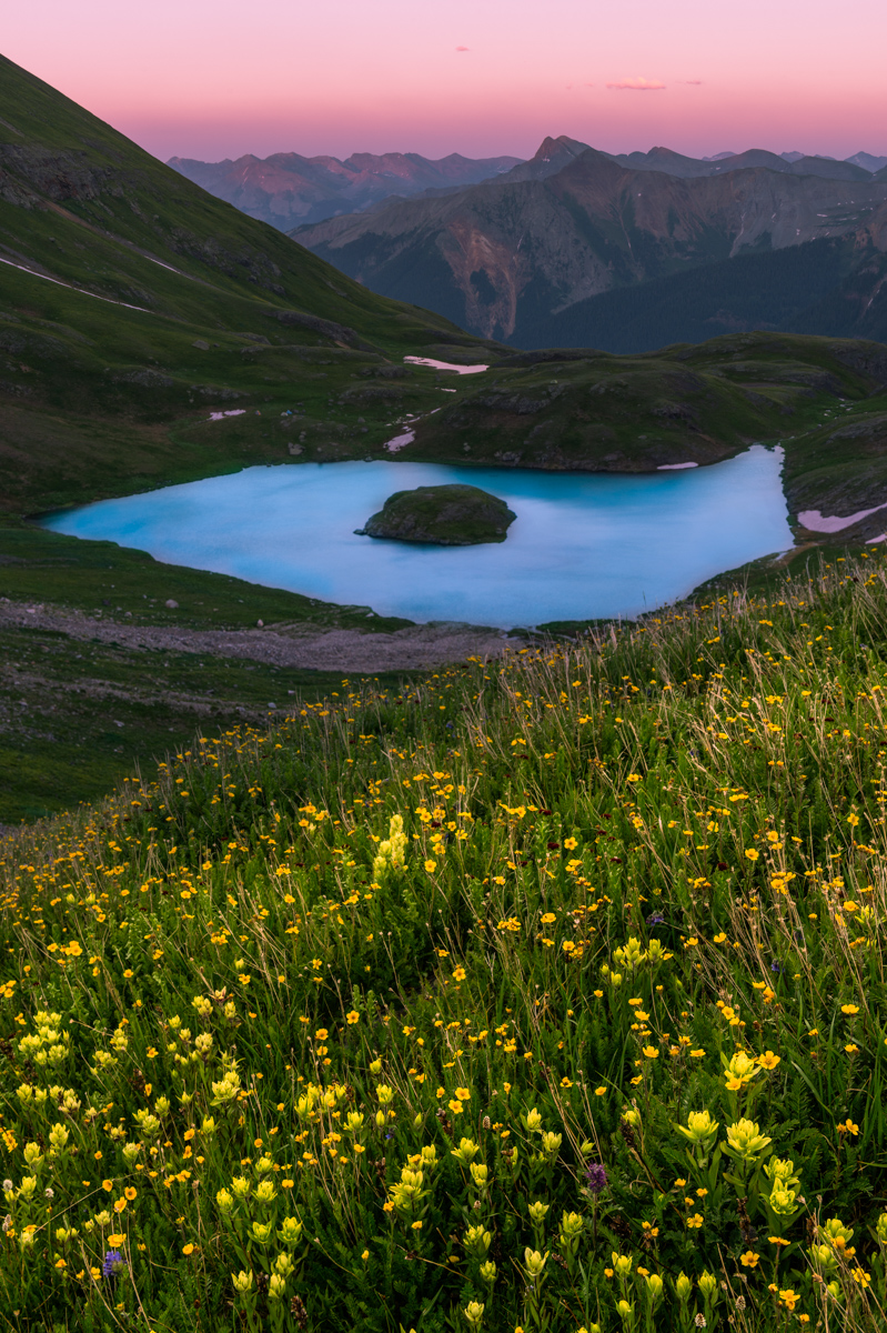
Upon breaking into upper Ruby Basin, the trail flattened out considerably and opened up to some amazing views above. The willow maze in the upper basin was actually not that hard to navigate, having been trampled through enough times to make it easy to find the weaknesses. The meadow in the upper basin below the Turret Needles and Pigeon came into view and I was quite excited until I noticed two other tents. I was hopeful that the people camped there would not mind another person joining them in the meadow. It turns out that the meadow is quite large and it would take quite a few parties worth of tents to fill it up. I arrived at the meadow at 5 PM and was pretty exhausted. I was at the opposite end of the meadow from these other backpackers, who later informed me that they had unsuccessfully attempted the east face of Pigeon earlier in the day which caught my attention. The climber, named Rex (or Max,?) explained that he had climbed Pigeon's east face 20 years prior and that he wanted to see if he could do it again. Impressive! I set up my tent and destroyed my dinner in preparation for a night of photography and sleeplessness. I had hoped to catch some sleep, which was really just a pipe dream. No sleep was obtained. I did get some decent photos around camp though.
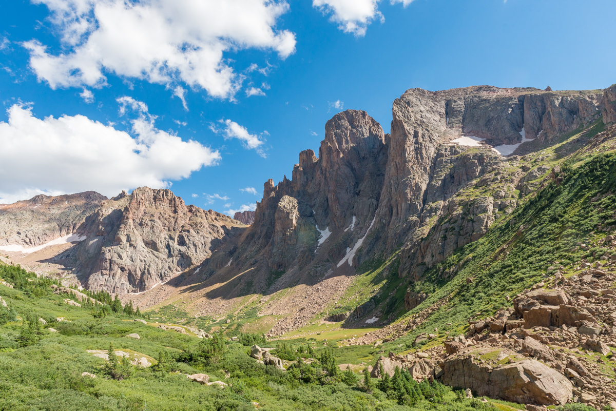
The Turret Needles were the most impressive feature of the basin and I decided to camp right below them about 100 feet away from the stream. Knowing that I would not have any trees to hang my food from, I had purchased an Ursack the day before from Backcountry Experience in Durango. The Ursack is designed to withstand the chewing of rodents like marmots and mice, which I anticipated finding lots of at the upper basin. I also employed a technique that I read about in another trip report where I suspended my food sack from the side of a cliff - a technique I also used at Lillie Lake on my Chicago Basin backpacking trip in 2011. At any rate, the wildflowers were still quite prolific in the upper basin, and I was pretty much in heaven as a photographer.
I shot exclusively with my Nikon 14-24 f/2.8 lens, and my Nikon 24-70 f/2.8 lens attached to my Nikon D800, which is getting a bit long in the tooth. Someday I'd love to upgrade to a D810 or maybe something lighter from Fuji or Sony.
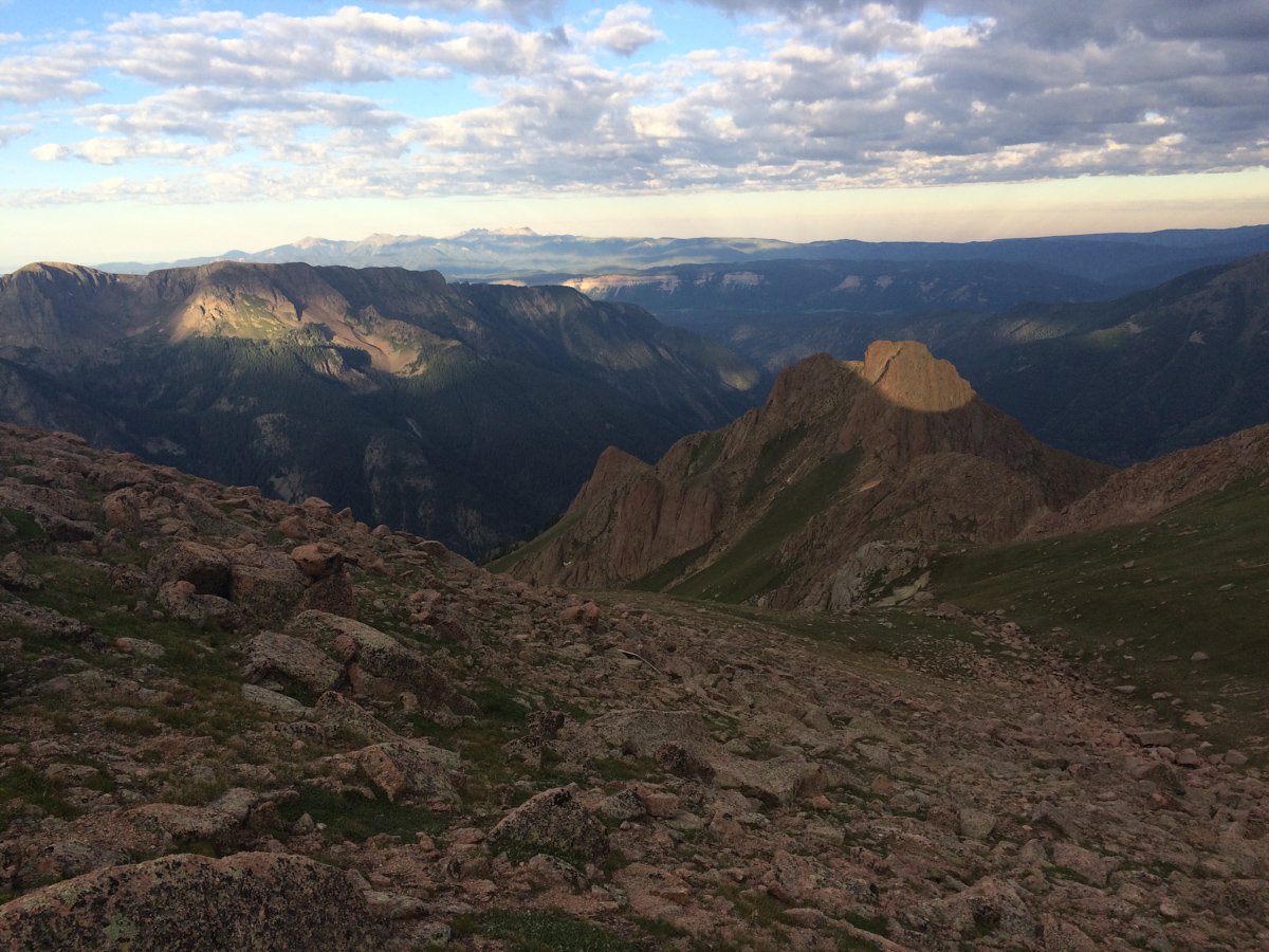
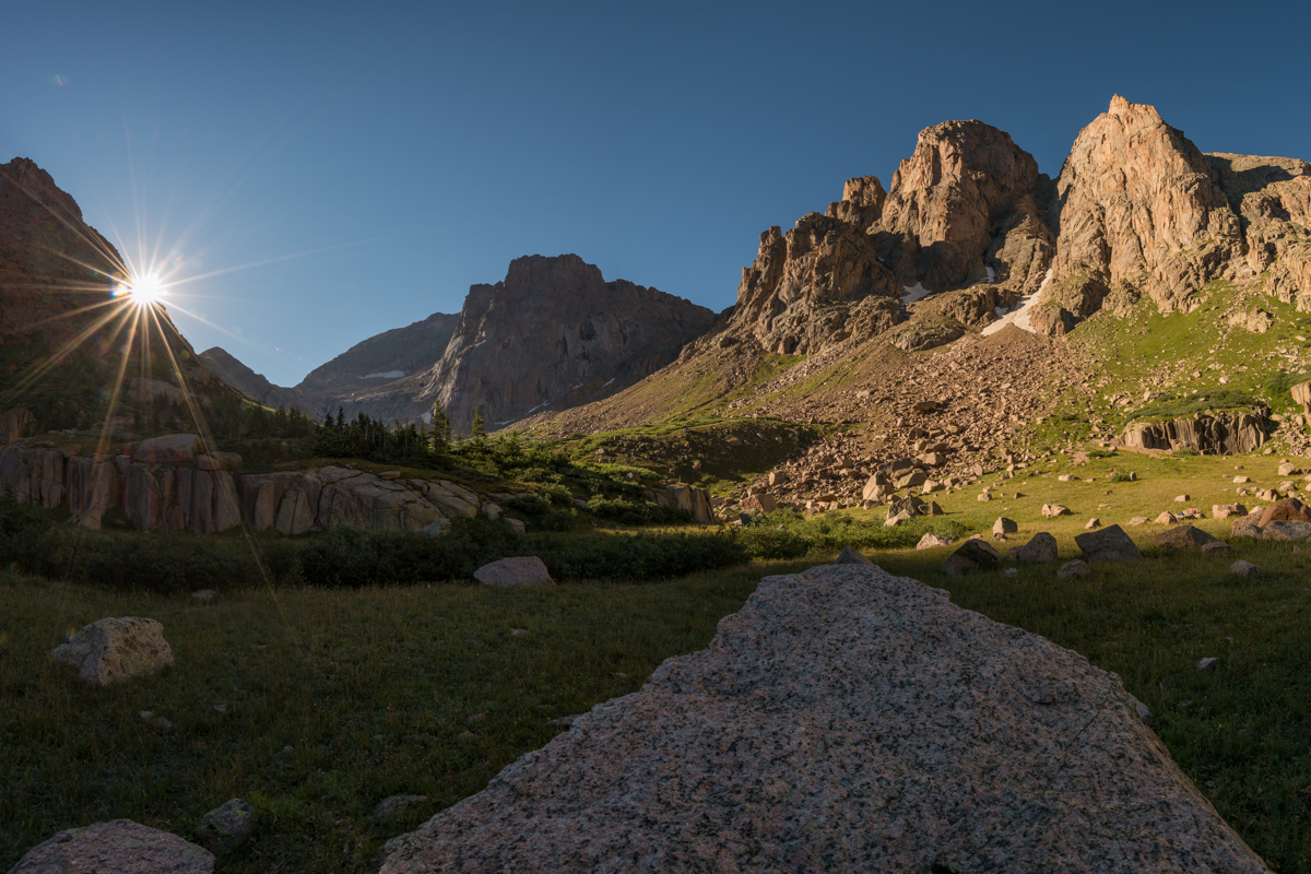
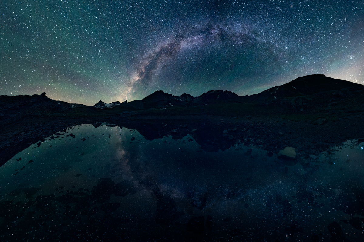
I set my alarm for 10:20 PM, but never actually slept. When the alarm went off, I bounced right out of my sleeping bag and out the door. The climber I met in the meadow had indicated that the "best" route up to the saddle was to take a little gully just to the left of where it looked like the obvious trail went. Taking their advice in the dark was pretty daunting - but it did manage to get me up very high quickly above the meadow. I followed cairns in the dark and enjoyed the views behind me of Animas Mountain and Monitor Peak, which were illuminated by the moon. Pigeon cast a long shadow across the peaks and was a constant reminder of just how much more climbing was ahead.
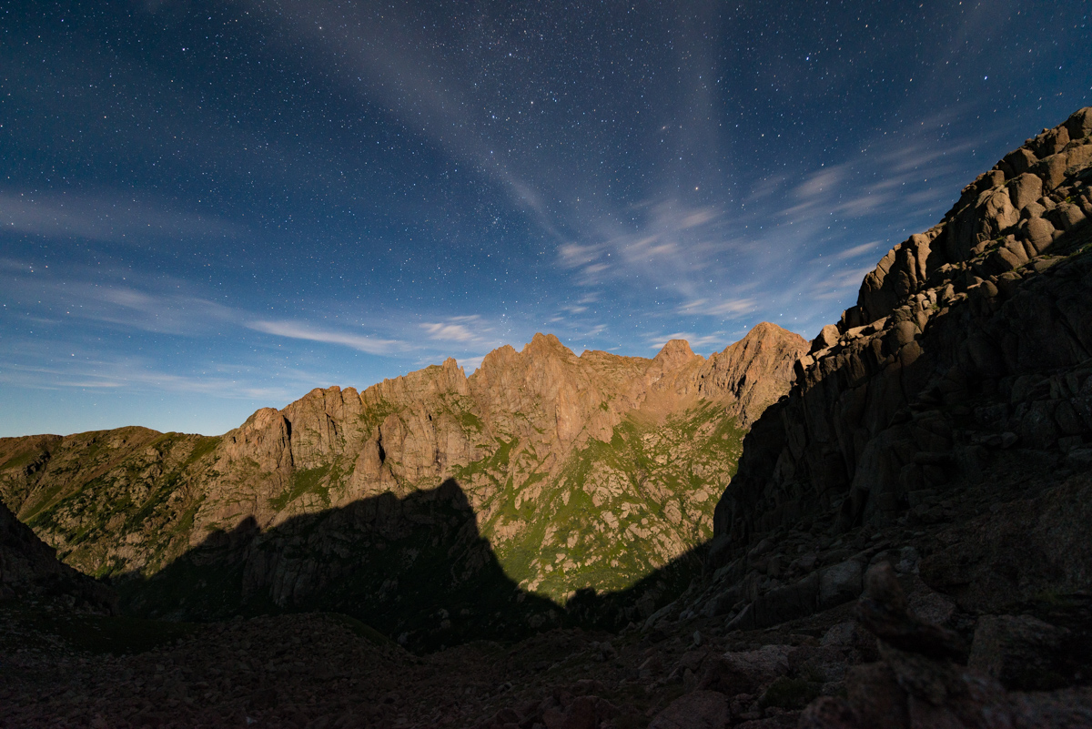
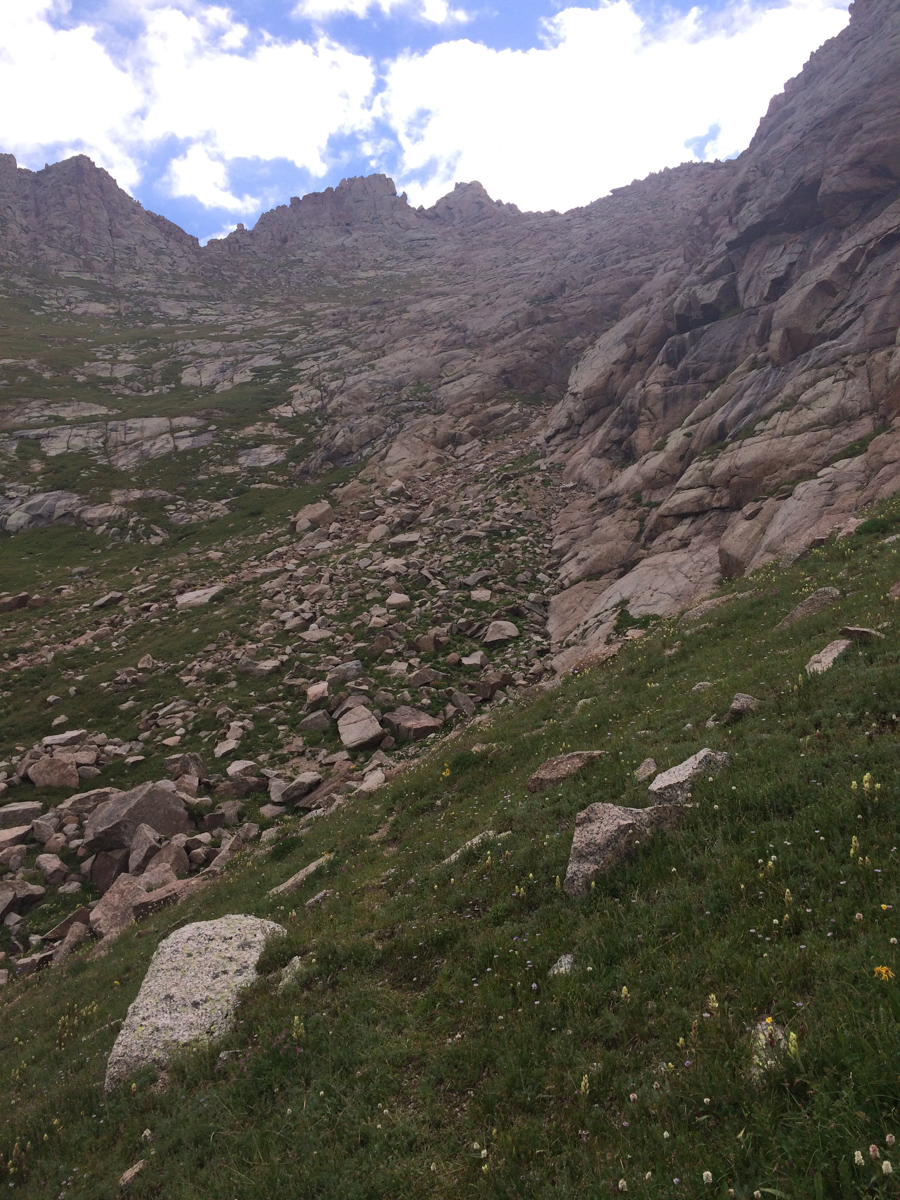
As I climbed into the area just below the saddle, I found myself in a large boulder field which I did not recall being described in any of the route descriptions. I'm not sure if I can explain it or not, but trying to locate cairns within a boulder field in the dark is pretty fun... and by fun what I mean is pretty pointless. Fortunately, I had my phone with GaiaGPS and could keep myself on route for the most part. Above this large boulder field I found the terrain smooth out a bit and I stopped again to get another photograph of the mountains behind me, the scene accentuated by this really awesome rock formation to my right, which was also illuminated by the moon.
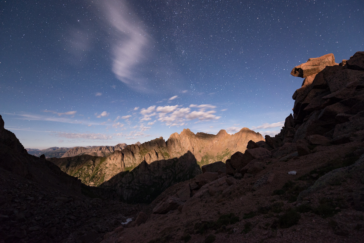
Upon reaching the saddle, I was of course not happy to find that there was some pretty cold breeze blowing over the top of the saddle. I knew that I was going to be in for a rough night of freezing my ass off. But hey, at least Pigeon looked absolutely stunning with the southeast face lit up by the moon.
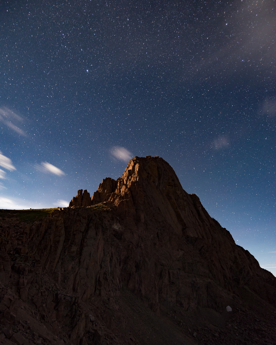
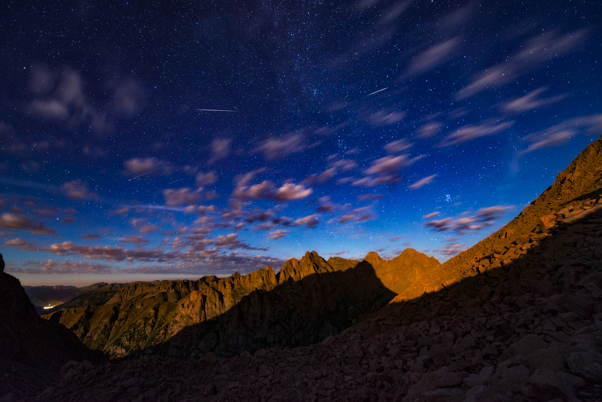
I found a nice spot to set-up my tripod for the night among some larger rocks that would be useful as a bed/chair/rest area in the cold wind. I clearly did not bring up enough warm clothing, because I basically shivered for 3 hours straight at this location, watching meteros streak by. In total, I believe I was able to capture about 15-30 meteors in my frame from 12 AM to 3 AM. The meteors were absolutely amazing to watch from this elevation, and I could even see the town of Silverton down below to the left.
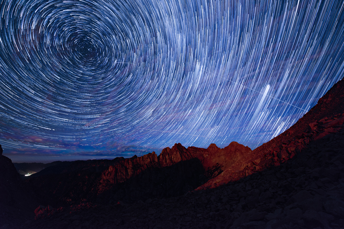
I combined the photos into some star trail sequences which turned out pretty well, and even did some timelapse video, which has music, so be warned!
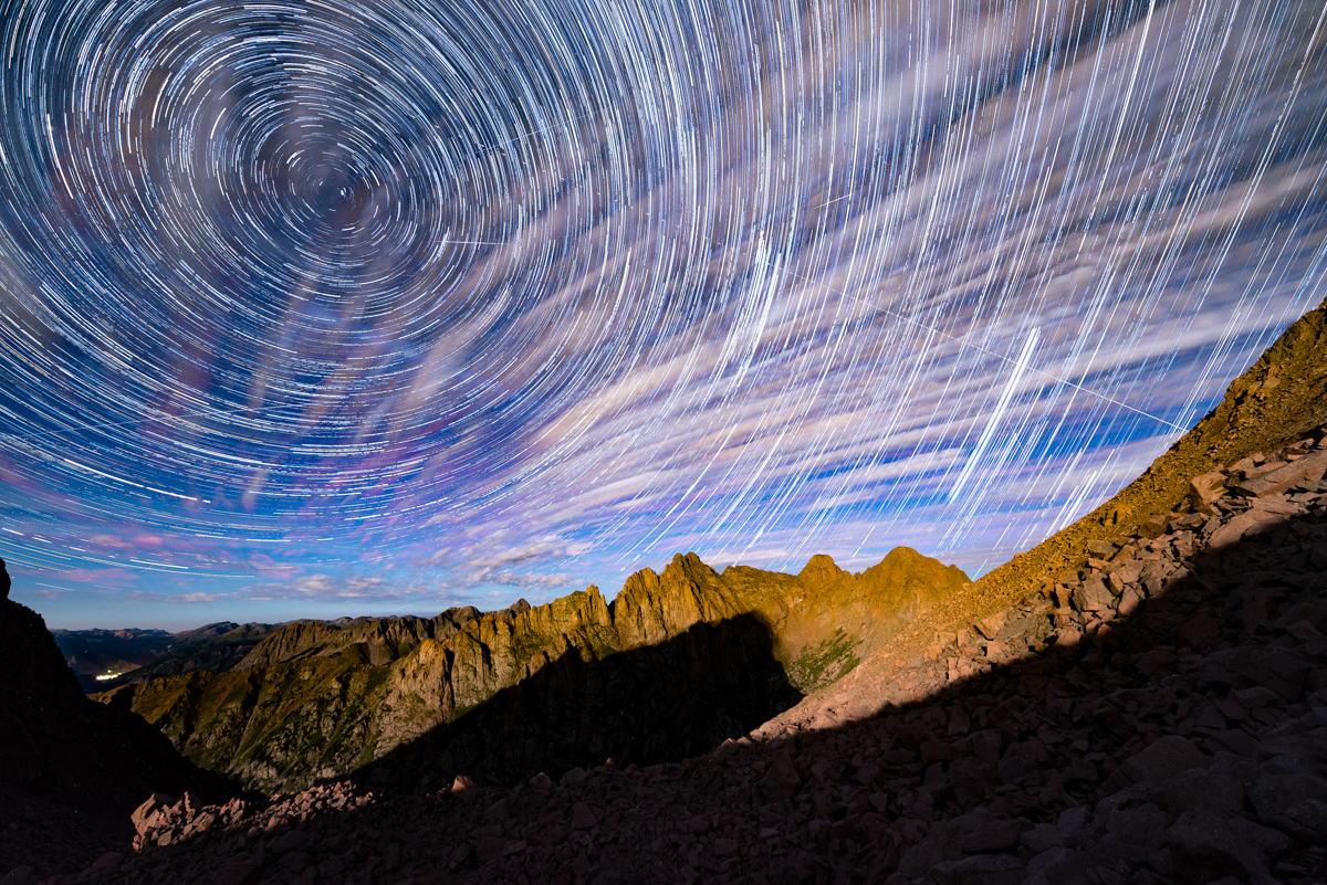
More star trails!
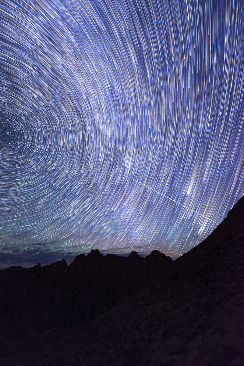
I noticed that a lot of meteors were originating at the apex of the night sky, so I turned my camera to portrait orientation for the last half of my shooting, this time in pitch black. I know I have some more photo editing to do to really highlight my work on the saddle, but this is what I have so far.
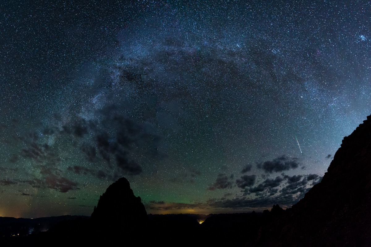
After freezing for a couple of hours I decided it was time to begin my ascent of Turret Peak. I also noted that since the moon had set that I might be able to get a glimpse of the Milky Way Core, which might open up a nice opportunity to photograph the Milky Way arching over Pigeon Peak. I pulled that off just below Turret's summit and even got a meteor in the last frame of the panorama - awesome!
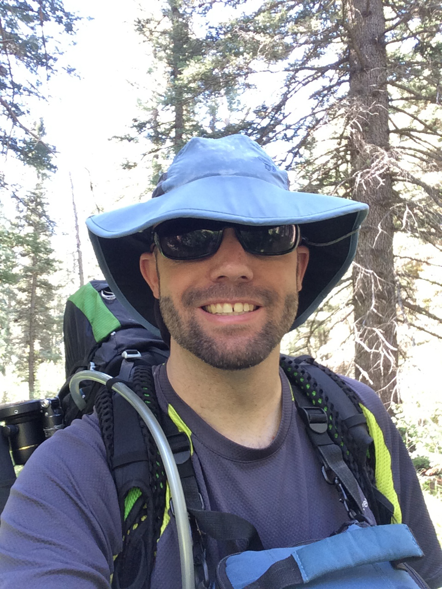
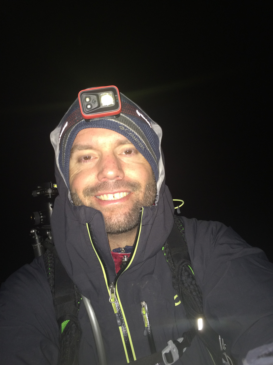
I arrived at the summit of Turret at 4:30 AM and felt completely wiped out. I think this photo says it all.
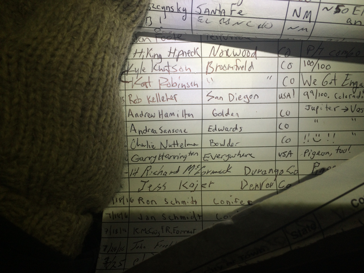
I saw some familar names on the summit register, including Andrew Hamilton from just a few weeks prior. His notes stated "Jupiter ---> Vestal" which I found quite interesting. If I'm reading it correctly, he started on Jupiter and this was just a spot in between his final destination of Vestal. That seemed like madness to me.
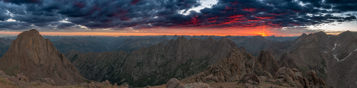
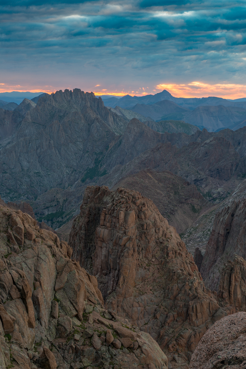
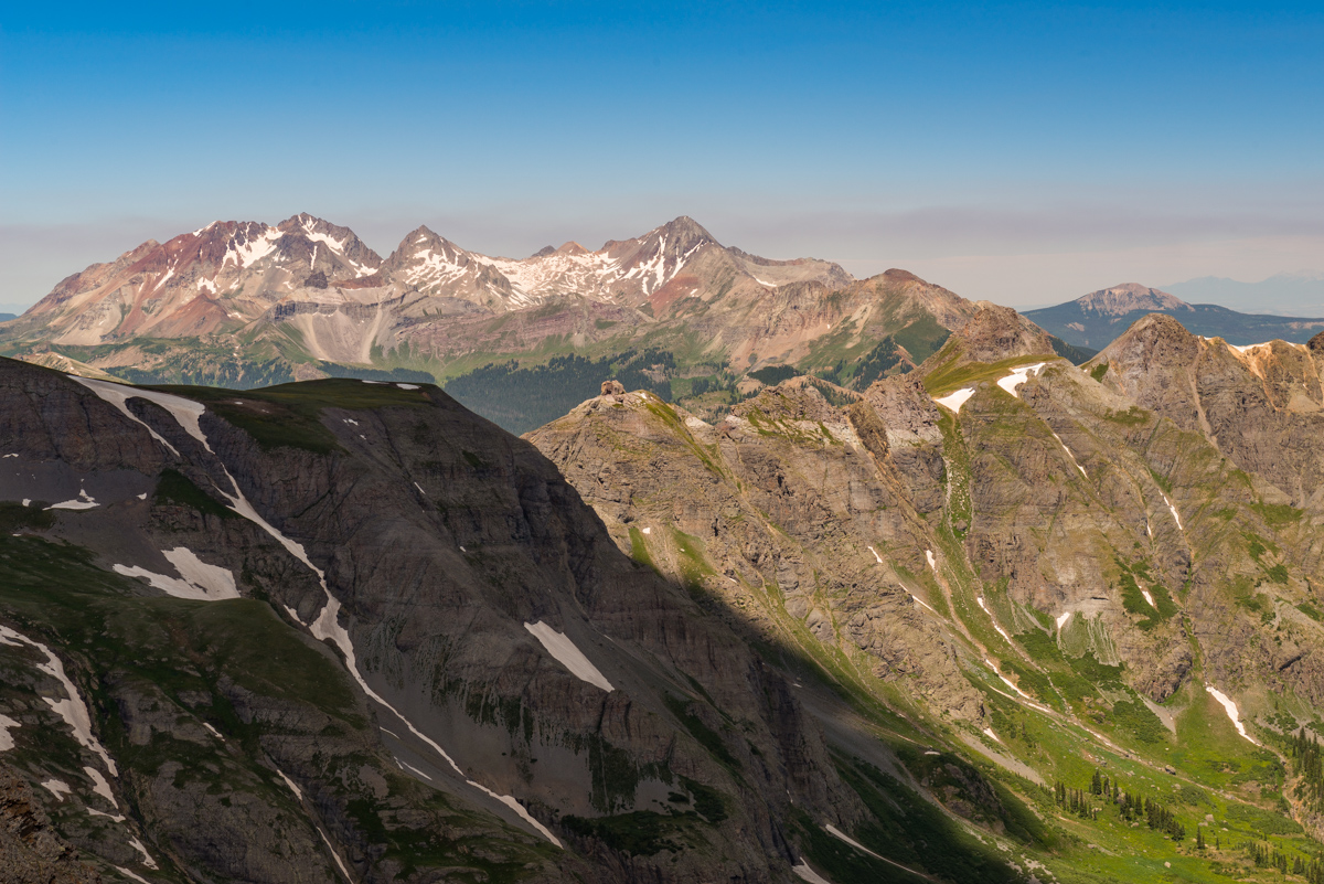
As I sat on Turret pondering life and getting my energy back up, I noted that the horizon behind Jagged Mountain was looking pink. There were a lot of low clouds, which was either going to spell disaster or complete success for photographing sunrise. It turned out to be a totally amazing sunrise to say the least. I would rate it as top three summit sunrises of my life, with the other two being North Eolus in 2011 and Uncompahgre in 2015, both of which I photographed (those links will take you to those photos). This one was pretty special though. The Grenadiers, including Arrow and Vestal as well as the Trinities were all nicely visible, accented by the Needles of Animas and Monitor. The sun was rising just behind Jagged Mountain and Rio Grande Pyramid and made for a really incredible showcase of color. Pinks, reds, oranges, and purples colored the sky and clouds. I am very proud of this one, which is available for sale on my photography website (click on it to follow there). I can't wait to print it up nice and big for display here in Durango.
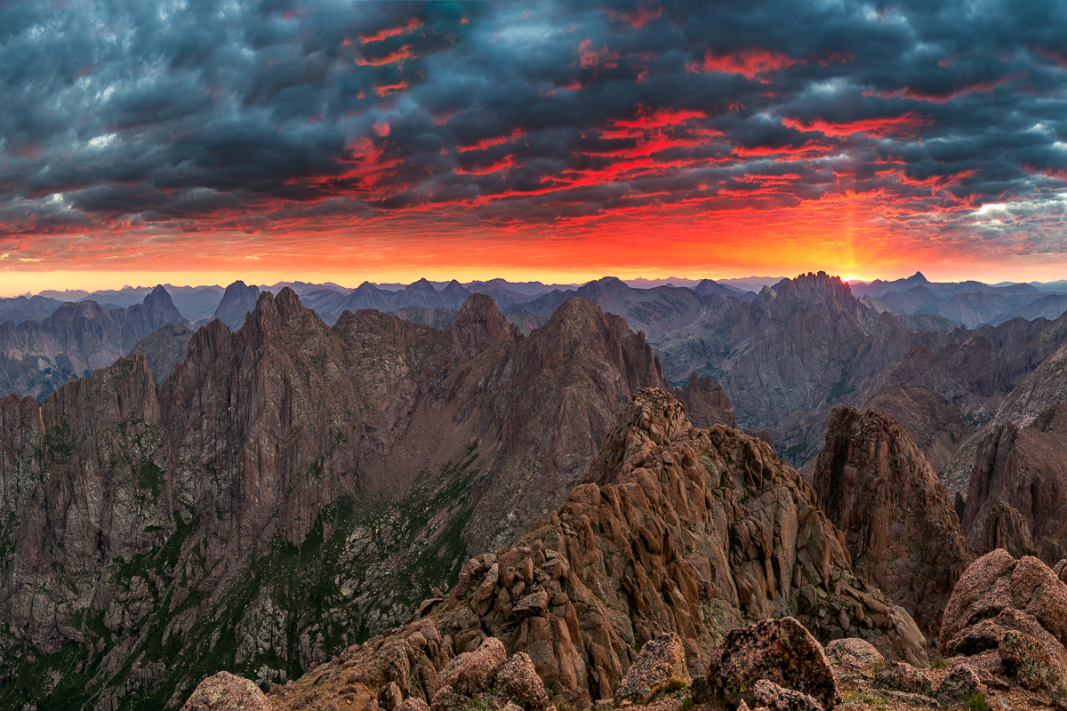
I was also able to get a nice panorama of this scene to include Pigeon Peak at left sweeping all the way over to the right to include North Eolus and Eolus. Unfortunatley, the light, sky, and clouds of about 1/2 of this scene were not very exciting, so I cut those out. Still - an amazing scene to say the least!
A few minutes later I was packing up to head down to the saddle again and noticed the light across to the La Plata Mountains and the Animas River below was looking quite nice as well, so I shot that.
Then I noticed the clouds above Jagged Mountain looking awfuly amazing, with beams of light come down through them from the sun. I guess I could spend more time up here.
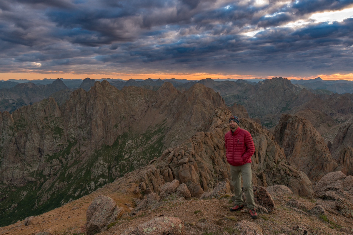
Lastly, I set-up for a quick self-timer shot of myself with some of my favorite peaks behind me. What a morning!
I packed up and set sights on my next objective - Pigeon Peak. I knew that in order to climb Pigeon from here I would have to descend down to the saddle and then down to another notch between Pigeon and a small un-named point southwest of it. After that, I would be forced to drop to 12,200 feet on the west face of Pigeon and all the way back up again to 13,972. I was not sure I could handle it, but the thought of coming this far and not getting Pigeon kept me motivated.
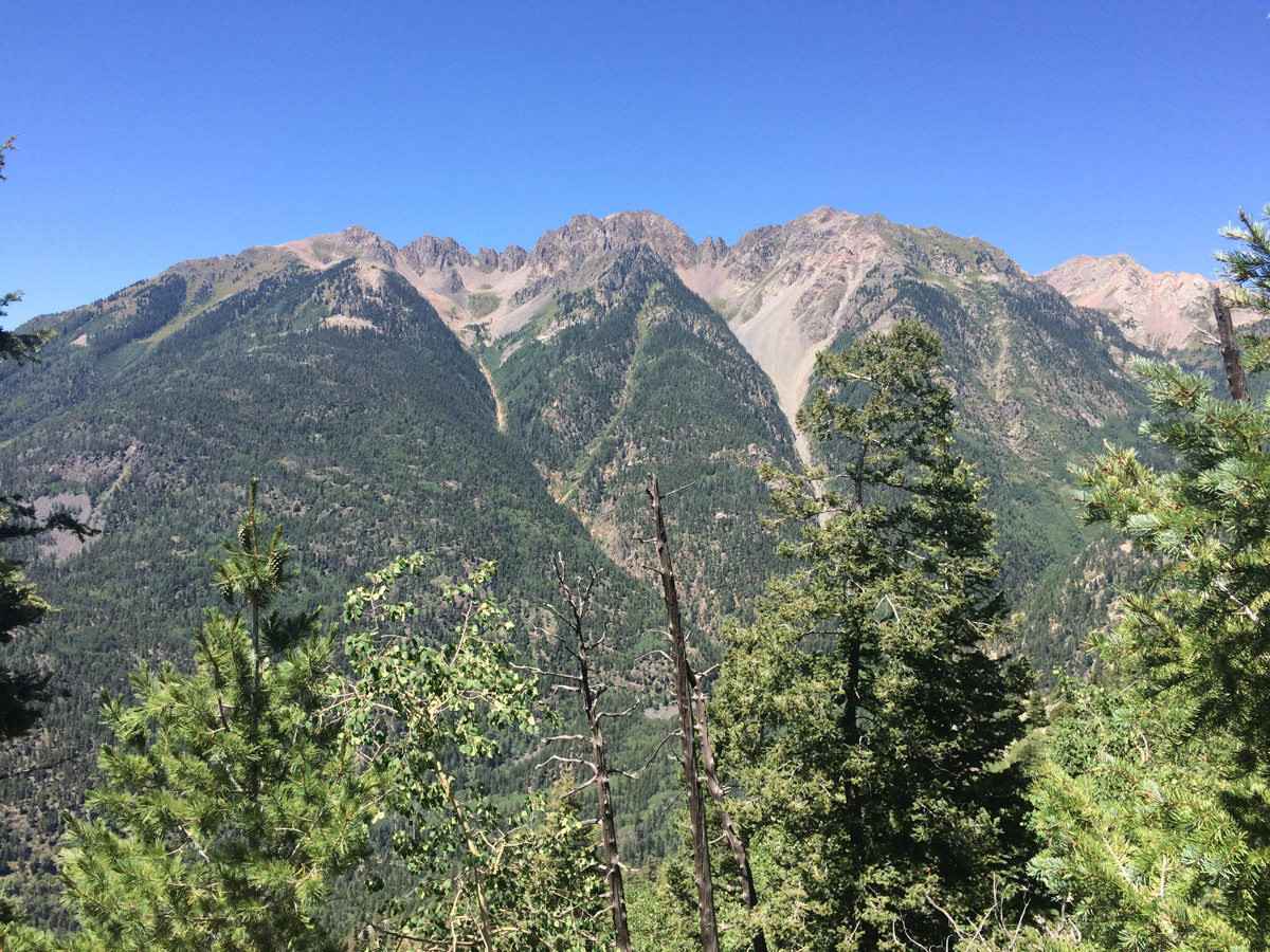
On the way down to the saddle, I enjoyed the light hitting the peaks around me and made a note of the small notch left of Pigeon, which was my next target (as seen just right of the large 'white' rock outcropping and below the illuminated peak in the photo below).
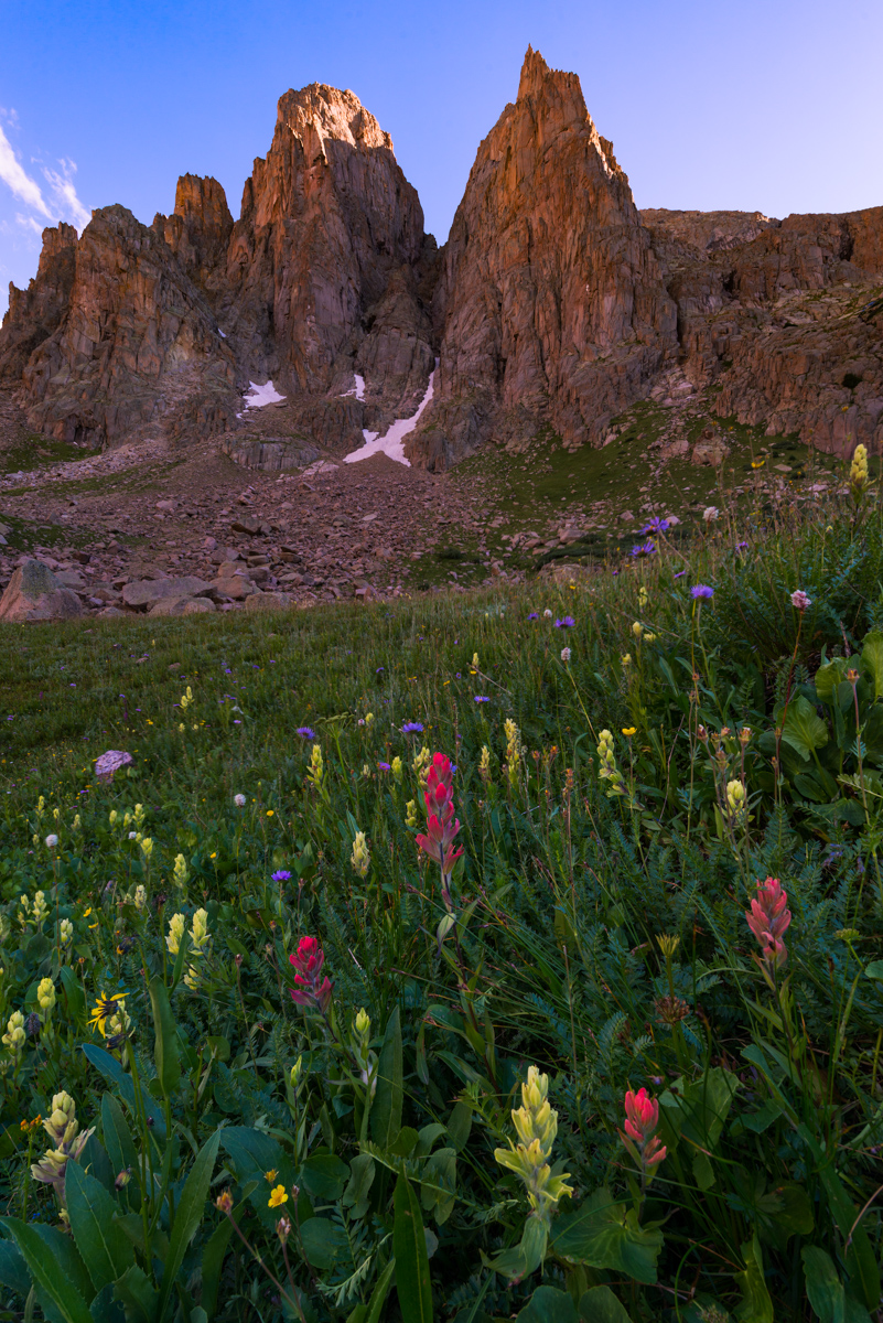
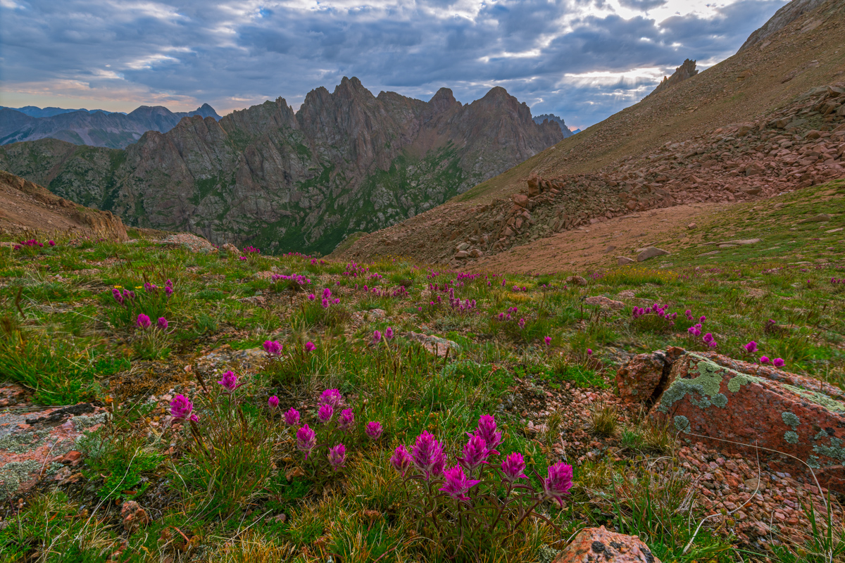
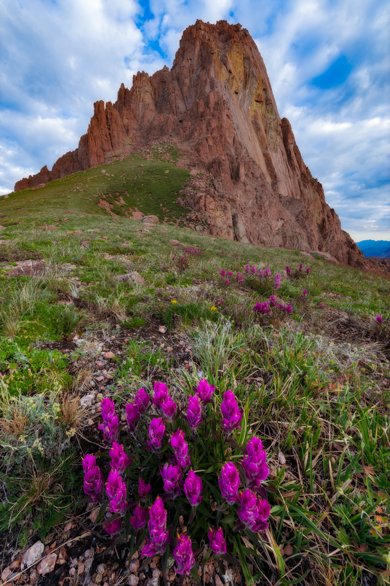
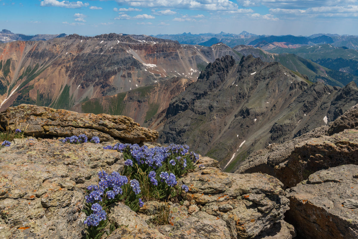
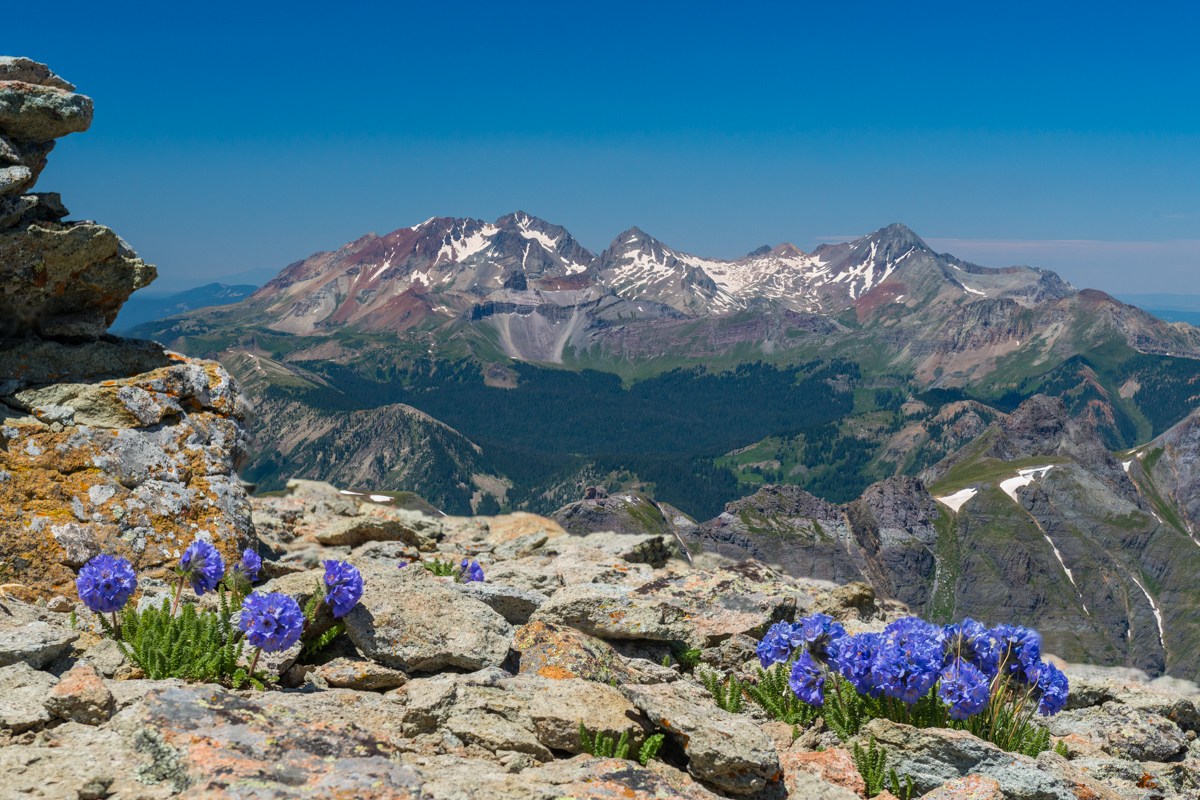
Reaching the saddle again was no problem and the scenery was incredible. The wildflowers at 13,000 ft. absolutely astounded me, in particular, these rosy paintbrush caught my attention.
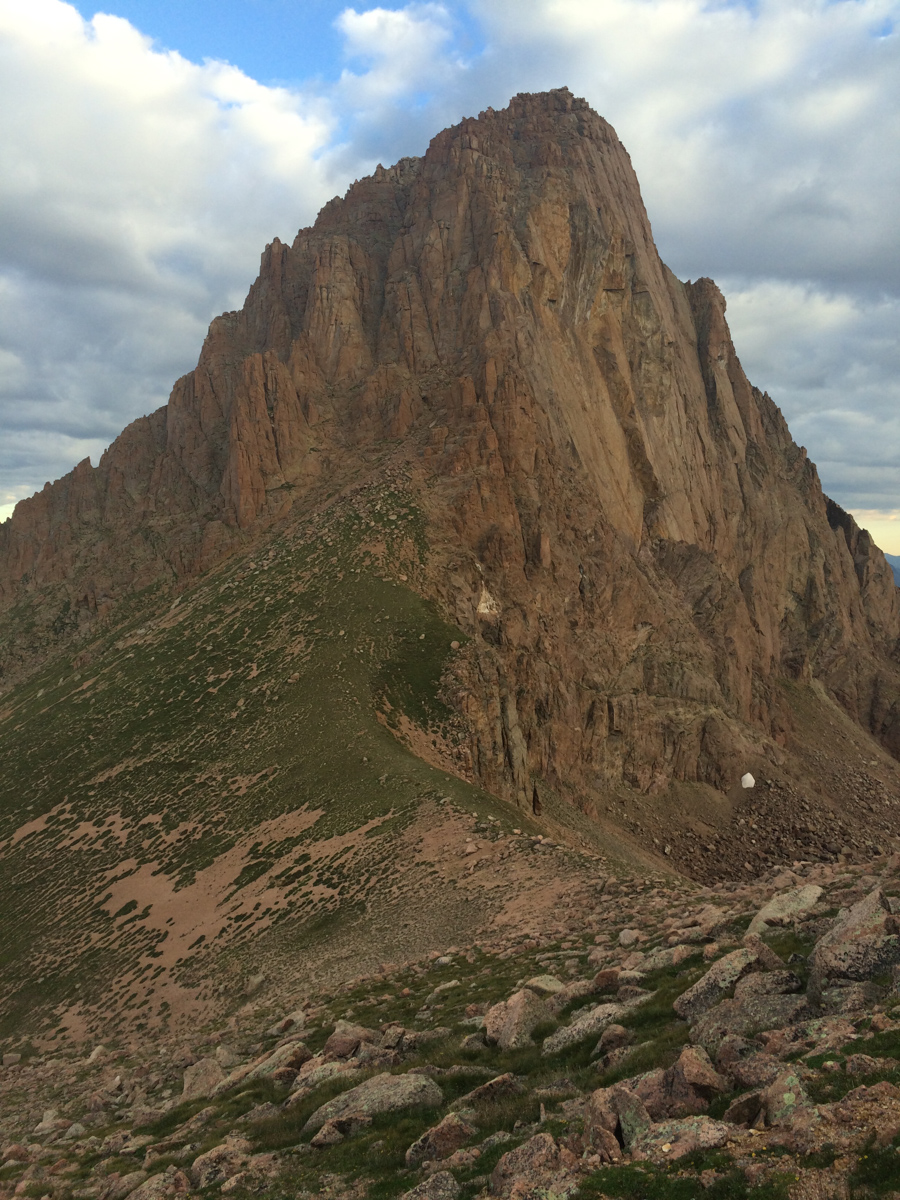
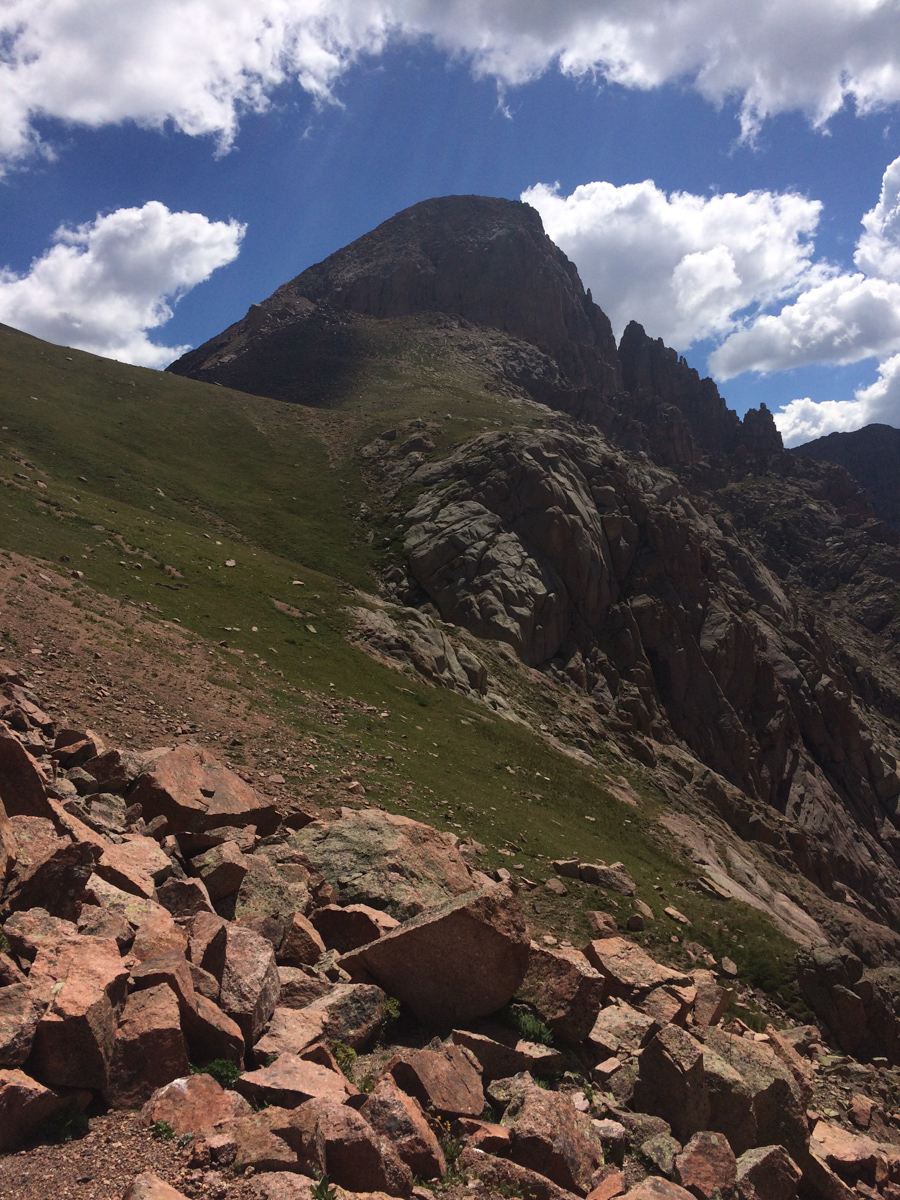
Pigeon towered above me as a reminder of the pain I would endure if I wanted to summit today. I could see how a confident and equipped climber could take this gully off the ridge, but it was something way outside of my comfort zone and ability.
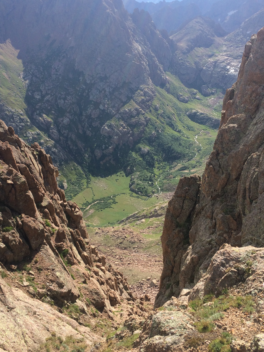
I descended from the saddle to my left towards the notch and reached it quickly. I undershot (went too high) the notch a little and had to downclimb some sketchy rock to reach the notch, which greeted me with a view west of West Needle and the Twilights. A look down to my next destination was demoralizing to say the least. It looked so steep, and knowing I'd have to come back up it was not a welcoming thought.
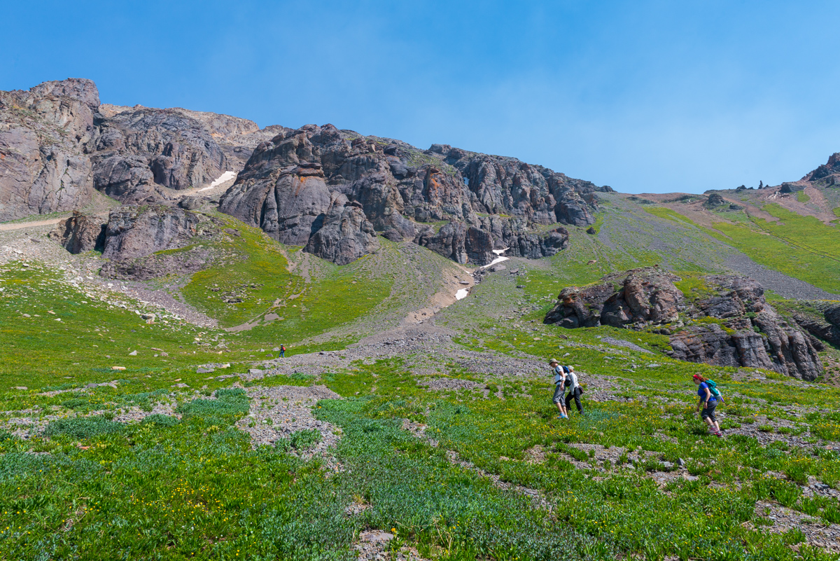
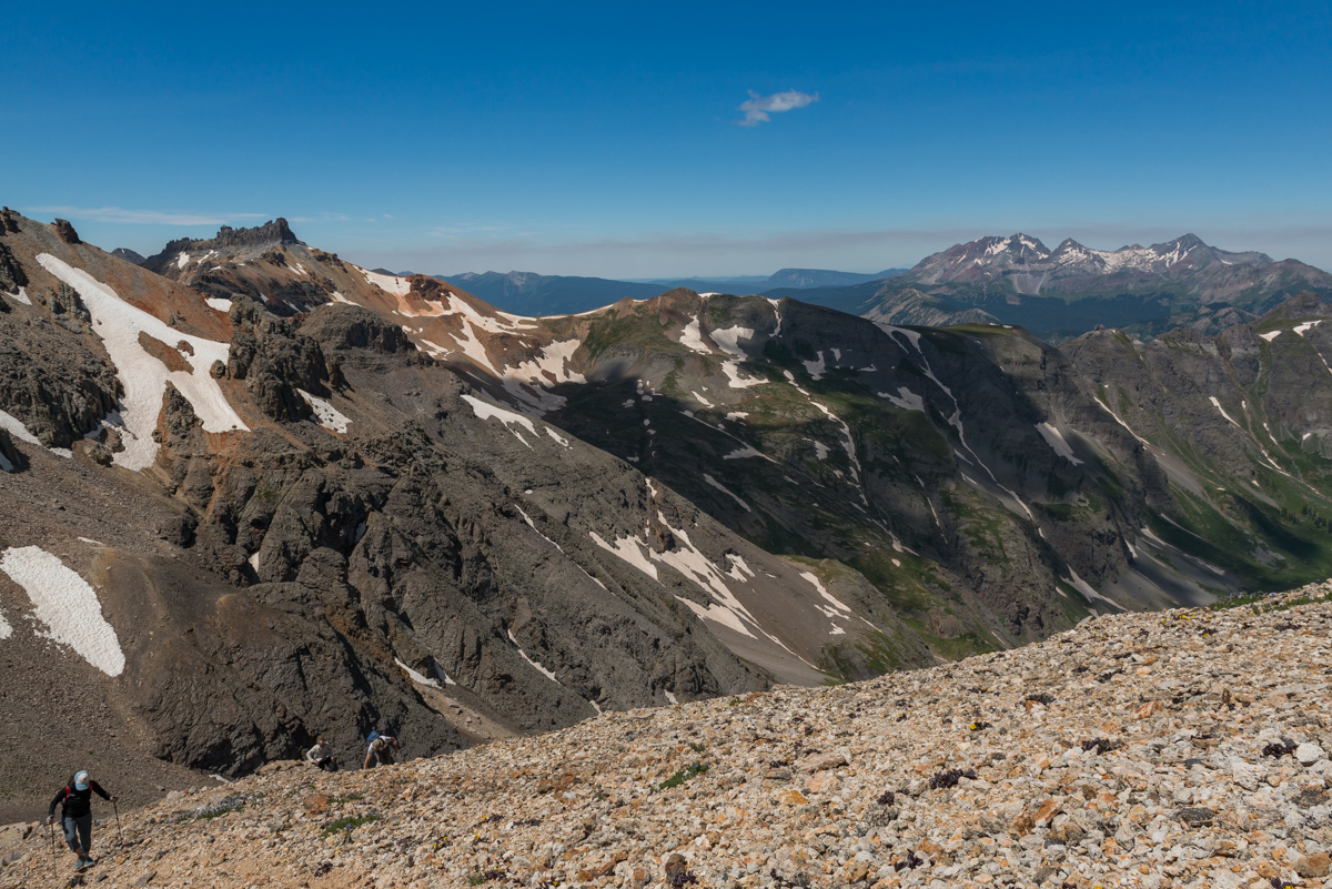
I reached the bottom of the descent without any issues and wrapped around the side of Pigeon to find myself at 12,200 feet with another 1,700 feet of gain to go on un-marked terrain. My legs were tired. I was hungry and tired. The clouds were concerning as well. Everything looked OK to my west, but I could no longer see to the east. The climb up the steep grassy dirt was awful. I had to stop about every 30 steps to catch my breath, which was not normal for me, but understandable given how long I'd been out. I was eventually passed by a young man and his dog that had came up from North Pigeon Creek. He flew by in ease. Jealous.
This young man and his dog stirred up some mountain goats while I pontificated my ability to finish, all documented in a quick video on my phone:
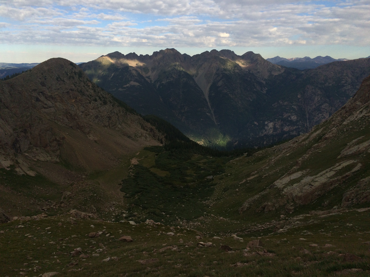
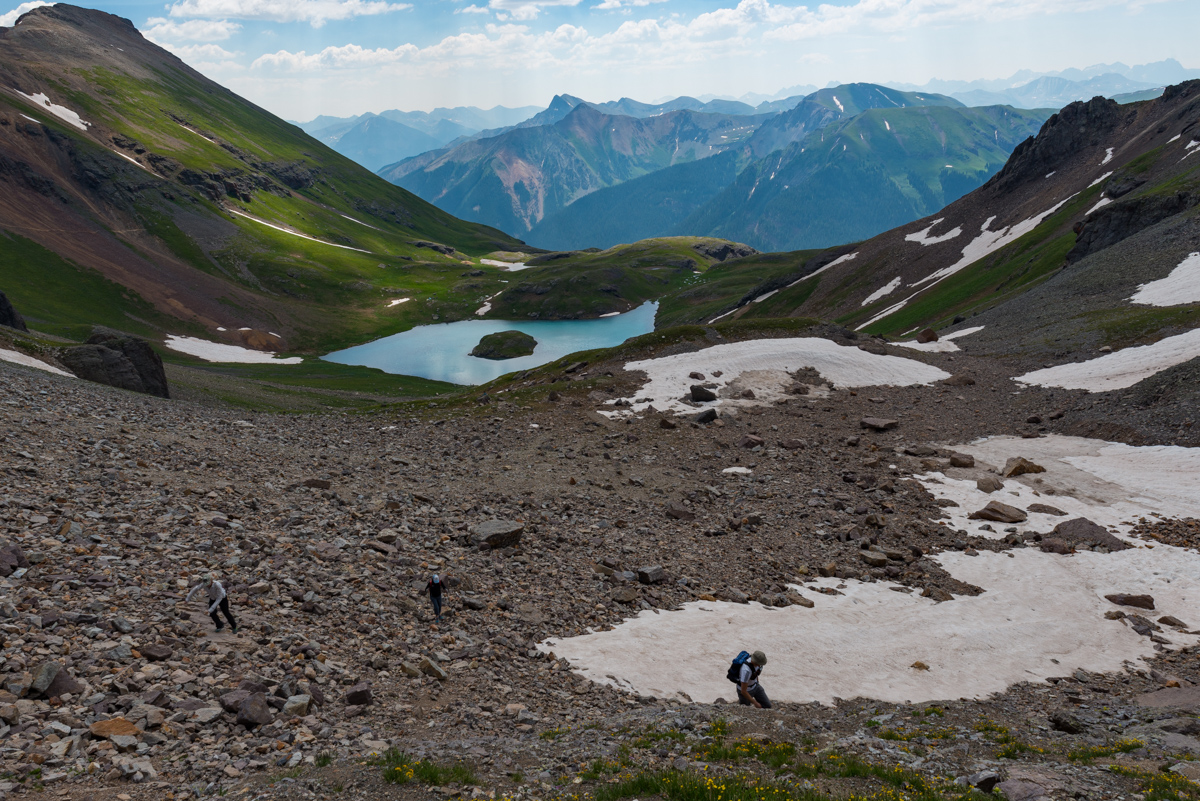
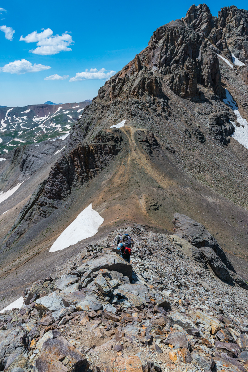
Alas, I was able to reach the top of the long gully leading up to a notch that looked back down to the meadow in upper Ruby basin and my campsite, some 2,000 feet below.
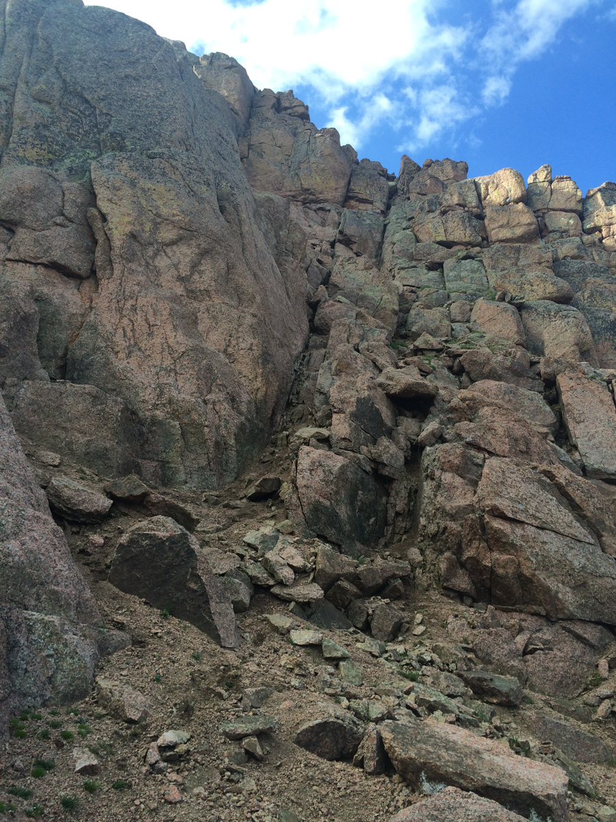
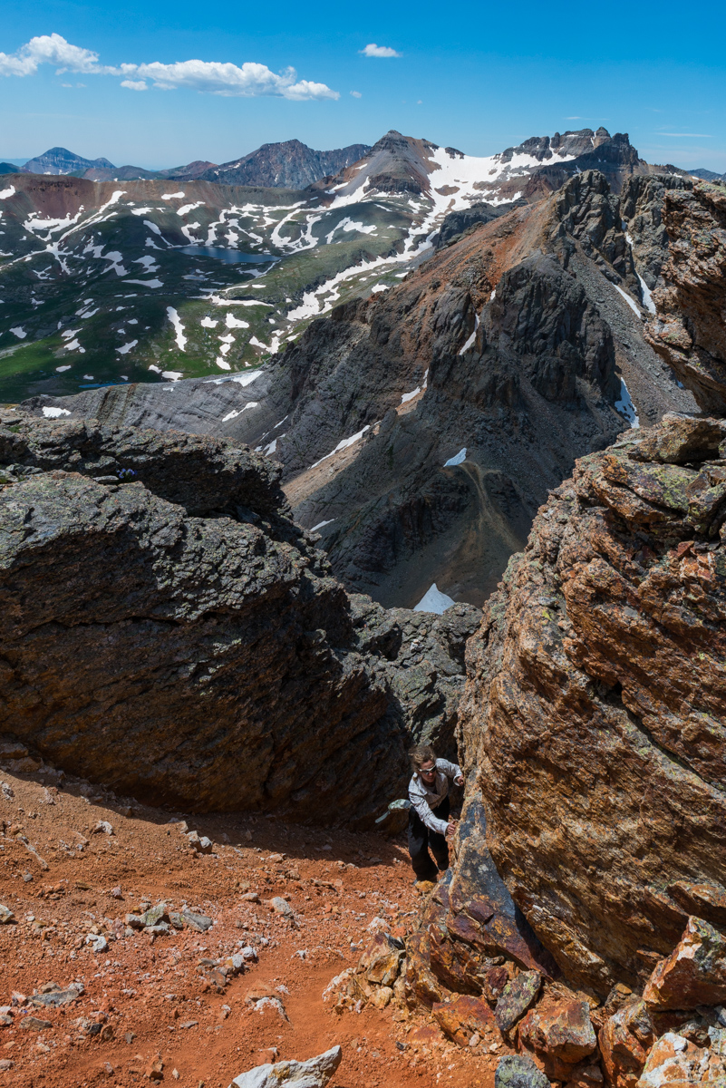
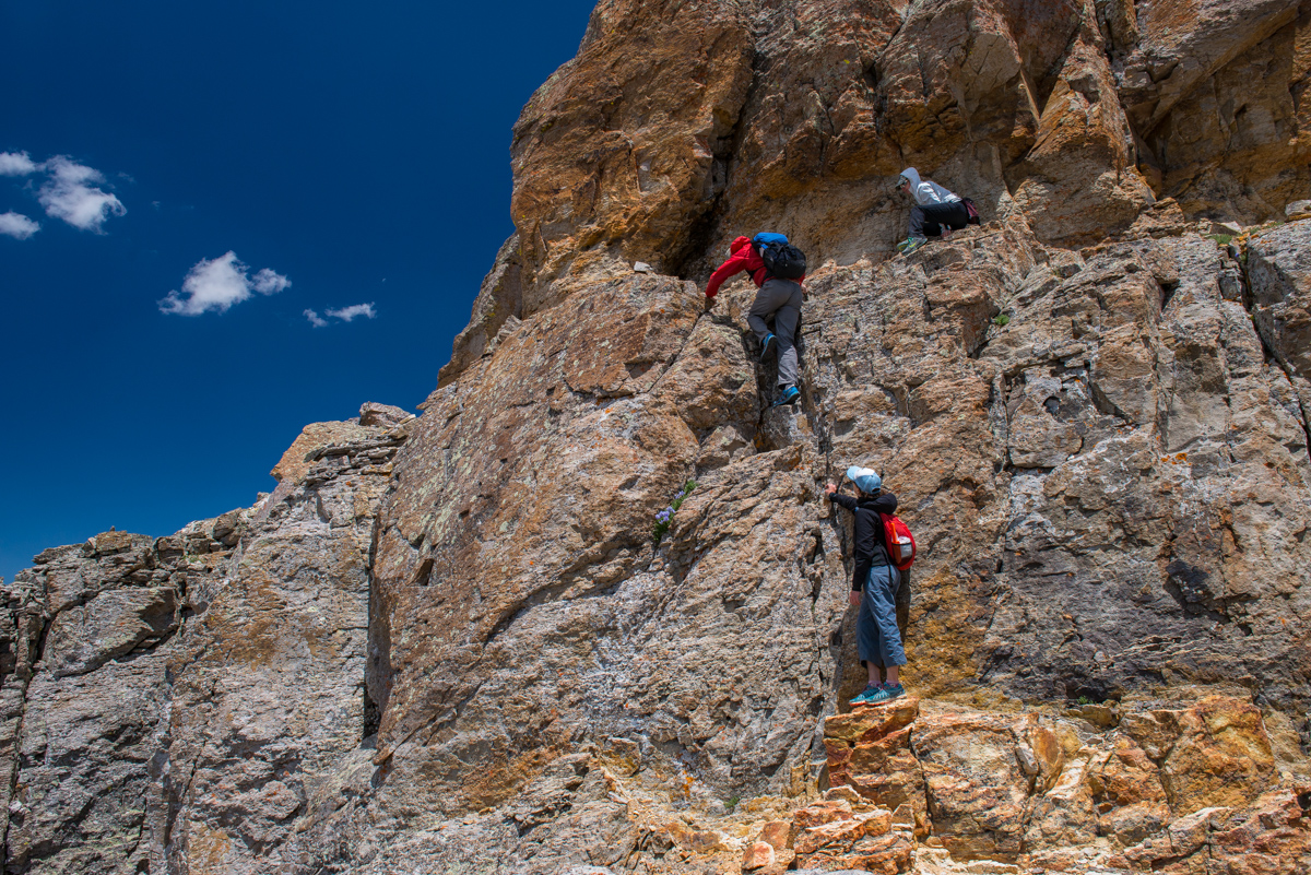
I quickly found the class 4 weakness in the summit block, just right of the terminus of the gully at the top of the grassy dirt slopes and made it over there in no time. Navigating the actual class 4 section was another story though. I enjoy exposure more than most; however, I found this move to be quite challenging, especially with all that camera weight on my back. I actually thought about leaving my backpack there but reminded myself of a classic Gerry Roach saying, "never leave your lunch," and kept it on. The class 4 section was only two or three moves deep, but there was a slight overhanging feel to the rock and the holds were a bit awkward for me. I think being alone played a part in making it feel harder than it was as well. A mistake here would have been fatal.
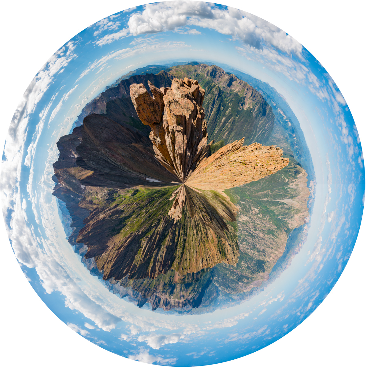
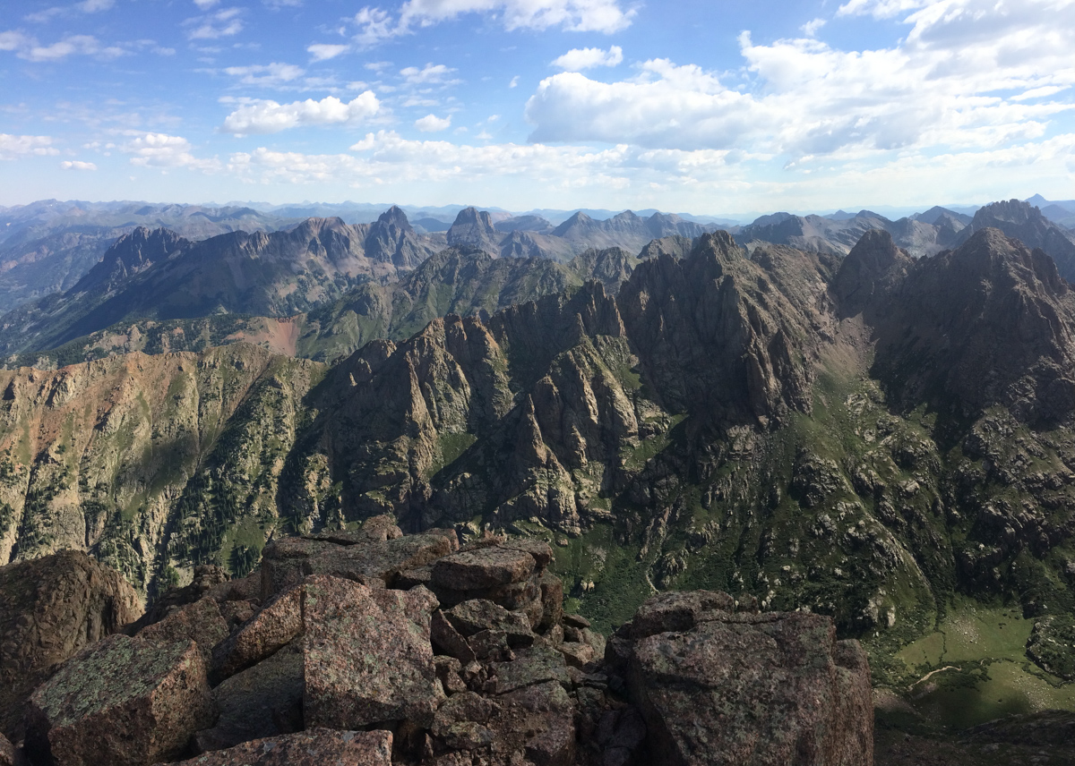
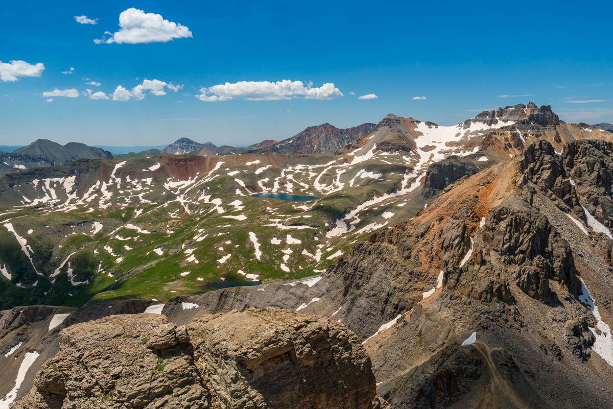
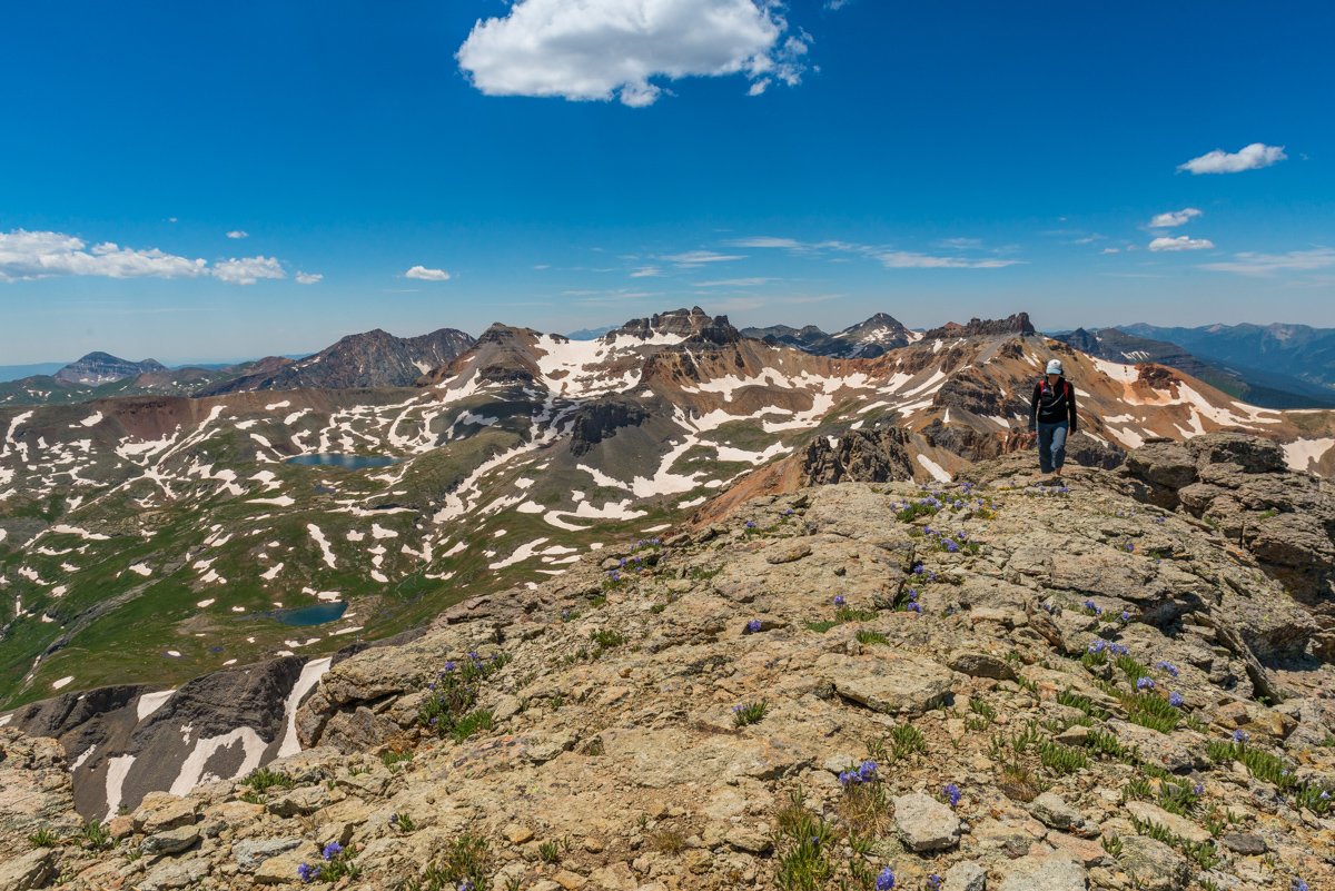
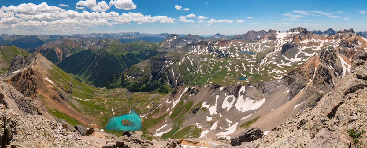
Alas, I reached the summit and enjoyed the view from my 89th Centennial. Only 11 to go! Here's a 360 degree view from Pigeon.
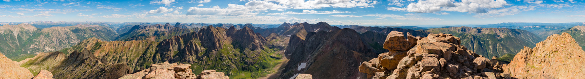
And here's the same photo made into a planet to show a different perspective.
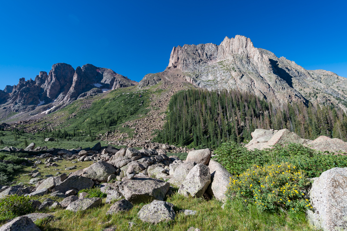
The Grenadiers looked amazing as usual. I still think the view from Arrow Peak looking back towards Pigeon is the best I've had. Unbelievable.
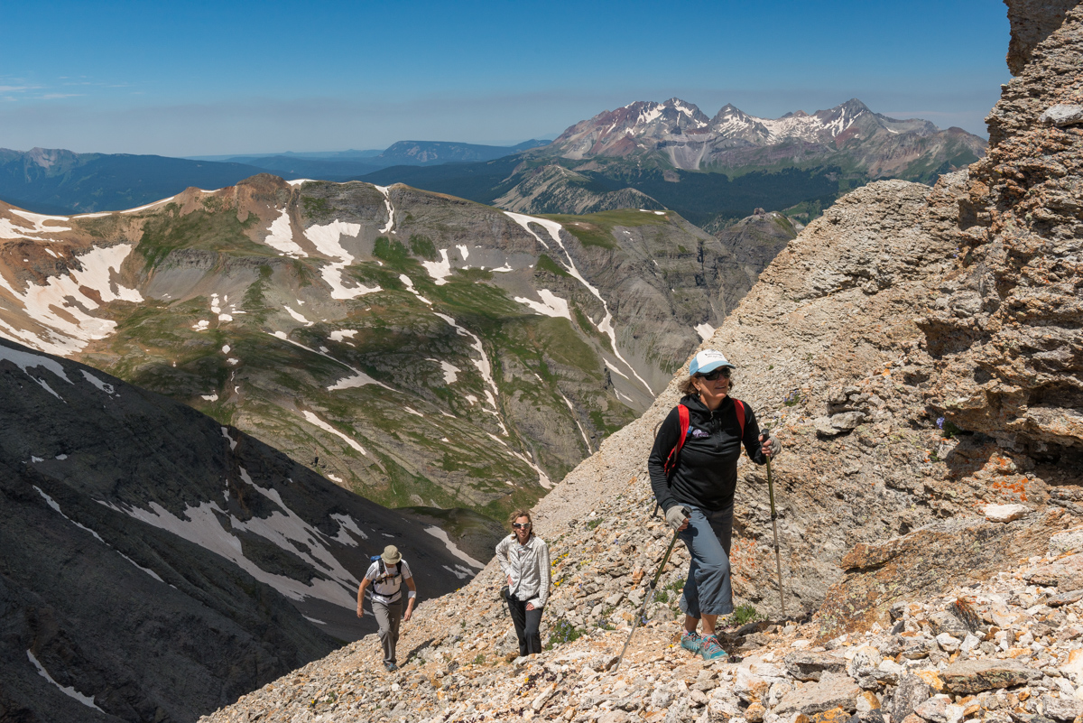
While the clouds did not seem too threatening, I was quickly reminded of just how much more work laid ahead of me before I was safely back in my tent. I still had to safely downclimb Pigeon without dying and then make it down 1,700 feet and back up again to the Pigeon - Turret saddle, and then back down to upper Ruby basin. Yikes. I departed without delay, eating as I climbed down. I serendipitously found an alternative route to the class 4 route by following some cairns to the left of the class 4 section which was quite a relief since I did not really want to go down that way. The class 3 alternative was much easier to downclimb and brought me back to the same general area to allow a safe descent back towards North Pigeon Creek, which went quite quickly following the loose dirt and scree. I re-climbed up to the lower saddle below Pigeon in less time than I thought I would need and found myself gazing back up at Turret. My legs were feeling the burn to say the least!
Upon reaching the saddle between Pigeon and Turret, I ran into two young hikers I had seen on the train the day before. I talked to them for awhile and learned that they had camped at Ruby Lake and were thinking of ascending both Turret and Pigeon. I gave them some tips and it seemed as though they were going to just head up Turret for the day. I was starving and exhausted and told them I was going to go pass out in my tent. I quickly descended down towards the basin without any issues except for the constant feeling of hunger. I could not keep enough food in my system. To make it worse, I had really painful and annoying heartburn, I think caused by drinking Gatorade, but who knows. This later was quite annoying at dinner because I could not eat all of my food - I felt like I wanted to throw it up after every bite despite wanting to devour it. Maybe I was eating too quickly?
Making it back to camp was a great feeling and I had the whole meadow to myself.
Except for the five goats that joined me later on after I napped for three hours in the nude.
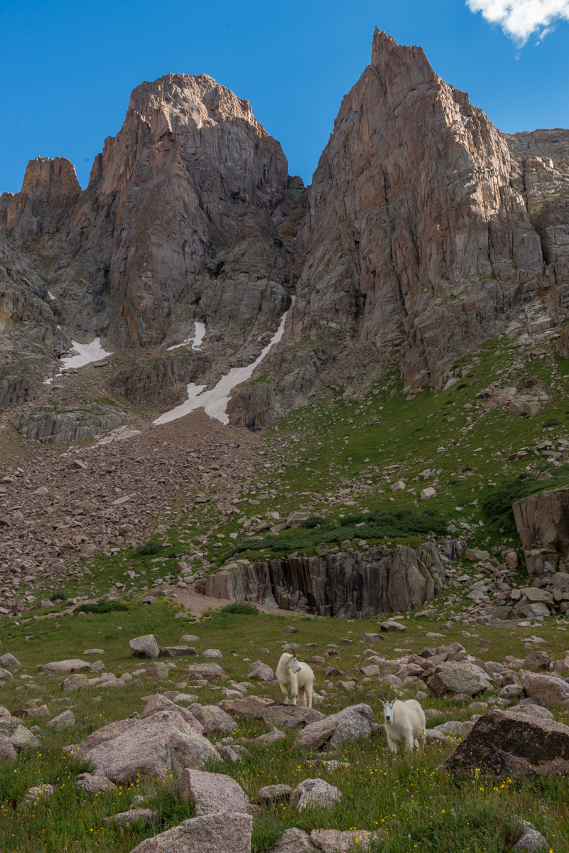
These goats were foraging around my tent pretty much all evening and night so I made the most of the situation and filmed a timelapse of the mountain goats grazing for about an hour long.
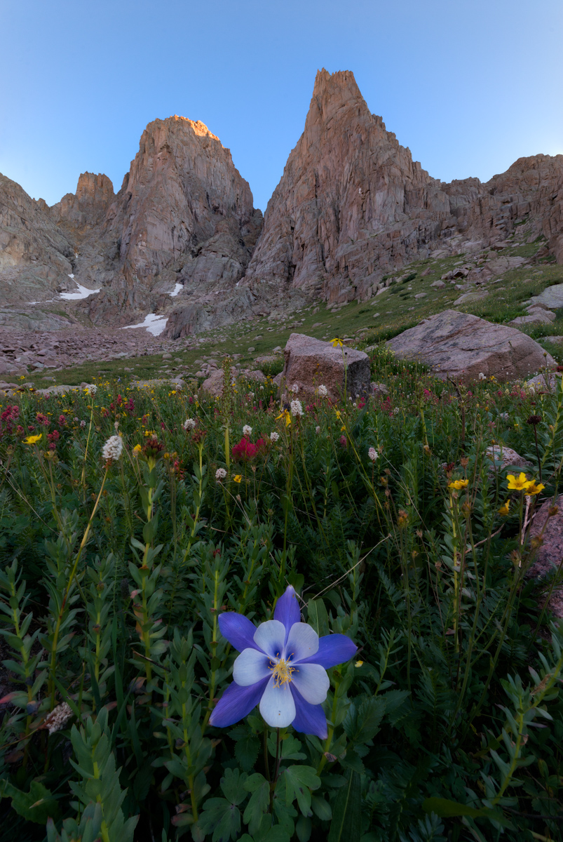
After filming the goats and eating dinner, I decided I still had some energy left in me before bed, so I found some flowers to photograph and some spots to shoot for sunset. I was particularly happy with how this photo of a single columbine flower turned out below Turret Needles.
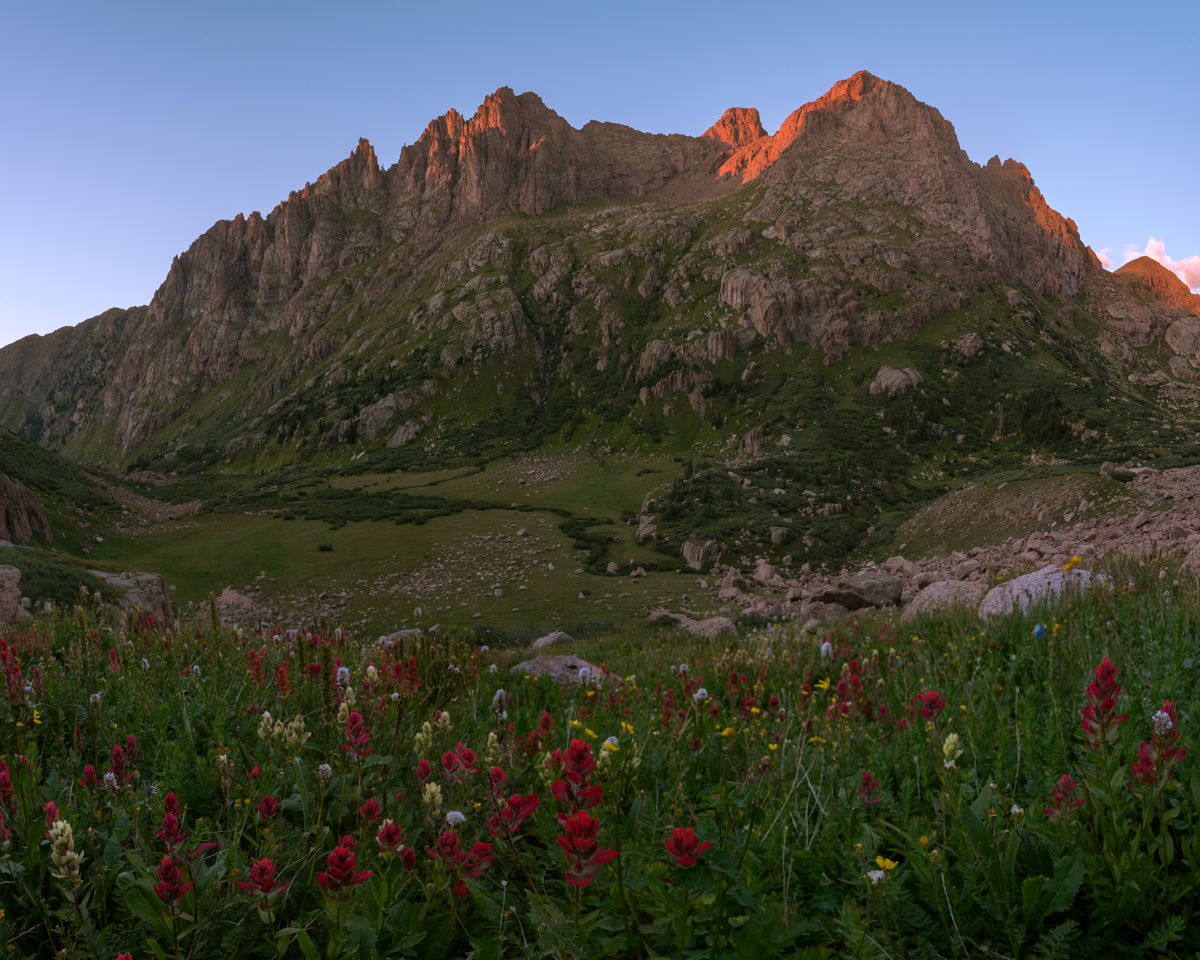
Sunset was pretty remarkable, especially with the assortment of wildflowers at my feet above my campsite, which you can barely see in the middle of the photo.
After photographing sunset, I was ready to turn in for the night. My heartburn kept me up a lot of the night, which was incredibly frustrating given how exhausted I was; however, I did get some pretty solid sleep from about 2 AM until 6 AM, at which point I was woken up by some heavy breathing outside of my tent. I opened it up and found a large mountain goat staring right into my door. I tried to get a photo of him, but he lazily scurried off before I could. I made some coffee (the Starbucks Via Blonde Verdana is pretty amazing), packed up, and photographed sunrise.
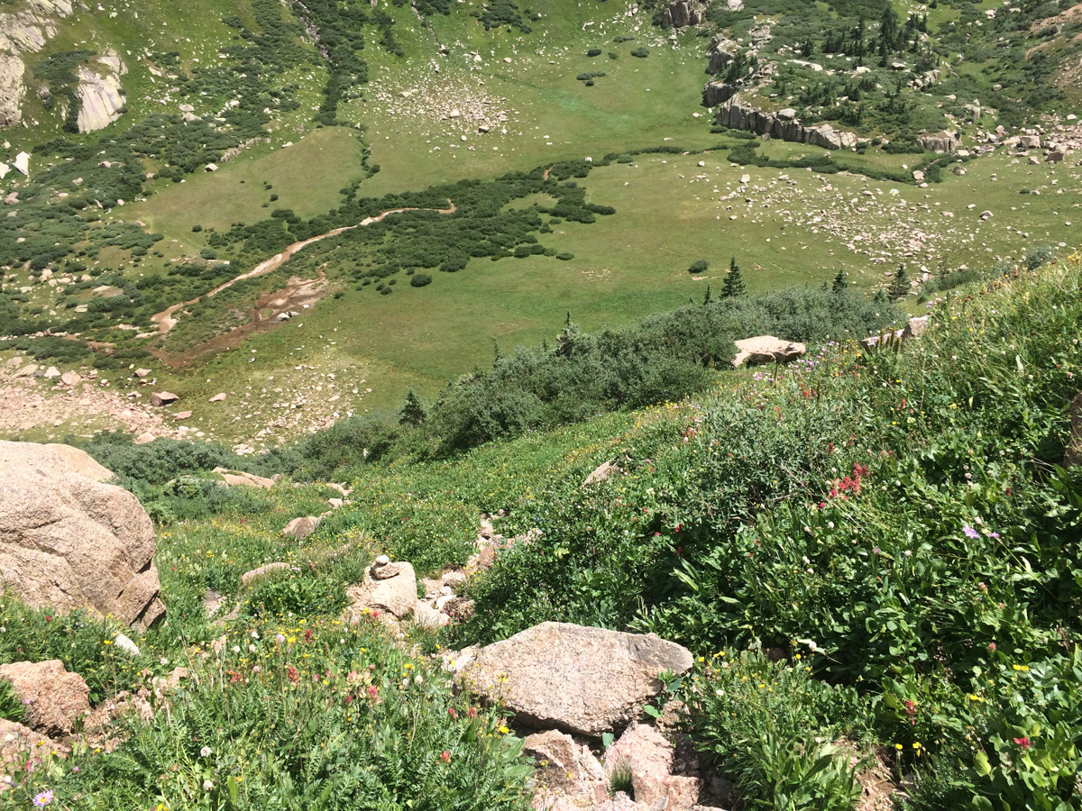
I left my campsite at 9 AM. Even though my train was not supposed to pick me up until 3:30 PM, I wanted to get down earlier to try to get on an earlier train. The views down were just as good as going up and Pigeon dominated the scene.
I made it down to Ruby Lake quite quickly and ran into those two climbers from yesterday, named Jacob and Rose. Turned out that Jacob works for the train and Rose attends Fort Lewis College. Really nice kids! I then later learned that one of my employees at work is married to Jacob's cousin. Small town!
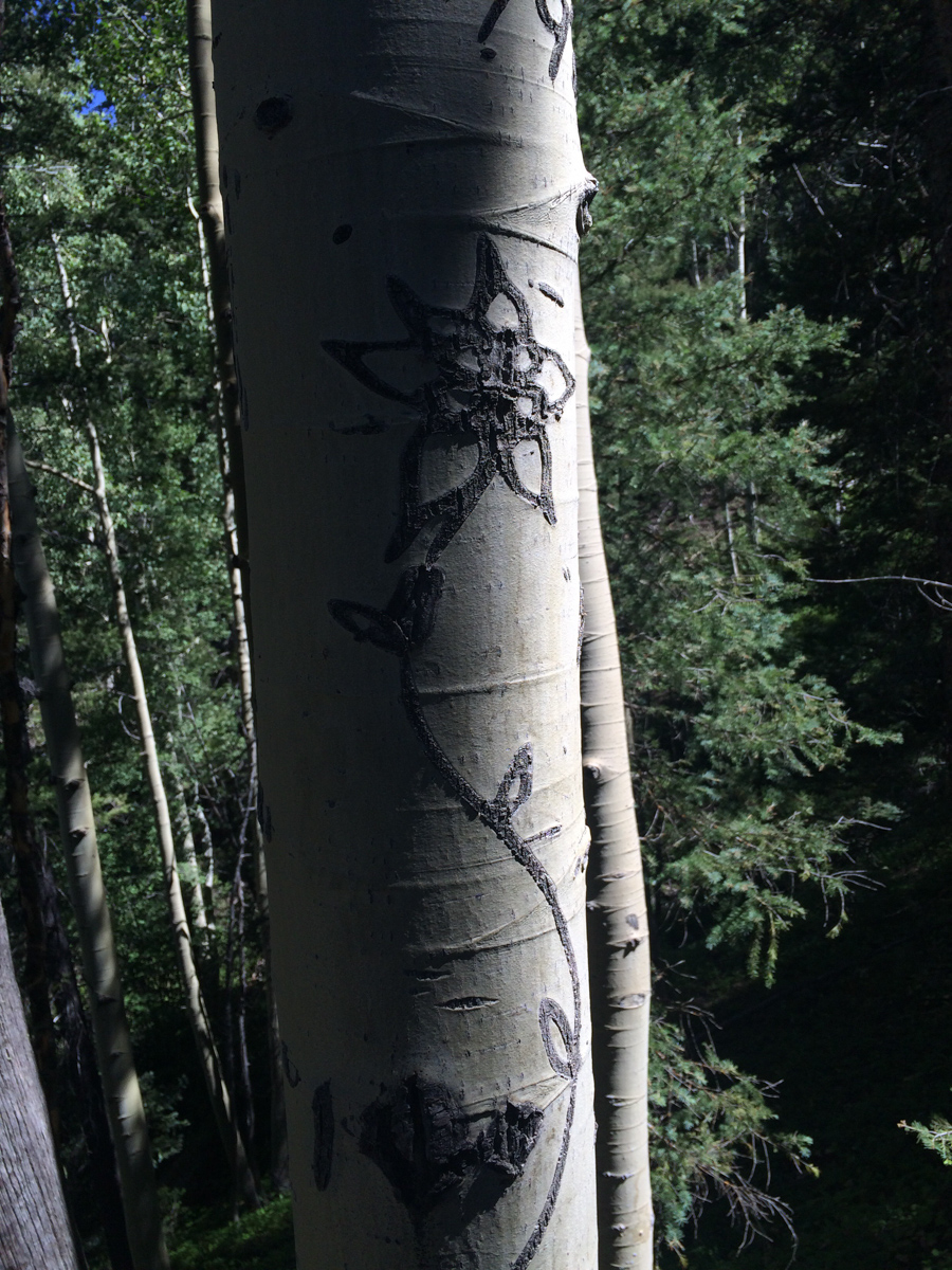
Routefinding on the way down was not as hard and I even found the tree with the Columbine carved into it - which is noted nicely on my GaiaGPS track.
I made it back to the bridge crossing the Animas at 12:05 PM without any problems and found myself among several other people waiting for the train. Apparently the train had derailed in Durango and was an hour and a half late. I wound up waiting there until 4:30 PM while hanging out with two guys from Arkansas, one of which had just moved to Greely, Colorado for work.
Once the train finally arrived heading to Silverton (I did not board this one), it was a mad dash to get on board.
I ended up riding on the train with Jacob and Rose and we had a nice talk about how great it is to live in Durango and how lucky we felt to be this close to such amazing mountains. Life is good.
Adventures in Silverton, Colorado: Backpack to Island Lake and summit U.S. Grant Peak
After visiting Ice Lake Basin in August of 2013, I knew that I had to return to the area to photograph the wildflowers there at peak season (mid-July). After moving back to Colorado in November of 2015, I knew that one of my first destinations would be the Ice Lake Basin area. I also wanted to get my wife into backpacking so I got her equipped with some light gear and we both began exercising together to get ready for the primetime hiking season. Since my wife was new to backpacking, I decided to get our pack weight as low as possible. My friend Todd Myers loaned us a great book on Ultralight Backpacking by Mike Clelland which offered some great tips to get our weight down. The items I picked up for my wife included a new sleeping bag, a new sleeping pad, and a new backpack. We were able to get her pack weight under 15 lbs, which I think is a huge success. Here's the short list of gear we picked up for her:
1. REI Joule Women's Sleeping Bag - my wife sleeps super cold and this bag kept her nice and cozy at 12,500 ft, and it only weighs 2 lbs 2 oz. Success.
2. Therm-a-rest NeoAir XLite Sleeping Pad - while this is probably the lightest sleeping pad I've ever seen and it packs down to almost nothing, my wife complained it was a bit too small. Get the longer version.
3. Osprey Tempest 30 backpack - this pack was the perfect size for what she was carrying and weighed under 2 lbs. Awesome.
For myself, I picked up a new backpack as well, the Osprey Exos 48 - a perfect size pack for a tent, bag, pad, food, cookware, and my camera system.
We weighed all of our gear using a kitchen scale and used the awesome gear planner from Erik the Black to calculate our total weight. The whole planning thing helped my wife get into the ordeal and get excited, I think.
Lastly, we invited some of new friends from Durango, including Todd, Autumn, and Ellen. Good times were for sure going to be had! From my last adventure up to Ice Lake Basin, I knew about a shortcut by taking the road up to Clear Lake and then parking at the 1st switchback. This saves about 1,000 feet of total climbing. We arrived at the small parking area, which was empty (a good sign for sure). Our adventure began immediately by crossing the strong creek coming down from Clear Lake. This was my wife's very first stream crossing and she did it like a champion. The trail was steeper than I remembered and my wife struggled a great deal on the way up, but our group was supportive and I was SO proud of her determination. She rocked it! As we entered lower Ice Lake Basin, we had a decision to make - to continue on to Ice Lake Basin, to stay at the lower Ice Lake Basin, or to go to Island Lake, which was somewhere I had never been. The group unanimously voted to go to Island Lake since we anticipated the weekend to be quite busy with wildflower peepers and we thought Island Lake would be a little less busy. I personally had no problems with this since I could head over to Ice Lake no problem to take photos if I wanted. We made quick work up towards Island Lake as sunset approached and I captured a shot of the last light as we gained elevation quickly. The wildflowers were insane. By the way, you can check out the map of where we went and the GPS / GPX file over on Gaia GPS, who generously gave me a free Pro account. I love Gaia GPS - such an awesome app! You can purchase it here and help support the site.
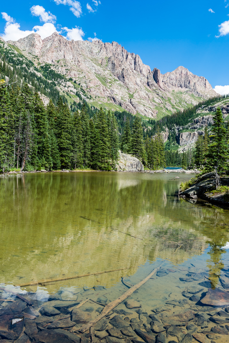
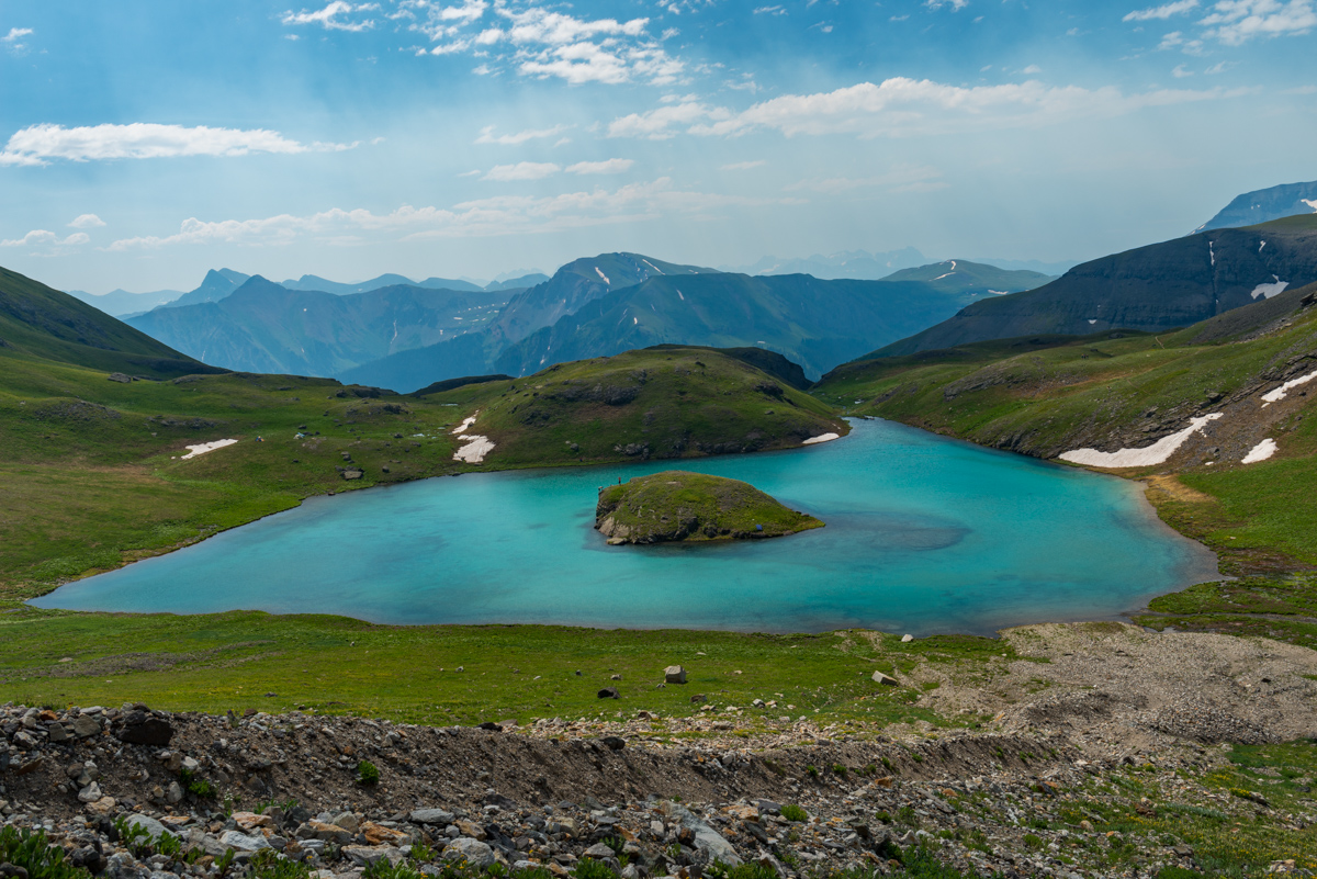
Upon arriving in the upper basin near Island Lake, the whole area opened up to the South and East, revealing views of the Grenadiers, the Chicago Basin 14ers, and Rolling Mountain (right). As you can see, the yellow paintbrush were stunning.
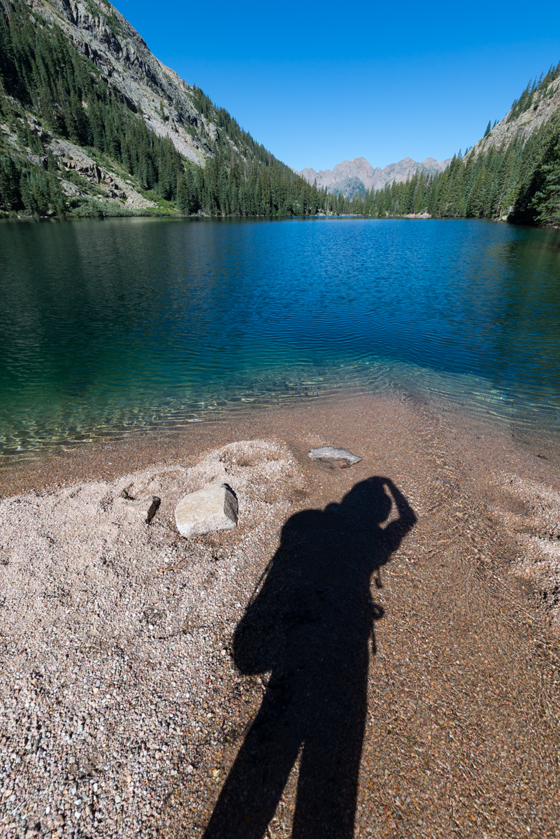
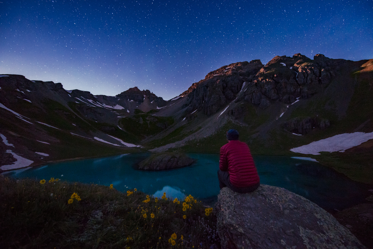
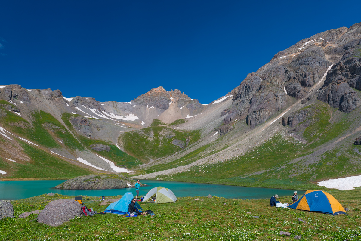
Our group found a great spot right by Island Lake to camp and we proceeded to get set-up. We were alone at the lake (or so we thought) and just loved the solitude. I knew that I would have some great opportunities for some photography at night - I had studied the projections for the moon's brightness, location, and time of rise/set as well as the location of the Milky Way and the time it would rise and set - all using a handy app called PhotoPills. Since the moon was looking to be quite bright and nearly full, I knew that I would shoot in two sessions - early at night for the bright moon illumination, and later in the very early morning after the moon had set. So - I set off to take some photos using the bright moon light to provide some ambient light in the basin. The Milky Way was barely visible, but the moon provided some light to bring out the flowers in the basin and the summit of U.S. Grant Peak.
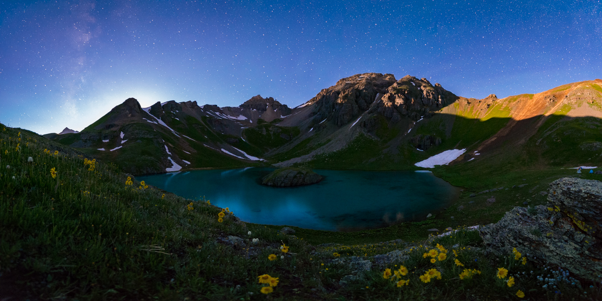
The lake was mesmerizing. I could sit there and take it in for hours.
After wandering around for awhile taking photos, I decided to re-join the group at our campsite and go to bed. I set my alarm for 2 AM so that I could find a cool spot to photograph the Milky Way. Sleep is over-rated. None of us slept all that well - it was eerily quiet and everyone could hear everyone else move in their bags, open and close zippers, etc. It was pretty tough to get any sleep. I got out of the tent at about 1:45 AM and looked for a good spot to shoot the Milky Way, as planned. I found a little shallow lake nearby that had a nice view over towards the Ice Lake Basin 13ers. I was able to find a way to place my tripod in the center of the lake (it was really only about 3 inches deep), and loved how I could get the reflection of the Milky Way in the water. An amazing sight, for sure!
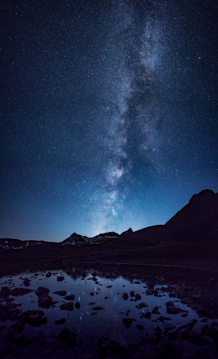
I really wanted to get a 180 degree panorama of the full Milky Way reflected in the water, and was able to pull it off after some work on my settings. The airglow (those high, green looking clouds) was looking awesome as well.
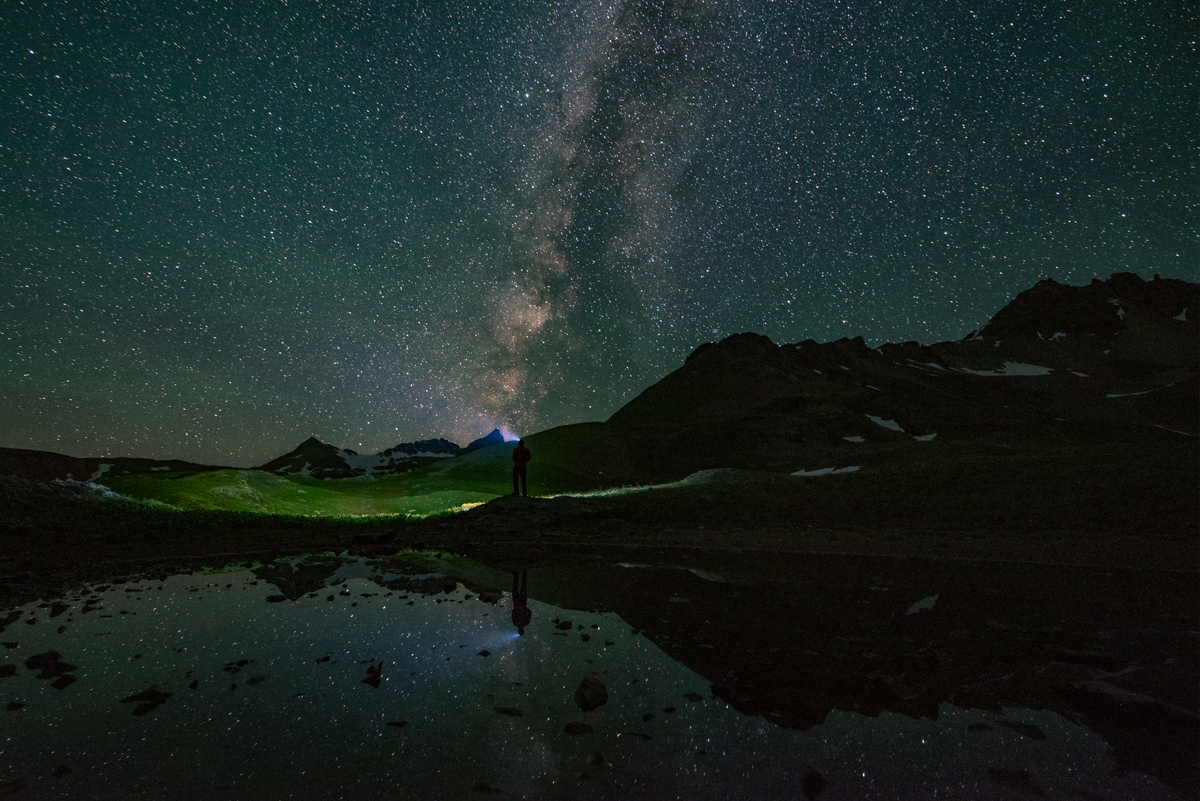
I played around a little with my headlamp as well, wanting to add a human element to the scene. I think it worked out pretty nicely.
I went back over to Island Lake to set-up for one last shot before going to back to bed. This was a photo that I shot as a tattoo concept that I have been thinking about for awhile - imagine the flowers or a campfire at the bottom on the wrist and then the tattoo works its way up the arm to the mountain and then the Milky Way. I think it would look great, personally.
I went to bed again around 4 AM, getting about 4 hours of sleep total. We all woke up and enjoyed the amazing view from the lake and noticed some hikers heading up U.S. Grant Peak. I threw out the idea of doing the same and everyone agreed to give it a shot. So, we made breakfast and got ready for an adventure up U.S. Grant Peak. Normally I do a lot of research before climbing any peak; however, for this one, I decided to just see how things would go and turn-around if needed. I knew there was some challenging class 3 or 4 sections but had no idea what would be in store for us. Exciting!
Off we went towards U.S. Grant peak - our goal was to gain the saddle between the two small areas of snow to the right of the peak above the lake seen above.
While we were hiking up there was a large group of day hikers having a bit of fun on the island - one even took a backflip off the lake. I'm thinking that was pretty damn cold. More on that later.
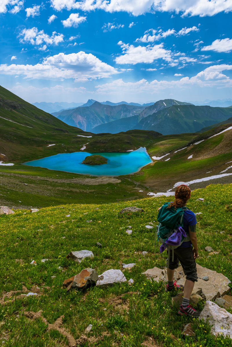
We reached the last section with grass and that is where my wife decided to rest while we continued on. She had an amazing view to take in.
There was a very lightly travelled trail up to the ridge up the muddy dirt and scree. My legs were feeling great so I took the lead, which was awesome because then I could stop and take photos of my friends climbing up. This was a particularly memorable climb because it was Autumn's first mountain climb in Colorado, one I'm sure she will remember.
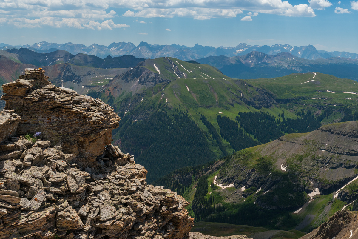
The higher we got, the better the view was, which eventually opened up fully to reveal the San Juans in their glory, from Pigeon all the way over past Vestal and again past Jones and Handies (right to left).
Upon reaching the ridge, I was greeted with a glorious view of Mount Wilson (left), Gladstone (left of center), and Wilson Peak (center). It was great seeing them from this vantage point since I had just climbed Gladstone and Wilson Peak the weekend before from Bilk Basin.
Ellen and Todd joined me on the ridge to take in all of the awesomeness.
From the ridge we took a right turn and followed a very solid but slightly loose trail straight up the ridge. Here is a view looking down that ridge.
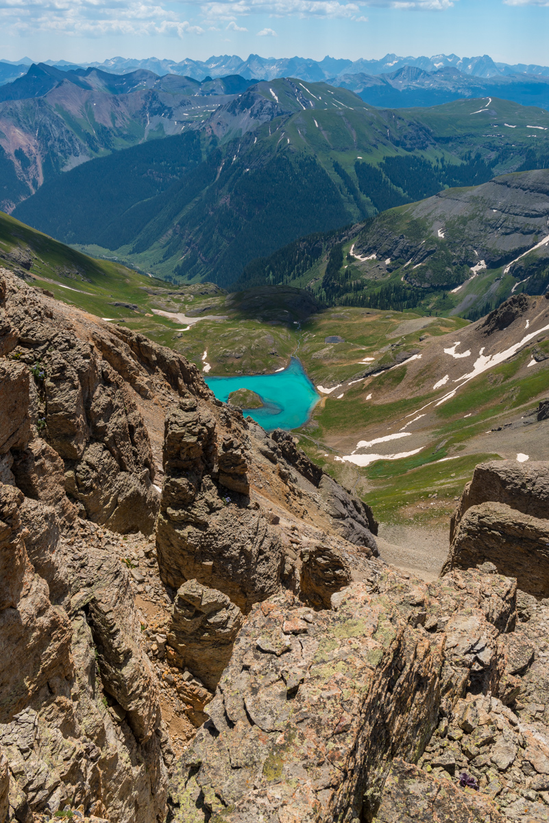
The view back down to Island Lake dominated my mind as we scrambled up the relatively easy class 2+ scree.
Eventually, looking back we could see Pilot Knob's gnarly summit block behind us over in Ice Lake Basin. The group continued the slog up the loose scree, which was pretty manageable.
I live for this kind of terrain but I think my friends thought I was a little crazy for enjoying it. The rock was pretty much what you'd expect in the San Juans.
We eventually found ourselves in a steep orange gully with great hand-holds on the sides which was fairly loose. Sticking close to the wall made for pretty easy navigation.
The full beauty of Ice Lake Basin presented itself as we gained elevation, showcasing both Ice Lake and Fuller Lake. The weather looked like it would hold for the whole day.
Honestly, I think I could have stayed up there for hours on end, taking in the views in every direction. It was just the reason I moved back to Colorado.
Island Lake pretty much stayed in view the entire way up, a nice beacon and reminder of just how high we had climbed in such a short amount of time.
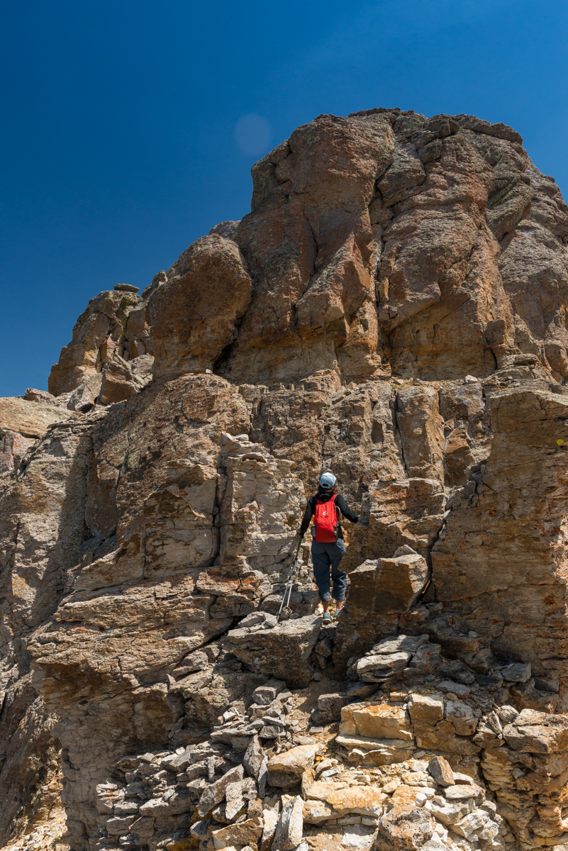
At last we reached the crux of the climb, which I had no idea existed. We got to this wall and wondered if we had taken a wrong turn or if we needed to go around, or, what? Upon close examination I decided it was the only way up. It consisted of three or four relatively exposed moves up to a small ledge, which wrapped around to the right. I went first and Ellen decided to join me. Todd and Autumn decided to stay behind because it looked too difficult.
When Ellen and I got to the top, about 3 minutes later Todd and Autumn joined us - we were so excited that they decided to come up the wall. Even though the shots are out of sequence, I thought it best to show how hard the wall looked, on our way down, with Todd and Autumn still needing to downclimb it (below).
The top was magnificent. Here's Ellen topping out on a summit filled with purple wildflowers (their name always escapes me).
From the summit you could make out every major summit in the San Juans, including Uncompagre and Wetterhorn (top center).
My gaze kept going back over to the San Miguels to the west. They were so damned impressive.
Next, a 180 degree view showing most of the San Juans and Ice Lake Basin, and Island Lake. So amazing.
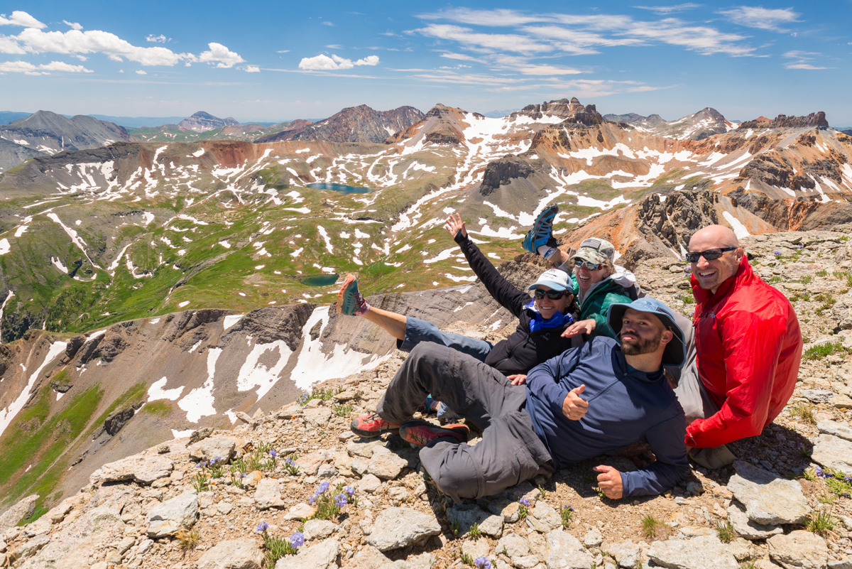
A quick group photo was in order, so I set up the tripod and self-timer. All I remember is that Todd invented a new food item on top - a burrito consisting of Peanut Butter, Fritos, and slices of apple. Apparently it was quite delicious.
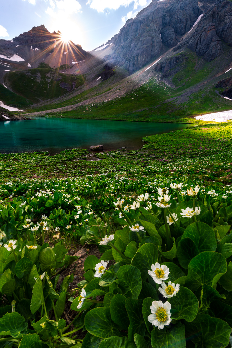
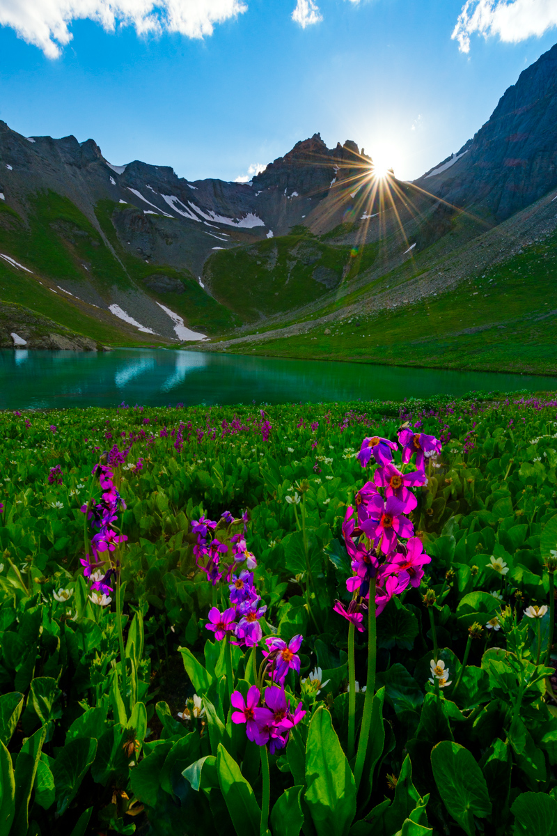
After enjoying lunch, we head back down, without any issues at all. We all faced-in on the crux and it was surprisingly easier than I thought it would be. Now, remember above where I said the lake was cold? When we were about 1/2 way down the ridge, I noticed a group of people huddled around our tents at the lake. I was not too concerned until I saw them open Todd's tent. My first reaction was, "what the heck are they doing, trying to steal beer or something?" I raced down the mountain at a quick pace and caught up with the group. As I approached they asked if they were invading our campsite. I replied, "well, yes, kind of...". They apologized and said that their son (probably about 14) had swam in the lake and was getting hypothermia and needed somehwere to lay down and warm up, and was that OK? I felt horrible for thinking they were doing something bad and replied, "of course not - not a problem at all, and that makes total sense!" The rest of our group arrived and we helped them ensure he had food and was warm before they departed the basin. We rested up and as the sun dropped lower and lower I decided to get the camera out and take some photos of sunset at the lake. It was a pretty nice one. The marsh marigolds and fireweed looked awesome.
The last light left an impression on the fireweed that I knew would look fantastic in camera. I think I was right.
After dinner, I decided that I wanted to hike back up to the top of the grassy area below the ridge for U.S. Grant. I know that sounds crazy but I had a vision for some shots looking back over the lake at sunset. I hoped the clouds would stick around, and they were looking like they might, so I took a chance and hiked back up the mountain again. Todd thankfully joined me and kept me company. Unfortunately, the clouds did not cooperate much, but I think I still got some decent shots, including one with the nearly full moon in it.
As the last light kissed the tops of the Chicago Basin 14ers, I took advantage and snapped off a two-row panorama to include the pink sky (which was a bit hazy from fire I presume), the lake, and some wildflowers.
It was quite a memorable sunset, for sure. Flowers + sunset + Island Lake + San Juan Mountains in alpenglow = awesome.
We head back down to our tents and got some much needed sleep. I never did make it over to Ice Lake for sunrise wildflower photos. Maybe next year! As a reminder, you can take a look at my GPS and/or KML file for this hike over on Gaia GPS. Prints of my photos are always available on my photography website (if you see one you like and can't find it, let me know). Thanks for reading!