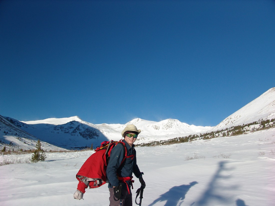
Colorado is easily one of the most scenic places in the whole world, so creating this set of lists was not an easy task by any stretch of the imagination. Having lived in Colorado my whole life and having visited nearly every mountain range the State has to offer, I wanted to reflect on my absolute favorite locations as well as highlight the places I’ve not yet visited. If you’ve not yet had the opportunity to visit some of these places, I would highly recommend that you do so immediately! Without further ado, here is my list of the top five stunning locations in Colorado that I have visited:
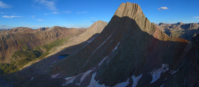
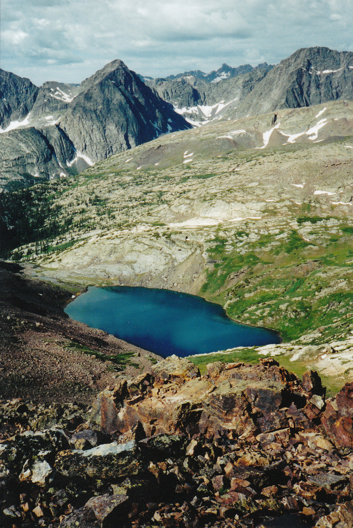
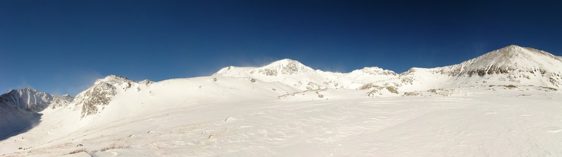
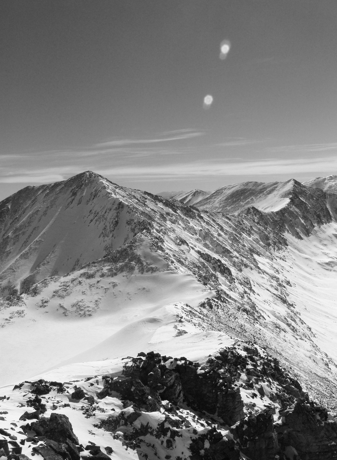
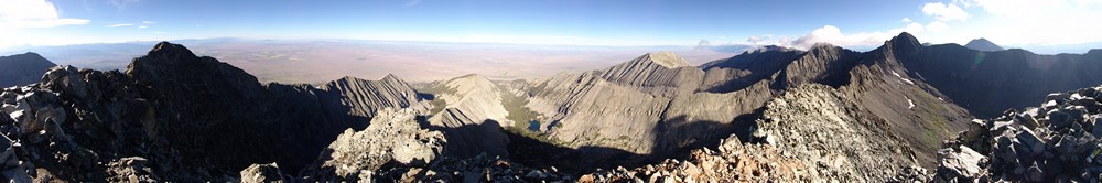
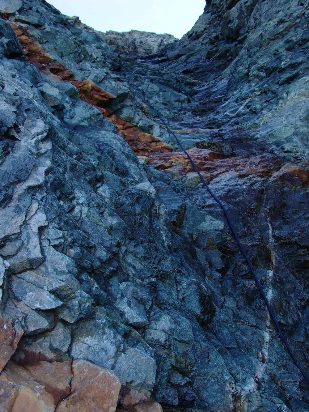
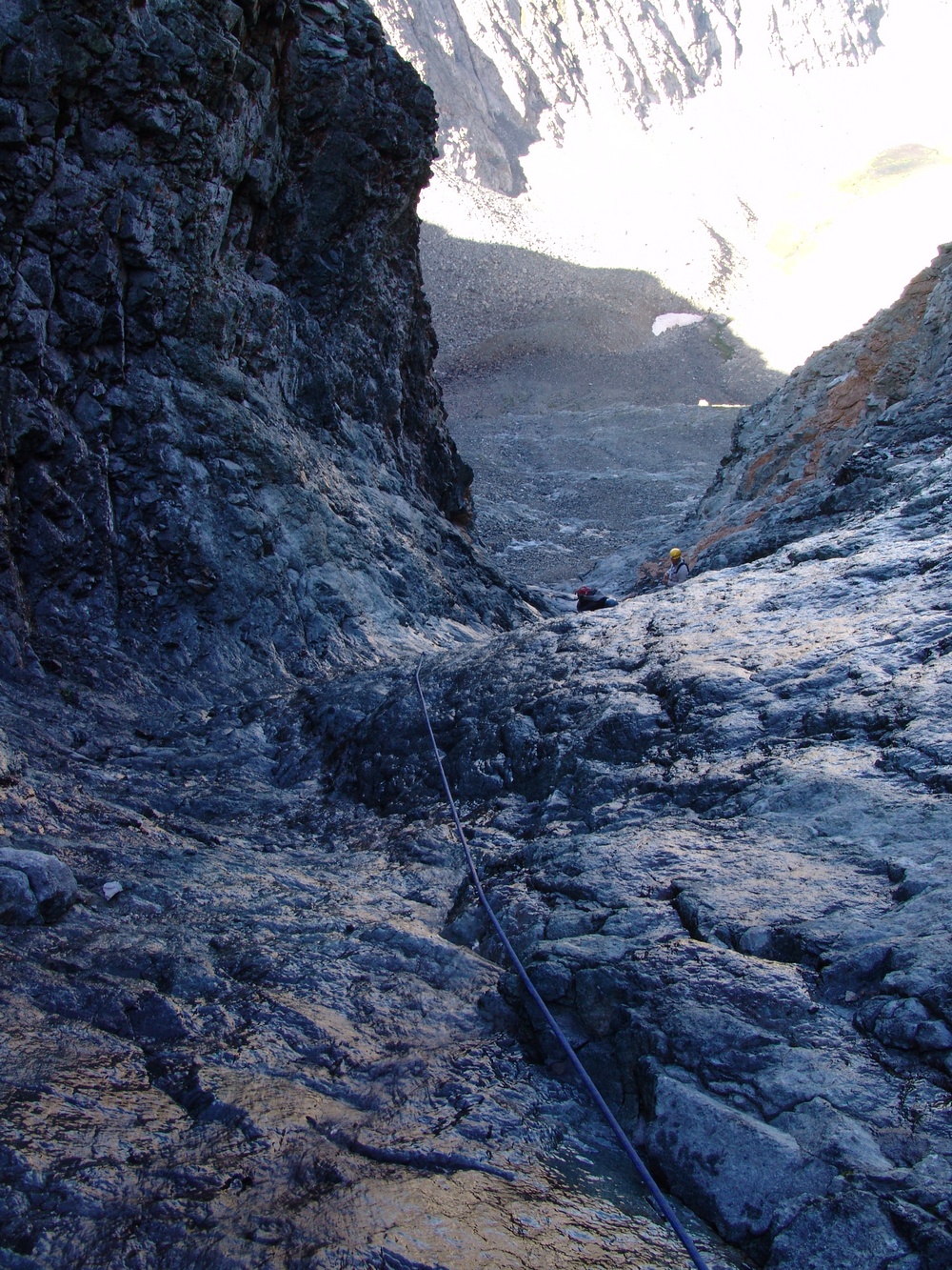
- Vestal Basin. Vestal Basin is a very remote valley located deep within the Weminuche Wilderness Area 32 miles northeast of Durango, Colorado. The surrounding mountains are members of the Grenadier Range, which is a sub-range of the San Juan Mountains. Vestal Basin is home to one of the most aesthetically inspiring mountains in Colorado, Vestal Peak. Vestal Peak towers above the basin in a upwards sloping fashion and contains one of the most classic climbs in all of Colorado up what is known as Wham Ridge. Vestal Peak is easily recognized from all directions by the dramatic and awe-inspiring Wham Ridge. Next door to Vestal Peak lies the also impressive Arrow Peak, which also has similar traits, in that it rises to the sky in a very dramatic fashion. A trip up these two incredible peaks should be on any serious Colorado mountaineer’s bucket list.
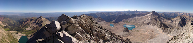
- Capitol Lake / Elk Mountains. Capitol Lake sits at the base of Capitol Peak, located deep within the Elk Mountains 13 miles west of Aspen, Colorado. Access to some of Colorado’s most stunning peaks is granted from this location, including the challenging task of summiting Capitol Peak via its famous Knife Edge. Once above tree-line, views of other famous peaks, such as The Maroon Bells and Pyramid Peak are seen to the southeast. The Elk Mountains are a truly magical place to behold.
- Mount Sneffels Wilderness Area. This pristine wilderness area is located 10 miles south of the town of Ridgway, Colorado in the San Juan Mountains. The area is home to the famous Yankee Boy Basin and several incredible mountains within the highest 100 of Colorado, including Mount Sneffels, Teakettle Mountain and Dallas Peak. Dallas Peak is arguably the most difficult mountain to climb out of the highest 100 in Colorado. The rugged terrain and incredible foliage located in this area are something every visitor to Colorado should take time to see. Especially beautiful in the fall, the wilderness area’s aspen trees change to a magical display of deep gold, red and yellow, all with the dramatic and spectacular Mount Sneffels in the background. This area is a must-see for natives and out-of-state visitors alike.
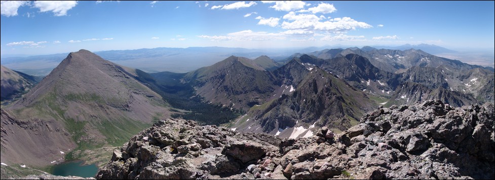
- Colony Lakes / Cottonwood Creek. These two magical lakes rest at the eastern base of Crestone Needle, Crestone Peak and Humboldt Peak in the Sangre de Cristo Range, 13 miles southwest of the town of Westcliffe, Colorado. Cottonwood Creek runs on the western side of Crestone Peak and Crestone Needle and provides remote access to one of the densest, most pristine wilderness Colorado has to offer. Unfortunately, access to Cottonwood Creek is currently problematic due some private property complications at the trailhead near Crestone, Colorado. Hopefully this area will be opened back up someday so that others can fully appreciate the natural wonder and beauty this area has to offer. Access to the Colony Lakes is still available by way of a four-wheel drive road that recently was re-developed by the Forest Service. There is plenty of controversy surrounding this access point as well, due to damage to the ecosystem at the lakes above.
- Highland Mary Lakes. Highland Mary Lakes are some of the most remote lakes in Colorado located quite deep within the Weminuche Wilderness Area in the San Juan Mountains, southeast of Silverton, Colorado. The lakes are located on the Colorado Trail on a stretch of earth that is completely above tree-line for several miles in each direction. It is truly insane to be on such an elevated plateau with some of Colorado most splendid mountain vistas surrounding you. This location is a favorite attraction of mountain goats as well. An amazing 3-5 day backpacking trip can be made by traveling from north to south or south to north from the silverton-side trailhead of these lakes all the way to Vallecito Reservior or vice-versa. The trek is truly magnificent. Be sure to coordinate a car shuttle ahead of time!
-
The top 5 places in Colorado that I’d like to visit but not had a chance to yet:
- Ice Lake Basin. Ice Lake Basin is a remote area west of Silverton, Colorado. From what I understand, this is one of the most incredible places in Colorado and I cannot wait to see it myself. The basin provides access to some of Colorado’s greatest peaks, including U.S. Grant Peak, Pilot Knob, Vermillion Peak and Fuller Peak.
- Chicago Basin. Chicago Basin is home to three of Colorado’s 14ers, Sunlight Peak, Windom Peak and Eolus Peak. Located deep within the San Juan Mountains’ Needle sub-range, these mountains are quite possibly some of the most photogenic and rugged looking out of any set in the State. While travel to the area is popular due to the access provided for the area’s 14ers, it is still tops on my list of places to visit.
- Indian Peaks Wilderness Area. Indian Peaks Wilderness Area is located northwest of Denver, Colorado, just south of Rocky Mountain National Park. While this area boasts no 14ers and only one peak over 13,500 ft, it is apparently a very pristine mountain range full of incredible hikes and challenging climbs.
- Gore Range. The Gore Range is a relatively unknown area north of Vail, Colorado and obtains some of Colorado’s most glaciated and rugged looking peaks. Many mountains in this range have never been named, mostly because of the remoteness of the area.
- West Elk Wilderness Area. This swath of wilderness is located north of Crested Butte, Colorado is home to some of the most insane images of autumn colors ever imaginable.
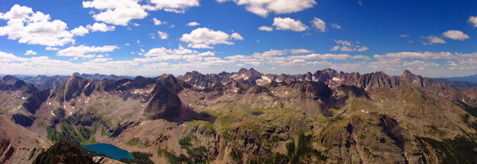
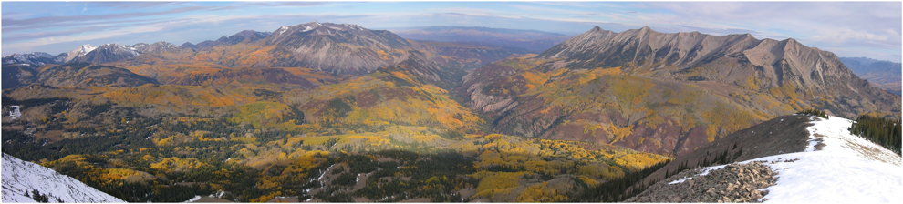
Photo by KAE Photography
What areas not covered have you been to that you’d like to share? Have any places you have yet to visit that you want to? I’d love to hear about your thoughts.
{fcomment}
One of the things I have become really excited about is taking High Dynamic Range (HDR) photos with my new Nikon D7000. Since I knew almost nothing about how to do this, other than the fact that I needed to take some bracketed photos at various exposure levels, I decided to check out a book from the Pikes Peak Library District, entitled, High Dynamic Range Photography for Dummies. This is a really great book for beginners, and I strongly recommend it if you are new to this method of photography.
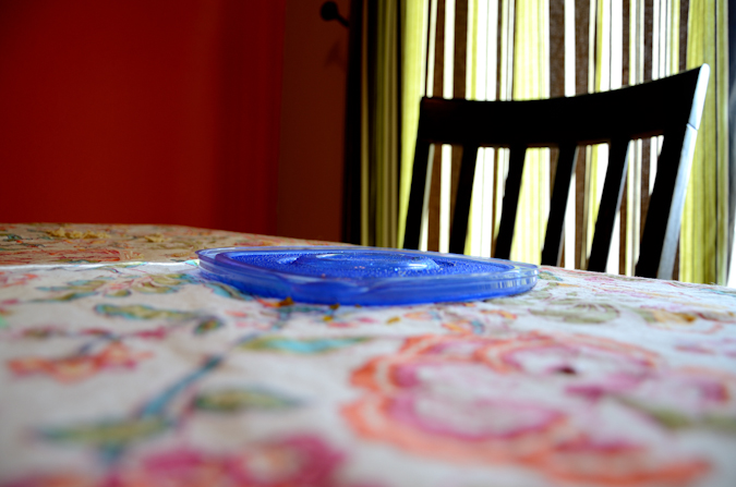
I wanted to keep my first HDR project as simple as possible, so I set my camera on my dining room table, which has a very colorful tablecloth on it. I also set out the lid to a tupperware container that had just been covering my lunch. The sun was bright outside, but the light in that part of the house was mixed - some bright light was let in through the curtains, but there were tons of shadows as well - a seemingly perfect scenario for HDR work.
In the book, it explained that I needed to use my camera's built in auto exposure bracketing for the best results. Fortuntely, my new camera has this setting, which makes HDR work a lot faster. I set my exposure levels to -2, 0 and +2 exposure values (EV) for the auto-bracketing. If you're not familiar with bracketing, it is the practice by which you take three or more photos of the same subject (preferably with a tripod for best results), at a different exposure value for each photo taken. In this case, I did 3 photos to simplify the process, but one could use up to 9 or more photos if there is a large amount of dynamic range in the scene you are photographing. Dynamic range is basically the range of light the camera is seeing with its sensor. Most digital camera sensors can only fit so much light data onto their sensors, so if you are shooting a scene with lots of bright lights and shadows, high dynamic range is your solution to capture the full range of light. Once the photos with varying exposure values are taken, they are then combined using a process called tone-mapping, which maps all that light information onto a smaller amount of data. That is why it is called tone-mapping. I won't go into all of the specifics, but I hope that is enough for you to get a grasp of the concept.
So, here are the three photos I took, one under-exposed (-2 EV), one properly exposed (0 EV), and one over-exposed (+2 EV), labled 1, 2 and 3 respectively.
Example 1: -2 EV
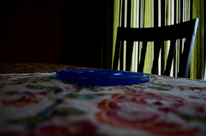
Example 2: 0 EV
Example 3: +2 EV

I shot all three photos in "RAW" mode. If you're not familiar with the difference between RAW and JPG, read this awesome article by the Digital Photography School. Using a program called Capture NX2, which is designed to handle the RAW .NEF files from my Nikon D7000, I applied some extra sharpness and color saturation to each photo (+20 sharpness and +40 saturation). I then converted each photo to a 16 bit .TIFF file. .TIFF files are great for working in HDR because they retain the full quality of the image, whereas .JPG files are compressed and lose some of the image quality.
Once converted into TIFF files, I open up Photomatix Pro, software designed specifically for working with HDR images. In this great program, you can do amazing things with bracketed images, and there are literally thousands of different combinations of settings that can be used to tweak the image into something you like. The main settings that you will work with are Strength and Smoothness. These two settings control a great deal of how the final image turns out. I won't go into depth here on the various settings in Photomatix since I am still learning, but I wanted to highlight those two settings as being very important. The best way to use this program is to play with each setting and see what kind of effect it has on your photos.
With the three images loaded, I set the Strength to 100 and the Smoothness very high (I don't recall the exact number). I reduced Chromatic Abberations and hit process - away to the races!
The final product is something that I feel looks great. You can mouse over the image to see what the original image at 0 EV looked like vs. the HDR version.

I really like the look of HDR photos, and I am excited to play more with this on my hikes this summer to produce some great images. If you have expertise in working with HDR, I'd love for you to comment or Register on the site and add your own article on how your HDR workflow differs from mine.
If you enjoyed this article, remember, you can always stay up-to-date on new articles and trip reports by following 100summits on Facebook and Twitter.
After obtaining my brand-spanking-new Nikon D7000 this month, I knew the first accessories to get would be a circular polarizer and the Nikon MC-DC2 remote release. In order to take star trail photos, I knew I'd need to use my new handy-dandy bulb setting and a cable release for ultra long exposures of 1-2 hours.
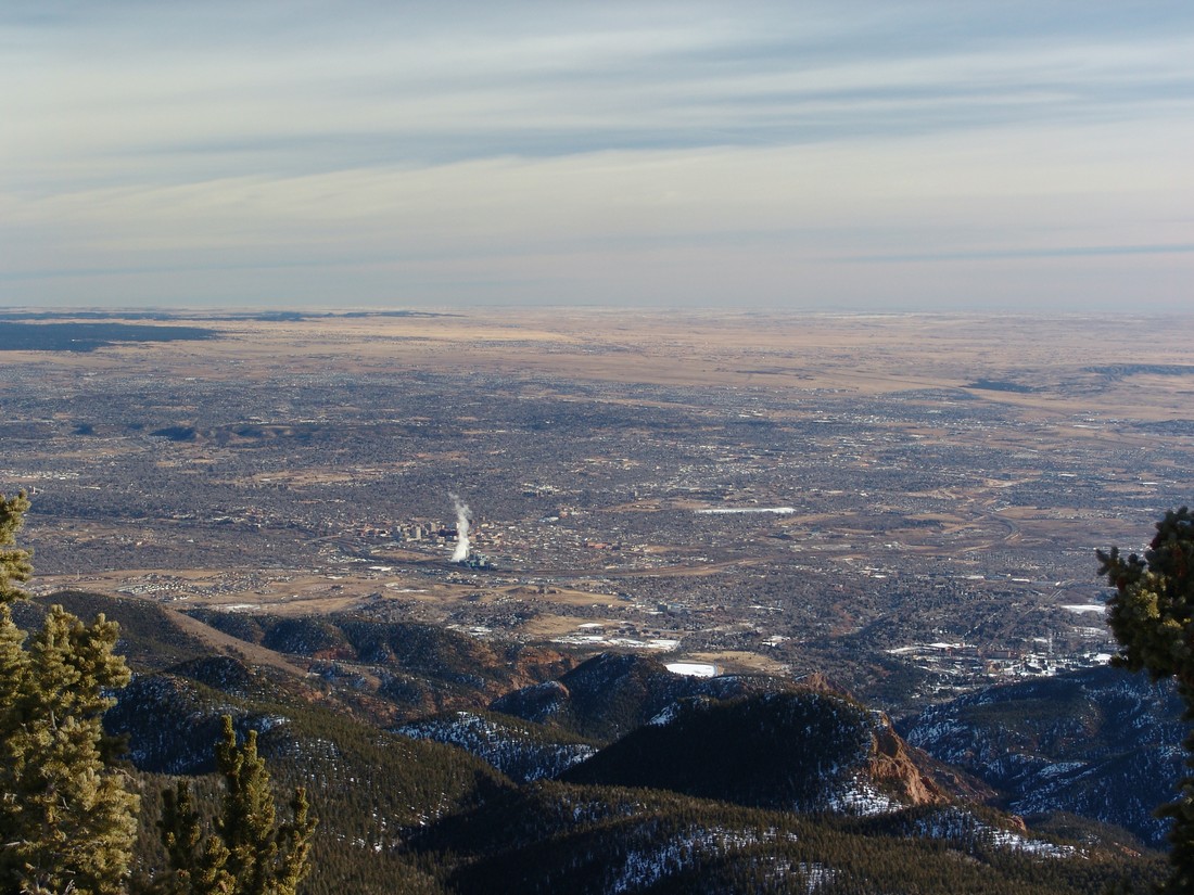
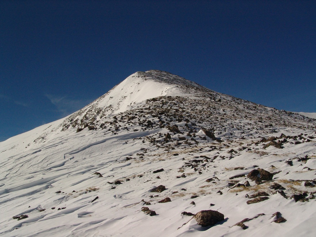
Mount Rosa is a 11,499 ft. mountain located just west of Colorado Springs and from Colorado Springs appears to be next to (north of) Cheyenne Mountain. Mount Rosa is a deceptive mountain though because it is actually quite a bit west of Cheyenne Mountain. According to David Phillips, who wrote an entire thesis on the mountain, the peak was named in 1874 after Rose G. Kingsley, a prominent figure and devoted hiker in the early days of Colorado Springs. As a native to Colorado Springs, Mount Rosa has always intrigued me because of its visibility and prominent form.
In fact, most people don't know Mount Rosa by name, but if you said "that pointy mountain next to Cheyenne Mountain," most people would know which mountain you were talking about. So naturally, because of how visible this peak is, I have always been intrigued by it and wondered what kind of climb it would be. Not having researched it at all before doing this hike, I was surprised by the level of ease and high level of access that Mount Rosa affords the casual hiker. Within minutes, you can be at the trailhead from Colorado Springs and on the summit within another hour or two. This makes Rosa a great option for someone looking for a quick hike or a first ascent for less advanced hikers wanting to get a great view of Colorado Springs. Indeed, the views from the summit do not dissappoint and are surprisingly good despite Mount Rosa's low elevation of only 11,499 ft. In fact, from Mount Rosa, one can see most of the Sangre de Cristo Range, including the Blanca Massif.
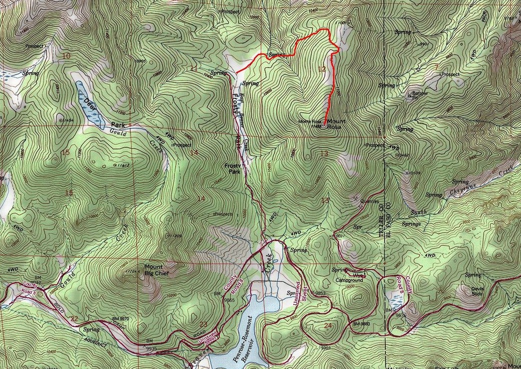
To get to the trailhead for Mount Rosa, take Old Stage/Gold Camp Road approximately 12.5 miles to Forest Service Road 379 (close to the Penrose-Rosemont Reservoir). Turn north on 379 and travel on the 4WD road to Frosty Park for another 1.5 miles. There is no marked trail per-se; however, the Frosty Park area is easy to spot as it is a huge clearing with lots of mud tracks from off-road vehicles. Even in winter, we were able to get my Jeep Grand Cherokee (4 inch lift, 32 inch tires) to Frosty Park without any issues; however, a lower clearance vehicle or one lacking 4WD will cause you to add another mile or two to your hike.
From the Frosty Park trailhead, Mount Rosa is only a 1.75 mile hike up moderate terrain. We did not employ snowshoes although it would be probably be a good idea to have them with you if there were recent snowstorms. We had ours with us but opted to leave them in the car.
There is ample parking at Frosty Park; however, I would be curious to see this area in the summer months, as there was evidence that people go there to fire their weapons. It may be prudent to find alternative parking in that case.
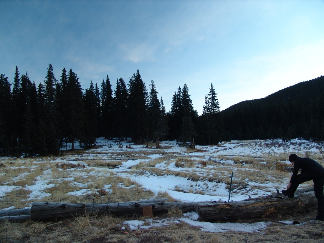
Ethan Beute prepares for our quick hike up Mount Rosa.
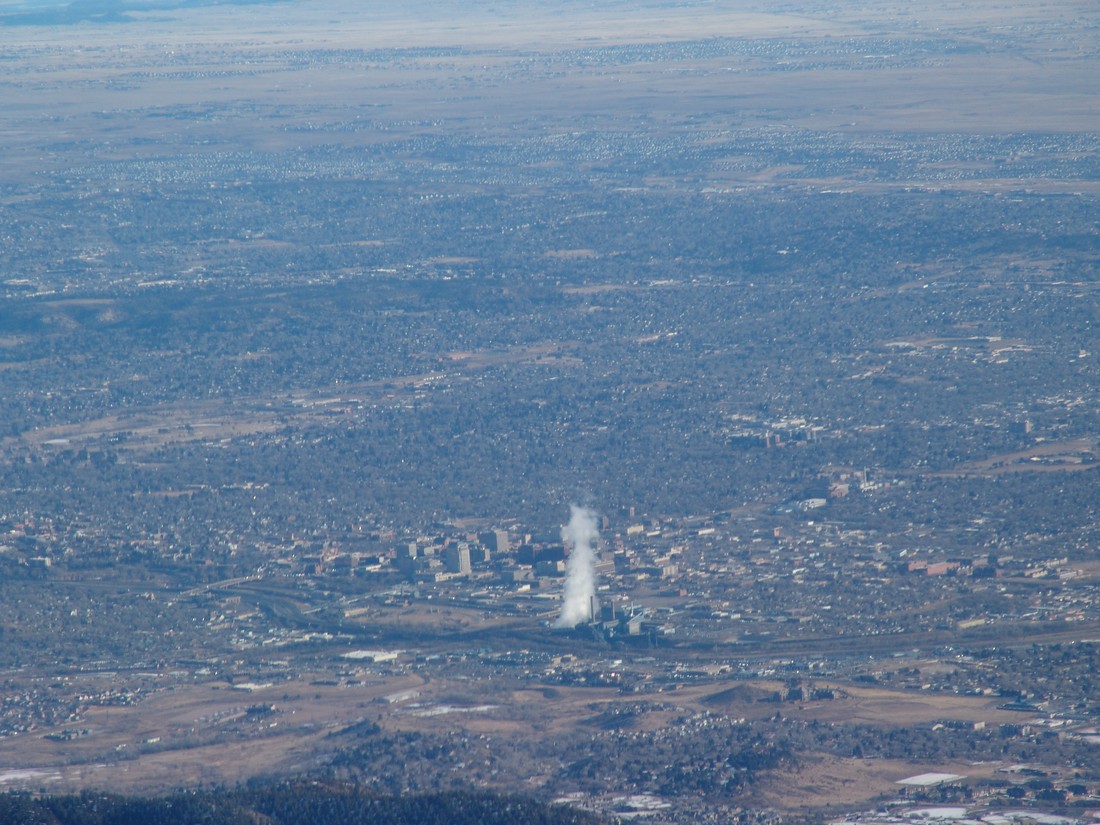
Although the trail was obscured by about 6 inches of snow for the entire hike, we found the route to be pretty straight-forward and easy to follow. If you've never been in the area, it may be advisable to bring a map and/or GPS just in case. The trail heads east and then gains the ridge for Mount Rosa pretty quickly. Before you know it, you're standing on the summit, with excellent views of Pikes Peak and the Colorado Springs metro area. Rosemont Reservoir looks really cool with the snow covering it as well.
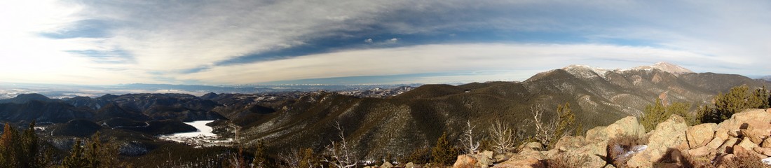
The views of the Sangre de Cristo range were also really nice, which was a surprise for sure.
You could also make out most of the major geographical points of reference down in town.
Can you see your house?
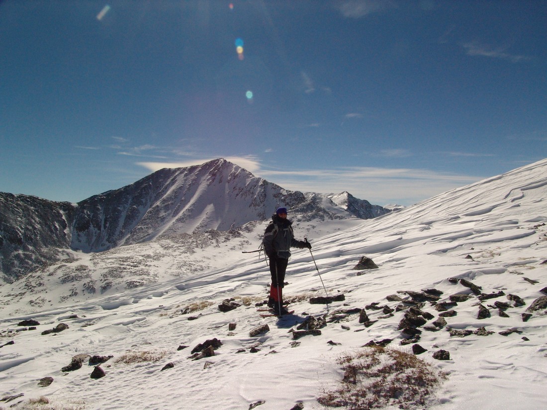
The weather was very nice for mid-January, so Ethan and I enjoyed our time on top of Mount Rosa. We also got a good idea of the route up Almagre Mountain from there, and made tentative plans to return to hike that mountain in the future.
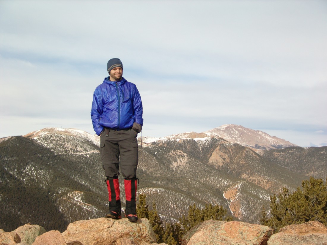
Almagre Mountain seen behind Matt Payne
And to finish of the report - here's the 360 Degree view from the summit:
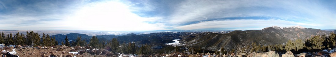
Mount Rosa looks intimidating from Colorado Springs, but in reality, it is a quite easy day hike that could be accomplished by nearly anyone. I hope you can get out and enjoy the views from Mount Rosa's great summit! If you find these trip reports useful, you can always follow 100summits.com on Facebook or Twitter to stay updated.
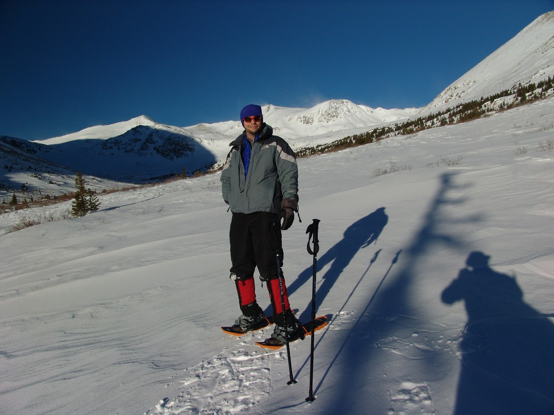
Traver Peak is a high un-ranked 13er (13,852 ft) in the Tenmile Range just one valley north of the Kite Lake basin, which includes the popular 14ers Lincoln, Democrat and Bross. The valley which Traver calls home is also home of one of the highest 100 summits in Colorado, Clinton Peak, Wheeler Mountain and another un-ranked peak, McNamee Peak. My original plan was to summit Traver Peak, traverse over to McNamee and finish off on top of Clinton Peak...
Since my wife and I had plans for Saturday, I decided to hike on Sunday. My friend Regina had to work, and my other friend, Ethan, had plans with his family, so I put a call out to other climbers on 14ers.com to see if anyone would be interested in giving Traver et. al. a go. Soon, Ryan Marsters (Monster5) from 14ers.com responded that he would join me for the hike. I had never met Ryan before, but we had exchanged several messages last year concerning an incident he was part of on Ellingwood Point where a hiker he was with had an epilectic seizure, and subsequently dislocated her shoulder, forcing Ryan to spend the night with her on the side of a 14er through a thunderstorm.
Anyways, I left my house in Colorado Springs at 4:15 AM to meet up with Ryan at 6:15 at Montgomery Reservoir, which is located just up Highway 9 from the second highest incoroporated town in America, Alma.
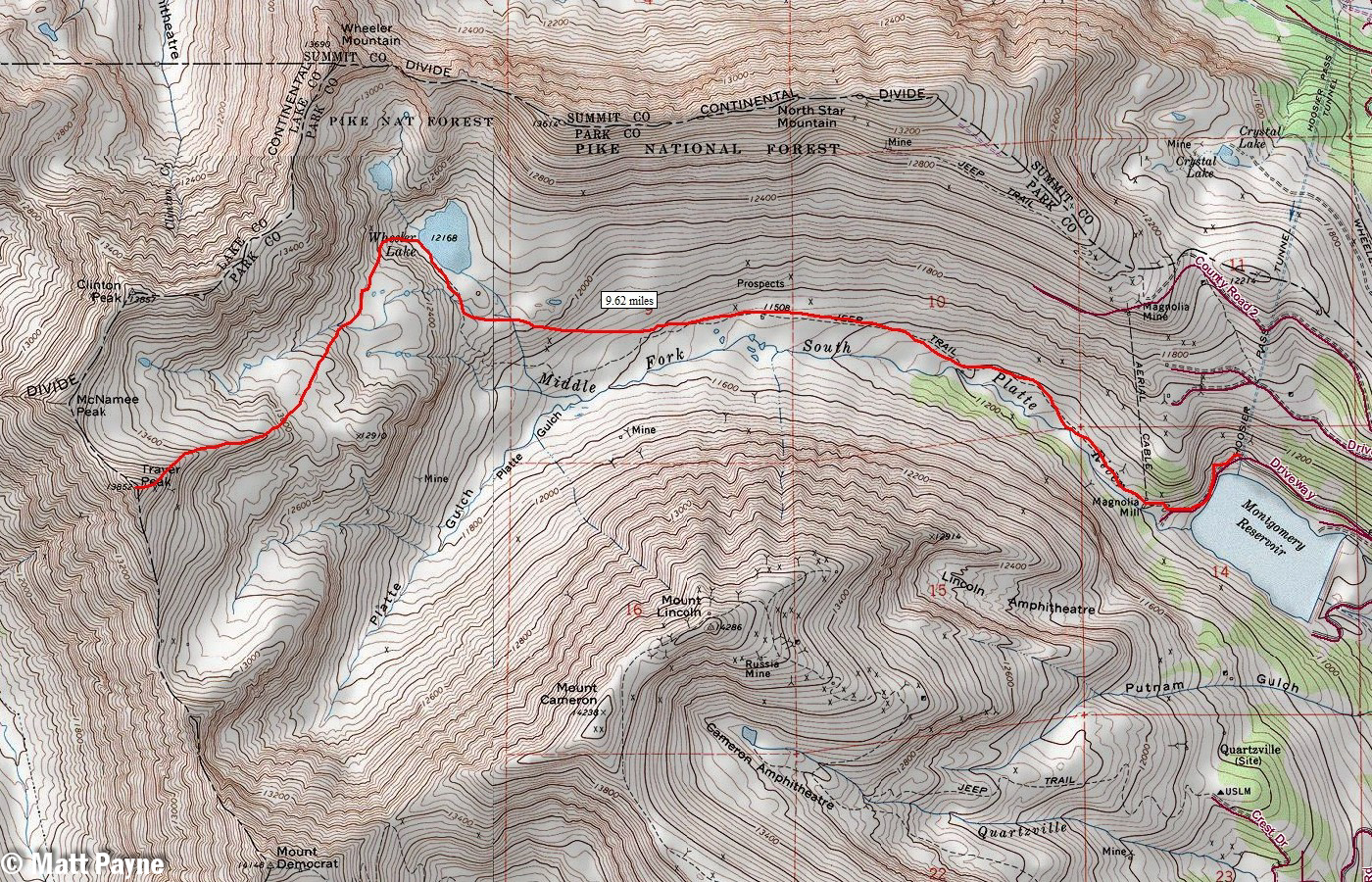
A map of our route up Traver Peak. Click to enlarge.
All in all, we traveled a total of 9.62 miles round-trip and gained 3,000 feet of elevation on snowshoes to conquer this rarely-summited 13er.
I arrived at the reservoir at 6:20 AM and hustled to get ready to hike. The sun had not quite risen yet, but the area was nicely lit by the early morning light.
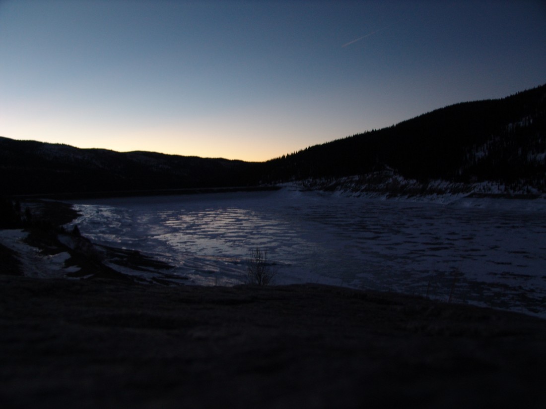
Montgomery Reservoir.
Ryan and I began hiking at about 6:30 AM and made our way up the snowy trail in quick order. Excellent views of the Lincoln Ampitheatre were available as well - it would appear to be a really awesome place to go ice climbing if you were so inclined.
We were able to manage without snowshoes until about a 1/4 of a mile into the hike, right at the base of an old abandoned mine, the snow became too deep and powdery to continue in boots only. We were postholing up to our hips. So, on went the snowshoes for the duration of the hike up. The snow further up the basin was quite hardened, and the wind was blowing quite a lot, which made for some really neat effects on the ground - it was like a dust storm only with snow.
Ryan proved to be a very quick hiker. I felt pretty out of shape for some reason (must be all those holiday calories catching up with me), but I managed to keep up for the most part. It also helped that Ryan was 21-years-old, a good 11 years younger than me. Hehe.
Ryan Marsters - adventurer, geologic engineering student, and hiker extrordinaire.
Views of North Star Mountain were available throughout the day. I had heard a lot of good things about that mountain for winter hiking, and I think it would be a pretty easy one to do on another day.

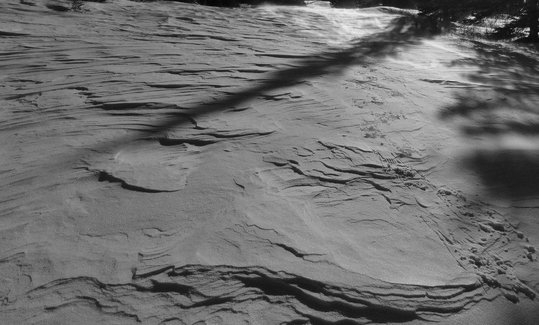
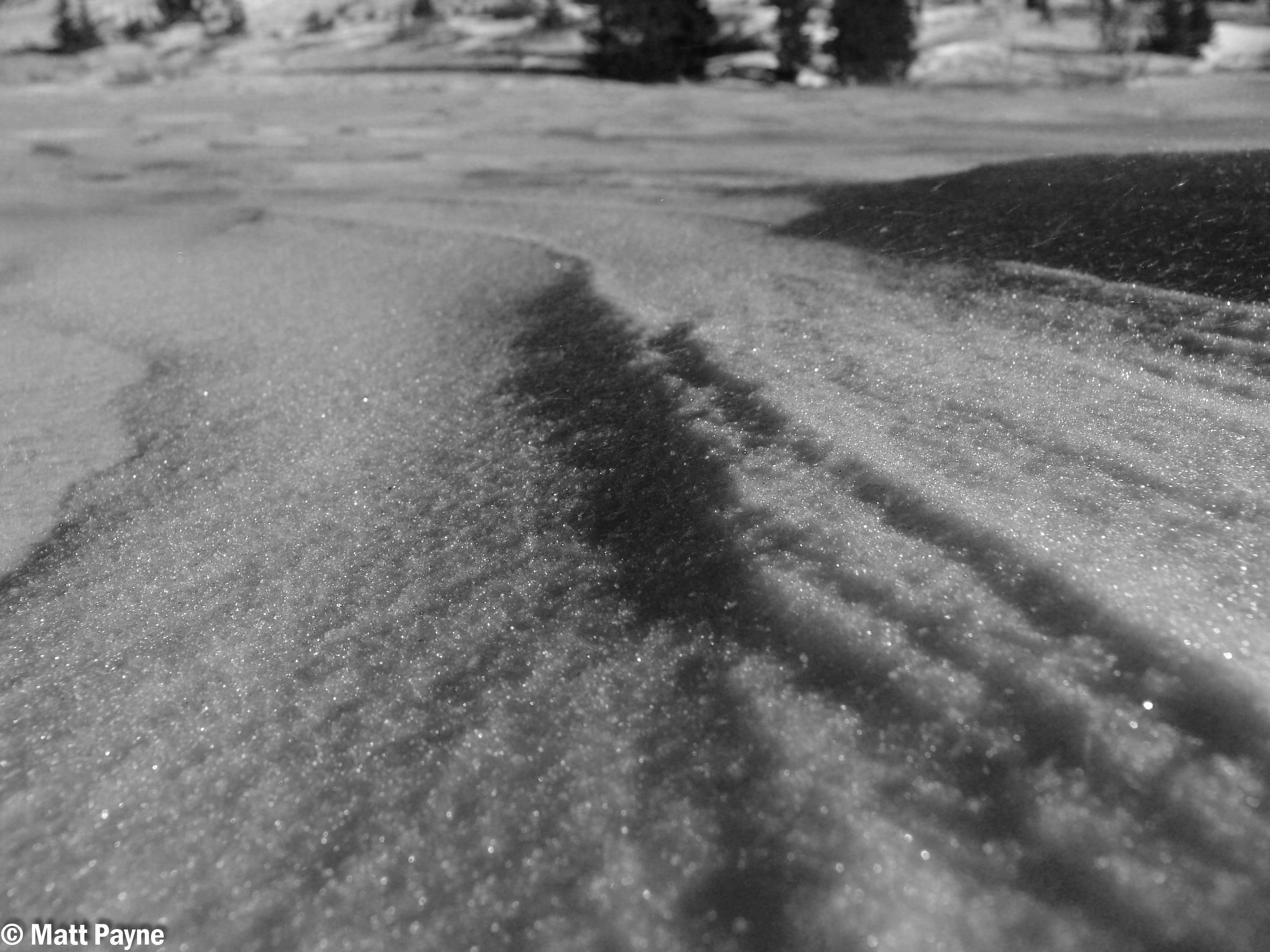
The snow continued to be blown about by the strong winds, which seemed to gust up to 40 or 50 miles per hour throughout the day. Even though the tempurature was around 20-30 degrees, it was still pretty chilly if your skin was exposed to the wind. The blowing snow made for some cool photo opportunities. Also, the snow acted like sand, and it reminded me of the Great Sand Dunes at times.
Excellent views of Silverheels Mountain were also available for much of the morning, and it looked pretty wind-blown, confirming reports from a friend of mine, Jason Wichman (who by the way runs a cool photography business), that Silverheels looks quite doable currently.
Silverheels looking good in mid-winter (right of center).
The hike up into the basin was quite a haul in snowshoes, so we stopped frequently to take breaks and enjoy the views.
Matt Payne stops to admire the views on the way up to Traver Peak.
I was impressed with the performance of my MSR Lightning Ascent snowshoes for the most part. The heel ascenders really make a difference when hiking up the steep sections, no doubt. If you want to learn more about those shoes, I wrote a review about them.
As we gained more elevation, the terrain became steeper. The snow conditions on the ground became inconsistent, and we were finding ourselves stepping on hard snow one step and soft snow the next, which made for interesting travelling conditions. I could not imagine doing this without snowshoes, but I think skis might be more effective. I might have to give that s shot someday when I have money to buy skiis.
The basin below Wheeler Lake.
We made our way up towards where Wheeler Lake is supposed to be, and of course we found it to be covered completely in snow. It was a pretty location, and I would recommend you check it out when you get a chance. I will probably return sometime in the summer to see the area, because it seems that it would be pretty amazing! The whole basin is surrounded by high peaks in all directions. Can't beat that!
For the most part, the snow on the mountain had a sugary consistency, as seen below:
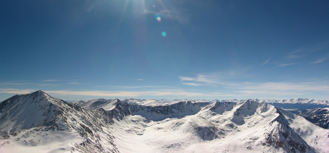
Once we reached Wheeler Lake, we evaluated the avalanche conditions and agreed that the best route up would be to head to the top of the basin and then up a gully that was the least steep and presented the least amount of avalanche terrain. Once we reached the top of this section, we found ourselevs at the base of Traver and the rest of the peaks in the area. Before heading up Traver, I snapped off this 360 degree pano, highlighting Traver Peak at far left, McNamee, Clinton (the snowy one at center), Quandary, Lincoln and Democrat (far right).

The route up Traver was very straight-forward. We kept our snowshoes on for the extra traction up the mixed rock-and-snow terrain that Traver offered.
Traver Peak.
As we climbed, views of Democrat and Buckskin were very welcomed. The whole valley instilled a sense of peace within me. Something about being up high in the bright white snow, with wind rushing around - breaking the silence... it was calming.
Democrat and Buckskin looking fine in February.
We both finally reached the top of Traver at 12:30 PM and hung out on top for about 30 minutes, taking photos, snacking and discussing all things related to the awesome beauty that laid before our eyes. I was really impressed by the view from Traver - it does not disappoint! The views of Lincoln and Democrat were superb, but what really impressed me was how well you could make out the Collegiates over in the Sawatch Range as well as Mount of the Holy Cross. Additionally, the Gore Range really stood out to the north of us - and we both commented about wanting to go there to enjoy the class 4 climbing offered by that secluded range.

The Sawatch Range.
Democrat, Buckskin and the Sawatch Range.
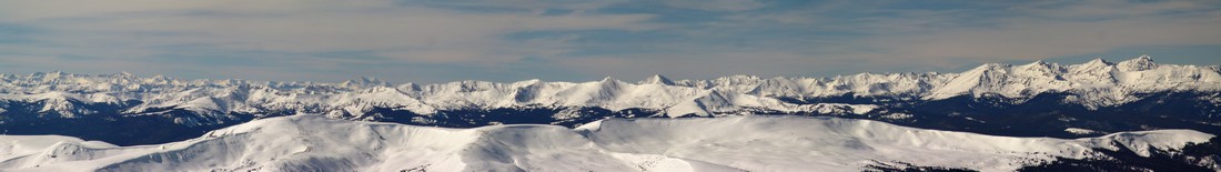
Black and White view of the Sawatch Range.
Views of the Elk Mountains were pretty good too - Snowmass and Capitol stood out pretty nicely. Holy Cross is seen at far right:
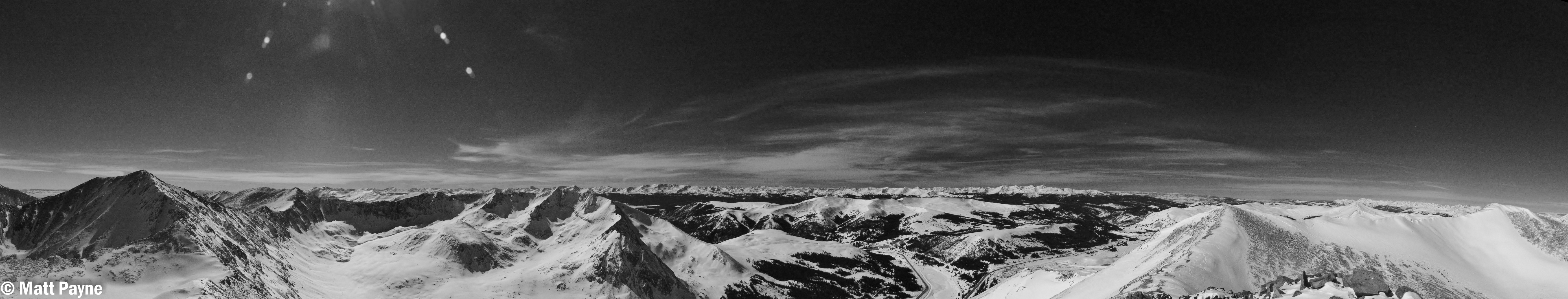
Obligatory 360 degree summit pano:
Ryan captured this photo of me being goofy on the summit:
We started to plan to head over to McNamee and Clinton, but my legs were starting to cramp up so we opted to head down instead since it was already 1 PM. In retrospect, I regret this decision because of how close those two mountains are to where we were at; however, now it gives me an excuse to go back to this really nice valley.
So, Ryan and I took off the snowshoes and headed back down. As soon as we reached the area just above the gully I spoke about before, we had to put our snowshoes back on. The snow was a bit heavier in the afternoon after soaking up the sun, so the going was a little rough. We sunk into the snow a bit more than I would have liked, but we still made great time. It was a tiring affair. Here's a shot Ryan took of me after we made it down the gully:
We finally made it back down to the trailhead at 4 PM, making the entire trip 9.5 hours. I highly recommend this hike to anyone looking to get out this winter! Thanks for reading!
If you find these trip reports useful, you can always follow 100summits.com on Facebook or Twitter to stay updated.
Avalanches are a very serious and dangerous threat to Colorado winter outdoor enthusiasts
Over the last 10 winters in the United States an average of 25 people died in avalanches every year. Colorado has the highest number of avalanche fatalities, by far.
Avalanches are incredibly powerful. Even a small avalanche can kill you. As the avalanche goes down the mountain, it gathers more and more snow, which can bury you quickly.
The best way to prevent avalanche accidents, other than avoiding avalanche-prone areas altogether, is to obtain solid education in avalanche awareness and safety. Is it highly recommended that anyone going into avalanche-prone areas take classes. One great resource to find out about avalanche courses is Avalanche.org. Additionally, Friends of Berthod Pass offer free, high quality avalanche courses each year and a comprehensive resource page on avalanche safety. Lastly, the Colorado Avalanche Information Center provides awesome resources for people looking to learn more about avalanche safety.
By the end of your first class, you should be able to:
-
Understand the basics of avalanche formation and release.
-
Identify avalanche terrain.
-
Know the steps required to plan and carry out a trip.
-
Use the Avalanche Terrain Exposure Scale (ATES) and where Avalanche Danger Ratings and Avalanche Bulletins are available.
-
Find resources for obtaining ATES terrain ratings if their trip is not rated.
-
Find resources for obtaining Avalanche Danger Ratings and Avalanche Bulletins if these are not available.
-
Use appropriate travel techniques in avalanche terrain.
-
Carry out a companion rescue.
-
Understand the limits of your training.
Check out this video of avalanches just to see how powerful they can be:
Avalanche Safety Basics
Here are some basic things to think about if you are going to venture into avalanche-prone terrain:
-
Stick to ridges - it is impossible to be caught in an avalanche if you are at the top of a ridge:
-
Avoid terrain that could slide or that has snow above that could slide.
-
Areas with lots of dense trees are generally safe.
-
The slope must be steeper than about 30 degrees to trigger a slide. Slopes less than about 30 degrees are not steep enough to avalanche.
-
The snowpack must be unstable to trigger a slide - snowpacks are a series of layers stacked on top of one another. Some of the layers are hard and strong, some of them are soft and weak. The snowpack is unstable when a harder stronger layer sets on top of a softer weaker layer and the soft weak layer can barely support the hard strong layer above it.
-
Watch for changing conditions.
-
Be ready to change your plans when conditions change - be flexible and know when to turn around!
-
Make sure everyone in your group talks to each other and discusses what is going on.
-
Plan ahead with contingencies. Make sure the entire group knows and agrees to the plan before beginning your trip.
-
Make sure you and all members of your group can perform a fast and effective rescue - practice, practice, practice!
Avalanche Safety Gear
There are several critical tools of the trade that you'll want to invest in if you're serious about hiking or skiing in avalanche-prone areas. This is not meant to be an exhaustive list. One such item is the avalanche beacon. If you are buried by an avalanche, wearing a avalanche beacon can help people find you. However, it will not prevent you from being buried, it will not prevent you from being killed by trauma, and it will not prevent you from suffocating while buried. Another critical tool is the avalanche probe. The avalanche probe allows you to quickly locate a buried survivor of an avalanche. The last critical item you'll want to invest in is an avalanche shovel. The shovel will allow you to quickly dig the survivor out once they have been located.
One of the latest inclusions to avalanche safety gear is the Avalung device, which, if used properly, can increase your rate of survival if buried. Another new item on the market that is gaining a lot of positive review is the Avalanche Airbag by Backcountry Access. The airbag not only helps prevent burial, but protects the head, neck and upper body from trauma. With its location behind the head and away from the hips and arms, it preserves the user’s peripheral vision and his or her ability to escape the avalanche before it picks up speed.
If you are planning on going into the high country this winter, please take the time to learn about avalanche safety. It just may save you or your hiking partner's life!
An in-depth review and analysis of every Colorado mountaineering death from 2010.
TABLE OF CONTENTS
- Introduction
- Heidi Kloos – Baldy Peak (Ice Climb) - 3/30/2010
- Kevin Hayne - Little Bear Peak - Hourglass route - 6/15/2010
- Jeffrey R. Rosinski - Longs Peak - Keyhole Route - 7/15/2010
- Robert Doyle - Mount Cutler - 7/25/2010
- Peter Topp - El Diente Peak - 7/26/2010
- Duane and Linda Buhrmester - Crestone Needle - Ellingwood Arete route - 7/27/2010
- Spencer James Nelson - Maroon Bells - Bells Traverse - Bell Cord Couloir - 8/14/2010
- Benjamin Russell Hebb - Longs Peak - Diamond - Dunn-Westbay route - Broadway ledge - 8/27/2010
- Don Thurman - Kit Carson Mountain - 9/18/2010
- John Regan - Longs Peak - Keyhole route - 9/25/2010
- John Merrill - El Diente Peak - 9/26/2010
- James Nelson - Mount of the Holy Cross - 10/3/2010
- James Patrick - Taylor Peak and Powell Peak - Rocky Mountain National Park - 10/16/2010
- Chris Pruchnic - Thatchtop Mountain - 11/20/2010
- Summary / Data / Charts / Common Themes
2010 marked one of the deadliest years in Colorado history for mountaineers -15 deaths. While no entity keeps official records of mountaineering deaths in Colorado, the American Alpine Club publishes its annual Accidents in North American Mountaineering (ANAM) book, which highlights every known accident and death in North America as well as providing meaningful statistics, broken down by State and type of accident. The scope and purpose of that book is for mountaineers to read about accidents and to learn from them. Through analyzing what went wrong in each situation, ANAM gives experienced and beginning mountaineers the opportunity to learn from other climbers' mistakes. From inadequate protection, clothing, or equipment to inexperience, errors in judgment, and exceeding abilities, the mistakes recorded in the book are invaluable safety lessons for all climbers.
With that being said, I wanted to focus more on Colorado Mountaineering specifically, and provide my own respectful opinion on each death, as well as a remembrance for each victim. I am also hopeful that this website may serve as a historical reference for Colorado Mountaineering Accidents - at least 2010 and forward. I have tried to follow reasonable guidelines in analyzing each death. If you have information or data that contradicts or adds further clarity to one of the accidents described below, please feel free to This email address is being protected from spambots. You need JavaScript enabled to view it..
My personal philosophy is that each mistake, accident or unfortunate event has a valuable lesson attached to it. I also believe that even simple coincidences or freak accidents, where no fault can be laid upon the mountaineer, can be analyzed or studied. Perhaps in reading about one of these such accidents, other climbers may decide to avoid that mountain or take extra precautions when attempting to climb it. I am hopeful that if I were to perish from a mountaineering accident that others will study my actions to discover any possible errors I may have made that contributed to my demise, and share those errors with others for educational purposes. Additionally, most of us that climb mountains do so with the knowledge that it is dangerous and that accidents can and will occur. The only thing we can do to mitigate that risk is to educate ourselves, learn from others, and prepare as much as possible. My hope is that this work is a small means to that end.
In researching this topic, when possible, I have made attempts to contact family and friends of the deceased in order to obtain permission for photographs, etc.
Lastly, I want to leave the reader with a few quotes before I begin, in the hopes that they may impress upon the reader the true intent of this body of work:
- “Learn all you can from the mistakes of others. You won't have time to make them all yourself.” - Alfred Sheinwold
- “Mountains are not fair or unfair - they are just dangerous.” - Reinhold Messner
- “The mountains will always be there, the trick is to make sure you are too.” - Hervey Voge
1. Heidi Kloos – Baldy Peak (Ice Climb) - 3/30/2010
 |
|
Photo courtesy of The American Alpine Club by Drew Ludwig |
Heidi Kloos was a 41-year-old Ridgway resident and well-known mountain guide. She was found buried under 10 feet of snow after she was caught by an avalanche near Baldy Peak, just east of Ridgway, CO.
Heidi was one of only a few female alpine guides certified by the American Mountain Guides Association. She had guided extensively around the world, and therefore one could assume that she was well trained and educated on proper avalanche precautions.
According to the Colorado Avalanche Information Center (CAIC), a website dedicated to providing avalanche infomation and education, Kloos was alone when she headed out to do a remote ice climb. After friends reported her missing, members of the Ouray Mountain Rescue Team were dispatched to the area.
Searchers found tracks leading into a large avalanche debris field measuring 150 by 80 meters. They also found Heidi's backpack and climbing gear, including an avalanche beacon, just outside the avalanche debris area at the base of a cliff wall.
According to CAIC, searchers presume that Kloos dropped her gear before heading up to assess the climb and en route was caught low in the path of the avalanche. Kloos' body was found with probes, buried 10 feet below the surface.
In 2008, she received the Denali National Park Service's Denali Pro Award for her efforts in assisting the National Park with a difficult rescue there in 2007.
Additionally, Kloos led guided trips in Antarctica and Argentina - she was clearly a well-trained and accomplished mountaineer.
For the official CAIC report of the incident, click HERE.
Analysis:
Because of her extensive experience and accomplishments, Heidi was clearly quite capable of climbing nearly any route she would have encountered. Some highly experienced mountaineers tend to take higher risks than less experienced mountaineers, due to their confidence and also because of the inherent rewards for success when risks are overcome. In some instances, the more experienced one becomes, the greater the challenge required to stimulate that sense of excitement and pursuit of reward. It is therefore reasonable to theorize that Heidi may have taken some unnecessary risks that led to the accident that killed her.
First, Heidi could have greatly benefited from having at least one other person with her for the trip into an avalanche prone area and the climb. Not only is this a common safety precaution for ice climbing, but it is also a common safety precaution for all back-country activity where avalanche danger is high. Travel into areas with high avalanche danger should always be with groups that are staggered (to avoid everyone from being buried at once). Everyone in the group should also be equipped with all of the proper avalanche safety equipment, including beacons, probes and shovels.
Due to her high skill level, it is reasonable to assume that Heidi had successfully soloed many similar ice climbs before without incident. Previous mountaineering success is a frequently correlated with higher risk taking - a cause that stems from psychological pitfalls.
Since Heidi was carrying an avalanche beacon, it is also reasonable to assume that she knew of the avalanche risks. Unfortunately, an avalanche beacon is of little use if no one is with you with probes and a shovel to rescue you. Lastly, Heidi had made the trip to this area prior to the accident, without incident, which may have caused her to believe it was safe to return to the area for climbing. It is unknown if snow conditions had changed between her visits to the area.
My deepest condolences and sympathy go out to Heidi's family and friends. Heidi's passing is a tremendous loss to the climbing world. A memorial scholarship fund was established through Mountain Trip for the Telluride Adaptive Sports Program. Donations in memory of Heidi Kloos may be made to TASP (contact Mountain Trip, 866-886-8747 or 970-369-1153), as well as to Ouray Mountain Rescue (970-318-8872).
2. Kevin Hayne - Little Bear Peak - Hourglass route - 6/15/2010
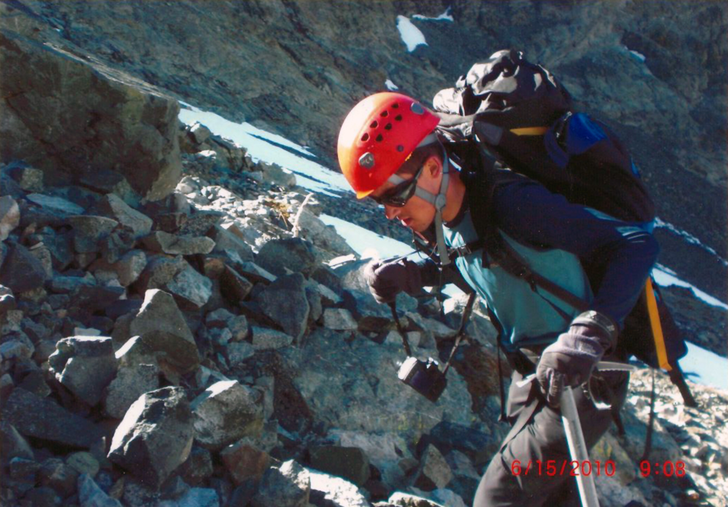
Photo courtsey of Lynn Hayne, taken on Kevin's way up Little Bear the day of the accident.
Kevin Hayne, an 18-year-old from Highlands Ranch, CO, died while attempting to climb the standard route of Little Bear Peak, known as the Hourglass. The Hourglass is a 4th class scramble - a very narrow gap between two towering cliffs comprised of very loose rock. Having climbed Little Bear's Hourglass myself, I can attest to the gritty and dangerous nature of this section of the mountain, and can personally say it was one of the more challenging mountaineering adventures I've been on. Here are three photos of the Hourglass, looking up and looking down, which demonstrate the sheer steepness of this section. In the first photo, you can see the loose rock just above me - this is where I believe Kevin fell from.
Kevin was accompanied by his friend, Travis Winder. The two reached the Hourglass and found it covered with a thin coating of ice. They decided to pass the Hourglass on its left, climbing across the broken cliffs as seen above. Just after they started climbing, Kevin slipped and fell down the rocky terrain. Travis posted a detailed account of those events on 14ers.com: "Today me and Kevin8020 were hiking the hourglass just shy of the summit of Little Bear Peak. The hourglass was completely iced over and was impassable, we decided to take a ledge on the left side of The Hourglass and decided to wait and see if the sun would help melt anything out. 30 seconds after this decision was made, Kevin's hand/foothold (I could not see all of him) broke loose and he fell several hundred yards down the mountain. When I got to him he was breathing heavily and both his arms looked broken, both of our spot trackers malfunctioned at a terrible time. I waited 30 minutes by chance that the distress signal did go out, tried to comfort Kevin, and after no response from either Kevin or SAR, I made the hardest decision of my life and had to hike out, leaving my partner behind."
By the time the Search and Rescue (SAR) team reached Kevin, he had already passed away.
Kevin was a very religious and spiritual person, as well as the class valedictorian of his senior high school class at Lutheran High School in Parker. At the time of Kevin's death, he had climbed 35 of Colorado's Fourteeners, making him a fairly accomplished mountaineer by most standards. Several 14ers.com members who had previously climbed with Kevin had nothing but good things to say about him as a person, and it is obvious that he will be greatly missed by family and friends.
Analysis:
Little Bear Peak is one of the most dangerous mountains in Colorado, as evidenced by an incomplete historical timeline of accidents on that mountain provided by John Kirk. The Hourglass is generally climbed in the spring, when there is ample snow, using an ice axe and crampons to aid climbing, or in the later summer months, when the Hourglass is empty of snow and ice. Usually the biggest danger in the Hourglass is rockfall from above, often dislodged by other climbers. In Kevin's case, much of the snow had melted on Little Bear, causing running water to coat the Hourglass, which freezes at night, leaving a thin coat of ice on all of the rock. Even with adequate equipment and experience, thin ice accompanied by loose rock makes for quite dangerous climbing conditions. Mountains like Little Bear present dangerous challenges, even in the best of conditions. The lives of accomplished and experienced mountaineers, making no mistakes whatsoever, have been claimed by Little Bear before. With that being said, it would seem that Kevin and his climbing partner, Travis, possibly made minor errors in judgement that precipitated Kevin's death.
When reading this analysis I want to caution readers from reacting. Kevin's possible errors in judgement were quite minor, and depending on the circumstances, possibly not the worst decisions that could have been made at that time.
Choosing to climb Little Bear during the early part of June makes for a difficult and challenging climb, given the route's reputation and the challenges it presents when it is not completly full or devoid of snow. These challenges have been well-documented on 14ers.com, where Kevin frequently researched the mountains he climbed. According to 14ers.com, the Hourglass route of Little Bear is, "probably the most difficult standard 14er route." His partner, Travis, indicated that Kevin generally conducted meticulous research before climbing a mountain. 14ers.com has over 100 trip reports for Little Bear, many of them outlining the dangers that can be found on that mountain. So, going into this climb, Kevin certainly knew of the risks and dangers that could be present.
Compounding these findings is the fact that Kevin found himself in a similarly precarious situation just a year prior, where he was rescued by helicopter on the Maroon Bells, another set of very dangerous mountains. That trip report can be found HERE. During that climb, Kevin was traversing to the second peak when adverse weather conditions moved in and deposited snow on the mountain. In those accounts, Kevin stated, "Looking back, it was clear that with only a few exceptions, we made the right decisions. For one, despite the fact that my personal weather forecast/prediction said I was safe and NOAA said we were safe until afternoon, weather is unpredictable - I shouldn't have taken the chance of heading for North Maroon even though we were ahead of schedule. Second, I shouldn't have set foot on the snow to begin with."
Kevin's own analysis of those events was very mature, and it seemed that he learned a great deal from his experience on the Maroon Bells. Kevin should have learned a valuable mountaineering lesson - knowing when to turn-around and go back down. This is what makes Kevin's tragedy on Little Bear so baffling. The very lesson he learned on the Maroon Bells very well may have saved his life, or caused him to not pursue such a difficult mountain like Little Bear without more experience or better conditions.
It seems that both Kevin and Travis made the right analysis at first - in finding the Hourglass covered in ice, they decided it would not be safe to continue. Unfortunately, instead of climbing back down to a safe location, they chose to climb up onto looser terrain to wait for the ice to melt. It is easy to see how many other people could make the same decision - especially since the Hourglass is quite steep and not easy to down-climb. The idea of down-climbing was probably not as appealing as waiting on a loose ledge.
Lastly, Kevin relied on the use of a SPOT beacon during his rescue on the Maroon Bells, a device that can be used to transmit an emergency rescue message via satellite to Search and Rescue teams. The SPOT beacon requires a clean line-of-sight with the sky from all directions, something the Hourglass does not provide. The use of such equipment potentially lulls climbers into a false sense of security, giving them the idea that if they were injured, a rescue would not be difficult to obtain.
In conclusion:
- Kevin made a very good initial assessment to not continue up the Hourglass due to ice being present; however, he chose to wait on unstable terrain without adequate protection (rope, harness, anchor).
- Climbing the Hourglass in similar conditions should only be attempted with adequate protection and knowledge of its use.
- Climbing the Hourglass is recommended only when snow is completely absent or when snow completely fills the gully.
- Caution should be taken when employing the use of equipment such as a SPOT beacon. They are not adequate protection from injury and should not be used in lieu of adequate training and preparation.
- Some mountains are just plain dangerous. We will never truly know if Kevin could have done much differently to avoid his death, other than not climbing to begin with. Clearly, I don't want to advocate that no one should ever climb mountains; however, before attempting mountains like Little Bear, one should have a keen sense of their personal limitations, and trust their instincts if something does not feel safe.
A memorial fund has been created in honor of Kevin. Details of that fund can be found HERE.
3. Jeffrey R. Rosinski - Longs Peak - Keyhole Route - 7/15/2010
Jeff was a 29-year-old man from Middletown, Rhode Island and the associate pastor of the Kings Grant Fellowship Church in Portsmouth, RI. Rosinski was also a clinician at Rhode Island Hospital. Jeff was also married and was the father of two young children: a 2½ year-old boy and an eight-month-old girl. Jeff's body was found by another climber, Corbin Mabon, at 3 AM the following day, along a section of the route known as "the Trough." Based on where Jeff's body was found, it is not entirely known how he came to die; however, it would seem that he was hiking late at night (possibly in the dark), and went off-route and fell up to 300 feet from above. The terrain above the Trough is quite steep, and venturing off-route into that part of the mountain would almost certainly lead to trouble for almost anyone. If you look at the next photo of the Keyhole on Longs Peak, you can see steep cliffs to the left of the Keyhole - the rock terrain above the Trough is quite similar to those cliffs.
This particular incident was quite interesting to me, personally, because I climbed Longs Peak the day after Jeff's body was found, and saw some of the forensic evidence that still remained on the trail. According to Mabon, the winds on Longs that morning were fierce, which could have caused Jeff' to want to get off the summit quickly.
Analysis
Not much is known about the circumstances surrounding Jeff's death, or the events leading up to his fall. What I have been able to learn, through correspondence with Jeff's father-in-law, Jim Treat, is that Jeff was not an especially experienced mountaineer. He had been training on Mount Washington in New Hampshire in preparation for attempting to climb Longs Peak.Mount Washington is a respectable mountain by most's standards; however, at 6,288 ft in elevation, it is not fair to compare it to Longs Peak, which has an elevation of 14,255 ft. Additionally, the conditions and technical requirements of the two mountains are completely different. Additionally, Longs Peak is a very long and strenuous climb. It is very easy for beginner hikers to become tired, not only from the elevation that is gained, but also from the length of the hike. Due to the lack of information surrounding Jeff's death, I can only speculate that he went off-route and fell. While the Keyhole route is littered with "bulls-eyes" that show hikers where to go, it is still easy to get off-route if you are not experienced in route-finding or with Longs itself.
In conclusion:
- Longs Peak is a difficult mountain - unless you are in peak physical condition and have experience in Colorado mountaineering, it is advised that you not climb Longs Peak.
- Unfortunately, because Longs Peak is inside of a National Park, where thousands of people visit each year, it is all too often climbed by people lacking adequate experience, preparation, gear, or physical condition. Based on descriptions of Jeff, it would seem that he could have fallen into at least two of those categories.
- It seems that Jeff went off-route, even with the presence of the bulls-eye markers that show people where to go. It is important to research your route before you attempt a climb such as Longs Peak. Without a good route description or map and navigation skills, it can be quite easy to get lost or disoriented, especially if you get a late start or encounter difficult weather conditions.
4. Robert Doyle - Mount Cutler - 7/25/2010
Robert was a 19-year-old man from Colorado Springs, CO. He was killed in a fall on the southeast rock face of Mount Cutler, near Colorado Springs. Doyle was a 2009 graduate of Cheyenne Mountain High School in Colorado Springs and an avid outdoorsman. Not much is known of Robert's mountaineering experience; however, he was not aware that a trail existed up Mount Cutler, and attempted to climb a loose section of the mountain. According to Christian Crookham, the group Robert was with reached the top of Mount Cutler, but worried it would be dangerous to go down the way they came up. Crookham took the trail, while Robert and another friend took the more risky descent. According to The Gazette, the two were climbing down a rock when Robert decided to jump down to the next ledge, slipped, and fell into the canyon below.
Analysis
Not much is known about Robert's mountaineering ability or the footwear he was wearing the day he fell. What is known is that Robert climbed a relatively dangerous route on a fairly easy mountain that has an established route on it. This information paints a picture of someone that was probably just out to have fun on a sunny July afternoon, not knowing that he could get into a dangerous situation on a seemingly easy mountain. Even the easiest mountains present dangers if they are not taken seriously or if one strays off-route without the proper gear, equipment, or training. It would seem that Robert was not adequately prepared for what he encountered and placed himself in a dangerous situation. This is especially troubling considering that a much easier route existed and that others in his group heeded caution. Unfortunately, this situation is not uncommon and is described in more detail in the psychology section of my mountaineering safety article. My analysis is that Robert was the victim of psychological pitfalls.
In conclusion:
- Robert climbed a mountain without knowing anything about it beforehand. This is highly discouraged unless your equipment and experience are adequate to adjust for situations you may find yourself in.
- Robert descended a dangerous route, despite he and his group recognizing that it was not a safe route to take.
- It is possible that Robert may have viewed himself as being invincible, ignoring dangerous warnings and proceeded on a dangerous route carelessly.
Robert seems to have been a well-liked young man with a real passion for the outdoors. My condolences go out to his family and friends.
5. Peter Topp - El Diente Peak - 7/26/2010
|
|
|
Photo courtesy of Doug Hatfield, taken the day of the accident |
Peter Topp was a 59-year-old retired colonel and experienced mountaineer who perished on the jagged ridge between El Diente Peak and Mount Wilson, located in the rugged San Juan Range in southwest Colorado. According to Peter's 14ers.com profile, he had climbed 47 fourteeners, an indication that he had adequate experience for a climb such as El Diente.
According to the Colorado Springs Gazette, a party of five climbers were traversing the 1.5 mile ridge between the two mountains when the accident occurred. This particular ridge is well-known as being quite dangerous, loose, and difficult to navigate (author's note: at the time of this article's writing I have not yet completed this traverse). After leaving El Diente's summit, the group of five worked their way along the ridge towards Mount Wilson. They reached a notch on the ridge and were climbing up a steep gully to the next ridge point when a climber above dislodged some loose rock, which cascaded down, hitting three of the climbers below, including Peter. Peter was wearing a helmet, which is an excellent precaution for climbs such as this; however, the rockfall hit Peter in the head and torso, knocking him unconcious and eventually killing him. It is not known if Peter's group caused the rockfall or if another group ahead of them triggered the rocks to fall.
Analysis
El Diente Peak, and most of the mountains located in the San Juan Range for that matter, are full of loose and dangerous rock. It is well-known that the ridge between El Diente Peak and Mount Wilson is a strenuous and dangerous route that presents challenging route-finding obstacles. Not much can be said regarding precautions that Peter or his group did or did not take. He was wearing a helmet and following the correct route. For all intents and purposes, Peter did everything right. If there was anything that could be taken away from this accident, it would be some safety precautions when hiking in groups up steep sections of rock:
- Climb one at a time while the rest of the group is sheltered from rockfall, or climb along parallel paths so that if rocks were to fall they would not hit anyone.
- Pay attention to your surroundings at all times - be vigilant about who is above and below you, and take extra precautions to prevent rocks from falling.
- If rocks do fall, make sure you notify others by yelling, "ROCK!"
- Get up earlier to beat crowds - if you're ahead of the rest of the climbers, you don't need to worry about rockfall above you (but you should still be cautious about knocking rocks down on people below you).
It would seem pretty clear that Peter's death was one of those "freak accidents" that sometimes "just happen" on mountains. Unfortunately, you can't control the behavior of others that climb above or below you, so there will always be risk of rockfall unless your group sticks to a very clear plan of avoidance. When I climbed Mount Lindsey's 4th class ridge in 2008, my climbing partner and I were very concientious about rockfall danger, and made sure that we took turns ascending and descending steep sections, constantly communicating about our location and when it was safe to for the other person to continue. Even using such precaution, there will always be risk of rockfall that is not avoidable.
Peter was obviously a well-respected family-man and generally great person, as evidenced by the out-pour of grief after his death. His death was a real loss to the Colorado mountaineering community. I can only say that I am hopeful that when it is time for me to die that I am doing something I love when it happens - just like Peter.
6 & 7. Duane and Linda Buhrmester - Crestone Needle - Ellingwood Arete route - 7/27/2010
Photo courtesy of Michael Buhrmester - Vestal and Arrow Peak
Duane and Linda Buhrmester, 57 years old and 56 years old, respectively, were washed to their deaths during a very violent storm on Crestone Needle. The couple resided in Plano, Texas, where Duane was the associate dean of the School of Behavioral and Brain Sciences (BBS) and a professor of psychological sciences at UT Dallas. Linda Buhrmester ran an in-home childcare company. Both were quite accomplished climbers and mountaineers with the adequate training, expertise and equipment to tackle a difficult route such as Ellingwood Arete.
 Custer County Coroner Art Nordyke provided his analysis to thedenverchannel.com:
The Buhrmasters were ascending a near-vertical cliff when they were blasted by a torrential downpour, Nordyke said. They fell about 500 feet and then were carried about 300 feet farther by a mudslide that buried their bodies. "It was very violent," he said. "It looks like a huge amount of water came down that washed them off the mountain." "The mudslide buried them. We're just lucky we found them," Nordyke said.
It is not known if they were roped up and using anchors when the accident occurred; however, they did have climbing rope with them. It is also highly probable that even if they were roped up and using anchors that the severe storm could have taken them off of the mountain anyways.
Not much else is known about the accident that led to their deaths; however, through the gathering of evidence and through knowledge about his parent's behavior patterns, Michael Buhrmester provided some insightful thoughts about the timeline of his parent's death on a message board thread on 14ers.com:
Mom and dad walked in from the trailhead to Upper Colony Lake on Monday the 26th in the mid afternoon. They camped there for the night. They would have gotten up well before dawn, knowing that weather could be an issue (they had actually gone into last labor day to climb Ellingwood but there was so much rain they never attempted the summit climb). We found only one eaten dinner in their tent and several more days worth of food, suggesting they attempted the summit climb on Tuesday the 27th. They likely saw that the weather was changing for the worse at some point on the Ellingwood route (unsure when, but it is fairly certain they did not summit because they would have descended the standard route, but that's not where they were found, they had also not eaten their packed lunch, which we normally do on the summit). Upon seeing the weather changing, they would have tried to get down as safely and quickly as possible. Its likely they rappeled or down-climbed to the gully/chute to the north? (right of the route if you're looking at the regular face pictures of the route) where it probably looked safest and most direct to the camp. At some point during their descent, there may have been a major rock/mud fall hitting them and carrying them perhaps several hundred feet. I believe this is what happened because mom and dad weren't roped together when found (mom had a mountaineer's coil over her shoulder and had both ends of the rope, suggesting they had used the rope earlier and had it at the ready should they need it again). If they were in that chute with much scree, they knew that it would have been safest for them to not be tied together because of the potential for the rope to get caught on loose rock and cause rockfall. Both were also wearing their boots when found, and had their rock shoes in their packs, suggesting that they had not taken a fall on a technical pitch where they would have been wearing their rock shoes. I suspect they got pretty high up the arete in their rock shoes, bailed, switched to boots as they probably didn't want to twist an ankle in their rock shoes on any loose scree, then encountered a rock slide. Based on where they were found and the likely weather issues, we think this is what happened.
Analysis
Based on the thoughtful analysis provided by Michael above, it is difficult to speculate if anything could have been done differently by Duane and Linda to prevent their deaths. Severe weather is always a risk when climbing mountains in Colorado; even on the clearest of days with the best forecast, lightning and rain and move in quickly to unsuspecting climbers. This risk is amplified when climbing because of the limited range of visibility and the fact that the mountain can obscure incoming storms from view. As Michael suggests, Duane and Linda both knew of these risks and most likely began their climb as early as possible to avoid storms. The storm that killed them has been described by many locals as a freakish "100-year" event. The mudslides in the area were significant, and the aftermath can still be seen in the drainage beneath Crestone Needle, with mud and rock being deposited where none previously existed.
This accident can be categorized under the "freak accident" category. Based on an article written by Duane's former employer, UT Dallas, Duane and Linda were clearly outstanding individuals that cared deeply about those in their community. They will be missed by families and friends alike, no doubt.
Those wishing to make an acknowledgement of the Buhrmesters may send a donation to:
Buhrmester Student Development Fund
The University of Texas at Dallas
Office of Development and Alumni Relations
800 W. Campbell Road
Richardson, TX 75080
8. Spencer James Nelson - Maroon Bells - Bells Traverse - Bell Cord Couloir - 8/14/2010
Photo courtsey of Sara Hjertman
Spencer James Nelson was a 20-year-old college student from Winter Park, CO. He was a graduate of Middle Park High School and an avid outdoor enthusiast, including skiing and mountaineering. According to Skihidailynews.com:
At age 7, Spencer began racing with the Winter Park Competition Center and eventually made the ski team at the University of Colorado in Boulder. Only four months before the start of pre-season training, Spencer encountered a major setback when he was severely injured in a dirt bike accident. He broke his back and ruptured his spleen, among other things. Yet, he recovered from those injuries in time for the season and went on to become one of the team's top skiers — as a walk-on freshman.
His coach remarked to the family this week that given his dirt bike injuries, Spencer likely had one of the best seasons in history for a freshman and established himself as one of the best giant slalom racers on the team. His seventh place finish at the Rocky Mountain Intercollegiate Ski Association Championships helped the Buffs qualify a full 12-member team for the NCAA Championships.
Nelson finished his freshman season with nine Top 20 performances and finished 21st in the giant slalom and 23rd in the slalom at NCAAs, helping the team to a second-place finish.
He received the Lucie Hanusova Memorial Award, which is given to those who overcome adversity and challenges with smiles and enthusiasm.
After the season, he was honored by Colorado Ski Country USA in its Double Diamond Awards as male all-star athlete of the year.
Spencer, like many Colorado mountaineers, was determined to climb all of the state's 14ers and had already ascended 17 of them at the time of his death. The Maroon Bells, where Spencer died, is home of some of the most treacherous, loose rock of any mountains in Colorado.
Spencer summited the first of the two mountains with his group of 8, which included his father, Peter Nelson, and Mike Cronin, who is a member of the Grand County Search and Rescue team. While traversing what is known as one of Colorado's "Four Great Traverses," between North Maroon Peak and Maroon Peak, a rock was dislodged from above, which struck Spencer, knocking him 600 feet down the Bell Cord Couloir. Spencer was wearing a climbing helmet at the time of the incident. It was believed that a member of Spencer's climbing party knocked the rock loose that knocked him down.
Analysis
Based on the information that is available at the time of this report, it seems fairly clear that Spencer's death could not be attributed to anything he did or did not do, rather, similar to Peter Topp's accident above, Spencer was a victim of pure coincidence and accidental rock fall triggered by another person. It is not known if Spencer had adequate training or experience to be attempting the Bell's Traverse; however, at least one member of his party, his father, seemed to have the necessary training and equipment for the technical climb.
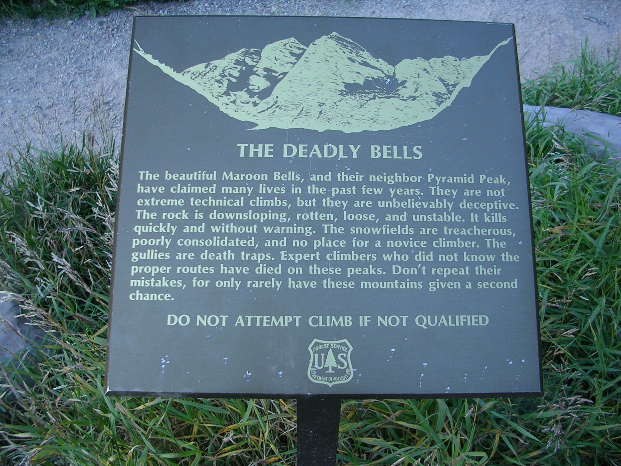
The Maroon Bells are some of the most deadly mountains in Colorado. It is not known how many people have perished on them over the years; however, a sign clearly warns hikers at the trailhead:
It would seem that Spencer's death could have been avoided if his group practiced safety precautions that should be employed when climbing in groups on steep terrain. This information is copied from Peter Topp's analysis above, but I believe it is worth repeating due to the value of the information:
- Climb one at a time while the rest of the group is sheltered from rockfall, or climb along parallel paths so that if rocks were to fall they would not hit anyone.
- Pay attention to your surroundings at all times - be vigilant about who is above and below you, and take extra precautions to prevent rocks from falling.
- If rocks do fall, make sure you notify others by yelling, "ROCK!"
- Get up earlier to beat crowds - if you're ahead of the rest of the climbers, you don't need to worry about rockfall above you (but you should still be cautious about knocking rocks down on people below you).
Failure to follow these precautions is something I've been seeing a lot lately, especially on popular 14ers. When I climbed Capitol Peak last year, I was down-climbing towards the knife edge when a group of three climbers, without helmets, came right below me and proceeded to climb up towards me, oblivious to the fact that I was above them on very loose terrain. I even warned them that I was on loose rock and that they should wait for me to continue, but they ignored my plea of caution. On Longs Peak last year, I witnessed the same thing, just after the "Narrows" section just after passing over to the "Trough." Several climbers, oblivious to the fact that many people were below them, carelessly knocked rocks down on people below, some large enough to cause significant injury or death.
It cannot be stressed enough that climbers be vigilant of the terrain they are on. Unfortunately, due to the growing popularity of the sport of climbing 14ers in Colorado, the number of people on any given mountain can be very high, making it almost impossible to mitigate the risk of rockfall caused by others. It is therefore the responsibility of each and every climber to practice sound safety precautions. In the example of my encounter on Capitol Peak, I stopped climbing until the three other climbers reached a safe distance away from any possible rockfall beneath me.
It is obvious that Spencer was a special person and well-liked by many. This is evidenced by a quote from a Facebook group created in his memory: "This is a toast to the life of a boy who had such a big heart. Today we lost someone who had so much determination and will power to be the best he could be. Someone with a world of friends and no enemies." My condolences go out to his family and friends.
9. Benjamin Russell Hebb - Longs Peak - Diamond - Dunn-Westbay route - Broadway ledge - 8/27/2010
|
|
| Photo courtesy of Jason Kaplan |
Benjamin was a 26-year-old from Broomfield, CO. He was set to graduate from the University of Colorado at Boulder in December with a degree in chemical engineering and had previously earned a degree in physics. He also worked as a research assistant at Gill Lab at CU - Boulder. Benjaimin was an expert rock climber, having spent most weekends climbing. At the time of his death, he was wearing a helmet and had all of the appropriate rock climbing gear and equipment with him for a successful ascent. Benjamin was solo-aiding the route, which involves fixing the rope to an anchor and connecting yourself to the free end with either knots or one of the various modern devices designed for roped soloing. Then the pitch is led as a standard aid pitch would be led. According to Rocky Mountain Park officials that witnessed his fall, he was unroped at the time - a common situation for experienced climbers in that location. Benjamin fell approximately 800 feet down a chimney.
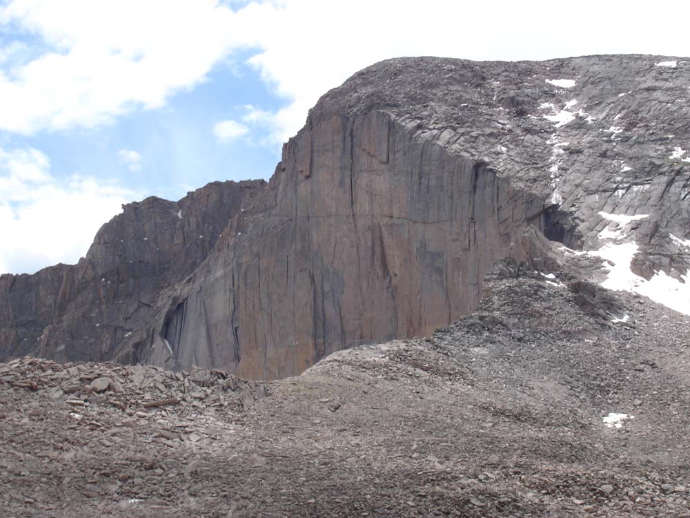
Longs Peak's "Diamond" - Photo by Matt Payne
Analysis
While Benjamin was climbing solo, which is generally considered more dangerous than climbing with a partner, it was most likely not a contributing factor to his death. The section of the route he fell from is often not protected because of the comparatively easy terrain it is on. With that being said, it would seem prudent to protect that section of the route if high winds are present or if your climbing abilities are not honed (Benjamin was a very experienced climber). Placing protection on this section of the route might be more feasible if a partner is with you; however, since I have not been on the route personally, I cannot attest to that. It would seem that Benjamin fell on one of the "easier" sections of the route, while unprotected - a relatively common event for expert climbers. The easier sections of any given route are often free-soloed due to the speed by which a route can be accomplished. Obviously, even on easier sections of a route, the most experienced of climbers can still have an accidental fall, just as in the case of Benjamin Hebb. In conclusion:
- When possible, climb with others - climbing solo is generally less safe than with other people.
- When free-soloing an easy section of a route, extra caution should be employed to avoid a fall.
It is not known if Benjamin could have done anything to prevent his death, except to use protection on an easy section (which is generally not something most climbers do). This accident merely accentuates the fact that even the best climbers can still fall to their death on easy routes or easier sections of a route (which is probably one of the reasons why people climb to begin with - the rush of climbing is a powerful experience).
10. Don Thurman - Kit Carson Mountain - 9/18/2010
Don Thurman - photo courtesy of Don's hiking partner.
Don Thurman was a 63-year-old man from Parker, CO. Don perished on Kit Carson Mountain near what is commonly referred to as the "Kit Carson Avenue," a small cut-out in the mountain that allows climbers to gain access to the summit. It is not known what exactly happened to cause Don's death; however, his climbing partner strongly believes that Don fell on steep terrain after the two of them became separated after mis-calculating their exit into the Kit Carson Avenue upon descent. According to his 14ers.com profile, he had previously climbed 51 of Colorado's 14ers. Don went by the name of PeakCowboy on 14ers.com and was known by that community as one of the nicest and most pleasant individuals on the site, as evidenced by some of these comments about him:
- "I was deeply saddened to hear of Don's passing. I only had the honor of climbing with Don once, but it was one of the most memorable climbs I have had."
- "Don Thurman possessed a powerful drive and desire to experience the outdoors. He was an accomplished outdoors-man, and was always ready for the next challenge. I had the great pleasure of making Don's acquaintance via 14ers.com."
- "He's a great guy, very experienced, knowledgeable, and fun to talk with. I had never done a bear bag before and he showed me how to do it correctly."
- "He was a great companion and a careful climber. Each outing [with him] is a cherished memory."
Analysis
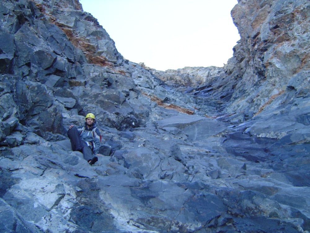
Don was clearly an experienced and accomplished mountaineer - he had been climbing mountains for several decades. His skill level was certainly high enough to tackle Kit Carson's relatively difficult terrain. Although Don had an undisclosed medical condition, it is not believed that it was a contributing factor in his death. Both he and his climbing partner were wearing helmets at the time of the accident. It would appear that what happened in this case was that Don and his climbing partner "missed" the exit to the Kit Carson Avenue while descending from Kit Carson's summit. When the Avenue is "missed" in this fashion, climbers descend too far into much steeper, looser terrain which requires careful climbing and route-finding to escape. This is a relatively common mistake on Kit Carson - in fact, my climbing partner, Terry Mathews, made the same mistake when we climbed it together in 2009. Fortunately, he was able to reverse course and ascend out via the Avenue properly. The Kit Carson Avenue can be seen in the below photographs. The first, a view of the Kit Carson Avenue as seen from Crestone Peak - photo courtesy of Terry Mathews. You can see that the terrain below the Avenue is quite steep.
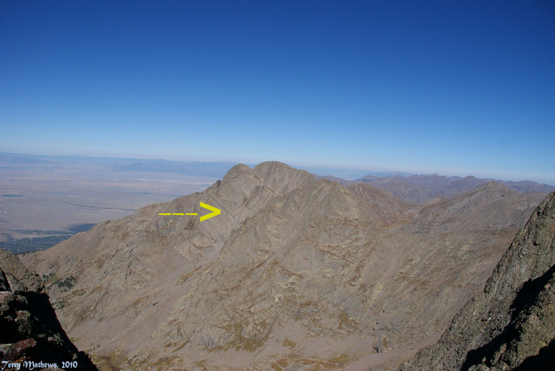
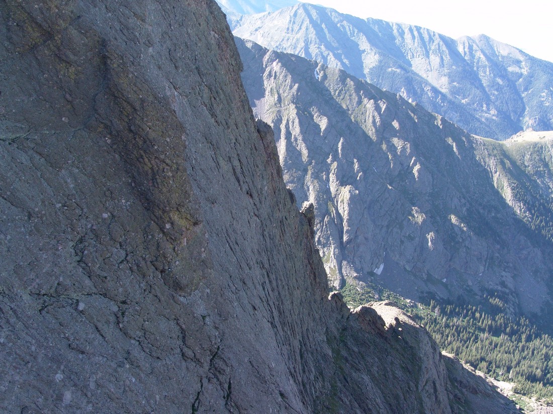
To get a sense of just how steep and dangerous the terrain becomes once one misses the Avenue, take a look at the next photograph that I took in 2009:
Based on what is known about Don's death, it is not certain that he could have done much differently to avoid his death. He was wearing the proper equipment, he had the necessary skills and experience, and he was hiking with a competent partner. If anything could be learned from his accident, it would be:
- When climbing, one should take careful notice of their surroundings, making special mental notes of geographical features when changing directions or climbing up from another feature.
- By taking these mental notes, you will help remember where you need to go upon descent to prevent finding yourself off-route in much more dangerous terrain.
- By reading other's trip reports one can read about different pitfalls and things to look out for on a given mountain. This is not the first time I've heard of someone "missing" the Kit Carson Avenue, and I am certain it won't be the last.
- If you are planning on climbing Kit Carson, make sure you pay attention when you are leaving the Avenue to finish the climb. Look for unique rocks, cairns, or other unique features to clue you upon your descent.
11. John Regan - Longs Peak - Keyhole route - 9/25/2010
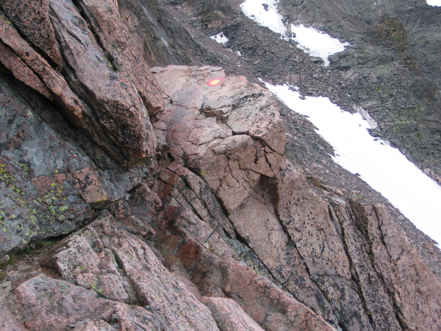
John Regan, a 57-year-old from Wichita, Kansas, died after falling about 300 feet from "The Ledges" on the Keyhole Route of Longs Peak. In response to this fatality, Rocky Mountain National Park changed the rating of the route to technical. The fall happened on the where two metal bars protrude from the rocks on the trail. See below:
Not much is known about John or the accident other than the fact that he slipped off of the mountain on a narrow section.
Analysis
John's accident was one of many on Longs Peak in 2010. Not much is known about John or his climbing capabilities, mountaineering experience or equipment. John's death reads quite similar as Jeffrey Rosinski's - an inexperienced climber who underestimated the mountain's difficulty. That is most likely the number one issue with Longs Peak, in general. Due to being in a National Park, Longs attracts thousands of visitors per year, many of which have little to no experience with climbing mountains. It is also possible that the section of the route that John fell from was iced-over and slippery.
In conclusion:
- Do not attempt Longs Peak unless you are an experienced mountaineer in excellent physical condition or unless you are with an experienced individual.
- Take extra caution on "The Ledges" section - it is slippery even on the driest of days due to the rock being worn down by years of boot traffic. Mountaineering boots such as the La Sportiva Trango or ascent shoes, not tennis shoes, should be employed to climb mountains such as Longs Peak. Excellent footwear is vital for grip, support, warmth and protection.
12. John Merrill - El Diente Peak - 9/26/2010
John Merrill was a 30-year-old climber from Cortez, CO. John was crushed by rockfall in nearly the same location as Peter Topp, exactly two months later. He was hiking alone with his dog, Oof. El Diente Peak would have been his fifteenth 14er. John was survived by his pregnant wife. John's dog, Oof, was rescued by a Search and Rescue operation the following day. The dog is now being cared for by Kacey Long, according to Watchnewspapers.com.
In searching for information about John Merrill, I stumbled upon his best friend's blog, which portrays John as being a lover of the outdoors and of elevated summits. In this blog, his friend, Tom Alphin writes about John:
"John has always been obsessed with reaching high places professionally and personally. I have always found the biggest reward for reaching high places were the clear views around me, but I think for John, part of the reward was the ability to see himself more clearly."
Analysis
Since John was by himself when he died, not much is known about what caused his death other than the evidence left behind by the rock fall that he died from. All signs point to this being a freak accident, almost identical in nature to the circumstances surrounding Peter Topp's death. It is not known if John was wearing a helmet or if he died instantly from his wounds. It is also not known if John's dog, Oof, played any role in the rockfall. What is known is that John's mountaineering experience was likely limited, based solely on the number of summits he had completed. The only mistake John likely made was climbing such a difficult mountain by himself without prior experience on similarly difficult terrain. In conclusion:
- Generally speaking, it is not a good idea to climb mountains by yourself unless you have significant mountaineering experience and / or a SPOT beacon.
- Climb within your abilities. There's no shame in turning around if a mountain presents challenges that you do not feel comfortable with.
- Test your footholds and handholds before placing a significant amount of your weight on them. This is especially vital in rugged terrain like the San Juan Mountains or Elk Mountains of Colorado.
- Climbing mountains with dogs is a personal decision. On more difficult terrain found on mountains like El Diente Peak, it is generally not a good idea to bring a dog with you since dogs tend not to be careful about rockfall, etc.
- Read above examples on how to climb safely on steep terrain to avoid rock-fall.
13. James Nelson - Mount of the Holy Cross - 10/3/2010
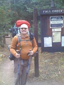
James Nelson is a 31-year-old man from Chicago, IL. No one has seen him since he went missing on October 3rd, 2010 when he set out for a five-day, 25 mile hike in the Holy Cross Wilderness Area. At the time of this article, James is presumed to be deceased; however, his body has yet to be found. Several attemps have been made to locate James to no avail. The circumstances leading up to, and following his dissappearance are murky, convoluded and controversial, as evidenced by the discussion on 14ers.com. Some speculate that James attempted Mount of the Holy Cross and fell - James had shared his proposed route with some friends before leaving Chicago and in those plans was a tentative scheduled climb of Mount of the Holy Cross. Others believe he became lost, similar to the case of Michelle Vanek, who famously went missing in the Holy Cross Wilderness Area in 2005. Some people speculate that he was killed and consumed by a mountain lion, despite a lack of evidence available to support that theory. It is also quite possible that James, being alone, became injured - perhaps a twisted ankle or knee ligament tear - and was far enough off the beaten path that no one could find him to rescue him. Clearly, not much is known about what happened to Mr. Nelson, and we probably will never know. What we do know is that he was somewhat experienced in backpacking, having led several trips with his Chicago Backpackers Meetup Group since 2006. Also, James was well-equipped with the proper gear and supplies for a long backpack trip.
Update: 5/27/2012: It would seem that the remains of James was finally found in the Holy Cross Wilderness Area: http://www.denverpost.com/commented/ci_20720181?source=commented-
Analysis
Embarking on a 5-day, 25 mile backpacking trip in a wilderness area notorious for lost hikers is a challenging undertaking for almost anyone. It is not known if James had the necessary fitness level or experience to accomplish such a feat. One of the last people to see James stated that he "covered the same ground it took James 45 minutes to cover in 10 minutes." This would seem to indicate that James was having trouble carrying his heavy pack at high elevation. A logical possibility is that James became exhausted from Acute Mountain Sickness at some point (read more about the impacts of AMS HERE). This could have led to any number of fatal mistakes, including straying off-route, falling down dangerous terrain, or other physical disabilities that could have impacted his ability to complete the hike safely. With that being said, it is also entirely possible that James was in great shape and that some other tragic event took place to explain for his disappearance.
Unfortunately, James' case presents us with several opportunities to learn some key lessons about wilderness travel:
- Make sure you are in good enough shape to accomplish the goal at hand - climbing mountains and backpacking are very physically demanding activities.
- Know the area you are traveling into before leaving home. While James had a GPS with him, he was traveling into a very wild part of the backcountry. Without first-hand knowledge of the area, James took some risks by traveling there by himself.
- If possible, hike with others - this ensures that if you are injured that someone can get help to rescue you.
14. James Patrick - Taylor Peak and Powell Peak - Rocky Mountain National Park - 10/16/2010
James Patrick was a 54-year-old licensed master plumber from Littleton, CO. He fell 1,000 feet down Taylor Glacier on steep terrain. During his fall, he pulled down his group's climbing rope, which stranded the other two climbers that were with him whom were later rescued. I have not been able to find many other details about James or the accident which caused him to perish. Apparently, his accident occurred during a sponsored trip from the Colorado Mountain Club, so many of the details of the accident are kept secret for legal reasons.
Analysis
Unfortunately, not much else is known about the accident. Based on the research I've done, it would seem that the cause of the accident was technically-related, meaning, either some piece of climbing equipment failed, or James made a mistake with his climbing equipment (knot / protection placement / etc).
15. Chris Pruchnic - Thatchtop Mountain - 11/20/2010
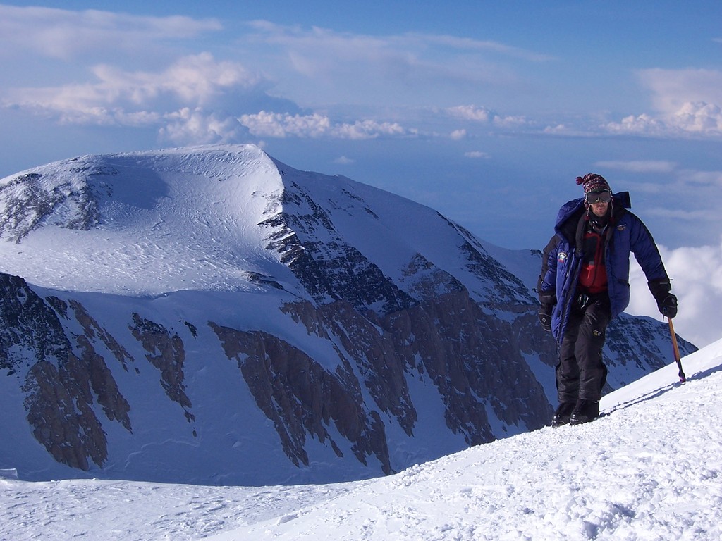
Photo courtesy of Kiefer Thomas
Chris Pruchnic was a 42-year-old man from Denver, CO and the former chair of the Front Range Section of the American Alpine Club. Chris was a very experienced mountaineer and ice climber. Chris was attempting an ice climbing route known as "All Mixed Up," located 1,200 feet above Mills Lake in Rocky Mountain National Park. Chris was climbing with one other person at the time, who was not injured. The route is very steep with loose ice and talus. It is one of the most famous ice climbing routes in Colorado. Chris was one of the most well-respected climbers in the Denver area, as evidenced by comments left by other climbers and people that knew him:
- "Even though I knew only a few morsels of his life, I will remember his kindness, his refreshing perspective on life and living it to the fullest, that went hand in hand with his passion for the outdoors from the deepest depths to the highest heights."
- "You'll be greatly missed as a climbing partner, a mentor, and most of all a great friend."
- "He had an infectious love of the outdoors and truly loved to give back. He will be greatly missed, in many ways in the climbing community."
Analysis
Not much is known about the details of the accident that caused Chris to fall to his death. It could have been ice conditions, gear malfunction, technical oversight - or a combination of all three. The route that Chris fell from is highly technical and quite difficult, even for experienced mountaineers. The very nature of ice climbing includes risks that are generally accepted as part of the sport. Placement of protection is generally difficult, and even more so on routes such as All Mixed Up. It is quite possible that Chris placed an ice screw or other form of protection, fell, and the protection failed. This is actually fairly common in ice climbing because of the way in which the protection is placed into the ice. According to an article on ezinearticles.com by Phil Lyall:
"Putting a piece of protection into ice is not easy. Most commonly you are looking at putting in an ice screw, which is very similar to a normal screw but larger: about the size of a plastic tent peg. There are no pre-bored holes in ice, so one must first chip a small area of ice away for purchase: a depression that allows the screw to bite. If you are lucky the screw does bite and then you are able to begin boring into the ice. No screw drivers, no vises, no warm basement workshops, and no hands because you are still clinging by ice axes to the approximately perpendicular face of waterfall ice. Houdini would have appreciated the act. Placing a screw is difficult. Placing a screw in the throes of worrying about a fear-fall, is next to impossible."
In conclusion:
- Ice climbing is dangerous, even for experienced mountaineers. Take extra caution when engaging in this sport.
- Route conditions can negatively impact your ability to safely complete a climb. Before starting a climb, evaluate the conditions of the route and make a sound decision on whether or not to continue.
- Check your equipment before starting a climb - make sure your rope is in good condition. Stewart Green from about.com provides good advice on how to do this.

Summary / Data / Charts / Common Themes
2010 marked one of the deadliest mountaineering years in history for Colorado. As an avid hiker and mountain climber, I could not help but take special notice of each death, as each incident personally impacted me due to the fact that these people died doing something that I do almost every weekend. Witnessing the impact of these deaths on the hiking community at large, and reading the misinformed reactions of non-participants of the sport inspired me to research each death and try to formulate explanations for the lay person, the expert and everyone in between. I realize that this is a quite controversial undertaking, and also know that there will be critics. To reiterate from my introduction, I believe that this is an acceptable risk for me to take if even one person reads this article and learns something from it.
Many have speculated that the up-tick in deaths is caused by an increase in climbers and new hikers to the sport of hiking and climbing mountains in Colorado. I have a different set of explanations that I'd like the reader to consider:
- The digital era has made it even easier for people to access information, whether that be news or information about the sport in general. As media outlets continue to saturate the market with news of events via print, websites and social media, the public's awareness of deaths and accidents will increase.
- So too will the public's access to information on how to climb mountains - in fact - many people believe that sites like this one and 14ers.com have only made things worse by encouraging people to climb when they are probably not physically or mentally capable of it.
- In reviewing the statistical tables of mountaineering deaths in North America, I've discovered, at least on a surface-level, that there is not a meaningful or significant increase in the number of accidents over the past 50 years. This would seem to debunk the theory that because more people are climbing mountains, more people are dying.
- The increase in 2010 is therefore most likely only a fluke.
The below charts were created using data from the ANAM statistical tables. Chart 1 shows Colorado Mountaineering Deaths from 1961-2006. While ANAM captures all death types (avalanches, rock climbing, etc) and does not drill down to show Colorado-specific data for mountain climbing, it is still good data to analyze. As you can see, the trend has remained relatively static over the past 50 years, with only a slight increase in the past decade. ANAM has not released 2007-2010 data at the time this article was written.
Chart 1:
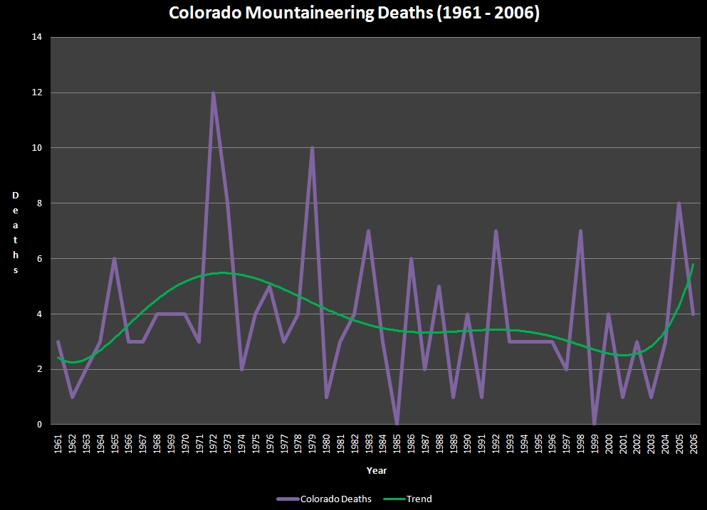
Chart 2 illustrates Colorado mountaineering deaths as a % of USA mountaineering deaths. This data is useful because it shows that Colorado is not an outlier for mountaineering deaths.
Chart 2:
Again we see that the trend is that deaths have been relatively static with only a slight up-tick in recent years.
There were some common themes of the deaths this year:
- Highly experienced mountaineers perished on difficult mountains or routes. This is not surprising if one considers that as one becomes more experienced, they will pursue more difficult mountains or climbs. Compound this with a steady increase in self-confidence, which may deter a climber from taking precautions they normally would, and there is increased potential for risk and subsequent death.
- Inexperienced mountaineers perished trying to climb mountains that probably exceeded their ability, expertise or equipment.
- 6 out of 15 (40%) deaths were individuals over the age of 50.
- 3 out of 15 (20%) deaths were individuals 20 years or younger.
- Longs Peak was the most deadly mountain, followed by El Diente Peak and Crestone Needle. All three mountains require "Class 3" climbing or harder.
- The quest to summit all of the 14ers seems to drive people to attempt mountains that are either beyond their skill level or during poor conditions.
- Some of the victims were almost finished with their quest to summit all the 14ers. The increasing use of these lists to establish mountaineering goals (of which I am guilty of as well) may not be practical for all climbers, especially when their final climbs are considered to be highly dangerous (Thanks to Curt Kennedy for pointing this out to me).
- Longs Peak is dangerous. Tourists, beginners and inexperienced climbers beware!
If you are considering climbing mountains in Colorado and found the contents of this article overwhelming, consider joining the Colorado Mountain Club and taking their Basic Mountaineering class. At the very least, please take the time to read the contents of my mountaineering safety article. Be safe out there!
It's finally here! After a fun contest for a design of the t-shirt, the 100summits.com t-shirt has arrived and is now available for purchase in several colors, including white, grey, lime green , pink, and more.
If you've followed any of my other trip reports this year or last year, you'd know that Tabeguache Peak is officially my nemesis. After one failed attempt last year (2009) due to weather, another failed attempt this May due to exhaustion after summiting Shavano, and then a 3rd failed attempt in September due to trying to knock off too many 13ers in one day, I felt I needed to return to conquer this beast of a mountain. Tabeguache is not a technically challenging 14er, or even inaccessible due to distance or other factors, so why has it given me and tons of other hikers problems? Quite simply, the standard route is a really long day that I'd not been in shape to do in past attempts, and the alternate routes are either "off-limits" or remote. After reading up about the Jennings Creek approach thanks to my friend Regina, who had summited Tabeguache eariler this year via Jennings Creek and thanks to my friend Terry who accomplished the same just a couple weeks ago, I felt that it was a good approach and that I had a high likelihood of success. Additionally, I had conferred with Aaron Johnson last year on Summitpost that the route was viable. The Jennings Creek trailhead was closed in 2002 by the Forest Service because the upper portions of the trail had major erosion and it was becoming quite an eyesore with no solution in sight. Fortunately, however, the trail leading to the Jennings Creek drainage is not closed off for those wanting to gain access to other portions of the area, such as the west ridge of Tabeguache. Please note that the route I used was not on the closed trail and that it is important for hikers to stay off of that route due to the damage caused on the mountain.
Having been instructed wisely by my wife to find a hiking partner for this November hike, I dialed-up a fellow 100summits.com member, Curt Kennedy to see if he wanted to go. It was a last minute invitation, but Curt was game. We agreed on the route and plan, and he drove down from Denver to pick me up early on Sunday morning for our climb. After a quick drive over Highway 24, down Highway 285 to Highway 50 West, we turned off on Chaffee County Road 240 and hit the trailhead after approximately 7.45 miles. The trailhead can be really hard to spot - the exact coordinates are: 38.60070o N and 106.27929o W. We arrived at the trailhead around 8:30 AM and started hiking at around 9:00 AM, which was a little late for my typical taste, but I felt we would be in good shape.

Curt Kennedy preps for a long day of hiking.
Here are some meaningful metrics from our adventure:
Total elevation gain: 3,533 ft.
Total distance hiked: 7.14 miles
Total time hiking: Approximately 10 hours
Total wildlife sightings: 1 (Mountain Goat)
Our planned route would take us up the trail and into the Jennings Creek valley, where we would follow the drainage up to the saddle between Carbonate Mountain and Tabeguache Peak. From there, we would ascend the ridge up to the first false summit at 13,936 ft., and then over to the summit of Tabeguache.

After hiking only a short distance, we noticed that already a storm was starting to build to the west. Since the weather forecast was only 10% chance of precipitation, I was not concerned that it would prevent us from accomplishing our goal. Regardless, the storm did pass through briefly and drop trace amounts of snow, which was a very peaceful yet exciting experience to have winter knocking on the door.
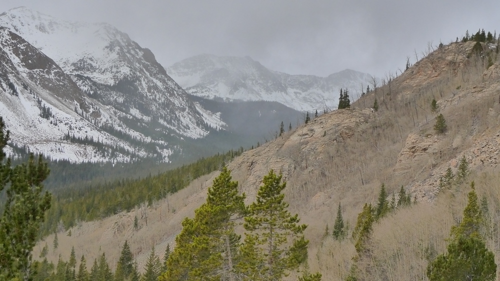
A storm moves in to the west of Jennings Creek. Photo by Curt Kennedy.
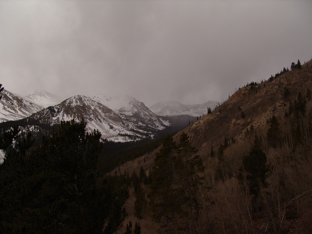
The skies darkened as the storm moved in on us early in the day.
From here on out, the wind became a factor, blowing steadily throughout the day at speeds varying between 10 and 30 or 40 MPH.
After a short hike up into the basin, the trail turned east to head up the closed restoration area and we continued straight north towards the top of the Jennings Creek valley. Both Curt and I greatly enjoy hiking off-route, due to the added challenge and the unexplainable feeling of excitement you get when conducting exploration.
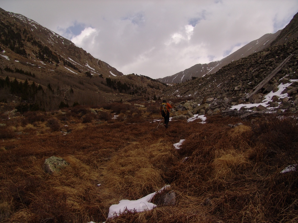
Curt hikes up the basin.
The basin itself is not very challenging or difficult. There was a faint, relatively easy trail leading up the valley. We had seen boot prints in the snow periodically, most likely from the group Terry was in just the previous weekend. Speaking of snow, both Curt and I were prepared with gaiters; however, we never encountered much more than a few inches the entire day. The south-facing valley and ridges fared well over the past few weeks, granting us with bare ground on much of the terrain we would cross.
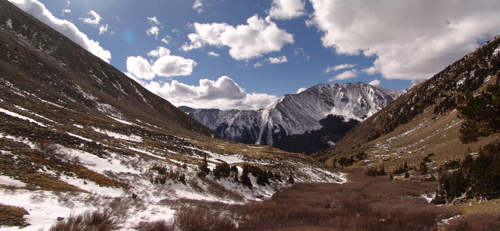
Looking back down the Jennings Creek valley.
The valley itself is littered with ancient-looking trees, placed in almost guardian-like poses throughout the hike up into the basin.The views of Taylor Mountain were ubiquitous while hiking up the basin, as evidenced by the above photo and the one below, which demonstrates the elderly presence of the trees in the valley.

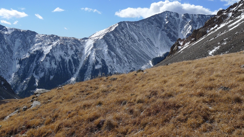
Tundra grass grows on this ledge which rested in front of our view of Taylor Mountain - photo by Curt Kennedy
Our pace up the valley was steady - not too fast, not too slow. We took minimal breaks and enjoyed the amazing weather.
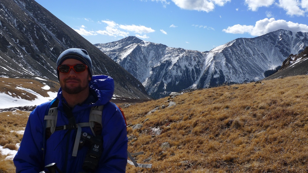
Matt Payne in the Jennings Creek basin - photo by Curt Kennedy
Before long, we gained our first views of Carbonate Mountain, located just west of Tabeguache Peak. I had been on the summit of Carbonate Mountain just a couple months ago, which was somewhat frustrating being that close to Tabeguache and not having the energy to reach it.
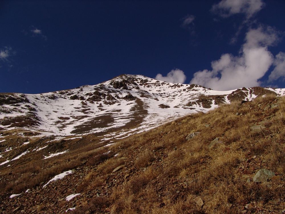
Carbonate Mountain.
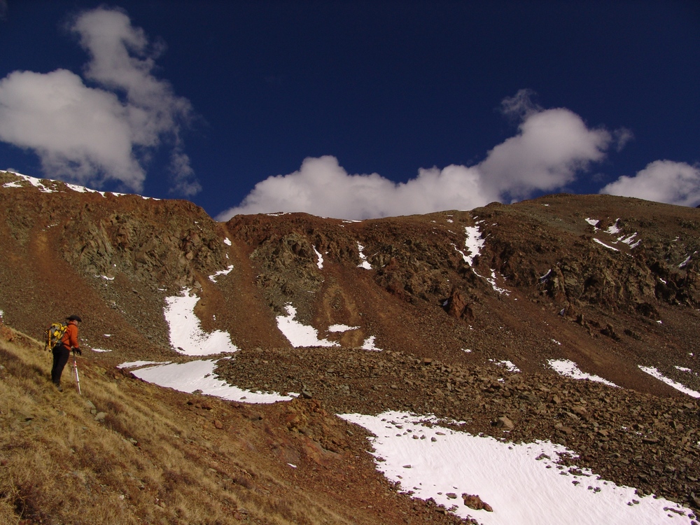
Curt surveys the valley.
After taking a short break near the base of the ridge between Carbonate and Tabeguache, we quickly gained the ridge and began our grueling ascent up the steep and long west ridge of Tabeguache.
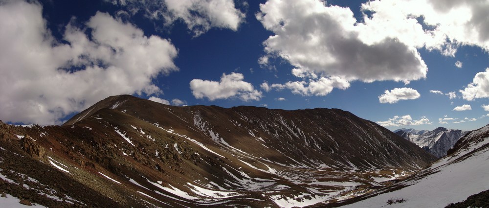
Tabeguache's west ridge.
Views from the ridge were spectacular. The Jennings Creek basin was littered with small snow drifts everywhere, making for a very interesting pattern as viewed from above on the ridge.
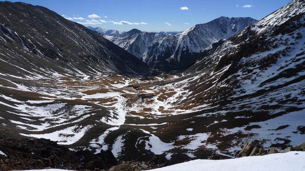
Jennings Creek valley. Photo by Curt Kennedy
Additionally, the view of Antero was great, which revealed that there was very little snow in this portion of the state.
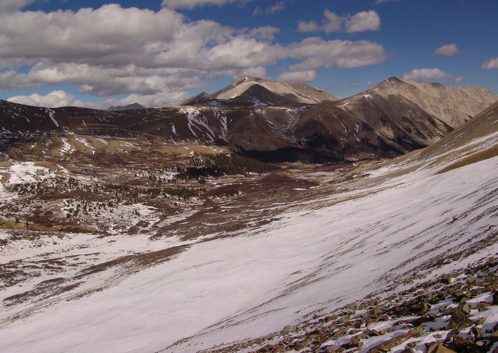
Antero as seen from the Tabeguache - Carbonate ridge.
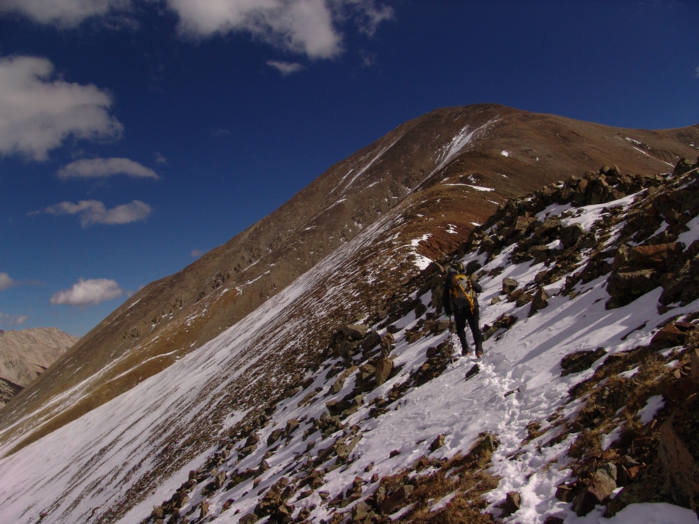
Curt plowed through the light snow leading up the ridge-line.
Once we gained elevation, the view back to Carbonate was outstanding. The ridge heading up Carbonate should probably not be under-estimated due to it's steepness and ability to hold snow, as evidence by the following photo.
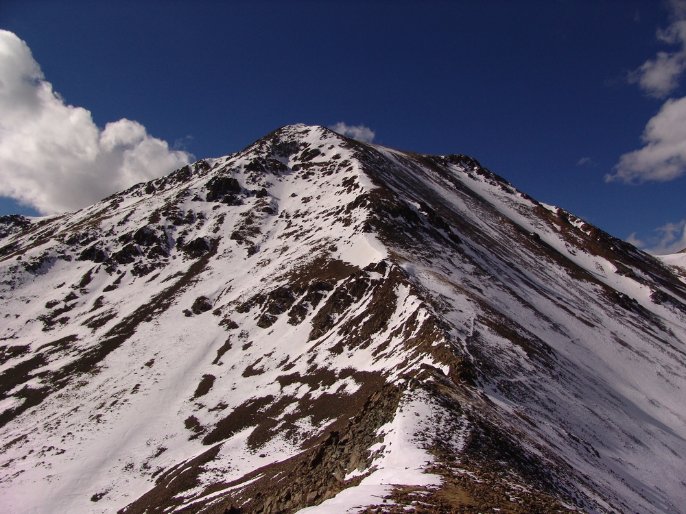
Carbonate's east ridge.
Eventually, views of Cyclone and Grizzly were available, which was an interesting perspective since I had climbed them earlier in the year.

After reaching the first false summit of Tabeguache, the rest of the climb came into view and put a damper on our excitement. Tabeguache was still quite a long distance away from where we stood.

Tabeguache as seen from point 13,936ft.
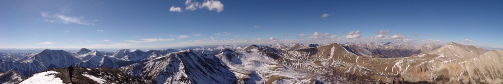
Curt Kennedy is seen at left in this large panoramic photo taken from point 13,936ft.
This vantage also offered excellent views of both Taylor Mountain and Mount Aetna, two of the most southern summits in the Sawatch range.
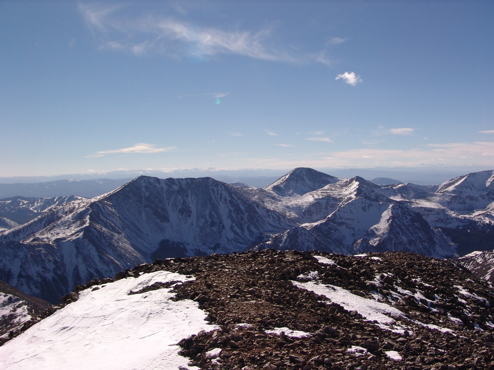
I headed up towards Tabeguache at a brisk pace. For some reason, when I'm close to the summit of a mountain, my body shifts into high gear and I'm able to tap into an unknown energy source. It seemed that Curt was holding back and throughout my ascent to Tabeguache, I looked back to see that Curt was OK. Soon, I realized that Curt had stopped his ascent for some reason and that he was signaling me to continue without him. The terrain on the final two summit sections of Tabeguache were quite challenging, much to my satisfaction and surprise. By going up and over the top of every obstacle, I found myself completing class 3 moves to reach the summit of Tabeguache. It was a nice additional challenge that I somehow knew my nemesis would find a way to provide. I believe that people should take caution on this route due to this final section. While it was well within my comfort zone, I could see someone signing up to climb Tabeguache with the expectation of an easy walk-up, only to find themselves doing some class 3 moves outside of their comfort zone or skill level.
Reaching the summit of Tabeguache was very satisfying. Having had my previous attempts foiled, I was quite elated to finally put an end to this mountain's curse on me. Conversely, I was a little disappointed in how close Shavano appeared to be from this vantage point. Nothing at all what I had remembered when viewing Tabeguache from Shavano's summit back in May.
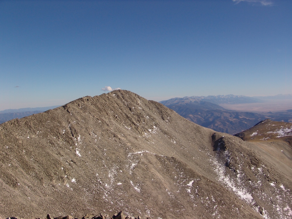
Shavano and the Sangre de Cristo range in the distance.
I set-up the self-timer to take the obligatory summit shot, took a few photos to later create a pano with, ate some light food, and headed back over to see what Curt's hold-up was.
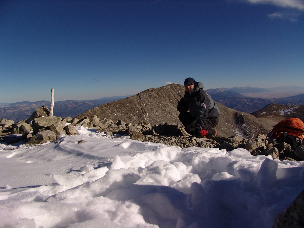
Matt Payne poses in this self-timer on Tabeguache Peak.

A 360 degree pano from the summit of Tabeguache Peak
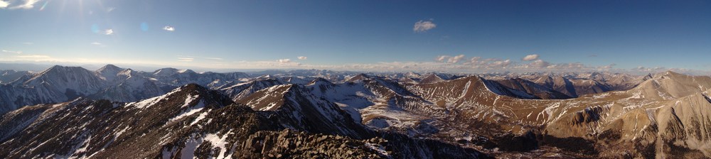
Looking west and north from Tabeguache.
I quickly made it back over to Curt, who was waiting for me on the false summit at 13,936 ft. He explained that he had developed a leg cramp on the way over to Tabeguache and was glad that I understood that he was not wanting me to wait for him on top. Unfortunately, his leg cramp was quite severe, and it greatly reduced his mobility and usage of his left leg. Our descent speed would be greatly reduced by his injury. We carefully climbed back the same route we had climbed up, being careful not to disrupt Curt's leg too much. When we reached the saddle between Tabeguache and Carbonate, the sun was already down and the light in the area was getting dimmer and dimmer by the minute. Fortunately, we both had head lamps packed and plenty of warm clothing. By the time we reached the trees at the lower half of the basin, we were in complete darkness. We were quite careful to select our route and ensure that we did not miss the trail. After much searching and good teamwork, Curt and I were able to find the trail heading back down to the trailhead. Due to our hike in the dark, I am sure that this trip will go down in memory as one of the more exciting and enjoyable ones I've had.
Earlier this year I had made plans to climb Mount Wilson, Wilson Peak, and El Diente with my dad; however, plans quickly changed through the summer as Ray painfully realized that he did not have the flexibility, strength, nor desire to conquer those mountains. We decided instead to take a camping trip with my son, Quinn, up to the southern Sawatch range and I would figure out alternative climbing options later.
Being that one of the best months to climb mountains in Colorado is September, I wanted to get in as much hiking time as possible to soak in the fall colors. I chose the far southern Sawatch range to begin my quest for great fall color photos and hoped to conquer my personal nemesis, Tabeguache Peak, as a bonus. Due to it's location, Tabeguache is generally climbed in conjunction with Mount Shavano - which I've already climbed twice in two years due to my quest for Tabegauche's summit. For this trip, I'd planned to hit Tabeguache from the north, while bagging Grizzly Mountain, Cyclone Mountain, and Carbonate Mountain; however, upon further inspection of the TOPO map for the area (St. Elmo Quadrangle), I discovered that there were several other 13ers right near where we were planning to camp, all of which were connected by long ridges, and that it would be a shame not to climb them while we were in the area. My plans quickly changed and I added Boulder Mountain and Mount Mamma to my itinerary.
Trip Statistics:
Summits reached:
Boulder Mountain: 13,528 ft. (ranked 236 in Colorado)
Mount Mamma: 13,646 ft.(ranked 173 in Colorado)
Grizzly Mountain: 13,708 ft. (ranked 142 in Colorado)
"Lo Carb": 13,591 ft. (unranked)
Cyclone Mountain: 13,596 ft. (ranked 192 in Colorado)
Carbonate Mountain: 13,663 ft. (ranked 165 in Colorado)
Total elevation gain: 4,883 ft.
Total prominence in feet: 2,723 ft.
Total distance hiked: 11.41 miles
Total time hiking: 10 hours, 30 minutes
Total photos taken: 592
Total wildlife sightings: 1 (Mountain Goat)

Collegiate Peaks - located in the Sawatch Range, including Mount Antero left of center, Mount Princeton at center and Mount Yale at far right.
On Saturday, September 18, 2010, my dad, my son, and I loaded into my Jeep Grand Cherokee and headed for Baldwin Gulch. To get there, we traveled to Highway 285 via Highway 24 and drove south from Buena Vista / Johnson's Corner to Chaffee County Road 162, heading west towards Mount Princeton & St. Elmo. After 12.5 miles, we took a left (south) on Chaffee County Road 277 (Mount Antero / Baldwin Gulch Road).

The aspen changing colors in Baldwin Gulch.
This is a 4WD road and put my Jeep to the test. In fact, when I purchased this Jeep earlier this year, I had this road in mind as a good barometer for how much clearance etc. I wanted to have. The road is fairly rough in spots, and I knew that after the road splits towards Baldwin Lake, it becomes even rougher. Sure enough, after passing the turn-off for County Road 278 at Baldwin Creek and staying right, the road became fairly crazy. If you don't have good clearance, this would be a great place to stop.
We found a great campsite roughly 4.3 miles up the road (1.7 miles from the Baldwin Creek turn-off) near a large boulder field near the smaller lakes below the main Baldwin Lake. We set-up camp and enjoyed the cool yet pleasant fall weather. Speaking of weather, the forecast for the weekend was ideal for hiking - no rain, no storms, no wind. I took a small hike around the area to enjoy the fall colors. I was very impressed by the golds, yellows, reds, and browns of the vegetation - it certainly made for quite the view, and complimented the diverse colors of the mined rock on the mountainsides.

Antero Peak is reflected with vibrant blue colors.

Cronin Peak and lower Baldwin Lake.

Cronin Peak and lower Baldwin Lake.
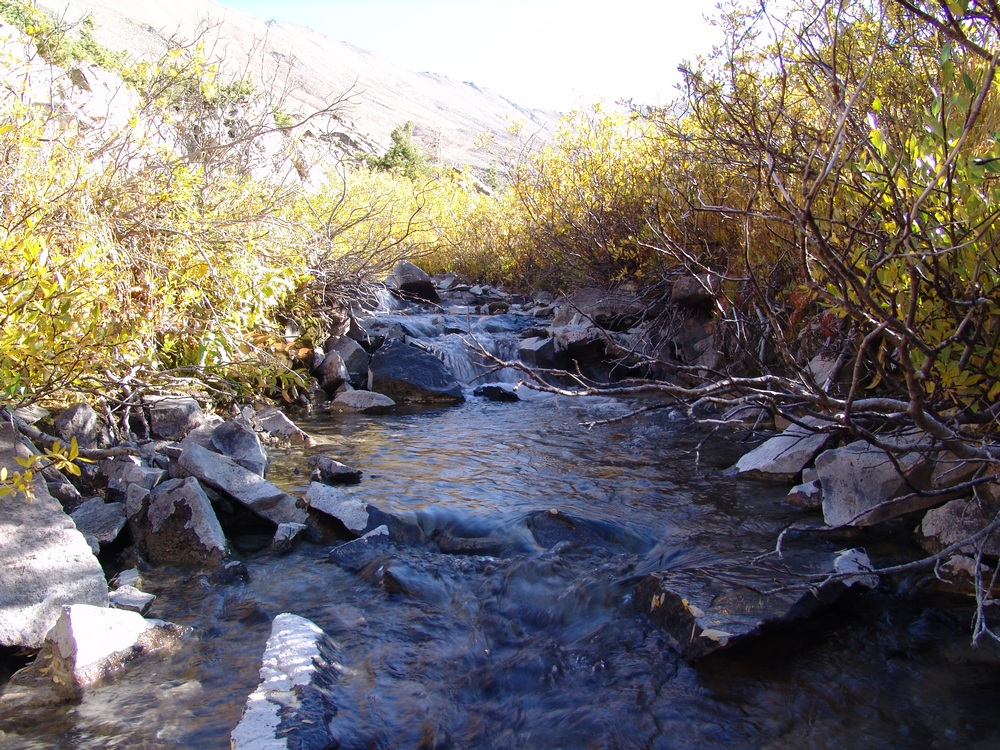
Baldwin Creek.
The moon was nearly full and much to my surprise, there were great views of the moon rising above Cronin Peak in the early evening.

Cronin Peak with the moon rising above it, reflected in the water.

Cronin Peak with the moon rising above it, reflected in the water (lighter this time).
After enjoying a large campfire and roasting marshmellows with my son, we all went to bed. I set my alarm for 4 AM so that I would have a full day for my planned epic hike:

The route map for Boulder Mountain, Mount Mamma, Grizzly Mountain, "Lo Carb," Cyclone Mountain and Carbonate Mountain.
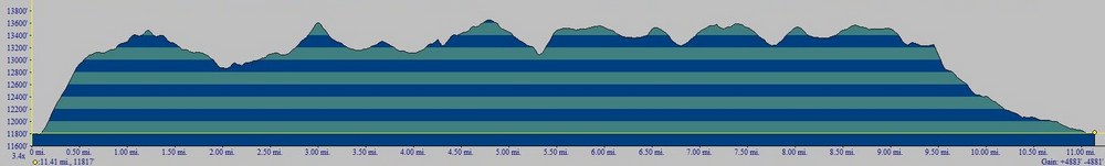
Elevation profile for Boulder Mountain, Mount Mamma, Grizzly Mountain, "Lo Carb," Cyclone Mountain and Carbonate Mountain.The first 1/2 mile was pure bushwhacking scree hell.
I left camp at 4:30 AM and bushwhacked straight up the side of the ridge of Boulder Mountain. I stumbled across an abandoned mine on the way up and found this part of the hike to be the worst part of the day. As you can see above, the first 1/2 mile of the hike was absolutely brutal - I gained 1,400 ft in the first 1/2 mile on loose scree, boulders and talus. It was the kind of rock where you took one step forward and then slid backwards half a step. It took me only an hour to reach the ridge, where I was greeted by strong, cold wind and pure darkness. The stars were amazing though, and the sun was just beginning to provide the first glimpse of light on the eastern horizon, left of Antero. Looking north, I could see the vague outlines of Boulder Mountain, which seemed to be pretty far away in the darkness. Through the cold wind, I pushed my way up the summit ridge of Boulder Mountain, and reached the summit at 6 AM, a mere 1.5 hours after I began my adventure. The summit had a very awesome looking cairn at the top, which provided nice contrast with the light of the rising sun.

If you've never experienced the sunrise from the top of a mountain before, it should be on your bucket list. This marks the third time I've been able to witness the sunrise from 13,000 ft+ and it never gets old. The sunrise provided excellent outlines of Mount Antero, Mount White, Tabeguache Peak, and Mount Shavano to my east. Additionally, as the sunrise continued to increase the amount of light, it became clear that there were incredible views of gold and red aspen across the valley along the ridgeline for Mount Princeton to the north. It was quite stunning to see all of the colors emerge from the darkness as the sun rose above the horizon.

The sunrise illuminates the sky, revealing Mount Princeton (left) and Mount Antero (right).

The sunrises behind Mount Antero.

The changing aspen are visible from the summit of Boulder Mountain.
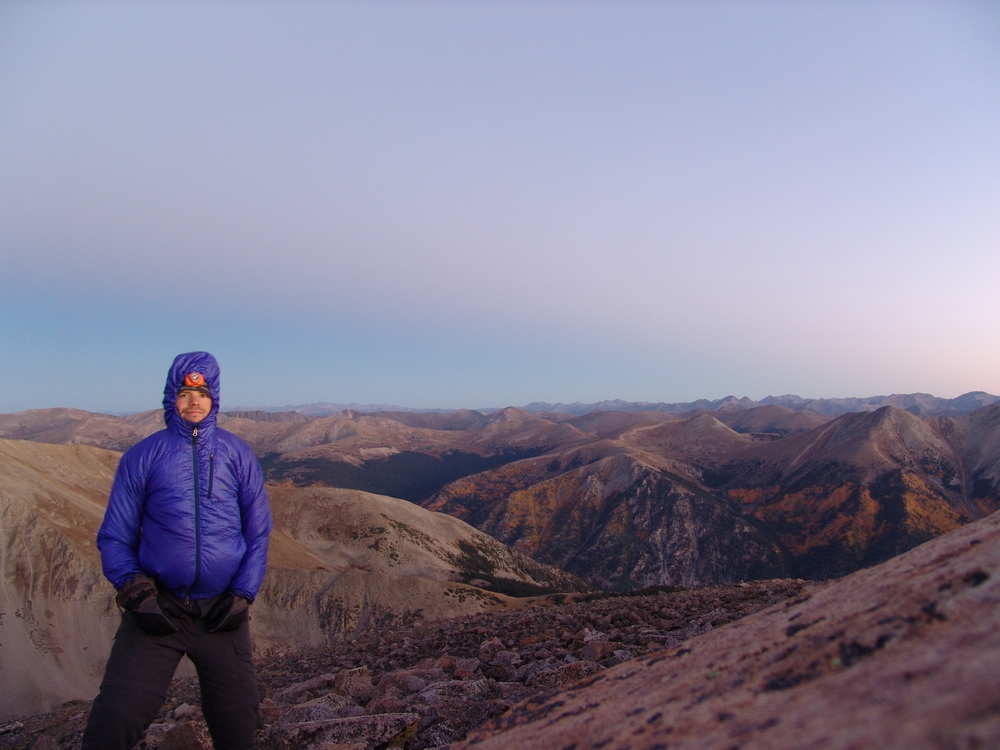
Matt Payne on the summit of Boulder Mountain - it was really windy!

Aspen change colors on the slopes of Mount Princeton and it's neighbors.
After enjoying the sunrise, I started to head back down the ridge of Boulder Mountain to the south. As I traveled along the ridge, the sunrise lit up skyline to my right (west) across the slopes of Mount Mamma and to the north, illuminating groves of aspen trees. It was nothing short of spectacular.
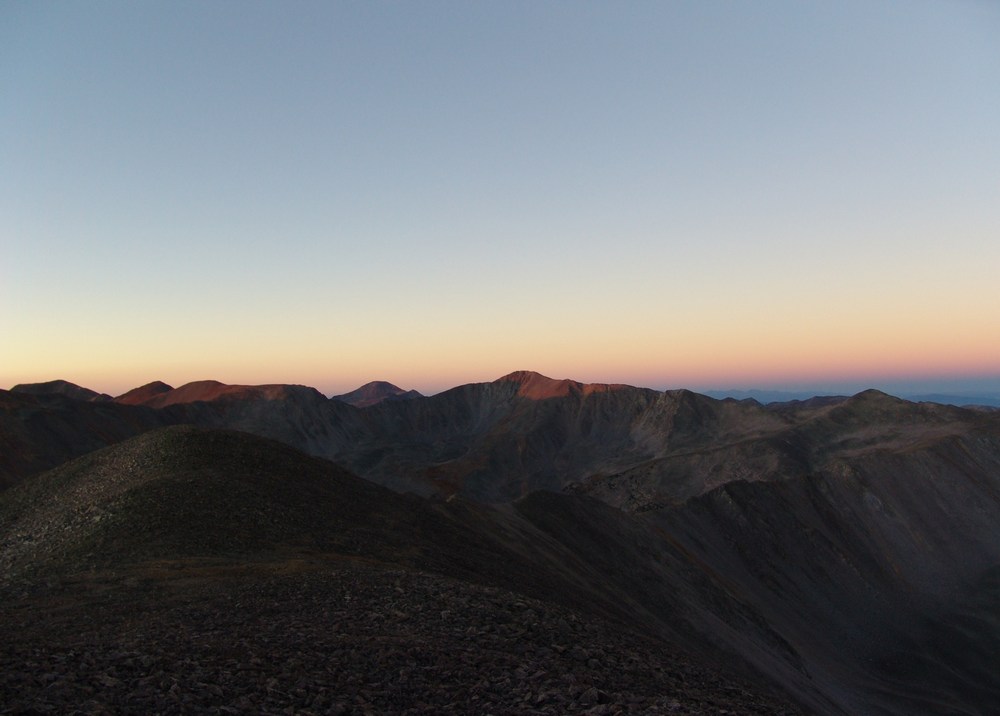
Grizzly Mountain in the far distance...
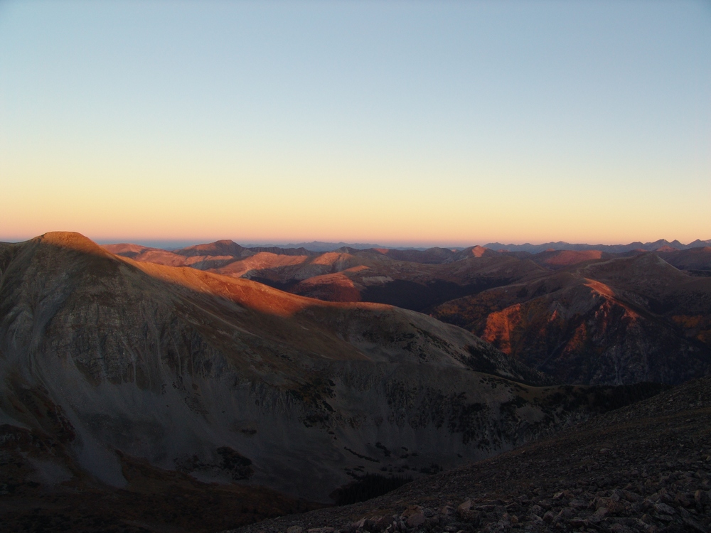
Mount Mamma is lit up by alpenglow.

Aspen are further revealed by the rising sun across from Mount Mamma's north ridge.
As I approached the ridge between Mount Mamma and Boulder Mountain, the full length of my next summit revealed itself in quite an overwhelming way. The distance between the two peaks seemed quite vast; however, I was so entranced by the surrounding views that any doubts I had about going onwards were destroyed.

At center - Cronin Peak. In the far distance just right and behind Cronin were the final two mountains I would end up climbing - Cyclone and Carbonate. The ridge to Mount Mamma is quite long from Boulder Mountain.
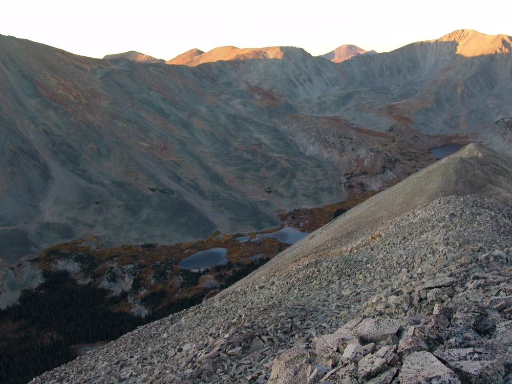
The lower Baldwin Lakes were right below me on the saddle between Mamma and Boulder.
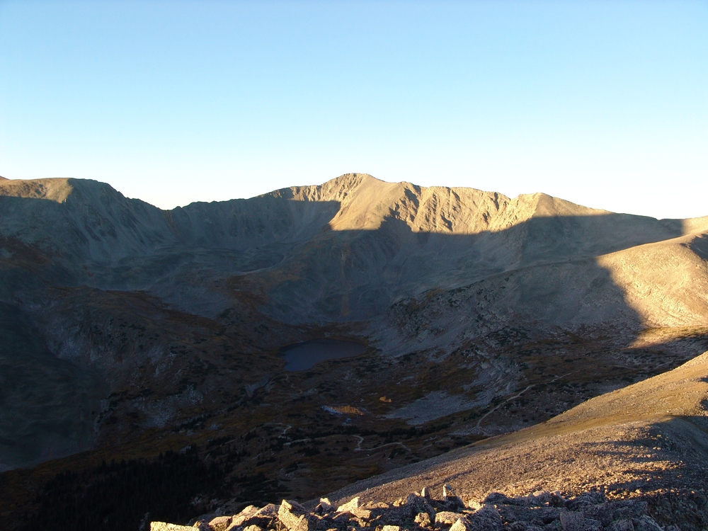
Baldwin Lake pools reflect parts of "Lo Carb" to the South from the saddle between Mount Mamma and Boulder Mountain.
About halfway across to Mamma, it still felt like I had a long way to go...
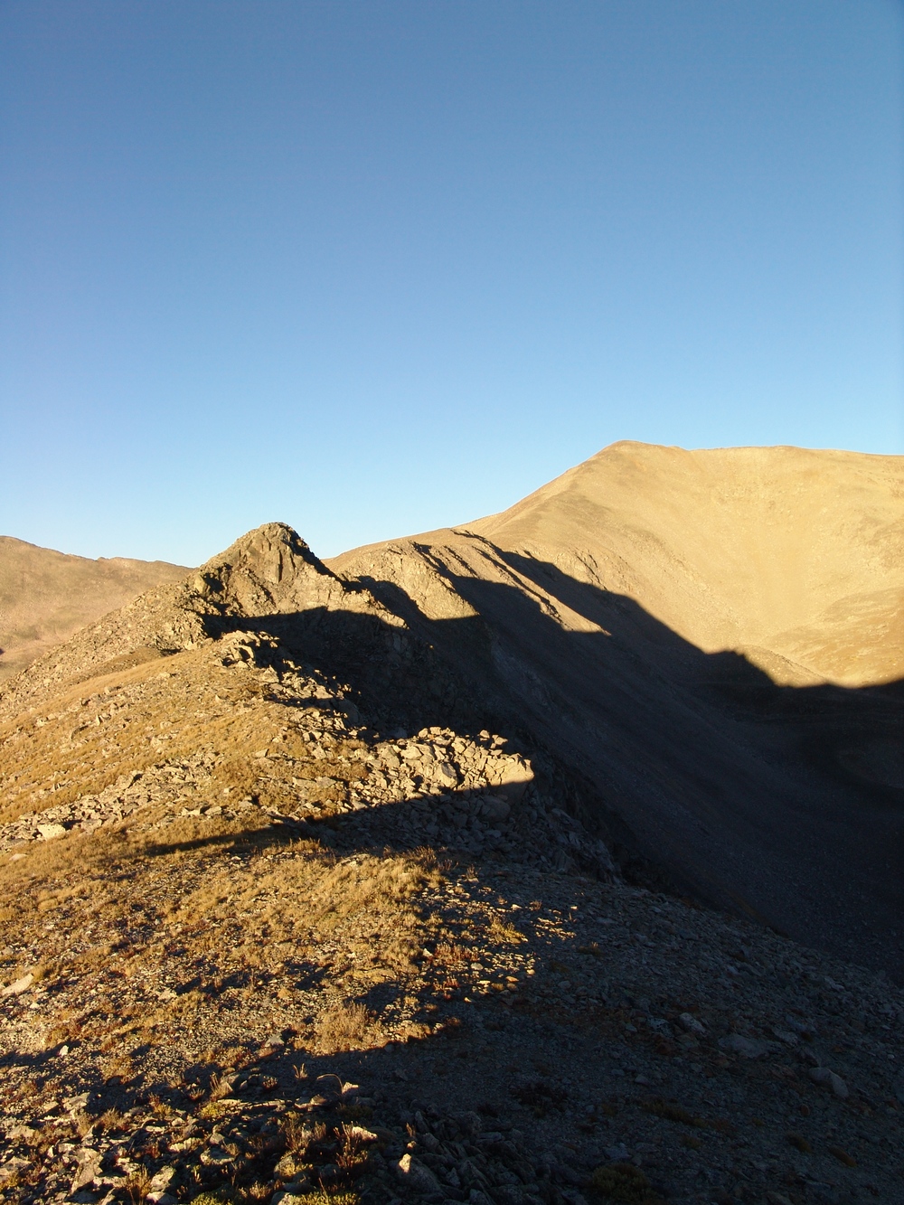
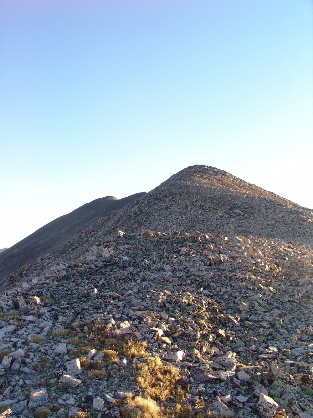
Mount Mamma was quite a long haul from Boulder Mountain...
At 7:30 AM I finally reached the summit of Mount Mamma, just three short hours from the start of my trip. My legs were feeling extra spicy!
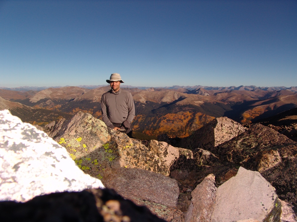
Matt Payne on the summit of Mount Mamma - with insane aspen in the background.
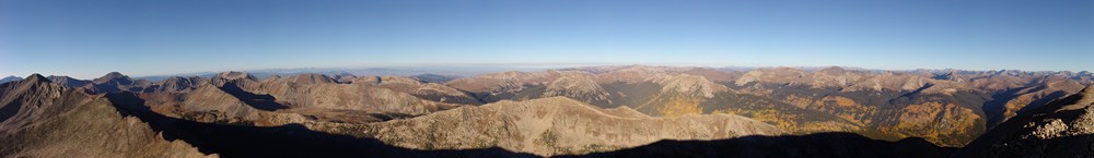
A panoramic landscape looking south to north from the summit of Mount Mamma.
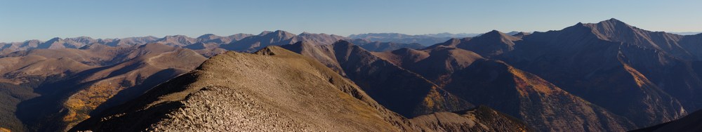
Mount Princeton seen at far right among changing aspen, as seen from the summit of Mount Mamma.
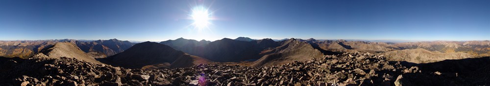
A 360 degree panoramic landscape from the summit of Mount Mamma.
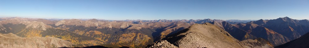
Huge groves of aspen are seen to the north and west of Mount Mamma.
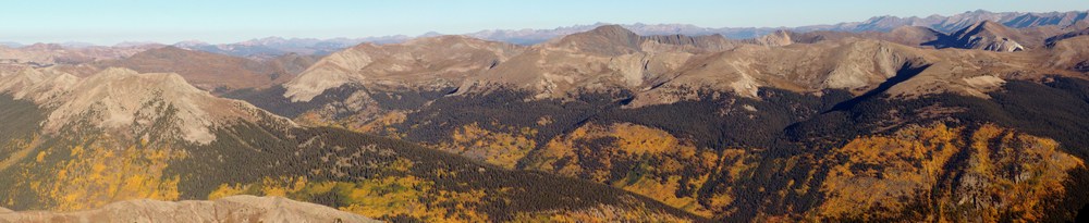
A zoomed-in panoramic landscape of aspen trees west and north of Mount Mamma.
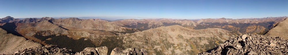
A panoramic photo looking west from Mount Mamma.
After taking some time to rest on Mount Mamma, I peered over to my next objective: Grizzly Mountain. Grizzly Mountain would be the highest mountain for me to summit this day, and it was not easy.
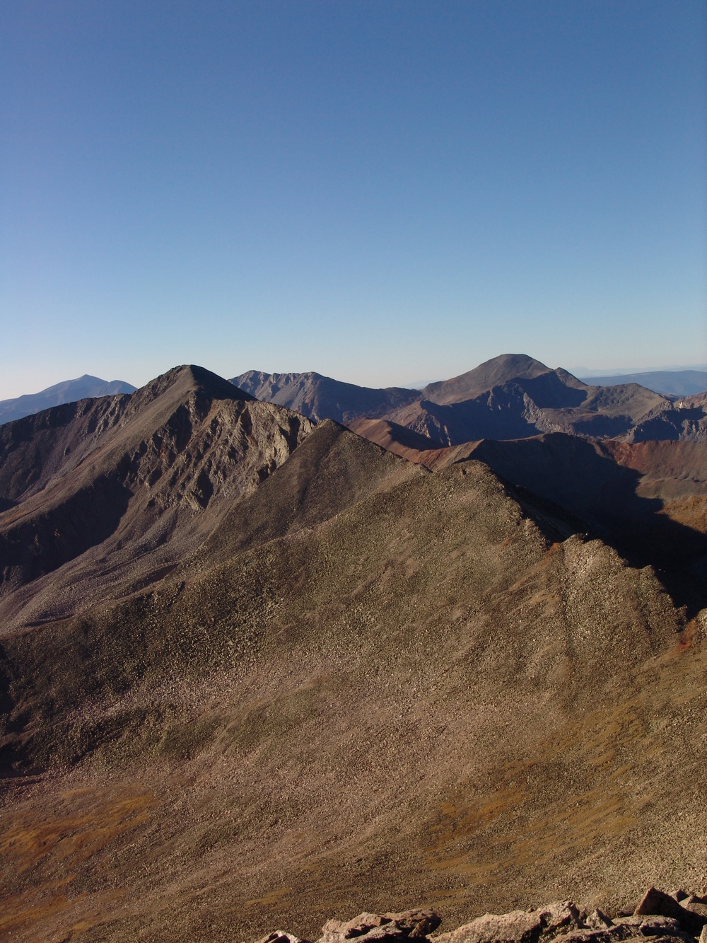
The terrain on the ridge from Mount Mamma to Grizzly Mountain is steep and rugged, without a trail. The rocks were looser and slightly more dangerous on this section of the route, so I was careful to choose my foot placements.
After another hour of hiking, I reached the saddle between Mamma and Grizzly and took time to appreciate the sheer northern face of Grizzly that stood before me. At this point, the ridge became quite narrow, and it was quite fun having nothing but sheer drop to my left and incredible views of Grizzly Gulch to my right. Grizzly Gulch contains Grizzly Lake and some of the most photogenic and pristine looking wetlands I've seen.
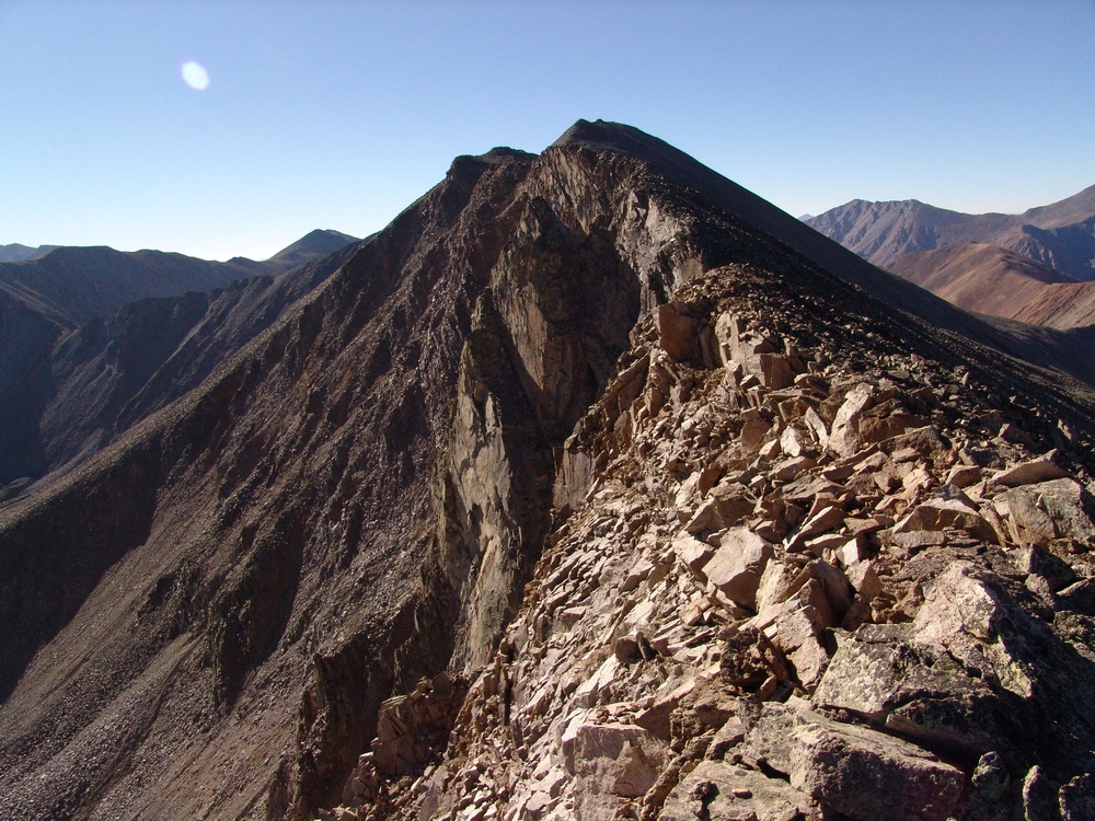
Grizzly Mountain's north face is quite impressive.
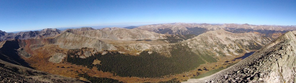
Grizzly Gulch seen from the saddle of Grizzly Mountain and Mount Mamma.
As I approached the summit of Grizzly Mountain, I could really gain some perspective on the hike I had completed so far. It was certainly impressive seeing the distance I had traveled thus far:
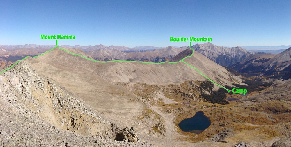
Additionally, I was able to get a great view of the entire route for the day, from start to finish. I had traveled a great distance already, but could see that I had a long way to go yet...
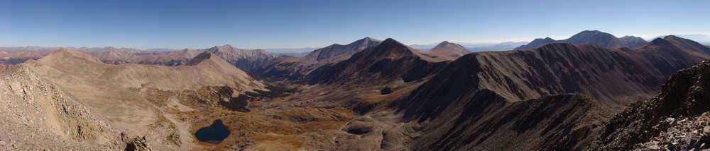
A view of Baldwin Gulch, including Baldwin Lake, Boulder Mountain, Mount Mamma, Cronin Peak, Antero Peak, Mount White, Cyclone Peak and Carbonate Peak.
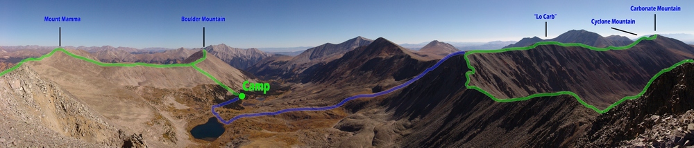
The entire route as seen from Grizzly Mountain.
I finally reached the summit of Grizzly Mountain at 10 AM and dove into my pack for some much needed food. The views from Grizzly were great, but I could see that I still had quite a lot of ground to cover if I were to complete my goals.
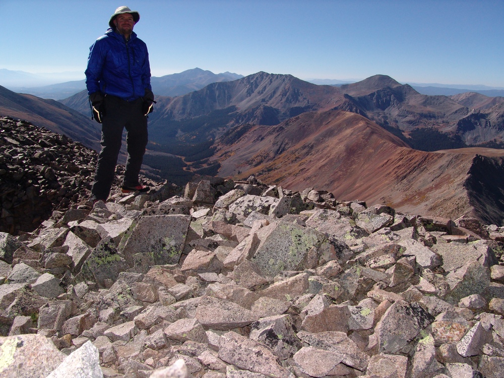
Matt Payne on the summit of Grizzly Mountain, with Cyclone Creek Basin in the background.
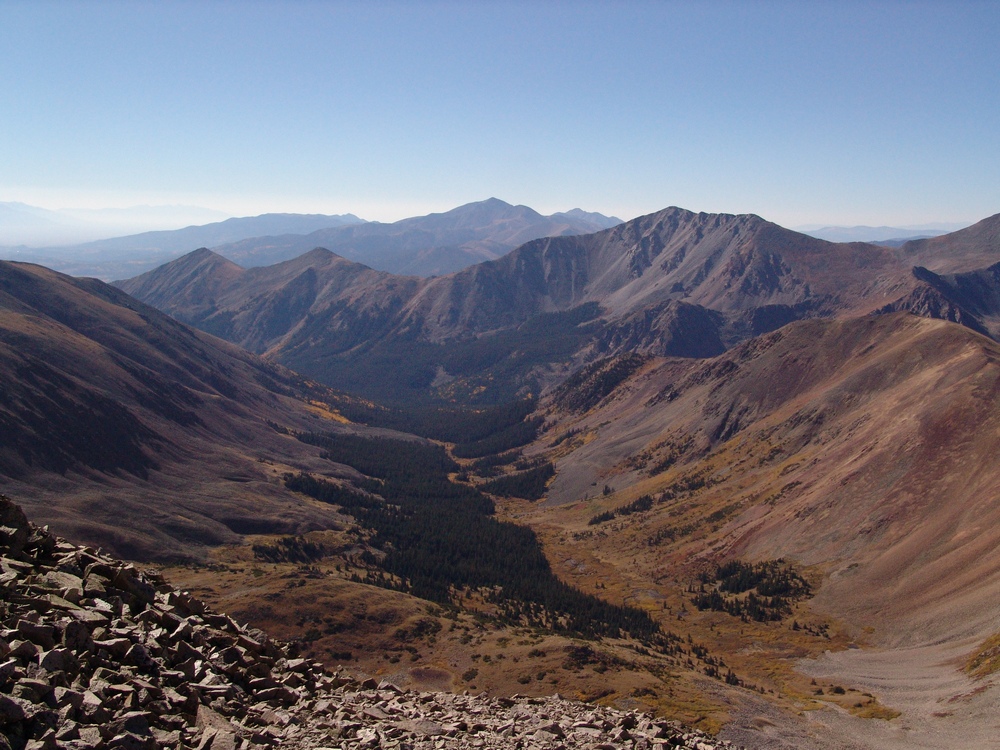
Cyclone Creek Basin, south of Grizzly Mountain. Taylor Mountain in the foreground with Mount Ouray in the distance.
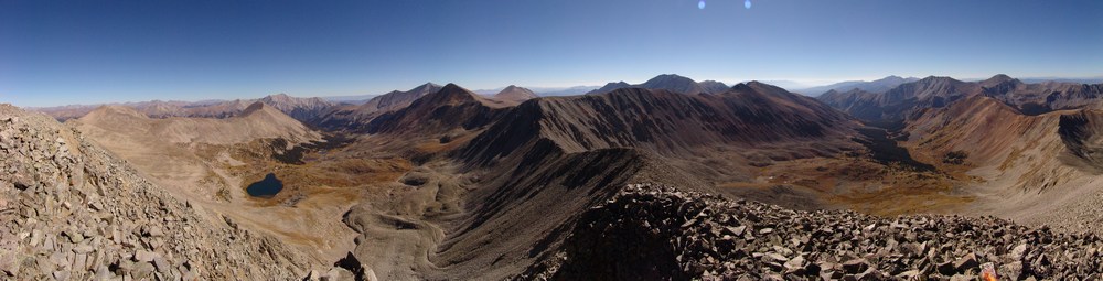
A 360 degree pano from the summit of Grizzly Mountain.
Knowing that I had a long day in front of me still, I departed Grizzly Mountain's summit promptly and made my way over towards saddle of "Lo Carb" and Grizzly. From afar, the terrain between Grizzly and "Lo Carb" seemed rather intimidating, and I was a little concerned with what I would find once I began climbing to the top of ridge at the end of the ridge-line.
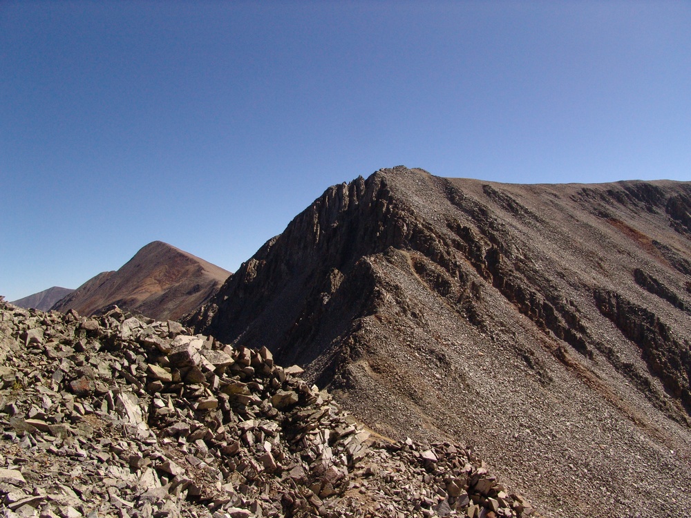
Steeper terrain greeted me at the saddle between Grizzly Mountain and "Lo Carb."
The terrain indeed proved to be challenging, but quite fun. I would rate the tough section of this climb low Class 4 or high Class 3.

At this point, Boulder Mountain seemed like a completely different trip - it was so far away!
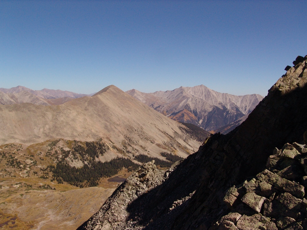
After reaching the false summit of "Lo Carb," which is basically the high point between Lo Carb and Cronin Peak, I was able to get a full grasp of the distance I had traveled. It continued to amaze me.
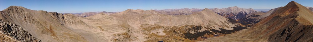
Grizzly Mountain (left), Mount Mamma (center), Boulder Mountain (right of center) and Cronin Peak (far right).
I began the long hike towards Lo Carb, Cyclone Mountain and Carbonate Mountain. Tabeguache was still a long way away, which pretty much sealed the deal for me - I would be coming back for Tab a 3rd time!
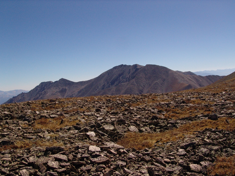
I don't know what came over me at this juncture of the trip, but I just remember being overcome with positive feelings and I remember saying to myself, "Man - THIS is so awesome!" I think the combination of solitude, great weather, awesome views, and the sustained time above 13,000 ft. had something to do with it.
Cyclone and Carbonate are really gentle peaks nestled at the top of Brown's Creek Basin, which divides Mount Antero and Mount White from Tabeguache Peak.
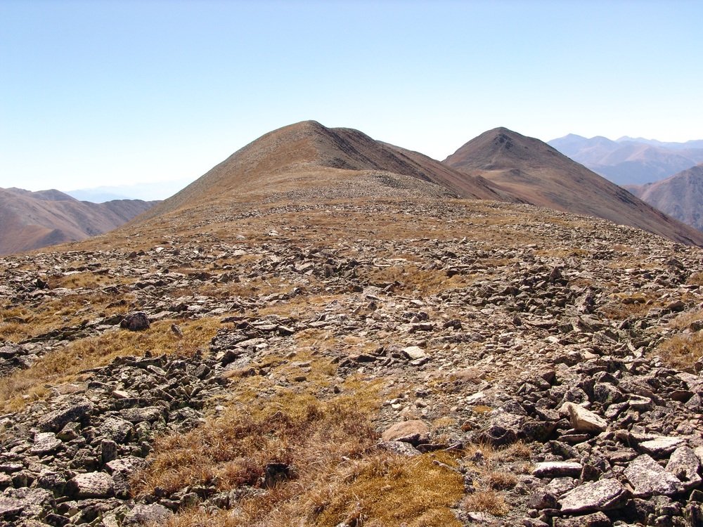
Cyclone Mountain and Carbonate Mountain.
One detraction from the view was the large network of roads that connects Mount White and Mount Antero. As many know, these mountains are rather famous for gemstone mining, so a lot of people probably make a living from these roads' existence. With that being said, it seems like there are too many roads up there and it is an eyesore for sure.
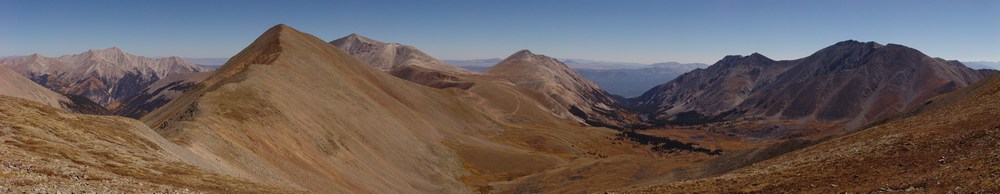
Mount Princeton, Cronin Peak, Mount Antero, Mount White and Tabeguache Peak as seen from the saddle of "Lo Carb" and Cyclone Mountain.
Reaching the summit of Cyclone was somewhat of a treat because the summit register there had listings from all the way back to 1349. Of particular note, I saw an entry there from the famed Bob Martin, of Martin and Garratt - Colorado's High Thirteeners, which is one of my favorite mountain books. One more note about Bob Martin - he's probably climbed every mountain in Colorado over 10,000 ft., not an easy task to complete! In fact, at the date of this report, he's climbed 2,563 mountains in Colorado... as compared to my 91 (at the date of this report) and some people think I'm obsessed! :-) My take on it - impressive dedication!
Bob Martin sighting...
From the top of Cyclone, I was able to get a really nice zoom-in pano of Cyclone Gulch and the mountains across the valley. In case you're wondering what that means - I take several photos where I've zoomed-in as far as I can with my camera, and I've combined them. The result is that you are able to see a great deal of detail in the photo. Individual trees can be made out easily. Of course to see this, you need to see the full resolution version of the photo. Let me know if you'd like to!
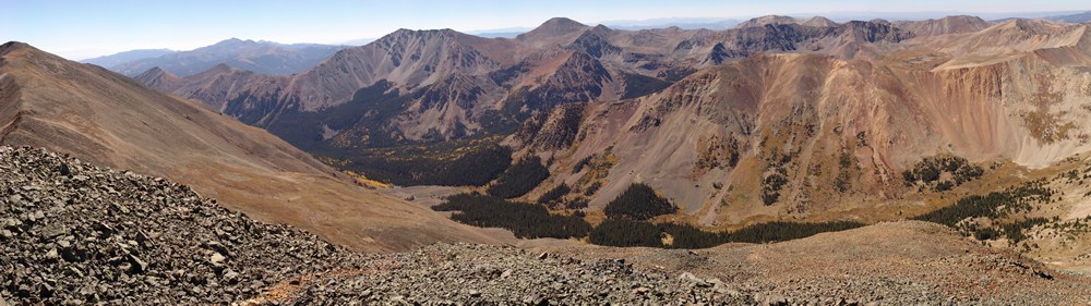
Cyclone Gulch seen at high resolution. Carbonate Mountain at far left with Taylor Mountain and Mount Aetna in the valley over above the groves of changing aspen trees.
At this stage, my legs were definitely getting tired. I strolled on over to the summit of Carbonate Mountain, and after seeing the huge drop in elevation between Carbonate and Tabeguache, I made an official declaration that Tab would just have to wait for another day.
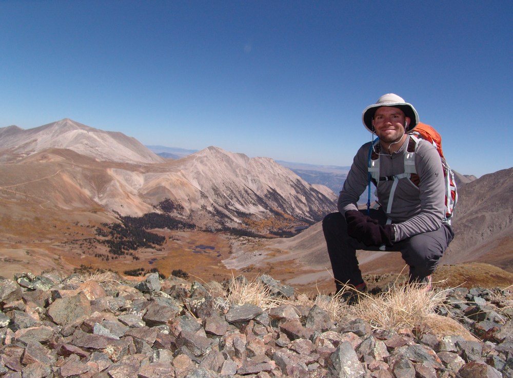
Matt Payne on the summit of Carbonate Mountain.
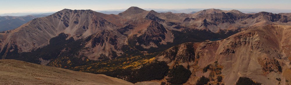
Taylor Mountain and Mount Aetna rise above a forest of colorful aspen tree and North Fork Reservoir.
While it was somewhat of a hazy day, I could still see aspen changing in every valley that I could see with the naked eye.
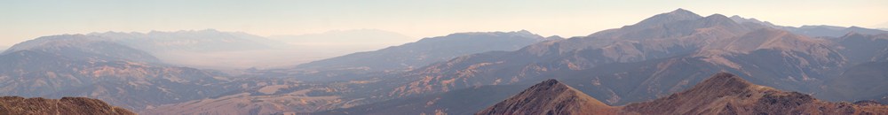
Having summited 6 mountains in one day, 5 of which being ranked 13ers, I felt that my day was a huge success and that I was ready to return to camp for some awesome burgers. I made my way back over Cyclone Mountain and Lo Carb, down to the saddle between Lo Carb and Cronin, and down to Baldwin Lake.
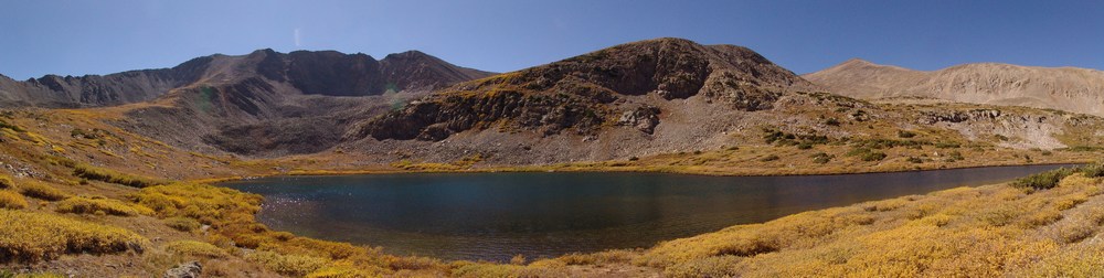
Baldwin Lake.
Once I reached our campsite, it was only 3 PM. Quinn was happy to see me, and many burgers were happily consumed!
"Welcome back dad!"